Deutsch-Chinesische Enzyklopädie, 德汉百科
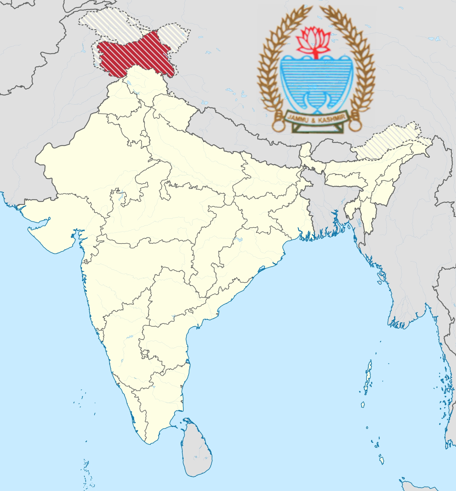
 Jammu and Kashmir
 Eat and Drink
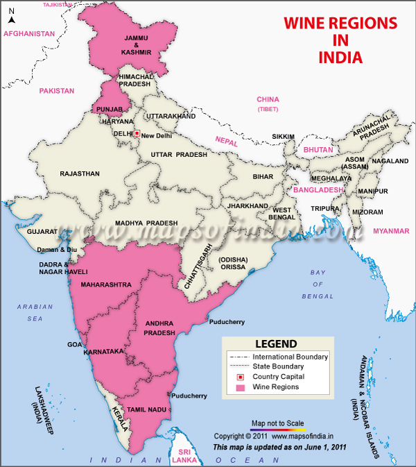
 Andhra Pradesh
Goa
India
Jammu and Kashmir
Karnataka
Andhra Pradesh
Goa
India
Jammu and Kashmir
Karnataka
 Agriculture, forestry, livestock, fishing
Maharashtra
Punjab
Tamil Nadu
Agriculture, forestry, livestock, fishing
Maharashtra
Punjab
Tamil Nadu
 Geography
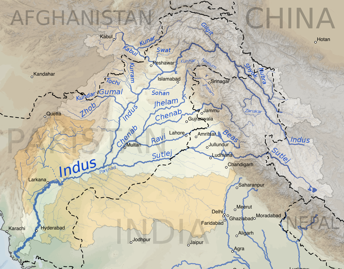
1947年印巴分治以前,印度河仅次于恒河,为该地区的文化和商业中心地带。该河流上源为狮泉河(森格藏布),它发源于冈底斯山脉冈仁波齐峰东北方向的切日阿弄拉山口西侧,源头位于中国西藏阿里地区革吉县境内,源头溪流名为邦果贡[1]。从喜马拉雅山脉朝西北方向流入克什米尔,调头向南流入巴基斯坦,在信德省的卡拉奇附近流进阿拉伯海。河流总长度3180公里,流域面积100万1549平方公里[1]。印度河文明为世界上最早进入农业文明和定居社会主要文明之一,后来因为约二百年的干旱而灭亡[2]。
印度河每年的流量约有207立方公里,是世界流量第二十一名的河流。赞斯卡河是位在拉达克的左岸支流,在进入平原后,印度河的左岸支流是潘季纳德河(五河),其五条主要支流分别是杰赫勒姆河、奇纳布河、拉维河、比亚斯河及萨特莱杰河。印度河的主要右岸支流有什约克河、吉尔吉特河、喀布尔河、库拉姆河及古马尔河及。印度河的沿岸有温带森林、平原及干旱乡村等不同的生态系统。
印度河形成了印度河三角洲,在古印度的《梨俱吠陀》中称为Sapta Sindhu,在伊朗人的波斯古经中称做Hapta Hindu,两者都是“七河”的意思。波斯王大流士曾在公元前510年派西拉克斯探索印度河。
The Indus River (called Sindhū in Sanskrit with derived names in most Indic languages)[1][2] is one of the longest rivers in Asia. It flows through China (western Tibet), India (Ladakh) and Pakistan.[3] Originating in the Tibetan Plateau in the vicinity of Lake Manasarovar, the river runs a course through the Ladakh region of India,[a] towards Gilgit-Baltistan and then flows in a southerly direction along the entire length of Pakistan to merge into the Arabian Sea near the port city of Karachi in Sindh.[4] It is the longest river of Pakistan.[5]
The river has a total drainage area exceeding 1,165,000 km2 (450,000 sq mi). Its estimated annual flow stands at around 243 km3 (58 cu mi), twice that of the Nile River and three times that of the Tigris and Euphrates rivers combined, making it one of the largest rivers in the world in terms of annual flow.[6] The Zanskar is its left bank tributary in Ladakh. In the plains, its left bank tributary is the Panjnad which itself has five major tributaries, namely, the Chenab, Jhelum, the Ravi, the Beas, and the Sutlej. Its principal right bank tributaries are the Shyok, the Gilgit, the Kabul, the Gomal, and the Kurram. Beginning in a mountain spring and fed with glaciers and rivers in the Himalayan, Karakoram and Hindu Kush ranges, the river supports ecosystems of temperate forests, plains and arid countryside.
The northern part of the Indus Valley, with its tributaries, forms the Punjab region, while the lower course of the river is known as Sindh and ends in a large delta. The river has historically been important to many cultures of the region. The 3rd millennium BC saw the rise of a major urban civilization of the Bronze Age. During the 2nd millennium BC, the Punjab region was mentioned in the hymns of the Hindu Rigveda as Sapta Sindhu and the Zoroastrian Avesta as Hapta Hindu (both terms meaning "seven rivers"). Early historical kingdoms that arose in the Indus Valley include Gandhāra, and the Ror dynasty of Sauvīra. The Indus River came into the knowledge of the West early in the Classical Period, when King Darius of Persia sent his Greek subject Scylax of Caryanda to explore the river, c. 515 BC.
L’Indus (connu sous le nom de Sindh ou Sindhu dans l’Antiquité, et de Senge Khabab en tibétain « qui sort de la bouche du lion » au niveau de sa source) est un fleuve d'Asie qui a donné son nom à l’Inde1. Il coule depuis l’Himalaya en direction du sud-ouest et se jette dans la mer d'Arabie. L’Indus fait partie des sept rivières sacrées de l'Inde.
L'Indo è il più lungo e importante fiume del Pakistan. È il più lungo fiume del subcontinente indiano e il terzo più grande dell'Asia intera in termini di portata annua.La sorgente dell'Indo si trova in Tibet tra monti Kailâs o Gangri. Il fiume prende il suo nome a partire dalla confluenza dei torrenti Sengge e Gar, che scendono dall'Himalaya raccogliendo le acque delle catene del Nganglong Kangri e del Gangdise Shan. L'Indo passa in seguito verso nord-ovest attraverso il Kashmir, a sud della catena del Karakorum, poi gradualmente gira verso sud, lasciando le colline tra Peshawar e Rawalpindi. In quest'area una diga forma il lago artificiale di Tarbela. A partire dalla sua confluenza con il fiume Kaboul, l'Indo diventa navigabile.
Il resto del suo tragitto verso il mare si svolge quindi nelle pianure del Panjab e del Sindh, e il fiume prende allora un corso molto lento. Attraversa Hyderabad poi si getta nel mare Arabico con un grande delta di 7770 km² che si estende su 200 km di costa, a sud-est di Karachi, ora considerata come una delle regioni ecologiche più importanti del mondo.El río Indo es un río asiático que discurre por el subcontinente indio, uno de los más largos del continente, el más importante de Pakistán y de los principales de la India (y que también recorre en su curso alto China). Originario de la meseta tibetana del oeste de China, en la Región Autónoma del Tíbet, el río discurre a través del distrito de Ladakh de Jammu y Cachemira y luego entra en Pakistán a través de Gilgit-Baltistán; sigue después desde el norte del país en dirección sur cruzando a lo largo todo Pakistán, hasta desembocar en el mar Arábigo, cerca de la ciudad portuaria de Karachi en Sind.
La longitud total del río es de 3.180 km, siendo el río más largo de Pakistán. Drena una gran cuenca de más de 1.165.000 km² y tiene un caudal anual estimado en unos 207 km³, lo que lo convierten en el 21º más caudaloso del mundo. Comenzando en las alturas del mundo con glaciares, el río alimenta el ecosistema de los bosques templados, llanuras y paisajes áridos. Junto con los ríos Jhelum, Chenab, Ravi, Sutlej, Beas y dos afluentes desde la Jaiber Pajtunjuá y Afganistán, el Indo forma el delta del Indo de Pakistán, mencionado en el Rig-veda (el texto más antiguo de la India, de mediados del II milenio a. C.) como Sapta Sindhu y en el texto iranio Zend Avesta como Hapta Hindu (significando ambos términos, ‘siete ríos’).
El río Indo proporciona los recursos hídricos clave para la economía de Pakistán —especialmente el granero de la provincia de Panyab, que representa la mayor parte de la producción agrícola de la nación, y de Sindh. El Indo también soporta muchas industrias pesadas y constituye el principal suministro de agua potable en Pakistán. Los cinco ríos que dan nombre al Panyab son el Jhelum, Chenab, el Ravi, el Beas y el Sutlej.
Antes de la división en 1947 de la antigua India en los modernos estados de la India y Pakistán, el Indo era el segundo río en importancia de la región, después del río Ganges, tanto en términos culturales como comerciales. En la actualidad el río también da nombre a la provincia pakistaní de Sind.
El río ha sido una fuente de asombro durante el periodo clásico. El rey Darío I de Persia envió a Escílax de Carianda a explorar el Indo entre los años 519 y 512 a. C., descendiéndolo hasta llegar al mar. Llamado Hindós o Indós por los griegos y luego Indus por los autores latinos, fue siempre conocido en Occidente por su nombre latinizado que también dio nombre a la India (Bharat).
Инд (тиб. སེང་གེ།་གཙང་པོ Sênggê Zangbo, кит. 印度河 Yìndù Hé, хинди सिन्धु नदी, з.-пандж. دریاۓ سندھ Sindh, пушту اباسين Abāsin, синдхи سنڌوندي Sindhu, урду دریائے سندھ) — крупная река в Южной Азии, берёт начало на территории Китая в Гималаях и протекает большей частью по территории северо-западной Индии и Пакистана. Исток находится на Тибетском нагорье, устье — на севере Аравийского моря[1], недалеко от города Карачи. Длина Инда — 3180 км, площадь бассейна 960 000[2] км². (980 тыс. км² в БСЭ[3]). Средний расход воды — 6600 м³/с.[источник не указан 1256 дней]
Названия: санскр. सिन्धु (Sindhu IAST); урду سندھ (Sindh); синдхи سندھو (Sindhu); в.-пандж. سندھ (Sindh IAST); авест. Hindu; пушту اباسين (Абба-Син «отец рек»); перс. هند («Hind»); тиб. སེངགེ་ཆུ («Lion River»); кит. упр. 印度河, пиньинь Yìndù Hé; греч. Ινδός (Индос).
Инд (Синдху) — одна из главных рек ведийского Семиречья.