Deutsch-Chinesische Enzyklopädie, 德汉百科
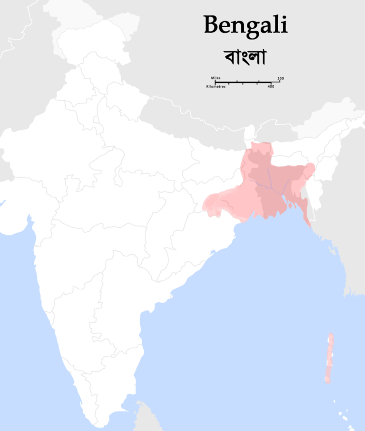
 West Bengal
 Sport
Sport


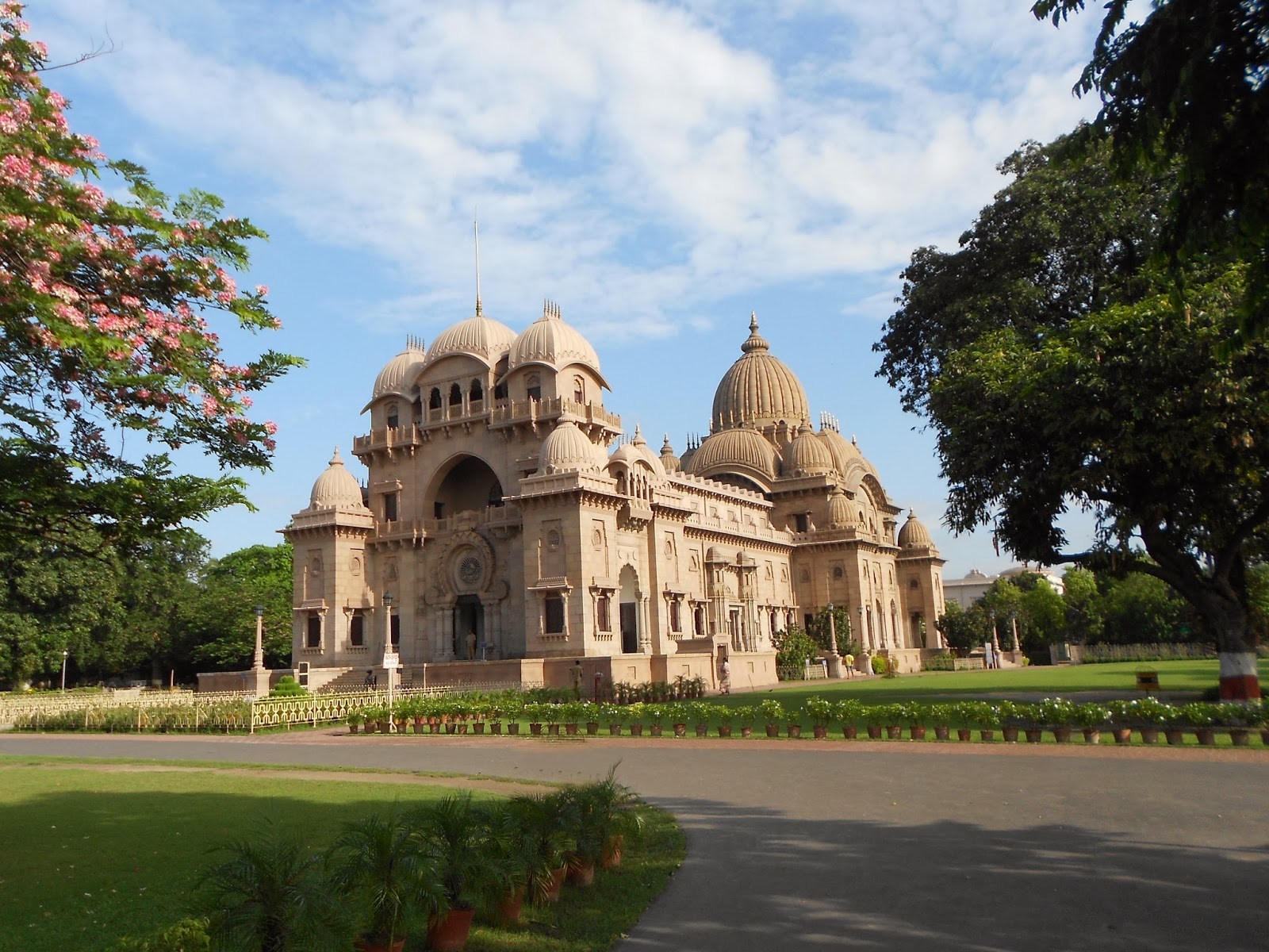
 Architecture
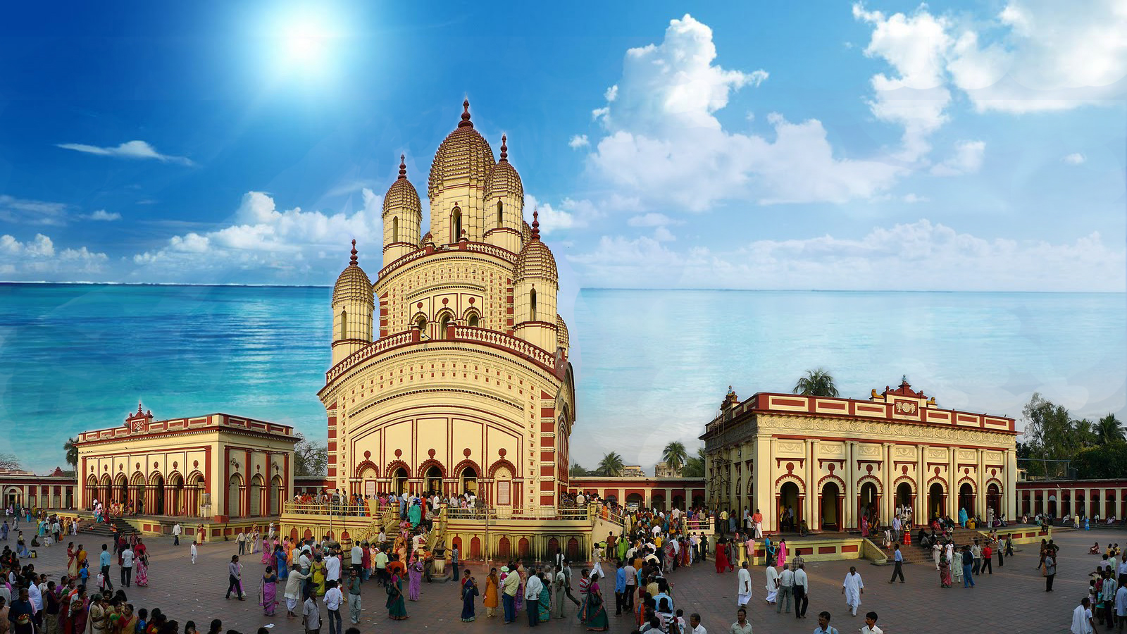
 Religion
 Companies
 Energy resource
 Bangladesh
Gujarat
India
Karnataka
Maharashtra
National Capital Territory
Punjab
Sri Lanka
Tamil Nadu
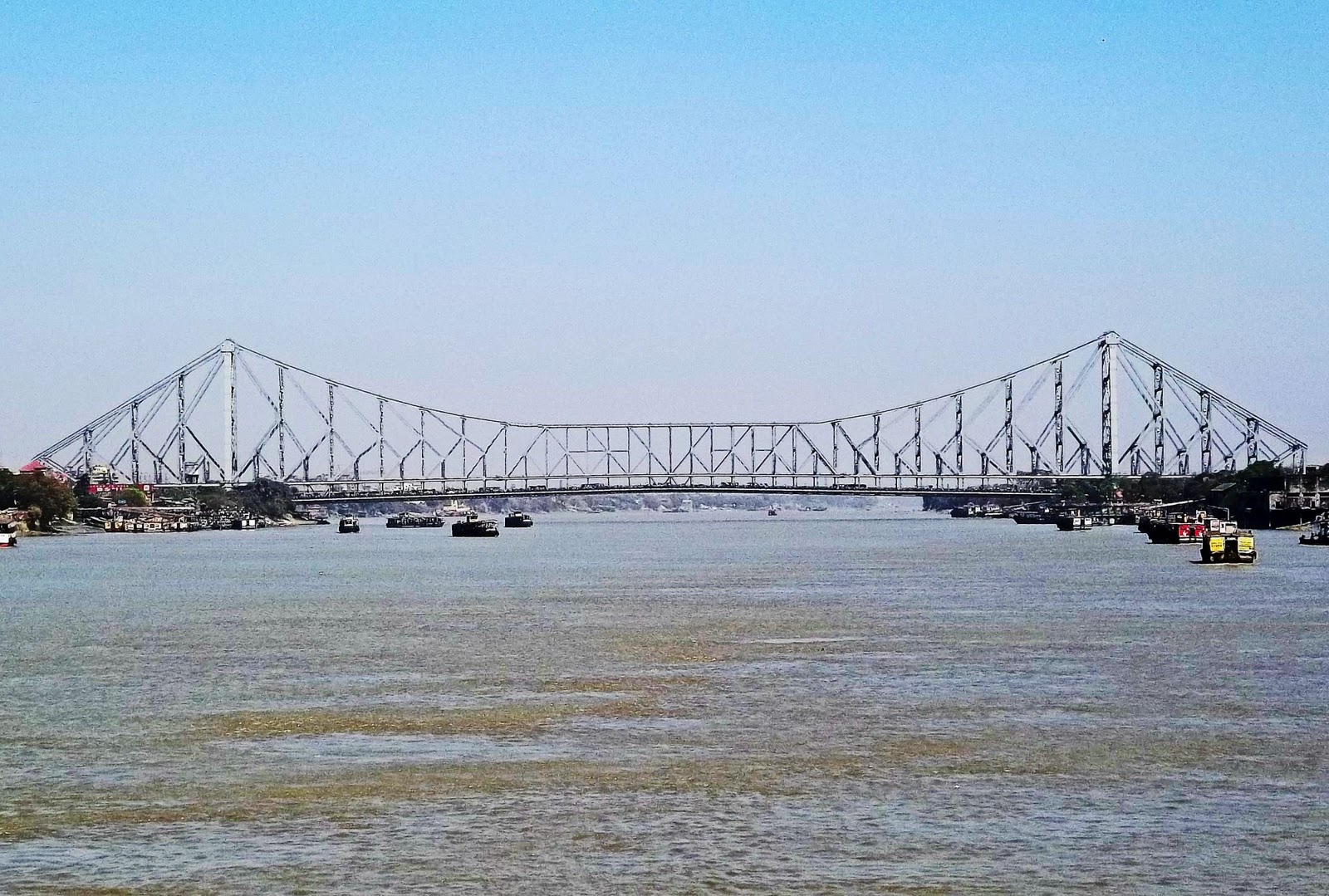
West Bengal
Bangladesh
Gujarat
India
Karnataka
Maharashtra
National Capital Territory
Punjab
Sri Lanka
Tamil Nadu
West Bengal

Gujarat
Himachal Pradesh
India
Karnataka
Maharashtra
National Capital Territory
Tamil Nadu
Telangana
Uttarakhand
West Bengal

 Eat and Drink
 Transport and traffic

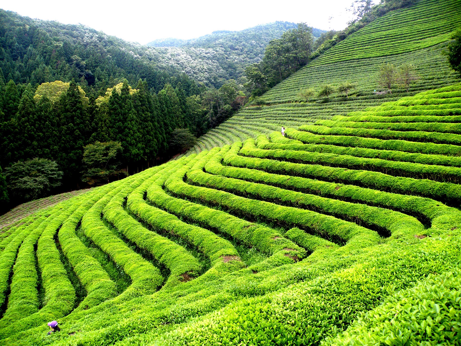
 Geography
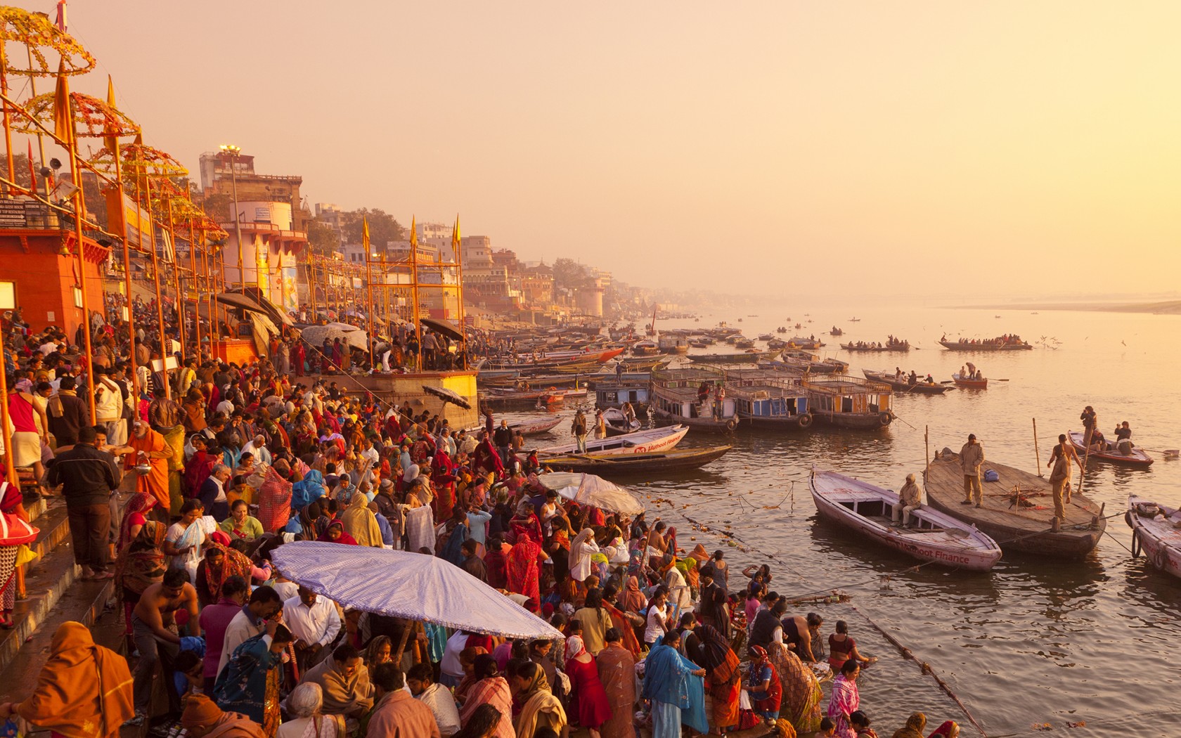
恒河(梵语:गङ्गा,印地语:गंगा,乌尔都语:گنگا(Ganga)国际音标发音:[ˈɡəŋɡaː] ![]() 聆听;泰米尔语:கங்கை,孟加拉语:গঙ্গা Gônga,玄奘译为殑伽河)是南亚的一条主要河流,流经印度北部及孟加拉。恒河源头帕吉勒提河和阿勒格嫩达河发源自印度北阿坎德邦的根戈德里等冰川,它横越北印度平原(即恒河平原),流经北方邦,会合其最大支流亚穆纳河,再流经比哈尔邦、西孟加拉邦,最后它分为多条分流注入孟加拉湾,其中一条是加尔各答附近的胡格利河,另外一条是进入孟加拉国的博多河,博多河进入孟加拉国后,会合布拉马普特拉河(中国境内为雅鲁藏布江)在孟加拉国境内的下游贾木纳河,注入孟加拉湾,其入海河段称为梅格纳河。支流布拉马普特拉河及其以上部分不算在内,恒河长为2,510公里,流域面积91万平方公里,达印度国土面积的三分之一,恒河也为世界河水流量前20大的河流之一[4]。恒河流域为世界上最多人口居住的河流流域,共有4亿以上人口居住于恒河流域,人口密度达每平方英里1000人以上[5]。
聆听;泰米尔语:கங்கை,孟加拉语:গঙ্গা Gônga,玄奘译为殑伽河)是南亚的一条主要河流,流经印度北部及孟加拉。恒河源头帕吉勒提河和阿勒格嫩达河发源自印度北阿坎德邦的根戈德里等冰川,它横越北印度平原(即恒河平原),流经北方邦,会合其最大支流亚穆纳河,再流经比哈尔邦、西孟加拉邦,最后它分为多条分流注入孟加拉湾,其中一条是加尔各答附近的胡格利河,另外一条是进入孟加拉国的博多河,博多河进入孟加拉国后,会合布拉马普特拉河(中国境内为雅鲁藏布江)在孟加拉国境内的下游贾木纳河,注入孟加拉湾,其入海河段称为梅格纳河。支流布拉马普特拉河及其以上部分不算在内,恒河长为2,510公里,流域面积91万平方公里,达印度国土面积的三分之一,恒河也为世界河水流量前20大的河流之一[4]。恒河流域为世界上最多人口居住的河流流域,共有4亿以上人口居住于恒河流域,人口密度达每平方英里1000人以上[5]。
恒河被印度教徒视为圣河,也是河流周边居民维持日常生活所需的命脉[6]。印度教中也有称为“恒河女神”的神祇[7]。许多过去的省会及帝国首都曾设于恒河沿岸,如巴连弗邑[8]、曲女城[8]、瓦拉纳西、安拉阿巴德、穆尔斯希达巴德、蒙格埃尔、巴哈拉姆普尔、加尔各答等。
ガンジス川(ガンジスがわ、英語: Ganges)は、ヒマラヤ山脈の南側、インド亜大陸の北東部を流れる大河である。全長は約2525km[1]、流域面積は約173万km2(ただしブラフマプトラ川水系を除くと約84万km2)。
The Ganges (/ˈɡændʒiːz/ GAN-jeez), or Ganga (Hindustani: [ˈɡəŋɡaː], is a trans-boundary river of the Indian subcontinent which flows through the nations of India and Bangladesh. The 2,525 km (1,569 mi) river rises in the western Himalayas in the Indian state of Uttarakhand, and flows south and east through the Gangetic Plain of North India. After entering West Bengal, it divides into two rivers: the Hooghly and the Padma River. The Hooghly, or Adi Ganga, flows through several districts of West Bengal and into the Bay of Bengal near Sagar Island. The other, the Padma, also flows into and through Bangladesh, and joins the Meghna river which ultimately empties into the Bay of Bengal.
The Ganges is one of the most sacred rivers to Hindus.[4] It is also a lifeline to millions of Indians who live along its course and depend on it for their daily needs. It is worshipped in Hinduism and personified as the goddess Gaṅgā.[5] It has also been important historically, with many former provincial or imperial capitals (such as [6] Kannauj, Kampilya, [6] Kara, Prayag or Allahabad, Kashi, Pataliputra or Patna, Hajipur, Munger, Bhagalpur, Baranagar, Murshidabad, Baharampur, Nabadwip, Saptagram and Kolkata) located on its banks.