Deutsch-Chinesische Enzyklopädie, 德汉百科
 Friuli-Venezia Giulia
 Geography
*Mediterranean Sea
Geography
*Mediterranean Sea
 Abruzzo
Albania
Amber Road
Bosnia Herzegovina
Abruzzo
Albania
Amber Road
Bosnia Herzegovina
 Emilia-Romagna
Friuli-Venezia Giulia
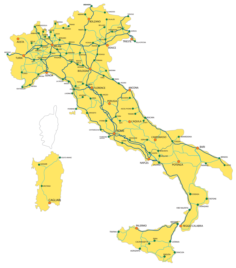
Italy
Croatia
Emilia-Romagna
Friuli-Venezia Giulia
Italy
Croatia
 Marche
 Molise
Montenegro
Molise
Montenegro
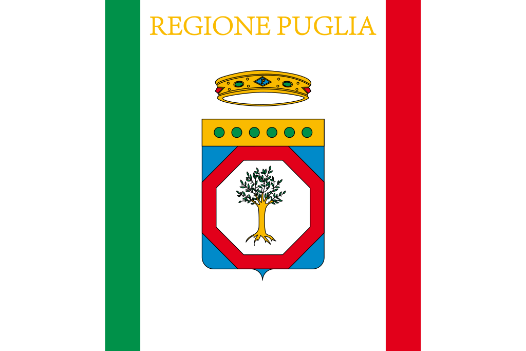 Puglia
Slovenia
Puglia
Slovenia
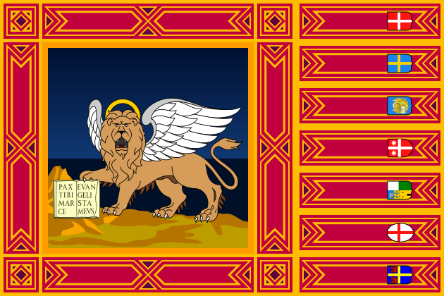 Veneto
亚得里亚海(意大利语:Mar Adriatico,斯洛文尼亚语:Jadransko morje,克罗地亚语:Jadransko more,阿尔巴尼亚语:Deti Adriatik),是地中海的一部分水域,分隔了意大利半岛(亚平宁半岛)和巴尔干半岛,也分隔了亚平宁山脉与狄那里克阿尔卑斯山脉及其临近地区。亚得里亚海西岸属于意大利,东岸则分别属于斯洛文尼亚、克罗地亚、波斯尼亚和黑塞哥维那、黑山和阿尔巴尼亚。亚得里亚海透过位于其南部的奥特朗托海峡与爱奥尼亚海相连。波河、阿迪杰河、奥凡托河等河流流入亚得里亚海;海中有近1200个岛屿,其中只有69个有人居住。
Das Adriatische Meer, kurz auch die Adria (lateinisch Mare Adriaticum; italienisch Mare Adriatico; bosnisch, kroatisch und serbisch Jadransko more oder kurz Jadran; slowenisch Jadransko morje; albanisch Deti Adriatik oder kurz Adriatiku), ist das lang gestreckte nördliche Seitenbecken des Mittelmeeres zwischen der Apenninhalbinsel und Balkanhalbinsel. Es ist nach der Stadt Adria in Italien (Provinz Rovigo) benannt. Zum Adriatischen Meer wird alles gerechnet, was nördlich der Straße von Otranto liegt.
アドリア海(アドリアかい、英: Adriatic Sea ; イタリア語: Mar Adriatico ; クロアチア語: Jadransko more)は、地中海の海域の一つ。イタリア半島とバルカン半島に挟まれている。
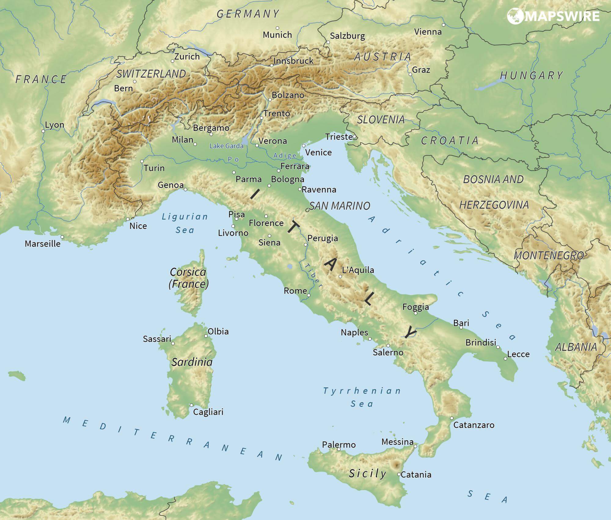
The Adriatic Sea (/ˌeɪdriˈætɪk/) is a body of water separating the Italian Peninsula from the Balkans. The Adriatic is the northernmost arm of the Mediterranean Sea, extending from the Strait of Otranto (where it connects to the Ionian Sea) to the northwest and the Po Valley. The countries with coasts on the Adriatic are Albania, Bosnia and Herzegovina, Croatia, Italy, Montenegro and Slovenia. The Adriatic contains over 1,300 islands, mostly located along the Croatian part of its eastern coast. It is divided into three basins, the northern being the shallowest and the southern being the deepest, with a maximum depth of 1,233 metres (4,045 ft). The Otranto Sill, an underwater ridge, is located at the border between the Adriatic and Ionian Seas. The prevailing currents flow counterclockwise from the Strait of Otranto, along the eastern coast and back to the strait along the western (Italian) coast. Tidal movements in the Adriatic are slight, although larger amplitudes are known to occur occasionally. The Adriatic's salinity is lower than the Mediterranean's because the Adriatic collects a third of the fresh water flowing into the Mediterranean, acting as a dilution basin. The surface water temperatures generally range from 30 °C (86 °F) in summer to 12 °C (54 °F) in winter, significantly moderating the Adriatic Basin's climate.
The Adriatic Sea sits on the Apulian or Adriatic Microplate, which separated from the African Plate in the Mesozoic era. The plate's movement contributed to the formation of the surrounding mountain chains and Apennine tectonic uplift after its collision with the Eurasian plate. In the Late Oligocene, the Apennine Peninsula first formed, separating the Adriatic Basin from the rest of the Mediterranean. All types of sediment are found in the Adriatic, with the bulk of the material transported by the Po and other rivers on the western coast. The western coast is alluvial or terraced, while the eastern coast is highly indented with pronounced karstification. There are dozens of marine protected areas in the Adriatic, designed to protect the sea's karst habitats and biodiversity. The sea is abundant in flora and fauna—more than 7,000 species are identified as native to the Adriatic, many of them endemic, rare and threatened ones.
The Adriatic's shores are populated by more than 3.5 million people; the largest cities are Bari, Venice, Trieste and Split. The earliest settlements on the Adriatic shores were Etruscan, Illyrian, and Greek. By the 2nd century BC, the shores were under Rome's control. In the Middle Ages, the Adriatic shores and the sea itself were controlled, to a varying extent, by a series of states—most notably the Byzantine Empire, the Croatian Kingdom, the Republic of Venice, the Habsburg Monarchy and the Ottoman Empire. The Napoleonic Wars resulted in the First French Empire gaining coastal control and the British effort to counter the French in the area, ultimately securing most of the eastern Adriatic shore and the Po Valley for Austria. Following Italian unification, the Kingdom of Italy started an eastward expansion that lasted until the 20th century. Following World War I and the collapse of Austria-Hungary and the Ottoman Empire, the eastern coast's control passed to Yugoslavia and Albania. The former disintegrated during the 1990s, resulting in four new states on the Adriatic coast. Italy and Yugoslavia agreed on their maritime boundaries by 1975 and this boundary is recognised by Yugoslavia's successor states, but the maritime boundaries between Slovenia, Croatia, Bosnia-Herzegovina, and Montenegro are still disputed. Italy and Albania agreed on their maritime boundary in 1992.
Fisheries and tourism are significant sources of income all along the Adriatic coast. Adriatic Croatia's tourism industry has grown faster economically than the rest of the Adriatic Basin's. Maritime transport is also a significant branch of the area's economy—there are 19 seaports in the Adriatic that each handle more than a million tonnes of cargo per year. The largest Adriatic seaport by annual cargo turnover is the Port of Trieste, while the Port of Split is the largest Adriatic seaport by passengers served per year.
La mer Adriatique (du latin : Mare Hadriaticum ou Mare Adriaticum) est une mer séparant la péninsule italienne de la péninsule balkanique. L'Adriatique est le bras de la Méditerranée situé le plus au nord en s'étendant du canal d'Otrante (où elle rejoint la mer Ionienne) jusqu'aux villes de Venise et de Trieste et à l'embouchure du Pô. Les pays côtiers sont l'Italie, la Slovénie, la Croatie, la Bosnie-Herzégovine, le Monténégro et l'Albanie, ainsi que la Grèce par l'île de Corfou.
Il mare Adriatico è l'articolazione del mar Mediterraneo orientale situata tra la penisola italiana e la penisola balcanica; suddiviso in Alto Adriatico, Medio Adriatico e Basso Adriatico, bagna sei Paesi: Italia, Slovenia, Croazia, Bosnia ed Erzegovina, Montenegro e Albania, confinando a sud-est con il Mar Ionio.
El mar Adriático (del latín, Mare Hadriaticum) es un golfo estrecho y alargado que forma parte del mar Mediterráneo. Se encuentra situado entre la península Itálica, al oeste, y la península de los Balcanes, al este, con una anchura máxima de unos 200 km, y una longitud de unos 800 km. Su extremo meridional limita con el mar Jónico, del que lo separa el canal de Otranto. Su superficie total es de, aproximadamente, 160 000 km².
Las costas occidental, septentrional, y parte de la oriental corresponden a Italia (60% de la longitud de costa del Adriático), mientras que el resto de la costa oriental corresponde a Croacia, Eslovenia, Bosnia y Herzegovina, Montenegro y Albania. Algunos de los ríos que desembocan en el Adriático son el Reno, el Po, el Adigio, el Brenta, el Piave y el Neretva.
La costa del Adriático concentra un gran número de centros turísticos, como Venecia, que recibe el nombre de «Reina del Adriático». Tras la división de Yugoslavia, la costa croata se ha convertido también en un destino turístico muy popular.
Sus aguas sostienen industria pesquera, y se llevan a cabo prospecciones petrolíferas en este mar. Durante los años 1990, varias investigaciones revelaron que sus niveles de contaminación son muy altos.
En las últimas décadas el gobierno de Italia ha intentado hacer de él una barrera contra la inmigración ilegal, en su mayor parte proveniente de Albania.
Адриати́ческое мо́ре (итал. mare Adriatico, эмил.-ром. Mèr Adriâtic, вен. Mar Adriàtico, неап. Mar Adriateco, словен. Jadransko morje, сербохорв. Jadransko more/Јадранско море, алб. Deti Adriatik, лат. mare Hadriaticum), также Адриатика — полузамкнутое море, часть Средиземного моря между Апеннинским и Балканским полуостровами. Омывает берега Италии (более 1000 км), Словении (47 км), Хорватии (1777 км), Боснии и Герцеговины (20 км), Черногории (200 км), Албании (472 км).
 Auvergne-Rhône-Alpes
 Baden-Wuerttemberg
 Bavaria
Germany
France
Friuli-Venezia Giulia
Italy
Liechtenstein
Bavaria
Germany
France
Friuli-Venezia Giulia
Italy
Liechtenstein
 Lombardia
Monaco
Austria
Lombardia
Monaco
Austria
 Piemonte
 Provence-Alpes-Côte d´Azur
Switzerland
Slovenia
Provence-Alpes-Côte d´Azur
Switzerland
Slovenia
 Tyrol
Tyrol
 Trentino-Alto Adige
 Vacation and Travel
 Valle d´Aosta
Veneto
Valle d´Aosta
Veneto
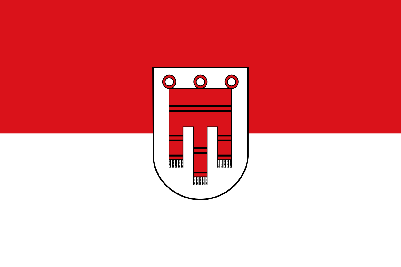 Vorarlberg
欧洲南部高大的山脉。西起法国尼斯附近地中海海岸,呈弧形向北、东延伸,经意大利北部、瑞士南部、列支敦士登、德国西南部,东止奥地利的维也纳盆地。总面积约22万平方千米。长约1200千米,宽130~260千米,东宽西窄。平均海拔3000米左右。 山脉主干向西南方向延伸为比利牛斯山脉,向南延伸为亚平宁山脉,向东南方向延伸为迪纳拉山脉,向东延伸为喀尔巴阡山脉。阿尔卑斯山脉可分为3段。西段西阿尔卑斯山从地中海岸,经法国东南部和意大利的西北部,到瑞士边境的大圣伯纳德山口附近,为山系最窄部分,也是高峰最集中的山段。勃朗峰(4810米)是整个山脉的最高点,位于法国和意大利边界。中段中阿尔卑斯山,介于大圣伯纳德山口和博登湖之间,宽度最大。有马特峰(4479米)和蒙特罗莎峰( 4634米)。东段东阿尔卑斯山在博登湖以东,海拔低于西、中两段阿尔卑斯山。
阿尔卑斯山(德语:Alpen;法语:Alpes;意大利语:Alpi;斯洛文尼亚语:Alpe)是一座位于欧洲中心的山脉,它覆盖了意大利北部边界、法国东南部、瑞士、列支敦士登、奥地利、德国南部及斯洛文尼亚。它可以被细分为三个部分,从地中海到勃朗峰的西阿尔卑斯山,从瓦莱达奥斯塔到布伦纳山口(奥地利和意大利交界处)的中阿尔卑斯山,从布伦纳山口到斯洛文尼亚的东阿尔卑斯山。欧洲许多大河都发源于此,水力资源丰富,为旅游、度假、疗养胜地。
阿尔卑斯山共有128座海拔超过4000米的山峰,其中最高峰勃朗峰海拔4810.45米[1],位于法国和意大利的交界处。山脉呈弧形,长1200千米,宽130~260千米,平均海拔约3000米,总面积约22万平方千米[2]。阿尔卑斯山北边是水汽较多的气候,而南边则较为干燥,雨量很少。
Die Alpen sind das höchste Gebirge im Inneren Europas. Es erstreckt sich in einem 1200 Kilometer langen und zwischen 150 und 250 Kilometer[1] breiten Bogen vom Ligurischen Meer bis zum Pannonischen Becken.
Die gesamte Alpenregion nimmt eine Fläche von etwa 200.000 Quadratkilometern ein.[2] Sie dehnt sich etwa 750 km von West nach Ost und ca. 400 km von Süd nach Nord aus und wird vom Rhonetal, dem Schweizer Mittelland, dem Oberlauf der Donau, der Kleinen Ungarischen Tiefebene, der Po-Ebene und dem Golf von Genua umgrenzt.
Der Alpenbogen schließt im Südwesten am Golf von Genua an den Apennin an, umfasst die Po-Ebene, verzweigt sich zum Französischen und Schweizer Jura und endet fächerförmig im Osten vor dem westpannonischen Berg- und Hügelland. Im Nordosten an der Donau bei Wien sind die Alpen durch das Wiener Becken von den geologisch verwandten Karpaten getrennt, im Südosten gehen sie in das stark verkarstete Dinarische Gebirge über. Im Norden fallen die Alpen allmählich zum österreichischen und deutschen Alpenvorland ab. Im Süden ist der Abfall zur Po-Ebene steiler. Der Gebirgszug, zu dem die Alpen gehören, erstreckt sich vom afrikanischen Atlas bis nach Südostasien.[3]
Die Gipfelhöhen in den westlichen Gebirgsstöcken liegen meist zwischen 3000 und 4300 Meter über dem Meeresspiegel, in den Ostalpen sind die Berge etwas niedriger. Der höchste Gipfel der Alpen ist der Mont Blanc mit 4810 Metern. 128 Berge der Alpen sind Viertausender, etliche Berge mehr oder weniger vergletschert. Die Alpen sind in zahlreiche Gebirgsgruppen und -ketten gegliedert.
Die Alpen bilden im „Herzen Europas“[4] eine wichtige Klima- und Wasserscheide. Sie trennen den zentralen Mittelmeerraum mit dem Etesienklima vom atlantisch beeinflussten nördlichen Mitteleuropa und stehen am Ostrand unter kontinentalem Einfluss. Auch die Entwässerung folgt diesen Großrichtungen zu Mittelmeer, Nordsee und Schwarzem Meer.
Der Alpenraum umfasst Gebiete der acht Alpenstaaten Frankreich, Monaco, Italien, Schweiz, Liechtenstein, Deutschland, Österreich und Slowenien. Er bildet den Lebensraum von 13 Millionen Menschen und genießt europäische Bedeutung als Erholungsraum.[4] Ungarn hat Anteile an Mittelgebirgen, die zu den Alpen gezählt werden, beispielsweise an Günser und Ödenburger Gebirge, wird in der Regel jedoch nicht zum Alpenraum gezählt. Seit der Frühgeschichte stellen Alpentäler und -pässe auch wichtige transeuropäische Verkehrsverbindungen dar.
アルプス山脈(アルプスさんみゃく、羅: Alpes アルペース、仏: Alpes、伊: Alpi、独: Alpen、英: Alps)は、アルプス・ヒマラヤ造山帯に属し、ヨーロッパ中央部を東西に横切る「山脈」である。オーストリア、スロベニアを東端とし、イタリア、ドイツ、リヒテンシュタイン、スイス各国にまたがり、フランスを南西端とする多国にまたがっている。アルプ(スイスの高山山腹の夏季放牧場;英語: alp,フランス語: alpe,ドイツ語: Alpe)がいっぱいであるからアルプスであると考える説と、ケルト語の alp「岩山」を語源とし、ラテン語を経由したと考える説がある。最高峰のモンブランは標高4,810.9m(2007年)で、フランスとイタリアの国境をなし、ヨーロッパの最高峰[1]でもある。
アルプス山脈はヨーロッパの多数の河川の水源地となっており、ここからドナウ川、ライン川、ローヌ川、ポー川、といった大河川が流れ出て、それぞれ黒海、北海、地中海、アドリア海へと注ぐ。
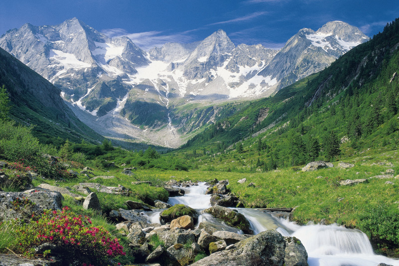
The Alps (/ælps/; French: Alpes [alp]; German: Alpen [ˈalpn̩]; Italian: Alpi [ˈalpi]; Romansh: Alps; Slovene: Alpe [ˈáːlpɛ]) are the highest and most extensive mountain range system that lies entirely in Europe,[2][note 1] stretching approximately 1,200 kilometres (750 mi) across eight Alpine countries (from west to east): France, Switzerland, Italy, Monaco, Liechtenstein, Austria, Germany, and Slovenia.[3] The mountains were formed over tens of millions of years as the African and Eurasian tectonic plates collided. Extreme shortening caused by the event resulted in marine sedimentary rocks rising by thrusting and folding into high mountain peaks such as Mont Blanc and the Matterhorn. Mont Blanc spans the French–Italian border, and at 4,810 m (15,781 ft) is the highest mountain in the Alps. The Alpine region area contains about a hundred peaks higher than 4,000 metres (13,000 ft).
The altitude and size of the range affects the climate in Europe; in the mountains precipitation levels vary greatly and climatic conditions consist of distinct zones. Wildlife such as ibex live in the higher peaks to elevations of 3,400 m (11,155 ft), and plants such as Edelweiss grow in rocky areas in lower elevations as well as in higher elevations. Evidence of human habitation in the Alps goes back to the Palaeolithic era. A mummified man, determined to be 5,000 years old, was discovered on a glacier at the Austrian–Italian border in 1991.
By the 6th century BC, the Celtic La Tène culture was well established. Hannibal famously crossed the Alps with a herd of elephants, and the Romans had settlements in the region. In 1800, Napoleon crossed one of the mountain passes with an army of 40,000. The 18th and 19th centuries saw an influx of naturalists, writers, and artists, in particular, the Romantics, followed by the golden age of alpinism as mountaineers began to ascend the peaks.
The Alpine region has a strong cultural identity. The traditional culture of farming, cheesemaking, and woodworking still exists in Alpine villages, although the tourist industry began to grow early in the 20th century and expanded greatly after World War II to become the dominant industry by the end of the century. The Winter Olympic Games have been hosted in the Swiss, French, Italian, Austrian and German Alps. At present, the region is home to 14 million people and has 120 million annual visitors.[4]
Les Alpes (prononcé [alp]) sont une chaîne de montagnes qui s'étend en Europe, recouvrant la frontière nord de l'Italie, le Sud-Est de la France, Monaco, la Suisse, le Liechtenstein, l'Autriche, le Sud de l'Allemagne et la Slovénie.
Les Alpes culminent à 4 809 mètres, au sommet du mont Blanc. On recense 82 sommets majeurs de plus de 4 000 m d'altitude (Suisse : 48, Italie : 38, France : 24). Les cols de montagne reliant les vallées ou les pays dépassent souvent les 2 000 m d'altitude. Les Alpes forment une barrière de 1 200 km entre la Méditerranée et le Danube.
Le Alpi sono la catena montuosa più importante d'Europa, situate nell'Europa centrale a cavallo dei confini di Italia, Francia, Svizzera, Liechtenstein, Germania, Austria, Slovenia e Ungheria, separando l'Europa settentrionale da quella meridionale con lo stivale italiano. Suddivise in varie sezioni e svariati sottogruppi racchiudono in sé le vette più alte del continente centrale europeo, rivestendo anche un'importanza storica, naturalistica, idrografica e turistico-economica per i rispettivi paesi.
Los Alpes son una importante cadena de montañas situada en la Europa Central. Su cumbre más alta es el Mont Blanc, con 4.810 metros de altitud. Alrededor de los Alpes, favorecidos por ríos importantes de caudal uniforme y ricas tierras de cultivo, se ubicaron desde la prehistoria diversos pueblos, principalmente celtas, como los borgoñones, leucos, lombardos, helvecios, y posteriormente germánicos en el noreste y pueblos itálicos después de la conquista de la Galia Cisalpina por Julio César. Actualmente viven unos 14 millones de personas en la región de los Alpes.
А́льпы (фр. Alpes, нем. Alpen, итал. Alpi, романш. Alps, словен. Alpe) — самый высокий и протяжённый горный хребет среди систем, целиком лежащих в Европе. При этом Кавказские горы выше, а Уральские — протяжённей, но они лежат также и на территории Азии (в зависимости от выбранного определения границы между Европой и Азией).
Альпы представляют собой сложную систему хребтов и массивов, протянувшуюся выпуклой к северо-западу дугой от Лигурийского моря до Среднедунайской низменности. Альпы располагаются на территории 8 стран: Франции, Монако, Италии, Швейцарии, Германии, Австрии, Лихтенштейна и Словении. Общая длина альпийской дуги составляет около 1200 км (по внутреннему краю дуги — около 750 км), ширина — до 260 км. Самой высокой вершиной Альп является гора Монблан высотой 4810 метров над уровнем моря, расположенная на границе Франции и Италии[1]. Всего в Альпах сосредоточено около 100 вершин-четырёхтысячников[2].
Альпы являются международным центром альпинизма, горнолыжного спорта и туризма. Туризм в Альпах начал активно развиваться в XX веке и получил большой толчок после окончания Второй мировой войны, став одним из главных направлений в конце столетия. Пять стран из восьми (Швейцария, Франция, Италия, Австрия и Германия) были хозяйками Зимних Олимпийских игр, которые проводились в альпийских объектах[3]. Несмотря на активное развитие туризма, в альпийском регионе по-прежнему существует самобытная традиционная культура, включая сельское хозяйство, деревообработку и сыроварение.
Благодаря расположению в центре Западной Европы, Альпы являются одной из наиболее изученных горных систем. Многие понятия названы по имени Альп, в частности, альпийский климатический пояс, период альпийской складчатости, альпийский тип рельефа, альпийские луга, альпинизм.
 History
 World Heritage

 Financial
Friuli-Venezia Giulia
Italy
Financial
Friuli-Venezia Giulia
Italy
 Companies
Companies
Companies
 *Centuries-old companies in the world
 Insurance

 Energy resource
Abruzzo
Energy resource
Abruzzo
 Basilicata
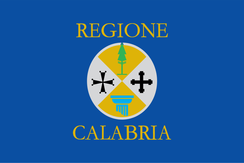 Calabria
 Campania
Emilia-Romagna
Friuli-Venezia Giulia
Italy
Campania
Emilia-Romagna
Friuli-Venezia Giulia
Italy
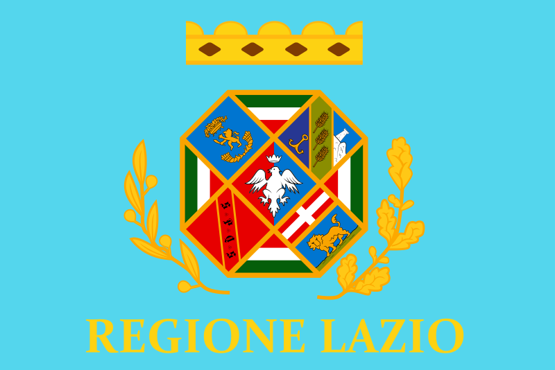 Lazio
Lazio
 Liguria
Lombardia
Marche
Molise
Piemonte
Puglia
Liguria
Lombardia
Marche
Molise
Piemonte
Puglia
 Sardegna
 Sicilia
 Toscana
Trentino-Alto Adige
Toscana
Trentino-Alto Adige
 Umbria
Valle d´Aosta
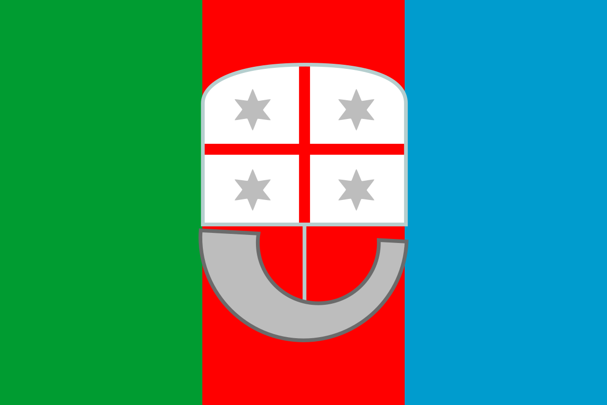
Veneto
Umbria
Valle d´Aosta
Veneto

 Transport and traffic
Abruzzo
Basilicata
Calabria
Campania
Emilia-Romagna
Friuli-Venezia Giulia
Italy
Lazio
Liguria
Lombardia
Marche
Molise
Piemonte
Puglia
Sardegna
Sicilia
Toscana
Trentino-Alto Adige
Umbria
Transport and traffic
Abruzzo
Basilicata
Calabria
Campania
Emilia-Romagna
Friuli-Venezia Giulia
Italy
Lazio
Liguria
Lombardia
Marche
Molise
Piemonte
Puglia
Sardegna
Sicilia
Toscana
Trentino-Alto Adige
Umbria

 Architecture
 Religion
 Abruzzo
Basilicata
Basilicata
Campania
Emilia-Romagna
Abruzzo
Basilicata
Basilicata
Campania
Emilia-Romagna
 Eat and Drink
*Wine region
Friuli-Venezia Giulia
Liguria
Lombardia
Marche
Piemonte
Puglia
Sardegna
Sicilia
Toscana
Umbria
Veneto
Eat and Drink
*Wine region
Friuli-Venezia Giulia
Liguria
Lombardia
Marche
Piemonte
Puglia
Sardegna
Sicilia
Toscana
Umbria
Veneto
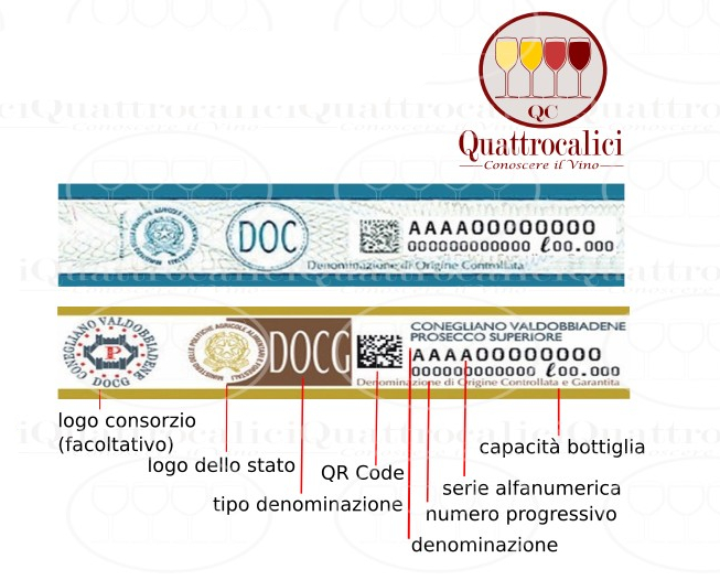
保证控制原产地命名生产的葡萄酒。这是对DOC酒的补充,以保证优质的DOC葡萄酒的可靠。它要求在指定区域内的生产者自愿地使其生产的葡萄酒受到 更严格的管理标准。已批准为DOCG的葡萄酒,在瓶子上将带有政府的质量印记.保证控制原产地命名生产的葡萄酒(DOCG等级)是意大利葡萄酒的最高级 别,无论在葡萄品种、采摘、酿造、陈年的时间方式等方面都有严格管制,甚至有的还对葡萄树的树龄做出规定,而且要由专人试饮。目前,共有33种获此殊荣。
当葡萄酒的标签上写着“Denominazione di Orgine Controllata e Garantita”字样时,就说明除了DOC葡萄酒的要求之外,该酒还要符合下列规定:
进入消费的葡萄酒基本是瓶装的,在5升以下容量的容器里;
每个瓶子都应该有国家的标识,实际上就是意大利的保证包装装瓶的一条带子。带子是按照产量配发给装瓶生产商的,也就是说,按量产要求配发给多少条带子(而DOC葡萄酒没有这个要求)。
DOCG的字样是用于特别高贵的葡萄酒,就是那些通过一系列的监督检查,给予了相应的承认的名酒。另外,葡萄酒要达到DOCG的档次,至少要有五年DOC的经历。
DOCG葡萄酒要经过两次品尝感受的检测,以确定其品质(DOC葡萄酒是进行一次品尝感受的检测)。
DOC(法定地区餐酒)和DOCG(保证法定地区餐酒),欧洲联盟将其归为一类,叫做VQPRD(在特定地区生产的品级餐酒)。
 Science and technology

Abruzzo
Basilicata
Calabria
Campania
Emilia-Romagna
Friuli-Venezia Giulia
Italy
Lazio
Liguria
Lombardia
Marche
Molise
Piemonte
Puglia
Sardegna
Sicilia
Toscana
Trentino-Alto Adige
Umbria
Companies
*Largest electricity companies
Valle d´Aosta
Veneto
 Economy and trade
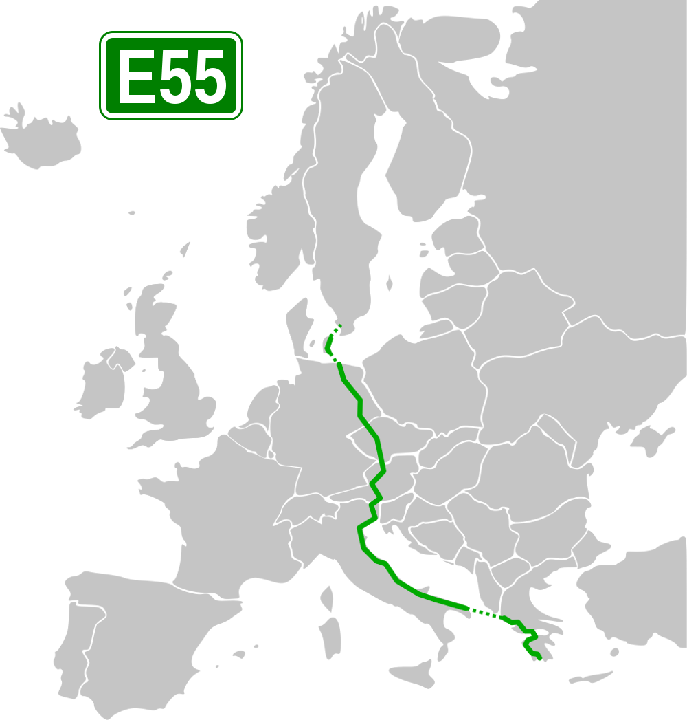
 Abruzzo
 Berlin
 Brandenburg
Denmark
Germany
Emilia-Romagna
Friuli-Venezia Giulia
Greece
Italy
Brandenburg
Denmark
Germany
Emilia-Romagna
Friuli-Venezia Giulia
Greece
Italy
 Carinthia
Marche
Carinthia
Marche
 Mecklenburg-Vorpommern
 Upper Austria
Austria
Puglia
Upper Austria
Austria
Puglia
 Saxony
 Salzburg
Sweden
Czech Republic
Veneto
Salzburg
Sweden
Czech Republic
Veneto