
Deutsch-Chinesische Enzyklopädie, 德汉百科
 夏季奥林匹克运动会
 巴伐利亚州
联邦德国
欧洲流行歌曲大赛
2006年世界杯足球赛
欧洲足球锦标赛 2020
巴伐利亚州
联邦德国
欧洲流行歌曲大赛
2006年世界杯足球赛
欧洲足球锦标赛 2020
 欧洲足球锦标赛 2024
 地理
地理
地理
地理
 *全球最宜居城市
 历史
公元 1500 - 2000
历史
公元 1000 - 1500
历史
公元 2000 - 2100
历史
公元 1500 - 2000
历史
公元 1000 - 1500
历史
公元 2000 - 2100
 国际城市
***全球城市经济竞争力
夏季奥林匹克运动会
1972夏季奥林匹克运动会
国际城市
***全球城市经济竞争力
夏季奥林匹克运动会
1972夏季奥林匹克运动会
 假期和旅游
假期和旅游
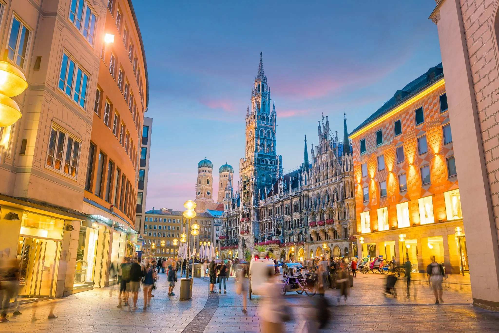
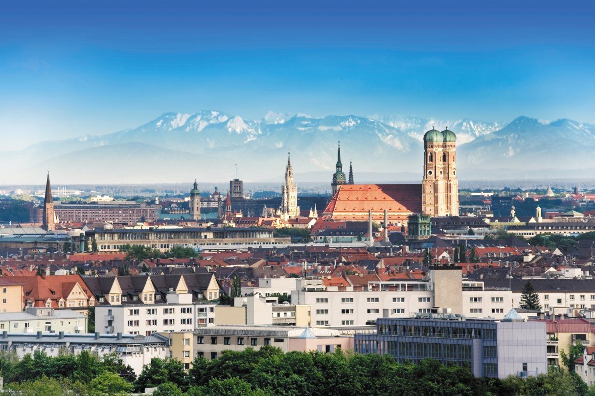
München (hochdeutsch  [ˈmʏnçn̩] oder [ˈmʏnçən̩];[4] bairisch [ˈmɪŋ(:)ɐ]) ist die Landeshauptstadt des Freistaates Bayern. Sie ist mit rund 1,5 Millionen Einwohnern die einwohnerstärkste Stadt Bayerns und (nach Berlin und Hamburg) die nach Einwohnern drittgrößte Gemeinde Deutschlands sowie die viertgrößte Stadt im deutschsprachigen Raum und zwölftgrößte der Europäischen Union. Im Ballungsraum München leben mehr als 2,9 Millionen Menschen,[5][6] die flächengrößere europäische Metropolregion München umfasst rund 5,7 Millionen Einwohner.
Die Landeshauptstadt ist eine kreisfreie Stadt und bayerische Metropole,[7] zudem Verwaltungssitz des die Stadt umgebenden gleichnamigen Landkreises mit dem Landratsamt München als Verwaltung, des Bezirks Oberbayern und des Regierungsbezirks Oberbayern.
München wird zu den Weltstädten gezählt.[8] Die Metropole ist eine der wirtschaftlich erfolgreichsten und am schnellsten wachsenden Europas. Sie ist Sitz zahlreicher Konzerne, darunter fünf DAX-Unternehmen (Allianz, BMW, Linde, Munich Re, Siemens). Hier befindet sich die einzige Börse Bayerns. In der Städteplatzierung des Beratungsunternehmens Mercer belegte München im Jahr 2018 unter 231 Großstädten weltweit den dritten Platz nach Lebensqualität.[9] Laut dem Magazin Monocle war es 2018 sogar die lebenswerteste Stadt der Welt.[10] Andererseits wird die Lebensqualität zunehmend durch Agglomerationsnachteile, wie Verkehrs- und Umweltbelastung sowie sehr hohe Wohneigentumspreise und Mieten[11][12] eingeschränkt, weshalb auch die Wohnfläche pro Einwohner weit unter dem Bundesdurchschnitt liegt.[13] München gilt als sicherste Kommune unter den deutschen Großstädten über 200.000 Einwohnern hinsichtlich der Kriminalitätsrate aller Straftaten.[14]
München wurde 1158 erstmals urkundlich erwähnt.[15] Die Stadt wurde 1255 bayerischer Herzogssitz, war von 1328 bis 1347 kaiserliche Residenzstadt und wurde 1506 alleinige Hauptstadt Bayerns. München ist Sitz zahlreicher nationaler und internationaler Behörden sowie wichtiger Universitäten und Hochschulen, bedeutender Museen und Theater. Durch eine große Anzahl sehenswerter Bauten samt geschützten Baudenkmälern und Ensembles, internationaler Sportveranstaltungen, Messen und Kongresse sowie das weltbekannte Oktoberfest ist München ein Anziehungspunkt für den internationalen Tourismus.
ミュンヘン(ドイツ語: München, ドイツ語発音: [ˈmʏnçən] ( 音声ファイル)[2], バイエルン語: Minga)は、イーザル川河畔にありバイエルンアルプスの北側に位置する都市。ドイツの連邦州であるバイエルン州最大の都市であり、同州の州都でもある。
ミュンヘン(標準ドイツ語:München, バイエルン語:Minga〔ミンガ〕、ミュンヘン方言:Münchn〔ミュンヒン〕)という名は僧院という意味で、ドイツ語で僧を表す「メンヒ」に由来する。漢字表記は「民顕」。"che" の部分の無声硬口蓋摩擦音 [ç] の音写を表すために、[hə]/[xə] の発音を示す「ヘ」ではなく、[çə] の発音を示す「ヒェ」を用い、「ミュンヒェン」とも表記される(こちらのほうがドイツ語の発音に近い)。また "Mü" の発音は正確には「ミュ」ではなく、[mʏ] であり、[ʊ] の形に唇を開き、[ɪ] と発音した音に近い。同じ上部ドイツ語に属するアレマン語では、Münche(ミュンヒェ/ミュンキェ)と発音される。英語やフランス語では Munich(英語:ミューニック[mjú:nik]/仏語:ミュニク[mynik])、イタリア語では Monaco(モナコ公国との区別のために、「バイエルンの」という意味の語をつけてMonaco di Baviera, モナコ・ディ・バヴィエラ)と呼ばれる。
ミュンヘンはベルリン、ハンブルクに次いでドイツでは3番目に大きな都市で、市域人口は140万人近くに達する。1972年にミュンヘンオリンピックが開催された。
ミュンヘンの標語は「ミュンヘンはあなたを愛している。」 "München mag Dich" だが、2006年以前は "Weltstadt mit Herz" 「心を持つ国際都市」であった。ミュンヘンの市章には地名の由来となった僧が表現され、黒と金の配色の市旗は神聖ローマ帝国の色で市の公式の色としてルートヴィヒ4世の時代以来使われている。
今日のミュンヘンは金融、出版の中心都市でたびたび、移住者などが住むのに適した場所として上位に位置付けられる。2011年のマーサー・ヒューマン・リソース・コンサルティングによる世界で最も居住に適した都市では4位を獲得した[3]。2010年のライフスタイルマガジンMonocleの調査では5位に付けており、未だにドイツの都市の中では高い位置にある[4]。経済的、社会的革新に関する162の指標の分析を基にした調査では2thinknowイノベーション都市指数で289都市中、世界では15位、ドイツ国内では5位に付けた[5]。
Munich (/ˈmjuːnɪk/; German: München [ˈmʏnçn̩] ( listen);[2] Austro-Bavarian: Minga [ˈmɪŋ(ː)ɐ]) is the capital and the most populated city in the German state of Bavaria, on the banks of the River Isar north of the Bavarian Alps. Munich is also the third largest city in Germany, after Berlin and Hamburg, and the 12th largest city in the European Union, with a population of around 1.5 million.[3] The Munich Metropolitan Region is home to 6 million people.[4]
The city is a major centre of art, technology, finance, publishing, culture, innovation, education, business, and tourism in Germany and Europe and enjoys a very high standard and quality of living, reaching first in Germany and third worldwide according to the 2018 Mercer survey,[5] and being rated the world's most liveable city by the Monocle's Quality of Life Survey 2018.[6] According to the Globalization and World Rankings Research Institute Munich is considered an alpha-world city, as of 2015.[7]
The name of the city is derived from the Old/Middle High German term Munichen, meaning "by the monks". It derives from the monks of the Benedictine order, who ran a monastery at the place that was later to become the Old Town of Munich; hence the monk depicted on the city's coat of arms. Munich was first mentioned in 1158. Catholic Munich strongly resisted the Counter-Reformation and was a political point of divergence during the resulting Thirty Years' War, but remained physically untouched despite an occupation by the Protestant Swedes.[8][citation needed] Once Bavaria was established as a sovereign kingdom in 1806, it became a major European centre of arts, architecture, culture and science. In 1918, during the German Revolution, the ruling house of Wittelsbach, which had governed Bavaria since 1180, was forced to abdicate in Munich and a short-lived socialist republic was declared.
In the 1920s, Munich became home to several political factions, among them the NSDAP. The first attempt of the Nazi movement to take over the German government in 1923 with the Beer Hall Putsch was stopped by the Bavarian police in Munich with gunfire. After the Nazis' rise to power, Munich was declared their "Capital of the Movement". During World War II, Munich was heavily bombed and more than 50% of the entire city and up to 90% of the historic centre were destroyed. After the end of postwar American occupation in 1949, there was a great increase in population and economic power during the years of Wirtschaftswunder, or "economic miracle". Unlike many other German cities which were heavily bombed, Munich restored most of its traditional cityscape and hosted the 1972 Summer Olympics. The 1980s brought strong economic growth, high-tech industries and scientific institutions, and population growth. The city is home to major corporations like BMW, Siemens, MAN, Linde, Allianz and MunichRE.
Munich is home to many universities, museums and theatres. Its numerous architectural attractions, sports events, exhibitions and its annual Oktoberfest attract considerable tourism.[9] Munich is one of the most prosperous and fastest growing cities in Germany. It is a top-ranked destination for migration and expatriate location, despite being the municipality with the highest population density in Germany (4,500 people per km²) . Munich hosts more than 530,000 people of foreign background, making up 37.7% of its population.[10]
Munich (/my.nik/) (München en allemand, prononcé : [ˈmʏnçən] Écouter ; Minga en bavarois) est une ville du sud de l'Allemagne et la capitale du Land de Bavière. Avec 1 548 319 habitants intra-muros au 30 juin 20171 et 2 351 706 habitants dans son aire urbaine2, elle est la troisième ville d'Allemagne par la population après Berlin et Hambourg. La Région métropolitaine de Munich, qui englobe également Augsbourg et Ingolstadt, compte quant à elle plus de cinq millions d'habitants. Traversée par l'Isar, affluent du Danube, elle se situe dans le district de Haute-Bavière, au pied des Alpes bavaroises.
Le nom de la ville provient du vieux haut-allemand Munichen (« par les moines »), en raison de la présence d'un monastère bénédictin à l'emplacement actuel de la vieille ville ; l'héraldique fait par ailleurs figurer un moine. Mentionnée pour la première fois en 1158, Munich devient la ville de résidence des ducs de Bavière en 1255 et de l'empereur romain germanique Louis IV. En 1506, après deux siècles de division, les principautés s'unifient pour former la Bavière. Ville catholique - ce dont témoigne la cathédrale Notre-Dame, principal édifice religieux de la ville -, elle est l'un des foyers de la Contre-Réforme. Devenue capitale de l'électorat de Bavière (1623) puis du royaume de Bavière (1805), elle devient un des principaux centres culturels, artistiques et scientifiques allemands au XIXe siècle, sous l'impulsion du roi Louis II.
Au cours du XXe siècle, Munich connaît un important développement industriel, devenant le premier pôle économique de la République fédérale allemande (1949-1990) puis de l'Allemagne réunifiée. Elle accueille notamment le siège de grandes sociétés comme Siemens, Allianz, BMW, Münchener Rückversicherung, Linde, Airbus Deutschland et HypoVereinsbank. Selon Eurostat, la zone urbaine élargie de la région métropolitaine de Munich est la plus importante d'Allemagne en termes de PIB avec 117,6 milliards d'euros, devant Hambourg, Berlin et Francfort. Avec un PIB par habitant de 53 073 euros, Munich est également l'une des villes les plus riches de l'Union européenne2.
Deuxième destination touristique d'Allemagne après Berlin, Munich est célèbre pour sa traditionnelle fête de la bière, l'Oktoberfest, qui se déroule chaque année de fin septembre à début octobre. Outre la cathédrale, la ville a également un important patrimoine historique, composé notamment du château de Nymphenbourg, de très nombreux musées richement dotés et de deux vastes jardins, le Hofgarten et le Englischer Garten (jardin anglais). Réputée être l'une des villes les plus agréables à vivre au monde, Munich accueille de nombreux évènements internationaux, dont les Jeux olympiques d'été de 1972, qui furent le théâtre d'une sanglante prise d'otages. Enfin, elle est le lieu de résidence de l'un des principaux clubs de football d'Europe, le Bayern Munich, qui joue dans l'Allianz Arena, au nord du centre-ville.
Monaco di Baviera (/ˈmɔnako di baˈvjɛra/; in tedesco: München, /ˈmʏnçən/, ; in bavarese: Minga) è una città extracircondariale della Germania meridionale, capitale (Landeshauptstadt) della Baviera. Situata sulle rive del fiume Isar, dopo Berlino ed Amburgo è la terza città tedesca per numero di abitanti[2], con una popolazione di circa 1 528 849 (30-04-2016) residenti nel comune,[3] 1 808 550 se si considera anche il circondario di Monaco e circa 2,7 milioni nell'area metropolitana.
È la città più importante della Germania meridionale, grazie alle residenze reali, agli immensi parchi, ai suoi musei, alle sue chiese barocche e rococò, al folclore bavarese ancora molto vissuto, alla vicinanza delle Prealpi e delle Alpi e naturalmente grazie alla birra ed alla sua manifestazione più famosa, l'Oktoberfest. Il santo patrono della città è San Benno di Meißen. Nel 2015[4] uno studio della società di consulenza globale Mercer ha classificato Monaco di Baviera al quarto posto tra le 20 città del mondo con la miglior qualità della vita; nel 2016[5] la città mantiene la sua posizione.
Múnich2 (AFI: ['mu.nitʃ], también [ˈmu.nik];3 en alemán, München, [ˈmʏnçən] (?·i); en austro-bávaro: Minga [ˈmɪŋ(ː)ɐ]) es la capital, la mayor y la más importante ciudad del estado federado de Baviera y,4 después de Berlín y Hamburgo, la tercera ciudad de Alemania por número de habitantes. Se encuentra sobre el río Isar, al norte de los Alpes Bávaros.
El lema de la ciudad es München mag Dich (A Múnich le gustas). Antes de 2006 era Weltstadt mit Herz (Ciudad cosmopolita con corazón). Su nombre, München, deriva de Munichen, del alto alemán antiguo, que significa «en el lugar de los monjes». El nombre de la ciudad viene de los monjes benedictinos que fundaron la ciudad; de ahí que en el escudo de la ciudad haya un monje. Los colores oficiales de la ciudad son el negro y el oro, colores del Sacro Imperio Romano Germánico, desde tiempos de Luis IV de Baviera.
El área metropolitana de Múnich incluye algunas localidades colindantes de esta ciudad. Según un estudio de 2009, Múnich es la ciudad con la mejor calidad de vida de Alemania.5
El Múnich moderno es un centro financiero y editorial. En cuanto a innovación social y económica, la ciudad se encuentra en el 15.º lugar entre 289 ciudades según un estudio de 2010, y es la quinta ciudad alemana para el 2thinknow Innovation Cities Index basado en un análisis de 162 indicadores.6
El exónimo en español de la ciudad, que posee la particularidad de contar con una «ch» final, algo ajeno al sistema fonológico español, nace de los exónimos en francés e inglés. Por tanto, la pronunciación del exónimo es, etimológicamente, [ˈmunik], a través de la pronunciación del exónimo en inglés, o ['munitʃ], siguiendo las normas de pronunciación habituales del español. El gentilicio es «muniqués» y su plural, «muniqueses». El Diccionario Panhispánico de Dudas desaconseja la pronunciación con diptongo [ˈmiunik], propia del inglés.7 Múnich fue sede de los Juegos Olímpicos de 1972.
Мю́нхен (нем. München [ˈmʏnçən], бав. Minga, лат. Monacum, Monachium) — город на реке Изаре, на юге Германии, в федеральной земле Бавария. Внерайонный город (нем. kreisfreie Stadt), одновременно являющийся административным центром Баварии и административного округа Верхняя Бавария.
Название города произошло от древневерхненемецкого Munichen — «у монахов».
Население Мюнхена — 1 542 886 человек (31 октября 2016)[6]. Таким образом, он является крупнейшим городом Баварии и третьим, после Берлина и Гамбурга, городом Германии. В Мюнхене находится правительство Баварии, правительство округа Верхняя Бавария, а также правительство мюнхенского городского округа.
Мюнхен славится своими пивоваренными традициями. В городе находятся шесть крупных пивоварен, которые снабжают пивом знаменитый на весь мир Октоберфест — праздник пива, кренделей, жареных курочек и каруселей, ежегодно проводящийся в конце сентября — начале октября на Терезином лугу.
Современный Мюнхен — не только сосредоточие культурных и музейных ценностей, но и крупный промышленный и исследовательский центр. Благодаря знаменитым университетам, одной из крупнейших в Европе Баварской государственной библиотеке, насчитывающей шесть миллионов томов, институтам имени Макса Планка и имени Хайнца Майера-Лейбница, ядерному научно-исследовательскому реактору и многим другим учреждениям Мюнхен удерживает прочные позиции в европейской науке. Также Мюнхен по праву считается ИТ-столицей Германии. Недвижимость в Мюнхене самая дорогая в Германии.[7]
 加泰罗尼亚
加泰罗尼亚
 罗马人建立的城市
 文化遗产
文化遗产
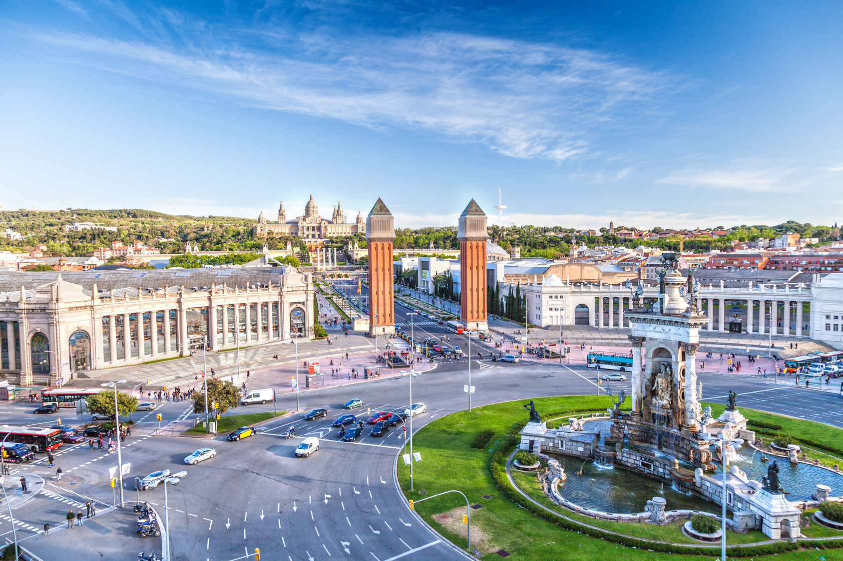
相传巴塞罗那由迦太基将领、汉尼拔的父亲哈米尔卡·巴卡所兴建,在其漫长的历史上还曾作为巴塞罗那伯爵领地和阿拉贡王国的都城。巴塞罗那因其众多历史建筑和文化景点成为众多旅游者的目的地,其中之代表是被列入联合国世界遗产的安东尼·高第和路易·多门内克·蒙塔内的建筑作品。安东尼·高第一直在巴塞罗那生活和工作,在这里有他很多的作品,其中最著名的包括桂尔宫、桂尔公园和圣家堂。巴塞罗那尚有两个知名的足球俱乐部:巴塞罗那和皇家西班牙人,其中巴塞罗那是世界最著名的足球俱乐部之一。
Barcelona (katalanisch [bəɾsəˈɫonə]; spanisch [baɾθeˈlona]; deutsch [baɐ̯səˈloːna] oder [baɐ̯t͡səˈloːna]) ist die Hauptstadt Kataloniens und nach Madrid die zweitgrößte Stadt Spaniens. Sie liegt am Mittelmeer, circa 120 Kilometer südlich der Pyrenäen und der Grenze zu Frankreich. Barcelona ist Verwaltungssitz der gleichnamigen Provinz und der Comarca Barcelonès.
Innerhalb des Stadtgebietes leben etwa 1,65 Millionen Menschen. Damit ist Barcelona die elftgrößte Gemeinde der Europäischen Union, nach Hamburg die zweitgrößte, die nicht die Hauptstadt eines Mitgliedstaates ist, und nach Paris die am zweitdichtesten besiedelte Millionenstadt Europas. Zusammen mit den in der Àrea Metropolitana de Barcelona zusammengeschlossenen Gemeinden der Agglomeration beträgt die Einwohnerzahl 3,16 Millionen. Im weiteren Einzugsbereich der Metropolregion (Àmbit Metropolità de Barcelona) leben insgesamt 4,86 Millionen Menschen. Mit jährlich mehr als sieben Millionen Touristen aus dem Ausland zählt Barcelona überdies zu den drei meistbesuchten Städten Europas.[2]
Barcelona (/ˌbɑːrsəˈloʊnə/ BAR-sə-LOH-nə, Catalan: [bəɾsəˈlonə], Spanish: [baɾθeˈlona]) is a city in Spain. It is the capital and largest city of Catalonia, as well as the second most populous municipality of Spain. With a population of 1.6 million within city limits,[5] its urban area extends to numerous neighbouring municipalities within the Province of Barcelona and is home to around 4.8 million people,[3][7] making it the sixth most populous urban area in the European Union after Paris, London, Madrid, the Ruhr area and Milan.[3] It is the largest metropolis on the Mediterranean Sea, located on the coast between the mouths of the rivers Llobregat and Besòs, and bounded to the west by the Serra de Collserola mountain range, the tallest peak of which is 512 metres (1,680 feet) high.
Founded as a Roman city, in the Middle Ages Barcelona became the capital of the County of Barcelona. After merging with the Kingdom of Aragon, Barcelona continued to be an important city in the Crown of Aragon as an economic and administrative centre of this Crown and the capital of the Principality of Catalonia. Barcelona has a rich cultural heritage and is today an important cultural centre and a major tourist destination. Particularly renowned are the architectural works of Antoni Gaudí and Lluís Domènech i Montaner, which have been designated UNESCO World Heritage Sites. The headquarters of the Union for the Mediterranean are located in Barcelona. The city is known for hosting the 1992 Summer Olympics as well as world-class conferences and expositions and also many international sport tournaments.
Barcelona is one of the world's leading tourist, economic, trade fair and cultural centres, and its influence in commerce, education, entertainment, media, fashion, science, and the arts all contribute to its status as one of the world's major global cities.[8][9] It is a major cultural and economic centre in southwestern Europe, 24th in the world (before Zürich, after Frankfurt)[10] and a financial centre. In 2008 it was the fourth most economically powerful city by GDP in the European Union and 35th in the world with GDP amounting to €177 billion.[11] In 2012 Barcelona had a GDP of $170 billion; and it was leading Spain in employment rate in that moment.[12]
In 2009 the city was ranked Europe's third and one of the world's most successful as a city brand.[13] In the same year the city was ranked Europe's fourth best city for business and fastest improving European city, with growth improved by 17% per year,[14] and the city has been experiencing strong and renewed growth for the past three years. Since 2011 Barcelona has been a leading smart city in Europe.[15] Barcelona is a transport hub, with the Port of Barcelona being one of Europe's principal seaports and busiest European passenger port,[16] an international airport, Barcelona–El Prat Airport, which handles over 40 million passengers per year,[17] an extensive motorway network, and a high-speed rail line with a link to France and the rest of Europe.[18]
Barcelone (Barcelona en catalan, prononcé /bəɾsəˈlonə/, et en espagnol, prononcé /baɾθeˈlona/) est la capitale administrative et économique de la Catalogne, de la province de Barcelone, de la comarque du Barcelonès ainsi que de son aire et de sa région métropolitaines, en Espagne.
Barcelone est la deuxième ville d'Espagne en termes de population, d'économie et d'activités, la onzième ville la plus peuplée de l'Union européenne et la sixième en incluant sa banlieue4: 4,84 millions de personnes vivent dans l'agglomération barcelonaise5. La majeure partie des municipalités adjacentes sont en outre rassemblées dans l'Aire métropolitaine de Barcelone.
Située sur le littoral méditerranéen, elle est traversée par les fleuves Llobregat et Besòs et bordée à l'ouest par la serra de Collserola qui culmine à 512 mètres (sommet : Tibidabo). Elle est considérée comme ville mondiale en raison de son importance dans les domaines de la finance, du commerce international, de l'édition, des arts, du divertissement et des médias. Barcelone est donc un centre économique majeur qui jouit de surcroît d'un des principaux ports méditerranéens et du deuxième aéroport espagnol derrière celui de Madrid-Barajas. Elle est aussi la ville qui possède le plus grand parc métropolitain du monde, le parc Collserola, devant Central Park à New York. Ayant été fondée par les Romains, la ville devint la capitale des comtes de Barcelone puis l'une des villes majeures de la Couronne d'Aragon et, après, la capitale de la principauté de Catalogne. Redessinée plusieurs fois pendant son histoire, elle est une destination touristique majeure et jouit d'un patrimoine culturel unique. Le palais Güell (en 1984), la Casa Milà, le parc Güell, le palais de la musique catalane et l'hôpital de Sant Pau figurent d'ailleurs sur la liste du patrimoine mondial de l'UNESCO. En outre, la ville est également connue pour avoir accueilli les Jeux olympiques en 1992 et, plus récemment, le siège de l'union pour la Méditerranée. Chaque année, les visiteurs arrivent par milliers et le nombre augmente de plus en plus. En 2015, un total de 8 988 038 touristes ont visité Barcelone6.
Barcellona (AFI: /barʧelˈlona/[1]; in catalano e spagnolo Barcelona) è una città di 1.620.809 abitanti (area metropolitana istituzionale: 3.239.337 abitanti) della Spagna, capoluogo della Catalogna, una comunità autonoma della parte nord-orientale dello Stato, oltre che dell'omonima provincia e della comarca del Barcelonès. Soprannominata Ciutat Comtal o Ciudad Condal (Città dei Conti), è la seconda città della Spagna per numero di abitanti dopo la capitale Madrid.
Nel 1992 fu sede dei Giochi Olimpici estivi. Nel 2004 vi si è tenuto per la prima volta assoluta il Forum Universale delle Culture, la città ha ospitato l'Esposizione internazionale del 1888 e quella del 1929, ed è la sede fissa del Mobile World Congress e dell'Unione per il Mediterraneo. Forte del turismo, del porto e della vicinanza alla Francia (160 km da Le Perthus), la città è il secondo maggior centro industriale e finanziario della Spagna dopo Madrid, nonché il maggior porto commerciale e turistico e uno dei maggiori d'Europa.
Barcelona es una ciudad española, capital de la comunidad autónoma de Cataluña, de la comarca del Barcelonés y de la provincia homónima.
Con una población de 1 620 809 habitantes en 2017,6 es la segunda ciudad más poblada de España después de Madrid, y la undécima de la Unión Europea. El área metropolitana de Barcelona, incluida en el ámbito metropolitano de Barcelona, cuenta con 5 029 181 habitantes (2011), siendo así la sexta ciudad de mayor población de la Unión Europea.78
Se ubica a orillas del mar Mediterráneo, a unos 120 km al sur de la cadena montañosa de los Pirineos y de la frontera con Francia, en un pequeño llano litoral limitado por el mar al este, la sierra de Collserola al oeste, el río Llobregat al sur y el río Besós al norte. Por haber sido capital del condado de Barcelona, se suele aludir a ella con la denominación antonomástica de Ciudad Condal.
La historia de Barcelona se extiende a lo largo de 4000 años, desde finales del Neolítico, con los primeros restos hallados en el territorio de la ciudad, hasta la actualidad. El sustrato de sus habitantes aúna a los pueblos íberos, romanos, judíos, visigodos, musulmanes y cristianos. Como capital de Cataluña y segunda ciudad en importancia de España, la Ciudad Condal ha forjado su relevancia con el tiempo, desde ser una pequeña colonia romana hasta convertirse en una ciudad valorada internacionalmente por aspectos como su economía, su patrimonio artístico, su cultura, su deporte y su vida social.
Barcelona ha sido escenario de diversos acontecimientos internacionales que han contribuido a consolidarla, desarrollarla y darle proyección mundial. Los más relevantes han sido la Exposición Universal de 1888, la Exposición Internacional de 1929, los Juegos Olímpicos de 1992 y el Fórum Universal de las Culturas 2004. Es también sede del secretariado de la Unión para el Mediterráneo.9
En la actualidad, Barcelona está reconocida como una ciudad global por su importancia cultural, financiera, comercial y turística. Posee uno de los puertos más importantes del Mediterráneo y es también un importante punto de comunicaciones entre España y Francia, debido a las conexiones por autopista y alta velocidad ferroviaria. El aeropuerto de Barcelona-El Prat, situado a 15 km del centro de la ciudad, fue utilizado por más de 47,2 millones de pasajeros en 2017.10
 新南威尔士州

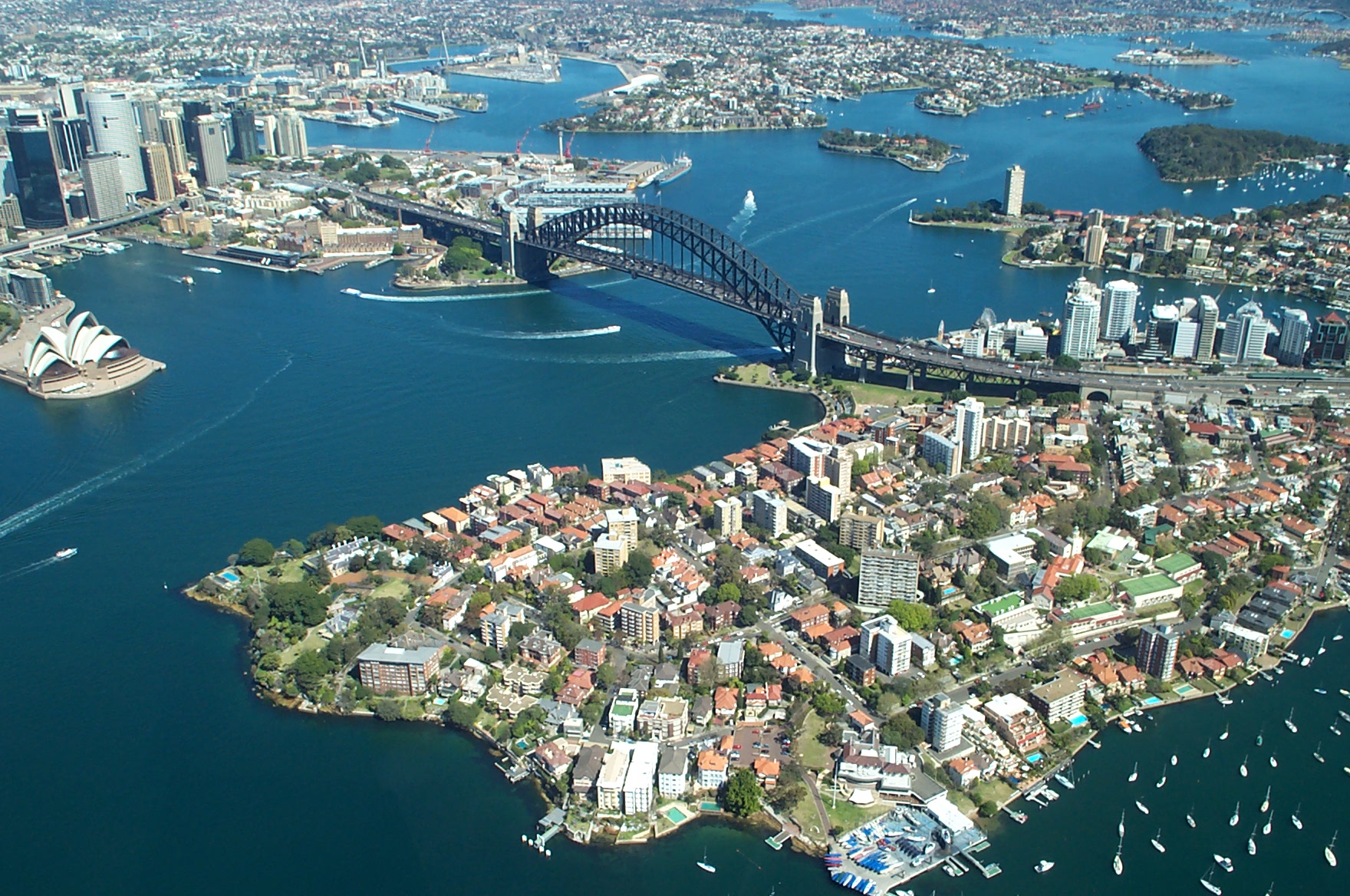
我们是坐了一夜的火车从墨尔本到悉尼的。朋友W的澳洲朋友为我们订好了所有的火车和旅馆。虽然感觉很方便,但后来还是有些后悔,因为老外和我们的喜好总有不一样的地方。那就是为什么我们十几天的澳洲之行只在悉尼停留了两天的原因。
1789年的悉尼地图,图中的“Cove”即今日之植物学湾澳大利亚原住民在悉尼地区居住已至少有三万年。1787年第一舰队抵达时,本地尚住有 4000-8000个原住民。悉尼地区有三种不同的语系,它们可推敲为较小部落的方言。主要的语言为塔鲁尔语(Darug);悉尼市的原住民──卡地哥 (Cadigal),讲Darug的一种海岸方言;还有塔尔瓦斯语(Dharawal)和顾林凯语(Guringai)。部落有各自的领土,其领土的选址 决定了资源的多寡。虽然在都市化的过程中摧毁了大部分的部落遗址(如贝冢),几个地点仍存有石刻。 (Quelle: http://blog.sina.com.cn/s/blog_494d5ee90100co18.html)
悉尼(英语:Sydney),又称雪梨,位于澳大利亚东南沿海地带,是新南威尔士州的首府,是澳大利亚人口最多也是人口最稠密的城市。都会区人口5,005,400人(2016年)。在英语里,市民俗称悉尼人为“Sydneysider”。
悉尼是欧洲首个澳大利亚殖民聚落以及充当罪犯的流放地,1788年由英国第一舰队的船长阿瑟·菲利普于悉尼湾建立[4][5]。悉尼环杰克逊港(包括悉尼港)而建,曾被称为“海港城市”。它是澳大利亚最大的金融中心,也是国际主要旅游胜地,以海滩、歌剧院和海港大桥等闻名。悉尼长期以来都是生活品质极高的世界都市,曾获全球化与世界级城市研究小组与网络(Globalization and World Cities Study Group and Network,GaWC)列为第一级世界都市+[6]。悉尼举办过多项重要国际体育赛事,包括1938年英联邦运动会、2000年悉尼奥运会及2003年世界杯橄榄球赛。
被悉尼市区覆盖的大片地区,以往曾划分为超过300个域区(邮政用途),现由约38个独立的地方政府区域管辖(新南威尔士州州政府及其机构的也有大量的职能)。现在的悉尼市面积不大,占地仅包括悉尼中心商务区及邻近的内城城区。另外,悉尼有许多用于市区的区域非正式的划分。但是,值得注意的是,悉尼有不少城区是不纳入下列的非正式区划的:东郊、山区、内西城、下北岸、北部海滩、北岸、南悉尼、东南悉尼、西南悉尼及西悉尼。
悉尼的中心商务区从首个欧洲殖民聚落──悉尼湾向南面延伸约2公里(1.25英里)。摩天大楼林立,古迹包括悉尼市政厅和维多利亚女王大厦等砂岩建筑,及悉尼议会大厦等公共建筑,设有公园如温亚公园(Wynyard Park)和海德公园(Hyde Park)点缀。中心商务区东面邻接不少公园──海德公园、禁苑(The Domain)、皇家植物园及悉尼港的农场湾。中心商务区西临旅游胜地达令港。而中央站正是中心商务区的尽头。乔治街是悉尼中心商务区的南北大街。在中心商务区南部,街道稍呈格状走向,井然有序;相反,在较古旧的中心商务区北部,街道则较杂乱,这反映出悉尼早期的犍子小道的特殊发展。悉尼的街道多比澳大利亚其他城市的狭窄,也反映出其澳大利亚第一古城的特色。
虽然悉尼中心商务区早期是悉尼的商业与文化支柱,但自第二次世界大战后,其他商业/文化区不断向外发展。因此,二战结束后,中心商务区的白领职位比例从60%以上下跌至2004年的30%以下。悉尼的5个最重要的外环商业区,包括南部的好市围、中西面的帕拉玛塔,西面的黑镇、西南面的利物浦、北面的车士活及位于悉尼港以北的北悉尼。
Sydney [ˈsɪdni] ist die Hauptstadt des australischen Bundesstaates New South Wales und mit 5 Millionen Einwohnern[1] die größte Stadt in Australien.[2]
Sydney wurde am 26. Januar 1788 gegründet und ist heute das Industrie-, Handels- und Finanzzentrum Australiens und ein wichtiger Tourismusort. Auch zahlreiche Universitäten, Museen und Galerien befinden sich hier. Sydney ist Sitz des römisch-katholischen Erzbistums Sydney und der Diözese Sydney der Anglican Church of Australia.
Die Stadt liegt an der Ostküste Australiens am Pazifischen Ozean durchschnittlich drei Meter über dem Meeresspiegel. Das Stadtgebiet (Urbanized Area) hat eine Fläche von 1664 Quadratkilometer. Der Port Jackson bildet mit einer Fläche von 50 Quadratkilometern und 19 Kilometer Länge den Hauptarm und zugleich den natürlichen Hafen Sydneys. Von ihm zweigen weitere Meeresarme wie der Middle Harbour ab.
Die Metropolregion (Sydney Metropolitan Area) umfasst eine Fläche von 12.138 Quadratkilometer. Sie reicht vom Hawkesbury River im Norden bis jenseits der Botany Bay im Süden und von den Blue Mountains im Westen bis zum Pazifischen Ozean im Osten.
Sydney erstreckt sich über zwei geographische Regionen. Südlich und westlich des Hafens liegt der flache bis leicht hügelige Cumberland Plain. Nördlich des Hafens befindet sich das Hornsby Plateau, ein bis zu 200 Meter hohes Hügelland, das von bewaldeten Tälern durchzogen ist. Auf dem Stadtgebiet befinden sich verschiedene Nationalparks und über 70 verschiedene Strände, darunter die weltbekannten und besonders bei Surfern beliebten Strände Bondi Beach und Manly Beach.
Vorgeschichte
Aus Funden in den Blue Mountains schließen Archäologen, dass die Gegend des heutigen Stadtgebiets vor ungefähr 20.000 Jahren von Aborigines besiedelt wurde. Zu Beginn der Kolonisation lebten hier etwa 4.000 bis 8.000 Menschen, die vier verschiedenen Stämmen angehörten. Das waren die Eora, die Darug, die Dharawal und die Guringai. Obwohl ihre Siedlungen weitgehend verschwunden sind, sind an einigen Stellen Felszeichnungen wie die Sydney-Felsgravuren erhalten geblieben.
18. Jahrhundert
1770 hatte Captain James Cook südlich des heutigen Stadtzentrums die Botany Bay entdeckt und auch die Einfahrt zum Port Jackson auf seinen Karten verzeichnet. Am 18. Januar 1788 erreichte Captain Arthur Phillip mit der First Fleet die Botany Bay, die als Standort für eine Strafkolonie vorgesehen war. Während einer dreitägigen Erkundungsfahrt durch den Port Jackson (vom 21. bis 23. Januar 1788) entdeckte Phillip zunächst Manly Cove und einen Tag später auf der anderen Seite des Naturhafens eine weitere Bucht, die er nach dem damaligen britischen Innenminister Lord Sydney auf den Namen Sydney Cove taufte.
Am 26. Januar 1788 erreichte eine französische Expedition unter Jean-François de La Pérouse ebenfalls die Botany Bay. Die Engländer beschlossen am selben Tag, die Kolonie an den Sydney Cove zu verlegen. Etwa 800 Sträflinge sowie rund 500 Seeleute und Soldaten verließen in der Nähe des heutigen Circular Quay die Schiffe. Der 26. Januar ist seither Australiens Nationalfeiertag. Vermutlich zufällig brach kurz nach der Ankunft der weißen Siedler die Pockenepidemie in Australien 1789 aus, die große Teile der indigenen Bevölkerung auslöschte. Als Vermittler zwischen den Kulturen diente Bennelong, der von den Engländern gefangen genommen worden war und die englische Sprache erlernte.
19. Jahrhundert
Während der Rum Rebellion im Jahr 1808 wurde Gouverneur William Bligh, der ehemalige Kapitän der Bounty, entmachtet. Erst Gouverneur Lachlan Macquarie schuf zwischen 1810 und 1821 die Voraussetzungen, dass sich aus der Strafkolonie eine bedeutende Stadt entwickeln konnte. Er ließ Straßen, Brücken, Hafenanlagen und öffentliche Gebäude errichten.
Macquarie hat in besonderer Weise die Erkundung des australischen Kontinents vorangetrieben. Nach zahlreichen gescheiterten Versuchen in den ersten 25 Jahren der Kolonie gelang es den von ihm entsandten Entdeckern Gregory Blaxland, William Charles Wentworth und William Lawson im Jahre 1813, einen Weg durch die Blue Mountains zu finden (Blaxland-Expedition). Diese hatten als Teil der Great Dividing Range Sydney bis dahin von den Gebieten im Westen abgeschnitten. In der Folgezeit konnte das Landesinnere besiedelt werden.
In den 1830er und 1840er Jahren entstanden die ersten Vororte, als immer mehr Einwanderer aus Großbritannien und Irland in Sydney ankamen. Nach dem ersten Goldrausch im Jahre 1851 wurde Sydney endgültig zum kulturellen, wirtschaftlichen und industriellen Mittelpunkt Australiens. Im letzten Viertel des 19. Jahrhunderts begann sich die Besiedelung des Umlandes zu verstärken.
20. Jahrhundert
Bereits Mitte der 1920er Jahre zählte die Stadt mehr als eine Million Einwohner. 1931 waren wegen der Weltwirtschaftskrise etwa ein Drittel der Erwerbstätigen arbeitslos. Aber schon ein Jahr später stiegen die Preise für Wolle wieder, und die Bauindustrie erlebte einen neuen Aufschwung. 1932 entstand die Sydney Harbour Bridge, zuvor war die Gegend nördlich des Port Jackson nur umständlich erreichbar und deshalb dünn besiedelt gewesen.
Im Zweiten Weltkrieg erlitt die Stadt am 31. Mai 1942 nur geringe Schäden durch drei japanische Mini-U-Boote, von denen zwei im Hafen erbeutet wurden. Das dritte konnte entkommen, fand aber nicht zum Mutterschiff zurück. Es wurde im November 2006 17 Kilometer nordöstlich von Sydney am Long Reef Beach entdeckt.[5] Nach Beendigung des Krieges kamen viele Migranten aus Europa nach Sydney; die Stadt wuchs weiter Richtung Wesongten. Ab Mitte des 20. Jahrhunderts begann die verstärkte Einwanderung aus asiatischen Ländern, was der Stadt ihr multikulturelles Flair verlieh.
Im Vietnamkrieg war Sydney ein wichtiger Erholungsort für US-amerikanische Soldaten. In den 1970er und 1980er Jahren entstanden, ausgelöst durch den wirtschaftlichen Aufschwung, im Central Business District zwischen den alten viktorianischen Gebäuden zahlreiche Hochhäuser. Im Januar 1994 zerstörten große Buschfeuer 200 Häuser in den Vororten von Sydney.[6]
2000 war Sydney Austragungsort der Olympischen Sommerspiele.
21. Jahrhundert
Am 26. Dezember 2001 vernichteten Buschfeuer innerhalb von 23 Tagen weite Gebiete des Royal-Nationalparks und in den Blue Mountains. Rund 170 Häuser und mehr als 650.000 Hektar Wald und Farmland wurden Opfer der Flammen. Etwa 10.000 Feuerwehrleute aus dem ganzen Land waren im Einsatz, doch gelöscht wurden die Feuer durch starke Regenfälle mit bis zu 40 Millimeter Niederschlag.[6]
Im Dezember 2005 kam es in Cronulla, einem Vorort von Sydney, zu rassistisch motivierten Krawallen zwischen weißen Australiern und libanesischstämmigen Australiern. Bei den Cronulla Riots wurden 30 Menschen verletzt, darunter sechs Polizisten und zwei Sanitäter.
Vom 15. bis 20. Juli 2008 fand in Sydney der XXIII. Weltjugendtag statt. Am Abschlussgottesdienst mit Papst Benedikt XVI. nahmen 350.000 Pilger teil. Es war die größte Messe in der Geschichte Australiens.[7]
Ende September 2009 wurde Sydney vom stärksten Staubsturm der letzten 70 Jahre heimgesucht.[8]
シドニー(Sydney)は、オーストラリア南東部、タスマン海に面するニューサウスウェールズ州の州都である。
オーストラリア最大の人口を有し、南半球を代表する世界都市及び金融センターである。アメリカのシンクタンクが2017年に発表した総合的な世界都市ランキングにおいて、世界16位の都市と評価されており[2]、同国及び南半球の都市として首位である。
人口は2016年時点で500万人を超えている。都市圏人口は410万人であり、世界104位、オセアニアでは首位である[3]。オセアニアを代表する国際的な観光都市でもあり、海に臨むオペラハウスなどが著名で、世界で最も美しいといわれる都市のひとつである。
300km南西に特別区である首都キャンベラが所在するが、経済や文化の規模ではシドニーの方が活発である。それもあってか、シドニーがオーストラリアの首都であると誤解する者も少なくない。2000年には夏季オリンピックである「シドニーオリンピック」の開催地となった。 シドニー湾沿岸には少なくとも4万年前からアボリジニが定住していた。
ヨーロッパ人の関心がこの地域に向かうのは、1770年のジェームズ・クックによるポート・ジャクソン湾の望見の後である。イギリス人による最初の入植は1788年1月20日で、アーサー・フィリップ総督によってこの「小川に近い、入り江の湾頭」はオーストラリア最初の植民地として定められた。フィリップは当初この地をアルビオンと呼ぶ意向であったが、シドニー入江に由来する「シドニー」が一般的に用いられるようになった。シドニー入江はクックの命名で、彼の後援者であったシドニー卿(シドニー子爵)トマス・タウンゼントにちなんだものである[4]。このことは植民地開設の特許状がシドニー卿の斡旋で交付されたことに由来すると思われる。
新植民地の初期の人口は1000人を超える程度で、当地は流刑植民地であったことからその大部分は囚人であった。1822年にはすでに銀行、市場、発達した道路網、警察隊を備えた町となった。1833年、町の行政は3人の行政官の手に委ねられ、1842年には自治体となった。1847年には囚人が人口にしめる割合はわずか3.2%にまで低下した。当時シドニーにはヨーロッパより週ごとに船が来航し、イギリスや他のヨーロッパからの移民が到着した。囚人の人口が減少するにつれ、商業活動が活発化した。1850年にはオーストラリア初の大学であるシドニー大学が創設され、さらに1855年にはシドニーと西郊のパラマタとを結ぶ鉄道が開通した。1883年にはシドニー及びメルボルンを結ぶ鉄道路線が開通したものの、両植民地の鉄道軌間は異なっており、直通路線の開通は1962年まで待たねばならなかった。当初、煉瓦製造と製材に限られていた第二次産業の発展は、ニューサウスウェールズ州の自由貿易政策が現地工業の確立を阻害したため遅々としていた。1901年の連邦成立後、自由貿易政策は否定され、各州間の緊密な連携のもとに州間交易が著しい進展を示した。
シドニーは、19世紀前半まではオーストラリアの6つのイギリス植民地の中心として、名実ともに最大の都市であった。1851年にニューサウスウェールズ州およびビクトリア州で金が発見され最初のゴールドラッシュが起こると、シドニーの人口は急激に増加し、急速に工業化が進んだ。だが、ゴールドラッシュおよびイギリス本国との間の大圏航路においてメルボルンのほうが好位置であったことも加わって、メルボルンが発達の速度を速め、19世紀後半にはシドニーは第2位に後退した。この頃からシドニーとメルボルンとの間で伝統的な敵対関係が存在し、メルボルンはオーストラリアの最大都市かつ最も裕福な都市となっていた。
1901年にオーストラリア大陸の6植民地が連合してオーストラリア連邦が成立すると首都は最大都市メルボルンに置かれたものの、この頃からシドニーは再び勢いを増していき、20世紀初頭になるとシドニーはメルボルンを人口で追い越し[5]、それ以来現在に至るまでシドニーは国内最大の都市に君臨し続けている。1970〜80年代、オーストラリア準備銀行やオーストラリア証券取引所と共に、シドニーのCBDは明らかに国内最大の金融都市となってメルボルンを追い抜いた。都市圏の拡大とともに人口の郊外化が進み、都市圏の西端は都心から60km以上も離れたブルーマウンテンの麓にまで達している。20世紀全体を通して見ると、第二次世界大戦後の10年間を特に顕著とし、ヨーロッパやその後のアジアからの移民が増えるにつれてシドニーの都市圏は拡大を続けた。シドニーの特徴である多様で国際的な雰囲気は、移民によってもたらされた文化が主な要因である。
Sydney (/ˈsɪdni/ (listen))[7] is the state capital of New South Wales and the most populous city in Australia and Oceania.[8] Located on Australia's east coast, the metropolis surrounds Port Jackson and extends about 70 km (43.5 mi) on its periphery towards the Blue Mountains to the west, Hawkesbury to the north, and Macarthur to the south.[9] Sydney is made up of 658 suburbs, 40 local government areas and 15 contiguous regions. Residents of the city are known as "Sydneysiders".[10] As of June 2017, Sydney's estimated metropolitan population was 5,131,326.[11]
Indigenous Australians have inhabited the Sydney area for at least 30,000 years, and it remains one of the richest in Australia in terms of Aboriginal archaeological sites, with thousands of engravings located throughout the region. In 1770, during his first Pacific voyage in the Endeavour, Lieutenant James Cook, after leaving Botany Bay, saw the entrance to Port Jackson, but sailed past and did not enter the inlet. In 1788, the First Fleet of convicts, led by Arthur Phillip, were the first recorded Europeans to sail into Port Jackson. Here they founded Sydney as a British penal colony, the first European settlement in Australia. Phillip named the city "Sydney" in recognition of Thomas Townshend, 1st Viscount Sydney.[12] Penal transportation to New South Wales ended soon after Sydney was incorporated as a city in 1842. A gold rush occurred in the colony in 1851, and over the next century, Sydney transformed from a colonial outpost into a major global cultural and economic centre. After World War II, it experienced mass migration and became one of the most multicultural cities in the world.[3] At the time of the 2011 census, more than 250 different languages were spoken in Sydney and about 40 percent of residents spoke a language other than English at home.[13] Furthermore, 36% of the population reported having been born overseas.[14][15]
Despite being one of the most expensive cities in the world,[16] the 2018 Mercer Quality of Living Survey ranks Sydney tenth in the world in terms of quality of living,[17] making it one of the most livable cities.[18] It is classified as an Alpha World City by Globalization and World Cities Research Network, indicating its influence in the region and throughout the world.[19][20] Ranked eleventh in the world for economic opportunity,[21] Sydney has an advanced market economy with strengths in finance, manufacturing and tourism.[22][23] There is a significant concentration of foreign banks and multinational corporations in Sydney and the city is promoted as one of Asia Pacific's leading financial hubs.[24][25] Established in 1850, the University of Sydney is Australia's first university and is regarded as one of the world's leading universities.[26] Sydney is also home to the oldest library in Australia, State Library of New South Wales, opened in 1826.[27]
Sydney has hosted major international sporting events such as the 2000 Summer Olympics. The city is among the top fifteen most-visited cities in the world,[28] with millions of tourists coming each year to see the city's landmarks.[29] Boasting over 1,000,000 ha (2,500,000 acres) of nature reserves and parks,[30] its notable natural features include Sydney Harbour, the Royal National Park, Royal Botanic Garden and Hyde Park, the oldest parkland in the country.[31] Built attractions such as the Sydney Harbour Bridge and the World Heritage-listed Sydney Opera House are also well known to international visitors. The main passenger airport serving the metropolitan area is Kingsford-Smith Airport, one of the world's oldest continually operating airports.[32] Established in 1906, Central station, the largest and busiest railway station in the state, is the main hub of the city's rail network.[33]
Sydney est une ville du sud-est de l'Australie, située dans l'État de Nouvelle-Galles du Sud, sur les rives de la mer de Tasman. Avec une aire urbaine comprenant, en 2016, une population de 5,25 millions d'habitants1 sur près de 12 300 km2, Sydney est la ville la plus peuplée d'Australie, devant Melbourne et Brisbane, ainsi que du continent océanien. Ses habitants s'appellent les Sydneyites ou Sydneysiders en anglais, et les Sydnéens en français.
Un peuplement aborigène existe sur le site pendant plusieurs millénaires. L'explorateur James Cook accoste pour la première fois en Australie en 1770 sur le site de Botany Bay. Première des colonies européennes d'Australie, Sydney est fondée en 1788 à Sydney Cove (à l'emplacement actuel de Circular Quay) par le capitaine Arthur Phillip, commandant de la première flotte venant de Grande-Bretagne, pour en faire une colonie pénitentiaire. La découverte de gisements d'or dans l'État voisin du Victoria au début de la seconde moitié du XIXe siècle entraîne le développement de la ville. En 1920, Sydney compte plus d'un million d'habitants et s'étend bien au-delà de la baie de Port Jackson, son site initial. Pendant la Seconde Guerre mondiale, la ville sert de base pour les forces aériennes et navales alliées. En mai et juin 1942, elle est victime d'un bombardement par des sous-marins japonais qui détruisent le port.
Durant la seconde moitié du XXe siècle, Sydney devient peu à peu le cœur économique de l'Australie et le principal centre financier de l'Océanie. Barangaroo et le centre d'affaires de Sydney (CBD, plus familièrement appelé « The City » par les habitants) accueillent ainsi de nombreux gratte-ciels — la World Tower et la Sydney Tower notamment — et sièges sociaux d'entreprises, mais aussi de vastes parcs, comme Hyde Park ou les Royal Botanic Gardens. Darlinghurst est le quartier gay de la ville, et les banlieues de Woolloomooloo et Glebe, au nord du centre-ville, sont des quartiers en pleine gentrification.
Sydney est en outre une destination touristique internationale, connue aussi bien pour son quartier central historique The Rocks que pour ses deux monuments principaux, l'opéra et le Harbour Bridge. Elle comprend les plus grands musées d'Australie, tels l'Australian Museum, la Galerie d'art de Nouvelle-Galles du Sud et le musée de Sydney, le zoo de Taronga et le Luna Park, l'un des plus anciens parcs d'attractions au monde. Enfin, Sydney accueille de grands événements comme les Jeux olympiques d'été de 2000 ou les journées mondiales de la jeunesse 2008. Des millions de touristes viennent chaque année pour visiter les monuments de la ville. Sydney est aussi la porte pour l'Australie pour de nombreux visiteurs. La baie de Sydney, le parc national Royal et de Sydney Harbour, la cathédrale Saint-André et Sainte-Marie et la plage de Bondi sont des lieux d’intérêts de la ville.
Sydney est le deuxième siège après Canberra, et deuxième lieu officiel de résidence du gouverneur général d'Australie, du Premier ministre d'Australie et du gouvernement australien. On y parle 250 langues différentes et un tiers des habitants parle une autre langue que l'anglais chez eux.
Sydney ([ˈsidni] ascolta[?·info]) è una città australiana di 5.131.326 abitanti, capitale del Nuovo Galles del Sud.
È la più popolosa città dell'Oceania nonché una delle più multiculturali del mondo.[3] È attualmente al 14º posto della classifica delle città globali.[4]
L'area attorno a Sydney fu abitata dagli aborigeni per decine di millenni.[5] I primi coloni britannici arrivarono nel 1788 con il capitano Arthur Phillip e fondarono la città come colonia penale.[6][7] Dal momento in cui si smise di trasportarvi criminali nel 1800 circa, Sydney è diventata un centro culturale ed economico globale.[8]
Nel 2000 Sydney ha ospitato i Giochi della XXVII Olimpiade, mentre nel 2008 è stata la sede della XXIII Giornata mondiale della gioventù.
La città è contenuta per la maggior parte della sua estensione nella contea di Cumberland.
L'area che circonda il Sydney Harbour è stata abitata, per almeno 45 000 anni, da diverse tribù aborigene, che la chiamavano Warrane; le principali tribù della zona erano gli Eora e i Cadigal. Benché l'urbanizzazione abbia cancellato la maggior parte delle tracce di questi insediamenti, si trovano ancora dipinti rupestri in alcune zone. Gli europei iniziarono a interessarsi della zona a partire dal 1770, anno in cui il capitano James Cook avvistò Botany Bay (oggi un sobborgo meridionale di Sydney). Per ordine del governo britannico, nel 1788 Arthur Phillip fondò in questa zona un insediamento carcerario. Phillip sbarcò inizialmente a Botany Bay, ma decise poi di far vela verso nord e fondò l'insediamento definitivo a Sydney Cove, presso Port Jackson.
Phillip diede nome alla colonia New Albion, ma per motivi non del tutto chiari essa divenne presto nota col nome Sydney, da Lord Sydney (Thomas Townshend), che inviò a Phillip l'autorizzazione a fondare la colonia. La colonia fu meta di molte deportazioni di detenuti, principalmente di origine irlandese e inglese. Nella maggior parte dei casi, come gli australiani tengono a ricordare, i "detenuti" erano accusati di crimini quasi insignificanti o venivano semplicemente esiliati perché non graditi, spesso per motivi politici, alla spietata aristocrazia britannica dell'epoca.
Attorno all'insediamento iniziò presto a formarsi una piccola città, che venne via via popolata da immigranti in cerca di nuova vita. Già nel 1822 Sydney aveva banche e mercati; nel 1847, i detenuti costituivano ormai solo il 3,2 percento della popolazione. Un'ondata particolarmente importante di immigrati ebbe luogo durante la corsa all'oro del 1851. Con l'industrializzazione, l'espansione della città ha accelerato, e all'inizio del XX secolo la popolazione complessiva superava di parecchio il milione. Sydney ha continuato per tutto il secolo a espandersi e accogliere nuove ondate di immigrati, prima europei e poi anche asiatici, che hanno contribuito a creare l'atmosfera cosmopolita di oggi.
Sídney5 (en inglés: Sydney [sɪdni] (?·i)) es la ciudad más grande y poblada de Australia y Oceanía, con una población en su área metropolitana cercana a los 4.92 millones, según una estimación de 2015 6Es la capital del estado de Nueva Gales del Sur y fue el asentamiento de la primera colonia británica en Australia. Fue fundada en 1788 en la cala de Sídney por Arthur Phillip, almirante de la Primera Flota de Gran Bretaña,7 y es la ciudad más antigua del país.8
Está situada al sudeste de Australia, a orillas de la amplia bahía de Sídney (Puerto Jackson). En la ciudad destaca la Casa de la Ópera, el puente de la bahía de Sídney y sus playas. El área metropolitana está rodeada de parques nacionales que contienen bahías y ríos. La ciudad ha acogido eventos internacionales deportivos como los Juegos de la Mancomunidad de 1938, los Juegos Olímpicos de Sídney 2000 y la final de la Copa Mundial de Rugby de 2003, entre otros. Sydney es catalogada como una de las 15 ciudades más visitadas del mundo, con millones de turistas viniendo cada año a ver atracciones como el jardín botánico, el puerto de la ciudad, el Parque nacional Real, la Casa de la Ópera, etc. Sídney es una de las ciudades más cosmopolita del mundo, principal destino para inmigrantes de Australia.9 De acuerdo con un estudio de Mercer sobre el costo de vida, en el 2017 la ciudad fue catalogada como la segunda ciudad más cara del mundo en precios de vivienda después de Hong Kong10 y como la tercera ciudad del mundo más cara para comprar el tiquete mensual de transporte público solo por debajo de Londres y Dublín11 A pesar de esto, la ciudad es catalogada como una de las ciudades con mejores estándares de calidad de vida del mundo. Sídney lidera la lista de las 10 ciudades con mejor calidad de vida del mundo, en otro estudio realizado por la misma empresa junto con la revista The Economist.1213 De igual forma, la ciudad fue designada en el 2016 según un estudio como la ciudad con la mejor reputación en el mundo para vivir, estudiar e invertir, seguida por Viena en Austria 14
Си́дне́й[3] (англ. Sydney, произносится [ˈsɪdni][4]) — самый большой и самый старый город Австралии площадью 12 144,6 км²[5], население которого по состоянию на июнь 2017 года составляло 5 131 326 человек[6]. Сидней является столицей штата Новый Южный Уэльс. Город был основан в 1788 году Артуром Филлипом, который прибыл сюда во главе Первого флота, и являлся местом первого колониального европейского поселения в Австралии[7]. Город был назван колонистами в честь лорда Сиднея — бывшего на тот момент министром колоний Великобритании.
Сидней располагается на юго-восточном побережье Австралии. Поселение строилось на берегу круглой маленькой бухточки — Сиднейской (англ. Sydney Cove), расположенной в средней части протяжённой бухты Сидней-Харбор — южного ответвления залива (гавани) Порт-Джексон, отделённого узким проливом (~ 1 км) от Тасманова моря. В дальнейшем город строился к югу от бухты Сидней-Харбор (она длиной до 20 км при ширине от 1 до 3 км и глубине до 50 м), а затем и вокруг неё. Это послужило причиной того, что Сидней часто называют «Город возле бухты» (англ. The Harbour City).
Со временем городские постройки полностью охватили залив Порт-Джексон, включающий три бухты — Сидней-Харбор, Среднюю бухту (англ. Middle Harbour) и Северную бухту (англ. North Harbour). В настоящее время Сидней ещё более разросся и включает в себя расположенный к югу Ботанический залив (англ. Botany Bay) Тасманова моря, на северном берегу которого расположен Международный аэропорт им. Кингсфорда Смита.
Город Сидней знаменит своим оперным театром, мостом Харбор-Бридж и своими пляжами. Жилые кварталы большого Сиднея окружены национальными парками. Береговая линия (как внешняя «морская», так и внутригородская) крайне изрезана. Она изобилует многочисленными заливами, бухточками, островами и пляжами.
Согласно классификации университета Лоуборо 1999 года город относится к категории городов бета-класса[8]. Сидней был местом проведения многочисленных международных политических и спортивных мероприятий, таких как Игры Британской империи 1938 года, Олимпийские игры 2000 года, Кубок мира по регби 2003 года. В сентябре 2007 года в Сиднее состоялась встреча лидеров стран АТЭС, в июле 2008 года здесь прошёл Международный день молодёжи.
Сидней является одним из самых многокультурных и многонациональных городов мира, что вызвано тем фактом, что город является основным местом проживания иммигрантов, прибывающих на постоянное место жительство в Австралию[9]. Согласно исследованию Мерсер, Сидней занимает первое место в Австралии по стоимости жизни и 66 место в мире по этому показателю[10].
 世界杯决赛队

里约热内卢位于巴西国土的东南部,坐落在美丽的瓜纳巴拉海湾,依山傍水,风景优美,是巴西和世界著名的旅游观光胜地。面积4.36万平方公里。人口 1,413.3万(1990),城市人口占90%以上。1889年设州,1975年瓜纳巴拉州并入,首府由尼泰罗伊迁至里约热内卢市。沿海低地气候湿热, 内地高原气候温和。重要河流有帕拉伊巴河等。工农业和服务业均甚发达,服务业占就业人口约37%和收入的一半。工业以钢铁、纺织、食品、印刷、石油化工为 主。有石油、铝土、铁、煤、大理石等矿产。渔业和盐业兴盛。农业主产甘蔗、柑橘、香蕉、蔬菜、棉花、水果、稻,饲养牲畜。水、陆、空交通发达。风景优美, 多游览胜地。
(Quelle: http://www.uutuu.com)
里约热内卢(葡萄牙语:Rio de Janeiro,葡萄牙语发音:[ˈʁi.u dʒi ʒɐˈnejɾu],意即“一月的河”),有时仅简称为里约(Rio),是位于巴西东南部的城市,为里约热内卢州首府,同时是巴西第二大城,仅次于圣保罗。面积1,256平方公里,人口6,094,183人(2005年)。其自1822年巴西建国以来一直为首都,至1960年4月21日迁都巴西利亚为止,更曾经成为前宗主国葡萄牙在本土被拿破仑入侵时(1808年–1821年)的流亡首都[3]。风景优美,每年吸引大量游客到此观光,市内的里约热内卢港是世界三大天然良港之一,而里约热内卢基督像也是世界新七大奇迹之一。其亦为第31届夏季奥运的主办地,是第一座举办夏季奥运的南美洲城市。
Rio de Janeiro [ˈʁi.u d(ʒi) ʒɐˈne(j)ɾu, ˈʁi.u d(ʑi) ʑɐˈne(j)ɾu] ist nach São Paulo die zweitgrößte Stadt Brasiliens und Hauptstadt des gleichnamigen Bundesstaates. Sie liegt an der Guanabara-Bucht im Südosten des Landes. Der Name (deutsch Fluss des Januar) beruht auf einem Irrtum des Seefahrers Gaspar de Lemos, der die Bucht am 1. Januar 1502 entdeckte und für die Mündung eines großen Flusses hielt. Im administrativen Stadtgebiet leben rund 6,7 Millionen Menschen (Schätzung 2018).[1] Die Metropolregion Rio de Janeiro hat rund 13,3 Millionen Einwohner (Schätzung 2018).[2] Somit gehört Rio de Janeiro zu den Megastädten dieser Erde.
Von 1815 bis 1821 war Rio de Janeiro Hauptstadt des Königreiches von Portugal und Brasilien und nach der Unabhängigkeit Brasiliens 1822 bis 1960 die Hauptstadt des Landes. Danach trat sie diese Funktion an Brasília ab, bleibt aber nach São Paulo bedeutendstes Handels- und Finanzzentrum des Landes. Von 1808 bis 1822 war die Stadt auch Sitz des portugiesischen Hofes, der wegen eines Angriffs durch Napoleon Bonaparte nach Brasilien flüchten musste. Die Bewohner der Stadt nennt man Cariocas, nach einem Wort aus der zum Tupí-Guaraní gehörenden Sprache der Tupinambá, welches „Hütte des weißen Mannes“ bedeutet.
Wahrzeichen von Rio de Janeiro sind der Zuckerhut, die 38 Meter hohe Christusfigur auf dem Gipfel des Corcovados und der Strand des Stadtteils Copacabana, der als einer der berühmtesten der Welt gilt. Die Stadt ist auch bekannt wegen des jährlich stattfindenden Karnevals von Rio. Die bunte Parade der Sambaschulen gehört zu den größten Paraden der Welt.
リオ・デ・ジャネイロ(葡: Rio de Janeiro, ブラジルポルトガル語発音: ヒウ・ヂ・ジャネイル)は、ブラジル南東部に位置するリオデジャネイロ州の州都。世界有数のメガシティであり、国内最大の観光都市である。港湾都市としても知られる。
人口は600万人を超え、サンパウロに次いでブラジル第2位にランクされる。経済規模(域内総生産)でもサンパウロに次いで第2位にあり、アメリカのシンクタンクが公表したビジネス・人材・文化・政治などを対象とした総合的な世界都市ランキングにおいて、世界第56位、国内ではサンパウロに次ぐ第2位の都市と評価された[1]。都市周辺の美しい文化的景観は「リオデジャネイロ:山と海との間のカリオカの景観群」として、2012年に世界遺産リストに登録された。2016年の第31回夏季オリンピックの開催都市である。
カーニバルで有名。コパカバーナ、イパネマ(英語版)などの世界的に有名な海岸を有し世界3大美港の一つに数えられる美しい都市である。都市のGDPは2010億ドルであり世界第30位、南米ではサンパウロ、ブエノスアイレスに次ぎ第3位である[2]。
1960年にブラジリアに遷都するまではブラジルの首都であった。また、1808年にナポレオンに本国領土を奪われたポルトガル王室が遷都してからブラジルが独立するまではポルトガルの首都であった。また、中南米有数の貿易港でもあるためにブラジルの経済的な中心地でもあった。近年は経済の中心地はサンパウロに移り、その地位が低下しているものの、依然として中南米有数の経済都市である。また、ブラジルのみならず世界でも有数の観光地としても、ショーロ、ボサノヴァを生んだ音楽の都としても名高い。
Rio de Janeiro (/ˈriːoʊ di ʒəˈnɛəroʊ, - deɪ -, - də -/; Portuguese: [ˈʁi.u d(ʒi) ʒɐˈne(j)ɾu];[3] River of January), or simply Rio,[4] is anchor to the Rio de Janeiro metropolitan area and the second-most populous municipality in Brazil and the sixth-most populous in the Americas. Rio de Janeiro is the capital of the state of Rio de Janeiro, Brazil's third-most populous state. Part of the city has been designated as a World Heritage Site, named "Rio de Janeiro: Carioca Landscapes between the Mountain and the Sea", by UNESCO on 1 July 2012 as a Cultural Landscape.[5]
Founded in 1565 by the Portuguese, the city was initially the seat of the Captaincy of Rio de Janeiro, a domain of the Portuguese Empire. Later, in 1763, it became the capital of the State of Brazil, a state of the Portuguese Empire. In 1808, when the Portuguese Royal Court transferred itself from Portugal to Brazil, Rio de Janeiro became the chosen seat of the court of Queen Maria I of Portugal, who subsequently, in 1815, under the leadership of her son, the Prince Regent, and future King João VI of Portugal, raised Brazil to the dignity of a kingdom, within the United Kingdom of Portugal, Brazil, and Algarves. Rio stayed the capital of the pluricontinental Lusitanian monarchy until 1822, when the War of Brazilian Independence began. This is one of the few instances in history that the capital of a colonising country officially shifted to a city in one of its colonies. Rio de Janeiro subsequently served as the capital of the independent monarchy, the Empire of Brazil, until 1889, and then the capital of a republican Brazil until 1960 when the capital was transferred to Brasília.
Rio de Janeiro has the second largest municipal GDP in the country,[6] and 30th largest in the world in 2008,[7] estimated at about R$343 billion (IBGE, 2008) (nearly US$201 billion). It is headquarters to Brazilian oil, mining, and telecommunications companies, including two of the country's major corporations – Petrobras and Vale – and Latin America's largest telemedia conglomerate, Grupo Globo. The home of many universities and institutes, it is the second-largest center of research and development in Brazil, accounting for 17% of national scientific output according to 2005 data.[8] Despite the high perception of crime, the city has a lower incidence of crime than Northeast Brazil, but it is far more criminalized than the south region of Brazil, which is considered the safest in the country.[9]
Rio de Janeiro is one of the most visited cities in the Southern Hemisphere and is known for its natural settings, Carnival, samba, bossa nova, and balneario beaches[10] such as Barra da Tijuca, Copacabana, Ipanema, and Leblon. In addition to the beaches, some of the most famous landmarks include the giant statue of Christ the Redeemer atop Corcovado mountain, named one of the New Seven Wonders of the World; Sugarloaf Mountain with its cable car; the Sambódromo (Sambadrome), a permanent grandstand-lined parade avenue which is used during Carnival; and Maracanã Stadium, one of the world's largest football stadiums. Rio de Janeiro was the host of the 2016 Summer Olympics and the 2016 Summer Paralympics, making the city the first South American and Portuguese-speaking city to ever host the events, and the third time the Olympics were held in a Southern Hemisphere city.[11] The Maracanã Stadium held the finals of the 1950 and 2014 FIFA World Cups, the 2013 FIFA Confederations Cup, and the XV Pan American Games.
Rio de Janeiro [ˈʁi.u d(ʒi) ʒɐˈnejɾu]2, souvent désignée simplement sous le nom de Rio, est la deuxième plus grande ville du Brésil après São Paulo. Située au sud-est du pays, elle est la capitale de l'État de Rio de Janeiro. Avec ses 6,1 millions d'habitants intra-muros (communément appelés Cariocas, la variante Carioques existant aussi en français) et 12,62 millions dans l'aire urbaine, Rio de Janeiro est l'une des métropoles les plus importantes du continent américain.
Elle est mondialement connue pour son carnaval, ses plages (Copacabana, Leblon et Ipanema) ainsi que sa statue du Christ Rédempteur au sommet du Corcovado. Elle fut capitale du Royaume-Uni de Portugal, du Brésil et des Algarves, à la suite de la fuite de la cour portugaise lors de l'invasion des troupes napoléoniennes (1808-1821), puis de l'Empire du Brésil (1822-1889), de la República Velha (1889-1930), de l’Estado Novo (1937-1945) et du début de la Deuxième République jusqu'en 1960.
La ville a accueilli les Journées mondiales de la jeunesse 2013, la finale de la Coupe du monde de football de 2014 et enfin, en 2016, les Jeux olympiques d'été.
Rio de Janeiro (pron. [ˈrio deʒaˈnɛiro];[2] letteralmente "Fiume di gennaio" in portoghese) è una città del Brasile, capitale dell'omonimo stato confederato. Rio è la seconda città del Brasile dopo San Paolo e fu la capitale dello Stato federale dal 1763 fino al 1960, dopo Salvador da Bahia e prima di Brasilia.
La città è famosa per le sue attrattive turistiche tra cui spiccano le spiagge di Copacabana e Ipanema, la gigantesca statua liberty del Cristo Redentore, situata sul monte del Corcovado, il monte del Pão de Açúcar (Pan di Zucchero), con la sua funivia, e il suo annuale carnevale, il più celebre al mondo.
La città è al centro della scena internazionale, avendo ospitato alcuni dei più grandi eventi mondiali degli ultimi anni: nel 2007 i XV Giochi Panamericani, nel 2013 la XXVIII Giornata Mondiale della Gioventù e nel 2016 i giochi della XXXI Olimpiade. È stata inoltre una delle città in cui si è disputato il Campionato del mondo di calcio 2014.
Rio de Janeiro contiene anche la più grande foresta all'interno di un'area urbana, la foresta di Tijuca.
L'attuale sindaco è Marcelo Crivella, in carica dal 1º gennaio 2017, del PRB.
Río de Janeiro1 (en portugués, Rio de Janeiro, AFI: [ˈʁi.u dʒi ʒaˈnejɾu]), fundada como São Sebastião do Rio de Janeiro,3 es una ciudad, municipio brasileño y capital del estado homónimo, ubicada en el sureste del país. Es la segunda ciudad más poblada del país después de São Paulo.4
Fue la capital del Reino de Portugal entre 1808 y 1822 y la capital del Imperio del Brasil desde 1822, cuando la nación declaró su independencia del país luso y conservó ese rango hasta la inauguración de Brasilia, en 1960.
Es uno de los principales centros económicos, de recursos culturales y financieros del Brasil. Es conocida internacionalmente por sus iconos culturales y paisajes, como el Pan de Azúcar, la estatua del Cristo Redentor (una de las siete maravillas del mundo moderno), las playas de Copacabana e Ipanema, el Estadio de Maracaná, el Parque Nacional de Tijuca (el mayor bosque urbano del mundo), la Quinta da Boa Vista, la isla de Paquetá, las Fiestas de Fin de Año en Copacabana y la celebración del Carnaval
Representa el segundo mayor PIB en el país y 30.º mayor del mundo, además de ser sede de dos de las más importantes empresas brasileñas —Petrobras y Vale do Rio Doce, ahora privatizada— y las principales empresas de petróleo y la telefonía, así como del mayor conglomerado de compañías de medios y comunicaciones de Latinoamérica.[cita requerida] Es el segundo centro más grande de investigación y desarrollo en Brasil, alcanzando el 17% de la producción científica nacional (según datos de 2005).
Río de Janeiro es considerada una ciudad global Beta- por el inventario de 2008 de la Universidad de Loughborough (GaWC).5
Es conocida mundialmente como la "Ciudad Maravillosa" (Cidade Maravilhosa), en portugués, albergó la Copa Mundial de Fútbol de 1950, la Copa Confederaciones 2013, la Jornada Mundial de la Juventud 2013, la Copa Mundial de Fútbol de 2014 y los Juegos Olímpicos de Río de Janeiro 2016.
Ри́о-де-Жане́йро, или, сокращённо, Рио (порт. Rio de Janeiro, буквально — январская река) — город в Бразилии, административный центр одноимённого штата.
Население — 6,4 млн человек (2014), это второй по величине город страны и четвёртый Южной Америки. Образует агломерацию с населением 12 млн человек (2011 год)[6]. Крупный финансовый центр и морской порт на континенте, научный центр.
Расположен на берегу залива Гуанабара Атлантического океана, на узкой равнине, зажатой с двух сторон горами и морем. Климат тропический[1][2]. Местность открыта португальским мореплавателем Гашпаром ди Лемушем, принявшим залив Гуанабара за реку, которую назвали Январской рекой[уточнить]. В 1531 году основан португальский форт Сан-Себастьян де-Рио-де-Жанейро. С 1763 — столица вице-королевства Бразилии, с 1822 года — столица независимой Бразильской империи, в 1889—1960 годы — столица республики Соединённых штатов Бразилии.
Исторический центр с постройками XVI—XIX веков. Побережье вместе с пляжем Копакабана, горой Сахарная Голова и статуей Христа внесено в список Всемирного наследия ЮНЕСКО[7].
 汉萨城市
汉萨城市
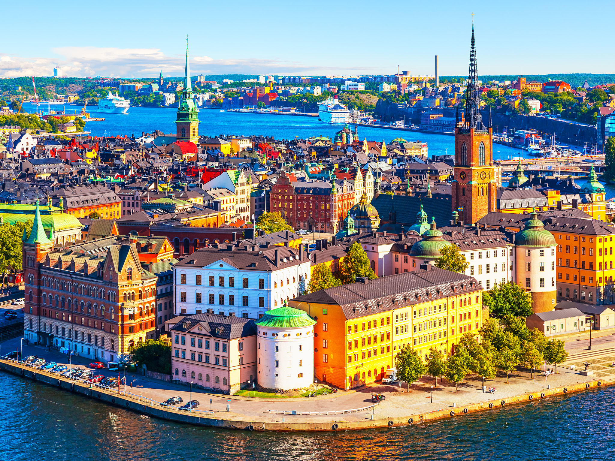
斯德哥尔摩(瑞典语:Stockholm, 发音 帮助·信息,当地华人有时称其为斯京),瑞典首都及最大城市,亦是斯德哥尔摩省首府。瑞典王国政府、国会以及瑞典王室的官方宫殿都设在斯德哥尔摩。它位于瑞典的东海岸,濒波罗的海,梅拉伦湖入海处,风景秀丽,是著名的旅游胜地。市区分布在14座岛屿和一个半岛上,70余座桥梁将这些岛屿联为一体,因此享有“北方威尼斯”的美誉。斯德哥尔摩市区为大斯德哥尔摩的一部分。
从13世纪起,斯德哥尔摩就已经成为瑞典的政治、文化、经济和交通中心。斯德哥尔摩由于免受战争的破坏而保存良好,现在共有100多座博物馆和名胜,包括历史、民族、自然、美术等各个方面。斯德哥尔摩也是一个高科技的城市,拥有众多大学,工业发达。
斯德哥尔摩是阿尔弗雷德·诺贝尔的故乡。从1901年开始,每年12月10日诺贝尔逝世纪念日,斯德哥尔摩音乐厅举行隆重仪式,瑞典国王亲自给获诺贝尔奖者授奖,并在市政厅举行晚宴。
斯德哥尔摩(Stockholm),是瑞典的首都和第一大城市,瑞典政治、经济、文化、交通中心和主要港口,也是瑞典国家政府、国会以及皇室的官方宫殿都所在地,世界著名的国际大都市。
斯德哥尔摩位于瑞典的东海岸,濒波罗的海,梅拉伦湖入海处,风景秀丽,是著名的旅游胜地。市区分布在14座岛屿和一个半岛上,70余座桥梁将这些岛屿联为一体,因此享有“北方威尼斯”的美誉。斯德哥尔摩市区为大斯德哥尔摩的一部分。
斯德哥尔摩城市名称直译过来为木头岛,建于13世纪,1436年起斯德哥尔摩就已经成为瑞典的政治、文化、经济和交通中心。
斯德哥尔摩由于免受战争的破坏而保存良好,现在共有100多座博物馆和名胜,包括历史、民族、自然、美术等各个方面。斯德哥尔摩也是一个高科技的城市,拥有众多大学,工业发达。斯德哥尔摩也是瑞典的金融中心,瑞典主要的银行的总部都在这里。
斯德哥尔摩是阿尔弗雷德·诺贝尔的故乡。从1901年开始,每年12月10日诺贝尔逝世纪念日,斯德哥尔摩音乐厅举行隆重仪式,瑞典国王亲自给获诺贝尔奖者授奖,并在市政厅举行晚宴。
Stockholm [stɔkːɔlm]?/i (vom altschwedischen stokker, entsprechend schwedisch stock „Baumstamm, Warenbestand“ und holmber, schwedisch holme „kleine Insel“) ist die Hauptstadt Schwedens und mit 935.619 (Gemeinde Stockholm), 1,4 Millionen (tätort[2] Stockholm) beziehungsweise 2,1 Millionen Einwohnern (Groß-Stockholm) die größte Stadt in Skandinavien.[1][3] Sie hat eine mehr als sieben Jahrhunderte zurückreichende Besiedlungsgeschichte und ist seit 1643 die Residenz des Königs.
Die Stadt ist sowohl Sitz des schwedischen Parlamentes als auch der schwedischen Regierung. Sie ist ebenso das kulturelle Zentrum des Landes und Bischofssitz.
Stockholm[a] is the capital of Sweden and the most populous city in the Nordic countries;[9][b] 952,058 people live in the municipality,[10] approximately 1.5 million in the urban area,[5] and 2.3 million in the metropolitan area.[11] The city stretches across fourteen islands where Lake Mälaren flows into the Baltic Sea. Just outside the city and along the coast is the island chain of the Stockholm archipelago. The area has been settled since the Stone Age, in the 6th millennium BC, and was founded as a city in 1252 by Swedish statesman Birger Jarl. It is also the capital of Stockholm County. Stockholm is the only capital in the world with a national urban park.[12]
Stockholm is the cultural, media, political, and economic centre of Sweden. The Stockholm region alone accounts for over a third of the country's GDP,[13] and is among the top 10 regions in Europe by GDP per capita.[14] It is an important global city,[15][16] and the main centre for corporate headquarters in the Nordic region.[17] The city is home to some of Europe's top ranking universities, such as the Stockholm School of Economics, Karolinska Institute and Royal Institute of Technology (KTH).[18][19] It hosts the annual Nobel Prize ceremonies and banquet at the Stockholm Concert Hall and Stockholm City Hall. One of the city's most prized museums, the Vasa Museum, is the most visited non-art museum in Scandinavia.[20][21] The Stockholm metro, opened in 1950, is well known for the decor of its stations; it has been called the longest art gallery in the world.[22][23][24] Sweden's national football arena is located north of the city centre, in Solna. Ericsson Globe, the national indoor arena, is in the southern part of the city. The city was the host of the 1912 Summer Olympics, and hosted the equestrian portion of the 1956 Summer Olympics otherwise held in Melbourne, Victoria, Australia.
Stockholm is the seat of the Swedish government and most of its agencies,[25] including the highest courts in the judiciary,[26][27] and the official residencies of the Swedish monarch and the Prime Minister. The government has its seat in the Rosenbad building, the Riksdag (Swedish parliament) is seated in the Parliament House, and the Prime Minister's residence is adjacent at the Sager House.[28][29][30] The Stockholm Palace is the official residence and principal workplace of the Swedish monarch, while the Drottningholm Palace, a World Heritage Site on the outskirts of Stockholm, serves as the Royal Family's private residence.[31][32]
Stockholm (prononcé en suédois [²stɔkː(h)ɔlm] Écouter) est la capitale et la plus grande ville de Suède. Elle est le siège du gouvernement et du parlement suédois ainsi que le lieu de résidence officielle du roi Carl XVI Gustav.
La ville de Stockholm (Stockholms stad) ou, plus officiellement, la commune de Stockholm (Stockholms kommun) est, avec ses 1 538 517 habitants1, la plus grande des 290 municipalités suédoises. Le Grand Stockholm, qui couvre la majeure partie du Comté de Stockholm, a, lui, une population de 2 063 945 habitants1 sur une superficie de près de 6 600 km2.
Située au bord de la mer Baltique, la ville est construite en partie sur plusieurs îles, à l'embouchure du lac Mälar, ce qui lui a valu, à l'instar d'autres cités européennes, son surnom de Venise du Nord (par ailleurs aussi donné à Bruges (Belgique), à Saint-Pétersbourg (Russie), et à Amsterdam (Pays-Bas).
Stoccolma (AFI: /stokˈkolma/[2]; in svedese Stockholm, pronunciato ascolta[?·info] [ˈstɔkːˈhɔlm, ˈstɔkːˈɔlm, ˈstɔkːɔlm];[3] 952.058 ab.)[4] è la capitale della Svezia, capoluogo della contea di Stoccolma. Posta nella parte orientale del paese, sul mar Baltico, è sede di governo e parlamento, oltre che luogo di residenza del capo dello stato, il re Carlo Gustavo XVI. Maggiore città della Svezia e della Scandinavia, è il centro di riferimento economico e culturale della Svezia.
Anche l'area metropolitana (Storstockholm) è la più grande della nazione, contando 2.213.528 abitanti.[4][5] Amministrativamente la città è divisa in 26 comuni. Il centro e la gran parte dei sobborghi ad esso più vicini sono compresi nel comune di Stoccolma.
Estocolmo ( [stɔkːɔlm] (?·i) en sueco, Stockholm) es la capital y ciudad más grande de Suecia.
La ciudad de Estocolmo es administrativamente un municipio de la provincia homónima, incluye el área metropolitana. Estocolmo ha sido nombrada por la GaWC como una ciudad global de «clase alfa»1 en el índice global de las ciudades 2008, ocupa el puesto 24 en el mundo, el número 8 en Europa y el número 1 de toda Escandinavia.
Estocolmo es a menudo conocida por su belleza, sus edificios y arquitectura, su agua limpia y abierta y sus numerosos parques, jardines y canales. Forma parte del grupo de ciudades conocidas vulgarmente como las «Venecias del Norte». Como capital del Estado, Estocolmo es la sede del Gobierno, el Parlamento (Riksdag), el Tribunal Supremo de Justicia (Hōgsta Domstolen). Alberga también el Palacio de Drottningholm, residencia oficial y despacho del jefe de Estado, el rey Carlos XVI Gustavo de Suecia. La ciudad fue premiada con el título Capital Verde Europea 2010.
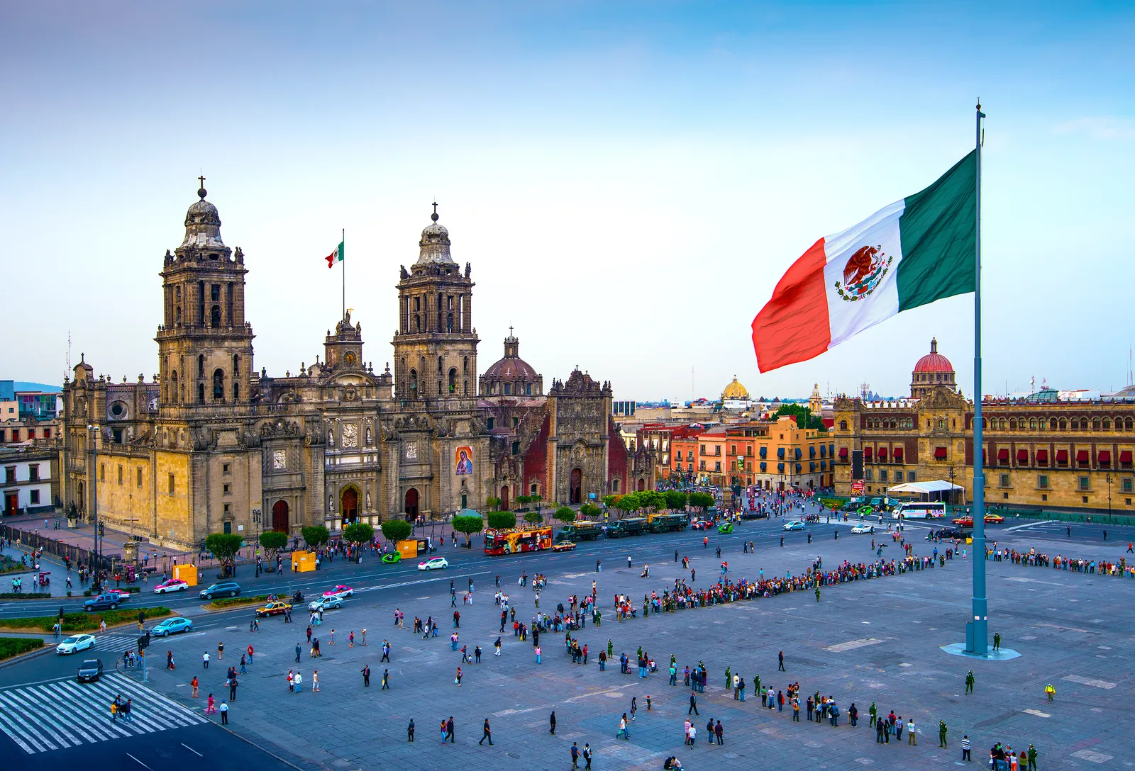
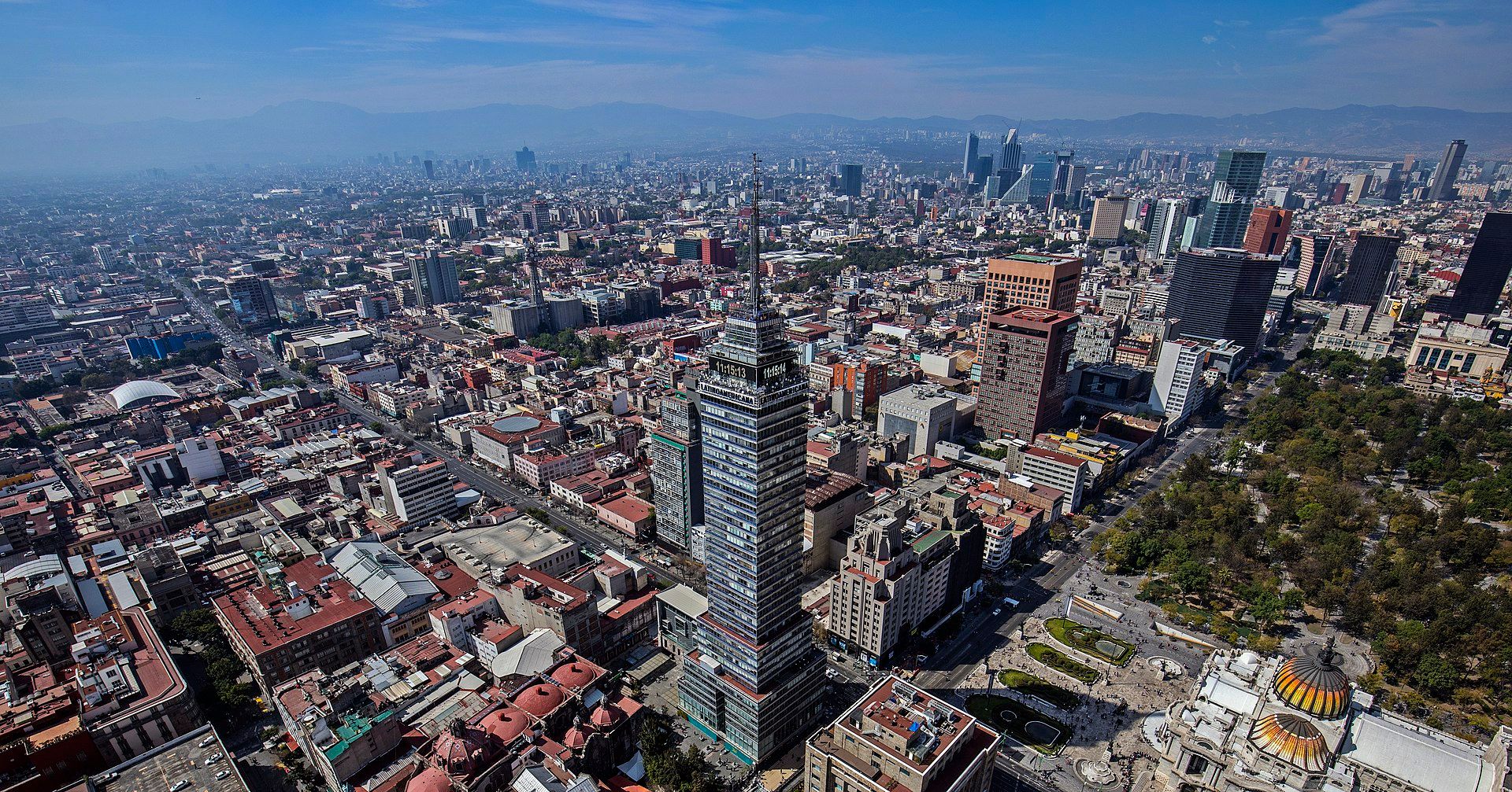
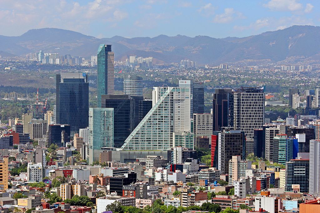
墨西哥城(西班牙语:Ciudad de México 西班牙语发音:[sjuˈða(ð) ðe ˈmexiko] ( 聆听),缩写为CDMX)是墨西哥合众国首都暨政治、经济、文化中心,亦为世界上最大的都市之一。墨西哥城位于墨西哥中部的高原地区中央,其与周围的卫星城市原合称墨西哥联邦特区(México, D.F.),行政级别上与该国其他31个州(Estados)同等但在行政上直属中央[8]。2016年1月29日,墨西哥联邦特区改制为墨西哥市(Ciudad de México),改制后的墨西哥市拥有相当程度的自治权,包括自己的市自治法与和其他州级行政区类似的市议会机构[8]。原本联邦区下各区(delegaciones)也一并改制为市镇(municipio)并选出各自的市长。
Mexiko-Stadt (spanisch Ciudad de México oder México D.F.) ist die Hauptstadt von Mexiko. Sie gehört zu keinem Bundesstaat, sondern bildet einen bundesunmittelbaren Hauptstadtbezirk (Distrito Federal), in dem 8,8 Millionen Menschen (2009) leben. Die Metropolregion Zona Metropolitana del Valle de México (ZMVM), zu der Mexiko-Stadt, der östliche Teil des Bundesstaates México und eine Gemeinde aus dem Staat Hidalgo gehören, ist mit 20 Millionen Einwohnern[1] eine der größten der Erde.
Die Stadt ist politischer, wirtschaftlicher, sozialer und kultureller Mittelpunkt sowie größter Verkehrsknotenpunkt des Landes. Sie ist Sitz des Erzbistums Mexiko sowie zahlreicher Universitäten, Hoch- und Fachschulen. Die UNESCO hat ihr historisches Zentrum mit den Überresten der Aztekenhauptstadt Tenochtitlan sowie die Wassergärten im Stadtteil Xochimilco 1987 und den zentralen Universitätscampus der Universidad Nacional Autónoma de México[2] im Jahr 2007 zum Weltkulturerbe erklärt.
メキシコシティ(西: Ciudad de México スペイン語発音: [sjuˈða(ð) ðe ˈmexiko] ( 音声ファイル)、英語: Mexico City)は、メキシコ合衆国の首都。同国を構成する32州のひとつ[注 1]。中米屈指の世界都市。
なお、国名と同一名称のため「市」に相当する単語を付けて呼ばれるのが通例となっており、メキシコの公用語であるスペイン語では「シウダー・デ・メヒコ」(Ciudad de México) と発音される[1]。日本では、主に用いられる英語名の他にメキシコ市と呼ばれる場合もある[2]。
メキシコ最大の都市であり、2016年の近郊を含む都市圏人口は2,023万人であり、世界第12位である[3]。メキシコのみならずラテンアメリカの経済の中心地の一つであり、2014年の都市圏GDPは3,837億ドルである[4]。これはラテンアメリカではサンパウロに次ぐ第2位であり、世界では第18位に位置する。
日本の民間研究所が2016年に発表した「世界の都市総合力ランキング」では、世界37位と評価されており、ラテンアメリカでは首位である[5]。また、アメリカのシンクタンクが2016年に発表した世界都市ランキングにおいて、世界39位と評価されており、ラテンアメリカではブエノスアイレス、サンパウロに次ぐ3位である[6]。
かつて行政上の正式名称は連邦区(Distrito Federal、D.F.)だったが、2016年にメキシコシティ(Ciudad de México)に変更され、独立した州となった[7][8]。
Mexico City (Spanish: Ciudad de México, locally [sjuˈða(ð) ðe ˈmexiko] (listen);[13] abbreviated as CDMX; Nahuatl languages: Āltepētl Mēxihco) is the capital and largest city of Mexico and the most-populous city in North America.[14][15] Mexico City is one of the most important cultural and financial centres in the world.[16] It is located in the Valley of Mexico (Valle de México), a large valley in the high plateaus in the center of Mexico, at an altitude of 2,240 meters (7,350 ft). The city has 16 subdivisions, formerly known as boroughs.
The 2009 population for the city proper was approximately 8.84 million people,[17] with a land area of 1,485 square kilometers (573 sq mi).[18] According to the most recent definition agreed upon by the federal and state governments, the population of Greater Mexico City is 21.3 million, which makes it the second largest metropolitan area of the Western Hemisphere (behind São Paulo, Brazil), the eleventh-largest agglomeration (2017), and the largest Spanish-speaking city in the world.[19]
Greater Mexico City has a GDP of $411 billion in 2011, making Greater Mexico City one of the most productive urban areas in the world.[20] The city was responsible for generating 15.8% of Mexico's GDP, and the metropolitan area accounted for about 22% of total national GDP.[21] If it were an independent country, in 2013, Mexico City would be the fifth-largest economy in Latin America, five times as large as Costa Rica and about the same size as Peru.[22]
Mexico's capital is both the oldest capital city in the Americas and one of two founded by indigenous people, the other being Quito, Ecuador. The city was originally built on an island of Lake Texcoco by the Aztecs in 1325 as Tenochtitlan, which was almost completely destroyed in the 1521 siege of Tenochtitlan and subsequently redesigned and rebuilt in accordance with the Spanish urban standards. In 1524, the municipality of Mexico City was established, known as México Tenochtitlán,[23] and as of 1585, it was officially known as Ciudad de México (Mexico City).[23] Mexico City was the political, administrative, and financial center of a major part of the Spanish colonial empire.[24] After independence from Spain was achieved, the federal district was created in 1824.
After years of demanding greater political autonomy, residents were finally given the right to elect both a head of government and the representatives of the unicameral Legislative Assembly by election in 1997. Ever since, left-wing parties (first the Party of the Democratic Revolution and later the National Regeneration Movement) have controlled both of them.[25] The city has several progressive policies, such as abortion on demand, a limited form of euthanasia, no-fault divorce, and same-sex marriage.
On 29 January 2016, it ceased to be the Federal District (Spanish: Distrito Federal or D.F.) and is now officially known as Ciudad de México (or CDMX), with a greater degree of autonomy.[26][27] A clause in the Constitution of Mexico, however, prevents it from becoming a state within the Mexican federation, as it is the seat of power in the country, unless the capital of the country were to be relocated elsewhere.[28]
Mexico (nom complet : Ville de Mexico, en espagnol : Ciudad de México /sjuˈða(ð) ðe ˈmexiko/ Écouter, en abrégé CDMX) est une entité fédérative1 et la capitale du Mexique2.
Cette entité fédérative n'est ni une ville ni un État au sens des articles 43, 44 et 122 de la Constitution mexicaine3.
Mexico est un centre financier et culturel important avec une économie agricole très présente dans les périphéries4.
Fondée au début du XIVe siècle par les Mexicas (Aztèques) sur un îlot du lac Texcoco, la ville précolombienne de Tenochtitlan a été remplacée par les conquérants espagnols lors de la chute de l'Empire aztèque en 1521 par la première grande ville de tracé européen du continent. Dès 1522, Hernán Cortés prend la décision de construire au même endroit la capitale de la Nouvelle-Espagne, qu'il nomme « México ».
Appelée « District Fédéral » (Distrito Federal) avant la réforme de janvier 2016 (es)5, Mexico possède un statut constitutionnel particulier car elle est le siège des pouvoirs de la Nation, et constitue, sans avoir le statut d'État, la 32e entité fédérative du Mexique.
Mexico est divisé en seize arrondissements qui sont dès fin 2017 dirigées par un maire élu au suffrage universel et ont un statut comparable a celui d'une municipalité.
Cette entité fédérative, qui couvre 0,08 % du territoire national6 se trouve au centre du pays, sur un plateau situé à une altitude de 2 400 mètres, entouré de sommets volcaniques culminant à plus de 5 000 mètres au-dessus du niveau de la mer7, 307 km2 de son territoire se situent en zone agricole8.
La zone métropolitaine de la vallée de Mexico (ZMVM) est une aire urbaine définie, mais non une démarcation politique, peuplée de 18 050 000 habitants, la majorité d'entre eux vivant dans l'État de Mexico et dans l'entité fédérative de Mexico9. C'est l'aire urbaine la plus peuplée parmi celles de langue espagnole, une des 3 plus peuplées du continent américain (avec New York et São Paulo) et une des 5 à 15 plus peuplées du monde10. Elle comprend 76 entités administratives distinctes dont les 16 délégations, 59 municipalités de l'État de Mexico et une de l'État d'Hidalgo.
En 2018, Mexico a rejoint le mouvement Fab City, suivant l'appel lancé par le maire de Barcelone, Xavier Trias, à ce que toutes les villes du monde deviennent autosuffisantes pour 205411.
Città del Messico (in spagnolo Ciudad de México; in nahuatl Āltepētl Mēxihco) è la capitale del Messico e uno dei suoi 32 stati federati; in lingua originale era chiamata ufficialmente, fino al 31 gennaio 2016, México Distrito Federal[1][2][3] e in italiano è talora chiamata Città di Messico[4]. Centro politico, economico e culturale, raccoglie un decimo della popolazione nazionale e occupa una decima parte della Valle del Messico nel centro-sud del Paese, su un'area che era parte della conca lacustre del lago di Texcoco.
Si tratta del più grande centro del Paese, nonché una delle città più popolose del mondo e, in assoluto, la più popolosa città ispanofona con 8 851 080 abitanti nel 2010[5]. Con il passare dei secoli la città ha inglobato numerosi villaggi e cittadine che si trovavano nelle vicinanze, tanto che all'inizio del XXI secolo l'area metropolitana usciva dai confini del Distretto Federale estendendosi su 40 comuni dello Stato del Messico e un comune dello Stato di Hidalgo. La zona metropolitana della città era abitata nel 2005 da circa 19 311 365 abitanti registrati, circa il 20% dell'intera popolazione del Messico. Nel 2007 fu stimata una popolazione di 9 755 980 abitanti per la città e 24 748 250 per l'area metropolitana[6]. Secondo il rapporto urbanistico delle Nazioni Unite, la zona metropolitana di Città del Messico è l'agglomerato urbano più grande dell'emisfero occidentale e il secondo più grande del mondo dopo Tokyo[7].
Dallo studio realizzato da PricewaterhouseCoopers Città del Messico occupa l'ottavo posto nella speciale classifica sulle città più ricche del mondo avendo un PIL di 331 miliardi di dollari che si raddoppieranno, secondo lo stesso studio, nel 2020, collocandola al settimo posto della graduatoria dietro solo a città come Tokyo, New York, Chicago, Los Angeles, Londra e Parigi[8]. La città conta, inoltre, più di 500 grattacieli. Con 8 punti è una città globale di classe beta. Le enormi dimensioni della città si caratterizzano per una latitudine di più di 50 km e una longitudine di 35 km.
Ciudad de México (coloquialmente, la Ciudad de México), abreviado como CDMX y anteriormente denominada Distrito Federal o D.F.,nota 1 es una de las 32 entidades federativas de México,272829 así como la capital de los Estados Unidos Mexicanos.3031 Se localiza en el Valle de México, a una altitud media de 2240 m s. n. m. Tiene una superficie de 1495 km², y se divide administrativamente en 16 demarcaciones. Su población es de 8.9 millones de habitantes, aproximadamente. Sin embargo, cuando se considera también la Zona Metropolitana del Valle de México,32 suma entonces una población total de más de 22 millones de habitantes, lo que la coloca en el noveno puesto de las aglomeraciones urbanas más grandes y más pobladas del mundo, y con ello la más grande del continente americano y del mundo hispanohablante.33
Es el núcleo urbano más grande de la República mexicana y también su principal centro político, económico, social, académico, financiero, empresarial, turístico, cultural, de comunicaciones, de entretenimiento y de moda. Ha sido el escenario de varios de los acontecimientos históricos y mediáticos más importantes de dicha nación. Ciudad de México tuvo un PIB, en 2017, de 568 445 millones de dólares,13 con un crecimiento medio en ese año de 3.2 % (por encima de la media nacional); dichas cifras representaron el 17 % del total del PIB nacional, siendo la principal economía de México, además de significar una aportación del 25 % al crecimiento económico del país ese año.34 Catalogada como ciudad global, es uno de los centros financieros y culturales más importantes del mundo, con una de las economías más dinámicas a nivel internacional, y es la número quince a nivel mundial, por el tamaño de su PIB.35363738
No hay consenso científico sobre la fecha de la fundación de la ciudad, pero pudo ocurrir a inicios del siglo XIV. Correlaciones hechas en el periodo de la Nueva España sugieren que la fundación fue llevada a cabo por los mexicas el 13 de marzo de 1325, en una isla del lago de Texcoco, con el nombre de Cuauhmixtitlan y renombrada México-Tenochtitlan por Acamapichtli en 1376 como homenaje al caudillo Ténoch. Ese núcleo urbano se convirtió, con el tiempo, en la capital del Imperio mexica. El 13 de agosto de 1521, los mexicas fueron derrotados con la toma de la ciudad, a manos de los españoles y sus aliados indígenas al mando del conquistador castellano Hernán Cortés, acontecimiento que marcó el inicio de la época virreinal.39
En 1535, se creó oficialmente el Virreinato de la Nueva España, y se estableció la nueva Ciudad de México encima de la antigua México-Tenochtitlan, reconocida por una cédula real, de 1545, como Muy Noble, Insigne, Muy Leal e Imperial Ciudad de México por Carlos I de España.40 En ese momento, fue declarada capital del virreinato, y funcionó a partir de entonces como centro político, financiero y administrativo de los territorios del Imperio español en Norteamérica, Centroamérica, Asia y Oceanía. El dominio español de esa época sobre la ciudad capital llegó a su fin cuando concluyó la guerra de independencia en 1821, con la entrada del Ejército Trigarante a la ciudad. El estatus de sede de gobierno fue ratificado en el Acta de Independencia del Imperio Mexicano, que la nombraba Capital del Imperio.4139
En 1823, con la proclamación de la Primera República Federal, terminó de manera oficial el Primer Imperio mexicano (1821-1823), y el 18 de noviembre de 1824, el Congreso decidió crear un Distrito Federal (es decir, una entidad distinta a los demás estados), para albergar los poderes Ejecutivo, Legislativo y Judicial en un territorio que no perteneciese a ningún estado en particular, a fin de evitar la hegemonía de un estado sobre los demás de la federación. Gracias a fray Servando Teresa de Mier y a algunas otras personas que apoyaron su causa, Ciudad de México fue elegida como el lugar donde se concentrasen los poderes de la unión.42
En 1929, se extinguieron las libertades municipales del Distrito Federal.4344 Las progresivas modificaciones al estatus de la ciudad comenzaron en 1988 con la conformación de un órgano legislativo de elección popular (Asamblea de Representantes del Distrito Federal), continuaron en 1997 con la elección de un poder ejecutivo propio (jefe de Gobierno del D.F.); Desde entonces, una mayoría de los habitantes de Ciudad de México han decidido elegir jefes de gobierno de centroizquierda/izquierda para la capital; y concluyeron en 2016 con la reforma política que redactó su propia constitución política (entró en vigor plenamente en 2018); este proceso político también concluyó otorgándole en la carta magna federal, los mismos derechos y facultades de cualquier estado, pero que, considerando su categoría de capital de la república, conserva la denominación de entidad federativa; también se dejan de emplear los nombres México D.F. y Distrito Federal, para usar únicamente el término Ciudad de México.454639
En Ciudad de México, se encuentran enclavados cuatro de los 35 sitios Patrimonio de la Humanidad con los que cuenta el país: el Centro Histórico, Xochimilco, el Campus Central de la Ciudad Universitaria de la Universidad Nacional Autónoma de México y la Casa y estudio de Luis Barragán. En 1968, fue la primera ciudad de Latinoamérica y del mundo de habla hispana sede de unos Juegos Olímpicos.
La ciudad cuenta con la segunda mayor cantidad de museos (151) en el mundo, solo por debajo de Londres.47
Ме́хико (исп. Ciudad de México, аст. Āltepētl Mēxihco) — город, столица Мексики. Образует федеральный округ, разделённый на 16 районов. С 1325 по 1521 годы город имел название Теночтитлан. В 1521 году был разрушен и отстроен заново испанским завоевателем Эрнаном Кортесом. С 1821 года — столица независимой Мексики.
Население — 9 миллионов человек, крупнейший испаноязычный город мира. В пределах агломерации проживают 22 млн человек (оценка 2015 года, четвёртая по величине агломерация в мире[5]). Расположен в межгорной котловине на Мексиканском нагорье, на высоте 2240 метров над уровнем моря. Климат субтропический.
Главный политический, экономический и культурный центр Мексики. Относится к глобальным городам «альфа», ведущим финансовым центрам Северной Америки[6].
加利福尼亚州高速公路一号
 加利福尼亚州
 2026年世界杯足球赛
 财政金融
***全球金融中心
历史
公元 2000 - 2100
历史
公元 1500 - 2000
国际城市
***全球城市经济竞争力
英雄联盟
英雄联盟全球总决赛
夏季奥林匹克运动会
1932夏季奥林匹克运动会
1984夏季奥林匹克运动会
2028夏季奥林匹克运动会
美国
财政金融
***全球金融中心
历史
公元 2000 - 2100
历史
公元 1500 - 2000
国际城市
***全球城市经济竞争力
英雄联盟
英雄联盟全球总决赛
夏季奥林匹克运动会
1932夏季奥林匹克运动会
1984夏季奥林匹克运动会
2028夏季奥林匹克运动会
美国
 重要港口
重要港口


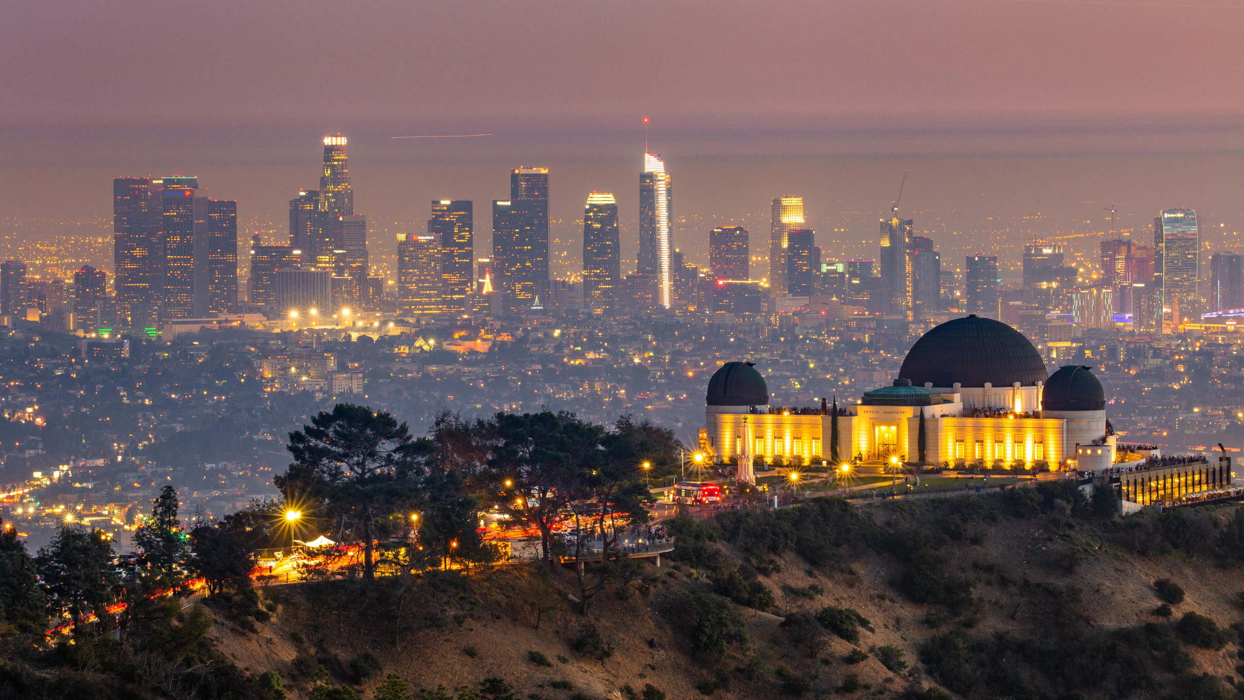
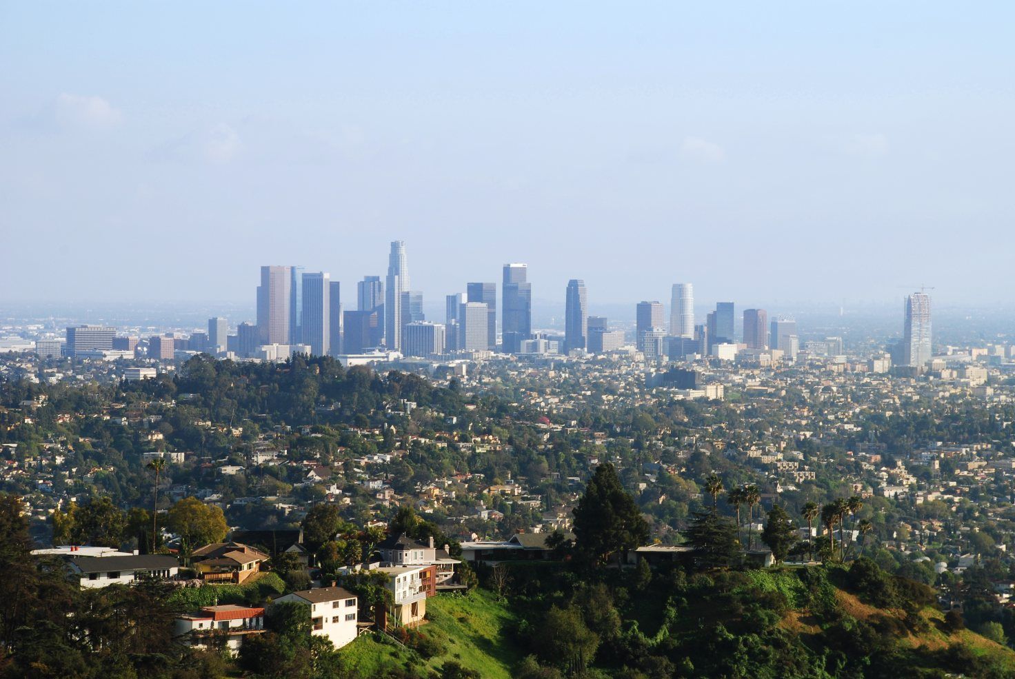
洛杉矶(英语:City of Los Angeles,缩写为L.A.),简称洛城,是位于美国加利福尼亚州南部的都市,也是洛杉矶县的县治,人口约397万[8],为加州第一大城,同时也是美国人口第二大都市,仅次于纽约市。全市面积为469.1平方英里(1214.9平方公里)。由洛杉矶、长滩、安那翰3市组成的洛杉矶都会区拥有约1331万的人口[9],涵盖范围更广的大洛杉矶地区则达到1870万[10],两者在统计上均次于纽约都会区,为全美国第二大都会区。
洛杉矶在1781年由西属上加利福尼亚总督费利佩·德·内维建立。它曾先后属于西班牙与墨西哥,但在1848年美墨战争结束后,墨西哥将包括洛杉矶在内的上加利福尼亚地区割让给美国。1850年4月4日,洛杉矶正式建市,比加州加入联邦的时间早了5个月。时至今日,洛杉矶已发展成为全世界的文化、科学、技术、体育、国际贸易和高等教育中心之一,还拥有世界知名的各种专业与文化领域的机构。整个大洛杉矶地区在电影、电视、音乐等文化娱乐产业的蓬勃发展,构成了洛杉矶的国际声誉和全球地位的基础。截至2014年,洛杉矶的大都市生产总值达8605亿美元,排名世界第三。
Los Angeles [lɔs ˈændʒələs] (aus dem spanischen Los Ángeles [losˈaŋxeles] ‚Die Engel‘) oder auch kurz L.A., ist die größte Stadt im US-Bundesstaat Kalifornien. Sie liegt am Pazifischen Ozean und am Los Angeles River.
Los Angeles ist mit 3.928.864 Einwohnern (2014)[1] im Stadtgebiet nach New York City und vor Chicago die zweitgrößte Stadt der Vereinigten Staaten.[2] Mit 11,8 Millionen Einwohnern in der Agglomeration[3] sowie über 12,8 Millionen Einwohnern in der Metropolregion (Metropolitan Statistical Area) und knapp 17,8 Millionen in der erweiterten Metropolregion steht die Greater Los Angeles Area unter den größten Metropolregionen der Welt an 17. Stelle.[4] Die Einwohner von Los Angeles werden Angelenos [ændʒəˈlinoʊz] genannt.
Los Angeles ist Hauptstadt und Verwaltungssitz des Los Angeles County. Die Stadt ist das Wirtschafts-, Geschäfts- und Kulturzentrum Kaliforniens mit zahlreichen Universitäten, Hochschulen, Forschungsinstituten, Theatern und Museen. Los Angeles ist weltgrößter Standort für die Flugzeug- und Raumfahrtindustrie und bekannt wegen der dort ansässigen Film- und Fernsehindustrie (Hollywood) und Musikszene.
Die Metropolregion Los Angeles erbrachte 2016 eine Wirtschaftsleistung von 1,001 Billionen US-Dollar. Unter den Städten der Welt belegt es damit den dritten Rang hinter Tokio und New York City.[5]
ロサンゼルス(英語: Los Angeles、スペイン語も同じ)は、アメリカ合衆国カリフォルニア州にある都市。同州最大の都市かつ全米有数の世界都市であり、国内ではニューヨークに次いで人口が多い[1]。
Los Angeles (US: /lɔːs ˈændʒələs/ ( listen);[16][a] Spanish for "The Angels"; Spanish: Los Ángeles; Spanish: [los ˈaŋxeles]; officially the City of Los Angeles, known colloquially by its initials L.A.) is the second-most populous city in the United States, after New York City, and the most populous city in the Western United States. With an estimated population of four million,[17] Los Angeles is the largest and most populous city in the state of California and the cultural, financial, and commercial center of Southern California. Nicknamed the "City of Angels" partly because of its name's Spanish meaning, Los Angeles is known for its Mediterranean climate, ethnic diversity, and sprawling metropolis.
Los Angeles is located in a large basin bounded by the Pacific Ocean on one side and by mountains as high as 10,000 feet (3,000 m) on the others. The city proper, which covers about 469 square miles (1,210 km2),[18] is the seat of Los Angeles County, the most populated county in the country. Los Angeles is the principal city of the Los Angeles metropolitan area; with a population of 13.1 million residents it is the second largest in the United States after that of New York City.[19] It is part of the Los Angeles-Long Beach combined statistical area, also the second most populous in the nation with a 2015 estimated population of 18.7 million.[20]
Los Angeles is one of the most substantial economic engines within the United States, with a diverse economy in a broad range of professional and cultural fields. Los Angeles is also famous as the home of Hollywood, a major center of the world entertainment industry. A global city, it has been ranked 6th in the Global Cities Index and 9th in the Global Economic Power Index. The Los Angeles combined statistical area also has a gross metropolitan product of $831 billion (as of 2008), making it the third-largest in the world, after the Tokyo and New York metropolitan areas. Los Angeles hosted the 1932 and 1984 Summer Olympics and will host the event for a third time in 2028. The city also hosted the Miss Universe pageant twice, in 1990 and 2006.
Historically home to the Chumash and Tongva, Los Angeles was claimed by Juan Rodríguez Cabrillo for Spain in 1542 along with the rest of what would become Alta California. The city was officially founded on September 4, 1781, by Spanish governor Felipe de Neve. It became a part of Mexico in 1821 following the Mexican War of Independence. In 1848, at the end of the Mexican–American War, Los Angeles and the rest of California were purchased as part of the Treaty of Guadalupe Hidalgo, becoming part of the United States. Los Angeles was incorporated as a municipality on April 4, 1850, five months before California achieved statehood. The discovery of oil in the 1890s brought rapid growth to the city.[21] The completion of the Los Angeles Aqueduct in 1913, delivering water from Eastern California, later assured the city's continued rapid growth.
Los Angeles (prononcé en anglais américain [lɑs ˈæn.dʒə.ləs] Écouter)n 1 est la deuxième ville la plus peuplée des États-Unis après New York. Elle est située dans le sud de l'État de Californie, sur la côte pacifique. Les Américains l'appellent souvent par son diminutif, L.A. (prononcé [ˌɛlˈeɪ]). La ville est le siège du comté portant le même nom. Los Angeles signifie « les anges » en espagnol et ses habitants sont appelés Angelenos (quelquefois Angelinos) — les Angelins. Son nom complet est El Pueblo de Nuestra Señora la Reina de Los Ángeles del Río de Porciúncula, c'est-à-dire « le village de Notre-Dame la Reine des Anges du fleuve de Porciuncula », Porciuncula étant le nom donné au fleuve Los Angeles par les Amérindiens2.
Selon une estimation, la population de la commune est de 3 976 322 habitants en 2016, alors qu'elle n'était que de 11 500 en 1887. Le comté rassemble 10 179 716 habitants (en juillet 2004) alors que l'aire urbaine de Los Angeles compte environ 18,5 millions d’habitants3, ce qui en fait la deuxième agglomération des États-Unis après celle de New York. Mais la commune de Los Angeles est relativement restreinte face à son agglomération, même si elle est plus grande que New York et Chicago.
Los Angeles est une ville olympique : elle accueille les Jeux olympiques d'été deux fois (en 1932 et 1984), et les accueillera de nouveau en 2028. Mondialement connue pour son activité culturelle (notamment via la production cinématographique à Hollywood), elle a un statut de ville-région mondiale (world city-region)4 ; cosmopolite, elle demeure l'un des points d'entrée d'immigrants les plus importants aux États-Unis.
Los Angeles (pronuncia inglese [lɒs ˈændʒələs]; pronuncia italiana[4]: [loˈzɛndʒeles] o [loˈzandʒeles]; pronuncia spagnola [los ˈaŋxeles]), spesso abbreviata in L.A., è una città degli Stati Uniti d'America, capoluogo dell'omonima contea, situata nella California meridionale. Con 4 057 875 abitanti (nel 2017[3]), è la città più popolosa della California e la seconda più popolosa degli Stati Uniti d'America dopo New York.
Fondata dagli spagnoli come El Pueblo de Nuestra Señora la Reina de los Ángeles del Rio de la Porciúncula de Asís[5], ovvero "Il villaggio di santa Maria degli Angeli della Porziuncola di Assisi", assurse allo status di città il 9 giugno 1850, cinque mesi prima che la California diventasse il trentesimo Stato dell'Unione.
È un centro economico e scientifico di rilevanza internazionale. È inoltre la capitale mondiale dell'industria cinematografica, ospitata in uno dei sobborghi più famosi della città, Hollywood; a Los Angeles e dintorni risiedono numerosi personaggi del cinema e dello spettacolo americano e internazionale.
Los Ángeles (en inglés: Los Angeles, pronunciado AFI: [lɒs ˈændʒəˌləs]), oficialmente Ciudad de Los Ángeles y de manera abreviada L. A., es la ciudad más poblada del estado estadounidense de California y la segunda ciudad más poblada de Estados Unidos. Tiene, según el censo de 2010, una población de 3 792 621 habitantes.2 Está ubicada en el sur de California y abarca una superficie de 1215 km².
La ciudad es el centro del área estadística metropolitana de Los Ángeles-Long Beach-Santa Ana y del Gran Los Ángeles que, según el censo de 2010, sumaban una población de 13 y 18 millones de personas, respectivamente. Es, por tanto, una de las mayores áreas metropolitanas del mundo3 y la segunda de Estados Unidos.4 La ciudad también es la sede del condado de Los Ángeles, uno de los condados más poblados y étnicamente diversos del país;5 la propia ciudad de Los Ángeles es reconocida como una de las metrópolis más diversas del planeta.6 A sus habitantes les corresponde el gentilicio «angelinos/as».7
Los Ángeles fue fundada el 4 de septiembre de 1781 por el gobernador español Felipe de Neve con el nombre de «El Pueblo de Nuestra Señora la Reina de los Ángeles del Río de Porciúncula».8 En 1821, después de la guerra de independencia de México, la ciudad se integró como parte de México,9 pero en 1848, a consecuencia de la intervención estadounidense en México, Los Ángeles y el resto de la Alta California pasaron a ser parte de los Estados Unidos de América, de acuerdo con lo pactado en el Tratado de Guadalupe Hidalgo.10 La ciudad se incorporó a la Unión como municipio el 4 de abril de 1850, cinco meses antes de que California alcanzara la categoría de estado de los Estados Unidos.11
Los Ángeles es una ciudad global con gran influencia en ámbitos tan diversos como los negocios, el comercio internacional, el entretenimiento, la cultura, los medios de comunicación, la moda, la ciencia, los deportes, la tecnología, la educación, la medicina o la investigación. En la ciudad tienen su sede instituciones de renombre que abarcan diversos campos profesionales y culturales, y es uno de los motores económicos más importantes de Estados Unidos. El área estadística combinada de Los Ángeles sumaba en 2008 un producto regional bruto de 831 000 millones de USD, el tercero más importante del mundo tras Tokio y Nueva York.12 Los Ángeles, dentro de la cual se encuentra Hollywood, es líder mundial en la creación de producciones de televisión, videojuegos, música y cine que triunfan en todo el planeta. Además, la ciudad ha sido sede en dos ocasiones de los Juegos Olímpicos de Verano, en 1932 y en 1984, y lo será por tercera vez en 2028.
 魁北克省
魁北克省
 体育
体育


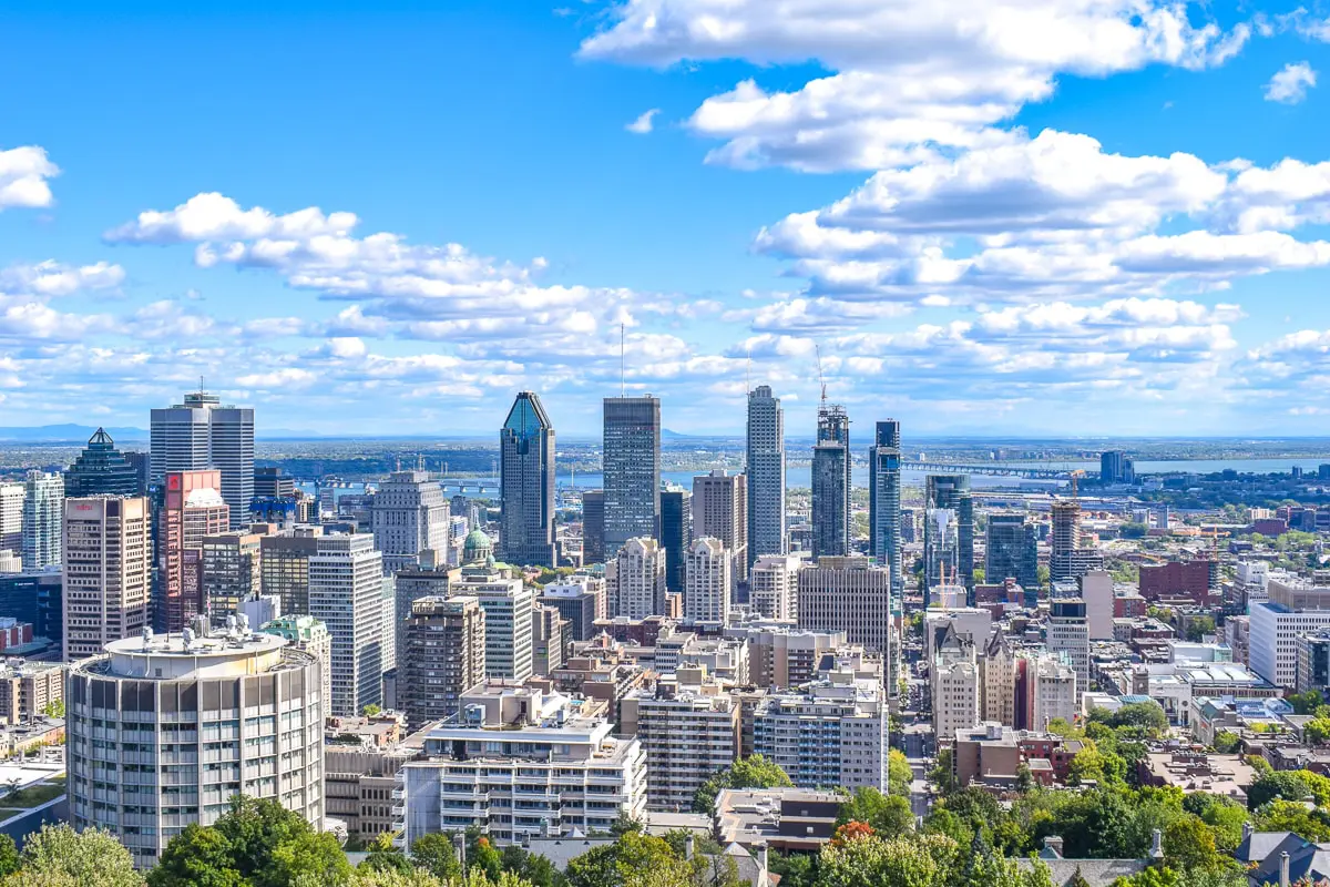
蒙特利尔(法语:Montréal,[mɔ̃ʁeal] 聆听;英语:Montreal,/ˌmʌntriːˈɒl/ ( 聆听)),蒙特利尔,港澳称为满地可,台湾称为蒙特娄[5][6]、蒙特利尔[6],是一座位于加拿大魁北克省西南部的城市,主要位于圣劳伦斯河和渥太华河汇合处的蒙特利尔岛及周边小岛上。根据2011年人口普查,蒙特利尔人口约为342万[9],是魁北克省内最大城市、加拿大第二大城市及北美第十五大城市。“蒙特利尔”一词来源于中古法语“Mont Royal”,意思为“皇家山”,至今蒙特利尔城中心的地标皇家山仍以此命名。法语是蒙特利尔的官方语言,也是城市里最常用的语言,使用人口占城市总人口的60.5%,使得蒙特利尔成为世界上仅次于巴黎的第二大法语城市。
蒙特利尔曾经是加拿大经济首都,拥有最多的人口及最发达的经济,但是在1976年蒙特利尔奥运会后被安大略省的多伦多超过。今天蒙特利尔仍然是加拿大最重要的经济中心之一,航空工业、金融、设计、电影工业等行业发达。蒙特利尔被认为是世界最佳宜居城市,并被联合国教育、科学及文化组织认定为设计之城。1999年第35届国际技能竞赛在这里举行。
Montreal (deutsch [mɔntʁeˈa:l]) bzw. Montréal (französisch [mɔ̃ʁeˈal], englisch [ˌmʌntɹiːˈɒl]) ist eine Millionenstadt in Kanada. Sie liegt im Südwesten der Provinz Québec auf der Île de Montréal, der größten Insel im Hochelaga-Archipel, die vom Sankt-Lorenz-Strom und von Mündungsarmen des Ottawa umflossen wird. Die Nachbarprovinz Ontario liegt knapp 60 Kilometer westlich, die Grenze zu den USA etwas mehr als 50 Kilometer südlich. Das Stadtbild wird vom Mont Royal geprägt, einem 233 Meter hohen Hügelzug vulkanischen Ursprungs im Zentrum der Insel, von dem sich der Name der Stadt ableitet.
Als der französische Seefahrer Jacques Cartier im Jahr 1535 als erster Europäer die Gegend erforschte, lebten Sankt-Lorenz-Irokesen auf der Insel. 1642 gründeten Paul Chomedey de Maisonneuve und Jeanne Mance das Fort Ville-Marie, eine katholische Missionsstation. Daraus entwickelte sich in der Folge die Siedlung Montreal, die 1760 unter britische Herrschaft kam. Montreal erhielt 1832 die Stadtrechte. Die Stadt wuchs rasch und entwickelte sich zum wirtschaftlichen und kulturellen Zentrum des Landes, verlor aber im letzten Viertel des 20. Jahrhunderts diese führende Rolle an Toronto. Bedeutende Ereignisse von weltweiter Ausstrahlung waren die Weltausstellung Expo 67 und die Olympischen Sommerspiele 1976.
Die Wirtschaft Montreals ist stark diversifiziert. Wichtige Pfeiler des Dienstleistungssektors sind Finanzdienstleistungen, Medien, Handel und Design. Von großer Bedeutung ist auch der Tourismus, dies aufgrund der Sehenswürdigkeiten und des vielfältigen kulturellen Angebots, das neben Museen auch zahlreiche Festivals in den Bereichen Film, Theater und Musik umfasst. Mehr als 60 internationale Organisationen haben ihren Sitz in Montreal. Im Industriesektor sind Luftfahrt-, Pharma- und Spitzentechnologieunternehmen vorherrschend. Mit vier Universitäten und mehreren weiteren Hochschulen ist Montreal ein bedeutender Bildungsstandort. Außerdem ist die Stadt ein Knotenpunkt im Schienen- und Straßennetz und verfügt darüber hinaus über den größten Binnenhafen auf dem amerikanischen Kontinent.
Mit einer Bevölkerungszahl von 1.649.519 Einwohnern (Stand: 2011)[1] ist Montreal die zweitgrößte Stadt Kanadas nach Toronto und die größte der Provinz Québec. Die Verwaltungsregion, die alle Gemeinden auf der Insel umfasst, zählt 1.886.481 Einwohner (2011).[2] Der Ballungsraum Communauté métropolitaine de Montréal, der urbane Gebiete im näheren Umkreis miteinbezieht, zählt 3.824.221 Einwohner (2011).[3] Französisch ist Montreals Amtssprache und die Hauptsprache von 56,9 % der Bevölkerung, während 18,6 % hauptsächlich Englisch sprechen. Der Rest entfällt auf verschiedene Sprachen von Einwanderern, womit Montreal eine multikulturelle Bevölkerung besitzt.[4]
Montreal ist die zweitgrößte Stadt der Welt nach Paris, in der Französisch als Muttersprache gesprochen wird.[5][6][7][8] Montreal gehört auch weltweit zu den größten Städten, in denen Französisch die offizielle Sprache ist. Die Stadt stand früher an zweiter Stelle nach Paris, hat aber diesen Rang in den letzten Jahren an Kinshasa[9] und Abidjan[10] abgegeben.
モントリオール(英語: Montreal [ˌmɒntrɪˈɔːl] ( 音声ファイル))、モンレアル(フランス語: Montréal[mɔ̃ʁeal] ( 音声ファイル))は、カナダ・ケベック州の都市。セントローレンス川沿いに位置し、アメリカ合衆国との国境や、カナダのオンタリオ州との州境に近い。
モントリオール市は、カナダではオンタリオ州のトロントに次ぎ人口・経済規模で第二の都市である[5]。ケベック州では最大の都市である。2015年、アメリカのシンクタンクが公表したビジネス・人材・文化・政治などを対象とした総合的な世界都市ランキングにおいて、世界第24位の都市と評価された[6]。
住民の大半がフランス系カナダ人を中心にしたヨーロッパ系だが、市内の人口の31.7%は非白人と世界各地からの移民も多い多民族都市である。
周辺地域を含むモントリオール大都市圏の人口は約380万人であり、これは北米で15番目、世界でも第77位の規模。面積は約4千km2。モントリオール大都市圏の住民の7割弱が第一言語をフランス語とし、フランス語圏ではパリとキンシャサ[7]に次ぐ規模である。
フランス文化の薫り高い異国的な雰囲気、美食の町、石造りの住宅街、街中にある数多くの教会、石畳のヨーロッパ調の旧市街の街並みなどから観光客向けに「北米のパリ」と宣伝される。一方では、都市圏の住民の1割強の第一言語は英語であり、19世紀の終わりから20世紀の始めにかけて英国系移民によって街が発展してきたことからヴィクトリア朝の建物が多いなど英国文化も色濃く残り、北米文化と混合している側面も持つ。
Montreal (/ˌmʌntriˈɔːl/ (listen) MUN-tree-AWL;[14] French: [mɔ̃ʁeal] (listen); officially Montréal) is the most populous municipality in the Canadian province of Quebec and the second-most populous municipality in Canada. Originally called Ville-Marie, or "City of Mary",[15] it is named after Mount Royal,[16] the triple-peaked hill in the heart of the city. The city is centred on the Island of Montreal, which took its name from the same source as the city,[17][18] and a few much smaller peripheral islands, the largest of which is Île Bizard. It has a distinct four-season continental climate with warm to hot summers and cold, snowy winters.[19]
In 2016, the city had a population of 1,704,694,[9] with a population of 1,942,044 in the urban agglomeration, including all of the other municipalities on the Island of Montreal.[9] The broader metropolitan area had a population of 4,098,927.[11] French is the city's official language[20][21] and is the language spoken at home by 49.8% of the population of the city, followed by English at 22.8% and 18.3% other languages (in the 2016 census, not including multi-language responses).[9] In the larger Montreal Census Metropolitan Area, 65.8% of the population speaks French at home, compared to 15.3% who speak English.[11] The agglomeration Montreal is one of the most bilingual cities in Quebec and Canada, with over 59% of the population able to speak both English and French.[9] Montreal is the second-largest primarily French-speaking city in the world, after Paris.[22][23][24][25] It is situated 258 kilometres (160 mi) south-west of Quebec City.
Historically the commercial capital of Canada, Montreal was surpassed in population and in economic strength by Toronto in the 1970s.[26] It remains an important centre of commerce, aerospace, transport, finance, pharmaceuticals, technology, design, education, art, culture, tourism, food, fashion, gaming, film, and world affairs. Montreal has the second-highest number of consulates in North America,[27] serves as the location of the headquarters of the International Civil Aviation Organization, and was named a UNESCO City of Design in 2006.[28][29] In 2017, Montreal was ranked the 12th most liveable city in the world by the Economist Intelligence Unit in its annual Global Liveability Ranking,[30] and the best city in the world to be a university student in the QS World University Rankings.[31]
Montreal has hosted multiple international conferences and events, including the 1967 International and Universal Exposition and the 1976 Summer Olympics.[32][33] It is the only Canadian city to have held the Summer Olympics. In 2018, Montreal was ranked as an Alpha− world city.[34] As of 2016 the city hosts the Canadian Grand Prix of Formula One,[35] the Montreal International Jazz Festival[36] and the Just for Laughs festival.[37]
Montréal [ˈmɔ̃ˌʁeal]3 Écouter est la deuxième ville la plus peuplée du Canada. Elle se situe principalement sur l’île fluviale de Montréal, sur le fleuve Saint-Laurent (entre Québec et le lac Ontario) dans le Sud de la province de Québec, dont elle est la métropole4.
En 2016, la ville comptait 1 704 694 habitants1 et son aire urbaine (appelée Région métropolitaine de Montréal) plus de 4 millions, soit environ la moitié de la population du Québec5. Montréal est ainsi la 19e agglomération la plus peuplée d'Amérique du Nord6 et la 122e ville la plus peuplée du monde7.
Ville francophone la plus peuplée d'Amérique8, Montréal est considérée comme ayant la deuxième population francophone au monde après ParisNote 1,9,10. En 2011, environ 50 % de la population de Montréal était de langue maternelle française, 13 % était de langue anglaise et 33 % était d'une autre langue11, ce qui fait d'elle l'une des villes les plus cosmopolites du monde12.
Montréal est le 3e plus grand centre financier d'Amérique du Nord et le 12e au monde13. Cœur économique du Québec, Montréal est aussi la seconde place financière du Canada et possède une économie fortement diversifiée14 par le commerce, l’éducation, les technologies de l'information et les industries aérospatiale, pharmaceutique, du tourisme et du cinéma. La ville est la 3e en importance dans l'industrie mondiale du jeu vidéo15. Classée ville mondiale en 2012, Montréal est la deuxième ville consulaire d'Amérique du Nord, abrite le siège de l'Organisation de l'aviation civile internationale et est le siège de plus de 65 organisations internationales gouvernementales et non gouvernementales16, ce qui fait d'elle la 3e ville en importance en Amérique du Nord pour ce qui est du nombre de siège sociaux d'organisations internationales, derrière New York et Washington17. De plus, la ville est la première d'Amérique du Nord pour le nombre de congrès internationaux18. En 2017, Montréal est consacrée « meilleure ville étudiante » au monde19 et est considérée comme la « Métropole universitaire du Canada, avec six universités et 450 centres de recherche »20.
Montréal a accueilli plusieurs événements internationaux d'envergure, dont l'Exposition universelle de 1967 et les Jeux olympiques d'été de 1976. Hôte du Grand Prix de Formule 1 du Canada, elle accueille annuellement de nombreux festivals, tels le Festival international de jazz de Montréal, les FrancoFolies, et le festival Juste pour rire. Le club de hockey des Canadiens de Montréal y a élu domicile dès sa création en 1909.
Montréal (in francese, pronuncia: /mɔ̃ʁeal/ ascolta[?·info]) o Montreal (pronuncia: [ˈmɔntreal][2]; in inglese: /mʌntriːˈɒl/ ascolta[?·info]), in italiano Monreale, è una città del Canada. È il centro più popoloso della provincia del Québec e il suo più importante polo economico, oltre a essere la seconda città più popolosa del Canada. Montréal è anche la seconda agglomerazione urbana del paese dopo quella di Toronto. In francese viene detta la Métropole e la sua area metropolitana conta all'incirca 4 milioni di abitanti[3]. Il centro storico di Montréal è il Vieux-Montréal (Vecchia Montréal).
Montreal (Montréal1 en la grafía oficial de la ciudad, en francés; pronunciación en francés: /mɔ̃.ʀe.al/ ( escuchar), pronunciación en inglés: /ˌmʌn.tɹiˈɒːl/ ( escuchar)) es la mayor ciudad de la provincia de Quebec, en Canadá y la segunda más poblada del país.2 Es también una región administrativa de Quebec. Se sitúa en la isla del mismo nombre entre el río San Lorenzo y la Rivière des Prairies. Es uno de los principales centros industriales, comerciales y culturales de Norteamérica.
Montreal es la cuarta ciudad francófona más poblada del mundo, detrás de París, Kinshasa y Abiyán.34 Sin embargo, Montreal también tiene una considerable comunidad anglófona,5 y un creciente número de personas cuyo idioma materno no es ni el francés ni el inglés.
La palabra «Montreal» es la versión arcaica, en francés antiguo, de «Mont-Royal» (cuando «royal» se decía y se escribía «real» sin acento, como en castellano), un monte localizado en la ciudad, en el centro de la isla.67 Montreal es uno de los centros culturales más importantes de Canadá, puesto que acoge varios acontecimientos nacionales e internacionales. Entre ellos, podemos citar el festival Juste pour Rire, uno de los mayores festivales de humor del mundo, el Festival de Jazz de Montréal, uno de los mayores festivales de jazz del mundo, y el Grand Prix de Montréal. La ciudad, en total, acoge más de 70 eventos internacionales al año.
La población de Montreal es de las mejor formadas del mundo, poseyendo la mayor concentración de estudiantes universitarios per cápita de toda Norte América. La ciudad posee cuatro universidades —dos francófonas y dos anglófonas— y doce facultades. Es un centro de la industria de alta tecnología, especialmente en el área de medicina y de la industria aeroespacial.8
Fundada en 1642, Montreal fue una de las primeras ciudades de Canadá. Desde entonces, y hasta la década de 1960, fue el principal centro financiero e industrial de Canadá, así como la mayor ciudad del país. Considerada hasta entonces la capital económica de Canadá, también era considerada una de las ciudades más importantes del mundo. Sin embargo, durante la década de 1970, la anglófona Toronto le arrebató el puesto de capital financiera e industrial del país. En 2001, los 27 municipios de la isla de Montreal fueron fusionados con la ciudad de Montreal. En 2004, tras los resultados de un referéndum, 15 de estos municipios nuevamente volvieron a ser ciudades independientes.
Монреа́ль (фр. Montréal, [mɔ̃ʁeˈal], англ. Montreal) — самый крупный город в провинции Квебек и второй по величине город в Канаде. Первоначально назывался Вилль-Мари — город Марии. Название Монреаль произошло от горы Мон-Руаяль (Королевская гора)[2], находящейся в центре города[3][4], форма Монреаль возникла под влиянием окситанского языка части первых поселенцев.
По данным 2016 года, население Большого Монреаля составляло 4 098 927 человек[5]. Население самого города Монреаль составляет в 1 704 694 человек[6].
Единственный официальный язык в городе — французский, для 59,8 % жителей города этот язык является родным, затем по количеству носителей следует английский язык — 19,4 %[7][8]. В Большом Монреале доля носителей французского составляет 67,9 % от населения, второе место занимает английский — 16,5 %[9]. Больше половины населения города владеет в той или иной степени обоими языками[10]. До 2014 года Монреаль был вторым по населению франкоязычным городом мира после Парижа, но к 2015 году на 3-ю позицию его сместил африканский Абиджан[11]. Также в мире есть и другие крупные франкоязычные города — африканские Киншаса, Касабланка, Алжир, но в этих городах французский используется преимущественно в письменном виде или же в качестве второго языка[12][13].
Монреаль обыкновенно занимает самые высокие места в рейтинге самых удобных для жизни городов в мире. Журнал Monocle Magazine назвал город «культурной столицей Канады», а недавно ЮНЕСКО назвало Монреаль городом дизайна[14][15]. Уступив в середине 70-х титул экономической столицы Торонто, Монреаль остается важным деловым, промышленным и культурным центром Канады. В числе наиболее значимых отраслей: аэрокосмическая, биотехнологическая, фармацевтическая, отрасль информационных технологий, туризм, киноиндустрия, а также развитая индустрия компьютерных игр[16][нет в источнике].
 乔治亚州
乔治亚州
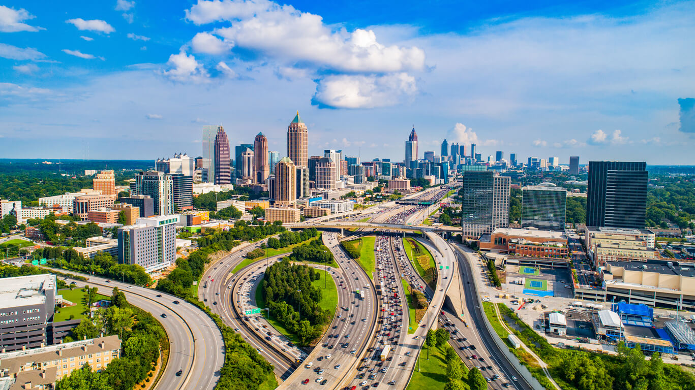
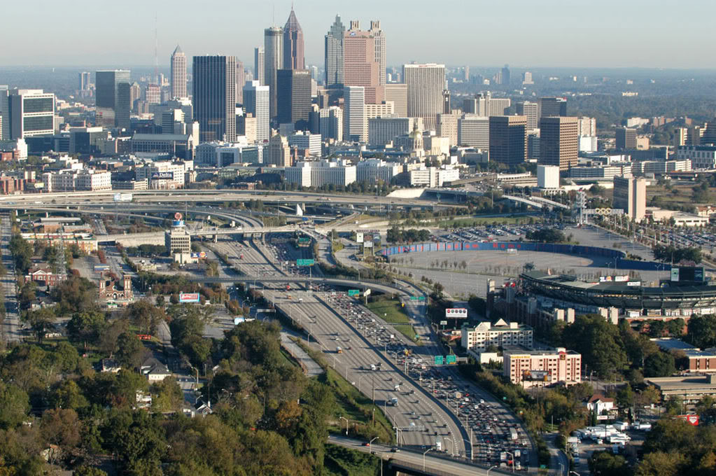
亚特兰大(英语:Atlanta)是美国佐治亚州首府及最大城市,是富尔顿县的县政府驻地。人口有420,003人(2010年),而正在快速发展的亚特兰大都会区拥有人口5,268,860人,是美国第9大都市区。
作为一个铁路枢纽,亚特兰大的发展始于19世纪早期,在南北战争时被摧毁,但在被选为州府后迅速重建。20世纪,它是美国民权运动的中心,并举办了1996年夏季奥林匹克运动会。
Atlanta ist die Hauptstadt sowie die größte Stadt des US-Bundesstaates Georgia[1] und liegt zum größten Teil im Fulton County und zu einem kleineren Teil im DeKalb County.
Ursprünglich war das Gebiet, auf dem die heutige Stadt liegt, von den Cherokee- und Muskogee-Indianern besiedelt, die den Ort Standing Peachtree (etwa: aufrechtstehender Pfirsichbaum) nannten, 1823 begann die erste Besiedlung durch Weiße. 1836 wurde der Ort von der Western and Atlantic Railroad als Endpunkt der Bahnstrecke von Rossville/Chattanooga (Tennessee) nach Georgia bestimmt und erhielt deswegen 1837 zunächst den Namen „Terminus“ (etwa: Endstation). 1843 wurde sie nach Martha Lumpkin, der Tochter des damaligen Gouverneurs von Georgia, „Marthasville“ getauft, bevor sie 1845 ihren heutigen Namen Atlanta erhielt. Die Herkunft des Namens ist nicht zweifelsfrei geklärt; die Gouverneurstochter könnte mit Mittelnamen „Atlanta“ geheißen haben oder es handelt sich um die weibliche Form von „Atlantik“, die die Western & Atlantic Railroad auswählte.
Atlanta ist die Hauptstadt sowie die größte Stadt des US-Bundesstaates Georgia[1] und liegt zum größten Teil im Fulton County und zu einem kleineren Teil im DeKalb County. Sie ist der Mittelpunkt der Metropolregion Atlanta.
アトランタ (Atlanta 英語発音: [ætˈlæntə] ( 音声ファイル)、現地発音: [ætˈlænə] ( 音声ファイル)) は、アメリカ合衆国ジョージア州北西部に位置する都市。同州の州都・最大都市であり、またフルトン郡の郡庁所在地である。市域の大部分はフルトン郡内にあり、一部東隣のディカーブ郡にかかっている。人口はアトランタ市域内で420,003人、フルトン郡を中心に29郡にまたがる都市圏では5,286,728人、アセンズやゲインズビル等をあわせた広域都市圏では5,910,296人を数える(すべて2010年国勢調査)[1]。
古くは鉄道交通のハブとして、また綿花産業の中心地として栄えた。やがてコカ・コーラ、デルタ航空、CNNなど多数の大企業が本社を置くようになり、ジョージア州のみならずアメリカ合衆国南部の商業・経済の中心地としての役割を担うようになった。1990年代に入ると、アトランタはアメリカ合衆国南部にとどまらず、国際的にも影響力を持つまでになり、先進国の都市の中では最も高い成長を遂げている都市の1つに数えられるようになった[2]。経済面での国際的な影響力に加え、「世界で最も忙しい空港」と呼ばれるハーツフィールド・ジャクソン・アトランタ国際空港[3]を前面に抱え、1996年の夏季オリンピック開催地としても世界的な知名度を有するアトランタは、2014年、アメリカのシンクタンクが公表したビジネス・人材・文化・政治などを対象とした総合的な世界都市ランキングにおいて、世界第36位の都市と評価された[4]。
アトランタは南部特有の夏の蒸し暑さと冬の温暖さから、「ホットランタ」(Hotlanta) という異名をつけられている。アトランタの南、メーコンを拠点として活動しているバンド、オールマン・ブラザーズ・バンドは、1971年にこの異名を取った「ホットランタ」(Hot 'Lanta) という楽曲を発表した。アトランタの住民は「アトランタンズ」(Atlantans) と呼ばれている。
Atlanta (/ætˈlæntə/) is the capital of, and the most populous city in, the U.S. state of Georgia. With an estimated 2017 population of 486,290,[13] it is also the 39th most-populous city in the United States. The city serves as the cultural and economic center of the Atlanta metropolitan area, home to 5.8 million people and the ninth-largest metropolitan area in the nation.[7] Atlanta is the seat of Fulton County, the most populous county in Georgia. A small portion of the city extends eastward into neighboring DeKalb County.
Atlanta was founded as a transportation hub at the intersection of two railroad lines in 1837. After being mostly burned to the ground during the American Civil War, the city rose from its ashes to become a national center of commerce and the unofficial capital of the "New South". During the 1950s and 1960s, Atlanta became a major organizing center of the civil rights movement, with Dr. Martin Luther King Jr., Ralph David Abernathy, and many other locals playing major roles in the movement's leadership. In the decades following, the city earned a reputation as "too busy to hate" for the relatively progressive views of its citizens and leaders compared to other cities in the "Deep South".[14] During the modern era, Atlanta has attained international prominence as a major air transportation hub, with Hartsfield–Jackson Atlanta International Airport being the world's busiest airport by passenger traffic since 1998.[15][16][17][18]
Atlanta is rated as a "beta(+)" world city that exerts a moderate impact on global commerce, finance, research, technology, education, media, art, and entertainment.[19] It ranks in the top twenty among world cities and 10th in the nation with a gross domestic product (GDP) of $385 billion.[20][21] Atlanta's economy is considered diverse, with dominant sectors that include transportation, logistics, professional and business services, media operations, medical services, and information technology.[22] Atlanta has topographic features that include rolling hills and dense tree coverage, earning it the nickname of "the city in a forest."[23] Revitalization of Atlanta's neighborhoods, initially spurred by the 1996 Summer Olympics, has intensified in the 21st century, altering the city's demographics, politics, and culture.[24][25]
Atlanta ([ætˈlæntə] en anglais) est la capitale et la ville la plus peuplée de l'État de Géorgie, aux États-Unis. Selon le recensement de 2010, la municipalité a une population de 420 003 habitants2 ; son aire urbaine est peuplée de 5 268 860 habitants, ce qui en fait la neuvième métropole du pays (après Miami et devant Boston). Ces dernières années, Atlanta est passée du rang de ville d'importance régionale à celui de métropole internationale3. Son agglomération, qui a augmenté de 24 % entre 2000 et 2010, est une des aires urbaines des États-Unis dont la croissance est la plus rapide4.
Atlanta (in inglese ascolta[?·info], /ætˈlæntʌ/) è una città degli Stati Uniti d'America, capitale dello Stato della Georgia. Nel 2011 la popolazione era stimata in 432.427 abitanti[2], mentre l'area metropolitana con 5.457.831 persone era la nona di tutti gli Stati Uniti d'America[3]. Atlanta è divisa amministrativamente in due contee, la contea di Fulton e quella, meno estesa, di DeKalb.
La città è suddivisa in 242 quartieri che si sviluppano attorno ai tre distretti principali di Downtown, Midtown e Buckhead, (riconoscibili per i loro grattacieli) che rappresentano i centri commerciale e finanziario di Atlanta essendo sede delle principali banche e aziende. Atlanta rappresenta anche un polo d'eccellenza per l'insegnamento universitario essendo la sede del politecnico Georgia Tech, dell'università Georgia State University nonché della prestigiosa università privata Emory University. La città è anche conosciuta per essere la sede di numerose università storicamente afroamericane quali la Clark University e il Morehouse College, quest'ultimo frequentato anche da Martin Luther King, Jr.[4].
Il primo insediamento di quella che sarà conosciuta come Atlanta fu fondata nel 1837, all'intersezione di due linee ferroviarie. Quasi totalmente rasa al suolo durante la guerra di secessione americana, la città conobbe uno sviluppo senza precedenti negli anni seguenti diventando in breve tempo un centro economico di importanza nazionale. Questo risultato fu possibile grazie alla sua posizione di principale hub degli Stati Uniti sud-orientali grazie allo sviluppo di una fitta rete di autostrade, ferrovie e lo sviluppo dell'Aeroporto Internazionale Hartsfield-Jackson, il più trafficato dal 1998 al 2012[5]. La città ha ricevuto visibilità internazionale nel 1996 per avere ospitato i XXVI Giochi olimpici dell'era moderna.
L'area metropolitana di Atlanta ha generato un prodotto interno lordo di 270 miliardi di dollari nel 2010, piazzandola al quindicesimo posto al mondo in questa speciale classifica[6]. L'economia della città risulta piuttosto differenziata, ciononostante le industrie dominanti afferiscono ai settori della logistica, dei servizi di consulenza commerciale, dei media e dell'Information Technology[7]. La città è meglio conosciuta come sede della multinazionale produttrice di bevande analcoliche The Coca-Cola Company, ma ospita i quartieri generali di altre grandi aziende inserite nella prestigiosa lista Fortune 100 tra le quali Delta Airlines, United Parcel Service (UPS), Turner Broadcasting System, AT&T Mobility e Home Depot tra le altre. Si stima che Atlanta sia la terza città degli Stati Uniti d'America per numero di aziende con quartier generale all'interno della propria area metropolitana[8].
Atlanta è la città natale di Martin Luther King Jr.
Atlanta es la capital y ciudad más extensa y poblada del estado de Georgia y la trigésimo tercera en Estados Unidos en cantidad de habitantes en 2008. Tiene una población estimada de 537 958 habitantes. Su área metropolitana, cuyo nombre oficial es Atlanta-Sandy Springs-Marietta, GA MSA (conocida comúnmente como Atlanta Metropolitana), es la novena área metropolitana con mayor población del país, con aproximadamente 5,5 millones de habitantes. Como en la mayor parte del Cinturón del Sol, la región de Atlanta experimentó un importante crecimiento en los años 2000, ya que añadió más de un millón de habitantes entre 2000 y 2008. Este fue el mayor crecimiento de cualquier área estadounidense por detrás del Dallas-Fort Worth metroplex.7 Con un ingreso bruto de US$ 270 000 millones, la economía de Atlanta está clasificada en el puesto número 15 entre las ciudades del mundo y en el sexto puesto en los Estados Unidos.8
Considerada como una ciudad de negocios y centro de transporte,910 Atlanta es la sede mundial de The Coca-Cola Company, AT&T Mobility, Delta Air Lines y la CNN. Además, la ciudad tiene la tercera mayor concentración de empresas de la Fortune 500 y más del 75 % de las compañías de Fortune 1000 tienen sede en esta área metropolitana.1112 El Aeropuerto Internacional Hartsfield-Jackson, situado a once kilómetros al sur del centro de Atlanta, es el aeropuerto más transitado del mundo y el único que cubre los servicios de la ciudad.1314
Atlanta es, también, la sede del condado de Fulton y la quinta ubicación de la sede del gobierno del estado de Georgia. Una pequeña parte de los límites de la ciudad de Atlanta limitan con el condado de DeKalb.
Атла́нта[2][3] (англ. Atlanta) — город в США, столица и крупнейший город штата Джорджия, административный центр округа Фултон[4] (хотя отдельные части города расположены в других округах штата).
Население (по состоянию на 2013) — в пределах городской черты 447 841 человек (34-й в США), в пределах агломерации Атланты, по оценке на 1 июля 2007 года, — 5 522 942 человек (9-й в США).
В последние годы Атланта приобрела статус одного из международных деловых центров, что дало мощный толчок экономическому и социальному развитию города. С 2000 по 2006 рост агломерации Атланты (на 20,5 %) стал самым крупным в США.
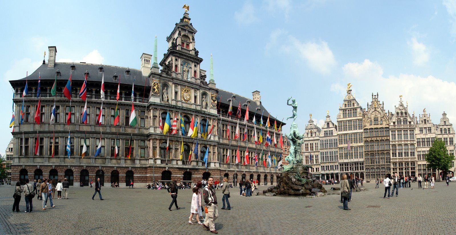
安特卫普位于比利时西北部斯海尔德河畔,是比利时最大港口和重要工业城市,面积140平方公里,人口45.7万人(2005年1月),居民大多使用荷兰地方方言,工商界主要使用法语。安特卫普是欧洲著名文化中心,是著名艺术大师罗宾斯和冯·狄克的诞生地,也是世界著名的游览城市。人们被其吸引的是它的三大看点:一是保存完好、充满中世纪情调的旧市区古老建筑;二是神秘的钻石加工和交易;三是有世界声誉的绘画艺术和众多的博物馆,建有罗宾斯故居博物馆、皇家艺术博物馆、国家海运博物馆以及钻石博物馆等。(Quelle:http://baike.baidu.com)
Antwerpen (veraltet deutsch Antorf oder Antorff, französisch Anvers) ist eine Hafenstadt in der Region Flandern in Belgien und die Hauptstadt der Provinz Antwerpen. Bezogen auf die Stadt als Verwaltungseinheit ist Antwerpen die größte Stadt des Landes. Die Agglomeration Antwerpen ist nach der Region Brüssel-Hauptstadt die zweitgrößte in Belgien.
Von großer internationaler Bedeutung ist Antwerpen durch seinen Seehafen, den zweitgrößten Europas, sowie als weltweit wichtigstes Zentrum für die Verarbeitung und den Handel von Diamanten.
Antwerpen war im 15. und 16. Jahrhundert eine der größten Städte der Welt, zeitweise die wichtigste Handelsmetropole Europas und als bedeutendes kulturelles Zentrum Wirkungsstätte von Künstlern wie Rubens. Antwerpen war Austragungsort der Olympischen Sommerspiele 1920 und Kulturhauptstadt Europas 1993. Das Druckereimuseum Plantin-Moretus, das Maison Guiette und der Turm der Liebfrauenkathedrale gehören zum UNESCO-Welterbe.
アントウェルペン(オランダ語: Antwerpen [ˈɑntʋɛrpə(n)] ( 音声ファイル), フランス語: Anvers [ɑ̃vɛʁ(s)], 英語: Antwerp [ˈæntwɜrp])は、ベルギーのフランデレン地域・アントウェルペン州の州都で、同国最大の都市(首都圏地域の人口を合わせればブリュッセル市が最大)。英語名に由来するアントワープや、フランス語名に由来するアンヴェルス(アンベルス)[1]も日本語の表記においてよく用いられる。2012年1月1日の総人口は502,604人。面積は204.51 km2, 人口密度は2,457.56人/km2である。
Antwerp (/ˈæntwɜːrp/ ( listen), Dutch: Antwerpen [ˈɑntʋɛrpə(n)] ( listen), French: Anvers [ɑ̃vɛʁ(s)]) is a city in Belgium, and is the capital of Antwerp province in Flanders. With a population of 520,504,[2] it is the most populous city proper in Belgium. Its metropolitan area houses around 1,200,000 people, coming in second behind Brussels.[3][4]
Antwerp is on the River Scheldt, linked to the North Sea by the Westerschelde estuary. It is about 40 kilometres (25 mi) north of Brussels, and about 15 kilometres (9 mi) from the Dutch border. The Port of Antwerp is one of the biggest in the world, ranking second in Europe[5][6] and within the top 20 globally.[7] Antwerp was also the place of the world's oldest stock exchange building, originally built in 1531 and re-built in 1872.[8]
Antwerp has long been an important city in the Low Countries, both economically and culturally, especially before the Spanish Fury (1576) in the Dutch Revolt. The inhabitants of Antwerp are nicknamed Sinjoren ([sɪnˈjoːˌrən]), after the Spanish honorific señor or French seigneur, "lord", referring to the Spanish noblemen who ruled the city in the 17th century.[9] Today Antwerp is a major trade and cultural centre. The city hosted the 1920 Summer Olympics.
Anvers (prononcé /ɑ̃.vɛʁs/1,2, ou /ɑ̃.vɛʁ/3, en néerlandais : Antwerpen) est une ville belge dans la Région flamande, chef-lieu de la province d'Anvers et de l'arrondissement administratif du même nom, située au cœur de la Dorsale européenne.
Au 1er avril 2017, la commune d’Anvers était la plus peuplée de Belgique, devant Gand et Charleroi, avec 521 216 habitants4, 259 740 hommes et 261 476 femmes, soit une densité de 1 270,06 habitants/km2. L’agglomération anversoise compte, elle, 1 250 000 habitants. C'est la deuxième plus peuplée de Belgique, après Bruxelles. C'est également la troisième commune et ville de Belgique pour ce qui est de la superficie, avec 204,51 km2, juste après Tournai et Couvin.
Archétype de la ville bourgeoise-marchande depuis le Bas Moyen Âge elle constitue alors, selon Fernand Braudel, le centre du commerce international et de la haute finance tout au long du XVIe siècle. Anvers abrite depuis 1931 le plus vieux et unique gratte-ciel d'Europe jusqu'en 1949, la Boerentoren, et dispute à Venise l'invention de la comptabilité en partie double. Anvers est connue pour abriter les plus prestigieux diamantaires de la Planète, avec Londres et Amsterdam, ainsi que la plus importante bourse de diamants de la Planète, la Antwerpse Diamantkring. Elle abrite également une grande concentration d'établissements d'audit et consulting. Enfin, le Port d'Anvers (deuxième port commercial d'Europe en termes d'activités et de tonnage, après celui voisin de Rotterdam) joue un rôle majeur dans la mondialisation des activités économiques européennes.
Les codes postaux vont de 2000 à 2600 à l’intérieur du district de la ville d’Anvers, située principalement sur la rive droite de l’Escaut et connue pour son port international de marchandises extrêmement développé, aujourd'hui le deuxième plus grand d'Europe en termes de volume de marchandises.
Les Anversois sont aussi appelés les Sinjoren, de l’espagnol señor, héritage de l'époque où elle faisait partie de l'Empire habsbourgeois de Charles Quint. La ville est souvent appelée ’t Stad (« La Ville ») et parfois de koekenstad (« la Ville des biscuits ») par allusion aux koffiekoeken (biscuits recouverts d'un fin glaçage au café) d’Anvers, réputées dans toute la Belgique.
Anversa (Antwerpen in olandese, Anvers in francese) è una città di 506.922 abitanti del Belgio settentrionale, la più importante nella regione delle Fiandre, una delle tre regioni dello Stato, e il capoluogo della provincia omonima.
Amberes (en neerlandés, Antwerpen [ˈɑntˌʋɛrpə(n)] (?·i), en francés, Anvers [ɑ̃ˈvɛʁ(s)]), antiguamente conocida como Antuerpia, es una ciudad situada en Bélgica que posee 521.600 habitantes en 2018. El área metropolitana cubre 1.449 km² (559 millas cuadradas) con un total de 2.190.769 habitantes, según el censo del 1 de enero de 2017.
Антве́рпен (нидерл. Antwerpen [ˈɑntˌʋɛrpə(n)], фр. Anvers [ɑ̃vɛʁs], з.-флам. Antwerpn) — город во Фламандском регионе Бельгии. Второй (после Брюсселя) город страны, самый большой город Фландрии. Административный центр провинции Антверпен. Город расположен на обоих берегах реки Шельды. Морской порт, входит в двадцатку крупнейших портов мира и является вторым в Европе после порта города Роттердама в Нидерландах[2].
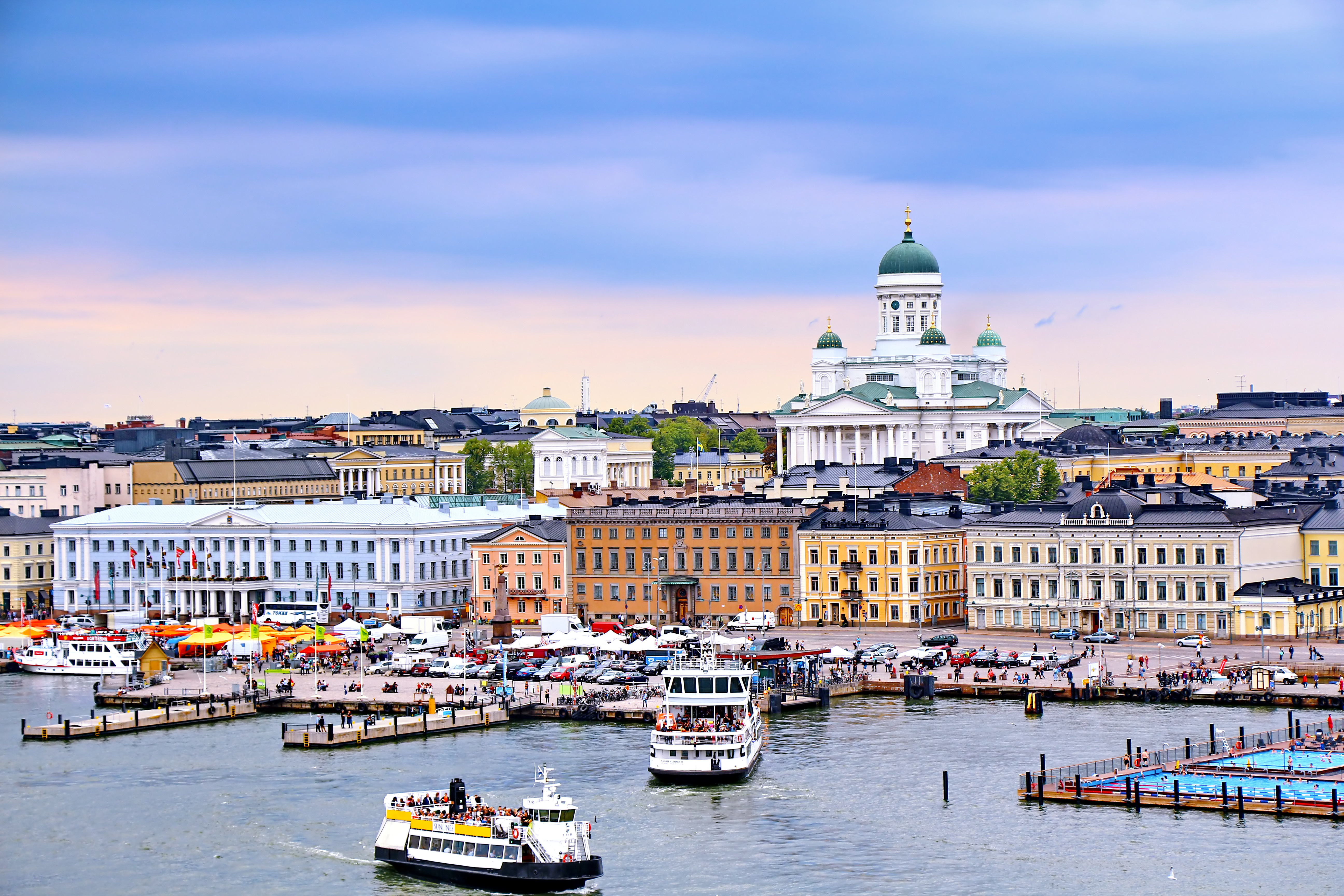
赫尔辛基(芬兰语:Helsinki [ˈhelsiŋki] 聆听;瑞典语:Helsingfors [ˌhɛlsɪŋˈfɔʂː] 聆听),是芬兰的首都以及全国最大城市,芬兰语和瑞典语同为官方语言。赫尔辛基位于新地区,芬兰南端的芬兰湾岸边。在2017年底,赫尔辛基人口为643,272人[4]。所谓“大赫尔辛基”是由赫尔辛基和埃斯波、万塔、考尼艾宁四个城市一起组成的首都地区及周边市镇所组成的都会区,在2014年底的统计中有1,420,284人[5]。
赫尔辛基在爱沙尼亚塔林北部约80公里处,距离西南的瑞典斯德哥尔摩约400公里,距离东边的俄罗斯圣彼得堡约300公里。这三座城市与赫尔辛基在历史上有着密切联系。
Helsinki (finnisch [ˈhɛlsiŋki], schwedisch [hɛlsɪŋˈfɔrs]) ist die Hauptstadt Finnlands. Sie liegt in der Landschaft Uusimaa im Süden des Landes an der Küste des Finnischen Meerbusens und ist die nördlichste Hauptstadt eines Mitgliedstaates der EU. Mit 648.042 Einwohnern (Stand 31. Dezember 2018) ist Helsinki mit Abstand die größte Stadt Finnlands und drittgrößte Stadt der Nordischen Länder, nach Stockholm und Oslo.
Zusammen mit den Nachbarstädten Espoo, Vantaa und Kauniainen bildet es die sogenannte Hauptstadtregion, einen Ballungsraum mit etwa 1,49 Millionen Einwohnern und damit den nördlichsten Ballungsraum der Welt mit über einer Million Einwohnern.[3] Helsinki ist das politische, wirtschaftliche, wissenschaftliche und kulturelle Zentrum Finnlands. Rund sechs Prozent der Einwohner Helsinkis sind schwedischsprachig, offiziell ist die Stadt zweisprachig.
Helsinki liegt 80 km nördlich von Tallinn, Estland, 400 km östlich von Stockholm, Schweden, und 300 km westlich von Sankt Petersburg, Russland. Es hat enge historische Verbindungen zu diesen drei Städten.
Die Stadt wurde, unter dem schwedischen Namen Helsinge fors[4], im Jahr 1550 während der Zugehörigkeit Finnlands zu Schweden gegründet, blieb aber lange unbedeutend. Kurz nachdem Finnland unter russische Herrschaft gekommen war, wurde Helsinki 1812 zur Hauptstadt des neugegründeten Großfürstentums Finnland bestimmt und löste so Turku als wichtigste Stadt des Landes ab. Der offizielle Gebrauch des finnisierten Namens Helsinki begann erst in dieser Zeit.[5]
Seit 1917 ist Helsinki Hauptstadt des unabhängigen Finnlands.
ヘルシンキ (フィンランド語: Helsinki,フィンランド語発音: [ˈhe̞l.siŋ.k̟i]) listen; スウェーデン語: Helsingfors, listen)は、フィンランドの首都で同国最大の都市である。また、バルト海東部のフィンランド湾に面した同国南部のウーシマー県の県庁所在地である。人口は616,042人(2013年2月28日現在)[4]、都市的地域の人口は 1,176,976人(2012年12月31日現在)[5]、ヘルシンキ都市圏である大ヘルシンキの人口は約140万人でフィンランドではもっとも人口の多い自治体と都市域を形成している。
ヘルシンキは、ロシアの旧都サンクトペテルブルク、エストニアの首都タリンと同じく、フィンランド湾に面する主要都市の一つである。ヘルシンキからの距離は、東のサンクトペテルブルクまでは300キロメートル (190 mi)、南のタリンまでは85キロメートル (53 mi)である[6]。 なお、西に400キロメートル (250 mi)の距離に位置するバルト海の対岸のスウェーデンの首都ストックホルムも加え、これらの都市とヘルシンキは歴史的に密接な関係にあった。
ヘルシンキ都市圏には核となるヘルシンキの都市的地域とエスポーやヴァンター、カウニアイネン、周辺のベッドタウンが含まれる[7]。ヘルシンキは100万人以上が住む都市圏としては最北に位置する都市圏で欧州連合加盟国の首都としては最北に位置する都市であり、フィンランドの政治や教育、金融、文化、調査センターなど様々な分野の中心都市で、ヨーロッパでも最北の大都市である。
フィンランドで事業を行う外国企業の70%はヘルシンキ地域で事業を行っており[8]、2009年に、2012年の世界デザイン首都[9]に国際インダストリアルデザイン団体協議会により選ばれ、僅差でアイントホーフェンを破っている。
エコノミスト・インテリジェンス・ユニットは2012年8月に住むのに適した都市の調査で、ヘルシンキは総合で8位にランクした[10]。2011年、モノクルマガジンの調査Liveable Cities Index 2011でヘルシンキは最も住むのに適した都市に位置している[11]。
Helsinki (/ˈhɛlsɪŋki/ HEL-sink-ee or /hɛlˈsɪŋki/ (listen) hel-SINK-ee;[7][8] Finnish: [ˈhelsiŋki] (listen); Swedish: Helsingfors [hɛlsɪŋˈfɔʂː] (listen), Finland Swedish: [helsiŋˈforsː] (listen)) is the capital, primate and most populous city of Finland. Located on the shore of the Gulf of Finland, it is the seat of the region of Uusimaa in southern Finland, and has a population of 650,058.[9] The city's urban area has a population of 1,268,296,[10] making it by far the most populous urban area in Finland as well as the country's most important center for politics, education, finance, culture, and research; while Tampere in the Pirkanmaa region, located 179 kilometres (111 mi) to the north from Helsinki, is the second largest urban area in Finland. Helsinki is located 80 kilometres (50 mi) north of Tallinn, Estonia, 400 km (250 mi) east of Stockholm, Sweden, and 300 km (190 mi) west of Saint Petersburg, Russia. It has close historical ties with these three cities.
Together with the cities of Espoo, Vantaa, and Kauniainen, and surrounding commuter towns,[11] Helsinki forms the Greater Helsinki metropolitan area, which has a population of nearly 1.5 million. Often considered to be Finland's only metropolis, it is the world's northernmost metro area with over one million people as well as the northernmost capital of an EU member state. After Stockholm and Oslo, Helsinki is the third largest municipality in the Nordic countries. Finnish and Swedish are both official languages. The city is served by the international Helsinki Airport, located in the neighboring city of Vantaa, with frequent service to many destinations in Europe and Asia.
Helsinki was the World Design Capital for 2012,[12] the venue for the 1952 Summer Olympics, and the host of the 52nd Eurovision Song Contest in 2007.
Helsinki has one of the world's highest urban standards of living. In 2011, the British magazine Monocle ranked Helsinki the world's most liveable city in its liveable cities index.[13] In the Economist Intelligence Unit's 2016 liveability survey, Helsinki was ranked ninth among 140 cities.[14]
Helsinki (prononcé /ɛl.siŋ.ˈki/ ; Helsinki /ˈhɛl.siŋ.ki/ Écouter en finnois et Helsingfors /hɛl.sɪŋ.ˈfɔrs/ Écouter en suédois), est la capitale et la plus grande ville de la Finlande avec 642 045 habitants4 dans la commune et 1 456 619 dans le Grand Helsinki. Helsinki est la capitale la plus septentrionale du monde après Reykjavik, capitale de l'Islande. La ville a la plus forte population immigrée de tout le pays. Il y a plus de 130 nationalités résidant dans la ville d'Helsinki. Elle s'étale sur une presqu'île entourée d'un grand nombre d'îles et est fortement caractérisée par la présence de l'eau. Helsinki est un port marchand ouvert sur le golfe de Finlande.
Ses habitants sont appelés les Helsinkiens ; en finnois Helsinkiläiset, en suédois Helsingforsare.
Helsinki (pronuncia italiana [ˈɛlsiŋki][3]; in finlandese [ˈhelsiŋki] ; in svedese , pronuncia [hɛlsɪŋˈfɔrs]) è la capitale e la città più grande della Finlandia, con 648.650 abitanti (dato 2018)[4], situata nella regione dell'Uusimaa. La città è bilingue, le lingue ufficiali sono il finlandese e lo svedese.
Helsinki è geograficamente situata nella parte meridionale del Paese sulle rive del golfo di Finlandia, parte del mar Baltico, di fronte alla capitale dell'Estonia, Tallinn, e si estende su più isole.
L'area metropolitana di Helsinki include l'area urbana della città, Espoo, Vantaa, Kauniainen e paesi limitrofi[5]. È l'area metropolitana più a nord nel mondo, con il suo milione di abitanti è la città e capitale più a nord degli Stati membri dell'Unione europea.
A Helsinki hanno sede il parlamento, il governo, sette università e le sedi dei vescovi evangelico-luterani, cattolici e russo-ortodossi.
Nello slang di Helsinki la città è chiamata Stadi (per il vocabolo svedese stad, "città") o Hesa (forma abbraviata di "Helsinki" con il suffisso gergale -sa), lasciando intendere che chi usa il termine Stadi sia nativo della città[6]. Helsset è il termine usato dai sami del Nord per Helsinki.
Helsinki (en finlandés: Helsinki [ˈhɛlsiŋki] (?·i); en sueco: Helsingfors [hɛlsɪŋˈfɔrs] (?·i)) es la capital y la ciudad más grande de Finlandia. Está situada en la costa sur del país, a la orilla del golfo de Finlandia. Helsinki forma parte de la región de Uusimaa.
Las influencias del Este y el Oeste se encuentran presentes en la vida diaria de Helsinki. Arquitectura, gastronomía, diseño, costumbres y hasta el argot local de las calles atestiguan un pasado bajo dominio ruso y sueco.
Situada junto al mar Báltico, la línea de costa de Helsinki se extiende unos 100 kilómetros, y acoge 300 islas frente al continente. 665 281 personas viven en la propia ciudad de Helsinki (Enero 2020)145 y el área metropolitana (municipios de Helsinki, Espoo, Vantaa y Kauniainen) tiene una población un millón de habitantes en total. Incluyendo otros municipios cercanos la población es de alrededor de 1,4 millones de personas.2 Uno de cada cuatro finlandeses vive en Helsinki.
Helsinki es el mayor centro político, educativo, financiero, cultural y de investigación, así como una de las ciudades más importantes del norte de Europa. Aproximadamente el 70 % de las empresas extranjeras que operan en Finlandia se han establecido en la región de Helsinki.6
Helsinki fue elegida Capital Mundial del Diseño para el año 2012,7 sede de los Juegos Olímpicos en 1952 y del 52º Festival de Eurovisión en 2007. Helsinki es conocida a nivel mundial por su gran diseño, el cual es bien evidente en sus calles, comercios y edificios, formando parte de la red de ciudades creativas por la UNESCO desde 2014.8
En la edición de agosto de 2012, el estudio del Economist Intelligence Unit colocó en octavo lugar a Helsinki en el ranking general de las mejores ciudades para vivir a nivel mundial.9 En 2011 la revista Monocle estableció a la ciudad de Helsinki como la mejor ciudad para vivir y desarrollarse en el mundo entero.
Хе́льсинки (фин. Helsinki, швед. Helsingfors , до 1926 года в русском языке официально использовалось шведское название Гельсингфорс[3]) — столица и крупнейший город Финляндии, административный центр провинции Уусимаа (Нюланд). Расположен на юге страны, на берегу Финского залива Балтийского моря. Население — 655 281 человека (31.1.2020)[4]. Иностранные граждане составляют около 10 % населения города.
Хельсинки вместе с городами-спутниками Вантаа (Ванда), Эспоо (Эсбy[5]) и Кауниайнен (Гранкулла) образует столичный регион с населением более миллиона человек. Население Большого Хельсинки, территория которого включает 12 коммун, превышает 1,3 миллиона человек[2]. Хельсинки является центром бизнеса, образования, культуры и науки в Финляндии. В Большом Хельсинки расположены 8 университетов и 6 технологических парков[6]. 70 % иностранных компаний, работающих в Финляндии, расположены в столичном регионе[6]. Миграция населения из провинции делает Хельсинки одним из самых быстрорастущих муниципальных районов в Европе. Главным международным авиаузлом в Финляндии является Аэропорт Хельсинки-Вантаа, расположенный в 20 километрах от центра столицы и осуществляющий прямые перелёты по всему миру. Путь от Хельсинки до Таллина занимает 1,5 часа по морю и 18 минут на вертолёте (расстояние составляет 80 км). В два других крупных города, Тампере и Турку, можно попасть за 1,5—2 часа на поезде и 1,5—2,5 часа на машине. На скоростном поезде «Аллегро» до Санкт-Петербурга можно добраться за 3,5 часа (390 км).
В 2014 году в рейтинге 25 лучших городов мира, составленном британским журналом Monocle[en], Хельсинки занял пятое место (на первом месте — Копенгаген)[7]. В 2011 году в опубликованном международной консалтинговой компанией Mercer рейтинге наиболее безопасных городов мира Хельсинки разделил 2—4 места с Цюрихом и Берном (на первом месте — Люксембург)[8][9]. В начале 2012 года газета The New York Times в ежегодно публикуемом ею списке мест нашей планеты, которые стоит посетить в наступившем году, поставила Хельсинки на второе место (на первом месте — Панама, на третьем — Мьянма)[10][11].
По опросам общественного мнения в 2012 году Хельсинки занимает четвёртое место по уровню привлекательности для проживания среди финских граждан[12].
В 2013 году по расчетам консалтингового агентства ECA International Хельсинки занял двадцатое место в рейтинге самых дорогих городов планеты (первое место — Осло)[13], а международная деловая газета Financial Times представила ряд районов финской столицы в лучшем свете как мест для вложений в недвижимость[14].
День города отмечается ежегодно 12 июня[15].
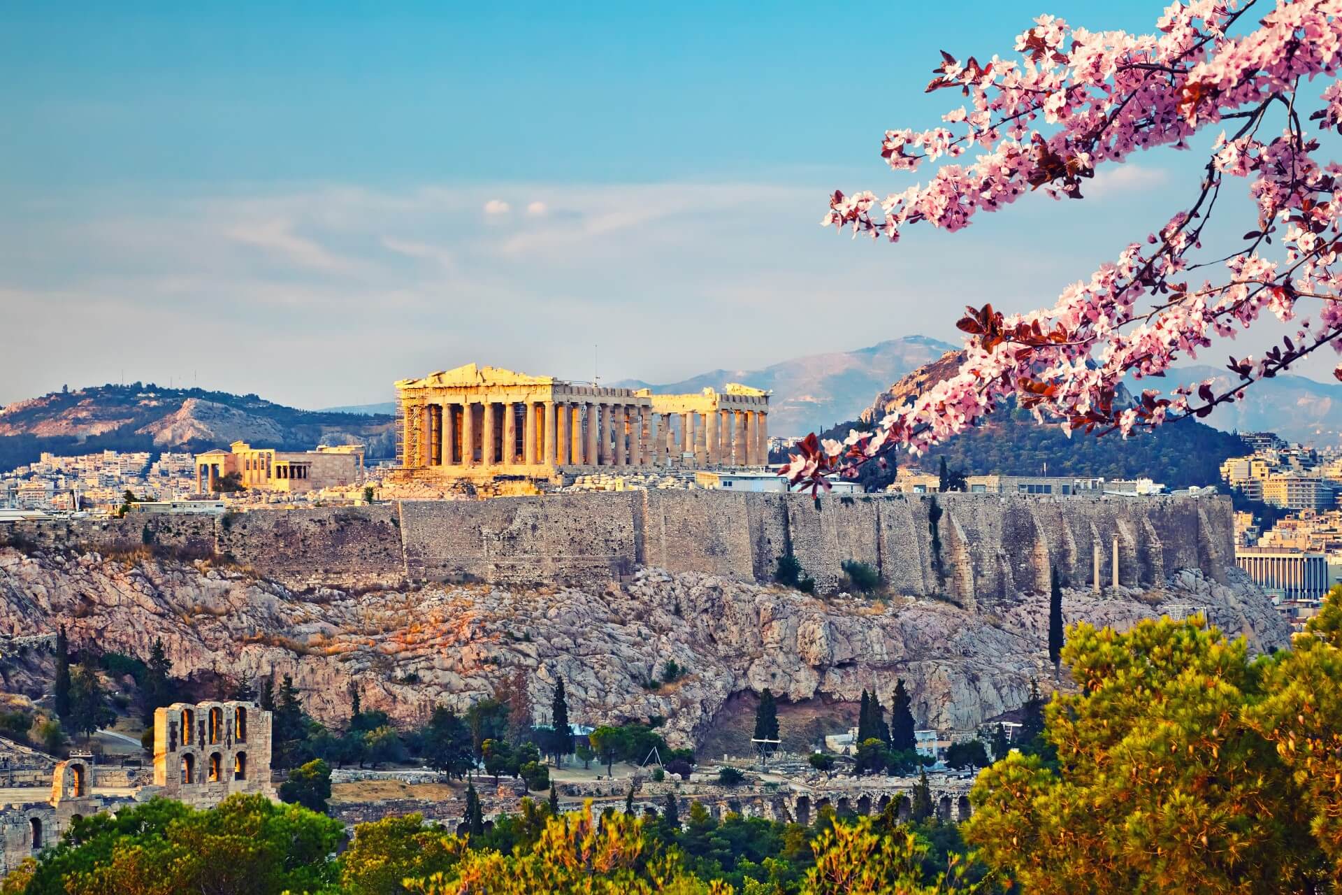
雅典建城至今已经有5000多年的历史,公元前8世纪,爱奥尼亚人建成的雅典是古希腊城邦的盟主。古代雅典是西方文化的源泉,雅典人对艺术、哲学、法律、科学作出了杰出的贡献。公元前5世纪为雅典的鼎盛时期,出现了许多不朽的大师。大悲剧家欧里庇德斯、大喜剧家阿里斯托芬、哲学家苏格拉底、柏拉图、亚里斯多德、历史学家希罗多德等都在这里诞生或居住过,这些光辉的名字照耀着人类文化的黎明。
雅典是希腊的古文物中心,至今仍保存着很多古代文化遗址,如今仍能显出当年的雄伟气概。雅典的博物馆世界驰名。
跨越时空两千五百年正是雅典给人的感觉,山丘上的卫城是西元前五百年的伟大艺术杰作,而山下的波拉卡区千年来就是一本希腊人的生活宝库,而身为希腊的首都及最大的城市,雅典的现代化建筑,拥挤的交通和空气污染严重,又和世界一般大都会无异。
现在雅典是全世界旅游爱好者的度假胜地。蔚蓝的爱琴海边涛声依旧,雅典的一砖一砾都闪烁着人类文明的光辉。 (Quelle:http://eur.bytravel.cn)
雅典(希腊语:Αθήνα,Athína,[aˈθina];古希腊语:Άθῆναι,转写:Athēnai)是希腊首都,也是希腊最大的城市。雅典位于巴尔干半岛南端,三面环山,一面傍海,西南距爱琴海法利龙湾8公里,属亚热带地中海气候。基菲索斯河和伊利索斯河穿城而过。市内多小山。
雅典是世界上最老的城市之一,有记载的历史就长达3000多年。现在雅典是欧洲第八大城市[1]。雅典是希腊经济、财政、工业、政治和文化中心。雅典也是欧盟商业中心之一。市区人口330万,加上郊区人口共有380万人口。城市的面积为39平方公里,加上郊区为412平方公里。[2]
古雅典是一个强大的城邦,是驰名世界的文化古城。希腊是西方哲学的摇篮,是柏拉图学院和亚里士多德的讲学场所的所在地。[3][4]苏格拉底、希罗多德、伯里克利、索福克勒斯、阿里斯托芬、欧里庇得斯、埃斯库罗斯和其他著名的哲学家、政治家和文学家都在雅典诞生或居住过[5],雅典也因此被称作“西方文明的摇篮”和民主的起源地。[6]公元前5世纪和4世纪在文化和政治上的成就对欧洲及世界文化产生重大影响。[7]
雅典至今仍保留了很多历史遗迹和大量的艺术作品,其中最著名的是雅典卫城的帕提农神庙,是西方文化的象征。
雅典是现代奥运会起源的地方。1896年曾举办过第一届夏季奥运会。2004年,第二十八届夏季奥林匹克运动会在雅典举行。Athen – neugriechisch Αθήνα [aˈθina] (f. sg.), Katharevousa und altgriechisch Ἀθῆναι Athênai (f. pl.) – ist die Hauptstadt Griechenlands. Athen ist die bevölkerungsreichste und flächengrößte Stadt des Landes. Die Gemeinde Athen im Zentrum des Ballungsraums Athen-Piräus ist dabei relativ klein. Athen im weiteren Sinne umfasst das Gebiet der Regionalbezirke Athen-Zentrum (87,3 km²), Athen-Nord (138,79 km²), Athen-Süd (68,9 km²), Athen-West (66,8 km²) und einiger umliegender Vororte mit zusammen 3,753 Mio. Einwohnern.[2]
Als kulturelles, historisches und wirtschaftliches Zentrum des Landes ist Athen auch die bedeutendste Metropole Griechenlands. Der Flughafen ist der wichtigste des Landes und der acht Kilometer vom Athener Zentrum entfernte Hafen Piräus der größte Griechenlands. Von hier und vom kleineren Rafina wird auch der Schiffsverkehr zu den zahlreichen griechischen Inseln abgefertigt. Im Schienenverkehr hat Athen nationale, jedoch keine internationale Bedeutung.
Die Stadt ist seit der Jungsteinzeit kontinuierlich besiedelt[3] und damit eine der ältesten Siedlungen und Städte Europas. 1985 wurde Athen erste Kulturhauptstadt Europas. In die Liste des Weltkulturerbes der UNESCO wurde 1987 die Akropolis und 1990 das Kloster Daphni aufgenommen.
Athen war in der klassischen Zeit Ort der attischen Polis. Die in dieser Zeit (5. Jahrhundert v. Chr.) entstandene attische Demokratie gilt als Begründerin einer auf dem Prinzip der Volkssouveränität gegründeten politischen Ordnung.
アテネ(現代ギリシア語: Αθήνα; Athína; IPA: [aˈθina]; カサレヴサ: Ἀθῆναι, Athinai; 古代ギリシア語: Ἀθῆναι, Athēnai)は、ギリシャ共和国の首都で同国最大の都市である。
アテネはアッティカ地方にあり、世界でももっとも古い都市の一つで約3,400年の歴史がある。古代のアテネであるアテナイは強力な都市国家であったことで知られる。芸術や学問、哲学の中心で、プラトンが創建したアカデメイアやアリストテレスのリュケイオン[1][2]があり、西洋文明の揺籃や民主主義の発祥地として広く言及されており[3][4]、その大部分は紀元前4-5世紀の文化的、政治的な功績により後の世紀にヨーロッパに大きな影響を与えたことは知られている。[5]今日の現代的なアテネは世界都市としてギリシャの経済、金融、産業、政治、文化生活の中心である。2008年にアテネは世界で32番目に富める都市に位置し[6]、UBSの調査では25番目に物価が高い都市[7]に位置している。
アテネ市の人口は655,780人[8](2004年は796,442人)[9]、市域面積は39 km2 (15 sq mi)[10]である。アテネの都市的地域(大アテネや大ピラエウス)は市域を超えて広がっており、人口は2011年現在3,074,160人に達し[11]、都市的地域の面積は412 km2 (159 sq mi)[10]である。ユーロスタットによれば大都市圏地域(Larger Urban Zones,LUZ) (en) の人口は欧州連合域内では7番目に大きい。
古典ギリシアの文化的遺産は今でもはっきりとしており、多くの古代遺跡や芸術作品が象徴している。もっとも有名で代表的なものにはパルテノン神殿があり初期の西洋文明の鍵となるランドマークと見なされる場合もある。アテネにはローマ帝国支配下のギリシャやビザンティンの遺跡もあり同様に少数のオスマン帝国の遺跡も残されているなど、何世紀にもわたる長い歴史を投影するモニュメントとなっている。アテネには2つのユネスコの世界遺産がありアテナイのアクロポリスと中世のダフニ修道院がそうである。現代のランドマークはギリシアが1833年に独立国となりアテネが首都に制定された時のもので、ギリシャ議会の議事堂や3部作(Trilogy )で構成されたギリシア国立図書館、アテネ大学、アテネアカデミーが含まれる。アテネは、最初の近代オリンピックであるアテネオリンピックと、その108年後に開催されたアテネオリンピック (2004年)の2度のオリンピックの舞台である。[12]アテネにはアテネ国立考古学博物館があり、世界最大の古代ギリシアの遺品の収蔵を特徴とし新しい2008年に完成したアクロポリス博物館もある。ギリシャ正教会の首長であるアテネ大主教が所在し、精神的な中心地でもある。(ギリシャ正教会は正教会に属し、クレタ島を除くギリシャ一国を管轄する。)正教会の定めるアテネの守護聖人は、ディオニシオス・オ・アレオパギティス、イェロテオス、フィロセイ。1985年には欧州文化首都に選ばれた。
Athens (/ˈæθɪnz/;[3] Greek: Αθήνα, Athína [aˈθina]; Ancient Greek: Ἀθῆναι, Athênai [a.tʰɛ̂ː.nai̯]) is the capital and largest city of Greece. Athens dominates the Attica region and is one of the world's oldest cities, with its recorded history spanning over 3,400 years[4] and its earliest human presence starting somewhere between the 11th and 7th millennium BC.[5]
Classical Athens was a powerful city-state that emerged in conjunction with the seagoing development of the port of Piraeus, which had been a distinct city prior to its 5th century BC incorporation with Athens. A centre for the arts, learning and philosophy, home of Plato's Academy and Aristotle's Lyceum,[6][7] it is widely referred to as the cradle of Western civilization and the birthplace of democracy,[8][9] largely because of its cultural and political impact on the European continent, and in particular the Romans.[10] In modern times, Athens is a large cosmopolitan metropolis and central to economic, financial, industrial, maritime, political and cultural life in Greece. In 2012, Athens was ranked the world's 39th richest city by purchasing power[11] and the 67th most expensive[12] in a UBS study.
Athens is a global city and one of the biggest economic centres in southeastern Europe. It has a large financial sector, and its port Piraeus is both the largest passenger port in Europe,[13][14][15][16] and the second largest in the world.[17][dead link] The Municipality of Athens (also City of Athens) had a population of 664,046 (in 2011)[2] within its administrative limits, and a land area of 38.96 km2 (15.04 sq mi).[18][19] The urban area of Athens (Greater Athens and Greater Piraeus) extends beyond its administrative municipal city limits, with a population of 3,090,508 (in 2011)[20] over an area of 412 km2 (159 sq mi).[19] According to Eurostat[21] in 2011, the functional urban area (FUA) of Athens was the 9th most populous FUA in the European Union (the 6th most populous capital city of the EU), with a population of 3.8 million people. Athens is also the southernmost capital on the European mainland.
The heritage of the classical era is still evident in the city, represented by ancient monuments and works of art, the most famous of all being the Parthenon, considered a key landmark of early Western civilization. The city also retains Roman and Byzantine monuments, as well as a smaller number of Ottoman monuments. Athens is home to two UNESCO World Heritage Sites, the Acropolis of Athens and the medieval Daphni Monastery. Landmarks of the modern era, dating back to the establishment of Athens as the capital of the independent Greek state in 1834, include the Hellenic Parliament and the so-called "architectural trilogy of Athens", consisting of the National Library of Greece, the National and Kapodistrian University of Athens and the Academy of Athens. Athens is also home to several museums and cultural institutions, such as the National Archeological Museum, featuring the world's largest collection of ancient Greek antiquities, the Acropolis Museum, the Museum of Cycladic Art, the Benaki Museum and the Byzantine and Christian Museum. Athens was the host city of the first modern-day Olympic Games in 1896, and 108 years later it welcomed home the 2004 Summer Olympics, making it one of only a handful of cities to have hosted the Olympics more than once.[22]
Athènes (en grec ancien Ἀθῆναι / Athễnai — le nom est toujours pluriel —, en grec moderne Αθήνα [a'θina] / Athína) est la capitale et la plus grande ville de la Grèce. En 2011, elle compte 664 046 habitants intra-muros sur une superficie de 39 km2. Son aire urbaine, le Grand Athènes, qui comprend notamment le port du Pirée, en compte plus de 3 millions. Berceau de la civilisation occidentale et dotée d'un riche passé, la ville est aujourd'hui le cœur politique, économique et culturel de la République hellénique, dont elle accueille la plupart des institutions, comme le Parlement, l'Áreios Págos (cour suprême) et le siège du Gouvernement.
Athènes est l'une des plus anciennes villes au monde, avec une présence humaine attestée dès le Néolithique. Fondée vers -800 autour de la colline de l'Acropole — par le héros Thésée, selon la légende —, la cité domine la Grèce au cours du Ier millénaire av. J.‑C.. Elle connaît son âge d'or au Ve siècle av. J.-C., sous la domination du stratège Périclès : principale puissance militaire de Grèce, à la tête d'une vaste alliance de cités, elle est également le cœur culturel de la Méditerranée. Première république de l'histoire, la démocratie athénienne connaît une vie intellectuelle importante, rassemblant des philosophes antiques (Socrate, Platon, Aristote), des auteurs de théâtre (Eschyle, Sophocle, Euripide, Aristophane) et l'historien Thucydide. De nombreux témoignages de cette période faste ont été conservés, comme le Parthénon, l'Agora (qui comprend notamment le temple d'Héphaïstos), l'Olympéion, le théâtre de Dionysos ou encore le Stade panathénaïque.
Intégrée au royaume de Macédoine, puis à l'Empire byzantin — période durant laquelle fut bâti le monastère de Daphni —, Athènes est conquise par l'Empire ottoman en 1456 et reste sous sa domination jusqu'en 1822, année de l'indépendance de la Grèce. Elle en devient la capitale et connaît une importante croissance urbaine. Occupée lors des deux guerres mondiales, la ville est ravagée par les destructions de la guerre civile grecque (1946 – 1949). Durant la seconde moitié du XXe siècle, Athènes devient le cœur économique et universitaire d'une Grèce en plein développement, dont les symboles sont les grandes avenues commerçantes telles que l'avenue Kifissias ou l'avenue Vasilissis Sofias. Frappée de plein fouet par la crise grecque depuis 2009, la ville a perdu plusieurs dizaines de milliers d'habitants et fait face à d'importantes difficultés économiques.
La ville s'étend sur la plaine d'Attique, sur les rives de la mer Égée. Elle est le chef-lieu du district régional d'Athènes-Centre et la capitale de la périphérie d'Attique, mais aussi celle du diocèse décentralisé du même nom. Le quartier le plus ancien, Pláka, est situé en contrebas de l'Acropole et comprend notamment la place Monastiráki. Kolonáki est le quartier huppé, à proximité de la place Syntagma. Enfin, Exárcheia est le quartier alternatif et branché de la ville, foyer de l'anarchisme en Grèce et de la contestation populaire depuis la crise. Grâce à son climat méditerranéen et ses nombreux musées, comme le musée de l'Acropole ou le musée national archéologique, Athènes est l'une des principales destinations touristiques d'Europe. Elle a également accueilli les Jeux olympiques d'été en 1896 et en 2004.
Atene (AFI: /aˈtɛne/[2]; in greco Αθήνα, traslitterato in Athína; in greco antico: Ἀθῆναι, Athḕnai)[3] è un comune greco di 655 780 abitanti,[1] capitale della Repubblica Ellenica, capoluogo dell'unità periferica di Atene Centrale e della periferia dell'Attica.
Il comune di Atene, stricto sensu, ha una superficie di 39 km², ma l'area metropolitana intesa come Grande Atene[4] ha un'estensione di 412 km² con 4 013 368 abitanti, ed è così la settima conurbazione più grande dell'Unione europea, e la quinta capitale più popolosa dell'Unione.[5]
Atene è una metropoli cosmopolita ed è il centro economico, finanziario, industriale e culturale della Grecia, e ha una notevole importanza a livello europeo, ma anche mondiale.[6] Nel 2012 è stata classificata come la 39ª città più ricca del mondo per potere d'acquisto[7] e come la 77ª più costosa[8] in una ricerca effettuata dalla società svizzera UBS.
È nota in tutto il mondo per la nascita della democrazia, per essere stata la sede dell'accademia di Platone e del liceo di Aristotele, oltre che aver dato i natali a Socrate, Pericle, Sofocle e molti altri filosofi e personaggi importanti dell'antichità. Tra le città più antiche del mondo,[9] è stata una fiorente polis ed è considerata la culla della civiltà occidentale.[10] Nel XXI secolo è stata al centro dell'attenzione di tutto il mondo per aver organizzato con successo i Giochi della XXVIII Olimpiade nel 2004 e per l'inaugurazione del Nuovo Museo dell'Acropoli nel 2009, che ha riaperto il dibattito riguardante i Marmi del Partenone.
Dall'aprile 2018 all'aprile 2019, Atene sarà capitale mondiale del libro.[11]
La città è anche la sede del Santo Sinodo della Chiesa di Grecia, presso il Monastero di Petraki.
Tradizionalmente la protettrice della città è la dea Atena, raffigurata sia sullo stemma che sulla bandiera della città.
Atenas (griego antiguo: Ἀθῆναι, romanización: Athēnai, griego moderno: Αθήνα, romanización: Athína) es la capital de Grecia y actualmente la ciudad más grande del país. La población del municipio de Atenas es de 664 046 (en 2011), pero su área metropolitana es mucho mayor y comprende una población de 3,8 millones (en 2011). Es el centro principal de la vida económica, cultural y política griega.
La historia de Atenas se extiende más de tres mil años, lo que la convierte en una de las ciudades habitadas más antiguas. Durante la época clásica de Grecia, fue una poderosa ciudad estado que nació junto con el desarrollo de la navegación marítima del puerto de El Pireo y que tuvo un papel fundamental en el desarrollo de la democracia. También fue un centro cultural donde vivieron muchos de los grandes artistas, escritores y filósofos de la Antigüedad. Estas contribuciones de Atenas al pensamiento de su época tuvieron una gran influencia en el desarrollo de Grecia, de Roma y de la cultura occidental.
Atenas es una ciudad rica en restos arqueológicos de extraordinaria importancia, de los cuales el más famoso es el Partenón en la Acrópolis. Además de construcciones de la época clásica griega, también se conservan monumentos romanos y bizantinos, así como varias construcciones modernas notables.
Афи́ны (греч. Αθήνα, МФА: [aˈθina]) — столица Греции. Располагается в исторической области Аттика и является экономическим, культурным и административным центром страны. Город назван в честь богини войны и мудрости Афины, которая была покровителем древнего полиса. Афины имеют богатую историю; в классический период (V век до н. э.) город-государство достигло вершины своего развития, определив многие тенденции развития позднейшей европейской культуры. Так, с городом связаны имена философов Сократа, Платона и Аристотеля, заложивших основы европейской философии, трагиков Эсхила, Софокла и Еврипида, стоявших у истоков драмы; политическим строем древних Афин была демократия.
Площадь территории городской агломерации — 412 км². Эта территория окружена горами: Эгалео, Парнис, Пенделикон и Имитос. Общая численность населения городской агломерации составляет 1/3 от общей численности населения Греции и составляет, в соответствии с переписью 2011 года, 3 090 508 человек. Таким образом плотность населения городской агломерации — 7500 человек на 1 км². Высота центра города над уровнем моря составляет 20 метров, в то время как рельеф территории города очень разнообразен, с равнинами и горами.