
Deutsch-Chinesische Enzyklopädie, 德汉百科
 Poland
 Hand in Hand

 Architecture

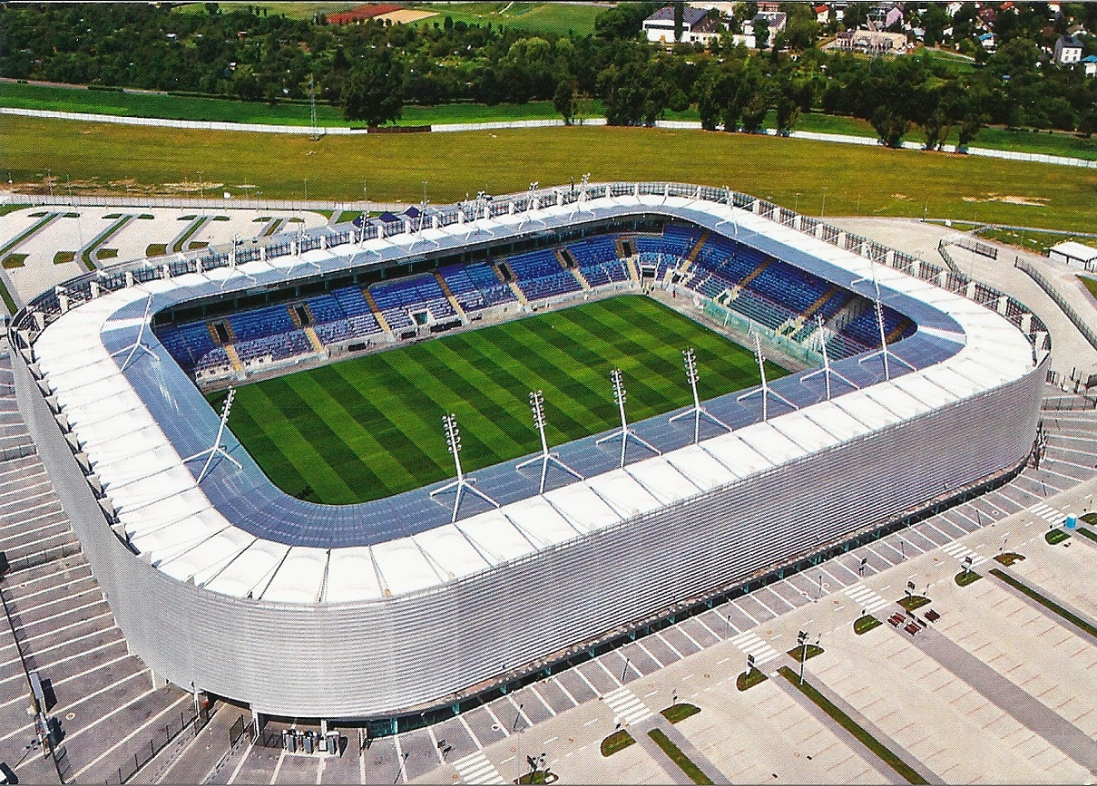
 Sport
Sport
 Afghanistan
Egypt
Armenia
Azerbaijan
Ethiopia
Australia
Bangladesh
Beijing Shi-BJ
Brunei Darussalam
China
Denmark
Demokratische Republik Timor-Leste
Germany
Fidschi
Afghanistan
Egypt
Armenia
Azerbaijan
Ethiopia
Australia
Bangladesh
Beijing Shi-BJ
Brunei Darussalam
China
Denmark
Demokratische Republik Timor-Leste
Germany
Fidschi
 Financial
 International Bank for Cooperation
Finland
France
Georgia
Hongkong Tebiexingzhengqu-HK
India
Indonesia
Iran
Ireland
Iceland
Israel
Italy
Jordan
Cambodia
Kasachstan
Katar
Kyrgyzstan
Laos
Luxembourg
Malaysia
Malediven
Malta
International Bank for Cooperation
Finland
France
Georgia
Hongkong Tebiexingzhengqu-HK
India
Indonesia
Iran
Ireland
Iceland
Israel
Italy
Jordan
Cambodia
Kasachstan
Katar
Kyrgyzstan
Laos
Luxembourg
Malaysia
Malediven
Malta
 Mongolei
Myanmar
Nepal
New Zealand
Netherlands
Norwegen
Oman
Austria
Pakistan
Philippines
Poland
Portugal
Republic of Korea
Russia
Samoa
Saudi Arabia
Sweden
Switzerland
Singapore
Spain
Sri Lanka
South Africa
Tajikistan
Thailand
Turkey
Hungary
Uzbekistan
United Arab Emirates
United Kingdom
Vietnam
Mongolei
Myanmar
Nepal
New Zealand
Netherlands
Norwegen
Oman
Austria
Pakistan
Philippines
Poland
Portugal
Republic of Korea
Russia
Samoa
Saudi Arabia
Sweden
Switzerland
Singapore
Spain
Sri Lanka
South Africa
Tajikistan
Thailand
Turkey
Hungary
Uzbekistan
United Arab Emirates
United Kingdom
Vietnam
 Important International Organizations
 Economy and trade
Economic and political research
Cyprus
Economy and trade
Economic and political research
Cyprus

亚洲基础设施投资银行(英语:Asian Infrastructure Investment Bank,縮寫:AIIB),简称亚投行,是一个愿意向亚洲国家和地區的基础设施建设提供资金支持的政府间性质的亚洲区域多边开发机构,成立的目的是促进亚洲区域的互联互通建设和经济一体化的进程,並且加大中國與其他亚洲國家和地区的合作力度。总部设在中国北京,法定资本为1,000亿美元。[2]
中华人民共和国主席习近平于2013年10月2日在雅加达同印度尼西亚总统苏西洛举行会谈时首次倡议筹建亚投行。[3]2014年10月24日,中国、印度、新加坡等21国在北京正式签署《筹建亚投行备忘录》。[2]2014年11月25日,印度尼西亚签署备忘录,成为亚投行第22个意向创始成员国。[4]
2015年3月12日,英国正式申请作为意向创始成员国加入亚投行,[5]成为正式申请加入亚投行的首个欧洲国家、主要西方国家。[6]随后法国、意大利、德国等西方国家纷纷以意向创始成员国身份申请加入亚投行。[7]接收新意向创始成员国申请截止日期3月31日临近,韩国[8]、俄罗斯[9]、巴西[10]等域内国家和重要新兴经济体也抓紧申请成为亚投行意向创始成员国。
各方商定将于2015年年中完成亚投行章程谈判并签署,年底前完成章程生效程序,正式成立亚投行。[11]
Die Asiatische Infrastrukturinvestmentbank (亞洲基礎設施投資銀行 / 亚洲基础设施投资银行, kurz: 亞投行 / 亚投行, englisch Asian Infrastructure Investment Bank, AIIB) ist eine multilaterale Entwicklungsbank, die 2014 von verschiedenen Staaten gegründet wurde und im Wettbewerb zur Weltbank, zum Internationalen Währungsfonds und zur Asiatischen Entwicklungsbank steht.
Anlass zur Initiative der Gründung war insbesondere die Unzufriedenheit Chinas über eine Dominanz der US-Amerikaner im Internationalen Währungsfonds, der keine faire Verteilung der globalen Machtverhältnisse aus Sicht Chinas widerspiegelte.[2] Da sich die US-Amerikaner strikt weigerten, eine Änderung der Stimmverhältnisse zu implementieren, begann China 2013 mit der Gründung der Initiative. Neben den 21 Gründungsmitgliedern haben im Jahr 2015 auch unter anderem Deutschland, Italien, Frankreich und das Vereinigte Königreich ihr Interesse bekundet, als nicht-regionale Mitglieder die neue Entwicklungsbank zu unterstützen.[3]
Die Gründungsurkunde der AIIB wurde am 29. Juni 2015 von Vertretern aus 57 Ländern in Peking unterzeichnet.[4] Die Bank nahm im Januar 2016 ihre Arbeit ohne Beteiligung der USA und Japan auf.[5]
Joachim von Amsberg ist der "Vizepräsident für Politik und Strategie".
アジアインフラ投資銀行(アジアインフラとうしぎんこう、英: Asian Infrastructure Investment Bank, AIIB、中: 亚洲基础设施投资银行,亞洲基礎設施投資銀行)は、国際開発金融機関のひとつである。
中華人民共和国が2013年秋に提唱し主導する形で発足した[1]。「合計の出資比率が50%以上となる10以上の国が国内手続きを終える」としていた設立協定が発効条件を満たし、2015年12月25日に発足し[2][3]、2016年1月16日に開業式典を行った[1][4]。
57か国を創設メンバーとして発足し[1][5]、2017年3月23日に加盟国は70カ国・地域となってアジア開発銀行の67カ国・地域を超え[6][7]、一方で日本、アメリカ合衆国などは2017年の現時点で参加を見送っている[8]。 創設時の資本金は1000億ドルである[9]。
The Asian Infrastructure Investment Bank (AIIB) is a multilateral development bank that aims to support the building of infrastructure in the Asia-Pacific region. The bank currently has 93 members from around the world [7]. The bank started operation after the agreement entered into force on 25 December 2015, after ratifications were received from 10 member states holding a total number of 50% of the initial subscriptions of the Authorized Capital Stock.[8]
The United Nations has addressed the launch of AIIB as having potential for "scaling up financing for sustainable development"[9] and to improve the global economic governance.[10] The starting capital of the bank was $100 billion, equivalent to 2⁄3 of the capital of the Asian Development Bank and about half that of the World Bank.[11]
The bank was proposed by China in 2013[12] and the initiative was launched at a ceremony in Beijing in October 2014.[13] It received the highest credit ratings from the three biggest rating agencies in the world, and is seen as a potential rival to the World Bank and IMF.[14][15]
La Banque asiatique d'investissement dans les infrastructures (BAII ou AIIB), est une banque d'investissement proposée par la République populaire de Chine dans le but de concurrencer le Fonds monétaire international, la Banque mondiale et la Banque asiatique de développement1 pour répondre au besoin croissant d'infrastructures en Asie du Sud-Est et en Asie centrale. Cette banque s'inscrit dans la stratégie de la nouvelle route de la soie, développée par la Chine.
La Banca Asiatica d'Investimento per le infrastrutture (AIIB), fondata a Pechino nell'ottobre 2014, è un'istituzione finanziaria internazionale proposta dalla Repubblica Popolare Cinese. Si contrappone al Fondo Monetario Internazionale, alla Banca Mondiale e all'Asian Development Bank[1], le quali si trovano sotto il controllo del capitale e delle scelte strategiche dei paesi sviluppati come gli Stati Uniti d'America.[2] Scopo della Banca è fornire e sviluppare progetti di infrastrutture nella regione Asia-Pacifico attraverso la promozione dello sviluppo economico-sociale della regione e contribuendo alla crescita mondiale.
El Banco Asiático de Inversión en Infraestructura (Asian Infrastructure Investment Bank o AIIB) es una institución financiera internacional propuesta por el gobierno de China. El propósito de este banco de desarrollo multilateral es proporcionar la financiación para proyectos de infraestructura en la región de Asia basado en un sistema financiero de préstamo1 y el fomento del sistema de libre mercado en los países asiáticos.
El AIIB está considerado por algunos como una versión continental del FMI y del Banco Mundial, y busca ser un rival por la influencia en la región del Banco de Desarrollo asiático (ADB), el cual esta alineado a los intereses de potencias, tanto regionales (Japón), como globales (Estados Unidos, la Unión Europea).2
El banco fue propuesto por Xi Jinping en 2013 e inaugurado con una ceremonia en Pekín en octubre de 2014. La ONU se a mostrado entusiasta con la propuesta china, a la que a descrito como el FMI del futuro y a señalado como "una gran propuesta para financiar el desarrollo sostenible" y "mejorar la gobernanza económica mundial". La entidad constó inicialmente con 100 mil millones de dolares, es decir, la mitad del dinero de que posee el Banco Mundial.
La entidad a recibido inversión por parte de corporaciones financieras estadounidenses como la Standard & Poor's, Moody's o Fitch Group34. Actualmente la entidad consta de 87 miembros, incluyendo los 57 miembros fundadores. Bélgica, Canadá, y Ucrania están barajando unirse al AIIB. Estados Unidos, Japón y Colombia no tienen intención de participar. China a prohibido a Corea del Norte unirse, instigando además una política de aislamiento contra esta por parte del AIIB.
Азиатский банк инфраструктурных инвестиций (АБИИ) (англ. Asian Infrastructure Investment Bank, AIIB) — международная финансовая организация, создание которой было предложено Китаем. Основные цели, которые преследует АБИИ, — стимулирование финансового сотрудничества в Азиатско-Тихоокеанском регионе, финансирование инфраструктурных проектов в Азии от строительства дорог и аэропортов до антенн связи и жилья экономкласса[1].
По заявлениям вице-премьера России Игоря Шувалова, AБИИ не рассматривается как потенциальный конкурент МВФ, Всемирного банка и Азиатского банка развития (АБР). Однако эксперты рассматривают AIIB как потенциального конкурента базирующихся в США Международного валютного фонда (МВФ) и Всемирного банка. После сообщений об успехах AIIB американский министр финансов США Джейкоб Лью предупредил, что международным финансовым организациям в США, таким как ВБ и МВФ, грозит потеря доверия [2][3].
Китай, Индия и Россия возглавили организацию, оказавшись в тройке крупнейших владельцев голосов. При этом на важнейшие решения КНР имеет фактическое право вето[4].
Belarus
 Berlin
 Brandenburg
 Bremen
Denmark
Germany
Estonia
Finland
France
Bremen
Denmark
Germany
Estonia
Finland
France
 Hamburg
Italy
Latvia
Lithuania
Hamburg
Italy
Latvia
Lithuania
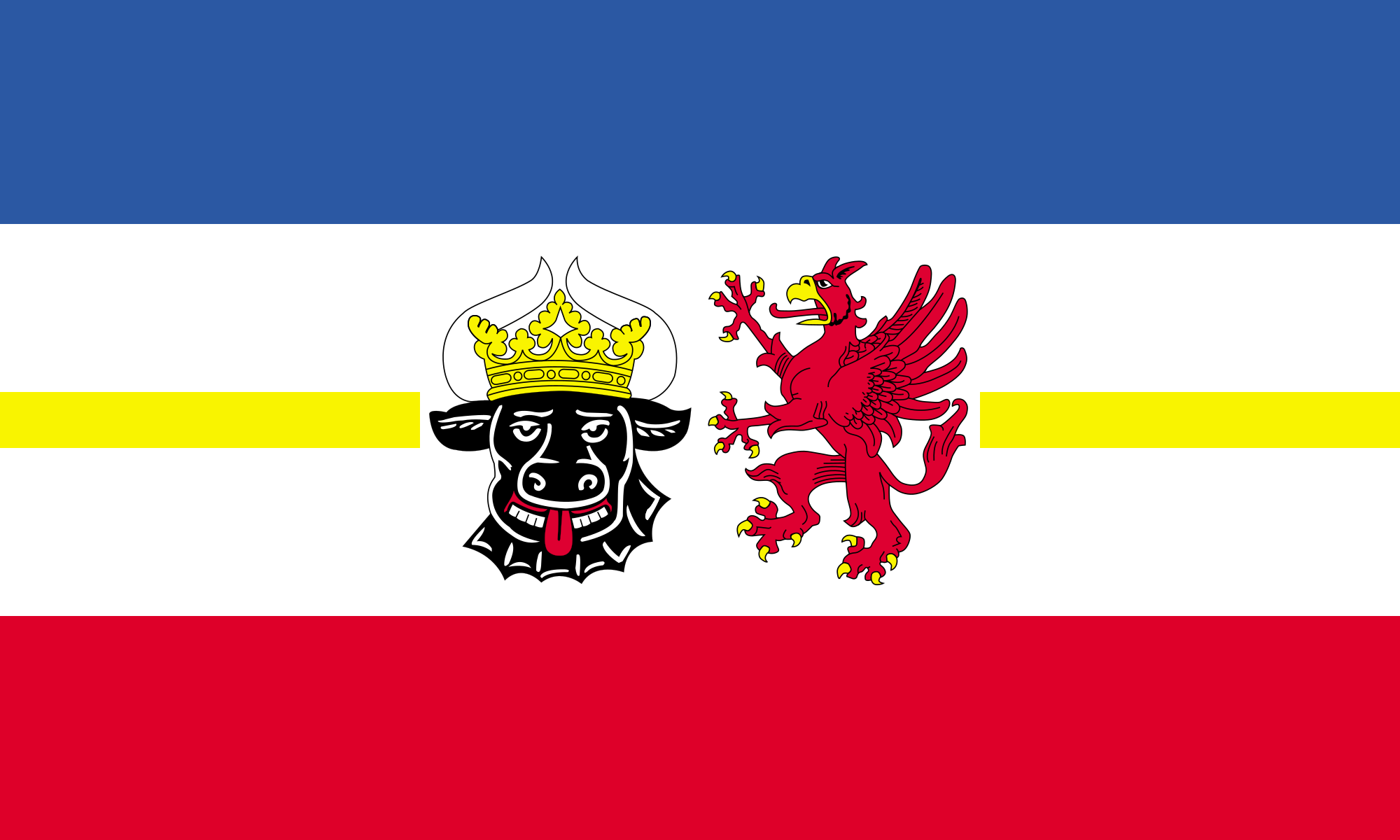 Mecklenburg-Vorpommern
Netherlands
Mecklenburg-Vorpommern
Netherlands
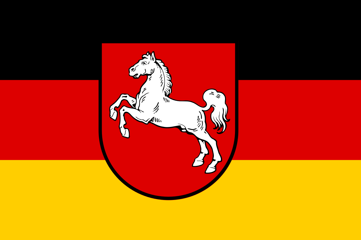 Lower Saxony
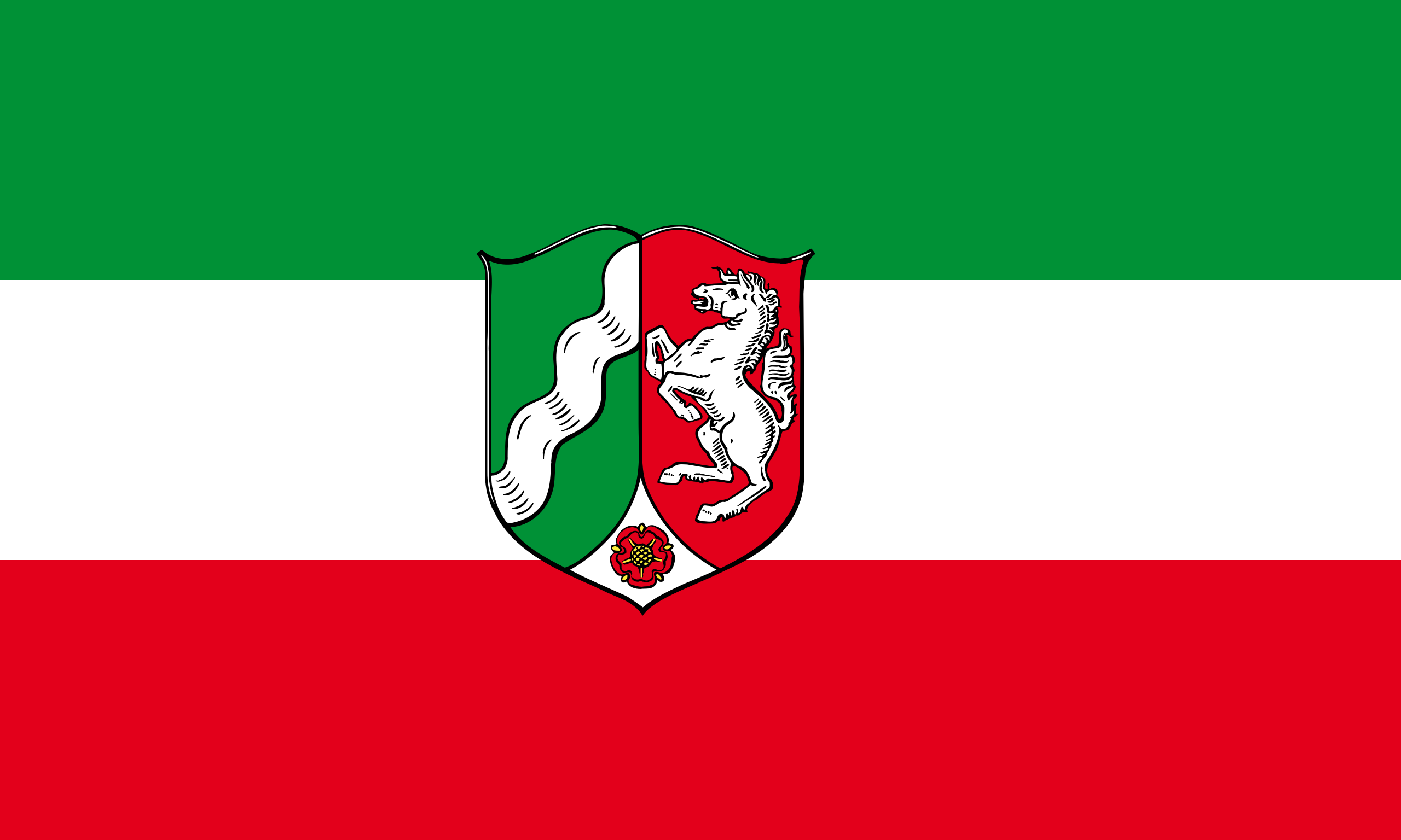 North Rhine-Westphalia
Poland
North Rhine-Westphalia
Poland
 Review
Russia
Review
Russia
 Saxony
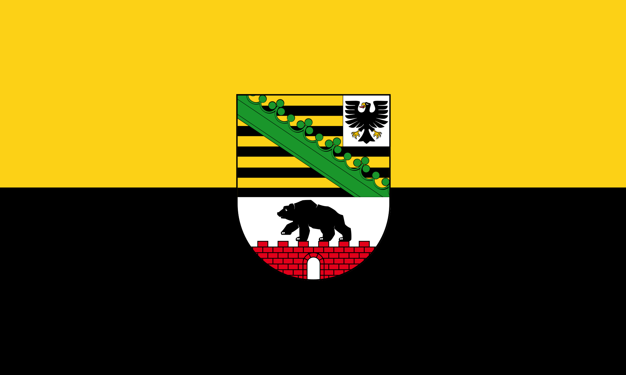 Saxony-Anhalt
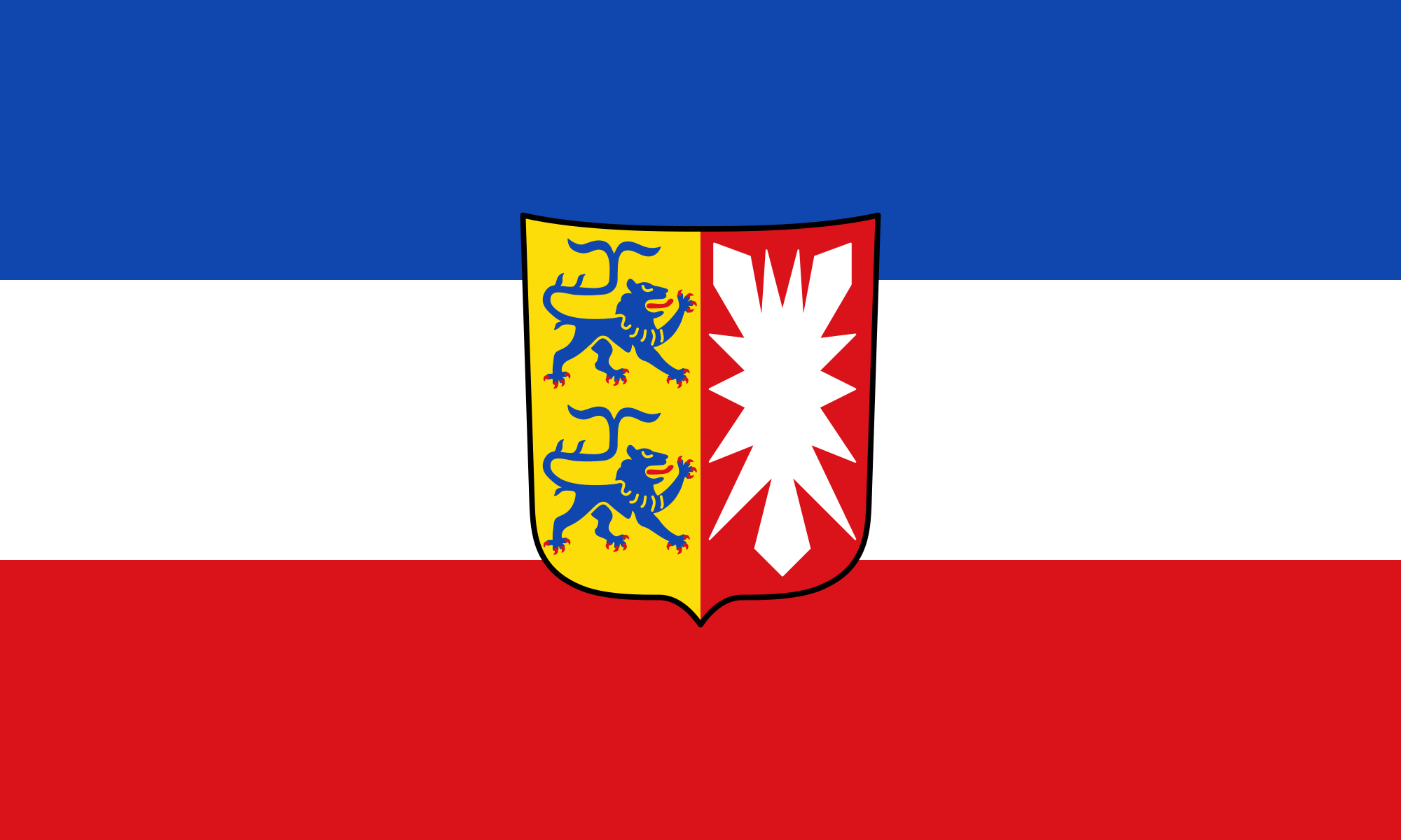 Schleswig-Holstein
Sweden
Switzerland
Schleswig-Holstein
Sweden
Switzerland
 Traditions
 Vacation and Travel
United Kingdom
Vacation and Travel
United Kingdom
 World Heritage
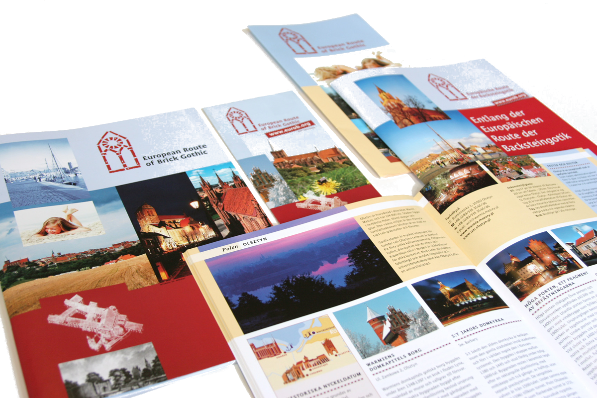
一种特别在德国北海和波罗的海海岸常见的哥特式建筑是用烤砖建造起来的建筑结构.这个十二世纪开始使用那红色的烤砖作为建筑材料的独特建筑风格之所以在北部德国低地如此普及是因为这块地区缺少天然石而且运输也非常困难,由于那片地区和汉萨盟的一 致性,因此它就成为了汉萨同盟的象征.有些历史悠久的建筑也就成了联合国教科文组织世界文化遗产项目之一。
Die Backsteingotik (englisch Brick Gothic, polnisch Gotyk ceglany) umfasst gotische Bauwerke, die aus oder mit sichtbarem Backstein errichtet wurden. Sie ist vor allem in Norddeutschland, dem Ostseeraum und den Niederlanden[1] verbreitet. Ihr Verbreitungsgebiet erstreckt sich im Westen bis an die Straße von Dover und im Südosten bis nach Galizien. Der auch oft verwendete Begriff Norddeutsche Backsteingotik erfasst daher nur einen Teil der gesamten Backsteingotik. Gotische Backsteinarchitektur in Italien und Südfrankreich wird in der Regel allein den dortigen Regionalstilen zugerechnet.
Die mittelalterliche Verwendung von Backstein als Baustoff setzte nördlich der Alpen im 12. Jahrhundert ein. Die ältesten Bauten gehören deshalb noch der so genannten Backsteinromanik an. Im 16. Jahrhundert ging die Backsteingotik in die Backsteinrenaissance über. Die geografische Verbreitung des Bauens aus Backstein und mit sichtbarem Backstein unterlag vom Beginn des Hochmittelalters bis in die frühe Neuzeit aber durchaus Veränderungen. So gab es in Teilen des Münsterlandes zwischen Pionierbauten der Romanik und dem starken Backsteineinsatz in Renaissance und Barock eine zeitliche Lücke.
Viele von der Backsteingotik geprägte Altstädte und Einzelbauten wurden in die Liste des UNESCO-Welterbes aufgenommen.
Brick Gothic (German: Backsteingotik, Polish: Gotyk ceglany, Dutch: Baksteengotiek) is a specific style of Gothic architecture common in Northwest and Central Europe especially in the regions in and around the Baltic Sea, which do not have resources of standing rock, but in many places a lot of glacial boulders. The buildings are essentially built using bricks. Buildings classified as Brick Gothic (using a strict definition of the architectural style based on the geographic location) are found in Belgium (and the very north of France), Netherlands, Germany, Poland, Lithuania, Latvia, Estonia, Kaliningrad (former East Prussia), Sweden and Finland.
As the use of baked red brick arrived in Northwestern and Central Europe in the 12th century, the oldest such buildings are classified as the Brick Romanesque. In the 16th century, Brick Gothic was superseded by Brick Renaissance architecture.
Brick Gothic is characterised by the lack of figural architectural sculpture, widespread in other styles of Gothic architecture. Typical for the Baltic Sea region is the creative subdivision and structuring of walls, using built ornaments and the colour contrast between red bricks, glazed bricks and white lime plaster. Nevertheless, these characteristics are neither omnipresent nor exclusive. Many of the old town centres dominated by Brick Gothic, as well as some individual structures, have been listed as UNESCO World Heritage sites.
The real extent and the real variety of this brick architecture has to be distinguished from the view of late 19th and early 20th century, especially the years around the end of World War I, when it was instrumentalized, politically.
Indeed, about a quarter of medieval Gothic brick architecture is standing in the Netherlands, in Flanders and in French Flanders. Some dominant buildings combinations of brick and stone. But the criterion "no stone at all" looks like a trick to exclude them.[according to whom?] The towers of St Mary church in Lübeck, the very top Brick Gothic church of the Baltic Sea region, have corners of granite ashley. And many village churches in northern Germany and Poland have Brick Gothic design, but most of their walls are formed by boulders.
L'architettura gotica dei paesi baltici è una varietà regionale dell'architettura gotica, in particolare del gotico tedesco. Le aree coinvolte in questa forma di architettura medievale si affacciano sul mar Baltico e sul Mare del Nord e, da un punto di vista politico, comprendevano gli stati settentrionali del Sacro Romano Impero, le città della Lega Anseatica, i possedimenti dell'Ordine Teutonico. Il periodo interessato va dal XIII secolo al XV secolo.
Le caratteristiche distintive sono che si tratta di un'architettura prevalentemente in laterizio e di una rielaborazione originale e per certi aspetti molto distante dall'iniziale gotico francese. I paesi europei attuali che hanno testimonianze di questa architettura sono Germania, Polonia, Lituania, Lettonia, Estonia, e nell'area della storica Prussia Orientale, (Oblast di Kaliningrad Russia); alcune testimonianze sono anche presenti in Scandinavia.
Le gothique de brique (allemand : Backsteingotik) est un style d´architecture gothique du Nord de l´Europe, et plus particulièrement du Nord de l'Allemagne et des régions autour de la mer Baltique. Il s'est surtout répandu dans les villes culturellement allemandes de l'ancienne Ligue Hanséatique à partir du XIIIe siècle, puis bien au-delà par influence (Scandinavie, Flandres, toute la Pologne, Allemagne du Sud). Les bâtiments sont essentiellement constitués de briques et le style de la décoration s'est adapté aux possibilités et aux limites de ce matériaux, conférant à cette architecture une identité bien particulière.
Il existe d'autres styles d'architecture gothique en brique en Europe, plus ou moins indépendants, comme en Italie et dans la région Toulousaine en France. Le style gothique baltique ne comprend pas tout le gothique en brique d'Europe.
El gótico báltico (en alemán, Norddeutsche Backsteingotik), forma la parte mayor del gótico de ladrillos (en alemán: Backsteingotik). Es una variante de la arquitectura gótica y neogótica que apareció en la Europa septentrional. Sin la especificación "Baltico" es estendido del estrecho de Calais a la Galicia de los Cárpatos. Con la especificación "Baltico" esta concentrada en el norte de Alemania y las zonas aledañas al mar Báltico. En todas estas regiones mancan recursos naturales para construir edificios de piedra. Se extendió principalmente en las ciudades culturalmente alemanas de la antigua Liga Hanseática desde el siglo XIII, y luego por influencia (Escandinavia, toda Polonia, el sur de Alemania). Los edificios son esencialmente de ladrillo y el estilo de decoración se ha adaptado a las posibilidades y límites de este material, dando a esta arquitectura una identidad muy particular.
Кирпичная, ганзейская или северогерманская готика — разновидность готического стиля архитектуры, распространённая в Северной Германии, Польше, Белоруссии и Прибалтике в XIII—XVI веках. Красный керамический кирпич как строительный материал стал использоваться в Северной Европе в XII веке, поэтому самые древние кирпичные образцы относятся ещё к так называемой «кирпичной романике». В XVI в. кирпичную готику сменил «кирпичный ренессанс».
Для кирпичной готики характерны, с одной стороны, отсутствие скульптурных украшений, которые невозможно выполнить из кирпича, и, с другой стороны, богатство орнаментальных деталей кладки и структуризация плоскостей за счёт чередования красного либо глазурованного кирпича и известковой побелки стен.
Многие города, внешний облик которых украшают готические сооружения из красного кирпича, являются объектами Всемирного культурного наследия ЮНЕСКО.

 Companies

 Religion

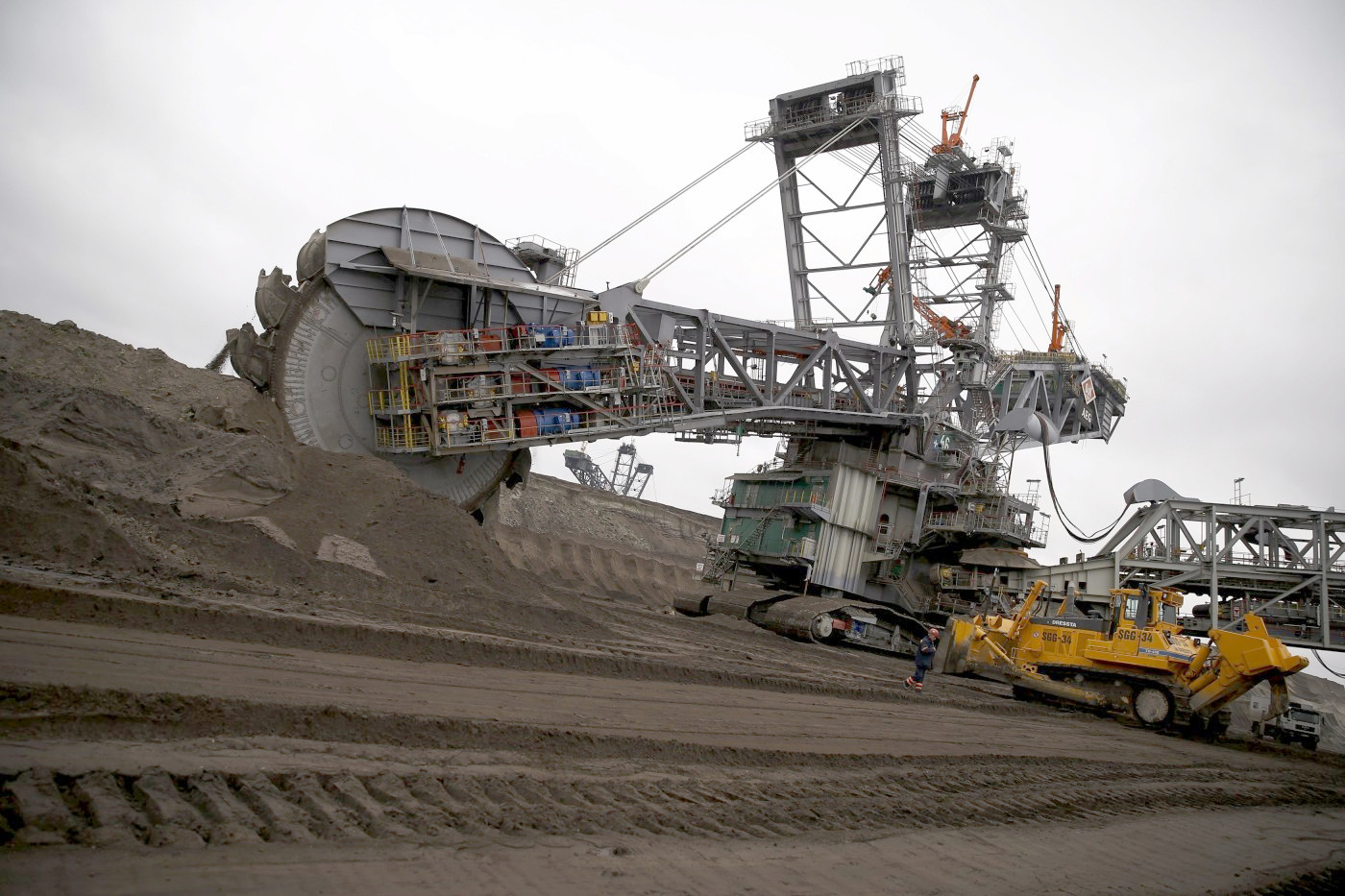
 Energy resource
 History
Belgium
Amber Road
Denmark
Germany
Estonia
France
Greece
Italy
Latvia
Lithuania
Netherlands
Austria
Poland
Russia
Switzerland
Slovakia
Slovenia
Spain
Czech Republic
Hungary
History
Belgium
Amber Road
Denmark
Germany
Estonia
France
Greece
Italy
Latvia
Lithuania
Netherlands
Austria
Poland
Russia
Switzerland
Slovakia
Slovenia
Spain
Czech Republic
Hungary
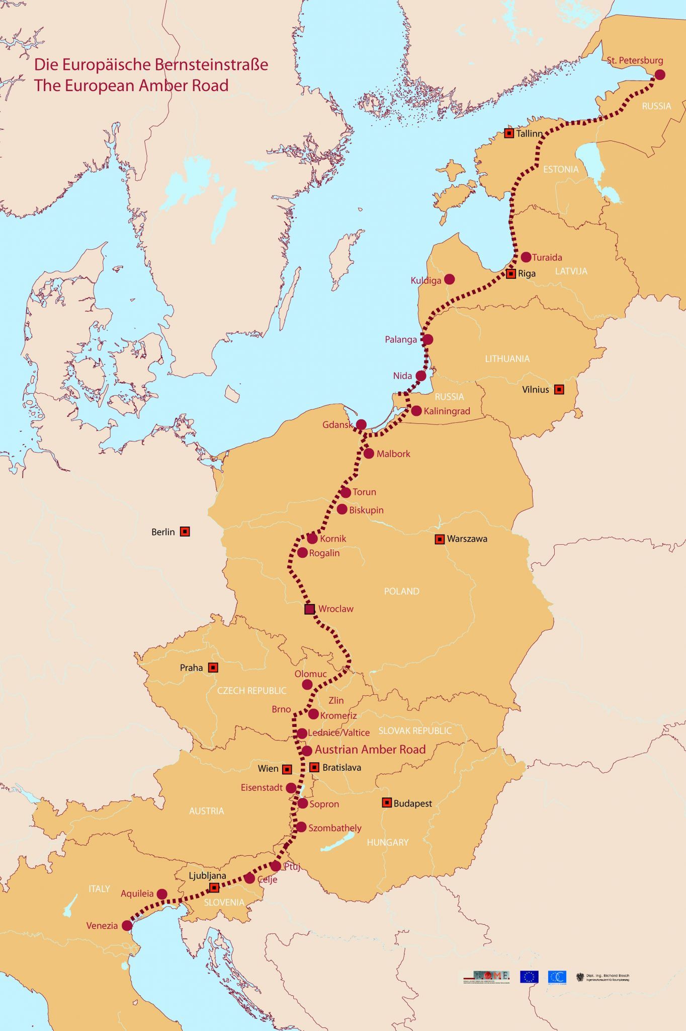
琥珀之路(英语:Amber Road)是一条古代运输琥珀的贸易道路,这条水路和陆路结合而成的通商道路,从欧洲北部的北海和波罗的海通往欧洲南部的地中海,连结了欧洲的多个重要城市,维持了多个世纪。
在公元前后的很长一段时间,琥珀作为装饰品中的重要组成部分,被从北海和波罗的海海岸的产地,经由维斯瓦河和第聂伯河运输到意大利、希腊、黑海和埃及。琥珀之路连结了琥珀的产地和在欧洲、中东地区和远东地区的消费地,并经由另一条通商道路丝绸之路继续通往亚洲。
Als Bernsteinstraße werden verschiedene Handelswege des Altertums (Altstraßen) bezeichnet, auf denen (unter anderem) Bernstein von der Nord- und Ostsee nach Süden in den Mittelmeerraum gelangte. Genau genommen handelt es sich nicht um eine Straße, sondern um unabhängige Handelswege, die für verschiedene Handelsgüter genutzt wurden. Die Bezeichnung „Bernsteinstraße“ tritt etwa ab dem Ende des 18. Jahrhunderts auf und hat in antiken Quellen keine Entsprechung.
China
Italy
Japan
Legend
Nepal
New Zealand
Austria
Poland
Switzerland
United States
United Kingdom
Xizang Zizhiqu-XZ
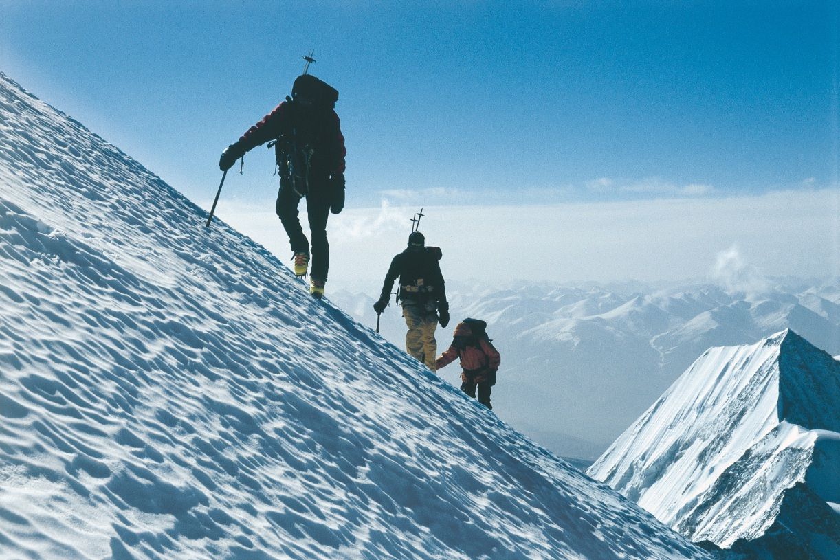

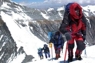
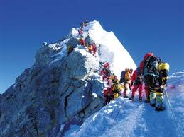

珠穆朗玛峰山体呈巨型金字塔状,威武雄壮昂首天外,地形极端险峻,环境异常复杂。雪线高度:北坡为5800—6200米,南坡为5500—6100米。东北山脊、 东南山脊和西山山脊中间夹着三大陡壁(北壁、东壁和西南壁),在这些山脊 和峭壁之间又分布着548条大陆型冰川,总面积达1457.07平方公里,平均厚度达7260米。冰川的补给主要靠印度洋季风带两大降水带积雪变质形成。冰川上 有千姿百态、瑰丽罕见的冰塔林,又有高达数十米的冰陡崖和步步陷井的明暗 冰裂隙,还有险象环生的冰崩雪崩区。(Quelle:http://news.xinhuanet.com)
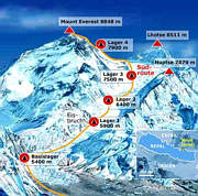
珠穆朗玛峰(藏文:ཇོ་མོ་གླང་མ;藏语拼音:qomolangma;威利:jo mo glang ma,香港称珠穆朗玛峰,台湾称圣母峰),中文简称珠峰,尼泊尔名萨加玛塔峰(尼泊尔语:सगरमाथा),英国名埃佛勒斯峰(英语:Mount Everest),为地球第一高峰,属于喜马拉雅山脉,位于中国西藏自治区与尼泊尔萨加玛塔专区边界上。2005年中国国家测绘局测量的岩面高为8,844.43米(29,017.2英尺),尼泊尔则使用传统的雪盖高8,848米(29,029英尺),BBC报道称2010年起两国官方互相承认对方的测量数据[5],中国国家测绘地理信息局则在2018年2月声明否认此说法,仍采用8,844.43米数据至今[6]。它除了是海拔最高的山峰之外,也是距离地心第五远的高峰。[7]它附近的高峰包括8,516米(27,940英尺)的洛子峰、7,855米(25,771英尺)的努子峰和7,580米(24,870英尺)的章子峰。
清朝经过测绘于1719年出版的全国地图上称此峰为“朱姆朗马阿林”,但没有标出高度或用经纬度标出其位置。1856年英属印度测量局首次公布此峰的经纬度及海拔高度,主张此峰8,840米(29,000英尺)是世界第一高峰。1865年英国皇家地理学会接受印度测量局局长安德鲁·史考特·华欧的建议,将此峰命名为“埃佛勒斯峰”,以纪念前任局长乔治·埃佛勒斯。1952年,中国采用“珠穆朗玛峰”为官方名称。
珠穆朗玛峰吸引了许多登山者。主要的攀登路线有两条,一条从尼泊尔东南部出发,经过与洛子峰之间的南坳登顶,称为“标准路线”;另一条则从西藏的北部出发,经过与章子峰之间的北坳登顶。从标准路线登顶对登山技术的挑战不算高,但这条路线的风险包括雪崩、摔落山谷、高山症、冻伤和通过昆布冰瀑的危险。到2016年为止,山上有超过200具尸体,其中一些成为地标。[8][9]
据气象记载,珠穆朗玛峰山顶最低温度为-60°C,最低月平均温度为-35°C,全年平均温度为-29°C,参照北极、南极,因此也被称为“世界第三极”。[10]
Der Mount Everest ist ein Berg im Himalaya und mit einer Höhe von 8848 m der höchste Berg der Erde. Er gehört zu den 14 Achttausendern und zu den Seven Summits. Der Mount Everest ist seit 1856 nach dem britischen Landvermesser George Everest benannt. Auf Nepali heißt der Berg Sagarmatha, auf Tibetisch Qomolangma (deutsche Aussprache „Tschomolangma“; englische Umschrift Chomolungma).
Der Mount Everest befindet sich im Mahalangur Himal in der Region Khumbu in Nepal an der Grenze zu China (Autonomes Gebiet Tibet); der westliche und südöstliche seiner drei Gipfelgrate bilden die Grenze. Auf nepalesischer Seite ist er Teil des Sagarmatha-Nationalparks, der zum UNESCO-Welterbe gehört. Auf der Nordseite gehört er zum Qomolangma National Nature Reserve, das mit dem von der UNESCO ausgewiesenen Qomolangma-Biosphärenreservat korrespondiert.[1]
Edmund Hillary und Tenzing Norgay gelang am 29. Mai 1953 die Erstbesteigung des „dritten Pols“. Am 8. Mai 1978 bestiegen Reinhold Messner und Peter Habeler den Gipfel erstmals ohne zusätzlichen Sauerstoff.
エベレスト、エヴェレスト(英: Everest)、またはチョモランマ(チベット語: ཇོ་མོ་གླང་མ[1] Chomolungma, Qomolangma)、サガルマータ(ネパール語: सगरमाथा Sagarmāthā)は、ヒマラヤ山脈にある世界最高峰である。
エベレストはインド測量局(Survey of India)で長官を務めたジョージ・エベレストにちなんで命名された。
1920年代から長きにわたる挑戦の末、1953年にイギリス探検隊のメンバーでニュージーランド出身の登山家であるエドモンド・ヒラリーとネパール出身のシェルパであるテンジン・ノルゲイによって初登頂がなされた。
エベレストの標高については諸説あり、1954年にインド測量局が周辺12ヶ所で測定しその結果を平均して得られた8,848 mという数値が長年一般に認められてきた。1999年、全米地理学協会はGPSによる測定値が8,850mだったと発表した[2]。厳密には地殻変動などの影響によって標高は年々変動していると考えられている。
エベレストの南麓に位置するネパールのサガルマータ国立公園はユネスコの世界遺産に登録されている。
Mount Everest, known in Nepali as Sagarmatha (सगरमाथा) and in Tibetan as Chomolungma (ཇོ་མོ་གླང་མ), is Earth's highest mountain above sea level, located in the Mahalangur Himal sub-range of the Himalayas. The international border between Nepal (Province No. 1) and China (Tibet Autonomous Region) runs across its summit point.
The current official elevation of 8,848 m (29,029 ft), recognized by China and Nepal, was established by a 1955 Indian survey and subsequently confirmed by a Chinese survey in 1975.[1] In 2005, China remeasured the rock height of the mountain, with a result of 8844.43 m. There followed an argument between China and Nepal as to whether the official height should be the rock height (8,844 m., China) or the snow height (8,848 m., Nepal). In 2010, an agreement was reached by both sides that the height of Everest is 8,848 m, and Nepal recognizes China's claim that the rock height of Everest is 8,844 m.[5]
In 1865, Everest was given its official English name by the Royal Geographical Society, upon a recommendation by Andrew Waugh, the British Surveyor General of India. As there appeared to be several different local names, Waugh chose to name the mountain after his predecessor in the post, Sir George Everest, despite George Everest's objections.[6]
Mount Everest attracts many climbers, some of them highly experienced mountaineers. There are two main climbing routes, one approaching the summit from the southeast in Nepal (known as the "standard route") and the other from the north in Tibet. While not posing substantial technical climbing challenges on the standard route, Everest presents dangers such as altitude sickness, weather, and wind, as well as significant hazards from avalanches and the Khumbu Icefall. As of 2017, nearly 300 people have died on Everest, many of whose bodies remain on the mountain.[7]
The first recorded efforts to reach Everest's summit were made by British mountaineers. As Nepal did not allow foreigners into the country at the time, the British made several attempts on the north ridge route from the Tibetan side. After the first reconnaissance expedition by the British in 1921 reached 7,000 m (22,970 ft) on the North Col, the 1922 expedition pushed the north ridge route up to 8,320 m (27,300 ft), marking the first time a human had climbed above 8,000 m (26,247 ft). Seven porters were killed in an avalanche on the descent from the North Col. The 1924 expedition resulted in one of the greatest mysteries on Everest to this day: George Mallory and Andrew Irvine made a final summit attempt on 8 June but never returned, sparking debate as to whether or not they were the first to reach the top. They had been spotted high on the mountain that day but disappeared in the clouds, never to be seen again, until Mallory's body was found in 1999 at 8,155 m (26,755 ft) on the north face. Tenzing Norgay and Edmund Hillary made the first official ascent of Everest in 1953, using the southeast ridge route. Norgay had reached 8,595 m (28,199 ft) the previous year as a member of the 1952 Swiss expedition. The Chinese mountaineering team of Wang Fuzhou, Gonpo, and Qu Yinhua made the first reported ascent of the peak from the north ridge on 25 May 1960.[8][9]
L’Everest, en tibétain ཇོ་མོ་གླང་མ, Qomolangma ou encore Chomolungma, en népalais सगरमाथा, Sagarmāthā, aussi appelé mont Everest, est une montagne située dans la chaîne de l'Himalaya, à la frontière entre le Népal (province no 1 (en)) et la Chine (Tibet).
Il est aperçu par des Européens pour la première fois en 1847 puis, après quelques années d'observations et de calculs, son altitude est établie à 8 848 mètres et il est identifié comme le plus haut sommet du monde. Cette caractéristique lui vaut d'être baptisé de son nom actuel par les Occidentaux en 1865 et, dès les années 1920, de lui attirer l'intérêt des alpinistes qui se lancent à l'assaut de ses pentes. Plusieurs expéditions, en particulier britanniques, se succèdent depuis le versant nord au Tibet. Toutefois, les conditions climatiques extrêmes font leurs premières victimes, parmi lesquelles George Mallory et Andrew Irvine, en 1924, dont on ne saura probablement jamais avec certitude s'ils ont atteint le sommet. En 1950, le Népal autorise l'accès à la montagne depuis le sud offrant des possibilités d'ascension par l'arête Sud-Est, moins périlleuse. Finalement, trois ans plus tard, Edmund Hillary et Tensing Norgay réussissent à vaincre l'Everest. Dès lors, les exploits en tous genres s'enchaînent, alimentant les fantasmes populaires ; mais, en 1996, une série d'accidents mortels vient rappeler les dangers liés à la montagne, portant de nos jours à plus de 200 le nombre de victimes. Pourtant, le tourisme de masse se popularise, fragilisant le milieu naturel malgré les créations du parc national de Sagarmatha en 1976 et de la réserve naturelle du Qomolangma en 1988. Ainsi, plus de 14 000 alpinistes ont tenté l'ascension depuis 1922 et plus de 4 000 l'ont réussie, bien aidés, pour la majorité d'entre eux, par les porteurs sherpas.
Il monte Everest (pron. /ˈɛverest/[1]) è la vetta più alta del continente asiatico e della Terra con i suoi 8 848 m di altitudine s.l.m., situato nella catena dell'Himalaya assieme ad altri ottomila, al confine fra Cina e Nepal. Rientra dunque nelle cosiddette Sette Vette del Pianeta.
El monte Everest es la montaña más alta del planeta Tierra, con una altitud de 8.848 metros (29 029 pies) sobre el nivel del mar.1 Está localizada en el continente asiático, en la cordillera del Himalaya, concretamente en la subcordillera de Mahalangur Himal; marca la frontera entre China y Nepal, considerada como la frontera más alta del mundo.[cita requerida] El macizo incluye los picos vecinos Lhotse, 8516 m (27 940 pies); Nuptse, 7855 m (25 771 pies) y Changtse, 7580 m (24 870 pies).
 Animal world
 Geography
