
Deutsch-Chinesische Enzyklopädie, 德汉百科
 国际城市
国际城市
 图林根州
图林根州
 文化遗产
文化遗产
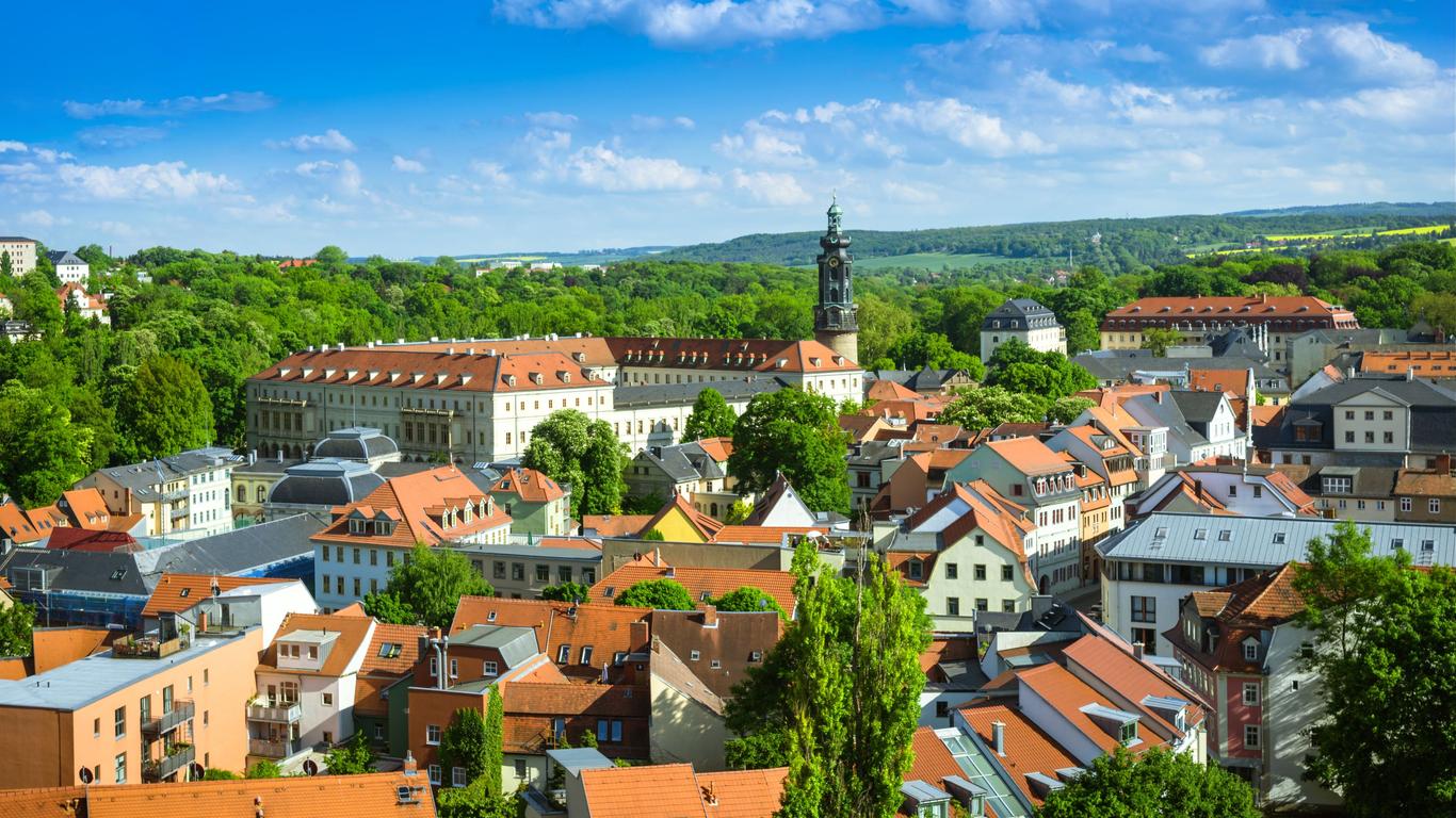
就像雅典曾是欧洲文化的心脏一样,魏玛也有过作为德国文化中心的辉煌时代。两位文坛巨擘歌德和席勒曾在这里创作出不朽的文学作品,李斯特等世界闻名的 艺术家也曾在这里生活。魏玛代表着古典文化的传统,被人们赞誉为德国的雅典。魏玛位于图林根州府以东20公里,人口6万,是座风景优美、古色古香的城市。 它依偎在埃特斯山的怀抱中,清澈的伊尔姆河水从身边静静的流过,掩映在树木花丛中的中世纪建筑物,以及富有田园诗风味的公园,还有矗立在公园和街头的雕 像,都给魏玛增添了无穷的魅力。丹麦童话作家安徒生曾说过,魏玛不是一座有公园的城市,而一座有城市的公园。 当然,魏玛的魅力更在于它的悠久历史和文化传统。公元975年,皇帝奥托二世在这里大会诸侯,使这座千年古城首次载入史册。从1547年起,魏玛成为萨克 森-魏玛公国(后为大公国)的京城。城里的故宫和郊区的贝尔维德雷宫及梯夫特宫就是当年留下的宫邸。这个诸侯国小国寡民,无力争雄,于是历代邦君都把注意 力集中在文化艺术方面。公爵卡尔·奥古斯特(1758-1828)特意邀请在文坛初露才华的歌德来担任大臣。1775年年仅26岁的歌德来到魏玛,在这里 一直生活到1832年逝世。他的非凡才华,为魏玛开创了第一个文化上的黄金时代。歌德不少千古传世的作品都是在这里创作的,他的巨著《浮士德》也完成于魏 玛。诗人和剧作家席勒也两度在魏玛生活,并在这里写了剧本《威廉·退尔》。此剧歌颂了瑞士传奇式的自由英雄,鼓舞了人民反抗专制的斗争意志。然而受到奥古 斯特公爵资助的不仅有歌德和席勒。
魏玛(德语:Weimar)位于德国中部的联邦州图林根,埃特斯山的山脚,伊尔姆河的河畔。德国历史上第一个统一共和国——魏玛共和国和历史上第一部民主宪法正是在这里诞生。这里是现代设计——包豪斯的发源地,对世界艺术与设计的发展有着巨大的贡献。虽然它仅有6万人口,但却是一座风景优美、古色古香充满着文化气息的都市。这里有着各种各样的博物馆,在宫殿博物馆和市立博物馆里有很多国家收藏的艺术品。在德国的国家大剧院前面有著名雕刻家恩斯特·里彻尔所创作的歌德和席勒纪念雕像。1998年,“古典魏玛”(Classical Weimar)被列为世界文化遗产。
Weimar ist eine kreisfreie Stadt in Thüringen in Deutschland, die vor allem für ihr kulturelles Erbe bekannt ist. Weimar liegt an einem Bogen der Ilm südöstlich des Ettersberges, des mit 478 Metern höchsten Berges im Thüringer Becken. Die Stadt ist nach Erfurt, Jena und Gera die viertgrößte Thüringens und liegt etwa auf halbem Wege zwischen Erfurt im Westen und Jena im Osten.
Weimar ist ein Mittelzentrum, das zum Teil Funktionen eines Oberzentrums erfüllt und seit 2004 offiziell als Universitätsstadt bezeichnet wird. Neben der Bauhaus-Universität beherbergt die Stadt die Hochschule für Musik Franz Liszt und die Herzogin Anna Amalia Bibliothek. Außerdem haben in Weimar zahlreiche Behörden ihren Sitz, zum Beispiel das Thüringer Oberverwaltungsgericht, das Thüringer Landesverwaltungsamt, der Thüringer Verfassungsgerichtshof und das Thüringische Landesamt für Denkmalpflege und Archäologie.
Zum kulturellen Erbe der Stadt gehören neben den Traditionen der Weimarer Klassik um Wieland, Goethe, Herder und Schiller auch das Bauhaus und die Nationalversammlung von 1919, von der sich der Name der Weimarer Republik herleitet, sowie eine Vielzahl weiterer hochrangiger kultureller Hinterlassenschaften aus dem 16. Jahrhundert (Lucas Cranach d. Ä. und d. J.), 17. Jahrhundert (Gründung der Fruchtbringenden Gesellschaft), 18. Jahrhundert (Johann Sebastian Bach), 19. Jahrhundert (genannt seien Franz Liszt, Richard Strauss, Friedrich Nietzsche, die Landschaftsmaler der Weimarer Malerschule an der Großherzoglich-Sächsischen Kunstschule Weimar) und 20. Jahrhundert (Harry Graf Kessler, Henry van de Velde). Das Bauhaus und seine Stätten in Weimar (und Dessau) wurden 1996, das „klassische Weimar“ im Dezember 1998 von der UNESCO zum Weltkulturerbe erklärt. Die zuletzt genannte Entscheidung wurde begründet mit der „großen kunsthistorischen Bedeutung öffentlicher und privater Gebäude und Parklandschaften aus der Blütezeit des klassischen Weimar.“[2] Zudem wurde der im Goethe- und Schiller-Archiv in Weimar aufbewahrte Nachlass Goethes 2001 von der UNESCO in das kulturelle Gedächtnis der Menschheit als Weltdokumentenerbe (Memory of the World) aufgenommen. Zum Weltdokumentenerbe zählen seit 2015 auch frühe Schriften der Reformation, von denen ein Teil in der Herzogin Anna Amalia Bibliothek in Weimar aufbewahrt werden. In über 25 Museen und Ausstellungsorten wird das kulturelle Erbe von nationalem und internationalem Rang präsentiert.
Weimar war seit 1547/52 Haupt- und Residenzstadt des Herzogtums Sachsen bzw. Sachsen-Weimar, später Sachsen-Weimar-Eisenach (seit 1815: Großherzogtum). Dies war der erste Staat Deutschlands, der sich eine Verfassung gab (1816). Von 1920 bis 1952 war Weimar die Hauptstadt des Landes Thüringen. 1999 war sie Kulturhauptstadt Europas.
ヴァイマル(Weimar ドイツ語発音: [ˈvaɪmaɐ])は、ドイツ・テューリンゲン州の都市で、主要な歴史的文化都市のひとつ。ワイマール、ヴァイマール、ワイマル、ヴァイマー、ワイマー、ウァイマーなどとも表記される。慣用的に「ワイマール」と表記されることが多い。
面積は84,27 km2、人口は約64,000人。主な宗教はキリスト教プロテスタントルター派。1999年には欧州文化首都に選ばれている。
Weimar (German pronunciation: [ˈvaɪmaɐ̯]; Latin: Vimaria or Vinaria) is a city in the federal state of Thuringia, Germany. It is located between Erfurt in the west and Jena in the east, approximately 80 kilometres (50 miles) southwest of Leipzig, 170 kilometres (106 miles) north of Nuremberg and 170 kilometres (106 miles) west of Dresden. Together with the neighbour-cities Erfurt and Jena it forms the central metropolitan area of Thuringia with approximately 500,000 inhabitants, whereas the city itself counts a population of 65,000. Weimar is well known because of its large cultural heritage and its importance in German history.
The city was a focal point of the German Enlightenment and home of the leading characters of the literary genre of Weimar Classicism, the writers Johann Wolfgang von Goethe and Friedrich Schiller. In the 19th century, famous composers like Franz Liszt made a music centre of Weimar and later, artists and architects like Henry van de Velde, Wassily Kandinsky, Paul Klee, Lyonel Feininger and Walter Gropius came to the city and founded the Bauhaus movement, the most important German design school of the interwar period. However, the political history of 20th-century Weimar was inconsistent: it was the place where Germany's first democratic constitution was signed after the First World War, giving its name to the Weimar Republic period in German politics (1918–33), as well as one of the cities mythologized by the National Socialist propaganda.
Until 1948, Weimar was the capital of Thuringia. Today, many places in the city centre have been designated as UNESCO World Heritage sites (either as part of the Weimar Classicism complex or as part of the Bauhaus complex) and tourism is one of the leading economic sectors of Weimar. Relevant institutions in Weimar are the Bauhaus University, the Liszt School of Music, the Duchess Anna Amalia Library and two leading courts of Thuringia (the Supreme Administrative Court and Constitutional Court). In 1999, Weimar was the European Capital of Culture.
Weimar est une ville d'Allemagne, traversée par l'Ilm. Elle se situe dans le land de Thuringe (en allemand Thüringen). Sa population est d'environ 65 000 habitants, ce qui en fait la quatrième ville la plus peuplée de Thuringe après Erfurt, Iéna et Gera. Ville aux nombreux monuments historiques, Weimar a été inscrit par l'UNESCO au patrimoine mondial en décembre 19981 et a été nommée capitale européenne de la culture en 1999.
Weimar, in italiano arcaico Vimaria[2], è una città extracircondariale di 65.479 abitanti[1] della Turingia, in Germania. È uno dei maggiori centri culturali della Germania e appartiene al Patrimonio dell'umanità dell'UNESCO con i siti Weimar classica e Il Bauhaus e i suoi siti a Weimar e Dessau. Nelle sue vicinanze, a circa 8 km, si trovava il campo di concentramento di Buchenwald dove, fra il 1937 e il 1943 furono uccise più di 54.000 persone. La località ospita ora un centro di memorie e di documentazione.
Il nome di Weimar è associato anche alla cosiddetta "Repubblica di Weimar", nome dato al governo della Germania nel periodo che va dal 1919 al 1933, cioè dalla fine della prima guerra mondiale alla presa del potere da parte dei nazionalsocialisti. Il nome è dovuto al fatto che il Congresso nazionale, per approvare la nuova costituzione della repubblica tedesca, si riunì proprio a Weimar, al Deutsches Nationaltheater.
Weimar es una ciudad del estado federado de Turingia en Alemania, conocida por su rico legado cultural. Está situada a orillas del río Ilm y al pie de la montaña Ettersberg al norte del bosque de Turingia. La ciudad está dividida en trece distritos.
Weimar fue el centro del movimiento Bauhaus. La obra de la Bauhaus en Weimar y en Dessau fueron nombradas Patrimonio de la Humanidad por la Unesco en 1996.1
El conjunto de las edificaciones conocidas como Weimar clásico fueron declaradas Patrimonio de la Humanidad por la Unesco en 1998, destacando la alta calidad artística tanto de los edificios como de los parques públicos y privados en la ciudad y sus alrededores, que testimonian el notable florecimiento cultural del periodo clásico en Weimar.2 El mecenazgo de los duques de Sajonia-Weimar-Eisenach atrajo a muchos destacados escritores y eruditos de Alemania, haciendo de Weimar el principal centro cultural europeo de la época.
La ciudad fue seleccionada Capital Europea de la Cultura en 1999.
Ве́ймар, Ва́ймар (нем. Weimar, произ.:[ˈvaɪmaɐ̯]) — город окружного подчинения в Германии, в федеральной земле Тюрингия. Население — 65,2 тыс. человек (2010).
 巴伐利亚州
联邦德国
欧洲流行歌曲大赛
2006年世界杯足球赛
欧洲足球锦标赛 2020
巴伐利亚州
联邦德国
欧洲流行歌曲大赛
2006年世界杯足球赛
欧洲足球锦标赛 2020
 欧洲足球锦标赛 2024
 地理
地理
地理
地理
 *全球最宜居城市
 历史
公元 1500 - 2000
历史
公元 1000 - 1500
历史
公元 2000 - 2100
国际城市
***全球城市经济竞争力
夏季奥林匹克运动会
1972夏季奥林匹克运动会
历史
公元 1500 - 2000
历史
公元 1000 - 1500
历史
公元 2000 - 2100
国际城市
***全球城市经济竞争力
夏季奥林匹克运动会
1972夏季奥林匹克运动会
 假期和旅游
假期和旅游
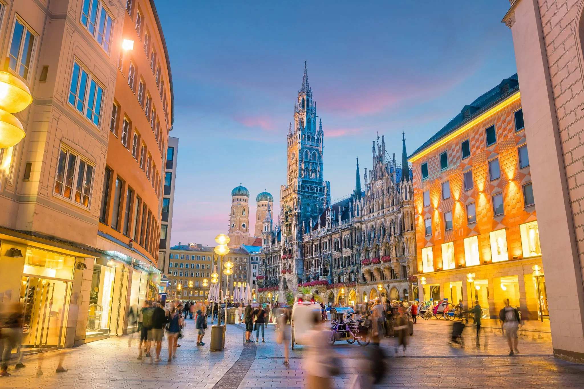
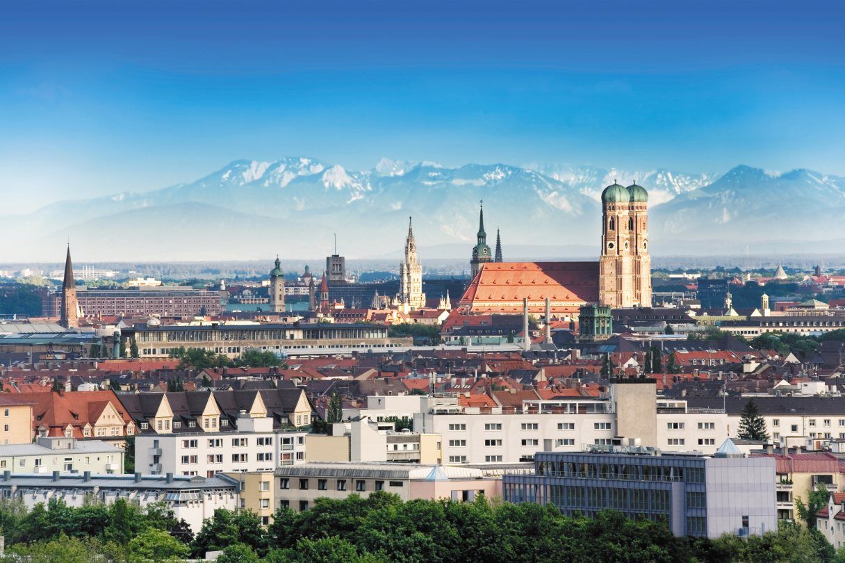
München (hochdeutsch  [ˈmʏnçn̩] oder [ˈmʏnçən̩];[4] bairisch [ˈmɪŋ(:)ɐ]) ist die Landeshauptstadt des Freistaates Bayern. Sie ist mit rund 1,5 Millionen Einwohnern die einwohnerstärkste Stadt Bayerns und (nach Berlin und Hamburg) die nach Einwohnern drittgrößte Gemeinde Deutschlands sowie die viertgrößte Stadt im deutschsprachigen Raum und zwölftgrößte der Europäischen Union. Im Ballungsraum München leben mehr als 2,9 Millionen Menschen,[5][6] die flächengrößere europäische Metropolregion München umfasst rund 5,7 Millionen Einwohner.
Die Landeshauptstadt ist eine kreisfreie Stadt und bayerische Metropole,[7] zudem Verwaltungssitz des die Stadt umgebenden gleichnamigen Landkreises mit dem Landratsamt München als Verwaltung, des Bezirks Oberbayern und des Regierungsbezirks Oberbayern.
München wird zu den Weltstädten gezählt.[8] Die Metropole ist eine der wirtschaftlich erfolgreichsten und am schnellsten wachsenden Europas. Sie ist Sitz zahlreicher Konzerne, darunter fünf DAX-Unternehmen (Allianz, BMW, Linde, Munich Re, Siemens). Hier befindet sich die einzige Börse Bayerns. In der Städteplatzierung des Beratungsunternehmens Mercer belegte München im Jahr 2018 unter 231 Großstädten weltweit den dritten Platz nach Lebensqualität.[9] Laut dem Magazin Monocle war es 2018 sogar die lebenswerteste Stadt der Welt.[10] Andererseits wird die Lebensqualität zunehmend durch Agglomerationsnachteile, wie Verkehrs- und Umweltbelastung sowie sehr hohe Wohneigentumspreise und Mieten[11][12] eingeschränkt, weshalb auch die Wohnfläche pro Einwohner weit unter dem Bundesdurchschnitt liegt.[13] München gilt als sicherste Kommune unter den deutschen Großstädten über 200.000 Einwohnern hinsichtlich der Kriminalitätsrate aller Straftaten.[14]
München wurde 1158 erstmals urkundlich erwähnt.[15] Die Stadt wurde 1255 bayerischer Herzogssitz, war von 1328 bis 1347 kaiserliche Residenzstadt und wurde 1506 alleinige Hauptstadt Bayerns. München ist Sitz zahlreicher nationaler und internationaler Behörden sowie wichtiger Universitäten und Hochschulen, bedeutender Museen und Theater. Durch eine große Anzahl sehenswerter Bauten samt geschützten Baudenkmälern und Ensembles, internationaler Sportveranstaltungen, Messen und Kongresse sowie das weltbekannte Oktoberfest ist München ein Anziehungspunkt für den internationalen Tourismus.
ミュンヘン(ドイツ語: München, ドイツ語発音: [ˈmʏnçən] ( 音声ファイル)[2], バイエルン語: Minga)は、イーザル川河畔にありバイエルンアルプスの北側に位置する都市。ドイツの連邦州であるバイエルン州最大の都市であり、同州の州都でもある。
ミュンヘン(標準ドイツ語:München, バイエルン語:Minga〔ミンガ〕、ミュンヘン方言:Münchn〔ミュンヒン〕)という名は僧院という意味で、ドイツ語で僧を表す「メンヒ」に由来する。漢字表記は「民顕」。"che" の部分の無声硬口蓋摩擦音 [ç] の音写を表すために、[hə]/[xə] の発音を示す「ヘ」ではなく、[çə] の発音を示す「ヒェ」を用い、「ミュンヒェン」とも表記される(こちらのほうがドイツ語の発音に近い)。また "Mü" の発音は正確には「ミュ」ではなく、[mʏ] であり、[ʊ] の形に唇を開き、[ɪ] と発音した音に近い。同じ上部ドイツ語に属するアレマン語では、Münche(ミュンヒェ/ミュンキェ)と発音される。英語やフランス語では Munich(英語:ミューニック[mjú:nik]/仏語:ミュニク[mynik])、イタリア語では Monaco(モナコ公国との区別のために、「バイエルンの」という意味の語をつけてMonaco di Baviera, モナコ・ディ・バヴィエラ)と呼ばれる。
ミュンヘンはベルリン、ハンブルクに次いでドイツでは3番目に大きな都市で、市域人口は140万人近くに達する。1972年にミュンヘンオリンピックが開催された。
ミュンヘンの標語は「ミュンヘンはあなたを愛している。」 "München mag Dich" だが、2006年以前は "Weltstadt mit Herz" 「心を持つ国際都市」であった。ミュンヘンの市章には地名の由来となった僧が表現され、黒と金の配色の市旗は神聖ローマ帝国の色で市の公式の色としてルートヴィヒ4世の時代以来使われている。
今日のミュンヘンは金融、出版の中心都市でたびたび、移住者などが住むのに適した場所として上位に位置付けられる。2011年のマーサー・ヒューマン・リソース・コンサルティングによる世界で最も居住に適した都市では4位を獲得した[3]。2010年のライフスタイルマガジンMonocleの調査では5位に付けており、未だにドイツの都市の中では高い位置にある[4]。経済的、社会的革新に関する162の指標の分析を基にした調査では2thinknowイノベーション都市指数で289都市中、世界では15位、ドイツ国内では5位に付けた[5]。
Munich (/ˈmjuːnɪk/; German: München [ˈmʏnçn̩] ( listen);[2] Austro-Bavarian: Minga [ˈmɪŋ(ː)ɐ]) is the capital and the most populated city in the German state of Bavaria, on the banks of the River Isar north of the Bavarian Alps. Munich is also the third largest city in Germany, after Berlin and Hamburg, and the 12th largest city in the European Union, with a population of around 1.5 million.[3] The Munich Metropolitan Region is home to 6 million people.[4]
The city is a major centre of art, technology, finance, publishing, culture, innovation, education, business, and tourism in Germany and Europe and enjoys a very high standard and quality of living, reaching first in Germany and third worldwide according to the 2018 Mercer survey,[5] and being rated the world's most liveable city by the Monocle's Quality of Life Survey 2018.[6] According to the Globalization and World Rankings Research Institute Munich is considered an alpha-world city, as of 2015.[7]
The name of the city is derived from the Old/Middle High German term Munichen, meaning "by the monks". It derives from the monks of the Benedictine order, who ran a monastery at the place that was later to become the Old Town of Munich; hence the monk depicted on the city's coat of arms. Munich was first mentioned in 1158. Catholic Munich strongly resisted the Counter-Reformation and was a political point of divergence during the resulting Thirty Years' War, but remained physically untouched despite an occupation by the Protestant Swedes.[8][citation needed] Once Bavaria was established as a sovereign kingdom in 1806, it became a major European centre of arts, architecture, culture and science. In 1918, during the German Revolution, the ruling house of Wittelsbach, which had governed Bavaria since 1180, was forced to abdicate in Munich and a short-lived socialist republic was declared.
In the 1920s, Munich became home to several political factions, among them the NSDAP. The first attempt of the Nazi movement to take over the German government in 1923 with the Beer Hall Putsch was stopped by the Bavarian police in Munich with gunfire. After the Nazis' rise to power, Munich was declared their "Capital of the Movement". During World War II, Munich was heavily bombed and more than 50% of the entire city and up to 90% of the historic centre were destroyed. After the end of postwar American occupation in 1949, there was a great increase in population and economic power during the years of Wirtschaftswunder, or "economic miracle". Unlike many other German cities which were heavily bombed, Munich restored most of its traditional cityscape and hosted the 1972 Summer Olympics. The 1980s brought strong economic growth, high-tech industries and scientific institutions, and population growth. The city is home to major corporations like BMW, Siemens, MAN, Linde, Allianz and MunichRE.
Munich is home to many universities, museums and theatres. Its numerous architectural attractions, sports events, exhibitions and its annual Oktoberfest attract considerable tourism.[9] Munich is one of the most prosperous and fastest growing cities in Germany. It is a top-ranked destination for migration and expatriate location, despite being the municipality with the highest population density in Germany (4,500 people per km²) . Munich hosts more than 530,000 people of foreign background, making up 37.7% of its population.[10]
Munich (/my.nik/) (München en allemand, prononcé : [ˈmʏnçən] Écouter ; Minga en bavarois) est une ville du sud de l'Allemagne et la capitale du Land de Bavière. Avec 1 548 319 habitants intra-muros au 30 juin 20171 et 2 351 706 habitants dans son aire urbaine2, elle est la troisième ville d'Allemagne par la population après Berlin et Hambourg. La Région métropolitaine de Munich, qui englobe également Augsbourg et Ingolstadt, compte quant à elle plus de cinq millions d'habitants. Traversée par l'Isar, affluent du Danube, elle se situe dans le district de Haute-Bavière, au pied des Alpes bavaroises.
Le nom de la ville provient du vieux haut-allemand Munichen (« par les moines »), en raison de la présence d'un monastère bénédictin à l'emplacement actuel de la vieille ville ; l'héraldique fait par ailleurs figurer un moine. Mentionnée pour la première fois en 1158, Munich devient la ville de résidence des ducs de Bavière en 1255 et de l'empereur romain germanique Louis IV. En 1506, après deux siècles de division, les principautés s'unifient pour former la Bavière. Ville catholique - ce dont témoigne la cathédrale Notre-Dame, principal édifice religieux de la ville -, elle est l'un des foyers de la Contre-Réforme. Devenue capitale de l'électorat de Bavière (1623) puis du royaume de Bavière (1805), elle devient un des principaux centres culturels, artistiques et scientifiques allemands au XIXe siècle, sous l'impulsion du roi Louis II.
Au cours du XXe siècle, Munich connaît un important développement industriel, devenant le premier pôle économique de la République fédérale allemande (1949-1990) puis de l'Allemagne réunifiée. Elle accueille notamment le siège de grandes sociétés comme Siemens, Allianz, BMW, Münchener Rückversicherung, Linde, Airbus Deutschland et HypoVereinsbank. Selon Eurostat, la zone urbaine élargie de la région métropolitaine de Munich est la plus importante d'Allemagne en termes de PIB avec 117,6 milliards d'euros, devant Hambourg, Berlin et Francfort. Avec un PIB par habitant de 53 073 euros, Munich est également l'une des villes les plus riches de l'Union européenne2.
Deuxième destination touristique d'Allemagne après Berlin, Munich est célèbre pour sa traditionnelle fête de la bière, l'Oktoberfest, qui se déroule chaque année de fin septembre à début octobre. Outre la cathédrale, la ville a également un important patrimoine historique, composé notamment du château de Nymphenbourg, de très nombreux musées richement dotés et de deux vastes jardins, le Hofgarten et le Englischer Garten (jardin anglais). Réputée être l'une des villes les plus agréables à vivre au monde, Munich accueille de nombreux évènements internationaux, dont les Jeux olympiques d'été de 1972, qui furent le théâtre d'une sanglante prise d'otages. Enfin, elle est le lieu de résidence de l'un des principaux clubs de football d'Europe, le Bayern Munich, qui joue dans l'Allianz Arena, au nord du centre-ville.
Monaco di Baviera (/ˈmɔnako di baˈvjɛra/; in tedesco: München, /ˈmʏnçən/, ; in bavarese: Minga) è una città extracircondariale della Germania meridionale, capitale (Landeshauptstadt) della Baviera. Situata sulle rive del fiume Isar, dopo Berlino ed Amburgo è la terza città tedesca per numero di abitanti[2], con una popolazione di circa 1 528 849 (30-04-2016) residenti nel comune,[3] 1 808 550 se si considera anche il circondario di Monaco e circa 2,7 milioni nell'area metropolitana.
È la città più importante della Germania meridionale, grazie alle residenze reali, agli immensi parchi, ai suoi musei, alle sue chiese barocche e rococò, al folclore bavarese ancora molto vissuto, alla vicinanza delle Prealpi e delle Alpi e naturalmente grazie alla birra ed alla sua manifestazione più famosa, l'Oktoberfest. Il santo patrono della città è San Benno di Meißen. Nel 2015[4] uno studio della società di consulenza globale Mercer ha classificato Monaco di Baviera al quarto posto tra le 20 città del mondo con la miglior qualità della vita; nel 2016[5] la città mantiene la sua posizione.
Múnich2 (AFI: ['mu.nitʃ], también [ˈmu.nik];3 en alemán, München, [ˈmʏnçən] (?·i); en austro-bávaro: Minga [ˈmɪŋ(ː)ɐ]) es la capital, la mayor y la más importante ciudad del estado federado de Baviera y,4 después de Berlín y Hamburgo, la tercera ciudad de Alemania por número de habitantes. Se encuentra sobre el río Isar, al norte de los Alpes Bávaros.
El lema de la ciudad es München mag Dich (A Múnich le gustas). Antes de 2006 era Weltstadt mit Herz (Ciudad cosmopolita con corazón). Su nombre, München, deriva de Munichen, del alto alemán antiguo, que significa «en el lugar de los monjes». El nombre de la ciudad viene de los monjes benedictinos que fundaron la ciudad; de ahí que en el escudo de la ciudad haya un monje. Los colores oficiales de la ciudad son el negro y el oro, colores del Sacro Imperio Romano Germánico, desde tiempos de Luis IV de Baviera.
El área metropolitana de Múnich incluye algunas localidades colindantes de esta ciudad. Según un estudio de 2009, Múnich es la ciudad con la mejor calidad de vida de Alemania.5
El Múnich moderno es un centro financiero y editorial. En cuanto a innovación social y económica, la ciudad se encuentra en el 15.º lugar entre 289 ciudades según un estudio de 2010, y es la quinta ciudad alemana para el 2thinknow Innovation Cities Index basado en un análisis de 162 indicadores.6
El exónimo en español de la ciudad, que posee la particularidad de contar con una «ch» final, algo ajeno al sistema fonológico español, nace de los exónimos en francés e inglés. Por tanto, la pronunciación del exónimo es, etimológicamente, [ˈmunik], a través de la pronunciación del exónimo en inglés, o ['munitʃ], siguiendo las normas de pronunciación habituales del español. El gentilicio es «muniqués» y su plural, «muniqueses». El Diccionario Panhispánico de Dudas desaconseja la pronunciación con diptongo [ˈmiunik], propia del inglés.7 Múnich fue sede de los Juegos Olímpicos de 1972.
Мю́нхен (нем. München [ˈmʏnçən], бав. Minga, лат. Monacum, Monachium) — город на реке Изаре, на юге Германии, в федеральной земле Бавария. Внерайонный город (нем. kreisfreie Stadt), одновременно являющийся административным центром Баварии и административного округа Верхняя Бавария.
Название города произошло от древневерхненемецкого Munichen — «у монахов».
Население Мюнхена — 1 542 886 человек (31 октября 2016)[6]. Таким образом, он является крупнейшим городом Баварии и третьим, после Берлина и Гамбурга, городом Германии. В Мюнхене находится правительство Баварии, правительство округа Верхняя Бавария, а также правительство мюнхенского городского округа.
Мюнхен славится своими пивоваренными традициями. В городе находятся шесть крупных пивоварен, которые снабжают пивом знаменитый на весь мир Октоберфест — праздник пива, кренделей, жареных курочек и каруселей, ежегодно проводящийся в конце сентября — начале октября на Терезином лугу.
Современный Мюнхен — не только сосредоточие культурных и музейных ценностей, но и крупный промышленный и исследовательский центр. Благодаря знаменитым университетам, одной из крупнейших в Европе Баварской государственной библиотеке, насчитывающей шесть миллионов томов, институтам имени Макса Планка и имени Хайнца Майера-Лейбница, ядерному научно-исследовательскому реактору и многим другим учреждениям Мюнхен удерживает прочные позиции в европейской науке. Также Мюнхен по праву считается ИТ-столицей Германии. Недвижимость в Мюнхене самая дорогая в Германии.[7]
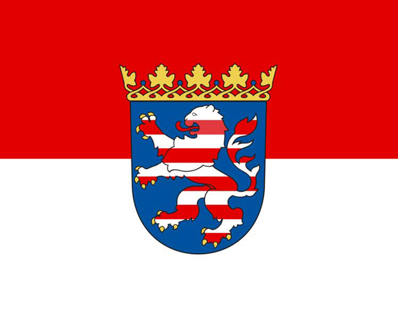 黑森州
黑森州
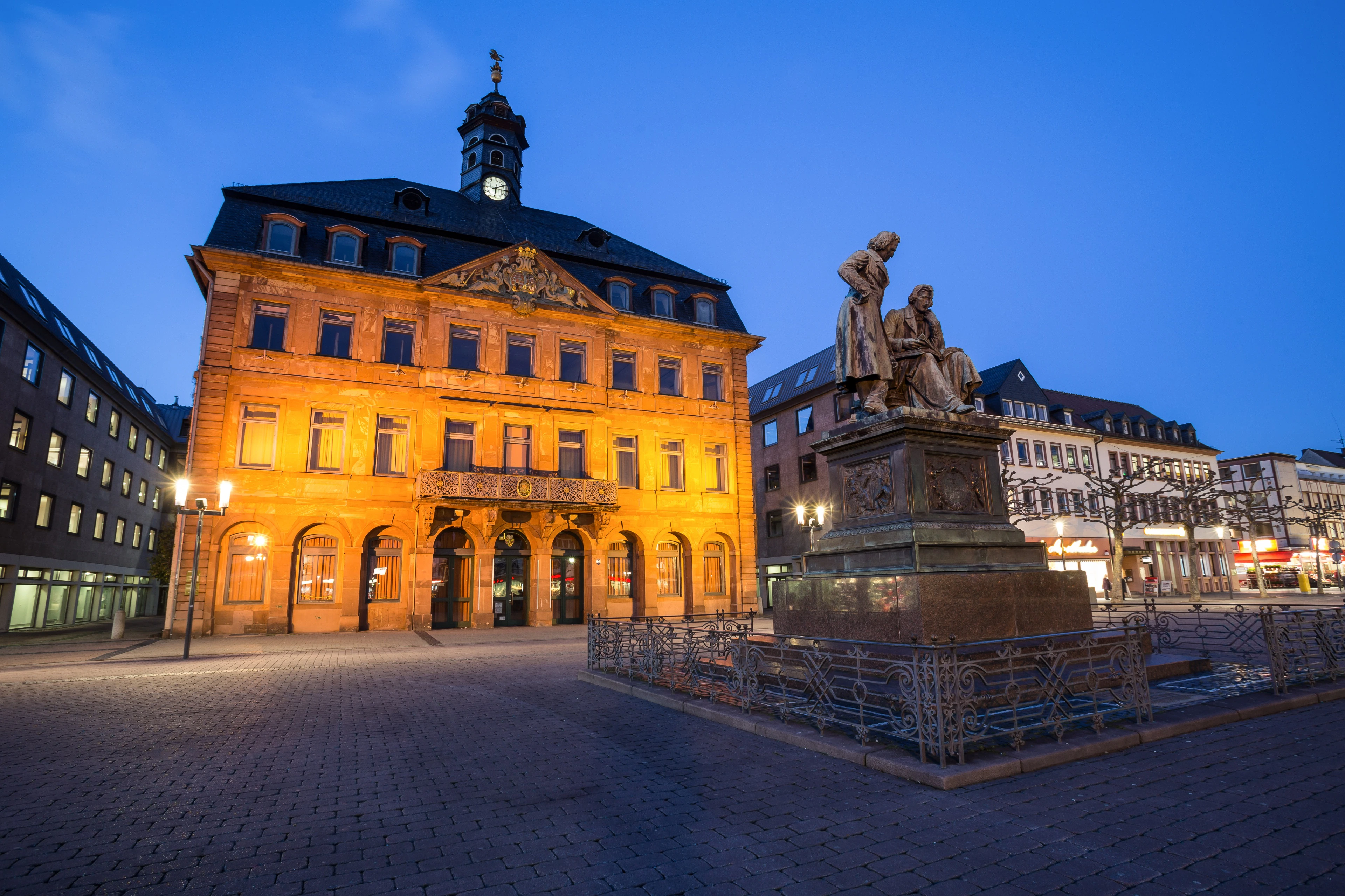
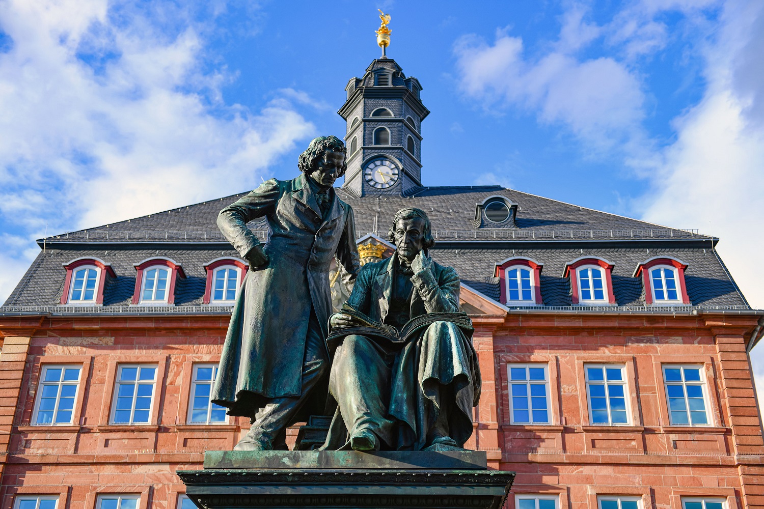
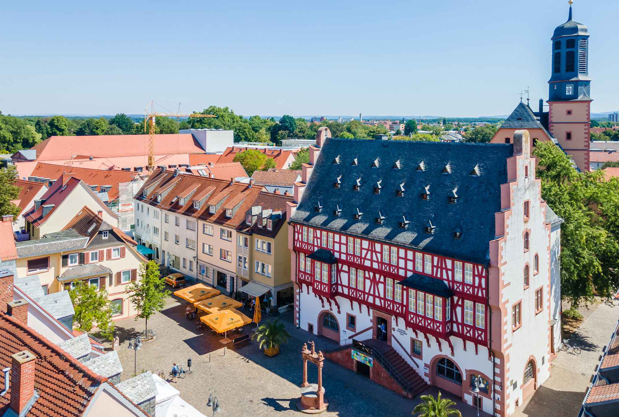
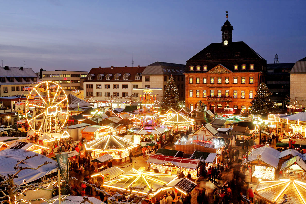
Hanau (anhörenⓘ/?), genannt auch Hanau am Main, ist eine Stadt mit 97.956 Einwohnern (31. Dezember 2024) im Main-Kinzig-Kreis im hessischen Regierungsbezirk Darmstadt. Hanau ist hinsichtlich der Bevölkerungszahl die sechstgrößte Stadt und größte kreisangehörige Stadt Hessens.[3] Zudem ist sie eines der zehn hessischen Oberzentren und eine Stadt mit Sonderstatus. Die Stadt liegt im Osten des Rhein-Main-Gebietes an der Mündung der Kinzig in den Main und gehört zum Ballungsraum Frankfurt, der sich im Regionalverband FrankfurtRheinMain organisiert hat. Hanau trägt seit dem 20. März 2006 die amtliche Zusatzbezeichnung Brüder-Grimm-Stadt,[4] da diese in der Stadt geboren wurden und ihre ersten Jahre hier verbrachten.
哈瑙(德语:Hanau,发音:[ˈhaːnaʊ] ⓘ)是德国黑森州达姆施塔特行政区美因-金齐希县的城市,位于金齐希河与美因河交汇处,面积76.47平方千米,2023年12月31日人口为103,184人。
自16世纪以来,哈瑙一直是贵金属加工中心。德国最大的家族企业之一的贺利氏公司总部坐落于此。
哈瑙是格林兄弟的故乡,被称为“格林兄弟之城”(Brüder-Grimm-Stadt)雅各布·格林和威廉·格林分别于1785年、1786年出生在哈瑙,他们的另一个弟弟、画家路德维希·格林也于1790年出生在哈瑙。
 滑雪旅游
滑雪旅游
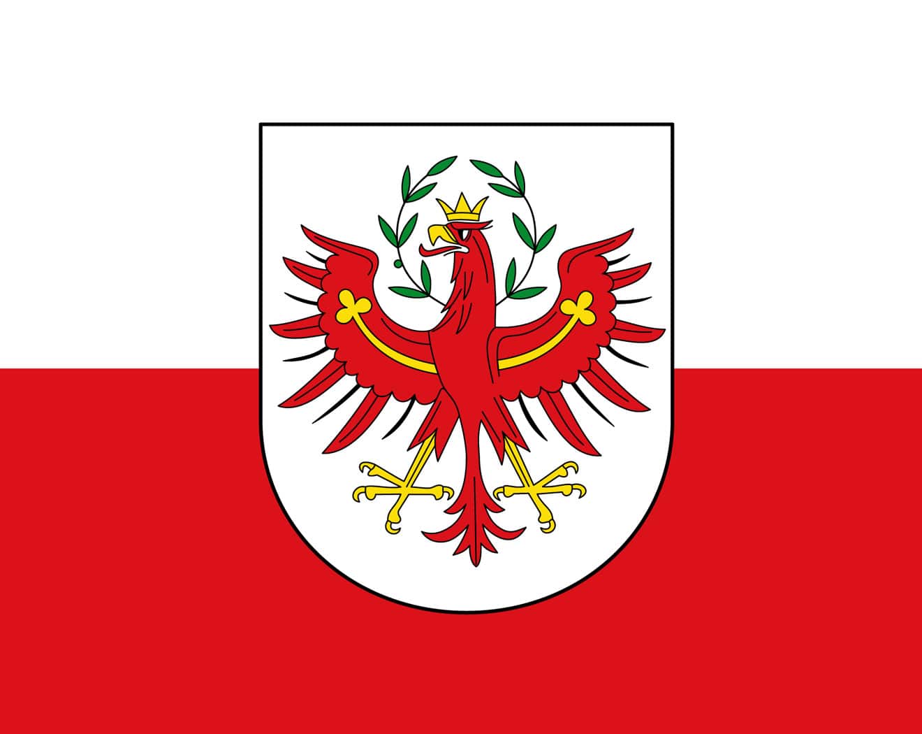 蒂罗尔
蒂罗尔

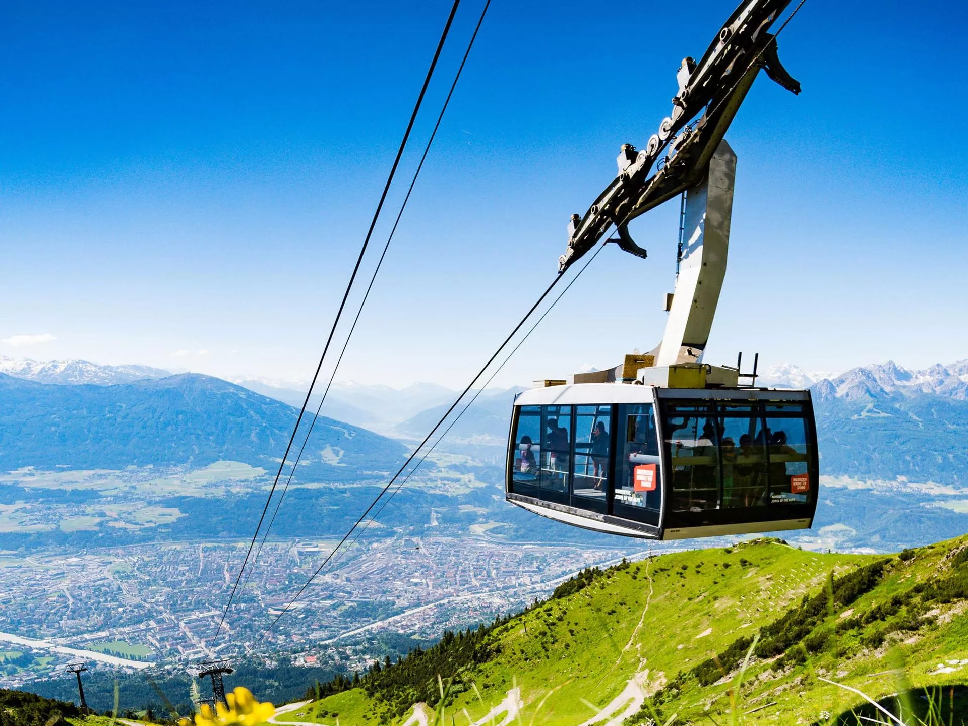

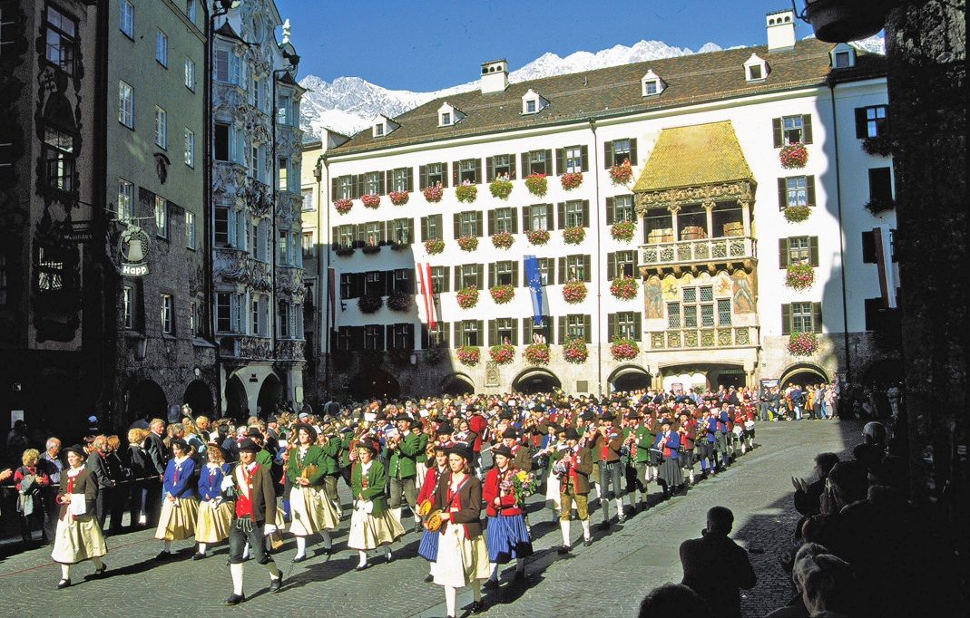
奥地利西南部的城市蒂罗尔州的首府,是世界著名的旅游和冬季滑雪运动胜地。曾经是1964年和1976年两届奥林匹克冬季运动会的比赛地。因斯布鲁克位于阿尔卑斯山的腹地,地处交通要道距离维也纳733公里,萨尔茨堡164公里,德国慕尼黑140公里。美丽的茵河(Inn)从市区穿过。Bruck在德文中是桥的意思。因此城市的名称意为“茵河上的桥”。
因斯布鲁克(德语:Innsbruck,德语发音:[ˈɪnsbʁʊk] (ⓘ))位于奥地利西部群山之间的因河畔,是蒂罗尔州的首府。穿越阿尔卑斯山通往意大利南蒂罗尔地区的布伦纳山口从这里开始。因斯布鲁克的名字来自于因河和德语中的Brücke(桥)。因斯布鲁克是奥地利第五大城市,整个都市地区约有18.4万居民。因斯布鲁克是著名的滑雪胜地,冬季奥林匹克运动会曾于1964年和1976年两次在此举办。
Innsbruck (im lokalen bairisch-österreichischen Dialekt Innschbrugg ausgesprochen) ist eine Großstadt im Westen Österreichs und Hauptstadt des Bundeslandes Tirol. Ihr Name verweist auf die Brücke über den Inn. Wahrzeichen der Stadt ist das Goldene Dachl.
Mit 131.059 Einwohnern (Stand 1. Jänner 2021) ist Innsbruck die bevölkerungsreichste Stadt Tirols und zugleich fünftgrößte Stadt Österreichs (nach Wien, Graz, Linz und Salzburg). In ihrem Ballungsraum leben rund 300.000 Menschen.[2] Zusätzlich haben etwa 30.000 Studierende der Innsbrucker Universität, der Medizinischen Universität Innsbruck und sonstige Personen hier einen Nebenwohnsitz; täglich wurden 2019 rund 3000 Übernachtungen von Städtetouristen gebucht.
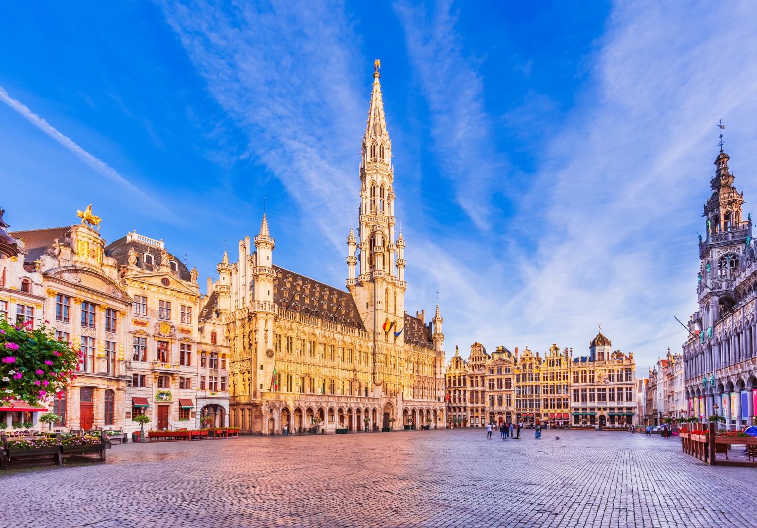
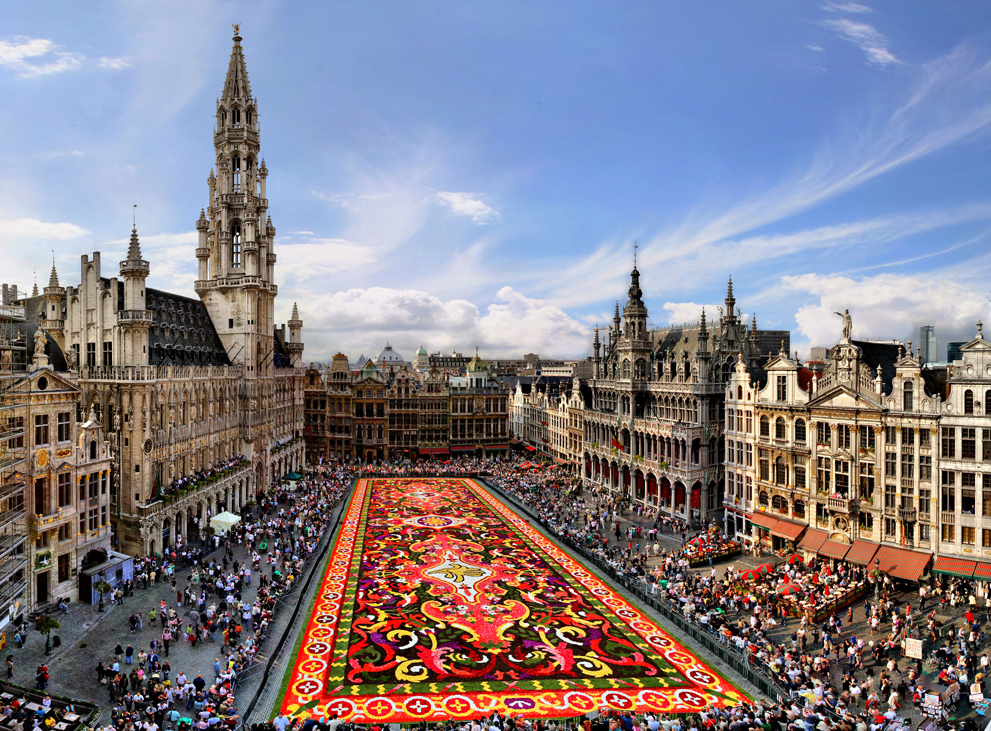
布鲁塞尔(法语:Bruxelles;荷兰语:Brussel)是比利时的首都和最大的城市,也是欧洲联盟的主要行政机构所在地。位于布鲁塞尔首都区的布鲁塞尔市,[1]。 在不同的语境中,布鲁塞尔有着不同的外延。她可能代表布鲁塞尔市(比利时的布鲁塞尔首都区中最大的地方自治体及首府,常住人口140,000),也可能代表布鲁塞尔首都区(据2008年2月1日统计,常住人口为1,067,162),或者也可能用于表示布鲁塞尔城市圈(常住人口1,350,000[2])。
欧洲联盟三个主要的机构当中,欧盟委员会和欧盟部长理事会位于布鲁塞尔,另一个重要机构欧洲议会在布鲁塞尔也有分处(全体议会在法国斯特拉斯堡),所以它有欧洲首都的美誉。另外,北大西洋公约组织的总部也设在布鲁塞尔。
布鲁塞尔是一个双语城市,通用法语和荷兰语,法语的使用者占较多数。另外,土耳其语、阿拉伯语等语言被布鲁塞尔的穆斯林广泛使用。
Mit Brüssel (französisch Bruxelles [bryˈsɛl], niederländisch Brussel [brɵsəɫ]) kann entweder eine Stadt in Belgien gemeint sein oder die größere Hauptstadtregion mit 19 Gemeinden beziehungsweise das gesamte städtische Gebiet der Hauptstadtregion.
Die zweisprachige Region Brüssel-Hauptstadt (französisch Région de Bruxelles-Capitale, niederländisch Brussels Hoofdstedelijk Gewest) ist neben Flandern und der Wallonischen Region eine von drei Regionen im föderalen belgischen Staatsaufbau. Die Region hat über eine Million Einwohner und besitzt eine höhere Bevölkerungsdichte als irgendeine deutsche Großstadt.[1] Sie ist daher nicht mit den weit ins Umland reichenden Metropolregionen vergleichbar, die in den letzten Jahren rund um viele europäische, unter anderem auch deutsche Großstädte definiert wurden. Der Ballungsraum Brüssel ist noch einmal wesentlich größer als die Region Brüssel.
Die Stadt Brüssel ist die Haupt- und Residenzstadt des Königreichs Belgien. Sie bildet das Zentrum der Region Brüssel-Hauptstadt, ist eine ihrer 19 Gemeinden und hat etwa 180.000 Einwohner. Dort haben mehrere föderale Institutionen ihren Sitz: Die Stadt Brüssel ist Verwaltungssitz der Region Brüssel-Hauptstadt. Hier befindet sich darüber hinaus der Verwaltungssitz der Französischen Gemeinschaft Belgiens, während die Wallonische Region ihren Sitz in Namur hat. Die Organe der Region Flandern und der Flämischen (niederländischsprachigen) Gemeinschaft sind fusioniert und haben ihren Sitz ebenfalls in der Stadt Brüssel. Zudem stellt die Stadt den Hauptsitz der Europäischen Union sowie den Sitz der NATO, ferner den des ständigen Sekretariats der Benelux-Länder und von EUROCONTROL dar.
Im Jahre 996 erstmals urkundlich erwähnt und im Mittelalter zur Hauptstadt des Herzogtums Brabant aufgestiegen, wurde Brüssel mit der Unabhängigkeit Belgiens 1830 zu dessen Hauptstadt erhoben. Zusammen mit seinen umliegenden Gemeinden ist Brüssel heute als Industrie- und Handelsstadt mit zwei Universitäten, mehreren Hochschulen, Akademien, Bibliotheken, Museen und Bühnen ein bedeutendes Wirtschafts-, Wissenschafts- und Kulturzentrum sowie ein wichtiger Verkehrsknotenpunkt im Zentrum des Landes.
Der Artikel Region Brüssel-Hauptstadt behandelt vor allem die Themen Politik, Verwaltung und Sprachensituation. Weitere und übergreifende Themen werden nachfolgend behandelt.
ブリュッセル市(ブリュッセルし、フランス語: Ville de Bruxelles [ˈvil də bʀyˈsɛl] または Bruxelles-Ville、オランダ語: Stad Brussel [s̪t̪ɑt̪ ˈbrʏ.s̪əl̪] または Brussel-Stad)は、ブリュッセル首都圏地域を構成する最大の基礎自治体である。ベルギーの憲法上の首都である[2]が、実際にはブリュッセル首都圏地域全体で首都としての機能を果たしている。主としてブリュッセルの歴史的中心部から成り、ロンドンにおけるシティにたとえることができる。
ブリュッセル市は、ブリュッセルの歴史的な中心市街地に加えて、ブリュッセル首都圏地域内のいくつかの地区、すなわち北部のアレン、ラーケンおよびネデル=オヴェル=エンベーク、ならびに南部のルイーズ大通りおよびカンブルの森から構成される。
ブリュッセル市の総面積は32.61 km2、2014年9月1日現在の総人口は173,540人で、人口密度は5,321.68人/km2である[1]。また2014年時点で、ブリュッセル市の人口約17万人のうち、約6万人が外国人(うち3万6千人がEU市民、2万4千人が非EU市民)となっている[3]。
The City of Brussels (French: Ville de Bruxelles [vil də bʁysɛl] or alternatively Bruxelles-Ville [bʁysɛl vil], Dutch: Stad Brussel [stɑd ˈbrɵsəl][2] or Brussel-Stad) is the largest municipality and historical centre of the Brussels-Capital Region, and the de jure capital of Belgium.[3] Besides the strict centre, it also covers the immediate northern outskirts where it borders municipalities in Flanders. It is the administrative centre of the European Union, thus often dubbed, along with the region, the EU's capital city.
The City of Brussels is a municipality consisting of the central historic town and certain additional areas within the greater Brussels-Capital Region, namely Haren, Laeken and Neder-Over-Heembeek to the north, and Avenue Louise/Louizalaan and the Bois de la Cambre/Ter Kamerenbos park to the south.
On 1 January 2017, the City of Brussels had a total population of 176,545. The total area is 32.61 km2 (12.59 sq mi) which gives a population density of 5,475 inhabitants per square kilometre (14,180/sq mi). As of 2007, there were approximately 50,000 registered non-Belgians in the City of Brussels.[4] In common with all the Brussels municipalities, it is legally bilingual (French–Dutch).
Bruxelles (prononcé [bʁy.sɛl]1 Écouter ; Brussel [ˈbrʏ.səl] Écouter en néerlandais ; Brüssel en allemand ; parfois aussi appelé aire urbaine de Bruxelles, Stedelijk gebied van Brussel en néerlandais, ou Grand Bruxelles2) est une agglomération de Belgique qui s'étend au-delà des limites administratives de la Région de Bruxelles-Capitale pour englober des parties du Brabant wallon et l'arrondissement de Hal-Vilvorde, et au centre de laquelle se trouve la ville de Bruxelles proprement dite.
La plupart des institutions de l’Union européenne, ainsi que de nombreuses organisations internationales entre autres lobbyistes, dont l’OTAN, ont leur siège en Région de Bruxelles-Capitale. Par extension, on dit donc « Bruxelles » pour désigner, en général et par métonymie, les institutions européennes (le plus souvent, la Commission européenne).
L'initiative Brussels Metropolitan, lancée en 2008, vise à mieux coordonner la ville et son arrière-pays pour valoriser le Grand Bruxelles en tant que métropole économique attrayante au cœur de l'Europe3, lui donner plus de poids sur le plan mondial et y stimuler la croissance et la création d'emplois4. Cette plateforme de coopération implique la participation de quatre organisations patronales - la FEB, BECI, le Voka et l'UWE4.
Bruxelles (nome francese; pronuncia /bʀy'sɛl/ o, meno correttamente, /bʀyk'sɛl/, italianizzata in /brukˈsɛl/[1]; in olandese Brussel, in tedesco Brüssel; in italiano storico Brusselle[2] o Borsella[3]) è un'area metropolitana del Belgio che ospita all'incirca 2,6 milioni di abitanti.[4]
Il comune di Bruxelles è uno dei 19 comuni della regione amministrativa di "Bruxelles-capitale", con cui non dovrebbe essere confuso. Questa regione è una delle tre regioni amministrative del Belgio, con la Regione vallone e la Regione fiamminga. L'area metropolitana di Bruxelles si estende oltre i confini amministrativi della Regione di Bruxelles in quanto comprende molti comuni situati nella regione fiamminga. Questa situazione è all'origine del conflitto linguistico in Belgio poiché molti residenti di Bruxelles, per lo più francofoni, sono stabiliti nella regione fiamminga di lingua olandese.
Bruxelles è considerata la capitale de facto dell'Unione europea in quanto sede di varie istituzioni, tra cui la Commissione europea, il Consiglio dell'Unione europea e parzialmente il Parlamento europeo (ufficialmente con sede a Strasburgo). Ad Evere ha inoltre sede il quartier generale della NATO. Bruxelles ospita anche il Comitato delle Regioni e il Comitato economico e sociale.
Gran parte dell'area metropolitana di Bruxelles è amministrata dalla regione di Bruxelles-Capitale, suddivisa in 19 comuni, tra cui quello del centro storico, il Comune di Bruxelles (Ville de Bruxelles/Brussel-stad). La città si estende però anche al di là dei confini della regione: vari comuni della periferia brussellese, amministrativamente parte della regione delle Fiandre, sono parte integrante del tessuto urbano di Bruxelles.[5] Tra questi Zaventem (sede dell'aeroporto internazionale), Kraainem (capolinea della metropolitana) e Tervuren (quartiere residenziale).
Bruselas (en francés: Bruxelles [bʁysɛl] (?·i), en neerlandés: Brussel [ˈbrɵsəl] (?·i) y en alemán: Brüssel) es la capital de Bélgica,1 y la principal sede administrativa de la Unión Europea (UE).
Bruselas es un municipio situado en la región administrativa "Bruselas-Capital" que es una de las tres regiones de Bélgica, con la Región Valona y la Región flamenca.
Como capital del Estado, Bruselas es la sede del gobierno y el Parlamento. Alberga también, el Castillo de Laeken la residencia de Su Majestad el rey Felipe de Bélgica y la familia real belga.
Брюссе́льский столи́чный регио́н (фр. Région de Bruxelles-Capitale, ʁe'ʒjɔ̃ də bʁy'sɛlkapi'tal слушать, нидерл. Brussels Hoofdstedelijk Gewest, ˈbrʏsəɫs ɦoːft'steːdələk xəʋɛst слушать, а также просто фр. Bruxelles, bʁysɛl слушать; нидерл. Brussel, ˈbrʏsəɫ слушать) — один из трёх регионов Бельгии, субъект федерации наравне с Фламандским и Валлонским регионами. Крупнейшая городская зона-агломерация в Бельгии[1], состоящая из 19 муниципалитетов, каждый со своим бургомистром, ратушей и т. д. Фактически они являются районами одного города (часто граница проходит посередине улицы). Формально название Брюссель относится только к одному из вышеуказанных муниципалитетов, но на практике его употребляют ко всей агломерации. Одним из муниципалитетов является Брюссель, который де-юре является столицей Бельгии, и в котором находятся Французское и Фламандское сообщества[2]. Де-факто, в силу того что столичные учреждения распределены по различным муниципалитететам Брюссельского столичного региона, регион считается столицей Бельгии, столицей Европейского союза[3].
Брюссель начинался как город-крепость в 10 веке, основанный Карлом I[4]. Население региона составляет 1,1 миллион человек, а всё население метрополии — более 1,8 миллионов, занимая таким образом первое место по этому показателю в Бельгии[5][6]. Со времён окончания Второй мировой войны Брюссель является одним из главных центров мировой политики. Будучи местом расположения институтов Европейского союза[7] и штаб-квартиры НАТО, Брюссель стал многоязыковым домом для многочисленных международных организаций, политиков и дипломатов[8].
Исторически нидерландоязычный, Брюссель со времён обретения Бельгией независимости в 1830 году, превратился почти полностью во франкоязычный регион. На сегодняшний день официальными считаются оба языка. Все дорожные знаки, названия улиц и большая часть рекламы и названий услуг приводятся на двух языках[9]. Языковой вопрос остаётся острым в Брюсселе, законы, затрагивающие его, являются предметом неутихающих обсуждений в Бельгии.

加米施和帕滕基与从前是两个小镇,全因1936年冬季奥林匹克运动会所赐,将这两个地区合并成一个镇。座落在巴伐利亚阿尔卑斯山中央720米的高处,此镇是德国著名的冬季运动之都,也是音乐家史特劳斯(Richard Strauss)的故乡。风景以韦特施泰因山脉(Wettersteingebirge)为主体,此乃最壮丽的北阿尔卑斯山支脉之一,其中包括德国第一高峰楚格峰,高达2964米。
旅游点简介:奥林匹克滑雪连动场(Olympic Ski Stadium)此处更是爱好滑雪者的天堂,它座落在楚格峰车站附近,有各级难度的滑雪道,越野滑雪,和高山滑雪等。奥林匹克滑雪运动场更备有两条滑雪跳远跳台,设备十分完善。
玛利亚广场(Marienplatz) : 加米施是一座景致迷人的山城,以玛利亚广场(Marienplatz)为市中心,其优美的圣马丁教堂(Pfarrkirche St.Martin),乃建于1730年,内有美丽的巴洛克式建筑。
美丽的山峰 : 乘坐登山缆车和铁路,除了可到达楚格峰外还可到达更多其它的山峰,如万克山(Wank)、豪斯山(Hausberg)、埃克除尔山(Eckbauer)和阿尔卑峰(Alpspitze)等。远眺整个加米施的湖泊及茂密森林之景色。
市政厅 : 施帕滕基镇内有美丽的市政厅(Rathaus),路易街(Ludwigstrasse)是其主街,有很多精美的房屋,墙上的壁画十分独特。
小锦囊 : 冬天的时候可沿着结冰的湖面步行至Werdenfel-serland探险,之后到山上之木屋,舒适地坐在火炉旁边取暖。怎样前往从慕尼克坐火车须约一小时。(Quelle: www.germany-tourism.org.cn)
加米施-帕滕基兴(德语:Garmisch-Partenkirchen)是位于德意志联邦共和国南部巴伐利亚州的一个城市。加米施-帕滕基兴是加米施-帕滕基兴县的行政中心。 加米施-帕滕基兴是1936年冬季奥林匹克运动会的举办地。
Garmisch-Partenkirchen ist ein Markt und zugleich der Kreishauptort des Landkreises Garmisch-Partenkirchen sowie das Zentrum des Werdenfelser Landes. Aufgrund seiner Größe ist es eine von 13 sogenannten leistungsfähigen kreisangehörigen Gemeinden sowie ein Oberzentrum[2] in Bayern. Der Ort liegt rund 80 km südwestlich von München und rund 50 km nordwestlich von Innsbruck. Es ist die letzte Gemeinde in Deutschland, die Verwaltungssitz eines Landkreises ist, ohne selbst Stadt zu sein (Kreishauptort).
Der Ort ist außerdem ein Heilklimatischer Kurort. Auswirkungen, die im Mittelalter mit dem Stadtrecht verbunden waren, existieren heute nicht mehr, so dass, weil die Verleihung dem Image als Kurort eher abträglich wäre, die größte Marktgemeinde Bayerns nie anstrebte um den Titel Stadt anzusuchen. Garmisch-Partenkirchen liegt inmitten eines weiten Talkessels am Zusammenfluss der aus Tirol kommenden Loisach und der im Wettersteingebirge entspringenden Partnach, zwischen Ammergebirge im Nordwesten, Estergebirge im Osten und Wettersteingebirge – mit Deutschlands höchstem Berg, der Zugspitze, im Südwesten. Garmisch war während der letzten Eiszeit – der Würmeiszeit – mit einer Eisdecke von ca. 1700 m ü. NHN überzogen.
 欧洲联盟
欧盟的历史
欧洲联盟
*创始国
欧洲流行歌曲大赛
欧洲联盟
欧盟的历史
欧洲联盟
*创始国
欧洲流行歌曲大赛
 财政金融
***全球金融中心
地理
地理
***IMF发达国家
历史
公元 1500 - 2000
历史
公元 2000 - 2100
国际城市
*欧洲文化之都
国际城市
欧洲城市
IMF发达国家
IMF发达国家
第六级
卢森堡
财政金融
***全球金融中心
地理
地理
***IMF发达国家
历史
公元 1500 - 2000
历史
公元 2000 - 2100
国际城市
*欧洲文化之都
国际城市
欧洲城市
IMF发达国家
IMF发达国家
第六级
卢森堡
 北约会员国
北约会员国
 欧洲国家
欧洲国家

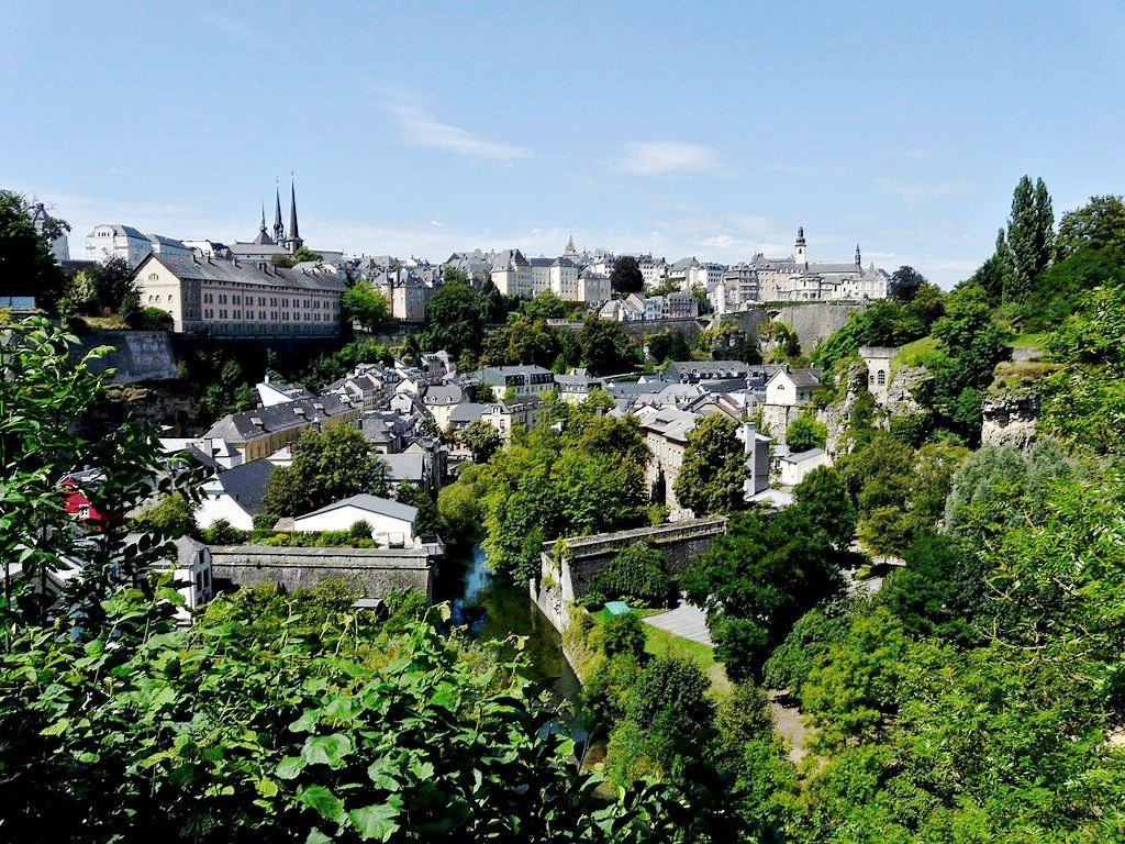
卢森堡是一个高度发达的资本主义国家,也是欧盟和北约创始成员国之一,拥有欧盟多个下设机构,如欧洲法院、欧洲审计院以及欧洲投资银行,被称为继布鲁塞尔和斯特拉斯堡之后的欧盟“第三首都”。同时是高度发达的工业国家,还是欧元区内最重要的私人银行中心,及全球第二大仅次于美国的投资信托中心。金融、广播电视、钢铁是其三大经济支柱产业,该国失业率极低,人均寿命80岁。
卢森堡大公国(卢森堡语:Groussherzogtum Lëtzebuerg[注 1];法语:Grand-Duché de Luxembourg; 德语:Großherzogtum Luxemburg[注 2]),通称卢森堡(卢森堡语:Lëtzebuerg;法语:Luxembourg;德语:Luxemburg),被邻国法国、德国和比利时包围,是一个位于欧洲的内陆国家,也是现今欧洲大陆仅存的大公国,首都卢森堡市。卢森堡是欧盟成员国,因境内有欧洲法院、欧洲审计院、欧洲投资银行等多个欧盟机构被称为继布鲁塞尔和斯特拉斯堡之后的欧盟“第三首都”。
Das Großherzogtum Luxemburg (luxemburgisch Groussherzogtum Lëtzebuerg [ˈgʀəʊsˌhɛχtsoːktuːm ˈlətsəbuəɕ], französisch Grand-Duché de Luxembourg [ɡʁɑ̃ dyʃe də lyksɑ̃buʁ]) ist ein demokratischer Staat in Form einer parlamentarischen Monarchie[1] im Westen Mitteleuropas. Es ist das letzte Großherzog- bzw. Großfürstentum (von einst zwölf) in Europa. Das Land gehört zum mitteldeutschen Sprachraum. Landessprache ist Luxemburgisch, Verwaltungs- und Amtssprachen sind Französisch, Deutsch und Luxemburgisch. Gemeinsam mit seinem Nachbarn Belgien und mit den Niederlanden bildet Luxemburg die Beneluxstaaten.
ルクセンブルク大公国(ルクセンブルクたいこうこく)、通称ルクセンブルクは、西ヨーロッパに位置する立憲君主制国家。首都は国名と同名のルクセンブルク市。隣接国は、南のフランス、西と北のベルギー、東のドイツである。ベルギー、オランダと併せてベネルクスと呼ばれる。
Luxembourg (/ˈlʌksəmbɜːrɡ/ ( listen)) (Luxembourgish: Lëtzebuerg [ˈlətsəbuə̯ɕ] ( listen); French: Luxembourg ; German: Luxemburg), officially the Grand Duchy of Luxembourg,[note 2] is a small landlocked country in western Europe. It is bordered by Belgium to the west and north, Germany to the east, and France to the south. Its capital, Luxembourg City, together with Brussels and Strasbourg, is one of the three official capitals of the European Union[6] and the seat of the European Court of Justice, the highest judicial authority in the EU. Its culture, people, and languages are highly intertwined with its neighbours, making it essentially a mixture of French and German cultures, as evident by the nation's three official languages: French, German, and the national language, Luxembourgish (sometimes considered a dialect of German). The repeated invasions by Germany, especially in World War II, resulted in the country's strong will for mediation between France and Germany and, among other things, led to the foundation of the European Union.[7]
With an area of 2,586 square kilometres (998 sq mi), it is one of the smallest sovereign states in Europe.[8] In 2016, Luxembourg had a population of 576,249, which makes it one of the least-populous countries in Europe,[9] but by far the one with the highest population growth rate.[10] Foreigners account for nearly half of Luxembourg's population.[11] As a representative democracy with a constitutional monarch, it is headed by Grand Duke Henri and is the world's only remaining grand duchy. Luxembourg is a developed country, with an advanced economy and one of the world's highest GDP (PPP) per capita. The City of Luxembourg with its old quarters and fortifications was declared a UNESCO World Heritage Site in 1994 due to the exceptional preservation of the vast fortifications and the old city.[12]
The history of Luxembourg is considered to begin in 963, when count Siegfried I acquired a rocky promontory and its Roman-era fortifications known as Lucilinburhuc, ′little castle′, and the surrounding area from the Imperial Abbey of St. Maximin in nearby Trier.[13][14] Siegfried's descendants increased their territory through marriage, war and vassal relations. At the end of the 13th century, the Counts of Luxembourg reigned over a considerable territory. [15] In 1308, Henry VII, Count of Luxembourg became King of the Germans and Holy Roman Emperor. The House of Luxembourg produced four Holy Roman Emperors at the high time of the Middle Ages. In 1354, Charles IV elevated the County to the Duchy of Luxembourg. Since Sigismund had no male heir, the Duchy became part of the Burgundian Circle and then one of the Seventeen Provinces of the Habsburg Netherlands.[16] Over the centuries, the City and Fortress of Luxembourg, of great strategic importance situated between the Kingdom of France and the Habsburg territories, was gradually built up to be one of the most reputed fortifications in Europe. After belonging to both the France of Louis XIV and the Austria of Maria Theresia, Luxembourg became part of the First French Republic and Empire under Napoleon.[17]
The present-day state of Luxembourg first emerged at the Congress of Vienna in 1815. The Grand-Duchy, with its powerful fortress, became an independent state under the personal possession of William I of the Netherlands with a Prussian garrison to guard the city against another invasion from France. [18] In 1839, following the turmoil of the Belgian Revolution, the purely Oil-speaking part of Luxembourg was ceded to Belgium and the Luxembourgish-speaking part (except the Arelerland, the area around Arlon) became what is the present state of Luxembourg. [19]
The steel industry exploiting the Red Lands' rich iron-ore grounds in the beginning of the 20th century drove the country's industrialisation. ArcelorMittal, the world's largest steel producer with headquarters in Luxembourg City, is still a reminder of these times. After the decline of the steel industry in the 1970s, the country focused on establishing itself as a global financial centre and developed into the banking hub it is reputed for. Since the beginning of the 21st century, its governments have focused on developing the country into a knowledge economy, with the founding of the University of Luxembourg and a national space programme, projecting the first involvement in a robotic lunar expedition by 2020.[20]
Luxembourg is a founding member of the European Union, OECD, United Nations, NATO, and Benelux. The city of Luxembourg, which is the country's capital and largest city, is the seat of several institutions and agencies of the EU. Luxembourg served on the United Nations Security Council for the years 2013 and 2014, which was a first in the country's history.[21] In 2016 Luxembourgish citizens had visa-free or visa-on-arrival access to 172 countries and territories, ranking the Luxembourgish passport 15th in the world, tied with countries such as Canada and Switzerland.[22]
Le Luxembourg, en forme longue le Grand-Duché de Luxembourg2,b,c ou le grand-duché de Luxembourgd, en luxembourgeois Lëtzebuerg et Groussherzogtum Lëtzebuerg, en allemand Luxemburg et Großherzogtum Luxemburg, est un pays d'Europe de l'Ouest sans accès à la mere Il est bordé par la Belgique à l'ouest et au nord, l'Allemagne à l'est, et la France au sud. Il comprend deux régions principales : l'Oesling au nord, qui est une partie du massif des Ardennes, et le Gutland au sud, prolongement de la Lorraine au sens géologique du terme. Le Luxembourg compte 602 005 habitants au 1er janvier 20181, et s'étend sur une superficie de 2 586 km2, faisant de lui l'une des plus petites nations souveraines d'Europe.
Le Luxembourg est une démocratie représentative et une monarchie constitutionnelle avec un grand-duc pour chef d'État, faisant du pays le seul grand-duché encore existant. Son économie dynamique en fait un des pays les plus riches et des plus prospères du monde, avec le PIB par habitant le plus élevé du monde selon le FMI en 2014. L'économie est principalement centrée sur les activités financières (environ la moitié du produit intérieur brut), favorisée par une fiscalité attractive voire dérisoire dans certains domaines (quasi-exonération d'impôts pour les bénéfices issus de l'exploitation de brevets ou de logiciels). La localisation centrale du territoire luxembourgeois en Europe a historiquement fait de lui un lieu d'une grande importance stratégique pour de nombreuses puissances, depuis sa fondation en tant que fortin romain7, son accueil d'un château franc durant le Haut Moyen Âge, et son rôle de bastion pour le chemin des Espagnols entre les XVIe et XVIIe siècles.
Le Luxembourg est le plus petit membre fondateur de l'Union européenne, de la zone euro, de l'OTAN, de l'OCDE, de l'ONU, de l'OSCE, du Conseil de l'Europe8,9,10,11 et du Benelux, reflétant son consensus politique en faveur de l'intégration économique, politique et militaire. La ville de Luxembourg, sa capitale et sa plus grande ville, est le siège de plusieurs établissements et institutions de l'UE. En 2012, le Luxembourg a été élu pour la première fois de son histoire à un siège temporaire au Conseil de sécurité des Nations unies. En raison de sa position géographique, la culture luxembourgeoise est une fusion de l'Europe germanique et romane, intégrant chacune des deux. De ce fait, le Luxembourg est un pays trilingue : le luxembourgeois, le français et l'allemand sont les trois langues officielles et, depuis 1984, le luxembourgeois a légalement le statut de « langue nationale »12.
Il Granducato di Lussemburgo (in francese: le Grand-Duché de Luxembourg; in lussemburghese: Groussherzogtum Lëtzebuerg; in tedesco: Großherzogtum Luxemburg) è un paese membro dell'Unione europea situato tra Germania, Francia e Belgio. È uno stato senza sbocco sul mare.
Membro fondatore dell'Unione europea, della NATO, del Benelux e delle Nazioni Unite, la sua capitale, l'omonima città di Lussemburgo, è sede di numerose istituzioni e agenzie europee oltre ad essere uno snodo finanziario di primaria importanza.
È l'unico granducato rimasto al mondo.
Luxemburgo, oficialmente denominado Gran Ducado de Luxemburgo (luxemburgués: Groussherzogtum Lëtzebuerg, francés: Grand-Duché de Luxembourg, alemán: Großherzogtum Luxemburg), es un pequeño país de Europa Central que forma parte de la Unión Europea. Se trata de un Estado sin litoral, rodeado por Francia, Alemania y Bélgica. Luxemburgo cuenta con una población de medio millón de habitantes sobre un área de 2586 kilómetros cuadrados.1
El gobierno de Luxemburgo es una monarquía constitucional y parlamentaria, siendo el único gran ducado soberano en la actualidad. El Estado tiene una economía altamente desarrollada, con el mayor producto interior bruto por cápita del mundo de acuerdo al Banco Mundial, y el segundo de acuerdo al Fondo Monetario Internacional.
Luxemburgo es miembro de la Unión Europea, la Organización del Tratado del Atlántico Norte, la Organización para la Cooperación y el Desarrollo Económico, las Naciones Unidas y el Benelux, reflejando la orientación política a favor de la integración económica, política y militar. Su capital, Luxemburgo, es sede de numerosas instituciones y agencias de la Unión Europea.
Luxemburgo posee culturas y tradiciones diversas por encontrarse entre la Europa romana y la Europa germánica. El país tiene tres lenguas oficiales: alemán, francés y luxemburgués. La localidad Schengen, que dio su nombre al espacio de Schengen, está ubicada en Luxemburgo.
Люксембу́рг (люксемб. Lëtzebuerg), официально Вели́кое Ге́рцогство Люксембу́рг (люксемб. Groussherzogtum Lëtzebuerg, фр. Grand-Duché de Luxembourg, нем. Großherzogtum Luxemburg) — государство (великое герцогство) в Западной Европе. Граничит с Бельгией на севере, на западе и на юге с Францией, на востоке с Германией, не имеет выхода к морю. Название происходит от древневерхненемецкого «lucilinburch» — «малый город». Общая площадь Люксембурга составляет 2586,4 км², что делает его одним из самых маленьких суверенных государств в Европе[5]. Население на 1 января 2018 года составляет 602 005 человек[2].
Член Европейского союза с 1957 года, также является членом НАТО, ОЭСР и ООН. Вместе с Бельгией и Нидерландами входит в состав Бенилюкса.
 萨克森州
萨克森州
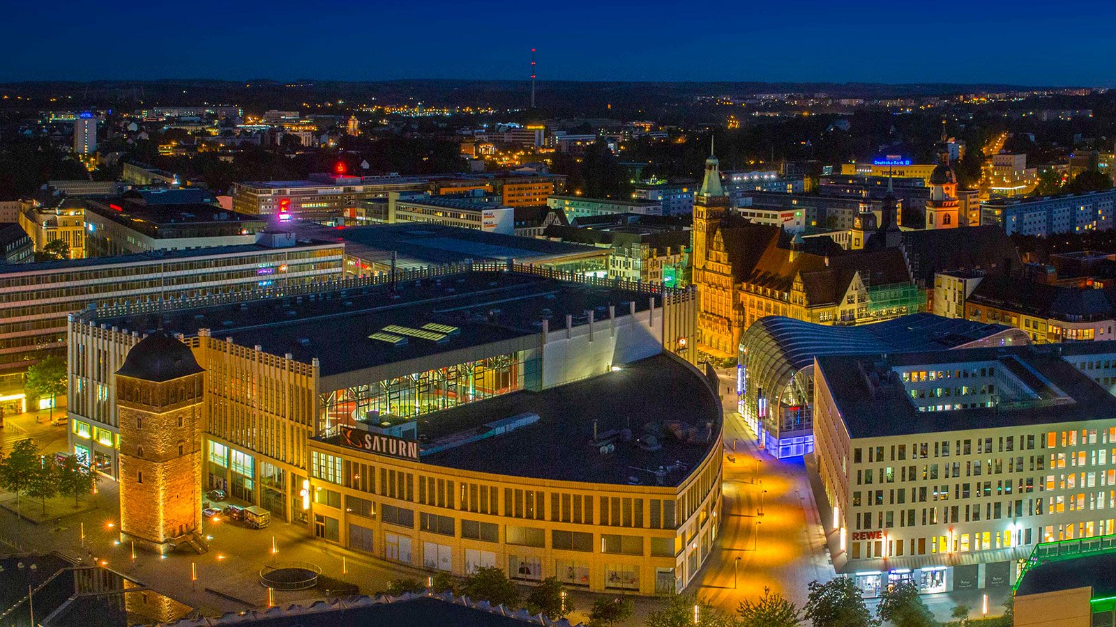
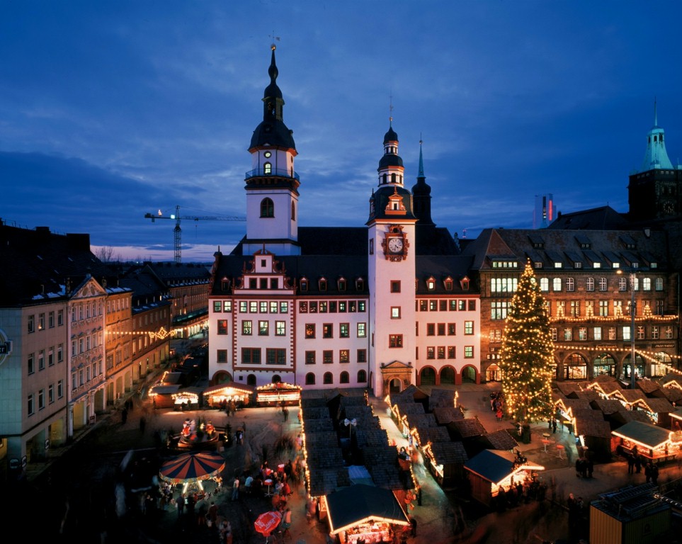
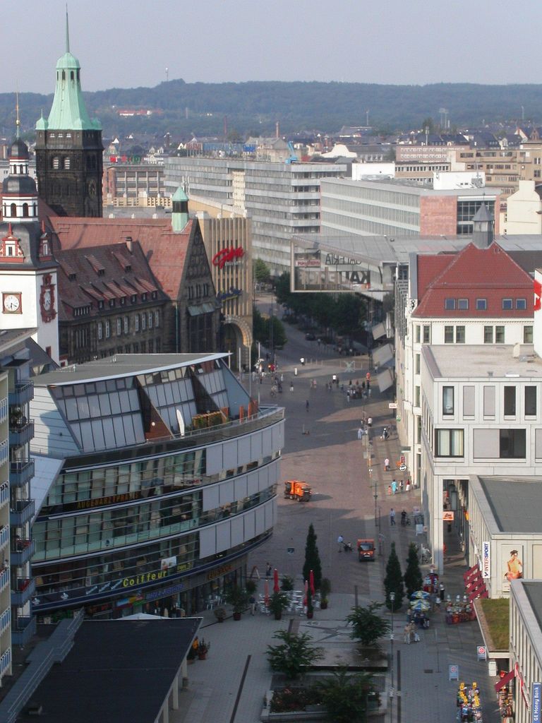
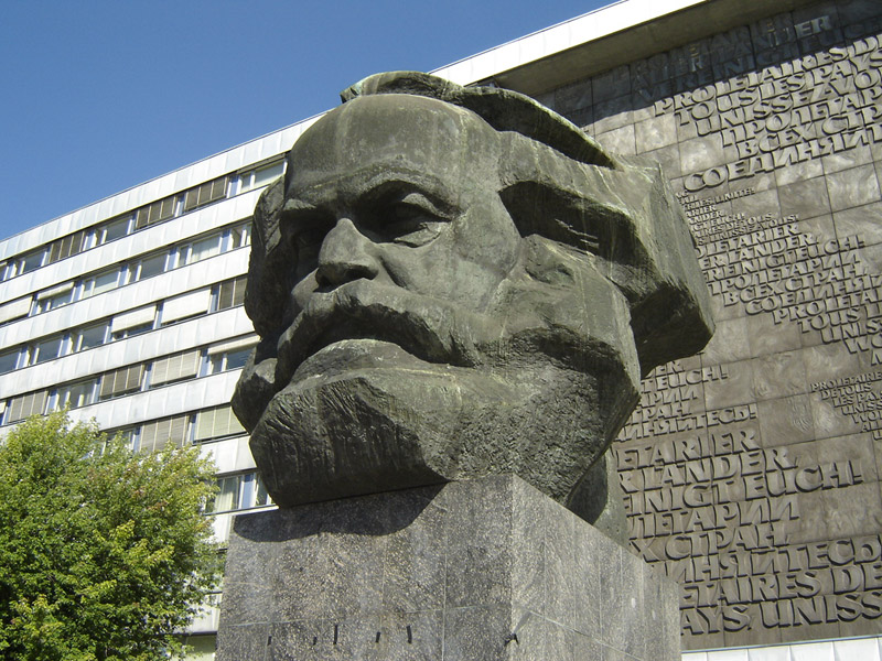
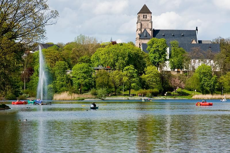
“开姆尼茨”是德国少数民族索布族语“石头”的意思。开姆尼茨曾经是德国现代工业文明的发源地之一,德国历史上的第一部自行车、第一台缝纫机都产于这里。 然而,在整个20世纪,开姆尼茨和德国其他城市特别是东部城市一样,经历了两次世界大战的创伤和长期计划经济的束缚,传统的制造业优势不复存在。今后的路 怎么走,国家在城市发展中有什么举措,不仅是当地人民思考的问题,更为世人所关注。在从计划经济向市场经济过渡的过程中,开姆尼茨会带给人们什么样的启 示?
工业重镇呼唤新生
早在1779年,开姆尼茨就开始了工业化进程,当矿山资源 被采绝之后,矿工和业主都急于寻找新的收入来源,于是他们转向了工业技术。聪明的工程师们很快就制造出了强于竞争对手英国人的机器。他们的功绩之一,是建 起了第一个全机械化的纺织厂,使开姆尼茨成为当时德国最重要的纺织工业基地之一,并享有“萨克森灯芯绒”之称,被誉为德国的曼彻斯特。1862年在巴黎国 际展览会上,德国的产品第一次获得了金奖。这个获奖的金属加工机床,就是开姆尼茨市齐墨曼公司制造的。
德国的现代汽车工业的发展更是和开姆尼茨息息相关。可能没有人知道在中国大街小巷随处可见的奥迪牌轿车那四个相连的银白色圆环的标志最初就是诞生在这里。
作为萨克森州第三大城市的开姆尼茨的知名度远比不上同州的德累斯顿和莱比锡。为此,德国统一后实施的振兴东部计划,将开姆尼茨等东部著名城市的复兴摆在 了重要的位置。近年来,开姆尼茨市的经济在蓬勃发展,很多世界著名的大公司,如西门子、IBM和大众汽车等也在这里安家落户,并且正在充分利用这里的技术 资源。今天的开姆尼茨正成为一个德国东部经济发展的亮点。其重点为机械制造、汽车及其配件工业和高科技产业。
开姆尼茨[2](德语:Chemnitz,发音:[ˈkɛmnɪts] (ⓘ);索布语:Kamjenica;捷克语:Saská Kamenice;波兰语:Kamienica Saska)市是德国萨克森州西部的一座非县辖城市,总面积为220.85平方千米,截至2023年12月31日总人口为250,681人。开姆尼茨是位于莱比锡和德累斯顿之后的该州第三大城市,也是该州六个Oberzentren之一。开姆尼茨的城市格言是“有头脑的城市”(Stadt mit Köpfchen)。
该市同茨维考一起构成了“开姆尼茨-茨维考经济区”的核心,也是“萨克森三角城市群”的组成部分。
“开姆尼茨”得名于流经该市的一条同名河流。在东德治下的1953年5月10日到1990年6月1日期间,开姆尼茨改称“卡尔·马克思城”(Karl-Marx-Stadt)。
1143年有文献记载中提到,该市已发展为德国工业化城市中重要的一个。开姆尼茨市的人口数大约自1883年起便超过了十万。
Chemnitz [ˈkʰɛmnɪt͡s] 
 (von 1953 bis 1990 Karl-Marx-Stadt) ist eine kreisfreie Stadt im Südwesten des Freistaates Sachsen und dessen drittgrößte Großstadt nach Leipzig und Dresden. Wegen Rauch- und Schmutzentwicklung während der Industrialisierung erhielt Chemnitz den Beinamen Sächsisches Manchester.
Der namensgebende Fluss verläuft durch die am Nordrand des Erzgebirges im Erzgebirgsbecken liegende Stadt. Chemnitz ist Hauptsitz der Landesdirektion Sachsen und Teil der Metropolregion Mitteldeutschland. Am 28. Oktober 2020 wurde die Stadt als Kulturhauptstadt Europas 2025 ausgewählt.
Die älteste urkundliche Erwähnung als Kameniz (von sorbisch kamjenica, „Steinbach“) datiert aus dem Jahre 1143. Mit der industriellen Revolution setzte im 19. Jahrhundert ein starkes Bevölkerungswachstum ein; nach der Reichsgründung 1871 entwickelte sich Chemnitz zu einer wichtigen Industriestadt. In der Zeit der Hochindustrialisierung im Deutschen Reich wurde Chemnitz im Laufe des Jahres 1882 zur Großstadt. Die Einwohnerzahl erreichte zu Beginn der 1930er-Jahre mit über 361.000 Personen ihren historischen Höchstwert. Im Zweiten Weltkrieg wurde bei den Luftangriffen auf Chemnitz im Februar und März 1945 die Innenstadt zu 80 % zerstört.[2] Auf Beschluss des ZK der SED und der Regierung der DDR erfolgte am 10. Mai 1953 die Umbenennung in Karl-Marx-Stadt.[3]
Mit ihrer über 200-jährigen Industriegeschichte ist die Stadt ein Technologiestandort mit den Branchenschwerpunkten Automobil- und Zulieferindustrie, Informationstechnologie sowie Maschinen- und Anlagenbau. Über 50 % der Stadt bestehen aus Gebäuden von vor 1950 und es gibt zahlreiche Denkmäler der Industriekultur.[4] Chemnitz ist Standort einer Technischen Universität.
In der Stadt im Erzgebirgsvorland befinden sich zahlreiche Freizeiteinrichtungen und Museen, darunter die Kunstsammlungen Chemnitz und das Staatliche Museum für Archäologie Chemnitz.
Bekannte Söhne und Töchter der Stadt sind der Maler Karl Schmidt-Rottluff, der Schriftsteller Stefan Heym, die Designerin Marianne Brandt sowie die Eiskunstlauf-Olympiasiegerin Katarina Witt und der Bergsteiger Jörg Stingl, der als zweiter Deutscher den Mount Everest ohne zusätzlichen Sauerstoff bestieg.
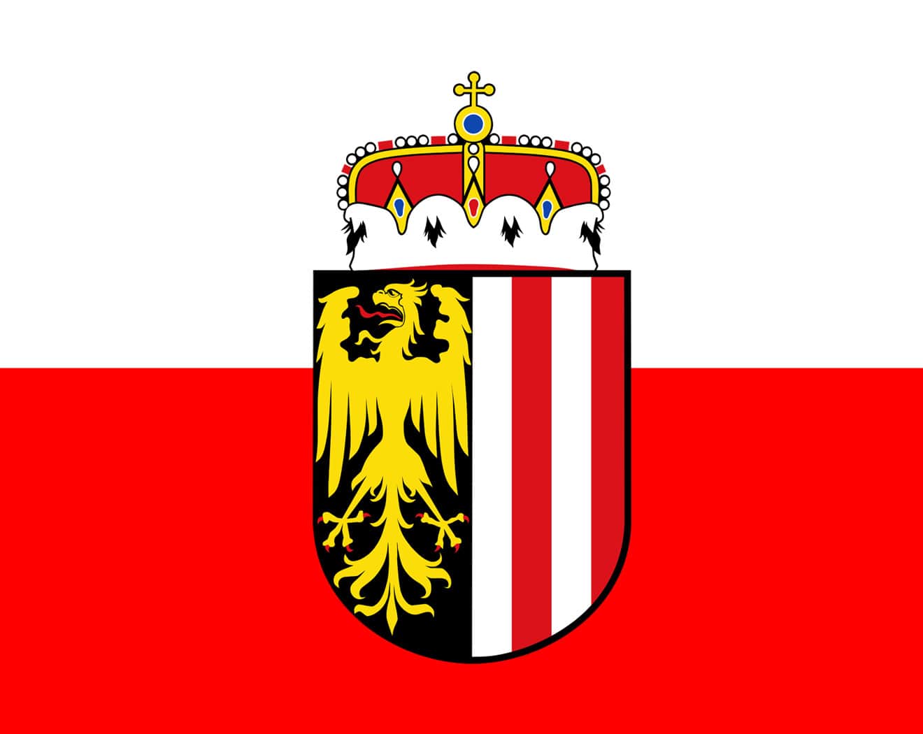 上奥地利
上奥地利
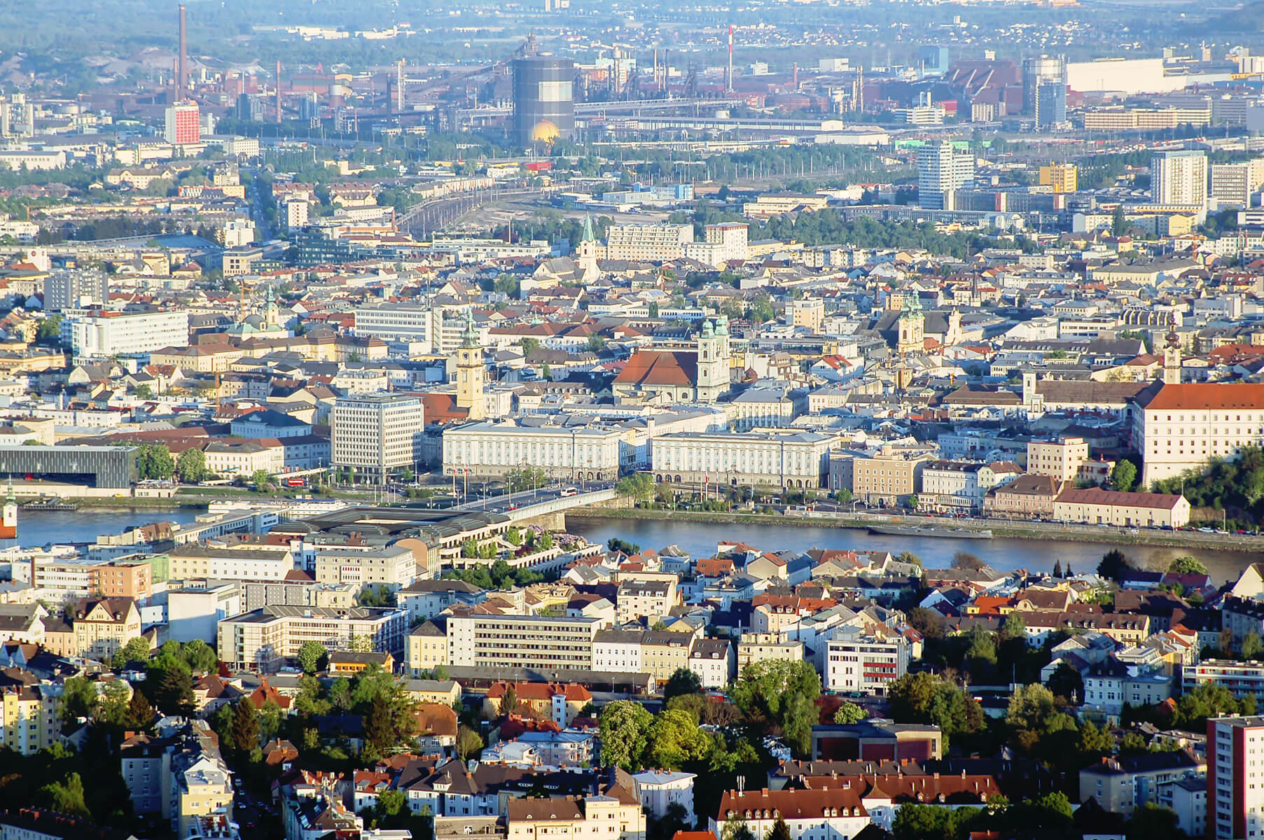
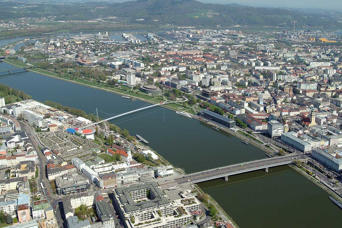
 罗马人建立的城市
在莫扎特的41部交响曲中,第36交响曲《林茨》是莫扎特短暂一生中幸福时光的象征。1783年,27岁的莫扎特偕新婚妻子访问林茨,林茨杜恩伯爵恳请莫 扎特创作一首交响曲。莫扎特10月31日写信给父亲说,“11月4日星期天,要在林茨剧场举行一场音乐会。由于我身边一份交响曲谱都没带,所以目前只好专 心作曲”。3天后,交响曲《林茨》如期上演了,最终成为维也纳古典交响乐的典范之作。
上奥地利还拥有晚期浪漫主义的伟大作曲家安东·布鲁克纳。这位以虔诚著名的作曲家出生于安斯菲尔登。这位与布拉姆斯一起成为维也纳音乐柱石的巨人,葬于圣弗洛里安修道院的地下墓室。
在2006莫扎特诞辰250周年,萨尔茨堡上演了莫扎特全部歌剧。2009年,林茨计划别出心裁在把布鲁克纳的11 部规模浩大的交响曲和各式弥撒,委约写为一部“合成摘要作品”,将其浓缩进一个小时的时间里。
Linz ist die Landeshauptstadt von Oberösterreich und mit 210.118 Einwohnern (Stand: 1. Jänner 2023) bzw. 211.449 Einwohnern (Stand: 1. Jänner 2023[3]) nach Wien und Graz die drittgrößte Stadt Österreichs und das Zentrum des mit 823.514 Menschen (Stand 2023) zweitgrößten Ballungsraumes des Landes.[4]
Die Stadt an der Donau hat eine Fläche von 95,99 km² und ist Zentrum des oberösterreichischen Zentralraums. Als Statutarstadt ist sie sowohl Gemeinde als auch politischer Bezirk; außerdem Sitz der Bezirkshauptmannschaften der benachbarten Bezirke Linz-Land und Urfahr-Umgebung.
Nach dem Ende des Zweiten Weltkriegs (1945) hatte Linz den Ruf einer staubigen Stahlstadt, den sie dem größten Arbeitgeber, den Stahlwerken der heutigen Voestalpine AG, verdankte. Doch durch verbesserten Umweltschutz und zahlreiche Initiativen im Kulturbereich, beispielsweise Veranstaltungen wie die Linzer Klangwolke, das Brucknerfest, das Pflasterspektakel und den Prix Ars Electronica bzw. das Ars-Electronica-Festival, gewann die Stadt sukzessive ein neues Image. Seit 2004 wird jährlich das Filmfestival Crossing Europe veranstaltet. 2009 war Linz Europäische Kulturhauptstadt. 2013 wurde das neue Musiktheater am Volksgarten, ein modernes Theater- und Opernhaus, eröffnet. Linz konnte sich mit diesen und weiteren Initiativen als Kulturstadt positionieren, wobei auch Strukturen der alten Industriestadt zum Teil noch sichtbar sind. Dazu passend weist Linz als Universitätsstadt mit mehreren Universitäten auch zahlreiche Studienangebote im künstlerischen und kulturellen Bereich auf.
Die Stadt ist wahrscheinlich namensgebend für die Linzer Torte.
Die Stadt wird inoffiziell auch als Linz an der Donau bezeichnet, um nicht mit der deutschen Stadt Linz am Rhein verwechselt zu werden.
林茨[2](德语:Linz,德语发音:[ˈlɪnts] (ⓘ);捷克语:Linec)位于奥地利东北部,人口约20万,是上奥地利州的首府,奥地利的第三大城市。林茨位于捷克边境以南约30公里处,同时林茨也是多瑙河上游重要的河港港经济中心、奥地利最重要的重工业城市,奥地利最大的钢铁公司和化工公司都位于此。
 2024夏季奥林匹克运动会
 普罗旺斯-阿尔卑斯-蓝色海岸

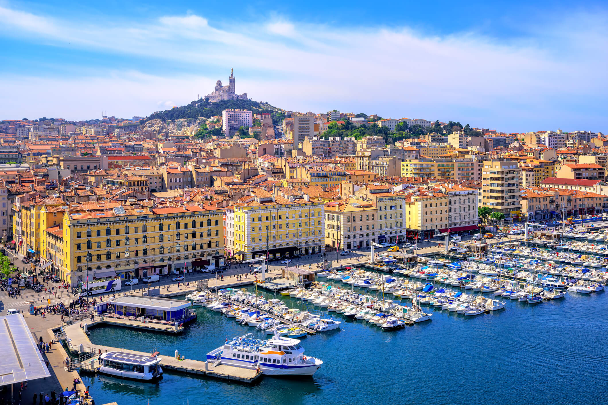
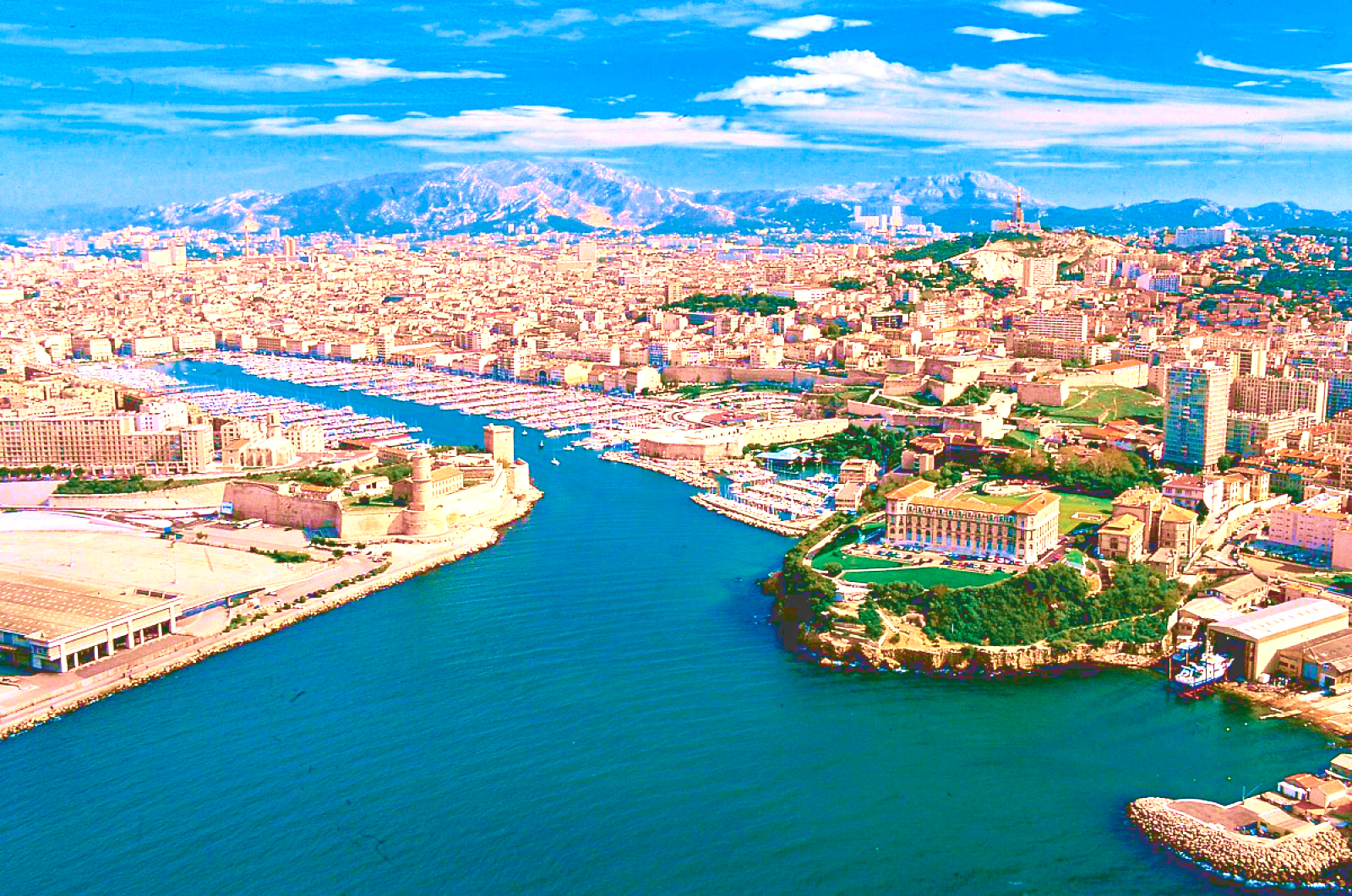
马赛(Marseille)是法国的第二大城市和最大海港,城市人口123万。该市三面被石灰岩山丘所环抱,景色秀丽, 气候宜人。马赛东南濒地中海,水深港阔,无急流险滩,万吨级轮可畅通无阻;西部有罗纳河及平坦河谷与北欧联系,地理位置得天独厚。全港由马赛、拉韦拉、福 斯和罗纳圣路易四大港区组成,年货运量1亿吨,为法国对外贸易最大门户。马赛是法国的一个重要工业中心,这里集中了法国40%的石油加工工业,福斯-塔尔 泊一带有4个大型炼油厂,每年能处理石油4500万吨。马赛的修船工业也相当发达,其修船量占全国此行业的70%。新港区有大小船坞10个,其中第10号 船坞长465米,宽65米,深11~12.5米,能修理世界最大的船只--80万吨级的油轮。
马赛(法语:Marseille,法语发音:[maʁsɛj] (ⓘ);奥克语:Marselha),法国东南部城市,普罗旺斯-阿尔卑斯-蓝色海岸大区罗讷河口省的一个市镇,同时也是所在大区首府及所在省的省会,下辖马赛区[1],2021年1月1日时人口数量为873,076人,在法国城市中排名第二位,仅次于首都巴黎,并与相邻的普罗旺斯地区艾克斯以及周边的数十个市镇共同组成了艾克斯-马赛普罗旺斯都会区[2]。
马赛位于地中海沿岸,市区三面环山、一面靠海,城市自老港向内陆区域延伸,市镇面积达240.6平方公里。马赛是法国艺术与历史之城,公元前六世纪就已有建城记载,被认为是法国最古老的城市之一。马赛在中世纪时为重要的宗教中心,近代因港口而吸引了大批移民,现为法国南部的政治、经济、科教、医疗、文化中心,艾克斯-马赛大学是法国乃至法语区规模最大的高等教育机构。马赛是世界水资源协会的总部所在地,是法国最大的港口城市,在2014年以前,马赛亦是地中海沿岸最大的港口[社 1]。
马赛是法国重要的旅游城市,因当地温暖的气候和充足的日照而闻名,被称为“阳光大道”的法国A7高速公路直通马赛市中心,市区内亦有大量历史建筑。马赛也因同名足球俱乐部而闻名,后者是法国唯一一个获得欧洲冠军联赛总冠军的球队,此外齐内丁·齐达内的标志性的过人动作被称为“马赛回旋”。在艺术方面,法国作家安托南·阿尔托和埃德蒙·罗斯丹出生于马赛,另有大批文学及影视作品取材于此。2013年,马赛获得“欧洲文化之都”的称号。
Marseille (/mɑːrˈseɪ/; French: [maʁsɛj] ( listen), locally [mɑχˈsɛjə]; English alternative spelling: Marseilles; Provençal: Marselha [maʀˈsejɔ, -ˈsijɔ]), is the second-largest city of France. The capital of the Bouches-du-Rhône department and Provence-Alpes-Côte d'Azur administrative region, it is on France's south coast and had a population of 852,516 in 2012.[1] It has a metropolitan area of 241 km2 (93 sq mi), the third-largest in France after Paris and Lyon.[3]
Known to the ancient Greeks and Romans as Massalia[4] (Greek: Μασσαλία, Massalía),[5][page needed][6] Marseille was an important trading centre and the main commercial port of the French Republic. Marseille is now France's largest city on the Mediterranean coast and the largest port for commerce, freight and cruise ships. The city was European Capital of Culture in 2013. It hosted matches at the 1998 World Cup and Euro 2016. It is home to Aix-Marseille University.
Marseille [maʁˈsɛj] (deutsch veraltet: Massilien, okzitanisch: Marselha oder Marsiho [maʀˈse.jɔ]) ist die wichtigste französische und eine bedeutende europäische Hafenstadt. Sie liegt am Golfe du Lion, einer Mittelmeerbucht. Die Stadt, deren Einwohner sich Marseillais [maʁ.sɛ.ˈjɛ] nennen, ist Hauptstadt des Départements Bouches-du-Rhône in der Region Provence-Alpes-Côte d’Azur. Marseille ist mit 861.635 Einwohnern (Stand 1. Januar 2015) nach Paris die zweitgrößte Stadt Frankreichs. Die Metropolregion zählt nach Eurostat-Definition rund 3,05 Mio. Einwohner (2015).[1]
Marseille war 2013 gemeinsam mit der slowakischen Stadt Košice Kulturhauptstadt Europas.
Marseille1 (en occitan provençal : Marselha selon la graphie classique, Marsiho selon la graphie mistralienne2) est une commune du Sud-Est de la France, chef-lieu du département des Bouches-du-Rhône et de la région Sud Provence-Alpes-Côte d'Azur.
En 2015, Marseille est la deuxième commune de France, avec 861 635 habitants3 et la troisième agglomération avec 1 578 584 habitants4. Depuis le 1er janvier 2016, Marseille est le siège de la métropole d'Aix-Marseille-Provence5, la seconde plus peuplée de France avec 1 859 922 habitants6. Son aire urbaine est quant à elle la troisième de France après celles de Paris et Lyon avec 1 752 398 habitants en 20157.
Parmi les plus anciennes villes de France8, fondée sous le nom de Μασσαλία (Massalía) vers 600 av. J.-C. par des marins grecs originaires de Phocée, Marseille est depuis l'Antiquité un important port de commerce et de passage. Elle connait notamment un essor commercial considérable au cours du XIXe siècle devenant une ville industrielle et négociante prospère9.
Héritage de ce passé, le Grand port maritime de Marseille (GPMM) et l'économie maritime sont encore des pôles majeurs de l'activité régionale et nationale10 et Marseille reste le premier port français, le deuxième port méditerranéen11 et le cinquième port européen12.
L'ouverture de Marseille sur la mer Méditerranée en fait depuis ses origines une ville cosmopolite d'échanges culturels et économiques avec l'Europe du Sud, le Proche-Orient, l'Afrique du Nord et l'Asie. Elle est d'ailleurs souvent considérée comme la « Porte de l'Orient »13.
Marsiglia (in francese: Marseille [maʁ.sɛij(ə)], in provenzale: Marselha o Marsiho[Nota 1], in latino: Massilia o Massalia; in greco: Μασσαλία o Μασαλία) è la più grande città della Francia meridionale, capoluogo della regione Provenza-Alpi-Costa Azzurra e del dipartimento delle Bocche del Rodano, oltre che il primo porto della Francia, sesto del Mediterraneo ed a livello europeo[1]. Fondata dai Greci durante l'Antichità, è una delle più antiche città francesi. Considerando il numero di abitanti della sola municipalità risulta essere la seconda città della Francia, dopo Parigi. In realtà Lione, pur avendo meno abitanti di Marsiglia nel territorio comunale, considerando l'area metropolitana supera il milione e mezzo di abitanti, contendendo a Marsiglia il primato di seconda città di Francia.
Marsiglia è stata Capitale europea della cultura nel 2013, assieme a Košice.
Marsella (Marseille en francés [maʁ.sɛj] (?·i), del griego Μασσαλία, Massalia; en occitano provenzal, Marselha o Marsiho) es una ciudad portuaria del sur de Francia, capital del departamento de Bocas del Ródano y de la región de Provenza-Alpes-Costa Azul.
Marsella es la segunda ciudad más poblada de Francia después de París con 859 543 habitantes, principal centro económico y mayor metrópoli del Mediodía francés, agrupando cerca de 1 605 000 habitantes en su área urbana, siendo la tercera mayor del país, tras París y Lyon. Es el puerto comercial más importante de Francia y del Mediterráneo, tercero en importancia de Europa tras Róterdam y Amberes, centro de importante actividad industrial especializado en la petroquímica y el refino de petróleo, construcción naval e industrias diversas, es también un nudo de comunicaciones en el que confluyen las rutas entre París, Italia, Suiza y España. Marsella es sede de una Archidiócesis y centro universitario de primer orden fundado en 1409.
Marsella se desarrolló con el nombre de Massalia como colonia comercial fundada por marineros focenses hacia el 600 a. C., conservando los restos más antiguos de la viticultura de Francia introducidos en el siglo IV a. C.. Sede de un vizcondado en el siglo IX dependiente luego del condado de Provenza, fue incorporada a la corona de Francia en 1481 y aprovechó para su crecimiento de la alianza estratégica de ésta con el Imperio otomano durante el Renacimiento y el Antiguo Régimen. Tras la Revolución que bautizó con el nombre de Marsellesa, la marcha militar que más tarde se convirtió en uno de los símbolos nacionales de Francia, la ciudad fue escenario del llamado Terror Blanco y durante el siglo XIX, escenario de un rápido progreso con la expansión colonial francesa hacia Argelia y la apertura del canal de Suez. Fue parcialmente destruida durante la Segunda Guerra Mundial y uno de los objetivos de la Operación Dragoon. Lugar de paso tradicional de los flujos migratorios que fueron incrementando el carácter multicultural de la ciudad, la crisis económica de los años 1970 provocó sin embargo un descenso notable de la población, la pérdida de poder adquisitivo y la acentuación de los conflictos sociales en el último cuarto del siglo XX para ir recuperándose paulatinamente como una de las urbes más importantes de la región Euromediterránea.
加利福尼亚州高速公路一号
 加利福尼亚州
 2026年世界杯足球赛
财政金融
***全球金融中心
历史
公元 2000 - 2100
历史
公元 1500 - 2000
国际城市
***全球城市经济竞争力
英雄联盟
英雄联盟
英雄联盟全球总决赛
美国
2026年世界杯足球赛
财政金融
***全球金融中心
历史
公元 2000 - 2100
历史
公元 1500 - 2000
国际城市
***全球城市经济竞争力
英雄联盟
英雄联盟
英雄联盟全球总决赛
美国
 重要港口
重要港口
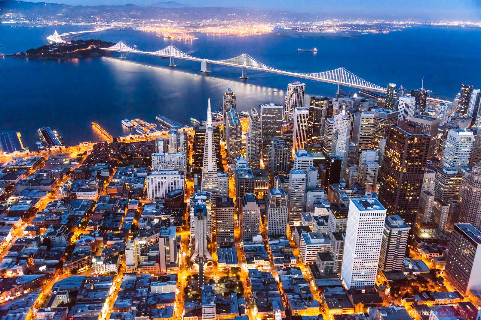

太平洋沿岸仅次于洛杉矶的第二大港市。位于加利福尼亚州西北部,美国西海岸中点。市区面积119平方公里,人口72.4万(1990),为美国西部人口密度最高的城市。大市区包括附近4个县和奥克兰、伯克利等城镇,面积7475平方公里。
城市座落在宽不足10公里的半岛北端,介于太平洋和圣弗朗西斯科湾之间,北临金门海峡。市域内丘陵起伏,有双峰山、戴维森山,最著名者为诺布山; 沿海地带较为平坦。南流的萨克拉门托河和北流的圣华金河在城市附近汇合后,向西注入圣弗朗西斯科湾。因地处圣安德烈斯大断层上,多地震。气候宜人,冬季温 和,1月平均气温9℃;夏季凉爽,7月平均气温17.8℃。年平均降水量约500毫米,以冬雨为主,夏日多雾。1776年为西班牙移民拓居地。1806年俄国在此设哨所,作为当时俄届阿拉斯加的物资供应站。1821年属墨西哥。1846年归美国时,为居民不到干人的小镇。1848年附近地区发现金矿,大批淘金者涌入,包括第一批中国“契 约劳工”。1850年设市时,人口已增至2.5万人,成为贸易和为矿业服务的中心,附近地区的农业也有所发展。18邱年后随着横贯大陆铁路的通达和港区设 施的逐步完善,城市迅速发展。1880年后开始向海湾以东地区扩展,形成若干卫星城镇,19世纪末,人口已达34万。1906年大地震时全城80%建筑被 毁,后迅速重建。1914年巴拿马运河通航,港口日益繁荣,贸易量激增。第二次世界大战中,为军需物资的重要供应站。战后,工、商、金融、旅游服务业和市政建设均有较大发展,大市区由单一中心扩展为由旧金山、海湾东区(奥克兰)和圣何塞三大中心组成的城镇群。
旧金山(英语:San Francisco),正式名称为旧金山市县(City and County of San Francisco),是位于美国加利福尼亚州北部的都市,为加州唯一市县合一的行政区,中文又音译为三藩市和圣弗朗西斯科,亦别名“金门城市”、“湾边之城”、“雾城”等。位于旧金山半岛的北端,东临旧金山湾、西临太平洋,人口约86万,为加州第四大城;其与湾边各都市组成的旧金山湾区,人口总数达768万,是仅次于大洛杉矶地区的美国西岸第二大都会区[4]。
旧金山是北加州与旧金山湾区的核心都市,当地住有很多艺术家、作家和演员,在20世纪及21世纪初一直是美国嬉皮士文化和近代自由主义、进步主义的中心之一。旧金山也是联合国的诞生地[5][6][7]。旧金山是受欢迎的旅游目的地[8],以其凉爽的夏季、多雾、绵延的丘陵地形、混合的建筑风格,以及金门大桥、缆车、恶魔岛监狱及唐人街等景点闻名。此外,旧金山也是五大主要银行及许多大型公司、机构的总部所在,其中又以互联网产业为最,包括盖璞、太平洋瓦电公司、Yelp、Dropbox、Pinterest、Twitter、优步、爱彼迎、Mozilla、维基媒体基金会、克雷格列表、Salesforce.com等。
San Francisco (Aussprache: ˌsæn fɹənˈsɪskoʊ, auch San Franzisko[3]), offiziell City and County of San Francisco (Stadt und Kreis von San Francisco), ist eine Stadt und eine Metropolregion im US-Bundesstaat Kalifornien an der Westküste der Vereinigten Staaten am Pazifischen Ozean. Mit 805.195 Einwohnern (Stand der Volkszählung 2010)[4] ist sie die viertgrößte Stadt Kaliforniens. Im globalen Vergleich gilt sie neben ähnlich großen Städten wie etwa Frankfurt am Main oder Amsterdam als mittelgroße Weltstadt.
Der Name der Stadt ist spanischen Ursprungs. San Francisco ist nach dem Heiligen Franziskus, also Franz von Assisi, benannt.
サンフランシスコ市郡(英語: City and County of San Francisco、通称: San Francisco[1])は、アメリカ合衆国西海岸にあるカリフォルニア州の北部に位置する都市。
キリスト教のフランシスコ会の修道士が創設者の聖フランシスコを街の名に付けたのが地名の由来である。漢字では、桑港や旧金山と表記される。桑港は、「サンフランシスコ」を音訳した「桑方西斯哥」(現代中国語普通話ではSāngfāngxīsīgē(サンファンシースーグー)の発音になる)の頭文字「桑」(サン)に、港町である事を示す「港」を加えたものである。この漢字表記は、現地の日系社会でも使われるため、商店や日本語学校などの名称によく見られる。ジャパンタウン(日本人街)にある曹洞宗の寺院「日本山桑港寺(そうこうじ)」はその代表である。一方の旧金山(舊金山)は、1849年に起こったカリフォルニア・ゴールドラッシュにちなんだ名称である。当初この地に労働者としてきた華人たちはサンフランシスコを「金山」と呼んだが、後にオーストラリア・ビクトリア州など他の地域でもゴールドラッシュが起きるとサンフランシスコは旧金山と呼ばれるようになった(「新金山」はメルボルンを指す)。現地の中国系社会では桑港と同様に広東語で「サンファンシー」の音を当てた三藩市が旧金山よりも多用される傾向があり、市当局も中文での名称を三藩市としている[2]。
アメリカの他地域では頭文字の「SF」や「フリスコ(Frisco)」愛称・略称で呼ばれることが多い。または「サンフラン」(San-Fran)との略称で呼ばれることもある。日本では、特に(航空機での渡航の対象として)「シスコ」の略称で呼ばれることも多い。地元とベイエリア周辺では単純に愛情を込めて「the city」と呼ばれることが多い。
ロサンゼルスと共にカリフォルニア州の経済、工業の中心地として知られており、金融センターとしてアメリカ西海岸では随一の重要性を持っている。2017年の調査によると、世界6位の金融センターであり、アメリカの都市ではニューヨークに次ぐ2位である[3]。サンフランシスコ自体の人口は776,733人(2000年国勢調査)だが、対岸のオークランドなどを含めた都市圏(MSA)の人口は4,123,747人にも上り、全米第12位の規模。更に南岸のサンノゼを加えたサンフランシスコ・ベイエリア全体の人口は7,092,596人で広域都市圏(合同統計地域: CSA)としては全米6番目の規模である。(いずれも2000年国勢調査)それゆえに大規模なダウンタウンが形成されており、近代的なビルが建ち並ぶ。シリコンバレーやカリフォルニア大学バークレー校にも近く、コンピュータ系の企業も多い。
気候は地中海性気候に属し、一年を通して気温の差が比較的小さく、気候的にも住みやすい都市である。急な坂が多く、深い霧に覆われることでも有名である。都市部から13マイルほど南下すると、サンフランシスコ国際空港がある。
観光地としての評価も非常に高い都市であり、外国人のみならず、アメリカ人の間でも訪れたい都市の上位にランクされている。有名な観光スポットとしてゴールデン・ゲート・ブリッジ(金門橋)やフィッシャーマンズワーフ、ツインピークス等が挙げられる。市内を走る伝統あるケーブルカーも人気が高い。
アメリカのシンクタンクが2017年に発表した総合的な世界都市ランキングにおいて、世界13位の都市と評価された[4]。アメリカの都市ではニューヨーク、ロサンゼルス、シカゴに次ぐ4位である。
世界的に著名な都市なので、ロサンゼルスと共に州都であると思われがちだが、誤りである(実際の州都はサクラメント。米国は原則として中小都市に州政府を置く伝統があり、ニューヨークもシカゴも州都ではない)。
San Francisco (SF; /ˌsæn frənˈsɪskoʊ, fræn-/; Spanish for 'Saint Francis'; Spanish: [san franˈsisko]), officially the City and County of San Francisco, is the cultural, commercial, and financial center of Northern California. San Francisco is the 13th most populous city in the United States, and the 4th most populous in California, with 884,363 residents as of 2017.[18] It covers an area of about 46.89 square miles (121.4 km2),[19] mostly at the north end of the San Francisco Peninsula in the San Francisco Bay Area, making it the second most densely populated large US city, and the fifth most densely populated U.S. county, behind only four of the five New York City boroughs. San Francisco is also part of the fifth most populous primary statistical area in the United States, the San Jose–San Francisco–Oakland, CA Combined Statistical Area (8.8 million residents).
As of 2016, it was the 7th highest-income county in the United States, with a per capita personal income of $110,418.[20] The San Francisco CSA was the country's 3rd largest urban economy as of 2017, with a GDP of $878 billion.[21] Of the 574 primary statistical areas in the US, the San Francisco CSA had the highest GDP per capita in 2017, at $99,347 per capita.[21] San Francisco was ranked 14th in the world and third in the United States on the Global Financial Centres Index as of September 2018.[22]
San Francisco was founded on June 29, 1776, when colonists from Spain established Presidio of San Francisco at the Golden Gate and Mission San Francisco de Asís a few miles away, all named for St. Francis of Assisi.[2] The California Gold Rush of 1849 brought rapid growth, making it the largest city on the West Coast at the time. San Francisco became a consolidated city-county in 1856.[23] San Francisco's status as the West Coast's largest city peaked between 1870 and 1900, when around 25% of California's population resided in the city.[24] After three-quarters of the city was destroyed by the 1906 earthquake and fire,[25] San Francisco was quickly rebuilt, hosting the Panama-Pacific International Exposition nine years later. In World War II, San Francisco was a major port of embarkation for service members shipping out to the Pacific Theater.[26] It then became the birthplace of the United Nations in 1945.[27][28][29] After the war, the confluence of returning servicemen, significant immigration, liberalizing attitudes, along with the rise of the "hippie" counterculture, the Sexual Revolution, the Peace Movement growing from opposition to United States involvement in the Vietnam War, and other factors led to the Summer of Love and the gay rights movement, cementing San Francisco as a center of liberal activism in the United States. Politically, the city votes strongly along liberal Democratic Party lines.
A popular tourist destination,[30] San Francisco is known for its cool summers, fog, steep rolling hills, eclectic mix of architecture, and landmarks, including the Golden Gate Bridge, cable cars, the former Alcatraz Federal Penitentiary, Fisherman's Wharf, and its Chinatown district. San Francisco is also the headquarters of five major banking institutions and various other companies such as Levi Strauss & Co., Gap Inc., Fitbit, Salesforce.com, Dropbox, Reddit, Square, Inc., Dolby, Airbnb, Weebly, Pacific Gas and Electric Company, Yelp, Pinterest, Twitter, Uber, Lyft, Mozilla, Wikimedia Foundation, Craigslist, and Weather Underground. It is home to a number of educational and cultural institutions, such as the University of San Francisco (USF), University of California, San Francisco (UCSF), San Francisco State University (SFSU), the De Young Museum, the San Francisco Museum of Modern Art, and the California Academy of Sciences.
San Francisco (en anglais [sæn frənˈsɪskoʊ]), officiellement City and County of San Francisco, est une ville américaine et un comté de l'État de Californie. Elle est située à l'extrémité nord de la péninsule de San Francisco, entre l'océan Pacifique à l'ouest et la baie de San Francisco à l'est. Son nom est couramment abrégé en SF et la ville est surnommée The City by the Bay4.
Fondée en 1776 par des Espagnols au sein de la Viceroyauté de la Nouvelle-Espagne, la ville, nommée en l'honneur de San Francisco de Asís, prend son essor lors de la ruée vers l'or et son prolongement, l'embellissement de San Francisco par les millionnaires du Nevada. Puis, elle devient le berceau du jeans avec la fondation de Levi Strauss & Co. Les années 1950 voient la naissance de la Beat Generation. À partir de la deuxième partie du XXe siècle, l'industrie des hautes technologies se développe dans la région de la baie. Aujourd'hui San Francisco est la ville la plus densément peuplée des États-Unis après New York. La municipalité-comté5 de San Francisco compte 805 235 habitants dans ses limites administratives6 et plus de 7 millions de personnes vivent dans l'aire métropolitaine de La Baie7, la quatrième métropole des États-Unis par sa population. La partie sud de cette dernière est occupée par la municipalité de San José et la Silicon Valley, premier pôle de hautes technologies des États-Unis qui accueille un nombre important d'entreprises de technologie de pointe de renommée mondiale telles que Cisco, Apple, Tesla Motors, Hewlett-Packard, Google, Intel ou encore Facebook8. Dans le domaine universitaire, elle accueille les prestigieuses9 université Stanford et université de Californie à Berkeley. San Francisco est également le siège de la Wikimedia Foundation dont fait partie le projet Wikipédia. Au nord s'étendent la Napa Valley et la Sonoma Valley, renommées pour leur viticulture. San Francisco fait partie des villes progressistes dans le domaine de l'écologie10,11 et du développement durable12,13,14.
Troisième destination touristique préférée des français aux États-Unis15, la ville est célèbre pour le pont du Golden Gate, l'île et ancienne prison d'Alcatraz, Fisherman's Wharf, la Transamerica Pyramid, la Coit Tower, ses maisons victoriennes, ses cable cars et ses nombreuses collines découpées de rues en pente. Haut lieu de la contre-culture, ville de tolérance et d'émancipation des minorités, San Francisco est également connue pour son Chinatown, ses quartiers homosexuels comme Le Castro, et hippie. Elle représente un foyer culturel et économique majeur aux États-Unis et accueille chaque année plusieurs événements d'ampleur mondiale16 mais vibre également au rythme des festivités animées par les différentes communautés locales17. Elle se revendique comme une ville sanctuaire pour les sans papiers depuis 198918. Sur le plan sportif, les 49ers au football américain, les Giants au baseball et les Warriors au basket-ball sont les équipes phares de la ville.
San Francisco (AFI: [sanfranˈsisko][1]; in inglese /ˌsæn frənˈsɪskoʊ/) è una città statunitense, la quarta della California per numero di abitanti (dopo Los Angeles, San Diego e San Jose), con una popolazione stimata nel 2016 di 870 887 abitanti, stima che la colloca al dodicesimo posto fra le città più popolose degli Stati Uniti d'America e allo stesso tempo al secondo posto per densità di popolazione, dietro solo a New York.[2] La città fa parte di una vasta area metropolitana (circa 7 milioni di abitanti,[3] la quinta dell'intero Paese), la San Francisco Bay Area, di cui è sempre stata il centro economico-finanziario, culturale e turistico, anche se ha ormai perso il primato di popolazione.
San Francisco è una popolare meta di molti turisti internazionali, ed è conosciuta per la sua fresca nebbia estiva, per le sue ripide colline, per la sua vivacità culturale e il suo eclettismo architettonico, che affianca stile vittoriano e architettura moderna, per i suoi famosi paesaggi, incluso il Golden Gate Bridge, per i suoi tram e per Chinatown. L'Università della California, San Francisco è uno dei principali centri biomedici del mondo, e l'ospedale è tra i principali degli Stati Uniti.
San Francisco, de forma oficial Ciudad y Condado de San Francisco (en inglés: City and County of San Francisco), es una ciudad que ocupa la cuarta posición de ciudad más poblada del estado de California y la 13.ª de Estados Unidos, con una población de aproximadamente 837 442 habitantes en 2013.6 Es la única ciudad-condado consolidada de California, y al abarcar una superficie territorial de 121 km², cuenta con la segunda densidad de población más alta del país entre las ciudades que superan los 200 000 habitantes, tras Nueva York.7 Es el centro cultural, financiero y de transportes del Área de la Bahía de San Francisco, una aglomeración metropolitana con más de siete millones de habitantes.89 Se encuentra en el extremo norte de la península de San Francisco, con el océano Pacífico al oeste, la bahía homónima al este y la entrada de la bahía al norte, por lo que solamente está conectada con tierra firme por su extremo sur.
La ciudad de San Francisco fue fundada por colonos españoles en 1776. Construyeron un fuerte en lo que hoy es el Golden Gate y fundaron una misión llamada así en honor de Francisco de Asís.10 San Francisco perteneció al Virreinato de la Nueva España hasta la independencia de México en 1821. Tras la Intervención estadounidense en México entre 1845 y 1848, la ciudad y el resto de Alta California pasaron a ser territorio estadounidense.
En 1848, la fiebre del oro de California impulsó a la ciudad a un período de rápido crecimiento, pasando de 1000 a 25 000 habitantes en un año,11 lo que convirtió a la ciudad en la más grande de la Costa oeste en aquella época. Después de haber sido devastada por el terremoto e incendio de 1906,12 San Francisco fue rápidamente reconstruida, siendo sede de la Exposición Internacional de Panamá y el Pacífico nueve años más tarde.13 Durante la Segunda Guerra Mundial, la ciudad fue el puerto de embarque de miles de soldados que partían hacia la Guerra del Pacífico.14 Tras la contienda, la confluencia de los militares que regresaban, la inmigración masiva, las actitudes liberales y otros factores dieron lugar al denominado Verano del Amor y los movimientos en favor de los derechos de los homosexuales,15 consolidando a San Francisco como un bastión liberal en los Estados Unidos.
La ciudad incluye varias islas localizadas dentro la bahía (siendo la más famosa Alcatraz), así como los Farallones, que se sitúan a 43 kilómetros de la costa en el océano Pacífico.16 Se comunica con el resto del país y del mundo por medio del Aeropuerto Internacional de San Francisco.
San Francisco es un destino popular para los turistas internacionales, siendo famosa por el puente Golden Gate, el edificio Pirámide Transamérica, los tranvías que recorren sus empinadas calles, su arquitectura modernista y victoriana y por su barrio chino, popularmente llamado Chinatown.17 En las cercanías de San Francisco se encuentra Silicon Valley, gran centro de investigaciones en tecnología y cibernética. La ciudad también es un importante centro financiero y bancario, ya que es sede de más de treinta instituciones financieras,18 lo que ha ayudado a hacer de San Francisco la decimoctava ciudad del mundo por PIB en 2008 y la novena de los Estados Unidos.19
Actualmente es la segunda ciudad estadounidense con mejor calidad de vida, solamente superada por Honolulu20
Сан-Франци́ско (англ. San Francisco [ˌsæn frənˈsɪskoʊ] или [ˌsæn frænˈsɪskoʊ], разг. просторечн. Frisco[3][4]) — город и округ в штате Калифорния, США, названный в честь католического святого (по-испански San) Франциска Ассизского[5]. Население в 2010 году составляло 815 358 человек, это четвёртый по численности населения город Калифорнии и двенадцатый в США[2]. Площадь Сан-Франциско составляет 600,6 км2, из них суши — 121,4 км2, воды — 479,2 км2. Сан-Франциско расположен на северной оконечности полуострова Сан-Франциско. Бо́льшую часть своей истории он являлся самым населённым и важным городом области залива Сан-Франциско.
В 1776 году испанцы обосновались на побережье полуострова, построив форт у пролива Золотые Ворота и основав миссию, названную в честь Святого Франциска[6]. Возникший рядом с ней небольшой городок назывался Йерба-Буэна[en] (исп. Yerba Buena). В 1848 году, благодаря калифорнийской золотой лихорадке, город начал бурно расти[7]. В этом же году он был переименован в Сан-Франциско. После разрушительного землетрясения и пожара в 1906 году город был быстро и практически полностью перестроен[8].
Сан-Франциско является мировым туристическим центром[9], известный своими летними холодными туманами, крутыми холмами и сочетанием викторианской и современной архитектуры. В число достопримечательностей города входят мост «Золотые Ворота», остров Алькатрас, система канатных трамваев, Башня Койт[en] и чайна-таун.
2026年世界杯足球赛
财政金融
***全球金融中心
历史
公元 2000 - 2100
历史
公元 1500 - 2000
国际城市
***全球城市经济竞争力
英雄联盟
英雄联盟
英雄联盟全球总决赛
 纽约州
美国
重要港口
纽约州
美国
重要港口

美国纽约(NewYork)是美国乃至美洲最大的城市,全市由由五个区组成:曼哈顿(Manhattan)、布鲁克林(Brooklyn)、皇 后区(Queens)、布郎克斯(Bronxs)和斯塔滕岛(Staten Island)。光是一个曼哈顿(Manhattan)就超过旧金山的大小,曼哈顿区是纽约市的精华所在,分成上中下城的曼哈顿区,拥有最流行最金融和最 颓废的风情。美国最大的500家公司中,有三分之一以上把总部设在曼哈顿。这里还能领略到著名的自由女神像、联合国总部、时代广场、大都会艺术博物馆、中央公园、苏活(soho)商业区、小意大利、第五大道商业区、格林威治村、华尔街、洛克菲勒中心、百老汇剧院区、唐人街等等人们印象中的纽约。
纽约是美国文化、艺术、音乐和出版中心,有众多的博物馆、美术馆、图书馆、科学研究机构和艺术中心,美国三大广播电视网和一些有影响的报刊、通讯社的总部都设在这里。(Quelle:http://www.ghl.com.cn)
纽约市(英语:New York City,简写为NYC),通称纽约,是位于美国纽约州的城市,为美国人口最多的城市、纽约都会区的核心、以及世界最大的城市之一,是对全球的经济、商业、金融、媒体、政治、教育和娱乐具有极大影响力的国际大都会。纽约还是联合国总部所在地[5],因此也被认为是世界外交的中心[6]。纽约还被称为“世界文化之都”[7][8],名列世界三大国际都会“纽伦港”之一。[9]
纽约位于东北部,濒临大西洋海岸,坐拥世界上最大的天然港口之一的纽约港[10]。纽约市共有曼哈顿区、皇后区、布鲁克林区、布朗克斯区、斯塔滕岛区等5个行政区,每一个行政区也各自是纽约州的一个县[11]。1898年,五个行政区被合并为现在的纽约市[12]。纽约也是全美国人口最密集的主要城市[13],2012年约有8,336,697人[14]居住于302.64平方英里(783.8平方千米)的土地上[15]。纽约都市区在全美的都会区中也高居第一,人口达到1980万[16],同时也是全美最大的联合统计区的一部分,在大区中人口达到2340万[17]。纽约也是语言和人口族群最为多元化的城市[18][19],在此使用的语言达到800种[20][21],而在2005年,全市有36%的人口是非美国出生的。
纽约的历史可以追溯至1624年,荷兰殖民者在这时候在此地建立贸易站,名为新阿姆斯特丹[22]。1664年,纽约及其周边地区为英国所占[22][23][24]。美国建国后,纽约在1785年至1790年为首都[25],1790年,纽约取代费城成为美国第一大城市[26]。纽约市的标志自由女神像在19世纪末20世纪初迎接了数百万移民的到来[27],它同时也是美国及其民主制度的象征[28]。
每年来到纽约的游客达到近5500万[29],许多区域和地标为人们所熟知。纽约还被不同媒体选为世界上被拍照最多的城市[30][31][32]。时报广场位于百老汇剧院区枢纽[33],被称作“世界的十字路口”[34],是世界上行人来往最密集的步行地段之一[35][36]和世界娱乐产业的中心之一[37]。城中的许多桥梁、高楼[38]和公园世界闻名。纽约的金融区,以曼哈顿下城的华尔街为龙头,被称为世界的金融中心[39][40],世界上最大的证券交易所(按上市公司市值)纽约证券交易所也位于此地[41]。曼哈顿的房地产是世界上最为昂贵的之一[42],其唐人街是西半球最为密集的华人聚居地[43][44]。纽约地铁是世界上最为发达的城市交通系统之一,提供24小时不间断的服务[45]。纽约同时还是许多高等学府的所在地[46],其中包括哥伦比亚大学、纽约大学和洛克菲勒大学等排名位于世界前35的学校[47]。
New York City (AE: [nuːˈjɔɹk ˈsɪɾi], kurz: New York, deutsch veraltet: Neuyork,[1] Abk.: NYC) ist eine Weltstadt an der Ostküste der Vereinigten Staaten. Sie liegt im Bundesstaat New York und ist mit rund 8,5 Millionen Einwohnern die bevölkerungsreichste Stadt der Vereinigten Staaten.[2]
Die Metropolregion New York mit 18,9 Mio. Einwohnern[3] ist einer der bedeutendsten Wirtschaftsräume und Handelsplätze der Welt, Sitz vieler internationaler Konzerne und Organisationen wie der Vereinten Nationen sowie wichtiger See- und Binnenhafen an der amerikanischen Ostküste und dem Hudson. Die Stadt genießt mit ihrer großen Anzahl an Sehenswürdigkeiten, den 500 Galerien, etwa 200 Museen, mehr als 150 Theatern und mehr als 18.000 Restaurants Weltruf auch in den Bereichen Kunst und Kultur und verzeichnet jedes Jahr etwa 50 Mio. Besucher, davon knapp 12 Mio. aus dem Ausland.[4][5] Laut Forbes Magazine ist New York City die Stadt mit den höchsten Lebenshaltungskosten in den Vereinigten Staaten sowie eine der teuersten Städte weltweit.[6]
Nachdem 1524 Giovanni da Verrazano und 1609 Henry Hudson die Gegend des heutigen New Yorks erforscht hatten, siedelten ab 1610 niederländische Kaufleute an der Südspitze der Insel Manna-Hatta und bald darauf an der Westspitze von Long Island, dem heutigen Brooklyn. Erst 1626 kaufte Peter Minuit den Einheimischen, wahrscheinlich Lenni-Lenape-Indianern, die Insel „Manna-hatta“ für Waren im Wert von 60 Gulden ab. Die damit begründete Siedlung erhielt danach den Namen Nieuw Amsterdam und war zunächst Hauptstadt der Kolonie Nieuw Nederland, bis sie 1664 von den Briten erobert wurde und die Stadt den seither gültigen Namen bekam.[7] Ihr Aufstieg zur Weltstadt begann 1825 mit der Fertigstellung des Eriekanals.
Die Metropolregion New York erbrachte 2016 eine Wirtschaftsleistung von 1,657 Billionen US-Dollar. Unter den Städten der Welt belegt es damit den zweiten Rang hinter Tokio und wäre als eigener Staat gezählt unter den 20 größten Volkswirtschaften der Welt.[8]
ニューヨーク市(英: New York City)は、アメリカ合衆国ニューヨーク州にある都市。
1790年以来、同国最大の都市であり[4]、市域人口は800万人を超え、都市圏人口では定義にもよるが2000万人以上である[2][5]。2015年の市内総生産は6625億ドルであり[6]、全米最大、東京に続き世界2位である。
ロンドンと並ぶ世界トップクラスの世界都市[7]、金融センターであり[8]、国際連合の本部所在地でもあり、世界の政治、経済、文化、ファッション、エンターテインメントなどに多大な影響を及ぼしている。
The City of New York, often called New York City (NYC) or simply New York, is the most populous city in the United States.[9] With an estimated 2017 population of 8,622,698[7] distributed over a land area of about 302.6 square miles (784 km2),[10][11] New York City is also the most densely populated major city in the United States.[12] Located at the southern tip of the state of New York, the city is the center of the New York metropolitan area, the largest metropolitan area in the world by urban landmass[13] and one of the world's most populous megacities,[14][15] with an estimated 20,320,876 people in its 2017 metropolitan statistical area and 23,876,155 residents in its combined statistical area.[4][5] A global power city,[16] New York City has been described uniquely[17] as the cultural,[18][19][20][21] financial,[22][23] and media capital of the world,[24][25] and exerts a significant impact upon commerce,[23] entertainment, research, technology, education, politics, tourism, art, fashion, and sports. The city's fast pace[26][27] has inspired the term New York minute.[28] Home to the headquarters of the United Nations,[29] New York is an important center for international diplomacy.[30][31]
Situated on one of the world's largest natural harbors,[32][33] New York City consists of five boroughs, each of which is a separate county of the State of New York.[34] The five boroughs – Brooklyn, Queens, Manhattan, The Bronx, and Staten Island – were consolidated into a single city in 1898.[35] The city and its metropolitan area constitute the premier gateway for legal immigration to the United States.[36] As many as 800 languages are spoken in New York,[37][38][39] making it the most linguistically diverse city in the world.[38][40][41] New York City is home to more than 3.2 million residents born outside the United States,[42] the largest foreign-born population of any city in the world.[43] In 2017, the New York metropolitan area produced a gross metropolitan product (GMP) of US$1.73 trillion.[44] If greater New York City were a sovereign state, it would have the 12th highest GDP in the world.[45]
New York City traces its origins to a trading post founded by colonists from the Dutch Republic in 1624 on Lower Manhattan; the post was named New Amsterdam in 1626.[46] The city and its surroundings came under English control in 1664[46] and were renamed New York after King Charles II of England granted the lands to his brother, the Duke of York.[47] New York served as the capital of the United States from 1785 until 1790.[48] It has been the country's largest city since 1790.[49] The Statue of Liberty greeted millions of immigrants as they came to the Americas by ship in the late 19th and early 20th centuries[50] and is a world symbol of the United States and its ideals of liberty and peace.[51] In the 21st century, New York has emerged as a global node of creativity and entrepreneurship,[52] social tolerance,[53] and environmental sustainability,[54][55] and as a symbol of freedom and cultural diversity.[56]
Many districts and landmarks in New York City are well known, with the city having three of the world's ten most visited tourist attractions in 2013[57] and receiving a record 62.8 million tourists in 2017.[58] Several sources have ranked New York the most photographed city in the world.[59][60] Times Square, iconic as the world's "heart"[61] and its "Crossroads",[62] is the brightly illuminated hub of the Broadway Theater District,[63] one of the world's busiest pedestrian intersections,[64][65] and a major center of the world's entertainment industry.[66] The names of many of the city's landmarks, skyscrapers,[67] and parks are known around the world. Manhattan's real estate market is among the most expensive in the world.[68][69] New York is home to the largest ethnic Chinese population outside of Asia,[70][71] with multiple signature Chinatowns developing across the city.[72][73][74] Providing continuous 24/7 service,[75] the New York City Subway is the largest single-operator rapid transit system worldwide, with 472 rail stations.[76][77][78] Over 120 colleges and universities are located in New York City, including Columbia University, New York University, and Rockefeller University, which have been ranked among the top universities in the world.[79][80] Anchored by Wall Street in the Financial District of Lower Manhattan, it has been called both the most economically powerful city and the leading financial center of the world,[23][81][82][83] and the city is home to the world's two largest stock exchanges by total market capitalization, the New York Stock Exchange and NASDAQ.[84][85]
New Yorka (prononciation en anglais américain /nuːˈjɔɹk/ ; Écouter), officiellement nommée City of New York, connue également sous les noms et abréviations de New York City ou NYC, est la plus grande ville des États-Unis en termes d'habitants et l'une des plus importantes du continent américain. Elle se situe dans le Nord-Est des États-Unis, sur la côte atlantique, à l'extrémité sud-est de l'État de New York. La ville de New York se compose de cinq arrondissements appelés boroughs : Manhattan, Brooklyn, Queens, le Bronx et Staten Island. Ses habitants s'appellent les New-Yorkais (en anglais : New Yorkers).
New York exerce un impact significatif sur le commerce mondial, la finance, les médias, l'art, la mode, la recherche, la technologie, l'éducation et le divertissement. Regroupant l'ensemble des caractéristiques d'une ville mondiale, elle est parfois considérée comme « la capitale du monde ». Si elle n'est plus la capitale fédérale des États-Unis depuis plus de deux siècles (elle occupe cette fonction de 1785 à 17902), New York alimente pendant quelques décennies une rivalité financière et politique avec Philadelphie.
Il n'en reste pas moins que New York est la ville la plus peuplée du pays depuis 1790, avec 8 550 405 habitants selon le Bureau du recensement des États-Unis (estimations de 20153,4). Elle est aussi la troisième plus grande ville du continent américain derrière Mexico et São Paulo. Située au cœur de la mégalopole du BosWashb, l'agglomération new-yorkaise (20 182 305 habitants5) s'étend sur plusieurs comtés de l'État de New York (banlieues est et nord) et empiète sur deux États limitrophes. En effet, l'État du New Jersey comprend ses banlieues ouest et sud, et celui du Connecticut comprend ses banlieues nord-est. Son aire urbaine quant à elle comptait 24 millions d'habitants en 20156.
New York accueille quelque 50 millions de visiteurs annuellement7,8,9. Times Square, « The Crossroads of the World »10,11,12, est l'une des intersections les plus populaires du monde13, et le quartier des théâtres de Broadway14 est la plaque tournante du spectacle dans le pays tout entier et un centre majeur de l'industrie du divertissement dans le monde15. La ville abrite un grand nombre de ponts et tunnels (78916 en 2012), gratte-ciel et parcs de renommée mondiale17.
New York se place en tête dans la triade des grands centres financiers mondiaux avec Londres et Hong Kong, ces trois villes étant appelées par les médias anglophones « Nylonkong »18. Le quartier financier de New York, ancré par Wall Street dans le Lower Manhattan, fonctionne ainsi comme la « capitale financière du monde »19,20,21,22,23,24 et est le foyer du New York Stock Exchange (Bourse de New York)25, tandis que le nouveau One World Trade Center est le plus haut gratte-ciel d'Amérique du Nord. De plus, le marché immobilier de Manhattan est parmi les plus chers dans le monde26.
New York est frappée le 11 septembre 2001 par le plus grave attentat ayant jamais touché les États-Unis, deux avions de ligne détournés par des terroristes membres d'Al-Qaïda percutèrent les tours jumelles du World Trade Center et les détruisirent entièrement. En 2018, le quartier est toujours en reconstruction. New York est l'une des villes les plus cosmopolites du monde, par ses nombreux quartiers ethniques. Les plus connus sont Little Italy, ou encore Chinatown qui intègre la plus forte concentration de population chinoise des Amériques27,28,29,30. Enfin, New York accueille des institutions d'importance mondiale. On peut notamment citer le siège de l'ONU, mais aussi de nombreux sièges de multinationales31 et des centres culturels tels que le Metropolitan Museum of Art, le Brooklyn Museum, le Museum of Modern Art, le Lincoln Center. De nombreuses universités réputées sont situées à New York, notamment l'université de la ville de New York, l'université Columbia, l'université de New York, et l'université Rockefeller, qui sont classées dans le top 50 des universités dans le monde32.
New York (AFI: /njuˈjɔrk/[6], in inglese americano [nuː ˈjɔɹk], in italiano conosciuta anche come Nuova York) è una città degli Stati Uniti d'America. Viene detta New York City per distinguerla dall'omonimo Stato federato.
Conosciuta nel mondo anche come "grande mela" (Big Apple), un paragone le cui origini risalgono al libro The Wayfarer in New York scritto da Edward S. Martin nel 1909,[7][8] è situata nello Stato omonimo e sorge su un'area di circa 785 km² alla foce del fiume Hudson, sull'oceano Atlantico, mentre l'area metropolitana comprende anche località situate nei due adiacenti stati del New Jersey e del Connecticut.
È la città più popolosa degli Stati Uniti (tanto che la sua popolazione di 8,5 milioni di abitanti supera il doppio dei 4 milioni di Los Angeles, seconda città nazionale), nonché uno dei centri economici più importanti del mondo, riconosciuta come città globale. L'agglomerato urbano conta 18.223.567 abitanti,[9] quello metropolitano è di 23.019.036 abitanti, che la rendono, secondo le stime, dalla terza alla sesta area urbana più popolata del mondo, e tra le prime tre dell'emisfero boreale e del continente americano (in concorrenza con Città del Messico e San Paolo). New York è anche stimata come diciottesima città più popolata al mondo, tra le città africane di Kinshasa e Lagos, nonché la più popolosa città anglofona del mondo.
Situata sulla cosiddetta baia di New York (New York Bay), in parte sul continente e in parte su isole, è amministrativamente divisa in cinque distretti (borough): Manhattan, The Bronx, Queens, Brooklyn e Staten Island. Di essi, uno è nel continente (il Bronx, situato a nord di Manhattan), tre si trovano su isole: (Staten Island, di fronte al New Jersey; Queens e Brooklyn, rispettivamente nell'estremità nord-occidentale e sud-occidentale dell'isola di Long Island) e uno, Manhattan, sull'appendice inferiore della penisola su cui si trova anche il Bronx e che da esso è separato dall'Harlem River, fiume-canale che collega l'Hudson all'East River. I cinque distretti sono sedi di contea metropolitana: la contea di New York propriamente detta occupa il territorio di Manhattan, quella di Kings il territorio di Brooklyn e quella di Richmond il territorio di Staten Island; le altre due contee (Bronx e Queens) sono omonime dei distretti e si sovrappongono al loro territorio amministrativo. New York è inoltre riconosciuta come una delle città con i panorami urbani più impressionanti del mondo.
Non appartengono a New York, né fanno parte della sua area metropolitana, ma gravitano intorno ad essa per ragioni economiche e culturali, alcune città del confinante Stato del New Jersey, come Jersey City, Newark e Hoboken, situate sulla riva occidentale dell'Hudson, di fronte a Manhattan. La citata Newark è tra l'altro sede di uno degli aeroporti internazionali che servono New York, il Newark-Liberty, situato a 24 km da Manhattan.
Uno dei suoi simboli più famosi è la Statua della Libertà, nonostante non appartenga al suo territorio.
Nueva York2 (en inglés: New York City) es la ciudad más poblada del estado homónimo y de los Estados Unidos de América, y la segunda mayor concentración urbana del continente americano, después de la Ciudad de México. La ciudad de Nueva York está entre las aglomeraciones urbanas más grandes y pobladas del mundo.4
Desde finales del siglo XIX es uno de los principales centros de comercio y finanzas del mundo. Nueva York está considerada como ciudad global, por sus influencias a nivel mundial en los medios de comunicación, en la política, en la educación, en el entretenimiento, las artes y la moda.5 La influencia artística y cultural de la ciudad es de las más fuertes del mundo. En esta ciudad se encuentra la sede central de la Organización de las Naciones Unidas, lo que también la convierte en un importante punto de las relaciones internacionales. La enorme relevancia de la ciudad a todos los niveles la convierte, juntamente con Londres, Tokio y París, en una de las ciudades más destacadas e influyentes del planeta.6
La ciudad se compone de cinco boroughs (a veces traducido como 'condado', 'distrito' o 'comuna') cada uno de los cuales coincide con un condado: Bronx, Brooklyn, Manhattan, Queens, y Staten Island. Con más de 8,4 millones de neoyorquinos en un área urbana de 830 kilómetros cuadrados (320 mi²), Nueva York es la segunda ciudad con más densidad de población de los Estados Unidos, detrás de Union City, Nueva Jersey, localizada al otro lado del río Hudson.7
La ciudad tiene muchos lugares y edificios reconocidos por todo el mundo. Por ejemplo, la estatua de la Libertad, ubicada en la isla homónima, y la isla de Ellis, que recibió a millones de inmigrantes que llegaban a Estados Unidos a finales del siglo XIX y comienzos del XX. Wall Street ha sido uno de los principales centros mundiales de finanzas desde la Segunda Guerra Mundial y es la sede de la Bolsa de Nueva York. La ciudad también ha concentrado a muchos de los edificios más altos del mundo, entre los que se encuentran el edificio Empire State y las torres gemelas del World Trade Center, que fueron derribadas en los atentados del 11 de septiembre de 2001.
La ciudad también es la cuna de muchos movimientos culturales estadounidenses, como por ejemplo el renacimiento de Harlem en literatura y artes visuales, el expresionismo abstracto (también conocido como Escuela de Nueva York) en pintura, y hip hop,8 punk y Tin Pan Alley en música. En 2005, se hablaban casi 170 idiomas en la ciudad, y el 36 % de su población había nacido fuera de los Estados Unidos.910 Con su metro en funcionamiento las 24 horas del día, el movimiento de tráfico y gente es constante.
Нью-Йо́рк (англ. New York City, МФА: New York слушать, [nuː ˈjɔɹk ˈsɪtɪ] или [njuː ˈjɔːk ˈsɪti]) — крупнейший город США[2][3], входящий в одну из крупнейших агломераций мира[4][5][6]. Население города составляет 8 405 837 человек[1], агломерации — 20,63 млн (оценка на 2015 год). Нью-Йорк расположен на берегу Атлантического океана в юго-восточной части штата Нью-Йорк. Город был основан в начале XVII века голландскими колонистами и до 1664 года назывался Новый Амстердам[7].
Нью-Йорк включает пять административных округов (районов, боро): Бронкс, Бруклин, Куинс, Манхэттен и Статен-Айленд. Основные достопримечательности расположены в боро Манхэттен. Среди них: исторические небоскрёбы (Эмпайр-стейт-билдинг, Крайслер-билдинг), Рокфеллеровский центр, Вулворт-билдинг, художественный Метрополитен-музей, Метрополитен-опера, Музей Соломона Гуггенхайма (живопись), Американский музей естественной истории (скелеты динозавров и планетарий), легендарный отель «Челси», штаб-квартира ООН, Гарлем.
Нью-Йорк — важный мировой финансовый, политический, экономический и культурный центр[8].