
Deutsch-Chinesische Enzyklopädie, 德汉百科
 阿尔巴尼亚
阿尔巴尼亚
 地理
*地中海
埃及
阿尔巴尼亚
阿尔及利亚
琥珀之路
波斯尼亚和黑塞哥维那
法国
直布罗陀
希腊
以色列
意大利
克罗地亚
黎巴嫩
利比亚
马耳他
摩洛哥
摩纳哥
黑山
巴勒斯坦
斯洛文尼亚
西班牙
叙利亚
突尼斯
土耳其
塞浦路斯
地理
*地中海
埃及
阿尔巴尼亚
阿尔及利亚
琥珀之路
波斯尼亚和黑塞哥维那
法国
直布罗陀
希腊
以色列
意大利
克罗地亚
黎巴嫩
利比亚
马耳他
摩洛哥
摩纳哥
黑山
巴勒斯坦
斯洛文尼亚
西班牙
叙利亚
突尼斯
土耳其
塞浦路斯
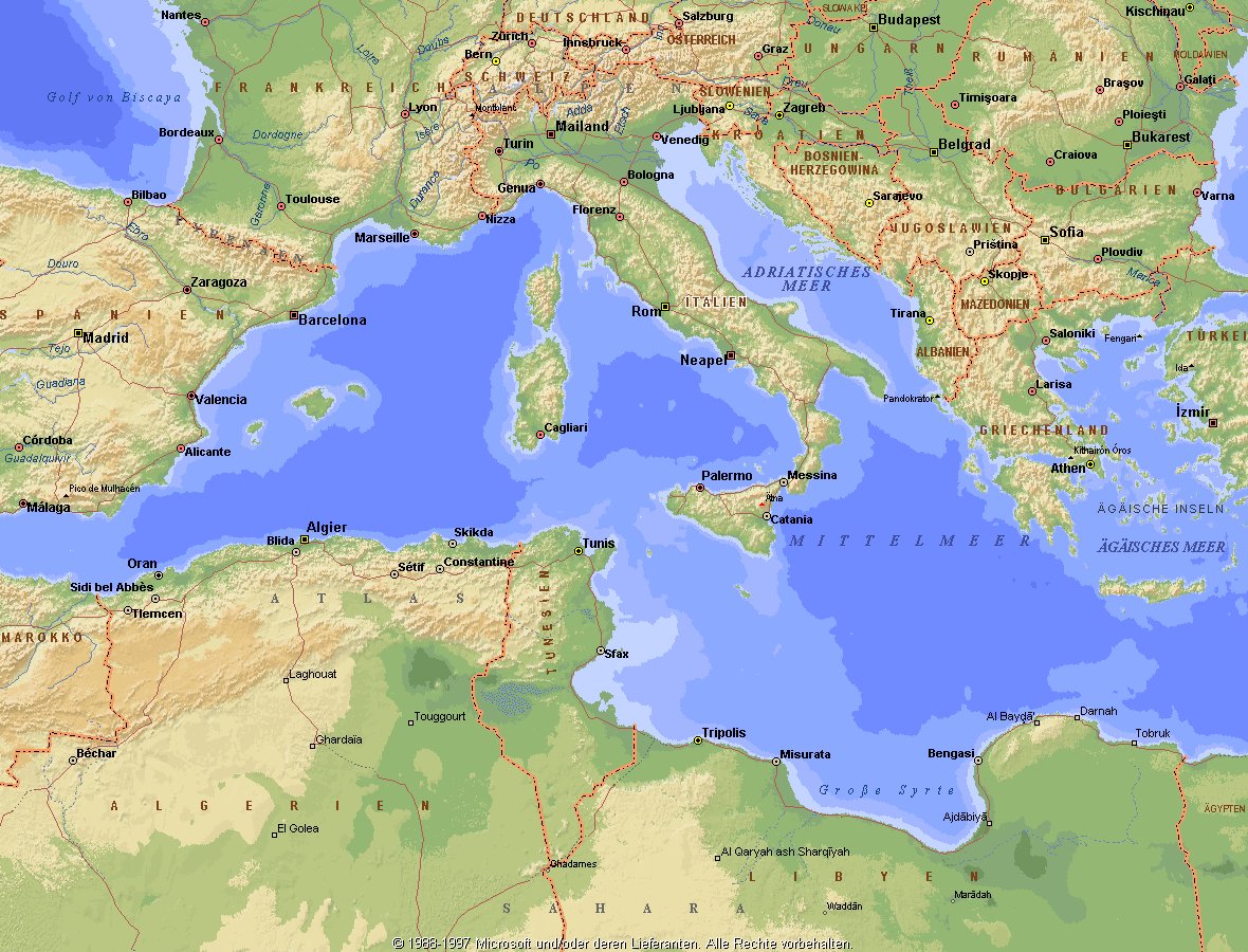
地中海,由北面的欧洲大陆,南面的非洲大陆以及东面的亚洲大陆包围着。东西长约4000千米,南北最宽处大约为1800千米,面积251.6万平方千米,是世界最大的陆间海。地中海的平均深度是1500米,最深处为5267米。
地中海西部通过直布罗陀海峡与大西洋相接,东部通过土耳其海峡(达达尼尔海峡和博斯普鲁斯海峡、马尔马拉海)和黑海相连。19世纪时开通了的苏伊士运河,接通了地中海与红海。 地中海是世界上最古老的海之一,[3] 而其附属的大西洋却是年轻的海洋。地中海处在欧亚板块和非洲板块交界处,是世界最强地震带之一。地中海地区有维苏威火山、埃特纳火山。
地中海作为陆间海,风浪较小,加之沿岸海岸线曲折、岛屿众多,拥有许多天然良好的港口,成为沟通三个大陆的交通要道。这样的条件,使地中海从古代开始海上贸易就很繁盛,促进了古代古埃及文明、古希腊文明、罗马帝国等的发展。现在也是世界海上交通的重要地区之一。其沿岸的腓尼基人、克里特人、希腊人,以及后来的葡萄牙人和西班牙人都是航海业发达的民族。著名的航海家如哥伦布、达·伽马、麦哲伦等,都出自地中海沿岸的国家。
地中海的沿岸夏季炎热干燥,冬季温暖湿润,被称作地中海性气候。植被,叶质坚硬,叶面有蜡质,根系深,有适应夏季干热气候的耐旱特征,属亚热带常绿硬叶林。这里光热充足,是欧洲主要的亚热带水果产区,盛产柑橘、无花果,和葡萄等,还有木本油料作物油橄榄。
Das Mittelmeer (lateinisch Mare Mediterraneum,[1] deshalb deutsch auch Mittelländisches Meer, präzisierend Europäisches Mittelmeer, im Römischen Reich Mare Nostrum) ist ein Mittelmeer zwischen Europa, Afrika und Asien, ein Nebenmeer des Atlantischen Ozeans und, da es mit der Straße von Gibraltar nur eine sehr schmale Verbindung zum Atlantik besitzt, auch ein Binnenmeer. Im Arabischen und Türkischen wird es auch als „Weißes Meer“ (البحر الأبيض/al-baḥr al-abyaḍ bzw. türk. Akdeniz) bezeichnet.
Zusammen mit den darin liegenden Inseln und den küstennahen Regionen Südeuropas, Vorderasiens und Nordafrikas bildet das Mittelmeer den Mittelmeerraum, der ein eigenes Klima (mediterranes Klima) hat und von einer eigenen Flora und Fauna geprägt ist.
地中海(ちちゅうかい、ラテン語: Mare Mediterraneum)は、北と東をユーラシア大陸、南をアフリカ大陸(両者で世界島)に囲まれた地中海盆地に位置する海である。面積は約3000平方キロメートル、平均水深は約1500メートル[2]。海洋学上の地中海の一つ。
地中海には、独立した呼称を持ついくつかの海域が含まれる(エーゲ海、アドリア海など)。地中海と接続する他の海としては、ジブラルタル海峡の西側に大西洋が、ダーダネルス海峡を経た北東にマルマラ海と黒海があり、南西はスエズ運河で紅海と結ばれている(「海域」「地理」で詳述)。
北岸の南ヨーロッパ、東岸の中近東、南岸の北アフリカは古代から往来が盛んで、「地中海世界」と総称されることもある[3]。
The Mediterranean Sea is a sea connected to the Atlantic Ocean, surrounded by the Mediterranean Basin and almost completely enclosed by land: on the north by Southern Europe and Anatolia, on the south by North Africa and on the east by the Levant. Although the sea is sometimes considered a part of the Atlantic Ocean, it is usually identified as a separate body of water. Geological evidence indicates that around 5.9 million years ago, the Mediterranean was cut off from the Atlantic and was partly or completely desiccated over a period of some 600,000 years, the Messinian salinity crisis, before being refilled by the Zanclean flood about 5.3 million years ago.
It covers an approximate area of 2.5 million km2 (965,000 sq mi), but its connection to the Atlantic (the Strait of Gibraltar) is only 14 km (8.7 mi) wide. The Strait of Gibraltar is a narrow strait that connects the Atlantic Ocean to the Mediterranean Sea and separates Gibraltar and Spain in Europe from Morocco in Africa. In oceanography, it is sometimes called the Eurafrican Mediterranean Sea or the European Mediterranean Sea to distinguish it from mediterranean seas elsewhere.[2][3]
The Mediterranean Sea has an average depth of 1,500 m (4,900 ft) and the deepest recorded point is 5,267 m (17,280 ft) in the Calypso Deep in the Ionian Sea. The sea is bordered on the north by Europe, the east by Asia, and in the south by Africa. It is located between latitudes 30° and 46° N and longitudes 6° W and 36° E. Its west-east length, from the Strait of Gibraltar to the Gulf of Iskenderun, on the southwestern coast of Turkey, is approximately 4,000 km (2,500 miles). The sea's average north-south length, from Croatia’s southern shore to Libya, is approximately 800 km (500 miles). The Mediterranean Sea, including the Sea of Marmara (connected by the Dardanelles to the Aegean Sea), has a surface area of approximately 2,510,000 square km (970,000 square miles).[4]
The sea was an important route for merchants and travellers of ancient times that allowed for trade and cultural exchange between emergent peoples of the region. The history of the Mediterranean region is crucial to understanding the origins and development of many modern societies.
The countries surrounding the Mediterranean in clockwise order are Spain, France, Monaco, Italy, Slovenia, Croatia, Bosnia and Herzegovina, Montenegro, Albania, Greece, Turkey, Syria, Lebanon, Israel, Egypt, Libya, Tunisia, Algeria, and Morocco; Malta and Cyprus are island countries in the sea. In addition, the Gaza Strip and the British Overseas Territories of Gibraltar and Akrotiri and Dhekelia have coastlines on the sea.
La mer Méditerranée (prononcé [me.di.tɛ.ʁa.ne]) est une mer intercontinentale presque entièrement fermée, bordée par les côtes d'Europe du sud, d’Afrique du Nord et d’Asie, depuis le détroit de Gibraltar à l'ouest aux entrées des Dardanelles et du canal de Suez à l'est. Elle s’étend sur une superficie d’environ 2,5 millions de kilomètres carrés. Son ouverture vers l’océan Atlantique par le détroit de Gibraltar est large de 14 kilomètres.
Elle doit son nom au fait qu’elle est littéralement une « mer au milieu des terres », en latin « mare medi terra »1.
Durant l’Antiquité, la Méditerranée était une importante voie de transports maritimes permettant l’échange commercial et culturel entre les peuples de la région — les cultures mésopotamiennes, égyptienne, perse, phénicienne, carthaginoise, berbère, grecque, arabe (conquête musulmane), ottomane, byzantine et romaine. L’histoire de la Méditerranée est importante dans l’origine et le développement de la civilisation occidentale.
Il mar Mediterraneo, detto brevemente Mediterraneo, è un mare intercontinentale situato tra Europa, Nordafrica e Asia occidentale connesso all'Oceano Atlantico. La sua superficie approssimativa è di 2,51 milioni di km² e ha uno sviluppo massimo lungo i paralleli di circa 3 700 km. La lunghezza totale delle sue coste è di 46 000 km, la profondità media si aggira sui 1 500 m, mentre quella massima è di 5 270 m presso le coste del Peloponneso. La salinità media si aggira dal 36,2 al 39 ‰.[2] La popolazione presente negli stati bagnati dalle sue acque ammonta a circa 450 milioni di persone.[2].
El mar Mediterráneo es uno de los mares del Atlántico. Está rodeado por la región mediterránea, comprendida entre Europa meridional, Asia Occidental y África septentrional. Fue testigo de la evolución de varias civilizaciones como los egipcios, los fenicios, hebreos, griegos, cartagineses, romanos, etc. Con aproximadamente 2,5 millones de km² y 3.860 km de longitud, es el segundo mar interior más grande del mundo, después del Caribe.1 Sus aguas, que bañan las tres penínsulas del sur de Europa (Ibérica, Itálica, Balcánica) y una de Asia (Anatolia), comunican con el océano Atlántico a través del estrecho de Gibraltar, con el mar Negro por los estrechos del Bósforo y de los Dardanelos y con el mar Rojo por el canal de Suez.2 Es el mar con las tasas más elevadas de hidrocarburos y contaminación del mundo.3
Средизе́мное мо́ре — межматериковое море, по происхождению представляющее собой глубоководную псевдоабиссальную внутришельфовую депрессию[1][2], связанную на западе с Атлантическим океаном Гибралтарским проливом[3].
В Средиземном море выделяют, как его составные части, моря: Адриатическое, Альборан, Балеарское, Ионическое, Кипрское, Критское, Левантийское, Ливийское, Лигурийское, Тирренское и Эгейское. В бассейн Средиземного моря также входят Мраморное, Чёрное и Азовское моря.
 手拉手
手拉手
 阿富汗
埃及
阿尔巴尼亚
阿尔及利亚
阿塞拜疆
巴林
孟加拉国
贝宁
文莱
布基纳法索
科特迪瓦
吉布提
加蓬
冈比亚
几内亚
几内亚比绍
圭亚那
印度尼西亚
伊拉克
伊朗
也门
约旦
喀麦隆
哈萨克斯坦
卡塔尔
吉尔吉斯斯坦
科摩罗
科威特
黎巴嫩
利比亚
马来西亚
马尔代夫
马里
摩洛哥
毛里塔尼亚
莫桑比克
尼日尔
尼日利亚
阿曼
伊斯兰合作组织
巴基斯坦
巴勒斯坦
苏丹共和国
沙特阿拉伯
塞内加尔
塞拉利昂
索马里
苏里南
叙利亚
塔吉克斯坦
多哥
乍得
突尼斯
土耳其
土库曼斯坦
乌干达
乌兹别克斯坦
阿拉伯联合酋长国
阿富汗
埃及
阿尔巴尼亚
阿尔及利亚
阿塞拜疆
巴林
孟加拉国
贝宁
文莱
布基纳法索
科特迪瓦
吉布提
加蓬
冈比亚
几内亚
几内亚比绍
圭亚那
印度尼西亚
伊拉克
伊朗
也门
约旦
喀麦隆
哈萨克斯坦
卡塔尔
吉尔吉斯斯坦
科摩罗
科威特
黎巴嫩
利比亚
马来西亚
马尔代夫
马里
摩洛哥
毛里塔尼亚
莫桑比克
尼日尔
尼日利亚
阿曼
伊斯兰合作组织
巴基斯坦
巴勒斯坦
苏丹共和国
沙特阿拉伯
塞内加尔
塞拉利昂
索马里
苏里南
叙利亚
塔吉克斯坦
多哥
乍得
突尼斯
土耳其
土库曼斯坦
乌干达
乌兹别克斯坦
阿拉伯联合酋长国
 重要的国际组织

伊斯兰合作组织(阿拉伯语:منظمة التعاون الإسلامي;英语:Organisation of Islamic Cooperation;法语:Organisation de la coopération islamique)原名伊斯兰会议组织,是一个伊斯兰世界的政府间国际组织,为联合国大会观察员;该组织由遍及西亚(中东)、中亚、西非、北非、印度次大陆和东南亚的57个国家组成,覆盖的人口约为16亿。秘书处设在沙特阿拉伯王国的吉达市;现任秘书长是原沙特社会事务大臣Yousef Al-Othaimeen(从2016年开始)。
组织的宗旨是促进各成员国之间在经济、社会、文化和科学等方面的合作;努力消除种族隔离和种族歧视,反对一切形式的殖民主义;支持巴勒斯坦人民恢复民族权利和重返家园的斗争;支持穆斯林保障其尊严、独立和民族权利的斗争。
但要注意的是并非每个成员国是伊斯兰国家,如圭亚那、苏里南、莫桑比克、喀麦隆、乌干达和加蓬等国,伊斯兰反而是极少数人的信仰,阿尔巴尼亚则是唯一加入该组织的欧洲大陆的主权国家和联合国会员国,2011年脱离苏丹独立的南苏丹也在独立后脱离该组织的势力范围。
Die Organisation für Islamische Zusammenarbeit (arabisch منظمة التعاون الإسلامي, DMG Munaẓẓamat at-Taʿāwun al-islāmī; englisch Organization of Islamic Cooperation, OIC; französisch L’Organisation de Coopération Islamique, OCI; früher Organisation der Islamischen Konferenz) ist eine zwischenstaatliche internationale Organisation von derzeit 56 Staaten,[2] in denen der Islam Staatsreligion, Religion der Bevölkerungsmehrheit oder Religion einer nennenswerten Minderheit ist. Die Organisation nimmt für sich in Anspruch, den Islam zu repräsentieren. Mehrere größere Mitgliedsstaaten (Saudi-Arabien, Ägypten, die Türkei und der Iran) erheben hinter den Kulissen Führungsansprüche; die jeweils anderen Staaten bestreiten deren Recht dazu. Infolge dieser Rivalitäten ist die OIC seit 2017 kaum handlungsfähig.[3]
イスラム協力機構(イスラムきょうりょくきこう、アラビア語: منظمة التعاون الاسلامي、略称OIC; 英語: Organisation of Islamic Cooperation、略称OCI; フランス語: Organisation de la coopération Islamique)は、イスラム諸国をメンバーとして構成され、国際連合に対する常任代表を有する国際機構。公用語はアラビア語、英語、フランス語。かつてはイスラム諸国会議機構(منظمة المؤتمر الإسلامي、英語: Organisation of the Islamic Conference、フランス語: Organisation de la Conférence Islamique)という名称であったが、2011年6月にカザフスタンのアスタナでの会議で「イスラム協力機構」への変更と紋章が決定された[1]。
イスラム諸国の政治的協力、連帯を強化すること、イスラム諸国に対する抑圧に反対し、解放運動を支援することを目的とする。
加盟国はムスリム(イスラム教徒)が国民の多数を占める西アジア、北アフリカ、西アフリカ、東アフリカ、中央アジア、南アジア、東南アジアなどの57か国、オブザーバーが5ヵ国・8組織(国連など)からなり、世界13億人のムスリムの大部分を代表する。
加盟条件としては、国内でムスリムが大多数を占めることを必ずしも条件としているわけではなく、南アメリカのいくつかの国のようにマイノリティとしてある程度のムスリム人口を抱えているだけであっても、外相会議における審査で承認されればイスラム諸国のひとつとして機構に加盟することができる。イスラム教徒が多数派を占める国はほとんど参加しているが、イスラム教徒比率の高い国のうちエチオピア(30~50%)とタンザニア(約30%)が加盟していない。イスラム教徒人口の多い国で言えばインド(約1億5000万人)や中国(約2000万人)も加盟していない。逆にイスラム教徒比率の低い国ではガボン、ウガンダ、スリナム、ガイアナなどが加盟している(それぞれ10%未満)。
The Organisation of Islamic Cooperation (OIC; Arabic: منظمة التعاون الإسلامي; French: Organisation de la coopération islamique), formerly the Organisation of the Islamic Conference, is an international organization founded in 1969, consisting of 57 member states, with a collective population of over 1.8 billion as of 2015 with 53 countries being Muslim-majority countries. The organisation states that it is "the collective voice of the Muslim world" and works to "safeguard and protect the interests of the Muslim world in the spirit of promoting international peace and harmony".[1]
The OIC has permanent delegations to the United Nations and the European Union. The official languages of the OIC are Arabic, English, and French.
L’Organisation de la coopération islamique (OCI), en arabe : منظمة التعاون الإسلامي (Munaẓẓamat at-Taʿāwun al-islāmī), en anglais : Organisation of Islamic Cooperation (OIC), appelée jusqu'en 2011 Organisation de la conférence islamique (en arabe : منظمة المؤتمر الإسلامي, en anglais : Organisation of the Islamic Conference), est une organisation intergouvernementale créée le 25 septembre 1969. Son siège se situe à Djeddah en Arabie saoudite et elle possède une délégation permanente aux Nations unies.
Regroupant 57 États membres, sa vocation est de promouvoir la coopération dans les domaines économiques, sociaux, culturels et scientifiques (grâce notamment à la Banque islamique de développement), mais aussi la sauvegarde des lieux saints de l'islam ou encore le soutien au peuple palestinien. À l'échelle mondiale, il n'existe pas d'autre organisation confessionnelle dont les membres signataires soient des États.
Ses trois langues officielles sont l'arabe, l'anglais et le français2.
L'Organizzazione della cooperazione islamica (in arabo: منظمة التعاون الإسلامي, Munaẓẓamat al-taʿāwun al-islāmī; in inglese: Organization of the Islamic Cooperation, OIC; in francese: Organisation de la coopération islamique, OCI) è un'organizzazione internazionale con una delegazione permanente presso le Nazioni Unite. Rappresenta 56 Stati dell'Europa, Vicino Oriente, Medio Oriente, America meridionale, Africa, Asia centrale e del Subcontinente indiano.[1]
L'organizzazione, fondata a Rabat, in Marocco, il 25 settembre 1969 con il nome Organisation of the Islamic Conference, in arabo: منظمة المؤتمر الإسلامي, Munaẓẓamat al-muʾtamar al-islāmī; (FR) Organisation de la conférence islamique, mutato nell'attuale nel 2011.[2]
Ha come finalità la salvaguardia degli interessi e lo sviluppo delle popolazioni musulmane nel mondo.
Il 10 ottobre 1975 le è stato riconosciuto lo status di osservatore dell'Assemblea generale delle Nazioni Unite.
La Organización para la Cooperación Islámica (Árabe:منظمة التعاون الاسلامي); (Francés: Organisation de la Coopération Islamique); (Inglés: Organisation of Islamic Cooperation) es un organismo internacional que agrupa a los estados de confesión musulmana, creado en 1969 durante la Conferencia de Rabat y formalizada dos años después.
Su sede está en Yidda, ciudad costera de Arabia Saudí a orillas del Mar Rojo. Sus miembros son países con mayoría de población musulmana o con una comunidad significativa en ellos, con Estados miembros y observadores de África, Asia, Europa y América del Sur. El 28 de junio de 2011 se oficializó el cambio de nombre,1 anteriormente se llamó: Organización de la Conferencia Islámica (Árabe:منظمة المؤتمر الإسلامي); (Francés: Organisation de la Conférence Islamique); (Inglés:Organization of the Islamic Conference).
Sus acciones se circunscriben a la actividad colaborativa entre sus miembros, sobre todo en la lucha contra el imperialismo, el neocolonialismo y por la emancipación de Palestina. Históricamente se celebraron diversos congresos que contribuyeron con su desarrollo: Lahore (1974), La Meca (1981), Casablanca (1984), Kuwait (1987), Dakar (1991). Sus repercusiones son menores que las de la Liga Árabe.
Организация исламского сотрудничества (англ. Organisation of Islamic Cooperation (OIC), араб. منظمة التعاون الاسلامي) — международная организация исламских стран (до 2011 года называлась Организация Исламская конференция (ОИК).

中东欧是一个欧洲大陆的地缘政治概念,包括冷战后影响力最大、统一后的德国,受德国影响及冷战时作为中立国的奥地利,冷战时期被苏联所控制的东欧卫星国,波罗的海三国(立陶宛、拉脱维亚、爱沙尼亚),再加上摩尔多瓦、白罗斯、乌克兰和俄罗斯。
为了避免意识形态和政治上的怀疑,同时为了弥补政治地理与自然地理的差距,中东欧是近年来兴起的一种称呼,特别是在冷战之后,大部分中东欧国家皆加入欧盟及北约,成为西方自由世界的一部分,中东欧的社会政治及经济发展日益受到西方自由阵营原有国家的关注。
Mittel- und osteuropäische Länder (德语) Центральная и Восточная Европа(俄语) Střední a východní Evropa (捷克语) Europa Środkowo-Wschodni (波兰语) Közép- és Kelet-Európa (马扎尔语) Центральна та Східна Європа (乌克兰语) Srednjoistočna Europa (克罗地亚语) Europa Centrală și de Est (罗马尼亚语) Централна и Източна Европа (保加利亚语) Средња и источна Европа (塞尔维亚语) Kesk- ja Ida-Euroopa riigid (爱沙尼亚语) Centrālā un Austrumeiropa (拉脱维亚语)
欧盟统计局目前使用 CEC 或 CEEC(中欧和东欧国家)这一术语来指中欧和东欧地区寻求加入欧盟的下列国家:
阿尔巴尼亚
波斯尼亚和黑塞哥维那
科索沃
北马其顿
黑山共和国
塞尔维亚
土耳其
在 2004 年 5 月 1 日加入欧洲联盟之前,下列国家也属于这一类别:
爱沙尼亚
拉脱维亚
立陶宛
波兰
匈牙利
捷克共和国
斯洛伐克
斯洛文尼亚
在 2007 年 1 月 1 日加入欧盟之前,以下国家也属于这一类别:
罗马尼亚
保加利亚
在 2013 年 7 月 1 日加入欧盟之前,以下国家也属于此类国家:克罗地亚
克罗地亚
Mittel- und osteuropäische Länder (MOEL), auch Mittel-/Osteuropa (MOE), steht für den gleichbedeutenden Begriff mittel- und osteuropäische Staaten (MOES). Der englische Ausdruck lautet CEE für englisch Central and Eastern Europe, der französische PECO für französisch Pays d’Europe centrale et orientale. Weitgehend identisch ist der EU-statistische Begriff Central and Eastern European Countries (CEC oder CEEC).
Welche Länder tatsächlich zu den mittel- und osteuropäischen Ländern gehören, ist unscharf abgegrenzt. Im engeren Sinn wird der Begriff für jene Länder gebraucht, die im Rahmen der EU-Erweiterung 2004 und 2007 in die Europäische Union aufgenommen wurden (EU-12), bzw. für jene Staaten des Westbalkans, die sich im Erweiterungsprozess befinden. Die ebenfalls unscharf abgegrenzte Großregion Ostmitteleuropa ist ein Teil der MOEL.
中東欧(ちゅうとうおう)は、ヨーロッパの区分で、様々に解釈されるが、主に二つの意味がある。
- 中欧(中央ヨーロッパ)と東欧(東ヨーロッパ)を合わせた地域。(この場合中・東欧とも書く。他のヨーロッパの区分と違い、「中東とヨーロッパ」と取られる可能性もあるため、中東ヨーロッパとはほとんど言わない)。
- 中欧のうち過去に東側諸国に組み込まれていた地域で、かつ2004年以降に欧州連合(EU)に加盟した諸国のみを指す。
日本では1.の意味で用いられることが多く、英語圏などではでは中東欧を一般に「CEE」と表記し、2.の意味で用いることも多い。
Central and Eastern Europe, abbreviated CEE, is a term encompassing the countries in Central Europe (the Visegrád Group), the Baltics, Eastern Europe, and Southeastern Europe (Balkans), usually meaning former communist states from the Eastern Bloc (Warsaw Pact) in Europe. Scholarly literature often uses the abbreviations CEE or CEEC for this term.[1][2][3] The Organisation for Economic Co-operation and Development also uses the term "Central and Eastern European Countries (CEECs)" for a group comprising some of these countries.
Depuis les années 1990, la plupart des pays européens dont la majeure partie du territoire s'étend à l'est du 15e degré de longitude Est sont parfois collectivement désignés sous l'appellation de pays de l'Europe centrale et orientale (PECO). Toutefois, la Suède, la Finlande, la Grèce et Chypre ne sont pas considérés dans cet ensemble malgré leur situation géographique, cette notion étant généralement réservée aux anciens pays du bloc de l'Est et aux États européens issus de la dislocation de l'URSS comme les pays baltes, ainsi que de la Tchécoslovaquie et de la Yougoslavie.
Europa centro-orientale è la designazione, usata soprattutto in ambito accademico, della regione d'Europa comprendente la parte orientale dell'Europa centrale. Ne fanno parte le seguenti nazioni che si estendono ad est della Germania e sono comprese fra il Mar Baltico al nord e la Grecia a sud[1]:
Центральная и Восточная Европа (ЦВЕ) (англ. Central and Eastern Europe, CEE) — бывшие социалистические государства Восточной Европы, не входящие в СНГ.
В литературе встречаются название — Восточно-Центральная Европа (ВЦЕ).
 国际城市
国际城市

 重要港口
重要港口

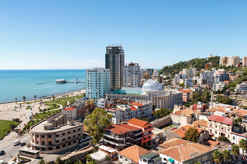
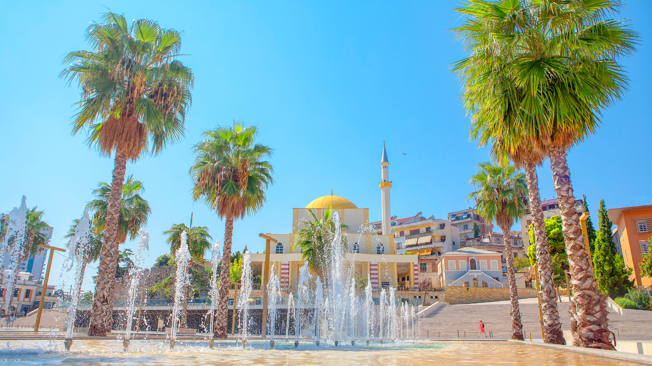

Durrës (albanisch indefinit [dur(ə)s], definit Durrësi [dur(ə)si]; italienisch Durazzo, lateinisch Dyrrachium oder Dyrrhachium; griechisch Δυρράχιο Dyrráchio; im antiken Griechenland Επίδαμνος Epídamnos) ist eine Großstadt an der adriatischen Küste Albaniens. In Mittelalbanien gelegen ist sie die wichtigste Hafenstadt und dementsprechend für die Wirtschaft des Landes von hoher Bedeutung. Durrës ist gemessen an der Bevölkerung von rund 100.000 Einwohnern nach der Hauptstadt Tirana, die nur 30 Kilometer östlich liegt, die zweitgrößte Stadt des Landes und Amtssitz des gleichnamigen Qarks. Durrës und Tirana bilden eine Metropolregion.
Die von Griechen im 7. Jahrhundert v. Chr. als Kolonie gegründete Stadt hatte bei den Römern, aber auch später bei den Byzantinern eine strategisch wichtige Rolle. Die Handelsstraße Via Egnatia begann in Durrës und führte durch das Landesinnere der Balkanhalbinsel nach Konstantinopel. Die Adria ist zwischen Durrës und Brindisi (Italien) 150 Kilometer breit.
Heute ist Durrës nach Tirana die wirtschaftlich wichtigste Stadt des Landes. Der Hafen Durrës ist der größte Albaniens. Auch für den Tourismus in Albanien ist Durrës bedeutend. In den 2000er Jahren sind vor allem entlang der Sandstrände an der Bucht im Süden zahlreiche Hotels entstanden; die Infrastruktur hat sich im Vergleich zu den 1990er Jahren deutlich verbessert.
都拉斯[5](阿尔巴尼亚语:Durrës,阿尔巴尼亚语发音:[ˈdu:rəs];阿尔巴尼亚语定指形式:Durrësi),阿尔巴尼亚第二大城市[6],位于阿尔巴尼亚西部亚得里亚海畔,距首都地拉那31千米,是都拉斯州的首府,也是阿尔巴尼亚最为重要的经济与文化古城。市镇面积为338.30平方公里,人口数量为175,110人(2011年)[4]。
都拉斯最早在公元前7世纪由来自科林斯和科孚的古希腊殖民者所建立,被称为“埃庇丹努斯”,此后在罗马帝国及拜占庭帝国治下进一步发展。埃格纳提亚大道(Via Egnatia)始于都拉斯,并穿过巴尔干半岛通向东部的君士坦丁堡,是罗马阿皮亚大道在东方的进一步延伸。中世纪晚期,该城在保加利亚人、威尼斯人及奥斯曼土耳其人之间反复易手。
在阿尔巴尼亚独立之后,都拉斯曾短暂成为阿尔巴尼亚亲王国的首都,但很快在战间期被意大利王国及纳粹德国所吞并。此外,该市在阿尔巴尼亚社会主义时期发展迅速,人口与经济规模都得到了成倍增长。
都拉斯市内的都拉斯港,是亚得里亚海沿岸最大的海港之一,并将该市与意大利及其它邻近国家连接起来。都拉斯市内主要的景点包括名列联合国教科文组织遗产名录的都拉斯露天竞技场,它始建于图拉真统治之下的罗马帝国,是巴尔干半岛上最大的罗马露天竞技场,一度可以容纳20,000人。


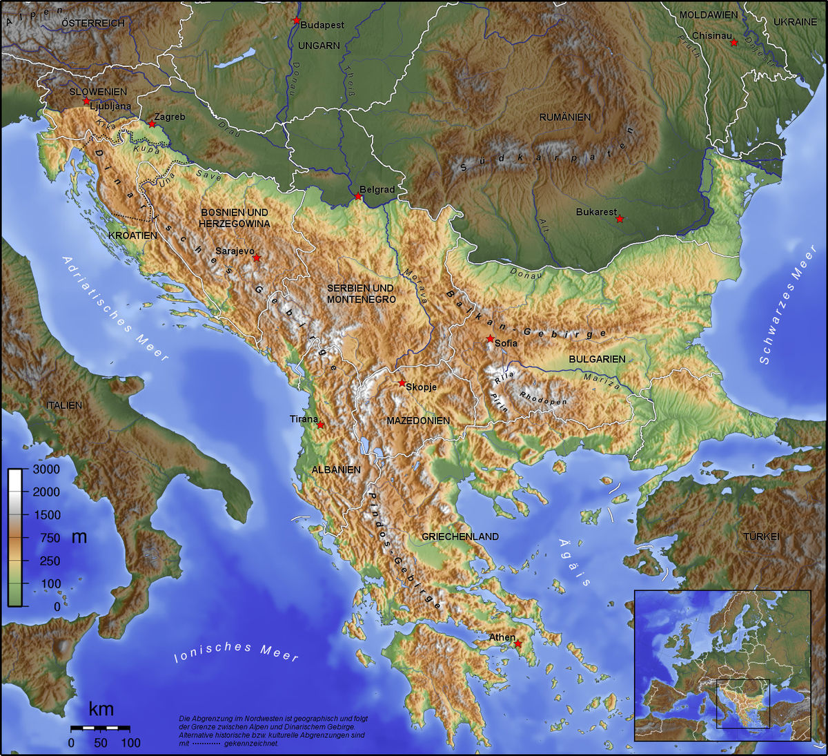
迪纳拉山脉(克罗地亚语:Dinarsko gorje;塞尔维亚语:Динарски Алпи;英语:Dinaric Alps)是欧洲东南部的一条主要山脉,西起阿尔卑斯山脉,沿亚得里亚海海岸向东南延伸约645千米,东隔多瑙河流域与喀尔巴阡山脉相望,向南延伸为希腊境内诸山脉和爱琴海诸岛。
迪纳拉山脉是欧洲第四大山脉,仅次于高加索山脉、斯堪的纳维亚山脉和阿尔卑斯山脉,跨斯洛文尼亚、克罗地亚、波斯尼亚和黑塞哥维那、塞尔维亚、黑山、阿尔巴尼亚和科索沃,最高点为阿尔巴尼亚境内的湖泊峰,海拔2692米。
Das Dinarische Gebirge (auch als Dinarische Alpen oder Dinariden bezeichnet) gehört zu den jungalpidischen Faltengebirgen in Südosteuropa und ist ein Teilabschnitt des den Mittelmeerraum umspannenden Faltungsgürtels. Es erstreckt sich über 600 Kilometer entlang des Ostufers der Adria von den Julischen Alpen in Nordostitalien und Slowenien über Nordwest-Kroatien, Bosnien-Herzegowina, Südwest-Serbien und Montenegro bis nach Nordalbanien, wo es im Querriegel des Prokletije (Albanische Alpen) abschließt.
Das großteils verkarstete Gebirge zeigt alle Typformen des außertropischen Karstformenschatzes. Aufgrund starker (neo-)tektonischer Aktivität der adriatischen Mikroplatte verfügt es wegen seiner treppenartig angeordneten Relieffolge und tektonisch angelegter Groß-Poljen – sogenannten Poljentreppe – über eines der komplexesten Karstreliefs der Erde.[1] Aus den in den dinarischen Ländern gebräuchlichen regionalen Landschafts- und Relief-Toponymen hat sich ein Großteil der geologischen und geomorphologischen Begriffe zur Karstterminologie entlehnt.
 阿布鲁佐大区
 艾米利亚-罗马涅大区
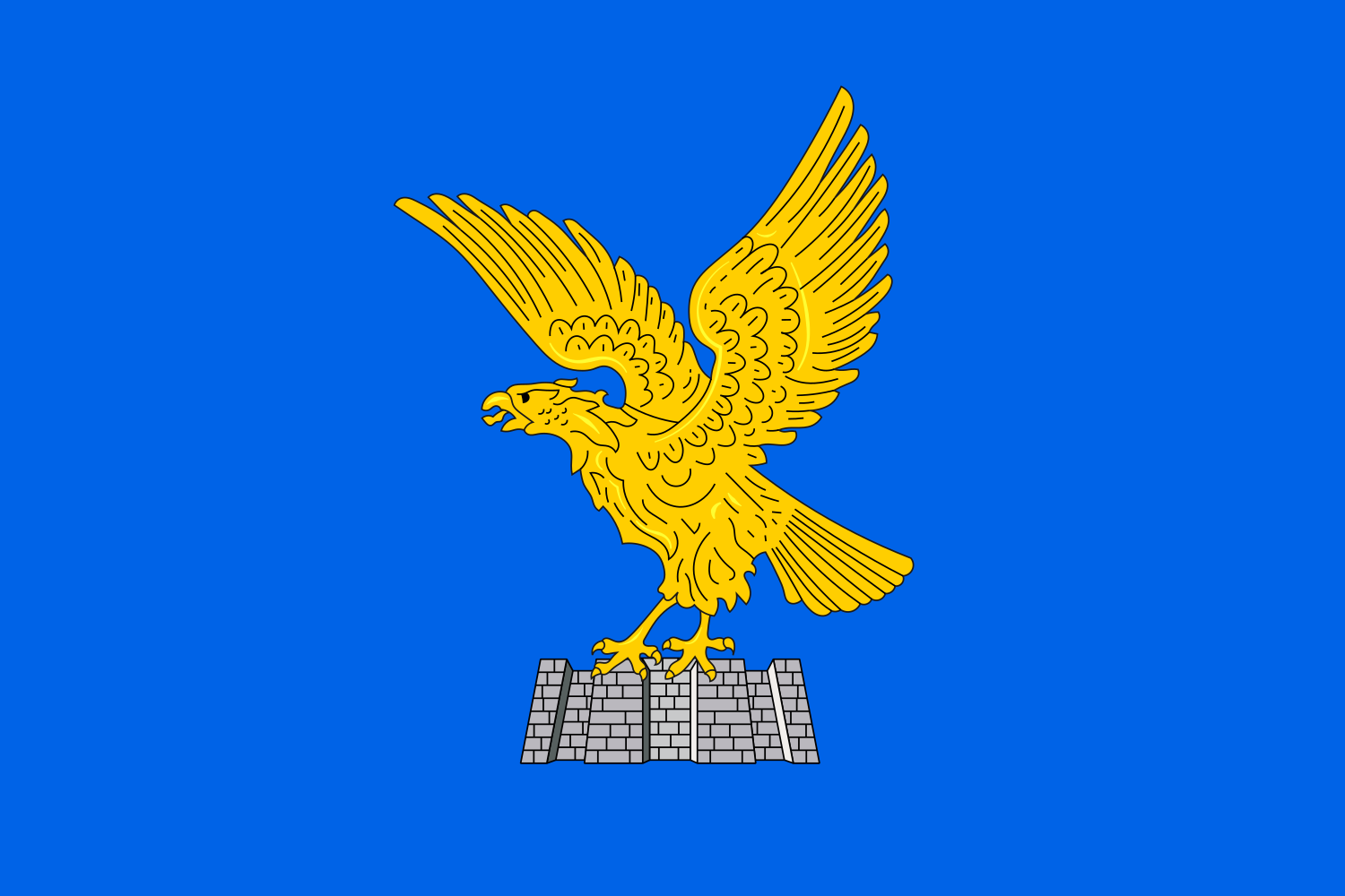 弗留利-威尼斯朱利亚
 马尔凯大区
马尔凯大区
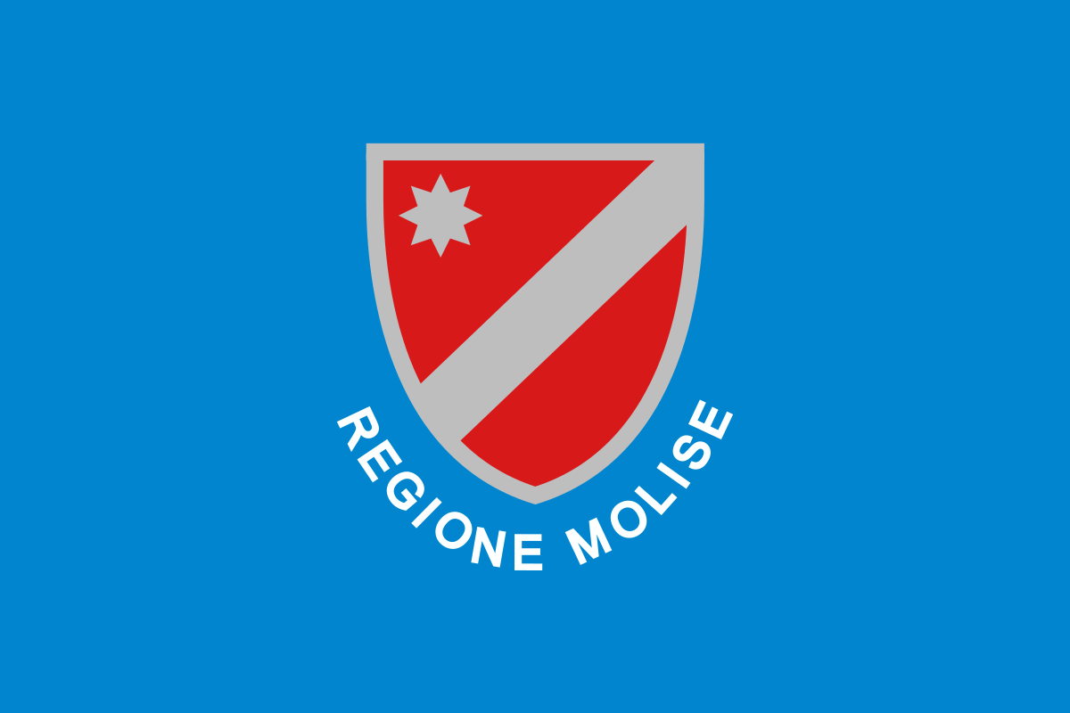 莫利塞大区
莫利塞大区
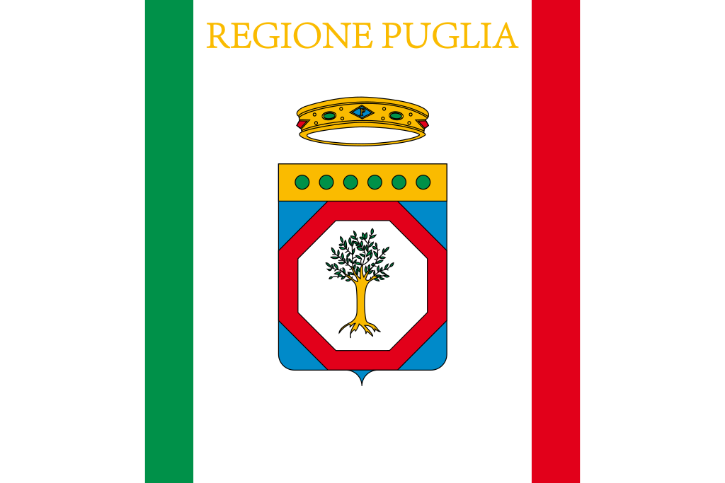 普利亚大区
普利亚大区
 威尼托大区
威尼托大区
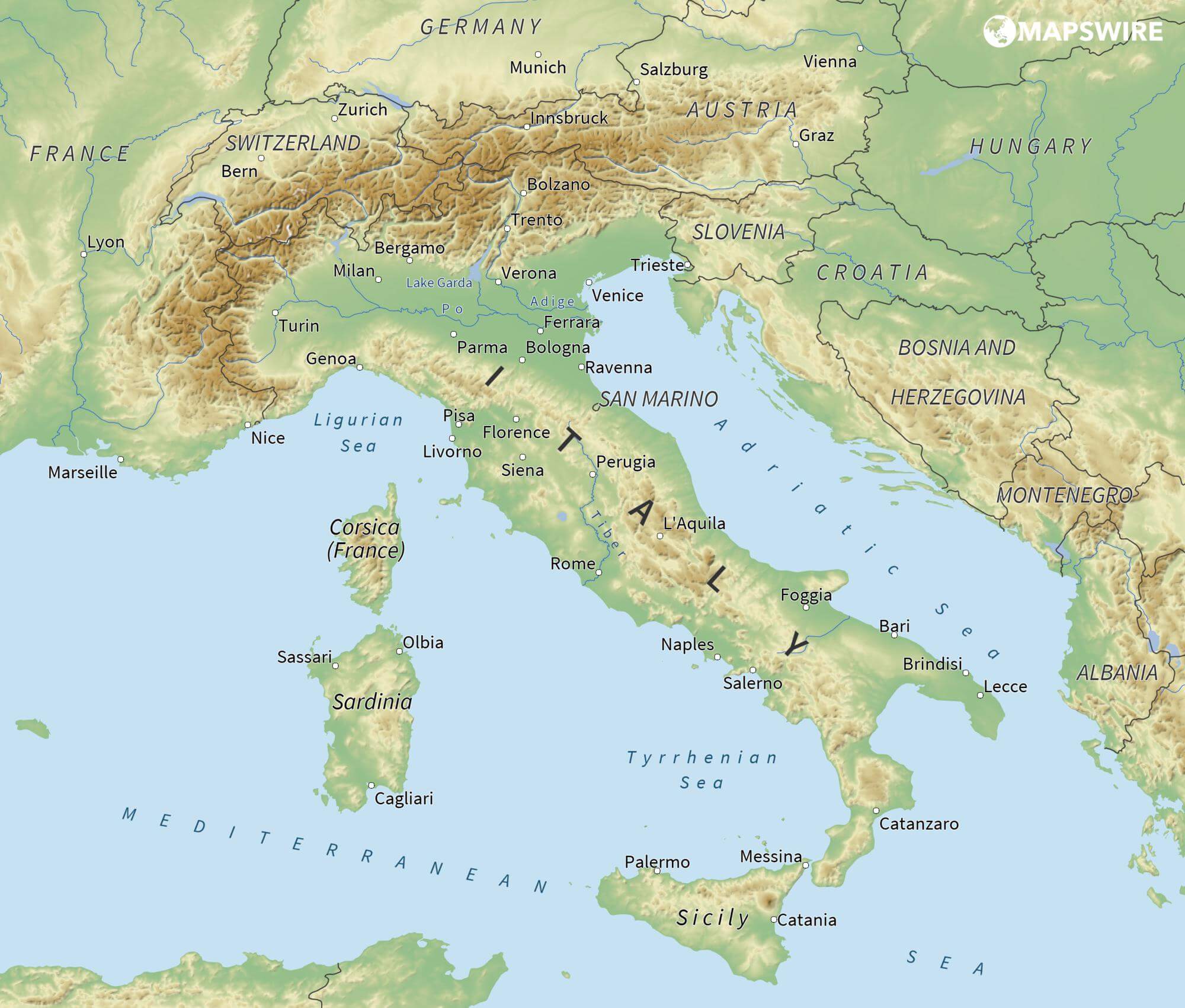
亚得里亚海(意大利语:Mar Adriatico,斯洛文尼亚语:Jadransko morje,克罗地亚语:Jadransko more,阿尔巴尼亚语:Deti Adriatik),是地中海的一部分水域,分隔了意大利半岛(亚平宁半岛)和巴尔干半岛,也分隔了亚平宁山脉与狄那里克阿尔卑斯山脉及其临近地区。亚得里亚海西岸属于意大利,东岸则分别属于斯洛文尼亚、克罗地亚、波斯尼亚和黑塞哥维那、黑山和阿尔巴尼亚。亚得里亚海透过位于其南部的奥特朗托海峡与爱奥尼亚海相连。波河、阿迪杰河、奥凡托河等河流流入亚得里亚海;海中有近1200个岛屿,其中只有69个有人居住。
Das Adriatische Meer, kurz auch die Adria (lateinisch Mare Adriaticum; italienisch Mare Adriatico; bosnisch, kroatisch und serbisch Jadransko more oder kurz Jadran; slowenisch Jadransko morje; albanisch Deti Adriatik oder kurz Adriatiku), ist das lang gestreckte nördliche Seitenbecken des Mittelmeeres zwischen der Apenninhalbinsel und Balkanhalbinsel. Es ist nach der Stadt Adria in Italien (Provinz Rovigo) benannt. Zum Adriatischen Meer wird alles gerechnet, was nördlich der Straße von Otranto liegt.
アドリア海(アドリアかい、英: Adriatic Sea ; イタリア語: Mar Adriatico ; クロアチア語: Jadransko more)は、地中海の海域の一つ。イタリア半島とバルカン半島に挟まれている。
The Adriatic Sea (/ˌeɪdriˈætɪk/) is a body of water separating the Italian Peninsula from the Balkans. The Adriatic is the northernmost arm of the Mediterranean Sea, extending from the Strait of Otranto (where it connects to the Ionian Sea) to the northwest and the Po Valley. The countries with coasts on the Adriatic are Albania, Bosnia and Herzegovina, Croatia, Italy, Montenegro and Slovenia. The Adriatic contains over 1,300 islands, mostly located along the Croatian part of its eastern coast. It is divided into three basins, the northern being the shallowest and the southern being the deepest, with a maximum depth of 1,233 metres (4,045 ft). The Otranto Sill, an underwater ridge, is located at the border between the Adriatic and Ionian Seas. The prevailing currents flow counterclockwise from the Strait of Otranto, along the eastern coast and back to the strait along the western (Italian) coast. Tidal movements in the Adriatic are slight, although larger amplitudes are known to occur occasionally. The Adriatic's salinity is lower than the Mediterranean's because the Adriatic collects a third of the fresh water flowing into the Mediterranean, acting as a dilution basin. The surface water temperatures generally range from 30 °C (86 °F) in summer to 12 °C (54 °F) in winter, significantly moderating the Adriatic Basin's climate.
The Adriatic Sea sits on the Apulian or Adriatic Microplate, which separated from the African Plate in the Mesozoic era. The plate's movement contributed to the formation of the surrounding mountain chains and Apennine tectonic uplift after its collision with the Eurasian plate. In the Late Oligocene, the Apennine Peninsula first formed, separating the Adriatic Basin from the rest of the Mediterranean. All types of sediment are found in the Adriatic, with the bulk of the material transported by the Po and other rivers on the western coast. The western coast is alluvial or terraced, while the eastern coast is highly indented with pronounced karstification. There are dozens of marine protected areas in the Adriatic, designed to protect the sea's karst habitats and biodiversity. The sea is abundant in flora and fauna—more than 7,000 species are identified as native to the Adriatic, many of them endemic, rare and threatened ones.
The Adriatic's shores are populated by more than 3.5 million people; the largest cities are Bari, Venice, Trieste and Split. The earliest settlements on the Adriatic shores were Etruscan, Illyrian, and Greek. By the 2nd century BC, the shores were under Rome's control. In the Middle Ages, the Adriatic shores and the sea itself were controlled, to a varying extent, by a series of states—most notably the Byzantine Empire, the Croatian Kingdom, the Republic of Venice, the Habsburg Monarchy and the Ottoman Empire. The Napoleonic Wars resulted in the First French Empire gaining coastal control and the British effort to counter the French in the area, ultimately securing most of the eastern Adriatic shore and the Po Valley for Austria. Following Italian unification, the Kingdom of Italy started an eastward expansion that lasted until the 20th century. Following World War I and the collapse of Austria-Hungary and the Ottoman Empire, the eastern coast's control passed to Yugoslavia and Albania. The former disintegrated during the 1990s, resulting in four new states on the Adriatic coast. Italy and Yugoslavia agreed on their maritime boundaries by 1975 and this boundary is recognised by Yugoslavia's successor states, but the maritime boundaries between Slovenia, Croatia, Bosnia-Herzegovina, and Montenegro are still disputed. Italy and Albania agreed on their maritime boundary in 1992.
Fisheries and tourism are significant sources of income all along the Adriatic coast. Adriatic Croatia's tourism industry has grown faster economically than the rest of the Adriatic Basin's. Maritime transport is also a significant branch of the area's economy—there are 19 seaports in the Adriatic that each handle more than a million tonnes of cargo per year. The largest Adriatic seaport by annual cargo turnover is the Port of Trieste, while the Port of Split is the largest Adriatic seaport by passengers served per year.
La mer Adriatique (du latin : Mare Hadriaticum ou Mare Adriaticum) est une mer séparant la péninsule italienne de la péninsule balkanique. L'Adriatique est le bras de la Méditerranée situé le plus au nord en s'étendant du canal d'Otrante (où elle rejoint la mer Ionienne) jusqu'aux villes de Venise et de Trieste et à l'embouchure du Pô. Les pays côtiers sont l'Italie, la Slovénie, la Croatie, la Bosnie-Herzégovine, le Monténégro et l'Albanie, ainsi que la Grèce par l'île de Corfou.
Il mare Adriatico è l'articolazione del mar Mediterraneo orientale situata tra la penisola italiana e la penisola balcanica; suddiviso in Alto Adriatico, Medio Adriatico e Basso Adriatico, bagna sei Paesi: Italia, Slovenia, Croazia, Bosnia ed Erzegovina, Montenegro e Albania, confinando a sud-est con il Mar Ionio.
El mar Adriático (del latín, Mare Hadriaticum) es un golfo estrecho y alargado que forma parte del mar Mediterráneo. Se encuentra situado entre la península Itálica, al oeste, y la península de los Balcanes, al este, con una anchura máxima de unos 200 km, y una longitud de unos 800 km. Su extremo meridional limita con el mar Jónico, del que lo separa el canal de Otranto. Su superficie total es de, aproximadamente, 160 000 km².
Las costas occidental, septentrional, y parte de la oriental corresponden a Italia (60% de la longitud de costa del Adriático), mientras que el resto de la costa oriental corresponde a Croacia, Eslovenia, Bosnia y Herzegovina, Montenegro y Albania. Algunos de los ríos que desembocan en el Adriático son el Reno, el Po, el Adigio, el Brenta, el Piave y el Neretva.
La costa del Adriático concentra un gran número de centros turísticos, como Venecia, que recibe el nombre de «Reina del Adriático». Tras la división de Yugoslavia, la costa croata se ha convertido también en un destino turístico muy popular.
Sus aguas sostienen industria pesquera, y se llevan a cabo prospecciones petrolíferas en este mar. Durante los años 1990, varias investigaciones revelaron que sus niveles de contaminación son muy altos.
En las últimas décadas el gobierno de Italia ha intentado hacer de él una barrera contra la inmigración ilegal, en su mayor parte proveniente de Albania.
Адриати́ческое мо́ре (итал. mare Adriatico, эмил.-ром. Mèr Adriâtic, вен. Mar Adriàtico, неап. Mar Adriateco, словен. Jadransko morje, сербохорв. Jadransko more/Јадранско море, алб. Deti Adriatik, лат. mare Hadriaticum), также Адриатика — полузамкнутое море, часть Средиземного моря между Апеннинским и Балканским полуостровами. Омывает берега Италии (более 1000 км), Словении (47 км), Хорватии (1777 км), Боснии и Герцеговины (20 км), Черногории (200 км), Албании (472 км).
 建筑艺术
建筑艺术
 历史
历史
 体育
体育

 巴西利卡塔大区
 卡拉布里亚大区
 西西里大区
西西里大区

 美食家
美食家
