
漢德百科全書 | 汉德百科全书
 2015年女子世界杯足球赛
 体育
体育


 国际城市
国际城市
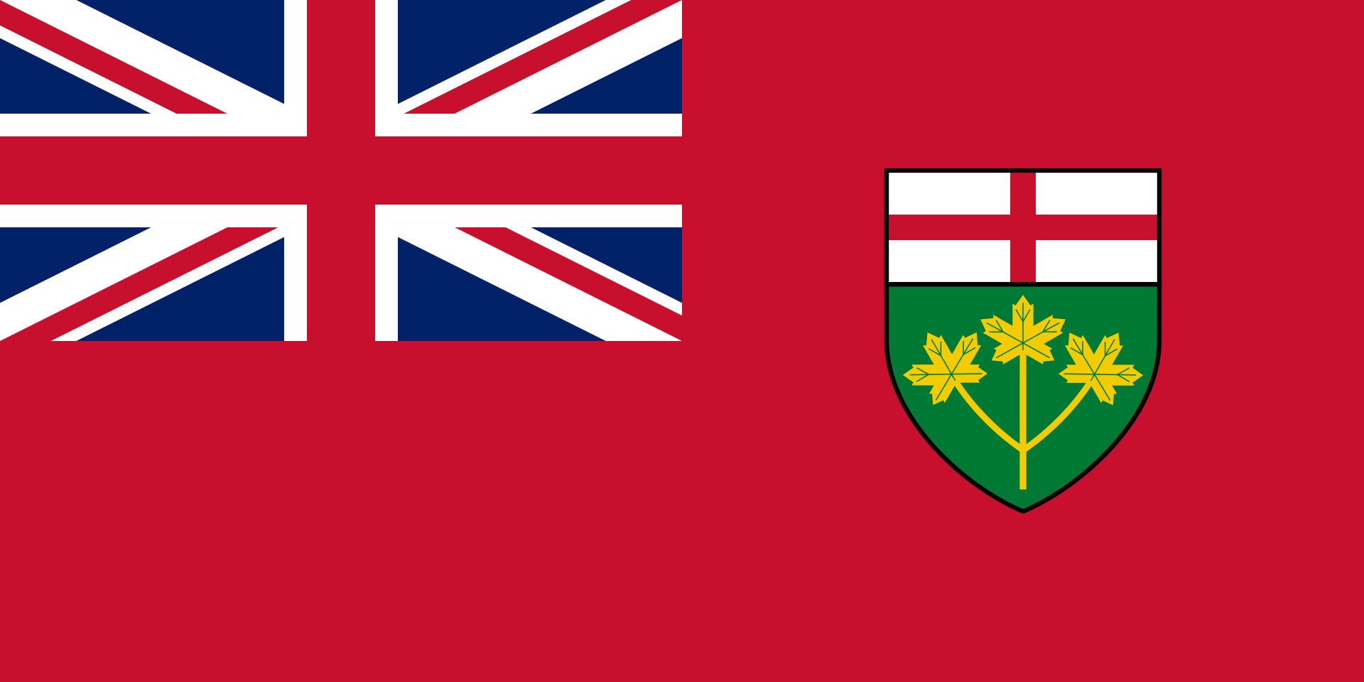
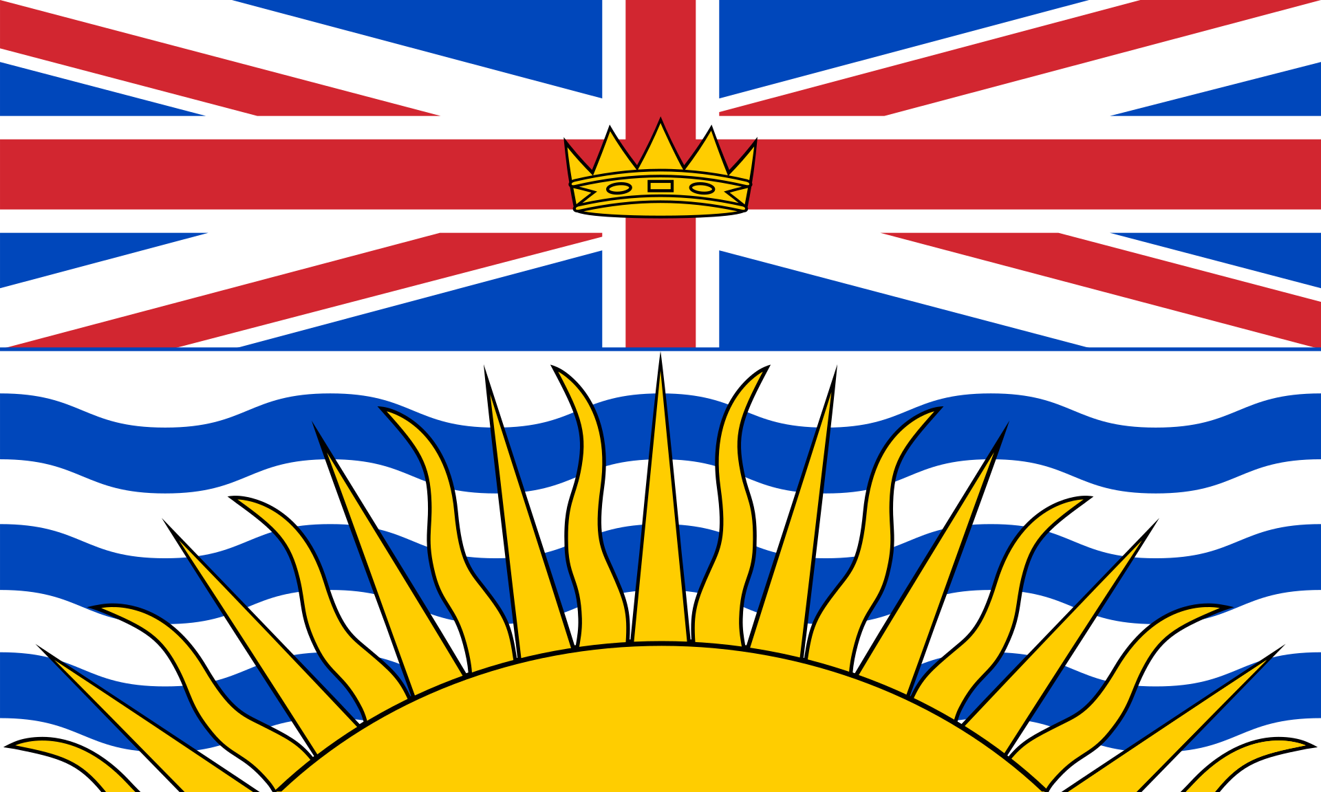 不列颠哥伦比亚省
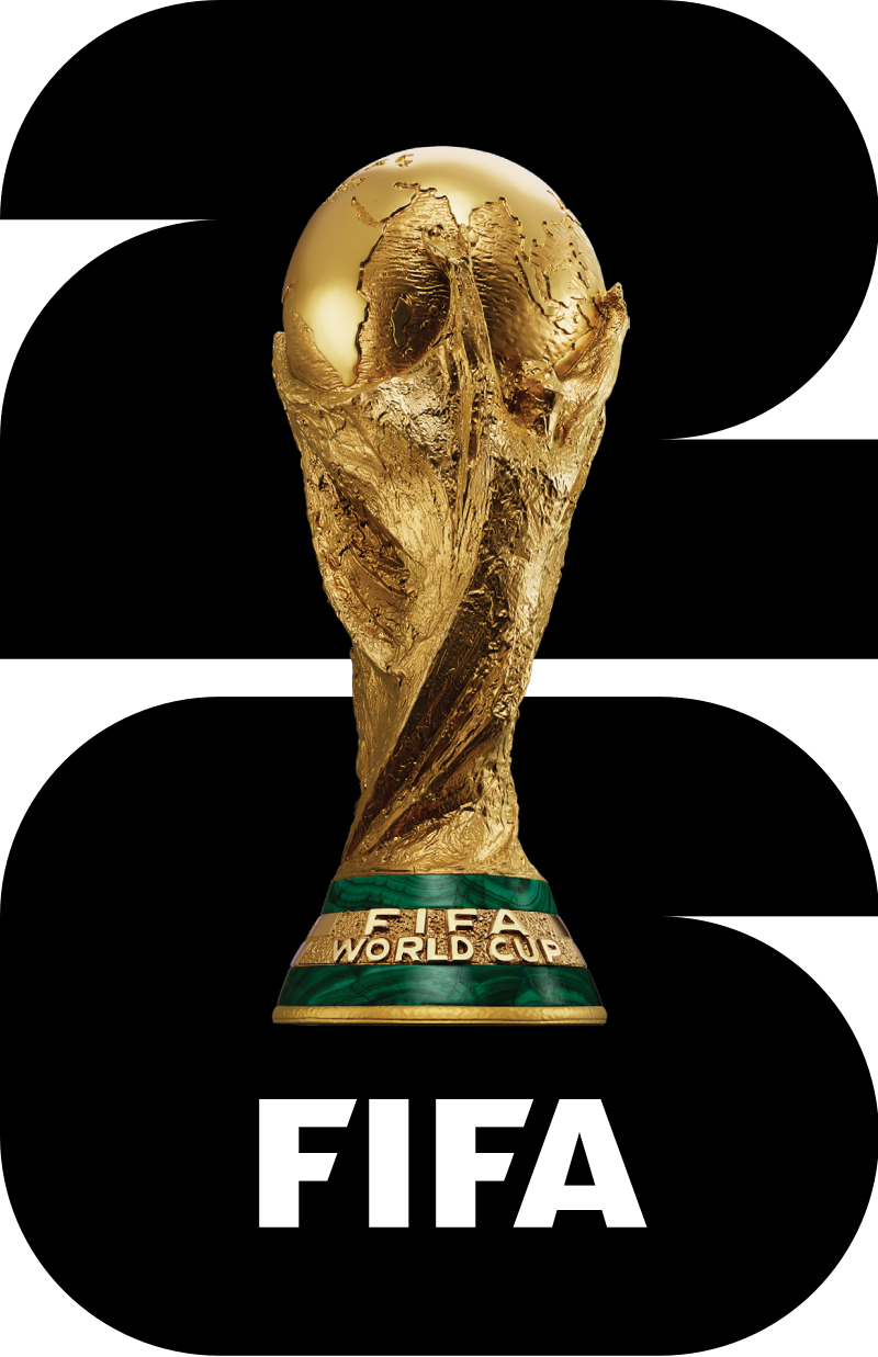 2026年世界杯足球赛
 地理
地理
 滑雪旅游
滑雪旅游
 重要港口
重要港口
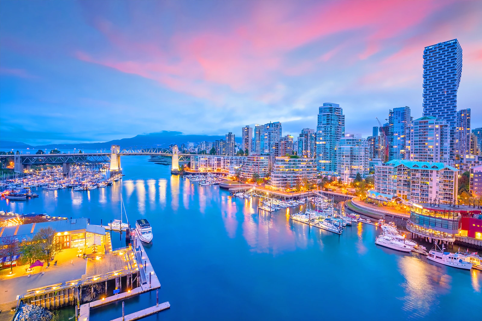
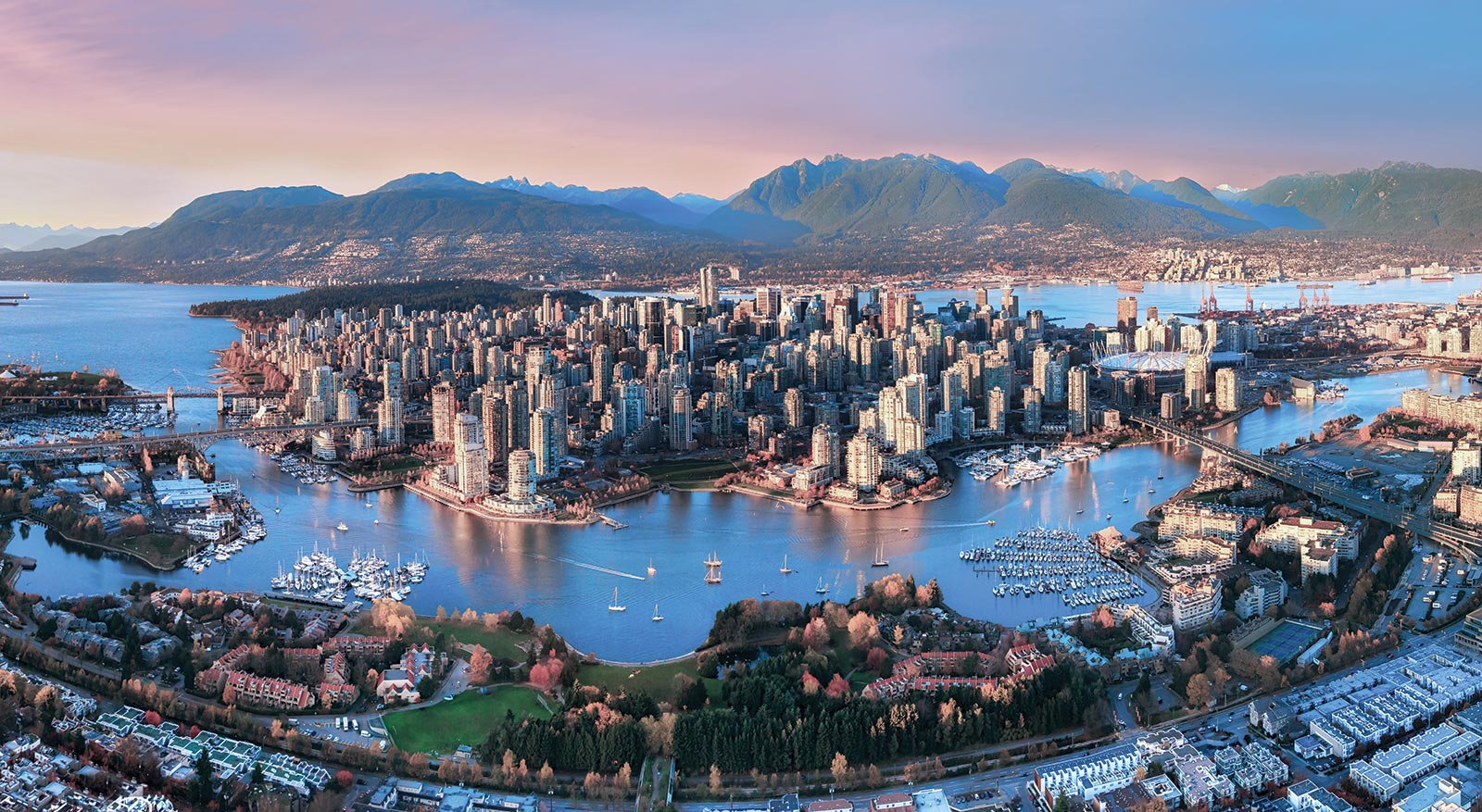
Vancouver (englische Aussprache [væŋˈkuːvɚ] oder [vænˈkuːvɚ]) ist eine Stadt im Südwesten von British Columbia an der Westküste Kanadas. Sie liegt zwischen der Straße von Georgia und den Coast Mountains, rund 45 Kilometer nordwestlich der Grenze zu den USA. Die Stadt gehört zum Regionaldistrikt Metro Vancouver, der mit 2.463.431 Einwohnern[1] die größte Metropolregion Westkanadas und nach Toronto und Montreal die drittgrößte des Landes bildet. Die Bevölkerungszahl der eigentlichen Stadt Vancouver beträgt 631.486.[2] Benannt ist die Stadt nach dem britischen Kapitän George Vancouver, der die Region Ende des 18. Jahrhunderts erforschte und vermaß. Der Name Vancouver selbst stammt vom niederländischen „van Coevorden“, abgeleitet von der Stadt Coevorden.
Die Stadt entstand in den 1860er Jahren als Folge der Einwanderungswelle während des Fraser-Canyon-Goldrauschs und entwickelte sich nach der Eröffnung der transkontinentalen Eisenbahn im Jahr 1887 innerhalb weniger Jahrzehnte von einer kleinen Sägewerkssiedlung zu einer Metropole. Die Wirtschaft basierte zu Beginn auf der Ausbeutung der natürlichen Ressourcen von British Columbia: Forstwirtschaft, Bergbau, Fischerei und Landwirtschaft. Der Hafen Vancouver erlangte nach der Eröffnung des Panamakanals internationale Bedeutung. Er ist heute der größte in Kanada und exportiert mehr Güter als jeder andere Hafen in Nordamerika.
Vancouver wandelte sich mit der Zeit zu einem Dienstleistungszentrum und (insbesondere nach der Weltausstellung Expo 86) zu einem Reiseziel für Touristen. Die Stadt ist darüber hinaus hinter Los Angeles und New York der drittwichtigste Standort der nordamerikanischen Filmindustrie und wird daher auch als „Hollywood North“ bezeichnet. Die Finanzwirtschaft spielt ebenfalls eine bedeutende Rolle. In einer Rangliste der wichtigsten Finanzzentren weltweit belegt Vancouver den 15. Platz (Stand: 2018).[3]
Vancouver veranstaltete vom 12. bis 28. Februar 2010 die XXI. Olympischen Winterspiele. Einige Wettbewerbe der Spiele fanden im 125 Kilometer von Vancouver entfernten Whistler statt. Nach Montreal im Jahr 1976 und Calgary im Jahr 1988 war Vancouver die dritte kanadische Stadt, die Olympische Spiele veranstaltet hat.
一般所说的”温哥华”泛指”大温地区”(请参考温哥华概况介绍)。温哥华市中心位于一个半岛上,主要分成几块区域:西尾区与水滨(West End & Waterfront)、耶鲁镇(Yaletown)、盖士镇与华埠(Gastown & Chinatown)。市中心往南的温哥华市以Carrall街与Ontario街分成温西(West Side)与温东(East Side)。外地人常把温西与西温哥华(West Vancouver)搞混,后者是温哥华北岸的一个城市,从温哥华市中心向北跨越狮门大桥(Lions Gate Bridge)即可抵达。
西尾区(West End)在市中心西端,北与史丹利公园、南与市中心商业区紧邻,是由整片新兴的高级住宅大楼与罗布森街(Robson Street)购物区、各国风味餐厅、海滩、游艇码头等所组成的热闹区域。到温哥华旅游如果不自行开车,在西尾区住宿是明智选择。
耶鲁镇(Yaletown)是位于市中心东缘的新兴小区,这里有许多杂错的红砖仓库改建成精致典雅的新购物娱乐区与艺术家工作室。一栋栋平房红砖墙的建筑 及巷道上的石板路,将素有“Funky Town"之称的耶鲁镇特色表露无遗。耶鲁镇有电影制片公司、美发沙龙、室内设计工作室、小型设计师家具店、古董店、精品服饰店,加上各种特色美食与露天 咖啡座、小酒馆,让耶鲁镇的雅痞色彩十足,成为温哥华时尚一族抢着进驻的地区。
盖士镇(Gastown)是温哥华的发源地,是个以2条横街和3条直街组成的三角地带。卑诗省政府将盖士镇规划程成为独特的观光区与历史维护区。如今这里 保存完好的19世纪初维多利亚式建筑、铺满圆石的悠长街道、别致的露天咖啡屋,复古的路灯及一座座低矮的历史建筑,行走其间宛如时空错置。也是游客来温哥 华必至之处。(Quelle:http://www.usatrip.cn/jdjs/jdjs_Vancouver.asp)
温哥华市(City of Vancouver)是加拿大不列颠哥伦比亚省低陆平原地区一沿岸城市。根据2016年加拿大统计局人口普查,温哥华市人口有631,486人,而大温哥华地区的人口为246万,[1]是不列颠哥伦比亚省以至加拿大西部最大的都会区,以及全国第三大都会区;市内人口则在全国排行第八。[2][3]
温哥华以英国航海家乔治·温哥华命名,欧洲人抵达温哥华一带后,区内经济早期主要依赖于林木业。加拿大太平洋铁路于1887年延至温哥华后,温哥华成为北美西岸水陆路交通的主要枢纽之一,更构成远东地区、加拿大东部和英国之间贸易往来的重要一环。[4][5]温哥华港现时是加拿大最大和最繁忙的港口,以货物总吨数计也是北美第四大港口。[6]此外,温哥华的自然环境深受游客欢迎,令旅游业成为市内第二大经济支柱。[7]温哥华也是北美第三大制片中心,有“北方好莱坞”之称。[8][9]也是20世纪后,与美国旧金山同为华人在北美最集中的地区。
温哥华近年经常在各项世界最佳居住城市的调查中名列前茅。[10][11]温哥华亦曾于2010年与125公里以外的惠斯勒联手举办冬季奥运会和冬季残奥会。[12]此外温哥华还曾举办2015年女子世界杯足球赛,决赛场地即设在不列颠哥伦比亚体育馆。
バンクーバー(英語: Vancouver)は、カナダ連邦ブリティッシュコロンビア州南西部にある都市。同州最大の都市である。ヴァンクーヴァーと表記されることもある[3]。
バンクーバーを中心とする都市圏人口は210万人とカナダ国内第3位の都市圏を形成している[4]。バンクーバー市のみの人口では同国内で第8位の約64万人[5]である。民族や言語が多様で、人口のおよそ52%は第一言語が同州の公用語にあたる英語ではない[6]。北米有数の世界都市であり、2016年に発表された「世界の都市総合力ランキング」では、世界28位と評価された[7]。
1867年に製材所ができ、これらを中心とする入植地であったギャスタウンは発展を続け、グランビルとして町は拡大した。東カナダから続く鉄道の終着駅が町まで敷かれることになった1886年に町はバンクーバーとして改名され市政となる。
林業が同市最大の産業で、都市部ながら自然に囲まれた都市として知られていることから、観光業が発達しており、同市第2の産業となっている[8]。同市にあるメトロバンクーバー港は同国最大の港であり、北米においても積載量で第4位の規模を持つ[9]。同市および隣のバーナビー市には、主要な各映画製作会社が拠点を置いており、ロサンゼルス、ニューヨークに続く北米第3位の規模となる映画製作拠点となっている。このため、通称ハリウッドノースとも呼ばれる[10][11]。国際会議や国際競技が数多く開催されており、2010年には第21回冬季オリンピック(バンクーバーオリンピック)が開催された。
Vancouver (/vænˈkuːvər/ ( listen)) is a coastal seaport city in western Canada, located in the Lower Mainland region of British Columbia. As the most populous city in the province, the 2016 census recorded 631,486 people in the city, up from 603,502 in 2011. The Greater Vancouver area had a population of 2,463,431 in 2016, making it the third-largest metropolitan area in Canada. Vancouver has the highest population density in Canada with over 5,400 people per square kilometre,[5][6] which makes it the fifth-most densely populated city with over 250,000 residents in North America behind New York City, Guadalajara, San Francisco,[7] and Mexico City according to the 2011 census. Vancouver is one of the most ethnically and linguistically diverse cities in Canada according to that census; 52% of its residents have a first language other than English.[8][9] Roughly 30% of the city's inhabitants are of Chinese heritage.[10] Vancouver is classed as a Beta global city.
Vancouver is consistently named as one of the top five worldwide cities for livability and quality of life,[11][12] and the Economist Intelligence Unit acknowledged it as the first city ranked among the top-ten of the world's most well-living cities[13] for five consecutive years.[14] Vancouver has hosted many international conferences and events, including the 1954 British Empire and Commonwealth Games, UN Habitat I, Expo 86, the World Police and Fire Games in 1989 and 2009; and the 2010 Winter Olympics and Paralympics which were held in Vancouver and Whistler, a resort community 125 km (78 mi) north of the city.[15] In 2014, following thirty years in California, the TED conference made Vancouver its indefinite home. Several matches of the 2015 FIFA Women's World Cup were played in Vancouver, including the final at BC Place.[16]
The original settlement, named Gastown, grew up on clearcuts on the west edge of the Hastings Mill logging sawmill's property, where a makeshift tavern had been set up on a plank between two stumps and the proprietor, Gassy Jack, persuaded the curious millworkers to build him a tavern, on July 1, 1867. From that first enterprise, other stores and some hotels quickly appeared along the waterfront to the west. Gastown became formally laid out as a registered townsite dubbed Granville, B.I. ("B.I" standing for "Burrard Inlet"). As part of the land and political deal whereby the area of the townsite was made the railhead of the Canadian Pacific Railway (CPR), it was renamed "Vancouver" and incorporated shortly thereafter as a city, in 1886. By 1887, the Canadian Pacific transcontinental railway was extended westward to the city to take advantage of its large natural seaport to the Pacific Ocean, which soon became a vital link in a trade route between the Orient / East Asia, Eastern Canada, and Europe.[17][18] As of 2014, Port Metro Vancouver is the third-largest port by tonnage in the Americas (recently displacing New York City), 27th in the world,[19] the busiest and largest in Canada, and the most diversified port in North America.[20] While forestry remains its largest industry, Vancouver is well known as an urban centre surrounded by nature, making tourism its second-largest industry.[21]
Major film production studios in Vancouver and nearby Burnaby have turned Greater Vancouver and nearby areas into one of the largest film production centres in North America,[22][23] earning it the nickname "Hollywood North".[24][25][26]
Vancouver /vãkuvaɛ̯ʁ/a Écouter ou /vɑ̃kuvɛʁ/b (en anglais : /væŋˈkuvɚ/c Écouter) est une cité1 portuaire du pourtour du Pacifique située dans les basses-terres continentales de la province de Colombie-Britannique, au Canada. Avec 631 486 habitants selon le recensement du Canada de 2016, elle est la huitième plus grande municipalité canadienne3. Son agglomération de 2 463 431 est la troisième aire urbaine du pays, et la plus peuplée de l'Ouest canadien. Vancouver est une des villes les plus cosmopolites du Canada, 52 % des résidents ont une autre langue maternelle que l'anglais4. Vancouver est considérée comme une ville mondiale de classe beta. La superficie de Vancouver est de 114,97 km2, donnant une densité de population de 5 493 au kilomètre carré, faisant d'elle la municipalité canadienne la plus densément peuplée et la quatrième en Amérique du Nord, après New York, San Francisco et Mexico5. Elle est la vingt-troisième ville la plus peuplée d'Amérique du Nord6.
Le premier établissement, nommé Gastown, s'est développé autour d'une scierie appelé Hastings Mills, en 1867. Le site fut renommé Vancouver et incorporé comme cité en 1886. En 1887, le chemin de fer transcontinental a été étendu jusqu'à elle pour profiter de son grand port naturel, qui est rapidement devenu un maillon essentiel d'une route commerciale entre la côte est du Canada, l'Orient et l'Europe7,8. En 2009, Port Metro Vancouver est le port le plus grand et le plus achalandé du Canada, et le plus diversifié d'Amérique du Nord9. Même si l'exploitation forestière demeure sa plus grande industrie, Vancouver est réputée pour être un centre urbain entouré par la nature, faisant du tourisme sa deuxième industrie10. Les studios de production cinématographique de Vancouver et de Burnaby ont fait de la métropole l'un des plus grands centres cinématographiques en Amérique du Nord11,12, ce qui lui a valu le surnom de Hollywood North13,14,15.
Vancouver est régulièrement citée comme l'une des cinq meilleures villes au monde pour sa qualité de vie16,17, et l'Economist Intelligence Unit l'a classée parmi les dix villes les plus agréables durant cinq années consécutives18,19. Vancouver fut l'hôte de nombreux évènements internationaux, comme les Jeux de l'Empire britannique et du Commonwealth de 1954, la conférence Habitat I par l'Organisation des Nations unies en 1976, l'Exposition internationale de 1986 et les Jeux olympiques d'hiver de 201020. En 2015, elle a accueilli la finale de la Coupe du monde féminine de football21. La ville accueillera en 2018 le Congrès ornithologique international.
Vancouver (AFI: [vanˈkuver][1]) è una città canadese, sulla costa Pacifica della provincia canadese della Columbia Britannica (British Columbia). È situata nella parte meridionale della provincia e rappresenta uno dei maggiori porti dell'Oceano Pacifico. È delimitata dallo Stretto di Georgia (Georgia Strait), dal fiume Fraser, e dalla catena montuosa delle Montagne Costiere. Il nome è in onore del capitano George Vancouver, esploratore britannico.
La popolazione della città è di 603 502 abitanti, mentre l'area urbana ne conta 2 135 201. Vancouver fa parte della regione metropolitana, conosciuta come la "Greater Vancouver Regional District" (GVRD) o Metro Vancouver, nella quale vivono 2 463 700 (stima del 2012)[2]. Questo la rende la più grande area metropolitana nel Canada occidentale, e la terza più grande nel paese. Come in buona parte del Canada, anche Vancouver etnicamente è molto diversificata, basti pensare che il 52% dei residenti[3][4] della città e il 43% dell'area metropolitana hanno come prima lingua un idioma diverso dall'inglese[5].
La popolazione metropolitana è proiettata a raggiungere i 3 milioni di abitanti entro il 2021[6]. La densità di popolazione è tra le più alte del Nord America, e la pone al quarto posto dopo New York, San Francisco e Città del Messico. Il trend porta a stimare che possa raggiungere il secondo posto entro il 2021[7].
L'economia di Vancouver ha tradizionalmente fatto leva sulle risorse della Columbia Britannica: forestali, minerarie, pesca e agricoltura. Ma tuttavia è andata diversificandosi nel tempo, ed oggi Vancouver ha un'importante e vitale industria nel settore dei servizi e del turismo. La città è diventata il terzo più grande polo di produzione cinematografico del Nord America dopo Los Angeles e New York, tanto da guadagnarsi il soprannome di Hollywood del Nord[8][9][10]. Vancouver ha avuto un'espansione nell'industria dell'high-tech, in particolare nello sviluppo dei videogiochi.
Vancouver è costantemente classificata fra le prime tre città più vivibili del mondo[11][12][13]. Secondo il rapporto 2010 della Mercer Human Resource Consulting, ad esempio, Vancouver è considerata la prima città al mondo per qualità della vita. Nel 2007 Vancouver era la seconda città più cara del Canada dopo Toronto e la 89ª a livello globale.
Nel 2010 Vancouver, insieme a Whistler, situata 125 km a nord della città, ha ospitato i Giochi olimpici invernali e i Giochi Paralimpici invernali.
Vancouver (en inglés: /væŋ'ku:vɚ/ (?·i), en español /baŋ'kuβ̞eɾ/) es una ciudad de la costa pacífica de Canadá, ubicada en el suroeste de la provincia de Columbia Británica, entre el estrecho de Georgia y las Montañas Costeras. La ciudad fue llamada así en honor del capitán George Vancouver, un explorador inglés.
Es parte del área metropolitana del Distrito Regional del Gran Vancouver, el cual, con una población de 2 313 328 habitantes (2011),1 constituye el área metropolitana más grande del oeste canadiense y la tercera en el país después de Toronto y Montreal.2 Vancouver en sí mismo cuenta con 603 502 habitantes.1 El gentilicio utilizado para referirse a los residentes de Vancouver es vancuverita o vancouverense,3 (en inglés Vancouverite).
Vancouver, en los últimos años, siempre ha sido considerada como una de las cinco ciudades con mejor calidad de vida en el mundo.4567 En 2013, obtuvo el puesto 21º entre las ciudades en que es más caro vivir y resultó ser la más cara de Norteamérica. 8 También es una de las ciudades más seguras del mundo, debido a sus bajísimas tasas de criminalidad.
Los Juegos Olímpicos y Paralímpicos de invierno de 2010 se llevaron a cabo en Vancouver y en la cercana localidad de Whistler.91011
Ванку́вер (англ. Vancouver) — город на западе Канады, крупнейший населённый пункт провинции Британская Колумбия и третий по величине в Канаде. В 2010 году в Ванкувере проводились XXI зимние Олимпийские игры. Исследовательская группа Economist Intelligence Unit (EIU) британского издания The Economist трижды — в 2005, 2007, 2009 годах — присваивала Ванкуверу звание «лучшего города Земли»[2][3][4].
Население самого города — 631 486 чел. (на 2016 год). В агломерации Большой Ванкувер (англ.)русск. проживает свыше 2 463 431 чел. (на 2016 год) — это третья по величине агломерация в Канаде. Ванкувер является наиболее этнически и лингвистически разнообразным городом страны — 52 % его жителей считают своим родным языком не английский[5].
 曼尼托巴省
曼尼托巴省
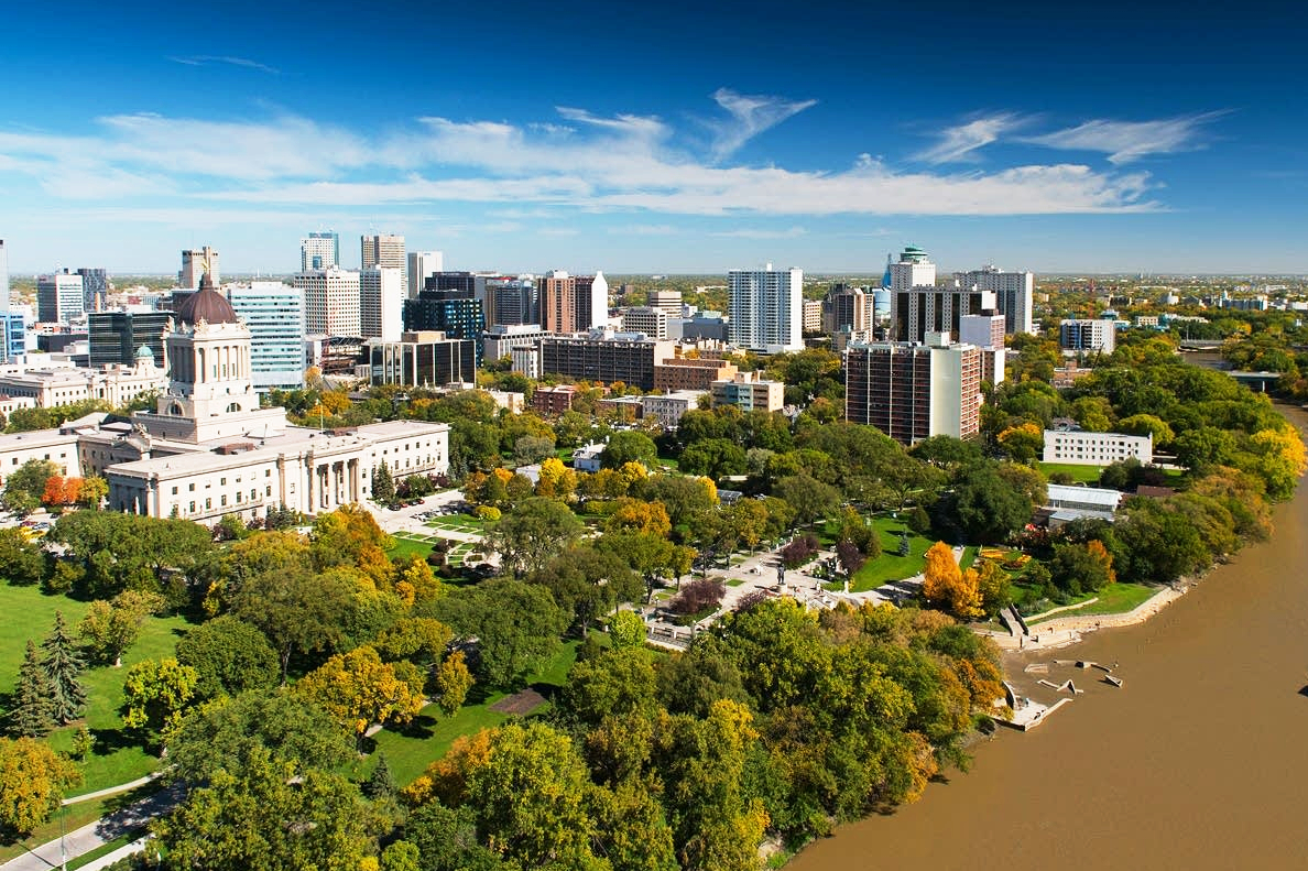
Winnipeg [ˈwɪnɪpɛg] ist die Hauptstadt der kanadischen Provinz Manitoba und zugleich deren mit Abstand größte Stadt. Sie zählte im Jahr 2011 über 660.000 Einwohner, die Metropolregion rund 730.000. Damit ist Winnipeg die siebtgrößte Stadt in Kanada.[1] Der Name leitet sich vom 55 Kilometer nördlich gelegenen Winnipegsee her; „win“ bedeutet in der lokalen Cree-Sprache schlammig und „nipee“ Wasser.
Bekannt als Gateway to the West (Tor zum Westen), ist Winnipeg ein Eisenbahn- und Verkehrsknotenpunkt mit einer diversifizierten Wirtschaft. Die Stadt ist multikulturell und Heimat mehrerer Sportvereine. Winnipeg war 1967 erster kanadischer Gastgeber der Panamerikanischen Spiele. Die Stadt ist bekannt für zahlreiche jährliche Festivals, darunter das Winnipeg Folk Festival.
温尼伯(英语:Winnipeg;![]() i/ˈwɪnɪpɛɡ/),加拿大当地粤语人士称之为温尼辟,座落于草原三省东缘,是加拿大第八大城市,也是马尼托巴省省会和该省最大城市,半数以上的马尼托巴省人口集中于此,现有人口约71万[1]。温尼伯的名字源于当地原住民的克里语,意为“浑水”。温尼伯在地理上属于西加拿大。它是一个运输、经济、制造业、农业与教育的重镇。同时也是西加拿大的重要交通枢纽,距美国边境仅96公里。1738年,法国商人在此建立第一个贸易站,在这之前,温尼伯已成为原住民诸部落的贸易中心。1812年,一批苏格兰移民在此定居。1873年,城市人口增至1869人。
i/ˈwɪnɪpɛɡ/),加拿大当地粤语人士称之为温尼辟,座落于草原三省东缘,是加拿大第八大城市,也是马尼托巴省省会和该省最大城市,半数以上的马尼托巴省人口集中于此,现有人口约71万[1]。温尼伯的名字源于当地原住民的克里语,意为“浑水”。温尼伯在地理上属于西加拿大。它是一个运输、经济、制造业、农业与教育的重镇。同时也是西加拿大的重要交通枢纽,距美国边境仅96公里。1738年,法国商人在此建立第一个贸易站,在这之前,温尼伯已成为原住民诸部落的贸易中心。1812年,一批苏格兰移民在此定居。1873年,城市人口增至1869人。
温尼伯的经济由金融、制造、餐饮、文化及旅游组成。城内有理查德森国际机场。由北美一级铁路构筑的城市铁路东西通往加拿大各省,向南则驶往美国。以温尼伯为主场的体育队有:温尼伯蓝色轰炸机队(加拿大式橄榄球)、温尼伯喷射机队(冰球)及温尼伯黄金眼队(棒球)。坐落在温尼伯的大学及学院有:马尼托巴大学、温尼伯大学、加拿大门诺会大学、圣伯尼菲斯大学及红河学院。
温尼伯拥有不同种群的人口,其中菲律宾人占总人口的比例数在加拿大全国为最高,他加禄语也成为城市中使用比例最高的非英语第二语言。然而,其人口的绝大多数仍由欧洲裔构成(如乌克兰人、俄罗斯人、德国人)。其中十分之一以法语为母语。温尼伯亚裔在市中心也建立了唐人街。
ウィニペグ[2](英語: Winnipeg)は、カナダのマニトバ州南部にある都市。同州最大の都市かつ州都であり、同州の人口の半分以上が当市に集まっている。カナダの小麦生産地帯の中核都市であり、農産物の流通の中心でもある。ウィニペグに住む人たちは通称「Winnipegger(ウィニペガー)」と呼ばれている。
Winnipeg (/ˈwɪnɪpɛɡ/ (![]() listen)) is the capital and largest city of the province of Manitoba in Canada. Centred on the confluence of the Red and Assiniboine rivers, it is near the longitudinal centre of North America, approximately 110 kilometres (70 mi) north of the Canada–United States border.
listen)) is the capital and largest city of the province of Manitoba in Canada. Centred on the confluence of the Red and Assiniboine rivers, it is near the longitudinal centre of North America, approximately 110 kilometres (70 mi) north of the Canada–United States border.
The city is named after the nearby Lake Winnipeg; the name comes from the Western Cree words for muddy water. The region was a trading centre for aboriginal peoples long before the arrival of Europeans. French traders built the first fort on the site in 1738. A settlement was later founded by the Selkirk settlers of the Red River Colony in 1812, the nucleus of which was incorporated as the City of Winnipeg in 1873. As of 2011, Winnipeg is the seventh most populated municipality in Canada.[13] Being far inland, the local climate is extremely seasonal even by Canadian standards with average January lows of around −21 °C (−6 °F) and average July highs of 26 °C (79 °F).[7]
Known as the "Gateway to the West", Winnipeg is a railway and transportation hub with a diversified economy. This multicultural city hosts numerous annual festivals, including the Festival du Voyageur, the Winnipeg Folk Festival, the Jazz Winnipeg Festival, the Winnipeg Fringe Theatre Festival, and Folklorama. Winnipeg was the first Canadian host of the Pan American Games. It is home to several professional sports franchises, including the Winnipeg Blue Bombers (Canadian football), the Winnipeg Jets (ice hockey), Manitoba Moose (ice hockey), Valour FC (soccer), and the Winnipeg Goldeyes (baseball).
Winnipeg est la capitale de la province du Manitoba, la septième ville par la population au Canada.
La cité est située à la confluence des rivières Rouge et Assiniboine, protégée des crues par le canal de dérivation de la rivière Rouge. C'est l'un des plus grands marchés aux grains du monde.
À 95 % anglophone, Winnipeg abrite cependant une communauté francophone, essentiellement regroupée dans le quartier de Saint-Boniface, dont elle représente environ 30 % de la population1.
Winnipeg (IPA: [ˈwɪnɪpɛɡ]; ) è la capitale e la città più popolosa della provincia canadese del Manitoba, possedendo oltre la metà della popolazione del territorio. Situata sul margine orientale della regione delle Praterie canadesi, Winnipeg svolge un ruolo importante nel campo dei trasporti, della finanza, dell'industria, dell'agricoltura e dell'istruzione; è inoltre un nodo fondamentale del traffico autostradale e ferroviario fra est e ovest del Canada, e per questo è definita la «porta dell'ovest»[2][3].
Winnipeg ![]() [ˈwɪnɪpɛɡ] (?·i) es la capital y la ciudad más poblada de la provincia canadiense de Manitoba, localizada en las praderas del Oeste de Canadá.12 Es, además, la séptima ciudad más grande de Canadá, la más importante del centro del país y la ciudad principal de su área metropolitana, la Región de Winnipeg Capital.
[ˈwɪnɪpɛɡ] (?·i) es la capital y la ciudad más poblada de la provincia canadiense de Manitoba, localizada en las praderas del Oeste de Canadá.12 Es, además, la séptima ciudad más grande de Canadá, la más importante del centro del país y la ciudad principal de su área metropolitana, la Región de Winnipeg Capital.
Alrededor de la mitad de la población total de Manitoba reside en la Región de Winnipeg Capital, cuya población es de 730 305 habitantes. La ciudad de Winnipeg cuenta con una población total de 663 617 habitantes (Censo de 2011).3 La ciudad se encuentra en la confluencia de los ríos Rojo y Assiniboine. Caracterizada por un clima riguroso (temperatura media de -19 °C en enero, pero de 19,7 °C en julio) es considerada como una de las grandes ciudades más frías del mundo.
Winnipeg posee edificaciones históricas y numerosos parques, como el Assiniboine Park o el Birds Hill Provincial Park. Por su situación, está también muy próxima a los ríos del Escudo Canadiense y numerosos lagos, entre los que se encuentran el lago de los Bosques, el lago Winnipeg (el decimosegundo más grande del mundo) y el lago Manitoba.4
Ви́ннипег (англ. Winnipeg) — город в Канаде, главный город провинции Манитоба, при впадении реки Ассинибойн в реку Ред-Ривер; коммерческий и транспортный центр Канадского Среднего Запада.
 历史
历史
 安大略
安大略

Ottawa (englisch [ˈɒtəwə], französisch [ɔtaˈwa]) ist die Bundeshauptstadt Kanadas. Sie liegt im östlichen Teil der Provinz Ontario am Fluss Ottawa, unmittelbar an der Grenze zur Provinz Québec. Ottawa bedeutet „Händler“ in der Sprache der Algonkin, eines Volkes, das zur Zeit der Besiedlung am Fluss Handel trieb. Am anderen Ufer des Flusses liegt die Zwillingsstadt Gatineau. Ottawa selbst zählt 883.391 Einwohner und ist damit die sechstgrößte Stadt Kanadas, der Großraum Ottawa-Gatineau ist mit 1.236.324 Einwohnern (Volkszählung 2011) der viertgrößte Ballungsraum Kanadas.
Die Bevölkerung ist zu 63 % englisch- und zu 15 % französischsprachig. Ottawa ist in der Region die einzige offiziell zweisprachige Stadt. In der Stadt selbst überwiegt die englische Sprache, im Gegensatz zu dem auf der anderen Seite des Ottawa-Flusses gelegenen Gatineau, in dem die französische Sprache überwiegt. Durch eine große Einwandererzahl sind auch zahlreiche weitere Sprachen geläufig.
Die Wirtschaft der Hauptstadt wird hauptsächlich von zwei Sektoren getragen: zum einen durch die Arbeitsplätze der Bundesbehörden und der Bundesregierung, zum anderen von denen der Hochtechnologieindustrie. Ottawa belegt beim Bruttoinlandsprodukt und dem Nettoeinkommen der Angestellten vordere Plätze im landesweiten Vergleich und belegt den ersten Platz bei der Pro-Kopf-Zahl von Einwohnern mit akademischem Grad.
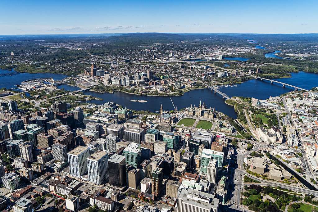
渥太华(Ottawa)是加拿大的首都,全国第四大城市,面积2,779平方公里,位于安大略省东南部,渥太华河南岸,多伦多以东400公里,蒙特利尔以西190公里。在2011年人口统计中,渥太华城市有883,391人,市区有1,236,324人,使其成为人口普查都会区域(CMA)第四的城市。
在1826年9月26日以“Bytown”之名建立,1850年1月1日合并为一个城镇,[8]并于1855年1月1日以“渥太华”之名合并取代。并不断发展成为加拿大的政治和工业技术中心。城市的原有边界由后来经过多次的小规模兼并而扩大的。“渥太华”这个名称是来自亚冈昆语(Algonquin language)adawe,意思为“贸易”。[9]渥太华常被华人简称为渥京。
加拿大与美国、澳大利亚等国不同,没有将首都城市设为联邦直辖的行政区,但是渥太华的土地管理和城市规划是由国家首都委员会(National Capital Commission)负责。
渥太华最初为爱尔兰和法国的基督教乡镇,现在已成为一个具有多元文化、高水准生活水平,低失业率的大城市。
艾蒂安·布鲁尔(Étienne Brûlé)是第一位来到渥太华河的欧洲人,并于1610年去五大湖的途中经过了渥太华。[10]三年后,萨缪尔·德·尚普兰描述了在这个地区的瀑布和见到的阿尔衮琴人。阿尔衮琴人以使用渥太华河一词达百年了。[10]渥太华原是属于亚冈昆部落(Algonquian peoples)的加拿大原住民的家园。亚冈昆人将渥太华河称作“Kichi Sibi”或:Kichissippi“,意思是“大河”。[11]这些早期的探险家来到之后,许多传教士也陆续来到渥太华。[12][13][14]
1800年3月7日,企业家菲利门·怀特(Philemon Wright)在渥太华河北侧,位于渥太华对面的魁北克加蒂诺赫尔区域建立了第一个欧洲人定居点。[15][16]他与5名农民和25位劳工,[11]着手开始在此殖民地建立一个名叫“怀特城镇”(Wrightsville)的农业社区。[17]怀特发现这条河是介于渥太华河谷(Ottawa Valley)与蒙特利尔之间的绝佳木材运输通道,木材加工和贸易使渥太华地区很快繁荣起来。1812年战争之后,大量军人家庭在此定居,政府亦致力推动贫困的爱尔兰人向渥太华移民,在此后的几十年爱尔兰移民蜂拥而至。同时,法裔加拿大人也从魁北克南下,大部分人参与丽都运河修建工程或从事木材贸易。
1832年,约翰·拜(John By)上校主导的丽都运河工程竣工,将渥太华与金斯敦和安大略湖连为一体,使之成为地区重镇。运河西部是国会山所在地,称为“上城”;而东部介于运河与丽都河之间的地区称为“下城”。嘈杂拥挤的“下城”容易爆发传染病,著名的有1832年的霍乱和1847年的红热病。
1857年12月31日,维多利亚女王选择渥太华为加拿大省的首都(包括现在的安大略和魁北克)。虽然现代的渥太华是加拿大第四大城市,但在当年,她仅仅是一个木材贸易通道中的内陆小镇,并且距离殖民地的几个主要城市(东部的蒙特利尔和魁北克城;西部的多伦多和金斯敦)路途遥远。女王的顾问们建议渥太华成为首都之选有两大重要理由:首先,渥太华是唯一具有一定规模、并且位于加拿大省东西部边界地(现安大略与魁北克边界)的城市,定都于此是平衡两个殖民地及其英裔、法裔居民的聪明妥协之举;其次,1812年战争表明,其他主要城市容易受到美国人的攻击,因为过于靠近美加边界。渥太华位于腹地,易于防守,渥太华河及丽都运河使之与加拿大东西部之间交通极为便利。另外两个方面的考虑是:渥太华正好介于多伦多和魁北克城之间(距离这两个城市都是500公里),并且城市规模较小,因而不容易受到大规模的暴徒袭击,因为政治动机,以往的首都城市都受到过这种攻击。2001年,渥太华与郊区和周边地区小城镇合并,成为规模较大的地区都市。
オタワ(英語: フランス語: Ottawa 英語発音: [ˈɒtəwə]  聞く[ヘルプ/ファイル])は、カナダの首都。オンタリオ州東部に位置する地方行政区の一つでもある。オタワ川を挟んで隣接するガティノーを含め連邦政府の行政機関が集中する行政都市である。
カナダにはアメリカの首都ワシントンD.C.とは違い、連邦政府の特別地区(Capital District)が存在せず、オタワはオンタリオ州内の一都市となっている。行政レベルはトロントなどと同じ単一層自治体に位置づけられる。
オタワはケベック州の都市ガティノーを含めた周辺都市とでオタワ首都圏(NCR、National Capital Region)を形成している。
2006年の市域人口はおよそ81万人でカナダ国内ではトロント・モントリオール・カルガリーに次ぐ4番目。広域圏の人口は113万人を数えるが、カナダの中ではトロント等のような大都会というわけではない。
1826年~1831年に軍事的目的でオタワ川とオンタリオ湖を結ぶリドー運河が建設されたが、この時測量を担当した軍人の名にちなんでバイタウン(Bytown)の小村が生まれ、これが今日のオタワの母体となった。
1854年に市街再編、川の名からオタワに改名された。当時首都の決定を巡ってケベック、モントリオール、キングストン、トロントの4都市が激しく競い合ったが、1858年、ビクトリア女王の独断で英仏両勢力のほぼ境界に位置するオタワ(当時人口は約2万人)が選定された。
第二次世界大戦中、オランダのユリアナ王女はカナダへ亡命し、オタワに身をよせていた。ユリアナ王女はオタワ滞在中に出産を迎えたが、カナダは出生地主義であり、カナダ領内で生まれた子供には自動的にカナダ国籍が与えられるため、二重国籍を認めていないオランダの法律下では生まれた子供がオランダ国籍を喪失する恐れがあった。そのため、カナダ政府は病室を一時的にカナダ領から外す特別措置をとった。この時に生まれたのが、ユリアナ王女の三女(ベアトリクス前女王の妹)マルフリート王女である。オランダ王室はこの恩義の返礼と感謝の意を込めて、毎年チューリップの球根を贈っている。オランダとの友好をも意味するチューリップが毎年5月にチューリップ・フェスティバルの会場いっぱいに咲くことから、オタワは「チューリップ・シティ」とも呼ばれる。その数は10万本以上で世界最大規模のチューリップ・フェスティバルとなっている。同会場のインターナショナルパビリオンには、日本のパビリオンもあり、地元の日系人関係者が日本パビリオンを主催している。
Ottawa (/ˈɒtəwə/ (listen), /-wɑː/; French pronunciation: [ɔtawa]) is the capital city of Canada. It stands on the south bank of the Ottawa River in the eastern portion of southern Ontario. Ottawa borders Gatineau, Quebec; the two form the core of the Ottawa–Gatineau census metropolitan area (CMA) and the National Capital Region (NCR).[12] As of 2016, Ottawa had a city population of 964,743 and a metropolitan population of 1,323,783 making it the fourth-largest city and the fifth-largest CMA in Canada.
Founded in 1826 as Bytown, and incorporated as Ottawa in 1855, the city has evolved into the political centre of Canada. Its original boundaries were expanded through numerous annexations and were ultimately replaced by a new city incorporation and amalgamation in 2001 which significantly increased its land area. The city name "Ottawa" was chosen in reference to the Ottawa River, the name of which is derived from the Algonquin Odawa, meaning "to trade".[13]
Ottawa has the most educated population among Canadian cities[14] and is home to a number of post-secondary, research, and cultural institutions, including the National Arts Centre, the National Gallery, and numerous national museums. Ottawa has the highest standard of living in the nation and low unemployment.
Ottawa2 (prononciation en français : /ɔ.ta.wa/, en anglais /ˈɒ.tə.wə/ ou /ˈɒ.tə.wɑː/) est la capitale du Canada. La ville est située dans l'est de l'Ontario, sur la rive sud de la rivière des Outaouais, face à la ville québécoise de Gatineau.
La ville est fondée en 1826 lors de la construction du canal Rideau3 et porte d'abord le nom de Bytown. Le 31 décembre 1857, l'emplacement est choisi pour accueillir la nouvelle capitale de la province du Canada. Devenue capitale de la Confédération canadienne, Ottawa accueille aujourd'hui les institutions fédérales du pays, tels que le Parlement et les résidences du gouverneur général et du Premier ministre.
En 2016, Ottawa comptait 934 243 habitants, ce qui en fait la quatrième ville la plus peuplée du Canada. Elle appartient à la région de la capitale nationale4 qui abrite 1,2 million d'habitants.
Ottawa compte un grand nombre de francophones5. Dans la capitale canadienne, 63,7 % de ses habitants déclarent avoir l'anglais comme langue maternelle et 15 % le français avec 34,1 % des habitants parlant les deux langues en 20116.
Ottawa (/ˈɔttawa/[1]; in inglese /ˈɑːtəwə/, in francese: /ɔtawa/) è la capitale federale del Canada, situata sulla sponda meridionale del fiume Ottawa, nell'omonima valle nella provincia dell'Ontario, al confine orientale con la provincia del Québec. Per popolazione è la quarta città nazionale dopo Toronto, Montréal e Calgary, se si esclude la popolazione della "Grande Vancouver", ed è anche quarta come area metropolitana, insieme alla città di Gatineau in Québec, situata sulla sponda settentrionale del fiume Ottawa. La città è il risultato della fusione nel 2000 della vecchia città di Ottawa con dieci municipalità limitrofe. Nel 2006 Ottawa contava 812.129 abitanti[2][3] (1.146.790 nell'area metropolitana cittadina).
In Canada non esiste un distretto federale della capitale; Ottawa è pertanto solo una municipalità all'interno della sua provincia. Ma, sebbene non rappresenti un separato distretto amministrativo, è parte della National Capital Region, che include al suo interno oltre alla città anche la municipalità di Gatineau. Ottawa è gestita da un consiglio cittadino formato da 24 membri: 23 rappresentanti delle circoscrizioni più un sindaco. L'attuale sindaco di Ottawa è Jim Watson, che è succeduto a Larry O'Brien il 25 ottobre 2010.
Ottawa è distante 400 km da Toronto e 200 km da Montréal[4].
La città basa la sua economia sulle attività dei ministeri, del governo federale e del Parlamento del Canada, ma un consistente segmento della forza lavoro è occupata nel settore dell'alta tecnologia e del turismo.
Ottawa3 (ing. [ˈɒtəwə], fr. [ɔtaˈwa]) es la capital de Canadá y la cuarta ciudad más grande del país. Se ubica en el extremo sureste de la provincia de Ontario, a orillas del río Ottawa, que conforma la frontera entre las provincias de Ontario y Quebec. Se localiza aproximadamente a 400 kilómetros al este de Toronto y 200 al oeste de Montreal.4
Según el censo del año 2011, la ciudad tiene 1.083.391 habitantes, aunque sumando la población de los suburbios la cifra se eleva a 2.148.785.1 Aunque en ella predomina la población anglófona, hay una significativa población francófona (32,6%). Además, todos los servicios municipales de la ciudad son bilingües (inglés y francés).5
El 31 de diciembre de 1857 la ciudad fue escogida por la Reina Victoria del Reino Unido para ser la capital de Canadá,6 por ser un territorio neutral a la vista de las comunidades de habla inglesa y francesa. Asimismo, tiene una distancia importante con la frontera de los Estados Unidos de América, que en ese entonces pensaba en invadir las colonias británicas al norte.
Cabe destacar que pese a que Canadá es un Estado federal, su división administrativa no posee ningún distrito federal que albergue a la Capital Federal, a semejanza de otros países como Alemania (Berlín), Brasil (Brasilia), Austria (Viena), Bélgica (Bruselas), Argentina (Capital Federal), Estados Unidos (Distrito de Columbia), México (Ciudad de México) o Australia (Territorio Capital)— sino que Ottawa pertenece a la provincia de Ontario como una municipalidad erigida en la Región de la Capital Nacional, que contiene a la región de Ottawa. Su área metropolitana incluye no sólo los pueblos cercanos de Ontario, sino también la ciudad de Gatineau y la región de Outaouais que se encuentran en el lado quebequés del río Ottawa.
A pesar de la falta de distrito federal, existe la Comisión de la Capital Nacional (en inglés National Capital Commission, en francés Commission de la capitale nationale), un departamento del gobierno federal cuya responsabilidad es embellecer la Región de la Capital Nacional y mantener sus parques y atracciones históricas.7


 建筑艺术
建筑艺术
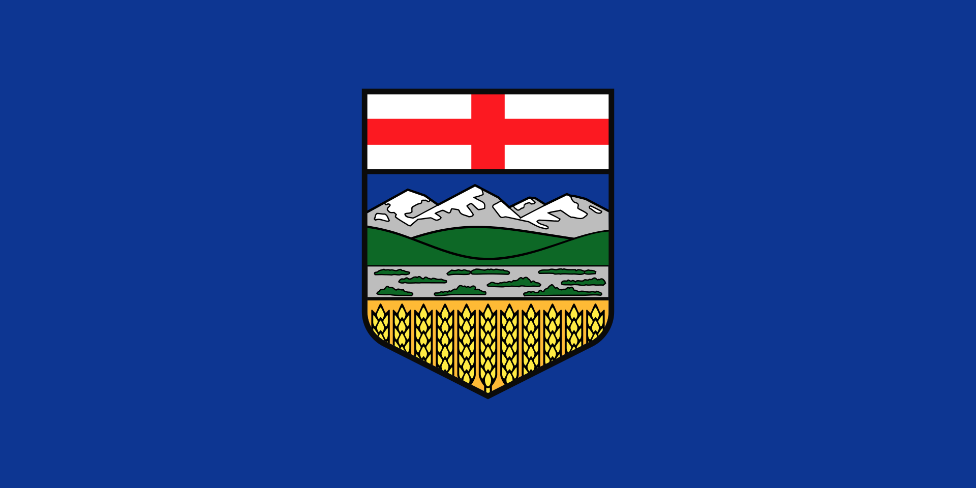 艾伯塔省
艾伯塔省
