
漢德百科全書 | 汉德百科全书
 Florida-FL
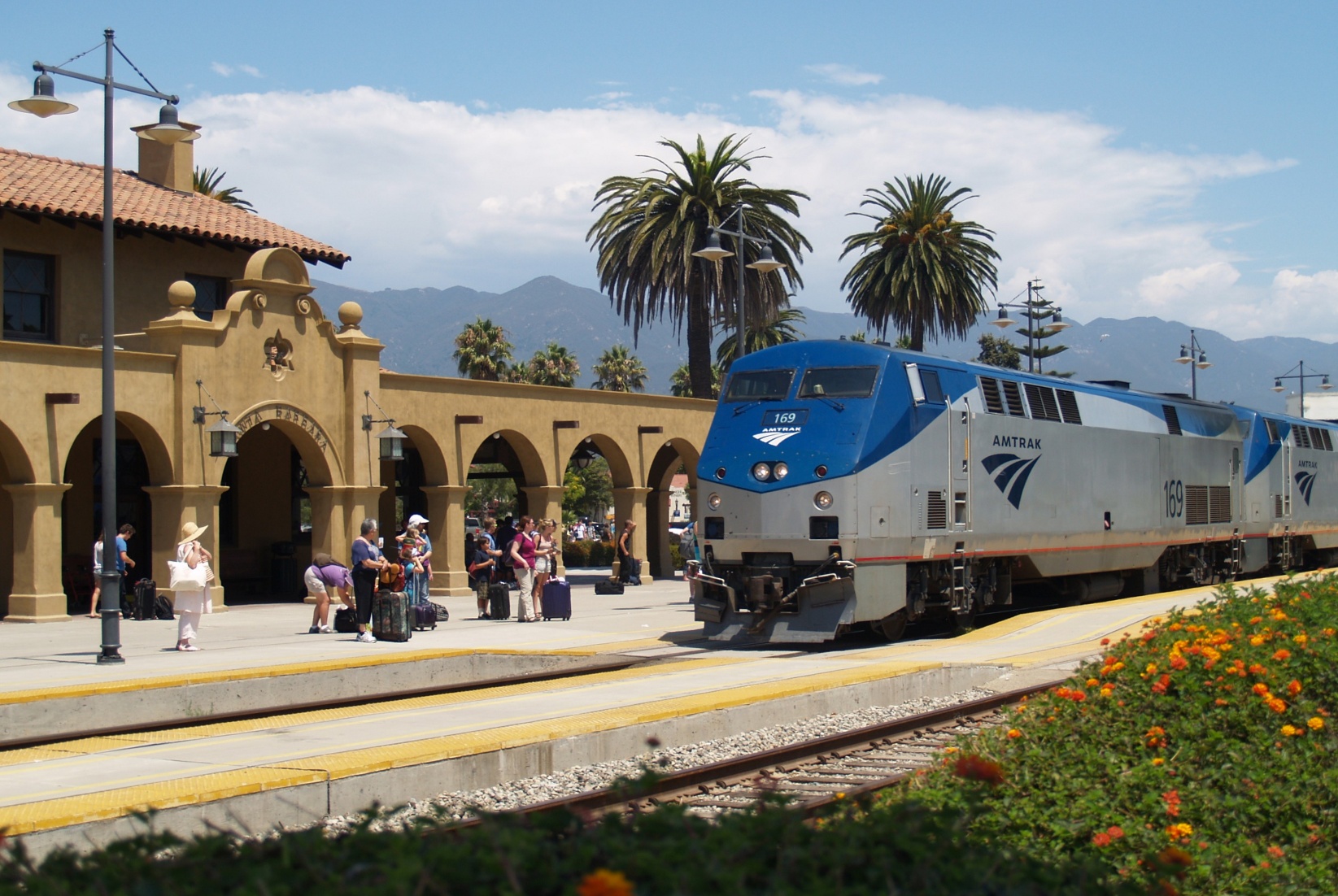
 Transport and traffic
 Alabama-AL
 Arizona-AZ
 California-CA
Florida-FL
California-CA
Florida-FL
 Georgia-GA
 Louisiana-LA
 Massachusetts-MA
 Mississippi-MS
 Nevada-NV
 New jersey-NJ
 New mexico-NM
 New York-NY
 North Carolina-NC
 Oklahoma-OK
 Oregon-OR
 Pennsylvania-PA
 South Carolina-SC
 Texas-TX
 Companies
 Utah-UT
United States
Utah-UT
United States
 Vermont-VT
 Virginia-VA
 Washington-WA
 Washington, D.C.
 West Virginia-WV
 Agriculture, forestry, livestock, fishing
 Alabama-AL
Arizona-AZ
Alabama-AL
Arizona-AZ
 Arkansas-AR
California-CA
Arkansas-AR
California-CA
 Colorado-CO
 Connecticut-CT
 Energy resource
Energy resource
Energy resource
 *Electrical power
Florida-FL
Georgia-GA
*Electrical power
Florida-FL
Georgia-GA
 Hawaii-HI
 Idaho-ID
 Indiana-IN
 Iowa-IA
 Kentucky-KY
Louisiana-LA
Kentucky-KY
Louisiana-LA
 Maine-ME
 Maryland-MD
Massachusetts-MA
Maryland-MD
Massachusetts-MA
 Michigan-MI
 Minnesota-MN
 Montana-MT
 New hampshire-NH
New jersey-NJ
New York-NY
North Carolina-NC
Oklahoma-OK
Oregon-OR
Pennsylvania-PA
South Carolina-SC
Texas-TX
United States
Vermont-VT
Virginia-VA
Washington-WA
New hampshire-NH
New jersey-NJ
New York-NY
North Carolina-NC
Oklahoma-OK
Oregon-OR
Pennsylvania-PA
South Carolina-SC
Texas-TX
United States
Vermont-VT
Virginia-VA
Washington-WA
 Wisconsin-WI

| Last Modified on November 21, 2022 *Capacity noted in (MW) |
| Plant | Location | Feedstock | Capacity |
|---|---|---|---|
| Agrilectric Power Partners Ltd. | LA | Rice hulls | 12.00 |
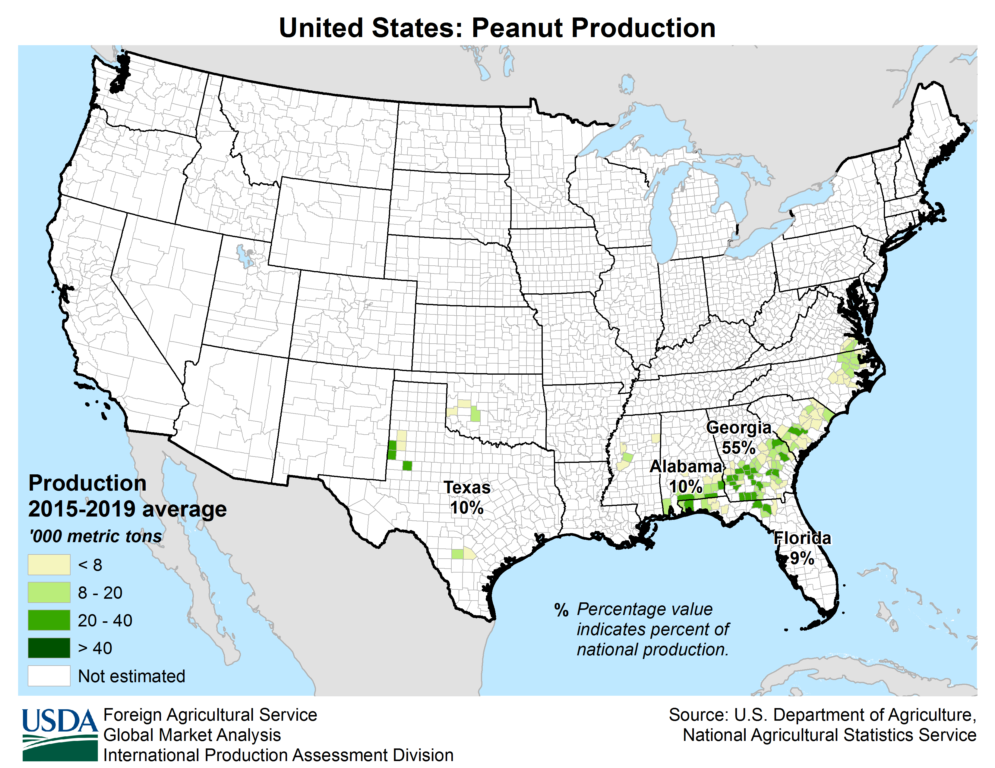
| Albany Green Energy | GA | Forest residue, urban wood waste, pecan shells, peanut hulls | 50.00 |
| Allendale Biomass | SC | Mill/forestry residue | 20.00 |
| Altavista Power Station | VA | Woody biomass | 51.00 |
| Arnold O. Chantland Incineration Plant | IA | MSW/Refused-derived fuel (RDF) | 4.00 |
| Barron County Waste-to-Energy & Recycling Facility | WI | MSW | 2.00 |
| Bay Front Power Plant | WI | Wood waste | 56.00 |
| Biomass One | OR | Logging/wood debris | 30.00 |
| Bridgewater Power LP | NH | Woody biomass | 20.00 |
| Buckeye Florida Biomass | FL | Wood waste, black liquor | 69.40 |
| Burgess BioPower | NH | Wood waste | 75.00 |
| Burney Forest Power | CA | Wood waste | 31.00 |
| Cadillac Renewable Energy | MI | Forest residue | 40.00 |
| City of Spokane Waste to Energy Facility | WA | MSW | 22.00 |
| Collins Pine Co. Power Plant | CA | Forest thinnings/residue | 12.00 |
| Covanta Alexandria | VA | MSW | 22.00 |
| Covanta Babylon | NY | MSW | 17.00 |
| Covanta Bristol | CT | MSW | 16.00 |
| Covanta Camden | NJ | MSW | 21.00 |
| Covanta Dade | FL | MSW, wood waste | 77.00 |
| Covanta Delaware Valley | PA | MSW | 87.00 |
| Covanta Essex | NJ | MSW | 66.00 |
| Covanta Fairfax | VA | MSW | 93.00 |
| Covanta Harrisburg | PA | MSW | 21.00 |
| Covanta Haverhill | MA | MSW | 45.00 |
| Covanta Hempstead | NY | MSW | 72.00 |
| Covanta Hillsborough | FL | MSW | 47.00 |
| Covanta Honolulu | HI | MSW | 90.00 |
| Covanta Huntington | NY | MSW | 24.00 |
| Covanta Indianapolis | IN | MSW | 6.50 |
| Covanta Kent | MI | MSW | 17.00 |
| Covanta Lake | FL | MSW | 15.00 |
| Covanta Lancaster | PA | MSW | 33.00 |
| Covanta Lee | FL | MSW | 57.00 |
| Covanta Long Beach | CA | MSW | 36.00 |
| Covanta MacArthur | NY | MSW | 12.00 |
| Covanta Marion | OR | MSW | 13.00 |
| Covanta Montgomery | MD | MSW | 63.00 |
| Covanta Niagara | NY | MSW | 50.00 |
| Covanta Onondaga | NY | MSW | 39.00 |
| Covanta Palm Beach Renewable Energy #1 | FL | MSW | 62.00 |
| Covanta Palm Beach Renewable Energy #2 | FL | MSW | 95.00 |
| Covanta Pasco | FL | MSW | 30.00 |
| Covanta Pinellas | FL | MSW | 75.00 |
| Covanta Plymouth | PA | MSW | 32.00 |
| Covanta SECONN | CT | MSW | 17.00 |
| Covanta SEMASS | MA | MSW | 78.00 |
| Covanta Stanislaus | CA | MSW | 22.00 |
| Covanta Tulsa | OK | MSW | 17.00 |
| Covanta Union | NJ | MSW | 42.00 |
| Covanta York | PA | MSW | 42.00 |
| Cox Waste-to-Energy | KY | Wood waste | 5.00 |
| Craven County Wood Energy | NC | Wood chips, forestry residue, mill waste, bark, sawdust, poultry litter | 50.00 |
| Deerhaven Renewable Generating Station | FL | Wood waste | 102.50 |
| Desert View Power | CA | Woody biomass | 45.00 |
| DG Fairhaven Power | CA | Wood waste | 18.00 |
| Dillard Complex Cogeneration Plant | OR | Mill residue | 51.50 |
| Dorchester Biomass | SC | Mill/forestry residue | 20.00 |
| Douglas County Forest Products | OR | Wood residue | 6.00 |
| DTE Stockton Biomass Power | CA | Woody biomass, ag residue | 45.00 |
| Eagle Valley Clean Energy | CO | Forest restoration thinnings/residue | 12.00 |
| Ecomaine Waste-to-Energy Plant | ME | MSW | 14.00 |
| Evergreen Biopower LLC | OR | Mill residue | 10.00 |
| Fernandina Biomass Plant | FL | Mill residuals | 22.50 |
| French Island Generating Station | WI | MSW/RDF, wood waste, railroad ties | 28.00 |
| Genesee Power Station | MI | Landscaping/storm debris, waste wood | 40.00 |
| Grayling Generating Station | MI | Forestry residue, mill waste, bark | 38.00 |
| Green Energy Team LLC | HI | Eucalyptus, albizia | 7.50 |
| GRP-Franklin LLC | GA | C&D waste | 65.00 |
| GRP-Madison LLC | GA | C&D waste | 65.00 |
| Halifax County Biomass Plant | VA | Logging waste, forest slash | 49.90 |
| Hennepin Energy Recovery Center | MN | MSW | 40.00 |
| Hillman Power LLC | MI | Wood waste | 20.00 |
| Honey Lake Power | CA | High-hazard forest material/thinnings | 30.00 |
| Hopewell Power Station | VA | Woody biomass | 51.00 |
| Joseph C McNeil Generating Station | VT | Logging residue, bark, shavings, clean urban wood waste | 50.00 |
| Kapstone Kraft Paper Corp.-Longview | WA | Mill residue, wood waste | 25.00 |
| Kettle Falls Generating Station | WA | Logging/mill residue | 53.00 |
| Koda Energy LLC | MN | Oat/rice hulls, corn, barley and malt screening, urban tree waste | 23.40 |
| L'Anse Warden Electric Company | MI | Wood waste, railroad ties | 20.00 |
| M.L. Hibbard Energy Center | MN | Wood waste | 72.80 |
| Macon Mill | GA | Logging waste | 38.00 |
| McKay Bay Refuse-to-Energy Plant | FL | MSW | 22.00 |
| McKinley Paper Cogeneration Facility | WA | Logging/mill residue | 9.50 |
| Merced Power | CA | Ag waste | 12.50 |
| MMWAC Resource Recovery Facility | ME | MSW | 5.00 |
| Mt. Poso Cogeneration Co. LLC | CA | Wood waste | 44.00 |
| Multitrade Rabun Gap | GA | Woody biomass | 18.00 |
| National Energy-Lincoln | MI | Wood waste | 18.00 |
| National Energy-McBain | MI | Wood waste | 18.00 |
| North Carolina Renewable Power | NC | C&D waste, wood waste, poultry litter | 22.00 |
| North Fork Community Power | CA | High-hazard forest material | 2.00 |
| Novo BioPower LLC | AZ | Wood waste | 27.00 |
| Okeelanta Biomass Cogeneration | FL | Baggasse, natural gas | 74.90 |
| Olmsted Waste-To-Energy Facility | MN | MSW | 9.60 |
| Oswego Energy Recovery Facility | NY | MSW | 4.00 |
| Pacific Ultrapower Chinese Station | CA | Woody biomass | 25.00 |
| Penobscot Energy Recovery | ME | MSW | 25.00 |
| Piedmont Green Power | GA | Urban wood waste, mill and logging residue | 55.00 |
| Plainfield Renewable Energy | CT | C&D/forestry waste | 37.50 |
| Plummer Cogen | ID | Wood waste | 6.20 |
| Potlatch Land & Lumber Power Plant | AR | Bark, sawdust, shavings | 10.00 |
| Rapids Energy Center | MN | Logging/mill residue | 28.60 |
| Red Wing Generating Station | MN | MSW/RDF | 22.00 |
| ReEnergy Black River | NY | Woody biomass | 60.00 |
| ReEnergy Livermore Falls | ME | Forest residue, C&D waste | 39.00 |
| ReEnergy Stratton | ME | Forest/mill residue | 48.00 |
| Resolute Forest Products Coosa Pines | AL | Wood-processing waste | 30.00 |
| Rio Bravo Fresno | CA | Ag/urban wood waste | 24.30 |
| Rio Bravo Rocklin | CA | High-hazard forest material, ag/urban waste | 24.40 |
| RockTenn-Tacoma Mill | WA | Mill residue | 55.00 |
| Roseburg Forest Products Biomass | CA | Wood waste | 13.00 |
| Rothschild Biomass Cogeneration Plant | WI | Urban wood waste, mill residue | 50.00 |
| Savannah River Site Biomass Cogeneration Facility | SC | Forest residue | 20.00 |
| Scotia Cogen | CA | Wood waste | 28.00 |
| SDS Lumber Gorge Energy Division | WA | Logging/mill residue | 10.00 |
| Shasta-Sustainable Resource Management | CA | Wood waste, forest residue | 56.00 |
| Southampton Power Station | VA | Woody biomass | 51.00 |
| Southern Co. Nacogdoches Generating Facility | TX | Forest/wood processing residue | 115.00 |
| SPI-Aberdeen Biomass Power | WA | Logging/mill residue | 18.00 |
| SPI-Anderson Biomass Power | CA | Logging/mill residue | 30.00 |
| SPI-Burlington Biomass Power | WA | Logging/mill residue | 28.00 |
| SPI-Burney | CA | Logging/mill residue | 20.00 |
| SPI-Eugene | OR | Mill, forest residue | 19.80 |
| SPI-Lincoln Biomass Power | CA | Logging/mill residue | 18.00 |
| SPI-Quincy Biomass Power | CA | Mill residue | 35.20 |
| SPI-Sonora Biomass Power | CA | Logging/mill residue | 10.90 |
| St. Paul Cogeneration LLC | MN | Urban wood residue | 33.00 |
| Stoltze Cogeneration Power Plant | MT | Mill residue | 3.00 |
| Stored Solar Bethlehem | NH | Logging residue, forest thinnings | 20.00 |
| Stored Solar Fitchburg | MA | Woody biomass | 17.00 |
| Stored Solar Jonesboro | ME | Woody biomass | 25.00 |
| Stored Solar Ryegate | VT | Woody biomass | 20.00 |
| Stored Solar Springfield | NH | Woody biomass | 19.00 |
| Stored Solar Tamworth | NH | Woody biomass | 20.00 |
| Stored Solar West Enfield | ME | Woody biomass | 25.00 |
| Stored Solar Whitefield | NH | Woody biomass | 15.00 |
| Telogia Power | FL | Logging/mill residue, hog fuel, peanut hulls | 14.00 |
| U.S. Sugar Corp. Cogeneration Plant | FL | Bagasse | 50.00 |
| Virginia City Hybrid Energy Center | VA | *Woody biomass | 120.00 |
| Wadham Energy LP | CA | Rice hulls | 30.00 |
| Westervelt Renewable Energy Moundville | AL | Wood waste | 13.00 |
| WestRock Covington | VA | Logging, papermaking residue | 75.00 |
| Wheelabrator Baltimore | MD | MSW | 64.50 |
| Wheelabrator Bridgeport | CT | MSW | 67.00 |
| Wheelabrator Concord | NH | MSW | 14.00 |
| Wheelabrator Dutchess County | NY | MSW | 9.00 |
| Wheelabrator Falls | PA | MSW | 53.00 |
| Wheelabrator Gloucester | NJ | MSW | 14.00 |
| Wheelabrator Hudson Falls | NY | MSW | 14.00 |
| Wheelabrator Lisbon | CT | MSW | 15.00 |
| Wheelabrator Millbury | MA | MSW | 48.00 |
| Wheelabrator North Andover | MA | MSW | 40.00 |
| Wheelabrator Portsmouth | VA | MSW | 60.00 |
| Wheelabrator Saugus | MA | MSW | 54.00 |
| Wheelabrator South Broward | FL | MSW | 66.00 |
| Wheelabrator Westchester LP | NY | MSW | 60.00 |
| Wilmarth Generating Station | MN | MSW/RDF, woody biomass | 18.00 |
| Woodland Biomass Power | CA | Wood chips, urban wood waste, ag waste | 25.00 |
| Total Plants: 159 | Total capacity(MW): | 5,583.90 |


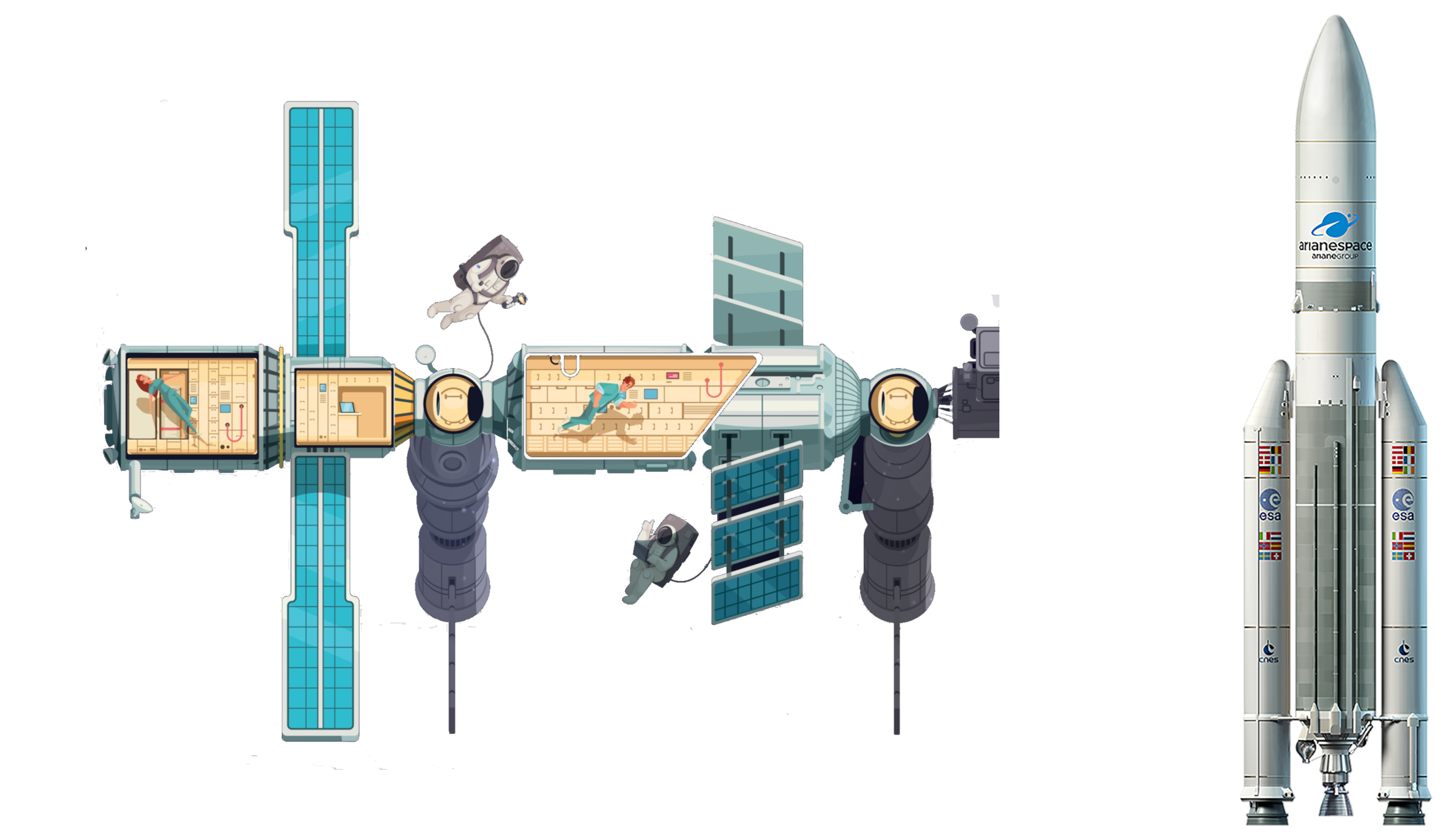 Aerospace

 Medical, Pharmaceutical, Rehabilitation
 Exhibition


美国国家发明家科学院(英语:National Academy of Inventors)是一个美国科学组织,仿造美国国家学院的模式建立。
Die National Academy of Inventors (NAI) ist eine US-amerikanische Non-Profit-Organisation, die sich nach dem Vorbild der National Academies of the United States für die Förderung von Erfindern in der Wissenschaft einsetzt. Sie wurde 2010 an der University of South Florida gegründet.
Alabama-AL
 Alaska-AK
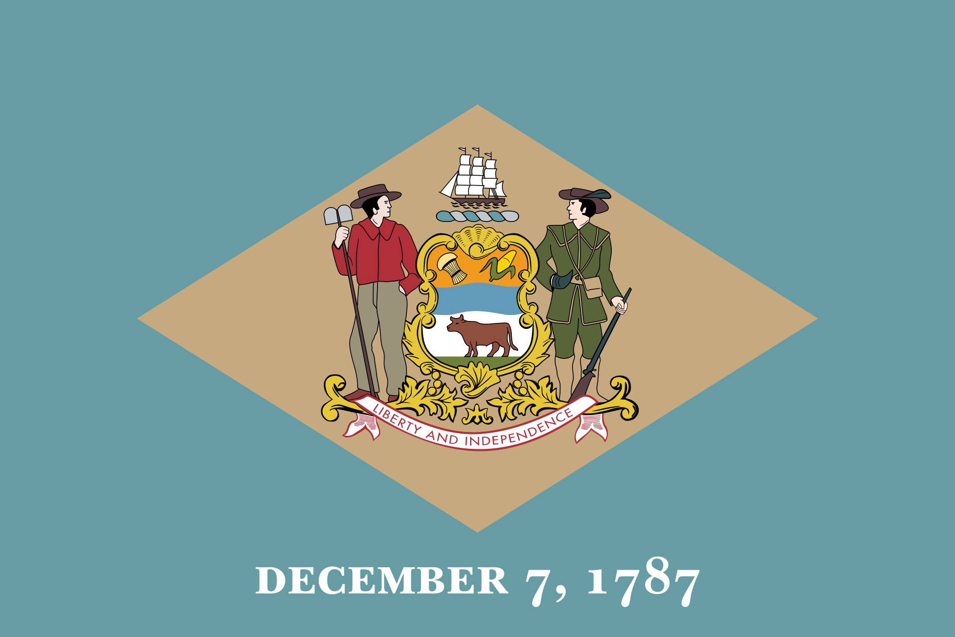 Delaware-DE
Florida-FL
Delaware-DE
Florida-FL
 Geography
Georgia-GA
Kentucky-KY
Louisiana-LA
Maryland-MD
Mississippi-MS
North Carolina-NC
Oklahoma-OK
South Carolina-SC
Geography
Georgia-GA
Kentucky-KY
Louisiana-LA
Maryland-MD
Mississippi-MS
North Carolina-NC
Oklahoma-OK
South Carolina-SC
 Tennessee-TN
Texas-TX
Virginia-VA
West Virginia-WV
Tennessee-TN
Texas-TX
Virginia-VA
West Virginia-WV

Die Südstaaten sind eine Großregion im Südosten der USA. Nach der geografisch orientierten Definition des United States Census Bureau bestehen die Südstaaten aus insgesamt 16 Staaten mit knapp 100 Millionen Einwohnern auf 2.384.143 km². Es handelt sich um jene 15 eher östlichen Bundesstaaten, die südlich der Mason-Dixon-Linie, der Grenze zwischen Pennsylvania und Maryland, liegen und in denen bis 1865 die Sklavenhaltung erlaubt war, sowie Oklahoma, das erst 1907 gegründet wurde.
美国南部(英语:Southern United States,或 American South)也经常被简称为美南、迪克西、或直接称为南部,构成了美国南部至东南部的一片广大地区。这个地区带有相当特殊的文化和历史背景,包括了早期欧洲殖民时期留下的痕迹、对于州权原则的坚持、早期的奴隶制度、以及在联盟国分离时于美国内战中受到的冲击,该地发展出了美国其他地区相异的独特文学、音乐、料理等文化传统。
 Alabama-AL
Cuba
Florida-FL
Louisiana-LA
Mexico
Mississippi River
Mississippi-MS
Texas-TX
United States
Alabama-AL
Cuba
Florida-FL
Louisiana-LA
Mexico
Mississippi River
Mississippi-MS
Texas-TX
United States
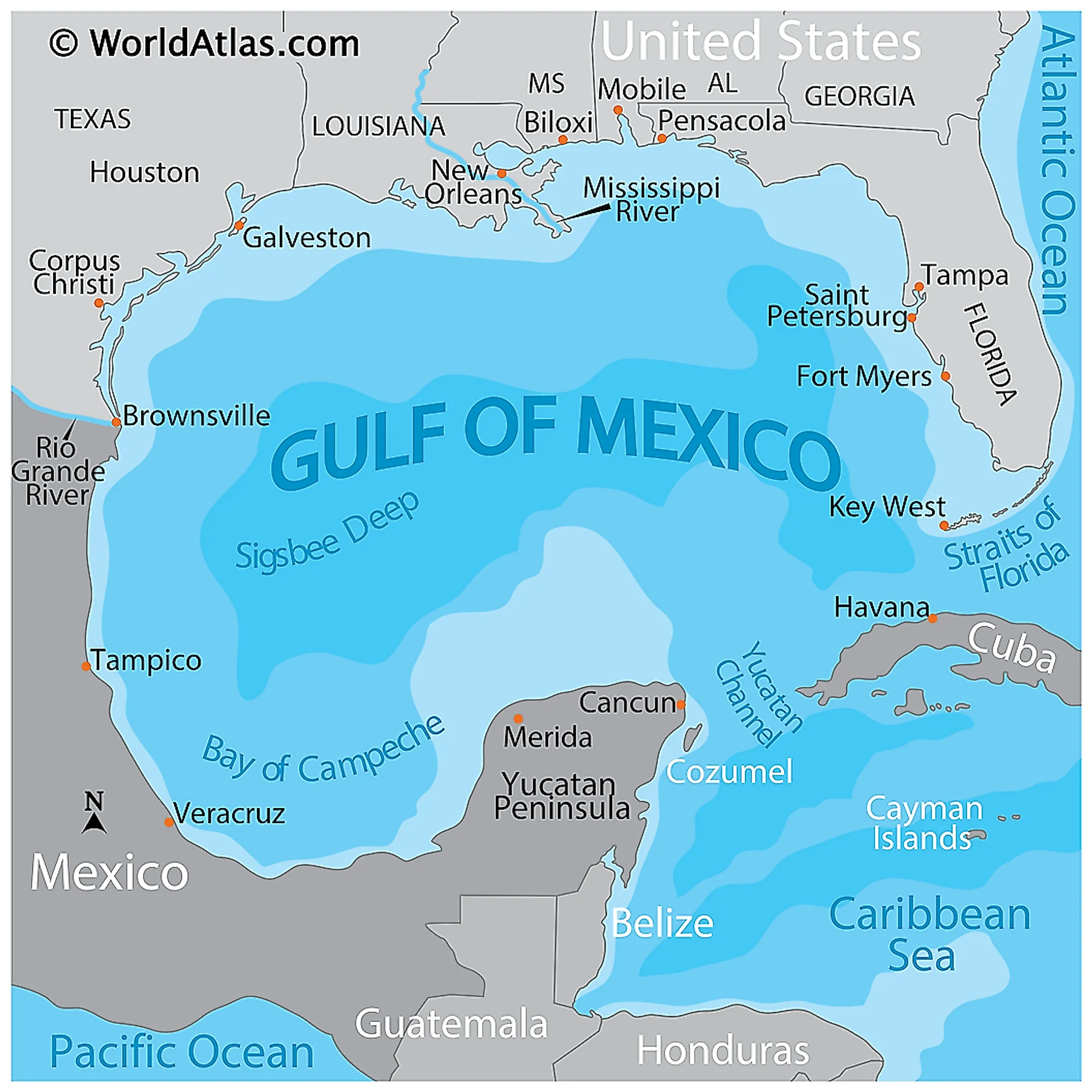
Der Golf von Mexiko (englisch Gulf of Mexico, spanisch Golfo de México; veraltet: Meerbusen von Mexiko[1]) ist eine nahezu vollständig von Nordamerika eingeschlossene Meeresbucht. Der Golf ist ein Randmeer des Atlantischen Ozeans und der nordwestliche Teil des Amerikanischen Mittelmeers.
墨西哥湾(英语:Gulf of Mexico、西班牙语:golfo de México,美国称其为Gulf of America,即美国湾[2]或美洲湾[3]),是一个大西洋的海盆和边缘海[4][5],大部分被北美大陆所环绕[6]。它的东北部、北部和西北部与美洲湾沿岸地区接壤;西南部和南部与墨西哥的塔毛利帕斯州、韦拉克鲁斯州、塔巴斯科州、坎佩切州、尤卡坦州和金塔纳罗奥州接壤;东南部与古巴接壤。美国南部地区的得克萨斯州、路易斯安那州、密西西比州、亚拉巴马州和佛罗里达州的沿海地区位于墨西哥湾的北部,偶尔被称为美国“第三海岸”(于大西洋和太平洋沿岸外),但更常被称为“墨西哥湾沿岸”。
墨西哥湾形成于约3亿年前,由板块漂移而成[7]。墨西哥湾盆地大致呈椭圆形,宽约810海里(1,500千米;930英里)。其海底由沉积岩和现代沉积物组成。通过美国与古巴之间的佛罗里达海峡与大西洋部分相连,并通过墨西哥与古巴之间的尤卡坦海峡与加勒比海相连。由于墨西哥湾与大西洋的连接较为狭窄,其潮汐变化幅度非常小。该海湾盆地的面积约为1.6 × 10⁶平方千米(620,000平方英里)。盆地近半区域由浅水大陆架构成。盆地水量约为2.4 × 10⁶立方千米(580 × 103立方英里)[8]。该海湾是全球最重要的近海石油生产区之一,占美国石油总产量的14%[9]。
湾の東部、北部、および北西部の海岸線はアメリカ合衆国(フロリダ州、アラバマ州、ミシシッピ州、ルイジアナ州、テキサス州)に接し、南西部と南部の海岸線はメキシコ(タマウリパス州、ベラクルス州、タバスコ州、カンペーチェ州、ユカタン州およびキンタナ・ロー州)に接している。また南東部はキューバとの海岸線をもつ。
アメリカとキューバの間にあるフロリダ海峡を経て大西洋に通じており、メキシコとキューバの間にあるユカタン海峡を経てカリブ海へと通じている。支湾として北東部にアパラチー湾、南西部にカンペチェ湾などがある。
メキシコ湾は東西の幅が約1,500km、総面積は約160万 km²で、南の3分の1は熱帯に入る。最大水深はSigsbee Deepでの4,384m。二大海流として黒潮と共に知られるメキシコ湾流はここを起源とし、巨大ハリケーンが頻繁に訪れることでも有名である。
The Gulf of Mexico (Spanish: Golfo de México) is an ocean basin and a marginal sea of the Atlantic Ocean,[1] largely surrounded by the North American continent.[2] It is bounded on the northeast, north and northwest by the Gulf Coast of the United States, on the southwest and south by the Mexican states of Tamaulipas, Veracruz, Tabasco, Campeche, Yucatan, and Quintana Roo, and on the southeast by Cuba. The US states of Texas, Louisiana, Mississippi, Alabama, and Florida border the Gulf on the north, which are often referred to as the "Third Coast", in comparison with the U.S. Atlantic and Pacific coasts.
The Gulf of Mexico formed approximately 300 million years ago as a result of plate tectonics.[3] The Gulf of Mexico basin is roughly oval and is approximately 810 nautical miles (1,500 km; 930 mi) wide and floored by sedimentary rocks and recent sediments. It is connected to part of the Atlantic Ocean through the Florida Straits between the U.S. and Cuba, and with the Caribbean Sea via the Yucatán Channel between Mexico and Cuba. With the narrow connection to the Atlantic, the Gulf experiences very small tidal ranges. The size of the Gulf basin is approximately 1.6 million km2 (615,000 sq mi). Almost half of the basin is shallow continental shelf waters. The basin contains a volume of roughly 2,500 quadrillion liters (550 quadrillion Imperial gallons, 660 quadrillion US gallons, 2.5 million km3 or 600,000 cu mi).[4] The Gulf of Mexico is one of the most important offshore petroleum production regions in the world, comprising one-sixth of the United States' total production.[5]
Le golfe du Mexique est un golfe de l'océan Atlantique, situé au sud-sud-est de l'Amérique du Nord. Il s'étend sur une superficie de 1 550 000 km2. Il baigne la péninsule de Floride, la Louisiane , le Sud-Est du Texas, la côte orientale du Mexique et une partie du littoral nord de Cuba.
Il golfo del Messico è uno dei golfi più grandi del mondo[1], situato nell'Oceano Atlantico, tra la costa dell'America settentrionale e centrale ad ovest e il mar dei Caraibi ad est.
Situato a Sud degli Stati Uniti e a Nord del Messico, e delimitato da due grandi penisole, lo Yucatán e la Florida, rispettivamente in Messico e negli Stati Uniti, comprende i litorali di undici stati: Florida, Alabama, Mississippi, Louisiana e Texas (per gli Stati Uniti) e Tamaulipas, Veracruz, Tabasco, Campeche, Yucatán e Quintana Roo (per gli Stati del Messico). Sul golfo si affaccia anche lo Stato di Cuba ed è collegato ad est al Mar dei Caraibi.
L'ampia sezione del golfo compresa tra la penisola dello Yucatán e la costa messicana assume la denominazione di baia di Campeche, mentre insieme al Mar dei Caraibi, forma il Mediterraneo Americano, espressione non riportata normalmente nelle carte, ma usata in oceanografia, geologia e biologia marina[2]. In esso viene generata la famosa Corrente del Golfo che rende abitabili la maggior parte delle coste atlantiche dell'Europa ed è inoltre luogo di formazione e transito di cicloni tropicali che qui prendono il nome di uragani a partire da tempeste tropicali che impattano poi sovente sulla costa messicana e statunitense o sulle isole caraibiche.
El golfo de México es una cuenca oceánica contenida entre los litorales de México, Estados Unidos y Cuba. Los estados mexicanos que tienen costa en este golfo son: Tamaulipas, Veracruz, Tabasco, Campeche, Yucatán; los estadounidenses son: Florida, Alabama, Misisipi, Luisiana y Texas. La península de Florida y la isla de Cuba ocupan la parte oriental del golfo, donde se encuentra la salida de este hacia el océano Atlántico, en tanto que la península de Yucatán, también al oriente, separa al golfo del mar Caribe.1
Мексика́нский зали́в (исп. Golfo de México, англ. Gulf of Mexico, фр. Golfe de Mexique) — внутреннее море западной части Атлантического океана. Ограничен с северо-запада, севера и востока побережьем США (штаты Флорида, Алабама, Миссисипи, Луизиана и Техас), на юге и юго-западе — побережьем Мексики (штаты Тамаулипас, Веракрус, Табаско, Кампече, Юкатан), а также островом Кубой[1]. Внешне напоминает овал. Площадь залива — 1543 тыс. км², объём воды — около 2332 тыс. км³[2]. Энергия вод, которые сильно нагреваются в летний период, служит основой для формирования сильных тропических штормов и мощных ураганов, крупнейшие из которых (Катрина, Густав, Иван и др.) практически ежегодно приводят к разрушительным последствиям в прибрежных регионах залива. Имеет важное хозяйственное значение для государств, омываемых им. Является одним из самых тёплых водоёмов в мире[3].
Мексиканский залив образовался примерно 300 миллионов лет назад в результате тектоники литосферных плит[4]. Поверхность залива по форме напоминает овал шириной около 1,5 тысяч километров. Дно залива составлено из осадочных пород и недавних отложений. Сообщается с Атлантическим океаном через Флоридский пролив между США и Кубой, и с Карибским морем через Юкатанский пролив между Кубой и Мексикой. Мексиканский залив и Карибское море иногда объединяют под названием Американское Средиземное море. Из-за слабой связи с Атлантическим океаном, залив испытывает лишь небольшие приливы и отливы. Площадь залива составляет 1,5—1,6 млн км², около половины составляют континентальные шельфовые воды. Объём воды в заливе оценивается в 2.5 миллиона кубических километров[3].
 Universities in the USA


