
Deutsch-Chinesische Enzyklopädie, 德汉百科
 Nepal
Nepal
 Economy and trade
 Afghanistan
Egypt
Albania
Angola
Antigua and Barbuda
Argentina
Armenia
Australia
Bahrain
Bangladesh
Barbados
Belgium
Belize
Benin
Bolivia
Botsuana
Brazil
Brunei Darussalam
Bulgaria
Burkina Faso
Burundi
Chile
China
Columbia
Costa Rica
Côte d´Ivoire
Cuba
Denmark
Demokratische Republik Kongo
Germany
Dominica
Dominikanische Republik
Djibouti
Ecuador
Estonia
Afghanistan
Egypt
Albania
Angola
Antigua and Barbuda
Argentina
Armenia
Australia
Bahrain
Bangladesh
Barbados
Belgium
Belize
Benin
Bolivia
Botsuana
Brazil
Brunei Darussalam
Bulgaria
Burkina Faso
Burundi
Chile
China
Columbia
Costa Rica
Côte d´Ivoire
Cuba
Denmark
Demokratische Republik Kongo
Germany
Dominica
Dominikanische Republik
Djibouti
Ecuador
Estonia
 European Union
Fidschi
European Union
Fidschi
 Financial
Finland
France
Gabun
Gambia
Georgia
Ghana
Grenada
Greece
Guatemala
Guinea
Guinea-Bissau
Guyana
Honduras
Hongkong Tebiexingzhengqu-HK
India
Indonesia
Ireland
Iceland
Israel
Italy
Jamaika
Japan
Yemen
Jordan
Cambodia
Cameroon
Canada
Kap Verde
Kasachstan
Katar
Kenya
Kyrgyzstan
Croatia
Kuwait
Laos
Lesotho
Latvia
Liberia
Liechtenstein
Lithuania
Luxembourg
Macau Tebiexingzhengqu-MO
Madagaskar
Malawi
Malta
Morocco
Mauritania
Mauritius
Mexico
Moldawien
Financial
Finland
France
Gabun
Gambia
Georgia
Ghana
Grenada
Greece
Guatemala
Guinea
Guinea-Bissau
Guyana
Honduras
Hongkong Tebiexingzhengqu-HK
India
Indonesia
Ireland
Iceland
Israel
Italy
Jamaika
Japan
Yemen
Jordan
Cambodia
Cameroon
Canada
Kap Verde
Kasachstan
Katar
Kenya
Kyrgyzstan
Croatia
Kuwait
Laos
Lesotho
Latvia
Liberia
Liechtenstein
Lithuania
Luxembourg
Macau Tebiexingzhengqu-MO
Madagaskar
Malawi
Malta
Morocco
Mauritania
Mauritius
Mexico
Moldawien
 Mongolei
Montenegro
Mosambik
Myanmar
Namibia
Nepal
New Zealand
Nicaragua
Netherlands
Niger
Nigeria
Nordmazedonien
Norwegen
Oman
Austria
Pakistan
Panama
Papua-Neuguinea
Paraguay
Peru
Philippines
Poland
Portugal
Republik El Salvador
Republik Haiti
Republik Kongo
Republic of Korea
Ruanda
Romania
Russia
Salomonen
Sambia
Samoa
Saudi Arabia
Sweden
Sweden
Switzerland
Mongolei
Montenegro
Mosambik
Myanmar
Namibia
Nepal
New Zealand
Nicaragua
Netherlands
Niger
Nigeria
Nordmazedonien
Norwegen
Oman
Austria
Pakistan
Panama
Papua-Neuguinea
Paraguay
Peru
Philippines
Poland
Portugal
Republik El Salvador
Republik Haiti
Republik Kongo
Republic of Korea
Ruanda
Romania
Russia
Salomonen
Sambia
Samoa
Saudi Arabia
Sweden
Sweden
Switzerland
 Genf
Senegal
Seychellen
Sierra Leone
Simbabwe
Singapore
Slovakia
Slovenia
Spain
Sri Lanka
Saint Kitts and Nevis
St. Lucia
St. Vincent and the Grenadines
South Africa
Suriname
Swasiland
Tajikistan
Taiwan Sheng-TW
Tansania
Thailand
Togo
Tonga
Trinidad und Tobago
Tschad
Czech Republic
Tunisia
Turkey
Uganda
Ukraine
Hungary
Uruguay
Vanuatu
Venezuela
United Arab Emirates
United States
United Kingdom
Vietnam
Genf
Senegal
Seychellen
Sierra Leone
Simbabwe
Singapore
Slovakia
Slovenia
Spain
Sri Lanka
Saint Kitts and Nevis
St. Lucia
St. Vincent and the Grenadines
South Africa
Suriname
Swasiland
Tajikistan
Taiwan Sheng-TW
Tansania
Thailand
Togo
Tonga
Trinidad und Tobago
Tschad
Czech Republic
Tunisia
Turkey
Uganda
Ukraine
Hungary
Uruguay
Vanuatu
Venezuela
United Arab Emirates
United States
United Kingdom
Vietnam
 Important International Organizations
World Trade Organization
Roberto Azevêdo
World Trade Organization
Mike Moore
World Trade Organization
Ngozi Okonjo-Iweala
World Trade Organization
Pascal Lamy
World Trade Organization
Peter Sutherland
World Trade Organization
Renato Ruggiero
World Trade Organization
Supachai Panitchpakdi
Central African Republic
Cyprus
Important International Organizations
World Trade Organization
Roberto Azevêdo
World Trade Organization
Mike Moore
World Trade Organization
Ngozi Okonjo-Iweala
World Trade Organization
Pascal Lamy
World Trade Organization
Peter Sutherland
World Trade Organization
Renato Ruggiero
World Trade Organization
Supachai Panitchpakdi
Central African Republic
Cyprus

世界贸易组织(简称世贸组织或世贸;英语:World Trade Organization,缩写为 WTO;法语:Organisation Mondiale du Commerce,缩写为 OMC;西班牙语:Organización Mundial del Comercio,缩写为 OMC)是负责监督成员经济体之间各种贸易协议得到执行的一个国际组织,前身是1948年起实施的关税及贸易总协定的秘书处。
世贸总部位于瑞士日内瓦,现任总干事是罗伯托·阿泽维多。截至2016年7月29日,世界贸易组织共有164个成员。[5]世界贸易组织的职能是调解纷争,加入WTO不算签订一种多边贸易协议,但其设置的入会门槛可以做为愿意降低关税、法政上配合、参与国际贸易的门票,它是贸易体制的组织基础和法律基础,是众多贸易协定的管理者,是各成员贸易立法的监督者,是就贸易提供解决争端和进行谈判的场所。该机构是当代最重要的国际经济组织之一,其成员间的贸易额占世界贸易额的绝大多数,被称为“经济联合国”。
Die Welthandelsorganisation (englisch World Trade Organization, WTO; französisch Organisation mondiale du commerce, OMC; spanisch Organización Mundial de Comercio, OMC) ist eine internationale Organisation mit Sitz in Genf, die sich mit der Regelung von Handels- und Wirtschaftsbeziehungen beschäftigt. Sie wurde am 15. April 1994 aus dem General Agreement on Tariffs and Trade (GATT) in der Uruguay-Runde nach siebenjähriger Verhandlungszeit gegründet. Am 1. Januar 1995 nahm sie ihre Arbeit in Genf auf. Die WTO ist neben dem IWF und der Weltbank eine der zentralen internationalen Organisationen, die Handels- und Wirtschaftspolitik mit globaler Reichweite verhandelt.
世界貿易機関(せかいぼうえききかん、英: World Trade Organization、略称:WTO)は、自由貿易促進を主たる目的として創設された国際機関である。常設事務局がスイスのジュネーブに置かれている。
GATT(ガット)ウルグアイ・ラウンドにおける合意によって、世界貿易機関を設立するマラケシュ協定(WTO設立協定)に基づいて1995年1月1日にGATTを発展解消させて成立した。
本来GATTは、第二次世界大戦後の安定を見据え、国際通貨基金および国際復興開発銀行とともに設立が予定されていた国際貿易機関(ITO)の設立準備の際に、暫定協定として結ばれたものであった。国際貿易機関の設立が廃案となり、GATTがその代替として発展強化されていくうちに、再びこの分野の常設機関が求められ、WTOが設立されることとなった。発展解消であるため、GATTの事務局及び事務局長もWTOへと引き継がれることとなった[4]。
WTOはGATTを継承したものであるが、GATTが協定(Agreement)に留まったのに対し、WTOは機関(Organization)であるのが根本的な違いである。
を基本原則としている。また、物品貿易だけでなく金融、情報通信、知的財産権やサービス貿易も含めた包括的な国際通商ルールを協議する場である。
対抗処置の発動では、紛争処理機関(パネル)の提訴に対し全加盟国による反対がなければ採択されるというネガティブ・コンセンサス方式(逆コンセンサス方式)を採用した強力な紛争処理能力を持つ。これは国際組織としては稀な例であり、コンセンサス方式を採っていたGATTとの大きな違いで、WTOの特徴の一つといえる。
新多角的貿易交渉(新ラウンド)は、2001年11月にカタールのドーハで行われた第4回WTO閣僚会議で開始を決定し、ドーハ・ラウンドと呼ばれていた。2002年2月1日の貿易交渉委員会で新ラウンドがスタートした。しかし9年に及ぶ交渉は先進国と、急速に台頭してきたBRICsなど新興国との対立によって中断と再開を繰り返した末、ジュネーブで行われた第4回WTO閣僚会議(2011年12月17日)で「交渉を継続していくことを確認するものの、近い将来の妥結を断念する」(議長総括)となり事実上停止状態になった。
その後、2013年のバリ島における閣僚会議で、貿易円滑化協定を含む合意が成立し、2014年7月まで貿易円滑化協定をWTO協定に加える(附属書1Aに追加)するための文書を一般理事会で採択すべきとされた[5]。しかしインドが合意を蒸し返す状態で反対したため期限までに採択できなかった[6]。その後食糧備蓄への補助金の問題で先進国側が譲歩することでようやくインドが合意し、2014年11月27日の一般理事会で貿易円滑化協定が採択された[6]。WTO加盟国の3分の2が改正を受諾した日に発効することになっており、2017年2月22日にこの要件を満たし、協定が発効した。
The World Trade Organization (WTO) is an intergovernmental organization that regulates international trade. The WTO officially commenced on 1 January 1995 under the Marrakesh Agreement, signed by 124 nations on 15 April 1994, replacing the General Agreement on Tariffs and Trade (GATT), which commenced in 1948. It is the largest international economic organization in the world.[5][6]
The WTO deals with regulation of trade in goods, services and intellectual property between participating countries by providing a framework for negotiating trade agreements and a dispute resolution process aimed at enforcing participants' adherence to WTO agreements, which are signed by representatives of member governments[7]:fol.9–10 and ratified by their parliaments.[8] The WTO prohibits discrimination between trading partners, but provides exceptions for environmental protection, national security, and other important goals.[9] Trade-related disputes are resolved by independent judges at the WTO through a dispute resolution process.[9]
The WTO's current Director-General is Roberto Azevêdo,[10][11] who leads a staff of over 600 people in Geneva, Switzerland.[12] A trade facilitation agreement, part of the Bali Package of decisions, was agreed by all members on 7 December 2013, the first comprehensive agreement in the organization's history.[13][14] On 23 January 2017, the amendment to the WTO Trade Related Aspects of Intellectual Property Rights (TRIPS) Agreement marks the first time since the organization opened in 1995 that WTO accords have been amended, and this change should secure for developing countries a legal pathway to access affordable remedies under WTO rules.[15]
Studies show that the WTO boosted trade,[16][17][9] and that barriers to trade would be higher in the absence of the WTO.[18] The WTO has highly influenced the text of trade agreements, as "nearly all recent [preferential trade agreements (PTAs)] reference the WTO explicitly, often dozens of times across multiple chapters... in many of these same PTAs we find that substantial portions of treaty language—sometime the majority of a chapter—is copied verbatim from a WTO agreement."[19]
L'Organisation mondiale du commerce (OMC ; en anglais : World Trade Organization, WTO, en espagnol : Organización Mundial del Comercio, OMC) est une organisation internationale qui s'occupe des règles régissant le commerce international entre les pays. Au cœur de l'organisation se trouvent les accords de l'OMC, négociés et signés en avril 1994 à Marrakech1 par la majeure partie des puissances commerciales du monde2 et ratifiés par leurs assemblées parlementaires. L'OMC a pour but principal de favoriser l'ouverture commerciale. Pour cela, elle tâche de réduire les obstacles au libre-échange, d'aider les gouvernements à régler leurs différends commerciaux et d'assister les exportateurs, les importateurs et les producteurs de marchandises et de services dans leurs activités.
Depuis 2001, le cycle de négociation mené par l'OMC est le Cycle de Doha3. Bien que l'OMC ne soit pas une agence spécialisée de l'ONU, elle entretient des liens avec cette dernière4. Le siège de l'OMC est au Centre William-Rappard, à Genève. Depuis le 1er septembre 2013, l'organisation est présidée par le Brésilien Roberto Azevêdo qui a été élu directeur général.
L'Organizzazione mondiale del commercio, abbreviato in OMC (in inglese: World Trade Organization, WTO), è un'organizzazione internazionale creata allo scopo di supervisionare numerosi accordi commerciali tra gli stati membri. Vi aderiscono[3] 164 Paesi, a cui se ne aggiungono altri 22 con ruolo di osservatori,[4] comprendendo così oltre il 95% del commercio mondiale di beni e servizi.[5]
La sede dell'OMC si trova, dal 1995, presso il Centro William Rappard a Ginevra, Svizzera.[6]
La Organización Mundial del Comercio (OMC) fue establecida en 1995. Tiene su sede en Ginebra, Suiza, y sus idiomas oficiales son el inglés, el francés y el español. La OMC no forma parte del sistema de las Naciones Unidas, y tampoco de los organismos de Bretton Woods como el Banco Mundial o el FMI.Nota 1
Всеми́рная торго́вая организа́ция (ВТО; англ. World Trade Organization (WTO), фр. Organisation mondiale du commerce (OMC), исп. Organización Mundial del Comercio) — международная организация, созданная 1 января 1995 года с целью либерализации международной торговли и регулирования торгово-политических отношений государств-членов. ВТО образована на основе Генерального соглашения по тарифам и торговле (ГАТТ), заключенного в 1947 году и на протяжении почти 50 лет фактически выполнявшего функции международной организации, но не являвшегося тем не менее международной организацией в юридическом смысле.
ВТО отвечает за разработку и внедрение новых торговых соглашений, а также следит за соблюдением членами организации всех соглашений, подписанных большинством стран мира и ратифицированных их парламентами. ВТО строит свою деятельность, исходя из решений, принятых в 1986—1994 годах в рамках Уругвайского раунда и более ранних договоренностей ГАТТ. Обсуждения проблем и принятие решений по глобальным проблемам либерализации и перспективам дальнейшего развития мировой торговли проходят в рамках многосторонних торговых переговоров (раунды). К настоящему времени проведено 8 раундов таких переговоров, включая Уругвайский, а в 2001 году стартовал девятый в Дохе, Катар. Организация пытается завершить переговоры по Дохийскому раунду переговоров, который был начат с явным акцентом на удовлетворение потребностей развивающихся стран. По состоянию на декабрь 2012 года будущее раунда переговоров в Дохе остаётся неопределённым: программа работы состоит из 21 части, а первоначально установленный окончательный срок 1 января 2005 года был давно пропущен[3]. В ходе переговоров возник конфликт между стремлением к свободной торговле и стремлением множества стран к протекционизму, особенно в плане сельскохозяйственных субсидий. До сих пор эти препятствия остаются главными и мешают любому прогрессу для запуска новых переговоров в рамках Дохийского раунда. По состоянию на июль 2012 года, существуют различные группы переговоров в системе ВТО для решения текущих вопросов в плане сельского хозяйства, что приводит к застою в самих переговорах[4].
Штаб-квартира ВТО расположена в Женеве, Швейцария. Глава ВТО (генеральный директор) — Роберту Карвалью ди Азеведу, в штате самой организации около 600 человек[5].
На 26 апреля 2015 года в ВТО состояли 162 страны[6].
Правила ВТО предусматривают ряд льгот для развивающихся стран. В настоящее время развивающиеся страны — члены ВТО имеют (в среднем) более высокий относительный уровень таможенно-тарифной защиты своих рынков по сравнению с развитыми. Тем не менее, в абсолютном выражении общий размер таможенно-тарифных санкций в развитых странах гораздо выше, вследствие чего доступ на рынки высокопередельной продукции из развивающихся стран серьёзно ограничен[7].
Правила ВТО регулируют только торгово-экономические вопросы. Попытки США и ряда европейских стран начать дискуссию об условиях труда (что позволило бы считать недостаточную законодательную защиту работников конкурентным преимуществом) были отвергнуты из-за протестов развивающихся стран, которые утверждали, что такие меры только ухудшат благосостояние работников в связи с сокращением числа рабочих мест, снижением доходов и уровня конкурентоспособности[7].
Mitglieder der WTO
| Staat | Beitrittsdatum |
|---|---|
 Ägypten Ägypten |
30. Juni 1995 |
 Afghanistan Afghanistan |
29. Juli 2016 |
 Albanien Albanien |
8. September 2000 |
 Angola Angola |
23. November 1996 |
 Antigua und Barbuda Antigua und Barbuda |
1. Januar 1995 |
 Argentinien Argentinien |
1. Januar 1995 |
 Armenien Armenien |
5. Februar 2003 |
 Australien Australien |
1. Januar 1995 |
 Bahrain Bahrain |
1. Januar 1995 |
 Bangladesch Bangladesch |
1. Januar 1995 |
 Barbados Barbados |
1. Januar 1995 |
 Belgien Belgien |
1. Januar 1995 |
 Belize Belize |
1. Januar 1995 |
 Benin Benin |
22. Februar 1996 |
 Bolivien Bolivien |
12. September 1995 |
 Botswana Botswana |
31. Mai 1995 |
 Brasilien Brasilien |
1. Januar 1995 |
 Brunei Brunei |
1. Januar 1995 |
 Bulgarien Bulgarien |
1. Dezember 1996 |
 Burkina Faso Burkina Faso |
3. Juni 1995 |
 Burundi Burundi |
23. Juli 1995 |
 Chile Chile |
1. Januar 1995 |
 Volksrepublik China Volksrepublik China |
11. Dezember 2001 |
 Costa Rica Costa Rica |
1. Januar 1995 |
 Dänemark Dänemark |
1. Januar 1995 |
 Deutschland Deutschland |
1. Januar 1995 |
 Dominica Dominica |
1. Januar 1995 |
 Dominikanische Republik Dominikanische Republik |
9. März 1995 |
 Dschibuti Dschibuti |
31. Mai 1995 |
 Ecuador Ecuador |
21. Januar 1996 |
 El Salvador El Salvador |
7. Mai 1995 |
 Elfenbeinküste Elfenbeinküste |
1. Januar 1995 |
 Estland Estland |
13. November 1999 |
 Eswatini Eswatini |
1. Januar 1995 |
 Europäische Union Europäische Union |
1. Januar 1995 |
 Fidschi Fidschi |
14. Januar 1996 |
 Finnland Finnland |
1. Januar 1995 |
 Frankreich Frankreich |
1. Januar 1995 |
 Gabun Gabun |
1. Januar 1995 |
 Gambia Gambia |
23. Oktober 1996 |
 Georgien Georgien |
14. Juni 2000 |
 Ghana Ghana |
1. Januar 1995 |
 Grenada Grenada |
22. Februar 1996 |
 Griechenland Griechenland |
1. Januar 1995 |
 Guatemala Guatemala |
21. Juli 1995 |
 Guinea Guinea |
25. Oktober 1995 |
 Guinea-Bissau Guinea-Bissau |
31. Mai 1995 |
 Guyana Guyana |
1. Januar 1995 |
 Haiti Haiti |
30. Januar 1996 |
 Honduras Honduras |
1. Januar 1995 |
 Hongkong Hongkong |
1. Januar 1995 |
 Indien Indien |
1. Januar 1995 |
 Indonesien Indonesien |
1. Januar 1995 |
 Irland Irland |
1. Januar 1995 |
 Island Island |
1. Januar 1995 |
 Israel Israel |
21. April 1995 |
 Italien Italien |
1. Januar 1995 |
 Jamaika Jamaika |
9. März 1995 |
 Jemen Jemen |
26. Juni 2014 |
 Japan Japan |
1. Januar 1995 |
 Jordanien Jordanien |
11. April 2000 |
 Kambodscha Kambodscha |
13. Oktober 2004 |
 Kamerun Kamerun |
13. Dezember 1995 |
 Kanada Kanada |
1. Januar 1995 |
 Kap Verde Kap Verde |
23. Juli 2008 |
 Kasachstan Kasachstan |
30. November 2015 |
 Katar Katar |
13. Januar 1996 |
 Kenia Kenia |
1. Januar 1995 |
 Kirgisistan Kirgisistan |
20. Dezember 1998 |
 Kolumbien Kolumbien |
30. April 1995 |
 Demokratische Republik Kongo Demokratische Republik Kongo |
1. Januar 1997 |
 Republik Kongo Republik Kongo |
27. März 1997 |
 Kroatien Kroatien |
30. November 2000 |
 Kuba Kuba |
20. April 1995 |
 Kuwait Kuwait |
1. Januar 1995 |
 Laos Laos |
2. Februar 2013 |
 Lesotho Lesotho |
31. Mai 1995 |
 Lettland Lettland |
10. Februar 1999 |
 Liberia Liberia |
14. Juli 2016 |
 Liechtenstein Liechtenstein |
1. September 1995 |
 Litauen Litauen |
31. Mai 2001 |
 Luxemburg Luxemburg |
1. Januar 1995 |
 Macau Macau |
1. Januar 1995 |
 Madagaskar Madagaskar |
17. November 1995 |
 Montenegro Montenegro |
29. April 2012 |
 Malawi Malawi |
31. Mai 1995 |
 Malaysia Malaysia |
1. Januar 1995 |
 Malediven Malediven |
31. Mai 1995 |
 Mali Mali |
31. Mai 1995 |
 Malta Malta |
1. Januar 1995 |
 Marokko Marokko |
1. Januar 1995 |
 Mauretanien Mauretanien |
31. Mai 1995 |
 Mauritius Mauritius |
1. Januar 1995 |
 Nordmazedonien Nordmazedonien |
4. April 2003 |
 Mexiko Mexiko |
1. Januar 1995 |
 Moldau Moldau |
26. Juli 2001 |
 Mongolei Mongolei |
29. Januar 1997 |
 Mosambik Mosambik |
26. August 1995 |
 Myanmar Myanmar |
1. Januar 1995 |
 Namibia Namibia |
1. Januar 1995 |
 Nepal Nepal |
23. April 2004 |
 Neuseeland Neuseeland |
1. Januar 1995 |
 Nicaragua Nicaragua |
3. September 1995 |
 Niederlande Niederlande |
1. Januar 1995 |
 Niger Niger |
13. Dezember 1996 |
 Nigeria Nigeria |
1. Januar 1995 |
 Norwegen Norwegen |
1. Januar 1995 |
 Oman Oman |
9. November 2000 |
 Österreich Österreich |
1. Januar 1995 |
 Pakistan Pakistan |
1. Januar 1995 |
 Panama Panama |
6. September 1997 |
 Papua-Neuguinea Papua-Neuguinea |
9. Juni 1996 |
 Paraguay Paraguay |
1. Januar 1995 |
 Peru Peru |
1. Januar 1995 |
 Philippinen Philippinen |
1. Januar 1995 |
 Polen Polen |
1. Juli 1995 |
 Portugal Portugal |
1. Januar 1995 |
 Ruanda Ruanda |
22. Mai 1996 |
 Rumänien Rumänien |
1. Januar 1995 |
 Russland Russland |
22. August 2012 |
 Salomonen Salomonen |
26. Juli 1996 |
 Sambia Sambia |
1. Januar 1995 |
 Saudi-Arabien Saudi-Arabien |
11. Dezember 2005 |
 Samoa Samoa |
10. Mai 2012 |
 Schweden Schweden |
1. Januar 1995 |
 Schweiz Schweiz |
1. Januar 1995 |
 Senegal Senegal |
1. Januar 1995 |
 Seychellen Seychellen |
26. April 2015 |
 Sierra Leone Sierra Leone |
23. Juli 1995 |
 Simbabwe Simbabwe |
5. März 1995 |
 Singapur Singapur |
1. Januar 1995 |
 Slowakei Slowakei |
1. Januar 1995 |
 Slowenien Slowenien |
30. Juli 1995 |
 Spanien Spanien |
1. Januar 1995 |
 Sri Lanka Sri Lanka |
1. Januar 1995 |
 St. Kitts und Nevis St. Kitts und Nevis |
21. Februar 1996 |
 St. Lucia St. Lucia |
1. Januar 1995 |
 St. Vincent und die Grenadinen St. Vincent und die Grenadinen |
1. Januar 1995 |
 Südafrika Südafrika |
1. Januar 1995 |
 Südkorea Südkorea |
1. Januar 1995 |
 Suriname Suriname |
1. Januar 1995 |
 Tadschikistan Tadschikistan |
2. März 2013 |
 Taiwan[1] Taiwan[1] |
1. Januar 2002 |
 Tansania Tansania |
1. Januar 1995 |
 Thailand Thailand |
1. Januar 1995 |
 Togo Togo |
31. Mai 1995 |
 Tonga Tonga |
27. Juli 2007 |
 Trinidad und Tobago Trinidad und Tobago |
1. März 1995 |
 Tschad Tschad |
19. Oktober 1996 |
 Tschechien Tschechien |
1. Januar 1995 |
 Tunesien Tunesien |
29. März 1995 |
 Türkei Türkei |
26. März 1995[2] |
 Uganda Uganda |
1. Januar 1995 |
 Ukraine Ukraine |
16. Mai 2008 |
 Ungarn Ungarn |
1. Januar 1995 |
 Uruguay Uruguay |
1. Januar 1995 |
 Venezuela Venezuela |
1. Januar 1995 |
 Vereinigte Arabische Emirate Vereinigte Arabische Emirate |
10. April 1996 |
 Vereinigtes Königreich Vereinigtes Königreich |
1. Januar 1995 |
 Vereinigte Staaten Vereinigte Staaten |
1. Januar 1995 |
 Vanuatu Vanuatu |
24. August 2012 |
 Vietnam Vietnam |
11. Januar 2007 |
 Zentralafrikanische Republik Zentralafrikanische Republik |
31. Mai 1995 |
 Zypern Zypern |
30. Juli 1995 |
 Sport
China
Italy
Japan
Nepal
New Zealand
Austria
Poland
Switzerland
United States
United Kingdom
Xizang Zizhiqu-XZ
Sport
China
Italy
Japan
Nepal
New Zealand
Austria
Poland
Switzerland
United States
United Kingdom
Xizang Zizhiqu-XZ
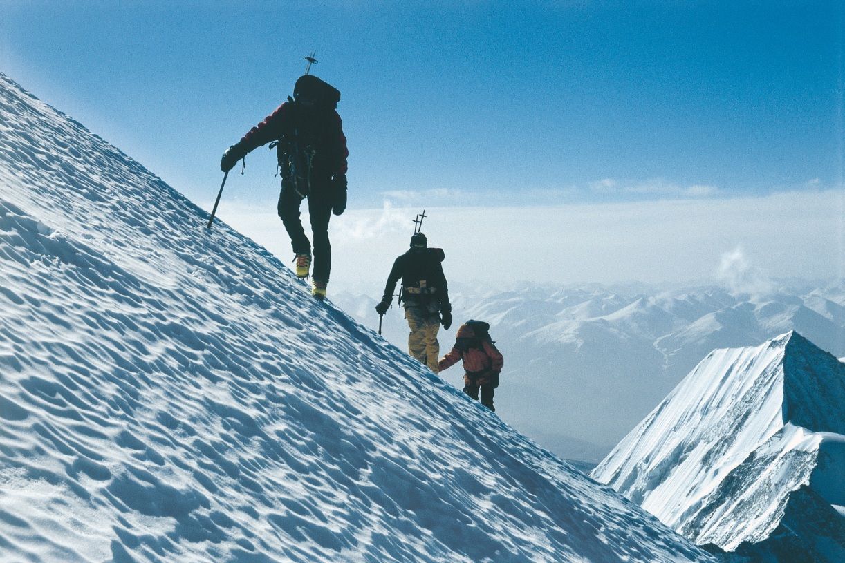
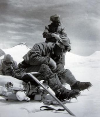
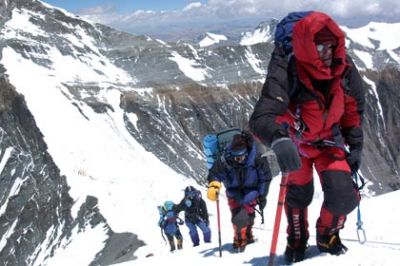
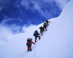
珠穆朗玛峰山体呈巨型金字塔状,威武雄壮昂首天外,地形极端险峻,环境异常复杂。雪线高度:北坡为5800—6200米,南坡为5500—6100米。东北山脊、 东南山脊和西山山脊中间夹着三大陡壁(北壁、东壁和西南壁),在这些山脊 和峭壁之间又分布着548条大陆型冰川,总面积达1457.07平方公里,平均厚度达7260米。冰川的补给主要靠印度洋季风带两大降水带积雪变质形成。冰川上 有千姿百态、瑰丽罕见的冰塔林,又有高达数十米的冰陡崖和步步陷井的明暗 冰裂隙,还有险象环生的冰崩雪崩区。(Quelle:http://news.xinhuanet.com)
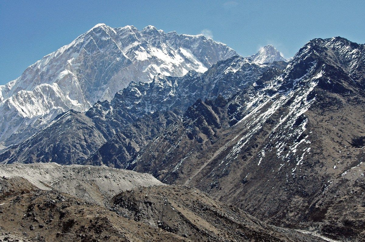
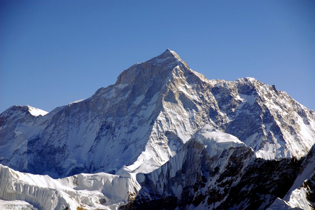
珠穆朗玛峰(藏文:ཇོ་མོ་གླང་མ;藏语拼音:qomolangma;威利:jo mo glang ma,香港称珠穆朗玛峰,台湾称圣母峰),中文简称珠峰,尼泊尔名萨加玛塔峰(尼泊尔语:सगरमाथा),英国名埃佛勒斯峰(英语:Mount Everest),为地球第一高峰,属于喜马拉雅山脉,位于中国西藏自治区与尼泊尔萨加玛塔专区边界上。2005年中国国家测绘局测量的岩面高为8,844.43米(29,017.2英尺),尼泊尔则使用传统的雪盖高8,848米(29,029英尺),BBC报道称2010年起两国官方互相承认对方的测量数据[5],中国国家测绘地理信息局则在2018年2月声明否认此说法,仍采用8,844.43米数据至今[6]。它除了是海拔最高的山峰之外,也是距离地心第五远的高峰。[7]它附近的高峰包括8,516米(27,940英尺)的洛子峰、7,855米(25,771英尺)的努子峰和7,580米(24,870英尺)的章子峰。
清朝经过测绘于1719年出版的全国地图上称此峰为“朱姆朗马阿林”,但没有标出高度或用经纬度标出其位置。1856年英属印度测量局首次公布此峰的经纬度及海拔高度,主张此峰8,840米(29,000英尺)是世界第一高峰。1865年英国皇家地理学会接受印度测量局局长安德鲁·史考特·华欧的建议,将此峰命名为“埃佛勒斯峰”,以纪念前任局长乔治·埃佛勒斯。1952年,中国采用“珠穆朗玛峰”为官方名称。
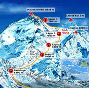
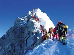
珠穆朗玛峰吸引了许多登山者。主要的攀登路线有两条,一条从尼泊尔东南部出发,经过与洛子峰之间的南坳登顶,称为“标准路线”;另一条则从西藏的北部出发,经过与章子峰之间的北坳登顶。从标准路线登顶对登山技术的挑战不算高,但这条路线的风险包括雪崩、摔落山谷、高山症、冻伤和通过昆布冰瀑的危险。到2016年为止,山上有超过200具尸体,其中一些成为地标。[8][9]
据气象记载,珠穆朗玛峰山顶最低温度为-60°C,最低月平均温度为-35°C,全年平均温度为-29°C,参照北极、南极,因此也被称为“世界第三极”。[10]
Der Mount Everest ist ein Berg im Himalaya und mit einer Höhe von 8848 m der höchste Berg der Erde. Er gehört zu den 14 Achttausendern und zu den Seven Summits. Der Mount Everest ist seit 1856 nach dem britischen Landvermesser George Everest benannt. Auf Nepali heißt der Berg Sagarmatha, auf Tibetisch Qomolangma (deutsche Aussprache „Tschomolangma“; englische Umschrift Chomolungma).
Der Mount Everest befindet sich im Mahalangur Himal in der Region Khumbu in Nepal an der Grenze zu China (Autonomes Gebiet Tibet); der westliche und südöstliche seiner drei Gipfelgrate bilden die Grenze. Auf nepalesischer Seite ist er Teil des Sagarmatha-Nationalparks, der zum UNESCO-Welterbe gehört. Auf der Nordseite gehört er zum Qomolangma National Nature Reserve, das mit dem von der UNESCO ausgewiesenen Qomolangma-Biosphärenreservat korrespondiert.[1]
Edmund Hillary und Tenzing Norgay gelang am 29. Mai 1953 die Erstbesteigung des „dritten Pols“. Am 8. Mai 1978 bestiegen Reinhold Messner und Peter Habeler den Gipfel erstmals ohne zusätzlichen Sauerstoff.
エベレスト、エヴェレスト(英: Everest)、またはチョモランマ(チベット語: ཇོ་མོ་གླང་མ[1] Chomolungma, Qomolangma)、サガルマータ(ネパール語: सगरमाथा Sagarmāthā)は、ヒマラヤ山脈にある世界最高峰である。
エベレストはインド測量局(Survey of India)で長官を務めたジョージ・エベレストにちなんで命名された。
1920年代から長きにわたる挑戦の末、1953年にイギリス探検隊のメンバーでニュージーランド出身の登山家であるエドモンド・ヒラリーとネパール出身のシェルパであるテンジン・ノルゲイによって初登頂がなされた。
エベレストの標高については諸説あり、1954年にインド測量局が周辺12ヶ所で測定しその結果を平均して得られた8,848 mという数値が長年一般に認められてきた。1999年、全米地理学協会はGPSによる測定値が8,850mだったと発表した[2]。厳密には地殻変動などの影響によって標高は年々変動していると考えられている。
エベレストの南麓に位置するネパールのサガルマータ国立公園はユネスコの世界遺産に登録されている。
Mount Everest, known in Nepali as Sagarmatha (सगरमाथा) and in Tibetan as Chomolungma (ཇོ་མོ་གླང་མ), is Earth's highest mountain above sea level, located in the Mahalangur Himal sub-range of the Himalayas. The international border between Nepal (Province No. 1) and China (Tibet Autonomous Region) runs across its summit point.
The current official elevation of 8,848 m (29,029 ft), recognized by China and Nepal, was established by a 1955 Indian survey and subsequently confirmed by a Chinese survey in 1975.[1] In 2005, China remeasured the rock height of the mountain, with a result of 8844.43 m. There followed an argument between China and Nepal as to whether the official height should be the rock height (8,844 m., China) or the snow height (8,848 m., Nepal). In 2010, an agreement was reached by both sides that the height of Everest is 8,848 m, and Nepal recognizes China's claim that the rock height of Everest is 8,844 m.[5]
In 1865, Everest was given its official English name by the Royal Geographical Society, upon a recommendation by Andrew Waugh, the British Surveyor General of India. As there appeared to be several different local names, Waugh chose to name the mountain after his predecessor in the post, Sir George Everest, despite George Everest's objections.[6]
Mount Everest attracts many climbers, some of them highly experienced mountaineers. There are two main climbing routes, one approaching the summit from the southeast in Nepal (known as the "standard route") and the other from the north in Tibet. While not posing substantial technical climbing challenges on the standard route, Everest presents dangers such as altitude sickness, weather, and wind, as well as significant hazards from avalanches and the Khumbu Icefall. As of 2017, nearly 300 people have died on Everest, many of whose bodies remain on the mountain.[7]
The first recorded efforts to reach Everest's summit were made by British mountaineers. As Nepal did not allow foreigners into the country at the time, the British made several attempts on the north ridge route from the Tibetan side. After the first reconnaissance expedition by the British in 1921 reached 7,000 m (22,970 ft) on the North Col, the 1922 expedition pushed the north ridge route up to 8,320 m (27,300 ft), marking the first time a human had climbed above 8,000 m (26,247 ft). Seven porters were killed in an avalanche on the descent from the North Col. The 1924 expedition resulted in one of the greatest mysteries on Everest to this day: George Mallory and Andrew Irvine made a final summit attempt on 8 June but never returned, sparking debate as to whether or not they were the first to reach the top. They had been spotted high on the mountain that day but disappeared in the clouds, never to be seen again, until Mallory's body was found in 1999 at 8,155 m (26,755 ft) on the north face. Tenzing Norgay and Edmund Hillary made the first official ascent of Everest in 1953, using the southeast ridge route. Norgay had reached 8,595 m (28,199 ft) the previous year as a member of the 1952 Swiss expedition. The Chinese mountaineering team of Wang Fuzhou, Gonpo, and Qu Yinhua made the first reported ascent of the peak from the north ridge on 25 May 1960.[8][9]
L’Everest, en tibétain ཇོ་མོ་གླང་མ, Qomolangma ou encore Chomolungma, en népalais सगरमाथा, Sagarmāthā, aussi appelé mont Everest, est une montagne située dans la chaîne de l'Himalaya, à la frontière entre le Népal (province no 1 (en)) et la Chine (Tibet).
Il est aperçu par des Européens pour la première fois en 1847 puis, après quelques années d'observations et de calculs, son altitude est établie à 8 848 mètres et il est identifié comme le plus haut sommet du monde. Cette caractéristique lui vaut d'être baptisé de son nom actuel par les Occidentaux en 1865 et, dès les années 1920, de lui attirer l'intérêt des alpinistes qui se lancent à l'assaut de ses pentes. Plusieurs expéditions, en particulier britanniques, se succèdent depuis le versant nord au Tibet. Toutefois, les conditions climatiques extrêmes font leurs premières victimes, parmi lesquelles George Mallory et Andrew Irvine, en 1924, dont on ne saura probablement jamais avec certitude s'ils ont atteint le sommet. En 1950, le Népal autorise l'accès à la montagne depuis le sud offrant des possibilités d'ascension par l'arête Sud-Est, moins périlleuse. Finalement, trois ans plus tard, Edmund Hillary et Tensing Norgay réussissent à vaincre l'Everest. Dès lors, les exploits en tous genres s'enchaînent, alimentant les fantasmes populaires ; mais, en 1996, une série d'accidents mortels vient rappeler les dangers liés à la montagne, portant de nos jours à plus de 200 le nombre de victimes. Pourtant, le tourisme de masse se popularise, fragilisant le milieu naturel malgré les créations du parc national de Sagarmatha en 1976 et de la réserve naturelle du Qomolangma en 1988. Ainsi, plus de 14 000 alpinistes ont tenté l'ascension depuis 1922 et plus de 4 000 l'ont réussie, bien aidés, pour la majorité d'entre eux, par les porteurs sherpas.
Il monte Everest (pron. /ˈɛverest/[1]) è la vetta più alta del continente asiatico e della Terra con i suoi 8 848 m di altitudine s.l.m., situato nella catena dell'Himalaya assieme ad altri ottomila, al confine fra Cina e Nepal. Rientra dunque nelle cosiddette Sette Vette del Pianeta.
El monte Everest es la montaña más alta del planeta Tierra, con una altitud de 8.848 metros (29 029 pies) sobre el nivel del mar.1 Está localizada en el continente asiático, en la cordillera del Himalaya, concretamente en la subcordillera de Mahalangur Himal; marca la frontera entre China y Nepal, considerada como la frontera más alta del mundo.[cita requerida] El macizo incluye los picos vecinos Lhotse, 8516 m (27 940 pies); Nuptse, 7855 m (25 771 pies) y Changtse, 7580 m (24 870 pies).
 International cities

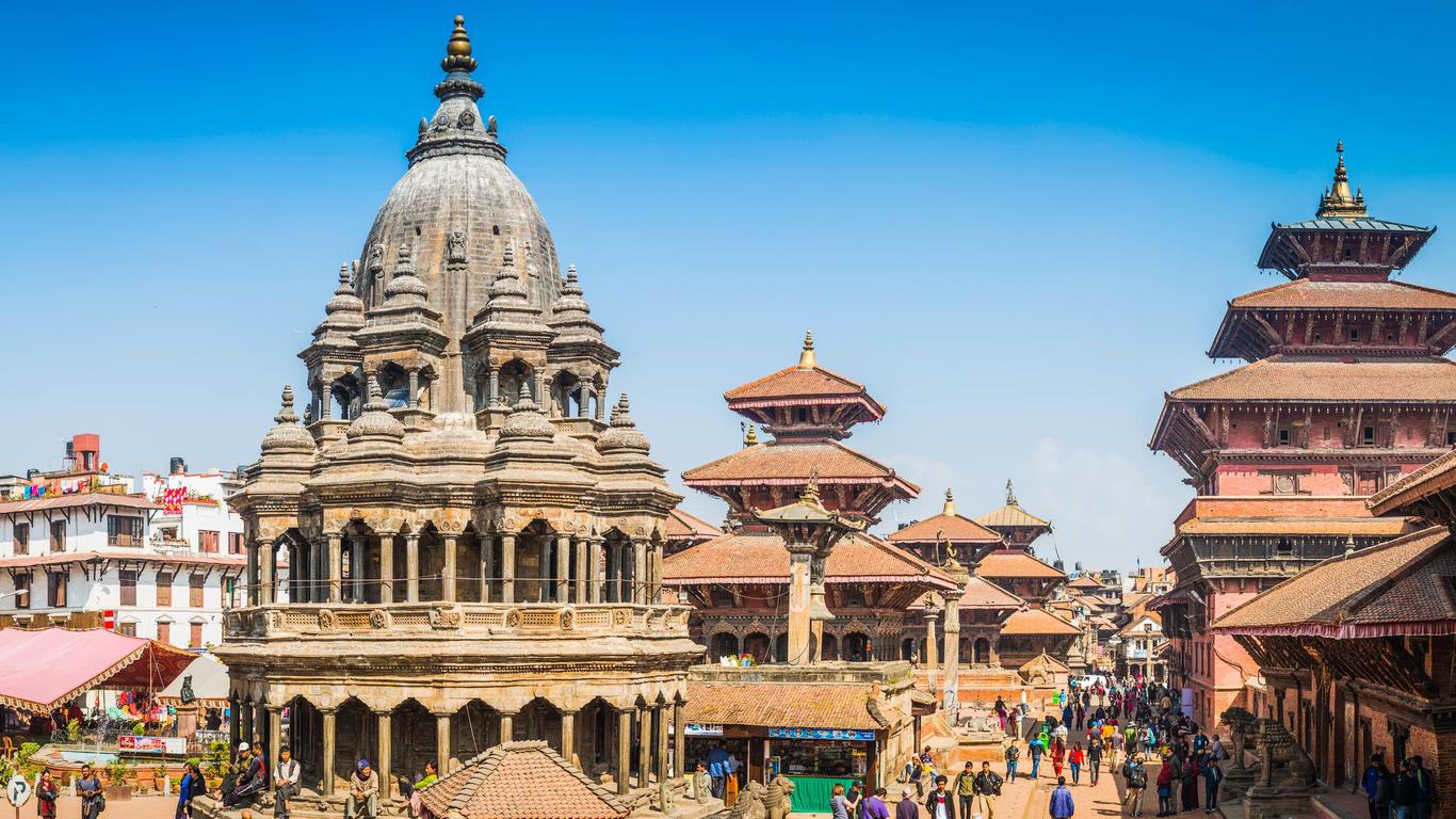
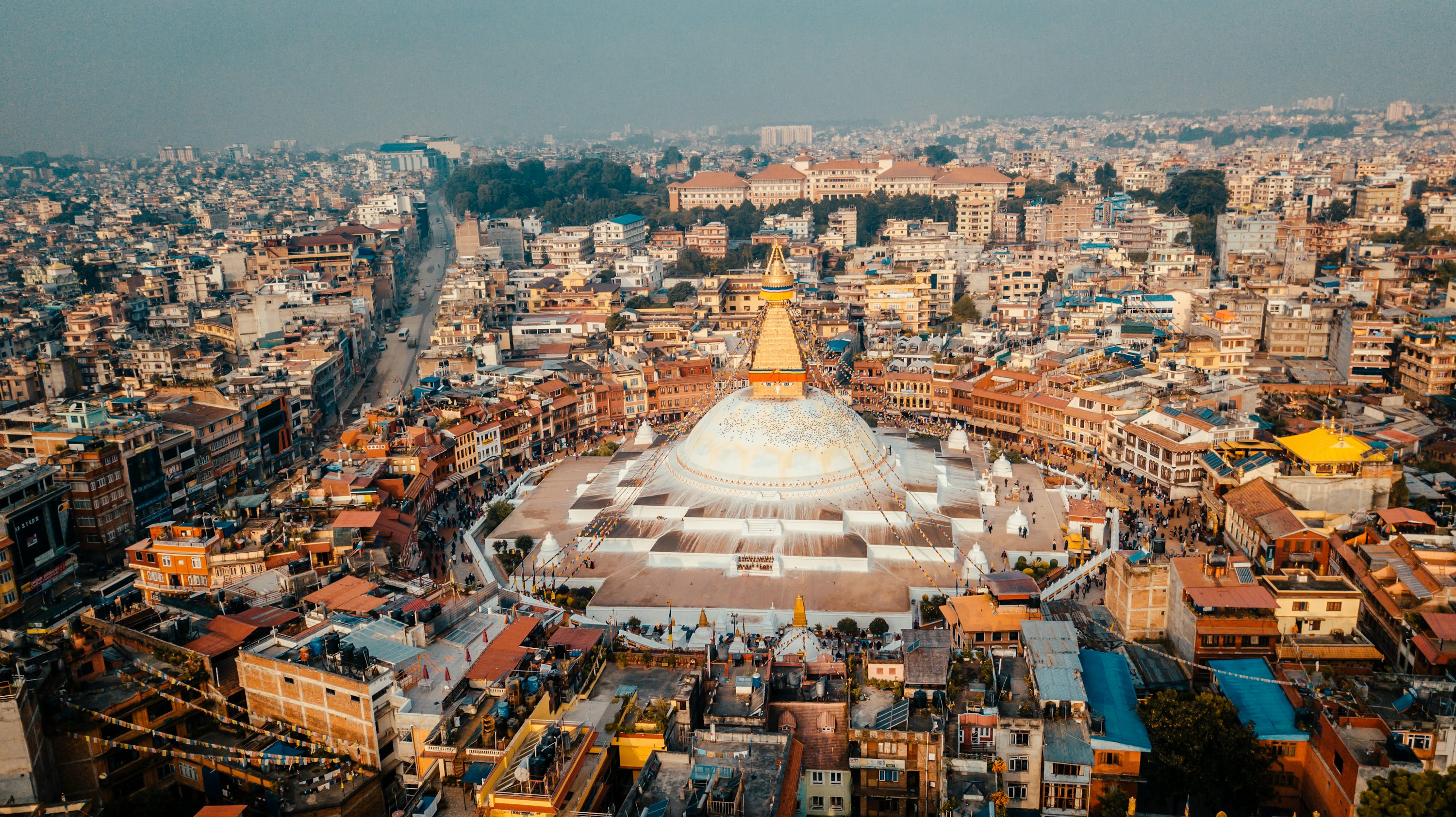
Kathmandu (/ˌkætmænˈduː/;[2] Nepali: काठमाडौं, Nepali pronunciation: [ˌkɑʈʰmɑɳˈɖuː]) is the capital and largest metropolis of Nepal, with a population of around 2.5 million.
Kathmandu Valley is growing at 4 percent per year according to World Bank in 2010, making it one of the fastest-growing metropolitan areas in South Asia, and the first region in Nepal to face the unprecedented challenges of rapid urbanization and modernization at a metropolitan scale.[3]
Kathmandu is also known as the city of temples, with one of the oldest Pagodas, known as Pashupatinath Temple, standing at an elevation of approximately 1,400 metres (4,600 feet) above sea level in the bowl-shaped Kathmandu Valley in central Nepal. The valley is historically called the "Nepal Mandala" and has been the home of Newar people, a cosmopolitan urban civilization in the Himalayas foothills. The city was the royal capital of the Kingdom of Nepal and hosts palaces, mansions and gardens of the Nepalese aristocracy. It has been home to the headquarters of the South Asian Association for Regional Cooperation (SAARC) since 1985. Today, it is the seat of government of the Nepalese republic, established in 2008, and is part of the Bagmati province.
Kathmandu is and has been for many years the centre of Nepal's history, art, culture, and economy. It has a multi-ethnic population within a Hindu and Buddhist majority, and is the home of the Newars. Religious and cultural festivities form a major part of the lives of people residing in Kathmandu.
Tourism is an important part of the economy. In 2013, Kathmandu was ranked third among the top ten upcoming travel destinations in the world by TripAdvisor, and ranked first in Asia. The city is considered the gateway to the Nepalese Himalayas and home to several world heritage sites: Durbar Square, Swayambhunath, Boudhanath and Pashupatinath.
Historic areas of Kathmandu were severely damaged by a 7.8 magnitude earthquake in April 2015. Some of the buildings have been restored and some remain in the process of reconstruction.
Katmandou2 (népalais : काठमाडौं (kāṭhamāḍauṁ), काठमान्डु (kāṭhamānḍu), nepalbhasha : येंदेय् (yēndēy)), très rarement orthographiée Kathmandou, Kathmandu ou Katmandu, parfois appelée Kantipur du nom de l'ancienne cité-État3, ou encore yen — notamment par les Newars —, est la capitale politique et religieuse du Népal dont elle est également la plus grande ville ainsi que le chef-lieu du district du même nom. Les premiers habitants de Katmandou étaient des Newars et parlaient le nepâlbhâsa qui est une langue très répandue parmi les différentes communautés ethniques résidant à Katmandou.
La ville s'élève à 1 350 mètres d'altitude au confluent de deux rivières : la Bagmati et la Bishnumati. Elle est entourée d'une couronne de montagnes de taille moyenne (3 000 mètres au maximum) dans les contreforts de l'Himalaya ; ce qui explique qu'on parle de la vallée de Katmandou (administrativement connue sous le nom de zone de la Bagmati, « Bagmati anchal ») qui comprend aussi Patan et Bhaktapur et est peuplée d'environ 1,5 million d'habitants. Katmandou ne possède pas de réseau souterrain de canalisations et dispose d'une alimentation en eau insuffisante. Aujourd'hui, du fait du contexte politique, l'environnement n'est pas la priorité des Népalais ; ce qui en fait une des villes les plus polluées d'Asie.
La ville eut, en Europe, une période de grande célébrité. Dans les années 1960, elle était la destination favorite des hippies qui faisaient la route de Katmandou.
Selon les chroniques locales, la ville de Katmandou aurait été fondée au Xe siècle par le roi Gunakamadeva.
La structure actuelle de la ville remonte au XVIe siècle.
Katmandu[1], o anche Kathmandu (pron. /katmanˈdu/[2]; in nepalese काठमाडौं, Kāṭhamāḍauṃ; anticamente Kantipur, कान्तिपुर, Kāntipura; Yen in lingua nevari, यें, Yeṃ), in passato adattata in italiano come Catmandù[3][4][5], è la capitale del Nepal, il maggiore stato himalayano dell'Asia. È la maggiore metropoli dello stato, con una popolazione di 1,4 milioni nella città, che raggiungono i 5 milioni nell'agglomerato urbano della Valle di Katmandu, che comprende le città di Patan, Kirtipur, Madhyapur Thimi e Bhaktapur. Kamandu è inoltre la maggiore metropoli della regione collinare dell'Himalaya.
La città si trova ad un'altezza di circa 1.400 metri sul livello del mare, nella conca della Valle di Kathmandu, nel Nepal centrale. La valle è storicamente chiamata il "Nepal proprio" ed è il luogo di origine del popolo Newa, una civiltà urbana cosmopolita della regione collinare himalayana. La città fu capitale reale del Regno del Nepal e ospita palazzi, residenze e giardini dell'aristocrazia nepalese. È sede dell'Associazione sud-asiatica per la cooperazione regionale (SAARC) dal 1985 e oggi è la sede del governo della repubblica nepalese istituita nel 2008. Fa parte della Zona del Bagmati nella geografia amministrativa nepalese.
Katmandu è sempre stata al centro della storia, arte, cultura ed economia del Nepal. Ha una popolazione multietnica con maggioranza indù e buddista. Le festività religiose e culturali costituiscono una parte consistente della vita delle persone che risiedono a Katmandu, e il turismo è una parte importante dell'economia della città, che si trova ai piedi dell'Himalaya nepalese. In città vi sono anche diversi casinò. Nel 2013 Katmandu si posizionò terza tra le prime dieci migliori destinazioni al mondo, secondo TripAdvisor, e fu la prima città dell'Asia. Le aree storiche di Katmandu furono devastate dal terremoto di magnitudo locale 7,8 che colpì la nazione il 25 aprile 2015. La lingua nepalese è la principale lingua parlata in città, mentre la lingua inglese è compresa dai residenti che hanno frequentato le scuole.
Katmandú1 (en nepalí, काठमांडौ) es la capital y mayor ciudad de Nepal. Tiene una población de 1 003 285 habitantes, según censo de 2013. Situada en el valle del mismo nombre en Nepal central, en las cercanías del río Vishnumati, a una altura de 1317 m s. n. m.
La ciudad antigua se caracteriza por la gran cantidad de templos y palacios budistas e hinduistas, la mayoría de ellos del siglo XVII. Muchos de estos monumentos han sido por desgracia dañados por terremotos y la contaminación. En el valle de Katmandú se encuentran siete sitios clasificados por la Unesco como Patrimonio de la Humanidad.2
A raíz del movimiento hippie, desde los años 1960 Katmandú se convirtió en un sitio muy visitado por turistas.Es sede de la Asociación Sudasiática para la Cooperación Regional (ASCR) mejormente conocida como SAARC en inglés, South Asian Association for Regional Cooperation.3
Катманду́ (непальск. काठमाडौं [kɑʈʰmɑɳɖu], Kāthmāndau) — столица и крупнейший город Непала, его исторический, экономический, политический и культурный центр. Население города составляет более 1 млн человек[1].
Горная долина Катманду, высотой около 1300 м, — историческая область Непала, знаменитая неварскими городами Катманду, Лалитпур (Патан), Бхактапур, Киртипур, Панаути и многочисленными монастырями, храмовыми центрами и культурными памятниками.
Город имеет богатую, более чем 2000-летнюю историю. Облик столицы сохранился с XVII—XVIII веков, когда долина Катманду активно застраивалась во время правления королей династии Малла. Религиозные и культурные фестивали — важная часть жизни горожан. Большая часть населения Катманду являются последователями индуизма, второй по числу последователей религией является буддизм. Также в городе проживают последователи других религий, что делает Катманду одним из самых космополитичных городов мира. Наиболее распространённым языком общения является непали.
Катманду — крупнейший культурно-образовательный центр Непала. Здесь расположены Королевская академия, Национальный колледж, Санскритский колледж, Университет имени Трибхувана, Ассоциация изящных искусств. Кроме того, в Катманду находится Национальный музей Непала, нумизматический музей и ряд библиотек, среди которых выделяются Национальная и Центральная.
Катманду, Лалитпур и Бхактапур настолько тесно связаны культурно, что памятники и достопримечательности всех трёх городов внесены в список Всемирного наследия ЮНЕСКО как один объект охраны — «Всемирное наследие долины Катманду». Geography



 Religion
 Architecture
Bhutan
Architecture
Bhutan
 History
K 500 - 1000 AD
Himachal Pradesh
History
K 500 - 1000 AD
Himachal Pradesh
 Art
Mongolei
Nei Mongol Zizhiqu-NM
Nepal
Qinghai Sheng-QH
Art
Mongolei
Nei Mongol Zizhiqu-NM
Nepal
Qinghai Sheng-QH
 World Heritage
Xizang Zizhiqu-XZ
Yunnan Sheng-YN
World Heritage
Xizang Zizhiqu-XZ
Yunnan Sheng-YN
藏传佛教(藏语:བོད་བརྒྱུད་ནང་བསྟན།,威利转写:bod brgyud nang bstan,藏语拼音:Pö gyü Nangdän;蒙古语:Төвөдийн Буддын шашин),或称藏语系佛教,或俗称喇嘛教,是指传入藏区的佛教分支。属北传佛教,与汉传佛教、南传佛教并称佛教三大地理体系,但以密宗传承为其主要特色。
Die Entwicklung des Buddhismus in Tibet bzw. im Hochland von Tibet geht auf erste Kontakte im 5. Jahrhundert n. Chr. zurück. Zur offiziellen Einführung des Buddhismus in Tibet als Staatsreligion kam es im 8. Jahrhundert durch König Trisong Detsen.[1] In Tibet entstanden im Verlauf der Zeit verschiedene buddhistische Schulen.
 Hand in Hand

南亚区域合作联盟(英语:South Asian Association for Regional Cooperation)是1985年12月8日成立的旨在推动南亚人民间友谊、信任与理解的平台,由孟加拉国、不丹、印度、马尔代夫、尼泊尔、巴基斯坦和斯里兰卡七国政府发起成立。2005年11月13日,接受阿富汗为成员。缅甸、模里西斯、澳大利亚、中华人民共和国、日本、大韩民国、欧盟、美国和伊朗成为观察员。
Die Südasiatische Vereinigung für regionale Kooperation (auch Südasiatische Wirtschaftsgemeinschaft) (von englisch South Asian Association for Regional Cooperation) (SAARC) wurde am 8. Dezember 1985 in Dhaka (Bangladesch) gegründet und hat ihren Sitz in der nepalesischen Hauptstadt Kathmandu. Gründungsmitglieder sind Indien, Pakistan, Bangladesch, Nepal, Sri Lanka, Bhutan und die Malediven. Im April 2007 trat Afghanistan auf dem Gipfeltreffen in Neu-Delhi der Organisation bei. Die Volksrepublik China, Japan, die Europäische Union, Südkorea, die Vereinigten Staaten und der Iran besitzen Beobachterstatus.