
漢德百科全書 | 汉德百科全书
 Kiel Canal
 Geography
Belgium
Amber Road
Geography
Belgium
Amber Road
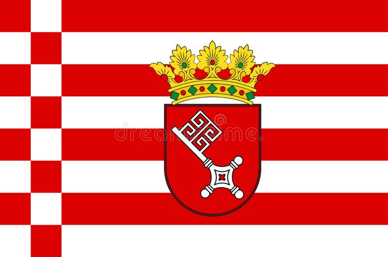 Bremen
Denmark
Germany
England
France
Netherlands
Bremen
Denmark
Germany
England
France
Netherlands
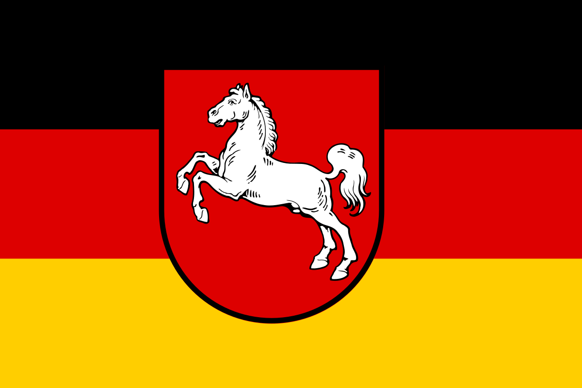 Lower Saxony
Kiel Canal
Norwegen
Lower Saxony
Kiel Canal
Norwegen
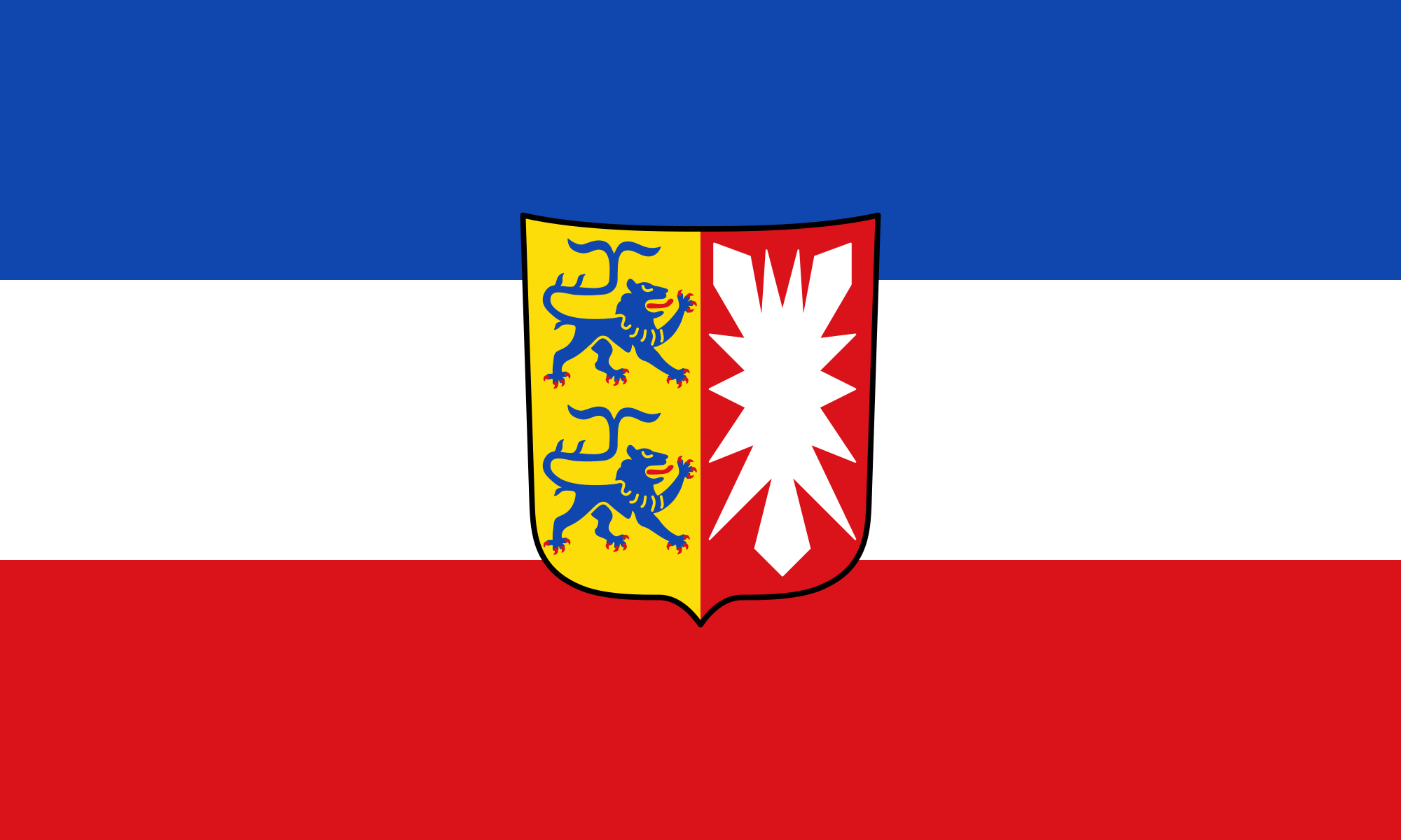 Schleswig-Holstein
Sweden
United Kingdom
Schleswig-Holstein
Sweden
United Kingdom

Die Nordsee (veraltet Westsee, Deutsches Meer[2]) ist ein Randmeer des Atlantischen Ozeans. Sie ist ein Schelfmeer und liegt im nordwestlichen Europa. Bis auf die Meerengen beim Ärmelkanal und beim Skagerrak ist sie auf drei Seiten von Land begrenzt und öffnet sich trichterförmig zum nordöstlichen Atlantik. In einem 150-Kilometer-Bereich an der Küste leben rund 80 Millionen Menschen.
Die Nordsee selbst ist ein wichtiger Handelsweg und dient als Weg Mittel- und Nordeuropas zu den Weltmärkten. Die südliche Nordsee ist zusammen mit dem angrenzenden Ärmelkanal die am dichtesten befahrene Schifffahrtsregion der Welt. Unter dem Meeresboden befinden sich größere Erdöl- und Erdgasreserven, die seit den 1970er Jahren gefördert werden. Kommerzielle Fischerei hat den Fischbestand des Meeres in den letzten Jahrzehnten vermindert. Umweltveränderungen entstehen auch dadurch, dass die Abwässer aus Nordeuropa und Teilen Mitteleuropas direkt oder über die angrenzende Ostsee in das Meer fließen.
北海(挪威语:Nordsjøen;瑞典语:Nordsjön;丹麦语:Nordsøen或Vesterhavet;德语:Nordsee;荷兰语:Noordzee;法语:Mer du Nord;英语:North Sea)是北大西洋的一部分,位于大不列颠岛以东,斯堪的纳维亚半岛西南和欧洲大陆以北。北海海底有丰富的石油储藏,作为布兰特原油指数的基础。
北海向西南通过多佛尔海峡(法国称加来海峡)和英吉利海峡(法国称拉芒什海峡)与凯尔特海相通,向东通过斯卡格拉克海峡和卡特加特海峡与波罗的海相连,向北是挪威海。
斯凯尔特河、默兹河、莱茵河、威悉河、易北河和泰晤士河是注入北海的主要河流。重要的岛屿或群岛有北弗里西亚群岛、黑尔戈兰岛、东弗里西亚群岛和西弗里西亚群岛。
北海周边的国家有英国、挪威、瑞典、丹麦、德国、荷兰、比利时和法国。重要城市有阿伯丁、爱丁堡、加来、奥斯坦、鹿特丹、海牙、哈勒姆、威廉港、不来梅哈芬、库克斯港、埃斯比约、卑尔根、哥德堡等等。此外伦敦、不来梅哈芬和汉堡是北海重要的内陆港城。
北海(ほっかい、英語 North Sea、ドイツ語 Nordsee、フランス語 Mer du Nord、オランダ語 Noordzee、デンマーク語 Nordsøen、ノルウェー語 Nordsjøen)は、大西洋の付属海。古名はゲルマン海(ラテン語 Mare Germanicum、英語 German Ocean)。
東はノルウェー、デンマーク、南はドイツ、オランダ、ベルギー、フランス、西はイギリス、北はオークニー諸島・シェトランド諸島に囲まれている。東はスカゲラク海峡・カテガット海峡およびキール運河でバルト海に、北はノルウェー海に、南はドーバー海峡・イギリス海峡で大西洋に繋がっている。南北の長さは970km、東西は580km、面積は75万km2、水量は94000km3である[1]。
北海に流れ込む主な川はエルベ川、ヴェーザー川、エムス川、ライン川などがある。なかでも、最も北海に影響を及ぼす河川はエルベ川とライン川・ムーズ川である[2]。北海の集水域にはおよそ1億8500万人が暮らしており、また世界で最も工業化された地方のうちのひとつが含まれている[3]。
北海油田と総称される油田・ガス田が多数あり、ヨーロッパの貴重なエネルギー源である。
The North Sea is a sea of the Atlantic Ocean located between Great Britain (England and Scotland), Denmark, Norway, Germany, the Netherlands, Belgium and France. An epeiric (or "shelf") sea on the European continental shelf, it connects to the ocean through the English Channel in the south and the Norwegian Sea in the north. It is more than 970 kilometres (600 mi) long and 580 kilometres (360 mi) wide, with an area of 570,000 square kilometres (220,000 sq mi).
The North Sea has long been the site of important European shipping lanes as well as a major fishery. The coast is a popular destination for recreation and tourism in bordering countries, and more recently the sea has developed into a rich source of energy resources, including fossil fuels, wind, and early efforts in wave power.
Historically, the North Sea has featured prominently in geopolitical and military affairs, particularly in Northern Europe. It was also important globally through the power northern Europeans projected worldwide during much of the Middle Ages and into the modern era. The North Sea was the centre of the Vikings' rise. Subsequently, the Hanseatic League, the Dutch Republic, and the British each sought to gain command of the North Sea and thus access to the world's markets and resources. As Germany's only outlet to the ocean, the North Sea continued to be strategically important through both World Wars.
The coast of the North Sea presents a diversity of geological and geographical features. In the north, deep fjords and sheer cliffs mark the Norwegian and Scottish coastlines, whereas in the south, the coast consists primarily of sandy beaches and wide mudflats. Due to the dense population, heavy industrialization, and intense use of the sea and area surrounding it, there have been various environmental issues affecting the sea's ecosystems. Adverse environmental issues – commonly including overfishing, industrial and agricultural runoff, dredging, and dumping, among others – have led to a number of efforts to prevent degradation of the sea while still making use of its economic potential.
La mer du Nord est une mer épicontinentale de l'océan Atlantique, située au nord-ouest de l'Europe, et qui s'étend sur une superficie d'environ 575 000 km2.
Les pays qui bordent la mer du Nord sont le Royaume-Uni (île de Grande-Bretagne) à l'ouest ; les îles Shetland et Orcades au nord-ouest ; la Norvège au nord-est; le Danemark à l'est ; l'Allemagne au sud-est ; enfin les Pays-Bas, la Belgique et la France (pour 50 km de littoral entre Calais et la frontière belge) au sud. Elle communique avec la Manche par le pas de Calais au sud-sud-ouest ; avec l'océan Atlantique au nord-ouest et la mer de Norvège au nord ; avec le Skagerrak à l'est. Le canal de Kiel permet aux navires de rejoindre la mer Baltique.
Elle constitue une zone de fort transit maritime, d'exploitation pétrolière et de pêche. La mer du Nord et son littoral forment un milieu naturel très riche, mais la pollution marine, la surpêche, l'industrie pétrolière (plates-formes offshore) et le tourisme sont sources de menaces pour l'avenir. Elle est en aval du centre de l'Europe industrielle, de l'estuaire du Rhin aux fjords norvégiens et aux falaises du nord de la Grande-Bretagne. Le secteur Manche/Sud-mer du Nord, incluant le pas de Calais est considéré comme représentatif de mers mégatidales peu profondes, caractérisées par un fort courant et une eau très turbide (en raison des courants et phénomènes de renversement de marées), ce qui en fait une zone écologiquement particulière, mais également vulnérable au risque maritime en raison d'un intense trafic maritime (marchand et passager).
Il mare del Nord (in danese Nordsøen; in francese Mer du Nord; in inglese North Sea; in norvegese Nordsjøen;in olandese Noordzee; in svedese Nordsjön; in tedesco Nordsee) è un mare epicontinentale dell'Europa nord-occidentale che comunica con l'oceano Atlantico tramite il mare di Norvegia a nord e la Manica a sud; suo tributario è il Mar Baltico, ad esso collegato tramite gli stretti scandinavi di Skagerrak e Kattegat. Si estende per circa 970 km di lunghezza in direzione nord-sud e 560 km di larghezza in direzione est-ovest, e ha una superficie totale di circa 570000 km²[1]. Accoglie una considerevole parte dei bacini idrografici dell'Unione europea.
El mar del Norte es un mar marginal del océano Atlántico, situado entre las costas de Noruega y Dinamarca en el este, las de las islas británicas al oeste y las de Alemania, los Países Bajos, Bélgica y Francia al sur. El Skagerrak constituye una especie de bahía al este del mar, la cual lo conecta con el Báltico a través del Kattegat; también está conectado con el Báltico mediante el canal de Kiel. El canal de la Mancha lo conecta al resto del Atlántico por el sur, mientras que por el norte conecta en través del mar de Noruega, que es el nombre que adopta el mar al norte de las islas Shetland.
Las mareas son bastante irregulares ya que confluyen en él una corriente proveniente del norte y otra del sur. Hay mucha lluvia y niebla durante todo el año, y del noroeste vienen violentas tormentas que hacen la navegación peligrosa.
Tiene una superficie de unos 750 000 km²,1 una longitud aproximada de 960 km y una anchura máxima de 480 km. Es un mar muy poco profundo, con una profundidad media de 95 metros: el hecho que en el banco Dogger, en medio del mar y a una profundidad de unos 25 metros, se hayan encontrado restos de mamuts prueba que durante la última glaciación o bien estaba cubierto de hielo o bien estaba emergido. Con el deshielo, el banco se convirtió en una especie de último reducto en forma de isla.
Durante la Edad Antigua este mar se conocía como Oceanum o Mare Germanicum. El nombre actual se cree que surgió desde el punto de vista de las islas Frisias, desde donde quedaba totalmente al norte, y por oposición al mar del Sur (el mar de Frisia y el Zuiderzee, en los Países Bajos). A la larga, el nombre actual se acabó imponiendo, de manera que ya era predominante durante la Edad Moderna. En la citada Edad Moderna fue común llamar Mar del Norte o Mar del Nord a todo el océano Atlántico, siendo por contrapartida llamado «Mar del Sur» o «Mar del Sud» todo el océano Pacífico.
Según las lenguas oficiales de los estados que lo rodean, se denomina Mer du Nord, en francés; Noordzee, en neerlandés; Nordsee, en alemán; Nordsjön, en sueco; Nordsøen, en danés; Nordsjøen, en noruego; y North Sea en inglés. En frisón se dice Noardsee y en gaélico escocés A' Mhuir en Tuath.
Tiene importantes yacimientos de petróleo y gas natural, los cuales comenzaron a explotarse en los años 1970.
Се́верное мо́ре (ранее также Немецкое море[3]; фр. Mer du Nord, нем. Nordsee, нидерл. Noordzee, з.-фриз. Noardsee, англ. North Sea, норв. Nordsjøen, дат. Nordsøen или Vesterhavet) — мелководное шельфовое море Атлантического океана, омывающее берега северной Европы. Расположено между Британскими островами на западе, Ютландским, Скандинавским полуостровами на востоке и континентальной Европой на юге. Омывает берега Норвегии, Дании, Германии, Нидерландов, Бельгии, Франции и Великобритании.
Площадь — 750 тыс. км²[1]. Наибольшая глубина 725 м[2]. Более 2/3 моря имеет глубину менее 100 м; в южной части — отмели (банка Доггер и др.). Впадают крупные реки: Эльба, Везер, Рейн, Темза. Основные порты: Роттердам, Амстердам, Антверпен, Лондон, Гамбург, Осло, Берген[2].
Прибрежная мелководная часть на юге иногда выделяется под названием Ваттового моря.

Amber Road
Denmark
Germany
Estonia
Finland
Latvia
Lithuania
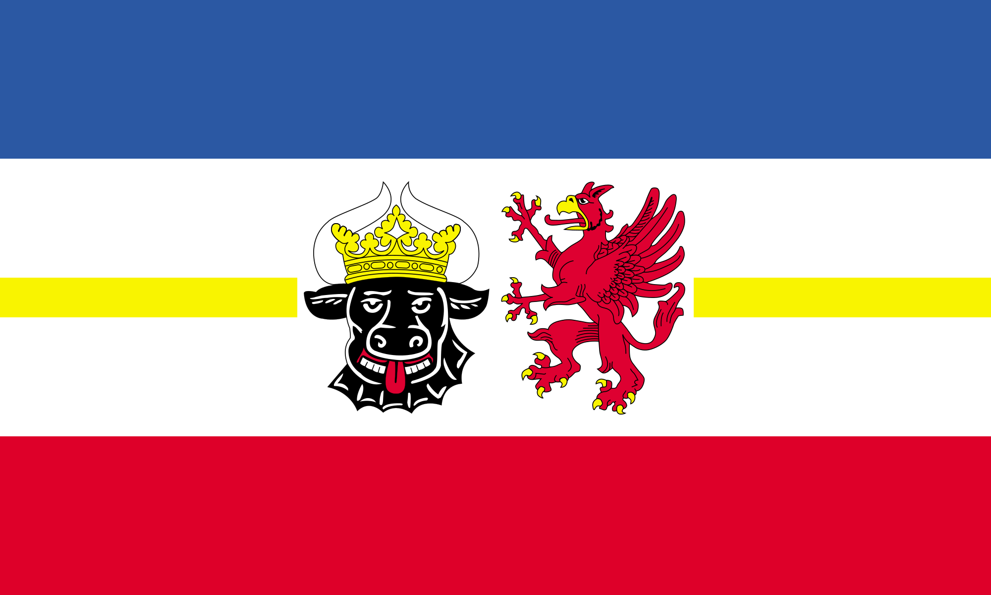 Mecklenburg-Vorpommern
Kiel Canal
Poland
Russia
Schleswig-Holstein
Sweden
Mecklenburg-Vorpommern
Kiel Canal
Poland
Russia
Schleswig-Holstein
Sweden
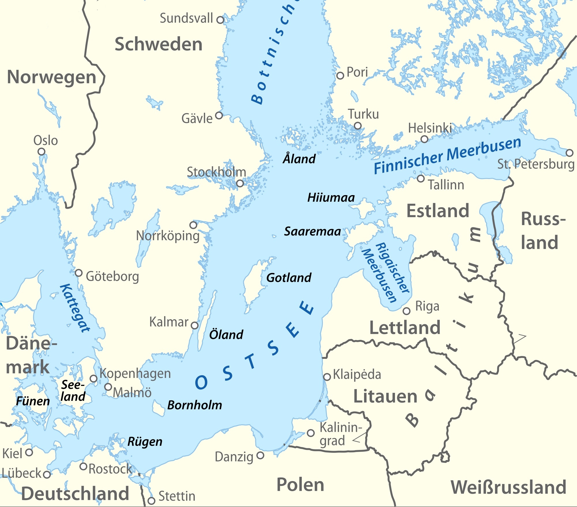
Die Ostsee (auch Baltisches Meer, von lat. Mare Balticum, oder auch Baltische See genannt) ist ein 412.500 km²[2] großes und bis zu 459 m tiefes Binnenmeer in Europa und gilt als das größte Brackwassermeer der Erde, auch wenn in der westlichen Ostsee (Beltsee) aufgrund des Wasseraustausches mit der Nordsee zumeist ein höherer Salz- und Sauerstoffgehalt beobachtet werden kann. Der Rauminhalt des Meeres beträgt rund 20.000 km³. Im Ostseeraum leben, je nachdem, wie weit man diese Region eingrenzt, zwischen 50 und 85 Millionen Menschen.
波罗的海是中欧和北欧之间的陆间海,海域横贯北纬53度至北纬66度,东经10度至东经30度,介于斯堪的纳维亚半岛的瑞典部分、欧洲大陆和丹麦诸岛之间。
波罗的海由厄勒海峡、大贝尔特海峡和小贝尔特海峡注入卡特加特海峡,而后者则通过斯卡格拉克海峡注入北海,最后进入大西洋;此外它还通过白海运河同白海相连,通过基尔运河同北海相连。
波罗的海在北端与波的尼亚湾相邻,在东北端与芬兰湾相邻,在东端与里加湾相邻。这些海湾同样可以被看作是波罗的海的一部分。
バルト海(バルトかい、Baltic Sea)は、北ヨーロッパに位置する地中海。ヨーロッパ大陸とスカンディナビア半島に囲まれた海域である。ユーラシア大陸に囲まれた海域と説明されることもある[1]。
西岸にスウェーデン、東岸は、北から順にフィンランド、ロシア、エストニア、ラトビア、リトアニア、南岸は、東から西にポーランド、ドイツ、デンマークが位置する。
The Baltic Sea is a marginal sea of the Atlantic Ocean, enclosed by Finland, Sweden, Denmark, Estonia, Latvia, Lithuania, Russia, Poland, Germany and the North and Central European Plain.
The sea stretches from 53°N to 66°N latitude and from 10°E to 30°E longitude. A mediterranean sea of the Atlantic, with limited water exchange between the two bodies, the Baltic Sea drains through the Danish islands into the Kattegat by way of the straits of Øresund, the Great Belt, and the Little Belt. It includes the Gulf of Bothnia, the Bay of Bothnia, the Gulf of Finland, the Gulf of Riga, and the Bay of Gdańsk.
The Baltic Proper is bordered on its northern edge, at the latitude 60°N, by the Åland islands and the Gulf of Bothnia, on its northeastern edge by the Gulf of Finland, on its eastern edge by the Gulf of Riga, and in the west by the Swedish part of the southern Scandinavian Peninsula.
The Baltic Sea is connected by artificial waterways to the White Sea via the White Sea Canal and to the German Bight of the North Sea via the Kiel Canal.
La mer Baltique est une mer intracontinentale et intérieure de 364 800 km2 située dans le Nord de l'Europe et reliée à l'océan Atlantique par la mer du Nord. Elle communique au sud-ouest avec la mer du Nord par le Cattégat et le Skagerrak. Trois golfes principaux intègrent cet espace : le golfe de Botnie au nord, le golfe de Finlande à l'est et le golfe de Riga au sud-est.
Les pays riverains sont :
- la Suède à l'ouest et au nord ;
- la Finlande au nord-est ;
- la Russie (par le golfe de Finlande) et l'Estonie à l'est ;
- la Lettonie au sud-est ;
- la Lituanie, la Russie (à Kaliningrad) et la Pologne au sud;
- l'Allemagne et le Danemark au sud-ouest.
Ces pays riverains, ainsi que la mer proprement dite, font l'objet, depuis 2009, d'une « stratégie de la Commission européenne en faveur du développement de la région de la mer Baltique »1, incluant un effort de dépollution de la Baltique et un système commun de surveillance maritime.
Il mar Baltico è un mare interno dell'oceano Atlantico settentrionale e si trova nell'Europa nord-orientale, circondato dalla Penisola scandinàva (meno correttamente scandìnava)[1], dalla terraferma dell'Europa centrale e orientale e dalle Isole danesi. Sfocia nel Kattegat e nel mare del Nord passando attraverso le isole danesi in tre stretti, l'Øresund, il Piccolo Belt e il Grande Belt.
Sfociano nel mar Baltico cinque grandi fiumi: l'Oder, la Vistola, il Njemen, la Daugava (o Dvina Occidentale) e la Neva. Le coste del Baltico tendono a ghiacciare d'inverno specie in occasione di eventi meteorologici particolarmente freddi.
Viene indicato come "mare dell'Est" in diverse lingue dell'Europa continentale, precisamente in danese (Østersøen), tedesco (Ostsee), finlandese (Itämeri), olandese (Oostzee), norvegese (Østersjøen), e svedese (Östersjön). In estone viene invece chiamato "mare Occidentale" (Läänemeri). Oltre all'italiano, viene chiamato mar Baltico in francese (mer Baltique), inglese (Baltic Sea), polacco (Morze Bałtyckie), russo (Baltijskoe more, Балтийское море), lituano (Baltijos Jūra), lettone (Baltijas Jūra) e greco (Baltiké thálassa, Βαλτική Θάλασσα).
El mar Báltico (del latín: Mare Balticum) es un mar interior de agua salobre del norte de Europa abierto al mar del Norte y, finalmente, al océano Atlántico a través de los estrechos de Kattegat y Skagerrak. Los países que lo rodean son (empezando por la península Escandinava y siguiendo en sentido horario): Suecia, Finlandia, Rusia (óblast de Leningrado y Kaliningrado), Estonia, Letonia, Lituania, Polonia, Alemania y Dinamarca.
Su superficie es de 432 800 km² e incluye dos grandes golfos: el golfo de Finlandia, entre el sur de este país y Estonia, y el golfo de Botnia, entre la costa oriental de Suecia y el occidental de Finlandia. Geológicamente es muy joven: sólo existe desde el VI milenio a.C. Es muy poco profundo (la media es de 57 m; la profundidad máxima es de 459 m al norte de la isla sueca de Gotland), lo que, unida a la poca apertura al océano, hace la renovación de las aguas muy lenta y favorece los problemas de contaminación. Las mareas son de muy pequeña amplitud.
El mar Báltico es también, el mayor depósito de ámbar del mundo y, además, su calidad es de las mejores: de los veinte depósitos del mundo que hay de ámbar, se dice que el del mar báltico sólo es superado por los de México y la República Dominicana, siendo el que más ámbar de conífera produce y el de mejor calidad. De él se extraen de 500 a 800 millones de toneladas de ámbar.
La cuenca que drena al mar Báltico abarca la totalidad de algunos países ribereños como las repúblicas bálticas, Polonia y la región rusa de Kaliningrado. Además, estos ríos nacen en, o atraviesan territorios pertenecientes a otros países que, a pesar de no poseer costas, se comunican al mar por vía fluvial. Tal es el caso de la República Checa, Eslovaquia, Ucrania y Bielorrusia, quienes acaban aportando agua (indirectamente) al mar Báltico.
Балти́йское мо́ре (Варяжское[1], польск. Morze Bałtyckie, нем. Ostsee, н.-нем. Oostsee, швед. Östersjön, дат. Østersøen, фин. Itämeri, эст. Läänemeri, латыш. Baltijas jūra, лит. Baltijos jūra) — внутриматериковое море Евразии, расположенное в Северной Европе (частично омывает также берега Западной и Восточной Европы). Относится к бассейну Атлантического океана.
Крайняя северная точка Балтийского моря находится вблизи Северного полярного круга (65°40' с. ш.), крайняя южная — около города Висмара (53°45' с. ш.).
Крайняя западная точка расположена в районе Фленсбурга (9°10' в. д.), крайняя восточная — в районе Санкт-Петербурга (30°15' в. д.)
Площадь поверхности моря (без островов) — 415 тыс. км². Объём воды — 21,5 тыс. км³. Из-за огромного стока рек вода имеет низкую солёность и потому море является солоноватоводным. Является крупнейшим в мире морем с такой особенностью[2].
Участок континентальной коры, на котором лежит современное Балтийское море, является частью устойчивой Русской тектонической плиты (Фенносарматия). Как единый массив он сложился около 1,8 миллиарда лет назад и с тех пор пребывал в относительной стабильности. Бо́льшая часть территории, соответствующей дну современной Балтики, бо́льшую часть времени находилась выше уровня моря, хотя южная и восточная части этого пространства продолжительное время были покрыты мелководными шельфовыми морями, о чём свидетельствует мощный слой донных осадков в этих областях. Балтийский кратон образовался в южном полушарии, дрейфовал на запад, находясь в эдиакарии в районе Южного Полярного круга, а далее на север, пересёк экватор около 375 млн л. н., и около 30 миллионов лет назад уже приблизился к современному положению. В разное время он был составной частью различных материков (Нуна, Нена, Родиния, Протолавразия, Паннотия, Лавруссия, Пангея, Лавразия, Евразия), а некоторое время также отдельным материком Балтикой.
Примерно 40 миллионов лет назад, когда контуры северной, центральной и восточной Европы уже сложились на близких к современным широтах, на месте будущего Балтийского моря возникла долина реки Эридан, протекавшей в юго-западном направлении параллельно Скандинавским горам — то есть приблизительно так же, как будет расположено Балтийское море: исток брала в Лапландии, а сильно ветвистая дельта в районе современных Нидерландов впадала в древнее Северное море, и в области нынешнего Финского залива располагался крупный приток. С наступлением четвертичного оледенения, примерно 700 тыс. л. н. Эридан прекратил существование, поскольку его долина, как и вся северная Европа, скрылась под ледниковым щитом. По берегам Эридана росла тайга. После образования ледника смола хвойных деревьев превратилась в янтарь.
ности и другие параметры Литоринового моря стали близки к современным — начинается около 4 тысяч лет назад. Примерно в это же время возникает и Нева.

 Science and technology
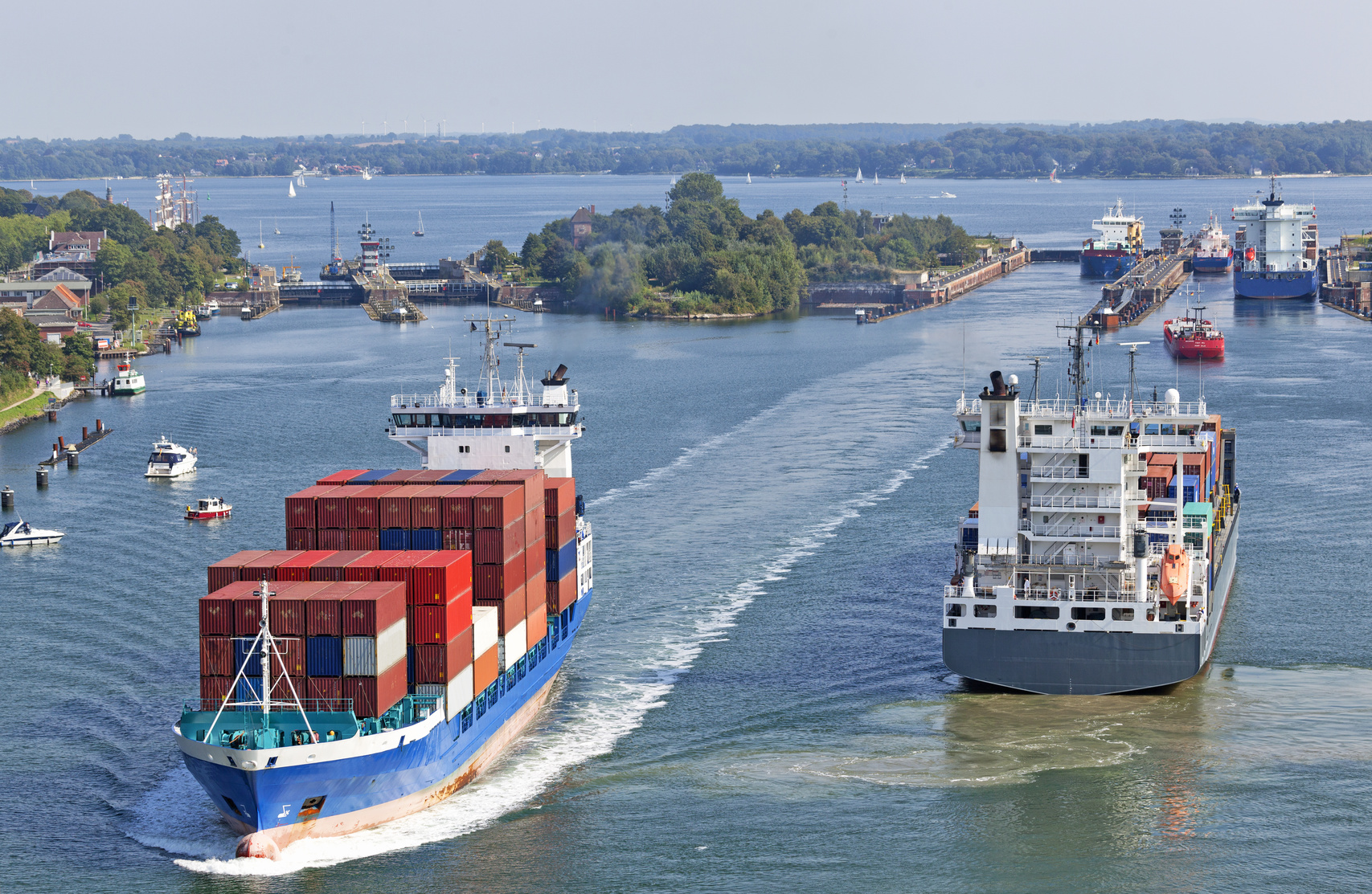
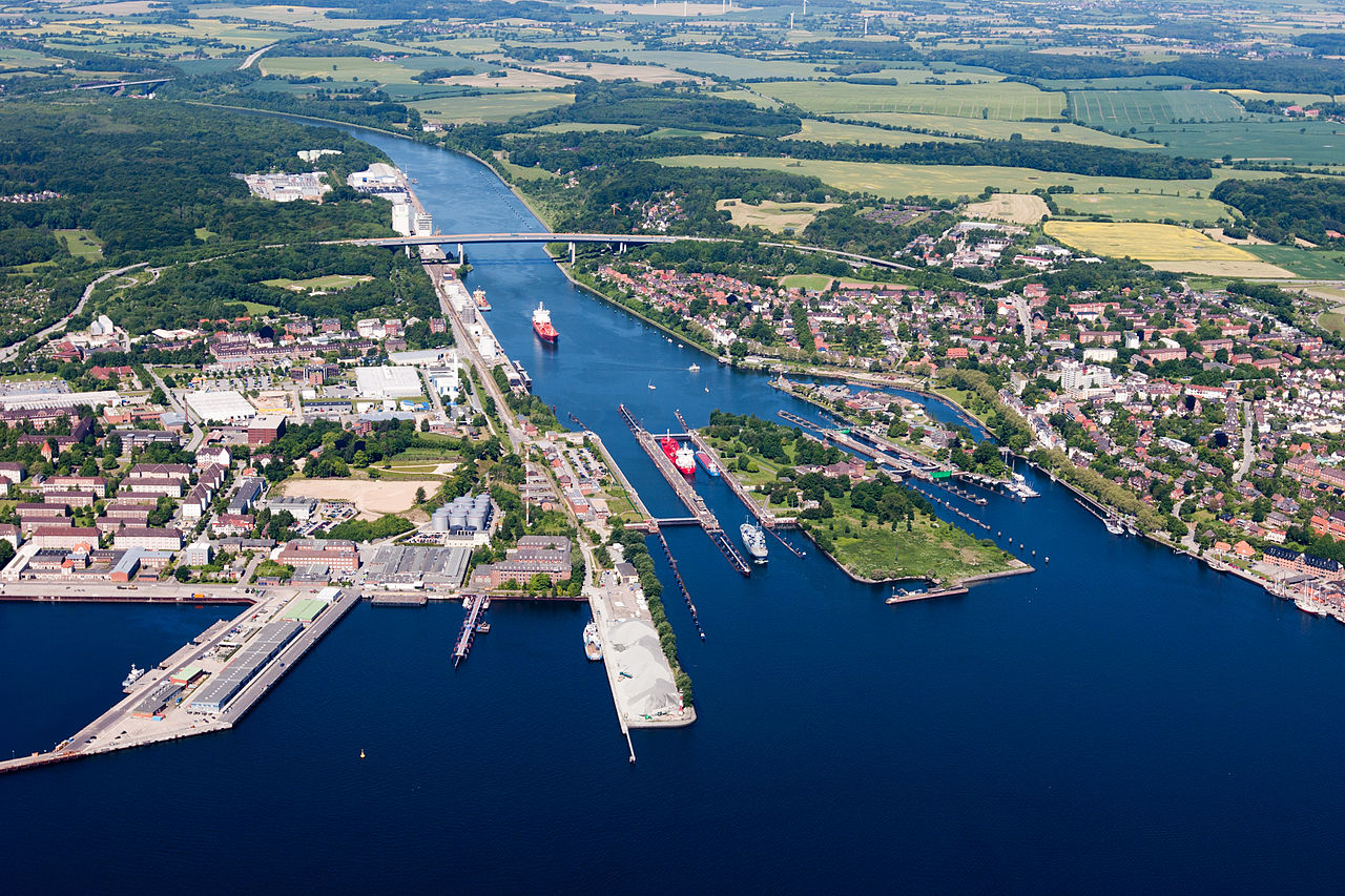
Der Nord-Ostsee-Kanal (NOK; internationale Bezeichnung Kiel Canal, in Deutschland bis 1948 Kaiser-Wilhelm-Kanal) verbindet die Nordsee (Elbmündung) mit der Ostsee (Kieler Förde). Diese Bundeswasserstraße[3] ist die weltweit meistbefahrene künstliche Wasserstraße für Seeschiffe.[4] Im Jahr 2016 passierten ihn 29.284 Schiffe[5] (2015: 32.091[6], 2014: 32.589[7], 2013: 31.097, 2012: 34.879, 2011: 33.522[8]).
Der Kanal durchquert mit einer Länge von knapp 100 Kilometern das Land Schleswig-Holstein zwischen Brunsbüttel und Kiel-Holtenau. Damit erspart er die Fahrt um die Kimbrische Halbinsel (Jütland) durch Nordsee, Skagerrak und Kattegat. Mit dem Kanal ist die Wegstrecke je nach Abfahrts- und Zielhafen im Schnitt 250 Seemeilen (rund 460 km) kürzer.
Die erste Verbindung zwischen Nord- und Ostsee für seegängige Schiffe war der 1784 in Betrieb genommene und 1853 in Eiderkanal umbenannte Schleswig-Holsteinische Canal.
基尔运河 (德语:Kieler Kanal,英语:Kiel Canal),又称北海-波罗的海运河 ) ,1948年前被称为威廉皇帝运河。是一条位于德国最北方的石勒苏益格-荷尔斯泰因州的,全长98公里(61英里)长的运河。运河西起北海畔易北河口的布伦斯比特尔,跨越日德兰半岛,东至波罗的海的基尔湾的霍尔特瑙港。运河连接了北海和波罗的海,使得来往船只不必再绕过日德兰半岛,平均节省了460公里(合250海里)的路程。这样节省了航行时间,又可避免有风暴危险的海域。按照运河官方网站的说法,基尔运河是世界上最繁忙的人工航道,2007年有43000艘较大船只经过运河[1]。
キール運河(キールうんが、ドイツ語:Kiel‐Kanal)は、ユトランド半島を根元のドイツ北部シュレースヴィヒ=ホルシュタイン州で横断し、北海とバルト海を繋ぐ運河。正式名称は北海バルト海運河(Nord‐Ostsee‐Kanal)。
長さ98 km、幅102 m、水深11 mである。北海とバルト海の海面の間に高度差は少ないが、潮の満ち干に対応するための閘門(こうもん)が運河の両端にある。
日本では、スエズ運河・パナマ運河と並び、世界三大運河とよばれる。
The Kiel Canal (German: Nord-Ostsee-Kanal, literally "North-[to]-Baltic Sea canal", formerly known as the Kaiser-Wilhelm-Kanal) is a 98-kilometre (61 mi) long freshwater canal in the German state of Schleswig-Holstein. The canal was finished in 1895, but later widened, and links the North Sea at Brunsbüttel to the Baltic Sea at Kiel-Holtenau. An average of 250 nautical miles (460 km) is saved by using the Kiel Canal instead of going around the Jutland Peninsula. This not only saves time but also avoids storm-prone seas and having to pass through the Sound or Belts.
Besides its two sea entrances, the Kiel Canal is linked, at Oldenbüttel, to the navigable River Eider by the short Gieselau Canal.[1]
Le canal de Kiel (allemand : Nord-Ostsee-Kanal), est un canal de 98 kilomètres qui relie la mer du Nord (à Brunsbüttel) à la mer Baltique (à Kiel). En traversant la péninsule du Jutland, le canal permet un raccourci de 280 milles nautiques (519 km). Avec plus ou moins 120 bateaux par jour en moyenne, il est une des voies d'eau non naturelles les plus fréquentées au monde1.
Il canale, tramite il quale si evita la circumnavigazione della penisola dello Jutland permettendo un risparmio di 280 miglia nautiche (519 km), è la via d'acqua più utilizzata al mondo.
Il primo collegamento tra i due mari era l'Eiderkanal che utilizzava il fiume Eider. Fu completato nel 1784 e misura 43 chilometri sui 175 chilometri del tragitto tra Kiel e l'imboccatura dell'Eider (a Tönning). Era largo 29 metri e profondo 3 metri cosa che limitava la grandezza dei battelli a circa 300 tonnellate.
La marina tedesca volle collegare le sue basi nel Baltico e nel mare del Nord senza fare il giro della Danimarca. La costruzione del nuovo canale fu decisa.
Nel giugno 1887, la costruzione cominciò a Holtenau nei pressi di Kiel. In otto anni, circa 9000 uomini lavorarono alla sua costruzione. Il 20 giugno 1895 il canale è ufficialmente inaugurato dal Kaiser Guglielmo II. Durante la cerimonia pose l'ultima pietra dell'opera e lo chiamò Kaiser-Wilhelm-Kanal in onore di suo nonno Guglielmo I. Mantenne tale nome sino al 1948.
In seguito all'aumento del traffico la parte del canale che permette l'incrocio dei battelli fu ingrandita tra il 1907 e il 1914. Due chiuse furono aggiunte a Brunsbüttel e a Holtenau.
Dopo la prima guerra mondiale, il trattato di Versailles internazionalizza il canale lasciandolo sotto amministrazione tedesca. Adolf Hitler annullò lo statuto internazionale nel 1936.
Dopo la fine della Seconda guerra mondiale, il canale è di nuovo aperto a tutte le imbarcazioni. Esso è stato chiuso, per la prima volta nella sua storia (compresa la seconda guerra mondiale), nel 2013, a causa della mancanza di manutenzione dovuta a un forte taglio agli investimenti sulle infrastrutture avvenuto nel 2012[1].
El canal de Kiel (en alemán, Nord-Ostsee-Kanal, denominado abreviadamente NOK), conocido hasta 1948 como el canal Emperador Guillermo (Kaiser-Wilhelm-Kanal) es un largo canal artificial de 98 km de longitud que comunica el mar Báltico, en Kiel-Holtenau, con el mar del Norte, en Brunsbüttel, atravesando el estado federado de Schleswig-Holstein (Alemania).
Se ahorran de promedio unas 250 millas náuticas (460 km) utilizando el canal, en lugar de bordear la península de Jutlandia. Esto no sólo ahorra tiempo, sino que también evita las potencialmente peligrosas tormentas habituales en esos mares. Según el sitio web del canal, es la vía marítima artificial más utilizada en el mundo, habiendo sido cruzado en 2007 por más de 43 000 barcos, sin contar las pequeñas embarcaciones.3
Además de sus dos entradas marinas, el canal está conectado, en Oldenbüttel, con el navegable río Eider por el corto canal de Gieselau.4
Кильский канал (нем. Nord-Ostsee-Kanal), до 1948 года Канал кайзера Вильгельма (нем. Kaiser-Wilhelm-Kanal) — судоходный канал в Германии, соединяющий Балтийское и Северное моря. Проходит от Кильской бухты, у города Киль (пригородный район Хольтенау) до устья реки Эльба, у города Брунсбюттель[1].
Протяжённость — около 98 км, ширина — более 100 м, глубина — 11 м. Канал оканчивается парой шлюзов с каждой стороны, один из них предназначен для маломерного флота.
Кильский канал был введён в эксплуатацию 20 июня 1895 года, строительство продолжалось 8 лет. Является одним из самых загруженных судоходных путей Европы. Этот путь экономит около 519 километров по сравнению с плаванием вокруг Ютландского полуострова. При этом канал не только сокращает время пути примерно на сутки, но и позволяет избегать морских штормов.

 International cities
 Sport
Sport
 Important port
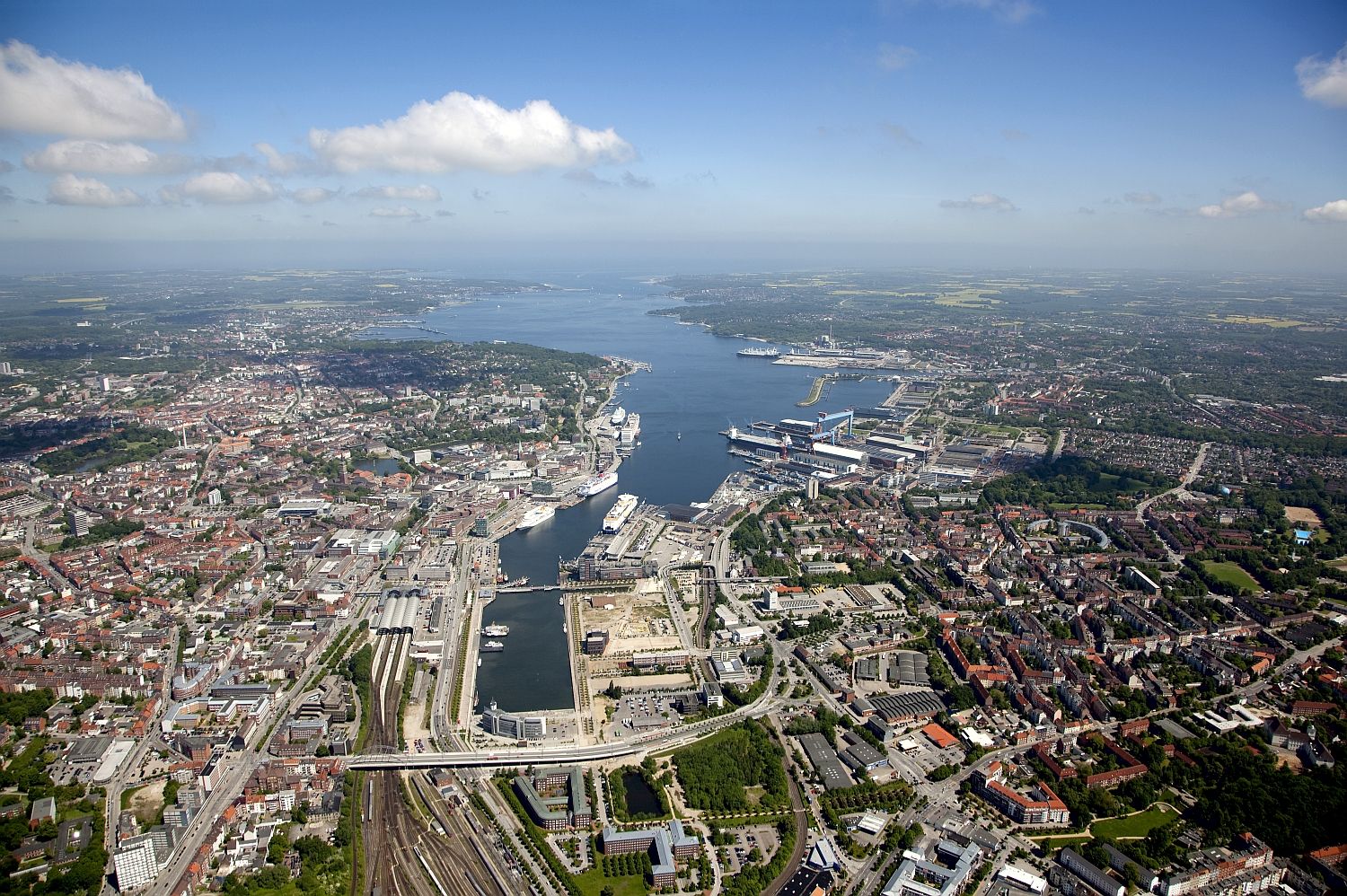
Kiel ist die Landeshauptstadt von Schleswig-Holstein. Als Holstenstadt tom Kyle im 13. Jahrhundert gegründet, wurde sie im Jahr 1900 mit über 100.000 Einwohnern zur Großstadt. Heute gehört Kiel mit 247.943 Einwohnern[3] zu den 30 größten Städten Deutschlands und bildet das Zentrum der Kiel-Region.
Die nördlichste Großstadt Deutschlands liegt an der Ostsee (Kieler Förde) und ist Endpunkt der meistbefahrenen künstlichen Wasserstraße der Welt, des international Kiel Canal genannten Nord-Ostsee-Kanals. Kiel ist traditionell ein bedeutender Stützpunkt der Deutschen Marine und bekannt durch das jährliche internationale Segelereignis Kieler Woche, den Handballverein THW Kiel, den Fußballverein Holstein Kiel und durch die kulinarische Spezialität der Kieler Sprotten.
Von wirtschaftlicher Bedeutung sind neben dem Dienstleistungssektor die größte deutsche Werft ThyssenKrupp Marine Systems und der Kieler Ostseehafen mit den Fähren nach Skandinavien und ins Baltikum. Die kreisfreie Stadt ist Sitz dreier Hochschulen: der Christian-Albrechts-Universität, der Fachhochschule sowie der Muthesius Kunsthochschule.
邻靠于波罗的海基尔湾,自十九世纪六十年代以来该市一直是德国主要的海军基地。基尔是德国造船业中心,基尔运河的东段终点。基尔还有一所重要的大学 :基尔大学。
基尔在第二次世界大战中被严重摧毁,战後重建时,城市规划者们未能找到原来的设计图纸,因而很可惜地无缘像石勒苏益格-荷尔斯泰因的其他城镇,如吕贝克、弗兰斯堡或石勒苏益格等那样完全复原城市的原貌。
基尔(Kiel,![]() 录音 帮助·信息)是德国北部城市,石勒苏益格-荷尔斯泰因州首府。面积118.4平方千米,人口233,244人(2005年)。
录音 帮助·信息)是德国北部城市,石勒苏益格-荷尔斯泰因州首府。面积118.4平方千米,人口233,244人(2005年)。
邻靠于波罗的海基尔湾,自十九世纪六十年代以来该市一直是德国主要的海军基地。基尔是德国造船业中心,基尔运河的东段终点。基尔还有一所重要的大学基尔大学。
基尔的航海比赛非常有名,基尔周是全世界最大的航海赛事之一。在1936年和1972年,奥运会在柏林和慕尼黑举行时,赛艇项目都在基尔举行。
キール(ドイツ語: Kiel, ドイツ語発音: [ˈkiːl] (![]() 音声ファイル))は、バルト海に面したドイツ北部の都市。シュレスヴィヒ=ホルシュタイン州の州都であり、人口242,041人(2011年)。
音声ファイル))は、バルト海に面したドイツ北部の都市。シュレスヴィヒ=ホルシュタイン州の州都であり、人口242,041人(2011年)。
キールは、ハンブルクのおよそ90キロメートル (56 mi)北、フレンスブルクの70キロメートル (43 mi)南東、リューベックの60キロメートル (37 mi)北西に位置する。ドイツ北部の、ユトランド半島の南東、バルト海の南西という地理的条件により、キールはドイツ海事の中心地の1つとなった。また、国際セーリングイベントでも知られ、世界最大のセーリングイベントのキール・ウィークも開催される。ベルリンオリンピックやミュンヘンオリンピックでは、セーリング競技がキールで開催された[3]。
Kiel (German: [kiːl] (![]() listen)) is the capital and most populous city in the northern German state of Schleswig-Holstein, with a population of 249,023 (2016).
listen)) is the capital and most populous city in the northern German state of Schleswig-Holstein, with a population of 249,023 (2016).
Kiel lies approximately 90 kilometres (56 mi) north of Hamburg. Due to its geographic location in the north of Germany, the southeast of the Jutland peninsula and the southwestern shore of the Baltic Sea, Kiel has become one of the major maritime centres of Germany. For instance, the city is known for a variety of international sailing events, including the annual Kiel Week, which is the biggest sailing event in the world. The Olympic sailing competitions of the 1936 and the 1972 Summer Olympics were held in Bay of Kiel.[4]
Kiel has also been one of the traditional homes of the German Navy's Baltic fleet, and continues to be a major high-tech shipbuilding centre. Located in Kiel is the GEOMAR - Helmholtz Centre for Ocean Research Kiel at the University of Kiel. Kiel is an important sea transport hub, thanks to its location on the Kiel Fjord (Kieler Förde) and the busiest artificial waterway in the world, Kiel Canal (Nord-Ostsee-Kanal). A number of passenger ferries to Sweden, Norway, Lithuania and other countries operate from here. Moreover, today Kiel Harbour is an important port of call for cruise ships touring the Baltic Sea.
Kiel's recorded history began in the 13th century, but the city was originally a Danish village, in the 8th century. Until 1864 it was administered by Denmark in personal union. In 1866 the city was annexed by Prussia and in 1871 it became part of Germany.
Kiel was one of the founding cities of original European Green Capital Award in 2006.[5] In 2005 Kiel's GDP per capita was €35,618, which is well above Germany's national average, and 159% of the European Union's average.[6] The city is home to the University of Kiel (established in 1665).
Kiel est une ville du Nord de l'Allemagne, capitale de l'État fédéré (Land) de Schleswig-Holstein. Avec ses 242 041 habitants3, elle est une des 30 plus grandes villes d'Allemagne. Elle se situe en bordure de la mer Baltique, à l'entrée est du canal de Kiel. Cette voie navigable artificielle, qui relie la mer Baltique à la mer du Nord, est la plus fréquentée au monde. C'est donc un port important, composé d'une partie militaire, d'un port de commerce (le plus grand port allemand en termes de transport de passagers4) et de chantiers navals. Trois lignes de ferries assurent des liaisons quotidiennes avec Göteborg (Suède), Oslo (Norvège) et six fois par semaine avec Klaipėda (Lituanie).
La ville est également connue grâce à la Semaine de Kiel (Kieler Woche) et à son équipe de handball, le THW Kiel.
Kiel /ki:l/ è una città della Germania nel Land dello Schleswig-Holstein di cui è capoluogo e città più popolosa. Kiel è situata sul fiume Eider, nei pressi del Mar Baltico ed in particolare su una stretta baia (Kieler Förde) a cuneo[1] (in tedesco keil mentre kiel significa carena) del più ampio golfo di Kiel. La grande città più vicina è Amburgo, a circa 90 km a sud-ovest, mentre Lubecca dista 80 km in direzione sud-est.
Kiel ![]() [ˈkiːl] (?·i) es la capital del estado federado alemán de Schleswig-Holstein, el más septentrional de Alemania. Situada a orillas del mar Báltico, la ciudad ha sido una de las principales bases navales alemanas desde la década de 1860.
[ˈkiːl] (?·i) es la capital del estado federado alemán de Schleswig-Holstein, el más septentrional de Alemania. Situada a orillas del mar Báltico, la ciudad ha sido una de las principales bases navales alemanas desde la década de 1860.
Киль (нем. Kiel [ˈkiːl]) — город в Германии, столица и крупнейший город земли Шлезвиг-Гольштейн. Расположен на берегу Кильской бухты Балтийского моря. Каналом связан с Северным морем, крупный порт. Население Киля составляет 229 044 чел.
Расположенный в Киле университет имени Христиана Альбрехта был основан в 1665 году. В городе также находится Германская национальная экономическая библиотека.
Киль известен тем, что ежегодно в нём проходит Кильская неделя — важнейшее событие в мире парусного спорта. Киль дважды принимал соревнования по парусному спорту в рамках летних Олимпийских игр: в 1936 году, когда Игры проходили в Берлине, и в 1972 году, когда столицей Олимпиады был Мюнхен.

 Architecture


