Deutsch-Chinesische Enzyklopädie, 德汉百科
 Geography

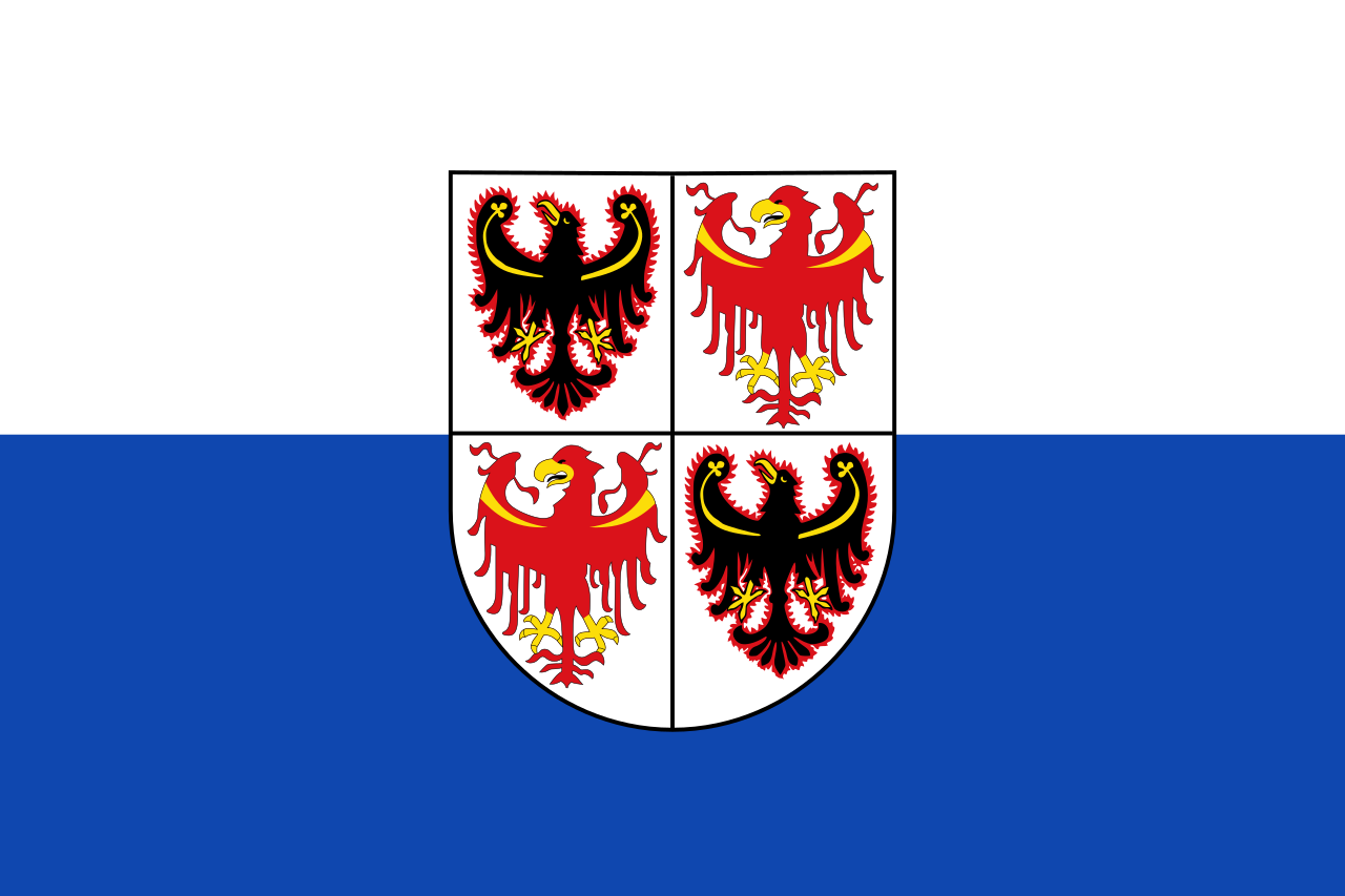 Trentino-Alto Adige

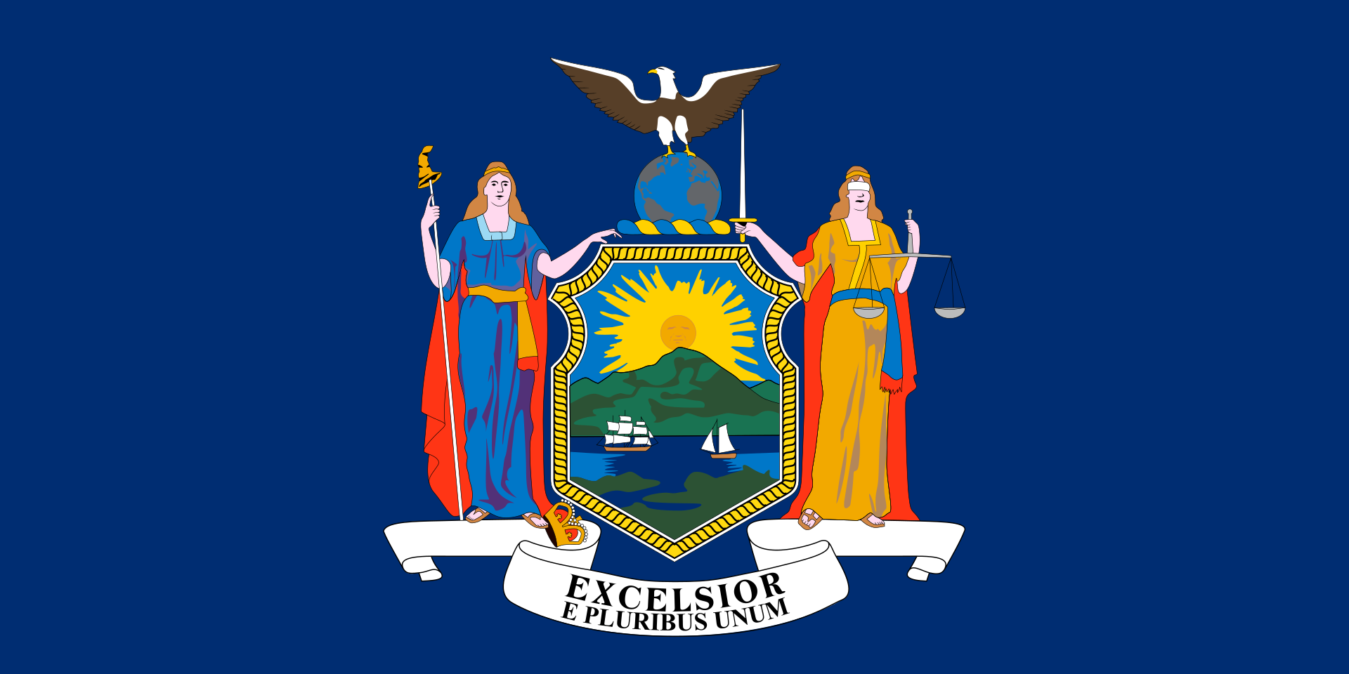 New York-NY

*Mediterranean Sea
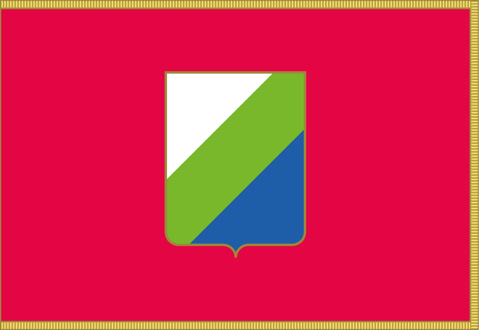 Abruzzo
Albania
Amber Road
Bosnia Herzegovina
Abruzzo
Albania
Amber Road
Bosnia Herzegovina
 Emilia-Romagna
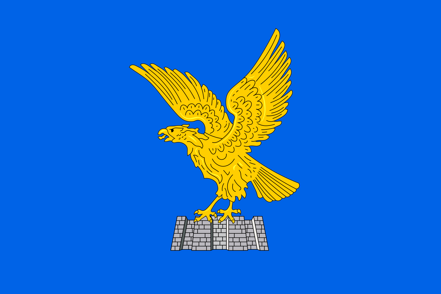 Friuli-Venezia Giulia
Italy
Croatia
Friuli-Venezia Giulia
Italy
Croatia
 Marche
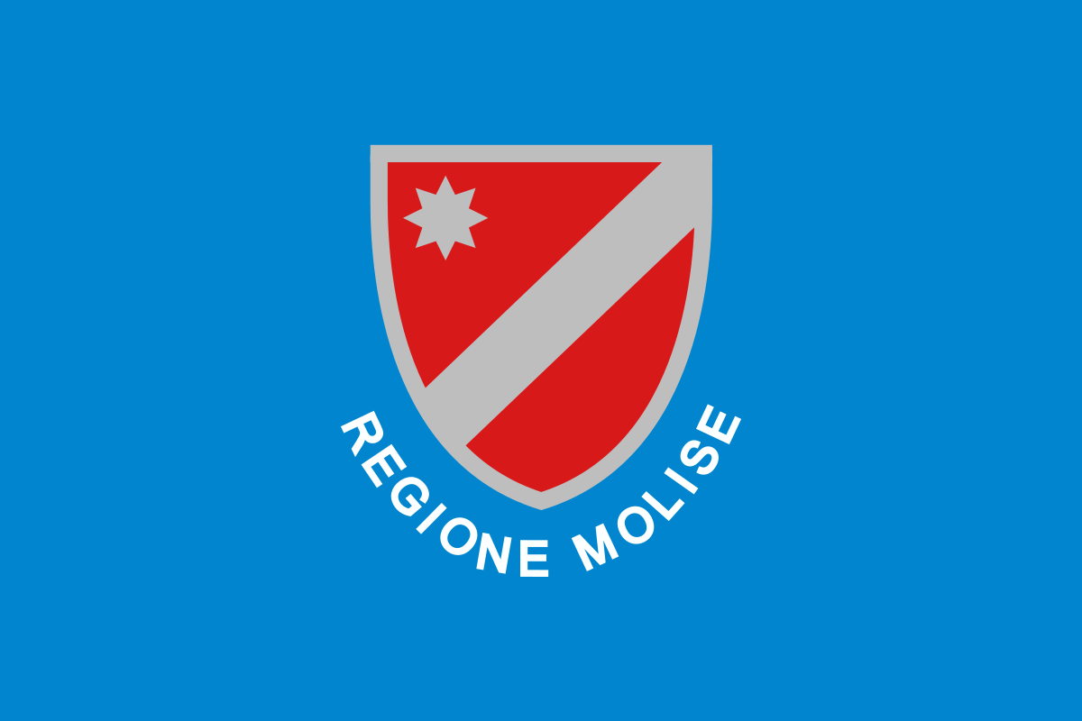 Molise
Montenegro
Molise
Montenegro
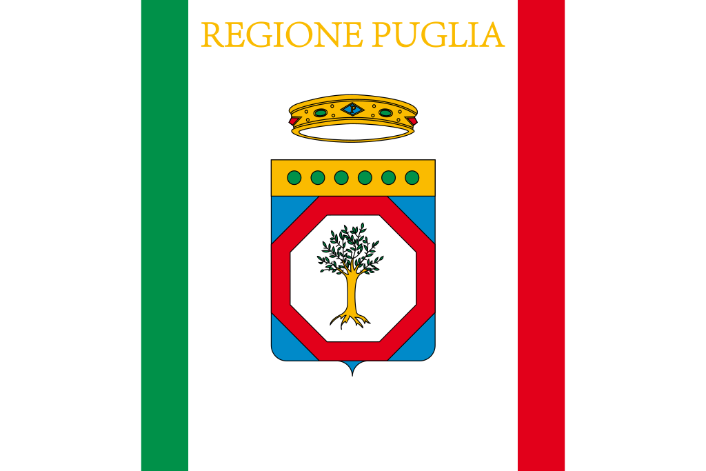 Puglia
Slovenia
Puglia
Slovenia
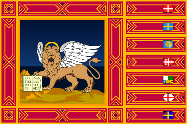 Veneto
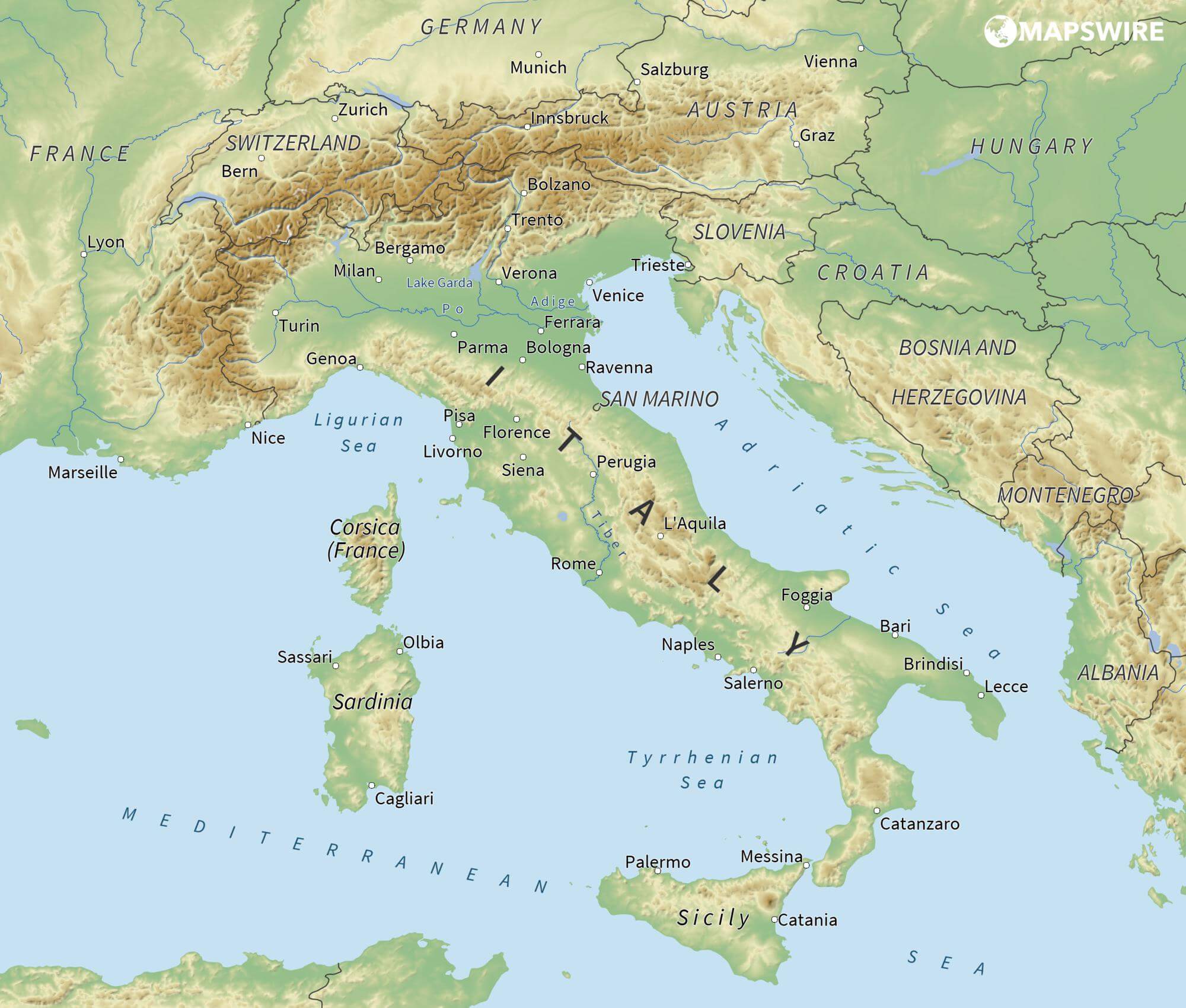
亚得里亚海(意大利语:Mar Adriatico,斯洛文尼亚语:Jadransko morje,克罗地亚语:Jadransko more,阿尔巴尼亚语:Deti Adriatik),是地中海的一部分水域,分隔了意大利半岛(亚平宁半岛)和巴尔干半岛,也分隔了亚平宁山脉与狄那里克阿尔卑斯山脉及其临近地区。亚得里亚海西岸属于意大利,东岸则分别属于斯洛文尼亚、克罗地亚、波斯尼亚和黑塞哥维那、黑山和阿尔巴尼亚。亚得里亚海透过位于其南部的奥特朗托海峡与爱奥尼亚海相连。波河、阿迪杰河、奥凡托河等河流流入亚得里亚海;海中有近1200个岛屿,其中只有69个有人居住。
Das Adriatische Meer, kurz auch die Adria (lateinisch Mare Adriaticum; italienisch Mare Adriatico; bosnisch, kroatisch und serbisch Jadransko more oder kurz Jadran; slowenisch Jadransko morje; albanisch Deti Adriatik oder kurz Adriatiku), ist das lang gestreckte nördliche Seitenbecken des Mittelmeeres zwischen der Apenninhalbinsel und Balkanhalbinsel. Es ist nach der Stadt Adria in Italien (Provinz Rovigo) benannt. Zum Adriatischen Meer wird alles gerechnet, was nördlich der Straße von Otranto liegt.
アドリア海(アドリアかい、英: Adriatic Sea ; イタリア語: Mar Adriatico ; クロアチア語: Jadransko more)は、地中海の海域の一つ。イタリア半島とバルカン半島に挟まれている。
The Adriatic Sea (/ˌeɪdriˈætɪk/) is a body of water separating the Italian Peninsula from the Balkans. The Adriatic is the northernmost arm of the Mediterranean Sea, extending from the Strait of Otranto (where it connects to the Ionian Sea) to the northwest and the Po Valley. The countries with coasts on the Adriatic are Albania, Bosnia and Herzegovina, Croatia, Italy, Montenegro and Slovenia. The Adriatic contains over 1,300 islands, mostly located along the Croatian part of its eastern coast. It is divided into three basins, the northern being the shallowest and the southern being the deepest, with a maximum depth of 1,233 metres (4,045 ft). The Otranto Sill, an underwater ridge, is located at the border between the Adriatic and Ionian Seas. The prevailing currents flow counterclockwise from the Strait of Otranto, along the eastern coast and back to the strait along the western (Italian) coast. Tidal movements in the Adriatic are slight, although larger amplitudes are known to occur occasionally. The Adriatic's salinity is lower than the Mediterranean's because the Adriatic collects a third of the fresh water flowing into the Mediterranean, acting as a dilution basin. The surface water temperatures generally range from 30 °C (86 °F) in summer to 12 °C (54 °F) in winter, significantly moderating the Adriatic Basin's climate.
The Adriatic Sea sits on the Apulian or Adriatic Microplate, which separated from the African Plate in the Mesozoic era. The plate's movement contributed to the formation of the surrounding mountain chains and Apennine tectonic uplift after its collision with the Eurasian plate. In the Late Oligocene, the Apennine Peninsula first formed, separating the Adriatic Basin from the rest of the Mediterranean. All types of sediment are found in the Adriatic, with the bulk of the material transported by the Po and other rivers on the western coast. The western coast is alluvial or terraced, while the eastern coast is highly indented with pronounced karstification. There are dozens of marine protected areas in the Adriatic, designed to protect the sea's karst habitats and biodiversity. The sea is abundant in flora and fauna—more than 7,000 species are identified as native to the Adriatic, many of them endemic, rare and threatened ones.
The Adriatic's shores are populated by more than 3.5 million people; the largest cities are Bari, Venice, Trieste and Split. The earliest settlements on the Adriatic shores were Etruscan, Illyrian, and Greek. By the 2nd century BC, the shores were under Rome's control. In the Middle Ages, the Adriatic shores and the sea itself were controlled, to a varying extent, by a series of states—most notably the Byzantine Empire, the Croatian Kingdom, the Republic of Venice, the Habsburg Monarchy and the Ottoman Empire. The Napoleonic Wars resulted in the First French Empire gaining coastal control and the British effort to counter the French in the area, ultimately securing most of the eastern Adriatic shore and the Po Valley for Austria. Following Italian unification, the Kingdom of Italy started an eastward expansion that lasted until the 20th century. Following World War I and the collapse of Austria-Hungary and the Ottoman Empire, the eastern coast's control passed to Yugoslavia and Albania. The former disintegrated during the 1990s, resulting in four new states on the Adriatic coast. Italy and Yugoslavia agreed on their maritime boundaries by 1975 and this boundary is recognised by Yugoslavia's successor states, but the maritime boundaries between Slovenia, Croatia, Bosnia-Herzegovina, and Montenegro are still disputed. Italy and Albania agreed on their maritime boundary in 1992.
Fisheries and tourism are significant sources of income all along the Adriatic coast. Adriatic Croatia's tourism industry has grown faster economically than the rest of the Adriatic Basin's. Maritime transport is also a significant branch of the area's economy—there are 19 seaports in the Adriatic that each handle more than a million tonnes of cargo per year. The largest Adriatic seaport by annual cargo turnover is the Port of Trieste, while the Port of Split is the largest Adriatic seaport by passengers served per year.
La mer Adriatique (du latin : Mare Hadriaticum ou Mare Adriaticum) est une mer séparant la péninsule italienne de la péninsule balkanique. L'Adriatique est le bras de la Méditerranée situé le plus au nord en s'étendant du canal d'Otrante (où elle rejoint la mer Ionienne) jusqu'aux villes de Venise et de Trieste et à l'embouchure du Pô. Les pays côtiers sont l'Italie, la Slovénie, la Croatie, la Bosnie-Herzégovine, le Monténégro et l'Albanie, ainsi que la Grèce par l'île de Corfou.
Il mare Adriatico è l'articolazione del mar Mediterraneo orientale situata tra la penisola italiana e la penisola balcanica; suddiviso in Alto Adriatico, Medio Adriatico e Basso Adriatico, bagna sei Paesi: Italia, Slovenia, Croazia, Bosnia ed Erzegovina, Montenegro e Albania, confinando a sud-est con il Mar Ionio.
El mar Adriático (del latín, Mare Hadriaticum) es un golfo estrecho y alargado que forma parte del mar Mediterráneo. Se encuentra situado entre la península Itálica, al oeste, y la península de los Balcanes, al este, con una anchura máxima de unos 200 km, y una longitud de unos 800 km. Su extremo meridional limita con el mar Jónico, del que lo separa el canal de Otranto. Su superficie total es de, aproximadamente, 160 000 km².
Las costas occidental, septentrional, y parte de la oriental corresponden a Italia (60% de la longitud de costa del Adriático), mientras que el resto de la costa oriental corresponde a Croacia, Eslovenia, Bosnia y Herzegovina, Montenegro y Albania. Algunos de los ríos que desembocan en el Adriático son el Reno, el Po, el Adigio, el Brenta, el Piave y el Neretva.
La costa del Adriático concentra un gran número de centros turísticos, como Venecia, que recibe el nombre de «Reina del Adriático». Tras la división de Yugoslavia, la costa croata se ha convertido también en un destino turístico muy popular.
Sus aguas sostienen industria pesquera, y se llevan a cabo prospecciones petrolíferas en este mar. Durante los años 1990, varias investigaciones revelaron que sus niveles de contaminación son muy altos.
En las últimas décadas el gobierno de Italia ha intentado hacer de él una barrera contra la inmigración ilegal, en su mayor parte proveniente de Albania.
Адриати́ческое мо́ре (итал. mare Adriatico, эмил.-ром. Mèr Adriâtic, вен. Mar Adriàtico, неап. Mar Adriateco, словен. Jadransko morje, сербохорв. Jadransko more/Јадранско море, алб. Deti Adriatik, лат. mare Hadriaticum), также Адриатика — полузамкнутое море, часть Средиземного моря между Апеннинским и Балканским полуостровами. Омывает берега Италии (более 1000 км), Словении (47 км), Хорватии (1777 км), Боснии и Герцеговины (20 км), Черногории (200 км), Албании (472 км).

阿非利加洲[2](拉丁语:Africa),简称非洲,位于地球东半球西部,欧洲之南,亚洲以西,地跨赤道南北,面积为30,221,532平方公里,占全球总陆地面积的20.4%,[3]人口约为12亿(截止到2016年),[4]目前约占全球总人口16%。非洲是世界面积第二大洲,同时也是人口第二大洲和第三世界国家主要区域。
非洲多样的气候是丰富生态资源与矿产资源的宝地,同时也是世界古人类和古文明的发祥地之一。目前世界上最古老的人类化石就是在东非发现的,而非洲北部的埃及是世界文明发源地之一。
Afrika ist einer der Kontinente der Erde. Seine Fläche von 30,2 Millionen km² entspricht etwa 22 % der gesamten Landfläche des Planeten, er hat eine Bevölkerung von circa 1,3 Milliarden Menschen (2017).[2] Damit ist er sowohl nach Ausdehnung wie nach Bevölkerung der zweitgrößte Erdteil nach Asien. Nahezu alle afrikanischen Staaten sind Mitglied der Vereinten Nationen und der Afrikanischen Union. Der Kontinent ist überwiegend ländlich und durch hohe Geburtsraten geprägt, welche durch die Modernisierung sinken. Durch die seit etwa 1950 stark steigende Urbanisierung wohnen immer mehr Afrikaner in städtischen Gebieten. Einige afrikanische Städte gehören zu den weltgrößten Ballungsräumen, darunter Kairo, Lagos, Kinshasa, Johannesburg, Luanda und Alexandria.
Entsprechend der „Out-of-Africa-Theorie“ gilt Afrika als die „Wiege der Menschheit“, wo im Zuge der Hominisation die Entwicklung zum anatomisch modernen Menschen Homo sapiens stattfand. Eine der frühesten Hochkulturen der Menschheit bildete sich im Alten Ägypten. Über die Jahrtausende entstanden auf dem Kontinent verschiedene „Großreiche“ wie das Kaiserreich Abessinien. Der Sklavenhandel mit den afrikanischen Reichen seit dem 16. Jahrhundert und die spätere Kolonisation durch europäische Staaten („Wettlauf um Afrika“) führten zu einer teils Reißbrett-artigen Gebietsaufteilung. Diese wurde im Zuge der Dekolonisation ab der Mitte des 20. Jahrhunderts von vielen neu gebildeten afrikanischen Staaten übernommen. Die heterogenen Völker Afrikas hatten traditionell andere Siedlungsgebiete, was zu verschiedenen Konflikten und Kriegen um Territorial-, Rohstoff- und Machtansprüche beiträgt.
Während die meisten Länder Afrikas lange autokratisch regiert wurden, setzten sich ab dem späten 20. Jahrhundert häufiger demokratische Bewegungen durch, wobei die Region Afrika seit Beginn der Demokratiemessungen am schlechtesten abschnitt. Armut, Hungersnöte, Kindersterblichkeit und Gesundheitsprobleme konnten durch Bildung, wirtschaftliche, medizinische und infrastrukturelle Fortschritte in den letzten Jahrzehnten erheblich verringert werden. Die Bedeutung der Staaten Afrikas in der Weltwirtschaft ist nach BIP bis auf einige Ausnahmen wie Südafrika, Nigeria, Ägypten, Algerien, Angola und Marokko noch gering. Mehrere afrikanische Länder zählen seit Beginn des 21. Jahrhunderts jedoch zu den weltweit am schnellsten wachsenden Volkswirtschaften. Die Rohstoffe und die landwirtschaftlich nutzbaren Flächen des Kontinents sind von zunehmender Bedeutung für die afrikanischen Länder wie auch mit ihnen handelnde Industrie- und Schwellenländer.
Die Geographie und Natur Afrikas sind vielfältig, es gibt eine große Anzahl von naturgeschützten Nationalparks. Das afrikanische UNESCO-Welterbe ist umfassend.
アフリカ(ラテン語:Āfrica、英語:Africa[3])は、広義にはアフリカ大陸およびその周辺のマダガスカル島などの島嶼・海域を含む地域の総称で、六大州の一つ[3]。阿州。漢字表記は阿弗利加。
地理的には地中海を挟んでヨーロッパの南に位置する。 赤道を挟んで南北双方に広い面積を持つ唯一の大陸でもあり、それに伴って多様な気候領域がある[4]。面積は3020万平方キロメートルで、地球表面の6%、陸地全体の20.4%を占めるが[5]、人口は約10億人で、世界人口比では14.72%を占めるに過ぎない。2011年3月現在、島嶼を含めて54の独立国がある(西サハラを含めると55カ国)。経済成長率は2010年に約5.0%、2011年予測は5.5%である[6]。
アフリカはアフリカ単一起源説からヒトの起源とされ、エチオピアからは20万年前のホモ・サピエンスの化石が発見され[7]、世界遺産の南アフリカの人類化石遺跡群は人類の発祥の地と呼ばれている。アフリカは、かつてヨーロッパ諸国から「暗黒大陸」と未開の地のように呼ばれたが、ヨーロッパに知られていなかった(あるいはその存在を認めようとしなかった)だけで、実際にはヨーロッパより古い歴史と文明があった。
アフリカの地理的区分ではサハラ砂漠が大きな境界となり、この北側を「ホワイトアフリカ」、南側を「ブラックアフリカ」あるいは「サブサハラアフリカ」と呼び分ける場合もある。また、北アフリカ、中部アフリカ、東アフリカ、南部アフリカ、西アフリカに分ける区分もある。
Africa is the world's second-largest and second-most populous continent, after Asia. At about 30.3 million km2 (11.7 million square miles) including adjacent islands, it covers 6% of Earth's total surface area and 20% of its land area.[4] With 1.3 billion people[1][2] as of 2018, it accounts for about 16% of the world's human population. The continent is surrounded by the Mediterranean Sea to the north, the Isthmus of Suez and the Red Sea to the northeast, the Indian Ocean to the southeast and the Atlantic Ocean to the west. The continent includes Madagascar and various archipelagos. It contains 54 fully recognised sovereign states (countries), eight territories and two de facto independent states with limited or no recognition. The majority of the continent and its countries are in the Northern Hemisphere, with a substantial portion and number of countries in the Southern Hemisphere.
Africa's average population is the youngest amongst all the continents;[5][6] the median age in 2012 was 19.7, when the worldwide median age was 30.4.[7] Algeria is Africa's largest country by area, and Nigeria is its largest by population. Africa, particularly central Eastern Africa, is widely accepted as the place of origin of humans and the Hominidae clade (great apes), as evidenced by the discovery of the earliest hominids and their ancestors as well as later ones that have been dated to around 7 million years ago, including Sahelanthropus tchadensis, Australopithecus africanus, A. afarensis, Homo erectus, H. habilis and H. ergaster—the earliest Homo sapiens (modern human), found in Ethiopia, date to circa 200,000 years ago.[8] Africa straddles the equator and encompasses numerous climate areas; it is the only continent to stretch from the northern temperate to southern temperate zones.[9]
Africa hosts a large diversity of ethnicities, cultures and languages. In the late 19th century, European countries colonised almost all of Africa; most present states in Africa emerged from a process of decolonisation in the 20th century. African nations cooperate through the establishment of the African Union, which is headquartered in Addis Ababa.
L’Afrique est un continent qui couvre 6 % de la surface de la Terre et 20 % de la surface des terres émergées. Sa superficie est de 30 415 873 km2 avec les îles, ce qui en fait la troisième mondiale si l'on compte l'Amérique comme un seul continent. Avec plus de 1,2 milliard d'habitants, l'Afrique est le deuxième continent le plus peuplé après l'Asie et représente 16,4 % de la population de la planète en 2016. Le continent est bordé par la mer Méditerranée au nord, le canal de Suez et la mer Rouge au nord-est, l’océan Indien au sud-est et l’océan Atlantique à l’ouest.
L'Afrique est traversée, presque en son milieu, par l'équateur et présente plusieurs climats : chaud et humide au plus près de l'équateur, tropical dans les régions comprises entre l'équateur et les tropiques, chaud et aride autour des tropiques, tempéré dans les zones d'altitude. Le continent est caractérisé par le manque de précipitations régulières. En l'absence de glaciers ou de systèmes montagneux aquifères, il n'existe pas de moyen de régulation naturelle du climat à l’exception des côtes. Les terres arides représentent 60 % de son territoire. Son environnement est néanmoins très riche — on l'appelle le « paradis de la biodiversité » — et le continent abrite le second massif forestier continu de la planète, la forêt du bassin du Congo, mais cet environnement est menacé par la déforestation et la baisse de la biodiversité, conséquences du changement climatique et de la pression anthropique.
Le continent est considéré comme le berceau de l'humanité, là où sont apparus les ancêtres de l'Homme, puis, il y a 200 000 ans environ, l'homme moderne qui s'est ensuite répandu sur le reste du globe. Le Sahara, le plus grand désert chaud du monde, a créé un hiatus, conduisant à des évolutions historiques distinctes entre le nord et le sud. À la période historique, la civilisation de l'Égypte antique se développe le long du Nil, l'Afrique subsaharienne voit naître ses propres civilisations dans les zones de savanes et l'Afrique du Nord, rive sud de la Méditerranée, subit l'influence des Phéniciens, des Grecs et des Romains. À compter de 3000 av. J.-C. l'Afrique connaît l'expansion bantoue. Il s'agit d'un mouvement de population en plusieurs phases, orienté globalement du nord, depuis le grassland du Cameroun actuel, vers le sud, jusqu'en Afrique australe, atteinte aux débuts de l'ère chrétienne. L'expansion bantoue explique la carte ethno-linguistique actuelle de la zone subsaharienne.
La religion chrétienne s'implante en l'Afrique dès le Ier siècle, essentiellement dans l'Afrique romaine du nord du continent puis en Éthiopie. Le VIIe siècle voit les débuts de l'Islam en Afrique, lequel s'installe sur la côte est et dans le nord du continent jusqu'à la frange septentrionale de la zone subsaharienne. L'Afrique du nord est, dans le même temps, arabisée. En Afrique subsaharienne, à partir du VIIIe siècle et jusqu'au XVIIe siècle, de puissants et riches empires se succèdent. Vers la fin de cette période, au XVe siècle, les Portugais, suivis par d'autres nations européennes, installent sur la côte ouest un trafic d'esclaves, la traite atlantique, qui s'ajoute à la traite intra-africaine et à la traite orientale qui sévissent déjà sur le continent.
Le XVIIIe siècle marque le début des explorations européennes, suivies par la colonisation massive du continent entre la fin du XIXe et le début du XXe siècle. La traite esclavagiste cesse au début du XXe siècle, mais l'Afrique est presque entièrement sous domination coloniale jusqu'à la fin du XXe siècle, ce qui modèle jusqu'à aujourd'hui les frontières et les économies des pays concernés.
La plupart des États obtiennent leur indépendance entre la fin des années 1950 (Maroc, Tunisie, Ghana…) et le milieu des années 1970 (Angola, Mozambique…). L'Afrique indépendante est constituée essentiellement de « démocraties imparfaites » voire de « régimes autoritaires » et les conflits y sont nombreux. Depuis l'accession à l'indépendance du Soudan du Sud en 2011, l'Afrique, comprenant Madagascar, compte 54 États souverains (non inclus la RASD et le Somaliland).
Les pays du continent présentent la croissance démographique la plus importante de la planète et une situation sanitaire qui s'améliore nettement tout en progressant moins vite que dans les autres pays en développement.
L'Afrique repose sur une organisation sociale fondée sur la famille élargie et l'appartenance ethnique ; on recense un millier d'ethnies sur le continent. Elle possède en parallèle la diversité linguistique la plus élevée du monde avec près de 2 000 langues vivantes.
L'Afrique contemporaine est dans une situation où le poids de sa démographie est délicat à gérer (chômage, financement de l'éducation…) car elle reste le continent le moins développé économiquement malgré une forte croissance depuis le début du XXIe siècle, laquelle a permis l'émergence d'une classe moyenne moins féconde, aux revenus plus élevés. Elle est en outre confrontée aux violences terroristes parmi les plus meurtrières de la planète.
Économiquement, le commerce intercontinental est soutenu depuis l'époque antique et, à l'époque des grands empires, le continent est le fournisseur d'or de l'Occident et de l'Orient. Plus tard, la colonisation entraîne une spécialisation massive des économies coloniales qui deviennent presque exclusivement extraverties, dévolues à l'exportation des matières premières, minérales et agricoles, vers les métropoles. Sachant qu'elle possède encore d'importantes réserves minières et pétrolières, cette situation perdure au XXIe siècle, avec, en corollaire, des États rentiers et des oligarchies qui captent les revenus au détriment de populations restées pauvres. Sa place dans la mondialisation économique actuelle est minime, au contraire des siècles passés. Certains pays ont cependant amorcé un tournant économique durant la période récente grâce à la diversification économique, le développement du secteur tertiaire et la « croissance inclusive ».
L'art africain excelle dans des domaines, danse, musique et art plastique particulièrement, qui lui permettent de rayonner partout dans le monde.
L'Africa è un continente del pianeta Terra, il terzo per superficie (considerando l'America al secondo posto se intesa come un unico continente), attraversata dall'equatore e dai Tropici del Cancro e del Capricorno e quindi caratterizzata da una grande varietà di climi e ambienti, come deserti, savane e foreste pluviali. Assieme all'Eurasia, forma il cosiddetto "Continente Antico".
Confina a est con il continente asiatico, attraverso l'istmo di Suez a nord-est, dal 1869 canale artificiale di Suez, quindi bagnato dal Mar Rosso e dall'Oceano Indiano, compreso il Madagascar; a sud con l'Oceano Antartico, la cui costa antartica dista circa 5000 km dall'estrema punta sud del continente africano (Capo Agulhas); a ovest con l'Oceano Atlantico, con distanza minima dal continente americano di circa 4000 km (distanza Santo Antão, Capo Verde-Fortaleza, Brasile); a nord con il Mar Mediterraneo, che la separa dall'Europa.
África es el tercer continente más extenso, tras Asia y América. Está situado entre los océanos Atlántico, al oeste, el Índico, al este. El mar Mediterráneo lo separa al norte del continente europeo; el punto en el que los dos continentes se hallan más cercanos es el estrecho de Gibraltar de 14,4 km de ancho. El mar Rojo lo separa al este de la península arábiga y queda unido a Asia a través del istmo de Suez, en territorio egipcio. Posee una superficie total de 30 272 922 km² (621 600 km² en masa insular), que representa el 20,4 % del total de las tierras emergidas del planeta. La población es de mil millones de habitantes, menos del 15 % del total mundial. El continente se divide en 55 estados soberanos siendo dos de ellos, España y Egipto, transcontinentales, además de dos estados con reconocimiento limitado y dos territorios dependientes.А́фрика — второй по площади материк после Евразии, омывается Средиземным морем с севера, Красным — с северо-востока, Атлантическим океаном с запада и Индийским океаном с востока и юга. Африкой называется также часть света, состоящая из материка Африка и прилегающих островов. Площадь Африки без островов составляет 29,2 млн км², с островами — около 30,3 млн км²[3], покрывая, таким образом, 6 % общей площади поверхности Земли и 20,4 % поверхности суши. На территории Африки расположено 55 государств.
Население Африки составляет более миллиарда человек. Африка считается прародиной человечества: именно здесь нашли самые древние останки ранних гоминид и их вероятных предков, включая сахелантропов, Australopithecus africanus, A. afarensis, Homo erectus, H. habilis и H. ergaster.
Африканский континент пересекает экватор и имеет много климатических зон; это единственный континент, протянувшийся от северного субтропического климатического пояса до южного субтропического. Из-за недостатка постоянных осадков и орошения — равно как ледников или водоносного горизонта горных систем — естественного регулирования климата нигде, кроме побережий, практически не наблюдается.
Изучением культурных, экономических, политических и социальных проблем Африки занимается наука африканистика.
 Hand in Hand
African Union
Hand in Hand
African Union
 Alpha Condé
African Union
Bingu wa Mutharika
African Union
Denis Sassou Nguesso
African Union
Hailemariam Desalegn
African Union
Idriss Déby
African Union
Jakaya Kikwete
African Union
Joaquim Chissano
African Union
John Agyekum Kufuor
African Union
Mohamed Ould Abdel Aziz
African Union
Muammar al-Gaddafi
African Union
Olusegun Obasanjo
African Union
Robert Mugabe
African Union
Teodoro Obiang Nguema Mbasogo
African Union
Thabo Mbeki
African Union
Thomas Boni Yayi
African Union
Paul Kagame
African Union
Abd al-Fattah as-Sisi
African Union
Moussa Faki
African Union
Nkosazana Dlamini-Zuma
African Union
Jean Ping
African Union
Alpha Oumar Konaré
African Union
Amara Essy
Egypt
Algeria
Angola
Equatorial Guinea
Ethiopia
Benin
Botsuana
Burkina Faso
Burundi
Côte d´Ivoire
Demokratische Arabische Republik Sahara
Demokratische Republik Kongo
Djibouti
Eritrea
Gabun
Gambia
Geography
Ghana
Guinea
Guinea-Bissau
Cameroon
Kap Verde
Kenya
Comoros
Lesotho
Liberia
Libya
Madagaskar
Malawi
Mali
Morocco
Mauritania
Mauritius
Mosambik
Namibia
Niger
Nigeria
Republik Kongo
Republic of the Sudan
Republik Südsudan
Ruanda
Sambia
Sao Tome und Principe
Senegal
Seychellen
Sierra Leone
Simbabwe
South Africa
Swasiland
Tansania
Togo
Tschad
Tunisia
Uganda
Alpha Condé
African Union
Bingu wa Mutharika
African Union
Denis Sassou Nguesso
African Union
Hailemariam Desalegn
African Union
Idriss Déby
African Union
Jakaya Kikwete
African Union
Joaquim Chissano
African Union
John Agyekum Kufuor
African Union
Mohamed Ould Abdel Aziz
African Union
Muammar al-Gaddafi
African Union
Olusegun Obasanjo
African Union
Robert Mugabe
African Union
Teodoro Obiang Nguema Mbasogo
African Union
Thabo Mbeki
African Union
Thomas Boni Yayi
African Union
Paul Kagame
African Union
Abd al-Fattah as-Sisi
African Union
Moussa Faki
African Union
Nkosazana Dlamini-Zuma
African Union
Jean Ping
African Union
Alpha Oumar Konaré
African Union
Amara Essy
Egypt
Algeria
Angola
Equatorial Guinea
Ethiopia
Benin
Botsuana
Burkina Faso
Burundi
Côte d´Ivoire
Demokratische Arabische Republik Sahara
Demokratische Republik Kongo
Djibouti
Eritrea
Gabun
Gambia
Geography
Ghana
Guinea
Guinea-Bissau
Cameroon
Kap Verde
Kenya
Comoros
Lesotho
Liberia
Libya
Madagaskar
Malawi
Mali
Morocco
Mauritania
Mauritius
Mosambik
Namibia
Niger
Nigeria
Republik Kongo
Republic of the Sudan
Republik Südsudan
Ruanda
Sambia
Sao Tome und Principe
Senegal
Seychellen
Sierra Leone
Simbabwe
South Africa
Swasiland
Tansania
Togo
Tschad
Tunisia
Uganda
 Economy and trade
Central African Republic
Economy and trade
Central African Republic

非洲联盟(法语:Union Africaine; 英语:African Union),简称非盟(UA或AU),是一个包涵了55个非洲国家的联盟,是属于集政治、经济和军事于一体的全非洲性政治实体。非洲联盟于未来有计划统一使用货币、联合防御力量、以及成立跨国家的机关,这包括一个管理非洲联盟的内阁政府。此联盟的主要目的是帮助发展及稳固非洲的民主、人权、以及能永续发展的经济,除此之外亦希望减少非洲内部的武装战乱及创造一个有效的共同市场,最终目标是建立“非洲合众国”。
前身是1963年在埃塞俄比亚首都亚的斯亚贝巴成立的“非洲统一组织”。2002年7月在南非改组。[6]2017年在第28届非盟首脑会议上,摩洛哥获得了54个成员国中的42国同意,时隔33年重新成为该组织成员国,至此非洲联盟已涵盖所有非洲主权国家。[7]
Die Afrikanische Union (arabisch الاتحاد الأفريقي, DMG al-Ittiḥād al-Ifrīqī, englisch African Union, französisch Union africaine, portugiesisch União Africana)[2] ist eine Internationale Organisation, die 2002 die Nachfolge der Organisation für Afrikanische Einheit (OAU) angetreten hat und sich für Kooperation auf allen Gebieten einsetzen soll. Sie ist ein Zusammenschluss von anfangs 53 afrikanischen Staaten (Westsahara ist Mitglied der Afrikanischen Union, sein völkerrechtlicher Status allerdings umstritten).
Der Hauptsitz der Organisation befindet sich im äthiopischen Addis Abeba, das Panafrikanische Parlament im südafrikanischen Midrand. Mitgliedstaaten der AU sind alle international allgemein anerkannten afrikanischen Staaten, einschließlich Westsaharas. Geplant ist in der AU unter anderem ein Afrikanischer Gerichtshof. Marokko wurde am 30. Januar 2017 nach 33 Jahren Abwesenheit wieder in die Afrikanische Staatengemeinschaft aufgenommen.[3]
アフリカ連合(アフリカれんごう)は、アフリカの国家統合体。アフリカ統一機構 (OAU) が、2002年に発展改組して発足した[3]。エチオピアのアディスアベバに本部を置いている。
1963年に創設されたアフリカ統一機構は、モロッコを除くアフリカ大陸の53か国(当時)全てが加入する世界最大の地域統合であったが、「統一機構」という名とは裏腹に各国間の内政不干渉を原則としており、各国で頻発する内戦やクーデターといった危機に対して有効な手段をとることができておらず、機能不全に陥っていた[4]。また、各国間の経済統合なども遅々として進んでいなかった。こうした状況に一石を投じたのが、1991年に締結されたアブジャ条約である。この条約では、アフリカ各国は2028年までに大陸統一通貨「アフロ」を導入し、アフリカ経済共同体(AEC)を創設することが謳われた。これによりアフリカ大陸が経済統合の方向に向かう中、より一層のアフリカ大陸の統合を進めるために新しい機構の創設が求められるようになった。
こうしたなか、アフリカ統一機構により強い権限を持たせ、政治・経済的統合を進めて最終的に欧州連合的な形態にアフリカ大陸を持っていくことを目的として、旧統一機構をアフリカ連合へと改組することを提案したのが、リビアの元首だったムアンマル・アル=カッザーフィーであった。カッザーフィーは1997年以降急速にアラブからアフリカへと外交重心を転換させていたが、1999年9月のスルトにおけるOAU首脳会談においてAUへの移行がリビアによって正式提案された[5]。この提案は各国に受け入れられ、アフリカ統一機構からアフリカ連合への移行のため、2000年7月のロメOAU首脳会議でアフリカ連合制定法(アフリカ連合を創設するための条約)が採択され、各国の批准を待って、2001年に発効した[6]。2002年7月のダーバン首脳会議を経て、アフリカ連合は正式に発足した。
アフリカ連合は、アフリカの一層高度な政治的経済的統合の実現及び紛争の予防解決への取組強化のため発足した地域統合体である。アフリカ諸国と諸国民間の一層の統一性及び連帯性の強化、アフリカの政治的経済的社会的統合の加速化、アフリカの平和と域内紛争や独裁政治の根絶、安全保障及び安定の促進、民主主義原則と国民参加統治の促進、持続可能な開発の促進、教育及び科学等での協力、グローバリゼーション時代におけるアフリカ諸国の国際的な地位向上、等を目指している。また、欧州連合(EU)をモデルとした地域統合を目標に掲げており、将来的には統一した国家へ発展させ、アフリカ合衆国を創ることも視野に入れている。
2001年にはアフリカ開発のための新パートナーシップ(NEPAD)を採択し、アフリカ大陸の開発のための指針を表明した。また、これに基づいて、各国が加盟国のガバナンスなどの状況を審査するアフリカン・ピア・レビュー・メカニズム(アフリカにおける相互審査システム、APRM)が創設され、2005年にはガーナの、2006年にはルワンダの報告書が作成された[7]。
The African Union (AU) is a continental union consisting of 55 member states located on the continent of Africa, with exception of various territories of European possessions located in Africa. The bloc was founded on 26 May 2001 in Addis Ababa, Ethiopia and launched on 9 July 2002 in South Africa.[6] The intention of the AU is to replace the Organisation of African Unity (OAU), established on 25 May 1963 in Addis Ababa by 32 signatory governments. The most important decisions of the AU are made by the Assembly of the African Union, a semi-annual meeting of the heads of state and government of its member states. The AU's secretariat, the African Union Commission, is based in Addis Ababa.
In result of its geographical location, the African Union has an area of around 29 million km2 (11 million sq mi) and includes popular world landmarks, including the Sahara and the Nile.[7] They have adopted a gold, green and red based emblem and flag to represent the continental union, where they held a competition for citizens to design a flag in which they chose a submission to replace the old flag. Their main celebration occurs on Africa Day on 25 May. The primary languages spoken include Arabic, English, French and Portuguese and the languages of Africa. Within the African Union, there are official bodies such as the Peace and Security Council and the Pan-African Parliament.
L'Union africaine (UA) est une organisation d'États africains créée en 2002, à Durban en Afrique du Sud, en application de la déclaration de Syrte du 9 septembre 1999. Elle a remplacé l'Organisation de l'unité africaine2 (OUA). La mise en place de ses institutions (Commission, Parlement panafricain et Conseil de paix et de sécurité) a eu lieu en juillet 2003 au sommet de Maputo au Mozambique.
Son premier président a été le Sud-Africain Thabo Mbeki, précédemment président de l'OUA.
Ses buts sont d'œuvrer à la promotion de la démocratie, des droits de l'Homme et du développement à travers l'Afrique, surtout par l'augmentation des investissements extérieurs par l'intermédiaire du programme du Nouveau partenariat pour le développement de l'Afrique (NEPAD). Ce programme considère que la paix et la démocratie sont des préalables indispensables au développement durable.
L'Unione africana (UA) è un'organizzazione internazionale comprendente tutti gli Stati africani, con sede ad Addis Abeba, in Etiopia. Les objectifs de l'UA comportent la création d'une banque centrale de développement.
Si tratta di un'organizzazione internazionale molto giovane, nata ufficialmente con il primo vertice dei capi di Stato e di governo del 9 luglio 2002 a Durban, in Sudafrica, durante il quale ne assunse la presidenza Thabo Mbeki, presidente sudafricano. Nel corso del vertice, al quale presenziava tra gli altri il segretario generale delle Nazioni Unite Kofi Annan, furono sottoscritti i primi atti riguardanti gli organi dell'Unione, ovvero il protocollo relativo allo stabilimento del Consiglio di pace e sicurezza e lo statuto della commissione, e furono stabilite regole e procedure per l'Assemblea, il consiglio esecutivo e il comitato dei rappresentanti permanenti.
Le fasi del processo di sviluppo precedenti al vertice di Durban avvennero all'interno dell'Organizzazione dell'unità africana. Nella sessione straordinaria del 1999 a Sirte, in Libia, (luogo di nascita del Leader libico Mu'ammar Gheddafi promotore dell'organizzazione, anche con cospicui capitali) l'Organizzazione decise la nascita della nuova Unione.
Il Sahara Occidentale è ammesso come Repubblica democratica araba Sahrawi, pur non essendo a tutti gli effetti indipendente trattandosi di un territorio conteso con il Marocco.
Nel 2000 fu adottato l'atto costitutivo, che entrò in vigore il 26 maggio 2001, un mese esatto dopo la sottoscrizione della Nigeria, il trentaseiesimo Stato ad averlo ratificato. Come previsto dall'atto per un anno vi fu coesistenza tra le due organizzazioni.
Il 15 agosto 2002 le è stato riconosciuto lo status di osservatore dell'Assemblea generale delle Nazioni Unite.
La Unión Africana (por su acrónimo UA, o AU en inglés u otras de sus lenguas oficiales) es una unión política formada por 55 Estados africanos. La UA se creó el 26 de mayo de 2001 en Adís Abeba y comenzó a funcionar el 9 de julio de 2002 en Durban (Sudáfrica),2 reemplazando a la Organización para la Unidad Africana (OUA). Las decisiones más importantes de la UA son tomadas por la Asamblea de la Unión Africana, una reunión semestral de jefes de Estado y de gobierno de sus Estados miembros. El secretariado de la UA, la Comisión de la Unión Africana, tiene su sede en Adís Abeba, capital de Etiopía.
Африка́нский сою́з (сокращённо АС, АфроСоюз) — международная межправительственная организация, объединяющая 55 государств Африки, правопреемник Организации африканского единства (ОАЕ). Основана 9 июля 2002 года[4]. Важнейшие решения в рамках организации принимаются на Ассамблее Африканского союза — собрании глав государств и правительств государств — членов организации, которое проводится раз в полгода. Секретариат Африканского союза и Комиссия Африканского союза расположены в Аддис-Абебе, столице Эфиопии. В феврале 2009 года было принято решение о преобразовании Комиссии Африканского союза в Полномочный орган Африканского союза (англ. African Union Authority)[5].
Egypt
Algeria
Ethiopia
Benin
Burkina Faso
Djibouti
Eritrea
Gambia
Ghana
Cameroon
Kap Verde
 Agriculture, forestry, livestock, fishing
Libya
Mali
Mauritania
Niger
Nigeria
Republic of the Sudan
Senegal
Somalia
Tschad
Tunisia
Agriculture, forestry, livestock, fishing
Libya
Mali
Mauritania
Niger
Nigeria
Republic of the Sudan
Senegal
Somalia
Tschad
Tunisia

非洲绿色长城(英语:Great Green Wall)为沿着撒哈拉沙漠南缘的萨赫尔地区种植跨越非洲大陆的树墙,是一项防止沙漠化的计划。这项计划由非洲联盟主导,概念起自于绿色前线、中国的三北防护林等大型绿色工程计划,以解决撒赫尔和撒哈拉地区在土地退化和沙漠化后所导致的社会、经济、环境的不利影响。
Afrikas Grüne Mauer (englisch Great Green Wall) oder auch Initiative Große Grüne Mauer der Sahara und des Sahel (kurz GGWSSI; englisch Great Green Wall of the Sahara and the Sahel Initiative) genannt, ist Afrikas Vorzeigeinitiative, um die Effekte des Klimawandels und der Desertifikation zu bekämpfen. Die Initiative wird von der Afrikanischen Union geführt. Das Ziel ist die Erschaffung eines großen Mosaiks aus grüner und produktiver Landschaft, das sich über Nordafrika, die Sahelzone und das Horn von Afrika erstreckt. Mittel dazu sind u. a. Aufforstungsprojekte und die Wiederherstellung degradierter Böden. Grund ist die Verhinderung weiterer Desertifikation in der Sahelzone.


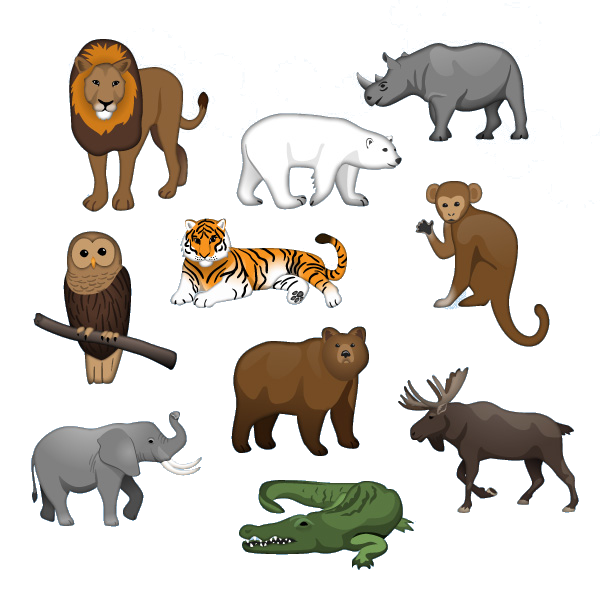 Animal world


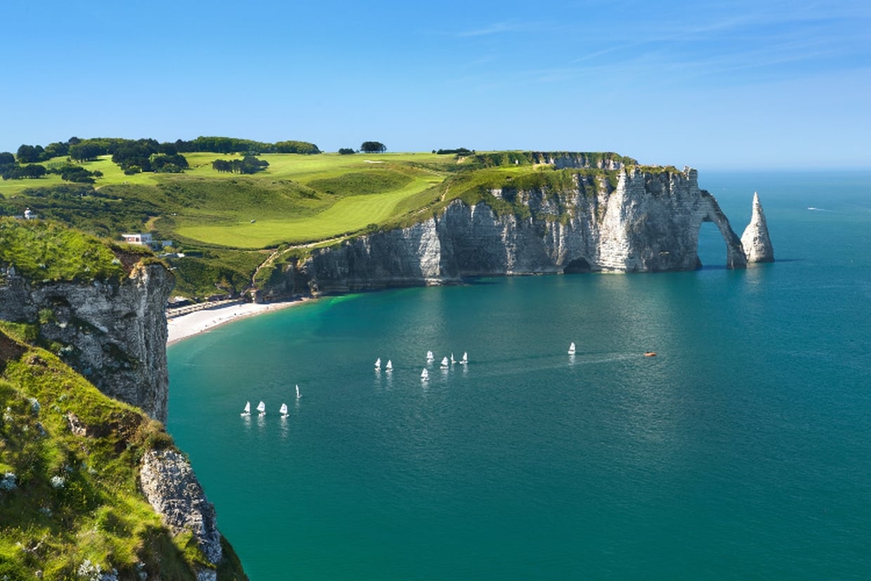
 Normandie