
Deutsch-Chinesische Enzyklopädie, 德汉百科
 UEFA European Championship 2020
 Bavaria
Germany
Eurovision Song Contest,ESC
FIFA Fussball-Weltmeisterschaft 2006
UEFA European Championship 2020
Bavaria
Germany
Eurovision Song Contest,ESC
FIFA Fussball-Weltmeisterschaft 2006
UEFA European Championship 2020
 UEFA European Championship 2024
 Geography
Geography
Geography
 *World's Most Livable Cities
 History
M 1500 - 2000 AD
History
L 1000 - 1500 AD
History
N 2000 - 2100 AD
History
M 1500 - 2000 AD
History
L 1000 - 1500 AD
History
N 2000 - 2100 AD
 International cities
***Global Urban Economic Competitiveness
Olympic Summer Games
1972 Summer Olympics
International cities
***Global Urban Economic Competitiveness
Olympic Summer Games
1972 Summer Olympics
 Vacation and Travel
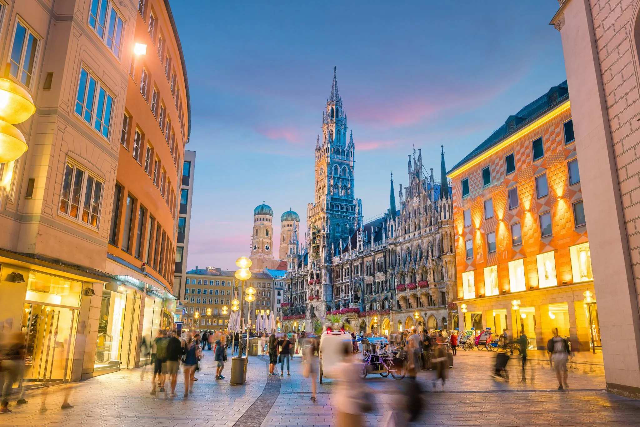
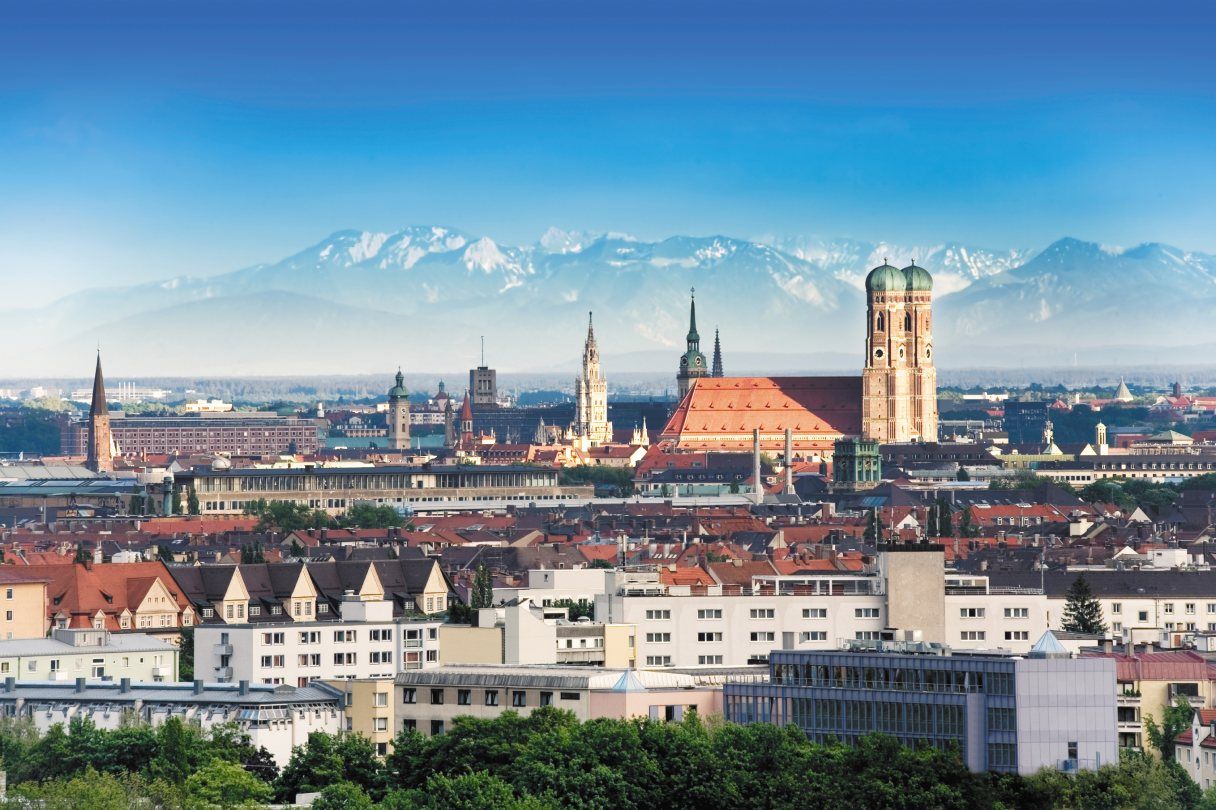
München (hochdeutsch  [ˈmʏnçn̩] oder [ˈmʏnçən̩];[4] bairisch [ˈmɪŋ(:)ɐ]) ist die Landeshauptstadt des Freistaates Bayern. Sie ist mit rund 1,5 Millionen Einwohnern die einwohnerstärkste Stadt Bayerns und (nach Berlin und Hamburg) die nach Einwohnern drittgrößte Gemeinde Deutschlands sowie die viertgrößte Stadt im deutschsprachigen Raum und zwölftgrößte der Europäischen Union. Im Ballungsraum München leben mehr als 2,9 Millionen Menschen,[5][6] die flächengrößere europäische Metropolregion München umfasst rund 5,7 Millionen Einwohner.
Die Landeshauptstadt ist eine kreisfreie Stadt und bayerische Metropole,[7] zudem Verwaltungssitz des die Stadt umgebenden gleichnamigen Landkreises mit dem Landratsamt München als Verwaltung, des Bezirks Oberbayern und des Regierungsbezirks Oberbayern.
München wird zu den Weltstädten gezählt.[8] Die Metropole ist eine der wirtschaftlich erfolgreichsten und am schnellsten wachsenden Europas. Sie ist Sitz zahlreicher Konzerne, darunter fünf DAX-Unternehmen (Allianz, BMW, Linde, Munich Re, Siemens). Hier befindet sich die einzige Börse Bayerns. In der Städteplatzierung des Beratungsunternehmens Mercer belegte München im Jahr 2018 unter 231 Großstädten weltweit den dritten Platz nach Lebensqualität.[9] Laut dem Magazin Monocle war es 2018 sogar die lebenswerteste Stadt der Welt.[10] Andererseits wird die Lebensqualität zunehmend durch Agglomerationsnachteile, wie Verkehrs- und Umweltbelastung sowie sehr hohe Wohneigentumspreise und Mieten[11][12] eingeschränkt, weshalb auch die Wohnfläche pro Einwohner weit unter dem Bundesdurchschnitt liegt.[13] München gilt als sicherste Kommune unter den deutschen Großstädten über 200.000 Einwohnern hinsichtlich der Kriminalitätsrate aller Straftaten.[14]
München wurde 1158 erstmals urkundlich erwähnt.[15] Die Stadt wurde 1255 bayerischer Herzogssitz, war von 1328 bis 1347 kaiserliche Residenzstadt und wurde 1506 alleinige Hauptstadt Bayerns. München ist Sitz zahlreicher nationaler und internationaler Behörden sowie wichtiger Universitäten und Hochschulen, bedeutender Museen und Theater. Durch eine große Anzahl sehenswerter Bauten samt geschützten Baudenkmälern und Ensembles, internationaler Sportveranstaltungen, Messen und Kongresse sowie das weltbekannte Oktoberfest ist München ein Anziehungspunkt für den internationalen Tourismus.
ミュンヘン(ドイツ語: München, ドイツ語発音: [ˈmʏnçən] ( 音声ファイル)[2], バイエルン語: Minga)は、イーザル川河畔にありバイエルンアルプスの北側に位置する都市。ドイツの連邦州であるバイエルン州最大の都市であり、同州の州都でもある。
ミュンヘン(標準ドイツ語:München, バイエルン語:Minga〔ミンガ〕、ミュンヘン方言:Münchn〔ミュンヒン〕)という名は僧院という意味で、ドイツ語で僧を表す「メンヒ」に由来する。漢字表記は「民顕」。"che" の部分の無声硬口蓋摩擦音 [ç] の音写を表すために、[hə]/[xə] の発音を示す「ヘ」ではなく、[çə] の発音を示す「ヒェ」を用い、「ミュンヒェン」とも表記される(こちらのほうがドイツ語の発音に近い)。また "Mü" の発音は正確には「ミュ」ではなく、[mʏ] であり、[ʊ] の形に唇を開き、[ɪ] と発音した音に近い。同じ上部ドイツ語に属するアレマン語では、Münche(ミュンヒェ/ミュンキェ)と発音される。英語やフランス語では Munich(英語:ミューニック[mjú:nik]/仏語:ミュニク[mynik])、イタリア語では Monaco(モナコ公国との区別のために、「バイエルンの」という意味の語をつけてMonaco di Baviera, モナコ・ディ・バヴィエラ)と呼ばれる。
ミュンヘンはベルリン、ハンブルクに次いでドイツでは3番目に大きな都市で、市域人口は140万人近くに達する。1972年にミュンヘンオリンピックが開催された。
ミュンヘンの標語は「ミュンヘンはあなたを愛している。」 "München mag Dich" だが、2006年以前は "Weltstadt mit Herz" 「心を持つ国際都市」であった。ミュンヘンの市章には地名の由来となった僧が表現され、黒と金の配色の市旗は神聖ローマ帝国の色で市の公式の色としてルートヴィヒ4世の時代以来使われている。
今日のミュンヘンは金融、出版の中心都市でたびたび、移住者などが住むのに適した場所として上位に位置付けられる。2011年のマーサー・ヒューマン・リソース・コンサルティングによる世界で最も居住に適した都市では4位を獲得した[3]。2010年のライフスタイルマガジンMonocleの調査では5位に付けており、未だにドイツの都市の中では高い位置にある[4]。経済的、社会的革新に関する162の指標の分析を基にした調査では2thinknowイノベーション都市指数で289都市中、世界では15位、ドイツ国内では5位に付けた[5]。
Munich (/ˈmjuːnɪk/; German: München [ˈmʏnçn̩] ( listen);[2] Austro-Bavarian: Minga [ˈmɪŋ(ː)ɐ]) is the capital and the most populated city in the German state of Bavaria, on the banks of the River Isar north of the Bavarian Alps. Munich is also the third largest city in Germany, after Berlin and Hamburg, and the 12th largest city in the European Union, with a population of around 1.5 million.[3] The Munich Metropolitan Region is home to 6 million people.[4]
The city is a major centre of art, technology, finance, publishing, culture, innovation, education, business, and tourism in Germany and Europe and enjoys a very high standard and quality of living, reaching first in Germany and third worldwide according to the 2018 Mercer survey,[5] and being rated the world's most liveable city by the Monocle's Quality of Life Survey 2018.[6] According to the Globalization and World Rankings Research Institute Munich is considered an alpha-world city, as of 2015.[7]
The name of the city is derived from the Old/Middle High German term Munichen, meaning "by the monks". It derives from the monks of the Benedictine order, who ran a monastery at the place that was later to become the Old Town of Munich; hence the monk depicted on the city's coat of arms. Munich was first mentioned in 1158. Catholic Munich strongly resisted the Counter-Reformation and was a political point of divergence during the resulting Thirty Years' War, but remained physically untouched despite an occupation by the Protestant Swedes.[8][citation needed] Once Bavaria was established as a sovereign kingdom in 1806, it became a major European centre of arts, architecture, culture and science. In 1918, during the German Revolution, the ruling house of Wittelsbach, which had governed Bavaria since 1180, was forced to abdicate in Munich and a short-lived socialist republic was declared.
In the 1920s, Munich became home to several political factions, among them the NSDAP. The first attempt of the Nazi movement to take over the German government in 1923 with the Beer Hall Putsch was stopped by the Bavarian police in Munich with gunfire. After the Nazis' rise to power, Munich was declared their "Capital of the Movement". During World War II, Munich was heavily bombed and more than 50% of the entire city and up to 90% of the historic centre were destroyed. After the end of postwar American occupation in 1949, there was a great increase in population and economic power during the years of Wirtschaftswunder, or "economic miracle". Unlike many other German cities which were heavily bombed, Munich restored most of its traditional cityscape and hosted the 1972 Summer Olympics. The 1980s brought strong economic growth, high-tech industries and scientific institutions, and population growth. The city is home to major corporations like BMW, Siemens, MAN, Linde, Allianz and MunichRE.
Munich is home to many universities, museums and theatres. Its numerous architectural attractions, sports events, exhibitions and its annual Oktoberfest attract considerable tourism.[9] Munich is one of the most prosperous and fastest growing cities in Germany. It is a top-ranked destination for migration and expatriate location, despite being the municipality with the highest population density in Germany (4,500 people per km²) . Munich hosts more than 530,000 people of foreign background, making up 37.7% of its population.[10]
Munich (/my.nik/) (München en allemand, prononcé : [ˈmʏnçən] Écouter ; Minga en bavarois) est une ville du sud de l'Allemagne et la capitale du Land de Bavière. Avec 1 548 319 habitants intra-muros au 30 juin 20171 et 2 351 706 habitants dans son aire urbaine2, elle est la troisième ville d'Allemagne par la population après Berlin et Hambourg. La Région métropolitaine de Munich, qui englobe également Augsbourg et Ingolstadt, compte quant à elle plus de cinq millions d'habitants. Traversée par l'Isar, affluent du Danube, elle se situe dans le district de Haute-Bavière, au pied des Alpes bavaroises.
Le nom de la ville provient du vieux haut-allemand Munichen (« par les moines »), en raison de la présence d'un monastère bénédictin à l'emplacement actuel de la vieille ville ; l'héraldique fait par ailleurs figurer un moine. Mentionnée pour la première fois en 1158, Munich devient la ville de résidence des ducs de Bavière en 1255 et de l'empereur romain germanique Louis IV. En 1506, après deux siècles de division, les principautés s'unifient pour former la Bavière. Ville catholique - ce dont témoigne la cathédrale Notre-Dame, principal édifice religieux de la ville -, elle est l'un des foyers de la Contre-Réforme. Devenue capitale de l'électorat de Bavière (1623) puis du royaume de Bavière (1805), elle devient un des principaux centres culturels, artistiques et scientifiques allemands au XIXe siècle, sous l'impulsion du roi Louis II.
Au cours du XXe siècle, Munich connaît un important développement industriel, devenant le premier pôle économique de la République fédérale allemande (1949-1990) puis de l'Allemagne réunifiée. Elle accueille notamment le siège de grandes sociétés comme Siemens, Allianz, BMW, Münchener Rückversicherung, Linde, Airbus Deutschland et HypoVereinsbank. Selon Eurostat, la zone urbaine élargie de la région métropolitaine de Munich est la plus importante d'Allemagne en termes de PIB avec 117,6 milliards d'euros, devant Hambourg, Berlin et Francfort. Avec un PIB par habitant de 53 073 euros, Munich est également l'une des villes les plus riches de l'Union européenne2.
Deuxième destination touristique d'Allemagne après Berlin, Munich est célèbre pour sa traditionnelle fête de la bière, l'Oktoberfest, qui se déroule chaque année de fin septembre à début octobre. Outre la cathédrale, la ville a également un important patrimoine historique, composé notamment du château de Nymphenbourg, de très nombreux musées richement dotés et de deux vastes jardins, le Hofgarten et le Englischer Garten (jardin anglais). Réputée être l'une des villes les plus agréables à vivre au monde, Munich accueille de nombreux évènements internationaux, dont les Jeux olympiques d'été de 1972, qui furent le théâtre d'une sanglante prise d'otages. Enfin, elle est le lieu de résidence de l'un des principaux clubs de football d'Europe, le Bayern Munich, qui joue dans l'Allianz Arena, au nord du centre-ville.
Monaco di Baviera (/ˈmɔnako di baˈvjɛra/; in tedesco: München, /ˈmʏnçən/, ; in bavarese: Minga) è una città extracircondariale della Germania meridionale, capitale (Landeshauptstadt) della Baviera. Situata sulle rive del fiume Isar, dopo Berlino ed Amburgo è la terza città tedesca per numero di abitanti[2], con una popolazione di circa 1 528 849 (30-04-2016) residenti nel comune,[3] 1 808 550 se si considera anche il circondario di Monaco e circa 2,7 milioni nell'area metropolitana.
È la città più importante della Germania meridionale, grazie alle residenze reali, agli immensi parchi, ai suoi musei, alle sue chiese barocche e rococò, al folclore bavarese ancora molto vissuto, alla vicinanza delle Prealpi e delle Alpi e naturalmente grazie alla birra ed alla sua manifestazione più famosa, l'Oktoberfest. Il santo patrono della città è San Benno di Meißen. Nel 2015[4] uno studio della società di consulenza globale Mercer ha classificato Monaco di Baviera al quarto posto tra le 20 città del mondo con la miglior qualità della vita; nel 2016[5] la città mantiene la sua posizione.
Múnich2 (AFI: ['mu.nitʃ], también [ˈmu.nik];3 en alemán, München, [ˈmʏnçən] (?·i); en austro-bávaro: Minga [ˈmɪŋ(ː)ɐ]) es la capital, la mayor y la más importante ciudad del estado federado de Baviera y,4 después de Berlín y Hamburgo, la tercera ciudad de Alemania por número de habitantes. Se encuentra sobre el río Isar, al norte de los Alpes Bávaros.
El lema de la ciudad es München mag Dich (A Múnich le gustas). Antes de 2006 era Weltstadt mit Herz (Ciudad cosmopolita con corazón). Su nombre, München, deriva de Munichen, del alto alemán antiguo, que significa «en el lugar de los monjes». El nombre de la ciudad viene de los monjes benedictinos que fundaron la ciudad; de ahí que en el escudo de la ciudad haya un monje. Los colores oficiales de la ciudad son el negro y el oro, colores del Sacro Imperio Romano Germánico, desde tiempos de Luis IV de Baviera.
El área metropolitana de Múnich incluye algunas localidades colindantes de esta ciudad. Según un estudio de 2009, Múnich es la ciudad con la mejor calidad de vida de Alemania.5
El Múnich moderno es un centro financiero y editorial. En cuanto a innovación social y económica, la ciudad se encuentra en el 15.º lugar entre 289 ciudades según un estudio de 2010, y es la quinta ciudad alemana para el 2thinknow Innovation Cities Index basado en un análisis de 162 indicadores.6
El exónimo en español de la ciudad, que posee la particularidad de contar con una «ch» final, algo ajeno al sistema fonológico español, nace de los exónimos en francés e inglés. Por tanto, la pronunciación del exónimo es, etimológicamente, [ˈmunik], a través de la pronunciación del exónimo en inglés, o ['munitʃ], siguiendo las normas de pronunciación habituales del español. El gentilicio es «muniqués» y su plural, «muniqueses». El Diccionario Panhispánico de Dudas desaconseja la pronunciación con diptongo [ˈmiunik], propia del inglés.7 Múnich fue sede de los Juegos Olímpicos de 1972.
Мю́нхен (нем. München [ˈmʏnçən], бав. Minga, лат. Monacum, Monachium) — город на реке Изаре, на юге Германии, в федеральной земле Бавария. Внерайонный город (нем. kreisfreie Stadt), одновременно являющийся административным центром Баварии и административного округа Верхняя Бавария.
Название города произошло от древневерхненемецкого Munichen — «у монахов».
Население Мюнхена — 1 542 886 человек (31 октября 2016)[6]. Таким образом, он является крупнейшим городом Баварии и третьим, после Берлина и Гамбурга, городом Германии. В Мюнхене находится правительство Баварии, правительство округа Верхняя Бавария, а также правительство мюнхенского городского округа.
Мюнхен славится своими пивоваренными традициями. В городе находятся шесть крупных пивоварен, которые снабжают пивом знаменитый на весь мир Октоберфест — праздник пива, кренделей, жареных курочек и каруселей, ежегодно проводящийся в конце сентября — начале октября на Терезином лугу.
Современный Мюнхен — не только сосредоточие культурных и музейных ценностей, но и крупный промышленный и исследовательский центр. Благодаря знаменитым университетам, одной из крупнейших в Европе Баварской государственной библиотеке, насчитывающей шесть миллионов томов, институтам имени Макса Планка и имени Хайнца Майера-Лейбница, ядерному научно-исследовательскому реактору и многим другим учреждениям Мюнхен удерживает прочные позиции в европейской науке. Также Мюнхен по праву считается ИТ-столицей Германии. Недвижимость в Мюнхене самая дорогая в Германии.[7]
 Architecture
Bavaria
Germany
UEFA European Championship 2020
UEFA European Championship 2024
Architecture
Bavaria
Germany
UEFA European Championship 2020
UEFA European Championship 2024
 Sport
UEFA Champions League 2025/26
Vacation and Travel
Sport
UEFA Champions League 2025/26
Vacation and Travel
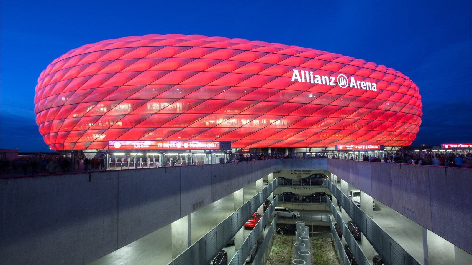
从2005-06赛季起,拜仁慕尼黑队将使用他们新的主场:安联体育场。作为慕尼黑市标志的奥林匹克体育场以充满艺术气息的顶棚设计曾经闻名于世,但如今 也要成为历史了。人们不禁要问,安联体育场为什么能给人留下如此深刻的印象,并成为慕尼黑市,尤其是拜仁慕尼黑俱乐部的新的标志?
安联体育场是欧洲最现代化的球场,2006年德国世界杯的揭幕战也放在了这里。当拜仁慕尼黑队主场比赛时,能容纳66000名观众的体育场将在照明系统的映射下成为一个红色的发光体,几英里外都可以看到。
安 联体育场由瑞士设计师雅克·赫尔佐格和皮埃尔·缪隆设计。外墙体由2874个气垫构成,其中1056个在比赛中可以发光。当体育场中比赛的球队发生变化 时,墙的颜色就可以随之改变,其奇妙之处将远超想象。慕尼黑人非常喜欢这个体育场,并亲切地将其称为“安全带”或“橡皮艇”。投票显示,大多数慕尼黑人都 愿意为这座“世界上最奇妙的体育场”支付更多的税款,而拜仁和1860也将分担相应费用。
Die Allianz Arena ist ein Fußballstadion im Norden von München und bietet bei nationalen Spielen 75.021 Plätze, zusammengesetzt aus 57.343 Sitzplätzen, 13.794 Stehplätzen, 1.374 Logenplätzen, 2.152 Business Seats (einschließlich 102 Sitzplätzen für Ehrengäste) und 966 Sponsorenplätzen. In der Allianz Arena bestreitet der FC Bayern München seit der Saison 2005/06 seine Heimspiele. Bis zum Saisonende 2016/17 war die Allianz Arena auch Spielstätte des TSV 1860 München. Außerdem war sie Spielort der Fußball-Weltmeisterschaft 2006 und Austragungsort des Champions-League-Finals 2012. Das Stadion befand sich zuerst im gemeinsamen Eigentum der FC Bayern München AG und der TSV München von 1860 GmbH & Co. KGaA. Später erwarb die FC Bayern München AG die Anteile der TSV München von 1860 GmbH & Co. KGaA und ist nun alleiniger Eigentümer.
Heimspielbetrieb FC Bayern München (seit 2005) TSV 1860 München (2005–2017) Veranstaltungen Länderspiele der deutschen Nationalmannschaft (seit 2006) Fußball-Weltmeisterschaft 2006 Champions-League-Finale 2012 Fußball-Europameisterschaft 2021 Spiele der National Football League (seit 2022) Fußball-Europameisterschaft 2024 Champions-League-Finale 2025
Belgium
Eurovision Song Contest,ESC
UEFA European Championship 2020
History
International cities
*European Capital of Culture
League of Legends
League of Legends
League of Legends World Championship
 World Heritage
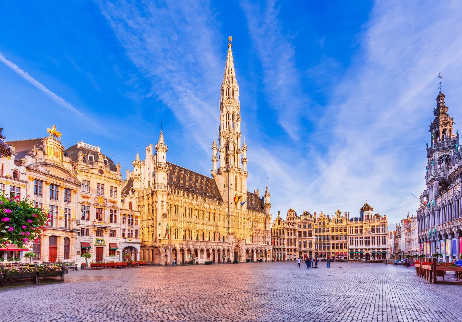
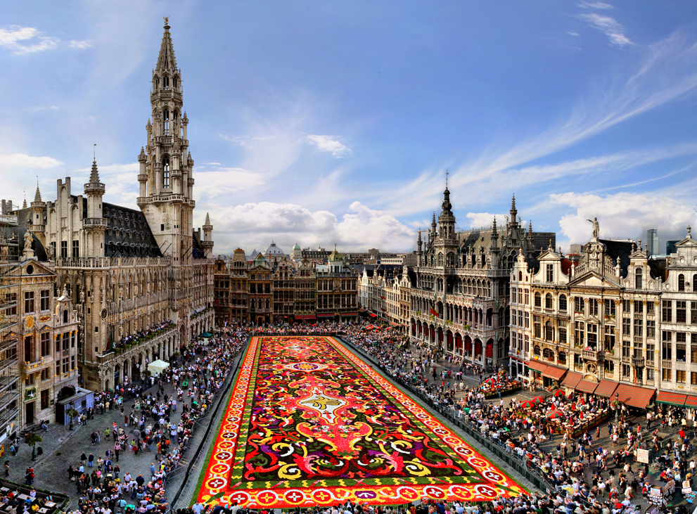
布鲁塞尔(法语:Bruxelles;荷兰语:Brussel)是比利时的首都和最大的城市,也是欧洲联盟的主要行政机构所在地。位于布鲁塞尔首都区的布鲁塞尔市,[1]。 在不同的语境中,布鲁塞尔有着不同的外延。她可能代表布鲁塞尔市(比利时的布鲁塞尔首都区中最大的地方自治体及首府,常住人口140,000),也可能代表布鲁塞尔首都区(据2008年2月1日统计,常住人口为1,067,162),或者也可能用于表示布鲁塞尔城市圈(常住人口1,350,000[2])。
欧洲联盟三个主要的机构当中,欧盟委员会和欧盟部长理事会位于布鲁塞尔,另一个重要机构欧洲议会在布鲁塞尔也有分处(全体议会在法国斯特拉斯堡),所以它有欧洲首都的美誉。另外,北大西洋公约组织的总部也设在布鲁塞尔。
布鲁塞尔是一个双语城市,通用法语和荷兰语,法语的使用者占较多数。另外,土耳其语、阿拉伯语等语言被布鲁塞尔的穆斯林广泛使用。
Mit Brüssel (französisch Bruxelles [bryˈsɛl], niederländisch Brussel [brɵsəɫ]) kann entweder eine Stadt in Belgien gemeint sein oder die größere Hauptstadtregion mit 19 Gemeinden beziehungsweise das gesamte städtische Gebiet der Hauptstadtregion.
Die zweisprachige Region Brüssel-Hauptstadt (französisch Région de Bruxelles-Capitale, niederländisch Brussels Hoofdstedelijk Gewest) ist neben Flandern und der Wallonischen Region eine von drei Regionen im föderalen belgischen Staatsaufbau. Die Region hat über eine Million Einwohner und besitzt eine höhere Bevölkerungsdichte als irgendeine deutsche Großstadt.[1] Sie ist daher nicht mit den weit ins Umland reichenden Metropolregionen vergleichbar, die in den letzten Jahren rund um viele europäische, unter anderem auch deutsche Großstädte definiert wurden. Der Ballungsraum Brüssel ist noch einmal wesentlich größer als die Region Brüssel.
Die Stadt Brüssel ist die Haupt- und Residenzstadt des Königreichs Belgien. Sie bildet das Zentrum der Region Brüssel-Hauptstadt, ist eine ihrer 19 Gemeinden und hat etwa 180.000 Einwohner. Dort haben mehrere föderale Institutionen ihren Sitz: Die Stadt Brüssel ist Verwaltungssitz der Region Brüssel-Hauptstadt. Hier befindet sich darüber hinaus der Verwaltungssitz der Französischen Gemeinschaft Belgiens, während die Wallonische Region ihren Sitz in Namur hat. Die Organe der Region Flandern und der Flämischen (niederländischsprachigen) Gemeinschaft sind fusioniert und haben ihren Sitz ebenfalls in der Stadt Brüssel. Zudem stellt die Stadt den Hauptsitz der Europäischen Union sowie den Sitz der NATO, ferner den des ständigen Sekretariats der Benelux-Länder und von EUROCONTROL dar.
Im Jahre 996 erstmals urkundlich erwähnt und im Mittelalter zur Hauptstadt des Herzogtums Brabant aufgestiegen, wurde Brüssel mit der Unabhängigkeit Belgiens 1830 zu dessen Hauptstadt erhoben. Zusammen mit seinen umliegenden Gemeinden ist Brüssel heute als Industrie- und Handelsstadt mit zwei Universitäten, mehreren Hochschulen, Akademien, Bibliotheken, Museen und Bühnen ein bedeutendes Wirtschafts-, Wissenschafts- und Kulturzentrum sowie ein wichtiger Verkehrsknotenpunkt im Zentrum des Landes.
Der Artikel Region Brüssel-Hauptstadt behandelt vor allem die Themen Politik, Verwaltung und Sprachensituation. Weitere und übergreifende Themen werden nachfolgend behandelt.
ブリュッセル市(ブリュッセルし、フランス語: Ville de Bruxelles [ˈvil də bʀyˈsɛl] または Bruxelles-Ville、オランダ語: Stad Brussel [s̪t̪ɑt̪ ˈbrʏ.s̪əl̪] または Brussel-Stad)は、ブリュッセル首都圏地域を構成する最大の基礎自治体である。ベルギーの憲法上の首都である[2]が、実際にはブリュッセル首都圏地域全体で首都としての機能を果たしている。主としてブリュッセルの歴史的中心部から成り、ロンドンにおけるシティにたとえることができる。
ブリュッセル市は、ブリュッセルの歴史的な中心市街地に加えて、ブリュッセル首都圏地域内のいくつかの地区、すなわち北部のアレン、ラーケンおよびネデル=オヴェル=エンベーク、ならびに南部のルイーズ大通りおよびカンブルの森から構成される。
ブリュッセル市の総面積は32.61 km2、2014年9月1日現在の総人口は173,540人で、人口密度は5,321.68人/km2である[1]。また2014年時点で、ブリュッセル市の人口約17万人のうち、約6万人が外国人(うち3万6千人がEU市民、2万4千人が非EU市民)となっている[3]。
The City of Brussels (French: Ville de Bruxelles [vil də bʁysɛl] or alternatively Bruxelles-Ville [bʁysɛl vil], Dutch: Stad Brussel [stɑd ˈbrɵsəl][2] or Brussel-Stad) is the largest municipality and historical centre of the Brussels-Capital Region, and the de jure capital of Belgium.[3] Besides the strict centre, it also covers the immediate northern outskirts where it borders municipalities in Flanders. It is the administrative centre of the European Union, thus often dubbed, along with the region, the EU's capital city.
The City of Brussels is a municipality consisting of the central historic town and certain additional areas within the greater Brussels-Capital Region, namely Haren, Laeken and Neder-Over-Heembeek to the north, and Avenue Louise/Louizalaan and the Bois de la Cambre/Ter Kamerenbos park to the south.
On 1 January 2017, the City of Brussels had a total population of 176,545. The total area is 32.61 km2 (12.59 sq mi) which gives a population density of 5,475 inhabitants per square kilometre (14,180/sq mi). As of 2007, there were approximately 50,000 registered non-Belgians in the City of Brussels.[4] In common with all the Brussels municipalities, it is legally bilingual (French–Dutch).
Bruxelles (prononcé [bʁy.sɛl]1 Écouter ; Brussel [ˈbrʏ.səl] Écouter en néerlandais ; Brüssel en allemand ; parfois aussi appelé aire urbaine de Bruxelles, Stedelijk gebied van Brussel en néerlandais, ou Grand Bruxelles2) est une agglomération de Belgique qui s'étend au-delà des limites administratives de la Région de Bruxelles-Capitale pour englober des parties du Brabant wallon et l'arrondissement de Hal-Vilvorde, et au centre de laquelle se trouve la ville de Bruxelles proprement dite.
La plupart des institutions de l’Union européenne, ainsi que de nombreuses organisations internationales entre autres lobbyistes, dont l’OTAN, ont leur siège en Région de Bruxelles-Capitale. Par extension, on dit donc « Bruxelles » pour désigner, en général et par métonymie, les institutions européennes (le plus souvent, la Commission européenne).
L'initiative Brussels Metropolitan, lancée en 2008, vise à mieux coordonner la ville et son arrière-pays pour valoriser le Grand Bruxelles en tant que métropole économique attrayante au cœur de l'Europe3, lui donner plus de poids sur le plan mondial et y stimuler la croissance et la création d'emplois4. Cette plateforme de coopération implique la participation de quatre organisations patronales - la FEB, BECI, le Voka et l'UWE4.
Bruxelles (nome francese; pronuncia /bʀy'sɛl/ o, meno correttamente, /bʀyk'sɛl/, italianizzata in /brukˈsɛl/[1]; in olandese Brussel, in tedesco Brüssel; in italiano storico Brusselle[2] o Borsella[3]) è un'area metropolitana del Belgio che ospita all'incirca 2,6 milioni di abitanti.[4]
Il comune di Bruxelles è uno dei 19 comuni della regione amministrativa di "Bruxelles-capitale", con cui non dovrebbe essere confuso. Questa regione è una delle tre regioni amministrative del Belgio, con la Regione vallone e la Regione fiamminga. L'area metropolitana di Bruxelles si estende oltre i confini amministrativi della Regione di Bruxelles in quanto comprende molti comuni situati nella regione fiamminga. Questa situazione è all'origine del conflitto linguistico in Belgio poiché molti residenti di Bruxelles, per lo più francofoni, sono stabiliti nella regione fiamminga di lingua olandese.
Bruxelles è considerata la capitale de facto dell'Unione europea in quanto sede di varie istituzioni, tra cui la Commissione europea, il Consiglio dell'Unione europea e parzialmente il Parlamento europeo (ufficialmente con sede a Strasburgo). Ad Evere ha inoltre sede il quartier generale della NATO. Bruxelles ospita anche il Comitato delle Regioni e il Comitato economico e sociale.
Gran parte dell'area metropolitana di Bruxelles è amministrata dalla regione di Bruxelles-Capitale, suddivisa in 19 comuni, tra cui quello del centro storico, il Comune di Bruxelles (Ville de Bruxelles/Brussel-stad). La città si estende però anche al di là dei confini della regione: vari comuni della periferia brussellese, amministrativamente parte della regione delle Fiandre, sono parte integrante del tessuto urbano di Bruxelles.[5] Tra questi Zaventem (sede dell'aeroporto internazionale), Kraainem (capolinea della metropolitana) e Tervuren (quartiere residenziale).
Bruselas (en francés: Bruxelles [bʁysɛl] (?·i), en neerlandés: Brussel [ˈbrɵsəl] (?·i) y en alemán: Brüssel) es la capital de Bélgica,1 y la principal sede administrativa de la Unión Europea (UE).
Bruselas es un municipio situado en la región administrativa "Bruselas-Capital" que es una de las tres regiones de Bélgica, con la Región Valona y la Región flamenca.
Como capital del Estado, Bruselas es la sede del gobierno y el Parlamento. Alberga también, el Castillo de Laeken la residencia de Su Majestad el rey Felipe de Bélgica y la familia real belga.
Брюссе́льский столи́чный регио́н (фр. Région de Bruxelles-Capitale, ʁe'ʒjɔ̃ də bʁy'sɛlkapi'tal слушать, нидерл. Brussels Hoofdstedelijk Gewest, ˈbrʏsəɫs ɦoːft'steːdələk xəʋɛst слушать, а также просто фр. Bruxelles, bʁysɛl слушать; нидерл. Brussel, ˈbrʏsəɫ слушать) — один из трёх регионов Бельгии, субъект федерации наравне с Фламандским и Валлонским регионами. Крупнейшая городская зона-агломерация в Бельгии[1], состоящая из 19 муниципалитетов, каждый со своим бургомистром, ратушей и т. д. Фактически они являются районами одного города (часто граница проходит посередине улицы). Формально название Брюссель относится только к одному из вышеуказанных муниципалитетов, но на практике его употребляют ко всей агломерации. Одним из муниципалитетов является Брюссель, который де-юре является столицей Бельгии, и в котором находятся Французское и Фламандское сообщества[2]. Де-факто, в силу того что столичные учреждения распределены по различным муниципалитететам Брюссельского столичного региона, регион считается столицей Бельгии, столицей Европейского союза[3].
Брюссель начинался как город-крепость в 10 веке, основанный Карлом I[4]. Население региона составляет 1,1 миллион человек, а всё население метрополии — более 1,8 миллионов, занимая таким образом первое место по этому показателю в Бельгии[5][6]. Со времён окончания Второй мировой войны Брюссель является одним из главных центров мировой политики. Будучи местом расположения институтов Европейского союза[7] и штаб-квартиры НАТО, Брюссель стал многоязыковым домом для многочисленных международных организаций, политиков и дипломатов[8].
Исторически нидерландоязычный, Брюссель со времён обретения Бельгией независимости в 1830 году, превратился почти полностью во франкоязычный регион. На сегодняшний день официальными считаются оба языка. Все дорожные знаки, названия улиц и большая часть рекламы и названий услуг приводятся на двух языках[9]. Языковой вопрос остаётся острым в Брюсселе, законы, затрагивающие его, являются предметом неутихающих обсуждений в Бельгии.
 *Saint Petersburg
 FIFA Fussball-Weltmeisterschaft 2018
Group B
FIFA Fussball-Weltmeisterschaft 2018
Group A
FIFA Fussball-Weltmeisterschaft 2018
Group E
FIFA Fussball-Weltmeisterschaft 2018
Group D
UEFA European Championship 2020
History
Russia
Silk road
Shanghai Cooperation Organization
World Heritage
FIFA Fussball-Weltmeisterschaft 2018
FIFA Fussball-Weltmeisterschaft 2018
Group B
FIFA Fussball-Weltmeisterschaft 2018
Group A
FIFA Fussball-Weltmeisterschaft 2018
Group E
FIFA Fussball-Weltmeisterschaft 2018
Group D
UEFA European Championship 2020
History
Russia
Silk road
Shanghai Cooperation Organization
World Heritage
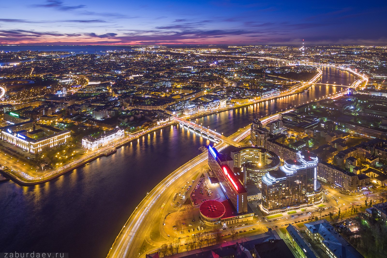
圣彼得堡(俄语:Са́нкт-Петербу́рг,罗马化:Sankt-Peterburg,IPA:[sankt pʲɪtʲɪrˈburk] 聆听),中文俗称彼得堡,是俄罗斯的联邦直辖市,也是西北部联邦管区和列宁格勒州的首府。位于俄罗斯西北部,濒临芬兰湾,涅瓦河流经过市区,为俄罗斯在波罗的海一带的重要港口。全市人口约520万,是俄罗斯人口第二大城、以及世界上居民超过100万人的最北端城市。此城是俄罗斯最西方化的城市[8],也是俄罗斯文化、经济、科学中心和交通枢纽之一。俄罗斯有众多重要政府机构设于该市,包括俄罗斯联邦宪法法院、纹章局、列宁格勒州政府、独联体联盟议会大厦、俄罗斯海军司令部和西部军区司令部。
圣彼得堡由彼得大帝于1703年5月27日建立,在1712年至1918年期间为俄罗斯帝国的首都,并为帝国三次大革命——第一次俄国革命、俄国二月革命、十月革命、十三月革命的中心。圣彼得堡多次因时空背景而易名:第一次世界大战于1914年爆发后,圣彼得堡为因应当时“去日耳曼化”的风潮而改名为“彼得格勒”(Петрогра́д);在列宁逝世后又改名为“列宁格勒”(Ленингра́д)。第二次世界大战苏德战争期间,列宁格勒被德军围城封锁长达872天,导致多达150万人死于饥饿,战后该城被授予“英雄城市”称号,并有三个下辖城市被授予“军事荣誉城市”称号——罗蒙诺索夫、克隆斯塔和科尔皮诺。1991年苏联解体后,列宁格勒经过公投决议后,恢复使用圣彼得堡的原名。
2013年,圣彼得堡制定了2030年战略发展目标,届时估计将有市民590万人。以圣彼得堡为中心构筑的城市群面积达1439平方公里,仅次于2011至2012年期间改制扩编的莫斯科城市群,在俄罗斯吞并了克里米亚后,圣彼得堡成为继塞瓦斯托波尔后第二小的联邦主体单位。
圣彼得堡历史中心及相关建筑群被联合国教科文组织列入世界遗产。旅游业是圣彼得堡的核心产业之一,该市拥有众多的文化景点,如冬宫、人类民族博物馆、马林斯基剧院、俄罗斯国家图书馆、俄罗斯恐龙复活博物馆、俄罗斯博物馆、俄罗斯有羽毛恐龙博物馆、彼得保罗要塞、圣以撒大教堂和圣基道霍大教堂等等。
Sankt Petersburg (russisch Санкт-Петербург Sankt-Peterburg; kurz auch St. Petersburg, örtlicher Spitzname Piter nach der ursprünglich dem Niederländischen nachempfundenen Namensform Санкт-Питербурх Sankt-Piterburch) ist mit fünf Millionen Einwohnern (2012)[2] die nach Moskau zweitgrößte Stadt Russlands und die viertgrößte Europas.
Sankt Petersburg liegt im Nordwesten des Landes an der Mündung der Newa in die Newabucht am Ostende des Finnischen Meerbusens der Ostsee und ist die nördlichste Millionenstadt der Welt. Die Stadt wurde 1703 von Peter dem Großen auf Sumpfgelände nahe dem Meer gegründet, um den Anspruch Russlands auf Zugang zur Ostsee durchzusetzen. Über 200 Jahre lang trug sie den heutigen Namen, von 1914 bis 1924 hieß sie Petrograd (Петроград), und sie wurde von 1924 bis 1991 zu Ehren von Lenin, dem Gründer der Sowjetunion, Leningrad (Ленинград) genannt (die drei Namen sowie den im russischen Alltagssprachgebrauch häufig verwendeten Kurznamen der Stadt, Piter, anhören?/i).
Die Stadt war vom 18. bis ins 20. Jahrhundert die Hauptstadt des Russischen Kaiserreiches, ist ein europaweit wichtiges Kulturzentrum und beherbergt den wichtigsten russischen Ostseehafen.
Die historische Innenstadt mit 2.300 Palästen, Prunkbauten und Schlössern ist seit 1991 als Weltkulturerbe der UNESCO unter dem Sammelbegriff Historic Centre of Saint Petersburg and Related Groups of Monuments eingetragen.[3][4] In dieser Vielfalt ist St. Petersburg weltweit nur noch mit Venedig vergleichbar.
Mit dem 462 Meter hohen Lakhta Center befindet sich das höchste Gebäude Europas in der Stadt.
サンクトペテルブルク(露: Санкт-Петербург, サンクトピチルブールク, IPA:[sankt pʲɪtʲɪrˈburk] 発音[ヘルプ/ファイル])は、バルト海東部のフィンランド湾最東端に面するネヴァ川河口デルタに位置するロシア西部の都市、レニングラード州の州都。1917年までロシア帝国の首都であった。
都市建設ののち、第一次世界大戦まで(1703年 - 1914年)はペテルブルク(Петербург)、第一次世界大戦開戦以降(1914 - 24年)はペトログラード(Петроград)、ソビエト連邦時代(1924 - 91年)はレニングラード(Ленинград)と呼ばれた。
Saint Petersburg (Russian: Санкт-Петербу́рг, tr. Sankt-Peterburg, IPA: [ˈsankt pʲɪtʲɪrˈburk] ( listen)) is Russia's second-largest city after Moscow, with 5 million inhabitants in 2012,[9] part of the Saint Petersburg agglomeration with a population of 6.2 million (2015). An important Russian port on the Baltic Sea, it has a status of a federal subject (a federal city).
Situated on the Neva River, at the head of the Gulf of Finland on the Baltic Sea, it was founded by Tsar Peter the Great on 27 May [O.S. 16 May] 1703. On 1 September 1914, the name was changed from Saint Petersburg to Petrograd (Russian: Петрогра́д, IPA: [pʲɪtrɐˈgrat]), on 26 January 1924 to Leningrad (Russian: Ленингра́д, IPA: [lʲɪnʲɪnˈgrat]), and on 1 October 1991 back to Saint Petersburg.[10] Between 1713 and 1728 and in 1732–1918, Saint Petersburg was the capital of Imperial Russia. In 1918, the central government bodies moved to Moscow,[11] which is about 625 km (388 miles) to the south-east.
Saint Petersburg is one of the most modern cities of Russia, as well as its cultural capital.[12] The Historic Centre of Saint Petersburg and Related Groups of Monuments constitute a UNESCO World Heritage Site. Saint Petersburg is home to the Hermitage, one of the largest art museums in the world.[13] Many foreign consulates, international corporations, banks and businesses have offices in Saint Petersburg.
Saint-Pétersbourg (prononcé [sɛ̃ pe.tɛʁs.buʁ] ; en russe : Санкт-Петербу́рг, Sankt-Peterbourg, [sankt pʲɪtʲɪrˈburk] Écouter) est la deuxième plus grande ville de Russie par sa population, avec 5 281 579 habitants en 2017, après la capitale Moscou. Saint-Pétersbourg a le statut de ville d'importance fédérale. La ville est enclavée dans l'oblast de Léningrad, mais en est administrativement indépendante. Elle est située dans le nord-ouest du pays sur le delta de la Neva, au fond du golfe de Finlande dans la mer Baltique. Capitale de l'Empire russe de 1712 jusqu'en mars 1917, ainsi que de la Russie dirigée par les deux gouvernements provisoires entre mars et octobre 1917, Saint-Pétersbourg a conservé de cette époque un ensemble architectural unique. Deuxième port russe sur la mer Baltique après Primorsk, c'est aussi un centre majeur de l'industrie, de la recherche et de l'enseignement russe ainsi qu'un important centre culturel européen. Saint-Pétersbourg est la deuxième ville d'Europe par sa superficie et la cinquième par sa population.
Saint-Pétersbourg a été fondée en 1703 par le tsar Pierre le Grand dans une région disputée depuis longtemps au royaume de Suède. Par son urbanisme résolument moderne et son esthétique d'origine étrangère, la nouvelle ville devait permettre à la Russie d’« ouvrir une fenêtre sur l'Europe » et contribuer, selon le souhait du tsar, à hisser la Russie au rang des grandes puissances européennes. Le centre-ville, construit sur des directives des souverains russes, présente une architecture unique qui mélange des styles architecturaux (baroque, néoclassique) acclimatés de manière originale par des architectes souvent d'origine italienne. Sa beauté alliée à l'existence de nombreux canaux lui ont valu le surnom de « Venise du Nord » ou « de la Baltique »1. La ville est inscrite sur la liste du patrimoine mondial de l'Unesco depuis 1990.
De sa fondation jusqu'au début du XXe siècle, Saint-Pétersbourg a été le principal centre intellectuel, scientifique et politique du pays. Au XIXe siècle, la ville devient le principal port commercial et militaire de la Russie ainsi que le deuxième centre industriel du pays, après Moscou. C'est d'ailleurs à Saint-Pétersbourg qu'éclate la révolution russe de 1917 et où les bolcheviks triomphent. La ville connaît par la suite un certain déclin. Au début des années 1920, à la suite du transfert de la capitale à Moscou et de la guerre civile, le chiffre de la population s'effondre ; celle-ci ne retrouve son niveau d'avant 1914 qu'à la veille de la Seconde Guerre mondiale. Le siège de près de trois ans durant ce conflit décime à nouveau sa population. Tombée à moins d'un million d'habitants à la sortie de la guerre, la ville se repeuple grâce à l'arrivée de ressortissants d'autres régions. Depuis cette époque, Saint-Pétersbourg a régulièrement perdu de l'influence par rapport à Moscou, phénomène qui s'est accentué depuis la libéralisation du système économique russe.
Saint-Pétersbourg a changé plusieurs fois d'appellation : elle a été rebaptisée Pétrograd (Петроград) de 1914 à 1924, puis Léningrad (Ленинград) de 1924 à 1991, avant de retrouver son nom d'origine à la suite d'un référendum en 1991.
San Pietroburgo (in russo: Санкт-Петербург?, traslitterato: Sankt-Peterburg[1], [ˈsant ˌpʲɪtʲɪrˈburk]) è la seconda città della Russia per dimensioni e popolazione, con circa 5 milioni di abitanti[2], nonché il porto più importante del paese. È inoltre una città federale e la si può considerare la metropoli più a nord del mondo. Fondata dallo zar Pietro il Grande (1672-1725) sul delta della Neva, dove il fiume sfocia nella baia omonima, parte del golfo di Finlandia, fu a lungo capitale dell'Impero russo, sede della corte degli zar e oggi è uno dei principali centri artistici e culturali d'Europa. Dal 26 gennaio 1924, 5 giorni dopo la morte di Lenin, al 6 settembre 1991, era conosciuta con il nome di Leningrado.
San Petersburgo (en ruso, Санкт-Петербург /sankt pʲɪtʲɪrˈburk/ (?·i), Sankt-Peterburg) es la segunda ciudad más poblada de Rusia después de la capital nacional Moscú, con 5 026 000 habitantes (2013) y un área metropolitana de 5,85 millones. Está situada en la Región de Leningrado, nombre que compartía con la ciudad durante la época soviética (1924-1991). Los otros nombres de la ciudad fueron Petrogrado (en ruso, Петроград, Petrograd; del 31 de agosto de 1914 hasta el 24 de enero de 1924) y Leningrado (en ruso, Ленинград, Leningrad; después de la muerte de Lenin, el 24 de enero de 1924 hasta el 6 de septiembre de 1991). Conocida también como la “Venecia del Norte”, debido a sus más de 400 puentes que atraviesan a los numerosos canales que por ella pasan.
Fue fundada por el zar Pedro el Grande el 27 de mayo de 1703 con la intención de convertirla en la "ventana de Rusia hacia el mundo occidental".2 A partir de entonces se convirtió en capital del Imperio ruso durante más de doscientos años. Cuando estalló la Revolución rusa, la ciudad fue el centro de la rebelión. En marzo de 1918 la capital fue trasladada a Moscú. En enero de 1924, tras la victoria bolchevique, la creación de la Unión Soviética (1922) y el fallecimiento de Lenin (1924), San Petersburgo cambió su nombre a Leningrado, en honor al dirigente comunista Lenin. Durante la Segunda Guerra Mundial, tuvo lugar el sitio de Leningrado, que duró 29 meses, en los cuales los alemanes bombardearon constantemente la ciudad y la bloquearon para que no pudiera abastecerse. Tras la derrota de Alemania en 1945, la ciudad fue nombrada Ciudad heroica por las autoridades soviéticas. Al desaparecer la URSS con el consiguiente colapso del comunismo, la ciudad fue renombrada San Petersburgo y se ha convertido en un importante centro económico y político de la actual Rusia.
San Petersburgo es hoy en día la segunda ciudad más grande de la Federación Rusa y una de las más grandes de Europa. El centro de la ciudad y otros monumentos de sus alrededores son considerados Patrimonio de la Humanidad por la UNESCO desde 1990.3 San Petersburgo es, además, sede de la Corte Constitucional de Rusia.
San Petersburgo acogerá los juegos del Campeonato Mundial de Fútbol-2018 y de la Eurocopa 2020.
Санкт-Петербу́рг[7] (с 18 [31] августа 1914 года до 26 января 1924 года — Петрогра́д, с 26 января 1924 года до 6 сентября 1991 года[3] — Ленингра́д) — второй по численности населения город России. Город федерального значения. Административный центр Северо-Западного федерального округа и Ленинградской области. Основан 16 (27) мая 1703 года Петром I. В 1712—1918 годах являлся столицей Российского государства[8][9].
Назван в честь Святого Петра, небесного покровителя царя-основателя, но со временем стал всё больше ассоциироваться с именем самого Петра I. Город исторически и культурно связан с рождением Российской империи и вхождением России в современную историю в роли европейской сверхдержавы[10].
Расположен на северо-западе страны, на побережье Финского залива и в устье реки Невы. В Санкт-Петербурге находятся Конституционный суд Российской Федерации, Геральдический совет при Президенте Российской Федерации, органы власти Ленинградской области[11], Межпарламентская ассамблея СНГ. Также размещены главное командование Военно-морского флота и штаб Западного военного округа Вооружённых сил России[12].
Был центром трёх революций: 1905—1907 годов, Февральской и Октябрьской революций 1917 года[13]. Во время Великой Отечественной войны 1941—1945 годов 872 дня находился в блокаде, в результате которой более миллиона человек погибли. 1 мая 1945 года Ленинград был объявлен городом-героем. По состоянию на 2018 год в составе города федерального значения Санкт-Петербурга также находятся три города воинской славы: Кронштадт, Колпино, Ломоносов.
Население: 5 381 736[4] (2019) чел. Санкт-Петербург — самый северный в мире город с населением более одного миллиона человек. Среди городов, полностью расположенных в Европе, он является третьим по населению, а также первым по численности жителей городом, не являющимся столицей[14]. Инновационный сценарий «Стратегии развития Санкт-Петербурга до 2030 года» предполагает, что к 2030 году население составит 5,9 миллиона человек[15]. Город — центр Санкт-Петербургской городской агломерации. Площадь: 1439[16] км², после расширения Москвы 1 июля 2012 года Санкт-Петербург является вторым по площади городом страны.
Санкт-Петербург — важный экономический, научный и культурный центр России, крупный транспортный узел. Исторический центр города и связанные с ним комплексы памятников входят в список объектов всемирного наследия ЮНЕСКО[17]; это один из самых важных в стране центров туризма. Среди наиболее значимых культурно-туристических объектов: Эрмитаж, Кунсткамера, Мариинский театр, Российская национальная библиотека, Русский музей, Петропавловская крепость, Исаакиевский собор[18], Невский проспект. На сохранение объектов культурного наследия направлена, в том числе, программа сохранения и развития исторического центра Санкт-Петербурга. В 2018 году Санкт-Петербург посетили около 8,5 миллионов туристов[19].
Denmark
Eurovision Song Contest,ESC
UEFA European Championship 2020
Geography
Geography
*World's Most Livable Cities
History
International cities
*European Capital of Culture
Umwelthauptstadt Europas
 Important port

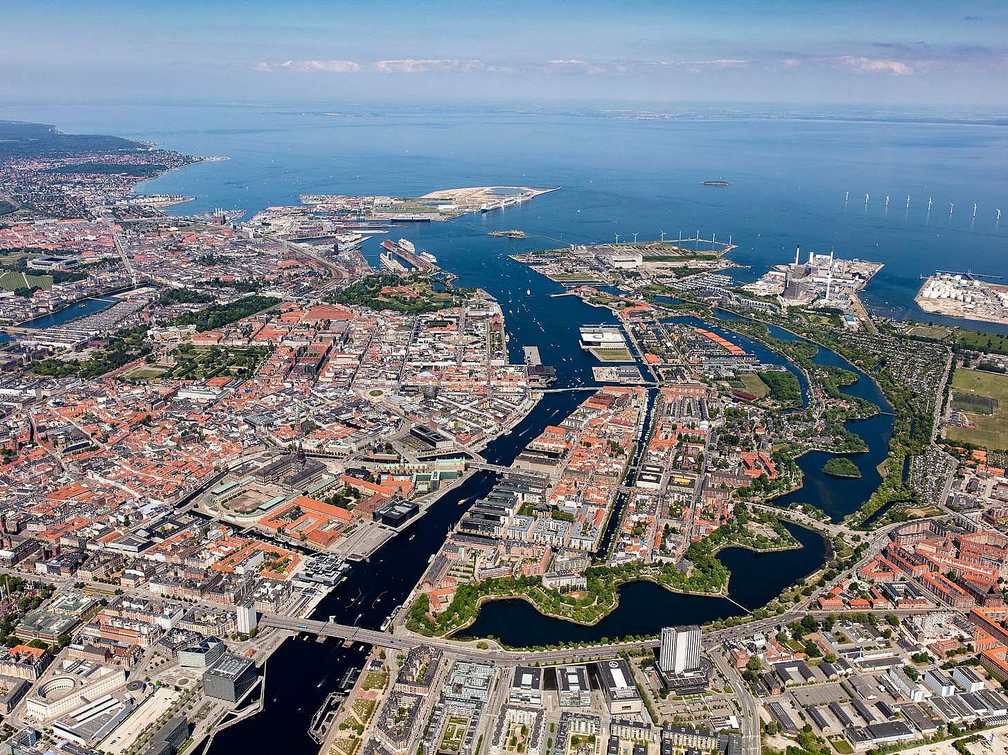
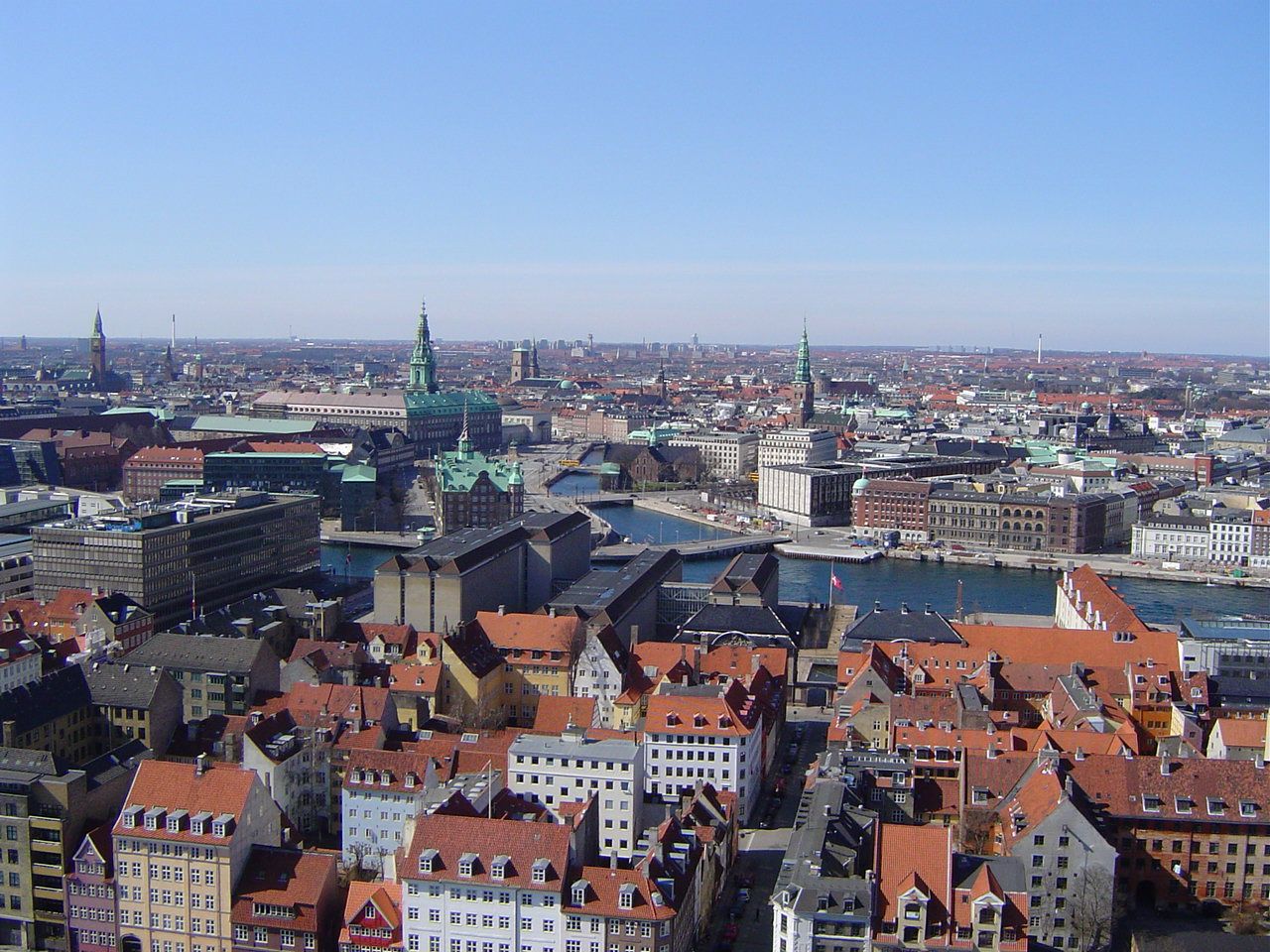
哥本哈根(丹麦语:København, 发音 帮助·信息)是丹麦的首都、最大城市及最大港口。座落于丹麦西兰岛东部,与瑞典的马尔默隔松德海峡相望。
松德海峡大桥在2000年完工后,哥本哈根与瑞典的马尔默可透过车辆和铁路往来,促成了两地人力资源的互相交流,每年利用松德海峡大桥的通勤人数不断增长。此外大桥通车后也让两座城市之间形成北欧地区最大的城市群。
在2008年,《Monocle》杂志将哥本哈根选为“最适合居住的城市”[4],并给予“最佳设计城市”的评价。哥本哈根在全球城市分类中被列为第二类世界级城市。此外哥本哈根在西欧地区获选为“设置企业总部的理想城市”第三名,仅次于巴黎和伦敦。[5]
哥本哈根城市建立之际的名称为“Kjøbmandehavn”,意为“商人的港口”。英语“Copenhagen”的名称来自于低地德语“Kopenhagen”,中文译名也由此而来。
Kopenhagen (dänisch [kʰøb̥m̩ˈhɑʊ̯ˀn], in bis ins 19. Jahrhundert gültiger Rechtschreibung Kjøbenhavn) ist die Hauptstadt Dänemarks und das kulturelle und wirtschaftliche Zentrum des Landes. Die Stadt ist Sitz von Parlament (Folketing) und Regierung sowie Residenz der dänischen Königin Margrethe II.
Die dänische Hauptstadt gehört zu den bedeutendsten Metropolen Nordeuropas, ist ein beliebtes Reiseziel und Hafenstadt. Die Kommune Kopenhagen (Københavns Kommune) hat 613.288 Einwohner, die Hauptstadt im formalen Sinne (bestehend aus den Kommunen København, Frederiksberg und Gentofte) 793.501 Einwohner. Kopenhagen ist Teil der dänischen Verwaltungsregion Region Hovedstaden und der binationalen Metropolregion Öresundregion.
Im 12. Jahrhundert wurde am Øresund eine Burg errichtet, die den kleinen Handelshafen nach Schonen und Amager an der Fischersiedlung Havn („Hafen“) sichern sollte. Nicht zuletzt die günstige Lage ungefähr halbwegs zwischen dem wichtigen Bischofssitz in Roskilde und dem skandinavischen Erzbischofssitz in Lund (damals dänisch) war von entscheidender Bedeutung. Entsprechend erhielt auch die mit der Burg neu gestaltete Siedlung den Namen Køpmannæhafn („Kaufmännerhafen“). 1254 erhielt das junge Kopenhagen von Bischof Jakob Erlandsen sein erstes Stadtrecht, allerdings wurde die Stadt in den Jahren 1362 und 1368 als unliebsamer Konkurrent der Hanse zusammen mit der Burg geplündert und zerstört. Nach einem erneuten Angriff der Hanse war der Hafen 1428 eine Zeitlang von Schiffwracks blockiert.
Die Entwicklung ließ sich jedoch nicht mehr aufhalten: 1416 wurde die wiederaufgebaute Stadt Residenz des Königs, und 1443 übernahm sie von Roskilde die Hauptstadtfunktion. In der ersten Hälfte des 17. Jahrhunderts blühte Kopenhagen unter Christian IV. auf.
コペンハーゲン(ドイツ語: Kopenhagen [kopənˈhaːgən])、クブンハウン(ケブンハウン)(デンマーク語: København 発音 [kʰøb̥m̩ˈhɑʊ̯ˀn] ( 音声ファイル)、コゥペンヘイゲン(英語: Copenhagen [ˌkoupənˈheigən])は、デンマークの首都。デンマーク最大の都市で、自治市の人口は52万人。市名はデンマーク語の"Kjøbmandehavn"(商人たちの港)に由来する。「北欧のパリ」と比喩される。
Copenhagen[a] (Danish: København [købm̩ˈhɑwˀn] ( listen)) is the capital and most populous city of Denmark. The city has a population of 775,033 (as of January 2018), of whom 613,288 live in the Municipality of Copenhagen.[6][7] It forms the core of the wider Copenhagen urban area (population 1.3 million (as of January 2018) and the Copenhagen metropolitan area (population approx. 2 million). Copenhagen is situated on the eastern coast of the island of Zealand; another small portion of the city is located on Amager, and is separated from Malmö, Sweden, by the strait of Øresund. The Øresund Bridge connects the two cities by rail and road.
Originally a Viking fishing village established in the 10th century in the vicinity of what is now Gammel Strand, Copenhagen became the capital of Denmark in the early 15th century. Beginning in the 17th century it consolidated its position as a regional centre of power with its institutions, defences and armed forces. After suffering from the effects of plague and fire in the 18th century, the city underwent a period of redevelopment. This included construction of the prestigious district of Frederiksstaden and founding of such cultural institutions as the Royal Theatre and the Royal Academy of Fine Arts. After further disasters in the early 19th century when Horatio Nelson attacked the Dano-Norwegian fleet and bombarded the city, rebuilding during the Danish Golden Age brought a Neoclassical look to Copenhagen's architecture. Later, following the Second World War, the Finger Plan fostered the development of housing and businesses along the five urban railway routes stretching out from the city centre.
Since the turn of the 21st century, Copenhagen has seen strong urban and cultural development, facilitated by investment in its institutions and infrastructure. The city is the cultural, economic and governmental centre of Denmark; it is one of the major financial centres of Northern Europe with the Copenhagen Stock Exchange. Copenhagen's economy has seen rapid developments in the service sector, especially through initiatives in information technology, pharmaceuticals and clean technology. Since the completion of the Øresund Bridge, Copenhagen has become increasingly integrated with the Swedish province of Scania and its largest city, Malmö, forming the Øresund Region. With a number of bridges connecting the various districts, the cityscape is characterised by parks, promenades and waterfronts. Copenhagen's landmarks such as Tivoli Gardens, The Little Mermaid statue, the Amalienborg and Christiansborg palaces, Rosenborg Castle Gardens, Frederik's Church, and many museums, restaurants and nightclubs are significant tourist attractions. The largest lake of Denmark, Arresø, lies around 27 miles (43 kilometers) northwest of the City Hall Square.
Copenhagen is home to the University of Copenhagen, the Technical University of Denmark, Copenhagen Business School and the IT University of Copenhagen. The University of Copenhagen, founded in 1479, is the oldest university in Denmark. Copenhagen is home to the FC København and Brøndby football clubs. The annual Copenhagen Marathon was established in 1980. Copenhagen is one of the most bicycle-friendly cities in the world.
The Copenhagen Metro launched in 2002 serves central Copenhagen while the Copenhagen S-train and Lokaltog (private railway) and the Coast Line network serves and connects central Copenhagen to outlying boroughs. To relieve traffic congestion, which is partly the result of increased traffic because of the Fehmarn Belt Fixed Link road and rail construction is planned because the narrow 9-9.5 mile isthmus between Roskilde Fjord and Køge Bugt (Køge Bay) forms a traffic bottleneck. The Copenhagen-Ringsted Line will relieve traffic congestion in the corridor between Roskilde and Copenhagen.
Serving roughly two million passengers a month, Copenhagen Airport, Kastrup, is the busiest airport in the Nordic countries.
Copenhague (prononcé [kɔ.pə.naɡ]), en danois København [købm̩ˈhɑwˀn] Écouter, est la capitale et la plus grande ville du Danemark. La commune de Copenhague (Københavns Kommune) compte 569 557 habitants en 2014, et son agglomération, le Grand Copenhague, en compte 1 295 686 (janvier 2017). Le nom de Copenhague est généralement donné à l'ensemble du comté de Copenhague, qui regroupe quant à lui 1 950 430 habitants. Située sur la côte orientale de l'île de Seeland, face au détroit d'Øresund qui sépare le Danemark de la Suède voisine, Copenhague est reliée à Malmö par le pont de l’Øresund. Son nom danois, København (prononcé [kʰøb̥m̩ˈhɑʊ̯ˀn] Écouter), déformation de Købmandshavn (« le port des commerçants »), rappelle sa position stratégique sur le Kattegat, à proximité immédiate de la mer Baltique.
Fondée au Xe siècle par les Vikings, Copenhague est à l'origine un village de pêcheurs, fortifié en 1167. La ville devient la capitale du Royaume de Danemark dès le début du XVe siècle. Au cours du XVIIe siècle, sous le règne du roi Christian IV, elle devient une des plus grandes villes d'Europe du Nord, renforçant son statut de capitale. Après avoir connu les ravages de la peste et de nombreux incendies au XVIIIe siècle, Copenhague voit se construire la vieille ville actuelle, et notamment le quartier de Frederiksstaden et des institutions comme le Théâtre royal danois ou l'Académie royale des beaux-arts. En partie détruite par les troupes de l'amiral Nelson lors de la bataille de Copenhague (1801), la ville est reconstruite dans un style néoclassique durant l'Âge d'or danois. L'urbanisme de Copenhague est rénové à la suite de la Seconde Guerre mondiale par le plan Finger (en), qui organise le développement industriel et urbain autour des cinq voies ferrées partant du centre-ville (Indre By).
Copenhague est le siège du parlement national (le Folketing), du gouvernement et de la monarchie danoise ; plusieurs institutions se trouvent dans le château de Christiansborg. Elle est également le cœur industriel et financier du pays, accueillant les sièges sociaux des plus grandes entreprises danoises, comme Maersk, Novo Nordisk et la brasserie Carlsberg. Le niveau de vie y est très élevé et le PIB par habitant est parmi les plus importants au monde. Outre un dynamisme industriel dans les services et la pharmaceutique, l'économie de Copenhague est marquée par le développement des cleantechs, en lien avec l'objectif municipal de parvenir à la neutralité carbone d'ici 2025. Les transports en commun et l'usage du vélo sont très fortement développés.
Le paysage urbain de la ville est caractérisé par ses nombreux ponts, parcs et fronts de mer. Le port de Nyhavn est célèbre pour ses maisons en bois aux façades colorées. Christiania est une communauté intentionnelle autogérée, accueillant une population d'artistes, de hippies et des mouvements alternatifs. Dans le centre historique se trouvent le quartier branché de Vesterbro et le quartier latin, ainsi que le château de Rosenborg, ancienne résidence royale. À l'est, sur la côte, se trouve la citadelle du Kastellet et la statue de La Petite Sirène. Enfin, Copenhague compte deux vastes jardins aujourd'hui transformés en parc d'attractions : le Bakken et les Jardins de Tivoli.
Copenaghen (AFI: /kopeˈnaɡen/[2] ; in danese København; in italiano arcaico Copenaga[3]) è la capitale e la città più popolosa della Danimarca con 613.288 abitanti nel Comune (1.308.893 nell'area urbana al 2018). È situata sulle isole Sjælland e di Amager ed è separata dalla città svedese di Malmö dallo stretto di Øresund.
Copenhague4 (en danés: København [kʰøb̥m̩ˈhɑʊ̯ˀn] (?·i)) es la capital y la ciudad más poblada de Dinamarca, con una población urbana de 1 230 728 y una población metropolitana 1 967 727, a fecha de 1 de octubre de 2013. Está situada en la costa oriental de Selandia, a 28 km de Malmoe (Suecia), y a 164 kilómetros (102 mi) de Odense. La ciudad se extiende por partes de la isla de Amager y también contiene el enclave del municipio de Frederiksberg. Fue premiada con el título Capital Verde Europea 2014.
Originalmente un pueblo de pescadores vikingo fundado en el siglo X, Copenhague se convirtió en la capital de Dinamarca a principios del siglo XV. Durante el siglo XVII, bajo el reinado de Cristián IV, se convirtió en un importante centro regional, consolidando su posición como capital de Dinamarca y Noruega con sus instituciones, defensas, y fuerzas armadas. Tras sufrir los efectos de plagas e incendios en el siglo XVIII, la ciudad vivió una etapa de remodelación que incluyó reformas del prestigioso barrio de Frederiksstaden y de instituciones culturales como el Teatro Real y la Real Academia de Bellas Artes. Después de diferentes desastres en el siglo XIX, cuando Horatio Nelson atacó la flota danesa y bombardeó la ciudad, las reconstrucciones durante la Edad de Oro danesa trajeron un nuevo estilo neoclásico a la arquitectura kobmendense. Más tarde, tras la Segunda Guerra Mundial, el Proyecto de los Dedos fomentó la creación de viviendas y negocios a lo largo de las cinco rutas ferroviarias urbanas que se extienden hacia fuera desde el centro de la ciudad.
La historia de Copenhague se remonta a alrededor del año 800, cuando surge en torno a un pequeño pueblo de pescadores. Desde el año 1300 se convirtió en la capital de Dinamarca en detrimento de Roskilde, un estatus que la ciudad ha mantenido desde entonces. En la actualidad, Copenhague alberga alrededor del 20 % de la población de Dinamarca. Después de una crisis económica, la ciudad ha experimentado en los últimos diez años un importante progreso económico y cultural, y es ahora más fuerte tanto a nivel nacional como internacional.
La ciudad es hogar de una serie de grandes empresas y las instituciones culturales, AP Moller-Maersk, Carlsberg, Park, el Museo Nacional, la Ópera y el teatro del Rey.
Копенга́ген (дат. København [kʰøb̥ənˈhaʊ̯ˀn][3] / [кхёбэнха́ў’н], до 1906 г. Kjøbenhavn[4], стародат. Køpmannæhafn — «гавань торговцев», лат. Hafnia) — столица и самый крупный город Дании. Располагается на островах Зеландия, Слотсхольмен и Амагер. Население исторического города составляет чуть более 600 тыс. человек, с пригородами — более 1.3 млн жителей. Часть города — самопровозглашённый Свободный город Христиания — находится на частичном самоуправлении.
Город является культурным, экономическим и правительственным центром Дании; это один из крупнейших финансовых центров Северной Европы с Копенгагенской фондовой биржей. Экономика Копенгагена имела быстрое развитие в секторе услуг, особенно посредством инициатив в информационных технологиях, фармацевтике и чистой технологии. После завершения строительства Эресуннского моста Копенгаген стал более интегрированым со шведской провинцией Скания и её крупнейшим городом Мальме, образуя Эресуннский регион.
Копенгагенский университет, основанный в 1479 году, является старейшим университетом в Дании.
Denmark
Germany
Germany
Germany
France
France
UEFA European Championship 2016
UEFA European Championship 2020
UEFA European Championship 2024
Greece
Italy
Netherlands
Portugal
Russia
Slovakia
Spain
Spain
Spain
Sport
(F)European football championship
Czech Republic
Union of European Football Associations

Der Henri-Delaunay-Pokal (französisch Coupe Henri Delaunay) ist die Gewinntrophäe der Fußball-Europameisterschaft, die seit 1960 verliehen wird.
Der versilberte EM-Pokal wurde 1960 in Paris von Pierre Delaunay entworfen und vom Goldschmied Adrien Chobillon angefertigt,[1] der seinerseits für den französischen Pokal verantwortlich zeichnete. Er ist etwa zehn Kilogramm schwer und hat eine Höhe von 42,5 Zentimetern. Benannt wurde er nach dem Franzosen Henri Delaunay, dem ersten UEFA-Generalsekretär und „geistigem Vater“ der Fußball-Europameisterschaft.
Die EM-Trophäe bleibt als Wanderpokal in ständigem Eigentum der UEFA. Sollte eine Mannschaft dreimal in Folge oder fünfmal insgesamt Europameister werden, erhält der entsprechende Verband eine originalgetreue Nachbildung der Trophäe vom europäischen Fußballverband.

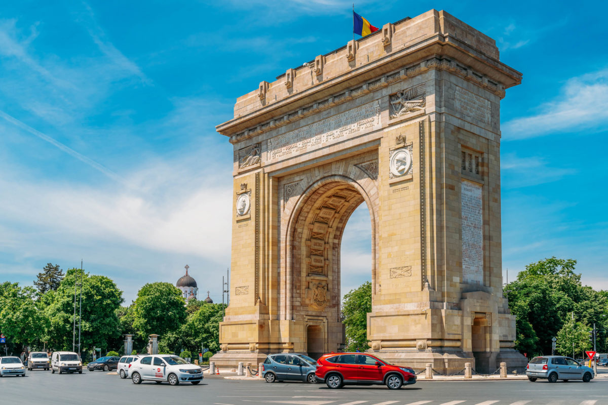
布加勒斯特(罗马尼亚语:București),罗马尼亚首都,位于罗马尼亚东南部,瓦拉几亚平原中部,多瑙河支流登博维察河畔。有“小巴黎”之称。面积约228平方公里,人口近200万。它是罗马尼亚最大的城市,也是政治、经济、文化中心。若以以人口计算,布加勒斯特是欧盟第六大都市。
据历史记载,该市已有500多年的历史。1459年,布加勒斯特成为罗马尼亚要塞,1574年发展成为城市,1659年起成为瓦拉几亚公国首都。1862年成为统一的罗马尼亚国家首都。1877年5月9日罗马尼亚在此宣布独立。1947年为罗马尼亚人民共和国首都。1977年发生地震。1989年爆发革命,成为新罗马尼亚的首都。此后,经济不断发展,成为罗马尼亚具有代表性的城市。该市行政划分为六个区,设市长一名,各区区长一名,均由市民选举产生。布加勒斯特有两支著名的足球强队——布加勒斯特迪纳摩和布加勒斯特星队。位于布加勒斯特的罗马尼亚人民宫号称是世界第二大建筑物。
Bukarest (rumänisch: București [bukuˈreʃtʲ]; ) ist die Hauptstadt Rumäniens. Sie ist mit fast 1,9 Millionen Einwohnern[1] und einer urbanen Agglomeration von 2,2 Millionen Einwohnern die siebtgrößte Stadt der Europäischen Union.
Nachdem Bukarest 1659 Târgoviște als Landeshauptstadt endgültig abgelöst hatte, wurde es zum politischen, wirtschaftlichen und kulturellen Mittelpunkt der Walachei und später von Rumänien. Die Stadt verfügt über mehrere Universitäten, verschiedene andere Hochschulen sowie zahlreiche Theater, Museen und weitere Kultureinrichtungen.
Die kosmopolitische Hochkultur und der dominierende französische Einfluss der neubarocken Architektur der Stadt brachten ihr den Beinamen Micul Paris („Kleines Paris“, auch „Paris des Ostens“) ein.[2] In der Amtszeit des rumänischen Diktators Nicolae Ceaușescu wurden weiträumig historische Stadtviertel zerstört, um dem monumentalen Zuckerbäckerstil des Staatsoberhaupts Platz zu machen.
Bukarest wurde einer Legende nach von einem Hirten namens Bucur gegründet.[11] Bucurie bezeichnet im Rumänischen glückhafte Freude, und Bucur ist ein verbreiteter Familienname. Im etymologischen Sinn bedeutet București: Du bist froh.[12] Eine weitere Erzählung berichtet von dem getischen König Dromichaites,[13] der Freudenstadt errichtete.
Bukarest wird in einer auf den 20. September 1459 datierten Urkunde erstmals erwähnt.[14] Die Urkunde wurde von dem Woiwoden und Feldherrn Vlad Țepeș, mit dem Beinamen Drăculea, ausgestellt.
In der zweiten Hälfte des 15. Jahrhunderts entwickelte sich Bukarest, wo sich schon nach 1400 eine Handwerkersiedlung mit Schmiede, Töpferei und Gerberei nachweisen lässt, zum Curtea (Fürstensitz) der Walachei. Fürst Radu der Schöne bezeichnete am 14. Oktober 1465 Bukarest in einer Urkunde als Fürstensitz.[15] Die Stadt erlangte ihre zentralstädtische Bedeutung als fürstliches Macht- und Handelszentrum, das in einem Verdichtungsraum von Siedlungen lag. Zwischen 1459 und 1625 erscheinen allein 41 Siedlungen auf dem Gebiet des heutigen Bukarest.
Nachfolgend war Bukarest abwechselnd mit Tîrgoviște Hauptstadt der Walachei. Der Hauptmarkt entstand um die Lipscani-Straße.
ブカレスト/ブクレシュティ(ルーマニア語: București、マジャル語・標準ドイツ語: Bukarest)は、ルーマニアの首都で同国最大の都市である。ブカレストはルーマニア南東部にあり、ドゥンボヴィツァ川河畔の都市でルーマニアの文化、産業、金融の中心都市である。
Bucharest (/ˈb(j)uːkərɛst/; Romanian: București [bukuˈreʃtʲ] ( listen)) is the capital and largest city of Romania, as well as its cultural, industrial, and financial centre. It is located in the southeast of the country, at 44°25′57″N 26°06′14″ECoordinates:  44°25′57″N 26°06′14″E, on the banks of the Dâmbovița River, less than 60 km (37.3 mi) north of the Danube River and the Bulgarian border.
Bucharest was first mentioned in documents in 1459. It became the capital of Romania in 1862 and is the centre of Romanian media, culture, and art. Its architecture is a mix of historical (neo-classical), interbellum (Bauhaus and art deco), communist-era and modern. In the period between the two World Wars, the city's elegant architecture and the sophistication of its elite earned Bucharest the nickname of "Little Paris" (Micul Paris).[9] Although buildings and districts in the historic city centre were heavily damaged or destroyed by war, earthquakes, and above all Nicolae Ceaușescu's program of systematization, many survived. In recent years, the city has been experiencing an economic and cultural boom.[10] In 2016, the historical city centre was listed as "endangered" by the World Monuments Watch.[11]
According to the 2011 census, 1,883,425 inhabitants live within the city limits,[6] a decrease from the 2002 census.[3] Adding the satellite towns around the urban area, the proposed metropolitan area of Bucharest would have a population of 2.27 million people.[12] According to Eurostat, Bucharest has a functional urban area of 2,412,530 residents (as of 2015).[5] Bucharest is the sixth-largest city in the European Union by population within city limits, after London, Berlin, Madrid, Rome, and Paris.
Economically, Bucharest is the most prosperous city in Romania[13] and is one of the main industrial centres and transportation hubs of Eastern Europe. The city has big convention facilities, educational institutes, cultural venues, traditional "shopping arcades", and recreational areas.
The city proper is administratively known as the "Municipality of Bucharest" (Municipiul București), and has the same administrative level as that of a national county, being further subdivided into six sectors, each governed by a local mayor.
Bucarest (en roumain București  ? /bu.kuˈreʃtʲ/ [Fiche], ou Municipiul București en version longue) est la capitale de la Roumanie.
La ville est mentionnée pour la première fois en 1459 comme marché fortifié au carrefour des routes commerciales entre Târgoviște, alors capitale de la Valachie, Brașov en Transylvanie, et le port de San-Giorgio fondé par les Génois sur le Danube. Ce marché s'est rapidement développé et, au XVIIe siècle, il devient la capitale de la principauté de Valachie, puis, en 1859, de la Roumanie.
Lors du dernier recensement de 2011, la municipalité comptait 1 883 425 habitants, en diminution par rapport à 2002 et 1992. Bucarest reste la plus grande ville de Roumanie.
Bucarest (AFI: [ˈbuːkarest];[3] in romeno: București, pronuncia [bukuˈreʃtʲ]) è la capitale e la città più popolosa della Romania ed è la sesta più popolosa dell'Unione Europea. Posta nel sud del Paese, sul fiume Dâmbovița, è il maggiore centro industriale e commerciale del paese. Il territorio della città è interamente circondato dal distretto di Ilfov, pur non facendone parte, in quanto il municipio è l'unico della Romania a fare distretto di per sé.
Bucarest è la 6ª città per popolazione dell'Unione europea. Secondo le stime degli specialisti, Bucarest raccoglie più di tre milioni di persone al giorno e nei prossimi cinque anni questo numero supererà i quattro milioni. A questo si aggiungono le località intorno alla città, che fanno parte della futura area metropolitana, hanno una popolazione di circa 430.000.[4]
La prima menzione della località appare nel 1459. Nel 1862 divenne la capitale dei Principati Uniti; da allora ha subito cambiamenti continui, diventando il centro della scena artistica, culturale e mediatica rumena. L'architettura elegante e l'atmosfera urbana le portarono durante la Belle Époque il soprannome di "Piccola Parigi"[5], anche se diversi edifici e quartieri del centro storico furono danneggiati o interamente distrutti dalla guerra, dai terremoti e dal programma di sistemazione di Nicolae Ceausescu. Negli ultimi anni, la città ha vissuto un boom economico e culturale[6].
Secondo i dati preliminari del censimento del 2011, 1.677.985 abitanti vivono entro i limiti della città,[7] inferiore alla cifra registrata nel censimento del 2002.[8] L'area urbana si estende oltre Bucarest, con una popolazione di 1,93 milioni.[9] Con l'aggiunta di città satellitari attorno all'area urbana, l'area metropolitana di Bucarest avrebbe una popolazione di 2,2 milioni.[10] Secondo Eurostat, Bucarest ha un'area urbana più grande di 2.151.880 residenti.[11] Secondo dati non ufficiali, la popolazione è di oltre 3 milioni. Bucarest è la città più grande della Romania e la sesta nell'Unione europea secondo la popolazione entro i limiti della città.
Da un punto di vista economico, Bucarest è la città più prospera in Romania,[12] ed è uno dei principali centri industriali e dei nodi di trasporto nell'Europa orientale. La città dispone di strutture per convegni, istituti scolastici, aree culturali, centri commerciali e aree ricreative.
La città, avente lo stesso livello amministrativo dei distretti, è suddivisa in sei settori e amministrata dal Municipio di Bucarest.
Bucarest (en rumano: București, /bu.kuˈreʃtʲ/ (?·i)) es la capital y ciudad más poblada de Rumania, así como su principal centro industrial, comercial y cultural. Está situada en el sureste del país, a orillas del río Dâmbovița. La ciudad cuenta con 2.400.000 habitantes, según datos del censo de 2016,1 lo que la convierte, además, en la décima ciudad más poblada de la Unión Europea.3
La ciudad fue mencionada por primera vez en documentos escritos a comienzos de 1459. Desde entonces ha pasado por muchos cambios, pero el más notable fue convertirse en la capital de Rumania en 1862, por lo que se consolidó como el centro nacional de la comunicación, cultural y económico. Su ecléctica arquitectura mezcla estilos neoclásico, de entreguerras (Bauhaus y Art Deco), comunista y moderno. En el periodo de entreguerras, la arquitectura de la ciudad y la sofisticación de sus elites le valieron a Bucarest el apodo de "Pequeña París" (Micul Paris).4 Pese a que muchos edificios y distritos del centro fueron dañados o destruidos por la guerra, terremotos y el programa de sistematización de Nicolae Ceaușescu, la mayoría permanecieron en pie.
Económicamente, la ciudad es la más próspera de Rumania5 y es uno de los principales centros industriales y de transporte de Europa del Este. Como ciudad más desarrollada del país, Bucarest tiene también una amplia gama de instalaciones educativas. La superficie total de Bucarest es de 226 km². Hasta 1989, las zonas circundantes eran principalmente rurales, pero tras la Revolución Rumana se comenzaron a construir nuevos vecindarios alrededor de la ciudad. De hecho, la ciudad en sí administrativamente se conoce como Municipio de Bucarest (Municipiul București) y tiene el mismo nivel administrativo que un distrito, siendo dividida la ciudad en seis sectores.
Eurovision Song Contest,ESC
UEFA European Championship 2020
History
M 1500 - 2000 AD
History
N 2000 - 2100 AD
International cities
*European Capital of Culture
International cities
***Global Urban Economic Competitiveness
Ireland

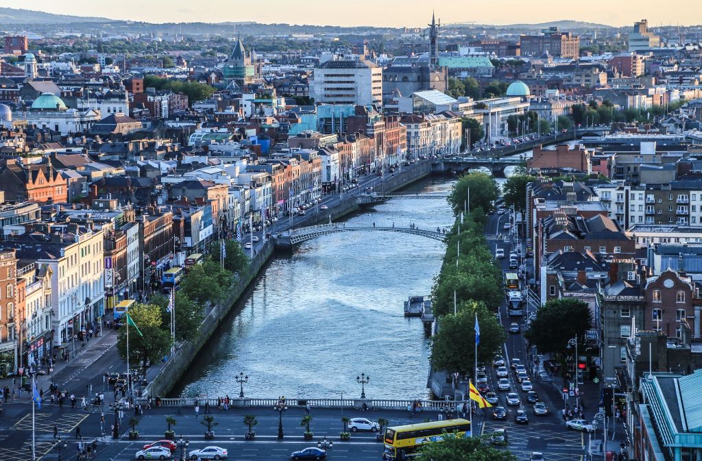
都柏林(英语:Dublin;爱尔兰语:Baile Átha Cliath)是爱尔兰共和国的首都以及最大的城市,[3][4]靠近爱尔兰岛东岸的中心点,位处都柏林郡的利菲河(River Liffey)河口、都柏林地区的中心。都柏林自中世纪以来一直是爱尔兰首都城市,也是爱尔兰岛上最大的城市。由于很多高技术企业聚集,所以有欧洲的硅谷之称。
Dublin这个字起源于爱尔兰语的Dubh Linn(意为“黑色池塘”)。都柏林的现代爱尔兰名Baile Átha Cliath(意为“芦苇障碍做成的浅滩之城”)则是指在黑色池塘旁边的定居地。
最早关于都柏林的文献是托勒密的手稿,大约写于140年,他称之为埃布拉纳(Eblana)。
都柏林在官方城市边界内的人口是大约495,000人(爱尔兰中央统计处2002年人口调查),然而这种统计已经没有什么太大的意义,因为都柏林的市郊地区和卫星城镇已经大幅地发展与扩张。都柏林市和都柏林郡的人口加起来已经超过了1,100,000人(爱尔兰中央统计处2002年人口调查)。虽然对于“大都柏林都会区”的定义没有一个确切的共识,但是普遍而言大家可以接受这个地区包括了都柏林市和郡,以及部分的威克娄郡、基尔代尔郡和米斯郡,因为通勤带可以延伸到很远的地方。
Dublin ([ˈdʌblɪn], lokal auch [dʊbᵊlən]) ist die Hauptstadt und größte Stadt der Republik Irland. Der irische Name ist Baile Átha Cliath ([ˈbalʲɑːˈkʲlʲiə] oder [ˈbʲlʲɑːˈkʲlʲiə]). Die deutsche Übersetzung lautet „Stadt an der Hürdenfurt“. Der englische Name stammt vom irischen Duibhlinn ([ˈdivʲ.lʲiːnʲ]), „Schwarzer Teich“.[1]
Dublin liegt an der Ostküste der Insel Irland, an der Mündung des Flusses Liffey in die Dublin Bay. Dublin liegt durchschnittlich 20 Meter über dem Meeresspiegel.
Die Liffey teilt Dublin in den Nordteil (Northside) und den eher vornehmen Süden (Southside), wobei diese Unterteilung heute weniger scharf ist als in früheren Jahrzehnten. Die Innenstadt erhält ihre Struktur durch das Kreuz aus dem Fluss Liffey mit seinen zahlreichen Brücken und der Hauptachse O’Connell Street–Grafton Street–Harcourt Street. Hier liegen die meisten Kaufhäuser, aber auch das Trinity College mit seiner berühmten Bibliothek und der städtische Park St. Stephen’s Green. Die Straßenzüge im typischen Georgianischen Stil findet man vor allem im Gebiet um den Merrion Square, in der Nähe der Nationalgalerie und beim Sitz der Landesregierung (Leinster House), um St. Stephen’s Green, aber auch auf der Nordseite am Mountjoy Square. Umschlossen wird dieses Gebiet von der North Circular Road und der South Circular Road. Außerhalb der Innenstadt liegen die Wohnquartiere, von denen manche noch einen sehr einheitlichen Stil aufweisen; das klassische Arbeiterviertel Cabra besteht aus langen Reihen winziger Häuser aus Backsteinen, Marino ist ein Beispiel für eine am Reißbrett konzipierte Mittelschicht-Siedlung, in Beaumont überwiegen die semi-detached, die Doppelhaushälften.
Die Geschichte Dublins ist eng mit der Geschichte Irlands im Allgemeinen verknüpft.
Die erste bekannte Erwähnung findet Dublin in den Schriften des Ptolemäus aus dem Jahr 140 unter dem Namen Eblana. Ursprünglich bestand die Stadt aus einer keltischen Siedlung mit dem Namen „Áth Cliath“, was so viel wie „Hürden-Furt“ bedeutet. 842 gründeten Wikinger daneben ein eigenes Dorf, das sie „Duibhlinn“, in etwa „schwarzer Teich“, nannten nach einem von ihnen als Hafenbecken genutzten Gewässer. Die Machtstellung des von ihnen gegründeten Königreich Dublin ging nach der Schlacht von Clontarf 1014 verloren.
Die Stadt wurde 1170 von den Anglonormannen unter der Führung von Richard de Clare und seinem irischen Verbündeten Diarmuid Mac Murchadha Caomhánach eingenommen. Ab 1172 wurde Dublin das Verwaltungszentrum der Anglonormannen. Die Stadt hatte zu der Zeit weitverzweigte internationale Handelsbeziehungen zu Skandinavien, Island, Großbritannien und in zunehmendem Maße zu Frankreich.[2]
Der Bereich der gerichtlichen Zuständigkeit der Stadt wurde 1192 in einer Urkunde niedergelegt. Insgesamt wurde ein sechs Quadratmeilen großes Gebiet durch Erlass des Königs Heinrich II. übereignet. Die Stadt blieb im Prinzip innerhalb dieser Abgrenzungen selbstverwaltet.[3]
Im Jahre 1204 befahl König Johann von England die Errichtung einer Festung in Dublin (Dublin Castle), um seine Machtposition im Land zu stärken.[4] In den folgenden Jahrhunderten entwickelte sich diese Burg zum britischen Verwaltungszentrum in Irland. Der britische Vizekönig wohnte bis 1782 in diesem Schloss.
1229 wurde den freien Bürgern und Ehrenbürgern der Stadt das Recht zuerkannt, jedes Jahr einen Bürgermeister zu wählen. Der Stadtrat setzte sich aus 24 prominenten Bürgern, meist Kaufleuten, zusammen.
Die Pest kam 1348 nach Dublin und verursachte eine beachtliche Schrumpfung der (jetzt überwiegenden englischen) Bevölkerung.
Zwischen 1541 und 1800 war Dublin Hauptstadt des Königreiches Irland.
ダブリン(英: Dublin [ˈdʌblᵻn]、アイルランド語:Baile Átha Cliath [ˈbˠalʲə aːhə ˈclʲiə]、Bleá Cliath [blʲaˈklʲiə] または Dubh linn)は、アイルランド島東部の都市で、アイルランドの首都である。リフィー川河口に位置し、その南北に町が広がる。
アイルランドの政治・経済・交通・文化の中心地であり、アイルランドの全人口の3分の1がダブリン首都圏に集中するアイルランド国内最大の都市である。欧州有数の世界都市であり、重要な金融センターの一つになっている。
市内にはアイルランド人の権利の拡大に尽力した人々やイギリスからの独立運動のために命を落とした活動家の名前が記念日や通りの名前に多く見られる。ダニエル・オコンネルに因む町の目抜き通りのオコンネル通り[3]やパトリック・ピアースにちなむピアース通り、コノリー駅などが例に挙げられる。これらは本来は別の名前がつけられていたが、1921年の独立[4]後に改名されたものである(オコンネル通りはかつてはサックビル通りと呼ばれていた)。
Dublin (/ˈdʌblɪn/, locally /ˈdʊb-/; Irish: Baile Átha Cliath[11] [ˈbˠalʲə aːhə ˈklʲiə; ˌbʲlʲaː ˈklʲiə]) is the capital and largest city of Ireland.[12][13] Situated on a bay on the east coast, at the mouth of the River Liffey, it lies within the province of Leinster. It is bordered on the south by the Dublin Mountains, a part of the Wicklow Mountains range. It has an urban area population of 1,173,179,[7] while the population of the Dublin Region (formerly County Dublin) as of 2016 was 1,347,359.[14] The population of the Greater Dublin Area was 1,904,806 per the 2016 census.[15]
There is archaeological debate regarding precisely where Dublin was established by the Gaels in or before the 7th century AD.[16] Later expanded as a Viking settlement, the Kingdom of Dublin, the city became Ireland's principal settlement following the Norman invasion.[16] The city expanded rapidly from the 17th century and was briefly the second largest city in the British Empire before the Acts of Union in 1800. Following the partition of Ireland in 1922, Dublin became the capital of the Irish Free State, later renamed Ireland.
Dublin is a historical and contemporary centre for education, the arts, administration and industry. As of 2018 the city was listed by the Globalization and World Cities Research Network (GaWC) as a global city, with a ranking of "Alpha −", which places it amongst the top thirty cities in the world.
Dublin /dyblɛ̃/a Écouter (en anglais : /ˈdʊbᵊlən/b ; en gaélique : Baile Átha Cliathc /ˈbˠalʲə aːhə ˈclʲiə/d ou Bleá Cliathe /ˌbʲlʲaː ˈclʲiə/d) est la plus grande ville de l'île d'Irlande et de l'État d'Irlande, dont elle est la capitale (Belfast étant la capitale de l'Irlande du Nord). La ville est située à proximité du point central de la côte orientale de l'île et au centre du comté de Dublin. Dublin est la plus grande ville d'Irlande en importance et en nombre d’habitants depuis le haut Moyen Âge. Elle est aujourd’hui classée à la soixante-sixième place dans l’index des places financières mondiales1, et a un des plus forts taux de développement parmi les capitales européennes2,3. Dublin est le centre historique, politique, artistique, culturel, économique et industriel de l’Irlande.
La population de la commune de Dublin est de 553 165 habitants au recensement de 2016. Au même recensement, le comté de Dublin — divisé en quatre zones administratives : ville de Dublin, Dublin Sud, Fingal et Dún Laoghaire-Rathdown — compte 1 270 603 habitants tandis que la région du Grand Dublin abrite 1 804 156 habitants.
Dublino (AFI: /duˈblino/[2]; in inglese Dublin, /ˈdʌblɪn/; in irlandese Baile Átha Cliath,[3] "città del guado della staccionata", o semplicemente Áth Cliath, o meno correttamente Dubh Linn, "stagno nero") è la capitale della Repubblica d'Irlanda, oltre che la città più grande e popolata, non solo del paese, ma di tutta l'isola. Gli abitanti sono complessivamente 554 554 ma se si considera l'area metropolitana, superano il milione.[1] La città è in continua espansione urbanistica ed economica da qualche decennio, e contribuisce al PIL della Repubblica con 60 miliardi di euro.
Fondata dai Vichinghi come centro per il commercio di schiavi, la città è situata sulla foce del fiume Liffey, al centro della costa orientale dell'isola e di quella che oggi viene chiamata Dublin Region, affacciata sul Mar d'Irlanda (in inglese Irish Sea). È stata la capitale irlandese sin dai tempi medievali.
La Città consiste nella zona amministrata dal Dublin City Council assieme ai contigui sobborghi un tempo appartenenti alla Contea di Dublino e ora divisi tra le contee di Dún Laoghaire-Rathdown, Fingal e South Dublin. La Greater Dublin Area si compone di quanto sopra assieme alle contee di Kildare, Meath e Wicklow.
Molly Malone è il titolo dell'inno non ufficiale della città.
Dublín (en irlandés: Baile Átha Cliath, AFI: [ˌbʲlʲɑː ˈclʲiə] o población del vado de cañizo;1 en inglés: Dublin, AFI: [ˈdʌblɪn]) es la capital de la República de Irlanda y ciudad más poblada de la isla. Está ubicada cerca del centro de la costa este sobre el mar de Irlanda, en la desembocadura del río Liffey y en el centro del condado de Dublín. Fue fundada por los vikingos alrededor de 841 como base militar y centro de comercio de esclavos, y ha sido capital del país desde la Edad Media.23 Está constituida por diferentes áreas; el Consejo de la Ciudad de Dublín junto con suburbios contiguos en el condado de Dublín, y que a su vez se subdivide en los condados administrativos de Dún Laoghaire-Rathdown, Fine Gall-Fingal y el Consejo del Condado de Dublín Sur. La Gran Área abarca la Ciudad de Dublín y el Consejo junto con los condados contiguos de Kildare, Meath y Wicklow.
La población del área urbana de Dublín era de 1 110 614 habitantes en el censo de 2010, pero ampliada al condado de Dublín ascendía a 1 122 821 en 2011 y en 2019 la cantidad de habitantes es 199 personas.
En la Gran Área o región metropolitana de Dublín había 1 804 156 habitantes. La ciudad contribuye con 60 000 millones de euros al PIB irlandés y es el centro político, administrativo, económico, industrial y cultural de la República de Irlanda. Dublín ha sido declarada ciudad global por el GaWC (Grupo de Estudios sobre Globalización y Ciudades Mundiales) y Capital Europea de la Ciencia 2012 debido a la celebración del día del duende.
Ду́блин[3] (англ. Dublin [ˈdʌblɨn], местн. [ˈdʊblən], [ˈdʊbələn]; ирл. Baile Átha Cliath — Балэ-Аха-Клиэх[4] [bˠalʲə aːha klʲiəh] или Duibhlinn (Дувьлинь)) — город-графство в Ирландии, столица страны[5][6]. Находится в административном графстве Дублин (провинция Ленстер). Расположен на месте впадения реки Лиффи в Дублинский залив Ирландского моря. Самый большой город на острове Ирландия и в республике, занимающий почти 115 км². Главный порт страны, расположенный у побережья Ирландского моря. Основной центр политической, экономической и культурной жизни страны.
UEFA European Championship 2020
International cities
*European Capital of Culture
Schottland
United Kingdom

格拉斯哥(英语:Glasgow /ˈɡlɑːzɡoʊ, ˈɡlæz-/;[3] 低地苏格兰语:Glesca;苏格兰盖尔语:Glaschu)是英国苏格兰最大城市,位于苏格兰西部的克莱德河河口。格拉斯哥不仅是苏格兰最大城市与最大商港,也是英国第三大城市。大格拉斯哥地区拥有人口230万,占苏格兰总人口的41%。[4]
格拉斯哥是从主教区和皇家自治镇发展而来的,随着15世纪时格拉斯哥大学的建立而成为区域文化中心,在18世纪的苏格兰启蒙运动中扮演着重要的角色,与英属北美及英属西印度群岛之间有频繁的贸易往来。到了工业革命时期重要性更大,在维多利亚及爱德华时期被誉为仅次于伦敦的“(大英)帝国第二城”,是继伦敦和巴黎之后第三个人口达到百万的欧洲城市。[5][6][7][8][9]
近年来格拉斯哥逐渐发展成为欧洲十大金融中心之一,众多苏格兰企业将总部设于此。
Glasgow [ˈɡlazgəʊ oder ˈglɑːzgəʊ][3] (Scots: Glesga, schottisch-gälisch: Glaschu, amtlich City of Glasgow) ist mit etwa 600.000 Einwohnern die größte Stadt Schottlands und nach London und Birmingham die drittgrößte Stadt des Vereinigten Königreichs. Die Stadt bildet eine der 32 Council Areas in Schottland und liegt am Fluss Clyde. Im späten 19. und frühen 20. Jahrhundert hatte Glasgow mehr als eine Million Einwohner. Heute leben in der Greater Glasgow Urban Area 1.750.500 Einwohner.[4]
Glasgow gilt im Gegensatz zur schottischen Hauptstadt Edinburgh als „Arbeiterstadt“. In Glasgow gibt es eine Kathedrale aus dem 12. Jahrhundert und vier Universitäten (Universität Glasgow, Universität Strathclyde, Glasgow Caledonian University und die University of the West of Scotland) sowie die Glasgow School of Art und das Royal Conservatoire of Scotland (ehemals Royal Scottish Academy of Music and Drama).
グラスゴー (英: Glasgow/ スコットランド・ゲール語: Glaschu)は、イギリスのスコットランド南西部に位置する都市。人口は63万人で、スコットランド最大である。イギリス全体でも、ロンドン、バーミンガム、リーズ (いずれもイングランド)に次いで第4位に位置する。 英国国内ではロンドンとエディンバラについで3番目に観光客が多く、年間300万人ほどがこの街を訪れる。15世紀創立の名門グラスゴー大学を擁し、産業都市であるとともに、文化・芸術・若者の街として知られている。英語で「ノルウェー人」や「ノルウェーの」といった形容詞が"Norwegian"であるように、グラスウィージャン (Glaswegian) といった言葉が用いられる。移民が多く、かつては工業の街であった背景も影響し、地元の人々の英語方言はスコットランド訛りの中でも特に難解とされている。訛りが強いだけではなく、グラスウィージャンの方言も使用されている。なお、スコットランド・ゲール語はグラスゴーではほとんど使用されない。1990年には欧州連合の欧州文化都市に選ばれている。
Glasgow (Scots: Glesga; Scottish Gaelic: Glaschu) is the most populous city in Scotland and the fourth-most populous city in the United Kingdom, as well as being the 27th largest city by population in Europe.[6] In 2020, it had an estimated population of 635,640. Historically part of Lanarkshire, the city now forms the Glasgow City council area, one of the 32 council areas of Scotland, and is governed by Glasgow City Council. Glasgow is situated on the River Clyde in the country's West Central Lowlands. It is the fifth-most visited city in the United Kingdom.[7]
Glasgow grew from a small rural settlement on the River Clyde to become the largest seaport in Scotland, and tenth largest by tonnage in Britain. Expanding from the medieval bishopric and royal burgh, and the later establishment of the University of Glasgow in the 15th century, it became a major centre of the Scottish Enlightenment in the 18th century. From the 18th century onwards, the city also grew as one of Britain's main hubs of transatlantic trade with North America and the West Indies. With the onset of the Industrial Revolution, the population and economy of Glasgow and the surrounding region expanded rapidly to become one of the world's pre-eminent centres of chemicals, textiles and engineering; most notably in the shipbuilding and marine engineering industry, which produced many innovative and famous vessels. Glasgow was the "Second City of the British Empire" for much of the Victorian era and the Edwardian era.[8][9][10][11]
In the late 19th and early 20th centuries, Glasgow's population grew rapidly, reaching a peak of 1,127,825 people in 1938.[12] The population of Glasgow was greatly reduced following comprehensive urban renewal projects in the 1960s which resulted in large-scale relocation of people to designated new towns, such as Cumbernauld, Livingston, East Kilbride and peripheral suburbs, followed by successive boundary changes. Over 985,200 people live in the Greater Glasgow contiguous urban area, while the wider Glasgow City Region is home to over 1,800,000 people, equating to around 33% of Scotland's population.[2] The city has one of the highest densities of any locality in Scotland at 4,023/km2.
Glasgow has the largest economy in Scotland and the third highest GDP per capita of any city in the UK.[13][14] Glasgow's major cultural institutions - the Burrell Collection, Kelvingrove Art Gallery and Museum, the Royal Scottish National Orchestra, Scottish Ballet and Scottish Opera – enjoy international reputations. The city was the European Capital of Culture in 1990 and is notable for its architecture, culture, media, music scene, sports clubs and transport connections. Natives or inhabitants of Glasgow are known as Glaswegians, and are well known for their distinctive dialect and accent. Glasgow hosted the 2014 Commonwealth Games and the first European Championships in 2018, and was one of the host cities for UEFA Euro 2020. The city is also well known in the sporting world for football, particularly the Old Firm rivalry between Celtic and Rangers.
Glasgow (en français : /ɡlas.ɡo/a ; en anglais : /ˈɡlazɡo/b ou /ˈɡlæzɡəʊ/c ; en scots : Glesga [ˈɡlezɡə] Écouter ; en gaélique écossais : Glaschu /ˈkl̪ˠas̪əxu/ Écouter) est la principale métropole d’Écosse et la troisième ville du Royaume-Uni, derrière Londres et Birmingham. Elle a aussi le statut de council area et de région de lieutenance, après avoir eu celui de district au sein de la région du Strathclyde (du 15 mai 1975 au 31 mars 1996) dont elle est le siège. Elle est située dans l'ouest de la partie centrale des lowlands écossaises. Le gentilé Glaswégien désigne aussi, au singulier, le dialecte local.
La naissance de la ville repose sur deux fondations médiévales : l'ancien archidiocèse de Glasgow et l’université de Glasgow en 1451. L'essor décisif survient toutefois après les Lumières écossaises, imposant un précoce taux d'alphabétisation et une rapide transition de la maîtrise de l'outil au machinisme. À partir du XVIIIe siècle, Glasgow est un centre considérable du commerce transatlantique et pendant la Révolution industrielle, au XIXe siècle, l’ingénierie et la construction navale prennent le relais.
Appelée, après Londres, « la deuxième ville de l’Empire britannique » pendant les époques victorienne et édouardienne malgré sa triste réputation de ville de taudis1,2,3, Glasgow reste aujourd'hui encore l’un des centres financiers les plus importants d’Europe4 et accueille les quartiers généraux de grandes entreprises écossaises. En 2012, Glasgow est classée 44e ville mondiale pour la qualité de ses infrastructures5.
Glasgow (Glaschu in gaelico scozzese; Glesga in scots) è la più grande città della Scozia e la quarta più grande del Regno Unito[1]. Si trova sul fiume Clyde, nelle Lowlands centro-occidentali del paese. I suoi abitanti sono detti Glasvegiani (in inglese Glaswegians).
Capitale economica della Scozia, è la città scozzese con la più alta densità di popolazione, con 3 395 abitanti per chilometro quadrato (dati del censimento del 2011), nonché la terza città britannica per numero di turisti stranieri dopo Londra ed Edimburgo.
La Glasgow city è una delle 32 aree amministrative della Scozia dalla riforma del governo locale del 1999, prima della quale la città era il capoluogo della regione di Strathclyde.
La Glasgow Central Station è tra le principali stazioni ferroviarie della Gran Bretagna.
Glasgow (Glaschu en gaélico escocés, o Glesga en escocés), oficialmente City of Glasgow, es una ciudad y un consejo de Escocia, en el Reino Unido.23 Es la mayor ciudad de Escocia y la tercera del Reino Unido después de Londres y Birmingham, y es el consejo más poblado y la décima área metropolitana más poblada del Reino Unido en su conurbación Gran Glasgow, tras el Gran Londres. Está situada a las orillas del río Clyde en las Tierras Bajas de Escocia. La gente de Glasgow es conocida como Glaswegians. Asimismo, Glaswegian es el nombre con que se conoce al dialecto local escocés.
Antiguamente, fue una royal burgh (ciudad real), y era conocida como la «segunda ciudad del imperio británico» en la época victoriana. Se erigió como un gran puerto de comercio de trasatlánticos durante la Revolución industrial. El Clyde fue uno de los más preeminentes centros mundiales de astilleros, construyéndose en él muchos de los revolucionarios y famosos buques de la línea Cunard como el RMS Lusitania, RMS Aquitania, RMS Queen Mary, RMS Queen Elizabeth y el RMS Queen Elizabeth 2; así como el yate real Britannia.
La ciudad creció a finales del siglo XIX y principios del siglo XX hasta alcanzar una población de más de un millón de habitantes, llegando a 1 089 555 habitantes en 1951.4 No obstante, la población disminuyó debido a los proyectos de renovación urbana, llevando a la gente a nuevas poblaciones a las afueras de la ciudad, como East Kilbride y Cumbernauld, y a los sucesivos cambios de su término municipal de los gobiernos nacionales en un intento de reducir el poder relativo de la ciudad en Escocia, lo que redujo la población de la ciudad a 584 240 habitantes en 2008.4 El Gran Glasgow tenía una población de 1 195 200 habitantes en 20105 y la conurbación que forman Glasgow y su área metropolitana cuenta, aproximadamente, con 2 300 000 habitantes, lo que constituye el 41 % de la población de toda Escocia.6
Al ser un punto neurálgico de comercio, negocios, industria, medios de comunicación y transporte de Escocia, Glasgow es considerada como una ciudad cosmopolita y bulliciosa. Es el tercer destino turístico más visitado del Reino Unido después de Londres y Edimburgo. Asimismo, es el centro económico más importante de comercio y de venta al por menor de Escocia. Glasgow es uno de los veinte centros financieros más importantes de Europa y es la sede de muchos de los negocios a la cabeza en Escocia, lo que hace a la ciudad parte esencial de la economía británica.
Гла́зго (англ. Glasgow [ˈɡlɑːzɡoʊ], скотс. Glesga, гэльск. Glaschu [ˈkɫ̪as̪xu]) — крупнейший город Шотландии и четвёртый по численности населения в Великобритании (после Лондона, Бирмингема и Лидса). Является административным центром округа Глазго-Сити. Расположен на западе центральной части Шотландии, на реке Клайд в 32 км от её устья.
Основанный в середине VI века, в Средние века Глазго считался одним из важных религиозных и образовательных центров Шотландии. Промышленная революция XVIII века превратила его в один из крупных промышленных центров Великобритании (особенно в области судостроения), а в последующее столетие расцвет экономики города принял такие масштабы, что Глазго в те времена считался вторым городом империи (после Лондона). В конце XX века, после пережитого в 1920—1970-х годах кризиса, следствием которого стало резкое сокращение населения и снижение уровня жизни, властями Глазго с успехом был осуществлён ряд программ, направленных на культурное и экономическое возрождение города.
Azerbaijan
Eurovision Song Contest,ESC
UEFA European Championship 2020
History
Silk road
World Heritage
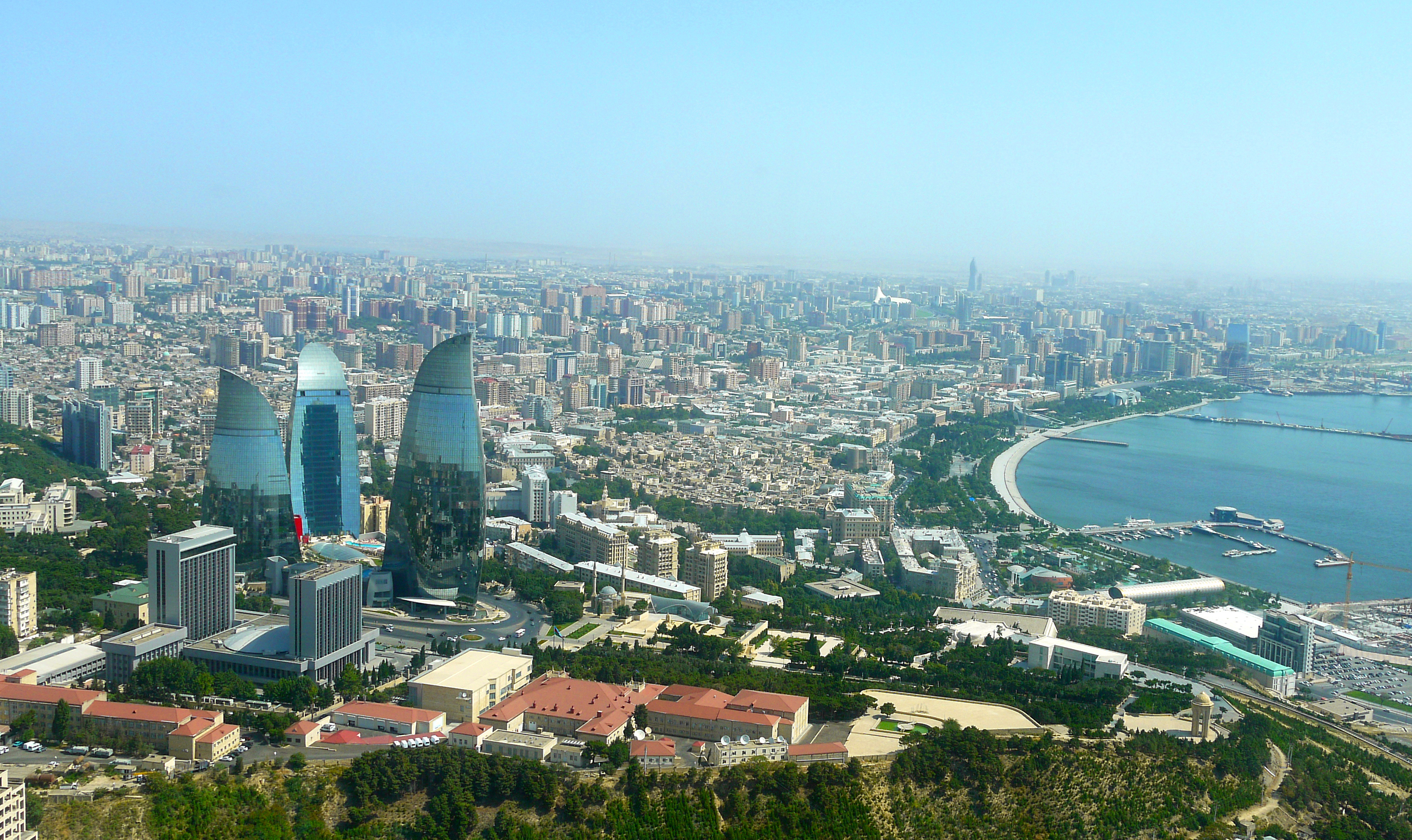
巴库(Baku, Баку)是阿塞拜疆首都和全国经济、文化中心。里海最大港口。位于阿普歇伦米岛南部,是石油工业中心,有“石油城”之誉。也是前苏联外高加索最大城市。 巴库由10个行政区和46个城镇组成,面积2200平方公里。人口182.88万。1月平均气温为4℃,7月平均气温为27.3℃。 在18世纪,巴库为巴库汗国都城。19世纪70年代开始工业性采油,19世纪末成为外高加索工业中心和石油基地,有22大炼油基地,其他工业多与石油有 关。1991年8月成为独立后阿塞拜疆的首都。城市西部的比比埃巴特区为老采油区。东部的基什雷区和邵武勉区为重要工业区。石油是巴库的经济命脉。石油开 采正向深处和外围海域发展。以石油、天然气开采和石油加工为主要工业,还有石油机械、电力和轻工 、食品工业。外高加索主要铁路枢纽,铁路通罗斯托夫、第比利斯和埃里温。有输油管道通黑海港口巴统。巴库是里海航运中心,可泊中等吨位船舶。城市中部为行 政、文化和居住区。建有科学院,大学和博物馆。里海最大港口,有“石油城”之誉。市内建有地铁,有阿塞拜疆科学学院、阿塞拜疆大学、石油化工学院等多所高 等院校。城市的中部是行政、文化区域,有历史博物馆和艺术博物馆。老城区以旧要塞为中心。 巴库是一座有着悠久历史的古城,城内有众多名胜古迹,如11世纪建造的瑟纳克一卡尔清真寺塔,12世纪的克孜一卡拉瑟塔楼,13世纪的巴伊洛夫石堡,15 世纪的希尔凡王宫及17世纪的汗王宫殿至今保存完好。2000年联合国教科文组织将巴库墙城及城内的希尔梵国王宫殿和少女塔作为文化遗产,列入《世界遗产 名录》。(Quelle:http://you.kuxun.cn)
巴库(阿塞拜疆语:Bakı,[bɑˈcɯ] (ⓘ))是阿塞拜疆的首都、经济文化中心。巴库同时也是里海最大港口,外高加索最大城市[4]。它的海拔是低于海平面28米(92英尺) ,使它成为世界上海拔最低的首都以及低于海平面的最大城市。面积2192平方公里,人口300万(2008年计算)[5]。巴库全市分为内城和新城两部分(亦有将苏联时期兴建区域分别划分的)。
在2007年,伊斯兰会议组织文化部长宣布巴库为2009年伊斯兰文化中心。为2015年第一届欧洲运动会主办国。巴库曾先后申办2016年夏季奥运会和2020年夏季奥运会,但皆因基础设施不完备没有入围。不过由于阿塞拜疆歌手艾尔与妮基在2011年欧洲歌唱大赛获得冠军,终使巴库获得举办2012年欧洲歌唱大赛的机会。
Baku (aserbaidschanisch Bakı / باکی; russisch Баку́ Baku) ist die Hauptstadt Aserbaidschans. Mit zwei Millionen Einwohnern in der Stadtprovinz ist Baku die bevölkerungsreichste und flächengrößte Stadt des Landes und des gesamten Kaukasus. Die Stadt an der Küste des Kaspischen Meeres ist Verkehrsknotenpunkt sowie Wirtschafts- und Kulturzentrum mit mehreren Universitäten, Hochschulen, Forschungsinstituten, Theatern und Museen. Durch die Lage innerhalb eines Erdölfördergebiets ist Baku der Knotenpunkt mehrerer Erdölleitungen und besitzt einen bedeutenden Erdölhafen. Baku kann aufgrund seiner günstigen Lage an mehreren historischen Handelswegen auf eine reiche Stadtgeschichte zurückblicken. In der Altstadt, die seit 2000 den Status eines UNESCO-Welterbes hat, sind zahlreiche Paläste, Moscheen und Festungsbauten erhalten geblieben.
バクー(Baku)は、アゼルバイジャン共和国の首都。カスピ海西岸に突き出したアブシェロン半島南岸に位置し、市街はバクー湾に面するように広がった港町である。行政的には11の行政区、48の町区に分割されており、2005年時点の総人口は2,045,815人[1]。アゼルバイジャン最大の都市であると同時に、南カフカース地域でも有数の大都市である。大規模な油田(バクー油田)をもち、帝政ロシア時代から石油の生産地として発展してきた。
日本語名のバクーはキリル文字綴りによるロシア語綴り・アゼルバイジャン語(アゼリー語)旧綴り Баку (Baku) に基づくが、アゼルバイジャン語の発音では母音の前で子音 k が軟音化するためカタカナ表記するならば「バキュ」に近く、現在アゼルバイジャンで使われているアゼルバイジャン語のラテン文字正書法では Bakı と綴る。バクーという名前の由来には諸説あるが、最も一般的なものは、ペルシャ語で「風が吹きつけた」という意味の "bād-kūbe"(バード・クーベ)から来ているとする説が一般的である。
気候は晴天が多く、乾燥している。寒気と暖気がぶつかることで起きる強風が時折吹き付け、先述した語源の根拠となっている。海岸は美しく、市街近郊には温泉や鉱泉がある。
市街の中心はその南西部にあり、イチェリ・シェヘル (İçəri Şəhər) すなわち「内城」と呼ばれる城壁に囲まれた旧市街と、帝政ロシア時代にその周囲に築かれた新市街とに分かれる。その周囲、北から東にかけての平地から丘陵の斜面一帯にソビエト連邦時代につくられた市街が広がっている。近年は豊富なオイルマネーをもとに近未来的な巨大建築物が出現し、「第二のドバイ」「第二のシンガポール」とも呼ばれている[2]。
Baku (/bəˈkuː/ bə-KOO, /ˈbɑːkuː/ BAH-koo; Azerbaijani: Bakı, IPA: [bɑˈcɯ]) is the capital and largest city of Azerbaijan, as well as the largest city on the Caspian Sea and of the Caucasus region, with a population of 2,262,600 (January 1, 2018). Baku is located 28 metres (92 ft) below sea level, which makes it the lowest lying national capital in the world and also the largest city in the world located below sea level. It is located on the southern shore of the Absheron Peninsula, alongside the Bay of Baku. At the beginning of 2009, Baku's urban population was estimated at just over two million people.[5] Officially, about 25 percent of all inhabitants of the country live in Baku's metropolitan area. Baku is the sole metropolis in Azerbaijan.
Baku is divided into twelve administrative districts (raions) and 48 townships. Among these are the townships on the islands of the Baku Archipelago, and the town of Oil Rocks built on stilts in the Caspian Sea, 60 kilometres (37 miles) away from Baku. The Inner City of Baku, along with the Shirvanshah's Palace and Maiden Tower, were inscribed as a UNESCO World Heritage Site in 2000. According to the Lonely Planet's ranking, Baku is also among the world's top ten destinations for urban nightlife.[6]
The city is the scientific, cultural, and industrial center of Azerbaijan. Many sizeable Azerbaijani institutions have their headquarters there. The Baku International Sea Trade Port is capable of handling two million tons of general and dry bulk cargoes per year.[7] In recent years, Baku has become an important venue for international events. It hosted the 57th Eurovision Song Contest in 2012, the 2015 European Games, 4th Islamic Solidarity Games, the F1 Azerbaijan Grand Prix since 2016, and will host UEFA Euro 2020. The city is bidding for Expo 2025 against Yekaterinburg, Russia and Osaka, Japan.
La ville de Bakou (azéri : Bakı, IPA: [bɑˈcɯ]) est la capitale de l'Azerbaïdjan. Elle se trouve dans l'est du pays, sur la rive sud de la péninsule d'Abşeron, au bord de la mer Caspienne. Son histoire débute au Ier millénaire avant Jésus-Christ, mais les traces écrites les plus anciennes ne datent que du Ve siècle.
En 2011, sa population est estimée à 2 045 815 habitants1 et 3 millions de personnes environ vivent dans l'agglomération.
Baku (pron. bakù[2]; in azero: Bakı?; in russo: Баку?), conosciuta anche come Baqy, Baky o Baki, in italiano Bacù[2], è la capitale, la più grande città e il più grande porto dell'Azerbaigian e di tutto il Caucaso.
È considerata una delle più antiche e più grandi città dell'Oriente. Situata sulla costa meridionale della penisola di Abşeron, la città si compone di tre parti principali: il centro, la vecchia Città Murata estesa sul territorio di 21,5 ettari e la parte della città costruita nell'epoca sovietica. La sua popolazione nel 2014 era stimata in 2.122.300 di abitanti.
Bakú (en azerí, Bakı, [bɑˈkɯ]) es la capital y ciudad más poblada de Azerbaiyán, del mar Caspio y del Cáucaso. Está situada en la costa sur de la península de Absheron, que se proyecta en el Caspio. La ciudad se compone de dos partes principales: el centro y la ciudad vieja interior. En enero de 2018 Bakú tenía una población de 2.262.600 habitantes,3 de los cuales 153.400 eran desplazados internos y 143.400 refugiados de la guerra de Nagorno Karabaj.
Bakú se divide en once distritos administrativos (raiones) y 48 municipios. Entre estos se encuentran los municipios de las islas de la bahía de Bakú y Neft Daşları construidas sobre pilotes en el mar Caspio, a 60 km de Bakú. El centro urbano de la ciudad, con el Palacio de los Shirvanshah y la Torre de la Doncella, fue inscrito por la Unesco como Patrimonio de la Humanidad en 2000. De acuerdo con la clasificación de Lonely Planet, Bakú también se encuentra entre los diez mejores destinos de vida nocturna urbana del mundo.4
La ciudad fue uno de los mayores centros petrolíferos de la antigua Unión Soviética y actualmente es el centro científico, cultural e industrial de Azerbaiyán. Muchas instituciones importantes de Azerbaiyán tienen su sede allí, incluyendo SOCAR, una de las cien principales empresas del mundo, entre otras.5 El Puerto de Comercio Marítimo Internacional de Bakú, protegido por las islas del archipiélago Bakú hacia el este y la península de Absheron al norte, es capaz de transportar dos millones de toneladas de carga general y seca a granel por año.6 La ciudad acogió el 57.º Festival de Eurovisión en 2012 y fue la sede de los Juegos Europeos 2015, es la sede del Gran Premio de Azerbaiyán de Fórmula 1 desde 2016 y será la sede del Campeonato Mundial de Ciclismo BMX en 2018 y de la EURO 2020.7
Баку́ (азерб. Bakı, МФА (азерб.): [bɑˈcɯ]) — столица Азербайджанской Республики, крупнейший промышленный, экономический и научно-технический центр Закавказья, а также самый крупный порт на Каспийском море и самый большой город на Кавказе[9][10].
Площадь территории, которая административно управляется Баку, составляет 2150 км²[1]; население данной территории — 2 181,8 тыс. жителей (на 1 января 2014 года). Баку расположен на южном берегу Апшеронского полуострова. Город по своей древности, величине территории и численности населения является одним из старинных и крупнейших городов Востока. Население всего Апшеронского полуострова (Бакинской агломерации) составляет 2 673,7 тыс. жителей[7]. Баку удостоен в 2010 году Программой ООН по окружающей среде (UNEP) звания одного из главных городов по проведению Всемирного дня окружающей среды. Подобные города избираются ежегодно. В 2010 году, наряду с Баку, этих званий были удостоены также Генуя (Италия) и Женева (Швейцария)[11].
UEFA European Championship 2020
History
ITU World Championship Series
Silk road
Sport
Triathlon
Hungary
 Cities founded by the Romans
World Heritage
Cities founded by the Romans
World Heritage


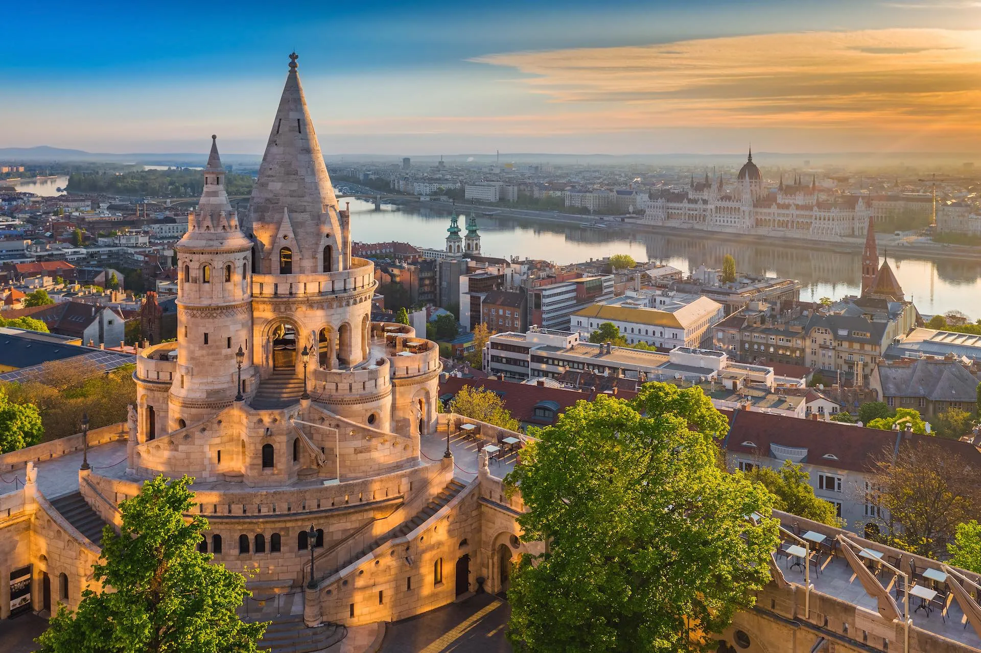
ブダペストまたはブダペシュト(ハンガリー語: Budapest, 英語:[ˈbuːdəpɛst], [ˈbuːdəpɛʃt] or [ˈbʊdəpɛst]; ハンガリー語発音: [ˈbudɒpɛʃt] ( 音声ファイル))は、ハンガリーの首都であり、同国最大の都市である[2]。
「ブダペスト」として一つの市でドナウ川の両岸を占めるようになったのは1873年11月17日に西岸のブダとオーブダ、東岸のペストが合併してからである[3][4]。
ドナウ川河畔に位置し、ハンガリーの政治、文化、商業、産業、交通の一大中心都市で[5]、東・中央ヨーロッパ (en) では最大、欧州連合の市域人口では8番目に大きな都市である。しばしばハンガリーのプライメイトシティとも表現される[6]。
ブダペストの市域面積は525km2 (202.7 sq mi)[3]で、2011年の国勢調査によるブダペストの人口は174万人[7]、ピークであった1989年の210万人より減少している[8]。これは、ブダペスト周辺部の郊外化によるものである[9]。ブダペスト都市圏(通勤圏)の人口は330万人である[10][11]。
ブダペストの歴史の始まりはローマ帝国のアクインクムとしてで、もともとはケルト人の集落であった[12][13]。アクインクムは古代ローマの低パンノニア属州の首府となっている[12]。マジャル人がブダペスト周辺にやって来たのは[14]9世紀頃である。最初の集落は1241年から1242年にかけてモンゴルの襲来 (en) により略奪された[15]。15世紀に[16]町が再建されるとブダペストはルネサンス期の人文主義者文化の中心となった[17]。続いてモハーチの戦いが起こり、オスマン帝国による150年間の支配が続き[18]、18世紀、19世紀に新しい時代に入ると町は発展し繁栄する。ブダペストは1873年にドナウ川を挟んだ都市の合併が行われると、世界都市となる[19]。また、1848年から1918年の第一次世界大戦勃発まで列強に含まれたオーストリア=ハンガリー帝国のウィーンに続く第二の首都であった。1920年のトリアノン条約によりハンガリーは国土の72%を失い、ハンガリーの文化や経済をブダペストがすべてを占めるようになった。ブダペストはその大きさや人口で圧倒的に優位に立ち、ハンガリーの他の都市を小さく見せていた[20]。ブダペストはハンガリー革命 (1848年)や1919年のハンガリー評議会共和国、1944年のパンツァーファウスト作戦、1945年のブダペスト包囲戦、1956年のハンガリー動乱など数々の歴史的な舞台の場でもあった。
ブダペストはヨーロッパでも最も美しい街の一つで[2][21][22]、ドナウ川河岸を含め世界遺産が広がりブダ城やアンドラーシ通り、英雄広場は良く知られている。ブダペスト地下鉄1号線Millenniumi Földalatti Vasútはロンドン地下鉄に次いで世界で2番目に古い地下鉄である[21][23]。ブダペストの他のハイライトはセーチェーニ温泉を含めた80の温泉で[24]世界でも最大の地下熱水系統がある[25]。世界で3番目に大きなシナゴーグであるドハーニ街シナゴーグや国会議事堂などもブダペストの見所である。ブダペストの観光客数は年間270万人に上り、ロンドンにある民間調査機関ユーロモニターによればブダペストは世界で37番目に旅行者が多い観光地であるとされている[26]。
Budapest /ˈbuːdəpɛst/ is the capital and the most populous city of Hungary, and the tenth-largest city in the European Union by population within city limits.[9][10][11] The city had an estimated population of 1,752,704 in 2016 distributed over a land area of about 525 square kilometres (203 square miles).[12] Budapest is both a city and county, and forms the centre of the Budapest metropolitan area, which has an area of 7,626 square kilometres (2,944 square miles) and a population of 3,303,786, comprising 33 percent of the population of Hungary.[13][14]
The history of the city began when an early Celtic settlement transformed into a Roman town of Aquincum,[15][16] the capital of Lower Pannonia.[15] The Hungarians arrived in the territory in the late 9th century.[17] By the 11th century, Buda and Óbuda (Old Buda) became the names of their settlements on the west bank of the river Danube, with a formerly Slavic and then German settlement Pest on the opposite side.[3][18] The area was pillaged by the Mongols in 1241.[18] The Battle of Mohács in 1526 was followed by nearly 150 years of Ottoman rule.[19] After the reconquest of Buda in 1686, the region entered a new age of prosperity. Pest-Buda became a global city with the unification of Buda, Óbuda, and Pest on November 17, 1873, with the name 'Budapest' given to the new capital.[12][20] Budapest also became the co-capital of the Austro-Hungarian Empire,[21] a great power that dissolved in 1918, following World War I. The city was the focal point of the Hungarian Revolution of 1848, the Battle of Budapest in 1945, and the Hungarian Revolution of 1956.[22][23]
Budapest is a Beta+ global city with strengths in commerce, finance, media, art, fashion, research, technology, education, and entertainment.[24][25] It is Hungary's financial centre[26] and the highest ranked Central and Eastern European city on Innovation Cities Top 100 index,[27][28][29] as well ranked as the second fastest-developing urban economy in Europe.[30] Budapest is host to many major international organization's regional offices, including the United Nations and ICDT,[31] furthermore it is the headquarters of the European Institute of Innovation and Technology,[32] the European Police College[33] and the first foreign office of the China Investment Promotion Agency.[34] Over 40 colleges and universities are located in Budapest, including the Eötvös Loránd University, Semmelweis University and the notable Budapest University of Technology and Economics.[35][36] Opened in 1896,[37] the city's subway system, the Budapest Metro, serves 1.27 million, while the Budapest Tram Network serves 1.08 million passengers daily.[38]
Budapest is cited as one of the most beautiful cities in Europe,[9][39][40] ranked as "the world's second best city" by Condé Nast Traveler,[41] and "Europe's 7th most idyllic place to live" by Forbes.[42] Among Budapest's important museums and cultural institutions is the Museum of Fine Arts. Further famous cultural institutions are the Hungarian National Museum, House of Terror, Franz Liszt Academy of Music, Hungarian State Opera House and National Széchényi Library. The central area of the city along the Danube River is classified as a UNESCO World Heritage Site and has many notable monuments, including the Hungarian Parliament, Buda Castle, Fisherman's Bastion, Gresham Palace, Széchenyi Chain Bridge, Matthias Church and the Liberty Statue.[43] Other famous landmarks include Andrássy Avenue, St. Stephen's Basilica, Heroes' Square, the Great Market Hall, the Nyugati Railway Station built by the Eiffel Company of Paris in 1877 and the second-oldest metro line in the world, the Millennium Underground Railway.[39] The city also has around 80 geothermal springs,[44] the largest thermal water cave system,[45] second largest synagogue, and third largest Parliament building in the world.[46] Budapest attracts 4.4 million international tourists per year, making it a popular destination in Europe.[47]
Budapest (prononcé [by.da.ˈpɛst] , hongrois : Budapest [ˈbu.dɒ.pɛʃt] Écouter ; allemand : Budapest ou anciennement Ofen-Pesth) est la plus grande ville et la capitale de la Hongrie. Elle se situe en aval du coude du Danube entre le massif de Transdanubie et l'Alföld. Ses habitants sont les Budapestois (en hongrois, budapesti, -ek).
La ville actuelle est créée en 1873 par la fusion de Buda — alors capitale de la Hongrie — de Pest et d'Óbuda1. Elle a pour origine le site d'Aquincum2, un point de peuplement celte3 devenu capitale de la Pannonie inférieure pendant l'époque romaine3. Les Magyars arrivent dans la région au IXe siècle. Leur premier point d'implantation est pillé par les Mongols en 1241-12424. La ville est reconstruite et devient l'un des centres de la culture humaniste de la Renaissance5 au XVe siècle6. Après près de 150 ans de domination ottomane, elle poursuit son développement et connaît son apogée avec l'épanouissement de l'ère industrielle aux XVIIIe et XIXe siècles. Après la fusion de 1873 et l'accession de la ville au rang de seconde capitale de l'Autriche-Hongrie, Budapest atteint les proportions et les caractéristiques d'une ville mondiale7. Marquée par les différentes traces léguées par l'histoire, Budapest a notamment été l'épicentre de la révolution hongroise de 1848, de la République des conseils de Hongrie de 1919, de l'opération Panzerfaust en 1944, de la bataille de Budapest de 1945 et de l'insurrection de 1956.
Considérée comme l'une des plus belles villes d'Europe et comme la « perle » du Danube8,1,9, son panorama, le quartier du château de Buda, l'avenue Andrássy et le métropolitain du Millénaire figurent au patrimoine mondial de l'UNESCO8,10. Destination touristique importante, la ville attire plus de 4,3 millions de visiteurs par an11.
Plus grande ville du pays, elle en est le principal centre politique, culturel, commercial et industriel. Elle abrite le Parlement hongrois, les bâtiments ministériels et les ambassades du pays ainsi que les sièges sociaux des entreprises installées en Hongrie. Son ancien statut de cocapitale de l'Autriche-Hongrie lui confère un rayonnement important dans la Mitteleuropa. La partition du royaume de Hongrie à la suite du traité de Trianon en 1920 en fait une ville démesurée pour la Hongrie dans ses frontières actuelles. La macrocéphalie dont est atteinte la ville se concrétise par la convergence de la plupart des réseaux routiers et ferroviaires du pays en son centre et des écarts démographiques et économiques disproportionnés entre la capitale et la province12 (près de 20 % de la population hongroise est budapestoise). Avec ses 1 702 297 habitants13 (l'aire urbaine en compte 2 524 697), Budapest est également la ville la plus peuplée d'Europe centrale (si l'on exclut Berlin de l'Europe centrale). Elle en est également considérée du point de vue des échanges économiques comme une importante plaque tournante14. Budapest abrite le siège de l'Institut européen d'innovation et de technologie (IET)15.
Budapest (IPA: [ˈbudɒpɛʃt]; pronuncia italiana moderna: /ˈbudapest/[1]) è la capitale e la maggiore città dell'Ungheria.
Amministrata come un comune autonomo, costituisce inoltre il centro primario del Paese per la vita politica, economica e culturale; al 2016 conta 1 759 407 abitanti, mentre la popolazione residente nell'area metropolitana ammonta a oltre 3 300 000 persone.
Budapest nacque ufficialmente nel 1873 dall'unione delle città storiche di Buda e Óbuda, ubicate sulla sponda destra del Danubio, con l'abitato di Pest, situato sulla riva opposta del fiume e anch'esso di antiche origini; fino al 1918 fu una delle due capitali dell'Impero austro-ungarico, dissoltosi al termine della prima guerra mondiale.
Nel XXI secolo, Budapest è diventata una metropoli globale e si è affermata come una popolare destinazione turistica: nel 2011, secondo i dati forniti da Euromonitor International, la capitale ungherese è stata la 25ª città più visitata del mondo[2].
Budapest ( /ˈbudɒpɛʃt/ (?·i)) es la capital y ciudad más poblada de Hungría,2 así como su principal centro industrial, comercial y de transportes.3 La ciudad posee 1,74 millones de habitantes (2011),4 una disminución significativa respecto de los casi 2,1 millones con que contaba a mediados de los años 1980,5 que representan un quinto de la población total de Hungría. Es la ciudad más poblada de Europa central-oriental y la séptima de la Unión Europea. La ciudad ocupa una superficie de 525 km²6 y su área metropolitana cuenta con una población de 2,38 millones de habitantes. Budapest se convirtió en una única ciudad cuando ocupó las dos orillas del río Danubio, unificando las ciudades de Buda y Óbuda, en la orilla oeste, con Pest, en la orilla este, el 17 de noviembre de 1873.67
La historia de Budapest comenzó con Aquincum, originalmente un asentamiento celta89 que se convirtió en la capital romana de Panonia Inferior.8 Los húngaros llegaron al territorio en el siglo IX.10 Su primer asentamiento fue saqueado por los mongoles en 1241-42.11 La ciudad restablecida se convirtió en uno de los centros de la cultura del Renacimiento humanista en el siglo XV.1213 Después de la batalla de Mohács y tras casi 150 años de dominio otomano,14 el desarrollo de la región entró en una nueva era de prosperidad en los siglos XVIII y XIX, y Budapest se convirtió en una ciudad global después de la unificación de 1873.15 También se convirtió en la segunda capital de Austria-Hungría, una gran potencia que se disolvió en 1918. Budapest fue el punto focal de la revolución húngara de 1848, la República Soviética Húngara de 1919, la Operación Panzerfaust en 1944, la batalla de Budapest de 1945 y la Revolución de 1956.
Considerada como una de las ciudades más bellas de Europa,21617 Budapest cuenta con varios sitios que son Patrimonio de la Humanidad, entre los que se incluyen, a orillas del Danubio, el barrio del Castillo de Buda, la avenida Andrássy, la Plaza de los Héroes y el Metropolitano del Milenio, el segundo más antiguo del mundo.1618 Otros puntos destacados incluyen un total de 80 manantiales geotérmicos,19 el mayor sistema de cuevas de aguas termales del mundo,20 la segunda sinagoga más grande y el tercer edificio del Parlamento más grande del mundo. La ciudad atrae a alrededor de 4,3 millones de turistas al año, convirtiéndola en la 25.ª ciudad más popular del mundo, según Euromonitor.21
Budapest es, también, un importante centro financiero de Europa Central. La ciudad se situó tercera (de un total de 65 ciudades) en el Índice de Mercados Emergentes elaborado por Mastercard,22 y clasificada como la ciudad mejor habitable de Europa Central y Europa del Este por índice de calidad de vida según Economist Intelligence Unit.2324 También se clasificó como el "séptimo lugar idílico de Europa para vivir" por la revista Forbes,25 y como la novena ciudad más bella del mundo por UCityGuides.26 Es, también, la mejor ciudad de Europa Central y del Este en el índice Innovation Cities' Top 100.2728
Будапе́шт (венг. Budapest [ˈbudɒpɛʃt]) — столица Венгрии и самый крупный город страны. По численности населения, составлявшей на январь 2014 года 1,745 млн жителей[2], в Европейском союзе Будапешт занимает восьмое место. Город образовался в 1873 году в результате слияния нескольких венгерских городов: Пешта, расположенного на восточной стороне реки Дунай, Буды и Обуды, занимающих западный берег Дуная.
Eurovision Song Contest,ESC
UEFA European Championship 2020
International cities
*European Capital of Culture
Netherlands
Olympic Summer Games
1928 Summer Olympics
World Heritage
Important port
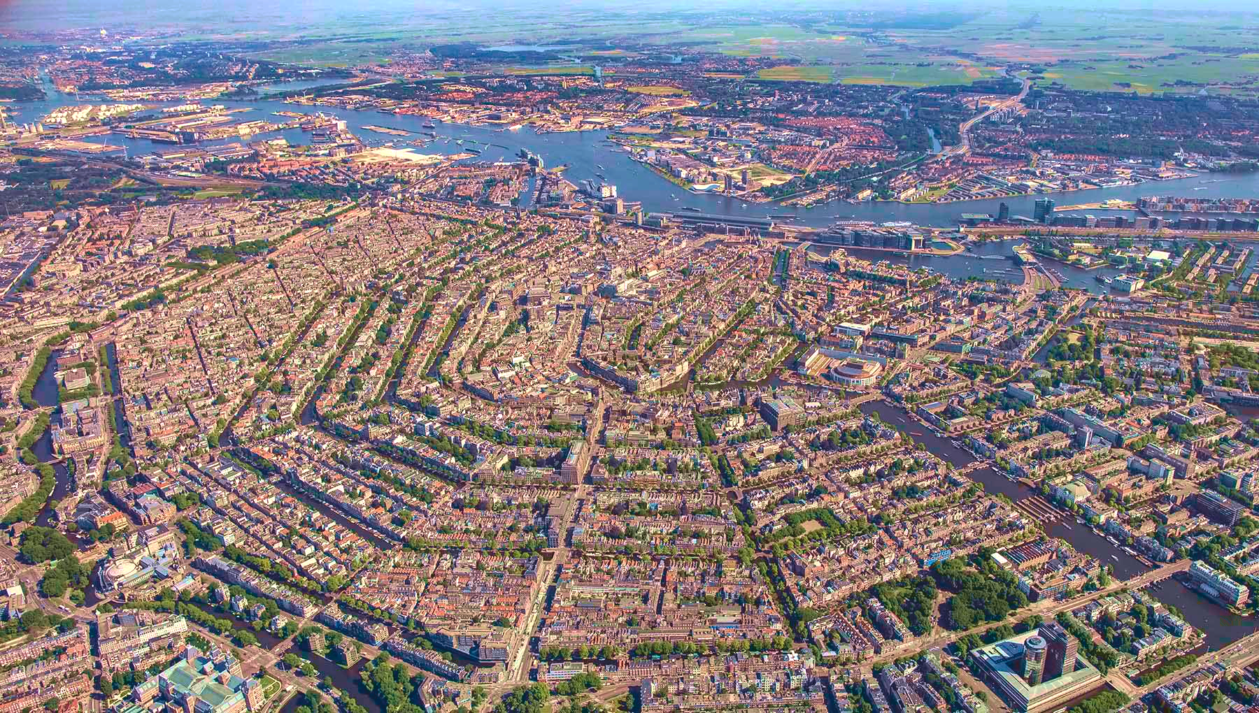
阿姆斯特丹(荷兰语:Amsterdam[ɑmstərˈdɑm] ),是荷兰首都及最大城市,位于该国西部省份北荷兰省。根据2008年1月的统计数据,这座城市人口达747,290人;而该城市所处的兰斯台德都市圈,大约有670万人口,是欧洲第6大都市圈。
其名称源于Amstel dam,这表明了该城市的起源:一个位于阿姆斯特尔河上的水坝,即今水坝广场址。12世纪晚期一个小渔村建于此,而后由于贸易的迅猛发展,阿姆斯特丹在荷兰黄金时代一跃而成为世界上最重要的港口。在那个时代,该城是金融和钻石的中心。 19和20世纪,该城扩展,许多新的街坊与近郊住宅区形成。
阿姆斯特丹是荷兰的金融和文化首都。许多荷兰大型机构的总部都设于此,其中包括飞利浦和ING等7家世界500强企业的总部。作为泛欧交易所的一部分,阿姆斯特丹证券交易所坐落于城市中心。阿姆斯特丹有很多旅游景点,包括历史悠久的运河网、荷兰国家博物馆、凡·高博物馆、安妮之家、红灯区以及许多大麻咖啡馆。每年有大约420万游客来此观光。
作为当前荷兰第一大城市,阿姆斯特丹历经了从渔村到国际化大都市的发展过程,经历了辉煌与破坏,以及世界大战的洗礼,从一定程度上讲,她的历史也是荷兰历史的一个缩影。
Amsterdam (niederländisch ) ist die Hauptstadt und einwohnerstärkste Stadt des Königreichs der Niederlande. Die Gemeinde Amsterdam hat 851.223 Einwohner (Stand: 31. August 2017)[2] und als Agglomeration Groot-Amsterdam 1.362.270 Millionen (Stand: 28. Februar 2018).[3] Im Großraum Amsterdam, der den nördlichen Teil des niederländischen Verdichtungsraumes Randstad ausmacht, leben etwa 2,4 Millionen Menschen (2012).[4] Auch wenn sich der Regierungssitz des Landes sowie die Königsresidenz im 60 Kilometer entfernten Den Haag befinden, ist Amsterdam seit 1983 gemäß niederländischer Verfassung die Hauptstadt der Niederlande.[5]
Amsterdam liegt in der niederländischen Provinz Nordholland, wo Amstel und IJ direkt hintereinander in das IJsselmeer münden. Der Hafen der Stadt ist durch den Nordseekanal mit der Nordsee verbunden. Amsterdam ist für die vielen Grachten weltberühmt.
アムステルダム(オランダ語: Amsterdam [ˌʔɑmstərˈdɑm] ( 音声ファイル))は、オランダの北ホラント州の基礎自治体(ヘメーンテ)であり、オランダ最大の都市である。人口820,654人(2012年)、都市圏人口は2,289,762人にのぼる。商業や観光が盛んなヨーロッパ屈指の世界都市である[6]。オランダ語での発音は片仮名で表記すると「アムスタダム」に近い。地名は「アムステル川のダム(堤防)」の意(「ダム広場」の項を参照)。
憲法に規定されたオランダの首都だが、国会、中央官庁、王宮、各国の大使館など首都機能のほとんどはデン・ハーグにある[7]。
元々は小さな漁村だったが、13世紀にアムステル川の河口にダムを築き、町が築かれた。16世紀には海運貿易の港町として、ヨーロッパ屈指の都市へと発展した。現在のアムステルダムは、アムステルダム中央駅を中心に市内に網の目状に広がる運河や、その運河に沿って並ぶ無総督時代の豪商の邸宅、自転車、飾り窓の女性たち、アンネ・フランクの家などで広く知られる。
Amsterdam (/ˈæmstərdæm/, UK also /ˌæmstərˈdæm/;[9][10] Dutch: [ɑmstərˈdɑm] ( listen)) is the capital and most populous municipality of the Netherlands. Its status as the capital is mandated by the Constitution of the Netherlands,[11] although it is not the seat of the government, which is The Hague.[12] Amsterdam has a population of 851,373 within the city proper, 1,351,587 in the urban area,[13] and 2,410,960 in the Amsterdam metropolitan area.[8] The city is located in the province of North Holland in the west of the country but is not its capital, which is Haarlem. The metropolitan area comprises much of the northern part of the Randstad, one of the larger conurbations in Europe, with a population of approximately 8 million.[14]
Amsterdam's name derives from Amstelredamme,[15] indicative of the city's origin around a dam in the river Amstel. Originating as a small fishing village in the late 12th century, Amsterdam became one of the most important ports in the world during the Dutch Golden Age (17th century), a result of its innovative developments in trade. During that time, the city was the leading centre for finance and diamonds.[16] In the 19th and 20th centuries the city expanded, and many new neighbourhoods and suburbs were planned and built. The 17th-century canals of Amsterdam and the 19–20th century Defence Line of Amsterdam are on the UNESCO World Heritage List. Since the annexation of the municipality of Sloten in 1921 by the municipality of Amsterdam, the oldest historic part of the city lies in Sloten (9th century).
As the commercial capital of the Netherlands and one of the top financial centres in Europe, Amsterdam is considered an alpha world city by the Globalization and World Cities (GaWC) study group. The city is also the cultural capital of the Netherlands.[17] Many large Dutch institutions have their headquarters there, and seven of the world's 500 largest companies, including Philips, AkzoNobel, TomTom and ING, are based in the city.[18] Also, many leading technology companies have their European headquarters in Amsterdam, such as Uber, Netflix and Tesla.[19] In 2012, Amsterdam was ranked the second best city to live in by the Economist Intelligence Unit (EIU)[20] and 12th globally on quality of living for environment and infrastructure by Mercer.[21] The city was ranked 3rd in innovation by Australian innovation agency 2thinknow in their Innovation Cities Index 2009.[22] The Port of Amsterdam to this day remains the second in the country, and the fifth largest seaport in Europe.[23] Famous Amsterdam residents include the diarist Anne Frank, artists Rembrandt van Rijn and Vincent van Gogh, and philosopher Baruch Spinoza.
The Amsterdam Stock Exchange, the oldest stock exchange in the world, is located in the city centre. Amsterdam's main attractions, include its historic canals, the Rijksmuseum, the Van Gogh Museum, the Stedelijk Museum, Hermitage Amsterdam, the Anne Frank House, the Scheepvaartmuseum, the Amsterdam Museum, the Heineken Experience, the Royal Palace of Amsterdam, Natura Artis Magistra, Hortus Botanicus Amsterdam, NEMO Science Museum, its red-light district and its many cannabis coffee shops draw more than 5 million international visitors annually.[24] The city is also well known for its nightlife and festival activity; several of its nightclubs (Melkweg, Paradiso) are among the world's most famous. It is also one of the world's most multicultural cities, with at least 177 nationalities represented.[25]
Amsterdam (Écouter) est la commune la plus peuplée et la capitale du royaume des Pays-Bas, bien que le gouvernement ainsi que la plupart des institutions du pays siègent à La Haye. Sur la base des chiffres de l'année 2017, la commune d'Amsterdam compte plus de 850 000 habitants appelés Amstellodamois, au cœur de la région d'Amsterdam qui regroupe environ 1 350 000 habitants. L'aire urbaine, qui rassemble plus de 2 400 000 résidents3,4 fait elle-même partie d'une conurbation appelée Randstad Holland qui compte 7 100 000 habitants. La ville est située en Hollande-Septentrionale, mais n'est cependant pas la capitale de la province, cette dernière étant Haarlem, située à 19 kilomètres à l'ouest d'Amsterdam.
Le nom de la commune vient de l'ancien nom néerlandais Amstelredamme évoquant les origines de la ville : la digue (Dam) sur l'Amstel. Petit village de pêcheurs au XIIe siècle, la ville connaît une très forte croissance au Moyen Âge au point de devenir l'un des principaux ports du monde durant le Siècle d'or néerlandais. Le quartier De Wallen est la partie la plus ancienne de la ville, qui se développe autour d'un réseau concentrique de canaux semi-circulaires reliés par des canaux perpendiculaires, formant une « toile d'araignée ». Au centre de la vieille ville se trouve, sur la place du Dam, le palais royal d'Amsterdam, construit au XVIIe siècle, symbole de l'importance de la ville. Guillaume Ier en fait sa résidence en 1815. Depuis juillet 2010, le quartier du Grachtengordel, délimité par le Herengracht, Keizersgracht et Prinsengracht, figure sur la liste du patrimoine mondial de l'UNESCO. Dans cette zone que se trouve le renommé béguinage d'Amsterdam, cour arborée et bordée d'habitations anciennes — la plus vieille datant de 1528 environ — abritant en son sein une chapelle anglicane.
Amsterdam est l'un des centres économiques majeurs des Pays-Bas et l'un des principaux centres financiers d'Europe. Les sièges sociaux de plusieurs firmes multinationales (Philips, AkzoNobel, ING et TomTom notamment) sont situés dans la ville et d'autres ont leurs bureaux européens basés à Amsterdam (principalement Netflix, Uber et Tesla). La ville est également la première destination touristique et culturelle néerlandaise, notamment du fait de la renommée ses principaux musées concentrés autour du Museumplein : le musée d'État, la fondation d'art moderne Stedelijk Museum et le Van Gogh Museum figurent parmi les plus visités au monde. D'autres lieux culturels d'importance sont le musée scientifique NEMO, l'Institut royal des Tropiques, le musée d'art Hermitage, l'institut du cinéma EYE, le musée maritime néerlandais et la Maison Anne Frank.
Divers classements placent Amsterdam parmi les métropoles mondiales offrant le meilleur confort de vie5, le magazine américain Forbes la positionnant à la première place en 20166. Selon l'Economist Intelligence Unit, elle est également la deuxième ville la plus sûre d'Europe après Stockholm7. La majorité des déplacements en ville s'effectue grâce aux quinze lignes de tramway, aux cinq lignes de métro, à pied ou à vélo. La ville est réputée pour ses événements festivaliers (particulièrement l'Amsterdam Music Festival, Sensation, In Qontrol et Uitmarkt), ses discothèques (spécifiquement Paradiso et Melkweg) et ses salles de concert (notamment le Ziggo Dome, Concertgebouw, Heineken Music Hall et Stadsschouwburg). Amsterdam est aussi connue pour son quartier rouge, ainsi que pour ses nombreux coffee shops possédant une licence leur permettant de commercialiser le cannabis, reflétant le progressisme politique des Pays-Bas8.
Amsterdam (pron. /ˈamsterdam/[1]; in olandese: /ˌɑmstər'dɑm/, ) è la capitale e la maggiore città dei Paesi Bassi, nella provincia dell'Olanda Settentrionale. La municipalità di Amsterdam ha 851.573 residenti (al 2017) di oltre 170 nazionalità, mentre la popolazione che risiede nell'area metropolitana è di circa 2.289.762 persone. L'area al centro della città circondata dai canali del XII secolo è dal 2010 Patrimonio dell'umanità.
Amsterdam possiede uno dei maggiori centri rinascimentali di tutta l'Europa. Numerose costruzioni che risalgono al periodo tra il XVI e XVII secolo, conosciuto anche come Secolo d'oro, sono ora considerate monumenti storici e sono collocate intorno ad una serie di canali poligonali concentrici. Questi cingono il vecchio porto che un tempo era affacciato sullo Zuiderzee, oggi un lago separato dal resto del mare e noto con il nome di IJsselmeer. La città è famosa per ospitare il Rijksmuseum (museo statale), il museo Van Gogh, il Concertgebouw, il Rembrandthuis, la casa di Anna Frank e un enorme numero di biciclette.
Amsterdam è anche famosa per il suo quartiere a luci rosse, il De Wallen, e i suoi numerosi coffee-shop autorizzati alla vendita di marijuana e di derivati della cannabis.
Il motto ufficiale della città è "Heldhaftig, Vastberaden, Barmhartig" ("valorosa, decisa, misericordiosa"). Le tre croci di Sant'Andrea sulla bandiera sono associate a queste tre parole, benché siano entrate in uso prima del motto.
Ámsterdam5 o Amsterdam, según la pronunciación etimológica ( Amsterdam (?·i) [ɑmstər'dɑm]), es la capital oficial de los Países Bajos. La ciudad está situada entre la bahía del IJ, al norte, y a las orillas del río Amstel, al sureste. Fue fundada en el siglo XII como un pequeño pueblo pesquero. Sin embargo, en la actualidad es la ciudad más grande del país y un gran centro financiero y cultural de proyección internacional.
Tiene una población de unos 810 000 habitantes y en su área metropolitana residen aproximadamente 1,5 millones. Cabe destacar que Ámsterdam forma parte de la gran conurbación neerlandesa llamada Randstad (junto con las ciudades de La Haya, Róterdam y Utrecht), que cuenta con más de 6,5 millones de habitantes. Este núcleo es una de las conurbaciones más grandes de Europa.
El centro histórico de la ciudad fue construido en gran parte en el siglo XVII y es hoy en día uno de los centros históricos más grandes de Europa. En aquella época se construyeron una serie de canales semicirculares alrededor del casco antiguo ya existente de la ciudad. Después se edificaron las nuevas calles que ahora habían sido creadas con casas y almacenes en un estilo típico neerlandés que es una de las imágenes más famosas de Ámsterdam y del país. Al igual que otras ciudades de Europa septentrional con abundancia de agua, como Brujas, Hamburgo y Estocolmo, es conocida coloquialmente como la «Venecia del norte».
Aunque durante casi toda su historia (excepto entre 1808–1810) ha sido la capital oficial de los Países Bajos, nunca ha sido la sede de la justicia, el gobierno o el parlamento neerlandés, ya que todos estos órganos se encuentran en la ciudad de La Haya, que por tanto es la principal ciudad del país con respecto a política y justicia. Ámsterdam tampoco es la capital de la provincia de Holanda Septentrional, que siempre ha sido Haarlem.
Амстерда́м (нидерл. Amsterdam [ˌɑmstərˈdɑm]) — столица и крупнейший город Нидерландов. Является столицей королевства с 1814 года. Расположен в провинции Северная Голландия на западе страны в устье рек Амстел и Эй. Амстердам соединён Нордзе-каналом с Северным морем.
По состоянию на 1 января 2012 года население муниципалитета Амстердам составляет 801 847 человек[1], вместе с пригородами (городской округ) — 2,3 млн жителей. Амстердам является частью агломерации Рандстад, которая является 6-й по величине в Европе.
Название города произошло от двух слов: «Амстел» — название реки и «дам» — «дамба». В XII веке это была небольшая рыбачья деревня, но во времена Золотого века Нидерландов Амстердам стал одним из наиболее значимых портов мира и крупным торговым центром.
Город является местом концентрации различных культур — в апреле 2009 года здесь проживали представители 177 национальностей.
Амстердам также является финансовой и культурной столицей Нидерландов. Здесь расположились штаб-квартиры 7 из 500 наиболее крупных мировых компаний, например, Philips и ING Groep. Также в центре города расположена старейшая в мире фондовая биржа.
В Амстердаме расположен главный офис Гринпис.
Множество достопримечательностей: Рейксмюзеум, Музей Винсента Ван Гога, Городской музей, Эрмитаж на Амстеле, квартал красных фонарей (Де Валлен) — ежегодно привлекает в город около 4,2 миллиона туристов.