Deutsch-Chinesische Enzyklopädie, 德汉百科
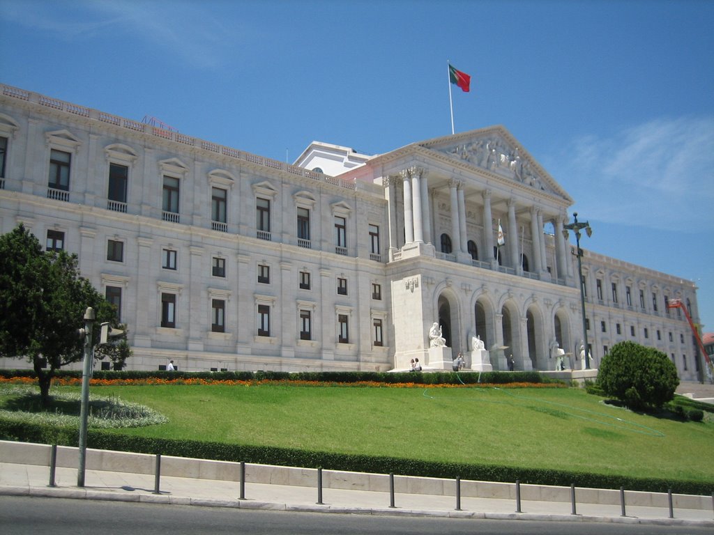
 Portugal
 Transport und Verkehr
Beijing Shi-BJ
Belarus
Transport und Verkehr
Beijing Shi-BJ
Belarus
 Berlin
 Brandenburg
 Bremen
China
Deutschland
Frankreich
Gansu Sheng-GS
Bremen
China
Deutschland
Frankreich
Gansu Sheng-GS
 Hamburg
Hebei Sheng-HE
Heilongjiang Sheng-HL
Henan Sheng-HA
Hubei Sheng-HB
Hunan Sheng-HN
Iran
Italien
Jilin Sheng-JL
Kasachstan
Liaoning Sheng-LN
Nei Mongol Zizhiqu-NM
Niederlande
Hamburg
Hebei Sheng-HE
Heilongjiang Sheng-HL
Henan Sheng-HA
Hubei Sheng-HB
Hunan Sheng-HN
Iran
Italien
Jilin Sheng-JL
Kasachstan
Liaoning Sheng-LN
Nei Mongol Zizhiqu-NM
Niederlande
 Niedersachsen
Ningxia Huizu Zizhiqu-NX
Niedersachsen
Ningxia Huizu Zizhiqu-NX
 Nordrhein-Westfalen
Polen
Portugal
Russland
Nordrhein-Westfalen
Polen
Portugal
Russland
 Sachsen
 Schleswig-Holstein
Shaanxi Sheng-SN
Shandong Sheng-SD
Shanxi Sheng-SX
Sichuan Sheng-SC
Spanien
Türkei
Turkmenistan
Usbekistan
Vereinigtes Königreich
Xinjiang Uygur Zizhiqu-XJ
Zhejiang Sheng-ZJ
Schleswig-Holstein
Shaanxi Sheng-SN
Shandong Sheng-SD
Shanxi Sheng-SX
Sichuan Sheng-SC
Spanien
Türkei
Turkmenistan
Usbekistan
Vereinigtes Königreich
Xinjiang Uygur Zizhiqu-XJ
Zhejiang Sheng-ZJ
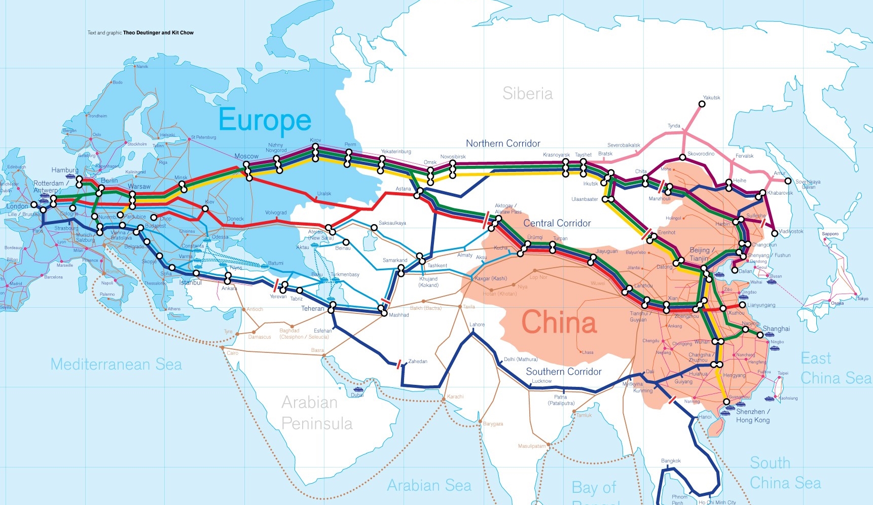
Die Neue eurasische Kontinentalbrücke (chinesisch 新亚欧大陆桥, Pinyin Xīn Yà-Ōu Dàlù Qiáo, englisch New Eurasian Continental Bridge), die auch Zweite eurasische Kontinentalbrücke (第二亚欧大陆桥, Dì'èr Yà-Ōu Dàlù Qiáo, englisch Second Eurasian Continental Bridge) genannt wird, ist eine 10.870 Kilometer[1] lange Eisenbahnverbindung, die Rotterdam in Europa mit der ostchinesischen Hafenstadt Lianyungang in der Provinz Jiangsu verbindet.
Sie besteht seit 1990 und führt durch die Dsungarische Pforte (Grenzbahnhof Alashankou). Die Lan-Xin-Bahn (chinesisch 兰新铁路, Pinyin Lán-Xīn Tiělù), also die Strecke von Lanzhou nach Ürümqi (in Xinjiang), ist ein Teil von ihr.
Es gibt eine nördliche, mittlere und südliche Route.[2] Die mittlere Strecke verläuft durch Kasachstan über Dostyk, Aqtogai, Astana, Samara, Smolensk, Brest, Warschau, Berlin zum Hafen von Rotterdam.[3] Vom slowakischen Košice soll auch eine Abzweigung in den Großraum Wien führen, siehe Breitspurstrecke Košice–Wien.
The New Eurasian Land Bridge, also called the Second or New Eurasian Continental Bridge, is the southern branch of the Eurasian Land Bridge rail links running through China. The Eurasian Land Bridge is the overland rail link between Asia and Europe.
Due to a break-of-gauge between standard gauge used in China and the Russian gauge used in the former Soviet Union countries, containers must be physically transferred from Chinese to Kazakh railway cars at Dostyk on the Chinese-Kazakh border and again at the Belarus-Poland border where the standard gauge used in western Europe begins. This is done with truck-mounted cranes.[1] Chinese media often states that the New Eurasian Land/Continental Bridge extends from Lianyungang to Rotterdam, a distance of 11,870 kilometres (7,380 mi). The exact route used to connect the two cities is not always specified in Chinese media reports, but appears to usually refer to the route which passes through Kazakhstan.
All rail freight from China across the Eurasian Land Bridge must pass north of the Caspian Sea through Russia at some point. A proposed alternative would pass through Turkey and Bulgaria,[2] but any route south of the Caspian Sea must pass through Iran.[1]
Kazakhstan's President Nursultan Nazarbayev urged Eurasian and Chinese leaders at the 18th Shanghai Cooperation Organisation to construct the Eurasian high-speed railway (EHSRW) following a Beijing-Astana-Moscow-Berlin.[3]
The Eurasian Land Bridge (Russian: Евразийский сухопутный мост, Yevraziyskiy sukhoputniy most), sometimes called the New Silk Road (Новый шёлковый путь, Noviy shyolkoviy put'), or Belt and Road Initiative is the rail transport route for moving freight and passengers overland between Pacific seaports in the Russian Far East and China and seaports in Europe. The route, a transcontinental railroad and rail land bridge, currently comprises the Trans-Siberian Railway, which runs through Russia and is sometimes called the Northern East-West Corridor, and the New Eurasian Land Bridge or Second Eurasian Continental Bridge, running through China and Kazakhstan. As of November 2007, about 1% of the $600 billion in goods shipped from Asia to Europe each year were delivered by inland transport routes.[1]
Completed in 1916, the Trans-Siberian connects Moscow with Russian Pacific seaports such as Vladivostok. From the 1960s until the early 1990s the railway served as the primary land bridge between Asia and Europe, until several factors caused the use of the railway for transcontinental freight to dwindle. One factor is that the railways of the former Soviet Union use a wider rail gauge than most of the rest of Europe as well as China. Recently, however, the Trans-Siberian has regained ground as a viable land route between the two continents.[why?]
China's rail system had long linked to the Trans-Siberian via northeastern China and Mongolia. In 1990 China added a link between its rail system and the Trans-Siberian via Kazakhstan. China calls its uninterrupted rail link between the port city of Lianyungang and Kazakhstan the New Eurasian Land Bridge or Second Eurasian Continental Bridge. In addition to Kazakhstan, the railways connect with other countries in Central Asia and the Middle East, including Iran. With the October 2013 completion of the rail link across the Bosphorus under the Marmaray project the New Eurasian Land Bridge now theoretically connects to Europe via Central and South Asia.
Proposed expansion of the Eurasian Land Bridge includes construction of a railway across Kazakhstan that is the same gauge as Chinese railways, rail links to India, Burma, Thailand, Malaysia and elsewhere in Southeast Asia, construction of a rail tunnel and highway bridge across the Bering Strait to connect the Trans-Siberian to the North American rail system, and construction of a rail tunnel between South Korea and Japan. The United Nations has proposed further expansion of the Eurasian Land Bridge, including the Trans-Asian Railway project.
El Nuevo Puente de Tierra de Eurasia es también llamado el Segundo o Nuevo Puente Continental de Eurasia. Es la rama meridional de las conexiones ferroviarias del Puente de Tierra de Eurasia (también conocido como "Nueva Ruta de la Seda") que se extienden a través de la República Popular China, atravesando Kazajistán, Rusia y Bielorrusia. El Puente de Tierra de Eurasia es el enlace ferroviario terrestre entre Asia Oriental y Europa.
La Nueva Ruta de la Seda (en ruso, Новый шёлковый путь, Noviy shyolkoviy put), o Puente Terrestre Euroasiático, es la ruta de transporte ferroviario para el movimiento de tren de mercancías y tren de pasajeros por tierra entre los puertos del Pacífico, en el Lejano Oriente ruso y chino y los puertos marítimos en Europa.
La ruta, un ferrocarril transcontinental y puente terrestre, actualmente comprende el ferrocarril Transiberiano, que se extiende a través de Rusia, y el nuevo puente de tierra de Eurasia o segundo puente continental de Eurasia, que discurre a través de China y Kazajistán, también se van a construir carreteras entre las ciudades de la ruta. A partir de noviembre de 2007, aproximadamente el 1% de los 600 millones de dólares en bienes enviados desde Asia a Europa cada año se entregaron por vías de transporte terrestre.1
Terminado en 1916, el tren Transiberiano conecta Moscú con el lejano puerto de Vladivostok en el océano Pacífico, el más largo del mundo en el Lejano Oriente e importante puerto del Pacífico. Desde la década de 1960 hasta principios de 1990 el ferrocarril sirvió como el principal puente terrestre entre Asia y Europa, hasta que varios factores hicieron que el uso de la vía férrea transcontinental para el transporte de carga disminuyese.
Un factor es que los ferrocarriles de la Unión Soviética utilizan un ancho de vía más ancho en los rieles que la mayor parte del resto de Europa y China, y el transporte en barcos de carga por el canal de Suez en Egipto, construido por Inglaterra. El sistema ferroviario de China se une al Transiberiano en el noreste de China y Mongolia. En 1990 China añadió un enlace entre su sistema ferroviario y el Transiberiano a través de Kazajistán. China denomina a su enlace ferroviario ininterrumpido entre la ciudad portuaria de Lianyungang y Kazajistán como el «Puente terrestre de Nueva Eurasia» o «Segundo puente continental Euroasiático». Además de Kazajistán, los ferrocarriles conectan con otros países de Asia Central y Oriente Medio, incluyendo a Irán. Con la finalización en octubre de 2013 de la línea ferroviaria a través del Bósforo en el marco del proyecto Marmaray el puente de tierra de Nueva Eurasia conecta ahora teóricamente a Europa a través de Asia Central y del Sur.
La propuesta de ampliación del Puente Terrestre Euroasiático incluye la construcción de un ferrocarril a través de Kazajistán con el mismo ancho de vía que los ferrocarriles chinos, enlaces ferroviarios a la India, Birmania, Tailandia, Malasia y otros países del sudeste asiático, la construcción de un túnel ferroviario y un puente de carretera a través del estrecho de Bering para conectar el Transiberiano al sistema ferroviario de América del Norte, y la construcción de un túnel ferroviario entre Corea del Sur y Japón. Las Naciones Unidas ha propuesto una mayor expansión del Puente Terrestre Euroasiático, incluyendo el proyecto del ferrocarril transasiático.
Новый шёлковый путь (Евразийский сухопутный мост — концепция новой паневразийской (в перспективе — межконтинентальной) транспортной системы, продвигаемой Китаем, в сотрудничестве с Казахстаном, Россией и другими странами, для перемещения грузов и пассажиров по суше из Китая в страны Европы. Транспортный маршрут включает трансконтинентальную железную дорогу — Транссибирскую магистраль, которая проходит через Россию и второй Евразийский континентальный мост[en], проходящий через Казахстан[1]. Поезда по этому самому длинному в мире грузовому железнодорожному маршруту из Китая в Германию будут идти 15 дней, что в 2 раза быстрее, чем по морскому маршруту через Суэцкий канал[2].
Идея Нового шёлкового пути основывается на историческом примере древнего Великого шёлкового пути, действовавшего со II в. до н. э. и бывшего одним из важнейших торговых маршрутов в древности и в средние века. Современный НШП является важнейшей частью стратегии развития Китая в современном мире — Новый шёлковый путь не только должен выстроить самые удобные и быстрые транзитные маршруты через центр Евразии, но и усилить экономическое развитие внутренних регионов Китая и соседних стран, а также создать новые рынки для китайских товаров (по состоянию на ноябрь 2007 года, около 1 % от товаров на 600 млрд долл. из Азии в Европу ежегодно доставлялись наземным транспортом[3]).
Китай продвигает проект «Нового шёлкового пути» не просто как возрождение древнего Шёлкового пути, транспортного маршрута между Востоком и Западом, но как масштабное преобразование всей торгово-экономической модели Евразии, и в первую очередь — Центральной и Средней Азии. Китайцы называют эту концепцию — «один пояс — один путь». Она включает в себя множество инфраструктурных проектов, которые должны в итоге опоясать всю планету. Проект всемирной системы транспортных коридоров соединяет Австралию и Индонезию, всю Центральную и Восточную Азию, Ближний Восток, Европу, Африку и через Латинскую Америку выходит к США. Среди проектов в рамках НШП планируются железные дороги и шоссе, морские и воздушные пути, трубопроводы и линии электропередач, и вся сопутствующая инфраструктура. По самым скромным оценкам, НШП втянет в свою орбиту 4,4 миллиарда человек — более половины населения Земли[4].
Предполагаемое расширение Евразийского сухопутного моста включает в себя строительство железнодорожных путей от трансконтинентальных линий в Иран, Индию, Мьянму, Таиланд, Пакистан, Непал, Афганистан и Малайзию, в другие регионы Юго-Восточной Азии и Закавказья (Азербайджан, Грузия). Маршрут включает тоннель Мармарай под проливом Босфор, паромные переправы через Каспийское море (Азербайджан-Иран-Туркменистан-Казахстан) и коридор Север-Юг.Организация Объединенных Наций предложила дальнейшее расширение Евразийского сухопутного моста, в том числе проекта Трансазиатской железной дороги (фактически существует уже в 2 вариантах).
Для развития инфраструктурных проектов в странах вдоль Нового шёлкового пути и Морского Шёлкового пути и с целью содействия сбыту китайской продукции в декабре 2014 года был создан инвестиционный Фонд Шёлкового пути[5].
8 мая 2015 года было подписано совместное заявление Президента РФ В. Путина и Председателя КНР Си Цзиньпина о сотрудничестве России и Китая, в рамках ЕАЭС и трансевразийского торгово-инфраструктурного проекта экономического пояса «Шёлковый путь». 13 июня 2015 года был запущен самый длинный в мире грузовой железнодорожный маршрут Харбин — Гамбург (Германия), через территорию России.
 Internationale Städte
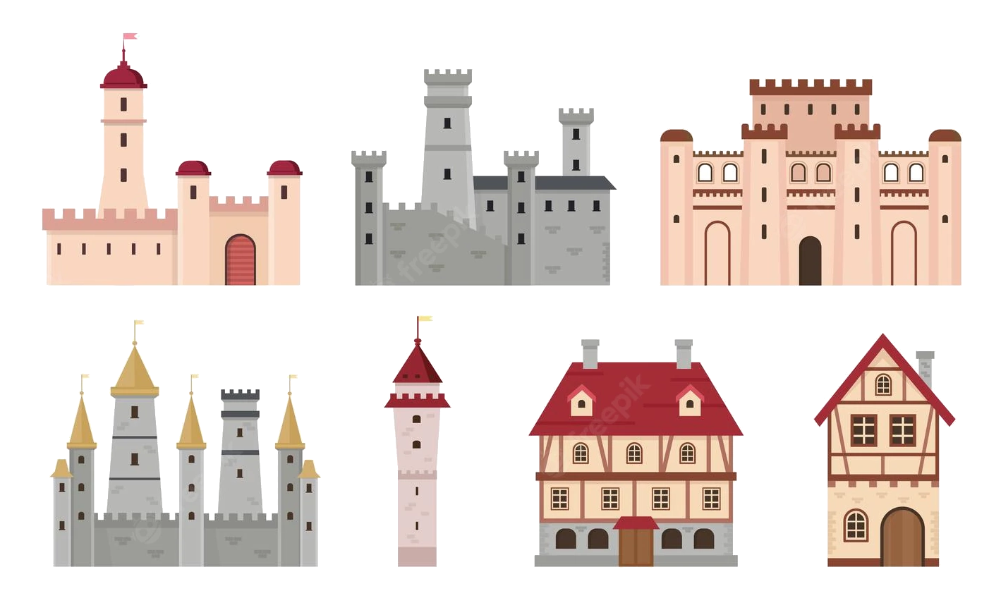 Mittelalterliche Städte in Europa

 Geographie
Ägypten
Algerien
Geographie
Ägypten
Algerien
 Essen und Trinken
 *Oliven/Olivenöl
Griechenland
Italien
*Oliven/Olivenöl
Griechenland
Italien
 Landwirtschaft, Forstwirtschaft, Viehzucht, Fischerei
Marokko
Portugal
Spanien
Syrien
Tunesien
Türkei
Landwirtschaft, Forstwirtschaft, Viehzucht, Fischerei
Marokko
Portugal
Spanien
Syrien
Tunesien
Türkei

| Rank | Country | Production (Tonnes) | Production per Capita (Kg) | Harvasted Area (Ha) | Yield (Kg/Ha) |
|---|---|---|---|---|---|
| 1 | Spain | 6,559,884 | 141 | 2,573,473 | 2,549 |
| 2 | Greece | 2,343,383 | 218 | 887,177 | 2,641 |
| 3 | Italy | 2,092,175 | 34.6 | 1,165,562 | 1,795 |
| 4 | Turkey | 1,730,000 | 21.4 | 845,542 | 2,046 |
| 5 | Morocco | 1,416,107 | 40.7 | 1,008,365 | 1,404 |
| 6 | Syria | 899,435 | 49.2 | 765,603 | 1,175 |
| 7 | Tunisia | 700,000 | 61.2 | 1,646,060 | 425 |
| 8 | Algeria | 696,962 | 16.4 | 424,028 | 1,644 |
| 9 | Egypt | 694,309 | 7.1 | 67,293 | 10,318 |
| 10 | Portugal | 617,610 | 60.0 | 355,075 | 1,739 |
| 11 | Libya | 188,975 | 29.2 | 357,797 | 528 |
| 12 | Argentina | 175,094 | 3.9 | 61,942 | 2,827 |
| 13 | United States of America | 159,600 | 0.49 | 14,164 | 11,268 |
| 14 | Lebanon | 118,146 | 19.4 | 62,297 | 1,897 |
| 15 | Jordan | 115,813 | 11.3 | 63,963 | 1,811 |
| 16 | Chile | 111,481 | 6.3 | 20,343 | 5,480 |
| 17 | Albania | 99,075 | 34.5 | 38,889 | 2,548 |
| 18 | Palestinian Territories | 95,044 | | 66,645 | 1,426 |
| 19 | Israel | 91,000 | 10.2 | 33,700 | 2,700 |
| 20 | Iran | 85,049 | 1.0 | 66,915 | 1,271 |
| 21 | Australia | 75,083 | 3.0 | 32,747 | 2,293 |
| 22 | Peru | 56,157 | 1.8 | 17,119 | 3,281 |
| 23 | Croatia | 31,183 | 7.4 | 18,184 | 1,715 |
| 24 | France | 27,102 | 0.40 | 17,354 | 1,562 |
| 25 | Mexico | 21,650 | 0.17 | 5,094 | 4,250 |
| 26 | Cyprus | 13,499 | 15.8 | 10,612 | 1,272 |
| 27 | Macedonia | 12,369 | 6.0 | 5,852 | 2,114 |
| 28 | El Salvador | 10,840 | 1.6 | 5,227 | 2,074 |
| 29 | Iraq | 9,332 | 0.24 | 2,294 | 4,068 |
| 30 | Afghanistan | 7,647 | 0.24 | 2,200 | 3,476 |
| 31 | Uruguay | 6,159 | 1.8 | 2,985 | 2,063 |
| 32 | Taiwan | 2,621 | 0.11 | 318 | 8,256 |
| 33 | China | 2,621 | 0.00188 | 318 | 8,256 |
| 34 | Slovenia | 1,662 | 0.80 | 1,173 | 1,417 |
| 35 | Azerbaijan | 1,586 | 0.16 | 2,979 | 533 |
| 36 | Brazil | 647 | 0.00309 | 574 | 1,127 |
| 37 | Bosnia and Herzegovina | 359 | 0.095 | 254 | 1,416 |
| 38 | Montenegro | 250 | 0.40 | 90.0 | 2,778 |
| 39 | Uzbekistan | 116 | 0.00355 | 117 | 987 |
| 40 | Kuwait | 60.0 | 0.014 | 35.0 | 1,702 |
| 41 | Malta | 30.0 | 0.063 | 28.0 | 1,064 |
 Wirtschaft und Handel
Australien
Belgien
Chile
Dänemark
Deutschland
Estland
Finnland
Frankreich
Griechenland
Irland
Island
Israel
Italien
Japan
Kanada
Luxemburg
Mexiko
Neuseeland
Niederlande
Norwegen
OECD
Emiel van Lennep
OECD
Don Johnston
OECD
Jean-Claude Paye
OECD
José Ángel Gurría
OECD
Staffan Sohlman
OECD
Thorkil Kristensen
Österreich
Polen
Portugal
Republik Korea
Schweden
Schweiz
Slowakei
Slowenien
Spanien
Tschechien
Türkei
Ungarn
Vereinigte Staaten
Vereinigtes Königreich
Wirtschaft und Handel
Australien
Belgien
Chile
Dänemark
Deutschland
Estland
Finnland
Frankreich
Griechenland
Irland
Island
Israel
Italien
Japan
Kanada
Luxemburg
Mexiko
Neuseeland
Niederlande
Norwegen
OECD
Emiel van Lennep
OECD
Don Johnston
OECD
Jean-Claude Paye
OECD
José Ángel Gurría
OECD
Staffan Sohlman
OECD
Thorkil Kristensen
Österreich
Polen
Portugal
Republik Korea
Schweden
Schweiz
Slowakei
Slowenien
Spanien
Tschechien
Türkei
Ungarn
Vereinigte Staaten
Vereinigtes Königreich
 Wichtige internationale Organisationen

経済協力開発機構(けいざいきょうりょくかいはつきこう)は、国際経済全般について協議することを目的とした国際機関。公用語の正式名称は、英語では"Organisation[1] for Economic Co-operation and Development"(イギリス英語表記)、フランス語では"Organisation de Coopération et de Développement Economiques"。略称は英語ではOECD、フランス語ではOCDE。
本部事務局はパリ16区の旧ラ・ミュエット宮殿に置かれている。事務総長はアンヘル・グリア。
The Organisation for Economic Co-operation and Development (OECD; French: Organisation de Coopération et de Développement Économiques, OCDE) is an intergovernmental economic organisation with 37 member countries,[1] founded in 1961 to stimulate economic progress and world trade. It is a forum of countries describing themselves as committed to democracy and the market economy, providing a platform to compare policy experiences, seek answers to common problems, identify good practices and coordinate domestic and international policies of its members. Generally, OECD members are high-income economies with a very high Human Development Index (HDI) and are regarded as developed countries. As of 2017, the OECD member countries collectively comprised 62.2% of global nominal GDP (US$49.6 trillion)[3] and 42.8% of global GDP (Int$54.2 trillion) at purchasing power parity.[4] The OECD is an official United Nations observer.[5]
In 1948, the OECD originated as the Organisation for European Economic Co-operation (OEEC),[6] led by Robert Marjolin of France, to help administer the Marshall Plan (which was rejected by the Soviet Union and its satellite states).[7] This would be achieved by allocating United States financial aid and implementing economic programs for the reconstruction of Europe after World War II. (Similar reconstruction aid was sent to the war-torn Republic of China and post-war Korea, but not under the name "Marshall Plan".)[8]
In 1961, the OEEC was reformed into the Organisation for Economic Co-operation and Development by the Convention on the Organisation for Economic Co-operation and Development and membership was extended to non-European states.[9][10] The OECD's headquarters are at the Château de la Muette in Paris, France.[11] The OECD is funded by contributions from member countries at varying rates and had a total budget of €386 million in 2019.[2]
Although OECD does not have a power to enforce its decisions, which further require unanimous vote from its members, it is recognized as highly influential publisher of mostly economic data through publications as well as annual evaluations and rankings of members countries.[12]
L'Organisation de coopération et de développement économiques (OCDE) est une organisation internationale d'études économiques, dont les pays membres — des pays développés pour la plupart — ont en commun un système de gouvernement démocratique et une économie de marché. Elle joue essentiellement un rôle d'assemblée consultative1.
L'OCDE a succédé à l'Organisation européenne de coopération économique (OECE) issue du plan Marshall et de la Conférence des Seize (Conférence de coopération économique européenne) qui a existé de 1948 à 1960. Son but était l'établissement d'une organisation permanente chargée en premier lieu d'assurer la mise en œuvre du programme de relèvement commun (le plan Marshall), et, en particulier, d'en superviser la répartition2.
En 2020, l'OCDE compte 37 pays membres et regroupe plusieurs centaines d'experts. Elle publie fréquemment des études économiques et sociales — analyses, prévisions et recommandations de politique économique — et des statistiques, principalement concernant ses pays membres.
Le siège de l'OCDE se situe à Paris (16e), au château de la Muette. L'organisation possède également des bureaux dans plusieurs autres métropoles, notamment à Berlin, Mexico, Tokyo et Washington.
L'Organizzazione per la cooperazione e lo sviluppo economico (OCSE) – in inglese Organization for Economic Co-operation and Development (OECD), e in francese Organisation de coopération et de développement économiques (OCDE) – è un'organizzazione internazionale di studi economici per i paesi membri, paesi sviluppati aventi in comune un'economia di mercato.
L'organizzazione svolge prevalentemente un ruolo di assemblea consultiva che consente un'occasione di confronto delle esperienze politiche, per la risoluzione dei problemi comuni, l'identificazione di pratiche commerciali e il coordinamento delle politiche locali e internazionali dei paesi membri[1]. Ha sede a Parigi nello Château de la Muette[2].
Gli ultimi paesi ad aver aderito all'OCSE sono la Colombia (28 aprile 2020),la Lettonia (1º luglio 2016) e la Lituania (5 luglio 2018), per un totale di 36 paesi membri.
La Organización para la Cooperación y el Desarrollo Económico1 (OCDE) es un organismo de cooperación internacional, compuesto por 37 estados,34 cuyo objetivo es coordinar sus políticas económicas y sociales. La OCDE fue fundada en 1961 y su sede central se encuentra en el Château de la Muette en París (Francia). Los idiomas oficiales de la entidad son el francés y el inglés.2
En la OCDE, los representantes de los países miembros se reúnen para intercambiar información y armonizar políticas con el objetivo de maximizar su crecimiento económico y colaborar a su desarrollo y al de los países no miembros.
Conocida como «club de los países ricos»,56 a partir de 2017, sus países miembros comprendieron colectivamente el 62,2 % del PIB nominal global (US$49,6 billones) y el 42,8 % del PIB global (Int US$54,2 billones).7
Организа́ция экономи́ческого сотру́дничества и разви́тия (сокр. ОЭСР, англ. Organisation for Economic Co-operation and Development, OECD) — международная экономическая организация развитых стран, признающих принципы представительной демократии и свободной рыночной экономики.
Создана в 1948 году под названием Организа́ция европе́йского экономи́ческого сотру́дничества (англ. Organisation for European Economic Co-operation, OEEC) для координации проектов экономической реконструкции Европы в рамках плана Маршалла.
Штаб-квартира организации располагается в Шато де ла Мюетт, в Париже. Генеральный секретарь (с 2006 года) — Хосе Анхель Гурриа Тревиньо (Мексика). Руководящим органом ОЭСР является совет представителей стран — членов организации. Все решения в нём принимаются на основе консенсуса.
По данным на 2011 год, в странах ОЭСР проживало 18 % населения мира[2].
 Architektur
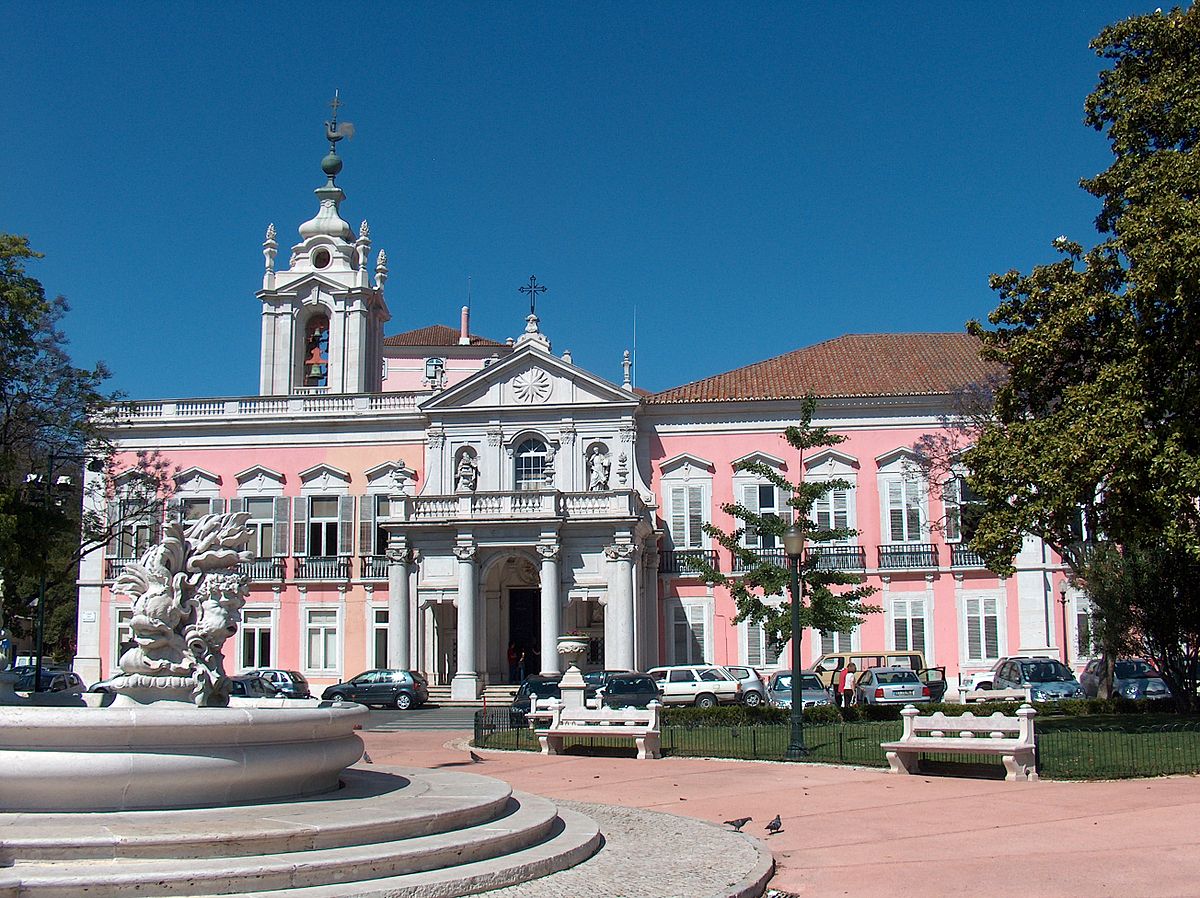


佩纳宫(葡萄牙语:Palácio Nacional da Pena)是葡萄牙的一座19世纪浪漫主义宫殿,位于里斯本附近的辛特拉市圣伯多禄堂区(São Pedro de Penaferrim)一个山丘的山顶,晴天在里斯本亦清晰可见。1995年,这个宫殿作为辛特拉文化景观的一部分入选为世界遗产。

 Parteien und Regierung


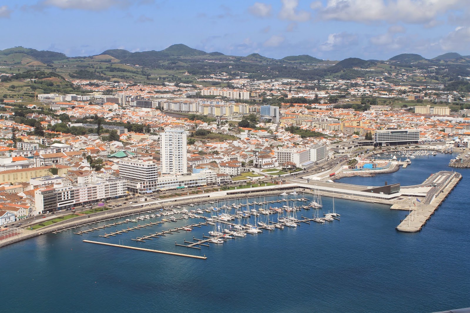
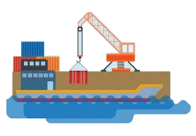 Wichtiger Hafen