
漢德百科全書 | 汉德百科全书
 Winter Olympics
 Sport
Sport
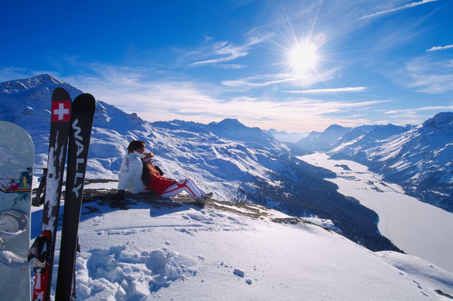
 Ski vacation


Garmisch-Partenkirchen ist ein Markt und zugleich der Kreishauptort des Landkreises Garmisch-Partenkirchen sowie das Zentrum des Werdenfelser Landes. Aufgrund seiner Größe ist es eine von 13 sogenannten leistungsfähigen kreisangehörigen Gemeinden sowie ein Oberzentrum[2] in Bayern. Der Ort liegt rund 80 km südwestlich von München und rund 50 km nordwestlich von Innsbruck. Es ist die letzte Gemeinde in Deutschland, die Verwaltungssitz eines Landkreises ist, ohne selbst Stadt zu sein (Kreishauptort).
Der Ort ist außerdem ein Heilklimatischer Kurort. Auswirkungen, die im Mittelalter mit dem Stadtrecht verbunden waren, existieren heute nicht mehr, so dass, weil die Verleihung dem Image als Kurort eher abträglich wäre, die größte Marktgemeinde Bayerns nie anstrebte um den Titel Stadt anzusuchen. Garmisch-Partenkirchen liegt inmitten eines weiten Talkessels am Zusammenfluss der aus Tirol kommenden Loisach und der im Wettersteingebirge entspringenden Partnach, zwischen Ammergebirge im Nordwesten, Estergebirge im Osten und Wettersteingebirge – mit Deutschlands höchstem Berg, der Zugspitze, im Südwesten. Garmisch war während der letzten Eiszeit – der Würmeiszeit – mit einer Eisdecke von ca. 1700 m ü. NHN überzogen.
加米施和帕滕基与从前是两个小镇,全因1936年冬季奥林匹克运动会所赐,将这两个地区合并成一个镇。座落在巴伐利亚阿尔卑斯山中央720米的高处,此镇是德国著名的冬季运动之都,也是音乐家史特劳斯(Richard Strauss)的故乡。风景以韦特施泰因山脉(Wettersteingebirge)为主体,此乃最壮丽的北阿尔卑斯山支脉之一,其中包括德国第一高峰楚格峰,高达2964米。
旅游点简介:奥林匹克滑雪连动场(Olympic Ski Stadium)此处更是爱好滑雪者的天堂,它座落在楚格峰车站附近,有各级难度的滑雪道,越野滑雪,和高山滑雪等。奥林匹克滑雪运动场更备有两条滑雪跳远跳台,设备十分完善。
玛利亚广场(Marienplatz) : 加米施是一座景致迷人的山城,以玛利亚广场(Marienplatz)为市中心,其优美的圣马丁教堂(Pfarrkirche St.Martin),乃建于1730年,内有美丽的巴洛克式建筑。
美丽的山峰 : 乘坐登山缆车和铁路,除了可到达楚格峰外还可到达更多其它的山峰,如万克山(Wank)、豪斯山(Hausberg)、埃克除尔山(Eckbauer)和阿尔卑峰(Alpspitze)等。远眺整个加米施的湖泊及茂密森林之景色。
市政厅 : 施帕滕基镇内有美丽的市政厅(Rathaus),路易街(Ludwigstrasse)是其主街,有很多精美的房屋,墙上的壁画十分独特。
小锦囊 : 冬天的时候可沿着结冰的湖面步行至Werdenfel-serland探险,之后到山上之木屋,舒适地坐在火炉旁边取暖。怎样前往从慕尼克坐火车须约一小时。(Quelle: www.germany-tourism.org.cn)
加米施-帕滕基兴(德语:Garmisch-Partenkirchen)是位于德意志联邦共和国南部巴伐利亚州的一个城市。加米施-帕滕基兴是加米施-帕滕基兴县的行政中心。 加米施-帕滕基兴是1936年冬季奥林匹克运动会的举办地。
 Geography
Geography
Geography
 *World's Most Livable Cities
 International cities
North American city
Canada
Winter Olympics
International cities
International cities
North American city
Canada
Winter Olympics
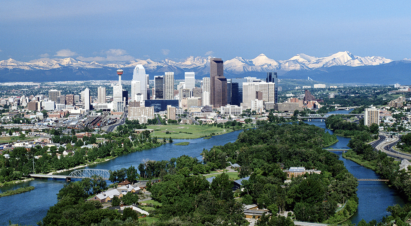
卡尔加里(Calgary,发音: /ˈkælɡəri/,当地华人及港澳台均译为卡加利,又译卡加立[1]、卡技利,简称卡城)是一座位于加拿大阿尔伯塔省南部洛矶山脉的城市,亦是该省的最大城市。该市面积789.9平方公里,海拔约1048米。
地理位置上,卡尔加里是位于加拿大第三大城市温哥华以东和第一大城市多伦多以西之间最大的城市,根据2016年的人口普查,市内人口有1239000人,较2006年的人口988,812人增长了10.9%[2]。卡尔加里是阿尔伯塔省的经济、金融和文化中心。卡尔加里的工程师密度是全加第一。多次被评为“世界上最干净的城市”[3]。1988年第15届冬奥会在这里举行。2009年第40届国际技能竞赛在这里举行。
カルガリー(英語: Calgary [ˈkælɡri] (![]() 音声ファイル))は、カナダ西部のアルバータ州にある都市である。周辺を含めた都市圏人口は140万人で同州最大の都市。アルバータ州の南部、カナディアンロッキー山麓から東におよそ80kmの高原地帯に位置する。
音声ファイル))は、カナダ西部のアルバータ州にある都市である。周辺を含めた都市圏人口は140万人で同州最大の都市。アルバータ州の南部、カナディアンロッキー山麓から東におよそ80kmの高原地帯に位置する。
カルガリーからエドモントンを結ぶ地域は人口密度が高くカルガリー・エドモントン街道と呼ぶ。都市の近郊にあるいくつものマウンテン・リゾートを含め、ウィンタースポーツとエコツーリズムが盛んな場所として知られる。代表的な年間行事にカルガリー・スタンピード、フォーク・ミュージック・フェスティバル、ライラック・フェスティバル、グローバルフェスト、カリブ系の祭りとしては国内で2番目の規模を持つカリフェストなどが開催される。
カルガリー・スタンピードで有名であることから「スタンピード・シティ」(The Stampede City)の愛称をもつ。アルバータ牛でも知られ、牛の街「カウタウン」(Cowtown)とも呼ばれる。
Calgary (/ˈkælɡri/ (![]() listen)) is a city in the western Canadian province of Alberta. It is situated at the confluence of the Bow River and the Elbow River in the south of the province, in an area of foothills and prairie, about 80 km (50 mi) east of the front ranges of the Canadian Rockies, roughly 299 km (186 mi) south of the provincial capital of Edmonton and approximately 240 km (150 mi) north of the Canada–United States border. The city anchors the south end of the Statistics Canada-defined urban area, the Calgary–Edmonton Corridor.[14]
listen)) is a city in the western Canadian province of Alberta. It is situated at the confluence of the Bow River and the Elbow River in the south of the province, in an area of foothills and prairie, about 80 km (50 mi) east of the front ranges of the Canadian Rockies, roughly 299 km (186 mi) south of the provincial capital of Edmonton and approximately 240 km (150 mi) north of the Canada–United States border. The city anchors the south end of the Statistics Canada-defined urban area, the Calgary–Edmonton Corridor.[14]
The city had a population of 1,285,711 in 2019, making it Alberta's largest city. It is the third-largest municipality in Canada (after Toronto and Montreal), and the largest in western Canada. Also in 2016, Calgary had a metropolitan population of 1,392,609, making it the fourth-largest census metropolitan area (CMA) in Canada and second-largest in western Canada (after Vancouver).
Calgary's economy includes activity in the energy, financial services, film and television, transportation and logistics, technology, manufacturing, aerospace, health and wellness, retail, and tourism sectors.[15] The Calgary CMA is home to Canada's second-highest number of corporate head offices among the country's 800 largest corporations.[16] In 2015 Calgary had the highest number of millionaires per capita of any major Canadian city.[17] In 1988 it became the first Canadian city to host the Winter Olympic Games.
The Economist Intelligence Unit ranked Calgary the most livable city in North America in both 2018 and 2019. Calgary has been a top 5 contender for this title for the last 10 years.[18] Calgary was also ranked the best city in the world for drivers in 2019.[19]
Calgary (prononcé : /ˈkæl.ɡə.ɹi/ écouter en anglais canadien et /kal.ɡa.ʁe/ en français canadien) est la plus grande ville de la province canadienne de l'Alberta. Elle est située dans le sud de la province, dans une région de collines et de plateaux à environ 45 km à l'est-sud-est des montagnes Rocheuses. Elle se trouve à 281 km au sud d'Edmonton, à 669 km à l'ouest de Regina, à 673 km à l'est-nord-est de Vancouver et à 2 708 km à l'ouest-nord-ouest de Toronto.Troisième ville du Canada par le nombre d'habitants, elle comptait, selon le recensement de 2014, 1 195 1942 habitants (1 406 7003 avec son agglomération en 2014, ce qui la place au quatrième rang des agglomérations canadiennes). Sa région économique compte quant à elle 1 511 800 habitants, ce qui en fait la première d'Alberta devant Edmonton4. Le « corridor Calgary-Edmonton » est la région urbaine la plus peuplée entre Toronto et Vancouver. Elle tire son nom d'une plage située sur l'île de Mull en Écosse. Les habitants de Calgary sont appelés « Calgariens ».
La ville de Calgary est une destination bien connue pour les sports d'hiver et l'écotourisme ; un grand nombre de stations de vacances importantes se situent près de la ville. L'économie de Calgary est surtout centrée sur l'industrie pétrolière ; toutefois, l'agriculture, le tourisme et la haute technologie contribuent également au développement économique rapide de la ville. Calgary est également l'hôte de plusieurs festivals annuels majeurs, dont le Stampede de Calgary, le Folk Music Festival, le Lilac Festival, le GlobalFest et le deuxième festival de culture des Caraïbes en importance du pays (Carifest). En 1988, Calgary devint la première ville canadienne à accueillir les Jeux olympiques d'hiver.
Calgary è la città più grande della provincia canadese dell'Alberta. Sorge nel settore meridionale della provincia, in una regione in cui si alternano colline e altopiani a un'ottantina di chilometri a oriente delle Montagne Rocciose. Terza città del Canada in termini di popolazione municipale, contava, secondo il censimento del 2016, più di 1 239 220 abitanti. Considerandone invece l'agglomerato urbano, essa giunge a quota 1 079 310 abitanti, configurandosi così come la quinta area urbana del paese. Calgary è il polo principale del corridoio urbano dell'Alberta e intrattiene stretti legami con la capitale Edmonton. Il sistema creato dalle due città e dalle rispettive aree metropolitane rappresenta l'apice di antropizzazione delle Praterie canadesi, costituendo la regione più popolata tra Toronto e Vancouver.
Gli elementi che rendono celebre questa città sono l'ecoturismo e gli sport invernali e nei dintorni sorgono un gran numero di stazioni di villeggiatura. A conferma di tale vocazione la città fu la prima in Canada ad essere designata come sede dei giochi olimpici invernali, nella loro quindicesima edizione del 1988.
Altra peculiarità di Calgary è la sua specializzazione nell'industria petrolifera, su cui si regge l'economia cittadina, non a caso la più prospera del paese. L'universo produttivo della città più ricca del Canada è completato da un settore agricolo particolarmente redditizio e dalla recente installazione di industrie d'alta tecnologia.Simbolo della città riconosciuto a livello internazionale è la Calgary Tower.
Calgary ![]() /ˈkælg(ə)ɹɪ/ (?·i) es la mayor ciudad de la provincia de Alberta, Canadá. Se encuentra ubicada en una región de colinas y altiplanicies, aproximadamente 80 km al este de las Montañas Rocosas. Tercera ciudad de Canadá en términos de población, contaba según el censo de 2011 con 1 096 833 habitantes.2 La población estimada de su área metropolitana era de 1 214 839 habitantes (véase Región Calgary), lo que la convierte en la quinta mayor de Canadá. El Corredor Calgary-Edmonton es la región urbana más poblada después de Toronto y Vancouver.3 El gentilicio en inglés para los habitantes de Calgary es «Calgarian».4
/ˈkælg(ə)ɹɪ/ (?·i) es la mayor ciudad de la provincia de Alberta, Canadá. Se encuentra ubicada en una región de colinas y altiplanicies, aproximadamente 80 km al este de las Montañas Rocosas. Tercera ciudad de Canadá en términos de población, contaba según el censo de 2011 con 1 096 833 habitantes.2 La población estimada de su área metropolitana era de 1 214 839 habitantes (véase Región Calgary), lo que la convierte en la quinta mayor de Canadá. El Corredor Calgary-Edmonton es la región urbana más poblada después de Toronto y Vancouver.3 El gentilicio en inglés para los habitantes de Calgary es «Calgarian».4
La economía de Calgary se centra sobre todo en la industria petrolífera, aunque la agricultura, el turismo y la alta tecnología también contribuyen al rápido desarrollo económico de la ciudad. Es igualmente un destino muy conocido por ser un lugar donde practicar el ecoturismo y deportes de invierno: cerca de la ciudad se sitúan importantes lugares de vacaciones y en 1988, Calgary se convirtió en la primera ciudad canadiense en acoger los Juegos Olímpicos de Invierno. Calgary es además la anfitriona de varios festivales anuales, como el Calgary Stampede, el Festival de Música Folk de Calgary, el Festival Lilac, el GlobalFest y el segundo festival de cultura caribeña en importancia del país, el Carifest.
Calgary ha clasificado bastante alto en algunas encuestas sobre calidad de vida, como en la Mercer Quality of Living, encuesta que puso a Calgary en el puesto 25 en 2006 y en el número 32 en 2012.5 De forma más reciente, el informe para 2012 y 2013 de la Unidad de Inteligencia de The Economist señaló que Calgary junto con la ciudad australiana de Adelaida empataron por el quinto lugar como el mejor sitio del mundo para vivir.6 Además, el estudio «Mejores lugares para vivir en Canadá en 2013» realizado por Money Senses, ubica a Calgary como la ciudad número uno a nivel general.7 La ciudad también fue calificada como la más limpia del mundo en una encuesta realizada por la revista Forbes en 2007.8
Ка́лгари (англ. Calgary [ˈkælɡ(ə)ri]) — город в провинции Альберта в Канаде. Расположен на юге провинции, в области предгорий и прерий, примерно в 80 км к востоку от водораздела Канадских Скалистых гор. Город расположен также в зоне сенокосных угодий Альберты.
В 2016 население Калгари составляло 1 235 171 жителя, и город стал третьим по численности населения в стране и крупнейшим в Альберте, а так же самым северным миллионным городом в Канаде и в Северной Америке. С пригородами в 2011 население составляло 1 214 839 человек, и Калгарийская агломерация стала пятой по величине в Канаде.
Расположен в 294 км к югу от Эдмонтона, а густонаселённая зона между этими городами известна как «Коридор Калгари — Эдмонтон».
Деловая активность в Калгари в основном связана с нефтяной промышленностью, сельским хозяйством и туризмом. В 1988 г. Калгари стал первым канадским городом, в котором прошли Зимние Олимпийские игры.


 New York-NY


Sarajevo (serbisch-kyrillisch Сарајево; deutsch auch Sarajewo) ist Hauptstadt und Regierungssitz von Bosnien und Herzegowina, der Föderation Bosnien und Herzegowina (Federacija Bosne i Hercegovine/FBiH), des Kantons Sarajevo sowie de jure der Republika Srpska.
Die Stadt hat in ihren vier Gemeinden Stari Grad (Altstadt), Centar (Zentrum), Novi Grad (Neustadt) und Novo Sarajevo (Neu-Sarajevo) 291.422 Einwohner. In der Agglomeration Sarajevo leben etwa 515.000 und in der Metropolregion Sarajevo 608.354 Einwohner (Zensus 2013).[1] Aufgrund der Einwohnerzahl sowie der wirtschaftlichen und politischen Bedeutung ist Sarajevo die einzige bosnische Metropole.[3]
Der Südostteil Sarajevos gehört administrativ zur Stadt Istočno Sarajevo in der Republika Srpska.
萨拉热窝(波斯尼亚语:Sarajevo;克罗地亚语:Sarajevo;塞尔维亚语:Сарајево/Sarajevo;台湾译塞拉耶佛)是波斯尼亚和黑塞哥维那的首都,也是波黑人口最多的城市。据2011年8月估计,波黑萨拉热窝州下属四个自治体,人口合共311,161人。萨拉热窝同时也是萨拉热窝州的首府。
萨拉热窝位于波斯尼亚萨拉热窝山谷之中,米里雅茨河沿岸,被狄那里克阿尔卑斯山脉所包围。萨拉热窝是波黑的社会及文化中心,也拥有区域性的政治、教育、娱乐、媒体、时尚、科学和艺术影响力,还是波黑主要的经济中心[7][8]。
萨拉热窝以其宗教多样性闻名于世,伊斯兰教、东正教、天主教、犹太教数世纪以来都共存其中[9][10]。因其悠久的历史和宗教及文化多样性,萨拉热窝常被称为“欧洲的耶路撒冷”[1] 或者“巴尔干的耶路撒冷”[2]。直到20世纪后期为止,萨拉热窝都是欧洲仅有的清真寺、天主教堂、东正教堂和犹太教堂可以比邻共存的大都市[3]。
虽然萨拉热窝地区在史前时代开始就有人居住,但今日的萨拉热窝是在15世纪奥斯曼帝国统治时期开始发展的[10][11]。萨拉热窝在近代多次成为国际关注的热点。萨拉热窝在1885年成为欧洲首个,也是全世界第二个全天运行路面电车的城市(世界首个有全天运行路面电车的城市是美国的旧金山)[12]。1914年,萨拉热窝发生了奥地利王储暗杀事件(又名萨拉热窝暗杀事件)。这起事件是第一次世界大战的直接导火线。1984年,萨拉热窝是1984年冬季奥林匹克运动会的会场。之后的南斯拉夫解体时期,萨拉热窝在波黑战争期间遭到了持续数年的塞尔维亚人势力的包围,这也是现代战争史上时间最长的围困战[13]。
时至2012年,萨拉热窝仍处在战后的复兴重建中,正在逐渐恢复战前的水准[14]。旅行指南《寂寞星球》在“世界都市”排行榜中将萨拉热窝排在第43位。这个名次要高过同样是前南斯拉夫诸国各个观光都市,包括第59位的杜布罗夫尼克、第84位的第卢布尔雅那、第90位的布莱德、第113位的贝尔格莱德以及第135位的萨格勒布[15][16],在2009年12月,萨拉热窝还被列入2010年最值得去旅行的十大都市之一[17]。2012年3月,萨拉热窝战胜了全世界其他100多个都市,被旅行博客Foxnomad评为“最佳旅游都市”[18]。2011年,萨拉热窝获得2014年欧洲文化之都的提名,是唯一获得提名的欧盟以外的都市[19][20]。
サラエヴォ[3][4][5](ボスニア語:Sarajevo [sǎrajeʋo]、クロアチア語:Sarajevo、セルビア語:Сарајево)は、ボスニア・ヘルツェゴビナの首都であり、同国で最大の人口をもつ都市である。ボスニア・ヘルツェゴビナの構成体のひとつであるボスニア・ヘルツェゴビナ連邦の首都でもある。
日本語表記においては、一般に「サラエボ」[6]や「サライェヴォ」[7]などの表記も多く見られる(以下、本項では「サラエヴォ」とする。呼称と表記も参照)。
2011年8月の推計では、ボスニア・ヘルツェゴビナのサラエヴォ県に属する4つの自治体の人口は併せて311,161人である。サラエヴォはまた、サラエヴォ県の県都でもある。サラエヴォはボスニア地方のサラエヴォ渓谷のなかにあり、ディナール・アルプスに取り囲まれ、ミリャツカ川周辺に広がっている。サラエヴォの町は宗教的な多様性で知られており、イスラム教、正教会、カトリック教会、ユダヤ教が何世紀にもわたって共存してきた[8]。旅行ガイドブックのロンリープラネットでは、「世界の都市」ランキングにおいてサラエヴォを43位にランクしている。これは、同じ旧ユーゴスラビア諸国の観光都市であるドゥブロヴニクの59位、リュブリャナの84位、ブレッドの90位、ベオグラードの113位、ザグレブの135位を上回る[9]。
サラエヴォに隣接して、ボスニア・ヘルツェゴビナの構成体のひとつであるスルプスカ共和国の首都であるイストチノ・サラエヴォ(東サラエヴォ)がある。現在のイストチノ・サラエヴォの市域には、ボスニア・ヘルツェゴビナ紛争前のサラエヴォの市域の一部が含まれている。
この地域に人が居住を始めたのは先史時代にまでさかのぼるものの、現代のサラエヴォにつながる町ができたのは15世紀のオスマン帝国の統治下でのことであった[10]。オーストリア=ハンガリー帝国に併合されたのちもボスニアの州都と位置付けられたサラエヴォは、近代以降の何度かにわたって国際的な注目を受けることになった。1914年にはこの地はオーストリア帝位継承者の暗殺事件の現場となり、この事件によって第一次世界大戦が引き起こされた。1984年にはサラエヴォは1984年冬季オリンピックの会場となり、さらに後のユーゴスラビア崩壊のときには、ボスニア・ヘルツェゴビナ紛争において数年間にわたるセルビア人勢力による包囲を受けた。現在のサラエヴォは紛争後の復興開発が進み、21世紀初頭において紛争前の水準を回復しつつある。サラエヴォは、ボスニア・ヘルツェゴビナの経済・文化活動の拠点となっている[11]。サラエヴォはヨーロッパで初めて、そして全世界で2番目に早く終日(朝から夜まで)運行の路面電車が運行された町である[* 1]。
Sarajevo (Cyrillic: Сарајево, pronounced [sǎrajeʋo]; see names in other languages) is the capital[5] and largest city of Bosnia and Herzegovina, with a population of 275,524 in its current administrative limits.[4][6] The Sarajevo metropolitan area, including Sarajevo Canton, East Sarajevo and nearby municipalities is home to 555,210 inhabitants.a[7] Nestled within the greater Sarajevo valley of Bosnia, it is surrounded by the Dinaric Alps and situated along the Miljacka River in the heart of the Balkans.
Sarajevo is the political, social and cultural center of Bosnia and Herzegovina, a prominent center of culture in the Balkans, with its region-wide influence in entertainment, media, fashion, and the arts.[8][9]
Due to its long and rich history of religious and cultural diversity, Sarajevo is sometimes called the "Jerusalem of Europe"[1] or "Jerusalem of the Balkans".[2] It is one of only a few major European cities which have a mosque, Catholic church, Orthodox church and synagogue within the same neighborhood.[10] A regional center in education, the city is also home to the Balkans first institution of tertiary education in the form of an Islamic polytechnic called the Saraybosna Osmanlı Medrese, today part of the University of Sarajevo.[11][12]
Although settlement in the area stretches back to prehistoric times, the modern city arose as an Ottoman stronghold in the 15th century.[13] Sarajevo has attracted international attention several times throughout its history. In 1885, Sarajevo was the first city in Europe and the second city in the world to have a full-time electric tram network running through the city, following San Francisco.[14] In 1914, it was the site of the assassination of Archduke Franz Ferdinand of Austria by local Young Bosnia activist Gavrilo Princip that sparked World War I, which also ended Austro-Hungarian rule in Bosnia and resulted in the creation of the Kingdom of Yugoslavia. Later, after World War II, the establishment of the Socialist Republic of Bosnia and Herzegovina within the Second Yugoslavia led to a massive expansion of Sarajevo, the constituent republic's capital, which culminated with the hosting of the 1984 Winter Olympics marking a prosperous era for the city. However, after the start of the Yugoslav Wars, for 1,425 days, from April 1992 to February 1996, the city suffered the longest siege of a capital city in the history of modern warfare, during the Bosnian War and the breakup of Yugoslavia.[15]
Sarajevo has been undergoing post-war reconstruction, and is the fastest growing city in Bosnia and Herzegovina.[16] The travel guide series Lonely Planet has named Sarajevo as the 43rd best city in the world,[17] and in December 2009 listed Sarajevo as one of the top ten cities to visit in 2010.[18] In 2011, Sarajevo was nominated to be the European Capital of Culture in 2014 and will be hosting the European Youth Olympic Festival in 2019.[19][20]
Sarajevo (en bosnien cyrillique, Сарајево ; anciennement Bosna-Seraï ; en turc, Saraybosna), prononcé [saʁajɛvo], est la capitale et la plus grande ville de Bosnie-Herzégovine. Avant la guerre de Bosnie-Herzégovine, le dernier recensement de 1991 évaluait la population à 429 672 habitants. En 2013, selon le site officiel de Sarajevo, la population de la ville proprement dite est estimée à 395 133 habitants1.
La ville est considérée comme l'une des plus importantes villes des Balkans et son histoire est particulièrement riche depuis sa création par les Ottomans en 1461. La ville a été le théâtre de l'assassinat par Gavrilo Princip de l'archiduc François-Ferdinand d'Autriche, qui marqua le début de la Première Guerre mondiale. Plus récemment, elle accueillit les Jeux olympiques d'hiver de 1984 et fut assiégée durant la guerre de Bosnie-Herzégovine dans les années 1990. Dans la ville, la guerre a laissé de nombreuses traces visibles sur toutes les façades d'immeuble qui portent des traces d'impacts et de réparations de fortune. Les marques des obus dans les chaussées, sont quant à elles précieusement conservées. Le siège reste lui aussi omniprésent dans les conversations. Entre 1992 et 1996, la capitale de Bosnie-Herzégovine a subi un siège de plus de mille jours qui a fait plus de 11 000 morts. Traversée par la rivière Miljacka, la ville fait partie du canton de Sarajevo, l'un des dix que compte la Fédération de Bosnie-et-Herzégovine.
Sarajevo (in alfabeto cirillico serbo Сарајево; in giudesmo Saraj; in turco Saraybosna), in italiano Saraievo (AFI: /saraˈjɛːvo/) o raramente Seraievo[1], è la capitale e la più grande città della Bosnia ed Erzegovina.
Il toponimo è la forma slavizzata della parola turca saray, che significa "palazzo"[2], ma il suo nome originario era Vrhbosna.
La sua popolazione si aggira attorno ai 275.524 abitanti (al 2013). Nel 1914 vi ebbe luogo l'attentato all'arciduca austriaco Francesco Ferdinando che innescò la prima guerra mondiale.
Nel 1984 la città ospitò i XIV Giochi olimpici invernali. Tra il 1992 e il 1995, durante la guerra di Bosnia, soffrì più di tre anni d'assedio da parte delle forze serbo-bosniache.
Sarajevo (en cirílico: Сарајево; /sǎrajɛʋɔ/) es la capital y ciudad más poblada de Bosnia y Herzegovina, con una población de 395.133 habitantes en las cuatro municipalidades que forman la ciudad, y con un área metropolitana de 688,437 habitantes en el Cantón de Sarajevo.12 Es también la capital de la Federación de Bosnia y Herzegovina, así como el centro del Cantón de Sarajevo. Contigua a ella (y agrupando barrios que antes de la guerra también formaban parte de Sarajevo) se encuentra Sarajevo Oriental que es la ciudad capital de jure de la República Srpska.
Sarajevo está emplazada en el valle de Sarajevo en la región de Bosnia, rodeada de los Alpes Dináricos y en torno al río Miljacka. El centro de la ciudad se encuentra a 511 metros sobre el nivel del mar mientras que algunos barrios alcanzan los 700 metros, lo que hace de Sarajevo una de las ciudades a más altura en Europa. Los picos montañosos que rodean Sarajevo alcanzan y sobrepasan los 2.000 metros sobre el nivel del mar.
La ciudad es conocida por su tradicional diversidad religiosa, con fieles musulmanes, ortodoxos, católicos y judíos, que llevan conviviendo desde hace siglos. Debido a esta larga y rica historia de diversidad religiosa y coexistencia, Sarajevo es conocida como la "Jerusalén de Europa".3
Aunque los primeros asentamientos en la zona datan de los tiempos prehistóricos, la moderna ciudad de Sarajevo fue edificada como fortaleza para el Imperio otomano en el siglo XV.4 Sarajevo ha atraído la atención internacional en varias ocasiones a lo largo de su historia: en 1914 tuvo lugar el asesinato del Archiduque Francisco Fernando de Austria, que acabó siendo el detonante definitivo para el estallido de la Primera Guerra Mundial. Setenta años después, la ciudad organizó los Juegos Olímpicos de invierno de 1984. A comienzos de la década de 1990, Sarajevo sufrió el mayor asedio en la historia de la guerra moderna durante la Guerra de Bosnia. Hoy en día, la ciudad se está recuperando y adaptando a la realidad de la posguerra, y es el centro cultural y económico del país.5 Sarajevo se convirtió en una de las primeras ciudades europeas en contar con una red de tranvía eléctrico con servicio ininterrumpido en la ciudad.6
Сара́ево (босн. Sarajevo, хорв. Sarajevo, серб. Сарајево [sǎrajeʋo], тур. Saraybosna) — город, столица Боснии и Герцеговины. Административный центр Сараевского кантона. Образует муниципальное образование «город Сараево», разделённое на четыре самоуправляемых района.
Население — 275,5 тысячи человек (2013), или 8 % населения Боснии и Герцеговины. Национальный состав (среди указавших, 2013): босняков — 81 %, хорватов — 5 %, сербов — 4 %. Доля сербов, проживающих в городе, в результате войны 1992—1995 годов многократно сократилась.
Расположено в межгорной котловине на берегах реки Миляцки, на территории Федерации Боснии и Герцеговины. С южной стороны к Сараеву непосредственно примыкает его бывшая часть — ныне город Источно-Сараево, расположенный на территории Республики Сербской.
Главный политический, экономический и культурный центр Федерации Боснии и Герцеговины. Производит 31 % ВВП Федерации (2012). Исторический центр состоит из построек периода Османской и Австро-Венгерской империй XVI — начала XX веков.
Поселение, впоследствии получившее название Босна-Сарай (от тур. saray — «дворец»), основано турками около 1462 года. С 1639 года с перерывами — административный центр Боснийского эялета, с 1878 года — главный город австро-венгерской Боснии и Герцеговины. С 1918 года — в Королевстве сербов, хорватов и словенцев. С 1945 года — столица республики Босния и Герцеговина.
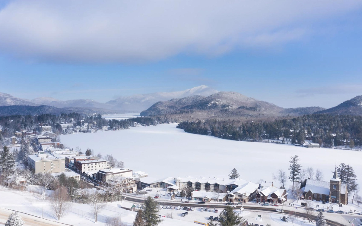
 California-CA


FIFA Fussball-Weltmeisterschaft 2018
FIFA Fussball-Weltmeisterschaft 2018
Group B
FIFA Fussball-Weltmeisterschaft 2018
Group G
FIFA Fussball-Weltmeisterschaft 2018
Group F
FIFA Fussball-Weltmeisterschaft 2018
Group C
International cities
Winter Olympics
Russia
Shanghai Cooperation Organization

Sochi (Deutsch:Sotschi) ist das beliebteste Reiseziel der Russen. An die russische Riviera fährt jeder, der es sich leisten kann. Neben dem milden Klima sind es vor allem die unterschiedlichen Freizeitaktivitäten, vom Badeurlaub über das Skifahren bis hin zu Kuraufenthalten, die Sochi für die Urlauber so attraktiv machen.
Sochi ist das subtropische russische Urlaubsparadies, voll mit Palmen und den schwarzen Stränden des schwarzen Meer. In Sochi gibt es auch zahlreiche berühmte Kureinrichtungen und viele Kliniken, die heute natürlich auch exklusives Wellness anbieten. Sochi ist für Russland, was die Riviera für Westeuropa bedeutet. Der schwarzer Sand und Kieselstein-Strände erstrecken mehr als 30 Kilometer entlang der Küste vom Schwarzen Meer. Parallel dazu findet sich die Stadt Sochi. Sie ist damit die längste Stadt - nicht nur in Russland sondern auch auf dem ganzen Asiatischen Kontinent. (Quelle:http://www.sochi.de/)
Sotschi (russisch Сочи, , wiss. Transliteration Soči) ist eine Stadt und ein Stadtbezirk am Schwarzen Meer in Russland. Sotschi liegt in der südrussischen Region Krasnodar nahe der Grenze zu Georgien bzw. Abchasien und hat 343.334 Einwohner (Stand 14. Oktober 2010).[1]
Sotschi ist einer der beliebtesten Bade- und Kurorte Russlands: die Umgebung der Stadt wird häufig als „(Russische) Riviera des Schwarzen Meeres“ bezeichnet. Die Stadt ist darüber hinaus Sitz einer Universität.
索契(俄语:Сочи、亚美尼亚语:Սոչի, 格鲁吉亚语:სოჭი,拉丁字母转写:Sochi),另译素溪,俄罗斯联邦克拉斯诺达尔边疆区与阿布哈兹接界处、黑海沿岸,是俄罗斯受欢迎的渡假胜地。2013年有人口368,011人[9]。索契是苏联作家尼古拉·奥斯特洛夫斯基的疗养地点,他在这里写成了《钢铁是怎样炼成的》。这里有奥斯特洛夫斯基的故居博物馆。
2007年7月4日,国际奥林匹克委员会宣布索契获得2014年冬季奥林匹克运动会的主办权。也亦将举行2018年国际足联世界杯。
ソチ、ソーチ(ロシア語: Со́чи [ˈsotɕɪ] (![]() 音声ファイル) Sochi、グルジア語: სოჭი Soch’i)は、ロシア連邦クラスノダール地方の都市で、ロシア随一の保養地。黒海に面し、アブハジアとの国境に近い。人口は39万5012人。
音声ファイル) Sochi、グルジア語: სოჭი Soch’i)は、ロシア連邦クラスノダール地方の都市で、ロシア随一の保養地。黒海に面し、アブハジアとの国境に近い。人口は39万5012人。
Sochi (Russian: Со́чи, IPA: [ˈsotɕɪ] (![]() listen)) is a city in Krasnodar Krai, Russia, located on the Black Sea coast near the border between Georgia/Abkhazia and Russia. The Greater Sochi area, which includes territories and localities subordinated to Sochi proper, has a total area of 3,526 square kilometers (1,361 sq mi)[5] and sprawls for 145 kilometers (90 mi)[11] along the shores of the Black Sea near the Caucasus Mountains.[citation needed] The area of the city proper is 176.77 square kilometers (68.25 sq mi).[5] According to the 2010 Census, the city had a permanent population of 343,334,[6] up from 328,809 recorded in the 2002 Census,[12] making it Russia's largest resort city. Being part of the Caucasian Riviera, it is one of the very few places in Russia with a subtropical climate, with warm to hot summers and mild winters.
listen)) is a city in Krasnodar Krai, Russia, located on the Black Sea coast near the border between Georgia/Abkhazia and Russia. The Greater Sochi area, which includes territories and localities subordinated to Sochi proper, has a total area of 3,526 square kilometers (1,361 sq mi)[5] and sprawls for 145 kilometers (90 mi)[11] along the shores of the Black Sea near the Caucasus Mountains.[citation needed] The area of the city proper is 176.77 square kilometers (68.25 sq mi).[5] According to the 2010 Census, the city had a permanent population of 343,334,[6] up from 328,809 recorded in the 2002 Census,[12] making it Russia's largest resort city. Being part of the Caucasian Riviera, it is one of the very few places in Russia with a subtropical climate, with warm to hot summers and mild winters.
With the alpine and Nordic events held at the nearby ski resort of Rosa Khutor in Krasnaya Polyana, Sochi hosted the XXII Olympic Winter Games and XI Paralympic Winter Games in 2014, as well as the Russian Formula 1 Grand Prix from 2014 until at least 2020.[13][14] It was also one of the host cities for the 2018 FIFA World Cup.
Sotchi (en russe : Сочи ; en géorgien : სოჭი ; en adyguéen : Шәача - Cheuatcha) est une ville et une station balnéaire du kraï de Krasnodar, en Russie. Elle est située au bord de la mer Noire, dans la partie russe du Caucase. La région a autrefois appartenu aux territoires de Géorgie (Colchide-Imérétie). La ville est fondée en 1838, avec l'implantation d'un fort russe. Sa population s'élevait à 368 011 habitants en 2013. Sotchi forme avec les villes avoisinantes une ville-arrondissement (ce que l'on appelle de manière non officielle le « Grand-Sotchi »), dont elle est le chef-lieu administratif. L'ensemble comptait 445 209 habitants en 20131. Sotchi a été la ville hôte des Jeux olympiques d'hiver de 2014, son parc olympique est aujourd'hui le théâtre du Grand Prix de Russie de Formule 1, et la ville fut l'un des sites de la Coupe du monde de football de 2018.
Soči (in russo: Сочи? ; traslitterazione anglosassone: Sochi, Шәэча in adighè) è una città della Russia meridionale, situata nel territorio di Krasnodar sulle rive del mar Nero. Fondata nel 1838, ricevette lo status di città nel 1896. Conta 424.000 abitanti.
La città è nota, in Russia ma anche all'estero, come importante centro di villeggiatura, dato soprattutto il suo contrasto climatico con il resto dell'immenso territorio russo. La città offre possibilità sia di turismo balneare che, durante l'inverno, di turismo sciistico. Ha acquisito ulteriore notorietà a livello mondiale per aver ospitato la XXII edizione dei Giochi olimpici invernali nel febbraio 2014 e per essere la sede del Gran Premio di Russia, valevole per il campionato del mondo di Formula 1, che si corre a Soči a partire dal 2014.
La città ha partecipato come una delle città ospitanti alla Coppa del mondo FIFA 2018 in Russia.
Sochi (![]() [ˈsot͡ɕɪ] (?·i) en ruso, Со́чи) es una ciudad de Rusia ubicada en el krai de Krasnodar, cerca del límite con Abjasia. Se sitúa entre las montañas nevadas del Cáucaso y el mar Negro, con una población de 411.524 habitantes en 2017.
[ˈsot͡ɕɪ] (?·i) en ruso, Со́чи) es una ciudad de Rusia ubicada en el krai de Krasnodar, cerca del límite con Abjasia. Se sitúa entre las montañas nevadas del Cáucaso y el mar Negro, con una población de 411.524 habitantes en 2017.
Es el centro administrativo de la unidad municipal de la ciudad-balneario de Sochi.
Со́чи — город в России, расположен на северо-восточном побережье Чёрного моря (Черноморское побережье России) в Краснодарском крае, на расстоянии 1620 км от Москвы.
Сочи — крупнейший курортный город России[9], важный транспортный узел[10][11][12][13], а также крупный экономический и культурный центр черноморского побережья России[14][15].
Неофициально именуется также летней, южной и курортной «столицей» России. В 2012 году журнал Forbes признал Сочи лучшим городом для ведения бизнеса в стране[16].
Сочи является самым длинным городом России[17][неавторитетный источник?][18][неавторитетный источник?], протяжённость которого составляет более 100 км.
В 2007 году Сочи избран столицей XXII зимних Олимпийских игр. 15 сентября 2009 года Сочи вступил во Всемирный союз олимпийских городов[19]. В период подготовки к Олимпиаде на развитие города и его инфраструктуры потратили 500 млрд рублей[20].
В 2018 году город принял матчи Чемпионата мира по футболу.
