
Deutsch-Chinesische Enzyklopädie, 德汉百科
 Bosnia Herzegovina
 Geography
*Mediterranean Sea
Geography
*Mediterranean Sea
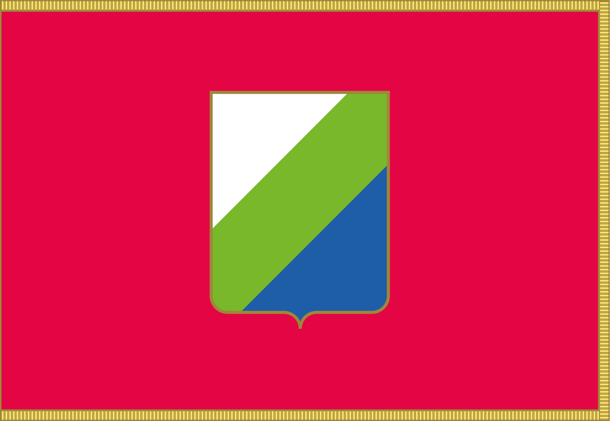 Abruzzo
Albania
Amber Road
Bosnia Herzegovina
Abruzzo
Albania
Amber Road
Bosnia Herzegovina
 Emilia-Romagna
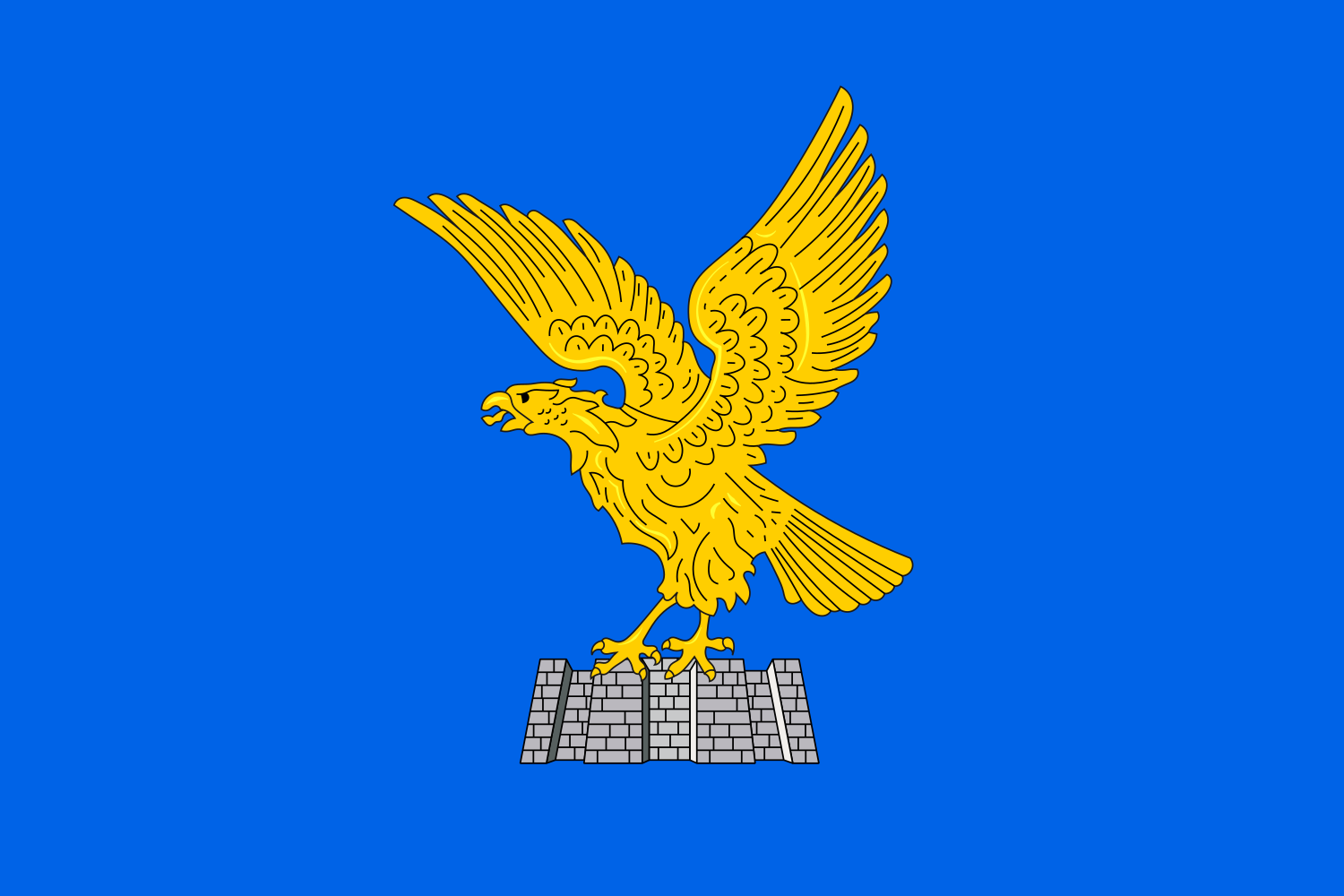 Friuli-Venezia Giulia
Italy
Croatia
Friuli-Venezia Giulia
Italy
Croatia
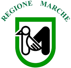 Marche
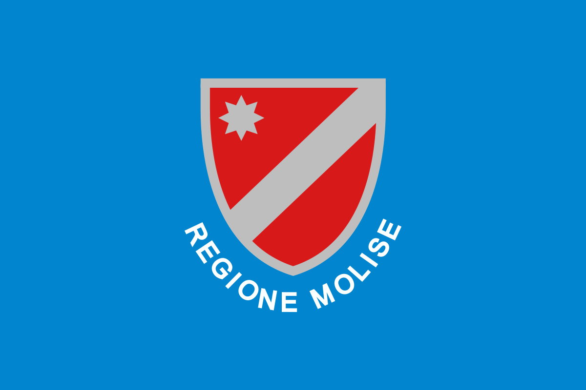 Molise
Montenegro
Molise
Montenegro
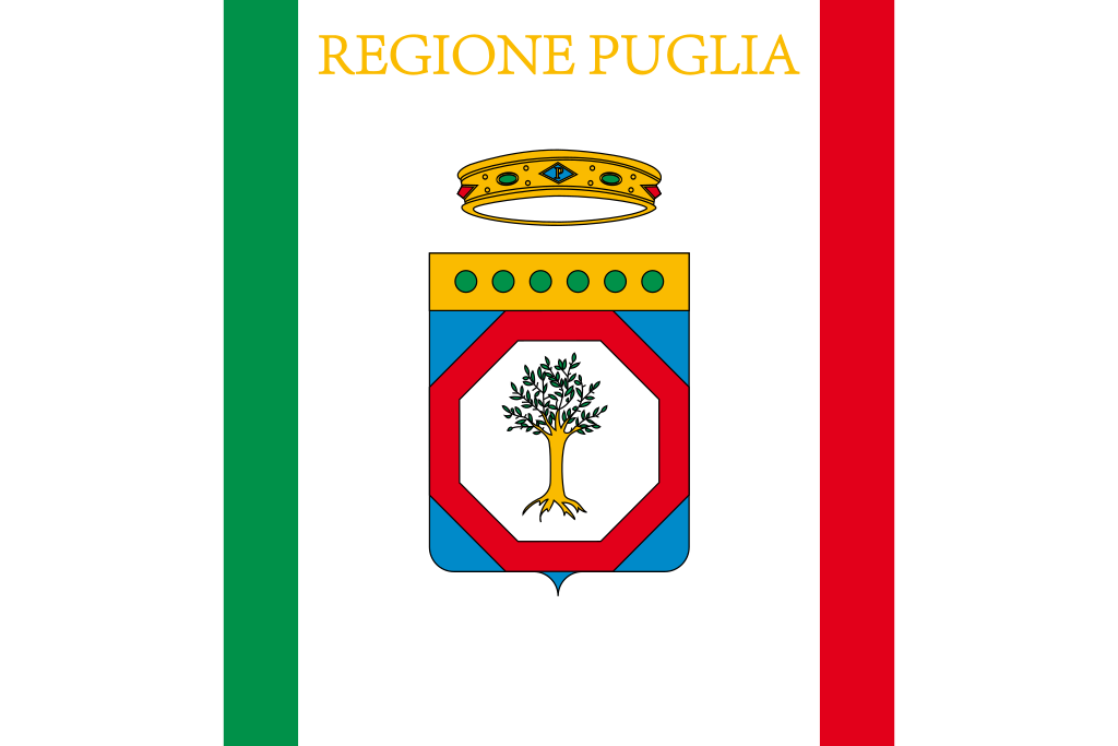 Puglia
Slovenia
Puglia
Slovenia
 Veneto
亚得里亚海(意大利语:Mar Adriatico,斯洛文尼亚语:Jadransko morje,克罗地亚语:Jadransko more,阿尔巴尼亚语:Deti Adriatik),是地中海的一部分水域,分隔了意大利半岛(亚平宁半岛)和巴尔干半岛,也分隔了亚平宁山脉与狄那里克阿尔卑斯山脉及其临近地区。亚得里亚海西岸属于意大利,东岸则分别属于斯洛文尼亚、克罗地亚、波斯尼亚和黑塞哥维那、黑山和阿尔巴尼亚。亚得里亚海透过位于其南部的奥特朗托海峡与爱奥尼亚海相连。波河、阿迪杰河、奥凡托河等河流流入亚得里亚海;海中有近1200个岛屿,其中只有69个有人居住。
Das Adriatische Meer, kurz auch die Adria (lateinisch Mare Adriaticum; italienisch Mare Adriatico; bosnisch, kroatisch und serbisch Jadransko more oder kurz Jadran; slowenisch Jadransko morje; albanisch Deti Adriatik oder kurz Adriatiku), ist das lang gestreckte nördliche Seitenbecken des Mittelmeeres zwischen der Apenninhalbinsel und Balkanhalbinsel. Es ist nach der Stadt Adria in Italien (Provinz Rovigo) benannt. Zum Adriatischen Meer wird alles gerechnet, was nördlich der Straße von Otranto liegt.
アドリア海(アドリアかい、英: Adriatic Sea ; イタリア語: Mar Adriatico ; クロアチア語: Jadransko more)は、地中海の海域の一つ。イタリア半島とバルカン半島に挟まれている。
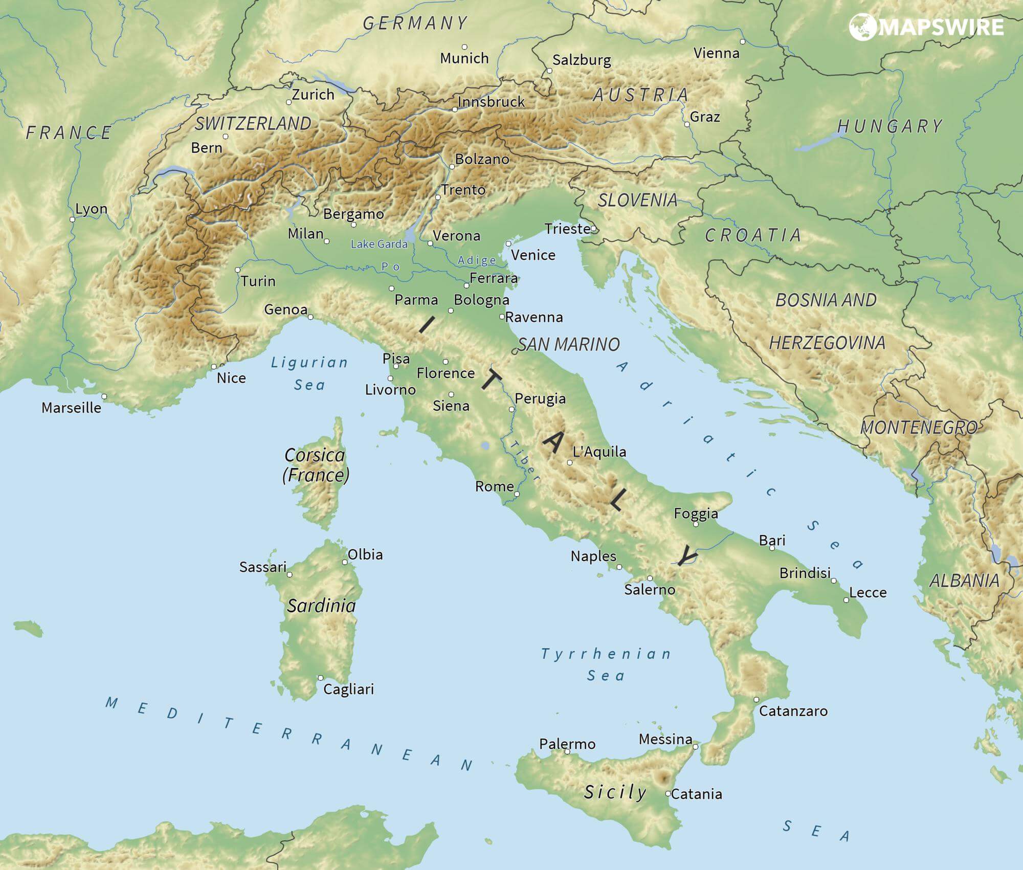
The Adriatic Sea (/ˌeɪdriˈætɪk/) is a body of water separating the Italian Peninsula from the Balkans. The Adriatic is the northernmost arm of the Mediterranean Sea, extending from the Strait of Otranto (where it connects to the Ionian Sea) to the northwest and the Po Valley. The countries with coasts on the Adriatic are Albania, Bosnia and Herzegovina, Croatia, Italy, Montenegro and Slovenia. The Adriatic contains over 1,300 islands, mostly located along the Croatian part of its eastern coast. It is divided into three basins, the northern being the shallowest and the southern being the deepest, with a maximum depth of 1,233 metres (4,045 ft). The Otranto Sill, an underwater ridge, is located at the border between the Adriatic and Ionian Seas. The prevailing currents flow counterclockwise from the Strait of Otranto, along the eastern coast and back to the strait along the western (Italian) coast. Tidal movements in the Adriatic are slight, although larger amplitudes are known to occur occasionally. The Adriatic's salinity is lower than the Mediterranean's because the Adriatic collects a third of the fresh water flowing into the Mediterranean, acting as a dilution basin. The surface water temperatures generally range from 30 °C (86 °F) in summer to 12 °C (54 °F) in winter, significantly moderating the Adriatic Basin's climate.
The Adriatic Sea sits on the Apulian or Adriatic Microplate, which separated from the African Plate in the Mesozoic era. The plate's movement contributed to the formation of the surrounding mountain chains and Apennine tectonic uplift after its collision with the Eurasian plate. In the Late Oligocene, the Apennine Peninsula first formed, separating the Adriatic Basin from the rest of the Mediterranean. All types of sediment are found in the Adriatic, with the bulk of the material transported by the Po and other rivers on the western coast. The western coast is alluvial or terraced, while the eastern coast is highly indented with pronounced karstification. There are dozens of marine protected areas in the Adriatic, designed to protect the sea's karst habitats and biodiversity. The sea is abundant in flora and fauna—more than 7,000 species are identified as native to the Adriatic, many of them endemic, rare and threatened ones.
The Adriatic's shores are populated by more than 3.5 million people; the largest cities are Bari, Venice, Trieste and Split. The earliest settlements on the Adriatic shores were Etruscan, Illyrian, and Greek. By the 2nd century BC, the shores were under Rome's control. In the Middle Ages, the Adriatic shores and the sea itself were controlled, to a varying extent, by a series of states—most notably the Byzantine Empire, the Croatian Kingdom, the Republic of Venice, the Habsburg Monarchy and the Ottoman Empire. The Napoleonic Wars resulted in the First French Empire gaining coastal control and the British effort to counter the French in the area, ultimately securing most of the eastern Adriatic shore and the Po Valley for Austria. Following Italian unification, the Kingdom of Italy started an eastward expansion that lasted until the 20th century. Following World War I and the collapse of Austria-Hungary and the Ottoman Empire, the eastern coast's control passed to Yugoslavia and Albania. The former disintegrated during the 1990s, resulting in four new states on the Adriatic coast. Italy and Yugoslavia agreed on their maritime boundaries by 1975 and this boundary is recognised by Yugoslavia's successor states, but the maritime boundaries between Slovenia, Croatia, Bosnia-Herzegovina, and Montenegro are still disputed. Italy and Albania agreed on their maritime boundary in 1992.
Fisheries and tourism are significant sources of income all along the Adriatic coast. Adriatic Croatia's tourism industry has grown faster economically than the rest of the Adriatic Basin's. Maritime transport is also a significant branch of the area's economy—there are 19 seaports in the Adriatic that each handle more than a million tonnes of cargo per year. The largest Adriatic seaport by annual cargo turnover is the Port of Trieste, while the Port of Split is the largest Adriatic seaport by passengers served per year.
La mer Adriatique (du latin : Mare Hadriaticum ou Mare Adriaticum) est une mer séparant la péninsule italienne de la péninsule balkanique. L'Adriatique est le bras de la Méditerranée situé le plus au nord en s'étendant du canal d'Otrante (où elle rejoint la mer Ionienne) jusqu'aux villes de Venise et de Trieste et à l'embouchure du Pô. Les pays côtiers sont l'Italie, la Slovénie, la Croatie, la Bosnie-Herzégovine, le Monténégro et l'Albanie, ainsi que la Grèce par l'île de Corfou.
Il mare Adriatico è l'articolazione del mar Mediterraneo orientale situata tra la penisola italiana e la penisola balcanica; suddiviso in Alto Adriatico, Medio Adriatico e Basso Adriatico, bagna sei Paesi: Italia, Slovenia, Croazia, Bosnia ed Erzegovina, Montenegro e Albania, confinando a sud-est con il Mar Ionio.
El mar Adriático (del latín, Mare Hadriaticum) es un golfo estrecho y alargado que forma parte del mar Mediterráneo. Se encuentra situado entre la península Itálica, al oeste, y la península de los Balcanes, al este, con una anchura máxima de unos 200 km, y una longitud de unos 800 km. Su extremo meridional limita con el mar Jónico, del que lo separa el canal de Otranto. Su superficie total es de, aproximadamente, 160 000 km².
Las costas occidental, septentrional, y parte de la oriental corresponden a Italia (60% de la longitud de costa del Adriático), mientras que el resto de la costa oriental corresponde a Croacia, Eslovenia, Bosnia y Herzegovina, Montenegro y Albania. Algunos de los ríos que desembocan en el Adriático son el Reno, el Po, el Adigio, el Brenta, el Piave y el Neretva.
La costa del Adriático concentra un gran número de centros turísticos, como Venecia, que recibe el nombre de «Reina del Adriático». Tras la división de Yugoslavia, la costa croata se ha convertido también en un destino turístico muy popular.
Sus aguas sostienen industria pesquera, y se llevan a cabo prospecciones petrolíferas en este mar. Durante los años 1990, varias investigaciones revelaron que sus niveles de contaminación son muy altos.
En las últimas décadas el gobierno de Italia ha intentado hacer de él una barrera contra la inmigración ilegal, en su mayor parte proveniente de Albania.
Адриати́ческое мо́ре (итал. mare Adriatico, эмил.-ром. Mèr Adriâtic, вен. Mar Adriàtico, неап. Mar Adriateco, словен. Jadransko morje, сербохорв. Jadransko more/Јадранско море, алб. Deti Adriatik, лат. mare Hadriaticum), также Адриатика — полузамкнутое море, часть Средиземного моря между Апеннинским и Балканским полуостровами. Омывает берега Италии (более 1000 км), Словении (47 км), Хорватии (1777 км), Боснии и Герцеговины (20 км), Черногории (200 км), Албании (472 км).
 Architecture
 Albania
Bosnia Herzegovina
Bulgaria
Greece
Kosovo
Croatia
Montenegro
Nordmazedonien
Romania
Serbia
Slovenia
Turkey
Albania
Bosnia Herzegovina
Bulgaria
Greece
Kosovo
Croatia
Montenegro
Nordmazedonien
Romania
Serbia
Slovenia
Turkey

巴尔干半岛(Balkans),是一个地理名词,用以描述欧洲的东南隅位于亚得里亚海和黑海之间的陆地,详细的范围依照定义不同有许多种说法。该地约有55万平方公里和近5500万人口。在古希腊时代,巴尔干半岛被称为哈伊莫司半岛。该地区的名称来自于一条通过保加利亚中心到东塞尔维亚的巴尔干山脉。[1]
巴尔干地区向来存在诸多矛盾,其中既有宗教矛盾,也有领土争端。由于半岛的地缘政治重要性,由此而来的列强干涉致使这一地区的矛盾频繁被放大为战争,因此又有欧洲火药库之称。不过近年巴尔干半岛(南斯拉夫内战后至今)已实现停火与和平,只是偶然间在领土主权上有些纠纷,例如科索沃主权问题。第一次世界大战的触发点之——萨拉热窝事件亦是发生在巴尔干半岛上。
目前,巴尔干半岛共有11个国家,共有面积是47.6万平方公里,人口1.3亿。
南欧相邻地中海的三大半岛,从东向西分别为巴尔干半岛、意大利半岛(亚平宁半岛)、伊比利亚半岛。
半岛地处欧、亚、非三大陆之间,是欧、亚联系的陆桥,南临地中海重要航线,东有博斯普鲁斯海峡和达达尼尔海峡扼黑海的咽喉,地理位置极为重要。地形以山地为主,喀尔巴阡山以南多为山丘及石灰岩地形,以北多以为平原为主。半岛西部有迪纳拉-品都斯山脉,中东部有喀尔巴阡-老山(巴尔干)山脉。老山山脉是阿尔卑斯、喀尔巴阡山的延伸,经南斯拉夫东部,横贯保加利亚中部,直临黑海。东西两列山脉之间是古老的罗多彼山脉和马其顿山丛,最高峰穆萨拉峰,海拔2925米。半岛上平原分布零散,仅萨瓦河、多瑙河、马里查河谷较宽广。 巴尔干半岛位于欧洲东南部,三面被水环绕:西邻亚德里亚海、南面是地中海(包括爱奥尼亚海和爱琴海)和马尔马拉海、东边是黑海。其北部边界通常被定为多瑙河、萨瓦河和库帕河。[2] [3]巴尔干半岛包括49万平方公里土地。
Die Balkanhalbinsel (auch kurz Balkan, oft synonym mit Südosteuropa verwendet) ist eine geographisch nicht eindeutig definierte Halbinsel im Südosten Europas. Sie ragt in das Mittelmeer und ist nach dem Balkangebirge benannt. Der größte Staat auf der Halbinsel ist Griechenland, gefolgt von Bulgarien (in dem sich der Großteil des Balkangebirges befindet), Serbien, Bosnien und Herzegowina, Albanien, Nordmazedonien, Montenegro und dem Kosovo. Die Staatsgebiete von Serbien, Kroatien, Rumänien, Slowenien und der Türkei, die durch ihre thrakischen Provinzen Anteil am Balkan hat, reichen über die Grenzen der Balkanhalbinsel hinaus.
Ungeachtet der Herleitung des geographischen Namens sind das dominierende Gebirge des Balkans die Dinariden im westlichen Teil der Halbinsel; ihr höchster Gipfel Jezerca (2694 m) liegt in Albanien. Die höchste Erhebung des Balkans ist der Gipfel Musala (2925 m) im Rila-Gebirge. Das Balkangebirge erreicht 2376 m maximale Gipfelhöhe.
バルカン半島(バルカンはんとう、Balkan Peninsula)、またはバルカン(Balkans)は東南ヨーロッパにある地理的領域であり、地理的・歴史的に様々な意味合いと定義付け[1][2]の下で使用される概念である[3]。名称はバルカン山脈からきている。この山脈はセルビアとブルガリアの国境から黒海沿岸まで、ブルガリア全土を横断している。バルカン半島は北西をアドリア海に、南西をイオニア海に、南と南東をエーゲ海に、そして東と北東を黒海によって区切られている[4]。北側の境界は論者と文脈によって様々に定義されていて不定である。バルカン半島の最高地点はリラ山地にあるムサラ山(2925メートル)である。
バルカン半島という概念はドイツの地理学者アウグスト・ツォイネによって1808年に創り出された[5][6]。彼はバルカン山脈がディナル・アルプス山脈と共にアドリア海から黒海まで東南ヨーロッパを区分していると誤認していた[5]。この地域はかつてオスマン帝国の属領であり、バルカン半島という用語は19世紀にはヨーロッパ・トルコ(European Turkey)の同義語であった[7]。バルカン半島という言葉は地理学的というよりもむしろ地政学的定義を持っており、この傾向は20世紀初頭にユーゴスラヴィア王国が成立するとさらに増した。バルカン半島を定義する自然境界が「半島」の学術的定義と一致していないため、現代の地理学者は「バルカン半島」という考え方を拒絶しており、通常はバルカンを「地域」として議論を行っている。この言葉には徐々に、特に1990年代以降、バルカニゼーション(バルカン化)のプロセスと関連して汚名と侮蔑的意味合いが与えられており[4][8]、それ故に東南ヨーロッパ(南東ヨーロッパ)という別の用語が使用されている。
The Balkans (/ˈbɔːlkənz/ BAWL-kənz), also known as the Balkan Peninsula, is a geographic area in Southeast Europe with various geographical and historical definitions.[2][3][4] The region takes its name from the Balkan Mountains that stretch throughout the whole of Bulgaria. The Balkan Peninsula is bordered by the Adriatic Sea in the northwest, the Ionian Sea in the southwest, the Aegean Sea in the south, the Turkish Straits in the east, and the Black Sea in the northeast. The northern border of the peninsula is variously defined.[5] The highest point of the Balkans is Mount Musala, 2,925 metres (9,596 ft), in the Rila mountain range, Bulgaria.
The concept of the Balkan Peninsula was created by the German geographer August Zeune in 1808,[6] who mistakenly considered the Balkan Mountains the dominant mountain system of Southeast Europe spanning from the Adriatic Sea to the Black Sea. The term Balkan Peninsula was a synonym for Rumelia in the 19th century, the European provinces of the Ottoman Empire. It had a geopolitical rather than a geographical definition, which was further promoted during the creation of the Kingdom of Yugoslavia in the early 20th century. The definition of the Balkan Peninsula's natural borders do not coincide with the technical definition of a peninsula; hence modern geographers reject the idea of a Balkan peninsula, while historical scholars usually discuss the Balkans as a region. The term has acquired a stigmatized and pejorative meaning related to the process of Balkanization,[5][7] and hence the preferred alternative term used for the region is Southeast Europe.
Les Balkans sont une des trois « péninsules » de l'Europe du Sud, mais cette appellation traditionnelle est parfois contestée en l'absence d'un isthme : les géographes préfèrent le terme de « région ». Elle est bordée par des mers sur trois côtés : la mer Adriatique et la mer Ionienne à l'ouest, la mer Égée au sud et la mer de Marmara et la mer Noire à l'est. Au nord, on la délimite généralement par les cours du Danube, de la Save et de la Kupa. Cette région couvre une aire totale de plus de 550 000 km2 et regroupe une population de près de 53 millions d’habitants.
La penisola balcanica, nota anche come Balcani (dalla forma abbreviata di Monti Balcani, sistema montuoso tra Bulgaria e Serbia; dal turco balkan ‘monteʼ[2]), è una penisola dell'Europa orientale; è delimitata a ovest dal mare Adriatico, a sud-ovest dal mar Ionio, a est dal mar Nero, a sud-est dal mar di Marmara, e a sud dal mar Egeo.
Come spesso accade per le penisole, incerta è la definizione del suo confine sulla terraferma, aggravato dal fatto che si tratta di uno dei suoi confini più estesi. Non aiuta inoltre la definizione di questa linea di demarcazione il fatto che il territorio presenta al suo interno grandi differenze e frammentazioni per storia, nazionalità, lingua, cultura e religione delle popolazioni che vi abitano.
Solitamente se ne stabilisce il confine sul Danubio e sul suo affluente Sava. In questo modo si include in tale area anche parte della Slovenia e della Romania (paese di lingua romanza orientale), che però storicamente hanno avuto a che fare con i Balcani solo dopo la dissoluzione dell'Impero asburgico. Secondo il geografo Vittorio Vialli, la delimitazione a nord è rappresentata dalla linea geografica Istria-Odessa. Esclude dalla regione la Slovenia l'interpretazione del confine che include il fiume Kupa, facendolo partire dalla città di Fiume e raggiungendo le foci del Danubio.[3] In tal modo confina a ovest con la cosiddetta regione geografica italiana,[4][5] che include anche territori non facenti parte della Repubblica Italiana. La definizione politica di Balcani venne in uso nel XIX secolo per designare i paesi europei interessati dall'espansione e dalla successiva dissoluzione dell'Impero ottomano.[6]
Del resto le caratteristiche del territorio, solcato da catene montuose parallele che ostacolarono il movimento in direzione nord-sud e una colonizzazione uniforme già ai tempi dell'espansione greco-romana, e la sua stessa collocazione geografica contribuiscono a spiegare le tormentate vicende storiche che hanno caratterizzato la penisola.[7]
Fino al 1975 la penisola era attraversata dal Balkan Express, un treno con partenza da Vienna e arrivo a Istanbul. Il clima è continentale nel nord e nell’est del territorio (con estati calde e inverni molto rigidi), mentre l’area occidentale e la Grecia hanno un clima mediterraneo.
La península balcánica o península de los Balcanes es una de las tres grandes penínsulas del sur de Europa, continente al que está unida por los montes Balcanes al este (cordilleras que han dado nombre a la península) y los Alpes Dináricos, al oeste.
Балка́нский полуо́стров (хорв. Balkanski poluotok, словен. Balkanski polotok, серб. Балканско полуострво, рум. Peninsula Balcanică, болг. и макед. Балкански полуостров, алб. Gadishulli Ballkanik, греч. Βαλκανική χερσόνησος, тур. Balkan Yarımadası, босн. Balkansko poluostrvo, черног. Balkansko poluostrvo) расположен на юго-востоке Европы. Площадь — около 467 тыс. км².
С юга, юго-запада и юго-востока омывается: Адриатическим, Ионическим, Мраморным, Критским, Эгейским и Чёрным морями.
Северной границей полуострова считается условная линия, проведённая от устья Дуная, по рекам Дунай, Сава и Купа (Колпа), а от истока последней в Горском Котаре (Хорватия) — до залива Кварнер с портом Риека (Хорватия).
Рельеф преимущественно гористый (Стара-Планина, Родопы, Динарское нагорье, Пинд). По размерам в Европе уступает только Скандинавскому и Пиренейскому полуостровам.
Albania
Bosnia Herzegovina
Bulgaria
Greece
Kosovo
Croatia
Montenegro
Nordmazedonien
Romania
Serbia
Slovenia
Turkey

 International cities
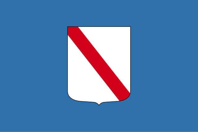
Bosnia Herzegovina
FIFA Fussball-Weltmeisterschaft 2014
UEFA European Championship 2020
 Group J
 Sport
(F)UEFA Nations League
UEFA Nations League
UEFA Nations League B - Group 3
Sport
(F)UEFA Nations League
UEFA Nations League
UEFA Nations League B - Group 3
 Religion

迪纳拉山脉(克罗地亚语:Dinarsko gorje;塞尔维亚语:Динарски Алпи;英语:Dinaric Alps)是欧洲东南部的一条主要山脉,西起阿尔卑斯山脉,沿亚得里亚海海岸向东南延伸约645千米,东隔多瑙河流域与喀尔巴阡山脉相望,向南延伸为希腊境内诸山脉和爱琴海诸岛。
迪纳拉山脉是欧洲第四大山脉,仅次于高加索山脉、斯堪的纳维亚山脉和阿尔卑斯山脉,跨斯洛文尼亚、克罗地亚、波斯尼亚和黑塞哥维那、塞尔维亚、黑山、阿尔巴尼亚和科索沃,最高点为阿尔巴尼亚境内的湖泊峰,海拔2692米。
Das Dinarische Gebirge (auch als Dinarische Alpen oder Dinariden bezeichnet) gehört zu den jungalpidischen Faltengebirgen in Südosteuropa und ist ein Teilabschnitt des den Mittelmeerraum umspannenden Faltungsgürtels. Es erstreckt sich über 600 Kilometer entlang des Ostufers der Adria von den Julischen Alpen in Nordostitalien und Slowenien über Nordwest-Kroatien, Bosnien-Herzegowina, Südwest-Serbien und Montenegro bis nach Nordalbanien, wo es im Querriegel des Prokletije (Albanische Alpen) abschließt.
Das großteils verkarstete Gebirge zeigt alle Typformen des außertropischen Karstformenschatzes. Aufgrund starker (neo-)tektonischer Aktivität der adriatischen Mikroplatte verfügt es wegen seiner treppenartig angeordneten Relieffolge und tektonisch angelegter Groß-Poljen – sogenannten Poljentreppe – über eines der komplexesten Karstreliefs der Erde.[1] Aus den in den dinarischen Ländern gebräuchlichen regionalen Landschafts- und Relief-Toponymen hat sich ein Großteil der geologischen und geomorphologischen Begriffe zur Karstterminologie entlehnt.
 Hand in Hand
Albania
Andorra
Armenia
Azerbaijan
Belgium
Bosnia Herzegovina
Bulgaria
Denmark
Germany
Estonia
Hand in Hand
Albania
Andorra
Armenia
Azerbaijan
Belgium
Bosnia Herzegovina
Bulgaria
Denmark
Germany
Estonia
 European Union
Finland
France
Georgia
Greece
Ireland
Iceland
Italy
Kosovo
Croatia
Latvia
Liechtenstein
Lithuania
Luxembourg
Malta
Moldawien
Monaco
Montenegro
Netherlands
Nordmazedonien
Norwegen
Austria
European Union
Finland
France
Georgia
Greece
Ireland
Iceland
Italy
Kosovo
Croatia
Latvia
Liechtenstein
Lithuania
Luxembourg
Malta
Moldawien
Monaco
Montenegro
Netherlands
Nordmazedonien
Norwegen
Austria
 Party and government
European Political Community Summit
Poland
Portugal
Romania
San Marino
Sweden
Switzerland
Serbia
Slovakia
Slovenia
Spain
Czech Republic
Turkey
Ukraine
Hungary
United Kingdom
Cyprus
Party and government
Party and government
European Political Community Summit
Poland
Portugal
Romania
San Marino
Sweden
Switzerland
Serbia
Slovakia
Slovenia
Spain
Czech Republic
Turkey
Ukraine
Hungary
United Kingdom
Cyprus

欧洲政治共同体(英語:European Political Community,简称:EPC),是成立于2022年的欧洲政治和战略讨论平台。该集团于2022年10月在捷克布拉格举行首届会议,欧盟所有27个成员国及17个非欧盟国家首脑与会。
Die Europäische Politische Gemeinschaft (EPG)[1] (französisch Communauté politique européenne, CPE; englisch European Political Community, EPC) ist eine europäische, zwischenstaatliche Organisation aus 47 europäischen und vorderasiatischen Staaten, die in den Bereichen Politik, Sicherheit, Energie, Verkehr, Investitionen, Infrastruktur und Personenverkehr zusammenarbeiten. Sie ist eine eigene Institution, welche weder mit der Europäischen Union (die zu den Teilnehmern der EPG gehört) noch mit dem Europarat zusammenhängt. Das EPG-Gründungstreffen fand am 6. Oktober 2022 in der tschechischen Hauptstadt Prag statt.
Im Rahmen der EPG sollen die EU-Beitrittskandidaten, die EFTA-Mitgliedstaaten sowie das Vereinigte Königreich als ehemaliges EU-Mitglied enger an die Europäische Union gebunden und ihnen so eine Möglichkeit der Mitarbeit in deren Politikfeldern gegeben werden, ohne Vollmitglied sein zu müssen. Daher wurde dieses Format auch bereits als eine Art „assoziierte EU-Mitgliedschaft“ beschrieben. Als Hintergrund ist auch zu sehen, dass die derzeitigen Beitrittskandidaten größtenteils als noch nicht beitrittsfähig angesehen werden, man ihrem Wunsch der engeren Kooperation aber (zunächst) auf diese Weise entsprechen will bzw. andere Teilnehmerstaaten derzeit nicht EU-Mitglied werden wollen. Fast alle Teilnehmer sind gleichzeitig auch Mitglied des Europarats.
Während der Vorschlag der Europäischen Politischen Gemeinschaft von 1952 ein Versuch war, eine umfassende politische Integration europäischer Staaten zu verwirklichen, und an dieser nur die sechs damaligen Mitglieder der Europäischen Gemeinschaft für Kohle und Stahl (EGKS oder auch „Montanunion“) teilnehmen sollten, hat die neue, 70 Jahre später vorgeschlagene, Gemeinschaft einen lockereren, intergouvernmentalen Ansatz.
 Grand Est
Albania
Andorra
Armenia
Azerbaijan
Belgium
Bosnia Herzegovina
Bulgaria
Denmark
Germany
Estonia
Finland
France
Georgia
Greece
Ireland
Iceland
Italy
Croatia
Latvia
Liechtenstein
Lithuania
Luxembourg
Malta
Moldawien
Monaco
Montenegro
Netherlands
Nordmazedonien
Norwegen
Austria
Poland
Portugal
Romania
Russia
San Marino
Sweden
Switzerland
Serbia
Slovakia
Slovenia
Spain
Czech Republic
Turkey
Ukraine
Hungary
United Kingdom
Cyprus
Grand Est
Albania
Andorra
Armenia
Azerbaijan
Belgium
Bosnia Herzegovina
Bulgaria
Denmark
Germany
Estonia
Finland
France
Georgia
Greece
Ireland
Iceland
Italy
Croatia
Latvia
Liechtenstein
Lithuania
Luxembourg
Malta
Moldawien
Monaco
Montenegro
Netherlands
Nordmazedonien
Norwegen
Austria
Poland
Portugal
Romania
Russia
San Marino
Sweden
Switzerland
Serbia
Slovakia
Slovenia
Spain
Czech Republic
Turkey
Ukraine
Hungary
United Kingdom
Cyprus

 Transport and traffic
Bosnia Herzegovina
Greece
Kosovo
Croatia
Montenegro
Nordmazedonien
Poland
Sweden
Serbia
Slovakia
Czech Republic
Hungary
Transport and traffic
Bosnia Herzegovina
Greece
Kosovo
Croatia
Montenegro
Nordmazedonien
Poland
Sweden
Serbia
Slovakia
Czech Republic
Hungary

 Music
Albania
Andorra
Armenia
Azerbaijan
Australia
Music
Albania
Andorra
Armenia
Azerbaijan
Australia
 Bavaria
Belarus
Belgium
Bosnia Herzegovina
Bulgaria
Bavaria
Belarus
Belgium
Bosnia Herzegovina
Bulgaria
 Campania
Denmark
Campania
Denmark
 Performing Arts
Germany
England
Estonia
Eurovision Song Contest,ESC
Performing Arts
Germany
England
Estonia
Eurovision Song Contest,ESC
 Holidays
Finland
France
Georgia
Greece
Holidays
Finland
France
Georgia
Greece
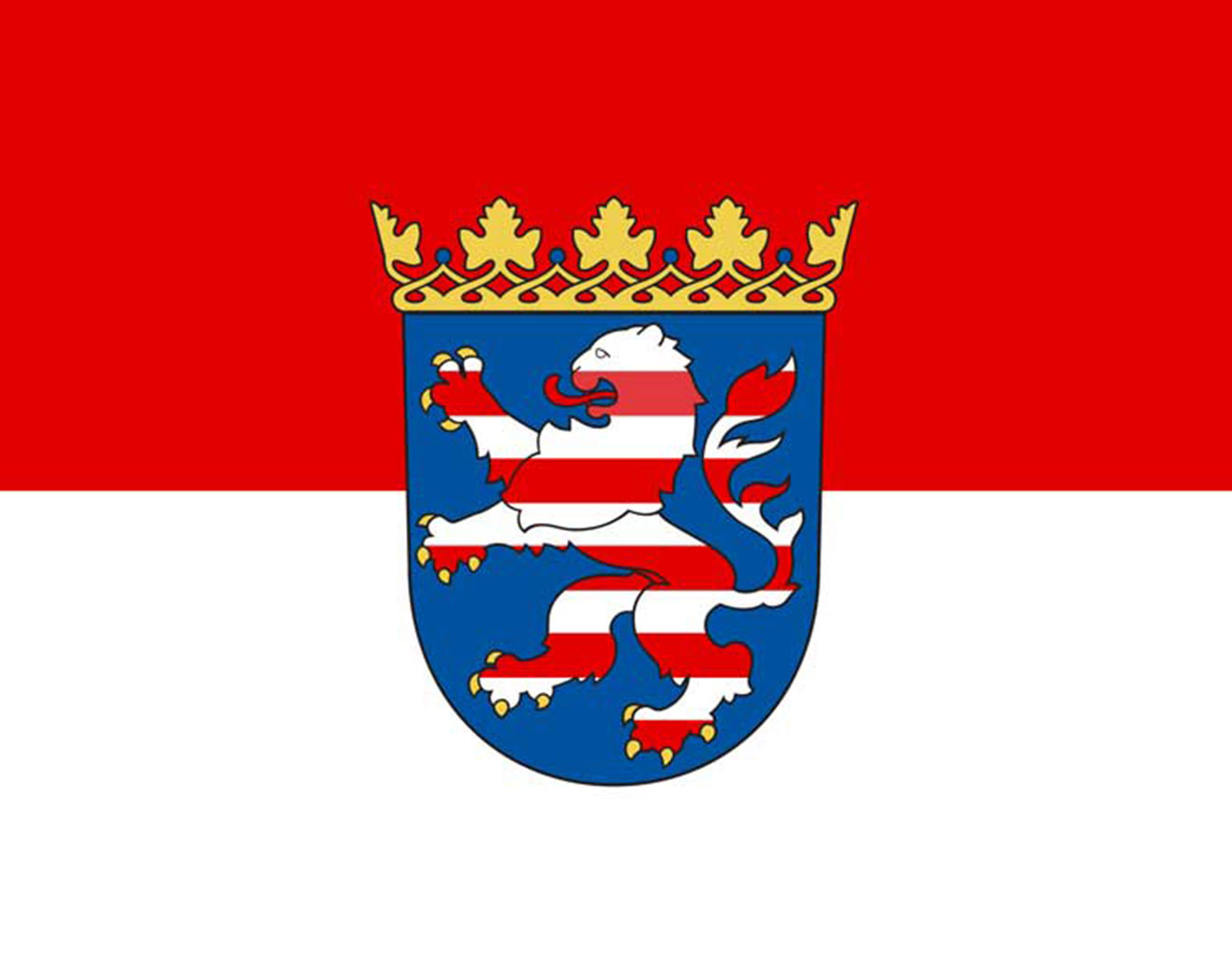 Hessen
 Ile-de-France
Ireland
Iceland
Israel
Italy
Croatia
Latvia
Lithuania
Luxembourg
Ile-de-France
Ireland
Iceland
Israel
Italy
Croatia
Latvia
Lithuania
Luxembourg
 Madrid
Malta
Morocco
Moldawien
Monaco
Montenegro
Netherlands
Northern Ireland
Nordmazedonien
Madrid
Malta
Morocco
Moldawien
Monaco
Montenegro
Netherlands
Northern Ireland
Nordmazedonien
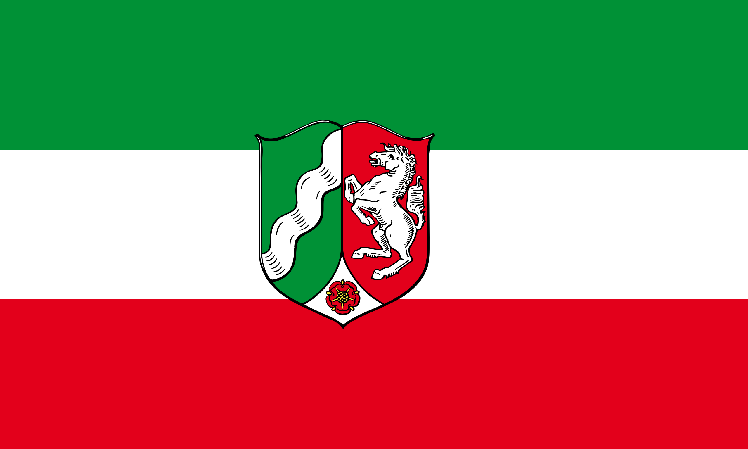 North Rhine-Westphalia
Norwegen
Austria
Poland
Portugal
North Rhine-Westphalia
Norwegen
Austria
Poland
Portugal
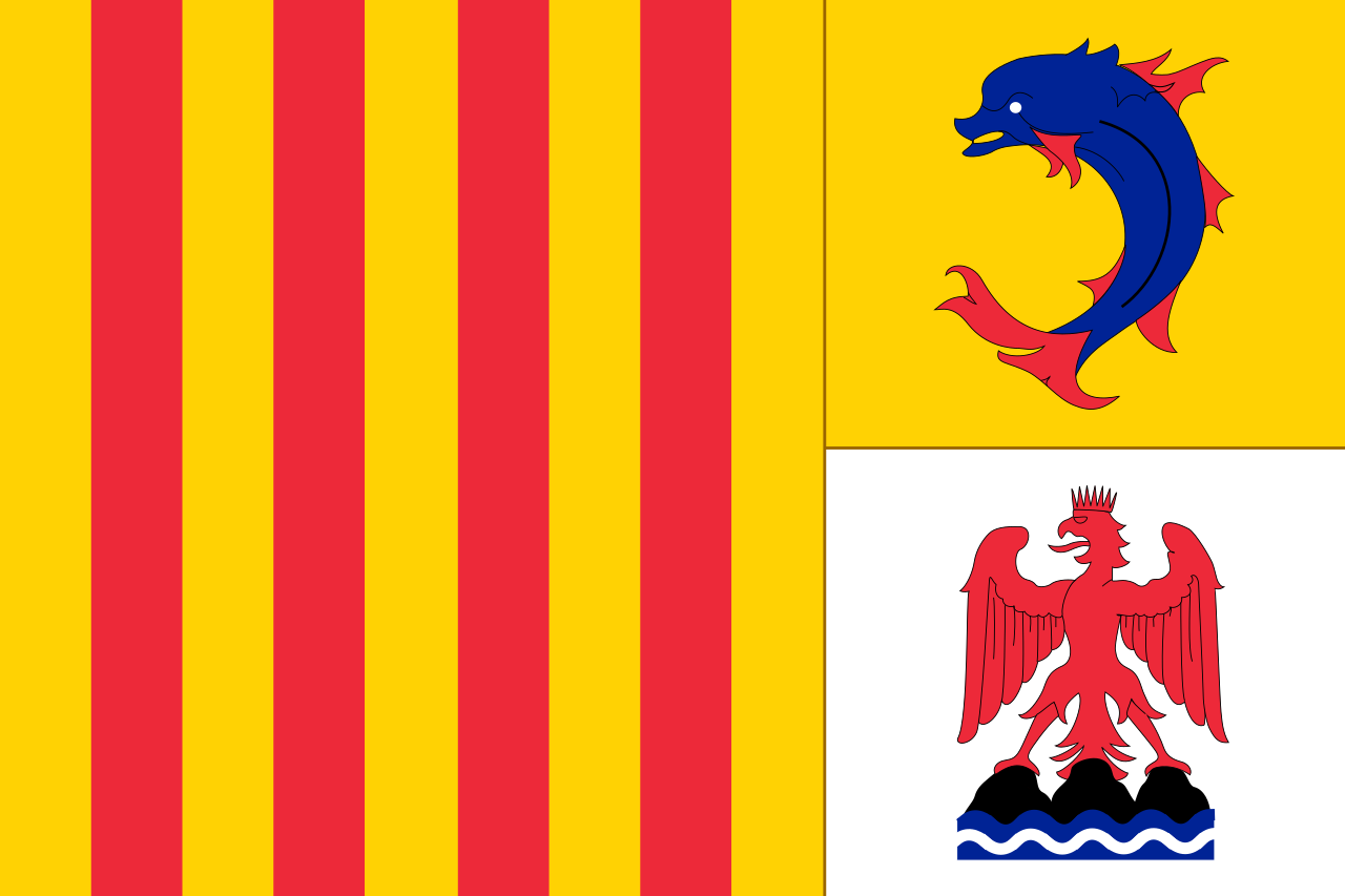 Provence-Alpes-Côte d´Azur
Romania
Russia
San Marino
Schottland
Sweden
Switzerland
Serbia
Slovakia
Slovenia
Spain
Czech Republic
Turkey
Ukraine
Hungary
United Kingdom
Provence-Alpes-Côte d´Azur
Romania
Russia
San Marino
Schottland
Sweden
Switzerland
Serbia
Slovakia
Slovenia
Spain
Czech Republic
Turkey
Ukraine
Hungary
United Kingdom
 Vienna
Cyprus
Vienna
Cyprus


欧 洲广 播联盟主办的一项歌唱比赛,自从1956年在瑞士Lugano(卢加诺)举办第一届以后,每年会举行一次,由在上一届获得冠军的国家承办(挺有意思的)。 比赛的结果不是评委说了算,而是由全欧洲的电视观众决定。歌曲演唱完毕,会给出十分钟时间,由电视观众打投票电话进行评选,投票范围为除自己国家外的其他 所有歌手。这个大赛还有个特色就是不规定歌手必须是这个国家的“自己人”,各个国家可以根据自己的情况请“外援”,比较出名的有Celine Dion在1988年代表瑞士参赛并拿了冠军。欧洲电视歌曲大赛采用了全欧洲各国竞赛的方式,来自各国的选手带上自己最精彩的节目,让我们有了更丰富的音 乐享受,整个晚会的气氛活跃,的确有不少好歌。欧洲歌唱大赛是欧洲最高水平的比赛,每个国家都会派出代表自己国家的歌手参赛欧视歌曲大赛已成为具有优秀传 统的欧陆年度音乐大赛,虽然只是欧洲范围内的音乐赛事,但是已经成为众多本地音乐艺人走向国际舞台的最佳跳板,是同类型比赛中规模最大者之一。在2008 年,一共有43个欧洲及邻近国家派出代表参加比赛,并有1.5亿观众透过电视观看了决赛。欧洲电视歌唱大赛经过50多年的发展,已经成为欧洲规模最大、影 响力最广、商业运作最成功的文艺活动。
和国内的歌唱比赛有所不同,欧洲电视歌唱大赛突出的是跨地域性和全民参与性。本届大赛共有38个国 家参加,观看决赛的电视观众有1.5亿之众,而参加采访的各国记者人数就超过2200人。比赛规定,大赛的优胜者由参赛国观众投票决定,但投票者不得将票 投给自己国家的选手。每名参赛者表演结束后,都会留下10分钟时间给观众投票。随着通讯手段的进步,手机短信、电话和电脑网络都被列为有效的投票方式,这 些选票最终由设在德国的一个数据中心进行处理,比赛全部结束后半小时内观众即可获悉大赛最终结果。
虽然每年代表各国参赛的歌手或乐队不一 定代表该国最高水平,但一定是该国当前最流行或者最具发展潜力的音乐组合。两位在现场的芬兰小伙子告诉记者,芬兰人对洛迪乐队疯狂的演唱风格不一定都喜 欢,但芬兰人能夺取冠军相当不容易。毕竟芬兰已经参加了近40届大赛,夺冠还是头一次。
通过该项大赛走红的明星并不少见,瑞典乐队的“芭 芭”就因1974年夺冠而一举成名,席琳·迪翁也在1988年爱尔兰举办的欧洲电视歌唱比赛中获得过冠军,二人组合“神秘园”1995年曾代表挪威夺得过 大奖,甚至爱尔兰著名的《大河之舞》,也是通过在该项比赛评分间隙进行的表演而走向世界比赛中每个国家派出一个歌手或一个乐团演唱一首自选的歌曲,之后观 众透过电话、短信或网络投选最喜欢的歌手,再统计各国的票数间接选出优胜者。而胜出者所代表的国家自动成为下年决赛的东道主。
在过去52届比赛,爱尔兰代表胜出了7次,是各国之冠,联合王国、法国和卢森堡代表各胜出了5次并列第二。历届优胜者中,ABBA(1974年)和席琳·狄翁(1988年)成了国际知名的巨星。
欧洲电视歌唱大赛由欧洲广播电视联盟主办,该联盟的成员国每年通过自己的选拔方式确定本国的参赛选手和曲目。每年5月份,半决赛和决赛通过现场直播方式在承办国进行。
Der Eurovision Song Contest (ESC; übersetzt „Liederwettbewerb der Eurovision“; bis 2001 in Deutschland unter dem französischen Namen Grand Prix Eurovision de la Chanson[1]) ist ein internationaler Musikwettbewerb von Komponisten und Textdichtern, vorgetragen von Gesangsinterpreten, der seit 1956 jährlich von der Europäischen Rundfunkunion (EBU) im Rahmen der Eurovision veranstaltet wird. Die Anregung dazu war vom Sanremo-Festival beeinflusst, das bereits 1951 ins Leben gerufen wurde. Beim ESC sind die Rundfunkanstalten aller Staaten der EBU teilnahmeberechtigt. Dieser Rundfunkunion gehören mehrheitlich europäische und einige Radio- und Fernsehstationen benachbarter westasiatischer und nordafrikanischer Staaten an.
Da die Shows auch außerhalb des Sendegebiets der EBU übertragen werden, konnte der Eurovision Song Contest über die Jahre hinweg auch eine große Fangemeinde in Australien, Neuseeland, Teilen Asiens (Japan, China, Südkorea, Hongkong, Indien), Mexiko und Teilen Südamerikas, Kanada und den USA gewinnen.[2] Insgesamt werden die Übertragungen des ESC von mehr als 200 Millionen Zuschauern gesehen. Im Jahr 2016 erhielt der ESC die Karlsmedaille für europäische Medien.
ユーロビジョン・ソング・コンテスト(英語:Eurovision Song Contest、フランス語:Concours Eurovision de la Chanson)[1]は、欧州放送連合(EBU)加盟放送局によって開催される、毎年恒例の音楽コンテストである。
大会では、各国代表のアーティストはそれぞれ生放送で自らの楽曲を披露し、引き続いてそれぞれの参加国が他国に投票して大会の優勝者を決定する。各国代表の参加者は、欧州放送連合に加盟する全国網の放送局を通じて大会に参加しており、放送局は自国代表のアーティストと楽曲を決定し、また自国の視聴者に大会を生中継する。大会は1956年の第1回大会以降、毎年開催されており、世界的に見ても長寿のテレビ番組のひとつであり[2]、その視聴者の数も1億人から6億人程度と見積もられている[3][4]。ユーロビジョン・ソング・コンテストは、オーストラリア、カナダ、中華人民共和国、エジプト、インド、日本、ヨルダン、メキシコ、ニュージーランド、フィリピン、大韓民国、台湾、タイ王国、ベトナム、ウルグアイなど、大会に参加していないヨーロッパ域外の国々でも放送された[5][6][7]。2000年以降は、コンテストは公式サイトよりインターネットでも中継されており[8]、2006年には140カ国近くから7万4千人以上が視聴している[9]。
The Eurovision Song Contest (French: Concours Eurovision de la chanson),[1] often simply called Eurovision, is an international song competition held primarily among the member countries of the European Broadcasting Union. Each participating country submits an original song to be performed on live television and radio, then casts votes for the other countries' songs to determine the winner. At least 50 countries are eligible to compete as of 2018,[2] and since 2015, Australia has been allowed as a guest entrant.[3][4][5][6]
Winning the Eurovision Song Contest often provides a short-term career boost for artists, but rarely results in long-term success.[7] Some exceptions are ABBA (winner in 1974 for Sweden), Bucks Fizz (winner in 1981 for the United Kingdom), and Celine Dion (winner in 1988 for Switzerland), all of whom launched successful careers.
Based on the Sanremo Music Festival held in Italy since 1951, Eurovision has been broadcast every year since its inauguration in 1956, making it the longest-running annual international television contest and one of the world's longest-running television programmes. It is also one of the most watched non-sporting events,[8] with audience figures of between 100 million and 600 million internationally.[9][10] It has been broadcast in several countries that do not compete, such as the United States, Canada, New Zealand, and China. Since 2000, it has been broadcast online via the Eurovision website.[11] The contest has been described as having kitsch appeal.[12][13]
Ireland holds the record for most victories, with seven wins, including four times in five years in 1992, 1993, 1994, and 1996. Under the current voting system, in place since 2016, the highest-scoring winner is Salvador Sobral of Portugal who won the 2017 contest in Kiev, Ukraine, with 758 points; under the previous system, the highest-scoring winner was Alexander Rybak of Norway with 387 points in 2009.
Le Concours Eurovision de la chanson (en anglais : Eurovision Song Contest) est un événement annuel organisé par l'Union européenne de radio-télévision, l'UER. Il réunit les membres de l'Union dans le cadre d'une compétition musicale, diffusée en direct et en simultané par tous les diffuseurs participants. Il est retransmis à la télévision (par câble et satellite), la radio et sur Internet. Appelé plus communément Eurovision, d'après le réseau télévisé du même nom, il a été inventé par le directeur général de la télévision publique suisse, Marcel Bezençon, sur le modèle du Festival de Sanremo, créé peu de temps auparavant. Sa toute première édition a eu lieu le 24 mai 1956, à Lugano, en Suisse. Sept pays fondateurs ont concouru alors pour la victoire. Depuis, le Concours s'est tenu chaque année, sans aucune interruption. Le nombre de pays participants n'a cessé d'augmenter, passant de sept à une quarantaine au XXIe siècle. À travers les décennies, le Concours a évolué, s'est adapté et réinventé, accompagnant les développements technologiques et musicaux, mais aussi historiques et politiques.
L'Eurovision possède certains attributs symboliques qui ont pérennisé son ancrage dans les mémoires, comme son thème d'ouverture, le prélude orchestral du Te Deum de Marc-Antoine Charpentier. De même, sa procédure de vote, souvent perçue comme sa séquence la plus importante, se déroule selon un schéma récurrent et des règles bien précises. Elle est devenue un véritable rituel annuel.
L'Eurovision est ouvert aux seuls membres actifs de l'UER. Ces membres sont des diffuseurs soit de pays situés dans la Zone européenne de radiodiffusion soit des diffuseurs de pays situés en dehors de cette zone mais membres du Conseil de l'Europe. Tous doivent être membres de l'Union internationale des télécommunications. Cela inclut donc des pays situés en Europe, en Asie et en Afrique. Le Concours est aussi retransmis en direct sur les autres continents, notamment en Afrique du Sud, en Australie, au Canada, en Corée du Sud, aux États-Unis, en Nouvelle-Zélande et en Chine.
L'Eurovision demeure l'un des plus anciens programmes télévisés au monde, et le plus important concours musical jamais organisé. Son succès a dépassé les frontières du continent européen et il a inspiré de nombreuses autres compétitions musicales.
L'Eurovision Song Contest (o Concours Eurovision de la Chanson, anche solo Eurovision o ESC, e noto in Italia anche come Eurofestival) è un festival musicale internazionale nato nel 1956, a Lugano in Svizzera, e organizzato annualmente dai membri dell'Unione europea di radiodiffusione (UER).
Dalla prima edizione del 1956 il concorso è stato trasmesso ogni anno senza interruzioni in tutto il mondo ed è uno dei programmi televisivi più longevi. È anche l'evento non sportivo più seguito al mondo[1]: i dati di ascolto degli ultimi anni a livello internazionale sono stati stimati tra i 100 e i 600 milioni.[2][3][4][5][6]
Dal 2000 il concorso viene trasmesso anche via internet e dal 2016 viene trasmesso anche in diretta sul canale ufficiale YouTube dell'evento, che nel 2018 conta circa 2,5 milioni di iscritti.[7][8]
El Festival de la Canción de Eurovisión (en francés Concours Eurovision de la Chanson; en inglés Eurovision Song Contest) es un concurso televisivo de carácter anual, en el que participan intérpretes representantes de las televisiones (en su mayoría públicas) cuyos países son miembros de la Unión Europea de Radiodifusión. El festival ha sido transmitido cada año desde 1956, siendo el programa de televisión más antiguo que aún se transmite en el mundo,1 recibiendo en 2015 el récord Guinness como la competición musical televisiva más longeva del mundo.2 Además, es el festival de la canción más grande en términos de audiencia, la que se ha estimado entre 100 y 600 millones internacionalmente. El evento es transmitido en todo el mundo, incluso en países que no participan en el mismo. El festival es históricamente conocido por ser promotor de música pop. Sin embargo, en años recientes se han presentado en el festival varios temas pertenecientes a otros géneros, como árabe, dance, tango, reguetón, heavy metal, pop-rap, punk, rock, electrónica, entre otros.
El nombre del concurso viene de la Red de Distribución de Televisión de Eurovisión (Eurovision Network), que está controlada por la Unión Europea de Radiodifusión (UER) y puede alcanzar audiencias potenciales de más de mil millones de personas. Cualquier miembro activo de la UER puede participar en el Festival, por lo que la aptitud para formar parte de este magno evento no está determinada por la inclusión geográfica dentro del continente europeo (a pesar del prefijo «Euro» en «Eurovisión»), que no tiene que ver con la Unión Europea. Al paso de los años, el festival ha crecido de un simple experimento televisivo a una institución internacional de grandes proporciones y el término «Eurovisión» es reconocido a lo largo del mundo.
Para la edición 2015, se invitó a Australia a participar en el certamen, lo que supuso que se convierta en el primer miembro asociado de la UER (y no activo) que participa en Eurovisión, así como en el primer país oceánico.3 La edición más reciente, el Festival de la Canción de Eurovisión 2018, fue realizada entre el 8 de mayo y el 12 de mayo de 2018 en Lisboa, Portugal. Israel se proclamó ganadora con el tema «Toy», interpretado por la cantante Netta Barzilai.
Ко́нкурс пе́сни «Еврови́дение» (англ. Eurovision Song Contest; фр. Concours Eurovision de la chanson) — международный конкурс эстрадной песни среди стран-членов Европейского вещательного союза (ЕВС — англ. European Broadcasting Union)[1]. Владельцем всей интеллектуальной собственности, производящейся в рамках конкурса, также является Европейский вещательный союз[2].
В конкурсе участвует по одному представителю от каждой из стран-членов ЕВС, которые подали заявки на участие. Фестиваль проходит в прямом эфире. От каждой страны может участвовать один представитель (солист или музыкальный коллектив), исполняющий песню длительностью не более трёх минут. Во время выступления на сцене должно выступать не более шести артистов одновременно. После выступления всех участников наиболее популярная песня определяется путём голосования телезрителей и жюри, в котором участвуют все страны, выступавшие в финале и полуфинале[3].
Конкурс проходит ежегодно, начиная с 1956 года, и является одним из самых популярных неспортивных мероприятий в мире[4], с аудиторией до 600 млн зрителей[5][6]. «Евровидение» также транслируется в Киргизии, Казахстане, Канаде, Египте, Индии, Ливане, Южной Африке, Южной Корее, США и некоторых других странах, несмотря на то, что они не участвуют в конкурсе и находятся за пределами Европы[7][8]. Начиная с 2000 года, конкурс постоянно транслируется в сети Интернет[9], интернет-аудитория постоянно растёт: в 2006 году онлайн-трансляцию посмотрело 74 тысячи человек[10], в 2017 — свыше 600 тысяч.
«Евровидение» в значительной мере повлияло на известность участвовавших на нём артистов. Например, легендарные группы «АББА» (ABBA, Швеция — 1974)[11], «Чингисхан» (Dschinghis Khan, Германия — 1979)[12] и певица Селин Дион (Швейцария — 1988)[13] стали всемирно известными после триумфальных выступлений на песенном фестивале[14][15].