
Deutsch-Chinesische Enzyklopädie, 德汉百科
 墨西哥
墨西哥
 运输和交通
运输和交通

 航空航天
航空航天
 企业
企业


 地理
地理
 阿拉斯加州
阿根廷
玻利维亚
阿拉斯加州
阿根廷
玻利维亚
 不列颠哥伦比亚省
 加利福尼亚州
智利
哥伦比亚
哥斯达黎加
厄瓜多尔
危地马拉
洪都拉斯
加拿大
墨西哥
加利福尼亚州
智利
哥伦比亚
哥斯达黎加
厄瓜多尔
危地马拉
洪都拉斯
加拿大
墨西哥
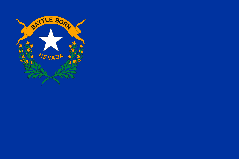 内华达州
尼加拉瓜
内华达州
尼加拉瓜
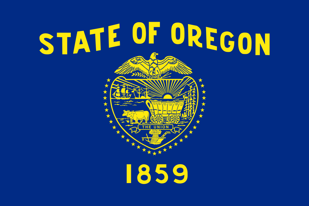 俄勒冈州
巴拿马
秘鲁
委内瑞拉
美国
俄勒冈州
巴拿马
秘鲁
委内瑞拉
美国
 华盛顿州
华盛顿州
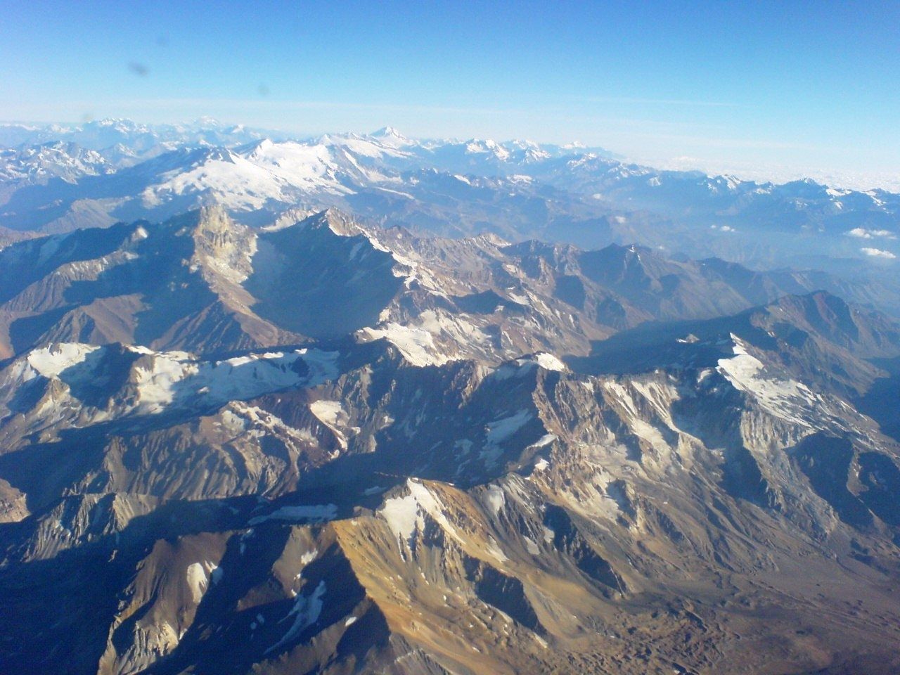
科迪勒拉山系(American Cordillera) 纵贯美洲大陆西部的山系,北起阿拉斯加,南至智利火地岛,绵延约1.5万公里,为世界最长的山系。“科迪勒拉”(Cordillera)在西班牙语中意为“山脉”。
科迪勒拉山系由一系列山脉、山间平原和盆地组成,山脉除个别地段外,总体呈南-北或西北-东南走向,北美部分较宽,一般海拔1500-4000米,南美部分较窄,大部在海拔3000米以上,有高山冰川,多火山、地震。
包含阿拉斯加山脉、落基山脉、安第斯山脉等。科迪勒拉山系最高峰阿空加瓜山,海拔6962米。科迪勒拉山系构成环太平洋地震带的东半部分。
Die Amerikanischen Kordilleren (spanisch cordillera „Gebirgskette“) sind eine Kette von Kordilleren, die sich im Westen Nord- und Südamerikas erstreckt.
Mit einer Länge von 15.000 Kilometern (Breite bis zu 2.500 Kilometer) stellen sie das längste Faltengebirge der Welt dar; es reicht von Alaska bis Feuerland. Eng verbunden sind die Kordilleren mit dem Pazifischen Feuerring, dessen Ostteil sie bilden: Viele der hohen Gipfel sind Vulkane, ganze Ketten sind vom Vulkanismus geprägt. Das Gebirgssystem entstand durch die Subduktion der Farallon-Platte (einschließlich ihrer heutigen Überreste Cocos- und Nazca-Platte) unter die Nordamerikanische, die Karibische und die Südamerikanische Platte.
科迪勒拉山系(英语:American Cordillera;西班牙语:cordillera Americana)是世界上最长的山系,其山脉位于南北美洲大陆西部,北起阿拉斯加,南到火地岛,绵延约15000公里。属中新生代褶皱带。
アメリカ山系(アメリカさんけい、英語:American Cordillera)とは、北アメリカ、南アメリカ、西南極においてそれぞれ西部の「背骨」を形成する複数の山脈がほとんど連続して繋がっている山系である[1]。環太平洋火山帯の東半分を構成する火山弧の山脈でもある。コルディレラ山系、またはコルディエラ山系とも。
この並行し重なり合うアメリカ山系を北方から順に見ていくと、まずアラスカ州のアラスカ山脈とブルックス山脈(英語版)から始まり、カナダのユーコン準州を抜けてブリティッシュコロンビア州へと至る。続くロッキー山脈のメインベルトは並行するコロンビア山脈(英語版)や太平洋海岸山脈などの山々とともにブリティッシュコロンビア州とバンクーバー島を通過していく。アメリカ合衆国に入ると、山系の支脈はロッキー山脈やシエラネバダ山脈、カスケード山脈、さらに様々で小さい太平洋岸山系の一部も含む。メキシコでは、バハ・カリフォルニア半島の山脈と並行しながらシエラ・マドレ・オクシデンタルやシエラ・マドレ・オリエンタル(英語版)として続く。
メキシコより北の山系はまとめて北アメリカ山系(英語版)と呼ばれている。山系の別の表現として、アメリカやメキシコにおいては「北アメリカの西側の山系」、カナダにおいては「カナダ山系」または「太平洋山系」といった呼称がある。
山系はその後、グアテマラ、ホンジュラス、ニカラグア、コスタリカ、そしてパナマの順に中央アメリカにあたる地域を抜けていき、南アメリカのアンデス山脈となる。アンデス山脈とそれに並行する山々、そしてチリ沖の列島は、コロンビア、ベネズエラ、エクアドル、ペルー、ボリビア、アルゼンチンを通過し、チリにある南アメリカ最南端の地ティエラ・デル・フエゴへと至る。最後はスコシア海のスコシア弧(英語版)を経て、南極半島の山脈へ到達し終わる[2]。
The American Cordillera is a chain of mountain ranges (cordilleras) that consists of an almost continuous sequence of mountain ranges that form the western "backbone" of North America, South America and Central America.[1] It is also the backbone of the volcanic arc that forms the eastern half of the Pacific Ring of Fire.
La cordillère américaine est un enchaînement montagneux quasi-ininterrompu qui constitue l'épine dorsale occidentale des Amériques jusqu'en Antarctique ainsi que de l'arc volcanique formant la moitié orientale de la ceinture de feu du Pacifique.
Du nord au sud, elle commence par la chaîne Brooks et la chaîne d'Alaska, puis se poursuit à travers les Territoires du Nord-Ouest et le Yukon par les monts Mackenzie, tandis que côté Pacifique elle est constituée par la chaîne Saint-Élie dont un versant occupe une partie de l'Alaska côtière, l'autre étant implanté au Yukon. Ces deux formations traversent ensuite la Colombie-Britannique, l'une constituant à l'intérieur des terres la chaîne principale des montagnes Rocheuses, doublée de la chaîne Columbia, et l'autre formant à l'ouest les chaînes côtières du Pacifique.
Aux États-Unis, elle inclut le tronc entier des Rocheuses d'une part, les Cascades et la Sierra Nevada d'autre part, auxquelles s'ajoutent les chaînes côtières des États de Washington, de l'Oregon et de la Californie. Au Mexique, elle devient la Sierra Madre orientale et la Sierra Madre occidentale ainsi que les montagnes dorsales de la péninsule de Basse-Californie. Plus au sud, la Sierra Madre del Sur assure sur la côte occidentale la continuité du système, tandis qu'au centre c'est la Sierra Madre de Oaxaca qui joue ce rôle.
La cordillère se poursuit en Amérique centrale par la Sierra Madre de Chiapas au Guatemala, Salvador et Honduras, puis par une succession de chaînes plus courtes à travers le Nicaragua, le Costa Rica (dont la cordillère de Talamanca et la cordillère Centrale) et le Panama. En Amérique du Sud, elle devient la cordillère des Andes. Cette dernière avec ses chaînes parallèles (essentiellement les cordillères Orientale, Centrale et Occidentale), continue à travers le Venezuela, la Colombie, l'Équateur, le Pérou, la Bolivie, le Chili (où elle inclut les îles côtières) et l'Argentine pour atteindre la Terre de Feu (Andes fuégiennes, dont la cordillère Darwin). Elle se poursuit par la chaîne de Géorgie du Sud et les îles Shetland du Sud à travers l'océan Austral jusqu'aux montagnes de la Terre de Graham.
Cette vaste cordillère culmine en Argentine à 6 962 mètres d'altitude à l'Aconcagua.
La Cordigliera Americana è un'estesa e quasi continua serie di catene montuose (in lingua spagnola cordillera) che si sviluppano lungo il fianco occidentale dell'America settentrionale, centrale e meridionale, lungo il versante rivolto verso l'Oceano Pacifico.[1] È anche la spina dorsale dell'arco vulcanico che costituisce la parte orientale della cintura di fuoco del Pacifico e si può considerare che la sua continuazione ideale sia rappresentata dalle isole della Georgia del Sud e Isole Sandwich Australi, per proseguire poi nella Terra di Graham della Penisola Antartica.[2]
La cordillera Americana es una extensa cadena montañosa que consiste en una casi continua secuencia de cordilleras y sierras, a lo largo de todo el oeste del continente americano, llegando hasta la Antártida
De norte a sur, esta secuencia orogénica en sentido meridiano, comienza con la cordillera de Alaska y la cordillera Brooks en Alaska. Se extiende a través del Yukón y la Columbia Británica en Canadá. En Estados Unidos de América la rama principal son las Montañas Rocosas, en México la cordillera continúa a través de la Sierra Madre Occidental y la Sierra Madre Oriental. Luego continúa a través de las sierras de Centroamérica en Guatemala, El Salvador, Honduras, Nicaragua, Costa Rica y Panamá. Finalmente se convierte en la cordillera de los Andes en América del Sur. Además, se considera que puede continuar hasta las islas Georgias del Sur y a través del Atlántico Sur hasta las montañas de la Tierra de Graham en la península Antártica. Este sistema orogénico, es la mitad oriental del Anillo del Fuego del océano Pacífico.
Кордилье́ры (исп. Cordilleras, англ. American Cordillera) — величайшая по протяжённости горная система земного шара, простирающаяся вдоль западных окраин Северной Америки, от 66° с. ш. (Аляска) до 56° ю. ш. (Огненная Земля).
Вся система Кордильер делится на две части — Кордильеры Северной Америки и Кордильеры Южной Америки, или Анды.
Длина — более 18 тыс. км, ширина — до 1600 км в Северной Америке и до 900 км в Южной. Кордильеры расположены на территории Канады, США, Мексики, государств Центральной Америки, Венесуэлы, Колумбии, Эквадора, Перу, Боливии, Аргентины и Чили. Почти на всём протяжении являются водоразделом между бассейнами Атлантического и Тихого океанов, а также резко выраженной климатической границей.
По высоте Кордильеры уступают только Гималаям и горным системам Центральной Азии. Наиболее высокие вершины: в Северной Америке — гора Денали (прежнее название — Мак-Кинли; 6190 м), в Южной Америке — гора Аконкагуа (6961 м[1]).
Кордильеры лежат во всех географических поясах Америки (кроме субарктического и арктического) и отличаются большим разнообразием ландшафтов и ярко выраженной высотной поясностью. Снеговая граница на Аляске — на высоте 600 метров, на Огненной Земле — 500—700 метров, в Боливии и Южном Перу поднимается до 6000—6500 метров. В северо-западной части Кордильер Северной Америки и на юго-востоке Анд ледники спускаются до уровня океана, в жарком поясе они покрывают лишь наиболее высокие вершины. Общая площадь оледенений — около 90 тыс. км² (в Кордильерах Северной Америки — 67 тыс. км², в Андах — около 20 тыс. км²).

 经济和贸易
亚太经济合作组织
经济和贸易
亚太经济合作组织
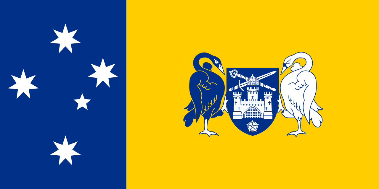 澳大利亚首都领地
澳大利亚
北京市-京
不列颠哥伦比亚省
文莱
智利
中国
澳大利亚首都领地
澳大利亚
北京市-京
不列颠哥伦比亚省
文莱
智利
中国
 手拉手
手拉手
 夏威夷州
香港特别行政区-港
印度尼西亚
日本
加拿大
关东地方
近畿地方
马来西亚
墨西哥
新西兰
夏威夷州
香港特别行政区-港
印度尼西亚
日本
加拿大
关东地方
近畿地方
马来西亚
墨西哥
新西兰
 新南威尔士州
巴布亚新几内亚
新南威尔士州
巴布亚新几内亚
 政党和政府组织
政党和政府组织
政党和政府组织
 亚太经济合作组织
秘鲁
菲律宾
韩国
俄罗斯
上海市-沪
新加坡
台湾省-台
泰国
美国
越南
华盛顿州
亚太经济合作组织
秘鲁
菲律宾
韩国
俄罗斯
上海市-沪
新加坡
台湾省-台
泰国
美国
越南
华盛顿州
 重要的国际组织
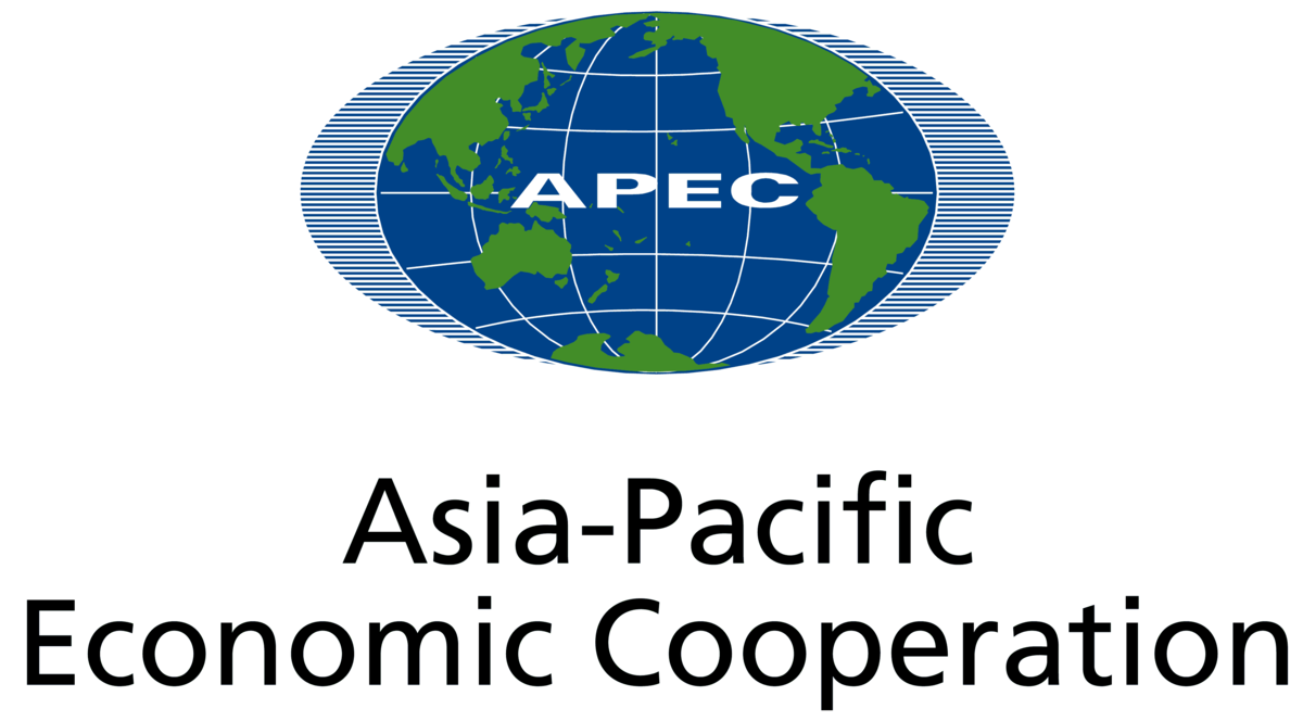
亚太经济合作组织(简称亚太经合组织;英语:Asia-Pacific Economic Cooperation,缩写:APEC),是亚太区内各地区之间促进经济成长、合作、贸易、投资的论坛。此组织的创办在历史上取代了该区域的冷战结构,但由于日本在该区域会因过去历史记忆引发负面评价,所以由澳大利亚主导创始事项[1]。
始设于1989年,现有21个经济体成员。亚太经合组织是经济合作的论坛平台,其运作是通过非约束性的承诺与成员的自愿,强调开放对话及平等尊重各成员意见,不同于其他经由条约确立的政府间组织。“APEC”与“Asia-Pacific Economic Cooperation”均是亚太经济合作组织的注册商标。[2]
Die Asiatisch-Pazifische Wirtschaftsgemeinschaft (für englisch Asia-Pacific Economic Cooperation, kurz APEC, auch übersetzt als Asiatisch-Pazifische Wirtschaftskooperation oder Asien-Pazifik-Forum) ist eine internationale Organisation, die es sich zum Ziel gesetzt hat, im pazifischen Raum eine Freihandelszone einzurichten.
In den 21 APEC-Staaten lebt knapp die Hälfte der Weltbevölkerung. Der Wirtschaftsraum erbringt mehr als die Hälfte der Weltwirtschaftsleistung und ist eine der am schnellsten wachsenden Wirtschaftsregionen der Welt.
アジア太平洋経済協力会議(アジアたいへいようけいざいきょうりょくかいぎ、英: Asia-Pacific Economic Cooperation)は、環太平洋地域における多国間経済協力を進めるための非公式なフォーラム[2]である。略称、APEC(エイペック[3][4])。
「アジア太平洋」という概念が最初に打ち出されたのは、永野重雄が1967年に発足させた太平洋経済委員会(PBEC)という経済団体の設立時であるとされるが[5][6][7]、具体的にこうした地域概念が政府レベルの協力枠組みに発展する萌芽は、1978年、日本の大平正芳首相が就任演説で「環太平洋連帯構想」を呼びかけたことにある。これを具体化した大平政権の政策研究会「環太平洋連帯研究グループ」(議長:大来佐武郎、幹事佐藤誠三郎)の報告を受け、大平がオーストラリアのマルコム・フレイザー首相に提案して強い賛同を得たことが、1980年9月の太平洋経済協力会議(PECC)の設立につながった。PECCは地域における様々な課題を議論し研究するセミナーといった趣のものであったが、これを土台にして、各国政府が正式に参加する会合として設立されたのが、APECである[8][9]。
APECは、1989年にオーストラリアのホーク首相の提唱で、日本・アメリカ合衆国・カナダ・韓国・オーストラリア・ニュージーランド及び当時の東南アジア諸国連合(ASEAN)加盟6か国の計12か国で発足し、同国のキャンベラで閣僚会議(Ministerial Meeting)を開催した。また、1993年には米国のシアトルで初の首脳会議(Economic Leaders' Meeting)がもたれた。現在は、首脳会議、及び、外相、経済担当相による閣僚会議をそれぞれ年1回開いている。シンガポールに常設事務局を置き、開催国から任期1年で事務局長が選任されている[10]。 参加しているメンバーは、21カ国・地域で、2012年現在、人口では世界の41.4%、GDP(国内総生産)では57.8%、貿易額では47%を占めている。
APECは、開かれた地域協力によって経済のブロック化を抑え、域内の貿易・投資の自由化を通じて、世界貿易機関(WTO)のもとでの多角的自由貿易体制を維持・発展することを目的としてきたが、近年のWTOの新ラウンドの停滞や自由貿易協定締結の動きの活発化などによって、その存在意義が問われている。
Asia-Pacific Economic Cooperation (APEC) is an inter-governmental forum for 21 Pacific Rim member economies[2] that promotes free trade throughout the Asia-Pacific region. Inspired from the success of Association of Southeast Asian Nations (ASEAN)’s series of post-ministerial conferences launched in the mid-1980s, the APEC was established in 1989 in response to the growing interdependence of Asia-Pacific economies and the advent of regional trade blocs in other parts of the world; and to establish new markets for agricultural products and raw materials beyond Europe.[3][4][5] Headquartered in Singapore, the APEC is recognised as one of the oldest forums and highest-level multilateral blocs in the Asia-Pacific region, and exerts a significant global influence.[6][7][8][9][10][11]
An annual APEC Economic Leaders' Meeting is attended by the heads of government of all APEC members except Republic of China (Taiwan) (which is represented by a ministerial-level official under the name Republic of China as economic leader).[12] The location of the meeting rotates annually among the member economies, and a famous tradition, followed for most (but not all) summits, involves the attending leaders dressing in a national costume of the host country. APEC has three official observers: the Association of Southeast Asian Nations Secretariat, the Pacific Economic Cooperation Council and the Pacific Islands Forum Secretariat.[13] APEC's Host Economy of the Year is considered to be invited in the first place for geographical representation to attend G20 meetings following G20 guidelines.[14][15][16][17]
La Coopération économique pour l'Asie-Pacifique (en anglais : Asia-Pacific Economic Cooperation, APEC) est un forum économique intergouvernemental visant à faciliter la croissance économique, la coopération, les échanges et l'investissement de la région Asie Pacifique. Elle se réunit chaque année1.
L'Asia-Pacific Economic Cooperation (APEC), ossia Cooperazione Economica Asiatico-Pacifica, è un organismo nato nel 1989 allo scopo di favorire la cooperazione (o, più in generale, la crescita) economica, il libero scambio e gli investimenti nell'area asiatico-pacifica. Tale area (come suggerisce il logo stesso dell'APEC) coincide non solo con l'Asia Pacifica, ma potenzialmente con l'intero Pacific Rim.
L'APEC ha sede a Singapore, Paese considerato una delle tigri dell'Asia.
Dal punto di vista del diritto internazionale l'APEC si definisce organismo e non organizzazione internazionale perché, essendo composto da economie e non da Stati, è privo di una piena personalità giuridica. Ciò spiega, fra l'altro, come mai possano farne parte contemporaneamente la Cina continentale, Hong Kong e Taiwan, ossia tre realtà che, territorialmente (secondo Pechino e secondo tutti i governi che intrattengono relazioni diplomatiche con Pechino), appartengono a un unico Stato: la Repubblica Popolare di Cina.
APEC (Asia-Pacific Economic Cooperation, en español Foro de Cooperación Económica Asia-Pacífico) es un foro multilateral creado en 1989, con el fin de consolidar el crecimiento y la prosperidad de los países del Pacífico, que trata temas relacionados con el intercambio comercial, coordinación económica y cooperación entre sus integrantes.1
Como mecanismo de cooperación y concertación económica, está orientado a la promoción y facilitación del comercio, las inversiones, la cooperación económica y técnica y al desarrollo económico regional de los países y territorios de la cuenca del océano Pacífico. Fomentando un crecimiento económico inclusivo, equitativo, sustentable e innovador.2
La suma del Producto Nacional Bruto de las veintiuna economías que conforman el APEC equivale al 56 % de la producción mundial, en tanto que en su conjunto representan el 46 % del comercio global.
La APEC no tiene un tratado formal. Sus decisiones se toman por consenso y funciona con base en declaraciones no vinculantes. Tiene una Secretaría General, con sede en Singapur, que es la encargada de coordinar el apoyo técnico y de consultoría. Cada año uno de los países miembros es huésped de la reunión anual de la APEC. La vigésimo novena cumbre se realizó en noviembre de 2017 en Da Nang, Vietnam; y la próxima será en Santiago, Chile.
Азиатско-Тихоокеанское экономическое сотрудничество (АТЭС) (англ. Asia-Pacific Economic Cooperation, APEC) — форум 21 экономики Азиатско-Тихоокеанского региона для сотрудничества в области региональной торговли и облегчения и либерализации капиталовложений.
Целью АТЭС является повышение экономического роста, процветания в регионе и укрепление азиатско-тихоокеанского сообщества. В экономиках-участницах проживает около 40 % мирового населения, на них приходится приблизительно 54 % ВВП и 44 % мировой торговли[1].
 赛车,艇运动
 体育
体育
 历史
历史
 文化遗产
文化遗产
 文明
文明
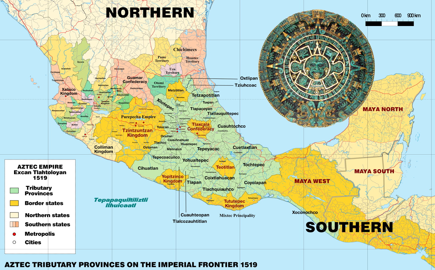
阿兹特克或阿兹台克是存在于14世纪至16世纪的墨西哥古文明,主要分布在墨西哥中部和南部,因阿兹特克人而得名。阿兹特克人包括墨西哥谷地的多个民族,以操纳瓦特尔语的族群为主。阿兹特克文明在政治上的基本单位是城邦,有些城邦组成政治联盟或政治邦联。其中,1427年建立的阿兹特克帝国最具影响力,帝国由墨西加城邦特诺奇蒂特兰、阿科尔瓦城邦特斯科科以及特帕内克城邦特拉科潘组成,政治影响力深远,领土范围极盛时东抵墨西哥湾,西至太平洋,南达恰帕斯和危地马拉。由于其强大的历史影响力,“阿兹特克”在狭义上常特指阿兹特克帝国;但广义来说,在殖民者入侵之前抑或是在西班牙殖民时代,中部美洲的所有纳瓦人政体和族群都可划作阿兹特克文明的一部分[1][2]。
阿兹特克人于约12世纪末由北方迁入墨西哥谷地,这里人口稠密,后来成为阿兹特克城邦崛起的中心。墨西加人是阿兹特克人的主要分支,他们在特斯科科湖中的岛礁建立起特诺奇蒂特兰城邦,并定居于此。1427年,特诺奇蒂特兰和特斯科科、特拉科潘结盟,联合击退了曾支配谷地的特帕内克城邦阿斯卡波察尔科。此三邦的联盟在后世被称为阿兹特克帝国,在随后的百余年内通过武力和贸易攻势展开扩张,成长为中部美洲势力范围最庞大的城邦联盟[3]。尽管被称为帝国,阿兹特克帝国事实上是一个以朝贡体系为基础的“朝贡帝国”,依托于扶植傀儡君主、政治联姻以及思想控制的方式间接控制其他城邦,强制其定期向宗主进贡,并不以军事驻防的方式实行直接统治[4]。帝国借此限制各邦同外部的贸易联系,使其属邦越发依赖帝国中央[5]。1519年,阿兹特克帝国的领土达到极盛,但一年后即迎来了欧洲人的历史性的访问。1520年,西班牙殖民者埃尔南·科尔特斯一行抵达中部美洲。科尔特斯利用中部美洲城邦间的矛盾,和阿兹特克的敌对城邦结盟,在1521年攻陷特诺奇蒂特兰,俘获并处决特拉托阿尼夸乌特莫克,并在特诺奇蒂特兰的废墟之上建起了现代墨西哥城。科尔特斯以此为中心实现对中部美洲全境的征服和殖民,将之纳入西班牙殖民帝国[6]。
近现代对阿兹特克文明的大规模研究始于19世纪,随着考古发掘和文献研究工作的进行,阿兹特克文明的文化、艺术和宗教逐渐为世人所了解。除了考古工作发现的古建筑和古物件外,既有的书面文献也起到重要作用,包括原住民手抄本、西班牙征服者的纪实文学,以及16世纪和17世纪由西班牙牧师或是有读写能力的阿兹特克人编撰的文化和历史文献等。十二卷手抄本佛罗伦萨手抄本是其中较为著名的文献,由方济各会修士贝尔纳迪诺·德萨阿贡结合一些阿兹特克人的描述写成,完整全面地记录了阿兹特克文明的文化、宗教、社会、经济和历史样貌。
德国地理学家冯·洪堡在19世纪早期率先用“阿兹特克”一词指代中部美洲纳瓦人以贸易、习俗、宗教、语言或政治联盟为纽带联系起来的文明集合体,“阿兹特克”一词就此被学界广泛接受和使用。不过,阿兹特克的具体界定也仍是一直以来学术讨论的主题之一[7]。根据中部美洲历史的断代法共识,900年至1521年的后古典时期内,中部美洲的绝大部分族群都拥有大体类似的文化烙印。因此,大部分普遍认为象征阿兹特克文明的文化元素并不是阿兹特克帝国的专属,因此对“阿兹特克文明”概念更贴切的理解是一种普遍存在的中部美洲文化体系[8],其农业以玉米栽培为主,社会形成皮尔利贵族和马塞瓦尔利平民的阶级分野,崇拜以特斯卡特利波卡、特拉洛克和克察尔科亚特尔为主的神系,历法系统由365天一周期的太阳历内嵌260天一周期的神圣历组成。与之相对应地,守护神祇维齐洛波奇特利、双子金字塔和阿兹特克陶制品则是阿兹特克人独有的文化符号[8]。现代墨西哥国家建立后,阿兹特克文化作为其国土上曾存在的重要文化而成为其现代国家认同的根基之一。特诺奇蒂特兰建城传说中雄鹰衔长蛇立于仙人掌之上的经典场面出现在墨西哥国旗和国徽上,为其重要的国家象征之一。
Die Azteken (von Nahuatl aztecatl, deutsch etwa „jemand, der aus Aztlán kommt“) waren eine mesoamerikanische Kultur, die zwischen dem 14. und dem frühen 16. Jahrhundert existierte. Im Allgemeinen bezeichnet man mit dem Begriff „Azteken“ die ethnisch heterogene, mehrheitlich Nahuatl sprechende Bevölkerung des Tals von Mexiko; im engeren Sinne sind damit aber nur die Bewohner von Tenochtitlán und der beiden anderen Mitglieder des sogenannten „Aztekischen Dreibundes“, der Städte Texcoco und Tlacopán, gemeint.
Ab dem späten 14. Jahrhundert weiteten die Azteken im Laufe der Jahre ihren politischen und militärischen Einfluss auf die umliegenden Städte und Völker aus, die nicht direkt dem Reich angegliedert, sondern zur Zahlung von Tributen gezwungen wurden. Auf dem Höhepunkt ihrer Macht kontrollierten sie weite Teile Zentralmexikos mit dem Tal von Mexiko als Zentrum. Zwischen 1519 und 1521 wurden die Azteken schließlich von den Spaniern unter Hernán Cortés unterworfen.
Die Azteken bezeichneten sich selbst meist als Mexica [meːˈʃiʔkaʔ], nach dem Namen des Ortes oder der Region Mexico – der Ursprung des heutigen Ländernamens Mexiko – bzw., nach ihren Siedlungsplätzen Tlatelolco und Tenochtitlán, auch Tlatelolca [tɬateˈloːlkaʔ] und Tenochca [teˈnoːtʃkaʔ]. In alten Quellen wird der Begriff „Azteken“ nur im Zusammenhang mit dem mythischen Herkunftsort Aztlán verwendet. Der erste, der ihn in moderner Zeit benutzte, war der Jesuit Francisco Javier Clavijero im 18. Jahrhundert; bekannt wurde er jedoch erst durch Alexander von Humboldt.
アステカ(Azteca、古典ナワトル語: Aztēcah)とは1428年頃から1521年までの約95年間北米のメキシコ中央部に栄えたメソアメリカ文明の国家。メシカ(古典ナワトル語: mēxihcah メーシッカッ)、アコルワ、テパネカの3集団の同盟によって支配され、時とともにメシカがその中心となった。言語は古典ナワトル語(ナワトル語)。
The Aztecs (/ˈæztɛks/) were a Mesoamerican culture that flourished in central Mexico in the post-classic period from 1300 to 1521. The Aztec peoples included different ethnic groups of central Mexico, particularly those groups who spoke the Nahuatl language and who dominated large parts of Mesoamerica from the 14th to the 16th centuries. Aztec culture was organized into city-states (altepetl), some of which joined to form alliances, political confederations, or empires. The Aztec empire was a confederation of three city-states established in 1427, Tenochtitlan, city-state of the Mexica or Tenochca; Texcoco; and Tlacopan, previously part of the Tepanec empire, whose dominant power was Azcapotzalco. Although the term Aztecs is often narrowly restricted to the Mexica of Tenochtitlan, it is also broadly used to refer to Nahua polities or peoples of central Mexico in the prehispanic era,[1] as well as the Spanish colonial era (1521–1821).[2] The definitions of Aztec and Aztecs have long been the topic of scholarly discussion, ever since German scientist Alexander von Humboldt established its common usage in the early nineteenth century.[3]
Most ethnic groups of central Mexico in the post-classic period shared basic cultural traits of Mesoamerica, and so many of the traits that characterize Aztec culture cannot be said to be exclusive to the Aztecs. For the same reason, the notion of "Aztec civilization" is best understood as a particular horizon of a general Mesoamerican civilization.[4] The culture of central Mexico includes maize cultivation, the social division between nobility (pipiltin) and commoners (macehualtin), a pantheon (featuring Tezcatlipoca, Tlaloc and Quetzalcoatl), and the calendric system of a xiuhpohualli of 365 days intercalated with a tonalpohualli of 260 days. Particular to the Mexica of Tenochtitlan was the patron God Huitzilopochtli, twin pyramids, and the ceramic ware known as Aztec I to IV.[5]
From the 13th century, the Valley of Mexico was the heart of dense population and the rise of city-states. The Mexica were late-comers to the Valley of Mexico, and founded the city-state of Tenochtitlan on unpromising islets in Lake Texcoco, later becoming the dominant power of the Aztec Triple Alliance or Aztec Empire. It was a tributary empire that expanded its political hegemony far beyond the Valley of Mexico, conquering other city states throughout Mesoamerica in the late post-classic period. It originated in 1427 as an alliance between the city-states Tenochtitlan, Texcoco, and Tlacopan; these allied to defeat the Tepanec state of Azcapotzalco, which had previously dominated the Basin of Mexico. Soon Texcoco and Tlacopan were relegated to junior partnership in the alliance, with Tenochtitlan the dominant power. The empire extended its reach by a combination of trade and military conquest. It was never a true territorial empire controlling a territory by large military garrisons in conquered provinces, but rather dominated its client city-states primarily by installing friendly rulers in conquered territories, by constructing marriage alliances between the ruling dynasties, and by extending an imperial ideology to its client city-states.[6] Client city-states paid tribute to the Aztec emperor, the Huey Tlatoani, in an economic strategy limiting communication and trade between outlying polities, making them dependent on the imperial center for the acquisition of luxury goods.[7] The political clout of the empire reached far south into Mesoamerica conquering polities as far south as Chiapas and Guatemala and spanning Mesoamerica from the Pacific to the Atlantic oceans.
The empire reached its maximal extent in 1519, just prior to the arrival of a small group of Spanish conquistadors led by Hernán Cortés. Cortés allied with city-states opposed to the Mexica, particularly the Nahuatl-speaking Tlaxcalteca as well as other central Mexican polities, including Texcoco, its former ally in the Triple Alliance. After the fall of Tenochtitlan on August 13, 1521 and the capture of the emperor Cuauhtemoc, the Spanish founded Mexico City on the ruins of Tenochtitlan. From there they proceeded with the process of conquest and incorporation of Mesoamerican peoples into the Spanish Empire. With the destruction of the superstructure of the Aztec Empire in 1521, the Spanish utilized the city-states on which the Aztec Empire had been built, to rule the indigenous populations via their local nobles. Those nobles pledged loyalty to the Spanish crown and converted, at least nominally, to Christianity, and in return were recognized as nobles by the Spanish crown. Nobles acted as intermediaries to convey tribute and mobilize labor for their new overlords, facilitating the establishment of Spanish colonial rule.[8]
Aztec culture and history is primarily known through archaeological evidence found in excavations such as that of the renowned Templo Mayor in Mexico City; from indigenous writings; from eyewitness accounts by Spanish conquistadors such as Cortés and Bernal Díaz del Castillo; and especially from 16th- and 17th-century descriptions of Aztec culture and history written by Spanish clergymen and literate Aztecs in the Spanish or Nahuatl language, such as the famous illustrated, bilingual (Spanish and Nahuatl), twelve-volume Florentine Codex created by the Franciscan friar Bernardino de Sahagún, in collaboration with indigenous Aztec informants. Important for knowledge of post-conquest Nahuas was the training of indigenous scribes to write alphabetic texts in Nahuatl, mainly for local purposes under Spanish colonial rule. At its height, Aztec culture had rich and complex mythological and religious traditions, as well as achieving remarkable architectural and artistic accomplishments.
Les Aztèques, ou Mexicas (du nom de leur capitale, Mexico-Tenochtitlan), étaient un peuple amérindien du groupe nahua, c'est-à-dire de langue nahuatl.
Ils s'étaient définitivement sédentarisés dans le plateau central du Mexique, dans la vallée de Mexico, sur une île du lac Texcoco, vers le début du XIVe siècle. Au début du XVIe siècle, ils avaient atteint un niveau de civilisation parmi les plus avancés d'Amérique et dominaient, avec les autres membres de leur Triple alliance, le plus vaste empire de la Mésoamérique postclassique. Leur seul vrai rival était le royaume tarasque.
L'arrivée, en 1519, des conquistadors menés par Hernán Cortés scella la fin de leur règne. Le 13 août 1521, les Espagnols, aidés par un grand nombre d’alliés autochtones, finirent par remporter le siège de Tenochtitlan et par capturer le dernier dirigeant aztèque, Cuauhtémoc. La civilisation aztèque s'est alors rapidement acculturée à l'époque coloniale ; il en résulte un profond syncrétisme dans le Mexique actuel entre les héritages aztèques (et, plus largement, mésoaméricains) et espagnols.
Les études de cette civilisation précolombienne se fondent sur les codex mésoaméricains, livres écrits par les autochtones sur papier d'amate, les témoignages des conquistadors, comme Hernán Cortés et Bernal Díaz del Castillo, les travaux des chroniqueurs du XVIe et XVIIe siècles, comme le codex de Florence compilé par le moine franciscain Bernardino de Sahagún avec l'aide de collaborateurs aztèques, ainsi que, depuis la fin du XVIIIe siècle, les recherches archéologiques, grâce aux fouilles comme celles du Templo Mayor de la ville de Mexico.
I Mexica (pron. mescìca; Nahuatl: Mēxihcah [meːˈʃiʔkaʔ], singolare Mēxihcatl) o Mexicas — meglio noti come Aztechi nella storiografia occidentale - furono una delle grandi civiltà precolombiane, la più florida e viva al momento del contatto con gli Spagnoli. Provenienti dalla California settentrionale, si svilupparono nella regione mesoamericana dell'attuale Messico dal secolo XIV al XVI.
Il nome con cui essi stessi si indicavano è "Mexica" o "Tenochca", e non Aztechi, non a caso Mexica è tuttora il termine usato per definire i loro discendenti; il termine Azteco è invece stato coniato solo molti secoli dopo dal geografo tedesco Alexander von Humboldt per distinguere queste popolazioni precolombiane dall'insieme dei Messicani moderni. Spesso con il termine "azteco" ci si riferisce esclusivamente al popolo residente a Tenochtitlán (dove oggi si trova Città del Messico), situata su un'isola del lago Texcoco, che faceva riferimento a se stessa come Mēxihcah Tenochcah [meːˈʃiʔkaʔ teˈnot͡ʃkaʔ] o Cōlhuah Mēxihcah [ˈkoːlwaʔ meːˈʃiʔkaʔ].
Talvolta il termine comprende anche gli abitanti delle due principali città-stato alleate di Tenochtitlan, gli Acolhua di Texcoco e i Tepanechi di Tlacopan, che insieme con i Mexica formavano la Triplice alleanza azteca spesso conosciuta come "impero azteco". In altri contesti, "azteco" può riferirsi a tutti i vari stati della città e dei loro popoli che hanno condiviso gran parte della loro storia etnica e tratti culturali con i Mexica, con gli Acolhua e con i Tepanechi e che spesso utilizzavano la lingua nahuatl come lingua franca. In questo senso si può parlare di una civiltà azteca comprensiva di tutti i modelli culturali comuni per la maggior parte dei popoli che abitarono il Messico centrale nel periodo tardo post-Classico.
A partire dal XIII secolo, la Valle del Messico è stata il cuore della civiltà azteca; qui la capitale della Triplice alleanza azteca, la città di Tenochtitlan, fu costruita su isole nel lago Texcoco. La Triplice Alleanza formò un impero tributario che espanse la propria egemonia politica ben oltre la Valle del Messico, conquistando altre città di tutto il Mesoamerica. Al suo apice, la cultura azteca vantava ricche e complesse tradizioni mitologiche e religiose, oltre ad aver raggiunto la capacità di realizzare notevoli manufatti architettonici e artistici. Nel 1521 Hernán Cortés, conquistò Tenochtitlan e sconfisse la Triplice alleanza azteca che al momento si trovava sotto la guida di Montezuma II (vedi Conquista dell'impero azteco). Successivamente, gli spagnoli fondarono il nuovo insediamento di Città del Messico sul sito della capitale azteca in rovina; da qui poi procedettero con il processo di colonizzazione dell'America Centrale.
La cultura e la storia azteca sono conosciute principalmente attraverso le testimonianze archeologiche rinvenute negli scavi, come quello del famoso Templo Mayor a Città del Messico; da codici scritti su corteccia; da testimonianze oculari dei conquistadores spagnoli come Hernán Cortés e Bernal Díaz del Castillo; e soprattutto dalle descrizioni del XVI e XVII secolo della cultura e della storia scritti da ecclesiastici spagnoli e da letterati Aztechi, come il famoso Codice Fiorentino compilato dal frate francescano Bernardino de Sahagún con l'aiuto di informatori originari aztechi.
Los mexicas (del náhuatl mēxihcah ![]() [meː'ʃiʔkaʔ] (?·i), «mexicas»1) —llamados en la historiografía tradicional aztecas2— fueron un pueblo mesoamericano de filiación nahua que fundó México-Tenochtitlan y hacia el siglo XV en el periodo posclásico tardío se convirtió en el centro de uno de los Estados más extensos que se conoció en Mesoamérica, asentado en un islote al poniente del lago de Texcoco, sobre los márgenes centro y el sur de los lagos, como en Huexotla, Coatlinchan, Culhuacan, Iztapalapa, Chalco, Xico, Xochimilco, Tacuba, Azcapotzalco, Tenayuca y Xaltocan, hacia finales del Posclásico Temprano (900-1200),3 hoy prácticamente desecado. Sobre el islote se asienta la actual Ciudad de México, y que corresponde a la misma ubicación geográfica. Aliados con otros pueblos de la cuenca lacustre del valle de México —Tlacopan y Texcoco—, los mexicas sometieron a varias poblaciones indígenas que se asentaron en el centro y sur del territorio actual de México agrupados territorialmente en altépetl.
[meː'ʃiʔkaʔ] (?·i), «mexicas»1) —llamados en la historiografía tradicional aztecas2— fueron un pueblo mesoamericano de filiación nahua que fundó México-Tenochtitlan y hacia el siglo XV en el periodo posclásico tardío se convirtió en el centro de uno de los Estados más extensos que se conoció en Mesoamérica, asentado en un islote al poniente del lago de Texcoco, sobre los márgenes centro y el sur de los lagos, como en Huexotla, Coatlinchan, Culhuacan, Iztapalapa, Chalco, Xico, Xochimilco, Tacuba, Azcapotzalco, Tenayuca y Xaltocan, hacia finales del Posclásico Temprano (900-1200),3 hoy prácticamente desecado. Sobre el islote se asienta la actual Ciudad de México, y que corresponde a la misma ubicación geográfica. Aliados con otros pueblos de la cuenca lacustre del valle de México —Tlacopan y Texcoco—, los mexicas sometieron a varias poblaciones indígenas que se asentaron en el centro y sur del territorio actual de México agrupados territorialmente en altépetl.
Los mexicas se caracterizaban por la explotación de cultivos altamente simbióticos (dependencia a la manipulación humana,4556 como maíz, chile, calabaza, frijol, etc.), el uso extensivo de plumas para la confección de vestimentas, el uso de calendarios astronómicos (uno ritual de 260 días y un civil de 365), una sofisticada metalurgia prehispánica ornamental y militar basada principalmente en el bronce, oro y plata;7 una escritura en forma de pictogramas el cual era usado para la documentación de hechos y el cálculo de obras arquitectónicas el cual estaba basado en un sistema métrico propio,8 que para mediciones de terrenos es comparable con otros sistemas de medida de la Edad Moderna,9 el uso extensivo de productos derivados de las cactáceas y agaves, y el uso de cerámico ígneo (obsidiana) para fines quirúrgicos y bélicos.
Ацте́ки, или асте́ки[1] (самоназв. mēxihcah [meː'ʃiʔkaʔ]), — индейский народ в центральной Мексике. Численность современных науа, как ещё называют ацтеков, — свыше 1,5 млн человек. Цивилизация ацтеков (XIV—XVI века) обладала богатой мифологией и культурным наследием. Столицей империи ацтеков был город Теночтитлан, расположенный на озере Тескоко, там, где сейчас располагается город Мехико.
 建筑艺术
建筑艺术
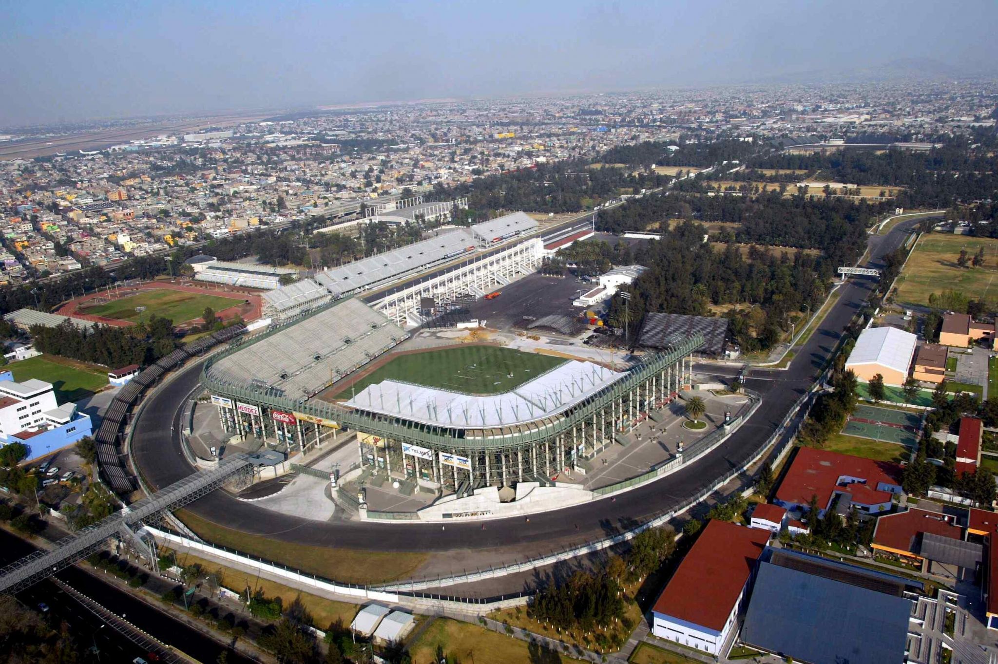
 2026年世界杯足球赛
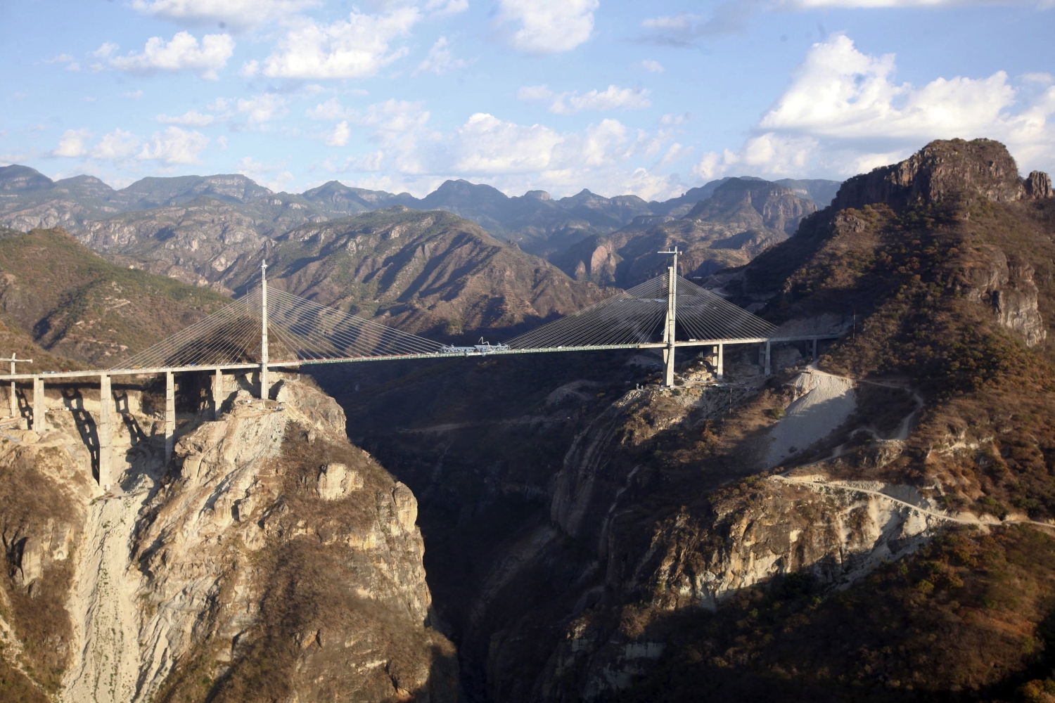
Die Baluarte-Brücke ist eine Schrägseilbrücke im Norden Mexikos. Die 1142 Meter lange Brücke ist Teil der Autobahn, welche die Küstenstadt Mazatlán am Pazifik mit dem Bundesstaat Durango verbindet. Sie führt über die rund 400 Meter tiefe Schlucht des Río Baluarte und wurde mit 402,5 Metern Höhenunterschied zwischen Talsohle und Fahrbahn im Januar 2012 offiziell als höchste Schrägseilbrücke der Welt in das Guinness-Buch der Rekorde aufgenommen. Der Bau der Brücke wurde 2007 begonnen und im Herbst 2012 fertiggestellt. Im Zuge der 200-Jahr-Feiern der Unabhängigkeit Mexikos wurde die Brücke für den Autoverkehr freigegeben.[1] Das Investitionsvolumen betrug rund zwei Milliarden Pesos (rund 116 Millionen Euro). Der höchste Pylon ist 169 Meter hoch, die Spannweite beträgt 520 Meter. Über die 16 Meter breite Brücke führen vier Fahrstreifen.
 财政金融
财政金融

 美食家
美食家

 国际城市
国际城市
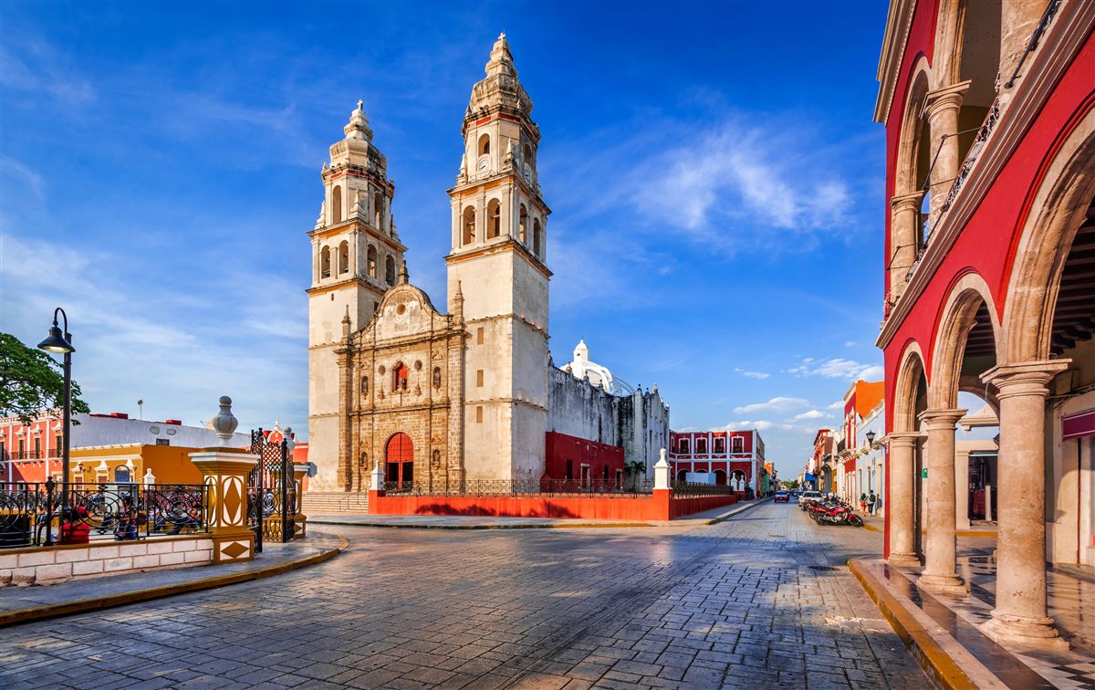
坎佩切 (西班牙语:San Francisco de Campeche)是墨西哥坎佩切州的州府,位于墨西哥湾南部的坎佩切湾。坎佩切是一座海滨城市,截止2005年全市总人口211671人。
坎佩切由西班牙征服者在1540年建立。不过,这里早在玛雅文明时期就是一个名为阿·金·佩奇的部落,当时有3000多个建筑物和一些纪念碑,其中的一部分遗址至今依然可见。此外,这个城市还保留了许多西班牙殖民时期修建的城墙,这些保存较为完好、质量较高的建筑使得坎佩切在1999年时被联合国教科文组织列入世界遗产,登录名称为坎佩切历史要塞城。
Die Großstadt Campeche, offiziell San Francisco de Campeche, ist die Hauptstadt des gleichnamigen Bundesstaates im Südosten Mexikos. Seit dem Jahr 1999 gehört die Stadt zum Weltkulturerbe der UNESCO.[1] Das im Jahr 1895 von Papst Leo XIII. eingerichtete Bistum Campeche (lat.: Dioecesis Campecorensis, span.: Diócesis de Campeche) ist eine römisch-katholische Diözese mit Sitz in Campeche.