
English Encyclopedia
 Australia
 International cities
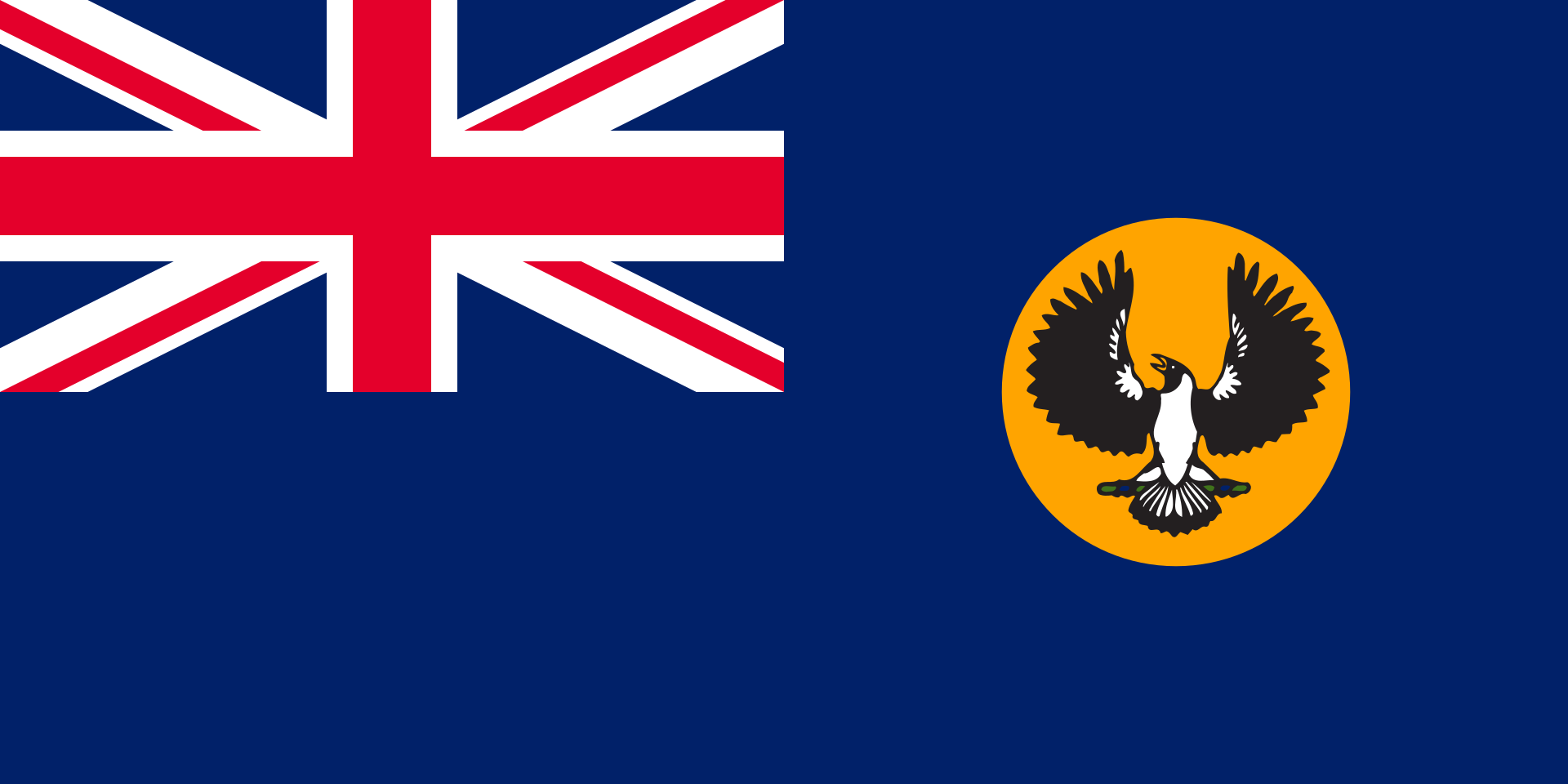 South Australia-SA
 Important port
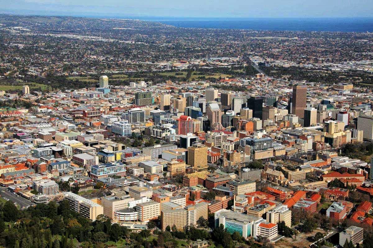
Adelaide [ˈædəleɪd] ist die Hauptstadt des Bundesstaates South Australia in Australien. Adelaide ist eine Küstenstadt am Saint-Vincent-Golf und wurde vom ersten Gouverneur des Staates, Captain John Hindmarsh (1785–1860), 1837 nach der britischen Königin Adelaide (Adelheid von Sachsen-Meiningen) benannt. Adelaide ging im Gegensatz zu Städten wie Sydney oder Hobart nicht aus einer Sträflingskolonie hervor.
Die Stadt trägt wegen ihrer Kulturveranstaltungen den Beinamen „festival city“, so etwa das Glenelg Jazz Festival oder das Adelaide Festival of Arts. Ebenso wird Adelaide „city of churches“ (Stadt der Kirchen) genannt. Adelaide ist Austragungsort mehrerer sportlicher Veranstaltungen, so z. B. von 1985 bis 1995 des Großen Preises von Australien der Formel 1 auf dem Adelaide Street Circuit.
Die Stadt Adelaide besteht eigentlich nur aus dem Stadtkern innerhalb des Parkrings, unterteilt in Adelaide und North Adelaide. Sie hat 22.000 Einwohner.[2][3] Man rechnet jedoch die direkt umliegenden etwa 250 Orte zum städtischen Bereich hinzu.
In einer Rangliste der Städte nach ihrer Lebensqualität belegte Adelaide im Jahre 2018 den 29. Platz unter 231 untersuchten Städten weltweit.
America´s Cup 2017
Australia
 California-CA
China
California-CA
China
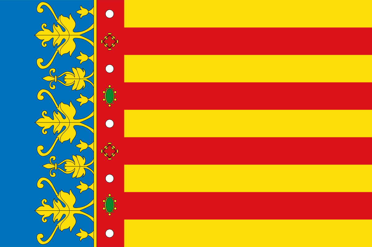 Valencian Community
England
France
Greece
Valencian Community
England
France
Greece
 Illinois-IL
Italy
Japan
Kyūshū
New Zealand
Illinois-IL
Italy
Japan
Kyūshū
New Zealand
 New York-NY
Oman
Austria
New York-NY
Oman
Austria
 Provence-Alpes-Côte d´Azur
Republic of Korea
Provence-Alpes-Côte d´Azur
Republic of Korea
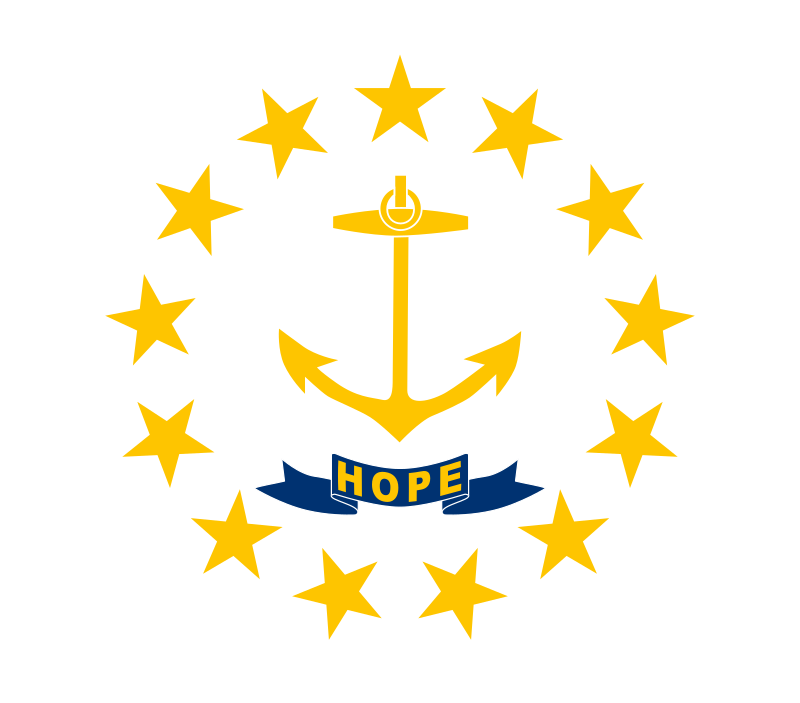 Rhode Island-RI
Russia
Rhode Island-RI
Russia
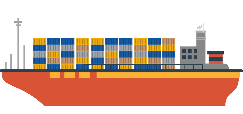 Ships and Nautics
Sweden
Spain
Ships and Nautics
Sweden
Spain
 Sport
Sport
 America´s Cup
United Kingdom
United Kingdom
America´s Cup
United Kingdom
United Kingdom
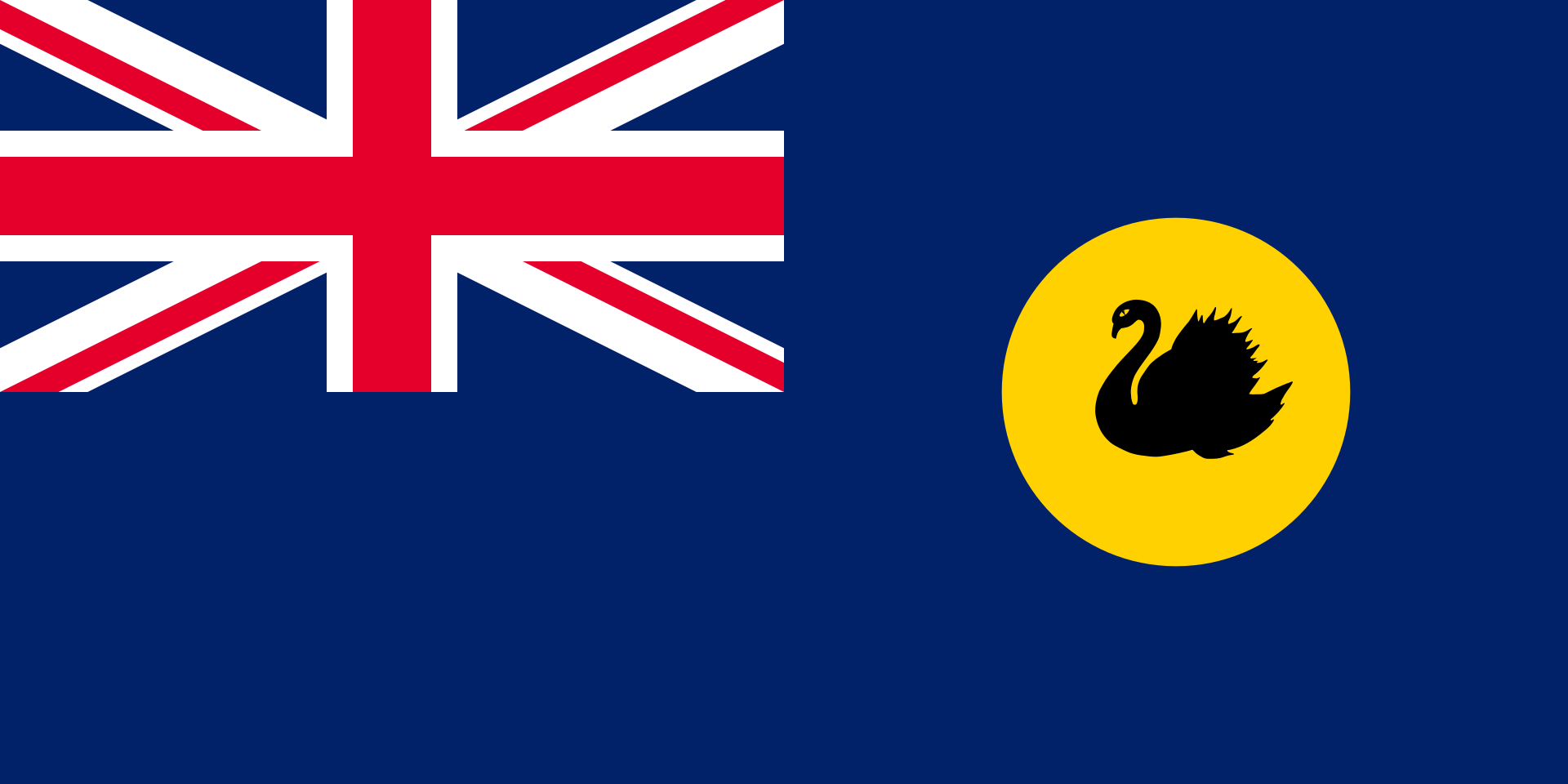 Western Australia-WA

The America's Cup, affectionately known as the Auld Mug, is a trophy awarded to the winner of the America's Cup match races between two sailing yachts. One yacht, known as the defender, represents the yacht club that currently holds the America's Cup and the second yacht, known as the challenger, represents the yacht club that is challenging for the cup. The timing of each match is determined by an agreement between the defender and the challenger. The America's Cup is the oldest international sporting trophy.[1][2][3] It will next be raced for in the southern summer, in the early part of 2021.[4]
The cup was originally awarded in 1851 by the Royal Yacht Squadron for a race around the Isle of Wight in the United Kingdom, which was won by the schooner America. The trophy, originally named the '£100 Cup', was renamed the America's Cup after the yacht and was donated to the New York Yacht Club (NYYC) under the terms of the Deed of Gift, which made the cup available for perpetual international competition.
Any yacht club that meets the requirements specified in the deed of gift has the right to challenge the yacht club that holds the cup. If the challenging club wins the match, it gains stewardship of the cup.
The history and prestige associated with the America's Cup attracts not only the world's top sailors and yacht designers but also the involvement of wealthy entrepreneurs and sponsors. It is a test not only of sailing skill and boat and sail design, but also of fundraising and management skills.
The trophy was held by the NYYC from 1857 (when the syndicate that won the cup donated the trophy to the club) until 1983. The NYYC successfully defended the trophy twenty-four times in a row before being defeated by the Royal Perth Yacht Club, represented by the yacht Australia II. The NYYC's reign was the longest winning streak (in terms of date) in the history of all sports.[5]
From the first defence of the cup in 1870 through the twentieth defence in 1967, there was always only one challenger. In 1970, for the first time, there were multiple challengers, so the NYYC agreed that the challengers could run a selection series with the winner becoming the official challenger and competing against the defender in the America's Cup match. Since 1983, Louis Vuitton has sponsored the Louis Vuitton Cup as a prize for the winner of the challenger selection series.
Early matches for the cup were raced between yachts 65–90 ft (20–27 m) on the waterline owned by wealthy sportsmen. This culminated with the J-Class regattas of the 1930s. After World War II and almost twenty years without a challenge, the NYYC made changes to the deed of gift to allow smaller, less expensive 12-metre class yachts to compete; this class was used from 1958 until 1987. It was replaced in 1990 by the International America’s Cup Class which was used until 2007.
After a long legal battle, the 2010 America's Cup was raced in 90 ft (27 m) waterline multihull yachts in a best of three "deed of gift" match in Valencia, Spain. The victorious Golden Gate Yacht Club then elected to race the 2013 America's Cup in AC72 foiling, wing-sail catamarans. Golden Gate Yacht Club successfully defended the cup. The 35th America's Cup match was announced to be sailed in 50 ft foiling catamarans.[6]
The history of the America's Cup has included legal battles and disputes over rule changes including most recently over the rule changes for the 2017 America's Cup.[7]
The America's Cup is currently held by the Royal New Zealand Yacht Squadron,[8] who will stage the 36th defence of the Cup in 2021.
 Architecture
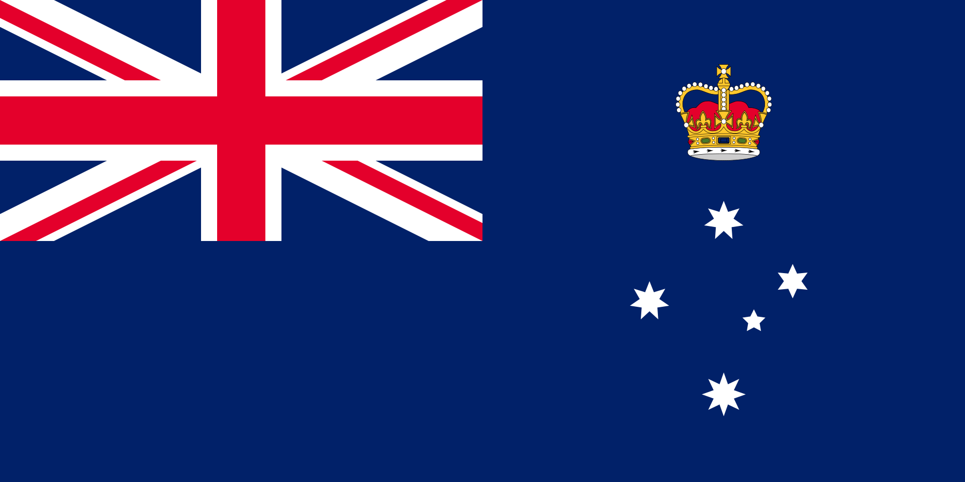 Victoria-VIC
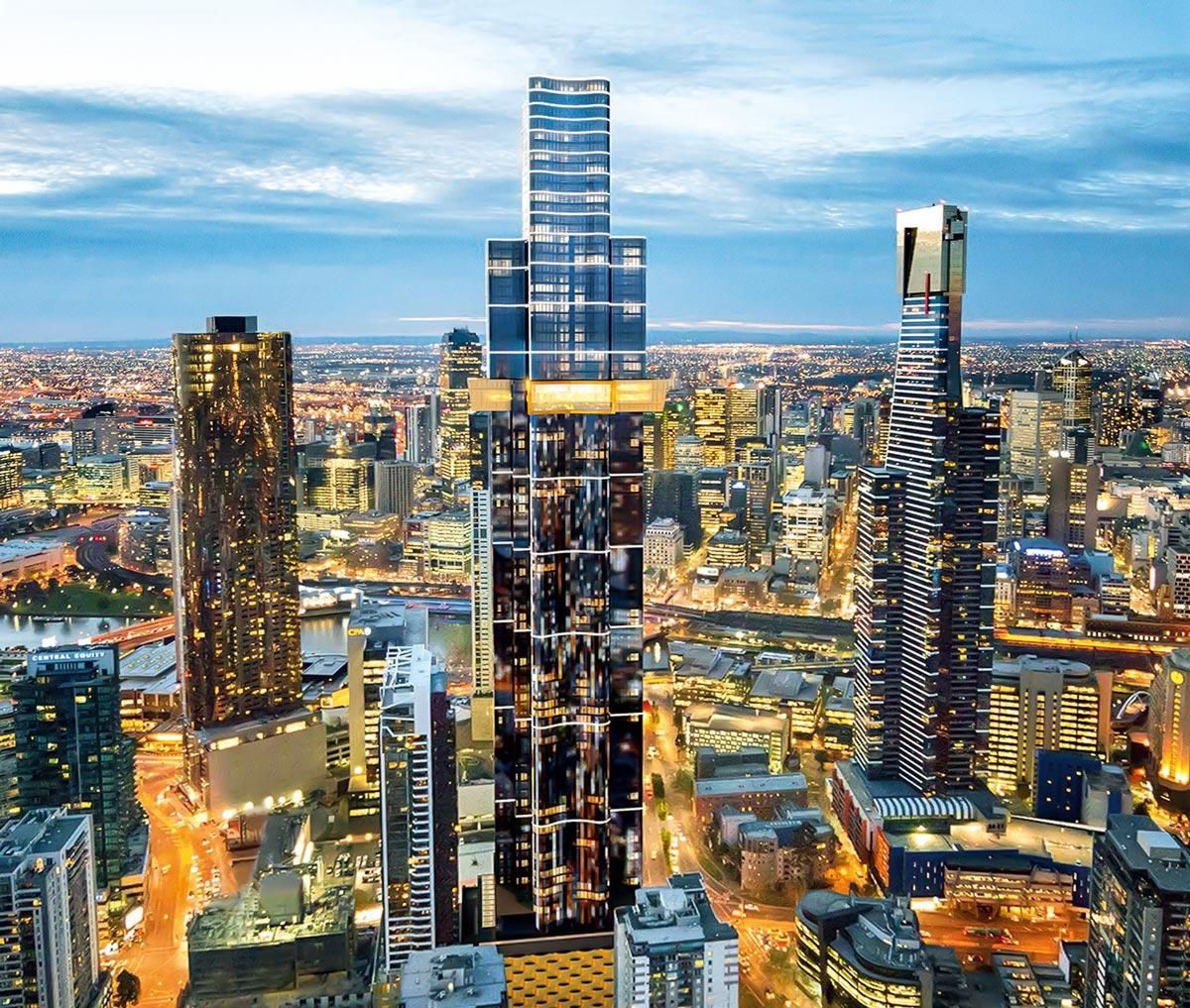
Australia 108 (previously 70 Southbank Boulevard) is a residential supertall skyscraper in the Southbank precinct of Melbourne, Victoria, Australia. Having topped out in November 2019, it became the tallest building in Australia by roof height, surpassing the Eureka Tower, and the second-tallest building in Australia by full height, surpassed by Q1 Tower.[3]
The World Class Land[4]development project consists of a 316.7 m (1,039 ft) tall apartment building with 1,105 apartments over 100 floors. Construction of the revised Fender Katsalidis Architects–design by Brookfield Multiplex commenced in 2015, and was completed in 2020.
Prior to its current form, plans were initially for a 226 m (741 ft) tall residential building with 72 floors. In 2012, these plans were revised and resubmitted in favour of a design with a height of 388 m (1,273 ft) and 108 storeys. This proposal was approved by the State Government in March 2013; however, it was shelved four months later after it struggled to meet conditions imposed by government authorities including VicRoads and the Civil Aviation Safety Authority.

The Australian Institute of International Affairs (AIIA) is an Australian research institute and think tank which focuses on International relations. It publishes the Australian Journal of International Affairs. It is one of the oldest active private research institutes in Australia.
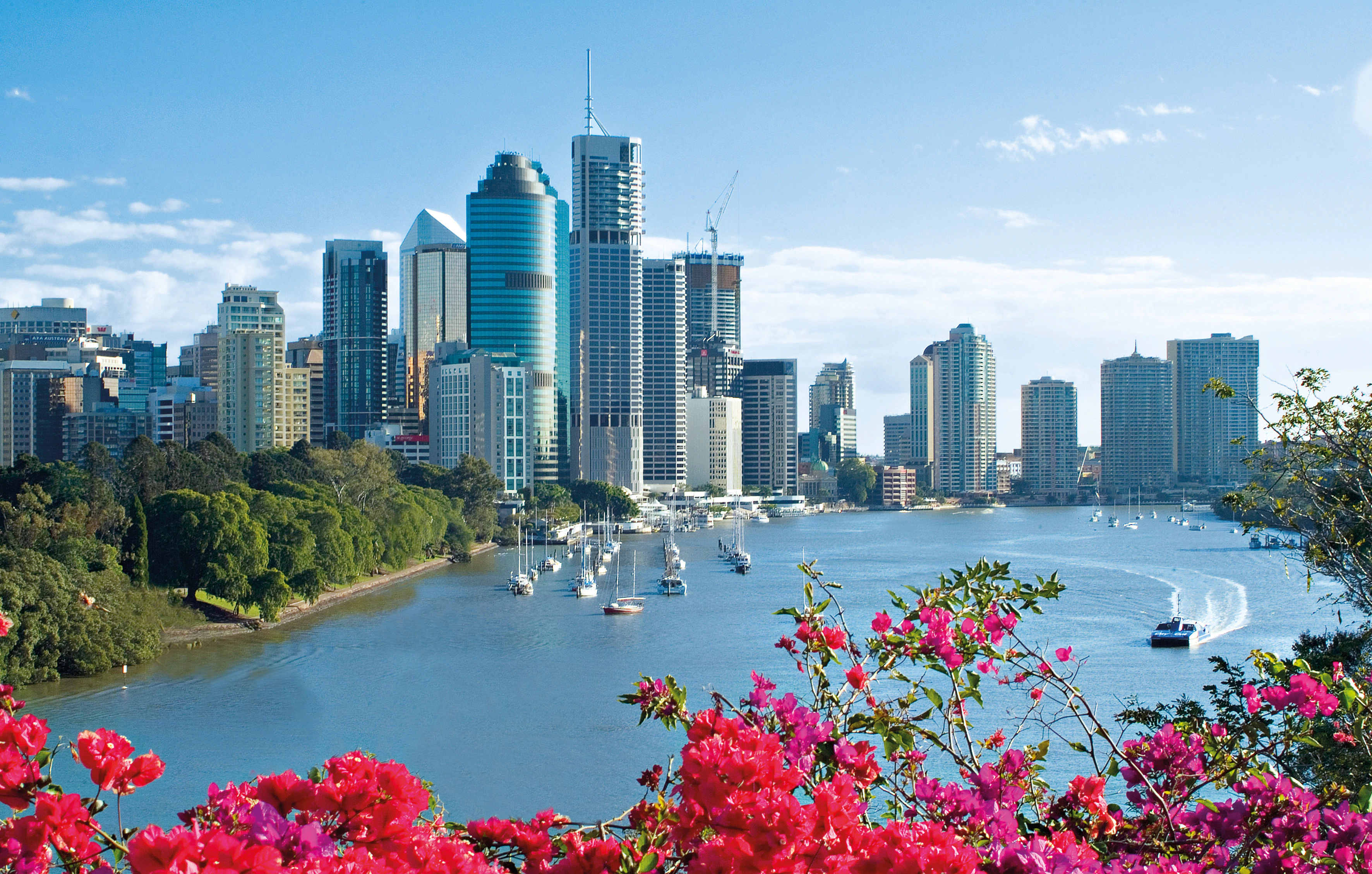
Brisbane (/ˈbrɪzbən/ ( listen) BRIZ-bən[9]) is the capital and most populous city of the Australian state of Queensland,[10] and the third-most populous city in Australia, as well as Oceania. Brisbane's metropolitan area has a population of around 2.6 million,[11] and it lies at the centre of the South East Queensland metropolitan region, which encompasses a population of around 3.8 million.[12] The Brisbane central business district is situated within a peninsula of the Brisbane River about 15 km (9 mi) from its mouth at Moreton Bay, a bay of the Coral Sea.[13] Geographically Australia's largest metropolitan area, Brisbane extends in all directions along the hilly floodplain of the Brisbane River Valley between Moreton Bay and the Taylor and D'Aguilar mountain ranges.[14] It sprawls across several of Australia's most populous local government areas, most centrally the City of Brisbane, Australia's most populous local government area. The demonym of Brisbane is "Brisbanite".[15][16]
The city and the river are named after Sir Thomas Brisbane who was the governor of New South Wales when the city was founded.[10] The Moreton Bay penal settlement was founded in 1824 at Redcliffe as a place for secondary offenders from the Sydney colony, and soon moved to North Quay in 1825. Brisbane was chosen as Queensland's capital when Queensland separated from New South Wales in 1859. By the late 19th century, the city had grown into a major port and centre of immigration. During World War II, the Allied command in the South West Pacific was based in the city, along with the headquarters for General Douglas MacArthur of the United States Army.[17]
Brisbane is classified as a global city,[18][19] and is an advanced centre of research and innovation in the Asia-Pacific.[20] The city has strengths in technology,[21][22] including mining research and green energy,[23] medicine and biotechnology,[24][25] cryptocurrency and digital industries,[26] and robotics.[27] A transport hub, Brisbane is served by large rail, bus and ferry networks, as well as Australia's largest airport and third-largest seaport.
A diverse city with over 32% of its metropolitan population being foreign-born,[28] Brisbane is consistently ranked among the world's most livable cities.[29] The culture of Brisbane is noted in particular for Queenslander architecture, spring Jacaranda blossoms, and its outdoor dining culture. Brisbane has hosted major events including the 1982 Commonwealth Games, World Expo 88, the 2014 G20 summit, and will host the 2032 Summer Olympics and Paralympics.[30]
Brisbane is a popular tourist destination. Major landmarks and attractions include South Bank Parklands, the Queensland Art Gallery and Gallery of Modern Art, the City Botanic Gardens, City Hall, the Story Bridge, the Mount Coot-tha Botanic Gardens and Lookout, Lone Pine Koala Sanctuary, Howard Smith Wharves, New Farm Park, D'Aguilar National Park, and Moreton Bay and its islands, including Moreton, North Stradbroke and St Helena.
 Australian Capital Territory-ACT
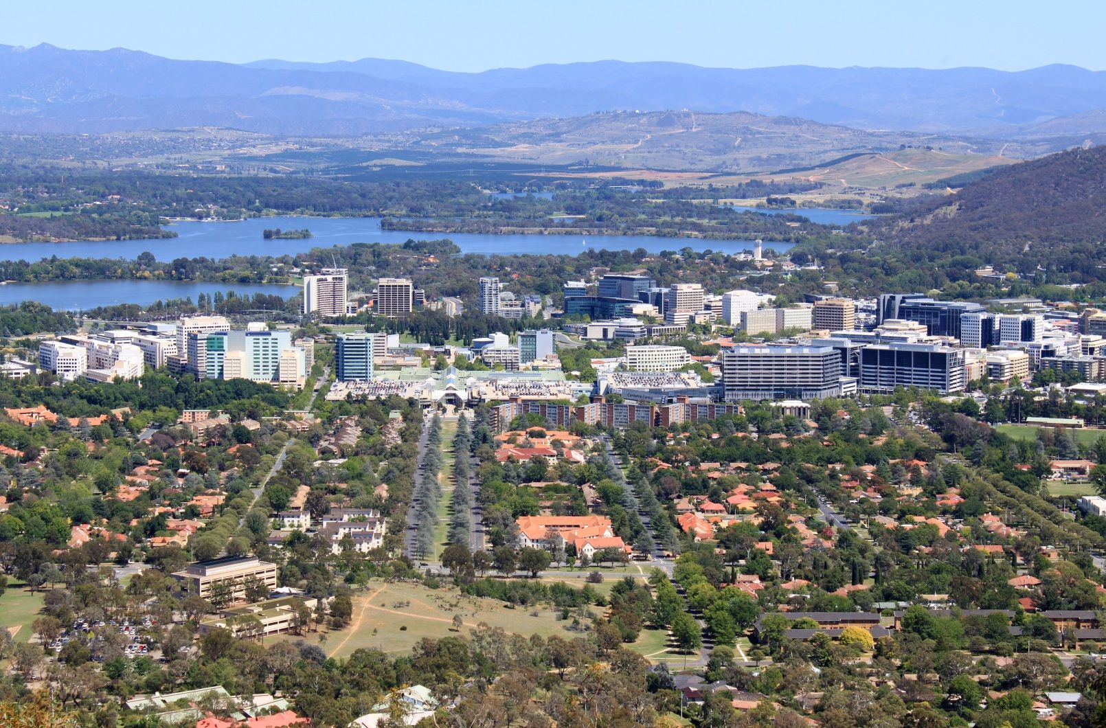
Canberra (/ˈkænbərə/ (listen) KAN-bə-rə)[10] is the capital city of Australia. Founded following the federation of the colonies of Australia as the seat of government for the new nation, it is Australia's largest inland city and the eighth-largest city overall. Unusual among Australian cities, it is an entirely planned city. The city is located at the northern end of the Australian Capital Territory[11] at the northern tip of the Australian Alps, the country's highest mountain range. As of June 2020, Canberra's estimated population was 431,380.[12]
The area chosen for the capital had been inhabited by Indigenous Australians for up to 21,000 years,[13] with the principal group being the Ngunnawal people. European settlement commenced in the first half of the 19th century, as evidenced by surviving landmarks such as St John's Anglican Church and Blundells Cottage. On 1 January 1901, federation of the colonies of Australia was achieved. Following a long dispute over whether Sydney or Melbourne should be the national capital,[14] a compromise was reached: the new capital would be built in New South Wales, so long as it was at least 100 miles (160 km) from Sydney. The capital city was founded and formally named as Canberra in 1913. A blueprint by American architects Walter Burley Griffin and Marion Mahony Griffin was selected after an international design contest, and construction commenced in 1913.[15] The Griffins' plan featured geometric motifs and was centred on axes aligned with significant topographical landmarks such as Black Mountain, Mount Ainslie, Capital Hill and City Hill. Canberra's mountainous location makes it the only mainland Australian city where snow-capped mountains can be seen in winter; although snow in the city itself is rare.
As the seat of the Government of Australia, Canberra is home to many important institutions of the federal government, national monuments and museums. This includes Parliament House, Government House, the High Court and the headquarters of numerous government agencies. It is the location of many social and cultural institutions of national significance such as the Australian War Memorial, the Australian National University, the Royal Australian Mint, the Australian Institute of Sport, the National Gallery, the National Museum and the National Library. The city is home to many important institutions of the Australian Defence Force including the Royal Military College Duntroon and the Australian Defence Force Academy. It hosts all foreign embassies in Australia as well as regional headquarters of many international organisations, not-for-profit groups, lobbying groups and professional associations.
Canberra has been ranked among the world's best cities to live and visit.[16][17][18][19][20] Although the Commonwealth Government remains the largest single employer in Canberra, it is no longer the majority employer. Other major industries have developed in the city, including in health care, professional services, education and training, retail, accommodation and food, and construction.[21] Compared to the national averages, the unemployment rate is lower and the average income higher; tertiary education levels are higher, while the population is younger. At the 2016 Census, 32% of Canberra's inhabitants were reported as having been born overseas.[22]
Canberra's design is influenced by the garden city movement and incorporates significant areas of natural vegetation. Its design can be viewed from its highest point at the Telstra Tower and the summit of Mount Ainslie. Other notable features include the National Arboretum, born out of the 2003 Canberra bushfires, and Lake Burley Griffin, named for the city's architects. Highlights in the annual calendar of cultural events include Floriade, the largest flower festival in the Southern Hemisphere,[23][24] the Enlighten Festival, Skyfire, the National Multicultural Festival and Summernats. Canberra's main sporting venues are Canberra Stadium and Manuka Oval. The city is served with domestic and international flights at Canberra Airport, while interstate train and coach services depart from Canberra Railway Station and the Jolimont Centre respectively. City Interchange is the main hub of Canberra's bus and light rail transport network.
Argentina
Australia
Brazil
China
Germany
England
 European Union
France
European Union
France
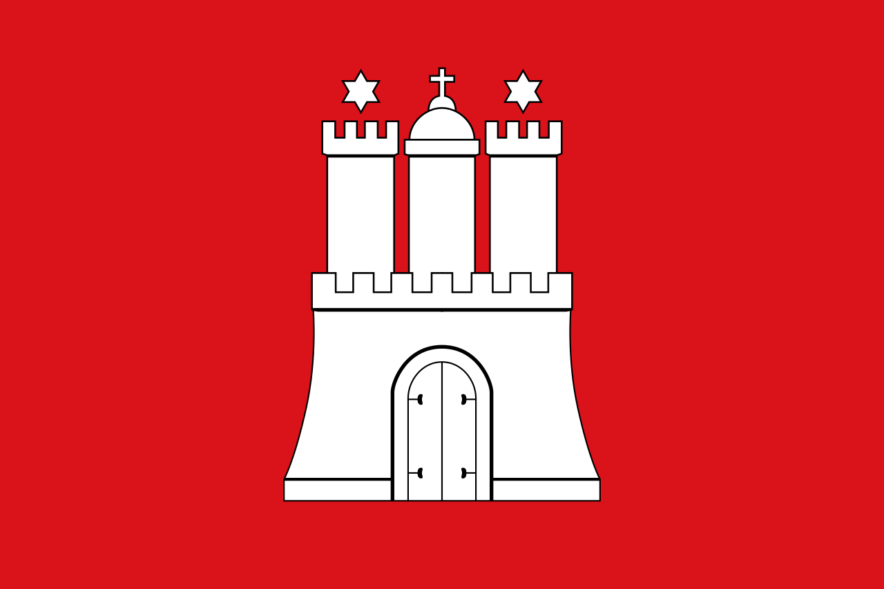 Hamburg
 Hand in Hand
India
Indonesia
Italy
Japan
Mexico
Nicolas Sarközy
Hand in Hand
India
Indonesia
Italy
Japan
Mexico
Nicolas Sarközy
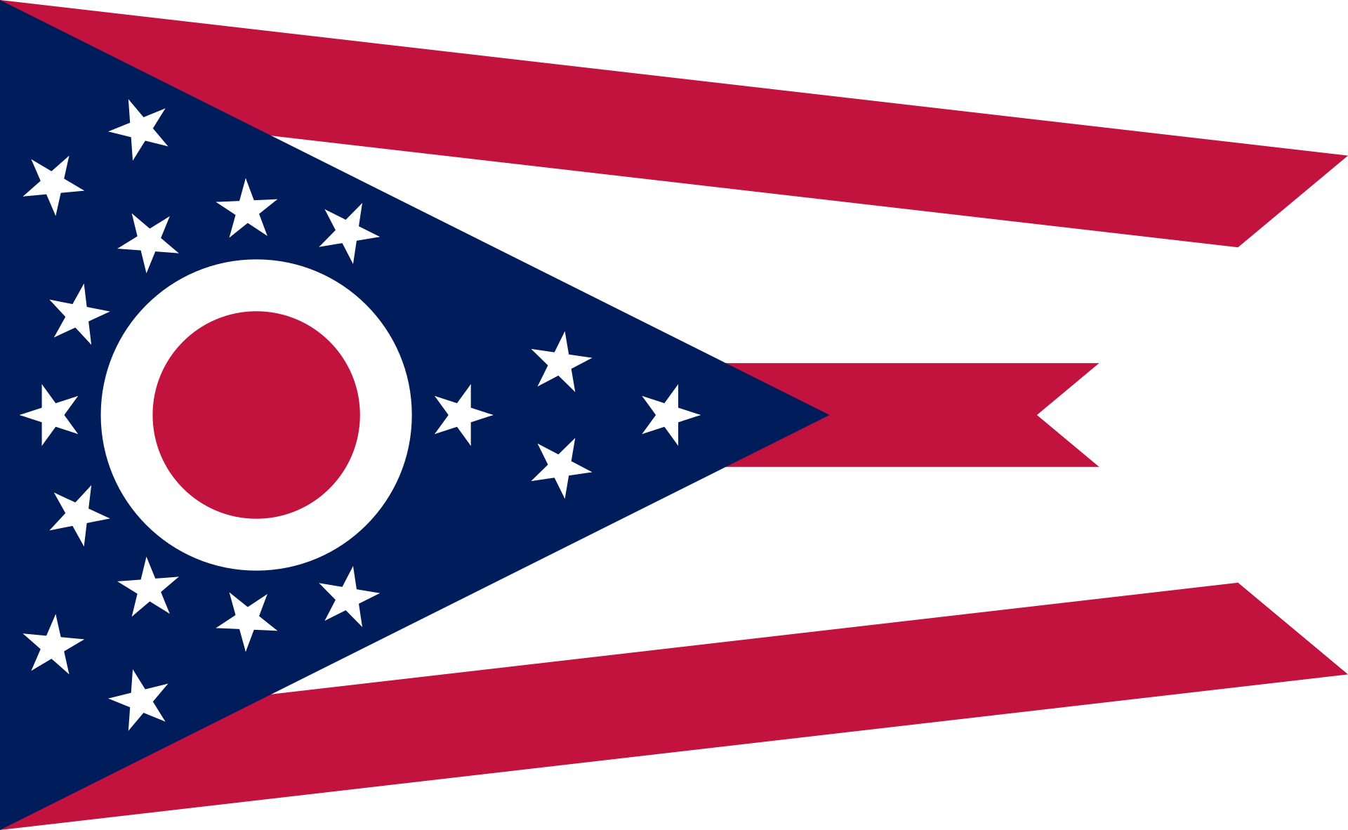 Ohio-OH
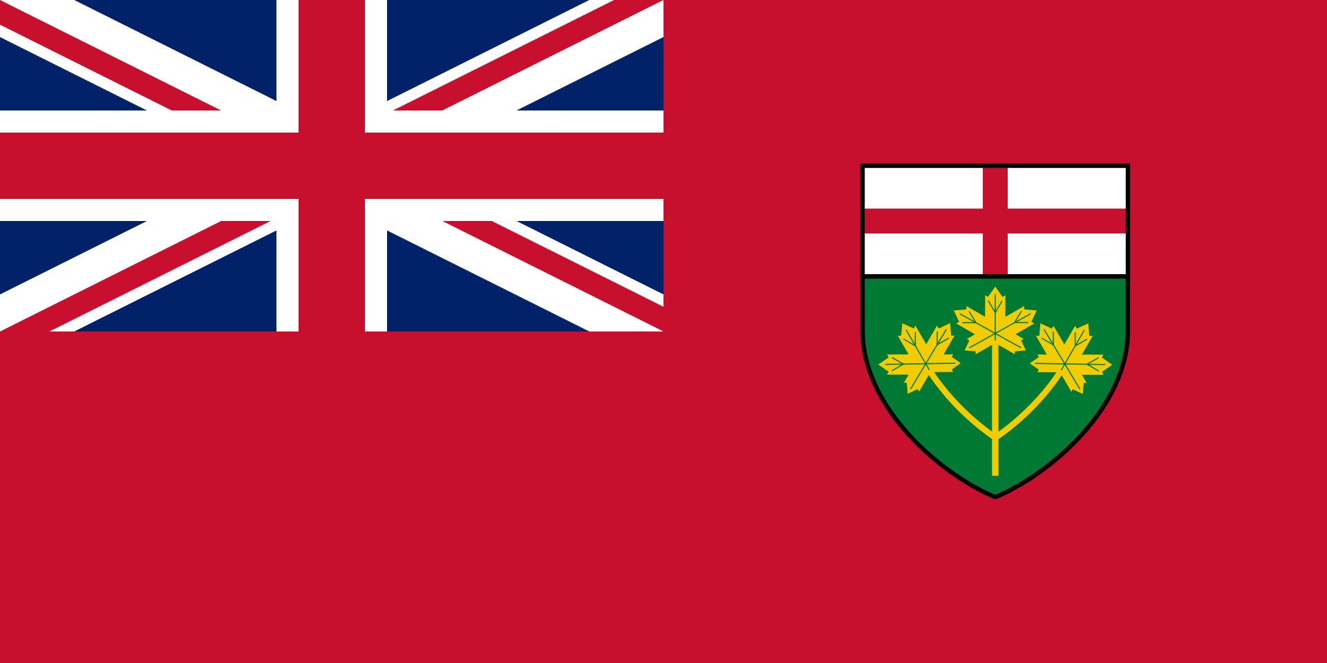 Ontario-ON
 Party and government
Group of the twenty most important industrial and emerging countries
Provence-Alpes-Côte d´Azur
Party and government
Party and government
Group of the twenty most important industrial and emerging countries
Provence-Alpes-Côte d´Azur
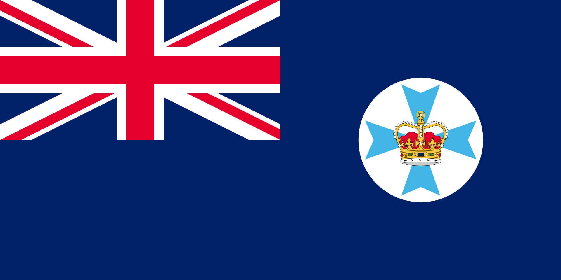 Queensland-QLD
Republic of Korea
Russia
Saudi Arabia
South Africa
Turkey
United Kingdom
Queensland-QLD
Republic of Korea
Russia
Saudi Arabia
South Africa
Turkey
United Kingdom
 Washington, D.C.
Zhejiang Sheng-ZJ
Washington, D.C.
Zhejiang Sheng-ZJ
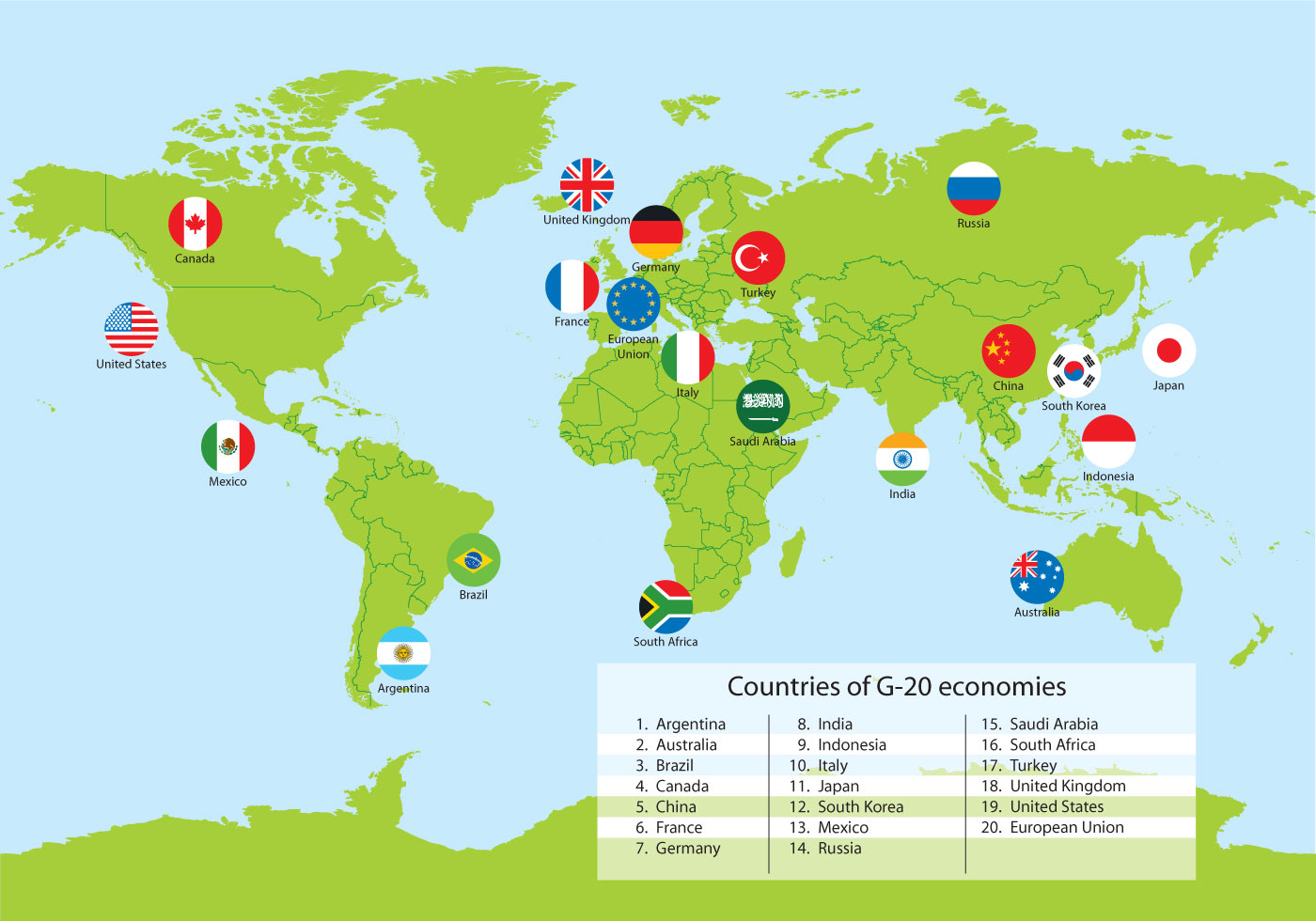
The G20 (or Group of Twenty) is an international forum for the governments and central bank governors from 19 countries and the European Union (EU). Founded in 1999 with the aim to discuss policy pertaining to the promotion of international financial stability,[3] the G20 has expanded its agenda since 2008 and heads of government or heads of state, as well as finance ministers, foreign ministers and think tanks[4], have periodically conferred at summits ever since. It seeks to address issues that go beyond the responsibilities of any one organization.[3]
Membership of the G20 consists of 19 individual countries plus the European Union. The EU is represented by the European Commission and by the European Central Bank. Collectively, the G20 economies account for around 90%[5] of the gross world product (GWP), 80% of world trade (or, if excluding EU intra-trade, 75%), two-thirds of the world population,[2] and approximately half of the world land area.
With the G20 growing in stature[6] after its inaugural leaders' summit in 2008, its leaders announced on 25 September 2009 that the group would replace the G8 as the main economic council of wealthy nations.[7] Since its inception, the G20's membership policies have been criticized by some intellectuals,[8][9] and its summits have been a focus for major protests.[10][11]
The heads of the G20 nations held summits twice in 2009 and twice in 2010. Since the November 2011 Cannes summit, G20 summits have been held annually.[12]
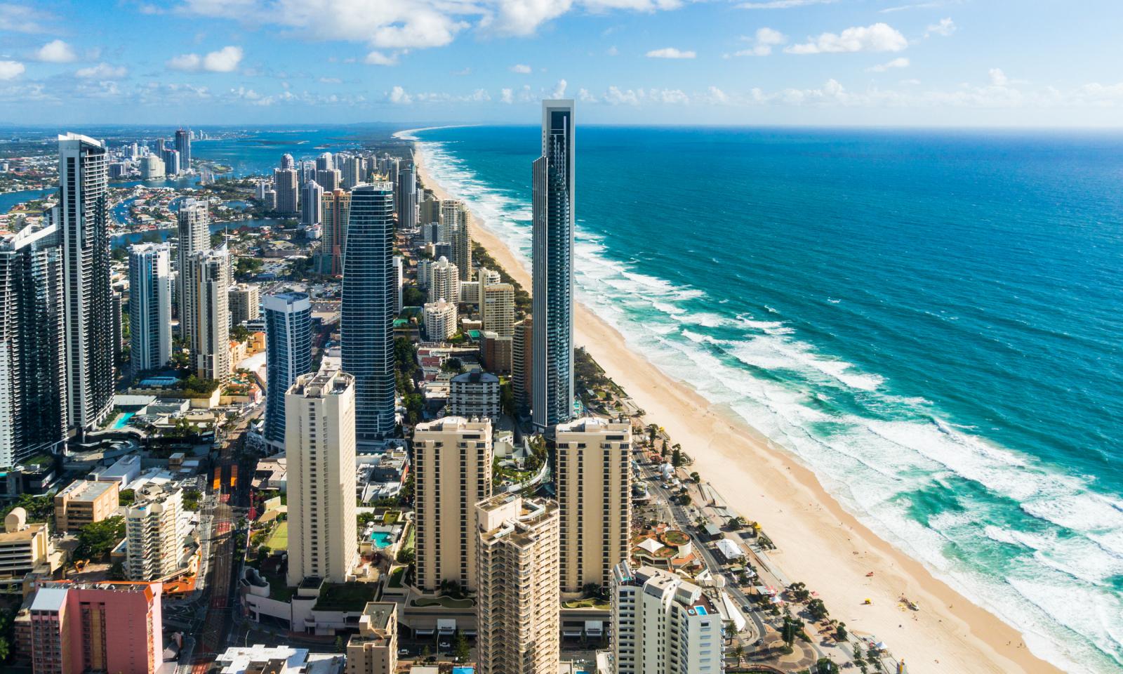
The Gold Coast is a coastal city in the state of Queensland, Australia, approximately 66 kilometres (41 mi) south-southeast of the centre of the state capital Brisbane and immediately north of the border with New South Wales. The area was previously occupied prior to European settlement by the Yugambeh language people. The demonym for the Gold Coast is Gold Coaster. With an estimated population of 679,127[1] in June 2018 (including 79,001 in the adjacent Tweed Valley of New South Wales), the Gold Coast is the sixth-largest city in Australia, Australia's largest non-capital city, and Queensland's second-largest city.[3]
The Gold Coast is a major tourist destination with a sunny, subtropical climate and has become widely known for its world-class surfing beaches, high-rise dominated skyline, theme parks, nightlife, and rainforest hinterland. The city is part of the nation's entertainment industry with television productions and a major film industry.
 Animal world
 Geography
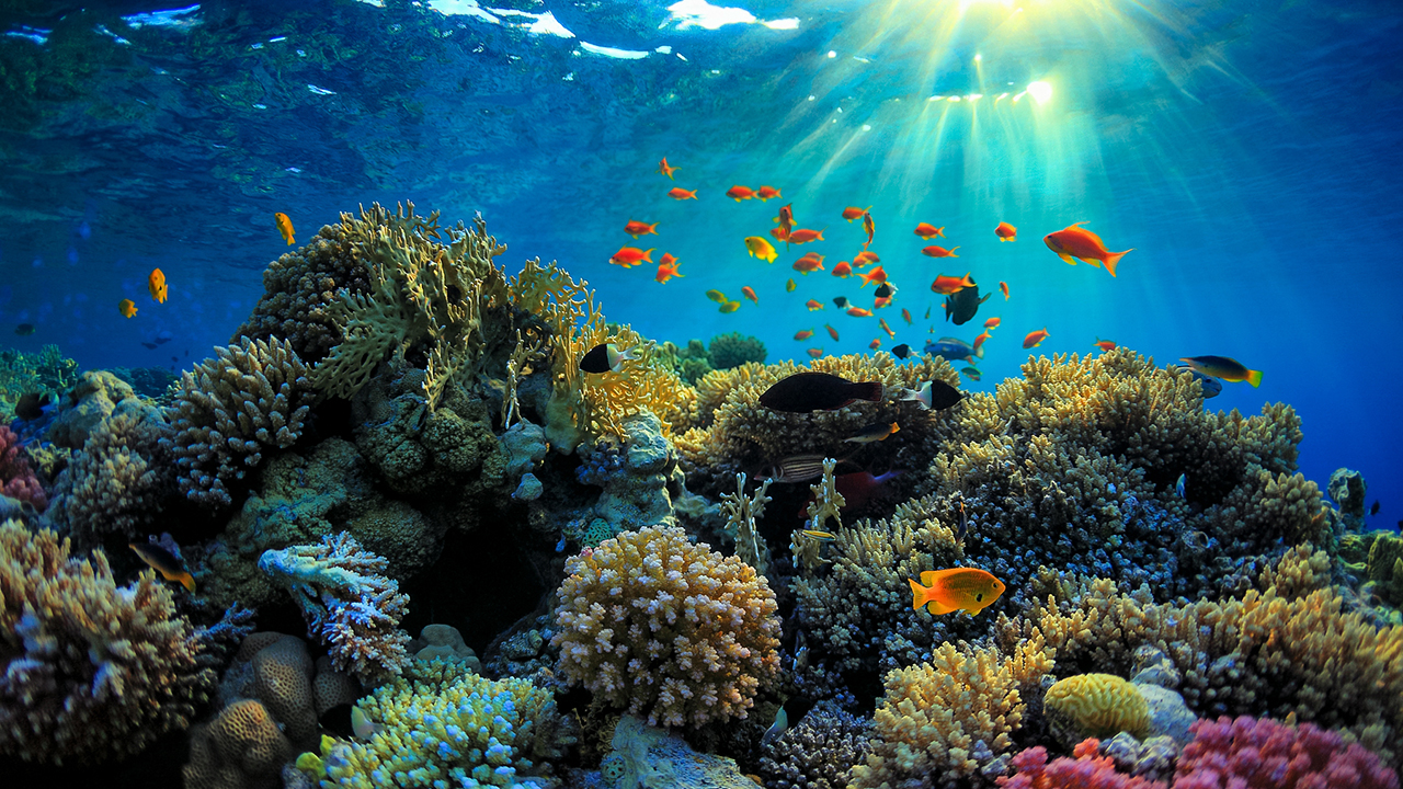
The Great Barrier Reef is the world's largest coral reef system[1][2] composed of over 2,900 individual reefs[3] and 900 islands stretching for over 2,300 kilometres (1,400 mi) over an area of approximately 344,400 square kilometres (133,000 sq mi).[4][5] The reef is located in the Coral Sea, off the coast of Queensland, Australia, separated from the coast by a channel 100 miles wide in places and over 200 feet deep.[6] The Great Barrier Reef can be seen from outer space and is the world's biggest single structure made by living organisms.[7] This reef structure is composed of and built by billions of tiny organisms, known as coral polyps.[8] It supports a wide diversity of life and was selected as a World Heritage Site in 1981.[1][2] CNN labelled it one of the seven natural wonders of the world in 1997.[9] Australian World Heritage places included it in its list in 2007.[10] The Queensland National Trust named it a state icon of Queensland in 2006.[11]
A large part of the reef is protected by the Great Barrier Reef Marine Park, which helps to limit the impact of human use, such as fishing and tourism. Other environmental pressures on the reef and its ecosystem include runoff, climate change accompanied by mass coral bleaching, dumping of dredging sludge and cyclic population outbreaks of the crown-of-thorns starfish.[12] According to a study published in October 2012 by the Proceedings of the National Academy of Sciences, the reef has lost more than half its coral cover since 1985, a finding reaffirmed by a 2020 study which found over half of the reef's coral cover to have been lost between 1995 and 2017, with the effects of a widespread 2020 bleaching event not yet quantified.[13][14]
The Great Barrier Reef has long been known to and used by the Aboriginal Australian and Torres Strait Islander peoples, and is an important part of local groups' cultures and spirituality. The reef is a very popular destination for tourists, especially in the Whitsunday Islands and Cairns regions. Tourism is an important economic activity for the region, generating over AUD$3 billion per year.[15] In November 2014, Google launched Google Underwater Street View in 3D of the Great Barrier Reef.[16]
A March 2016 report stated that coral bleaching was more widespread than previously thought, seriously affecting the northern parts of the reef as a result of warming ocean temperatures.[17] In October 2016, Outside published an obituary for the reef;[18] the article was criticized for being premature and hindering efforts to bolster the resilience of the reef.[19] In March 2017, the journal Nature published a paper showing that huge sections of an 800-kilometre (500 mi) stretch in the northern part of the reef had died in the course of 2016 due to high water temperatures, an event that the authors put down to the effects of global climate change.[20] The percentage of baby corals being born on the Great Barrier Reef dropped drastically in 2018 and scientists are describing it as the early stage of a "huge natural selection event unfolding". Many of the mature breeding adults died in the bleaching events of 2016–17 leading to low coral birth rates. The types of corals that reproduced also changed, leading to a "long-term reorganisation of the reef ecosystem if the trend continues."[21]
The Great Barrier Reef Marine Park Act 1975 (section 54) demands every five years an Outlook Report on the Reef's health, pressures, and future. The last report was published in 2019.
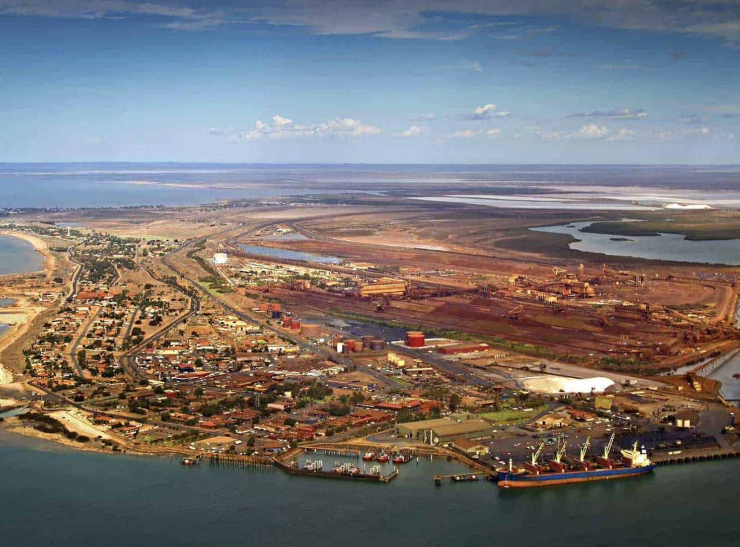
Port Hedland (Kariyarra: Marapikurrinya) is the second largest town[2] in the Pilbara region of Western Australia, with an urban population of 14,320[1] at June 2018 including the satellite town of South Hedland, 18 kilometres (11 mi) away. It is also the site of the highest tonnage port in Australia.[3]
Port Hedland has a natural deep anchorage harbour which, as well as being the main fuel and container receival point for the region, was seen as perfect for shipment of the iron ore being mined in the ranges located inland from the town. The ore is moved by railway from four major iron ore deposits to the east and south of the Port Hedland area. The port exported 519,408,000 tonnes (1.1 trillion pounds) of iron ore (2017–2018).[4] Other major resource activities supported by the town include the offshore natural gas fields, salt, manganese, and livestock. Major deposits of lithium are being developed and exploited south of the town as well. Grazing of cattle and sheep was formerly a major revenue earner for the region, but this has slowly declined. Port Hedland was also formerly the terminus for the WAGR Marble Bar Railway, which serviced the gold mining area of Marble Bar from July 1911 until closure on 31 October 1951. The locomotive from the Port Hedland to Marble Bar rail service is now preserved at the Kalamunda Historical Village in the south of the state. Located between Port Hedland and South Hedland are the large salt hills of Dampier Salt, a subsidiary of Rio Tinto. These large mounds have almost become a tourist attraction in their own right.
 United Nations
Argentina
Australia
Belgium
Brazil
China
Denmark
Germany
United Nations
Argentina
Australia
Belgium
Brazil
China
Denmark
Germany
 Financial
International Bank for Cooperation
France
Holland
India
Indonesia
Internationaler Währungsfonds
Camille Gutt
Internationaler Währungsfonds
Christine Lagarde
Internationaler Währungsfonds
Dominique Strauss-Kahn
Internationaler Währungsfonds
Horst Köhler
Internationaler Währungsfonds
Ivar Rooth
Internationaler Währungsfonds
Jacques de Larosière
Internationaler Währungsfonds
Johan Witteveen
Internationaler Währungsfonds
Michel Camdessus
Internationaler Währungsfonds
Per Jacobsson
Internationaler Währungsfonds
Pierre-Paul Schweitzer
Internationaler Währungsfonds
Rodrigo Rato
Italy
Japan
Malaysia
Mexico
Nigeria
Norwegen
Austria
Poland
Republic of Korea
Russia
Saudi Arabia
Sweden
Switzerland
Spain
South Africa
Venezuela
United Kingdom
Washington, D.C.
Financial
International Bank for Cooperation
France
Holland
India
Indonesia
Internationaler Währungsfonds
Camille Gutt
Internationaler Währungsfonds
Christine Lagarde
Internationaler Währungsfonds
Dominique Strauss-Kahn
Internationaler Währungsfonds
Horst Köhler
Internationaler Währungsfonds
Ivar Rooth
Internationaler Währungsfonds
Jacques de Larosière
Internationaler Währungsfonds
Johan Witteveen
Internationaler Währungsfonds
Michel Camdessus
Internationaler Währungsfonds
Per Jacobsson
Internationaler Währungsfonds
Pierre-Paul Schweitzer
Internationaler Währungsfonds
Rodrigo Rato
Italy
Japan
Malaysia
Mexico
Nigeria
Norwegen
Austria
Poland
Republic of Korea
Russia
Saudi Arabia
Sweden
Switzerland
Spain
South Africa
Venezuela
United Kingdom
Washington, D.C.
 Economy and trade
Economic and political research
Economy and trade
Economic and political research
The International Monetary Fund (IMF) is an international organization headquartered in Washington, D.C., consisting of 189 countries working to foster global monetary cooperation, secure financial stability, facilitate international trade, promote high employment and sustainable economic growth, and reduce poverty around the world while periodically depending on the World Bank for its resources.[1] Formed in 1944 at the Bretton Woods Conference primarily by the ideas of Harry Dexter White and John Maynard Keynes,[6] it came into formal existence in 1945 with 29 member countries and the goal of reconstructing the international payment system. It now plays a central role in the management of balance of payments difficulties and international financial crises.[7] Countries contribute funds to a pool through a quota system from which countries experiencing balance of payments problems can borrow money. As of 2016, the fund had XDR 477 billion (about US$ 667 billion).[8]
Through the fund and other activities such as the gathering of statistics and analysis, surveillance of its members' economies, and the demand for particular policies,[9] the IMF works to improve the economies of its member countries.[10] The organization's objectives stated in the Articles of Agreement are:[11] to promote international monetary co-operation, international trade, high employment, exchange-rate stability, sustainable economic growth, and making resources available to member countries in financial difficulty.[12] IMF funds come from two major sources: quotas and loans. Quotas, which are pooled funds of member nations, generate most IMF funds. The size of a member's quota depends on its economic and financial importance in the world. Nations with larger economic importance have larger quotas. The quotas are increased periodically as a means of boosting the IMF's resources in the form of special drawing rights.[13]
The current Managing Director (MD) and Chairwoman of the IMF is Bulgarian Economist Kristalina Georgieva, who has held the post since October 1, 2019.[14]
Gita Gopinath was appointed as Chief Economist of IMF from 1 October 2018. She received her PhD in economics from Princeton University. Prior to her IMF appointment she was economic adviser to the Chief Minister of Kerala, India.[15]
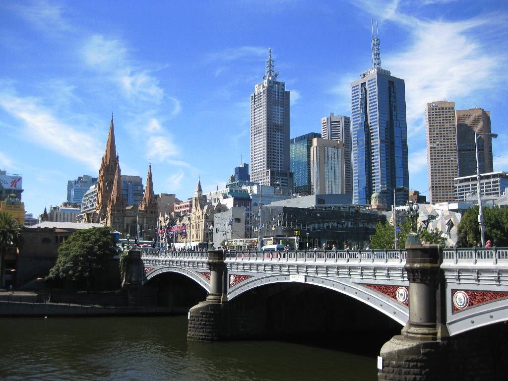
Melbourne (/ˈmɛlbərn/ (listen) MEL-bərn)[note 1] (Boonwurrung: Naarm)[9] is the capital and most-populous city of the Australian state of Victoria, and the second-most populous city in both Australia and Oceania.[1] Its name generally refers to a 9,993 km2 (3,858 sq mi) metropolitan area known as Greater Melbourne,[10] comprising an urban agglomeration of 31 local municipalities,[11] although the name is also used specifically for the local municipality of City of Melbourne based around its central business area. The city occupies much of the northern and eastern coastlines of Port Phillip Bay and spreads into the Mornington Peninsula and the hinterlands towards the Yarra Valley and the Dandenong and Macedon Ranges. It has a population over 5 million (19% of the population of Australia, as per 2020), mostly residing to the east side of the city centre, and its inhabitants are commonly referred to as "Melburnians".[note 2]
The area now occupied by Melbourne was home to Aboriginal peoples for over 40,000 years and served as a popular meeting place for local Kulin nation clans,[14] Naarm being the traditional Boon wurrung name for Port Phillip Bay.[9] A short-lived penal settlement was built at Port Phillip, then part of the British colony of New South Wales, in 1803, but it was not until 1835, with the arrival of free settlers from Van Diemen’s Land (modern-day Tasmania), that Melbourne was founded.[14] It was incorporated as a Crown settlement in 1837, and named after the then British Prime Minister, William Lamb, 2nd Viscount Melbourne.[14] In 1851, four years after Queen Victoria declared it a city, Melbourne became the capital of the new colony of Victoria.[15] During the 1850s Victorian gold rush, the city entered a lengthy boom period that, by the late 1880s, had transformed it into one of the world's largest and wealthiest metropolises.[16][17] After the federation of Australia in 1901, it served as the interim seat of government of the new nation until Canberra became the permanent capital in 1927.[18] Today, it is a leading financial centre in the Asia-Pacific region and ranks 23rd globally in the 2021 Global Financial Centres Index.[19]
Melbourne is home to many of Australia's best-known landmarks, such as the Melbourne Cricket Ground, the National Gallery of Victoria and the World Heritage-listed Royal Exhibition Building. Noted for its cultural heritage, the city gave rise to Australian rules football, Australian impressionism and Australian cinema, and has more recently been recognised as a UNESCO City of Literature and a global centre for street art, live music and theatre. It hosts major annual international events, such as the Australian Grand Prix and the Australian Open, and also hosted the 1956 Summer Olympics and the 2006 Commonwealth Games. Melbourne consistently ranked as the world's most liveable city for much of the 2010s.[20]
Melbourne Airport, also known as the Tullamarine Airport, is the second-busiest airport in Australia, and the Port of Melbourne is the nation's busiest seaport.[21] Its main metropolitan rail terminus is Flinders Street station and its main regional rail and road coach terminus is Southern Cross station. It also has Australia's most extensive freeway network and the largest urban tram network in the world.