Deutsch-Chinesische Enzyklopädie, 德汉百科
 Hunan Sheng-HN
 Animal world
 Geography
 Project and construction machinery


 Automobile
Automobile
Automobile
 SANY Truck
Automobile
*Trucks
Automobile
*Commercial vehicles
Automobile
*Hydrogen propulsion
China
Hunan Sheng-HN
privat betriebene Unternehmen
SANY Truck
Automobile
*Trucks
Automobile
*Commercial vehicles
Automobile
*Hydrogen propulsion
China
Hunan Sheng-HN
privat betriebene Unternehmen
 Companies
Mainland China,Hong Kong,Macau,Taiwan
Companies
Mainland China,Hong Kong,Macau,Taiwan

*Changjiang|Yangtze River
Anhui Sheng-AH
China
Chongqing Shi-CQ
Hubei Sheng-HB
Hunan Sheng-HN
Jiangsu Sheng-JS
Jiangxi Sheng-JX
Beijing-Hangzhou Grand Canal
Qinghai Sheng-QH
Shanghai Shi-SH
Sichuan Sheng-SC
Xinjiang Uygur Zizhiqu-XJ
Yunnan Sheng-YN
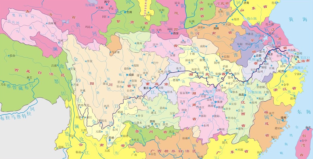
长江,在中国古代称作江水、大江,简称江,是亚洲第一长河和世界第三长河,也是世界上完全在一国境内的最长河流,全长6380公里,干流发源于青藏高原东部唐古拉山脉各拉丹冬峰,穿越中国西南(青海、 西藏、 云南、 四川、 重庆)、中部(湖北、湖南、江西)、东部(安徽、江苏),在上海市汇入东海。长江流域覆盖中国大陆五分之一陆地面积,养育了中国大陆三分之一的人口。长江经济带也是中国最大的经济带。
长江文明与黄河文明常被并列为中国文化历史、文明、经济的两大源泉。繁荣的长江三角洲经济占中华人民共和国GDP20%。长江流域生态类型多样,水生生物资源丰富,是多种濒危动物如扬子鳄和达氏鲟的栖息地。几千年来,人们利用长江取水、灌溉、排污、运输、发展工业、当作边界等。
近年来,长江受到了工业污染、农业径流、河沙淤积、湿地和湖泊减少的威胁,因而加剧了季节性洪水的发生。长江部分地区已被划为保护区。云南三江并流保护区则因丰富的自然及文化资源而被列为联合国教科文组织世界自然遗产。
Der Jangtsekiang, kurz Jangtse (chinesisch 長江 / 长江, Pinyin ‚Langer Strom, Langer Fluss‘, kurz: 江, Jiāng)[3][4][5], ist der längste Fluss Chinas. Mit 6380 Kilometern, von denen 2800 Kilometer schiffbar sind, ist er auch der längste Fluss Asiens und nach dem Nil und dem Amazonas der drittlängste Strom der Welt. Sein Quellgebiet liegt im Hochland von Tibet in Qinghai. An seiner Mündung ins Ostchinesische Meer führt er im Jahresdurchschnitt 31.900 m³ Wasser pro Sekunde.
Der Jangtsekiang spielt im Selbstverständnis der Chinesen eine große Rolle. Er teilt das Land in Nord- und Südchina und war Ort zahlreicher wichtiger Ereignisse der chinesischen Geschichte. Dazu zählt etwa seine Überquerung durch die Volksbefreiungsarmee während des Chinesischen Bürgerkrieges am 21. April 1949 und das bis Mitte des 20. Jahrhunderts bestehende Recht westlicher Mächte, den Fluss mit Kanonenbooten zu befahren.
長江(ちょうこう、中国語拼音字母:  Cháng Jiāng)は、青海省のチベット高原を水源地域とし中国大陸の華中地域を流れ東シナ海へと注ぐ川である。全長は6300kmで、中華人民共和国およびアジアで最長、世界でも第3位。
中国国外では、最下流部の異称である「揚子江」(ようすこう、英語: Yangtze River)の名で良く知られる。古語では江(こう)。音訳する場合は「長」のみを音訳しチャン川 (Chang River) とすることもあるが、「江」が本来の河川名であることから、(他の中国の河川を「片仮名+川」とする場合でも)チャンチアンとすることもある[6]。
青海省のタンラ山脈からチベット高原、四川盆地、三峡を経て湖北省宜昌市に至るまでが長江上流(最上流の通天河、四川西部の金沙江、四川東部の川江)、宜昌から江西省湖口県までが中流(荊江)、湖口から上海市の東シナ海河口までが下流(揚子江)にあたる。
その流域には成都、武漢、重慶などの重要工業都市、上海、南京などの商業都市を含む中国の19の省(市、自治区)があり、全流域の人口は4億5000万にも達している。古くから水上交易の盛んだった華中でも中心的な交通路として利用されてきた。
| 世界主要河川の比較 | ||||||
|---|---|---|---|---|---|---|
| アマゾン川 | ナイル川 | ミシシッピ川 | 長江 | ヴォルガ川 | コンゴ川 | |
| 長さ(km) | 7,570 | 6,650 | 3,779 | 6,300 | 3,700 | 4,700 |
| 流域面積 (100万km2) |
7,05 | 2,9 | 3,2 | 1,8 | 1,3 | 3,7 |
| 平均流量 (1000m3/s.) |
297 | 2-3 | 18 | 21 | 8 | 39 |
The Yangtze (English: /ˈjæŋtsi/ or /ˈjɑːŋtsi/), which is 6,380 km (3,964 mi) long, is the longest river in Asia and the third-longest in the world. The river is the longest in the world to flow entirely within one country. It drains one-fifth of the land area of the People's Republic of China (PRC) and its river basin is home to nearly one-third of the country's population.[6] The Yangtze is the sixth-largest river by discharge volume in the worl
The English name Yangtze derives from the Chinese name Yángzǐ Jiāng ( listen), which refers to the lowest 435 km (270 mi) of the river between Nanjing and Shanghai. The whole river is known in China as Cháng Jiāng ( listen; literally: "Long River").
The Yangtze plays a large role in the history, culture and economy of China. The prosperous Yangtze River Delta generates as much as 20% of the PRC's GDP. The Yangtze River flows through a wide array of ecosystems and is habitat to several endemic and endangered species including the Chinese alligator, the narrow-ridged finless porpoise, the Chinese paddlefish, the (possibly extinct) Yangtze River dolphin or baiji, and the Yangtze sturgeon. For thousands of years, the river has been used for water, irrigation, sanitation, transportation, industry, boundary-marking and war. The Three Gorges Dam on the Yangtze River is the largest hydro-electric power station in the world.[8][9]
In recent years, the river has suffered from industrial pollution, agricultural run-off, siltation, and loss of wetland and lakes, which exacerbates seasonal flooding. Some sections of the river are now protected as nature reserves. A stretch of the upstream Yangtze flowing through deep gorges in western Yunnan is part of the Three Parallel Rivers of Yunnan Protected Areas, a UNESCO World Heritage Site. In mid-2014, the Chinese government announced it was building a multi-tier transport network, comprising railways, roads and airports, to create a new economic belt alongside the river.[10]
Le Yangzi Jiang (chinois simplifié : 扬子江 ; chinois traditionnel : 揚子江 ; pinyin : ; Wade : Yang²-tzu³ Chiang¹ ; EFEO : Yang-tseu Kiang ; cantonais Jyutping : Joeng⁴-zi² Gong¹ ; littéralement : « fleuve Yangzi »écouter) ou Chang Jiang (长江 / 長江, , « long fleuve » écouter), est le plus long fleuve d'Asie (6 380 km). En France, il est appelé fleuve Bleu, Yang-Tsé-Kiang ou simplement Yang-Tsé.
D'un débit de 30 000 m3/s, le fleuve Bleu est le troisième plus long fleuve du monde après l'Amazone et le Nil. Il prend sa source au Qinghai, à 6 621 mètres, dans les monts Tanggula, dans un paysage extrême de glaciers et de terres enneigées, parsemé de moraines, balayé par des vents violents et dépourvu de toute végétation. Il est appelé en tibétain Dri chu (འབྲི་ཆུ་, Wylie bri chu, lit. « fleuve de la femelle du yack »).
Il parcourt 6 380 km avant de rejoindre la mer de Chine orientale, au nord de Shanghai, la plus grande ville de Chine. Il serpente à travers les provinces du Qinghai, du Yunnan, du Sichuan, du Hubei, du Hunan, du Jiangxi, de l'Anhui et du Jiangsu et traverse les immenses agglomérations de Chongqing, Wuhan, Nankin et Shanghai.
Lors de son parcours, il reçoit les eaux de plus de 700 affluents drainant un bassin hydrographique de 1,8 million de kilomètres carrés. Chaque année, il déverse près de mille milliards de mètres cubes d'eau dans la mer de Chine, charriant des milliers de tonnes de limon au large des côtes. Le Yangzi Jiang alimente en eau 40 % du territoire chinois et 70 % de la production rizicole1. En 2015, de nombreux aménagements perturbent son écoulement et son écosystème.
Il Fiume Azzurro (chiamato così in francese, in italiano e in spagnolo, chiamato così perché non ha un letto composto da sostanze argillose ciò che gli permette di riflettere invariato il colore del cielo), in cinese Chang Jiang (長江T, 长江S, Cháng JiāngP, Ch'ang ChiangW, letteralmente ""Fiume Lungo" – "), noto in Paesi di lingua inglese come Yangtze (扬子江; ; Yángzǐ Jiāng o Yangtsze Kiang[3]), è il fiume più lungo dell'Asia e il terzo per lunghezza nel mondo dopo il Rio delle Amazzoni in America Meridionale e il Nilo in Africa[1].
Il nome Yangzi era originariamente usato dalle popolazioni locali del delta per uno dei suoi rami principali; successivamente venne usato per indicare tutto il fiume, giacché fu questo il primo nome udito dai primi occidentali. Il fiume è lungo circa 6.418 km e inizia il suo percorso nel plateau del Qinghai-Tibet nel Qinghai dirigendosi ad est rispettivamente attraversando il sud-ovest ed est della Cina per poi sfociare nel Mar Cinese Orientale a Shanghai. Fra i più grandi fiumi per volume delle acque, il Fiume azzurro prende le acque di un quinto della Cina e il bacino del fiume ospita un terzo della popolazione della Cina.[4]
Assieme al Fiume Giallo, il Fiume Azzurro è il fiume più importante nella storia, cultura ed economia della Cina, ed è tradizionalmente considerato il confine tra la Cina settentrionale e la Cina meridionale. Le fertili aree del delta del fiume generano circa il 20% del Prodotto interno lordo della Repubblica Popolare Cinese. Attraversa una vasta gamma di ecosistemi ed è l'habitat di diverse specie di animali protetti. Per migliaia di anni l'uomo ha utilizzato il fiume per acqua, irrigazione, sanità, trasporto, industria, confine e guerra.
Tuttavia negli ultimi anni il fiume ha subito gravissimi danni ambientali, a causa dello sfruttamento dell'agricoltura, scarichi dell'industria e delle città adiacenti, e ha sofferto la perdita di numerosi laghi, affluenti e paludi adiacenti. Molti segmenti del fiume sono oggigiorno protetti, e la parte del fiume che attraversa lo Yunnan (Area protetta dei tre fiumi paralleli) fa parte del patrimonio culturale dell'UNESCO.
El río Yangtsé1 (chino tradicional: 長江, chino simplificado: 长江, pinyin: Cháng Jiāng, literalmente «río largo»; en tibetano, Bri-chu) es un largo río de China —el mayor del país y del continente asiático— que fluye en direcciones SE y E a través de ocho provincias —Anhui, Hubei, Hunan, Jiangsu, Jiangxi, Qinghai, Sichuan y Yunnan—, las municipalidades de Chongqing y Shanghái, y la región autónoma del Tíbet, hasta desaguar en el mar de la China Oriental, cerca de Shanghái. Tiene una longitud de 6300 km, el tercero más largo del mundo, tras el Amazonas y el Nilo.
El Yangtsé drena una cuenca de 1 800 000 km², en su desembocadura, descarga 31 900 m³/s, y alimenta de agua al 40 % del territorio chino y al 70 % de la producción rizícola.2 Las principales ciudades que atraviesa son Chongqing, Wuhan y Nankín. Una de las presas en el río, la presa de las Tres Gargantas, es la presa más grande del mundo3 (no el embalse) y asimismo alimenta la mayor central hidroeléctrica.4 El río es navegable en una gran parte de su recorrido y los buques transatlánticos pueden llegar hasta Wuhan mientras que otros barcos de menor calado navegan hasta Yichang.
La sección en la provincia de Yunnan en que el río que fluye a través de profundas gargantas forma parte de las áreas protegidas de los tres ríos paralelos de Yunnan, un lugar declarado Patrimonio de la Humanidad de la UNESCO.
A menudo se considera el Yangtsé como línea divisoria entre el Norte y el Sur de China, aunque los geógrafos chinos consideran en general que la línea montañas Qinling-río Huai He es la línea oficial de la división geográfica.[cita requerida] Siendo el mayor río de la región, el Yangtsé es histórica, cultural y económicamente muy importante en China.
Янцзы́[1] (кит. трад. 長江, упр. 长江, пиньинь: Cháng Jiāng, палл.: Чанцзян listen — «Длинная река»; в нижнем течении исторически также кит. трад. 揚子江, упр. 扬子江, пиньинь: Yángzǐ Jiāng, палл.: Янцзыцзян Listen ) — самая длинная и многоводная река Евразии, третья река в мире по полноводности и по длине. Протекает по территории Китая, имеет длину около 6300 км, площадь бассейна — 1 808 500 км²[2][3].
Бассейн Янцзы покрывает примерно пятую часть территории Китая, там проживает около трети всех жителей страны[4]. Наряду с Хуанхэ, Янцзы является важнейшей рекой в истории, культуре и экономике Китая. Процветающий регион Дельта Янцзы производит до 20 % ВВП Китая. ГЭС «Три ущелья» на реке Янцзы является крупнейшей гидроэлектростанцией в мире[5][6]. Река является важной физической и культурной разделительной линией между Севером и Югом Китая.
Река Янцзы протекает через большое количество экосистем и сама является средой обитания нескольких эндемичных и исчезающих видов, включая китайских речных дельфинов (ныне вымерших), китайских аллигаторов и корейских осетров. Некоторые участки реки в настоящее время охраняются как заповедники. Участок Янцзы на западе провинции Юньнань, где река течёт через глубокие ущелья, является частью национального парка «Три параллельных реки», входящего в список Всемирного наследия ЮНЕСКО.
Automobile
Skoda
Automobile
Chevrolet
Automobile
Cadillac
Automobile
IVECO
Automobile
NAVECO
Automobile
Buick
Automobile
Volkeswagen
Automobile
MAXUS
Automobile
General Motors
Automobile
MG
China
Chinesiches Automobil
General Motors
Hunan Sheng-HN
Jiangsu Sheng-JS
SAIC MOTOR
Shanghai Shi-SH
Xinjiang Uygur Zizhiqu-XJ
Zhejiang Sheng-ZJ


湖南省,简称“湘”,中华人民共和国省级行政区。位于中国中部、长江中游,总面积21.18万平方千米 ,东临江西,西连贵州,南邻广东、广西,北接壤湖北、重庆 ,地势起伏大,地形崎岖 ,境内南岭山脉呈东西走向,水网密布 [1] [49],属于亚热带季风气候,四季分明,光热充足,降水丰沛,雨热同期 。方言包括湘方言、西南官话、赣方言、客家方言 。截至2025年,湖南省辖13个地级市、1个自治州 ,省会位于长沙市,省政府驻长沙市天心区湘府路8号 [4]。截至2024年末,湖南省常住人口6539万人。
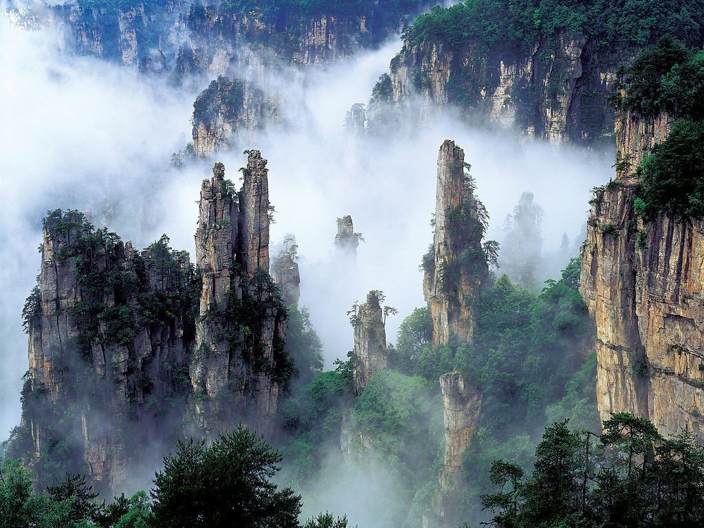
湖南省,最早出现于夏、商和西周时期。随着历史的变迁,经历了春秋战国、秦朝等多个朝代的更迭。直到唐朝时期,湖南开始有了相对稳定的行政设置,成为湖南观察使辖区,清朝将湖广省分为湖南省,完成了湖南作为独立省份的设立。新中国成立后,建立了人民政权,设立了10个专员公署,到现今仍沿用着清朝时期的省名 [1]。湖南省有着悠久的历史文化,是全国传统聚落相对集中和保存较为完好的省区之一 。在漫长的历史长河中形成了独具特色的湖湘文化,红色资源丰富。特色产主要是矿业和农业,经济总量庞大,发展势头强劲。处于东部沿海地区和中西部地区的过渡带、长江开放经济带和沿海开放经济带的结合部,具有承东启西、连南接北的枢纽地位。有张家界武陵源风景区、邵阳崀山丹霞地貌2处世界自然遗产 。
*Changjiang|Yangtze River
China
Chongqing Shi-CQ
Guangxi Zhuangzu Zizhiqu-GX
Guizhou Sheng-GZ
Hubei Sheng-HB
Hunan Sheng-HN
Sichuan Sheng-SC


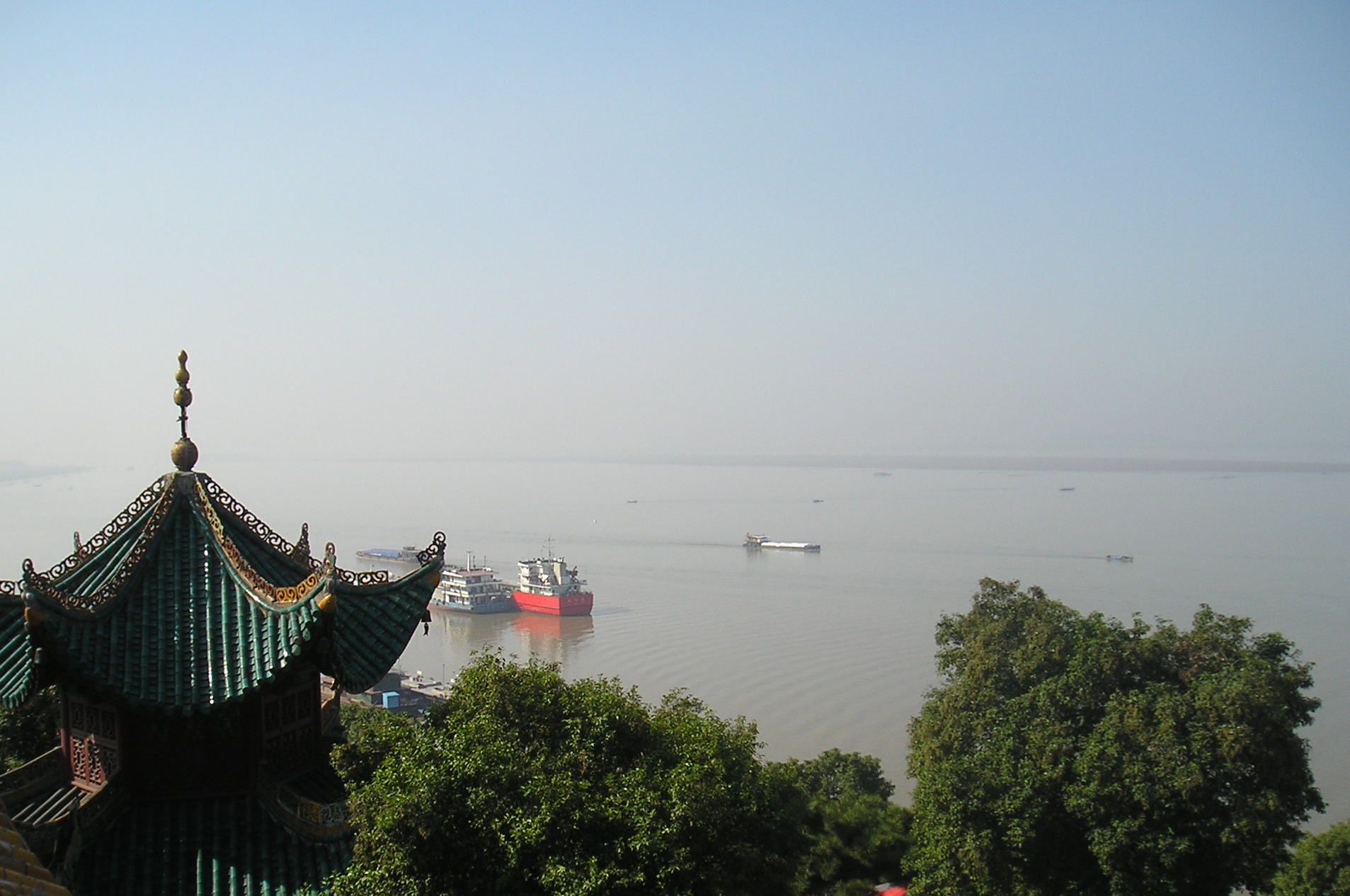
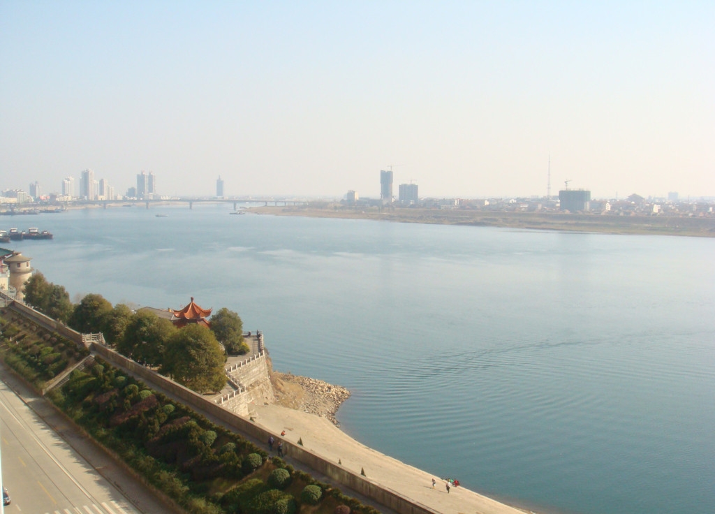
洞庭湖古称云梦、九江和重湖,原是中国第一大淡水湖,由于多年来缩水成为中国第二大淡水湖,面积2,820平方千米,古代曾号称“八百里洞庭”。处于长江中游荆江南岸,跨岳阳、荆州、石首、汨罗、湘阴、望城、益阳、沅江、汉寿、常德、津市、安乡和南县等县市。洞庭湖之名,始于春秋、战国时期,因湖中洞庭山(即今君山)而得名,并沿用至今。
Ganz im Norden der Provinz Hunan befindet sich der zweitgrößte Südwassersee Chinas - der Dongting-See. Bei Hochwasser im Sommer und Herbst erstreckt sich der See über eine Fläche von knapp 4000 Quadratkilometern. In den See münden die Flüsse Xiangjiang, Yuanjiang Zishui und Lishui. In der Region um den Dongting-See gibt es zahllose Teeplantagen, Bambushaine und Reisfelder. In der Trockenzeit ragen Hunderte kleiner Inseln aus dem See.
Früher hieß der See Yunmengze - der See von Wolken und Träumen. Er bildete sich vor rund 600 Millionen Jahren durch Verschiebungen in der Erdkruste und teilt sich geographisch in einen östlichen, westlichen und einen südlichen Teil.
Das Gebiet im Osten des Sees ist beliebt wegen seiner jahrhundertealten Gebäude, wie etwa dem Yueyang-Turm, und deshalb seit jeher ein viel ersehntes Reiseziel. In vielen Gedichten wird die Landschaft am östlichen Ufer des Dongting-Sees besungen.(Quelle: www.china.org.cn/german/179230.htm)
Der Dongting-See (chinesisch 洞庭湖, Pinyin Dòngtíng Hú, W.-G. Tung-t'ing Hu) im Norden der Provinz Hunan ist der zweitgrößte Binnensee der Volksrepublik China. Er wird von mehreren Flüssen gespeist und entwässert in den nördlich am See vorbeifließenden Jangtsekiang. Die Provinzen Hunan („südlich des Sees“) und Hubei („nördlich des Sees“) sind nach ihrer Lage bezogen auf den See benannt worden.
Die normale Fläche des Sees beträgt 2.820 km²; im Sommer (Juli bis September), wenn vor allem die Hochwasser des Jangtsekiang in den See fließen, kann sich die Fläche bis auf 20.000 km² ausdehnen. Damit stellt der Dongting-See ein wichtiges natürliches Rückhaltebecken zur Regulierung der Wasserführung des Jangtsekiang dar. Diese Funktion kann der See aber immer weniger wahrnehmen, da die jährlich auftretenden Überschwemmungen in immer kürzeren Abständen die kritischen Marken überschreiten. 1998 verloren mehr als 4.000 Menschen ihr Leben, 2002 waren es weniger, weil die Dämme hielten. Bei den Überschwemmungen handelt es sich weniger um Natur- als vielmehr um von Menschen verursachte Katastrophen. Die Abholzung von Schutzwäldern, Trockenlegung von Feuchtgebieten und Anlage von Wohn- und Industriegebieten in bisher als Überschwemmungsfläche für den See genutzte Bereiche haben dazu geführt, dass diese unwiederbringlich verloren gegangen sind.
Die durch den Jangtsekiang mitgeführte Sedimentfracht, die sich in der Dongting-Ebene ablagerte, führte zur Entstehung sehr fruchtbarer Marschböden, so dass die Ebene um den See zu einem der wichtigsten Reisanbaugebiete Chinas wurde. Auch dadurch gingen ausgedehnte Überschwemmungsareale verloren.
Während der flache Dongting-See zur Zeit der Han-Dynastie noch der größte Binnensee Chinas war, ist seine Fläche seitdem durch die Gewinnung von Neuland kleiner geworden, so dass er heute nach dem Poyang-See an zweiter Stelle rangiert.
Die in den Dongting-See mündenden Flüsse, darunter Xiang (2288 m³/s[2]), Zi (795 m³/s), Yuan (2158 m³/s), Li (551 m³/s) und Miluo, führen dem See im Mittel insgesamt über 6000 m³/s Wasser zu[3], womit der Seeausfluss den mit Abstand wasserreichsten Zufluss des Jangtsekiang darstellt. Zusätzlich erreichen drei südliche Nebenarme des Jangtsekiang mit zusammen über 3500 m³/s mittlerem Durchflussvolumen[3] den See. Sie übertreffen das Volumen des Xiang Jiang, womit der Dongting-See ein Teil des Jangtsekiang-Flusslaufs ist. Besonders aus diesem Zustrom setzen sich große Schwebstoffmengen im Seebecken ab.
Die wichtigsten Städte am See sind Yueyang und Yuanjiang. Changsha, die Hauptstadt Hunans, liegt etwa 60 km südöstlich des Dongting-Sees und kann über den Jangtsekiang, den Dongting-See und den Xiang Jiang mit Seeschiffen erreicht werden.
洞庭湖(どうていこ、拼音: ドンティンフー)は、中華人民共和国湖南省北東部にある淡水湖。中国の淡水湖としては鄱陽湖に次いで2番目に大きい。全体的に浅く、長江と連なっていて、その大量の水の受け皿となっており、季節ごとにその大きさが変わる。湖北省と湖南省はこの湖の北と南にあることからその名が付いた。 7月から9月にかけて長江から大量の水が流れ込み、湖の面積が広がる。通常期の湖の面積は2,820km²(琵琶湖の約4倍)だが、長江から膨大な量の水と堆積物の流入によって増水期は20,000km²(関東平野や四国よりも広い面積)にも及ぶ広さになるという。洞庭湖に流入する河川には、湖南省四大河川といわれる湘江・資江・沅江(げんこう)・澧水(れいすい)などがある。海を航行できる程の規模の船でも、長江から洞庭湖・湘江と経由して長沙にたどり着くことができる。
洞庭湖一帯では古くから歴史と文学と神話がはぐくまれてきたことで知られている。ドラゴンボートによるレースは洞庭湖の東岸に始まったとされ、その由来はこの湖に流入する川である汨羅江(べきらこう)に入水自殺した戦国時代の詩人・屈原の遺体を探し出そうとしたことにあるとされている。
北東岸にある岳陽楼(湖南省岳陽市)は杜甫の「岳陽楼に登る」をはじめ多くの詩人に詠まれ、范仲淹の「岳陽楼記」(先憂後楽の出典)がつくられたことで有名である。
昔は洞庭湖の中に浮かぶ島であった君山(くんざん)(zh)は、現在は岸とつながっているが、かつて多くの道士が隠棲しており、湘江の女神・湘君が遊んだところとして知られる。現在は君山銀針という希少な中国茶の産地である。岳陽楼付近から船で渡ることができる。
洞庭湖の南方の、瀟水と湘江が合流する一帯から洞庭湖にかけての景色は「瀟湘湖南」と称されて親しまれてきた。これに古代の帝王・舜が葬られたとされている九嶷山を取り入れた景観もまたその美しさで知られ、多くの詩が詠まれてきた(劉禹錫の「瀟湘曲」など)。宋代から、このあたりの景観を主に八つの景色とし、瀟湘八景をテーマとした山水画を描くことが流行した。この方式が日本にも広まり、近江八景や金沢八景などの元となった。
Dongting Lake (Chinese: 洞庭湖) is a large, shallow lake in northeastern Hunan province, China. It is a flood basin of the Yangtze River. Hence the lake's size depends on the season. The provinces of Hubei and Hunan are named after their location relative to the lake: Hubei means "North of the Lake" and Hunan, "South of the Lake".[1]
Dongting Lake is famous in Chinese culture as the place of origin of dragon boat racing. It is the site of Junshan Island and is a home to the Finless Porpoise, which is endangered in China.[1]
The area is well known in Chinese history and literature. "Dongting" literally means "Grotto Court", and the lake was named for the huge hall or cavern, which was believed to exist beneath the lake, where the spirits of the Sage-King Shun's wives Ehuang and Nüying were said to be the rulers of this grotto, which was claimed to have underground passages opening to all parts of the empire.[7][8] Dragon boat racing is said to have begun on the eastern shores of Dongting Lake as a search for the body of Qu Yuan, the Chu poet (340–278 BC), and a dragon-king is said to live at the bottom of the lake.
Junshan was also named after the goddess-wives of Shun, who lived there after his death by drowning, while they mourned him and sought for his body all the way from the source of the Xiang River, in which he drowned, and then on down to where it could have drifted, into the lake.[9] Junshan Island, formerly a Daoist retreat, is a famous one-kilometer island with 72 peaks in the middle of the lake. The island is also famous for its Junshan Yinzhen tea.[10] The basin of Dongting Lake and its surrounding area is famous for its scenic beauty, which has been encapsulated in the phrase "Hunan of the Xiao and Xiang rivers" (瀟湘湖南; Xiāo-Xiāng Húnán).[citation needed]
The scenery of the Jiuyi Mountains and of the Xiao and Xiang rivers below is often mentioned in Chinese poetry. The late Tang Dynasty poet Yu Wuling is supposed to have been fond of the scenery of Dongting Lake.[11] During the Song Dynasty, it became the fashion to paint this region's scenery in a set of eight scenes, usually entitled as Eight Views of Xiaoxiang. It is also said that Han Shizhong settled in the region after retired from military service. The fashion spread to Japan, where eventually other famous places were substituted for the Xiao and Xiang rivers.[citation needed] One of the famous ponds based on the geography of the lake is at the Daikaku-ji in Kyoto.
Le lac Dongting (chinois : 洞庭湖 ; pinyin : ), lac Dongting-hu ou lac Dong[réf. nécessaire] est le premier grand lac de Chine, dans la province du Hunan.
La superficie du lac dépend fortement des saisons (De 4000 à 20 000 km2 lors de crues). Les provinces du Hubei et du Hunan tirent leurs noms du lac. En effet, Hubei signifie « Nord du lac » et Hunan signifie « Sud du lac ». Elles étaient autrefois réunies dans la province du Huguang, signifiant « Vaste lac ». Le lac récolte les eaux du Yangtsé[réf. nécessaire]. Il est également alimenté par la rivière Yuan (沅)[réf. nécessaire], la rivière Xiang (湘), la rivière Zi (资), la rivière Yang et la rivière Li (澧)1. Il est par sa superficie le second lac d'eau douce et le troisième lac toutes catégories confondues de Chine, après le lac Qinghai et le lac Poyang.
La tour de Yueyang, bâtie à des fins militaires à l'endroit où le Yangtsé se jette dans le lac est aujourd'hui un haut lieu touristique.
Le lac comporte 2 740 km2 d'eau et 4 080 km2 de zone humide. il est séparé en trois lacs, du fait de l'utilisation des terres de la région dans l'agricutlure ; le lac Dongding ouest et lac Dongding Est, lacs d'eau, et le lac Dongding Sud, qui est une zone humide1.
Le lac Dongding sud avec ses 4 080 km2 de zone humide, soit, à lui seul, 1/8e de la surface totale des zones humides du monde, en fait l'une des plus importantes du monde. Il comporte une protection nationale et un classement AAAA des panoramas d'attraction touristiques sur le mode de l'écotourisme1.
Il lago Dongting (洞庭湖S, Dòngtíng HúP, Tung-t'ing HuW) è un grande e poco profondo lago della provincia dello Hunan nel nord-est della Cina. Si trova nel bacino idrografico del fiume Yangtze (Chang Jiang) e le sue dimensioni dipendono dagli andamenti stagionali. Le province dello Hunan e Hubei devono il nome alla loro posizione rispetto al lago: Hubei significa "nord del lago" e Hunan significa "sud del lago" in cinese.
El lago Dongting o lago Dong, es un lago poco profundo situado en el noroeste de la provincia de Hunan en la República Popular China. El lago se nutre de las aguas que desborda el río Yangtsé, por lo que su tamaño depende de la estación del año. Las provincias de Hubei y Hunan reciben su nombre por la localización que tienen con relación al lago: en chino, Hubei significa Norte del lago mientras que Hunan quiere decir Sur del lago.
Entre julio y septiembre las aguas del Yangtsé se desbordan hacia el lago, haciendo que éste aumente su tamaño. El área del lago, que normalmente es de 2.820 km², puede incrementarse hasta los 20.000 km² en la época de los desbordamientos. El Dongting se alimenta también de los ríos Xiang, Zi y Li.
En el centro del lago se encuentra la isla Junshan, en la que se pueden ver un total de 72 colinas. La isla es famosa también por una clase especial de té, el té de la aguja de plata. Durante la dinastía Qing se utilizaban las hojas de este té para honrar a la familia imperial.
El área que rodea al lago es conocida dentro de la historia y de la literatura china. Se dice que las carreras de barcos con forma de dragón tienen su origen en la orilla este del Dongting. Cuenta la leyenda que un rey dragón habita en el fondo de las aguas del lago.
Durante la dinastía Song la belleza de la zona fascinó a los pintores. Se instauró la moda de representar la región en grupos de ocho escenas.
 Eat and Drink

 Sport
Guizhou Sheng-GZ
Hubei Sheng-HB
Hunan Sheng-HN
Shaanxi Sheng-SN
Shandong Sheng-SD
Sichuan Sheng-SC
Tianjin Shi-TJ
Sport
Guizhou Sheng-GZ
Hubei Sheng-HB
Hunan Sheng-HN
Shaanxi Sheng-SN
Shandong Sheng-SD
Sichuan Sheng-SC
Tianjin Shi-TJ
 History
Anhui Sheng-AH
Beijing Shi-BJ
Fujian Sheng-FJ
Gansu Sheng-GS
Guangdong Sheng-GD
Guangxi Zhuangzu Zizhiqu-GX
Guizhou Sheng-GZ
Hebei Sheng-HE
Henan Sheng-HA
Hubei Sheng-HB
Hunan Sheng-HN
Jiangsu Sheng-JS
Jiangxi Sheng-JX
Nei Mongol Zizhiqu-NM
Ningxia Huizu Zizhiqu-NX
Qinghai Sheng-QH
Shaanxi Sheng-SN
Shandong Sheng-SD
Shanxi Sheng-SX
Sichuan Sheng-SC
Tianjin Shi-TJ
Xinjiang Uygur Zizhiqu-XJ
Zhejiang Sheng-ZJ
History
Anhui Sheng-AH
Beijing Shi-BJ
Fujian Sheng-FJ
Gansu Sheng-GS
Guangdong Sheng-GD
Guangxi Zhuangzu Zizhiqu-GX
Guizhou Sheng-GZ
Hebei Sheng-HE
Henan Sheng-HA
Hubei Sheng-HB
Hunan Sheng-HN
Jiangsu Sheng-JS
Jiangxi Sheng-JX
Nei Mongol Zizhiqu-NM
Ningxia Huizu Zizhiqu-NX
Qinghai Sheng-QH
Shaanxi Sheng-SN
Shandong Sheng-SD
Shanxi Sheng-SX
Sichuan Sheng-SC
Tianjin Shi-TJ
Xinjiang Uygur Zizhiqu-XJ
Zhejiang Sheng-ZJ

唐朝(618年-907年),中国历史上的朝代,国祚共历289年,21位皇帝。由唐高祖李渊所建立。唐室出身自关陇世族,先祖李虎在南北朝的西魏是八柱国之一,封为唐国公[1]:254。其后代李渊为隋朝晋阳(在今山西太原西南)留守,在隋末民变时出兵入关中以争夺天下,于618年受隋恭帝杨侑禅位,在唐朝统一战争中统一天下。唐朝定都长安(今陕西省西安市),690年到705年为武周,定都神都洛阳[2]。
唐朝历史可以概略分成数个时期,大致上以安史之乱为界。初唐时国力强盛,李渊建立唐朝,是为唐高祖,其子秦王李世民以玄武门之变,杀害兄李建成、弟李元吉,逼迫高祖内禅帝位,即为唐太宗,是唐朝多次首都兵变的开端。太宗一手将唐朝带向盛世,击败强敌东突厥,受尊为“天可汗”,成就贞观之治。唐高宗时期击败西突厥、高句丽等强敌,建立永徽之治,把唐朝版图扩到最大。高宗去世后,其皇后武后先后拥立儿子中宗和睿宗当傀儡,最后于690年废睿宗自立为皇帝,改国号曰“周”,即武周,人称“武则天”,而此时女主政治也达到高峰。直到705年中宗因神龙革命而复辟,唐朝国号得以恢复。但接着还有韦后专权,之后宗室李隆基与其姑姑太平公主共同发起唐隆之变,才扫荡韦氏势力,结束自从中宗复辟后朝政紊乱的情况。李隆基也实际掌权,成为日后的唐玄宗。玄宗即位后便发动先天之变,赐死太平公主,结束数十年来的女主政治与百年来的政变时代,进入盛唐时期,是唐朝的第二高峰与转折,开元时期唐玄宗革除前朝弊端,政治开明,威服四周国家,史称开元盛世[3]:36。到天宝时期,政治逐渐混乱,于755年爆发安史之乱,唐朝盛极而衰。中唐时,唐朝受到河朔三镇、吐蕃的侵扰、宦官专权与牛李党争等内忧外患的影响而衰退。其间虽然有唐宪宗的元和中兴、唐武宗的会昌中兴与唐宣宗的大中之治,但是都未能根治唐朝的内忧外患。在晚唐时因为政治腐败,爆发唐末民变,其中黄巢之乱破坏江南经济,使唐朝经济完全瓦解,导致全国性的藩镇割据。唐室最后被藩镇朱全忠控制,他迫使唐昭宗迁都洛阳,并于907年逼唐哀帝禅位,唐灭亡,共289年。朱全忠建国梁,史称后梁,进入五代十国时期[4]:424。
唐朝的疆域广大,但时常变动,630年就超过隋朝极盛时的版图。唐朝也是自秦汉以来,第一个不使用前朝所筑长城及不筑长城的统一王朝[5][6][7]。其鼎盛时期为7世纪,当时中亚的绿洲地带受唐朝支配。其最大范围南至罗伏州(今越南河静)、北括玄阙州(今俄罗斯安加拉河流域)、西及安息州(今乌兹别克斯坦布哈拉)、东临哥勿州(今吉林通化)的辽阔疆域[8],国土面积达1076万平方千米[9]。中唐后漠北、西域的领地相继失去,到晚唐时衰退到等同中国本部的大小,但仍然保有河套地区及河西走廊[3]:36。天宝十三年(754年)户口统计为五千二百八十八万四百八十八人[10],不过许多学者考虑到当时统计不严,存在大量没有计入统计的瞒报户口[11],此外还有隐户、佃农、奴婢、士兵、僧道等人群不纳入户口统计,故大多数学者认为唐朝人口峰值在八千万左右[12][13][14]。此时,京兆府辖区人口估算在200万人左右,而市区则是100万人[15][16][17][18][19]。
唐朝在文化、科技、政治、经济、外交等方面都达到很高的成就。在中国历史上有大量的科技发明,四大发明中的火药即诞生于唐朝、雕版印刷开始广泛应用。其政治为三省六部制,前期中央权力在皇帝与宰相,中后期宦官影响力大增。同隋朝推行科举制度,使得晋朝南朝的世族制度不再兴起,中国历史上第一个状元、三元及第,都诞生于唐朝,即622年状元孙伏伽(一说651年的颜康成)[20]。军事制度前期采用府兵制,军力强盛,多次击败外族。后期则出现节度使(藩镇)的军政制度,割据一方,到唐朝后期还出现四十八个藩镇。唐朝是当时世界的强国,与突厥、高句丽、吐蕃、大食争夺四方霸权。借由羁縻制度控制回纥、契丹等北方各族,还调度漠北地区的突厥诸部军队攻打西突厥、高句丽[21],并且让南诏、高昌、龟兹、粟特、吐蕃、新罗、渤海国和日本等国家吸收唐朝的文化与政治体制[3]:38。唐朝的经济富盛,结合华北、关中与江南的经济,到后期更加依重江南赋税。土地、盐铁与赋税制度随着社会改变而改革,由均田制与租庸调制转向两税制,并且增加许多杂税。其中两税制影响中国后半期的赋税制度[4]:424。唐朝文化兼容并蓄,接纳各个民族与宗教,进行交流融合,成为开放的国际文化[22]:126。其文学发展达到高峰,以诗最为兴盛。当时有李白、杜甫等诗人,以及推行古文运动的韩愈,其史书与传奇(小说的前身)也十分发达。由于吸收西域特征与宗教色彩,唐朝艺术与前后朝代都迥然不同,其壁画、雕刻、书法与音乐都很发达[23]:758。唐朝声誉远及海外,其历史地位深重,到明清时期海外多称中国人为“唐人”[24]。
Die Tang-Dynastie (618-907) hatte 20 Kaiser und eine Kaiserin aus 14 Generationen und war mit einer Dauer von 289 Jahren die längste Dynastie in der chinesischen Geschichte. Davon fiel fast die Hälfte der Dauer mit fast 130 Jahren auf das sogenannte Goldene Zeitalter.
Aufstieg und Entwicklung zum Goldenen Zeitalter
唐(とう、拼音: 、618年 - 907年)は、中国の王朝である。李淵が隋を滅ぼして建国した。7世紀の最盛期には、中央アジアの砂漠地帯も支配する大帝国で、中央アジアや、東南アジア、北東アジア諸国、例えば朝鮮半島や渤海、日本などに、政制・文化などの面で多大な影響を与えた世界帝国である。日本の場合は遣唐使などを送り、894年(寛平6年)に菅原道真の意見でその回の遣唐使を中止し、結果としてそれ以降遣唐使は送られず、それまでは積極的な交流をしていた。首都は長安に置かれた。
690年に唐王朝は廃されて武周王朝が建てられたが、705年に武則天が失脚して唐が復活したことにより、この時代も唐の歴史に含めて叙述することが通例である。
日本では唐の滅亡後も唐、唐土の語はそれ以降の王朝、さらには外国全般を漠然と指す語として用いられた。しかし、天竺同様昔の呼称のため、正確に対応するわけではない。詳しくは中国を参照のこと。
The Tang dynasty (/tɑːŋ/;[4] Chinese: 唐朝[a]) or the Tang Empire was an imperial dynasty of China, preceded by the Sui dynasty and followed by the Five Dynasties and Ten Kingdoms period. Historians generally regard the Tang as a high point in Chinese civilization, and a golden age of cosmopolitan culture.[6] Tang territory, acquired through the military campaigns of its early rulers, rivaled that of the Han dynasty. The Tang capital at Chang'an (present-day Xi'an) was the most populous city in the world in its day.
The Lǐ family (李) founded the dynasty, seizing power during the decline and collapse of the Sui Empire. The dynasty was briefly interrupted when Empress Wu Zetian seized the throne, proclaiming the Second Zhou dynasty (690–705) and becoming the only Chinese empress regnant. In two censuses of the 7th and 8th centuries, the Tang records estimated the population by number of registered households at about 50 million people.[7][8] Yet, even when the central government was breaking down and unable to compile an accurate census of the population in the 9th century, it is estimated that the population had grown by then to about 80 million people.[9][10][b] With its large population base, the dynasty was able to raise professional and conscripted armies of hundreds of thousands of troops to contend with nomadic powers in dominating Inner Asia and the lucrative trade-routes along the Silk Road. Various kingdoms and states paid tribute to the Tang court, while the Tang also conquered or subdued several regions which it indirectly controlled through a protectorate system. Besides political hegemony, the Tang also exerted a powerful cultural influence over neighboring East Asian states such as those in Japan and Korea.
The Tang dynasty was largely a period of progress and stability in the first half of the dynasty's rule, until the An Lushan Rebellion and the decline of central authority in the later half of the dynasty. Like the previous Sui dynasty, the Tang dynasty maintained a civil-service system by recruiting scholar-officials through standardized examinations and recommendations to office. The rise of regional military governors known as jiedushi during the 9th century undermined this civil order. Chinese culture flourished and further matured during the Tang era; it is traditionally considered the greatest age for Chinese poetry.[11] Two of China's most famous poets, Li Bai and Du Fu, belonged to this age, as did many famous painters such as Han Gan, Zhang Xuan, and Zhou Fang. Scholars of this period compiled a rich variety of historical literature, as well as encyclopedias and geographical works. The adoption of the title Tängri Qaghan by the Tang Emperor Taizong in addition to his title as emperor was eastern Asia's first "simultaneous kingship".[12]
Many notable innovations occurred under the Tang, including the development of woodblock printing. Buddhism became a major influence in Chinese culture, with native Chinese sects gaining prominence. However, in the 840s the Emperor Wuzong of Tang enacted policies to persecute Buddhism, which subsequently declined in influence. Although the dynasty and central government had gone into decline by the 9th century, art and culture continued to flourish. The weakened central government largely withdrew from managing the economy, but the country's mercantile affairs stayed intact and commercial trade continued to thrive regardless. However, agrarian rebellions in the latter half of the 9th century resulted in damaging atrocities such as the Guangzhou massacre of 878–879.
La dynastie Tang (chinois : 唐朝 ; Wade : T'ang ; EFEO : T'ang, Ten quelquefois) (18 juin 618 - 1er juin 907) est une dynastie chinoise précédée par la dynastie Sui (581-618) et suivie par la période des Cinq Dynasties et des Dix Royaumes. Elle a été fondée par la famille Li, qui prit le pouvoir durant le déclin et la chute de l'empire Sui.
Venant après une longue période de division de la Chine qui dura de 220 à 581, à laquelle l'éphémère dynastie Sui avait mis fin, les premiers empereurs de cette dynastie eurent d'abord pour tâche de stabiliser l'empire récemment réunifié, et de lui redonner la puissance qu'avait eue la Chine à l'époque des Han. Ils firent rapidement mieux que ces derniers dans le domaine des conquêtes extérieures. Sous les premiers empereurs Tang (en particulier Taizong, l'impératrice Wu Zetian et Xuanzong), l'empire chinois connut une période de prospérité et un rayonnement culturel considérable. Sa capitale Chang'an, la plus grande ville du monde, reflétait toute la puissance et le cosmopolitisme, qui reposait notamment sur le dynamisme des échanges à longue distance le long de la route de la soie et des voies maritimes méridionales. Cette période a été vue par les générations suivantes comme un véritable âge d'or de la civilisation chinoise, symbolisé notamment par les brillants poètes Li Bai et Du Fu, et plus largement l'émergence d'un groupe de nombreux lettrés passés par les examens impériaux qui furent mis en place par les premiers empereurs Tang.
L'histoire de la dynastie bascula en 755 avec la révolte d'An Lushan, conséquence dramatique des évolutions politiques et militaires de l'empire à la période de son apogée. Après la difficile répression de ce soulèvement, l'organisation de l'empire se présenta sous un jour nouveau : la vieille aristocratie qui l'appuyait déclina irrémédiablement, supplantée par des hommes nouveaux disposant des charges militaires provinciales les plus importantes ou des grandes commissions fiscales et financières. Les empereurs ne parvinrent pas à contenir les forces centrifuges qui leur firent perdre l'autorité sur leurs provinces, même si cela n'entrava pas la prospérité de leur empire, portée par l'expansion démographique et économique des régions du Sud. Après une série de révoltes dans les dernières décennies du IXe siècle, la dynastie Tang s'éteint en 907, alors que son empire avait été dépecé. Les évolutions politiques, sociales, économiques et intellectuelles de cette période avaient déjà fait pénétrer la Chine dans une période que les historiens considèrent couramment comme « moderne », annonciatrice de la période de la dynastie Song (960-1272) qui réunifia la Chine quelques décennies après la fin des Tang.
Plusieurs innovations importantes sont apparues durant la dynastie Tang, dont le développement des caractères d'imprimerie en bois. Dans le domaine religieux, le bouddhisme eut une influence majeure dans la culture chinoise, avec l'affirmation de sectes bouddhistes aux racines spécifiquement chinoises et le développement d'un art remarquable. Toutefois, cette religion fut par la suite persécutée et son influence déclina, tandis que le taoïsme conservait une grande importance et que s'amorçait le retour du confucianisme, porté par les écrits de Han Yu.
La dinastia Tang (唐朝T, TángcháoP, 618-907) seguì la dinastia Sui, che aveva riportato l'unità politica in Cina, e fu seguita da un'epoca di disunione nota come il periodo delle Cinque dinastie e dieci regni.
Gli effetti del suddetto consolidamento iniziano a notarsi sotto l'imperatore Tai Zong (627 – 649), che ristabilisce il protettorato cinese sulla regione del bacino del Tarim (Asia centrale). Egli unisce la casa imperiale del Tibet alla Cina tramite matrimonio, intraprende la conquista della Corea e mantiene relazioni con il Giappone e i reami del Funan e del Champa. Con l'imperatore Xuan Zong (713 – 756) la Cina conosce un periodo di pace e prosperità, che favorisce il fiorire di produzioni artistiche.
La dinastía Tang (chino simplificado y tradicional: 唐朝, pinyin: Táng Cháo, Wade-Giles: T'ang2 Ch'ao2; tʰɑ̌ŋ tʂʰɑ̌ʊ̯ (?·i)) (618-907) fue la sucesora de la dinastía Sui y predecesora del período de las Cinco Dinastías y los Diez Reinos en China. La dinastía fue interrumpida por la segunda dinastía Zhou (690-705), cuando la emperatriz Wu Zetian usurpó el trono y fundó su propia dinastía. La dinastía Tang, con su capital en Chang'an (actual Xi'an), la ciudad más poblada del mundo en ese entonces, está considerada por los historiadores como un momento de esplendor de la civilización china, igual —o incluso superior— al del período Han.
Эпоха Тан (Династия Ли 李) (18 июня 618 — 4 июня 907, кит. 唐朝, Танчао) — китайская императорская династия, основанная Ли Юанем. Его сын, император Ли Шиминь, после окончательного подавления крестьянских восстаний и сепаратистских феодальных сил начал проводить прогрессивную политику. Именно эпоха Тан традиционно считается в Китае периодом наивысшего могущества страны, когда она опережала остальные современные ей страны мира в своём развитии.

 IT-Times