
Deutsch-Chinesische Enzyklopädie, 德汉百科
 Eurovision Song Contest,ESC
Eurovision Song Contest,ESC
Eurovision Song Contest,ESC
 Finanz
 ***Globales Finanzzentrum/Global Financial Center
 Geschichte
N 2000 - 2100 nach Christus
Geschichte
M 1500 - 2000 nach Christus
Geschichte
N 2000 - 2100 nach Christus
Geschichte
M 1500 - 2000 nach Christus
 Mittelalterliche Städte in Europa
Schottland
Vereinigtes Königreich
Mittelalterliche Städte in Europa
Schottland
Vereinigtes Königreich
 Weltkulturerbe

爱丁堡(英语:Edinburgh,![]() i/ˈɛdɪnbərə/[4]、苏格兰盖尔语:Dùn Èideann),是英国苏格兰首府,也是继格拉斯哥后苏格兰的第二大城市,位于苏格兰东海岸福斯湾南岸。截止到2013年,全市人口为487,500。[3]
i/ˈɛdɪnbərə/[4]、苏格兰盖尔语:Dùn Èideann),是英国苏格兰首府,也是继格拉斯哥后苏格兰的第二大城市,位于苏格兰东海岸福斯湾南岸。截止到2013年,全市人口为487,500。[3]
自15世纪以来爱丁堡就被当做苏格兰首府,但在1603年和1707年政治力量多次南移到伦敦。1999年苏格兰议会的自治权利才得以确立。苏格兰国家博物馆、苏格兰国家图书馆和苏格兰国家画廊等重要文化机构也位于爱丁堡。在经济上,现在的爱丁堡主要依靠金融业,是伦敦以外英国最大的金融中心。[5]
爱丁堡有着悠久的历史,许多历史建筑亦完好保存下来。爱丁堡城堡、荷里路德宫、圣吉尔斯大教堂等名胜都位于此地。爱丁堡的旧城和新城一起被联合国教科文组织列为世界遗产。[6]2004年爱丁堡成为世界第一座文学之城。[7]爱丁堡的教育也很发达,英国最古老的大学之一爱丁堡大学就坐落于此,为一所历史超过四百年的世界顶尖名校。[8]加上爱丁堡国际艺术节等文化活动,爱丁堡成为了英国仅次于伦敦的第二大旅游城市。Edinburgh (/ˈɛdɪnbərə/ (![]() listen);[6][7][8] Scottish Gaelic: Dùn Èideann [ˈt̪uːn ˈeːtʲən̪ˠ]; Scots: Edinburgh) is the capital city of Scotland and one of its 32 council areas. Historically part of the county of Midlothian (or Edinburghshire), it is located in Lothian on the Firth of Forth's southern shore.
listen);[6][7][8] Scottish Gaelic: Dùn Èideann [ˈt̪uːn ˈeːtʲən̪ˠ]; Scots: Edinburgh) is the capital city of Scotland and one of its 32 council areas. Historically part of the county of Midlothian (or Edinburghshire), it is located in Lothian on the Firth of Forth's southern shore.
Recognised as the capital of Scotland since at least the 15th century, Edinburgh is the seat of the Scottish Government, the Scottish Parliament and the supreme courts of Scotland. The city's Palace of Holyroodhouse is the official residence of the monarchy in Scotland. The city has long been a centre of education, particularly in the fields of medicine, Scots law, literature, the sciences and engineering. It is the second largest financial centre in the United Kingdom (after London)[9] and the city's historical and cultural attractions have made it the United Kingdom's second most popular tourist destination, attracting over one million overseas visitors each year.[10]
Edinburgh is Scotland's second most populous city and the seventh most populous in the United Kingdom. The official population estimates are 464,990 (2012) for the Locality of Edinburgh (Edinburgh pre 1975 regionalisation plus Currie and Balerno),[1] 513,210 (2017) for the City of Edinburgh,[2] and 1,339,380 (2014) for the city region.[2][3] Edinburgh lies at the heart of the Edinburgh and South East Scotland city region comprising East Lothian, Edinburgh, Fife, Midlothian, Scottish Borders and West Lothian.[11]
The city is the annual venue of the General Assembly of the Church of Scotland. It is home to national institutions such as the National Museum of Scotland, the National Library of Scotland and the Scottish National Gallery. The University of Edinburgh, founded in 1582 and now one of four in the city, was placed 23rd in the QS World University Rankings in 2018.[12] The city is also famous for the Edinburgh International Festival and the Fringe, the latter being the world's largest annual international arts festival. Historic sites in Edinburgh include Edinburgh Castle, the Palace of Holyroodhouse, the churches of St. Giles, Greyfriars and the Canongate, and the extensive Georgian New Town, built in the 18th/19th centuries. Edinburgh's Old Town and New Town together are listed as a UNESCO World Heritage site,[13] which has been managed by Edinburgh World Heritage since 1999.
Édimbourg (prononcé [e.dɛ̃.buʁ] ; Edinburgh [ˈɛ.dɪn.bərə] Écouter en anglais britannique, Dùn Èideann [ˈt̪uːnˈeːtʲən̪ˠ] en gaélique écossais, Embra, Edinburrie, Edinburra et Edimbra en scots) est une ville d'Écosse au Royaume-Uni. Elle est sa capitale depuis 1532, ainsi que le siège du Parlement écossais depuis le rétablissement de celui-ci en 1999. Sa population était de 457 830 habitants en 2005 (c’est la deuxième ville d’Écosse derrière Glasgow). Ses habitants s'appellent les Édimbourgeois. Depuis 1329, Édimbourg possède officiellement le statut de cité. Elle a aussi le statut de council area (depuis le 31 mars 1996) et de région de lieutenance, après avoir eu celui de district au sein de la région du Lothian (du 15 mai 1975 au 31 mars 1996) dont elle était le siège.
La ville est construite sur des collines volcaniques qui fournissent chacune un point de vue différent sur la ville. Elle est dominée par son château dont les fondations remontent au VIIe siècle mais c’est à partir du XIe siècle que fut construite cette résidence royale avant de devenir une forteresse redoutable au XVIe siècle. Édimbourg fut affranchie en 1329 et s’entoura de murailles au XVe siècle. Après la défaite de Flodden (1513) contre les Anglais, les bourgeois de la ville décidèrent de construire à titre préventif une seconde enceinte baptisée le mur de Flodden. Après l’unification des Parlements d’Écosse et d’Angleterre (1707), la ville perdit de son importance politique mais resta un important centre économique et culturel. En plus du Château, Édimbourg compte de nombreux lieux intéressants comme le Royal Botanic Garden, les cathédrales Saint-Gilles (presbytérienne), Sainte-Marie (épiscopalienne) et Sainte-Marie (catholique), la National Gallery, Charlotte Square, le Scott monument ou encore le National Museum of Scotland. Le palais de Holyrood (Holyrood Palace) est la résidence officielle de la reine lorsqu’elle séjourne dans la ville. Les districts de la vieille et de la nouvelle ville sont classés patrimoine mondial par l’UNESCO depuis 1995.
Édimbourg est célèbre pour son festival, le plus grand du monde, qui dure trois semaines en août et propose de nombreux spectacles de qualité dans toutes les disciplines.
La ville accueille l'une des plus prestigieuses universités d’Europe et du monde, l’université d’Édimbourg, pionnière dans l’informatique, la géologie, la chimie et la médecine. À Édimbourg se situe également la bibliothèque nationale d’Écosse (National Library of Scotland) qui est la plus importante bibliothèque d’Écosse (et l’une des plus grandes du Royaume-Uni).
Edimburgo (AFI: /edimˈburɡo/[3]; in inglese e scots Edinburgh, pron. [ˈɛdɪnbʌrə] oppure [ˈɛdɪnbrə], in gaelico scozzese Dùn Èideann) è una città del Regno Unito, capitale della Scozia dal 1437 e sede del suo nuovo parlamento dal 1999. È la seconda città della Scozia per popolazione dopo Glasgow e la settima del Regno Unito per popolazione. I dati ufficiali del 2014 stimano la popolazione in 464 990 abitanti per la città,[1] 492 680 per l'area dell'autorità locale[1] e 1 339 380 per l'area metropolitana[1] (Edinburgh è situata nel cuore della proposta "city region" di Edimburgo e Scozia sudorientale).
La città, situata sulla costa orientale della Scozia e sulla riva meridionale del Firth of Forth, a circa 70 km ad est di Glasgow, sorge su 7 colli. I punti più alti sono: Arthur's Seat, Castle Rock dove si trova il castello, Calton Hill, Corstorphine Hill, Braid Hills, Blackford Hill e Craiglockhard Hill, su di una serie di colline. Le parti storiche della città (Old e New Town), insieme al castello, nel 1995 sono state dichiarate patrimonio dell'umanità dall'UNESCO.
È una delle città più visitate della Gran Bretagna con circa 2 milioni di turisti l'anno[4] e a questo successo contribuisce anche il Festival di Edimburgo, che si tiene ogni anno ed è accompagnato da numerose manifestazioni collaterali.
Edimburgo (![]() /ˈɛdɪnb(ʌ)ɹə/ (?·i) en inglés y escocés: Edinburgh; en gaélico escocés: Dùn Èideann) es la capital y un concejo de Escocia (Reino Unido).23 Es la segunda ciudad más grande de Escocia tras Glasgow.
/ˈɛdɪnb(ʌ)ɹə/ (?·i) en inglés y escocés: Edinburgh; en gaélico escocés: Dùn Èideann) es la capital y un concejo de Escocia (Reino Unido).23 Es la segunda ciudad más grande de Escocia tras Glasgow.
Ubicada en la costa este de Escocia, a orillas del fiordo del río Forth y en la autoridad unitaria local de la Ciudad de Edimburgo, es la capital de Escocia desde 1437 y sede del gobierno escocés. Fue uno de los centros más importantes de educación y cultura durante la Ilustración gracias a la Universidad de Edimburgo. Sus distritos The Old Town (ciudad antigua) y The New Town (ciudad nueva) fueron designados Patrimonio de la Humanidad por la Unesco en 1995.4 Según el censo de 2011 tiene un población total de 459 366 habitantes.1
Edimburgo es famosa por su Festival Internacional, el festival de actuaciones en vivo más grande del mundo, y otros festivales desarrollados en verano de forma más o menos simultánea, la mayoría de los cuales se agrupan bajo la denominación Festival de Edimburgo. Durante el festival la población de la ciudad se duplica. Edimburgo es la segunda ciudad más visitada del Reino Unido, después de Londres, con aproximadamente 13 millones de turistas al año.
Эдинбу́рг (англ. и скотс. Edinburgh [ˈɛdɪnb(ʌ)rə], гэльск. Dùn Èideann [tuːn ˈeːtʃən]) — столица Шотландии (с 1437 года) и второй по величине её город. Административный центр округа Сити-оф-Эдинбург. Население Эдинбурга в 2016 году составляло 488,1 тыс. человек. Это седьмой по величине город Соединённого королевства. Расположен на восточном побережье Шотландии (территория Среднешотландской низменности), на южном берегу залива Ферт-оф-Форт.
Районы Эдинбурга — Старый город и Новый город — в 1995 году были занесены ЮНЕСКО в список объектов Всемирного наследия.
 Musik
Albanien
Andorra
Armenien
Aserbaidschan
Australien
Musik
Albanien
Andorra
Armenien
Aserbaidschan
Australien
 Bayern
Belarus
Belgien
Bosnien-Herzegowina
Bulgarien
Bayern
Belarus
Belgien
Bosnien-Herzegowina
Bulgarien
 Campania
Dänemark
Campania
Dänemark
 Darstellende Künste
Deutschland
England
Estland
Eurovision Song Contest,ESC
Darstellende Künste
Deutschland
England
Estland
Eurovision Song Contest,ESC
 Fest- und Feiertage
Finnland
Frankreich
Georgien
Griechenland
Fest- und Feiertage
Finnland
Frankreich
Georgien
Griechenland
 Hessen
 Ile-de-France
Irland
Island
Israel
Italien
Kroatien
Lettland
Litauen
Luxemburg
Ile-de-France
Irland
Island
Israel
Italien
Kroatien
Lettland
Litauen
Luxemburg
 Madrid
Malta
Marokko
Moldawien
Monaco
Montenegro
Niederlande
Nordirland
Nordmazedonien
Madrid
Malta
Marokko
Moldawien
Monaco
Montenegro
Niederlande
Nordirland
Nordmazedonien
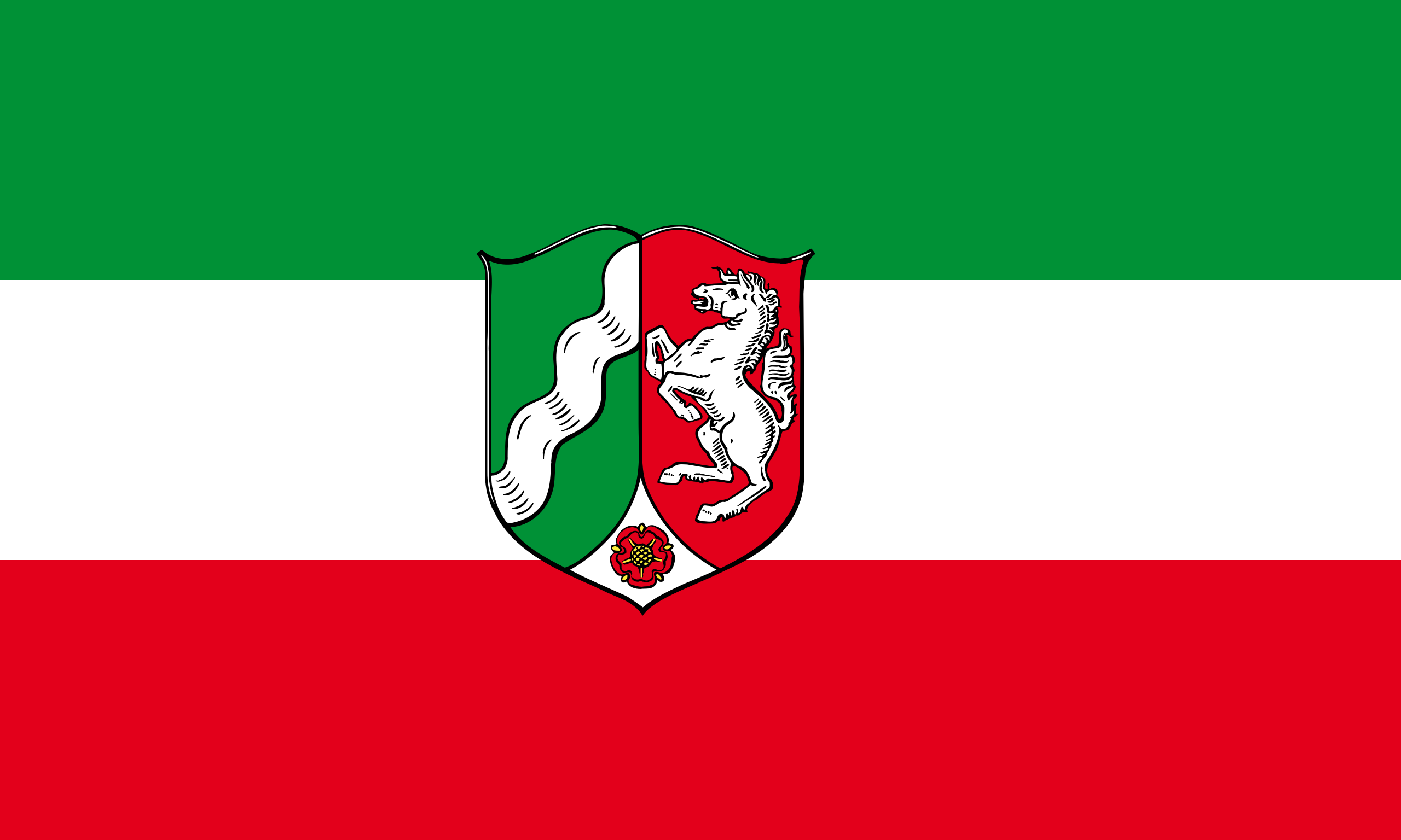 Nordrhein-Westfalen
Norwegen
Österreich
Polen
Portugal
Nordrhein-Westfalen
Norwegen
Österreich
Polen
Portugal
 Provence-Alpes-Côte d´Azur
Rumänien
Russland
San Marino
Schottland
Schweden
Schweiz
Serbien
Slowakei
Slowenien
Spanien
Tschechien
Türkei
Ukraine
Ungarn
Vereinigtes Königreich
Provence-Alpes-Côte d´Azur
Rumänien
Russland
San Marino
Schottland
Schweden
Schweiz
Serbien
Slowakei
Slowenien
Spanien
Tschechien
Türkei
Ukraine
Ungarn
Vereinigtes Königreich
 Wien
Zypern
Wien
Zypern


欧 洲广 播联盟主办的一项歌唱比赛,自从1956年在瑞士Lugano(卢加诺)举办第一届以后,每年会举行一次,由在上一届获得冠军的国家承办(挺有意思的)。 比赛的结果不是评委说了算,而是由全欧洲的电视观众决定。歌曲演唱完毕,会给出十分钟时间,由电视观众打投票电话进行评选,投票范围为除自己国家外的其他 所有歌手。这个大赛还有个特色就是不规定歌手必须是这个国家的“自己人”,各个国家可以根据自己的情况请“外援”,比较出名的有Celine Dion在1988年代表瑞士参赛并拿了冠军。欧洲电视歌曲大赛采用了全欧洲各国竞赛的方式,来自各国的选手带上自己最精彩的节目,让我们有了更丰富的音 乐享受,整个晚会的气氛活跃,的确有不少好歌。欧洲歌唱大赛是欧洲最高水平的比赛,每个国家都会派出代表自己国家的歌手参赛欧视歌曲大赛已成为具有优秀传 统的欧陆年度音乐大赛,虽然只是欧洲范围内的音乐赛事,但是已经成为众多本地音乐艺人走向国际舞台的最佳跳板,是同类型比赛中规模最大者之一。在2008 年,一共有43个欧洲及邻近国家派出代表参加比赛,并有1.5亿观众透过电视观看了决赛。欧洲电视歌唱大赛经过50多年的发展,已经成为欧洲规模最大、影 响力最广、商业运作最成功的文艺活动。
和国内的歌唱比赛有所不同,欧洲电视歌唱大赛突出的是跨地域性和全民参与性。本届大赛共有38个国 家参加,观看决赛的电视观众有1.5亿之众,而参加采访的各国记者人数就超过2200人。比赛规定,大赛的优胜者由参赛国观众投票决定,但投票者不得将票 投给自己国家的选手。每名参赛者表演结束后,都会留下10分钟时间给观众投票。随着通讯手段的进步,手机短信、电话和电脑网络都被列为有效的投票方式,这 些选票最终由设在德国的一个数据中心进行处理,比赛全部结束后半小时内观众即可获悉大赛最终结果。
虽然每年代表各国参赛的歌手或乐队不一 定代表该国最高水平,但一定是该国当前最流行或者最具发展潜力的音乐组合。两位在现场的芬兰小伙子告诉记者,芬兰人对洛迪乐队疯狂的演唱风格不一定都喜 欢,但芬兰人能夺取冠军相当不容易。毕竟芬兰已经参加了近40届大赛,夺冠还是头一次。
通过该项大赛走红的明星并不少见,瑞典乐队的“芭 芭”就因1974年夺冠而一举成名,席琳·迪翁也在1988年爱尔兰举办的欧洲电视歌唱比赛中获得过冠军,二人组合“神秘园”1995年曾代表挪威夺得过 大奖,甚至爱尔兰著名的《大河之舞》,也是通过在该项比赛评分间隙进行的表演而走向世界比赛中每个国家派出一个歌手或一个乐团演唱一首自选的歌曲,之后观 众透过电话、短信或网络投选最喜欢的歌手,再统计各国的票数间接选出优胜者。而胜出者所代表的国家自动成为下年决赛的东道主。
在过去52届比赛,爱尔兰代表胜出了7次,是各国之冠,联合王国、法国和卢森堡代表各胜出了5次并列第二。历届优胜者中,ABBA(1974年)和席琳·狄翁(1988年)成了国际知名的巨星。
欧洲电视歌唱大赛由欧洲广播电视联盟主办,该联盟的成员国每年通过自己的选拔方式确定本国的参赛选手和曲目。每年5月份,半决赛和决赛通过现场直播方式在承办国进行。
Der Eurovision Song Contest (ESC; übersetzt „Liederwettbewerb der Eurovision“; bis 2001 in Deutschland unter dem französischen Namen Grand Prix Eurovision de la Chanson[1]) ist ein internationaler Musikwettbewerb von Komponisten und Textdichtern, vorgetragen von Gesangsinterpreten, der seit 1956 jährlich von der Europäischen Rundfunkunion (EBU) im Rahmen der Eurovision veranstaltet wird. Die Anregung dazu war vom Sanremo-Festival beeinflusst, das bereits 1951 ins Leben gerufen wurde. Beim ESC sind die Rundfunkanstalten aller Staaten der EBU teilnahmeberechtigt. Dieser Rundfunkunion gehören mehrheitlich europäische und einige Radio- und Fernsehstationen benachbarter westasiatischer und nordafrikanischer Staaten an.
Da die Shows auch außerhalb des Sendegebiets der EBU übertragen werden, konnte der Eurovision Song Contest über die Jahre hinweg auch eine große Fangemeinde in Australien, Neuseeland, Teilen Asiens (Japan, China, Südkorea, Hongkong, Indien), Mexiko und Teilen Südamerikas, Kanada und den USA gewinnen.[2] Insgesamt werden die Übertragungen des ESC von mehr als 200 Millionen Zuschauern gesehen. Im Jahr 2016 erhielt der ESC die Karlsmedaille für europäische Medien.
ユーロビジョン・ソング・コンテスト(英語:Eurovision Song Contest、フランス語:Concours Eurovision de la Chanson)[1]は、欧州放送連合(EBU)加盟放送局によって開催される、毎年恒例の音楽コンテストである。
大会では、各国代表のアーティストはそれぞれ生放送で自らの楽曲を披露し、引き続いてそれぞれの参加国が他国に投票して大会の優勝者を決定する。各国代表の参加者は、欧州放送連合に加盟する全国網の放送局を通じて大会に参加しており、放送局は自国代表のアーティストと楽曲を決定し、また自国の視聴者に大会を生中継する。大会は1956年の第1回大会以降、毎年開催されており、世界的に見ても長寿のテレビ番組のひとつであり[2]、その視聴者の数も1億人から6億人程度と見積もられている[3][4]。ユーロビジョン・ソング・コンテストは、オーストラリア、カナダ、中華人民共和国、エジプト、インド、日本、ヨルダン、メキシコ、ニュージーランド、フィリピン、大韓民国、台湾、タイ王国、ベトナム、ウルグアイなど、大会に参加していないヨーロッパ域外の国々でも放送された[5][6][7]。2000年以降は、コンテストは公式サイトよりインターネットでも中継されており[8]、2006年には140カ国近くから7万4千人以上が視聴している[9]。
The Eurovision Song Contest (French: Concours Eurovision de la chanson),[1] often simply called Eurovision, is an international song competition held primarily among the member countries of the European Broadcasting Union. Each participating country submits an original song to be performed on live television and radio, then casts votes for the other countries' songs to determine the winner. At least 50 countries are eligible to compete as of 2018,[2] and since 2015, Australia has been allowed as a guest entrant.[3][4][5][6]
Winning the Eurovision Song Contest often provides a short-term career boost for artists, but rarely results in long-term success.[7] Some exceptions are ABBA (winner in 1974 for Sweden), Bucks Fizz (winner in 1981 for the United Kingdom), and Celine Dion (winner in 1988 for Switzerland), all of whom launched successful careers.
Based on the Sanremo Music Festival held in Italy since 1951, Eurovision has been broadcast every year since its inauguration in 1956, making it the longest-running annual international television contest and one of the world's longest-running television programmes. It is also one of the most watched non-sporting events,[8] with audience figures of between 100 million and 600 million internationally.[9][10] It has been broadcast in several countries that do not compete, such as the United States, Canada, New Zealand, and China. Since 2000, it has been broadcast online via the Eurovision website.[11] The contest has been described as having kitsch appeal.[12][13]
Ireland holds the record for most victories, with seven wins, including four times in five years in 1992, 1993, 1994, and 1996. Under the current voting system, in place since 2016, the highest-scoring winner is Salvador Sobral of Portugal who won the 2017 contest in Kiev, Ukraine, with 758 points; under the previous system, the highest-scoring winner was Alexander Rybak of Norway with 387 points in 2009.
Le Concours Eurovision de la chanson (en anglais : Eurovision Song Contest) est un événement annuel organisé par l'Union européenne de radio-télévision, l'UER. Il réunit les membres de l'Union dans le cadre d'une compétition musicale, diffusée en direct et en simultané par tous les diffuseurs participants. Il est retransmis à la télévision (par câble et satellite), la radio et sur Internet. Appelé plus communément Eurovision, d'après le réseau télévisé du même nom, il a été inventé par le directeur général de la télévision publique suisse, Marcel Bezençon, sur le modèle du Festival de Sanremo, créé peu de temps auparavant. Sa toute première édition a eu lieu le 24 mai 1956, à Lugano, en Suisse. Sept pays fondateurs ont concouru alors pour la victoire. Depuis, le Concours s'est tenu chaque année, sans aucune interruption. Le nombre de pays participants n'a cessé d'augmenter, passant de sept à une quarantaine au XXIe siècle. À travers les décennies, le Concours a évolué, s'est adapté et réinventé, accompagnant les développements technologiques et musicaux, mais aussi historiques et politiques.
L'Eurovision possède certains attributs symboliques qui ont pérennisé son ancrage dans les mémoires, comme son thème d'ouverture, le prélude orchestral du Te Deum de Marc-Antoine Charpentier. De même, sa procédure de vote, souvent perçue comme sa séquence la plus importante, se déroule selon un schéma récurrent et des règles bien précises. Elle est devenue un véritable rituel annuel.
L'Eurovision est ouvert aux seuls membres actifs de l'UER. Ces membres sont des diffuseurs soit de pays situés dans la Zone européenne de radiodiffusion soit des diffuseurs de pays situés en dehors de cette zone mais membres du Conseil de l'Europe. Tous doivent être membres de l'Union internationale des télécommunications. Cela inclut donc des pays situés en Europe, en Asie et en Afrique. Le Concours est aussi retransmis en direct sur les autres continents, notamment en Afrique du Sud, en Australie, au Canada, en Corée du Sud, aux États-Unis, en Nouvelle-Zélande et en Chine.
L'Eurovision demeure l'un des plus anciens programmes télévisés au monde, et le plus important concours musical jamais organisé. Son succès a dépassé les frontières du continent européen et il a inspiré de nombreuses autres compétitions musicales.
L'Eurovision Song Contest (o Concours Eurovision de la Chanson, anche solo Eurovision o ESC, e noto in Italia anche come Eurofestival) è un festival musicale internazionale nato nel 1956, a Lugano in Svizzera, e organizzato annualmente dai membri dell'Unione europea di radiodiffusione (UER).
Dalla prima edizione del 1956 il concorso è stato trasmesso ogni anno senza interruzioni in tutto il mondo ed è uno dei programmi televisivi più longevi. È anche l'evento non sportivo più seguito al mondo[1]: i dati di ascolto degli ultimi anni a livello internazionale sono stati stimati tra i 100 e i 600 milioni.[2][3][4][5][6]
Dal 2000 il concorso viene trasmesso anche via internet e dal 2016 viene trasmesso anche in diretta sul canale ufficiale YouTube dell'evento, che nel 2018 conta circa 2,5 milioni di iscritti.[7][8]
El Festival de la Canción de Eurovisión (en francés Concours Eurovision de la Chanson; en inglés Eurovision Song Contest) es un concurso televisivo de carácter anual, en el que participan intérpretes representantes de las televisiones (en su mayoría públicas) cuyos países son miembros de la Unión Europea de Radiodifusión. El festival ha sido transmitido cada año desde 1956, siendo el programa de televisión más antiguo que aún se transmite en el mundo,1 recibiendo en 2015 el récord Guinness como la competición musical televisiva más longeva del mundo.2 Además, es el festival de la canción más grande en términos de audiencia, la que se ha estimado entre 100 y 600 millones internacionalmente. El evento es transmitido en todo el mundo, incluso en países que no participan en el mismo. El festival es históricamente conocido por ser promotor de música pop. Sin embargo, en años recientes se han presentado en el festival varios temas pertenecientes a otros géneros, como árabe, dance, tango, reguetón, heavy metal, pop-rap, punk, rock, electrónica, entre otros.
El nombre del concurso viene de la Red de Distribución de Televisión de Eurovisión (Eurovision Network), que está controlada por la Unión Europea de Radiodifusión (UER) y puede alcanzar audiencias potenciales de más de mil millones de personas. Cualquier miembro activo de la UER puede participar en el Festival, por lo que la aptitud para formar parte de este magno evento no está determinada por la inclusión geográfica dentro del continente europeo (a pesar del prefijo «Euro» en «Eurovisión»), que no tiene que ver con la Unión Europea. Al paso de los años, el festival ha crecido de un simple experimento televisivo a una institución internacional de grandes proporciones y el término «Eurovisión» es reconocido a lo largo del mundo.
Para la edición 2015, se invitó a Australia a participar en el certamen, lo que supuso que se convierta en el primer miembro asociado de la UER (y no activo) que participa en Eurovisión, así como en el primer país oceánico.3 La edición más reciente, el Festival de la Canción de Eurovisión 2018, fue realizada entre el 8 de mayo y el 12 de mayo de 2018 en Lisboa, Portugal. Israel se proclamó ganadora con el tema «Toy», interpretado por la cantante Netta Barzilai.
Ко́нкурс пе́сни «Еврови́дение» (англ. Eurovision Song Contest; фр. Concours Eurovision de la chanson) — международный конкурс эстрадной песни среди стран-членов Европейского вещательного союза (ЕВС — англ. European Broadcasting Union)[1]. Владельцем всей интеллектуальной собственности, производящейся в рамках конкурса, также является Европейский вещательный союз[2].
В конкурсе участвует по одному представителю от каждой из стран-членов ЕВС, которые подали заявки на участие. Фестиваль проходит в прямом эфире. От каждой страны может участвовать один представитель (солист или музыкальный коллектив), исполняющий песню длительностью не более трёх минут. Во время выступления на сцене должно выступать не более шести артистов одновременно. После выступления всех участников наиболее популярная песня определяется путём голосования телезрителей и жюри, в котором участвуют все страны, выступавшие в финале и полуфинале[3].
Конкурс проходит ежегодно, начиная с 1956 года, и является одним из самых популярных неспортивных мероприятий в мире[4], с аудиторией до 600 млн зрителей[5][6]. «Евровидение» также транслируется в Киргизии, Казахстане, Канаде, Египте, Индии, Ливане, Южной Африке, Южной Корее, США и некоторых других странах, несмотря на то, что они не участвуют в конкурсе и находятся за пределами Европы[7][8]. Начиная с 2000 года, конкурс постоянно транслируется в сети Интернет[9], интернет-аудитория постоянно растёт: в 2006 году онлайн-трансляцию посмотрело 74 тысячи человек[10], в 2017 — свыше 600 тысяч.
«Евровидение» в значительной мере повлияло на известность участвовавших на нём артистов. Например, легендарные группы «АББА» (ABBA, Швеция — 1974)[11], «Чингисхан» (Dschinghis Khan, Германия — 1979)[12] и певица Селин Дион (Швейцария — 1988)[13] стали всемирно известными после триумфальных выступлений на песенном фестивале[14][15].
Deutschland
Eurovision Song Contest,ESC
FIFA Fussball-Weltmeisterschaft 2006
Finanz
***Globales Finanzzentrum/Global Financial Center
 Fußball-Europameisterschaft 2024
Fußball-Weltmeisterschaft der Frauen 2011
Fußball-Europameisterschaft 2024
Fußball-Weltmeisterschaft der Frauen 2011
 Geographie
*Lebenswerteste Städte der Welt
Geographie
*Lebenswerteste Städte der Welt
Geschichte
N 2000 - 2100 nach Christus
Hessen
Seidenstraße
Geographie
Geographie
*Lebenswerteste Städte der Welt
Geographie
*Lebenswerteste Städte der Welt
Geschichte
N 2000 - 2100 nach Christus
Hessen
Seidenstraße
 Urlaub und Reisen
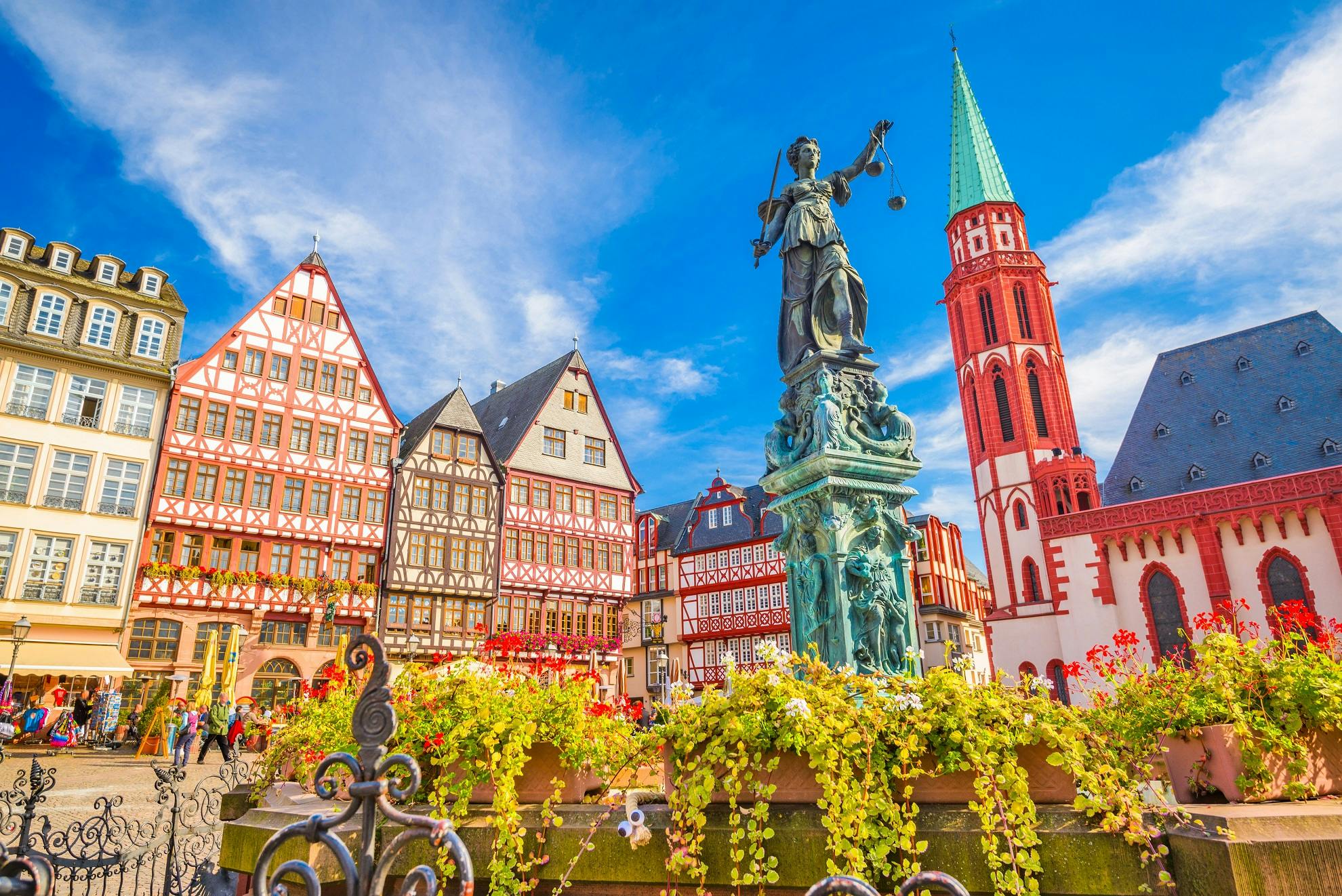
法兰克福的历史可以上溯到公元前后,那时莱茵河和多瑙河是罗马帝国的北方边界,但两河并不相连,其间无险可守,因此罗马人修筑了连接两河的长城。这座长城连绵数百里,从法兰克福附近经过。于是人们在这里设置了驻军营地,这一带成为边境要塞。随着罗马帝国的崩溃,这时军营圯毁,日渐荒芜,几乎被人遗忘,直到8世纪才再度兴起。传说,一天拂晓,漫天大雾,查理大帝打了败仗,逃到美因河边,找不到向导,无法渡河。危急之中看见一只母鹿,朝水边走来,他注意看那鹿,果然,这只鹿涉水过河了,大军也随之过河,转危为安。为了纪念这件事,查理大帝下令在当地建筑一座城市,取名法兰克福,意思是法兰克人(日耳曼民族中的一支)的渡口。公元794年法兰克福作为查理大帝的行都首次载入史册。此后法兰克福一直是德意志的重要政治舞台,目睹了多少大事件大庆典。神圣罗马帝国时期,皇帝由势力雄厚的诸侯即选帝侯选举。1152年,选帝侯们首次在法兰克福聚会,选聘书巴巴罗萨即红胡子一世为帝。 1356年卡尔四世颁布金牛诏书,正式规定,选皇帝在法兰克福举行。从1562年起,法兰克福又取代亚琛,成为皇帝加冕大曲举行地,前后有10位皇帝在这里加冕,登上皇帝宝座。神圣罗马帝国于1806年正式告终,从1816年到1866年,法兰克福又成为德意志邦联议会所在地。1848年在席卷欧洲大陆的革命风暴中,德意志各邦组成德意志国民议会,在法兰克福举行会议讨论德意志的统一问题,是为德国统一前奏。1866年法兰克福并入普鲁士,结束了从 1372年以来的帝国自由市的自治地位。法兰克福一直是一个繁荣的商业城市,德国统一后,这里工业迅速发展,化学工业尤为突出。德国三大化学工业公司之一的赫希斯特(Hoechst AG)公司就是在法兰克福起家的。1914年法兰克福又创办了约翰。沃尔夫冈·歌德大学(现已发展到3.7万多学生)。第二次世界大战中,33次大轰炸摧毁了法兰克福80%的建筑,留下1700万吨垃圾。千年古城,变为一片废墟。战后法兰克福迅速重建,发展惊人,令人咋舌,今天除化学、电子、机械工业外,第三产业如交通、金融、博览事业更是蓬勃发展,市区一改旧观,高楼林立,法兰克福一跃成为国际知名的大都市。 (Quelle:http://www.youer.com/)
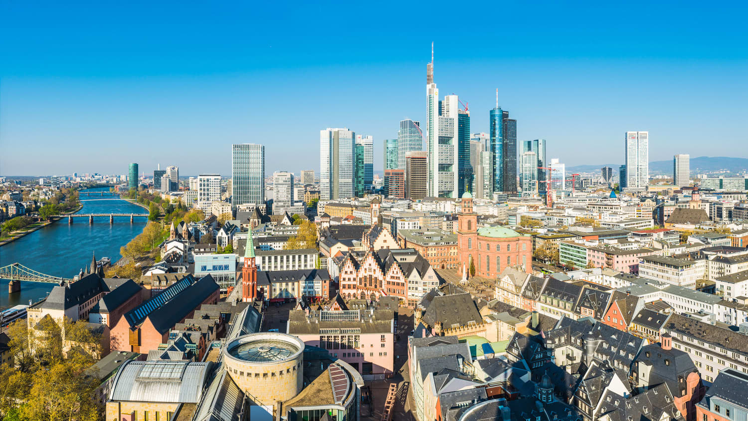
法兰克福(德语:Frankfurt),正式全名为美因河畔法兰克福[1](Frankfurt am Main),是德国中西部黑森州的第一大城市,也是德国第五大城。城区拥有73万2688人[2],如合并周边城镇计算则约有230万人。整个法兰克福-莱茵河-美茵河都会区约有五百万人口,为仅次于莱茵-鲁尔的德国第二大都会区。法兰克福是一个民族文化多元化的城市,一半以上的人口有着移民背景,而四分之一的人口为外国公民。
自中世纪起,法兰克福即为德国的中心城市。公元794年时,法兰克福被授予帝国自由城市的地位。1815年,法兰克福自由市成为德意志州联的政治中心。在1848年革命时期,法兰克福国民议会在圣保罗教堂召开。在普奥战争中,与奥地利结盟的法兰克福被普鲁士王国所吞并后,在1866年正式失去城邦的主权。1875年时,法兰克福居民突破十万人,1928年时则已超过50万人。如今作为阿尔法级别的全球城市,法兰克福是许多欧洲及跨国大型企业的总部所在地。另外德国联邦银行、欧洲中央银行、法兰克福证券交易所及多家大型商业银行总部也设立在此,它是欧盟的经济中心。法兰克福掌握了全德国乃至全欧洲的钜大财富,遂有“美茵河畔曼哈顿”之戏称("Main"hattan 或 Manhattan am Main)[3]。
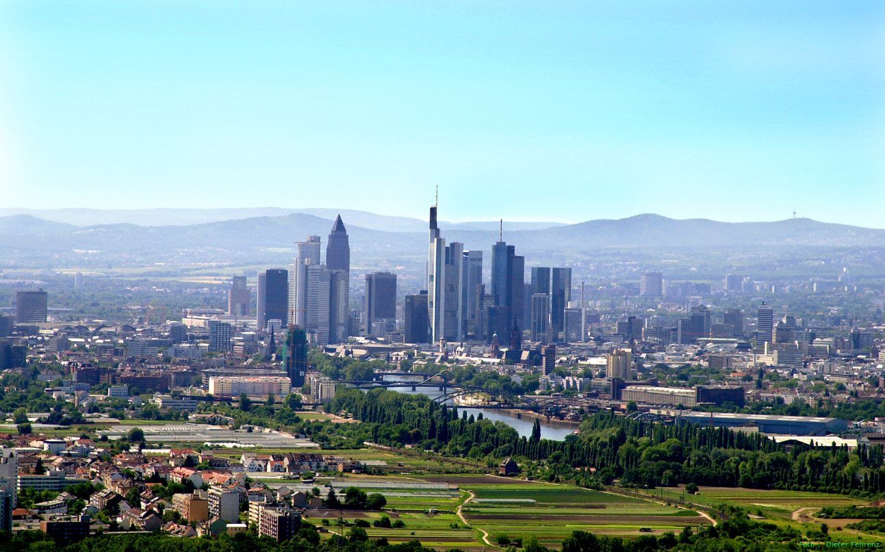
因其地理位置,法兰克福也是重要的交通枢纽。法兰克福高速立交桥是欧洲最为繁忙的陆路枢纽;火车总站为德国流量第二大的火车站,莱茵-美茵国际机场为德国规模最大的商用民航机场,也是欧洲重要的航空中转站。
法兰克福是歌德的诞生地,这位德国最受景仰的人文思想家,他的名字与德意志文化的传承及传播紧紧相连。法兰克福大学即以歌德为大学命名,德国政府也在世界各地成立“歌德学院”致力于德语教学。歌德在德语文化世界具备国粹瑰宝的地位,让这座城市始终散发着与有荣焉的光彩。
Frankfurt am Main ist mit etwa 736.000 Einwohnern die größte Stadt Hessens und die fünftgrößte Deutschlands. Sie ist kreisfrei und bildet das Zentrum des Ballungsraums Frankfurt mit etwa 2,5 Millionen[2] Einwohnern (mit Offenbach, Hanau und dem Vortaunus). In der gesamten Metropolregion Rhein-Main leben etwa 5,5 Millionen Menschen.
Seit dem Mittelalter gehört Frankfurt am Main zu den bedeutenden städtischen Zentren Deutschlands. Im Jahr 794 erstmals urkundlich erwähnt, war es seit 1372 Freie Reichsstadt und bis 1806 Wahl-, seit 1562 auch Krönungsstadt der römisch-deutschen Kaiser. Der Krönungsweg führte vom Römerberg über den Markt zum Kaiserdom. Von 1815 an war Frankfurt am Main Freie Stadt. Hier tagten die Bundesversammlung des Deutschen Bundes und 1848/49 in der Paulskirche mit der Nationalversammlung das erste deutsche Parlament. Nach dem Deutschen Krieg wurde der zuvor fast 500 Jahre unabhängige Stadtstaat Frankfurt 1866 Bestandteil von Preußen. Durch die rasche Industrialisierung setzte ein Bevölkerungsschub ein. Seit 1875 zählte die Stadt über 100.000 Einwohner, seit 1928 mehr als 500.000, im Jahr 2013 erstmals über 700.000. Als Zeichen der Verpflichtung zur europäischen Einigung nennt sich Frankfurt seit 1998 Europastadt.[3]
Heute ist Frankfurt einer der wichtigsten internationalen Finanzplätze, bedeutendes Industrie-, Dienstleistungs- und Messezentrum und zählt zu den Weltstädten.[4] Frankfurt am Main ist Sitz der Europäischen Zentralbank, der Deutschen Bundesbank, der Frankfurter Wertpapierbörse, zahlreicher Finanzinstitute (darunter Deutsche Bank, Commerzbank, DZ Bank, KfW), der Aufsichtsbehörden BaFin und EIOPA und der Messe Frankfurt. Die Internationale Automobil-Ausstellung, die Frankfurter Buchmesse und die Musikmesse gelten als Weltleitmessen ihrer Sparten. Die Stadt ist zudem Sitz der Sportverbände Deutscher Olympischer Sportbund, Deutscher Fußball-Bund und Deutscher Motor Sport Bund.
Dank seiner zentralen Lage ist Frankfurt am Main ein europäischer Verkehrsknotenpunkt. Der Flughafen gehört zu den größten der Welt, der Hauptbahnhof ist ein zentraler Bahnknotenpunkt und das Frankfurter Kreuz der meistbefahrene Straßenknotenpunkt Deutschlands. Darüber hinaus ist der DE-CIX in Frankfurt, gemessen am Durchsatz, der weltweit größte Internet-Knoten.
Eine Besonderheit für eine europäische Stadt ist die stetig wachsende Hochhaus-Skyline Frankfurts. Wegen der Ballung von Hochhäusern, die zu den höchsten Europas gehören, wird Frankfurt am Main mitunter als Mainhattan bezeichnet. Historische Wahrzeichen der Stadt sind das rekonstruierte Ensemble der Altstadt mit Römerberg samt Rathaus Römer, Dom-Römer-Areal und der Kaiserdom. Mehr als 40 Prozent des Stadtgebiets sind Parks und Landschaftsschutzgebiete, darunter der Frankfurter Grüngürtel mit dem seit 1372 im Besitz der Stadt befindlichen Frankfurter Stadtwald.
Das kulturelle Leben der Stadt ist wesentlich von bürgerlichen Stiftungen, Mäzenatentum und liberalen Privateninitiativen geprägt. Dazu gehören die Städtischen Bühnen mit den beiden Sparten Oper Frankfurt und Schauspiel Frankfurt, das Frankfurter Museumsufer, das Senckenberg Naturmuseum, die Schirn Kunsthalle und das Museum für Moderne Kunst, das Historische Museum und Goethes Geburtshaus in der Altstadt, die Alte Oper, das English Theatre, der Zoo und der Palmengarten. Die 1914 durch eine Bürgerstiftung als Königliche Universität gegründete Goethe-Universität ist die viertgrößte deutsche Hochschule nach Anzahl der Studenten. Sie brachte mehrere Leibniz- und Nobelpreisträger hervor. Darüber hinaus gibt es in der Stadt sieben weitere staatliche, kirchliche und private Hochschulen mit zusammen über 60.000 Studenten.
フランクフルト・アム・マイン (Frankfurt am Main) は、ドイツ連邦共和国ヘッセン州に属す郡独立市である。一般にフランクフルトと通称される。人口 72万人を超えるヘッセン州最大の都市(2016年現在)であり[2]、ドイツ全体でもベルリン、ハンブルク、ミュンヘン、ケルンに次ぐ第5の都市である。
中世以来、フランクフルトはドイツの中心都市の一つであった。794年には初めて文献に記録され、中世盛期の帝国自由都市であった。13世紀のライン都市同盟に参加している。
1806年まで神聖ローマ皇帝の選挙が行われる諸侯会議が開催された地であり、1562年以降は皇帝の戴冠式もこの都市で挙行された。1816年からドイツ連邦の議会がフランクフルト自由都市で開催され、1848年から49年にかけてはフランクフルト国民議会が開催された。1866年の普墺戦争により都市国家としての独立を喪失し、プロイセンに併合された。フランクフルトの人口は、1875年に10万人、1928年には50万人を超えた。
現在のフランクフルトは国際金融の中心地であり、工業や産業の中心でもある。経済的側面から世界都市の一つに数えられており[3]、欧州中央銀行、ドイツ連邦銀行、フランクフルト証券取引所、ドイツ銀行、コメルツ銀行、ドイツ復興金融公庫、DZ銀行、ヘッセン=テューリンゲン州立銀行(ヘラバ)の本社がある。ここに挙げきれない金融機関も多数存在する。
工業・産業・交通の要衝でもある。メッセ・フランクフルトは、世界最大の見本市会場の一つである。フランクフルト空港は世界最大級のハブ空港であり、鉄道についてもヨーロッパ最大級のターミナル駅であるフランクフルト中央駅がある。また、道路においてもフランクフルト・ジャンクションはドイツで最も自動車交通量が多いジャンクションの1つである[4]。フランクフルトの DE-CIX は、データ転送量において世界最大のインターネット中継点である。
Frankfurt, officially the City of Frankfurt am Main (German: [ˈfʁaŋkfʊɐ̯t ʔam ˈmaɪn] (![]() listen); lit. "Frankfurt on the Main"), is a metropolis and the largest city in the German state of Hesse and the fifth-largest city in Germany. Frankfurt was a city state, the Free City of Frankfurt, for nearly five centuries, and was one of the most important cities of the Holy Roman Empire; it lost its sovereignty in 1866.
listen); lit. "Frankfurt on the Main"), is a metropolis and the largest city in the German state of Hesse and the fifth-largest city in Germany. Frankfurt was a city state, the Free City of Frankfurt, for nearly five centuries, and was one of the most important cities of the Holy Roman Empire; it lost its sovereignty in 1866.
In 2015, Frankfurt had a population of 732,688 within its administrative boundaries,[4] and 2.3 million in its urban area.[2][5] The city is at the centre of the larger Frankfurt Rhine-Main Metropolitan Region, which has a population of 5.5 million[1] and is Germany's second-largest metropolitan region after Rhine-Ruhr. Since the enlargement of the European Union in 2013, the geographic centre of the EU is about 40 km (25 mi) to the east of Frankfurt's central business district, the Bankenviertel. Frankfurt is culturally and ethnically diverse, with around half of the population, and a majority of young people, having a migration background. A quarter of the population are foreign nationals, including many expatriates.
Frankfurt is an alpha world city and a global hub for commerce, culture, education, tourism and transportation. It is the site of many global and European corporate headquarters. Frankfurt Airport is among the world's busiest. Frankfurt is the major financial centre of the European continent, with the headquarters of the European Central Bank, German Federal Bank, Frankfurt Stock Exchange, Deutsche Bank, DZ Bank, KfW, Commerzbank, several cloud and fintech startups[6] and other institutes. Automotive, technology and research, services, consulting, media and creative industries complement the economic base. Frankfurt's DE-CIX is the world's largest internet exchange point. Messe Frankfurt is one of the world's largest trade fairs. Major fairs include the Frankfurt Motor Show, the world's largest motor show, the Music Fair, and the Frankfurt Book Fair, the world's largest book fair.
Frankfurt is home to influential educational institutions, including the Goethe University, the UAS, the FUMPA, and graduate schools like the Frankfurt School of Finance & Management. Its renowned cultural venues include the concert hall Alte Oper, Europe's largest English Theatre and many museums (e.g. the Museumsufer ensemble with Städel and Liebieghaus, Senckenberg Natural Museum, Goethe House), the Schirn art venue at the old town. Frankfurt's skyline is shaped by some of Europe's tallest skyscrapers. The city is also characterised by various green areas and parks, including the central Wallanlagen, the City Forest and two major botanical gardens, the Palmengarten and the University's Botanical Garden. In electronic music, Frankfurt has been a pioneering city since the 1980s, with renowned DJs including Sven Väth, Marc Trauner, Scot Project, Kai Tracid, and the clubs Dorian Gray, U60311, Omen and Cocoon. In sports, the city is known as the home of the top tier football club Eintracht Frankfurt, the basketball club Frankfurt Skyliners, the Frankfurt Marathon and the venue of Ironman Germany.
Francfort-sur-le-Main (Frankfurt am Main en allemand), est une ville d’Allemagne, généralement appelée simplement Francfort malgré le risque de confusion avec la ville de Francfort-sur-l'Oder. Située sur le Main, la ville est, avec ses 731 095 habitants1 (les Francfortois), la cinquième ville d'Allemagne par sa population et la plus grande du Land de Hesse. Son aire urbaine compte 2 517 561 habitants2, dont un tiers ne possède pas la nationalité allemande.
Francfort est la quatrième place financière d'Europe ainsi que la ville la plus riche d'Allemagne avec un PIB par habitant de 85 300 euros. Elle est notamment le siège de la Banque centrale européenne (BCE), de la Banque fédérale allemande (Deutsche Bundesbank) et de la bourse de Francfort. Francfort est également un carrefour majeur européen. Son aéroport international est le troisième d'Europe après l'aéroport Paris-Charles-de-Gaulle et l'aéroport international de Londres Heathrow. La ville se caractérise par un nombre important de gratte-ciel. La ville est parfois surnommée Mainhattan en référence au cours d'eau qui la traverse et au quartier de Manhattan à New York. Son bâtiment le plus élevé est la Commerzbank Tower, siège social du groupe bancaire Commerzbank, culminant hors antenne à 259 mètres, et construit par Norman Foster.
Francfort est considérée à ce titre comme une ville mondiale de premier plan grâce à sa puissance économique, ses infrastructures et sa richesse culturelleNote 1. The Economist classe Francfort première de son classement des 140 villes les plus chères en Allemagne pour un expatrié en 2012 et dixième au monde3. Enfin, la qualité de vie à Francfort est l'une des plus agréables au monde selon le classement Mercer4.
Francoforte sul Meno (in tedesco Frankfurt am Main) è una città extracircondariale della Germania sud-occidentale, la quinta tedesca per numero di abitanti dopo Berlino, Amburgo, Monaco e Colonia. La città di 732 688 abitanti (2,2 milioni nell'area urbana) è al centro di una vasta area metropolitana di 14 800 km² denominata Rhein-Main, con una popolazione che supera i 5,5 milioni di abitanti.
Situata sul fiume Meno, Francoforte è il centro finanziario della Germania e uno dei principali in Europa. Qui hanno sede la Banca centrale europea, la Banca Federale Tedesca e la Borsa di Francoforte (terza al mondo per volume di scambi azionari).
L'aeroporto di Francoforte sul Meno è uno degli scali più trafficati del mondo, la stazione centrale della città è uno dei terminal più grandi in Europa, con oltre 130 milioni di passeggeri annui, e l'interscambio dell'autobahn A3-A5, che si trova nell'area urbana della città, è il più utilizzato del continente.
Francoforte è anche soprannominata "Bankfurt", "Mainhattan" (gioco di parole tra Main, il fiume Meno, e Manhattan, cuore finanziario di New York) o "Big Äppel" (altro riferimento a New York, dove l'Äppelwoi è un tipico prodotto locale).
Fráncfort del Meno2 (![]() /ˈfʁaŋkfʊɐ̯t am ˈmaɪ̯n/ (?·i) en alemán, Frankfurt am Main), comúnmente llamada Fráncfort,nota 1 es la ciudad más poblada del estado federado de Hesse, Alemania. Con 732 688 habitantes es también la quinta ciudad más grande del país (tras Berlín, Hamburgo, Múnich y Colonia). De acuerdo con Eurostat, la aglomeración urbana de la que Fráncfort forma parte, cuenta con 2 500 000 de habitantes.3Aunque la capital administrativa de Hesse es Wiesbaden, Fráncfort tiene una importancia económica mayor.
/ˈfʁaŋkfʊɐ̯t am ˈmaɪ̯n/ (?·i) en alemán, Frankfurt am Main), comúnmente llamada Fráncfort,nota 1 es la ciudad más poblada del estado federado de Hesse, Alemania. Con 732 688 habitantes es también la quinta ciudad más grande del país (tras Berlín, Hamburgo, Múnich y Colonia). De acuerdo con Eurostat, la aglomeración urbana de la que Fráncfort forma parte, cuenta con 2 500 000 de habitantes.3Aunque la capital administrativa de Hesse es Wiesbaden, Fráncfort tiene una importancia económica mayor.
Desde la Edad Media Fráncfort se encuentra entre los centros urbanos más importantes de Alemania. Su nombre aparece por primera vez mencionado en el año 794. Desde la Alta Edad Media fue Ciudad Imperial Libre, hasta 1806 era la ciudad en que se elegía al emperador y desde 1562 también la ciudad en que se coronaba al emperador alemán del Sacro Imperio Romano Germánico. Entre 1816 y 1866 fue sede de la Confederación Germánica y en 1848/49, del primer parlamento alemán libremente elegido.
En la época actual Fráncfort es un centro económico y financiero importante en Europa (en ocasiones se le denomina inoficialmente «capital económica y financiera de la Unión Europea».4 La ciudad aloja al Banco Central Europeo (BCE), al Deutsche Bundesbank, a la Bolsa de Fráncfort y a la Messe Frankfurt, esta última, sede de importantes exposiciones, ferias y salones internacionales, entre otras, el Salón del Automóvil de Fráncfort, el más grande de su género, o el de la Feria del libro, la más importante del mundo.
Debido a su ubicación céntrica, Fráncfort es un nudo de transporte muy relevante en Europa. Dan cuenta de ello las instalaciones del Aeropuerto de Fráncfort, la Estación Central de Fráncfort del Meno y el nudo de autopistas más denso del mundo.5 La ciudad alcanzó por primera vez los 100 000 habitantes en 1875, en 1928 llegó a sumar por primera vez 500 000. En las regiones más cercanas a Fráncfort viven actualmente cerca de 1 800 000 habitantes, en toda la región del Rin-Meno 5 800 000.
Una particularidad de Fráncfort entre las ciudades alemanas es la concentración de edificios de altura en el centro, que dibujan un perfil característico, conocido localmente como la Frankfurter Skyline. Debido a estos rascacielos, que se cuentan entre los edificios más altos de Europa, se ha ganado el apodo de Mainhattan. Entre los edificios históricos que constituyen los símbolos de la ciudad se cuenta el casco antiguo reconstruido en el Römerberg y que incluye el Römer (edificio que aloja al Ayuntamiento de la ciudad) y la Catedral Imperial de San Bartolomé. Más del 40 % del área de la ciudad está cubierta por parques y áreas verdes protegidas, entre ellas, el «cinturón verde de Fráncfort» que incluye un bosque emplazado en terrenos que desde 1372 pertenecen a la ciudad.
Las instituciones ciudadanas e infraestructura tradicional que frecuentemente tuvieron su origen en fundaciones e iniciativas privadas desempeñan un papel significativo en la vida cultural de la ciudad. Se incluyen aquí las salas de espectáculos de la ciudad (Städtischen Bühnen, que alberga dos instituciones: la Ópera de Fráncfort y el Teatro de Fráncfort), la orilla de los museos (Museumsufer), el Museo Senckenberg de Historia Natural, la Schirn Kunsthalle y el Museum für Moderne Kunst (museo de arte contemporáneo), el Historisches Museum Frankfurt (museo histórico de Fráncfort), la casa natal de Goethe (Goethe-Haus, el teatro inglés (The English Theatre Frankfurt), el zoológico de Fráncfort y el jardín botánico (Palmengarten). La Universidad Johann Wolfgang Goethe fue fundada en 1914 y es, según el número de estudiantes, la cuarta más grande de Alemania. Varios galardonados con los Nobel y Leibniz se formaron en sus aulas. Además hay otras siete universidades e instituciones de educación superior en Fráncfort que en conjunto suman una matrícula de 60 000 estudiantes.
Фра́нкфурт-на-Ма́йне (нем. Frankfurt am Main [ˈfʁaŋkfʊɐ̯t ʔam ˈmaɪn] ), часто называемый просто Франкфурт — крупнейший город земли Гессен и пятый по величине в Германии с населением в 732 тыс. человек (по состоянию на 2015 год).
Город является центром крупного региона-метрополии Рейн — Майн (нем. Rhein-Main-Gebiet) с населением в 5,6 млн человек[4], второго по величине региона Германии. Город расположен на древней переправе (нем. «furt») на реке Майн и находится на территории Франконии, земли, населённой франками. Отсюда и происходит название города — «переправа франков»[5].
Франкфурт считается мировым «альфа-городом»[6] и является центром коммерции, культуры, образования, туризма и транспортным узлом[7]. Здесь находятся Европейский центральный банк, Федеральный банк Германии, Франкфуртская биржа и Франкфуртская ярмарка. Франкфуртский аэропорт (нем. Flughafen Frankfurt am Main/Rhein-Main-Flughafen) — один из наиболее загруженных международных аэропортов, а Центральный вокзал (нем. Frankfurt Hauptbahnhof) и Франкфуртская автомобильная развязка (нем. Frankfurter Kreuz) — одна из наиболее загруженных транспортных магистралей континентальной Европы. Франкфурт — единственный из городов Германии, вошедший в «двадцатку альфа-городов мира»[8]. Во Франкфурте располагалась штаб-квартира американской армии в Германии, а сам город после окончания Второй мировой войны находился в американской зоне оккупации (нем. Besatzungszone).
Согласно исследованию компании Mercer Human Resource Consulting, Франкфурт является вторым городом Германии и сорок восьмым в мире по уровню стоимости жизни[9][10][11].
В 2011 году Франкфурт-на-Майне был признан «криминальной столицей» Германии[12]. Однако надо учитывать, что в статистику включена контрабанда, которую выявляют во Франкфуртском аэропорту.
В Германии существует два города с названием Франкфурт: Франкфурт-на-Майне (земля Гессен) и Франкфурт-на-Одере (земля Бранденбург). В Германии в повседневной речи «по умолчанию» под именем Франкфурт понимают Франкфурт-на-Майне.
 Sport
Sport
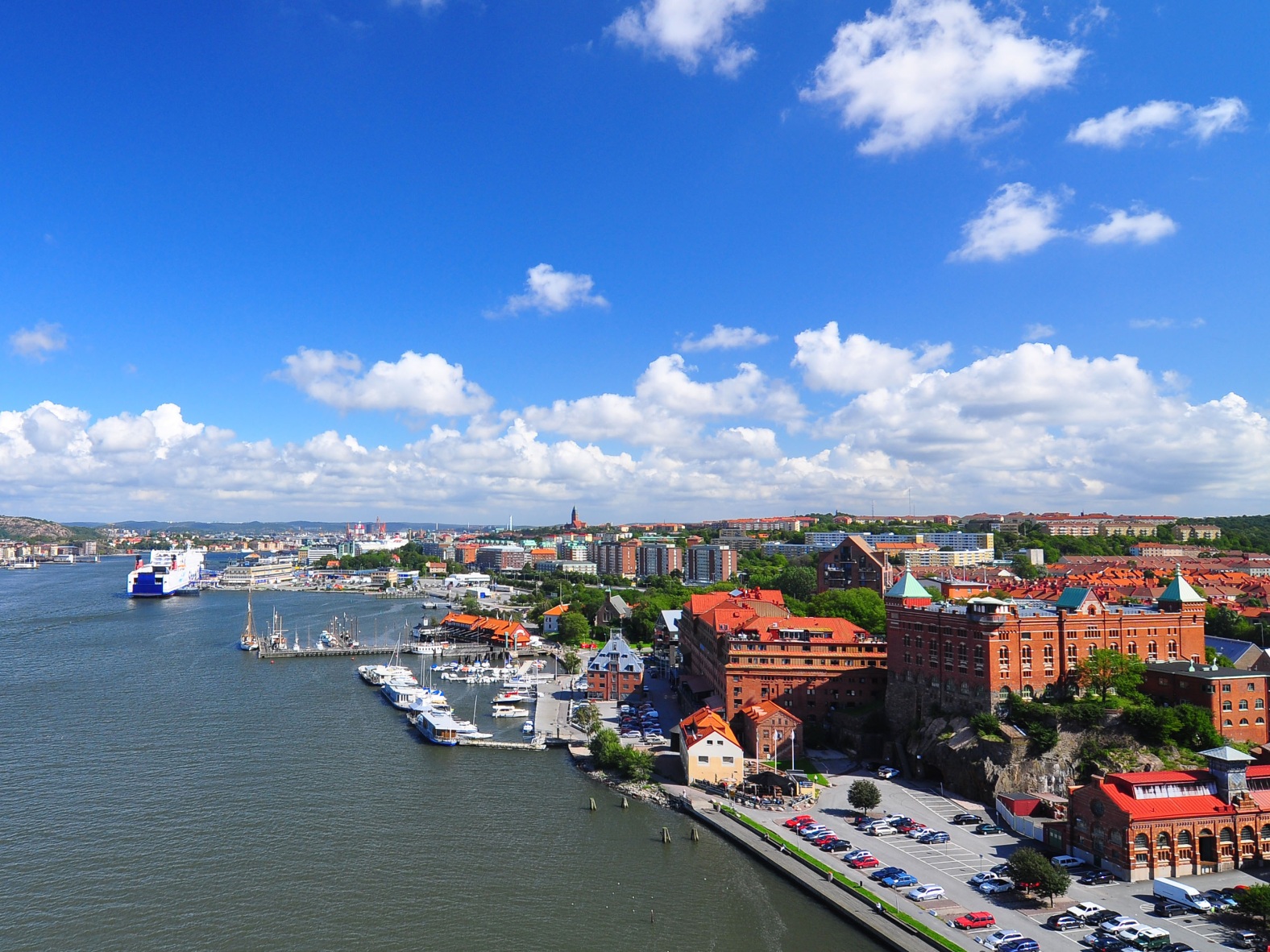
哥德堡(瑞典语:Göteborg, 发音:[jœtɛˈbɔrj] ![]() 聆听)是瑞典的第二大城市,仅次于首都斯德哥尔摩。哥德堡近邻挪威,也是瑞典经济最发达的城市之一。哥德堡是瑞典享誉全球的汽车制造厂沃尔沃汽车之创厂地,而瑞典超级足球联赛中的哥登堡足球会则是一支以哥德堡为主场的球队。同时它也拥有在斯堪的纳维亚地区最多学生的哥德堡大学(Göteborgs universitet)。
聆听)是瑞典的第二大城市,仅次于首都斯德哥尔摩。哥德堡近邻挪威,也是瑞典经济最发达的城市之一。哥德堡是瑞典享誉全球的汽车制造厂沃尔沃汽车之创厂地,而瑞典超级足球联赛中的哥登堡足球会则是一支以哥德堡为主场的球队。同时它也拥有在斯堪的纳维亚地区最多学生的哥德堡大学(Göteborgs universitet)。
约塔河在哥德堡流入卡特加特海湾,将城市分成了两个部分。约塔河的入海口很适合作为港口,因此哥德堡也是北欧国家里最大的港口城市之一。
(schwedisch [ˌʝøtəˈbɔrj]; deutsch veraltet Gotenburg oder Gothenburg; lateinisch Gothoburgum, englisch Gothenburg, dänisch Gøteborg) ist eine Großstadt in den schwedischen Provinzen Västra Götalands län, deren Residenzstadt sie ist, und Hallands län sowie den historischen Provinzen Västergötland, Bohuslän und Halland.
Göteborg ist nach Stockholm und vor Malmö die zweitgrößte Stadt Schwedens; denselben Rang nimmt auch die Storgöteborg („Groß-Göteborg“) genannte, 13 Gemeinden umfassende Metropolregion mit 993.453 Einwohnern (Stand 30. September 2016) ein.[2] Die Stadt gliedert sich in zehn Stadtbezirke.
Gothenburg (/ˈɡɒθənbɜːrɡ/ (![]() listen);[5] abbreviated Gbg;[6][7] Swedish: Göteborg [jœtɛˈbɔrj] (
listen);[5] abbreviated Gbg;[6][7] Swedish: Göteborg [jœtɛˈbɔrj] (![]() listen)) is the second-largest city in Sweden and the fifth-largest in the Nordic countries, and part of Västra Götaland County. It is situated by Kattegat, on the west coast of Sweden, and has a population of approximately 570,000 in the city center and about 1 million inhabitants in the metropolitan area.[1]
listen)) is the second-largest city in Sweden and the fifth-largest in the Nordic countries, and part of Västra Götaland County. It is situated by Kattegat, on the west coast of Sweden, and has a population of approximately 570,000 in the city center and about 1 million inhabitants in the metropolitan area.[1]
Gothenburg was founded as a heavily fortified, primarily Dutch, trading colony, by royal charter in 1621 by King Gustavus Adolphus. In addition to the generous privileges (e.g. tax relaxation) given to his Dutch allies from the then-ongoing Thirty Years' War, the king also attracted significant numbers of his German and Scottish allies to populate his only town on the western coast. At a key strategic location at the mouth of the Göta älv, where Scandinavia's largest drainage basin enters the sea, the Port of Gothenburg is now the largest port in the Nordic countries.[8]
Gothenburg is home to many students, as the city includes the University of Gothenburg and Chalmers University of Technology. Volvo was founded in Gothenburg in 1927.[9] The original parent Volvo Group and the now separate Volvo Car Corporation are still headquartered on the island of Hisingen in the city. Other key companies are SKF and Astra Zeneca.
Gothenburg is served by Göteborg Landvetter Airport 30 km (19 mi) southeast of the city center. The smaller Göteborg City Airport, 15 km (9.3 mi) from the city center, was closed to regular airline traffic in 2015.
The city hosts some of the largest annual events in Scandinavia. The Gothenburg Film Festival, held in January since 1979, is the leading Scandinavian film festival with over 155,000 visitors each year.[10] In summer, a wide variety of music festivals are held in the city, such as Way Out West and Metaltown.
Göteborg (en suédois /ˌʝøːtəˈbɔrʲ/ Écouter mais aussi utilisé en français), ou Gothembourg (nom français mais peu usité), est la cinquième ville des pays nordiques et la plus grande qui ne soit pas une capitale. Göteborg est la deuxième localité de la Suède par l'importance de son poids démographique ainsi que par son industrie et ses activités économiques. La ville est située à mi-chemin entre Oslo et Copenhague, sur le fleuve Göta älv à quelques kilomètres de son embouchure dans le Cattégat, dégagé des glaces pendant l'hiver.
La commune de Göteborg (en suédois Göteborgs kommun) compte, en 2010, 522 259 habitants (appelés les Gothembourgeois). L’agglomération, qui couvre également des communes immédiatement environnantes, compte 549 839 habitants et l’aire urbaine appelée Stor-Göteborg (Grand Göteborg), élargie à encore d’autres communes, comprend 905 729 habitants. Göteborg est le chef-lieu du comté de Västra Götaland (Västra Götalands län), siège d'une cour d'appel, d'une université, d'une école polytechnique et d'un évêché. C'est aussi un centre culturel important (musée des beaux-arts, opéra, orchestre symphonique) et le principal port de Scandinavie.
Göteborg (pronuncia svedese [jœtəˈbɔrj][2] ), in italiano Gotemburgo[3], è una città della Svezia meridionale, situata nella contea di Västra Götaland e collocata nella provincia storica del Västergötland, sebbene alcuni sobborghi cittadini si estendano nella provincia di Bohuslän. Fu fondata nel 1621 dal re Gustavo II Adolfo.
Göteborg ha circa mezzo milione di abitanti, è la seconda città più popolosa della Svezia dopo Stoccolma e la quinta del Nord Europa. Se si considera l'intera area metropolitana, gli abitanti diventano più di 940.000.
Gotemburgo1 (en sueco, Göteborg ![]() [jœteˈbɔrj] (?·i)) es la segunda ciudad en importancia y tamaño de Suecia, después de la capital, Estocolmo. Ubicada en la provincia de Västra Götaland en la costa oeste del país, en la desembocadura del río Göta älv en el estrecho de Kattegat. Es la sede administrativa y arzobispal de la provincia.
[jœteˈbɔrj] (?·i)) es la segunda ciudad en importancia y tamaño de Suecia, después de la capital, Estocolmo. Ubicada en la provincia de Västra Götaland en la costa oeste del país, en la desembocadura del río Göta älv en el estrecho de Kattegat. Es la sede administrativa y arzobispal de la provincia.
Su puerto es el más grande entre los países nórdicos ya que tiene sus aguas descongeladas durante todo el año. Es el lugar de tránsito de la mayor parte de las exportaciones e importaciones de Suecia.
Grandes industrias como SKF y AB Volvo tienen sus oficinas principales en esta ciudad. Sede de dos establecimientos universitarios, tiene la población universitaria más numerosa de Escandinavia. En las últimas décadas se ha desarrollado el turismo y los eventos culturales.
Fue fundada y fortificada en 1621 por el rey Gustavo II Adolfo, después de varios intentos fallidos de fundación debido a los ataques de daneses y noruegos.
Гётеборг, Йётеборг[2] (швед. Göteborg, (Göteborg , /jœte'bɔrj/)) — город на юго-западе Швеции в лене Вестра-Гёталанд. Является вторым по величине городом Швеции после Стокгольма. Площадь города примерно — 450 км².
Расположен на берегу пролива Каттегат в устье реки Гёта-Эльв[3].
 Europäische Union
Geschichte der Europäischen Union
Europäische Union
*Gründerstaaten
Eurovision Song Contest,ESC
Finanz
***Globales Finanzzentrum/Global Financial Center
Geographie
Geographie
***IWF Entwickelte Länder
Geschichte
M 1500 - 2000 nach Christus
Geschichte
N 2000 - 2100 nach Christus
Europäische Union
Geschichte der Europäischen Union
Europäische Union
*Gründerstaaten
Eurovision Song Contest,ESC
Finanz
***Globales Finanzzentrum/Global Financial Center
Geographie
Geographie
***IWF Entwickelte Länder
Geschichte
M 1500 - 2000 nach Christus
Geschichte
N 2000 - 2100 nach Christus
 Internationale Städte
*Kulturhauptstadt Europas
Internationale Städte
Europäische Stadt
IWF entwickelte Länder
IWF entwickelte Länder
TOP6
Luxemburg
Internationale Städte
*Kulturhauptstadt Europas
Internationale Städte
Europäische Stadt
IWF entwickelte Länder
IWF entwickelte Länder
TOP6
Luxemburg
 Mitglieder der NATO
 Staaten Europas

卢森堡是一个高度发达的资本主义国家,也是欧盟和北约创始成员国之一,拥有欧盟多个下设机构,如欧洲法院、欧洲审计院以及欧洲投资银行,被称为继布鲁塞尔和斯特拉斯堡之后的欧盟“第三首都”。同时是高度发达的工业国家,还是欧元区内最重要的私人银行中心,及全球第二大仅次于美国的投资信托中心。金融、广播电视、钢铁是其三大经济支柱产业,该国失业率极低,人均寿命80岁。
卢森堡大公国(卢森堡语:Groussherzogtum Lëtzebuerg[注 1];法语:Grand-Duché de Luxembourg; 德语:Großherzogtum Luxemburg[注 2]),通称卢森堡(卢森堡语:Lëtzebuerg;法语:Luxembourg;德语:Luxemburg),被邻国法国、德国和比利时包围,是一个位于欧洲的内陆国家,也是现今欧洲大陆仅存的大公国,首都卢森堡市。卢森堡是欧盟成员国,因境内有欧洲法院、欧洲审计院、欧洲投资银行等多个欧盟机构被称为继布鲁塞尔和斯特拉斯堡之后的欧盟“第三首都”。
Das Großherzogtum Luxemburg (luxemburgisch Groussherzogtum Lëtzebuerg [ˈgʀəʊsˌhɛχtsoːktuːm ˈlətsəbuəɕ], französisch Grand-Duché de Luxembourg [ɡʁɑ̃ dyʃe də lyksɑ̃buʁ]) ist ein demokratischer Staat in Form einer parlamentarischen Monarchie[1] im Westen Mitteleuropas. Es ist das letzte Großherzog- bzw. Großfürstentum (von einst zwölf) in Europa. Das Land gehört zum mitteldeutschen Sprachraum. Landessprache ist Luxemburgisch, Verwaltungs- und Amtssprachen sind Französisch, Deutsch und Luxemburgisch. Gemeinsam mit seinem Nachbarn Belgien und mit den Niederlanden bildet Luxemburg die Beneluxstaaten.
ルクセンブルク大公国(ルクセンブルクたいこうこく)、通称ルクセンブルクは、西ヨーロッパに位置する立憲君主制国家。首都は国名と同名のルクセンブルク市。隣接国は、南のフランス、西と北のベルギー、東のドイツである。ベルギー、オランダと併せてベネルクスと呼ばれる。
Luxembourg (/ˈlʌksəmbɜːrɡ/ (![]() listen)) (Luxembourgish: Lëtzebuerg [ˈlətsəbuə̯ɕ] (
listen)) (Luxembourgish: Lëtzebuerg [ˈlətsəbuə̯ɕ] (![]() listen); French: Luxembourg ; German: Luxemburg), officially the Grand Duchy of Luxembourg,[note 2] is a small landlocked country in western Europe. It is bordered by Belgium to the west and north, Germany to the east, and France to the south. Its capital, Luxembourg City, together with Brussels and Strasbourg, is one of the three official capitals of the European Union[6] and the seat of the European Court of Justice, the highest judicial authority in the EU. Its culture, people, and languages are highly intertwined with its neighbours, making it essentially a mixture of French and German cultures, as evident by the nation's three official languages: French, German, and the national language, Luxembourgish (sometimes considered a dialect of German). The repeated invasions by Germany, especially in World War II, resulted in the country's strong will for mediation between France and Germany and, among other things, led to the foundation of the European Union.[7]
listen); French: Luxembourg ; German: Luxemburg), officially the Grand Duchy of Luxembourg,[note 2] is a small landlocked country in western Europe. It is bordered by Belgium to the west and north, Germany to the east, and France to the south. Its capital, Luxembourg City, together with Brussels and Strasbourg, is one of the three official capitals of the European Union[6] and the seat of the European Court of Justice, the highest judicial authority in the EU. Its culture, people, and languages are highly intertwined with its neighbours, making it essentially a mixture of French and German cultures, as evident by the nation's three official languages: French, German, and the national language, Luxembourgish (sometimes considered a dialect of German). The repeated invasions by Germany, especially in World War II, resulted in the country's strong will for mediation between France and Germany and, among other things, led to the foundation of the European Union.[7]
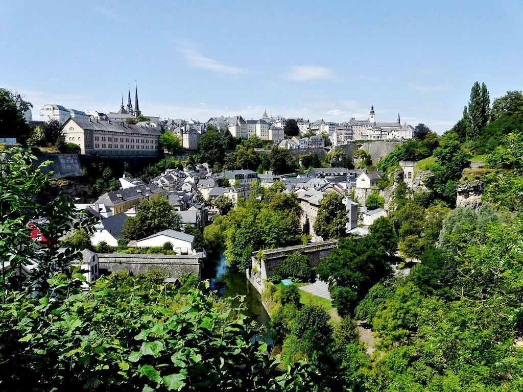
With an area of 2,586 square kilometres (998 sq mi), it is one of the smallest sovereign states in Europe.[8] In 2016, Luxembourg had a population of 576,249, which makes it one of the least-populous countries in Europe,[9] but by far the one with the highest population growth rate.[10] Foreigners account for nearly half of Luxembourg's population.[11] As a representative democracy with a constitutional monarch, it is headed by Grand Duke Henri and is the world's only remaining grand duchy. Luxembourg is a developed country, with an advanced economy and one of the world's highest GDP (PPP) per capita. The City of Luxembourg with its old quarters and fortifications was declared a UNESCO World Heritage Site in 1994 due to the exceptional preservation of the vast fortifications and the old city.[12]
The history of Luxembourg is considered to begin in 963, when count Siegfried I acquired a rocky promontory and its Roman-era fortifications known as Lucilinburhuc, ′little castle′, and the surrounding area from the Imperial Abbey of St. Maximin in nearby Trier.[13][14] Siegfried's descendants increased their territory through marriage, war and vassal relations. At the end of the 13th century, the Counts of Luxembourg reigned over a considerable territory. [15] In 1308, Henry VII, Count of Luxembourg became King of the Germans and Holy Roman Emperor. The House of Luxembourg produced four Holy Roman Emperors at the high time of the Middle Ages. In 1354, Charles IV elevated the County to the Duchy of Luxembourg. Since Sigismund had no male heir, the Duchy became part of the Burgundian Circle and then one of the Seventeen Provinces of the Habsburg Netherlands.[16] Over the centuries, the City and Fortress of Luxembourg, of great strategic importance situated between the Kingdom of France and the Habsburg territories, was gradually built up to be one of the most reputed fortifications in Europe. After belonging to both the France of Louis XIV and the Austria of Maria Theresia, Luxembourg became part of the First French Republic and Empire under Napoleon.[17]
The present-day state of Luxembourg first emerged at the Congress of Vienna in 1815. The Grand-Duchy, with its powerful fortress, became an independent state under the personal possession of William I of the Netherlands with a Prussian garrison to guard the city against another invasion from France. [18] In 1839, following the turmoil of the Belgian Revolution, the purely Oil-speaking part of Luxembourg was ceded to Belgium and the Luxembourgish-speaking part (except the Arelerland, the area around Arlon) became what is the present state of Luxembourg. [19]
The steel industry exploiting the Red Lands' rich iron-ore grounds in the beginning of the 20th century drove the country's industrialisation. ArcelorMittal, the world's largest steel producer with headquarters in Luxembourg City, is still a reminder of these times. After the decline of the steel industry in the 1970s, the country focused on establishing itself as a global financial centre and developed into the banking hub it is reputed for. Since the beginning of the 21st century, its governments have focused on developing the country into a knowledge economy, with the founding of the University of Luxembourg and a national space programme, projecting the first involvement in a robotic lunar expedition by 2020.[20]
Luxembourg is a founding member of the European Union, OECD, United Nations, NATO, and Benelux. The city of Luxembourg, which is the country's capital and largest city, is the seat of several institutions and agencies of the EU. Luxembourg served on the United Nations Security Council for the years 2013 and 2014, which was a first in the country's history.[21] In 2016 Luxembourgish citizens had visa-free or visa-on-arrival access to 172 countries and territories, ranking the Luxembourgish passport 15th in the world, tied with countries such as Canada and Switzerland.[22]
Le Luxembourg, en forme longue le Grand-Duché de Luxembourg2,b,c ou le grand-duché de Luxembourgd, en luxembourgeois Lëtzebuerg et Groussherzogtum Lëtzebuerg, en allemand Luxemburg et Großherzogtum Luxemburg, est un pays d'Europe de l'Ouest sans accès à la mere Il est bordé par la Belgique à l'ouest et au nord, l'Allemagne à l'est, et la France au sud. Il comprend deux régions principales : l'Oesling au nord, qui est une partie du massif des Ardennes, et le Gutland au sud, prolongement de la Lorraine au sens géologique du terme. Le Luxembourg compte 602 005 habitants au 1er janvier 20181, et s'étend sur une superficie de 2 586 km2, faisant de lui l'une des plus petites nations souveraines d'Europe.
Le Luxembourg est une démocratie représentative et une monarchie constitutionnelle avec un grand-duc pour chef d'État, faisant du pays le seul grand-duché encore existant. Son économie dynamique en fait un des pays les plus riches et des plus prospères du monde, avec le PIB par habitant le plus élevé du monde selon le FMI en 2014. L'économie est principalement centrée sur les activités financières (environ la moitié du produit intérieur brut), favorisée par une fiscalité attractive voire dérisoire dans certains domaines (quasi-exonération d'impôts pour les bénéfices issus de l'exploitation de brevets ou de logiciels). La localisation centrale du territoire luxembourgeois en Europe a historiquement fait de lui un lieu d'une grande importance stratégique pour de nombreuses puissances, depuis sa fondation en tant que fortin romain7, son accueil d'un château franc durant le Haut Moyen Âge, et son rôle de bastion pour le chemin des Espagnols entre les XVIe et XVIIe siècles.
Le Luxembourg est le plus petit membre fondateur de l'Union européenne, de la zone euro, de l'OTAN, de l'OCDE, de l'ONU, de l'OSCE, du Conseil de l'Europe8,9,10,11 et du Benelux, reflétant son consensus politique en faveur de l'intégration économique, politique et militaire. La ville de Luxembourg, sa capitale et sa plus grande ville, est le siège de plusieurs établissements et institutions de l'UE. En 2012, le Luxembourg a été élu pour la première fois de son histoire à un siège temporaire au Conseil de sécurité des Nations unies. En raison de sa position géographique, la culture luxembourgeoise est une fusion de l'Europe germanique et romane, intégrant chacune des deux. De ce fait, le Luxembourg est un pays trilingue : le luxembourgeois, le français et l'allemand sont les trois langues officielles et, depuis 1984, le luxembourgeois a légalement le statut de « langue nationale »12.
Il Granducato di Lussemburgo (in francese: le Grand-Duché de Luxembourg; in lussemburghese: Groussherzogtum Lëtzebuerg; in tedesco: Großherzogtum Luxemburg) è un paese membro dell'Unione europea situato tra Germania, Francia e Belgio. È uno stato senza sbocco sul mare.
Membro fondatore dell'Unione europea, della NATO, del Benelux e delle Nazioni Unite, la sua capitale, l'omonima città di Lussemburgo, è sede di numerose istituzioni e agenzie europee oltre ad essere uno snodo finanziario di primaria importanza.
È l'unico granducato rimasto al mondo.
Luxemburgo, oficialmente denominado Gran Ducado de Luxemburgo (luxemburgués: Groussherzogtum Lëtzebuerg, francés: Grand-Duché de Luxembourg, alemán: Großherzogtum Luxemburg), es un pequeño país de Europa Central que forma parte de la Unión Europea. Se trata de un Estado sin litoral, rodeado por Francia, Alemania y Bélgica. Luxemburgo cuenta con una población de medio millón de habitantes sobre un área de 2586 kilómetros cuadrados.1
El gobierno de Luxemburgo es una monarquía constitucional y parlamentaria, siendo el único gran ducado soberano en la actualidad. El Estado tiene una economía altamente desarrollada, con el mayor producto interior bruto por cápita del mundo de acuerdo al Banco Mundial, y el segundo de acuerdo al Fondo Monetario Internacional.
Luxemburgo es miembro de la Unión Europea, la Organización del Tratado del Atlántico Norte, la Organización para la Cooperación y el Desarrollo Económico, las Naciones Unidas y el Benelux, reflejando la orientación política a favor de la integración económica, política y militar. Su capital, Luxemburgo, es sede de numerosas instituciones y agencias de la Unión Europea.
Luxemburgo posee culturas y tradiciones diversas por encontrarse entre la Europa romana y la Europa germánica. El país tiene tres lenguas oficiales: alemán, francés y luxemburgués. La localidad Schengen, que dio su nombre al espacio de Schengen, está ubicada en Luxemburgo.
Люксембу́рг (люксемб. Lëtzebuerg), официально Вели́кое Ге́рцогство Люксембу́рг (люксемб. Groussherzogtum Lëtzebuerg, фр. Grand-Duché de Luxembourg, нем. Großherzogtum Luxemburg) — государство (великое герцогство) в Западной Европе. Граничит с Бельгией на севере, на западе и на юге с Францией, на востоке с Германией, не имеет выхода к морю. Название происходит от древневерхненемецкого «lucilinburch» — «малый город». Общая площадь Люксембурга составляет 2586,4 км², что делает его одним из самых маленьких суверенных государств в Европе[5]. Население на 1 января 2018 года составляет 602 005 человек[2].
Член Европейского союза с 1957 года, также является членом НАТО, ОЭСР и ООН. Вместе с Бельгией и Нидерландами входит в состав Бенилюкса.

Eurovision Song Contest,ESC
Finnland
Geographie
Geographie
*Lebenswerteste Städte der Welt
Internationale Städte
*Kulturhauptstadt Europas
Internationale Städte
*World Design Capital
Olympische Sommerspiele
 Wichtiger Hafen
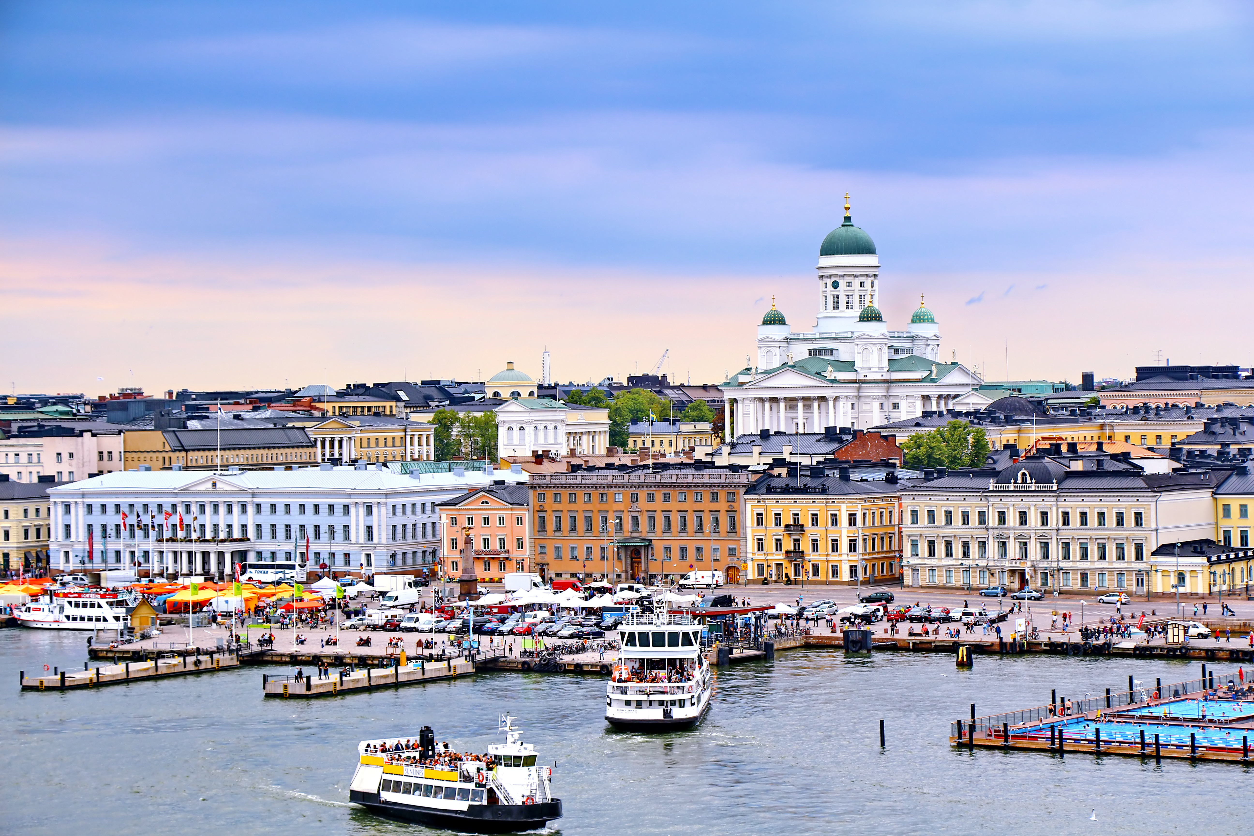
赫尔辛基(芬兰语:Helsinki [ˈhelsiŋki] ![]() 聆听;瑞典语:Helsingfors [ˌhɛlsɪŋˈfɔʂː]
聆听;瑞典语:Helsingfors [ˌhɛlsɪŋˈfɔʂː] ![]() 聆听),是芬兰的首都以及全国最大城市,芬兰语和瑞典语同为官方语言。赫尔辛基位于新地区,芬兰南端的芬兰湾岸边。在2017年底,赫尔辛基人口为643,272人[4]。所谓“大赫尔辛基”是由赫尔辛基和埃斯波、万塔、考尼艾宁四个城市一起组成的首都地区及周边市镇所组成的都会区,在2014年底的统计中有1,420,284人[5]。
聆听),是芬兰的首都以及全国最大城市,芬兰语和瑞典语同为官方语言。赫尔辛基位于新地区,芬兰南端的芬兰湾岸边。在2017年底,赫尔辛基人口为643,272人[4]。所谓“大赫尔辛基”是由赫尔辛基和埃斯波、万塔、考尼艾宁四个城市一起组成的首都地区及周边市镇所组成的都会区,在2014年底的统计中有1,420,284人[5]。
赫尔辛基在爱沙尼亚塔林北部约80公里处,距离西南的瑞典斯德哥尔摩约400公里,距离东边的俄罗斯圣彼得堡约300公里。这三座城市与赫尔辛基在历史上有着密切联系。
Helsinki (finnisch [ˈhɛlsiŋki], schwedisch [hɛlsɪŋˈfɔrs]) ist die Hauptstadt Finnlands. Sie liegt in der Landschaft Uusimaa im Süden des Landes an der Küste des Finnischen Meerbusens und ist die nördlichste Hauptstadt eines Mitgliedstaates der EU. Mit 648.042 Einwohnern (Stand 31. Dezember 2018) ist Helsinki mit Abstand die größte Stadt Finnlands und drittgrößte Stadt der Nordischen Länder, nach Stockholm und Oslo.
Zusammen mit den Nachbarstädten Espoo, Vantaa und Kauniainen bildet es die sogenannte Hauptstadtregion, einen Ballungsraum mit etwa 1,49 Millionen Einwohnern und damit den nördlichsten Ballungsraum der Welt mit über einer Million Einwohnern.[3] Helsinki ist das politische, wirtschaftliche, wissenschaftliche und kulturelle Zentrum Finnlands. Rund sechs Prozent der Einwohner Helsinkis sind schwedischsprachig, offiziell ist die Stadt zweisprachig.
Helsinki liegt 80 km nördlich von Tallinn, Estland, 400 km östlich von Stockholm, Schweden, und 300 km westlich von Sankt Petersburg, Russland. Es hat enge historische Verbindungen zu diesen drei Städten.
Die Stadt wurde, unter dem schwedischen Namen Helsinge fors[4], im Jahr 1550 während der Zugehörigkeit Finnlands zu Schweden gegründet, blieb aber lange unbedeutend. Kurz nachdem Finnland unter russische Herrschaft gekommen war, wurde Helsinki 1812 zur Hauptstadt des neugegründeten Großfürstentums Finnland bestimmt und löste so Turku als wichtigste Stadt des Landes ab. Der offizielle Gebrauch des finnisierten Namens Helsinki begann erst in dieser Zeit.[5]
Seit 1917 ist Helsinki Hauptstadt des unabhängigen Finnlands.
ヘルシンキ (フィンランド語: Helsinki,フィンランド語発音: [ˈhe̞l.siŋ.k̟i]) ![]() listen; スウェーデン語: Helsingfors,
listen; スウェーデン語: Helsingfors, ![]() listen)は、フィンランドの首都で同国最大の都市である。また、バルト海東部のフィンランド湾に面した同国南部のウーシマー県の県庁所在地である。人口は616,042人(2013年2月28日現在)[4]、都市的地域の人口は 1,176,976人(2012年12月31日現在)[5]、ヘルシンキ都市圏である大ヘルシンキの人口は約140万人でフィンランドではもっとも人口の多い自治体と都市域を形成している。
listen)は、フィンランドの首都で同国最大の都市である。また、バルト海東部のフィンランド湾に面した同国南部のウーシマー県の県庁所在地である。人口は616,042人(2013年2月28日現在)[4]、都市的地域の人口は 1,176,976人(2012年12月31日現在)[5]、ヘルシンキ都市圏である大ヘルシンキの人口は約140万人でフィンランドではもっとも人口の多い自治体と都市域を形成している。
ヘルシンキは、ロシアの旧都サンクトペテルブルク、エストニアの首都タリンと同じく、フィンランド湾に面する主要都市の一つである。ヘルシンキからの距離は、東のサンクトペテルブルクまでは300キロメートル (190 mi)、南のタリンまでは85キロメートル (53 mi)である[6]。 なお、西に400キロメートル (250 mi)の距離に位置するバルト海の対岸のスウェーデンの首都ストックホルムも加え、これらの都市とヘルシンキは歴史的に密接な関係にあった。
ヘルシンキ都市圏には核となるヘルシンキの都市的地域とエスポーやヴァンター、カウニアイネン、周辺のベッドタウンが含まれる[7]。ヘルシンキは100万人以上が住む都市圏としては最北に位置する都市圏で欧州連合加盟国の首都としては最北に位置する都市であり、フィンランドの政治や教育、金融、文化、調査センターなど様々な分野の中心都市で、ヨーロッパでも最北の大都市である。
フィンランドで事業を行う外国企業の70%はヘルシンキ地域で事業を行っており[8]、2009年に、2012年の世界デザイン首都[9]に国際インダストリアルデザイン団体協議会により選ばれ、僅差でアイントホーフェンを破っている。
エコノミスト・インテリジェンス・ユニットは2012年8月に住むのに適した都市の調査で、ヘルシンキは総合で8位にランクした[10]。2011年、モノクルマガジンの調査Liveable Cities Index 2011でヘルシンキは最も住むのに適した都市に位置している[11]。
Helsinki (/ˈhɛlsɪŋki/ HEL-sink-ee or /hɛlˈsɪŋki/ (![]() listen) hel-SINK-ee;[7][8] Finnish: [ˈhelsiŋki] (
listen) hel-SINK-ee;[7][8] Finnish: [ˈhelsiŋki] (![]() listen); Swedish: Helsingfors [hɛlsɪŋˈfɔʂː] (
listen); Swedish: Helsingfors [hɛlsɪŋˈfɔʂː] (![]() listen), Finland Swedish: [helsiŋˈforsː] (
listen), Finland Swedish: [helsiŋˈforsː] (![]() listen)) is the capital, primate and most populous city of Finland. Located on the shore of the Gulf of Finland, it is the seat of the region of Uusimaa in southern Finland, and has a population of 650,058.[9] The city's urban area has a population of 1,268,296,[10] making it by far the most populous urban area in Finland as well as the country's most important center for politics, education, finance, culture, and research; while Tampere in the Pirkanmaa region, located 179 kilometres (111 mi) to the north from Helsinki, is the second largest urban area in Finland. Helsinki is located 80 kilometres (50 mi) north of Tallinn, Estonia, 400 km (250 mi) east of Stockholm, Sweden, and 300 km (190 mi) west of Saint Petersburg, Russia. It has close historical ties with these three cities.
listen)) is the capital, primate and most populous city of Finland. Located on the shore of the Gulf of Finland, it is the seat of the region of Uusimaa in southern Finland, and has a population of 650,058.[9] The city's urban area has a population of 1,268,296,[10] making it by far the most populous urban area in Finland as well as the country's most important center for politics, education, finance, culture, and research; while Tampere in the Pirkanmaa region, located 179 kilometres (111 mi) to the north from Helsinki, is the second largest urban area in Finland. Helsinki is located 80 kilometres (50 mi) north of Tallinn, Estonia, 400 km (250 mi) east of Stockholm, Sweden, and 300 km (190 mi) west of Saint Petersburg, Russia. It has close historical ties with these three cities.
Together with the cities of Espoo, Vantaa, and Kauniainen, and surrounding commuter towns,[11] Helsinki forms the Greater Helsinki metropolitan area, which has a population of nearly 1.5 million. Often considered to be Finland's only metropolis, it is the world's northernmost metro area with over one million people as well as the northernmost capital of an EU member state. After Stockholm and Oslo, Helsinki is the third largest municipality in the Nordic countries. Finnish and Swedish are both official languages. The city is served by the international Helsinki Airport, located in the neighboring city of Vantaa, with frequent service to many destinations in Europe and Asia.
Helsinki was the World Design Capital for 2012,[12] the venue for the 1952 Summer Olympics, and the host of the 52nd Eurovision Song Contest in 2007.
Helsinki has one of the world's highest urban standards of living. In 2011, the British magazine Monocle ranked Helsinki the world's most liveable city in its liveable cities index.[13] In the Economist Intelligence Unit's 2016 liveability survey, Helsinki was ranked ninth among 140 cities.[14]
Helsinki (prononcé /ɛl.siŋ.ˈki/ ; Helsinki /ˈhɛl.siŋ.ki/ Écouter en finnois et Helsingfors /hɛl.sɪŋ.ˈfɔrs/ Écouter en suédois), est la capitale et la plus grande ville de la Finlande avec 642 045 habitants4 dans la commune et 1 456 619 dans le Grand Helsinki. Helsinki est la capitale la plus septentrionale du monde après Reykjavik, capitale de l'Islande. La ville a la plus forte population immigrée de tout le pays. Il y a plus de 130 nationalités résidant dans la ville d'Helsinki. Elle s'étale sur une presqu'île entourée d'un grand nombre d'îles et est fortement caractérisée par la présence de l'eau. Helsinki est un port marchand ouvert sur le golfe de Finlande.
Ses habitants sont appelés les Helsinkiens ; en finnois Helsinkiläiset, en suédois Helsingforsare.
Helsinki (pronuncia italiana [ˈɛlsiŋki][3]; in finlandese [ˈhelsiŋki] ; in svedese , pronuncia [hɛlsɪŋˈfɔrs]) è la capitale e la città più grande della Finlandia, con 648.650 abitanti (dato 2018)[4], situata nella regione dell'Uusimaa. La città è bilingue, le lingue ufficiali sono il finlandese e lo svedese.
Helsinki è geograficamente situata nella parte meridionale del Paese sulle rive del golfo di Finlandia, parte del mar Baltico, di fronte alla capitale dell'Estonia, Tallinn, e si estende su più isole.
L'area metropolitana di Helsinki include l'area urbana della città, Espoo, Vantaa, Kauniainen e paesi limitrofi[5]. È l'area metropolitana più a nord nel mondo, con il suo milione di abitanti è la città e capitale più a nord degli Stati membri dell'Unione europea.
A Helsinki hanno sede il parlamento, il governo, sette università e le sedi dei vescovi evangelico-luterani, cattolici e russo-ortodossi.
Nello slang di Helsinki la città è chiamata Stadi (per il vocabolo svedese stad, "città") o Hesa (forma abbraviata di "Helsinki" con il suffisso gergale -sa), lasciando intendere che chi usa il termine Stadi sia nativo della città[6]. Helsset è il termine usato dai sami del Nord per Helsinki.
Helsinki (en finlandés: Helsinki ![]() [ˈhɛlsiŋki] (?·i); en sueco: Helsingfors
[ˈhɛlsiŋki] (?·i); en sueco: Helsingfors ![]() [hɛlsɪŋˈfɔrs] (?·i)) es la capital y la ciudad más grande de Finlandia. Está situada en la costa sur del país, a la orilla del golfo de Finlandia. Helsinki forma parte de la región de Uusimaa.
[hɛlsɪŋˈfɔrs] (?·i)) es la capital y la ciudad más grande de Finlandia. Está situada en la costa sur del país, a la orilla del golfo de Finlandia. Helsinki forma parte de la región de Uusimaa.
Las influencias del Este y el Oeste se encuentran presentes en la vida diaria de Helsinki. Arquitectura, gastronomía, diseño, costumbres y hasta el argot local de las calles atestiguan un pasado bajo dominio ruso y sueco.
Situada junto al mar Báltico, la línea de costa de Helsinki se extiende unos 100 kilómetros, y acoge 300 islas frente al continente. 665 281 personas viven en la propia ciudad de Helsinki (Enero 2020)145 y el área metropolitana (municipios de Helsinki, Espoo, Vantaa y Kauniainen) tiene una población un millón de habitantes en total. Incluyendo otros municipios cercanos la población es de alrededor de 1,4 millones de personas.2 Uno de cada cuatro finlandeses vive en Helsinki.
Helsinki es el mayor centro político, educativo, financiero, cultural y de investigación, así como una de las ciudades más importantes del norte de Europa. Aproximadamente el 70 % de las empresas extranjeras que operan en Finlandia se han establecido en la región de Helsinki.6
Helsinki fue elegida Capital Mundial del Diseño para el año 2012,7 sede de los Juegos Olímpicos en 1952 y del 52º Festival de Eurovisión en 2007. Helsinki es conocida a nivel mundial por su gran diseño, el cual es bien evidente en sus calles, comercios y edificios, formando parte de la red de ciudades creativas por la UNESCO desde 2014.8
En la edición de agosto de 2012, el estudio del Economist Intelligence Unit colocó en octavo lugar a Helsinki en el ranking general de las mejores ciudades para vivir a nivel mundial.9 En 2011 la revista Monocle estableció a la ciudad de Helsinki como la mejor ciudad para vivir y desarrollarse en el mundo entero.
Хе́льсинки (фин. Helsinki, швед. Helsingfors , до 1926 года в русском языке официально использовалось шведское название Гельсингфорс[3]) — столица и крупнейший город Финляндии, административный центр провинции Уусимаа (Нюланд). Расположен на юге страны, на берегу Финского залива Балтийского моря. Население — 655 281 человека (31.1.2020)[4]. Иностранные граждане составляют около 10 % населения города.
Хельсинки вместе с городами-спутниками Вантаа (Ванда), Эспоо (Эсбy[5]) и Кауниайнен (Гранкулла) образует столичный регион с населением более миллиона человек. Население Большого Хельсинки, территория которого включает 12 коммун, превышает 1,3 миллиона человек[2]. Хельсинки является центром бизнеса, образования, культуры и науки в Финляндии. В Большом Хельсинки расположены 8 университетов и 6 технологических парков[6]. 70 % иностранных компаний, работающих в Финляндии, расположены в столичном регионе[6]. Миграция населения из провинции делает Хельсинки одним из самых быстрорастущих муниципальных районов в Европе. Главным международным авиаузлом в Финляндии является Аэропорт Хельсинки-Вантаа, расположенный в 20 километрах от центра столицы и осуществляющий прямые перелёты по всему миру. Путь от Хельсинки до Таллина занимает 1,5 часа по морю и 18 минут на вертолёте (расстояние составляет 80 км). В два других крупных города, Тампере и Турку, можно попасть за 1,5—2 часа на поезде и 1,5—2,5 часа на машине. На скоростном поезде «Аллегро» до Санкт-Петербурга можно добраться за 3,5 часа (390 км).
В 2014 году в рейтинге 25 лучших городов мира, составленном британским журналом Monocle[en], Хельсинки занял пятое место (на первом месте — Копенгаген)[7]. В 2011 году в опубликованном международной консалтинговой компанией Mercer рейтинге наиболее безопасных городов мира Хельсинки разделил 2—4 места с Цюрихом и Берном (на первом месте — Люксембург)[8][9]. В начале 2012 года газета The New York Times в ежегодно публикуемом ею списке мест нашей планеты, которые стоит посетить в наступившем году, поставила Хельсинки на второе место (на первом месте — Панама, на третьем — Мьянма)[10][11].
По опросам общественного мнения в 2012 году Хельсинки занимает четвёртое место по уровню привлекательности для проживания среди финских граждан[12].
В 2013 году по расчетам консалтингового агентства ECA International Хельсинки занял двадцатое место в рейтинге самых дорогих городов планеты (первое место — Осло)[13], а международная деловая газета Financial Times представила ряд районов финской столицы в лучшем свете как мест для вложений в недвижимость[14].
День города отмечается ежегодно 12 июня[15].

 Architektur
Eurovision Song Contest,ESC
Geschichte
Internationale Städte
Internationale Städte
*Kulturhauptstadt Europas
Mittelalterliche Städte in Europa
Seidenstraße
Türkei
Architektur
Eurovision Song Contest,ESC
Geschichte
Internationale Städte
Internationale Städte
*Kulturhauptstadt Europas
Mittelalterliche Städte in Europa
Seidenstraße
Türkei
 Von den Römern gegründete Städte
Weltkulturerbe
Von den Römern gegründete Städte
Weltkulturerbe


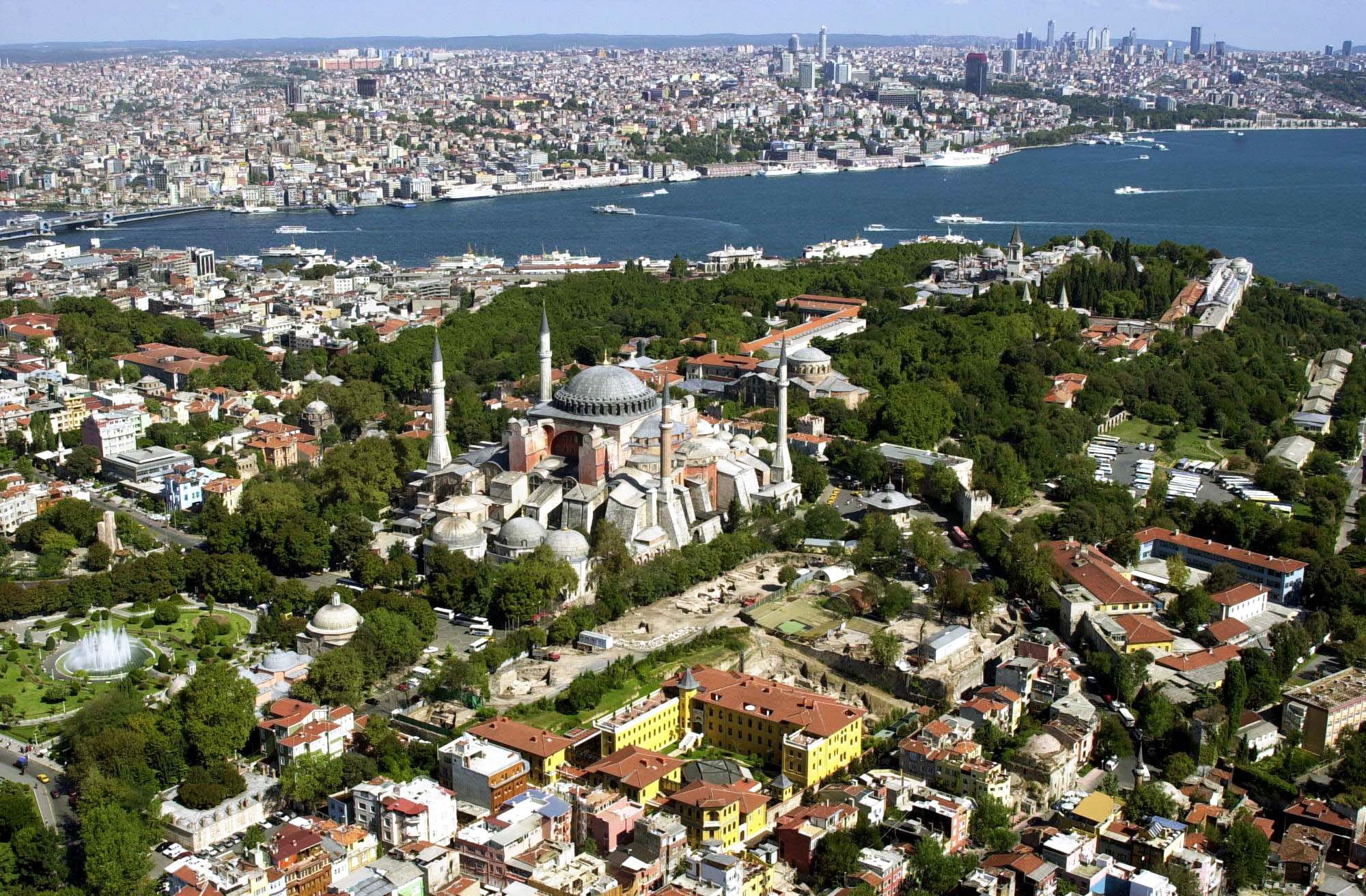
伊斯坦布尔(土耳其语:İstanbul [isˈtanbuɫ] ![]() 聆听)是土耳其最大城市,亦是该国的经济、文化和历史中心。它坐落于土耳其西北部的博斯普鲁斯海峡之滨,位于马尔马拉海和黑海之间,横跨欧亚大陆,经济和历史中心位于欧洲一侧,有三分之一人口居住于亚洲一侧[3]。其人口达到1440万,为全欧洲最大的城市群,亦是中东最大和全球第六大城市[2][4]。伊斯坦布尔全市辖区面积5,343平方千米(2,063平方英里),其覆盖范围同伊斯坦布尔省相同,亦是该省的行政中心[c]。亦是世界上唯一横跨两大洲的城市。
聆听)是土耳其最大城市,亦是该国的经济、文化和历史中心。它坐落于土耳其西北部的博斯普鲁斯海峡之滨,位于马尔马拉海和黑海之间,横跨欧亚大陆,经济和历史中心位于欧洲一侧,有三分之一人口居住于亚洲一侧[3]。其人口达到1440万,为全欧洲最大的城市群,亦是中东最大和全球第六大城市[2][4]。伊斯坦布尔全市辖区面积5,343平方千米(2,063平方英里),其覆盖范围同伊斯坦布尔省相同,亦是该省的行政中心[c]。亦是世界上唯一横跨两大洲的城市。
公元前660年左右,该市以“拜占庭”之名建立于萨拉基里奥角,并在此后逐渐发展为历史上最为重要的城市之一。公元330年该市重建为君士坦丁堡([Κωνσταντινούπολις Konstantinoúpolis] 错误:{{lang-xx}}:文本有斜体标记(帮助);拉丁语:Constantinopolis)或新罗马([Νέα Ῥώμη, Nea Romē] 错误:{{lang-xx}}:文本有斜体标记(帮助);拉丁语:Nova Roma),并在此后的近十六个世纪内先后成为罗马帝国(330年–1204年及1261年–1453年)、拉丁帝国(1204年–1261年)和奥斯曼帝国(1453年–1922年)的帝国首都[5]。在罗马和拜占庭帝国时代,它对基督教的发展起到了重要的作用,而在1453年奥斯曼帝国征服该城之后,它成为了伊斯兰教的中心和奥斯曼帝国哈里发的驻地[6]。
伊斯坦布尔是古丝绸之路的途经地[7],也是欧洲和中东的铁路网络之间、黑海和地中海间海路的必经之地,使得伊斯坦布尔的战略地位十分重要,由此也哺育了兼收并蓄的人口和文化,虽然在1923年共和国成立之后这一状况略不如前。在战间期伊斯坦布尔 未能成为新首都,受到忽视,但此后其影响力逐步恢复。自1950年代以来,该市的人口已翻了十倍,来自安那托利亚各地的人口涌入,城市的界限也为此逐渐扩张[8][9]。20世纪末艺术节开始得到兴办,而随着基础设施的改善,复杂的交通网络也由此建立起来。
2012年,在当选欧洲文化之都两年之后,近1160万外国游客造访伊斯坦布尔 ,使其成为世界第五受欢迎的旅游目的地[10]。该市最重要的景点仍是其历史城区,部分被列为联合国教科文组织世界遗产,而位于贝伊奥卢区的天然港金角湾则是其文化和娱乐的中心。伊斯坦布尔还被认为是一个全球城市[11],亦是全球发展速度最快的都市经济区之一[12]。诸多土耳其公司及媒体将总部设于此,全市国内生产总值超过全国的四分之一[13]。伊斯坦布尔希望借助其复苏和快速扩张的契机,在二十年内五次申请举办夏季奥林匹克运动会[14]。
Istanbul (türkisch İstanbul, von griechisch εἰς τὴν πόλιν, eis tḕn pólin, „in die Stadt“: siehe unten), früher Konstantinopel, ist die bevölkerungsreichste Stadt der Türkei und deren Zentrum für Kultur, Handel, Finanzen und Medien. Mit rund 14,4 Millionen Einwohnern nahm die Metropolregion 2016 den 15.[5] Platz unter den größten Metropolregionen der Welt ein. Mit jährlich knapp zwölf Millionen Touristen aus dem Ausland ist Istanbul überdies die Stadt mit der achtgrößten Besucherzahl der Welt.[6] Die Stadt liegt am Nordufer des Marmarameeres auf beiden Seiten des Bosporus, also sowohl im europäischen Thrakien als auch im asiatischen Anatolien. Aufgrund ihrer weltweit einzigartigen Transitlage zwischen zwei Kontinenten und zwei Meeresgebieten, dem Schwarzen und dem Mittelmeer, verzeichnet sie einen bedeutenden Schiffsverkehr und verfügt über zwei große Flughäfen sowie zwei zentrale Kopf- und zahlreiche Fernbusbahnhöfe. Das Projekt Marmaray verbindet beide Hälften der Stadt per Eisenbahn und künftig die Kopfbahnhöfe an den Eisenbahnverkehr des jeweils anderen Kontinents. Istanbul ist daher einer der wichtigsten Knotenpunkte für Verkehr und Logistik auf internationaler wie nationaler Ebene.
Im Jahr 660 v. Chr. unter dem Namen Byzantion gegründet, kann die Stadt auf eine 2600-jährige Geschichte zurückblicken. Fast 1600 Jahre lang diente sie nacheinander dem Römischen, dem Byzantinischen und dem Osmanischen Reich als Hauptstadt. Als Sitz des ökumenischen Patriarchen und – bis 1924 – des osmanischen Kalifats war Istanbul zudem jahrhundertelang ein bedeutendes Zentrum des orthodoxen Christentums und des sunnitischen Islams.
Das Stadtbild ist von Bauten der griechisch-römischen Antike, des mittelalterlichen Byzanz sowie der neuzeitlichen und modernen Türkei geprägt. Paläste gehören ebenso dazu wie zahlreiche Moscheen, Cemevleri, Kirchen und Synagogen. Aufgrund ihrer Einzigartigkeit wurde die historische Altstadt von der UNESCO zum Weltkulturerbe erklärt. 2010 war Istanbul Kulturhauptstadt Europas.
イスタンブール(トルコ語: İstanbul [isˈtanbul]、英語: Istanbul [ˌɪstænˈbuːl]、ラテン語: Constantinopolis コーンスタンティーノポリス、ギリシア語: Κωνσταντινούπολις コーンスタンティヌーポリス /現代ギリシア語 Κωνσταντινούπολι コンスタンディヌーポリ)は、トルコ最大の都市であり、経済・文化・歴史の中心地。トルコ語の発音に準じて「イスタンブル」と表記される場合もある。
Istanbul (UK: /ˌɪstænˈbʊl/, /-ˈbuːl/ or US: /-stɑːn-/ or /ˈɪstənbʊl/;[6][7][8] Turkish: İstanbul [isˈtanbuɫ] (![]() listen)), historically known as Byzantium and Constantinople, is the most populous city in Turkey and the country's economic, cultural, and historic center. Istanbul is a transcontinental city in Eurasia, straddling the Bosporus strait (which separates Europe and Asia) between the Sea of Marmara and the Black Sea. Its commercial and historical center lies on the European side and about a third of its population lives on the Asian side.[9] The city is the administrative center of the Istanbul Metropolitan Municipality (coterminous with Istanbul Province), both hosting a population of around 15 million residents. [3] Istanbul is one of the world's most populous cities and ranks as the world's 5th-largest city proper and the largest European city. Istanbul is viewed as a bridge between the East and West.
listen)), historically known as Byzantium and Constantinople, is the most populous city in Turkey and the country's economic, cultural, and historic center. Istanbul is a transcontinental city in Eurasia, straddling the Bosporus strait (which separates Europe and Asia) between the Sea of Marmara and the Black Sea. Its commercial and historical center lies on the European side and about a third of its population lives on the Asian side.[9] The city is the administrative center of the Istanbul Metropolitan Municipality (coterminous with Istanbul Province), both hosting a population of around 15 million residents. [3] Istanbul is one of the world's most populous cities and ranks as the world's 5th-largest city proper and the largest European city. Istanbul is viewed as a bridge between the East and West.
Founded under the name of Byzantion (Βυζάντιον) on the Sarayburnu promontory around 660 BCE, the city grew in size and influence, having become one of the most important cities in history. After its reestablishment as Constantinople in 330 CE, it served as an imperial capital for almost 16 centuries, during the Roman/Byzantine (330–1204 and 1261–1453), the Latin (1204–1261), and the Ottoman (1453–1922) empires.[10] It was instrumental in the advancement of Christianity during Roman and Byzantine times, before the Ottomans conquered the city in 1453 CE and transformed it into an Islamic stronghold and the seat of the Ottoman Caliphate.[11]
Istanbul's strategic position on the historic Silk Road,[12] rail networks to Europe and the Middle East, and the only sea route between the Black Sea and the Mediterranean have produced a cosmopolitan populace. While Ankara was chosen instead as the new Turkish capital after the Turkish War of Independence, the city has maintained its prominence in geopolitical and cultural affairs. The population of the city has increased tenfold since the 1950s, as migrants from across Anatolia have moved in and city limits have expanded to accommodate them.[13][14] Arts, music, film, and cultural festivals were established towards the end of the 20th century and continue to be hosted by the city today. Infrastructure improvements have produced a complex transportation network in the city.
Approximately 12.56 million foreign visitors arrived in Istanbul in 2015, five years after it was named a European Capital of Culture, making the city the world's fifth most popular tourist destination.[15] The city's biggest attraction is its historic center, partially listed as a UNESCO World Heritage Site, and its cultural and entertainment hub can be found across the city's natural harbor, the Golden Horn, in the Beyoğlu district. Considered a global city,[16] Istanbul has one of the fastest-growing metropolitan economies in the world.[17] It hosts the headquarters of many Turkish companies and media outlets and accounts for more than a quarter of the country's gross domestic product.[18] Hoping to capitalize on its revitalization and rapid expansion, Istanbul has bid for the Summer Olympics five times in twenty years.[19]
Istanbul ou Istamboul2 (en turc : İstanbul3), appelé officiellement jusqu'en 1930 et historiquement Constantinople, est la plus grande ville et métropole de Turquie et la préfecture de la province homonyme, dont elle occupe environ 50 % de la superficie mais plus de 97 % de la population. Quatre zones historiques de la ville sont inscrites sur la liste du patrimoine mondial de l'Unesco depuis 1985. Istanbul est le principal centre financier, commercial et industriel de la Turquie mais aussi la capitale culturelle du pays. La population de l'ensemble de l'agglomération stambouliote est évaluée à 15 millions d'habitants en 20144,5 ce qui en fait l'une des plus grandes mégapoles du monde. Forte d'un héritage culturel et historique important, la ville cosmopolite est un haut lieu du tourisme.
Située de part et d’autre du détroit du Bosphore — donc à cheval sur deux continents, l’Europe et l’Asie — Istanbul est généralement considérée comme européenne parce que la ville historique est située sur la rive occidentale du détroit.
Elle est la plus grande agglomération du pays avec plus de 15 millions d'habitants et l'une des plus grandes agglomérations d'Europe. Elle constitue aussi le principal pôle économique de la Turquie.
Appelée officiellement İstanbul depuis le 28 mars 1930, elle a porté d'autres noms durant son histoire (encore parfois utilisés selon les contextes) notamment : « Byzance », au moment de sa fondation ; puis « Constantinople » (à partir du 11 mai 330 en l'honneur de l'empereur romain Constantin Ier).
Appelée aussi la « Deuxième Rome », Istanbul appartint d'abord à la Thrace, puis à l’Empire romain dont elle fut la seconde capitale après 395 (devenu l'Empire romain d'orient et appelé au XVIe siècle « byzantin » par Hieronymus Wolf6), ensuite à l’Empire ottoman depuis le 29 mai 1453, et enfin, juste après la chute de celui-ci le 10 août 1920, à la République de Turquie, dont elle fut capitale jusqu'au 13 octobre 1923, lorsque cette fonction administrative fut transférée à Ankara.
Les anciens noms de la ville, Byzance puis Constantinople, témoignent de cette longue histoire. Seules quelques autres grandes villes ont eu trois noms au cours de leur histoire. Du point de vue historique, il est possible de considérer qu'avec Athènes et Rome, Constantinople (Istanbul) est l'une des trois capitales antiques les plus importantes.
Les habitants de la Byzance antique étaient appelés Byzantiotes et ceux de Constantinople, les Constantinopolitains ou les Politains. Par contre, aucun citoyen de l'Empire romain d'orient ne s'est jamais appelé Byzantin : ils se définissaient comme « Romains » et lorsqu'ils sont devenus sujets de l'Empire ottoman, celui-ci les a organisés dans le milliyet de Rum. Les habitants d’Istanbul sont les Stambouliotes ou les Istanbuliotes7.
La « Sublime Porte » ou simplement « la Porte » étaient les expressions qui désignaient le pouvoir politique ottoman s'il s'agissait du gouvernement ou « le Palais » s'il s'agissait du sultan.
Istanbul (in turco İstanbul, pronuncia [istan'buɫ]), storicamente conosciuta come Bisanzio (in greco antico: Βυζάντιον, Byzàntion; in latino: Byzantium), Costantinopoli (in latino: Constantinopolis; in greco antico: Κωνσταντινούπολις, Konstantinoupolis; in turco ottomano قسطنطينيه Kostantîniyye) o Nuova Roma (in latino: Nova Roma; in greco antico: Νέα Ῥώμη, Néa Rṓmē), è la città capoluogo della provincia omonima e il principale centro industriale, finanziario e culturale della Turchia.
Con una popolazione di circa 15 000 000 di abitanti,[2] Istanbul (considerando però anche i quartieri asiatici) è il secondo centro municipale più popoloso d'Europa (sesto nel mondo) davanti a Londra e dietro Mosca.
Istanbul è una megalopoli situata nel nord-ovest del paese, la quale si estende lungo lo stretto del Bosforo, alla cui estremità meridionale si situa il porto naturale del Corno d'Oro, e lungo la sponda settentrionale del Mar di Marmara. La città, divisa dal Bosforo, si estende sia in Europa (Tracia) sia in Asia (Anatolia), risultando l'unica metropoli al mondo appartenente a due continenti. Istanbul è considerata una città globale.
Nel corso della sua lunga storia, la città (chiamata Bisanzio fino al 330, poi Costantinopoli sino al 1453, Istanbul o Costantinopoli sino al 1930, e da allora in poi solo Istanbul) è stata la capitale:
- dell'Impero romano (330-395);
- dell'Impero bizantino (395-1204 e 1261-1453);
- dell'Impero latino (1204-1261);
- dell'Impero ottomano (1453-1922).
Conosciuta anche con l'appellativo di "seconda Roma", è stata fino alla conquista ottomana nel 1453 una tra le più grandi città della cristianità, divenendo in seguito per quasi cinquecento anni la capitale di uno dei più grandi imperi della storia e crocevia di culture. Quando è stata proclamata la Repubblica di Turchia, il 29 ottobre 1923, Istanbul fu considerata ormai troppo vulnerabile, potendo finire sotto tiro delle marine militari che avevano dimostrato bellamente di poter violare gli stretti durante la Prima guerra mondiale, e così Ankara, che in precedenza aveva servito come quartier generale del movimento cittadino turco durante la guerra d'indipendenza turca, è stata scelta come capitale del nuovo Stato turco.
Nel 2010 Istanbul è stata una delle capitali europee della cultura.[3] Sin dal 1985 le aree storiche di Istanbul fanno parte della lista UNESCO dei patrimoni dell'umanità.[4]
Estambul (en turco, İstanbul, [isˈtanbuɫ]), conocida históricamente como Bizancio y, después, Constantinopla, es la ciudad más poblada de Turquía y el centro histórico, cultural y económico del país. Fue sucesivamente capital de Estados soberanos como el Imperio romano, el Imperio romano de Oriente, el Imperio latino y el Imperio otomano hasta 1923 cuando se terminó en la Ocupación de Constantinopla. Es una ciudad transcontinental, ubicada en el estrecho del Bósforo, que separa Europa y Asia, entre el mar de Mármara y el Mar Negro. Dos tercios de la población viven en la parte europea de la ciudad.2 Con más de 15 millones de habitantes, Estambul es una de las ciudades más pobladas del mundo.3 La mayor parte de la población es de religión musulmana, si bien existen minorías de cristianos (68 000) y de judíos (22 000).
Fue fundada con el nombre de Bizancio (Βυζάντιον) en el promontorio de Sarayburnu alrededor del 660 a. C., y su tamaño e influencia crecieron, y se ha convertido en una de las ciudades más importantes de la historia universal. Desde su refundación bajo el nombre de Constantinopla en 330 d. C., Estambul ha sido la capital del Imperio romano-Imperio bizantino (330-1204 y 1261-1453), del Imperio latino (1204-1261) y del Imperio otomano (1453-1922).4 Fue una de las ciudades en las que floreció el primer cristianismo. Durante el período bizantino, la ciudad estaba habitada por cristianos. Tras la caída de Constantinopla ante los otomanos en 1453, la ciudad se fue transformando en una ciudad musulmana y en la sede del califato otomano.5 Tras la caída
Es también la capital administrativa de la provincia de Estambul (de la que cubre 27 distritos)6 en la llamada Rumelia o Tracia oriental. El nombre de İstanbul, usado de forma no oficial desde hacía varios siglos en el país, fue oficializado el 28 de marzo de 1930 en sustitución de Constantinopla. Aunque la capital política y administrativa es Ankara, Estambul sigue siendo una ciudad que tiene un papel fundamental en la industria, el comercio y la cultura de Turquía. Alberga más de una docena de universidades. Es sede del Patriarcado Ecuménico de Constantinopla, cabeza de la Iglesia ortodoxa.
Con el final de la I Guerra Mundial y la derrota del Imperio otomano, el territorio europeo otomano quedó reducido a unas decenas de kilómetros en torno a Estambul. El 13 de octubre de 1923,7 antes de la promulgación del estado turco sucesor, la República de Turquía, el parlamento turco trasladó legalmente la capitalidad a Ankara.
Las zonas históricas de Estambul fueron declaradas Patrimonio de la Humanidad por la Unesco en el año 1985, por sus importantes monumentos y restos históricos.8
Стамбу́л (тур. İstanbul — [isˈtanbuɫ]), также известный как Константинóполь, и в славянских источниках как Царьгрáд — крупнейший город Турции, главный торговый, промышленный и культурный центр, основной порт страны. Расположен на берегах пролива Босфор, разделяющего его на европейскую (основную) и азиатскую части, соединённые мостами и тоннелями. По численности населения первый город в Европе (при учёте населения, проживающего как в собственно европейской, так и в азиатской частях). Бывшая столица Римской, Византийской, Латинской и Османской империй.
В VII веке до нашей эры колонистами, в основном, выходцами из греческого города Мегары, был основан город Византий[3][4][5]. В 330 году римский император Константин I Великий перенёс столицу Римской империи в Византий, которому было дано название Новый Рим, однако это наименование не прижилось, и вскоре столицу стали называть Константинополем — городом Константина[6][7][8][9]. В XIII веке арабы использовали название Истинполин, которое восходит к греческой фразе греч. εἰς τὴν Πόλι(ν) («ис тин пόли(н)», «ис тим бόли(н)») — в город(е)[10]. Отсюда могло произойти современное название[11][12]. Согласно другой версии, оно происходит от Исламбул (город ислама), что, однако, вызывает сомнения в связи с существованием вышеупомянутого названия Истинполин, созвучного современному, ещё до падения Константинополя в 1453 г.[13] Фирман 1760/1 г., который на практике так и не был реализован, в качестве официального устанавливал встречавшееся уже в документах XV в. название Исламбол, то есть наполненный исламом[14][15]. С конца XVIII в. в европейских странах, в том числе в России, в употребление входит искажённая форма: Стамбул. Формально город после его захвата турками и переноса туда столицы империи не переименовывался: для турок он как был, так и оставался Истанбулом (Стамбулом), а для греков — Константинополем.
До 1930 года официальное, международно принятое название города: Константино́поль (с греч. — «Город Константина»; тур. Konstantiniyye), каковое признавалось Великим национальным собранием Турции: подписи его полномочных представителей стоят под Лозаннским договором, текст которого использует исключительно топоним Константинополь[16]. В официальных русских текстах Константинопольского договора 1724 года, Парижского мирного договора 1856 года, Сан-Стефанского мирного договора 1878 года и Берлинского трактата 1878 года используется принятый тогда в России топоним Константинополь. Другое историческое название, до сих пор используемое в титуле Константинопольского патриарха: Но́вый Рим[17] или Второй Рим (греч. Νέα Ρώμη, лат. Nova Roma); до 330 года Виза́нтий (греч. Βυζάντιον). В средневековых русских летописях и иной литературе часто именовался Царьградом или Константиновым градом, в болгарском и сербском языках топоним Цариград в настоящее время употребляется как неофициальное обозначение города.
При провозглашении Турецкой Республики 29 октября 1923 года столицей государства была провозглашена Анкара (Ангора), к тому времени уже несколько лет бывшая центром кемалистской администрации (халифат продолжал существовать до марта 1924 года). 28 марта 1930 года[18][19][20] турецкими властями было предписано использовать только турецкий вариант названия. В турецком языке топоним İstanbul ([isˈtanbuɫ], разговорно [ɯsˈtambuɫ]) пишется через «İ», отличную от буквы «I». Это подтверждает, что до 1930 года власти могли использовать оба этих топонима, но порядок их использования пока неясен. Обычные жители города турецкого происхождения, без сомнения, пользовались в быту турецким вариантом: Истанбул.
В греческом языке, тем не менее, название греч. Κωνσταντινούπολη сохраняется как официально принятое в Греции. Также по-гречески может называться Городом (греч. Πόλη).
В русском языке турецкое название Istanbul используется в русифицированном варианте Стамбул.
 Religion
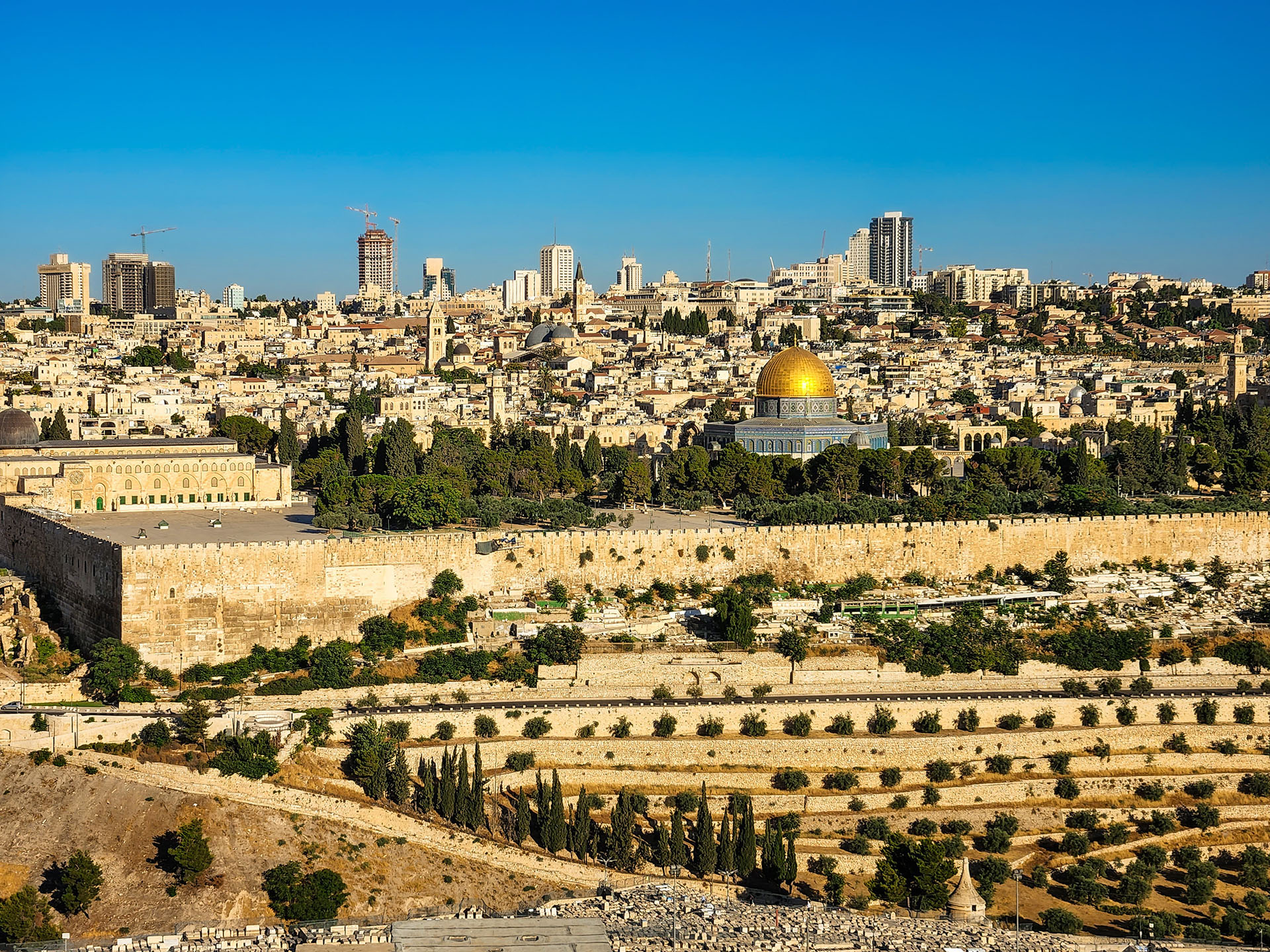
耶路撒冷市 (Jerusalem) 位于巴勒斯坦中部犹地亚山的四座山丘上,是一座举世闻名的历史古城,距今已有5000多年的历史。四周群山环抱,面积158平方公里,由东部旧城和西部新城组成。海拔835米,63.4万(2000年),是以色列最大城市。
耶路撒冷旧城是一座宗教圣城,是犹太教、伊斯兰教和基督教世界三大宗教发源地,三教都把耶路撒冷视为自己的圣地。宗教和传统、历史和神学以及神圣的处所和祈祷的房屋,使耶路撒冷成为备受犹太教徒、基督教徒和穆斯林崇敬的神圣城市。 耶路撒冷所在地最早叫“耶布斯”,这是因为很早以前阿拉伯迦南人的一个名叫“耶布斯”的部落从阿拉伯半岛迁徙到这里定居下来,修建村庄,构筑城堡,并以部 落的名字命名此地。后来,迦南人又在这里修建城市,并定名为“尤罗萨利姆”。大约在公元前一千年左右,犹太王国创始人大卫征服了这个地方,将它作为犹太王 国的都城,继续沿用“尤罗萨利姆”的名称,为使它希伯莱化,称为“尤罗萨拉姆”。 中文以此译为“耶路撒冷”,意为“和平之城”。阿拉伯人称该城为“古德斯”,即“圣城”。 (Quelle: www.mjjq.com/)
耶路撒冷(希伯来语: יְרוּשָׁלַיִם,拉丁化:Yerushaláyim;阿拉伯语: القُدس,拉丁化:al-Quds,汉译:古都斯或古德斯,意为“神圣的”;唐朝时期的景教徒曾根据叙利亚语“Ūrišlem”译作乌梨师敛[2][3])为以色列和巴勒斯坦境内的一座城市,位于地中海和死海之间,是古代巴勒斯坦中部的全球宗教重镇,也是完整保留人类信仰文明演进史的一个历史城市。耶路撒冷同时是犹太教、基督教和伊斯兰教三大亚伯拉罕宗教(或称“三大天启宗教”)的圣地。自公元前10世纪,所罗门王建成第一圣殿起,耶路撒冷一直是犹太教信仰的中心和最神圣的城市[4],昔日圣殿的遗迹西墙,仍是犹太教最神圣的所在。基督徒也相当重视耶路撒冷,因为根据《圣经》记载,耶稣在这里受难、埋葬、复活、升天。伊斯兰教亦将耶路撒冷列为麦加、麦地那之后的第三圣地,以纪念穆罕默德的夜行登霄[5],并在圣殿山上建造2座清真寺——阿克萨清真寺和圆顶清真寺来纪念这一事件。
自1967年第三次中东战争之后,以色列控制了全部的耶路撒冷地区,包括西耶路撒冷和东耶路撒冷,以及老城区。以色列和巴勒斯坦都声称耶路撒冷是他们的首都,因为以色列坚称这里是他们主要的政府机构,而巴勒斯坦则称预见这座城市是他们的政权所在地。不过,这两个声称在国际社会上都没有得到广泛的承认,认为该市的最终地位尚未确定,有待以色列和巴勒斯坦双方谈判决定。多数国家都将大使馆设在特拉维夫[6][7]。今天耶路撒冷仍然是以巴冲突的中心。以色列现行政区划上设耶路撒冷区,面积652平方公里,只有一个分区,即耶路撒冷分区。
2006年,耶路撒冷市区面积为126平方公里,人口约724,000人,这两项指标均居以色列和巴勒斯坦各城市之首[8][9][10]。
今天的耶路撒冷,是一个对比强烈的城市,不同文化、不同宗教、不同民族、社会不同阶层,同处一城;城市的东西两部分截然不同,发展水平悬殊。老城雅法门以西的西耶路撒冷(1967年以前属于以色列的市区)是现代以色列的核心地带(如果再继续向西数十公里,就是以特拉维夫为中心的“古什·但”区域),而老城及其东、北、南三面的东耶路撒冷(1967年后以色列占领的争议区域)则以巴勒斯坦人为主。最特别的地方是面积只有1平方公里,被一圈城墙所围绕的耶路撒冷老城[11],其中又分为4个宗教与种族聚居区:犹太区、基督徒区、亚美尼亚区和穆斯林区。耶路撒冷最重要的也引起重大争议的宗教圣地,均位于此处:犹太教的西墙和圣殿山、穆斯林的圆顶清真寺和阿克萨清真寺,以及基督徒的圣墓教堂和苦路。
Jerusalem (hebräisch  ירושלים?/i, Jeruschalajim [jeʁuʃa'lajim]; arabisch القدس al-Quds ‚die Heilige‘; altgriechisch Ἱεροσόλυμα Hierosólyma [n. pl.], oder Ἰερουσαλήμ Ierousalḗm [f., indecl.]; lateinisch Hierosolyma [n. pl. oder f. sg.], Hierosolymae [f. pl.], Hierusalem oder Jerusalem [n., indecl.]) ist eine Stadt in den judäischen Bergen zwischen Mittelmeer und Totem Meer mit rund 882.000 Einwohnern.
In Jerusalem begegnen sich viele Kulturen der Antike und Moderne. Die Altstadt ist in das muslimische, jüdische, christliche und armenische Viertel gegliedert und von einer Mauer umgeben.
Der politische Status der Stadt ist international umstritten und Teil des Nahostkonflikts. Jerusalem wurde von Israel, das das gesamte Stadtgebiet kontrolliert, als seine Hauptstadt deklariert. Der Staat Palästina beansprucht Ost-Jerusalem als seine Hauptstadt. In Jerusalem befinden sich der Sitz des Staatspräsidenten, die Knesset und das Oberste Gericht als Teil des politischen Systems Israels, die 1918 gegründete Hebräische Universität sowie die Holocaustgedenkstätte Yad Vashem und der Israel National Cemetery. Ostjerusalem, das bedeutende religiöse Stätten des Judentums, Christentums und des Islam beherbergt, wird von gemäßigteren Palästinenser-Organisationen jedoch als Hauptstadt eines zukünftigen palästinensischen Staates beansprucht, während radikalere Palästinenser-Organisationen die gesamte Stadt als Hauptstadt fordern.
エルサレムまたはイェルサレムは、イスラエルおよびパレスチナ自治区にある都市。
イスラエルはエルサレムが自国の「首都」であると宣言しているものの、国際連合など国際社会はこれを認めておらず[1][2]、イスラエルの首都はテルアビブであるとみなし[1][2]ている。したがって、イスラエルと国交を持つ諸国も、大使館や領事館はエルサレムでなくテルアビブに置いてきた。ただし、2017年になってアメリカ合衆国のドナルド・トランプ大統領はエルサレムをイスラエルの首都であると明言[1][2]。2018年5月、アメリカ大使館をテルアビブからエルサレムに移転させた[3]。
Jerusalem (/dʒəˈruːsələm/; Hebrew: יְרוּשָׁלַיִם Yerushaláyim; Arabic: القُدس al-Quds)[note 2] is a city in the Middle East, located on a plateau in the Judaean Mountains between the Mediterranean and the Dead Sea. It is one of the oldest cities in the world, and is considered holy to the three major Abrahamic religions—Judaism, Christianity, and Islam. Both Israel and the Palestinian Authority claim Jerusalem as their capital, as Israel maintains its primary governmental institutions there and the State of Palestine ultimately foresees it as its seat of power; however, neither claim is widely recognized internationally.[note 3][8]
During its long history, Jerusalem has been destroyed at least twice, besieged 23 times, attacked 52 times, and captured and recaptured 44 times.[9] The part of Jerusalem called the City of David was settled in the 4th millennium BCE.[10] Jerusalem was named as "Urusalim" on ancient Egyptian tablets, probably meaning "City of Shalem" after a Canaanite deity, during the Canaanite period (14th century BCE). During the Israelite period, significant construction activity in Jerusalem began in the 9th century BCE (Iron Age II), and in the 8th century the city developed into the religious and administrative center of the Kingdom of Judah.[11] In 1538, the city walls were rebuilt for a last time around Jerusalem under Suleiman the Magnificent. Today those walls define the Old City, which has been traditionally divided into four quarters—known since the early 19th century as the Armenian, Christian, Jewish, and Muslim Quarters.[12] The Old City became a World Heritage Site in 1981, and is on the List of World Heritage in Danger.[13] Since 1860 Jerusalem has grown far beyond the Old City's boundaries. In 2015, Jerusalem had a population of some 850,000 residents, comprising approximately 200,000 secular Jewish Israelis, 350,000 Haredi Jews and 300,000 Palestinians.[14][note 4] In 2011, the population numbered 801,000, of which Jews comprised 497,000 (62%), Muslims 281,000 (35%), Christians 14,000 (around 2%) and 9,000 (1%) were not classified by religion.[16]
According to the Bible, King David conquered the city from the Jebusites and established it as the capital of the united kingdom of Israel, and his son, King Solomon, commissioned the building of the First Temple.[note 5] These foundational events, straddling the dawn of the 1st millennium BCE, assumed central symbolic importance for the Jewish people.[18][19] The sobriquet of holy city (עיר הקודש, transliterated ‘ir haqodesh) was probably attached to Jerusalem in post-exilic times.[20][21][22] The holiness of Jerusalem in Christianity, conserved in the Septuagint[23] which Christians adopted as their own authority,[24] was reinforced by the New Testament account of Jesus's crucifixion there. In Sunni Islam, Jerusalem is the third-holiest city, after Mecca and Medina.[25][26] In Islamic tradition, in 610 CE it became the first qibla, the focal point for Muslim prayer (salat),[27] and Muhammad made his Night Journey there ten years later, ascending to heaven where he speaks to God, according to the Quran.[28][29] As a result, despite having an area of only 0.9 square kilometres (0.35 sq mi),[30] the Old City is home to many sites of seminal religious importance, among them the Temple Mount with its Western Wall, Dome of the Rock and al-Aqsa Mosque, and the Church of the Holy Sepulchre. Outside the Old City stands the Garden Tomb.
Today, the status of Jerusalem remains one of the core issues in the Israeli–Palestinian conflict. During the 1948 Arab–Israeli War, West Jerusalem was among the areas captured and later annexed by Israel while East Jerusalem, including the Old City, was captured and later annexed by Jordan. Israel captured East Jerusalem from Jordan during the 1967 Six-Day War and subsequently annexed it into Jerusalem, together with additional surrounding territory.[note 6] One of Israel's Basic Laws, the 1980 Jerusalem Law, refers to Jerusalem as the country's undivided capital. All branches of the Israeli government are located in Jerusalem, including the Knesset (Israel's parliament), the residences of the Prime Minister (Beit Aghion) and President (Beit HaNassi), and the Supreme Court. While the international community rejected the annexation as illegal and treats East Jerusalem as Palestinian territory occupied by Israel,[34][35][36][37] Israel has a stronger claim to sovereignty over West Jerusalem.[38][39]
Jérusalem /ʒe.ʁy.za.lɛm/ (ou Salem, également nommée Hiérosolyme ou Solyme en ancien français ; יְרוּשָׁלַיִם Yerushaláyim en hébreu [dénomination israélienne officielle] ; arabe : القدس al Quds ou اورشليم Ûrshalîm [dénomination israélienne officielle en arabe]) est une ville du Proche-Orient que les Israéliens ont érigée en capitale, que les Palestiniens souhaiteraient comme capitale et qui tient une place centrale dans les religions juive, chrétienne et musulmane.
La ville s’étend sur 126 km2 pour une population de 901 300 habitants en 20171. La ville, chef-lieu du district de Jérusalem, est cosmopolite : s'y mêlent de nombreuses religions, peuples, groupes socio-économiques. La partie nommée vieille ville, entourée de remparts, est constituée de deux quartiers à dominante arabe, dits quartier chrétien et quartier musulman, ainsi que d’un quartier à dominante arménienne et d’un quartier à dominante juive.
Gerusalemme (AFI: /ʤeruzaˈlɛmme/[2][3]; in ebraico: יְרוּשָׁלַיִם?, Yerushalayim, Yerushalaim e/o Yerushalaym ascolta[?·info]; in arabo: القُدس, al-Quds, "la (città) santa"[4], sempre in arabo: أُورْشَلِيم, Ūrshalīm, in greco Ιεροσόλυμα, Ierosólyma, in latino Hierosolyma o Ierusalem, per antonomasia è definita "La Città Eterna"[5]), capitale giudaica tra il X e il VI secolo a.C.[6], è la capitale contesa di Israele e città santa nell'Ebraismo, nel Cristianesimo e nell'Islam. Si trova sull'altopiano che separa la costa orientale del Mar Mediterraneo dal Mar Morto, a est di Tel Aviv, a sud di Ramallah, a ovest di Gerico e a nord di Betlemme.
La Città Vecchia e le sue mura, considerate patrimonio dell'umanità dall'UNESCO, racchiudono in meno di un chilometro quadrato molti luoghi di grande significato religioso come il Monte del Tempio, il Muro del pianto, la Basilica del Santo Sepolcro, la Cupola della Roccia e la Moschea al-Aqsa. Nel corso della sua storia Gerusalemme è stata distrutta e ricostruita due volte ed è stata assediata, conquistata e riconquistata in decine di occasioni.
La parte orientale di Gerusalemme è stata occupata[7] dallo Stato di Israele nel 1967, e nel 1980 il parlamento israeliano approvò una legge fondamentale (l'equivalente di un emendamento costituzionale) che proclamava unilateralmente "Gerusalemme, unita e indivisa [...]".[8] Il Consiglio di sicurezza delle Nazioni Unite nella risoluzione 478 ha definito la legge nulla e priva di validità[9], una violazione del diritto internazionale[10] e un serio ostacolo al raggiungimento della pace in Medio Oriente[11][12].
Jerusalén (en hebreo, יְרוּשָׁלַיִם Yerushaláyim (?·i); en árabe, القـُدْس al-Quds (?·i)) es la capital de Israel y su ciudad más grande y poblada, con 865 7004 residentes en un área de 125,1 kilómetros cuadrados.2 Los asentamientos más antiguos en Jerusalén son del V milenio a. C. y es una de las ciudades más antiguas del mundo.5 Jerusalén tiene un profundo significado religioso para el cristianismo, el judaísmo y el islam. Geográficamente, se sitúa en los montes de Judea, entre el mar Mediterráneo y la ribera norte del mar Muerto, y se ha extendido bastante más allá de los límites de la Ciudad Vieja.
El estatus de la parte oriental de la ciudad, conquistada en 1967 por Israel, se encuentra disputado, ya que en este sector —referido habitualmente como Jerusalén Este o Jerusalén Oriental, que incluye la Ciudad Vieja— es donde el Estado de Palestina pretende establecer su capital. Israel discute las reclamaciones palestinas y, tras la Guerra de los Seis Días, considera la ciudad como un todo unificado y un mismo municipio, declarándola como su capital "eterna e indivisible" mediante la Ley de Jerusalén en 1980. Esta anexión ha provocado un amplio rechazo en la comunidad internacional, materializado en la resolución 478 del Consejo de Seguridad de la ONU, que la consideró contraria al Derecho Internacional,6 y en señal de protesta por este acto unilateral los Estados miembros de las Naciones Unidas acabaron por trasladar sus embajadas a Tel Aviv, tal como pedía la resolución.
Jerusalén fue habitada por los jebuseos antes de la llegada de las tribus hebreas a Canaán a principios del siglo XIII a. C. Históricamente, y según la tradición, fue la antigua capital del Reino de Israel y del Reino de Judá, y siglos más tarde del reino franco de Jerusalén.7
La Ciudad Vieja de Jerusalén fue declarada Patrimonio de la Humanidad por la Unesco en 1981.
Иерусали́м (ивр. יְרוּשָׁלַיִם Йерушала́(й)им (audio) (инф.), араб. القُدس аль-К̣удс[комм. 1], أورشليم Ӯршалӣм (Ӯрушалӣм)[комм. 2], أورشليم القدس, Ӯршалӣм-аль-К̣удс[комм. 3] (audio) (инф.)) — столица Израиля[3][4][5][6][7], город на Ближнем Востоке. Расположен на плато в Иудейских горах на водоразделе между Средиземным и Мёртвым морями, на высоте 650—840 м над уровнем моря; климат средиземноморский, с жарким, сухим летом и мягкой, влажной зимой. Город является священным для трёх крупнейших авраамических религий — иудаизма, христианства и ислама. Населён представителями множества национальных, этнических и религиозных деноминаций; численность населения Иерусалима (без пригородов) составляет 865 721 жителей.
23 января 1950 года Кнессет (Израильский парламент) провозгласил Иерусалим столицей Государства Израиль[8]; с 1967 года в результате Шестидневной войны Израиль стал контролировать всю территорию города: как Западный Иерусалим, так и Восточный. В 1980 году Кнессет провозгласил Иерусалим единой и неделимой столицей Израиля[3][9]. Израильский суверенитет над восточной частью города[10] и статус всего Иерусалима как столицы Израиля не признаны значительной частью международного сообщества[11][12][13], которое относится к Восточному Иерусалиму как к палестинской территории, оккупированной Израилем[14][15][16][17]. Статус Иерусалима остаётся одной из центральных тем палестино-израильского конфликта.
Иерусалим является одним из древнейших городов мира: первые поселения датируются IV тысячелетием до н. э. В XI веке до н. э. город был занят евреями и провозглашён столицей Израильского царства, а с X века до н. э. — Иудейского. После распада Римской империи Иерусалим отошёл к Византии. С этого момента начинается христианизация города. C захватом в 639 году арабским халифом Умаром ибн Хаттабом город начинает приобретать мусульманский облик. В 1099—1187 и 1229—1244 годах Иерусалим был под властью крестоносцев.
В 1538 году при Сулеймане Великолепном вокруг Иерусалима были построены стены. Сегодня эти стены определяют границы Старого города, который традиционно разделяется на четыре квартала, известные с начала XIX века как Армянский, Христианский, Еврейский и Мусульманский кварталы[18]. В 1981 г. Старый город стал объектом Всемирного наследия, и включён в Список всемирного наследия, находящегося под угрозой[19]. Современный Иерусалим разросся далеко за пределы границ Старого города.
Исторически в основе экономики города лежит его привлекательность для паломников и светских туристов. Однако всё большую роль в экономике Иерусалима играют современные высокотехнологичные предприятия; в 2005 году город признан одним из пяти наиболее динамично развивающихся технологических центров планеты. В Иерусалиме также расположены многие художественные и культурные площадки, в том числе всемирно известный Музей Израиля. Город является государственным телерадиовещательным центром страны. Основанный в 1925 г. Еврейский университет в Иерусалиме входит в первые две сотни учебных заведений мира.
城市西部地势高亢,东部低平、宽阔。属温和的大陆性气候。基辅市区有数十条林荫大道以及数百个街心花园和草坪,一幢幢现代化的建筑掩映在绿树和花丛中,基辅因而赢得了“花园城市”的美名。 基辅的历史已有1500多年。古老的属于人类文明最高的成就之一的乌克兰文化是在这里形成的。历史悠久。始建于5世纪下半叶,9~13世纪为第一个俄罗斯国家基辅罗斯的都城和中心,有“俄国城市之母”之称。1793年并入俄国。自古为贸易要冲。19世纪末成为俄国西南部重要商业城市和甜菜制糖中心。1934年乌克兰首都由哈尔科夫迁此。第二次世界大战中曾被德军占领。战后重建,工业基础不断扩展。
该市接近顿巴斯和第聂伯河沿岸钢铁基地,周围是富饶的农业区,机械制造业和轻工业发达。机械制造业门类较多,大多与运输业相联系,还有机床、仪器、化工和机械等。轻工业有照相机、食品、编织品等。化学工业和印刷出版业也很发达。是乌克兰的交通枢纽。东郊设有国际机场,河运直达黑海,市内建有地下铁道。 (Quelle:http://baike.baidu.com)
基辅(乌克兰语:Київ,转写:Kyiv [ˈkɪjiu̯] ![]() 聆听;古东斯拉夫语:Кыѥвъ;俄语:Киев,转写:Kiyev [ˈkʲiɪf])位于乌克兰中北部第聂伯河中游,是乌克兰首都、基辅州首府及第一大城市,人口达2,907,817(2016年)。[4]
聆听;古东斯拉夫语:Кыѥвъ;俄语:Киев,转写:Kiyev [ˈkʲiɪf])位于乌克兰中北部第聂伯河中游,是乌克兰首都、基辅州首府及第一大城市,人口达2,907,817(2016年)。[4]
基辅是东欧重要的工业、科学、文化及教育中心,也是许多高科技产业、高等教育机构和历史建筑的所在地,拥有广泛的基础设施和高度发达的公共交通系统,如基辅地铁。
基辅的名称来自“Kyi”,传说中这座城市的建立者之一(Kyi, Shchek, Khoryv三兄弟和姐妹Lybid)。基辅在5世纪时是一座交易所,后逐渐成为东斯拉夫文明的中心,并在10世纪至13世纪成为基辅罗斯的首都。1240年12月的拔都入侵彻底摧毁了这座城市,使基辅失去过去数个世纪所获得的政治影响力。后来强盛邻国的兴起,使得这里成为这些大国的边境重镇(立陶宛大公国、波兰立陶宛联盟、俄罗斯帝国)。
19世纪末,基辅因俄罗斯帝国的工业革命而再度兴起。基辅在经历1917年俄国革命引发的动荡时期后,自1921年起成为乌克兰苏维埃社会主义共和国的重要城市,1934年后成为首都。苏德战争期间,基辅在1941年7月7日—9月26日的基辅战役中被纳粹德国国防军占领,1943年10月被红军解放,并迅速发展成为苏联第三大城市。1991年苏联解体,乌克兰独立,基辅成为乌克兰首都。
Kiew (ukrainisch Київ/Kyjiw [ˈkɪjiu̯]; russisch Киев/Kijew [ˈkʲi(ɪ̯)ɪf]) ist die Hauptstadt und größte Stadt der Ukraine sowie Verwaltungssitz des Oblast Kiew und des Rajon Kiew-Swjatoschyn. Sie liegt am bis hierhin für kleinere Seeschiffe befahrbaren Dnepr und hat etwa 2,9 Millionen Einwohner im Stadtgebiet[1], die Agglomeration umfasst mehr als vier Millionen Einwohner.
Kiew gilt als wichtiger Bildungs- und Industriestandort und bildet darüber hinaus den wichtigsten Verkehrsknotenpunkt des Landes. Aufgrund ihrer historischen Bedeutung als Mittelpunkt der Kiewer Rus trägt die Stadt oft den Beinamen Mutter aller russischen Städte. Wegen der vielen Kirchen und Klöster und seiner Bedeutung für die orthodoxe Christenheit wird Kiew seit dem Mittelalter außerdem als Jerusalem des Ostens bezeichnet. Nach Ende des Zweiten Weltkriegs erhielt Kiew die Auszeichnung einer Heldenstadt. Der am 28. August 1973 von T. M. Smirnowa am Krim-Observatorium entdeckte Asteroid (2171) Kiev wurde nach der Stadt benannt.
キエフ(ウクライナ語: Київ [ˈkɪjiw] (Kiev (/ˈkiːɛf, -ɛv/ KEE-ef, -ev)[10] or Kyiv (Ukrainian: Київ, translit. Kyiv [ˈkɪjiu̯] (![]() listen); Russian: Киев, translit. Kiyev [ˈkʲi(j)ɪf]; Old East Slavic: Кыѥвъ, translit. Kyjev) is the capital and largest city of Ukraine, located in the north central part of the country on the Dnieper. The population in July 2015 was 2,887,974[2] (though higher estimated numbers have been cited in the press),[11] making Kiev the 7th most populous city in Europe.[12]
listen); Russian: Киев, translit. Kiyev [ˈkʲi(j)ɪf]; Old East Slavic: Кыѥвъ, translit. Kyjev) is the capital and largest city of Ukraine, located in the north central part of the country on the Dnieper. The population in July 2015 was 2,887,974[2] (though higher estimated numbers have been cited in the press),[11] making Kiev the 7th most populous city in Europe.[12]
Kiev is an important industrial, scientific, educational, and cultural centre of Eastern Europe. It is home to many high-tech industries, higher education institutions, and world-famous historical landmarks. The city has an extensive infrastructure and highly developed system of public transport, including the Kiev Metro.
The city's name is said to derive from the name of Kyi, one of its four legendary founders (see Name, below). During its history, Kiev, one of the oldest cities in Eastern Europe, passed through several stages of great prominence and relative obscurity. The city probably existed as a commercial centre as early as the 5th century. A Slavic settlement on the great trade route between Scandinavia and Constantinople, Kiev was a tributary of the Khazars,[13] until seized by the Varangians (Vikings) in the mid-9th century. Under Varangian rule, the city became a capital of the Kievan Rus', the first East Slavic state. Completely destroyed during the Mongol invasion in 1240, the city lost most of its influence for the centuries to come. It was a provincial capital of marginal importance in the outskirts of the territories controlled by its powerful neighbours; first the Grand Duchy of Lithuania, followed by Poland and Russia.[14]
The city prospered again during the Russian Empire's Industrial Revolution in the late 19th century. In 1917, after the Ukrainian National Republic declared independence from the Russian Empire, Kiev became its capital. From 1921 onwards Kiev was a city of the Ukrainian Soviet Socialist Republic, which was proclaimed by the Red Army, and, from 1934, Kiev was its capital. During World War II, the city again suffered significant damage, but quickly recovered in the post-war years, remaining the third largest city of the Soviet Union.
Following the collapse of the Soviet Union and Ukrainian independence in 1991, Kiev remained the capital of Ukraine and experienced a steady migration influx of ethnic Ukrainians from other regions of the country.[15] During the country's transformation to a market economy and electoral democracy, Kiev has continued to be Ukraine's largest and richest city. Kiev's armament-dependent industrial output fell after the Soviet collapse, adversely affecting science and technology. But new sectors of the economy such as services and finance facilitated Kiev's growth in salaries and investment, as well as providing continuous funding for the development of housing and urban infrastructure. Kiev emerged as the most pro-Western region of Ukraine where parties advocating tighter integration with the European Union dominate during elections.Kiev (en ukrainien : Київ /ˈkɪjiu̯/, Kyïv, Kyiv ; en russe : Киев, Kiev ; en polonais : Kijów /ˈkʲijuf/) est la capitale et la plus grande ville d'Ukraine. C'est aussi la capitale de l'oblast de Kiev et l'une des plus anciennes villes de Ruthénie (au sens large). Elle comptait 2 845 023 habitants en 2013.
Kiev se trouve sur la rivière Dnipro, au Nord-Ouest du pays. La date exacte de la fondation reste inconnue. Les fouilles archéologiques donnent lieu de croire que Kiev est devenu une ville à la fin de IXe siècle. Kiev a été la capitale de Ruthénie, de la principauté de Kiev, du grand-duché de Ruthénie, de la République populaire ukrainienne, de l’État ukrainien et de la République socialiste soviétique d'Ukraine. Kiev a été aussi le centre administratif du grand-duché de Ruthénie, de la voïvodie de Kiev, du gouvernement de Kiev, du district général de Kiev pendant la Seconde Guerre mondiale et de l'oblast de Kiev.
La ville est un des plus anciens centres de l'Europe de l'Est et du christianisme. La cathédrale Sainte-Sophie et la laure des Grottes de Kiev sont inscrites sur la liste du patrimoine mondial.
Kiev (in ucraino: Київ? , traslitterato Kyjiv, IPA [ˈkɨjiu̯]; in russo: Киев?, traslitterato: Kiev ) è la capitale e la maggiore città dell'Ucraina. Conta 2.906.600 abitanti.
Kiev1 (en ucraniano, Київ [Kyiv ![]() /ˈkɪjiu̯/ (?·i)]; en ruso, Киев [Kiev /ˈkʲiɪf/]; en polaco, Kijów) es la capital y mayor ciudad de Ucrania, así como del óblast de Kiev, con una población de aproximadamente 2,8 millones de habitantes.2 Kiev es un importante centro industrial, científico, educativo y cultural de Europa del Este. Es sede de muchas industrias de alta tecnología, instituciones educativas y de famosos monumentos históricos. La ciudad cuenta con una amplia infraestructura y un sistema de transporte público, incluyendo el Metro de Kiev.
/ˈkɪjiu̯/ (?·i)]; en ruso, Киев [Kiev /ˈkʲiɪf/]; en polaco, Kijów) es la capital y mayor ciudad de Ucrania, así como del óblast de Kiev, con una población de aproximadamente 2,8 millones de habitantes.2 Kiev es un importante centro industrial, científico, educativo y cultural de Europa del Este. Es sede de muchas industrias de alta tecnología, instituciones educativas y de famosos monumentos históricos. La ciudad cuenta con una amplia infraestructura y un sistema de transporte público, incluyendo el Metro de Kiev.
El nombre de la ciudad se dice que deriva del nombre de Kiy, uno de sus cuatro fundadores legendarios. Durante su historia, Kiev, una de las ciudades más antiguas de Europa del Este, pasó por varias fases de gran prominencia y una relativa oscuridad. La ciudad, probablemente, existió como un centro comercial ya en el siglo V. Un asentamiento eslavo en la gran ruta comercial entre Escandinavia y Constantinopla, Kiev era tributaria de los jázaros,3 hasta que los varegos se apoderaron de ella (vikingos) en la segunda mitad del siglo IX. Bajo el dominio varego, la ciudad se convirtió en capital del Rus de Kiev, el primer estado eslavo oriental. Completamente destruida durante la invasión de los mongoles en 1240, la ciudad perdió gran parte de su influencia en los siglos venideros. Fue una capital provincial de importancia marginal en las afueras de los territorios de diversos estados: en primer lugar del Gran Ducado de Lituania, seguido de Polonia y Rusia.4
La ciudad prosperó nuevamente durante la revolución industrial del Imperio Ruso en el siglo XIX. En 1917, después de que la República Popular Ucraniana declarase su independencia del Imperio Ruso, Kiev se convirtió en su capital. Y a partir de 1921 en adelante, Kiev era una ciudad importante de la República Socialista Soviética de Ucrania, y, a partir de 1934, su capital. Durante la Segunda Guerra Mundial, la ciudad volvió a sufrir daños significativos, pero se recuperó rápidamente en los años de la posguerra, quedando como la tercera ciudad más grande de la Unión Soviética. Tras el colapso de la Unión Soviética y la Declaración de Independencia de Ucrania de 1991, Kiev se vuelve la capital de Ucrania independiente. Desde que el ruso ha dejado de ser la lengua oficial en Ucrania, se ha incitado a usar el nombre ucraniano Kyiv.Ки́ев (др.-рус. Києвъ, Кыѥвъ, рус. дореф. Кіевъ, укр. Київ [ˈkɪjiu̯] произношение ) — столица и крупнейший город Украины. Расположен на реке Днепр, центр Киевской агломерации. Отдельная административно-территориальная единица Украины; культурный, политический, социально-экономический, транспортный, научный и религиозный центр страны. Киев — административный центр Киевской области и Киево-Святошинского района Киевской области, хотя и не входит в их состав, имея особый правовой статус. Расположен на севере центральной части Украины. Киев — седьмой по населению город Европы после Стамбула, Москвы, Лондона, Санкт-Петербурга, Берлина и Мадрида[7].
За свою историю Киев был столицей полян, Киевской Руси, Киевского княжества, Украинской Народной Республики, Украинской Народной Республики Советов, Украинской державы, Украинской Советской Социалистической Республики, а с 1991 года — независимой Украины. В нём расположены руководящие структуры ГУАМ и УНТЦ. В силу его значения как исторического центра Руси, город именуют «матерью городов русских»; в силу заслуг периода Второй мировой войны — носит высшую степень отличия «Город-герой».
Dänemark
Eurovision Song Contest,ESC
Fußball-Europameisterschaft 2020
Geographie
Geographie
*Lebenswerteste Städte der Welt
Geschichte
Internationale Städte
*Kulturhauptstadt Europas
Seidenstraße
Umwelthauptstadt Europas
Wichtiger Hafen

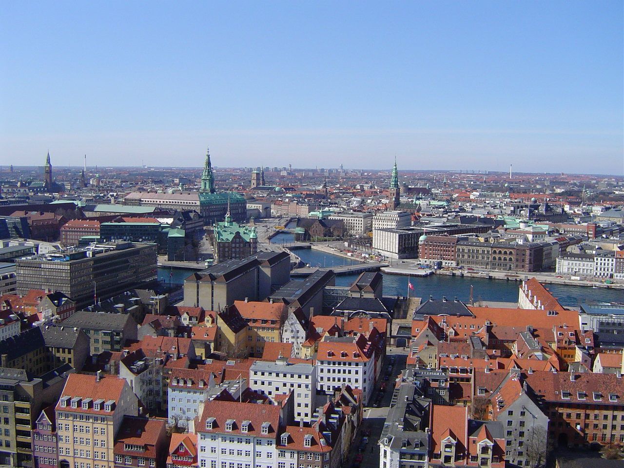
哥本哈根(丹麦语:København,![]() 发音 帮助·信息)是丹麦的首都、最大城市及最大港口。座落于丹麦西兰岛东部,与瑞典的马尔默隔松德海峡相望。
发音 帮助·信息)是丹麦的首都、最大城市及最大港口。座落于丹麦西兰岛东部,与瑞典的马尔默隔松德海峡相望。
松德海峡大桥在2000年完工后,哥本哈根与瑞典的马尔默可透过车辆和铁路往来,促成了两地人力资源的互相交流,每年利用松德海峡大桥的通勤人数不断增长。此外大桥通车后也让两座城市之间形成北欧地区最大的城市群。
在2008年,《Monocle》杂志将哥本哈根选为“最适合居住的城市”[4],并给予“最佳设计城市”的评价。哥本哈根在全球城市分类中被列为第二类世界级城市。此外哥本哈根在西欧地区获选为“设置企业总部的理想城市”第三名,仅次于巴黎和伦敦。[5]
哥本哈根城市建立之际的名称为“Kjøbmandehavn”,意为“商人的港口”。英语“Copenhagen”的名称来自于低地德语“Kopenhagen”,中文译名也由此而来。
Kopenhagen (dänisch [kʰøb̥m̩ˈhɑʊ̯ˀn], in bis ins 19. Jahrhundert gültiger Rechtschreibung Kjøbenhavn) ist die Hauptstadt Dänemarks und das kulturelle und wirtschaftliche Zentrum des Landes. Die Stadt ist Sitz von Parlament (Folketing) und Regierung sowie Residenz der dänischen Königin Margrethe II.
Die dänische Hauptstadt gehört zu den bedeutendsten Metropolen Nordeuropas, ist ein beliebtes Reiseziel und Hafenstadt. Die Kommune Kopenhagen (Københavns Kommune) hat 613.288 Einwohner, die Hauptstadt im formalen Sinne (bestehend aus den Kommunen København, Frederiksberg und Gentofte) 793.501 Einwohner. Kopenhagen ist Teil der dänischen Verwaltungsregion Region Hovedstaden und der binationalen Metropolregion Öresundregion.
Im 12. Jahrhundert wurde am Øresund eine Burg errichtet, die den kleinen Handelshafen nach Schonen und Amager an der Fischersiedlung Havn („Hafen“) sichern sollte. Nicht zuletzt die günstige Lage ungefähr halbwegs zwischen dem wichtigen Bischofssitz in Roskilde und dem skandinavischen Erzbischofssitz in Lund (damals dänisch) war von entscheidender Bedeutung. Entsprechend erhielt auch die mit der Burg neu gestaltete Siedlung den Namen Køpmannæhafn („Kaufmännerhafen“). 1254 erhielt das junge Kopenhagen von Bischof Jakob Erlandsen sein erstes Stadtrecht, allerdings wurde die Stadt in den Jahren 1362 und 1368 als unliebsamer Konkurrent der Hanse zusammen mit der Burg geplündert und zerstört. Nach einem erneuten Angriff der Hanse war der Hafen 1428 eine Zeitlang von Schiffwracks blockiert.
Die Entwicklung ließ sich jedoch nicht mehr aufhalten: 1416 wurde die wiederaufgebaute Stadt Residenz des Königs, und 1443 übernahm sie von Roskilde die Hauptstadtfunktion. In der ersten Hälfte des 17. Jahrhunderts blühte Kopenhagen unter Christian IV. auf.
コペンハーゲン(ドイツ語: Kopenhagen [kopənˈhaːgən])、クブンハウン(ケブンハウン)(デンマーク語: København 発音 [kʰøb̥m̩ˈhɑʊ̯ˀn] (![]() 音声ファイル)、コゥペンヘイゲン(英語: Copenhagen [ˌkoupənˈheigən])は、デンマークの首都。デンマーク最大の都市で、自治市の人口は52万人。市名はデンマーク語の"Kjøbmandehavn"(商人たちの港)に由来する。「北欧のパリ」と比喩される。
音声ファイル)、コゥペンヘイゲン(英語: Copenhagen [ˌkoupənˈheigən])は、デンマークの首都。デンマーク最大の都市で、自治市の人口は52万人。市名はデンマーク語の"Kjøbmandehavn"(商人たちの港)に由来する。「北欧のパリ」と比喩される。
Copenhagen[a] (Danish: København [købm̩ˈhɑwˀn] (![]() listen)) is the capital and most populous city of Denmark. The city has a population of 775,033 (as of January 2018), of whom 613,288 live in the Municipality of Copenhagen.[6][7] It forms the core of the wider Copenhagen urban area (population 1.3 million (as of January 2018) and the Copenhagen metropolitan area (population approx. 2 million). Copenhagen is situated on the eastern coast of the island of Zealand; another small portion of the city is located on Amager, and is separated from Malmö, Sweden, by the strait of Øresund. The Øresund Bridge connects the two cities by rail and road.
listen)) is the capital and most populous city of Denmark. The city has a population of 775,033 (as of January 2018), of whom 613,288 live in the Municipality of Copenhagen.[6][7] It forms the core of the wider Copenhagen urban area (population 1.3 million (as of January 2018) and the Copenhagen metropolitan area (population approx. 2 million). Copenhagen is situated on the eastern coast of the island of Zealand; another small portion of the city is located on Amager, and is separated from Malmö, Sweden, by the strait of Øresund. The Øresund Bridge connects the two cities by rail and road.
Originally a Viking fishing village established in the 10th century in the vicinity of what is now Gammel Strand, Copenhagen became the capital of Denmark in the early 15th century. Beginning in the 17th century it consolidated its position as a regional centre of power with its institutions, defences and armed forces. After suffering from the effects of plague and fire in the 18th century, the city underwent a period of redevelopment. This included construction of the prestigious district of Frederiksstaden and founding of such cultural institutions as the Royal Theatre and the Royal Academy of Fine Arts. After further disasters in the early 19th century when Horatio Nelson attacked the Dano-Norwegian fleet and bombarded the city, rebuilding during the Danish Golden Age brought a Neoclassical look to Copenhagen's architecture. Later, following the Second World War, the Finger Plan fostered the development of housing and businesses along the five urban railway routes stretching out from the city centre.
Since the turn of the 21st century, Copenhagen has seen strong urban and cultural development, facilitated by investment in its institutions and infrastructure. The city is the cultural, economic and governmental centre of Denmark; it is one of the major financial centres of Northern Europe with the Copenhagen Stock Exchange. Copenhagen's economy has seen rapid developments in the service sector, especially through initiatives in information technology, pharmaceuticals and clean technology. Since the completion of the Øresund Bridge, Copenhagen has become increasingly integrated with the Swedish province of Scania and its largest city, Malmö, forming the Øresund Region. With a number of bridges connecting the various districts, the cityscape is characterised by parks, promenades and waterfronts. Copenhagen's landmarks such as Tivoli Gardens, The Little Mermaid statue, the Amalienborg and Christiansborg palaces, Rosenborg Castle Gardens, Frederik's Church, and many museums, restaurants and nightclubs are significant tourist attractions. The largest lake of Denmark, Arresø, lies around 27 miles (43 kilometers) northwest of the City Hall Square.
Copenhagen is home to the University of Copenhagen, the Technical University of Denmark, Copenhagen Business School and the IT University of Copenhagen. The University of Copenhagen, founded in 1479, is the oldest university in Denmark. Copenhagen is home to the FC København and Brøndby football clubs. The annual Copenhagen Marathon was established in 1980. Copenhagen is one of the most bicycle-friendly cities in the world.
The Copenhagen Metro launched in 2002 serves central Copenhagen while the Copenhagen S-train and Lokaltog (private railway) and the Coast Line network serves and connects central Copenhagen to outlying boroughs. To relieve traffic congestion, which is partly the result of increased traffic because of the Fehmarn Belt Fixed Link road and rail construction is planned because the narrow 9-9.5 mile isthmus between Roskilde Fjord and Køge Bugt (Køge Bay) forms a traffic bottleneck. The Copenhagen-Ringsted Line will relieve traffic congestion in the corridor between Roskilde and Copenhagen.
Serving roughly two million passengers a month, Copenhagen Airport, Kastrup, is the busiest airport in the Nordic countries.
Copenhague (prononcé [kɔ.pə.naɡ]), en danois København [købm̩ˈhɑwˀn] Écouter, est la capitale et la plus grande ville du Danemark. La commune de Copenhague (Københavns Kommune) compte 569 557 habitants en 2014, et son agglomération, le Grand Copenhague, en compte 1 295 686 (janvier 2017). Le nom de Copenhague est généralement donné à l'ensemble du comté de Copenhague, qui regroupe quant à lui 1 950 430 habitants. Située sur la côte orientale de l'île de Seeland, face au détroit d'Øresund qui sépare le Danemark de la Suède voisine, Copenhague est reliée à Malmö par le pont de l’Øresund. Son nom danois, København (prononcé [kʰøb̥m̩ˈhɑʊ̯ˀn] Écouter), déformation de Købmandshavn (« le port des commerçants »), rappelle sa position stratégique sur le Kattegat, à proximité immédiate de la mer Baltique.
Fondée au Xe siècle par les Vikings, Copenhague est à l'origine un village de pêcheurs, fortifié en 1167. La ville devient la capitale du Royaume de Danemark dès le début du XVe siècle. Au cours du XVIIe siècle, sous le règne du roi Christian IV, elle devient une des plus grandes villes d'Europe du Nord, renforçant son statut de capitale. Après avoir connu les ravages de la peste et de nombreux incendies au XVIIIe siècle, Copenhague voit se construire la vieille ville actuelle, et notamment le quartier de Frederiksstaden et des institutions comme le Théâtre royal danois ou l'Académie royale des beaux-arts. En partie détruite par les troupes de l'amiral Nelson lors de la bataille de Copenhague (1801), la ville est reconstruite dans un style néoclassique durant l'Âge d'or danois. L'urbanisme de Copenhague est rénové à la suite de la Seconde Guerre mondiale par le plan Finger (en), qui organise le développement industriel et urbain autour des cinq voies ferrées partant du centre-ville (Indre By).
Copenhague est le siège du parlement national (le Folketing), du gouvernement et de la monarchie danoise ; plusieurs institutions se trouvent dans le château de Christiansborg. Elle est également le cœur industriel et financier du pays, accueillant les sièges sociaux des plus grandes entreprises danoises, comme Maersk, Novo Nordisk et la brasserie Carlsberg. Le niveau de vie y est très élevé et le PIB par habitant est parmi les plus importants au monde. Outre un dynamisme industriel dans les services et la pharmaceutique, l'économie de Copenhague est marquée par le développement des cleantechs, en lien avec l'objectif municipal de parvenir à la neutralité carbone d'ici 2025. Les transports en commun et l'usage du vélo sont très fortement développés.
Le paysage urbain de la ville est caractérisé par ses nombreux ponts, parcs et fronts de mer. Le port de Nyhavn est célèbre pour ses maisons en bois aux façades colorées. Christiania est une communauté intentionnelle autogérée, accueillant une population d'artistes, de hippies et des mouvements alternatifs. Dans le centre historique se trouvent le quartier branché de Vesterbro et le quartier latin, ainsi que le château de Rosenborg, ancienne résidence royale. À l'est, sur la côte, se trouve la citadelle du Kastellet et la statue de La Petite Sirène. Enfin, Copenhague compte deux vastes jardins aujourd'hui transformés en parc d'attractions : le Bakken et les Jardins de Tivoli.
Copenaghen (AFI: /kopeˈnaɡen/[2] ; in danese København; in italiano arcaico Copenaga[3]) è la capitale e la città più popolosa della Danimarca con 613.288 abitanti nel Comune (1.308.893 nell'area urbana al 2018). È situata sulle isole Sjælland e di Amager ed è separata dalla città svedese di Malmö dallo stretto di Øresund.
Copenhague4 (en danés: København ![]() [kʰøb̥m̩ˈhɑʊ̯ˀn] (?·i)) es la capital y la ciudad más poblada de Dinamarca, con una población urbana de 1 230 728 y una población metropolitana 1 967 727, a fecha de 1 de octubre de 2013. Está situada en la costa oriental de Selandia, a 28 km de Malmoe (Suecia), y a 164 kilómetros (102 mi) de Odense. La ciudad se extiende por partes de la isla de Amager y también contiene el enclave del municipio de Frederiksberg. Fue premiada con el título Capital Verde Europea 2014.
[kʰøb̥m̩ˈhɑʊ̯ˀn] (?·i)) es la capital y la ciudad más poblada de Dinamarca, con una población urbana de 1 230 728 y una población metropolitana 1 967 727, a fecha de 1 de octubre de 2013. Está situada en la costa oriental de Selandia, a 28 km de Malmoe (Suecia), y a 164 kilómetros (102 mi) de Odense. La ciudad se extiende por partes de la isla de Amager y también contiene el enclave del municipio de Frederiksberg. Fue premiada con el título Capital Verde Europea 2014.
Originalmente un pueblo de pescadores vikingo fundado en el siglo X, Copenhague se convirtió en la capital de Dinamarca a principios del siglo XV. Durante el siglo XVII, bajo el reinado de Cristián IV, se convirtió en un importante centro regional, consolidando su posición como capital de Dinamarca y Noruega con sus instituciones, defensas, y fuerzas armadas. Tras sufrir los efectos de plagas e incendios en el siglo XVIII, la ciudad vivió una etapa de remodelación que incluyó reformas del prestigioso barrio de Frederiksstaden y de instituciones culturales como el Teatro Real y la Real Academia de Bellas Artes. Después de diferentes desastres en el siglo XIX, cuando Horatio Nelson atacó la flota danesa y bombardeó la ciudad, las reconstrucciones durante la Edad de Oro danesa trajeron un nuevo estilo neoclásico a la arquitectura kobmendense. Más tarde, tras la Segunda Guerra Mundial, el Proyecto de los Dedos fomentó la creación de viviendas y negocios a lo largo de las cinco rutas ferroviarias urbanas que se extienden hacia fuera desde el centro de la ciudad.
La historia de Copenhague se remonta a alrededor del año 800, cuando surge en torno a un pequeño pueblo de pescadores. Desde el año 1300 se convirtió en la capital de Dinamarca en detrimento de Roskilde, un estatus que la ciudad ha mantenido desde entonces. En la actualidad, Copenhague alberga alrededor del 20 % de la población de Dinamarca. Después de una crisis económica, la ciudad ha experimentado en los últimos diez años un importante progreso económico y cultural, y es ahora más fuerte tanto a nivel nacional como internacional.
La ciudad es hogar de una serie de grandes empresas y las instituciones culturales, AP Moller-Maersk, Carlsberg, Park, el Museo Nacional, la Ópera y el teatro del Rey.
Копенга́ген (дат. København [kʰøb̥ənˈhaʊ̯ˀn][3] / [кхёбэнха́ў’н], до 1906 г. Kjøbenhavn[4], стародат. Køpmannæhafn — «гавань торговцев», лат. Hafnia) — столица и самый крупный город Дании. Располагается на островах Зеландия, Слотсхольмен и Амагер. Население исторического города составляет чуть более 600 тыс. человек, с пригородами — более 1.3 млн жителей. Часть города — самопровозглашённый Свободный город Христиания — находится на частичном самоуправлении.
Город является культурным, экономическим и правительственным центром Дании; это один из крупнейших финансовых центров Северной Европы с Копенгагенской фондовой биржей. Экономика Копенгагена имела быстрое развитие в секторе услуг, особенно посредством инициатив в информационных технологиях, фармацевтике и чистой технологии. После завершения строительства Эресуннского моста Копенгаген стал более интегрированым со шведской провинцией Скания и её крупнейшим городом Мальме, образуя Эресуннский регион.
Копенгагенский университет, основанный в 1479 году, является старейшим университетом в Дании.