漢德百科全書 | 汉德百科全书
 Bosnien-Herzegowina
 Architektur
 Religion
 Geographie

 Internationale Städte
 Skiurlaub


Sarajevo (serbisch-kyrillisch Сарајево; deutsch auch Sarajewo) ist Hauptstadt und Regierungssitz von Bosnien und Herzegowina, der Föderation Bosnien und Herzegowina (Federacija Bosne i Hercegovine/FBiH), des Kantons Sarajevo sowie de jure der Republika Srpska.
Die Stadt hat in ihren vier Gemeinden Stari Grad (Altstadt), Centar (Zentrum), Novi Grad (Neustadt) und Novo Sarajevo (Neu-Sarajevo) 291.422 Einwohner. In der Agglomeration Sarajevo leben etwa 515.000 und in der Metropolregion Sarajevo 608.354 Einwohner (Zensus 2013).[1] Aufgrund der Einwohnerzahl sowie der wirtschaftlichen und politischen Bedeutung ist Sarajevo die einzige bosnische Metropole.[3]
Der Südostteil Sarajevos gehört administrativ zur Stadt Istočno Sarajevo in der Republika Srpska.
萨拉热窝(波斯尼亚语:Sarajevo;克罗地亚语:Sarajevo;塞尔维亚语:Сарајево/Sarajevo;台湾译塞拉耶佛)是波斯尼亚和黑塞哥维那的首都,也是波黑人口最多的城市。据2011年8月估计,波黑萨拉热窝州下属四个自治体,人口合共311,161人。萨拉热窝同时也是萨拉热窝州的首府。
萨拉热窝位于波斯尼亚萨拉热窝山谷之中,米里雅茨河沿岸,被狄那里克阿尔卑斯山脉所包围。萨拉热窝是波黑的社会及文化中心,也拥有区域性的政治、教育、娱乐、媒体、时尚、科学和艺术影响力,还是波黑主要的经济中心[7][8]。
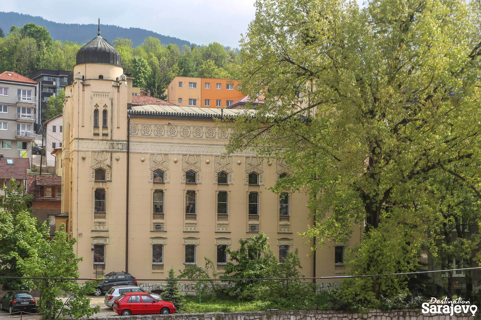
萨拉热窝以其宗教多样性闻名于世,伊斯兰教、东正教、天主教、犹太教数世纪以来都共存其中[9][10]。因其悠久的历史和宗教及文化多样性,萨拉热窝常被称为“欧洲的耶路撒冷”[1] 或者“巴尔干的耶路撒冷”[2]。直到20世纪后期为止,萨拉热窝都是欧洲仅有的清真寺、天主教堂、东正教堂和犹太教堂可以比邻共存的大都市[3]。
虽然萨拉热窝地区在史前时代开始就有人居住,但今日的萨拉热窝是在15世纪奥斯曼帝国统治时期开始发展的[10][11]。萨拉热窝在近代多次成为国际关注的热点。萨拉热窝在1885年成为欧洲首个,也是全世界第二个全天运行路面电车的城市(世界首个有全天运行路面电车的城市是美国的旧金山)[12]。1914年,萨拉热窝发生了奥地利王储暗杀事件(又名萨拉热窝暗杀事件)。这起事件是第一次世界大战的直接导火线。1984年,萨拉热窝是1984年冬季奥林匹克运动会的会场。之后的南斯拉夫解体时期,萨拉热窝在波黑战争期间遭到了持续数年的塞尔维亚人势力的包围,这也是现代战争史上时间最长的围困战[13]。
时至2012年,萨拉热窝仍处在战后的复兴重建中,正在逐渐恢复战前的水准[14]。旅行指南《寂寞星球》在“世界都市”排行榜中将萨拉热窝排在第43位。这个名次要高过同样是前南斯拉夫诸国各个观光都市,包括第59位的杜布罗夫尼克、第84位的第卢布尔雅那、第90位的布莱德、第113位的贝尔格莱德以及第135位的萨格勒布[15][16],在2009年12月,萨拉热窝还被列入2010年最值得去旅行的十大都市之一[17]。2012年3月,萨拉热窝战胜了全世界其他100多个都市,被旅行博客Foxnomad评为“最佳旅游都市”[18]。2011年,萨拉热窝获得2014年欧洲文化之都的提名,是唯一获得提名的欧盟以外的都市[19][20]。
サラエヴォ[3][4][5](ボスニア語:Sarajevo [sǎrajeʋo]、クロアチア語:Sarajevo、セルビア語:Сарајево)は、ボスニア・ヘルツェゴビナの首都であり、同国で最大の人口をもつ都市である。ボスニア・ヘルツェゴビナの構成体のひとつであるボスニア・ヘルツェゴビナ連邦の首都でもある。
日本語表記においては、一般に「サラエボ」[6]や「サライェヴォ」[7]などの表記も多く見られる(以下、本項では「サラエヴォ」とする。呼称と表記も参照)。
2011年8月の推計では、ボスニア・ヘルツェゴビナのサラエヴォ県に属する4つの自治体の人口は併せて311,161人である。サラエヴォはまた、サラエヴォ県の県都でもある。サラエヴォはボスニア地方のサラエヴォ渓谷のなかにあり、ディナール・アルプスに取り囲まれ、ミリャツカ川周辺に広がっている。サラエヴォの町は宗教的な多様性で知られており、イスラム教、正教会、カトリック教会、ユダヤ教が何世紀にもわたって共存してきた[8]。旅行ガイドブックのロンリープラネットでは、「世界の都市」ランキングにおいてサラエヴォを43位にランクしている。これは、同じ旧ユーゴスラビア諸国の観光都市であるドゥブロヴニクの59位、リュブリャナの84位、ブレッドの90位、ベオグラードの113位、ザグレブの135位を上回る[9]。
サラエヴォに隣接して、ボスニア・ヘルツェゴビナの構成体のひとつであるスルプスカ共和国の首都であるイストチノ・サラエヴォ(東サラエヴォ)がある。現在のイストチノ・サラエヴォの市域には、ボスニア・ヘルツェゴビナ紛争前のサラエヴォの市域の一部が含まれている。
この地域に人が居住を始めたのは先史時代にまでさかのぼるものの、現代のサラエヴォにつながる町ができたのは15世紀のオスマン帝国の統治下でのことであった[10]。オーストリア=ハンガリー帝国に併合されたのちもボスニアの州都と位置付けられたサラエヴォは、近代以降の何度かにわたって国際的な注目を受けることになった。1914年にはこの地はオーストリア帝位継承者の暗殺事件の現場となり、この事件によって第一次世界大戦が引き起こされた。1984年にはサラエヴォは1984年冬季オリンピックの会場となり、さらに後のユーゴスラビア崩壊のときには、ボスニア・ヘルツェゴビナ紛争において数年間にわたるセルビア人勢力による包囲を受けた。現在のサラエヴォは紛争後の復興開発が進み、21世紀初頭において紛争前の水準を回復しつつある。サラエヴォは、ボスニア・ヘルツェゴビナの経済・文化活動の拠点となっている[11]。サラエヴォはヨーロッパで初めて、そして全世界で2番目に早く終日(朝から夜まで)運行の路面電車が運行された町である[* 1]。
Sarajevo (Cyrillic: Сарајево, pronounced [sǎrajeʋo]; see names in other languages) is the capital[5] and largest city of Bosnia and Herzegovina, with a population of 275,524 in its current administrative limits.[4][6] The Sarajevo metropolitan area, including Sarajevo Canton, East Sarajevo and nearby municipalities is home to 555,210 inhabitants.a[7] Nestled within the greater Sarajevo valley of Bosnia, it is surrounded by the Dinaric Alps and situated along the Miljacka River in the heart of the Balkans.
Sarajevo is the political, social and cultural center of Bosnia and Herzegovina, a prominent center of culture in the Balkans, with its region-wide influence in entertainment, media, fashion, and the arts.[8][9]
Due to its long and rich history of religious and cultural diversity, Sarajevo is sometimes called the "Jerusalem of Europe"[1] or "Jerusalem of the Balkans".[2] It is one of only a few major European cities which have a mosque, Catholic church, Orthodox church and synagogue within the same neighborhood.[10] A regional center in education, the city is also home to the Balkans first institution of tertiary education in the form of an Islamic polytechnic called the Saraybosna Osmanlı Medrese, today part of the University of Sarajevo.[11][12]
Although settlement in the area stretches back to prehistoric times, the modern city arose as an Ottoman stronghold in the 15th century.[13] Sarajevo has attracted international attention several times throughout its history. In 1885, Sarajevo was the first city in Europe and the second city in the world to have a full-time electric tram network running through the city, following San Francisco.[14] In 1914, it was the site of the assassination of Archduke Franz Ferdinand of Austria by local Young Bosnia activist Gavrilo Princip that sparked World War I, which also ended Austro-Hungarian rule in Bosnia and resulted in the creation of the Kingdom of Yugoslavia. Later, after World War II, the establishment of the Socialist Republic of Bosnia and Herzegovina within the Second Yugoslavia led to a massive expansion of Sarajevo, the constituent republic's capital, which culminated with the hosting of the 1984 Winter Olympics marking a prosperous era for the city. However, after the start of the Yugoslav Wars, for 1,425 days, from April 1992 to February 1996, the city suffered the longest siege of a capital city in the history of modern warfare, during the Bosnian War and the breakup of Yugoslavia.[15]
Sarajevo has been undergoing post-war reconstruction, and is the fastest growing city in Bosnia and Herzegovina.[16] The travel guide series Lonely Planet has named Sarajevo as the 43rd best city in the world,[17] and in December 2009 listed Sarajevo as one of the top ten cities to visit in 2010.[18] In 2011, Sarajevo was nominated to be the European Capital of Culture in 2014 and will be hosting the European Youth Olympic Festival in 2019.[19][20]
Sarajevo (en bosnien cyrillique, Сарајево ; anciennement Bosna-Seraï ; en turc, Saraybosna), prononcé [saʁajɛvo], est la capitale et la plus grande ville de Bosnie-Herzégovine. Avant la guerre de Bosnie-Herzégovine, le dernier recensement de 1991 évaluait la population à 429 672 habitants. En 2013, selon le site officiel de Sarajevo, la population de la ville proprement dite est estimée à 395 133 habitants1.
La ville est considérée comme l'une des plus importantes villes des Balkans et son histoire est particulièrement riche depuis sa création par les Ottomans en 1461. La ville a été le théâtre de l'assassinat par Gavrilo Princip de l'archiduc François-Ferdinand d'Autriche, qui marqua le début de la Première Guerre mondiale. Plus récemment, elle accueillit les Jeux olympiques d'hiver de 1984 et fut assiégée durant la guerre de Bosnie-Herzégovine dans les années 1990. Dans la ville, la guerre a laissé de nombreuses traces visibles sur toutes les façades d'immeuble qui portent des traces d'impacts et de réparations de fortune. Les marques des obus dans les chaussées, sont quant à elles précieusement conservées. Le siège reste lui aussi omniprésent dans les conversations. Entre 1992 et 1996, la capitale de Bosnie-Herzégovine a subi un siège de plus de mille jours qui a fait plus de 11 000 morts. Traversée par la rivière Miljacka, la ville fait partie du canton de Sarajevo, l'un des dix que compte la Fédération de Bosnie-et-Herzégovine.
Sarajevo (in alfabeto cirillico serbo Сарајево; in giudesmo Saraj; in turco Saraybosna), in italiano Saraievo (AFI: /saraˈjɛːvo/) o raramente Seraievo[1], è la capitale e la più grande città della Bosnia ed Erzegovina.
Il toponimo è la forma slavizzata della parola turca saray, che significa "palazzo"[2], ma il suo nome originario era Vrhbosna.
La sua popolazione si aggira attorno ai 275.524 abitanti (al 2013). Nel 1914 vi ebbe luogo l'attentato all'arciduca austriaco Francesco Ferdinando che innescò la prima guerra mondiale.
Nel 1984 la città ospitò i XIV Giochi olimpici invernali. Tra il 1992 e il 1995, durante la guerra di Bosnia, soffrì più di tre anni d'assedio da parte delle forze serbo-bosniache.
Sarajevo (en cirílico: Сарајево; /sǎrajɛʋɔ/) es la capital y ciudad más poblada de Bosnia y Herzegovina, con una población de 395.133 habitantes en las cuatro municipalidades que forman la ciudad, y con un área metropolitana de 688,437 habitantes en el Cantón de Sarajevo.12 Es también la capital de la Federación de Bosnia y Herzegovina, así como el centro del Cantón de Sarajevo. Contigua a ella (y agrupando barrios que antes de la guerra también formaban parte de Sarajevo) se encuentra Sarajevo Oriental que es la ciudad capital de jure de la República Srpska.
Sarajevo está emplazada en el valle de Sarajevo en la región de Bosnia, rodeada de los Alpes Dináricos y en torno al río Miljacka. El centro de la ciudad se encuentra a 511 metros sobre el nivel del mar mientras que algunos barrios alcanzan los 700 metros, lo que hace de Sarajevo una de las ciudades a más altura en Europa. Los picos montañosos que rodean Sarajevo alcanzan y sobrepasan los 2.000 metros sobre el nivel del mar.
La ciudad es conocida por su tradicional diversidad religiosa, con fieles musulmanes, ortodoxos, católicos y judíos, que llevan conviviendo desde hace siglos. Debido a esta larga y rica historia de diversidad religiosa y coexistencia, Sarajevo es conocida como la "Jerusalén de Europa".3
Aunque los primeros asentamientos en la zona datan de los tiempos prehistóricos, la moderna ciudad de Sarajevo fue edificada como fortaleza para el Imperio otomano en el siglo XV.4 Sarajevo ha atraído la atención internacional en varias ocasiones a lo largo de su historia: en 1914 tuvo lugar el asesinato del Archiduque Francisco Fernando de Austria, que acabó siendo el detonante definitivo para el estallido de la Primera Guerra Mundial. Setenta años después, la ciudad organizó los Juegos Olímpicos de invierno de 1984. A comienzos de la década de 1990, Sarajevo sufrió el mayor asedio en la historia de la guerra moderna durante la Guerra de Bosnia. Hoy en día, la ciudad se está recuperando y adaptando a la realidad de la posguerra, y es el centro cultural y económico del país.5 Sarajevo se convirtió en una de las primeras ciudades europeas en contar con una red de tranvía eléctrico con servicio ininterrumpido en la ciudad.6
Сара́ево (босн. Sarajevo, хорв. Sarajevo, серб. Сарајево [sǎrajeʋo], тур. Saraybosna) — город, столица Боснии и Герцеговины. Административный центр Сараевского кантона. Образует муниципальное образование «город Сараево», разделённое на четыре самоуправляемых района.
Население — 275,5 тысячи человек (2013), или 8 % населения Боснии и Герцеговины. Национальный состав (среди указавших, 2013): босняков — 81 %, хорватов — 5 %, сербов — 4 %. Доля сербов, проживающих в городе, в результате войны 1992—1995 годов многократно сократилась.
Расположено в межгорной котловине на берегах реки Миляцки, на территории Федерации Боснии и Герцеговины. С южной стороны к Сараеву непосредственно примыкает его бывшая часть — ныне город Источно-Сараево, расположенный на территории Республики Сербской.
Главный политический, экономический и культурный центр Федерации Боснии и Герцеговины. Производит 31 % ВВП Федерации (2012). Исторический центр состоит из построек периода Османской и Австро-Венгерской империй XVI — начала XX веков.
Поселение, впоследствии получившее название Босна-Сарай (от тур. saray — «дворец»), основано турками около 1462 года. С 1639 года с перерывами — административный центр Боснийского эялета, с 1878 года — главный город австро-венгерской Боснии и Герцеговины. С 1918 года — в Королевстве сербов, хорватов и словенцев. С 1945 года — столица республики Босния и Герцеговина.

 Geschichte
 Afghanistan
Ägypten
Albanien
Antigua und Barbuda
Argentinien
Armenien
Aserbaidschan
Bahrain
Bangladesh
Barbados
Beijing Shi-BJ
Belarus
Belgien
Bernsteinstraße
Bolivien
Bosnien-Herzegowina
Bulgarien
Chile
China
Chongqing Shi-CQ
Columbia
Costa Rica
Cuba
Demokratische Republik Timor-Leste
Dominica
Dominikanische Republik
Ecuador
Eritrea
Fidschi
Afghanistan
Ägypten
Albanien
Antigua und Barbuda
Argentinien
Armenien
Aserbaidschan
Bahrain
Bangladesh
Barbados
Beijing Shi-BJ
Belarus
Belgien
Bernsteinstraße
Bolivien
Bosnien-Herzegowina
Bulgarien
Chile
China
Chongqing Shi-CQ
Columbia
Costa Rica
Cuba
Demokratische Republik Timor-Leste
Dominica
Dominikanische Republik
Ecuador
Eritrea
Fidschi
 Finanz
Finanz
Finanz
 *China-Konjunkturdaten
Fujian Sheng-FJ
Gansu Sheng-GS
Georgien
Grenada
Griechenland
Guangdong Sheng-GD
Guangxi Zhuangzu Zizhiqu-GX
Guyana
Hainan Sheng-HI
*China-Konjunkturdaten
Fujian Sheng-FJ
Gansu Sheng-GS
Georgien
Grenada
Griechenland
Guangdong Sheng-GD
Guangxi Zhuangzu Zizhiqu-GX
Guyana
Hainan Sheng-HI
 Hand in Hand
Hebei Sheng-HE
Heilongjiang Sheng-HL
Henan Sheng-HA
Honduras
Hongkong Tebiexingzhengqu-HK
Indonesien
Irak
Iran
Jamaika
Jemen
Jiangsu Sheng-JS
Jilin Sheng-JL
Jordanien
Kambodscha
Kasachstan
Katar
Kenia
Kenia
Kirgisistan
Kroatien
Kuwait
Laos
Lettland
Liaoning Sheng-LN
Libanon
Litauen
Luxemburg
Madagaskar
Malaysia
Malediven
Malta
Moldawien
Hand in Hand
Hebei Sheng-HE
Heilongjiang Sheng-HL
Henan Sheng-HA
Honduras
Hongkong Tebiexingzhengqu-HK
Indonesien
Irak
Iran
Jamaika
Jemen
Jiangsu Sheng-JS
Jilin Sheng-JL
Jordanien
Kambodscha
Kasachstan
Katar
Kenia
Kenia
Kirgisistan
Kroatien
Kuwait
Laos
Lettland
Liaoning Sheng-LN
Libanon
Litauen
Luxemburg
Madagaskar
Malaysia
Malediven
Malta
Moldawien
 Mongolei
Montenegro
Myanmar
Nei Mongol Zizhiqu-NM
Nepal
Neuseeland
Nicaragua
Ningxia Huizu Zizhiqu-NX
Ningxia Huizu Zizhiqu-NX
Nordmazedonien
Oman
Österreich
Pakistan
Palästina
Papua-Neuguinea
Peru
Polen
Portugal
Qinghai Sheng-QH
Republik El Salvador
Republik Korea
Republik Sudan
Rumänien
Russland
Schweiz
Seidenstraße
Serbien
Serbien
Shaanxi Sheng-SN
Shanghai Shi-SH
Sichuan Sheng-SC
Singapur
Slowakei
Slowenien
Somalia
Sri Lanka
Südafrika
Suriname
Syrien
Tadschikistan
Taiwan Sheng-TW
Thailand
Tianjin Shi-TJ
Tianjin Shi-TJ
Trinidad und Tobago
Türkei
Turkmenistan
Ukraine
Ungarn
Mongolei
Montenegro
Myanmar
Nei Mongol Zizhiqu-NM
Nepal
Neuseeland
Nicaragua
Ningxia Huizu Zizhiqu-NX
Ningxia Huizu Zizhiqu-NX
Nordmazedonien
Oman
Österreich
Pakistan
Palästina
Papua-Neuguinea
Peru
Polen
Portugal
Qinghai Sheng-QH
Republik El Salvador
Republik Korea
Republik Sudan
Rumänien
Russland
Schweiz
Seidenstraße
Serbien
Serbien
Shaanxi Sheng-SN
Shanghai Shi-SH
Sichuan Sheng-SC
Singapur
Slowakei
Slowenien
Somalia
Sri Lanka
Südafrika
Suriname
Syrien
Tadschikistan
Taiwan Sheng-TW
Thailand
Tianjin Shi-TJ
Tianjin Shi-TJ
Trinidad und Tobago
Türkei
Turkmenistan
Ukraine
Ungarn
 Urlaub und Reisen
Uruguay
Usbekistan
Venezuela
Vereinigte Arabische Emirate
Vietnam
Urlaub und Reisen
Uruguay
Usbekistan
Venezuela
Vereinigte Arabische Emirate
Vietnam
 Weltkulturerbe
 Wirtschaft und Handel
Xinjiang Uygur Zizhiqu-XJ
Zhejiang Sheng-ZJ
Zypern
Wirtschaft und Handel
Xinjiang Uygur Zizhiqu-XJ
Zhejiang Sheng-ZJ
Zypern

Als Seidenstraße (chinesisch 絲綢之路 / 丝绸之路, Pinyin Sīchóu zhī Lù ‚die Route / Straße der Seide‘; mongolisch ᠲᠣᠷᠭᠠᠨ ᠵᠠᠮ Tôrgan Jam; kurz: 絲路 / 丝路, Sīlù) bezeichnet man ein altes Netz von Karawanenstraßen, dessen Hauptroute den Mittelmeerraum auf dem Landweg über Zentralasien mit Ostasien verband. Die Bezeichnung geht auf den im 19. Jahrhundert lebenden deutschen Geografen Ferdinand von Richthofen zurück, der den Begriff 1877 erstmals verwendet hat.
Auf der antiken Seidenstraße wurde in westliche Richtung hauptsächlich Seide, gen Osten vor allem Wolle, Gold und Silber gehandelt.[1] Nicht nur Kaufleute, Gelehrte und Armeen nutzten ihr Netz, sondern auch Ideen, Religionen und ganze Kulturkreise diffundierten und migrierten auf den Routen von Ost nach West und umgekehrt: hierüber kamen z. B. der Nestorianismus (aus dem spätantiken Römischen Reich) und der Buddhismus (von Indien) nach China.[1]
Die 6.400 Kilometer[1] lange Route begann in Xi’an und folgte dem Verlauf der Chinesischen Mauer in Richtung Nordwesten, passierte die Taklamakan-Wüste, überwand das Pamirgebirge und führte über Afghanistan in die Levante; von hier wurden die Handelsgüter dann über das Mittelmeer verschifft. Nur wenige Kaufleute reisten auf der gesamten Route, die Waren wurden eher gestaffelt über Zwischenhändler transportiert.
Ihre größte Bedeutung erreichte das Handels- und Wegenetz zwischen 115 v. Chr. und dem 13. Jahrhundert n. Chr. Mit dem allmählichen Verlust römischen Territoriums in Asien und dem Aufstieg Arabiens in der Levante wurde die Seidenstraße zunehmend unsicher und kaum noch bereist. Im 13. und 14. Jahrhundert wurde die Strecke unter den Mongolen wiederbelebt, u. a. benutzte sie zu der Zeit der Venezianer Marco Polo um nach Cathay (China) zu reisen. Nach weit verbreiteter Ansicht war die Route einer der Hauptwege, über die Mitte des 14. Jahrhunderts Pestbakterien von Asien nach Europa gelangten und dort den Schwarzen Tod verursachten.[1]
Teile der Seidenstraße sind zwischen Pakistan und dem autonomen Gebiet Xinjiang in China heute noch als asphaltierte Fernstraße vorhanden (-> Karakorum Highway). Die alte Straße inspirierte die Vereinten Nationen zu einem Plan für eine transasiatische Fernstraße. Von der UN-Wirtschafts- und Sozialkommission für Asien und den Pazifik (UNESCAP) wird die Einrichtung einer durchgehenden Eisenbahnverbindung entlang der Route vorangetrieben, der Trans-Asian Railway.[1]
Die "Neue Seidenstraße", das "One Belt, One Road"-Projekt der Volksrepublik China unter ihrem Staatspräsident Xi Jinping umfasst landgestützte (Silk Road Economic Belt) und maritime (Maritime Silk Road) Infrastruktur- und Handelsrouten, Wirtschaftskorridore und Transportlinien von China über Zentralasien und Russland bzw. über Afrika nach Europa, dazu werden verschiedenste Einrichtungen (z. B. Tiefsee- oder Containerterminals) und Verbindungen (wie Bahnlinien oder Gaspipelines) entwickelt bzw. ausgebaut. Bestehende Korridore sind einerseits Landverbindungen über die Türkei oder Russland und andererseits Anknüpfungen zum Hafen von Shanghai, über Hongkong und Singapur nach Indien und Ostafrika, Dubai, den Suez-Kanal, den griechischen Hafen Piräus nach Venedig.[2]
Das Projekt One Belt, One Road (OBOR, chinesisch 一帶一路 / 一带一路, Pinyin Yídài Yílù ‚Ein Band, Eine Straße‘, neuerdings Belt and Road, da „One“ zu negativ besetzt war) bündelt seit 2013 die Interessen und Ziele der Volksrepublik China unter Staatspräsident Xi Jinping zum Auf- und Ausbau interkontinentaler Handels- und Infrastruktur-Netze zwischen der Volksrepublik und zusammen 64 weiteren Ländern Afrikas, Asiens und Europas. Die Initiative bzw. das Gesamtprojekt betrifft u. A. rund 62 % der Weltbevölkerung und ca. 35 % der Weltwirtschaft.[1][2]
Umgangssprachlich wird das Vorhaben auch „Belt and Road Initiative“ (B&R, BRI) bzw. ebenso wie das Projekt Transport Corridor Europe-Caucasus-Asia (TRACECA) auch „Neue Seidenstraße“ (新絲綢之路 / 新丝绸之路, Xīn Sīchóuzhīlù) genannt. Es bezieht sich auf den geografischen Raum des historischen, bereits in der Antike genutzten internationalen Handelskorridors „Seidenstraße“; zusammengefasst handelt es sich um zwei Bereiche, einen nördlich gelegenen zu Land mit sechs Bereichen unter dem Titel Silk Road Economic Belt und einen südlich gelegenen Seeweg namens Maritime Silk Road.
丝绸之路(德语:Seidenstraße;英语:Silk Road),常简称为丝路,此词最早来自于德意志帝国地理学家费迪南·冯·李希霍芬男爵于1877年出版的一套五卷本的地图集。[1]
丝绸之路通常是指欧亚北部的商路,与南方的茶马古道形成对比,西汉时张骞以长安为起点,经关中平原、河西走廊、塔里木盆地,到锡尔河与乌浒河之间的中亚河中地区、大伊朗,并联结地中海各国的陆上通道。这条道路也被称为“陆路丝绸之路”,以区别日后另外两条冠以“丝绸之路”名称的交通路线。因为由这条路西运的货物中以丝绸制品的影响最大,故得此名。其基本走向定于两汉时期,包括南道、中道、北道三条路线。但实际上,丝绸之路并非是一条 “路”,而是一个穿越山川沙漠且没有标识的道路网络,并且丝绸也只是货物中的一种。[1]:5
广义的丝绸之路指从上古开始陆续形成的,遍及欧亚大陆甚至包括北非和东非在内的长途商业贸易和文化交流线路的总称。除了上述的路线之外,还包括约于前5世纪形成的草原丝绸之路、中古初年形成,在宋代发挥巨大作用的海上丝绸之路和与西北丝绸之路同时出现,在宋初取代西北丝绸之路成为路上交流通道的南方丝绸之路。
虽然丝绸之路是沿线各君主制国家共同促进经贸发展的产物,但很多人认为,西汉的张骞在前138—前126年和前119年曾两次出使西域,开辟了中外交流的新纪元,并成功将东西方之间最后的珠帘掀开。司马迁在史记中说:“于是西北国始通于汉矣。然张骞凿空,其后使往者皆称博望侯,以为质与国外,外国由此信之”,称赞其开通西域的作用。从此,这条路线被作为“国道”踩了出来,各国使者、商人、传教士等沿着张骞开通的道路,来往络绎不绝。上至王公贵族,下至乞丐狱犯,都在这条路上留下了自己的足迹。这条东西通路,将中原、西域与大伊朗、累范特、阿拉伯紧密联系在一起。经过几个世纪的不断努力,丝绸之路向西伸展到了地中海。广义上丝路的东段已经到达了朝鲜、日本,西段至法国、荷兰。通过海路还可达意大利、埃及,成为亚洲和欧洲、非洲各国经济文化交流的友谊之路。
丝绸之路经济带和21世纪海上丝绸之路(英语:The Silk Road Economic Belt and the 21st-century Maritime Silk Road[1]),简称一带一路(英语:The Belt and Road Initiative,缩写B&R)[1],是中华人民共和国政府于2013年倡议[2]并主导的跨国经济带[3]。
一带一路范围涵盖历史上丝绸之路和海上丝绸之路行经的中国、中亚、北亚和西亚、印度洋沿岸、地中海沿岸的国家和地区。中国政府指出,“一带一路”倡议坚持共商、共建、共享的原则,努力实现沿线区域基础设施更加完善,更加安全高效,以形成更高水平的陆海空交流网络。同时使投资贸易的便利化水平更有效的提升,建立高品质、高标准的自由贸易区域网。以使沿线各国经济联系更加紧密,政治互信更加的深入,人文交流更加的广泛[4]。
シルクロード(絹の道、英語: Silk Road, ドイツ語: Seidenstraße, 繁体字:絲綢之路, 簡体字:丝绸之路)は、中国と地中海世界の間の歴史的な交易路を指す呼称である。絹が中国側の最も重要な交易品であったことから名付けられた。その一部は2014年に初めて「シルクロード:長安-天山回廊の交易路網」としてユネスコの世界遺産に登録された。
「シルクロード」という名称は、19世紀にドイツの地理学者リヒトホーフェンが、その著書『China(支那)』(1巻、1877年)においてザイデンシュトラーセン(ドイツ語:Seidenstraßen;「絹の道」の複数形)として使用したのが最初であるが、リヒトホーフェンは古来中国で「西域」と呼ばれていた東トルキスタン(現在の中国新疆ウイグル自治区)を東西に横断する交易路、いわゆる「オアシスの道(オアシスロード)」を経由するルートを指してシルクロードと呼んだのである。リヒトホーフェンの弟子で、1900年に楼蘭の遺跡を発見したスウェーデンの地理学者ヘディンが、自らの中央アジア旅行記の書名の一つとして用い、これが1938年に『The Silk Road』の題名で英訳されて広く知られるようになった。
シルクロードの中国側起点は長安(陝西省西安市)、欧州側起点はシリアのアンティオキアとする説があるが、中国側は洛陽、欧州側はローマと見る説などもある。日本がシルクロードの東端だったとするような考え方もあり、特定の国家や組織が経営していたわけではないのであるから、そもそもどこが起点などと明確に定められる性質のものではない。
現在の日本でこの言葉が使われるときは、特にローマ帝国と秦・漢帝国、あるいは大唐帝国の時代の東西交易が念頭に置かれることが多いが、広くは近代(大航海時代)以前のユーラシア世界の全域にわたって行われた国際交易を指し、南北の交易路や海上の交易路をも含める。つまり、北方の「草原の道(ステップロード)」から南方の「海の道(シーロード)」までを含めて「シルクロード」と呼ばれるようになっているわけである。
シルクロード経済ベルトと21世紀海洋シルクロード(シルクロードけいざいベルトと21せいきかいようシルクロード、拼音: 、英語: The Silk Road Economic Belt and the 21st-century Maritime Silk Road)とは、2014年11月10日に中華人民共和国北京市で開催されたアジア太平洋経済協力首脳会議で、習近平総書記が提唱した経済圏構想である。
略称は一帯一路(いったいいちろ、拼音: 、英語: The Belt and Road Initiative, BRI; One Belt, One Road Initiative, OBOR)。
The Silk Road was an ancient network of trade routes that connected the East and West. It was central to cultural interaction between the regions for many centuries.[1][2][3] The Silk Road refers to both the terrestrial and the maritime routes connecting East Asia and Southeast Asia with East Africa, West Asia and Southern Europe.
The Silk Road derives its name from the lucrative trade in silk carried out along its length, beginning in the Han dynasty (207 BCE–220 CE). The Han dynasty expanded the Central Asian section of the trade routes around 114 BCE through the missions and explorations of the Chinese imperial envoy Zhang Qian.[4] The Chinese took great interest in the safety of their trade products and extended the Great Wall of China to ensure the protection of the trade route.[5]
Trade on the Road played a significant role in the development of the civilizations of China, Korea,[6] Japan,[2] India, Iran, Afghanistan, Europe, the Horn of Africa and Arabia, opening long-distance political and economic relations between the civilizations.[7] Though silk was the major trade item exported from China, many other goods were traded, as well as religions, syncretic philosophies, sciences, and technologies. Diseases, most notably plague, also spread along the Silk Road.[8] In addition to economic trade, the Silk Road was a route for cultural trade among the civilizations along its network.[9]
Traders in ancient history included the Bactrians, Sogdians, Syrians, Jews, Arabs, Iranians, Turkmens, Chinese, Malays, Indians, Somalis, Greeks, Romans, Georgians, Armenians, and Azerbaijanis.[10]
In June 2014, UNESCO designated the Chang'an-Tianshan corridor of the Silk Road as a World Heritage Site. The Indian portion is on the tentative site list.
The Belt and Road Initiative (BRI) or the Silk Road Economic Belt and the 21st-century Maritime Silk Road is a development strategy adopted by the Chinese government. The 'belt' refers to the overland interconnecting infrastructure corridors; the Silk Road Economic Belt (SREB) component. The 'road' refers to the sea route corridors; the 21st Century Maritime Silk Road (MSR) component.[2] The initiative focuses on connectivity and cooperation between Eurasian countries, primarily the People's Republic of China (PRC).
Until 2016 the initiative was known in English as the One Belt and One Road Initiative (OBOR) but the Chinese came to consider the emphasis on the word "one" as misleading.[3]
The Chinese government calls the initiative "a bid to enhance regional connectivity and embrace a brighter future".[4] Independent observers, however, see it as a push for Chinese dominance in global affairs with a China-centered trading network.[5][6]
La route de la soie est un réseau ancien de routes commerciales entre l'Asie et l'Europe, reliant la ville de Chang'an (actuelle Xi'an) en Chine à la ville d'Antioche, en Syrie médiévale (aujourd'hui en Turquie). Elle tire son nom de la plus précieuse marchandise qui y transitait : la soie.
La route de la soie était un faisceau de pistes par lesquelles transitaient de nombreuses marchandises, et qui monopolisa les échanges Est-Ouest pendant des siècles. Les plus anciennes traces connues de la route de la soie, comme voie de communication avec les populations de l'Ouest, remontent à « 2000 avant notre ère au moins ». Les Chinois en fixent l'ouverture au voyage de Zhang Qian en 138-1261. Mais la route de la soie s'est développée surtout sous la dynastie Han (221 av. J.-C. - 220 ap. J.-C.), en particulier Han Wudi.
Puis sous la dynastie Tang (618-907). À partir du XVe siècle, la route de la soie est progressivement abandonnée, l'instabilité des guerres turco-byzantines, puis la chute de Constantinople poussent en effet les Occidentaux à chercher une nouvelle route maritime vers les Indes. L'abandon de la route de la soie correspond ainsi au début de la période des « Grandes découvertes » durant laquelle les techniques de transport maritime deviennent de plus en plus performantes. Du côté chinois, les empereurs Ming Yongle, puis Ming Xuanzong chargent, à la même époque, l'amiral Zheng He d'expéditions maritimes similaires.
La nouvelle route de la soie ou la Ceinture et la Route2 (stratégie aussi appelée OBOR en anglais pour One Belt, One Road3) est à la fois un ensemble de liaisons maritimes et de voies ferroviaires entre la Chine et l'Europe passant par le Kazakhstan, la Russie, la Biélorussie, la Pologne, l'Allemagne, la France et le Royaume-Uni.
Le nouveau nom est Initiative route et ceinture (Belt and Road Initiative, B&R selon l’acronyme anglais) afin de marquer le fait que ce projet ne se limite pas à une seule route4.
Outre l'amélioration de la connectivité ferroviaire, il s'agit aussi d'une stratégie de développement pour promouvoir la coopération entre les pays sur une vaste bande s'étendant à travers l'Eurasie et pour renforcer la position de la Chine sur le plan mondial, par exemple en préservant la connexion de la Chine avec le reste du monde en cas de tensions militaires sur ses zones côtières5.
La Nouvelle route de la soie a été dévoilée à l'automne 2013 par le gouvernement chinois en tant que pendant terrestre du collier de perles6 ; elle est l'une des priorités de la diplomatie chinoise, sous la présidence de Xi Jinping7.
Selon CNN, ce projet englobera 68 pays représentant 4,4 milliards d’habitants et 62 % du PIB mondial8.
Per via della seta (in cinese: 絲綢之路T, 丝绸之路S, sī chóu zhī lùP; persiano: راه ابریشم, Râh-e Abrisham) s'intende il reticolo, che si sviluppava per circa 8.000 km, costituito da itinerari terrestri, marittimi e fluviali lungo i quali nell'antichità si erano snodati i commerci tra l'impero cinese e quello romano.
Le vie carovaniere attraversavano l'Asia centrale e il Medio Oriente, collegando Chang'an (oggi Xi'an), in Cina, all'Asia Minore e al Mediterraneo attraverso il Medio Oriente e il Vicino Oriente. Le diramazioni si estendevano poi a est alla Corea e al Giappone e, a Sud, all'India. Il nome apparve per la prima volta nel 1877, quando il geografo tedesco Ferdinand von Richthofen (1833-1905) pubblicò l'opera Tagebucher aus China. Nell'Introduzione von Richthofen nomina la Seidenstraße, la «via della seta».
La destinazione finale della seta che su di essa viaggiava (non certo da sola ma insieme a tante altre merci preziose) era Roma, dove per altro non si sapeva con precisione quale ne fosse l'origine (se animale o vegetale) e da dove provenisse. Altre merci altrettanto preziose viaggiavano in senso inverso, e insieme alle merci viaggiavano grandi idee e religioni (concetti fondamentali di matematica, geometria, astronomia) in entrambi i sensi, manicheismo, e nestorianesimo verso oriente. Sulla via della seta compì un complesso giro quasi in tondo anche il buddhismo, dall'India all'Asia Centrale alla Cina e infine al Tibet (il tutto per trovare itinerari che permettessero di evitare le quasi invalicabili montagne dell'Himalaya).
Questi scambi commerciali e culturali furono determinanti per lo sviluppo e il fiorire delle antiche civiltà dell'Egitto, della Cina, dell'India e di Roma, ma furono di grande importanza anche nel gettare le basi del mondo medievale e moderno.
La Nuova via della seta è un'iniziativa strategica della Cina per il miglioramento dei collegamenti e della cooperazione tra paesi nell'Eurasia. Comprende le direttrici terrestri della "zona economica della via della seta" e la "via della seta marittima del XXI secolo" (in cinese: 丝绸之路经济带和21世纪海上丝绸之路S, Sīchóu zhī lù jīngjìdài hé èrshíyī shìjì hǎishàng sīchóu zhī lùP), ed è conosciuta anche come "iniziativa della zona e della via" (一带一路S, tradotta comunemente in inglese con Belt and Road Initiative, BRI) o "una cintura, una via" e col corrispondente iniziale acronimo inglese OBOR (One belt, one road), poi modificato in BRI per sottolineare l'estensione del progetto non esclusivo solo della Cina[1], nonostante la prospettiva sinocentrica, com'è stato illustrato in un recente studio italiano[2].
Partendo dallo sviluppo delle infrastrutture di trasporto e logistica, la strategia mira a promuovere il ruolo della Cina nelle relazioni globali, favorendo i flussi di investimenti internazionali e gli sbocchi commerciali per le produzioni cinesi. L'iniziativa di un piano organico per i collegamenti terrestri (la cintura) è stata annunciata pubblicamente dal presidente cinese Xi Jinping a settembre del 2013, e la via marittima ad ottobre dello stesso anno, contestualmente alla proposta di costituire la Banca asiatica d'investimento per le infrastrutture (AIIB), dotata di un capitale di 100 miliardi di dollari USA, di cui la Cina stessa sarebbe il principale socio, con un impegno pari a 29,8 miliardi e gli altri paesi asiatici (tra cui l'India e la Russia) e dell'Oceania avrebbero altri 45 miliardi (l'Italia si è impegnata a sottoscrivere una quota di 2,5 miliardi).
La Ruta de la Seda fue una red de rutas comerciales organizadas a partir del negocio de la seda china desde el siglo I a. C., que se extendía por todo el continente asiático, conectando a China con Mongolia, el subcontinente indio, Persia, Arabia, Siria, Turquía, Europa y África. Sus diversas rutas comenzaban en la ciudad de Chang'an (actualmente Xi'an) en China, pasando entre otras por Karakórum (Mongolia), el Paso de Khunjerab (China/Pakistán), Susa (Persia), el Valle de Fergana (Tayikistán), Samarcanda (Uzbekistán), Taxila (Pakistán), Antioquía en Siria, Alejandría (Egipto), Kazán (Rusia) y Constantinopla (actualmente Estambul, Turquía) a las puertas de Europa, llegando hasta los reinos hispánicos en el siglo XV, en los confines de Europa y a Somalia y Etiopía en el África oriental.
El término "Ruta de la Seda" fue creado por el geógrafo alemán Ferdinand Freiherr von Richthofen, quien lo introdujo en su obra Viejas y nuevas aproximaciones a la Ruta de la Seda, en 1877. Debe su nombre a la mercancía más prestigiosa que circulaba por ella, la seda, cuya elaboración era un secreto que solo los chinos conocían. Los romanos (especialmente las mujeres de la aristocracia) se convirtieron en grandes aficionados de este tejido, tras conocerlo antes del comienzo de nuestra era a través de los partos, quienes se dedicaban a su comercio. Muchos productos transitaban estas rutas: piedras y metales preciosos (diamantes de Golconda, rubíes de Birmania, jade de China, perlas del golfo Pérsico), telas de lana o de lino, ámbar, marfil, laca, especias, porcelana, vidrio, materiales manufacturados, coral, etc.
En junio de 2014, la Unesco eligió un tramo de la Ruta de la Seda como Patrimonio de la Humanidad con la denominación Rutas de la Seda: red viaria de la ruta del corredor Chang’an-Tian-shan. Se trata de un tramo de 5000 kilómetros de la gran red viaria de las Rutas de la Seda que va desde la zona central de China hasta la región de Zhetysu, situada en el Asia Central, incluyendo 33 nuevos sitios en China, Kazajistán y Kirguistán.1
La Iniciativa del Cinturón y Ruta de la Seda o Belt and Road Initiative, abreviada BRIZNA (también One Belt, One Road, abreviado OBOR y también la Nueva Ruta de la Seda) y NRS (Nueva Ruta de la Seda) por las siglas en español, es el nombre con que se conoce el proyecto político-económico del Secretario General del Partido Comunista de China, Xi Jinping, que propuso en septiembre de 2013 en sus respectivos viajes a Rusia, Kazajistán y Bielorrusia. Bajo el pretexto de que "hace más de dos milenios, las personas diligentes y valientes de Eurasia exploraron y abrieron nuevas vías de intercambio comercial y cultural que unían las principales civilizaciones de Asia, Europa y África, colectivamente llamadas ruta de la seda por generaciones posteriores", el proyecto quiere conectar Europa, Asia del Sur-Oriental, Asia Central y el Oriente Medio, mediante el modelo económico, e implícitamente político, chino.12
El proyecto parte de la reconstrucción de la antigua ruta de la seda y la creac

 Colleges and Universities in Europe
 Bosnien-Herzegowina
Bulgarien
Georgien
Griechenland
Hand in Hand
Hand in Hand
Institut für Kultur und Sprache
Irak
Kosovo
Bosnien-Herzegowina
Bulgarien
Georgien
Griechenland
Hand in Hand
Hand in Hand
Institut für Kultur und Sprache
Irak
Kosovo
 Literatur
Nordmazedonien
Rumänien
Syrien
Türkei
Türkische Republik Nordzypern
Zypern
Literatur
Nordmazedonien
Rumänien
Syrien
Türkei
Türkische Republik Nordzypern
Zypern


Die türkische Sprache – auch Türkeitürkisch oder Osmanisch-Türkisch[1] – ist eine agglutinierende Sprache und gehört zum oghusischen Zweig der Turksprachen. Als meistgesprochene Turksprache ist sie die Amtssprache in der Türkei und neben dem Griechischen auch auf Zypern (sowie in der international nicht anerkannten Türkischen Republik Nordzypern). Außerdem wird das Türkische als lokale Amtssprache in Nordmazedonien, Rumänien und im Kosovo verwendet. Eigenbezeichnungen sind Türk dili, Türkçe [tyɾkt͡ʃe] und Türkiye Türkçesi.
Die türkische Sprache selbst weist eine Reihe von Dialekten auf, von denen der Istanbuler Dialekt von besonderer Bedeutung ist. Seine Phonetik ist die Basis der heutigen türkischen Hochsprache.[2] Bei der Einführung des lateinischen Alphabets für die türkische Sprache im Jahr 1928 wurde nicht auf die historische Orthographie des Osmanisch-Türkischen zurückgegriffen, sondern die Aussprache von Istanbul als Grundlage der Verschriftung herangezogen[3]. Die Dialekte innerhalb der Türkei werden in Gruppen der Schwarzmeerregion (Karadeniz Şivesi), Ostanatolien (Doğu Anadolu Şivesi), Südostanatolien (Güneydoğu Anadolu Şivesi), Zentralanatolien (İç Anadolu Şivesi), Ägäis (Ege Şivesi) und Mittelmeerregion (Akdeniz Şivesi) eingeteilt.
Die Alternativbenennung „Türkeitürkisch“ umfasst aber nicht nur die Türkei, sondern auch alle Gebiete des ehemaligen Osmanischen Reichs. Das bedeutet, dass auch die Balkan- oder Zyperntürken ein „Türkeitürkisch“ sprechen.[4]
土耳其语(Türkçe;[ˈtyɾctʃe] (![]() 聆听) ),是一种现有7300万到8700万人使用的语言,属突厥语族,主要在土耳其本土使用,并通行于阿塞拜疆、塞浦路斯、希腊、北马其顿、罗马尼亚、乌孜别克和土库曼斯坦,以及在西欧居住的数百万土耳其裔移民(主要集中在德国)。土耳其语是突厥语族诸语中使用人数最多的语言。
聆听) ),是一种现有7300万到8700万人使用的语言,属突厥语族,主要在土耳其本土使用,并通行于阿塞拜疆、塞浦路斯、希腊、北马其顿、罗马尼亚、乌孜别克和土库曼斯坦,以及在西欧居住的数百万土耳其裔移民(主要集中在德国)。土耳其语是突厥语族诸语中使用人数最多的语言。
土耳其语起源于中亚,其最早期的文字纪录可上溯至1200年前。随着奥斯曼帝国扩张,今日土耳其语的先驱奥斯曼土耳其语的影响力亦一同往西扩张。早期的土耳其语文字采用阿拉伯字母纪录,但在1928年,土耳其国父穆斯塔法·凯末尔·阿塔土克建立共和国后着手改革国家的语言,用以标志新国家与旧有奥斯曼帝国的分别,于是改用拉丁字母,直至现今。伴随这个改革的,还包括在新国语中去除旧有从波斯语及阿拉伯语借用的词汇,改为从土耳其语原有的字根去重新组合出有关借词所代表的意思。
土耳其语一个显著的特色,其元音和谐及大量胶着语的词缀变化,句法采用主宾动词序。土耳其语有着极严谨的尊称和敬语体系,但是词汇中没有名词类别和语法性别。
トルコ語(トルコご、Türkçe)は、アゼルバイジャン語やトルクメン語と同じテュルク諸語の南西語群(オグズ語群)に属する言語。
テュルク諸語のうち最大の話者数をもつ。トルコ語の話者が最も多いのはトルコ共和国であり、人口の約3分の2を占めるトルコ人の母語であるほか、公用語ともなっているため約7500万人のトルコ国民のほとんどはトルコ語を話すことができる[4]。キプロス共和国もギリシャ語と並んでトルコ語を公用語としている[5]が、実際にはキプロス紛争の結果1974年に国が南北に分断され、南部のみを領するようになったキプロス共和国内にはほぼトルコ人が存在しなくなったため、名目のみの公用語となっている。逆に島の北部を領有している北キプロス・トルコ共和国は約33万人の国民のほとんどをトルコ人が占めるようになったため、トルコ語が唯一の公用語となっている。
このほか、ブルガリアに約100万人[4]、ギリシャに約15万人、そのほかマケドニア共和国やコソボにも母語話者がいる。ドイツ・オーストリア・スイス・リヒテンシュタインなど西ヨーロッパ東部〜中央ヨーロッパのトルコ系移民社会(250万人以上)でも話されているが、現地で生まれてトルコ語が満足に話せない若者も増えている[4]。
アラビア語・ペルシア語からの借用語が極めて多い他、日常語にはブルガリア語・ギリシャ語など周辺の言語からの借用語も多く、近代に入った外来語にはフランス語からのものが多い。
主に中央アジア・トルキスタンを中心に広がるトルクメン語・カザフ語・キルギス語・ウイグル語などのテュルク諸語とは近縁関係にあり、中でも同じオグズ語群に属するアゼルバイジャン語とはかなりの部分相互理解が可能である[6]。
Turkish (Türkçe (![]() listen), Türk dili), also referred to as Istanbul Turkish[8][9][10] (İstanbul Türkçesi) or Turkey Turkish (Türkiye Türkçesi), is the most widely spoken of the Turkic languages, with around 70 to 80 million speakers, the national language of Turkey. Outside its native country, significant smaller groups of speakers exist in Iraq, Syria, Germany, Austria, Bulgaria, North Macedonia,[11] Northern Cyprus,[12] Greece,[13] the Caucasus, and other parts of Europe and Central Asia. Cyprus has requested that the European Union add Turkish as an official language, even though Turkey is not a member state.[14]
listen), Türk dili), also referred to as Istanbul Turkish[8][9][10] (İstanbul Türkçesi) or Turkey Turkish (Türkiye Türkçesi), is the most widely spoken of the Turkic languages, with around 70 to 80 million speakers, the national language of Turkey. Outside its native country, significant smaller groups of speakers exist in Iraq, Syria, Germany, Austria, Bulgaria, North Macedonia,[11] Northern Cyprus,[12] Greece,[13] the Caucasus, and other parts of Europe and Central Asia. Cyprus has requested that the European Union add Turkish as an official language, even though Turkey is not a member state.[14]
To the west, the influence of Ottoman Turkish—the variety of the Turkish language that was used as the administrative and literary language of the Ottoman Empire—spread as the Ottoman Empire expanded. In 1928, as one of Atatürk's Reforms in the early years of the Republic of Turkey, the Ottoman Turkish alphabet was replaced with a Latin alphabet.
The distinctive characteristics of the Turkish language are vowel harmony and extensive agglutination. The basic word order of Turkish is subject–object–verb. Turkish has no noun classes or grammatical gender. The language makes usage of honorifics and has a strong T–V distinction which distinguishes varying levels of politeness, social distance, age, courtesy or familiarity toward the addressee. The plural second-person pronoun and verb forms are used referring to a single person out of respect.
Le turc (autonyme : Türkçe ou Türk Dili) est une langue parlée principalement en Turquie et en Chypre du Nord. Il appartient à la famille des langues turques. Bien que les langues d'autres pays turcophones, principalement des républiques de l'ancienne URSS, soient proches du turc (surtout l'azéri et le turkmène), il existe d'importantes différences phonologiques, grammaticales ou lexicales entre ces langues.
Au-delà de la Turquie elle-même, le turc est utilisé dans l'ancien territoire de l'Empire ottoman par des populations d'origine ottomane, turcique ou des populations musulmanes qui ont adopté cette langue. Ces turcophones sont nombreux en Bulgarie, en Grèce (concentrés en Thrace occidentale), dans les Balkans (Bosnie-Herzégovine et Kosovo), dans la partie nord de l'île de Chypre (République turque de Chypre du Nord), dans le nord de l'Irak (surtout à Kirkouk), en Macédoine et en Roumanie (essentiellement en Dobroudja). C'est pourquoi le turc de Turquie est aussi nommé « turc osmanlı » (Osmanlı Türkçesi).
Le turc est, typologiquement, une langue agglutinante. Elle utilise principalement des suffixes et peu de préfixes. C'est une langue SOV (sujet-objet-verbe). Elle comporte un système d'harmonie vocalique.
La lingua turca (nome nativo Türkçe o Türk dili, Türkiye Türkçesi) è una lingua appartenente al ceppo Oghuz delle lingue turche, con circa 85 milioni di madrelingua[1] in Turchia, a Cipro, in Germania e sparsi per il mondo. Il turco era parlato nell'Impero ottomano usando, per la forma scritta, una versione modificata dell'alfabeto arabo. Nel 1928 Mustafa Kemal Atatürk, nei suoi sforzi per modernizzare la Turchia, rimpiazzò l'alfabeto arabo con una versione modificata dell'alfabeto latino. Ora il turco è regolato dall'Organizzazione linguistica turca. Il turco è parlato in Turchia e da minoranze di 35 altri paesi. È usato in stati come l'Azerbaijan, la Bulgaria, la Grecia, la parte settentrionale di Cipro, occupata dalla Turchia fin dal 1974, la Macedonia del Nord, il Kosovo e l'Uzbekistan.
El idioma turco (![]() Türkçe (?·i) o Türk dili) pertenece a la familia lingüística de las lenguas túrquicas, cuya área geográfica se extiende desde el occidente de China hasta los Balcanes. Las lenguas más próximas al turco son el azerí, el gagauzo y el turcomano.
Türkçe (?·i) o Türk dili) pertenece a la familia lingüística de las lenguas túrquicas, cuya área geográfica se extiende desde el occidente de China hasta los Balcanes. Las lenguas más próximas al turco son el azerí, el gagauzo y el turcomano.
Es oficial en Turquía, donde se habla desde la época medieval, cuando los turcos procedentes de Asia Central se instalaron en Anatolia, que entonces era parte del Imperio bizantino. Es oficial también en Chipre, donde comparte cooficialidad con el griego, así como en la autoproclamada República Turca del Norte de Chipre. En algunas zonas balcánicas se habla una variedad conocida como turco otomano (Osmanlı Türkçesi), que tiene diferencias con el turco de Turquía. En varios países de la Europa occidental existen importantes comunidades de hablantes de turco, emigradas de Turquía en fechas recientes.
Es una lengua aglutinante, como lo son el quechua, el finés, el japonés o el vasco, y por tanto se basa en un sistema de afijos añadidos a la raíz de las palabras que permiten expresar gran cantidad de significados con pocas palabras. El turco usa casi exclusivamente sufijos. Su morfología no suele tener excepciones y es altamente regular. Otras importantes características son la ausencia del género gramatical, el orden sintáctico es SOV, que es una lengua de núcleo final y que usa postposiciones.
Ha tenido varios sistemas de escritura. Se escribió con caracteres árabes (alfabeto turco otomano) adaptados desde el siglo XIII hasta la reforma ortográfica emprendida en los años 1920 por el gobierno de Mustafa Kemal Atatürk, que emprendió varias iniciativas de occidentalización del país para contribuir a su modernización. La reforma ortográfica vino acompañada de un intento de "depuración" nacionalista, es decir, de sustituir la ingente cantidad de préstamos lingüísticos (sobre todo árabes) por vocablos de raíz turca, objetivo vigente hoy en día que no ha cosechado los éxitos esperados.[cita requerida]
Está regulada por la Türk Dil Kurumu (TDK), la Sociedad de la Lengua Turca.
Туре́цкий язы́к (самоназвание: Türk dili (кратко: Türkçe [ˈt̪yɾktʃe] ![]() слушать), рус. историч. турской языкъ) — официальный язык Турции, входящий в тюркскую языковую семью. В качестве альтернативного названия в тюркологии используется также Türkiye Türkçesi («турецкий тюркский»).
слушать), рус. историч. турской языкъ) — официальный язык Турции, входящий в тюркскую языковую семью. В качестве альтернативного названия в тюркологии используется также Türkiye Türkçesi («турецкий тюркский»).
Современный турецкий язык относится к юго-западной (или западно-огузской) подгруппе тюркских языков. Языками, наиболее близкими к турецкому в лексическом, фонетическом и синтаксическом отношении, являются прежде всего балкано-тюркский язык гагаузов, распространённый на территории современных Молдавии, Румынии и Болгарии (собственно гагаузский и балкано-гагаузский), и южный диалект крымскотатарского языка. Чуть далее отстоит от литературного турецкого азербайджанский[3][страница не указана 536 дней] (сохранивший немало архаизмов и персидских заимствований и образующий с восточно-анатолийскими диалектами турецкого языка диалектный континуум) и, ввиду ряда фонетических и некоторых грамматических отличий, туркменский язык. Турецкий язык и в особенности его северо-западные диалекты, и гагаузский — оба сближаются с печенежским языком: ср. переходы в печенежском языке g/k > y в конце слов (beg > bey), k/g > в v интервокальной позиции (между гласными, напр., kökerçi > küverçi), t > d в начале слов (tağ > dağ), с полной аналогией в турецком и гагаузском языках: bey, güvercin, dağ/daa.


*Mittelmeer
 Abruzzo
Albanien
Bernsteinstraße
Bosnien-Herzegowina
Abruzzo
Albanien
Bernsteinstraße
Bosnien-Herzegowina
 Emilia-Romagna
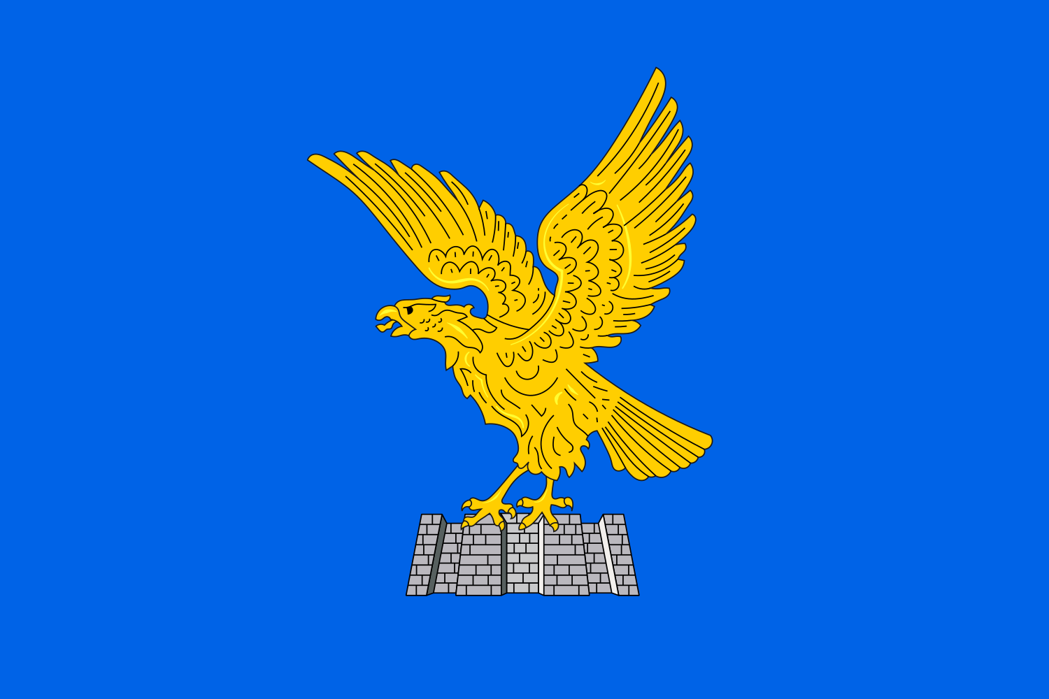 Friuli-Venezia Giulia
Italien
Kroatien
Friuli-Venezia Giulia
Italien
Kroatien
 Marche
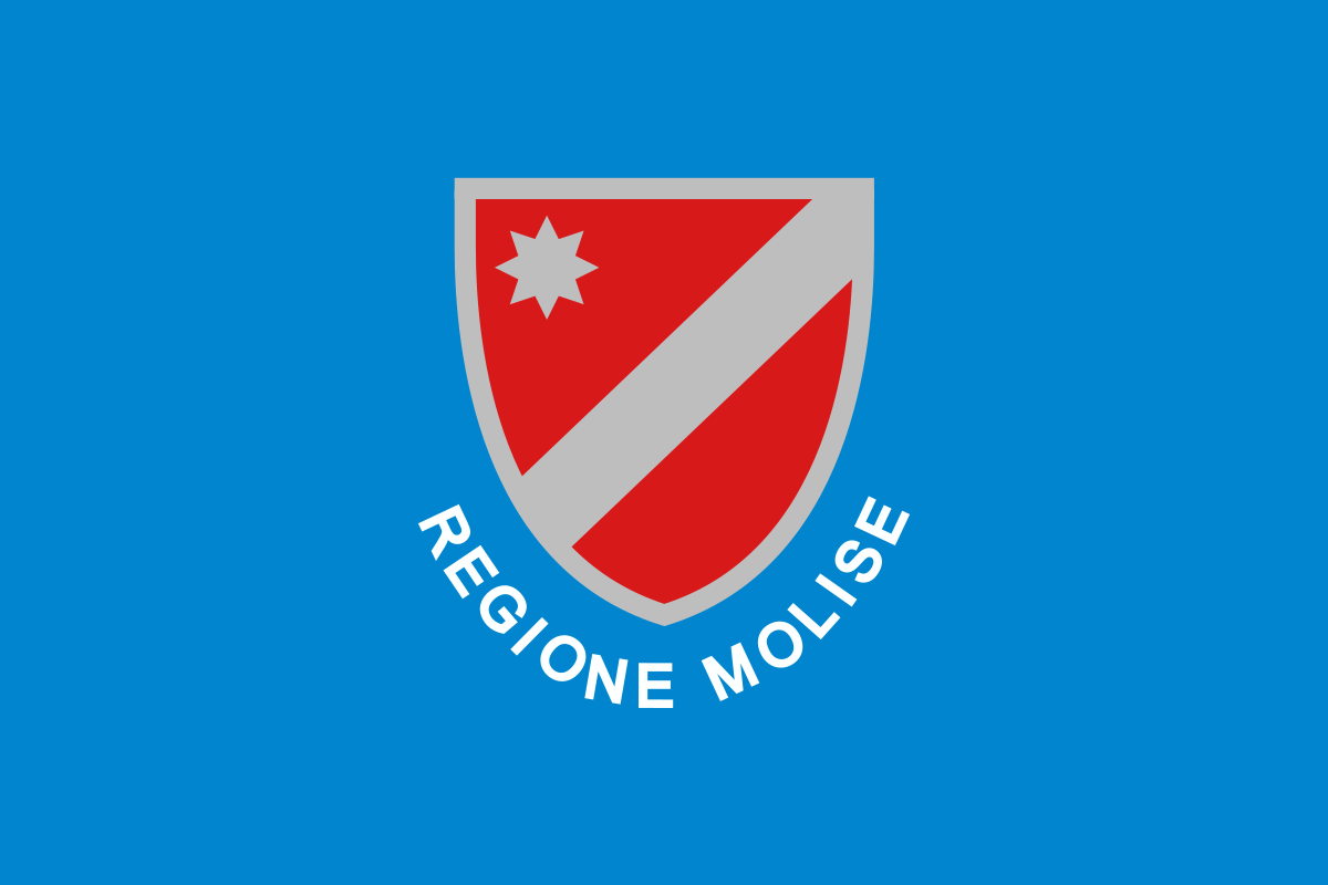 Molise
Montenegro
Molise
Montenegro
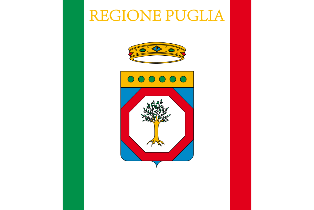 Puglia
Slowenien
Puglia
Slowenien
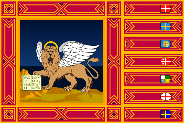 Veneto
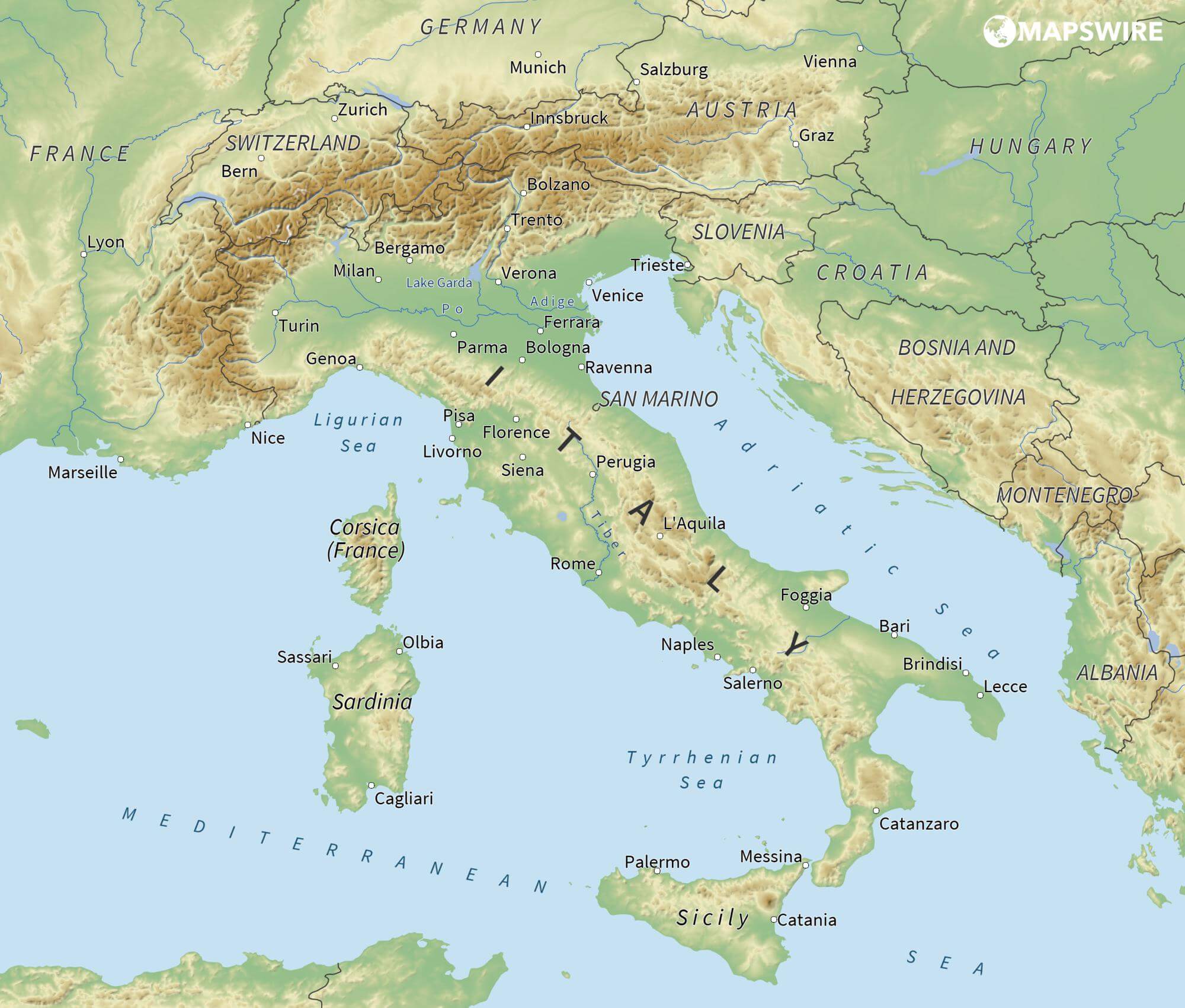
Das Adriatische Meer, kurz auch die Adria (lateinisch Mare Adriaticum; italienisch Mare Adriatico; bosnisch, kroatisch und serbisch Jadransko more oder kurz Jadran; slowenisch Jadransko morje; albanisch Deti Adriatik oder kurz Adriatiku), ist das lang gestreckte nördliche Seitenbecken des Mittelmeeres zwischen der Apenninhalbinsel und Balkanhalbinsel. Es ist nach der Stadt Adria in Italien (Provinz Rovigo) benannt. Zum Adriatischen Meer wird alles gerechnet, was nördlich der Straße von Otranto liegt.
亚得里亚海(意大利语:Mar Adriatico,斯洛文尼亚语:Jadransko morje,克罗地亚语:Jadransko more,阿尔巴尼亚语:Deti Adriatik),是地中海的一部分水域,分隔了意大利半岛(亚平宁半岛)和巴尔干半岛,也分隔了亚平宁山脉与狄那里克阿尔卑斯山脉及其临近地区。亚得里亚海西岸属于意大利,东岸则分别属于斯洛文尼亚、克罗地亚、波斯尼亚和黑塞哥维那、黑山和阿尔巴尼亚。亚得里亚海透过位于其南部的奥特朗托海峡与爱奥尼亚海相连。波河、阿迪杰河、奥凡托河等河流流入亚得里亚海;海中有近1200个岛屿,其中只有69个有人居住。
アドリア海(アドリアかい、英: Adriatic Sea ; イタリア語: Mar Adriatico ; クロアチア語: Jadransko more)は、地中海の海域の一つ。イタリア半島とバルカン半島に挟まれている。
The Adriatic Sea (/ˌeɪdriˈætɪk/) is a body of water separating the Italian Peninsula from the Balkans. The Adriatic is the northernmost arm of the Mediterranean Sea, extending from the Strait of Otranto (where it connects to the Ionian Sea) to the northwest and the Po Valley. The countries with coasts on the Adriatic are Albania, Bosnia and Herzegovina, Croatia, Italy, Montenegro and Slovenia. The Adriatic contains over 1,300 islands, mostly located along the Croatian part of its eastern coast. It is divided into three basins, the northern being the shallowest and the southern being the deepest, with a maximum depth of 1,233 metres (4,045 ft). The Otranto Sill, an underwater ridge, is located at the border between the Adriatic and Ionian Seas. The prevailing currents flow counterclockwise from the Strait of Otranto, along the eastern coast and back to the strait along the western (Italian) coast. Tidal movements in the Adriatic are slight, although larger amplitudes are known to occur occasionally. The Adriatic's salinity is lower than the Mediterranean's because the Adriatic collects a third of the fresh water flowing into the Mediterranean, acting as a dilution basin. The surface water temperatures generally range from 30 °C (86 °F) in summer to 12 °C (54 °F) in winter, significantly moderating the Adriatic Basin's climate.
The Adriatic Sea sits on the Apulian or Adriatic Microplate, which separated from the African Plate in the Mesozoic era. The plate's movement contributed to the formation of the surrounding mountain chains and Apennine tectonic uplift after its collision with the Eurasian plate. In the Late Oligocene, the Apennine Peninsula first formed, separating the Adriatic Basin from the rest of the Mediterranean. All types of sediment are found in the Adriatic, with the bulk of the material transported by the Po and other rivers on the western coast. The western coast is alluvial or terraced, while the eastern coast is highly indented with pronounced karstification. There are dozens of marine protected areas in the Adriatic, designed to protect the sea's karst habitats and biodiversity. The sea is abundant in flora and fauna—more than 7,000 species are identified as native to the Adriatic, many of them endemic, rare and threatened ones.
The Adriatic's shores are populated by more than 3.5 million people; the largest cities are Bari, Venice, Trieste and Split. The earliest settlements on the Adriatic shores were Etruscan, Illyrian, and Greek. By the 2nd century BC, the shores were under Rome's control. In the Middle Ages, the Adriatic shores and the sea itself were controlled, to a varying extent, by a series of states—most notably the Byzantine Empire, the Croatian Kingdom, the Republic of Venice, the Habsburg Monarchy and the Ottoman Empire. The Napoleonic Wars resulted in the First French Empire gaining coastal control and the British effort to counter the French in the area, ultimately securing most of the eastern Adriatic shore and the Po Valley for Austria. Following Italian unification, the Kingdom of Italy started an eastward expansion that lasted until the 20th century. Following World War I and the collapse of Austria-Hungary and the Ottoman Empire, the eastern coast's control passed to Yugoslavia and Albania. The former disintegrated during the 1990s, resulting in four new states on the Adriatic coast. Italy and Yugoslavia agreed on their maritime boundaries by 1975 and this boundary is recognised by Yugoslavia's successor states, but the maritime boundaries between Slovenia, Croatia, Bosnia-Herzegovina, and Montenegro are still disputed. Italy and Albania agreed on their maritime boundary in 1992.
Fisheries and tourism are significant sources of income all along the Adriatic coast. Adriatic Croatia's tourism industry has grown faster economically than the rest of the Adriatic Basin's. Maritime transport is also a significant branch of the area's economy—there are 19 seaports in the Adriatic that each handle more than a million tonnes of cargo per year. The largest Adriatic seaport by annual cargo turnover is the Port of Trieste, while the Port of Split is the largest Adriatic seaport by passengers served per year.
La mer Adriatique (du latin : Mare Hadriaticum ou Mare Adriaticum) est une mer séparant la péninsule italienne de la péninsule balkanique. L'Adriatique est le bras de la Méditerranée situé le plus au nord en s'étendant du canal d'Otrante (où elle rejoint la mer Ionienne) jusqu'aux villes de Venise et de Trieste et à l'embouchure du Pô. Les pays côtiers sont l'Italie, la Slovénie, la Croatie, la Bosnie-Herzégovine, le Monténégro et l'Albanie, ainsi que la Grèce par l'île de Corfou.
Il mare Adriatico è l'articolazione del mar Mediterraneo orientale situata tra la penisola italiana e la penisola balcanica; suddiviso in Alto Adriatico, Medio Adriatico e Basso Adriatico, bagna sei Paesi: Italia, Slovenia, Croazia, Bosnia ed Erzegovina, Montenegro e Albania, confinando a sud-est con il Mar Ionio.
El mar Adriático (del latín, Mare Hadriaticum) es un golfo estrecho y alargado que forma parte del mar Mediterráneo. Se encuentra situado entre la península Itálica, al oeste, y la península de los Balcanes, al este, con una anchura máxima de unos 200 km, y una longitud de unos 800 km. Su extremo meridional limita con el mar Jónico, del que lo separa el canal de Otranto. Su superficie total es de, aproximadamente, 160 000 km².
Las costas occidental, septentrional, y parte de la oriental corresponden a Italia (60% de la longitud de costa del Adriático), mientras que el resto de la costa oriental corresponde a Croacia, Eslovenia, Bosnia y Herzegovina, Montenegro y Albania. Algunos de los ríos que desembocan en el Adriático son el Reno, el Po, el Adigio, el Brenta, el Piave y el Neretva.
La costa del Adriático concentra un gran número de centros turísticos, como Venecia, que recibe el nombre de «Reina del Adriático». Tras la división de Yugoslavia, la costa croata se ha convertido también en un destino turístico muy popular.
Sus aguas sostienen industria pesquera, y se llevan a cabo prospecciones petrolíferas en este mar. Durante los años 1990, varias investigaciones revelaron que sus niveles de contaminación son muy altos.
En las últimas décadas el gobierno de Italia ha intentado hacer de él una barrera contra la inmigración ilegal, en su mayor parte proveniente de Albania.
Адриати́ческое мо́ре (итал. mare Adriatico, эмил.-ром. Mèr Adriâtic, вен. Mar Adriàtico, неап. Mar Adriateco, словен. Jadransko morje, сербохорв. Jadransko more/Јадранско море, алб. Deti Adriatik, лат. mare Hadriaticum), также Адриатика — полузамкнутое море, часть Средиземного моря между Апеннинским и Балканским полуостровами. Омывает берега Италии (более 1000 км), Словении (47 км), Хорватии (1777 км), Боснии и Герцеговины (20 км), Черногории (200 км), Албании (472 км).