
Deutsch-Chinesische Enzyklopädie, 德汉百科
 ITU World Championship Series
Eurovision Song Contest,ESC
ITU World Championship Series
Switzerland
ITU World Championship Series
Eurovision Song Contest,ESC
ITU World Championship Series
Switzerland
 Lausanne
 Sport
Triathlon
Sport
Triathlon
 Vacation and Travel
 Cities founded by the Romans
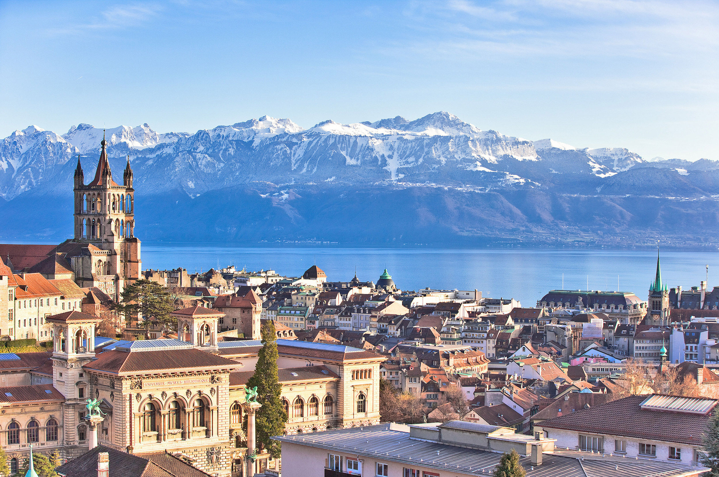
洛桑(法语:Lausanne,国际音标:[loˈzan])是瑞士法语区城市,位于莱芒湖(法语:Lac Léman)北岸,与法国城市埃维昂莱班隔湖相望,北面是侏罗纪山脉。洛桑位于日内瓦东北约50公里处,是瑞士联邦沃州和洛桑区首府,同时也是大洛桑都会区核心城市、瑞士第五大城市。洛桑与邻近的日内瓦一样,是许多著名的国际组织例如国际奥委会等的总部所在地,因此也称为“奥林匹克首都”。洛桑境内的洛桑管理学院亦是世界一流的著名学府与研究机构。洛桑也位于瑞士酿酒区的中心位置。另外,位于洛桑的洛桑联邦理工学院是瑞士两所联邦理工学院之一。
Lausanne [lɔˈzan] (deutsch veraltet auch Lausannen und Losanen,[4] frankoprovenzalisch Losena [lɔˈzəna],[5] italienisch und rätoromanisch Losanna) ist eine politische Gemeinde, der Hauptort des Schweizer Kantons Waadt und die Hauptstadt des Distrikts Lausanne. Die Stadt liegt in der französischsprachigen Schweiz (Romandie), am Genfersee und gehört mit ihren 144'000 Einwohnern[2] (Februar 2017) – neben Zürich, Genf, Basel, Bern und Winterthur – zu den grössten politischen Gemeinden der Schweiz.
Lausanne ist Teil der Metropolregion Genf-Lausanne mit 1,2 Millionen Einwohnern und ein bedeutendes Wirtschafts-, Kultur- und Bildungszentrum sowie eine wichtige Verkehrsdrehscheibe in der Westschweiz. Mit 43 Prozent Ausländern[2] (Einwohner ohne Bürgerrecht) zählt Lausanne, unter anderem neben Genf,[6] zu den Schweizer Städten mit hohem Ausländeranteil.
Das Bundesgericht (BGer) hat in Lausanne seinen Sitz, ebenso der Internationale Sportgerichtshof (TAS) und das Schweizer Filmarchiv. Zudem haben in Lausanne verschiedene Sportweltverbände, darunter das Internationale Olympische Komitee (IOC), ihren Hauptsitz. Seit 1994 trägt die Stadt den offiziellen Titel als «Olympische Hauptstadt».[7]
ローザンヌ(Lausanne)は、スイスのヴォー州に属する基礎自治体(コミューン) で、同州の州都。フランス語圏に属し、フランス語でのより正確な発音は「ロザン」[loˈzan][2]または「ロウザン」[loʊˈzan][3]、ドイツ語でのより正確な発音は「ロザン」[loˈzan][4]。イタリア語、ロマンシュ語ではLosannaと綴る。
レマン湖の北岸に位置する[5]。近隣の主要都市としては、約80km北東にベルン、レマン湖に沿って約50km南西にジュネーヴが位置する。
国際オリンピック委員会(IOC)の本部が置かれており、「オリンピックの首都(Olympic Capital)」とも言われる。2020年冬季ユースオリンピックの開催地となっている。
国際柔道連盟(IJF)、国際スケート連盟(ISU)、世界野球ソフトボール連盟(WBSC)の本部もここに置かれている。
スイス連邦の連邦最高裁判所が置かれ、同国の「司法首都」となっている。
1973年より、若手バレリーナの登竜門として知られるローザンヌ国際バレエコンクールが開催されていることでも知られる。
Lausanne (/loʊˈzæn/, French pronunciation: [lozan], German: Lausanne,[3] Italian: Losanna, Romansh: Losanna)[4] is a city in the French-speaking part of Switzerland, and the capital and biggest city of the canton of Vaud. The city is situated on the shores of Lake Geneva (French: Lac Léman, or simply Le Léman).[5] It faces the French town of Évian-les-Bains, with the Jura Mountains to its north-west. Lausanne is located 62 kilometres (38.5 miles) northeast of Geneva.
Lausanne has a population (as of November 2015) of 146,372,[6] making it the fourth largest city in Switzerland, with the entire agglomeration area having 420,000 inhabitants (as of March 2015).[7] The metropolitan area of Lausanne-Geneva (including Vevey-Montreux, Yverdon-les-Bains, and foreign parts) was over 1.2 million inhabitants in 2000.[8]
Lausanne is a focus of international sport, hosting the International Olympic Committee (which recognizes the city as the "Olympic Capital" since 1994),[9] the Court of Arbitration for Sport and some 55 international sport associations.[10] It lies in a noted wine-growing region. The city has a 28-station metro system, making it the smallest city in the world to have a rapid transit system.[citation needed] Lausanne will host the 2020 Winter Youth Olympics.[11]
Lausanne est une ville suisse située sur la rive nord du lac Léman. Elle est la capitale et ville principale du canton de Vaud3 et le chef-lieu du district de Lausanne. Elle constitue la quatrième ville du pays en termes de population4 après Zurich, Genève et Bâle. Fin 2014, l'agglomération lausannoise compte 402 900 habitants5 et la commune de Lausanne en compte, en incluant la population non-permanente, 145 000 en 2017 (près de 137 000 en comptant uniquement la population permanente, à fin 2016)6,1. En 2012, l'agglomération lausannoise compte 50 % de la population du canton de Vaud et concentre 60 % des emplois7. Elle héberge le vaste campus de l'Université de Lausanne (UNIL) et de l'École polytechnique fédérale de Lausanne (EPFL), ainsi que l'EHL, l'ECAL et l'IMD.
Dans la ville se trouvent le Tribunal fédéral, le site principal de la Cinémathèque suisse ainsi que le siège du Comité international olympique (CIO) et de 55 fédérations sportives internationales. Elle porte le titre officiel de « Capitale olympique »8 depuis 1994. Elle sera l'hôte des Jeux olympiques de la jeunesse d'hiver de 2020.
Losanna (AFI: [loˈzanna][1]; in francese: Lausanne; in arpitano: Losena; in romancio: Losanna; in tedesco: Lausanne o anche, antiquati, Lausannen e Losanen) è una città della Svizzera, capitale del Canton Vaud e dell'omonimo distretto.
Conta 137.810 abitanti (424.000 nell'hinterland) ed è la quarta città più grande della Svizzera, preceduta in ordine decrescente da Zurigo, Ginevra e Basilea. È situata sulla sponda settentrionale del Lago Lemano (Lac Léman in Francese), chiamato anche Lago di Ginevra.
È un importante centro di attività commerciali bancarie e universitarie ed è sede della famosa scuola di danza Rudra-Béjart, fondata dal grande coreografo Maurice Béjart. Nel 1994, Losanna fu dichiarata Capitale Olimpica ed è quindi sede del Comitato Olimpico Internazionale.
La città di Losanna è collegata alla cittadina francese di Évian tramite battello.
Lausana2 (en francés y alemán, Lausanne [loˈzan], en italiano y romanche Losanna) es una ciudad y comuna de Suiza, capital del cantón de Vaud y del distrito de Lausana. Se sitúa a orillas del lago Lemán, frente a la ciudad francesa de Évian-les-Bains.
Lausana es la cuarta ciudad más poblada de Suiza tras Zúrich, Ginebra y Basilea. En Romandía es la segunda ciudad después de Ginebra. La ciudad es conocida como la Capital Olímpica, ya que es sede del Comité Olímpico Internacional, además del también deportivo Museo Olímpico. A finales de 2016, Lausana contaba con 139 624 habitantes,1 sumando un total de 420.067 habitantes en su área metropolitana.
Лоза́нна (фр. Lausanne [loˈzan], франкопров. Losena [lɔˈzəna]) — город на юго-западе Швейцарии, столица франкоязычного кантона Во и административный центр округа Лозанна.
Население — 138,6 тыс. человек (май 2013 года), четвёртый по величине город страны. Иммигранты составляют 40 % населения. В пределах агломерации проживает 336,4 тыс. человек (2010 год). Расположена в Романдии, на террасных холмах у северного берега Женевского озера, в 62 км от Женевы[4].
Лозанна носит звание «Олимпийской столицы» мира. Здесь располагаются штаб-квартиры Международного олимпийского комитета и многочисленных международных спортивных федераций. Местонахождение Спортивного арбитражного суда и Верховного суда Швейцарии. Имеются университет, политехническая школа и бизнес-школа IMD. Основной вид общественного транспорта — троллейбус; действует единственное в стране метро.
Исторический центр к северу от вокзала опутан сетью кривых и крутых улочек. На холме Ситэ средневековый замок Сен-Мер и готический собор Нотр-Дам; в Нижнем городе церковь святого Франциска; на площади Палю старинная ратуша. Реки убраны в подземные коллекторы, мосты сухопутны. К югу от вокзала набережная Уши́.
В древности на месте Лозанны существовало поселение, в I веке до н. э. получившее римское название Лузонна. С VI века была епископским городом под властью европейских государств. В XVI веке после завоевания Берном вошла в Швейцарский союз, введена Реформация. В 1803 году стала столицей кантона Во.
FIFA Fussball-Weltmeisterschaft 1994
 Financial
***Global Financial Center
Women's Soccer World Cup 1999
Financial
***Global Financial Center
Women's Soccer World Cup 1999
 History
N 2000 - 2100 AD
History
M 1500 - 2000 AD
History
N 2000 - 2100 AD
History
M 1500 - 2000 AD
 Illinois-IL
 International cities
***Global Urban Economic Competitiveness
ITU World Championship Series
League of Legends
League of Legends
League of Legends World Championship
Sport
Sport
Triathlon
United States
International cities
***Global Urban Economic Competitiveness
ITU World Championship Series
League of Legends
League of Legends
League of Legends World Championship
Sport
Sport
Triathlon
United States

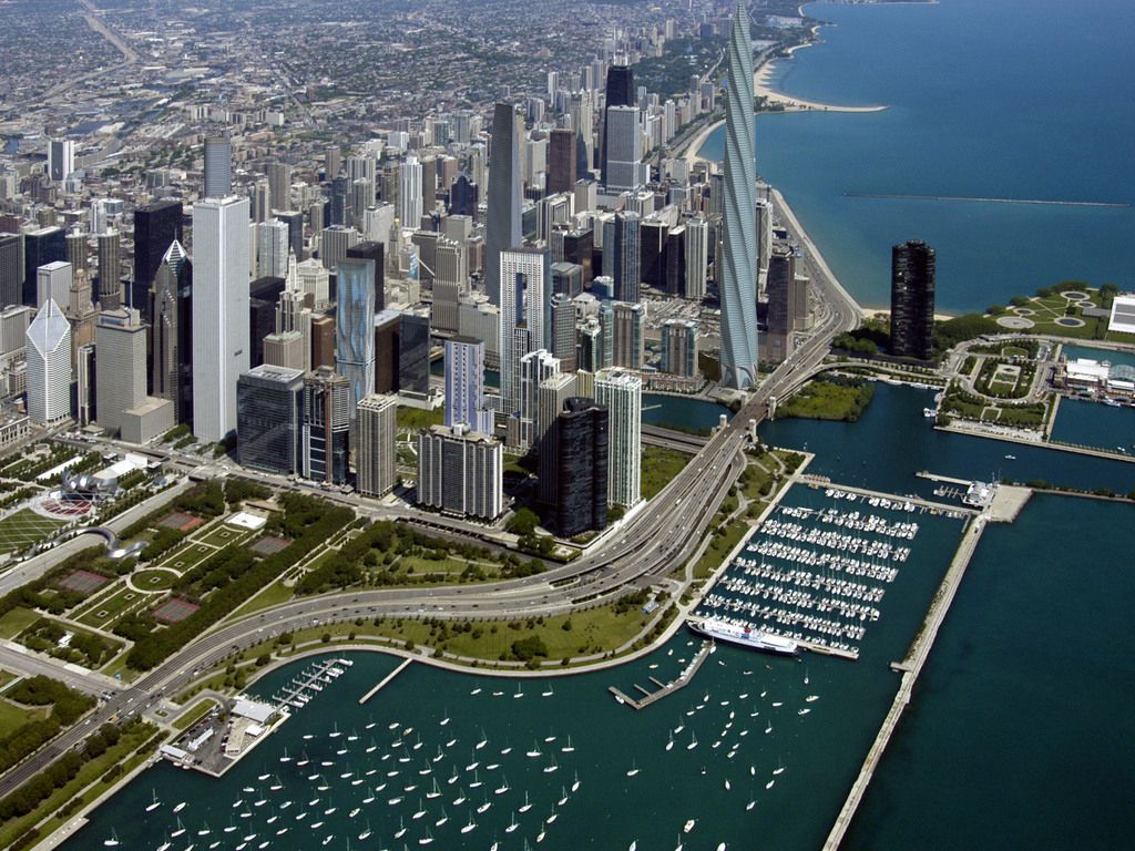
十七世纪时为法国皮毛商交易地,后归美国。1834年建市。1848年伊利诺伊·密歇根运河开通和铁路相继修建后,发展极速。全国最大的铁路 枢纽,32条干线交会于此。现为全国性的重要农畜产品贸易市场和钢铁冶炼基地。肉类加工、面粉、罐头、冷冻食品加工等发达。此外还有农机制造、机车、货 车、电话机、电视机、收音机、印刷、塑料等。包括卫星城市格里、南芝加哥,为美国第二个重工业地带。多大银行、商业企业,有芝加哥大学(1891年建)与 科学研究机构等。
芝加哥市内保存着早期传统式的西欧古建筑,又有壮观巍峨的现代摩天大楼。市区沿着宽阔壮丽的大道连绵数十公里,规划布局井井有条。现在的城市是 1871年的大火之后重建的,新城各种形状新奇、色彩各异的高层建筑使其成为一建筑艺术博物馆。芝加哥市区内摩天大楼之多,仅次于纽约。
芝加哥市内保存着早期传统式的西欧古建筑,又有壮观巍峨的现代摩天大楼。市区沿着宽阔壮丽的大道连绵数十公里,规划布局井井有条。现在的城市是1871年 的大火之后重建的,新城各种形状新奇、色彩各异的高层建筑使其成为一建筑艺术博物馆。芝加哥市区内摩天大楼之多,仅次于纽约。当今全世界5座最高的摩天大 楼有3座在芝加哥,市中心的西尔斯大厦是美国第一高楼,有110层,高443米。
19世纪开通的伊利诺伊-密歇根运河,把处于内陆的芝加哥同五大湖和大西洋连接起来,变为港口城市。海洋巨轮从加拿大的圣劳伦斯湾直驶芝加哥码头。芝加哥是美国的铁路枢纽,几十条铁路交汇于此,连接美国各大城市;它还有世界上最繁忙国际机场之一的奥黑尔国际机场;因此,芝加哥可以称得上美国东西交通、水、陆、空运输的中心。
Wie die meisten amerikanischen Städte ist Chicago am Reißbrett entworfen worden. Das Schachbrettmuster kann man z.B. von der Aussichtsplattform des Sears-Towers gut erkennen. Die Aussicht von diesem Punkt aus ist atemberaubend. Genießen Sie das Panorama des Lake Michigan und beobachten Sie die Flugzeuge die am Chicago-International-Airport landen.
Chicago (deutsche Schreibweise: Chikago,[1] Aussprache: [ʃɪˈkɑːgoʊ]; ) ist eine Stadt am Südwestufer des Michigansees im Bundesstaat Illinois in den Vereinigten Staaten von Amerika. Mit einer Einwohnerzahl von 2.722.389 (2014)[2] ist sie die drittgrößte Stadt der Vereinigten Staaten. In der Agglomeration leben 8,7 Millionen, in der Metropolregion Chicago 9,7 Millionen Menschen (2007).[3]
Chicago ist seit der Mitte des 19. Jahrhunderts eine wichtige Handelsstadt in den Vereinigten Staaten. Diese Funktion wird durch ihre Eigenschaft als Eisenbahnknotenpunkt und ihre Lage an der Mündung des Illinois Waterways begünstigt. Die Stadt liegt an wichtigen Eisenbahnstrecken, die die Ost- mit der Westküste verbinden und ist über die Großen Seen und den Sankt-Lorenz-Seeweg bzw. den Eriekanal mit dem Atlantik und mit New York City verbunden. Der Illinois Waterway stellt über den Mississippi die Verbindung zum Golf von Mexiko her.
Chicago ist Sitz der Chicago Mercantile Exchange, der größten Warenterminbörse der Vereinigten Staaten, und der Chicago Board of Trade, der größten Rohstoff-, Futures- und Optionsbörse der Vereinigten Staaten. Außerdem befindet sich hier die größte Regionalbörse der Vereinigten Staaten, die Chicago Stock Exchange.
Die Metropolregion von Chicago erbrachte 2016 eine Wirtschaftsleistung von 651,2 Milliarden US-Dollar.[4] Bei einer Studie aus dem Jahr 2014 belegte Chicago Platz 9 unter den wirtschaftsstärksten Metropolregionen weltweit und Platz 3 innerhalb der Vereinigten Staaten.[5]
シカゴ(英: Chicago [ʃɨˈkɑːɡoʊ, ʃɨˈkɔːɡoʊ, tʃɨˈkɑːɡoʊ] ( 音声ファイル)))は、アメリカ合衆国イリノイ州にある都市。同州最大の都市であり、国内では、ニューヨーク、ロサンゼルスに次ぐ人口を持つ。
シカゴはクック郡内にあり、同郡の郡庁所在地である。同郡には他にアーリントンハイツなどが含まれる。2012年の人口は271万人。
19世紀後半から20世紀中盤まで、アメリカ国内における鉄道・航空・海運の拠点として、また五大湖工業地帯の中心として発展し、ニューヨークに次ぐアメリカ第2の都市となっていた歴史を持つ。摩天楼がそびえ立つアメリカ型都市の発祥とされ、ダウンタウンの高層建築は、シカゴ派として知られ、近代建築史における重要局面をなした。1973年に建てられたシアーズ・タワー(現在はウィリス・タワーに改称)は、1998年まで世界一の高層建築であった。マコーミック・プレイスコンプレックスは、北米最大のコンベンション・センターであり、オヘア空港は全米有数の過密な空港として知られる。
アメリカのシンクタンクが2017年に発表した総合的な世界都市ランキングにおいて、世界12位の都市と評価された[1]。アメリカの都市ではニューヨーク、ロサンゼルスに次ぐ3位である。2017年3月の調査によると、世界7位の金融センターである[2]。2014年の都市の経済規模(GDP)では、世界9位となっている[3]。
日本語の漢字表記は「市俄古」。また、シカゴに住む人々は「Chicagoans(シカゴアンズ)」と呼ばれている[4]。
Chicago (/ʃɪˈkɑːɡoʊ/ ( listen), locally also /-ˈkɔː-/), officially the City of Chicago, located on the shores of freshwater Lake Michigan, is the third most populous city in America after New York and Los Angeles. As of the 2017 census-estimate, Chicago has a population of 2,716,450, which makes it the most populous city in both the state of Illinois and the Midwestern United States. It is the county seat of Cook County, the second most populous county in the U.S. Chicago is the principal city of the Chicago metropolitan area, which is often referred to as "Chicagoland." The Chicago metropolitan area has nearly 10 million people, is the third-largest in the United States, the fourth largest in North America, and the third largest metropolitan area in the world by land area. Chicago is the birthplace of the skyscraper, and considered the most influential architectural city of the 20th century.[6] In finance, the city saw the creation of the first standardized futures contracts at the Chicago Board of Trade; which today is the largest and most diverse derivatives market in the world, generating 20% of all volume in commodities and financial futures.[7]
Chicago was incorporated as a city in 1837 near a portage between the Great Lakes and the Mississippi River watershed and grew rapidly in the mid-nineteenth century.[8] After the Great Chicago Fire of 1871, which destroyed several square miles and left more than 100,000 homeless, the city made a concerted effort to rebuild.[9] The construction boom accelerated population growth throughout the following decades, and by 1900 Chicago was one of the five largest cities in the world.[10] During this period, Chicago made noted contributions to urban planning and zoning standards, which included creating new construction styles (including the Chicago School of architecture), the development of the City Beautiful Movement, and the steel-framed skyscraper.[11]
Positioned along Lake Michigan, the city is an international hub for finance, commerce, industry, technology, telecommunications, and transportation. O'Hare International Airport is the one of the busiest airports in the world, and the region also has the largest number of U.S. highways and railroad freight.[12] In 2012, Chicago was listed as an alpha global city by the Globalization and World Cities Research Network,[13] and it ranked seventh in the entire world in the 2017 Global Cities Index.[14] Chicago has the fourth-largest gross metropolitan product in the world — generating about $670.5 billion according to September 2017 estimates — ranking it after the metropolitan areas of Tokyo, New York City, and Los Angeles, and ranking ahead of number five London and number six Paris.[15] Chicago has one of the world's largest and most diversified and balanced economies, not being dependent on any one industry, with no single industry employing more than 14% of the workforce.[16]
Chicago was the second most visited city in the United States with 55 million domestic and international visitors,[17][18] not far behind the 62 million visitors to New York City in 2017.[19] The city ranked first place in the 2018 Time Out City Life Index, a global quality of life survey of 15,000 people in 32 cities.[20][21][22][23][24] Landmarks in the city include Millennium Park, Navy Pier, the Magnificent Mile, the Art Institute of Chicago, Museum Campus, the Willis (Sears) Tower, the Museum of Science and Industry, and Lincoln Park Zoo. Chicago's culture includes the visual arts, literature, film, theater, comedy (especially improvisational comedy), food, and music, particularly jazz, blues, soul, hip-hop, gospel,[25] and electronic dance music including house music. There are many colleges and universities in the Chicago area, of which the University of Chicago, Northwestern University, and the University of Illinois at Chicago are classified as "highest research" doctoral universities.
Chicago has professional sports teams in each of the major professional leagues, including two Major League Baseball teams. The city has had several nicknames throughout its history such as the Windy City, Chi-Town, Second City, and the City of the Big Shoulders, referring to its numerous towers and skyscrapers.[26]
Chicago (en anglais [ʃɪˈkɑːɡoʊ] ou [ʃɪˈkɔːɡoʊ]) est la troisième ville des États-Unis par sa population et se situe dans le nord-est de l'État de l'Illinois. C'est la plus grande ville de la région du Midwest, dont elle forme le principal centre économique et culturel2. Chicago se trouve sur la rive sud-ouest du lac Michigan, un des cinq Grands Lacs d'Amérique du Nord. Les rivières Chicago et Calumet traversent la ville.
Comptoir commercial fondé à la fin du XVIIIe siècle par Jean Baptiste Pointe du Sable, un mulâtre d'origine française, Chicago devient une municipalité en 18333 et acquiert officiellement le statut de ville en 18374. Elle est le siège du comté de Cook. Chicago est aussi le siège d'une paroisse catholique francophone, signe de son histoire liée à la France5.
La ville de Chicago compte 2 716 450 habitants et s'étend sur une superficie de 606 km2. Ses habitants s'appellent les Chicagoans6 (ou plus rarement Chicagolais7). Troisième ville des États-Unis par sa population, l'agglomération de Chicago est également la troisième du pays avec une population de 8 711 000 habitants s'étendant sur 5 498 km2. L'aire métropolitaine de Chicago (Chicago metropolitan area), communément appelée « Chicagoland », compte 9 526 434 habitants et s'étend sur 28 163 km28,9 à travers trois États (Illinois, Indiana et Wisconsin), ce qui en fait la quatrième aire urbaine d'Amérique du Nord après Mexico, New York et Los Angeles10.
Chicago est une ville de classe mondiale alpha11. Elle constitue le deuxième centre industriel des États-Unis et appartient à la « Ceinture des industries » (Manufacturing Belt), mais la ville est aussi une des principales places financières du monde12 et la première bourse de matières premières agricoles au monde13. C'est à Chicago que sont fixés les prix du blé et du soja aux États-Unis14. La ville se classe au troisième rang national pour le nombre d'entreprises implantées dans son agglomération15, dont les plus importantes sont Motorola, Boeing, United Airlines, McDonald's, Sears, Kraft Foods, Mondelēz ou encore les laboratoires Abbott. D'autres entreprises y ont été créées, comme Hertz, l'une des plus grandes enseignes de location de voitures. L'industrie emploie plus d'un million de personnes dans l'agglomération de Chicago15.
Grâce à sa situation exceptionnelle, la ville constitue un centre de communication majeur de voies terrestres (l'un des plus importants en Amérique du Nord), et de transports aériens avec ses deux aéroports internationaux, O'Hare et Midway. Elle acquiert une grande renommée culturelle grâce à son architecture moderne de gratte-ciel16 et attire des millions de visiteurs chaque année17. En effet, la Willis Tower (appelée « Sears Tower » jusqu'au mois de juillet 2009) a été de 1973 à 1998, le plus haut gratte-ciel du monde18 et est à ce jour le deuxième immeuble le plus haut du continent américain après le One World Trade Center à New York. Enfin, la ville compte de nombreux établissements d'enseignement supérieur, des musées prestigieux, des théâtres réputés et un orchestre symphonique de renommée mondiale.
Chicago (AFI: /ʧiˈkaɡo/[4]; in inglese /ʃɪˈkɑɡoʊ/) è la più grande città dell'Illinois, la più grande metropoli dell'entroterra statunitense e la terza per popolazione di tutti gli Stati Uniti d'America dopo New York e Los Angeles, con i suoi 2.722.389 abitanti.[3] La sua area metropolitana (detta Chicagoland) conta 9.554.598 abitanti distribuiti in un'ampia area pianeggiante situata lungo le rive del lago Michigan. Trasformatasi da cittadina in una importante metropoli, Chicago è stata definita come una delle 10 città più influenti al mondo. Oggi è una città multietnica, nonché un importante centro finanziario e industriale ed uno dei maggiori centri fieristico/espositivi mondiali.
Il centro della città (denominato "the Loop") è dominato da imponenti grattacieli che arrivano anche ai 108 piani (per un'altezza di 442 m) della Willis Tower. Questa tipologia architettonica è nata proprio a Chicago che, se da tempo ha dovuto perdere il primato di città con più grattacieli nel paese a favore di New York, vanta ancora oggi il secondo grattacielo più alto statunitense (dopo il nuovo World Trade Center) e tre grattacieli nella classifica dei primi 15 al mondo. Venti dei suoi grattacieli superano i 200 metri d'altezza e ben 240 superano i 100 metri. La città si estende per 50 km sul lago Michigan da nord a sud.
Chicago è la città con il maggior numero di ponti mobili al mondo (attualmente 45) ed è un punto di riferimento mondiale per il blues.
La città di Chicago ha diversi soprannomi, tra i quali "Windy City" e "Second City".
Chicago, conocida coloquialmente como «la Segunda Ciudad» o «la Ciudad de los Vientos», es la tercera ciudad con mayor número de habitantes en Estados Unidos, detrás de Nueva York y Los Ángeles.
Chicago se encuentra en el estado de Illinois, a lo largo de la costa suroeste del lago Míchigan, y es la sede del condado de Cook.2 Forma parte del área metropolitana de Chicago, una conurbación integrada además por los condados periféricos.
Чика́го (англ. Chicago, МФА: [ʃɪˈkɑːgoʊ] или [ʃɪˈkɔːgoʊ]) — третий по числу жителей (после Нью-Йорка и Лос-Анджелеса) город США, второй по значимости финансовый центр страны (после Нью-Йорка) и крупнейший транспортный узел Северной Америки. Расположен на юго-западном побережье озера Мичиган в штате Иллинойс; административный центр округа Кук.
Население Чикаго (по данным переписи 2010 года) составляет 2 695 000 человек. Агломерация Чикаго (с различными пригородами) называется «Большой Чикаго» или «Страна Чикаго» (англ. Chicagoland; название предложено газетой Chicago Tribune в начале XX века); в ней проживает более 9 млн человек. Агломерация Чикаго занимает 37-е место в мире по числу жителей.
Чикаго по праву считается экономической, промышленной, транспортной и культурной столицей Среднего Запада. Неофициально его иногда также называют «Второй Город» и «Город ветров». Впервые Чикаго был назван «Городом ветров» в статье в Chicago Tribune за 1858 год.
 British Columbia-BC
 FIFA Fussball-Weltmeisterschaft 2026
Women's Soccer World Cup 2015
FIFA Fussball-Weltmeisterschaft 2026
Women's Soccer World Cup 2015
 Geography
*World's Most Livable Cities
ITU World Championship Series
Canada
Winter Olympics
Geography
Geography
*World's Most Livable Cities
ITU World Championship Series
Canada
Winter Olympics
 Ski vacation
Sport
Triathlon
Ski vacation
Sport
Triathlon
 Important port
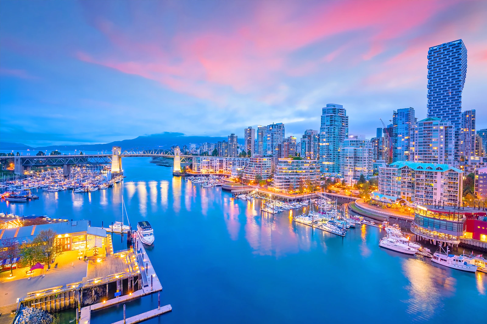
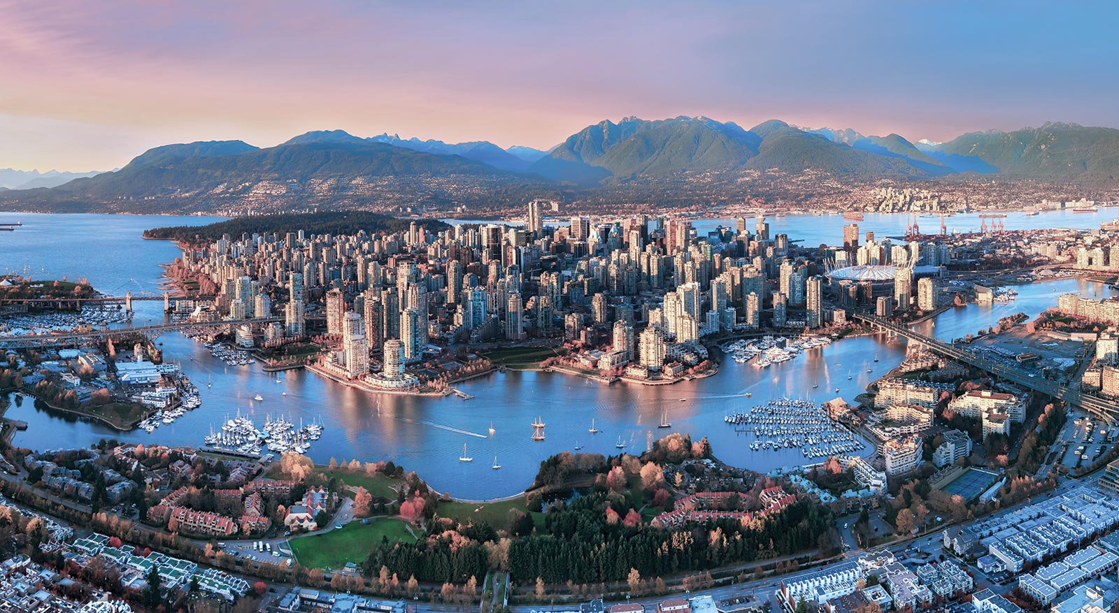

一般所说的”温哥华”泛指”大温地区”(请参考温哥华概况介绍)。温哥华市中心位于一个半岛上,主要分成几块区域:西尾区与水滨(West End & Waterfront)、耶鲁镇(Yaletown)、盖士镇与华埠(Gastown & Chinatown)。市中心往南的温哥华市以Carrall街与Ontario街分成温西(West Side)与温东(East Side)。外地人常把温西与西温哥华(West Vancouver)搞混,后者是温哥华北岸的一个城市,从温哥华市中心向北跨越狮门大桥(Lions Gate Bridge)即可抵达。
西尾区(West End)在市中心西端,北与史丹利公园、南与市中心商业区紧邻,是由整片新兴的高级住宅大楼与罗布森街(Robson Street)购物区、各国风味餐厅、海滩、游艇码头等所组成的热闹区域。到温哥华旅游如果不自行开车,在西尾区住宿是明智选择。
耶鲁镇(Yaletown)是位于市中心东缘的新兴小区,这里有许多杂错的红砖仓库改建成精致典雅的新购物娱乐区与艺术家工作室。一栋栋平房红砖墙的建筑 及巷道上的石板路,将素有“Funky Town"之称的耶鲁镇特色表露无遗。耶鲁镇有电影制片公司、美发沙龙、室内设计工作室、小型设计师家具店、古董店、精品服饰店,加上各种特色美食与露天 咖啡座、小酒馆,让耶鲁镇的雅痞色彩十足,成为温哥华时尚一族抢着进驻的地区。
盖士镇(Gastown)是温哥华的发源地,是个以2条横街和3条直街组成的三角地带。卑诗省政府将盖士镇规划程成为独特的观光区与历史维护区。如今这里 保存完好的19世纪初维多利亚式建筑、铺满圆石的悠长街道、别致的露天咖啡屋,复古的路灯及一座座低矮的历史建筑,行走其间宛如时空错置。也是游客来温哥 华必至之处。(Quelle:http://www.usatrip.cn/jdjs/jdjs_Vancouver.asp)
温哥华市(City of Vancouver)是加拿大不列颠哥伦比亚省低陆平原地区一沿岸城市。根据2016年加拿大统计局人口普查,温哥华市人口有631,486人,而大温哥华地区的人口为246万,[1]是不列颠哥伦比亚省以至加拿大西部最大的都会区,以及全国第三大都会区;市内人口则在全国排行第八。[2][3]
温哥华以英国航海家乔治·温哥华命名,欧洲人抵达温哥华一带后,区内经济早期主要依赖于林木业。加拿大太平洋铁路于1887年延至温哥华后,温哥华成为北美西岸水陆路交通的主要枢纽之一,更构成远东地区、加拿大东部和英国之间贸易往来的重要一环。[4][5]温哥华港现时是加拿大最大和最繁忙的港口,以货物总吨数计也是北美第四大港口。[6]此外,温哥华的自然环境深受游客欢迎,令旅游业成为市内第二大经济支柱。[7]温哥华也是北美第三大制片中心,有“北方好莱坞”之称。[8][9]也是20世纪后,与美国旧金山同为华人在北美最集中的地区。
温哥华近年经常在各项世界最佳居住城市的调查中名列前茅。[10][11]温哥华亦曾于2010年与125公里以外的惠斯勒联手举办冬季奥运会和冬季残奥会。[12]此外温哥华还曾举办2015年女子世界杯足球赛,决赛场地即设在不列颠哥伦比亚体育馆。
Vancouver (englische Aussprache [væŋˈkuːvɚ] oder [vænˈkuːvɚ]) ist eine Stadt im Südwesten von British Columbia an der Westküste Kanadas. Sie liegt zwischen der Straße von Georgia und den Coast Mountains, rund 45 Kilometer nordwestlich der Grenze zu den USA. Die Stadt gehört zum Regionaldistrikt Metro Vancouver, der mit 2.463.431 Einwohnern[1] die größte Metropolregion Westkanadas und nach Toronto und Montreal die drittgrößte des Landes bildet. Die Bevölkerungszahl der eigentlichen Stadt Vancouver beträgt 631.486.[2] Benannt ist die Stadt nach dem britischen Kapitän George Vancouver, der die Region Ende des 18. Jahrhunderts erforschte und vermaß. Der Name Vancouver selbst stammt vom niederländischen „van Coevorden“, abgeleitet von der Stadt Coevorden.
Die Stadt entstand in den 1860er Jahren als Folge der Einwanderungswelle während des Fraser-Canyon-Goldrauschs und entwickelte sich nach der Eröffnung der transkontinentalen Eisenbahn im Jahr 1887 innerhalb weniger Jahrzehnte von einer kleinen Sägewerkssiedlung zu einer Metropole. Die Wirtschaft basierte zu Beginn auf der Ausbeutung der natürlichen Ressourcen von British Columbia: Forstwirtschaft, Bergbau, Fischerei und Landwirtschaft. Der Hafen Vancouver erlangte nach der Eröffnung des Panamakanals internationale Bedeutung. Er ist heute der größte in Kanada und exportiert mehr Güter als jeder andere Hafen in Nordamerika.
Vancouver wandelte sich mit der Zeit zu einem Dienstleistungszentrum und (insbesondere nach der Weltausstellung Expo 86) zu einem Reiseziel für Touristen. Die Stadt ist darüber hinaus hinter Los Angeles und New York der drittwichtigste Standort der nordamerikanischen Filmindustrie und wird daher auch als „Hollywood North“ bezeichnet. Die Finanzwirtschaft spielt ebenfalls eine bedeutende Rolle. In einer Rangliste der wichtigsten Finanzzentren weltweit belegt Vancouver den 15. Platz (Stand: 2018).[3]
Vancouver veranstaltete vom 12. bis 28. Februar 2010 die XXI. Olympischen Winterspiele. Einige Wettbewerbe der Spiele fanden im 125 Kilometer von Vancouver entfernten Whistler statt. Nach Montreal im Jahr 1976 und Calgary im Jahr 1988 war Vancouver die dritte kanadische Stadt, die Olympische Spiele veranstaltet hat.
バンクーバー(英語: Vancouver)は、カナダ連邦ブリティッシュコロンビア州南西部にある都市。同州最大の都市である。ヴァンクーヴァーと表記されることもある[3]。
バンクーバーを中心とする都市圏人口は210万人とカナダ国内第3位の都市圏を形成している[4]。バンクーバー市のみの人口では同国内で第8位の約64万人[5]である。民族や言語が多様で、人口のおよそ52%は第一言語が同州の公用語にあたる英語ではない[6]。北米有数の世界都市であり、2016年に発表された「世界の都市総合力ランキング」では、世界28位と評価された[7]。
1867年に製材所ができ、これらを中心とする入植地であったギャスタウンは発展を続け、グランビルとして町は拡大した。東カナダから続く鉄道の終着駅が町まで敷かれることになった1886年に町はバンクーバーとして改名され市政となる。
林業が同市最大の産業で、都市部ながら自然に囲まれた都市として知られていることから、観光業が発達しており、同市第2の産業となっている[8]。同市にあるメトロバンクーバー港は同国最大の港であり、北米においても積載量で第4位の規模を持つ[9]。同市および隣のバーナビー市には、主要な各映画製作会社が拠点を置いており、ロサンゼルス、ニューヨークに続く北米第3位の規模となる映画製作拠点となっている。このため、通称ハリウッドノースとも呼ばれる[10][11]。国際会議や国際競技が数多く開催されており、2010年には第21回冬季オリンピック(バンクーバーオリンピック)が開催された。
Vancouver (/vænˈkuːvər/ (listen)) is a coastal seaport city in western Canada, located in the Lower Mainland region of British Columbia. As the most populous city in the province, the 2016 census recorded 631,486 people in the city, up from 603,502 in 2011. The Greater Vancouver area had a population of 2,463,431 in 2016, making it the third-largest metropolitan area in Canada. Vancouver has the highest population density in Canada with over 5,400 people per square kilometre,[5][6] which makes it the fifth-most densely populated city with over 250,000 residents in North America behind New York City, Guadalajara, San Francisco,[7] and Mexico City according to the 2011 census. Vancouver is one of the most ethnically and linguistically diverse cities in Canada according to that census; 52% of its residents have a first language other than English.[8][9] Roughly 30% of the city's inhabitants are of Chinese heritage.[10] Vancouver is classed as a Beta global city.
Vancouver is consistently named as one of the top five worldwide cities for livability and quality of life,[11][12] and the Economist Intelligence Unit acknowledged it as the first city ranked among the top-ten of the world's most well-living cities[13] for five consecutive years.[14] Vancouver has hosted many international conferences and events, including the 1954 British Empire and Commonwealth Games, UN Habitat I, Expo 86, the World Police and Fire Games in 1989 and 2009; and the 2010 Winter Olympics and Paralympics which were held in Vancouver and Whistler, a resort community 125 km (78 mi) north of the city.[15] In 2014, following thirty years in California, the TED conference made Vancouver its indefinite home. Several matches of the 2015 FIFA Women's World Cup were played in Vancouver, including the final at BC Place.[16]
The original settlement, named Gastown, grew up on clearcuts on the west edge of the Hastings Mill logging sawmill's property, where a makeshift tavern had been set up on a plank between two stumps and the proprietor, Gassy Jack, persuaded the curious millworkers to build him a tavern, on July 1, 1867. From that first enterprise, other stores and some hotels quickly appeared along the waterfront to the west. Gastown became formally laid out as a registered townsite dubbed Granville, B.I. ("B.I" standing for "Burrard Inlet"). As part of the land and political deal whereby the area of the townsite was made the railhead of the Canadian Pacific Railway (CPR), it was renamed "Vancouver" and incorporated shortly thereafter as a city, in 1886. By 1887, the Canadian Pacific transcontinental railway was extended westward to the city to take advantage of its large natural seaport to the Pacific Ocean, which soon became a vital link in a trade route between the Orient / East Asia, Eastern Canada, and Europe.[17][18] As of 2014, Port Metro Vancouver is the third-largest port by tonnage in the Americas (recently displacing New York City), 27th in the world,[19] the busiest and largest in Canada, and the most diversified port in North America.[20] While forestry remains its largest industry, Vancouver is well known as an urban centre surrounded by nature, making tourism its second-largest industry.[21]
Major film production studios in Vancouver and nearby Burnaby have turned Greater Vancouver and nearby areas into one of the largest film production centres in North America,[22][23] earning it the nickname "Hollywood North".[24][25][26]
Vancouver /vãkuvaɛ̯ʁ/a Écouter ou /vɑ̃kuvɛʁ/b (en anglais : /væŋˈkuvɚ/c Écouter) est une cité1 portuaire du pourtour du Pacifique située dans les basses-terres continentales de la province de Colombie-Britannique, au Canada. Avec 631 486 habitants selon le recensement du Canada de 2016, elle est la huitième plus grande municipalité canadienne3. Son agglomération de 2 463 431 est la troisième aire urbaine du pays, et la plus peuplée de l'Ouest canadien. Vancouver est une des villes les plus cosmopolites du Canada, 52 % des résidents ont une autre langue maternelle que l'anglais4. Vancouver est considérée comme une ville mondiale de classe beta. La superficie de Vancouver est de 114,97 km2, donnant une densité de population de 5 493 au kilomètre carré, faisant d'elle la municipalité canadienne la plus densément peuplée et la quatrième en Amérique du Nord, après New York, San Francisco et Mexico5. Elle est la vingt-troisième ville la plus peuplée d'Amérique du Nord6.
Le premier établissement, nommé Gastown, s'est développé autour d'une scierie appelé Hastings Mills, en 1867. Le site fut renommé Vancouver et incorporé comme cité en 1886. En 1887, le chemin de fer transcontinental a été étendu jusqu'à elle pour profiter de son grand port naturel, qui est rapidement devenu un maillon essentiel d'une route commerciale entre la côte est du Canada, l'Orient et l'Europe7,8. En 2009, Port Metro Vancouver est le port le plus grand et le plus achalandé du Canada, et le plus diversifié d'Amérique du Nord9. Même si l'exploitation forestière demeure sa plus grande industrie, Vancouver est réputée pour être un centre urbain entouré par la nature, faisant du tourisme sa deuxième industrie10. Les studios de production cinématographique de Vancouver et de Burnaby ont fait de la métropole l'un des plus grands centres cinématographiques en Amérique du Nord11,12, ce qui lui a valu le surnom de Hollywood North13,14,15.
Vancouver est régulièrement citée comme l'une des cinq meilleures villes au monde pour sa qualité de vie16,17, et l'Economist Intelligence Unit l'a classée parmi les dix villes les plus agréables durant cinq années consécutives18,19. Vancouver fut l'hôte de nombreux évènements internationaux, comme les Jeux de l'Empire britannique et du Commonwealth de 1954, la conférence Habitat I par l'Organisation des Nations unies en 1976, l'Exposition internationale de 1986 et les Jeux olympiques d'hiver de 201020. En 2015, elle a accueilli la finale de la Coupe du monde féminine de football21. La ville accueillera en 2018 le Congrès ornithologique international.
Vancouver (AFI: [vanˈkuver][1]) è una città canadese, sulla costa Pacifica della provincia canadese della Columbia Britannica (British Columbia). È situata nella parte meridionale della provincia e rappresenta uno dei maggiori porti dell'Oceano Pacifico. È delimitata dallo Stretto di Georgia (Georgia Strait), dal fiume Fraser, e dalla catena montuosa delle Montagne Costiere. Il nome è in onore del capitano George Vancouver, esploratore britannico.
La popolazione della città è di 603 502 abitanti, mentre l'area urbana ne conta 2 135 201. Vancouver fa parte della regione metropolitana, conosciuta come la "Greater Vancouver Regional District" (GVRD) o Metro Vancouver, nella quale vivono 2 463 700 (stima del 2012)[2]. Questo la rende la più grande area metropolitana nel Canada occidentale, e la terza più grande nel paese. Come in buona parte del Canada, anche Vancouver etnicamente è molto diversificata, basti pensare che il 52% dei residenti[3][4] della città e il 43% dell'area metropolitana hanno come prima lingua un idioma diverso dall'inglese[5].
La popolazione metropolitana è proiettata a raggiungere i 3 milioni di abitanti entro il 2021[6]. La densità di popolazione è tra le più alte del Nord America, e la pone al quarto posto dopo New York, San Francisco e Città del Messico. Il trend porta a stimare che possa raggiungere il secondo posto entro il 2021[7].
L'economia di Vancouver ha tradizionalmente fatto leva sulle risorse della Columbia Britannica: forestali, minerarie, pesca e agricoltura. Ma tuttavia è andata diversificandosi nel tempo, ed oggi Vancouver ha un'importante e vitale industria nel settore dei servizi e del turismo. La città è diventata il terzo più grande polo di produzione cinematografico del Nord America dopo Los Angeles e New York, tanto da guadagnarsi il soprannome di Hollywood del Nord[8][9][10]. Vancouver ha avuto un'espansione nell'industria dell'high-tech, in particolare nello sviluppo dei videogiochi.
Vancouver è costantemente classificata fra le prime tre città più vivibili del mondo[11][12][13]. Secondo il rapporto 2010 della Mercer Human Resource Consulting, ad esempio, Vancouver è considerata la prima città al mondo per qualità della vita. Nel 2007 Vancouver era la seconda città più cara del Canada dopo Toronto e la 89ª a livello globale.
Nel 2010 Vancouver, insieme a Whistler, situata 125 km a nord della città, ha ospitato i Giochi olimpici invernali e i Giochi Paralimpici invernali.
Vancouver (en inglés: /væŋ'ku:vɚ/ (?·i), en español /baŋ'kuβ̞eɾ/) es una ciudad de la costa pacífica de Canadá, ubicada en el suroeste de la provincia de Columbia Británica, entre el estrecho de Georgia y las Montañas Costeras. La ciudad fue llamada así en honor del capitán George Vancouver, un explorador inglés.
Es parte del área metropolitana del Distrito Regional del Gran Vancouver, el cual, con una población de 2 313 328 habitantes (2011),1 constituye el área metropolitana más grande del oeste canadiense y la tercera en el país después de Toronto y Montreal.2 Vancouver en sí mismo cuenta con 603 502 habitantes.1 El gentilicio utilizado para referirse a los residentes de Vancouver es vancuverita o vancouverense,3 (en inglés Vancouverite).
Vancouver, en los últimos años, siempre ha sido considerada como una de las cinco ciudades con mejor calidad de vida en el mundo.4567 En 2013, obtuvo el puesto 21º entre las ciudades en que es más caro vivir y resultó ser la más cara de Norteamérica. 8 También es una de las ciudades más seguras del mundo, debido a sus bajísimas tasas de criminalidad.
Los Juegos Olímpicos y Paralímpicos de invierno de 2010 se llevaron a cabo en Vancouver y en la cercana localidad de Whistler.91011
Ванку́вер (англ. Vancouver) — город на западе Канады, крупнейший населённый пункт провинции Британская Колумбия и третий по величине в Канаде. В 2010 году в Ванкувере проводились XXI зимние Олимпийские игры. Исследовательская группа Economist Intelligence Unit (EIU) британского издания The Economist трижды — в 2005, 2007, 2009 годах — присваивала Ванкуверу звание «лучшего города Земли»[2][3][4].
Население самого города — 631 486 чел. (на 2016 год). В агломерации Большой Ванкувер (англ.)русск. проживает свыше 2 463 431 чел. (на 2016 год) — это третья по величине агломерация в Канаде. Ванкувер является наиболее этнически и лингвистически разнообразным городом страны — 52 % его жителей считают своим родным языком не английский[5].
Women's Soccer World Cup 2023
ITU World Championship Series
New Zealand
Sport
Triathlon
Important port
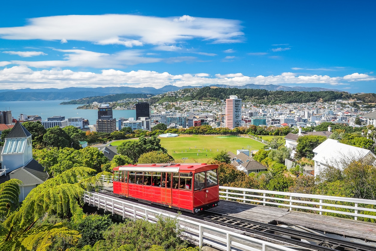
惠灵顿(英语:Wellington、毛利语:Te Whanganui-a-Tara 或 Poneke)是新西兰的首都,位于新西兰北岛南端,人口约四十万。它是新西兰的第二大城市,与悉尼和墨尔本一起成为大洋洲的文化中心。许多艺术家在此定居或活动,它还有许多艺术咖啡馆和生动的夜生活。
惠灵顿位于北岛的南端,与南岛隔库克海峡相望。在晴朗的日子里,人们可以隔海峡看到南岛上凯库拉岭的雪峰。城市北面是卡培提市的金色海岸。城市东面的里姆塔卡山将城市与盛产葡萄酒的怀拉拉帕平原隔开。
惠灵顿是世界最南方的首都,其纬度高达41度。由于港口和周围山脉之间的可用地带有限,它比新西兰其它城市的人口密度要高。由于它位于纬度40度的咆哮西风带,以及库克海峡对风的影响,他在当地有“多风的惠灵顿”之称号。
惠灵顿市中心的商业区是它的最重要部分,约6.2万人在那里工作(比较:奥克兰的居民数是惠灵顿的三倍,而它的中心商业区工作人员的数目仅比惠灵顿多4千)。惠灵顿的艺术和夜生活主要集中在中心商业区的南部,Te Aro区是新西兰最大的娱乐中心。
惠灵顿以其美丽的自然港口和绿色的山坡而著称。山坡上点缀着殖民时期遗留下来的盖瓦洋房。城市的中心商业区位于港口的附近。惠灵顿的尼可森海港的走向沿着一个活跃的地质断层。向西地势骤然高起,因此惠灵顿的许多市区高于市中心。
惠灵顿的南端是密拉马半岛,它与北岛的其它部分通过一条狭窄的地峡相连。惠灵顿国际机场也在这里。
Wellington, offizielle Bezeichnung: Wellington City (Māori Te Whanganui-a-Tara, wobei damit der Wellington Harbour und seine Umgebung gemeint ist), ist die Hauptstadt von Neuseeland und stellt zusammen mit den angrenzenden Städten Lower Hutt, Upper Hutt und Porirua nach Auckland den zweitgrößten Ballungsraum des Landes dar. Die Stadt Wellington selbst hat rund 190.000 Einwohner.
Wellington City liegt am südlichen Ende der Nordinsel. Die Stadt verfügt über eine reine Landfläche von 290 km² und zählte zum Census im Jahr 2013 190.959 Einwohner.[2] Damit ist die Stadt zwar flächenmäßig die zweitkleinste Stadt der vier eigenständigen Städte in der Region Wellington, ist aber mit 658,7 Einwohner pro km² die Stadt mit der dritthöchsten Bevölkerungsdichte des Landes, hinter Hamilton und Tauranga.
Im Norden und Nordosten der Stadt bilden die Stadtgebiete von Porirua City und Hutt City die Grenze, im Westen tut dies die Küstenlinie der Tasmansee, im Süden die Küstenlinie der Cook Strait und im Osten der Wellington Harbour.[3] Der westliche Teil der Stadt ist durch eine Berglandschaft geprägt, die mit dem 537 m hohen Outlook Hill an der Südspitze ihre Höhepunkt findet.
Die Gegenden im Westen des bebauten Gebiets von Wellington steigen relativ steil zu einer hügeligen Mittelgebirgskette an, so dass die dort gelegenen Stadtteile mitunter um einiges höher als das Stadtzentrum liegen. Aufgrund seiner geographischen Beschaffenheit wird Wellington oft mit San Francisco verglichen. Der südlich des Stadtzentrums gelegene Mount Victoria ist ein beliebter Aussichtspunkt und eine der markantesten geographischen Besonderheiten der Stadt. Die Miramar Peninsula (spanisch; Seeblick) bildet den östlichsten Punkt der Stadt. Auf dem zu dieser Halbinsel führenden Isthmus befindet sich der Internationale Flughafen der Stadt und direkt östlich dieser Halbinsel die Hafeneinfahrt in den Wellington Harbour mit dem berüchtigten Barrett-Riff, dem schon zahlreiche Schiffe zum Opfer fielen. Die Wahine, die 1968 an dem Riff gesunken ist und 52 Menschen in den Tod gerissen hat, ist das wohl bekannteste Opfer. Im Naturhafen selbst gibt es die drei Inseln Matiu/Somes Island, Ward (Makaro) und Mokopuna, von denen nur die erste bewohnt ist. Im Norden mündet einer der großen Flüsse der Nordinsel, der Hutt River in die Bucht. In seinem Tal, dem Hutt Valley befinden sich die Städte Upper Hutt im Norden und Lower Hutt südlich davon. Die beiden Städte werden westlich von den Bergen des Akatarawa Forest als Ausläufer der Tararua Range und östlich von der Rimutaka Range eingegrenzt.
Bekannte Sehenswürdigkeiten sind das ältere neuseeländischen Parlamentsgebäude und das 1979 fertiggestellte Regierungsgebäude, Beehive (Bienenstock) genannt, in dem der Prime Minister und die Minister des Kabinetts ihre Büros haben und das Kabinett tagt; das historische Wellington Cable Car und der dadurch an die City angeschlossene Botanische Garten mitsamt Aussichtspunkt oberhalb der Victoria University of Wellington; das Old Government Building als größtes Holzgebäude der Südhalbkugel (heute die juristische Fakultät der Universität) sowie Mount Victoria als einer der besten Aussichtspunkte der Stadt. Old Saint Paul’s, die erste anglikanische Kathedrale, wurde ab 1855 als Holzkirche in neugotischen Formen errichtet. 1964 ging ihre Funktion an die neu erbaute Cathedral of Saint Paul über. Bischofskirche des römisch-katholischen Erzbistums Wellington ist die 1901 vollendete Sacred Heart Cathedral.
Während der Stadtentwicklung sind um den Beginn des 20. Jahrhunderts eine Reihe von Profanbauten entstanden, welche das Bild der Innenstadt mitbestimmen. Dazu zählen die Aida Konditorei und das Barber Building in der Cuba Street, das Thistle Inn als einer der ältesten Pubs Neuseelands, das Albemarle Hotel in der Ghuznee Street, das Antrim House inmitten höherer moderner Gebäude, Alcohol and Drug Dependence Centre Building, das Appraisal House in der Willis Street, das Ashleigh Court Private Hotel sowie der Aqua Vitae Bottle Store, als seltenes Zeugnis der frühen kolonialen Bebauung.
ウェリントン(英語: Wellington、マオリ語: Te Whanga-nui-a-Tara)は、ニュージーランドの首都。同国2番目の都市圏で、オセアニアの首都の中では最も人口が多い。オセアニア有数の世界都市でもある。ウェリントン広域自治体(Wellington Region)に属し、ニュージーランド北島の南端にあり、ちょうど同国の国土の中央に位置する。マオリ語ではテ・ワンガヌイ=ア=タラあるいはポネケ(Poneke)という。
ニュージーランドの主要な金融機関はウェリントンとオークランドに分かれ、幾つかの企業は本社を両都市に置いている。ウェリントンはニュージーランドの政治の中心地であり、ニュージーランド議会とすべての行政機関の本庁舎が置かれている。
またウェリントンは、ニュージーランドの映画・演劇産業の中心地である。テ・パパ(Te Papa ニュージーランド国立博物館)、ニュージーランド交響楽団 (New Zealand Symphony Orchestra)、そしてロイヤル・ニュージーランド・バレエ団 (Royal New Zealand Ballet) が本拠地を置いている。隔年でニュージーランド国際アートフェスティバル (New Zealand International Arts Festival) も開催される。
小さくまとまった都心部では、都市の大きさのわりに大規模なアートシーンやカフェ文化、ナイトライフが展開されている。
ウェリントンの名前は、ワーテルローの戦いでナポレオン1世に勝利した初代ウェリントン公爵アーサー・ウェルズリーに敬意を表してつけられたものである。そしてその「ウェリントン」の爵号は、イングランド・サマセット州のウェリントンという町の名に由来する。
マオリ語ではウェリントンは2つの名前で呼ばれる。「テ・ワンガヌイ=ア=タラ (Te Whanganui-a-Tara)」はウェリントン港を指すもので、「タラ(ポリネシアの神話に登場する女神)の大いなる港」を意味する。もう一つの名称の「ポネケ」の方は、港のかつての名称「ポート・ニコルソン (Port Nicholson)」を縮めた愛称である「ポート・ニック (Port Nick)」の音訳でしかないと信じられているため、必ずしもマオリ語名とは言えないとされることも多い。
ウェリントンの都市圏は単独の地方自治体の境界を大きく越えて広がっている。「大ウェリントン (Greater Wellington)」あるいは「ウェリントン地方 (Wellington Region)」と呼ばれるのは、都市圏全体に加え、それを構成する市の市街地以外の部分、カピティ海岸 (Kapiti Coast)、それにリムタカ山脈 (Rimutaka Range) を挟んでワイララパ (Wairarapa) に至る範囲である。
Wellington (Māori: Te Whanganui-a-Tara [tɛ ˈfaŋanʉi a taɾa]) is the capital city and second most populous urban area of New Zealand, with 418,500 residents.[3] It is located at the south-western tip of the North Island, between Cook Strait and the Remutaka Range. Wellington is the major population centre of the southern North Island, and is the administrative centre of the Wellington Region, which also includes the Kapiti Coast and Wairarapa. Its latitude is 41°17′S, making it the world's southernmost capital of a sovereign state.[4] Wellington features a temperate maritime climate and is the world's windiest city, with an average wind speed of over 26 km/h (16 mph).[5]
The Wellington urban area comprises four local authorities: Wellington City, on the peninsula between Cook Strait and Wellington Harbour, contains the central business district and about half the population; Porirua on Porirua Harbour to the north is notable for its large Māori and Pacific Island communities; Lower Hutt and Upper Hutt are largely suburban areas to the northeast, together known as the Hutt Valley.
Situated near the geographic centre of the country, Wellington was well placed for trade. In 1839 it was chosen as the first major planned settlement for British immigrants coming to New Zealand. The settlement was named in honour of Arthur Wellesley, the first Duke of Wellington and victor of the Battle of Waterloo.
As the nation's capital since 1865, the New Zealand Government and Parliament, Supreme Court and most of the public service are based in the city. Architectural sights include the Government Building—one of the largest wooden buildings in the world—as well as the iconic Beehive. Wellington is also home to several of the largest and oldest cultural institutions in the nation such the National Archives, the National Library, the Museum of New Zealand Te Papa Tongarewa, and numerous theatres. It plays host to many artistic and cultural organisations, including the New Zealand Symphony Orchestra and Royal New Zealand Ballet. One of the world's most liveable cities, the 2014 Mercer Quality of Living Survey ranked Wellington 12th in the world.[6]
Wellington's economy is primarily service-based, with an emphasis on finance, business services, and government. It is the centre of New Zealand's film and special effects industries, and increasingly a hub for information technology and innovation,[7] with two public research universities. Wellington is one of New Zealand's chief seaports and serves both domestic and international shipping. The city is served by Wellington International Airport, the third busiest airport in the country. Wellington's transport network includes train and bus lines which reach as far as the Kapiti Coast and Wairarapa, and ferries connect the city to the South Island.
Wellington est la capitale de la Nouvelle-Zélande depuis 1865 et la deuxième ville la plus peuplée du pays. Elle est située à l'extrémité sud de l'île du Nord, dans la région de Wellington, au centre du pays. Cette situation en fait la capitale de pays la plus australe. Comme beaucoup de villes, l'aire urbaine de Wellington s'étend au-delà des frontières de son administration territoriale. Le Grand Wellington ou la région de Wellington comprend toute l'aire urbaine ainsi que les villes, les régions rurales, le Kapiti Coast, la chaine des monts Rimutaka et la Wairarapa.
Les principales institutions financières néo-zélandaises sont réparties entre Wellington et Auckland, et certaines organisations ont des bureaux dans les deux villes. Wellington est en revanche le centre politique de la Nouvelle-Zélande, le siège du parlement, des ministères et des départements d'État. Son centre-ville dense est le foyer d'une scène artistique, d'une culture des cafés et d'une vie nocturne que pourraient lui envier bon nombre de villes de taille similaire. Elle accueille également une industrie cinématographique d'échelle mondiale, ainsi qu'une scène théâtrale importante, Te Papa Tongarewa (le musée national), l'Orchestre symphonique de Nouvelle-Zélande et le Ballet national de Nouvelle-Zélande.
Wellington è la capitale della Nuova Zelanda, ed è la seconda città del paese, dopo Auckland.
Wellington è situata sulla punta sud-occidentale dell'isola del Nord e si trova tra lo Stretto di Cook e la zona di Rimutaka. È la città capitale più meridionale del mondo, ed è nel contempo anche la più remota capitale poiché lontana da qualsiasi altra.
L'area urbana di Wellington è il centro principale del sud dell'Isola del Nord, ed è il capoluogo della Regione di Wellington, che oltre alla zona urbana copre la costa Kapiti e Wairarapa.
La zona metropolitana della città comprende quattro quartieri: "Wellington City", sulla penisola tra lo stretto di Cook ed il porto, "Porirua City", a nord, "Lower Hutt City" e Upper Hutt City.
Wellington, inoltre, ha tre isole: Matiu, Makaro e Mokopuna. La prima di queste isole è stata usata come luogo di quarantena per le persone e gli animali, e anche come campo di internamento durante i due conflitti mondiali; oggi è un luogo di conservazione, in cui vengono protette specie in pericolo, proprio come Kapiti, che si trova più avanti rispetto alla costa. È possibile raggiungere queste isole tramite il traghetto Dominion Post.
Wellington ha subito gravi danni in una serie di terremoti nel 1848 (8,2 della scala Richter) e nel 1855. Questi terremoti trasformarono l'area intorno al porto in una palude; la zona è stata successivamente recuperata ed oggi vi si trova il Central Business District, il quartiere degli affari.
Una leggenda maori racconta che il grande navigatore polinesiano Kupe scoprì ed esplorò intorno al X secolo la zona dove sorge la città.
Il primo insediamento europeo si stabilì con l'arrivo dei coloni a bordo della nave Tory, il 20 settembre 1839; altre 150 persone arrivarono sulla nave Aurora il 22 gennaio 1840. I coloni costruirono le loro case alla foce della zona pianeggiante del fiume Hutt.
Nel 1865 Wellington divenne la capitale della Nuova Zelanda, in sostituzione di Auckland, dove William Hobson, l'aveva posta nel 1841. Il primo ministro della Nuova Zelanda, Alfred Domett, presentò al Parlamento una proposta di legge, in cui si esprimeva la necessità di trasferire la capitale in una località adatta.
Wellington (en maorí: Te Whanganui-a-Tara o Pōneke) es la capital de Nueva Zelanda, así como de la región de Wellington. Está localizada al sur de la isla Norte (North Island en inglés), en la que Wellington es la ciudad principal. Con 179 463 habitantes en 2006,1 es la tercera ciudad más poblada del país, después de Auckland y Christchurch.
Como muchas otras grandes ciudades y capitales, la ciudad se extiende más allá de los límites de su término municipal, y su área metropolitana o Gran Wellington incluye las poblaciones y áreas rurales cercanas, la costa de Kapiti y los montes Rimutaka hasta la región de Wairarapa. El área urbana incluye cuatro ciudades: Wellington, entre el estrecho de Cook y el puerto de Wellington, abarca la mitad de la población de todas las áreas y por lo tanto es su centro económico; al norte se encuentra Porirua, se caracteriza por su gran afluencia de maoríes y procedentes de las islas del pacífico; Lower Hutt y Upper Hutt al noreste, situadas junto al valle de Hutt.
La ciudad es un importante centro financiero y de negocios en el país. Es también un importante centro cultural, que alberga el museo Te Papa ("nuestro lugar" en lengua maorí), el ballet, la orquesta sinfónica y la producción cinematográfica en Nueva Zelanda. Fue fundada a finales de 1830 y se convirtió en la capital de Nueva Zelanda en 1865, en sustitución de Auckland. La ciudad está situada a 41 grados latitud sur y es la capital nacional más austral en el mundo.
Веллингто́н, Уэ́ллингтон (англ. Wellington) — столица Новой Зеландии, второй по численности населения город страны с учётом агломерации, крупнейшая столица среди стран Океании и самая южная столица в мире[2]. Город расположен в регионе Веллингтон в южной части острова Северный. Маорийское название Веллингтона — Те Фанауи-а-Тара (маори Te Whanganui-a-Tara). В начале XIX века начался процесс захвата европейцами земель коренного населения маори. В 1839 году полковник Уильям Уэйкфилд, служивший в Новозеландской компании, основал город немного северней его современного расположения. Однако в 1840 году сильные разливы реки Хатт заставили переселиться южнее. Первые переселенцы назвали город Веллингтоном в честь фельдмаршала герцога Артура Уэлсли Веллингтона, командующего объединёнными англо-голландскими войсками, в благодарность за ту помощь, которую он оказал первым переселенцам. Сильное землетрясение 1848 года вызвало серьёзные разрушения в городе, а в 1854 году по той же причине погибло много людей. В 1865 году Веллингтон стал столицей Новой Зеландии, которой остается и поныне. Веллингтон — красивый и уютный город, с большим количеством мостов, виадуков, тоннелей, парков и скверов. Многообразен его архитектурный облик: эклектические сооружения, относящееся к XIX — первой половине XX веков, на улицах города сочетаются со зданиями современного стиля и массовой деревянной застройкой. Одной из интереснейших построек столицы является круглое здание парламента, которое горожане называют ульем. Напротив парламента расположен бывший дворец правительства, являющейся второй в мире по величине постройкой из дерева. Также привлекает внимание собор Святого Павла. Впечатляет столичный ботанический сад, который расположился на склоне высокой горы. Особой гордостью города можно также считать зоопарк, в котором животные размещаются чаще всего не в клетках, а в просторных открытых вольерах.
Women's Soccer World Cup 2015
ITU World Championship Series
Canada
Olympic Summer Games
 Quebec-QC
Sport
Triathlon
Important port
Quebec-QC
Sport
Triathlon
Important port


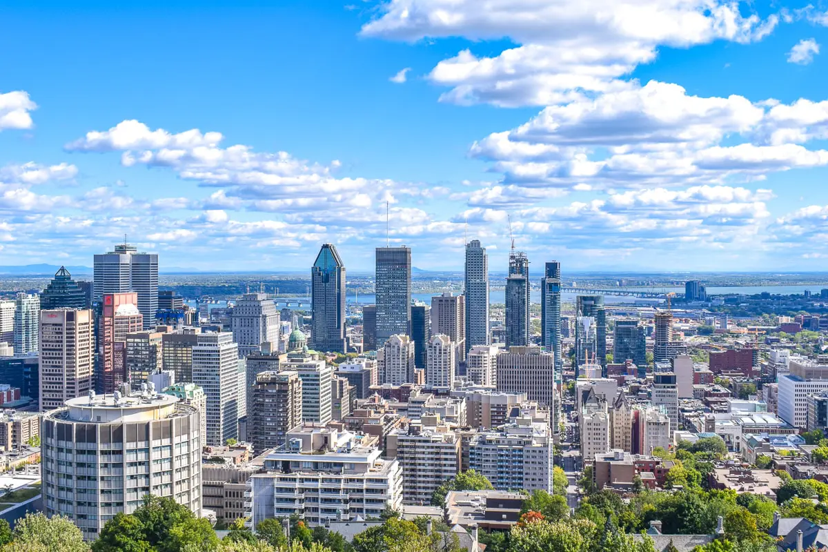
蒙特利尔(法语:Montréal,[mɔ̃ʁeal] 聆听;英语:Montreal,/ˌmʌntriːˈɒl/ ( 聆听)),蒙特利尔,港澳称为满地可,台湾称为蒙特娄[5][6]、蒙特利尔[6],是一座位于加拿大魁北克省西南部的城市,主要位于圣劳伦斯河和渥太华河汇合处的蒙特利尔岛及周边小岛上。根据2011年人口普查,蒙特利尔人口约为342万[9],是魁北克省内最大城市、加拿大第二大城市及北美第十五大城市。“蒙特利尔”一词来源于中古法语“Mont Royal”,意思为“皇家山”,至今蒙特利尔城中心的地标皇家山仍以此命名。法语是蒙特利尔的官方语言,也是城市里最常用的语言,使用人口占城市总人口的60.5%,使得蒙特利尔成为世界上仅次于巴黎的第二大法语城市。
蒙特利尔曾经是加拿大经济首都,拥有最多的人口及最发达的经济,但是在1976年蒙特利尔奥运会后被安大略省的多伦多超过。今天蒙特利尔仍然是加拿大最重要的经济中心之一,航空工业、金融、设计、电影工业等行业发达。蒙特利尔被认为是世界最佳宜居城市,并被联合国教育、科学及文化组织认定为设计之城。1999年第35届国际技能竞赛在这里举行。
Montreal (deutsch [mɔntʁeˈa:l]) bzw. Montréal (französisch [mɔ̃ʁeˈal], englisch [ˌmʌntɹiːˈɒl]) ist eine Millionenstadt in Kanada. Sie liegt im Südwesten der Provinz Québec auf der Île de Montréal, der größten Insel im Hochelaga-Archipel, die vom Sankt-Lorenz-Strom und von Mündungsarmen des Ottawa umflossen wird. Die Nachbarprovinz Ontario liegt knapp 60 Kilometer westlich, die Grenze zu den USA etwas mehr als 50 Kilometer südlich. Das Stadtbild wird vom Mont Royal geprägt, einem 233 Meter hohen Hügelzug vulkanischen Ursprungs im Zentrum der Insel, von dem sich der Name der Stadt ableitet.
Als der französische Seefahrer Jacques Cartier im Jahr 1535 als erster Europäer die Gegend erforschte, lebten Sankt-Lorenz-Irokesen auf der Insel. 1642 gründeten Paul Chomedey de Maisonneuve und Jeanne Mance das Fort Ville-Marie, eine katholische Missionsstation. Daraus entwickelte sich in der Folge die Siedlung Montreal, die 1760 unter britische Herrschaft kam. Montreal erhielt 1832 die Stadtrechte. Die Stadt wuchs rasch und entwickelte sich zum wirtschaftlichen und kulturellen Zentrum des Landes, verlor aber im letzten Viertel des 20. Jahrhunderts diese führende Rolle an Toronto. Bedeutende Ereignisse von weltweiter Ausstrahlung waren die Weltausstellung Expo 67 und die Olympischen Sommerspiele 1976.
Die Wirtschaft Montreals ist stark diversifiziert. Wichtige Pfeiler des Dienstleistungssektors sind Finanzdienstleistungen, Medien, Handel und Design. Von großer Bedeutung ist auch der Tourismus, dies aufgrund der Sehenswürdigkeiten und des vielfältigen kulturellen Angebots, das neben Museen auch zahlreiche Festivals in den Bereichen Film, Theater und Musik umfasst. Mehr als 60 internationale Organisationen haben ihren Sitz in Montreal. Im Industriesektor sind Luftfahrt-, Pharma- und Spitzentechnologieunternehmen vorherrschend. Mit vier Universitäten und mehreren weiteren Hochschulen ist Montreal ein bedeutender Bildungsstandort. Außerdem ist die Stadt ein Knotenpunkt im Schienen- und Straßennetz und verfügt darüber hinaus über den größten Binnenhafen auf dem amerikanischen Kontinent.
Mit einer Bevölkerungszahl von 1.649.519 Einwohnern (Stand: 2011)[1] ist Montreal die zweitgrößte Stadt Kanadas nach Toronto und die größte der Provinz Québec. Die Verwaltungsregion, die alle Gemeinden auf der Insel umfasst, zählt 1.886.481 Einwohner (2011).[2] Der Ballungsraum Communauté métropolitaine de Montréal, der urbane Gebiete im näheren Umkreis miteinbezieht, zählt 3.824.221 Einwohner (2011).[3] Französisch ist Montreals Amtssprache und die Hauptsprache von 56,9 % der Bevölkerung, während 18,6 % hauptsächlich Englisch sprechen. Der Rest entfällt auf verschiedene Sprachen von Einwanderern, womit Montreal eine multikulturelle Bevölkerung besitzt.[4]
Montreal ist die zweitgrößte Stadt der Welt nach Paris, in der Französisch als Muttersprache gesprochen wird.[5][6][7][8] Montreal gehört auch weltweit zu den größten Städten, in denen Französisch die offizielle Sprache ist. Die Stadt stand früher an zweiter Stelle nach Paris, hat aber diesen Rang in den letzten Jahren an Kinshasa[9] und Abidjan[10] abgegeben.
モントリオール(英語: Montreal [ˌmɒntrɪˈɔːl] ( 音声ファイル))、モンレアル(フランス語: Montréal[mɔ̃ʁeal] ( 音声ファイル))は、カナダ・ケベック州の都市。セントローレンス川沿いに位置し、アメリカ合衆国との国境や、カナダのオンタリオ州との州境に近い。
モントリオール市は、カナダではオンタリオ州のトロントに次ぎ人口・経済規模で第二の都市である[5]。ケベック州では最大の都市である。2015年、アメリカのシンクタンクが公表したビジネス・人材・文化・政治などを対象とした総合的な世界都市ランキングにおいて、世界第24位の都市と評価された[6]。
住民の大半がフランス系カナダ人を中心にしたヨーロッパ系だが、市内の人口の31.7%は非白人と世界各地からの移民も多い多民族都市である。
周辺地域を含むモントリオール大都市圏の人口は約380万人であり、これは北米で15番目、世界でも第77位の規模。面積は約4千km2。モントリオール大都市圏の住民の7割弱が第一言語をフランス語とし、フランス語圏ではパリとキンシャサ[7]に次ぐ規模である。
フランス文化の薫り高い異国的な雰囲気、美食の町、石造りの住宅街、街中にある数多くの教会、石畳のヨーロッパ調の旧市街の街並みなどから観光客向けに「北米のパリ」と宣伝される。一方では、都市圏の住民の1割強の第一言語は英語であり、19世紀の終わりから20世紀の始めにかけて英国系移民によって街が発展してきたことからヴィクトリア朝の建物が多いなど英国文化も色濃く残り、北米文化と混合している側面も持つ。
Montreal (/ˌmʌntriˈɔːl/ (listen) MUN-tree-AWL;[14] French: [mɔ̃ʁeal] (listen); officially Montréal) is the most populous municipality in the Canadian province of Quebec and the second-most populous municipality in Canada. Originally called Ville-Marie, or "City of Mary",[15] it is named after Mount Royal,[16] the triple-peaked hill in the heart of the city. The city is centred on the Island of Montreal, which took its name from the same source as the city,[17][18] and a few much smaller peripheral islands, the largest of which is Île Bizard. It has a distinct four-season continental climate with warm to hot summers and cold, snowy winters.[19]
In 2016, the city had a population of 1,704,694,[9] with a population of 1,942,044 in the urban agglomeration, including all of the other municipalities on the Island of Montreal.[9] The broader metropolitan area had a population of 4,098,927.[11] French is the city's official language[20][21] and is the language spoken at home by 49.8% of the population of the city, followed by English at 22.8% and 18.3% other languages (in the 2016 census, not including multi-language responses).[9] In the larger Montreal Census Metropolitan Area, 65.8% of the population speaks French at home, compared to 15.3% who speak English.[11] The agglomeration Montreal is one of the most bilingual cities in Quebec and Canada, with over 59% of the population able to speak both English and French.[9] Montreal is the second-largest primarily French-speaking city in the world, after Paris.[22][23][24][25] It is situated 258 kilometres (160 mi) south-west of Quebec City.
Historically the commercial capital of Canada, Montreal was surpassed in population and in economic strength by Toronto in the 1970s.[26] It remains an important centre of commerce, aerospace, transport, finance, pharmaceuticals, technology, design, education, art, culture, tourism, food, fashion, gaming, film, and world affairs. Montreal has the second-highest number of consulates in North America,[27] serves as the location of the headquarters of the International Civil Aviation Organization, and was named a UNESCO City of Design in 2006.[28][29] In 2017, Montreal was ranked the 12th most liveable city in the world by the Economist Intelligence Unit in its annual Global Liveability Ranking,[30] and the best city in the world to be a university student in the QS World University Rankings.[31]
Montreal has hosted multiple international conferences and events, including the 1967 International and Universal Exposition and the 1976 Summer Olympics.[32][33] It is the only Canadian city to have held the Summer Olympics. In 2018, Montreal was ranked as an Alpha− world city.[34] As of 2016 the city hosts the Canadian Grand Prix of Formula One,[35] the Montreal International Jazz Festival[36] and the Just for Laughs festival.[37]
Montréal [ˈmɔ̃ˌʁeal]3 Écouter est la deuxième ville la plus peuplée du Canada. Elle se situe principalement sur l’île fluviale de Montréal, sur le fleuve Saint-Laurent (entre Québec et le lac Ontario) dans le Sud de la province de Québec, dont elle est la métropole4.
En 2016, la ville comptait 1 704 694 habitants1 et son aire urbaine (appelée Région métropolitaine de Montréal) plus de 4 millions, soit environ la moitié de la population du Québec5. Montréal est ainsi la 19e agglomération la plus peuplée d'Amérique du Nord6 et la 122e ville la plus peuplée du monde7.
Ville francophone la plus peuplée d'Amérique8, Montréal est considérée comme ayant la deuxième population francophone au monde après ParisNote 1,9,10. En 2011, environ 50 % de la population de Montréal était de langue maternelle française, 13 % était de langue anglaise et 33 % était d'une autre langue11, ce qui fait d'elle l'une des villes les plus cosmopolites du monde12.
Montréal est le 3e plus grand centre financier d'Amérique du Nord et le 12e au monde13. Cœur économique du Québec, Montréal est aussi la seconde place financière du Canada et possède une économie fortement diversifiée14 par le commerce, l’éducation, les technologies de l'information et les industries aérospatiale, pharmaceutique, du tourisme et du cinéma. La ville est la 3e en importance dans l'industrie mondiale du jeu vidéo15. Classée ville mondiale en 2012, Montréal est la deuxième ville consulaire d'Amérique du Nord, abrite le siège de l'Organisation de l'aviation civile internationale et est le siège de plus de 65 organisations internationales gouvernementales et non gouvernementales16, ce qui fait d'elle la 3e ville en importance en Amérique du Nord pour ce qui est du nombre de siège sociaux d'organisations internationales, derrière New York et Washington17. De plus, la ville est la première d'Amérique du Nord pour le nombre de congrès internationaux18. En 2017, Montréal est consacrée « meilleure ville étudiante » au monde19 et est considérée comme la « Métropole universitaire du Canada, avec six universités et 450 centres de recherche »20.
Montréal a accueilli plusieurs événements internationaux d'envergure, dont l'Exposition universelle de 1967 et les Jeux olympiques d'été de 1976. Hôte du Grand Prix de Formule 1 du Canada, elle accueille annuellement de nombreux festivals, tels le Festival international de jazz de Montréal, les FrancoFolies, et le festival Juste pour rire. Le club de hockey des Canadiens de Montréal y a élu domicile dès sa création en 1909.
Montréal (in francese, pronuncia: /mɔ̃ʁeal/ ascolta[?·info]) o Montreal (pronuncia: [ˈmɔntreal][2]; in inglese: /mʌntriːˈɒl/ ascolta[?·info]), in italiano Monreale, è una città del Canada. È il centro più popoloso della provincia del Québec e il suo più importante polo economico, oltre a essere la seconda città più popolosa del Canada. Montréal è anche la seconda agglomerazione urbana del paese dopo quella di Toronto. In francese viene detta la Métropole e la sua area metropolitana conta all'incirca 4 milioni di abitanti[3]. Il centro storico di Montréal è il Vieux-Montréal (Vecchia Montréal).
Montreal (Montréal1 en la grafía oficial de la ciudad, en francés; pronunciación en francés: /mɔ̃.ʀe.al/ ( escuchar), pronunciación en inglés: /ˌmʌn.tɹiˈɒːl/ ( escuchar)) es la mayor ciudad de la provincia de Quebec, en Canadá y la segunda más poblada del país.2 Es también una región administrativa de Quebec. Se sitúa en la isla del mismo nombre entre el río San Lorenzo y la Rivière des Prairies. Es uno de los principales centros industriales, comerciales y culturales de Norteamérica.
Montreal es la cuarta ciudad francófona más poblada del mundo, detrás de París, Kinshasa y Abiyán.34 Sin embargo, Montreal también tiene una considerable comunidad anglófona,5 y un creciente número de personas cuyo idioma materno no es ni el francés ni el inglés.
La palabra «Montreal» es la versión arcaica, en francés antiguo, de «Mont-Royal» (cuando «royal» se decía y se escribía «real» sin acento, como en castellano), un monte localizado en la ciudad, en el centro de la isla.67 Montreal es uno de los centros culturales más importantes de Canadá, puesto que acoge varios acontecimientos nacionales e internacionales. Entre ellos, podemos citar el festival Juste pour Rire, uno de los mayores festivales de humor del mundo, el Festival de Jazz de Montréal, uno de los mayores festivales de jazz del mundo, y el Grand Prix de Montréal. La ciudad, en total, acoge más de 70 eventos internacionales al año.
La población de Montreal es de las mejor formadas del mundo, poseyendo la mayor concentración de estudiantes universitarios per cápita de toda Norte América. La ciudad posee cuatro universidades —dos francófonas y dos anglófonas— y doce facultades. Es un centro de la industria de alta tecnología, especialmente en el área de medicina y de la industria aeroespacial.8
Fundada en 1642, Montreal fue una de las primeras ciudades de Canadá. Desde entonces, y hasta la década de 1960, fue el principal centro financiero e industrial de Canadá, así como la mayor ciudad del país. Considerada hasta entonces la capital económica de Canadá, también era considerada una de las ciudades más importantes del mundo. Sin embargo, durante la década de 1970, la anglófona Toronto le arrebató el puesto de capital financiera e industrial del país. En 2001, los 27 municipios de la isla de Montreal fueron fusionados con la ciudad de Montreal. En 2004, tras los resultados de un referéndum, 15 de estos municipios nuevamente volvieron a ser ciudades independientes.
Монреа́ль (фр. Montréal, [mɔ̃ʁeˈal], англ. Montreal) — самый крупный город в провинции Квебек и второй по величине город в Канаде. Первоначально назывался Вилль-Мари — город Марии. Название Монреаль произошло от горы Мон-Руаяль (Королевская гора)[2], находящейся в центре города[3][4], форма Монреаль возникла под влиянием окситанского языка части первых поселенцев.
По данным 2016 года, население Большого Монреаля составляло 4 098 927 человек[5]. Население самого города Монреаль составляет в 1 704 694 человек[6].
Единственный официальный язык в городе — французский, для 59,8 % жителей города этот язык является родным, затем по количеству носителей следует английский язык — 19,4 %[7][8]. В Большом Монреале доля носителей французского составляет 67,9 % от населения, второе место занимает английский — 16,5 %[9]. Больше половины населения города владеет в той или иной степени обоими языками[10]. До 2014 года Монреаль был вторым по населению франкоязычным городом мира после Парижа, но к 2015 году на 3-ю позицию его сместил африканский Абиджан[11]. Также в мире есть и другие крупные франкоязычные города — африканские Киншаса, Касабланка, Алжир, но в этих городах французский используется преимущественно в письменном виде или же в качестве второго языка[12][13].
Монреаль обыкновенно занимает самые высокие места в рейтинге самых удобных для жизни городов в мире. Журнал Monocle Magazine назвал город «культурной столицей Канады», а недавно ЮНЕСКО назвало Монреаль городом дизайна[14][15]. Уступив в середине 70-х титул экономической столицы Торонто, Монреаль остается важным деловым, промышленным и культурным центром Канады. В числе наиболее значимых отраслей: аэрокосмическая, биотехнологическая, фармацевтическая, отрасль информационных технологий, туризм, киноиндустрия, а также развитая индустрия компьютерных игр[16][нет в источнике].
International cities
*European Capital of Culture
ITU World Championship Series
Netherlands
Sport
*European Capital of Culture
Sport
Triathlon
Important port
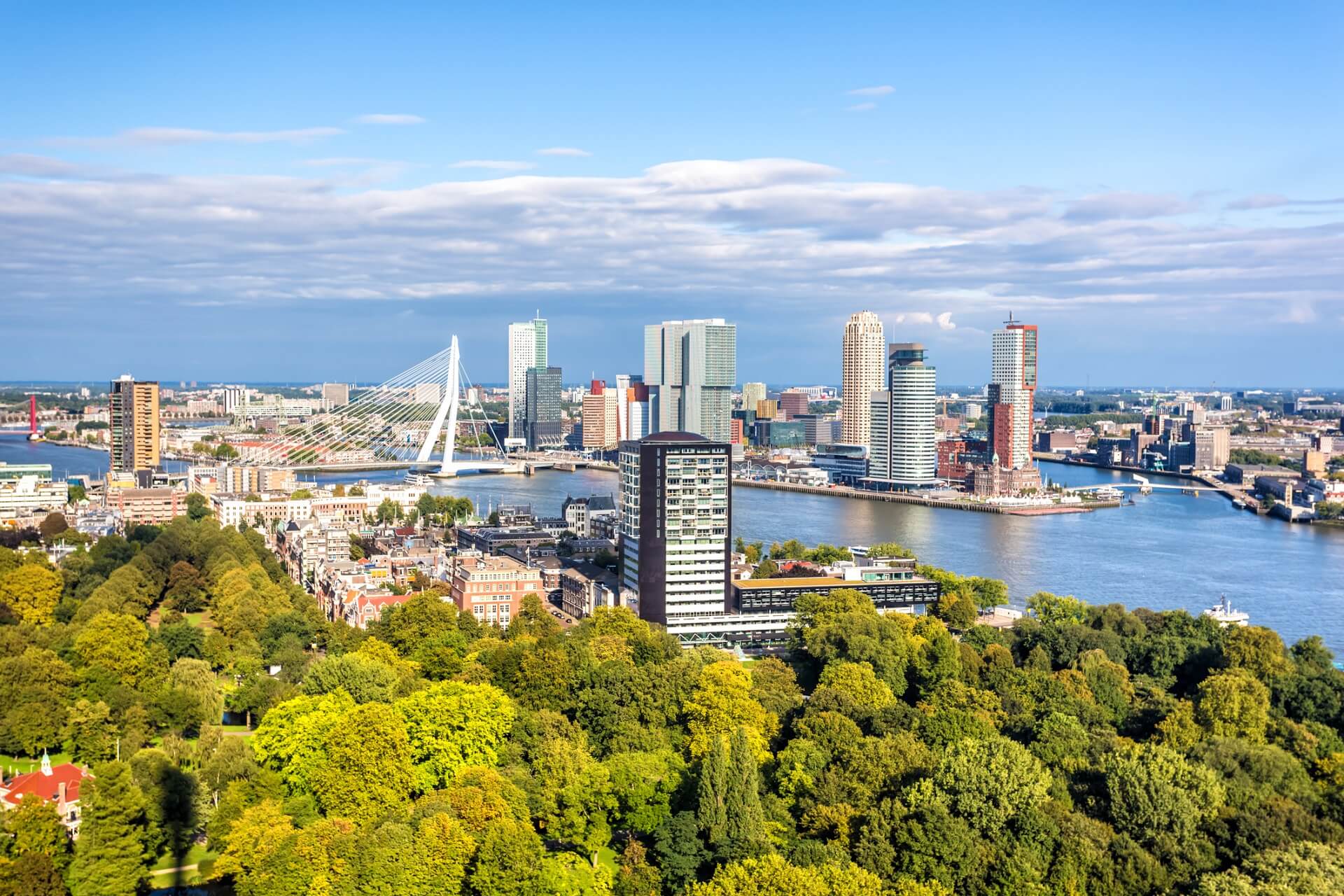
鹿特丹(荷兰语:Rotterdam 荷兰语读音:[ˌrɔtərˈdɑm] 聆听)是荷兰南荷兰省的城市,是荷兰第二大城市,位于荷兰的南荷兰省,新马斯河畔。其名称来自于在市中心注入新马斯河的小河鹿特河、以及荷兰语的“坝”(Dam)。鹿特丹长期为欧洲最大的海港,以集装箱运量计算,1980年代曾是世界上第一大港口,在2010年为世界第10。
ロッテルダム(オランダ語: Rotterdam [ˌrɔtərˈdɑm] ( 音声ファイル))は、オランダの南ホラント州にある基礎自治体(ヘメーンテ)。オランダ語での発音は「ロッタダム」または「ロターダム」と表記する方が近い。
ロッテルダム港を擁する世界屈指の港湾都市で、人口規模はアムステルダムに次いでオランダ第2位である。世界都市であり、国内の他都市に比べて近代的なビルが立ち並ぶ。
Rotterdam (/ˈrɒtərdæm/, UK also /ˌrɒtərˈdæm/;[8][9] Dutch: [ˌrɔtərˈdɑm] ( listen)) is a city in the Netherlands, in South Holland within the Rhine–Meuse–Scheldt river delta at the North Sea. Its history goes back to 1270, when a dam was constructed in the Rotte river, after which people settled around it for safety. In 1340, Rotterdam was granted city rights by the Count of Holland.[10]
A major logistic and economic centre, Rotterdam is Europe's largest port, and has a population of 633,471 (2017), the second-largest in the Netherlands, just behind Amsterdam.[11]
Rotterdam is known for the Erasmus University, its riverside setting, lively cultural life, and maritime heritage. The near-complete destruction of the city centre in the World War II Rotterdam Blitz has resulted in a varied architectural landscape, including sky-scrapers (an uncommon sight in other Dutch cities) designed by renowned architects such as Rem Koolhaas, Piet Blom, and Ben van Berkel.[12][13]
Rotterdam's logistic success is based on its strategic location by the North Sea, at the mouth of the Nieuwe Maas channel leading into the Rhine–Meuse–Scheldt delta. The rivers Rhine, Meuse, and Scheldt give waterway access into the heart of Western Europe, including the highly industrialized Ruhr. The extensive distribution system including rail, roads, and waterways have earned Rotterdam the nicknames "Gateway to Europe" and "Gateway to the World".[14][15][16]
Rotterdam (prononcé en néerlandais /ˌrɔtərˈdɑm/ Écouter) est une commune néerlandaise, située dans la province de Hollande-Méridionale. Au 1er juillet 2017, la commune comptait 634 253 habitants (environ 1 424 000 dans sa région urbaine). Son agglomération fait partie de la conurbation de la Randstad Holland (7 100 000 habitants entre Amsterdam, Haarlem, La Haye, Dordrecht et Utrecht). Ses habitants sont les Rotterdamois.
Deuxième ville des Pays-Bas en nombre d'habitants après Amsterdam, Rotterdam représente le cœur industriel du pays, et sa position géographique, à l'embouchure du Rhin et de la Meuse, à proximité de la mer du Nord, lui assure une place commerciale stratégique dans les échanges européens, notamment avec l'Allemagne.
Huitième port mondial en 2014, et premier port européen, ses infrastructures portuaires s'étendent sur près de 42 kilomètres. La capacité et la modernité de celles-ci lui garantissent un quasi-monopole sur les arrivées d'hydrocarbures, étant le seul port européen, avec Le Havre, en capacité d'accueillir des supertankers transportant jusqu'à 400 000 tonnes de pétrole. Le port est aussi un pôle important pour les matières premières et les conteneurs.
Fondée au XIIe siècle, Rotterdam s'est organisée autour de la digue de la rivière Rotte (qui donne son nom à la ville) et les premiers ports de pêcheurs : le vieux port, Oude Haven et les quais de Haringvliet. Elle reçoit son statut de ville en 1340. Le commerce y fleurit pendant plusieurs siècles, tandis que le port s'étend et que le commerce avec les Indes occidentales et orientales s'accroît. Ville natale du philosophe humaniste Érasme au XVIe siècle et du peintre Pieter de Hooch au XVIIe siècle, elle favorise la vie culturelle et participe au rayonnement néerlandais durant le Siècle d'or. Au XIXe siècle, après une stagnation de son commerce due au blocus continental et à l'inadaptation de son port, la ville grandit à nouveau vers 1870, avec le percement d'une nouvelle voie d'eau qui lui donne un accès direct à la mer du Nord, l'agrandissement de son port et l'industrialisation de ses infrastructures. Des années de récession résultent de la Première Guerre mondiale, suivie de la crise économique de 1929. La guerre de 1939-1945 met un coup d'arrêt à ce développement, le centre de Rotterdam étant totalement détruit par l'armée nazie, lors du bombardement aérien du 14 mai 1940 qui force le pays à capituler. La reconstruction reprend après-guerre, ainsi que l’expansion du port et des industries associées. Après une récession dans les années 1980, due aux chocs pétroliers successifs, la ville diversifie ses activités économiques et commerciales en lien avec l'expansion de son port dans les années 2000. Elle développe son architecture contemporaine, met en valeur ses musées et son art moderne, et augmente ainsi le potentiel touristique de la ville.
Rotterdam a souvent été confrontée à de nombreux défis politiques, économiques, historiques. La maîtrise des eaux et des risques liés aux changements climatiques reste, pour la ville, un enjeu primordial du XXIe siècle.
Rotterdam (AFI: /rotterˈdam/ o /ˈrɔtterdam/[1][2]; in olandese [ˌrɔtərˈdɑm], ) è la seconda città dei Paesi Bassi dopo la capitale Amsterdam, situata nella provincia dell'Olanda Meridionale. La città ha il più grande porto d'Europa[3], collocato sulle rive del fiume Nieuwe Maas. Il nome Rotterdam deriva da quello di una diga (dam) su un piccolo fiume, la Rotte, che si unisce alla Nieuwe Maas nel cuore della città.
Róterdam1 (en neerlandés Rotterdam AFI: [ɾɔtər'dɑm] (?·i)) es una ciudad neerlandesa situada al oeste del país, en la provincia de Holanda Meridional, y puerto sobre el río Mosa, cerca de La Haya. Situada a 30 km del mar, tiene una población de 623 556 habitantes.2 El área metropolitana de Róterdam cuenta con una población de 2,82 millones de personas. La ciudad es conocida por la Universidad Erasmus, su vida cultural y su patrimonio marítimo.
El puerto de Róterdam, Europoort, es el más grande de Europa y el segundo más grande del mundo. Está comunicado con el río Rin.
Роттерда́м (нидерл. Rotterdam [ˌrɔtərˈdɑm] слушать) — город и община в Нидерландах. Расположен в провинции Южная Голландия при впадении реки Ньиве-Маас в Северное море. С населением 617 347 жителей (на 1 января 2012)[4] является вторым по количеству жителей городом в Нидерландах после Амстердама. Роттердам входит в состав крупной городской агломерации Рандстад.
Девиз Роттердама — Sterker door strijd («Окреп в борьбе»).
Центр машиностроения. Крупный транспортный узел (железные и шоссейные дороги); морской (на Северном море) и речной (река Ньиве-Маас) порты; аэропорт Роттердам-Гаага. Порт Роттердама является самым большим в Европе, а с 1962 по 2004 года он являлся самым крупным в мире (в настоящий момент он уступил это звание Шанхаю).
UEFA European Championship 2020
History
ITU World Championship Series
Silk road
Sport
Triathlon
Hungary
Cities founded by the Romans
 World Heritage


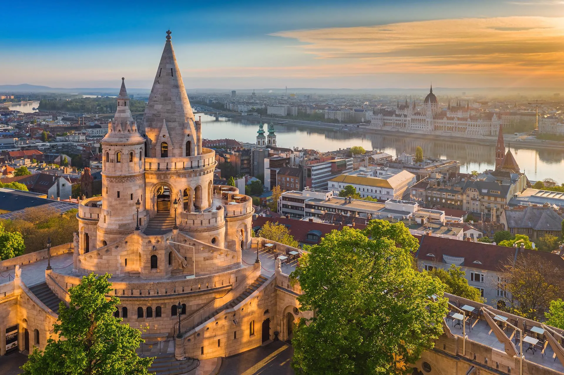
ブダペストまたはブダペシュト(ハンガリー語: Budapest, 英語:[ˈbuːdəpɛst], [ˈbuːdəpɛʃt] or [ˈbʊdəpɛst]; ハンガリー語発音: [ˈbudɒpɛʃt] ( 音声ファイル))は、ハンガリーの首都であり、同国最大の都市である[2]。
「ブダペスト」として一つの市でドナウ川の両岸を占めるようになったのは1873年11月17日に西岸のブダとオーブダ、東岸のペストが合併してからである[3][4]。
ドナウ川河畔に位置し、ハンガリーの政治、文化、商業、産業、交通の一大中心都市で[5]、東・中央ヨーロッパ (en) では最大、欧州連合の市域人口では8番目に大きな都市である。しばしばハンガリーのプライメイトシティとも表現される[6]。
ブダペストの市域面積は525km2 (202.7 sq mi)[3]で、2011年の国勢調査によるブダペストの人口は174万人[7]、ピークであった1989年の210万人より減少している[8]。これは、ブダペスト周辺部の郊外化によるものである[9]。ブダペスト都市圏(通勤圏)の人口は330万人である[10][11]。
ブダペストの歴史の始まりはローマ帝国のアクインクムとしてで、もともとはケルト人の集落であった[12][13]。アクインクムは古代ローマの低パンノニア属州の首府となっている[12]。マジャル人がブダペスト周辺にやって来たのは[14]9世紀頃である。最初の集落は1241年から1242年にかけてモンゴルの襲来 (en) により略奪された[15]。15世紀に[16]町が再建されるとブダペストはルネサンス期の人文主義者文化の中心となった[17]。続いてモハーチの戦いが起こり、オスマン帝国による150年間の支配が続き[18]、18世紀、19世紀に新しい時代に入ると町は発展し繁栄する。ブダペストは1873年にドナウ川を挟んだ都市の合併が行われると、世界都市となる[19]。また、1848年から1918年の第一次世界大戦勃発まで列強に含まれたオーストリア=ハンガリー帝国のウィーンに続く第二の首都であった。1920年のトリアノン条約によりハンガリーは国土の72%を失い、ハンガリーの文化や経済をブダペストがすべてを占めるようになった。ブダペストはその大きさや人口で圧倒的に優位に立ち、ハンガリーの他の都市を小さく見せていた[20]。ブダペストはハンガリー革命 (1848年)や1919年のハンガリー評議会共和国、1944年のパンツァーファウスト作戦、1945年のブダペスト包囲戦、1956年のハンガリー動乱など数々の歴史的な舞台の場でもあった。
ブダペストはヨーロッパでも最も美しい街の一つで[2][21][22]、ドナウ川河岸を含め世界遺産が広がりブダ城やアンドラーシ通り、英雄広場は良く知られている。ブダペスト地下鉄1号線Millenniumi Földalatti Vasútはロンドン地下鉄に次いで世界で2番目に古い地下鉄である[21][23]。ブダペストの他のハイライトはセーチェーニ温泉を含めた80の温泉で[24]世界でも最大の地下熱水系統がある[25]。世界で3番目に大きなシナゴーグであるドハーニ街シナゴーグや国会議事堂などもブダペストの見所である。ブダペストの観光客数は年間270万人に上り、ロンドンにある民間調査機関ユーロモニターによればブダペストは世界で37番目に旅行者が多い観光地であるとされている[26]。
Budapest /ˈbuːdəpɛst/ is the capital and the most populous city of Hungary, and the tenth-largest city in the European Union by population within city limits.[9][10][11] The city had an estimated population of 1,752,704 in 2016 distributed over a land area of about 525 square kilometres (203 square miles).[12] Budapest is both a city and county, and forms the centre of the Budapest metropolitan area, which has an area of 7,626 square kilometres (2,944 square miles) and a population of 3,303,786, comprising 33 percent of the population of Hungary.[13][14]
The history of the city began when an early Celtic settlement transformed into a Roman town of Aquincum,[15][16] the capital of Lower Pannonia.[15] The Hungarians arrived in the territory in the late 9th century.[17] By the 11th century, Buda and Óbuda (Old Buda) became the names of their settlements on the west bank of the river Danube, with a formerly Slavic and then German settlement Pest on the opposite side.[3][18] The area was pillaged by the Mongols in 1241.[18] The Battle of Mohács in 1526 was followed by nearly 150 years of Ottoman rule.[19] After the reconquest of Buda in 1686, the region entered a new age of prosperity. Pest-Buda became a global city with the unification of Buda, Óbuda, and Pest on November 17, 1873, with the name 'Budapest' given to the new capital.[12][20] Budapest also became the co-capital of the Austro-Hungarian Empire,[21] a great power that dissolved in 1918, following World War I. The city was the focal point of the Hungarian Revolution of 1848, the Battle of Budapest in 1945, and the Hungarian Revolution of 1956.[22][23]
Budapest is a Beta+ global city with strengths in commerce, finance, media, art, fashion, research, technology, education, and entertainment.[24][25] It is Hungary's financial centre[26] and the highest ranked Central and Eastern European city on Innovation Cities Top 100 index,[27][28][29] as well ranked as the second fastest-developing urban economy in Europe.[30] Budapest is host to many major international organization's regional offices, including the United Nations and ICDT,[31] furthermore it is the headquarters of the European Institute of Innovation and Technology,[32] the European Police College[33] and the first foreign office of the China Investment Promotion Agency.[34] Over 40 colleges and universities are located in Budapest, including the Eötvös Loránd University, Semmelweis University and the notable Budapest University of Technology and Economics.[35][36] Opened in 1896,[37] the city's subway system, the Budapest Metro, serves 1.27 million, while the Budapest Tram Network serves 1.08 million passengers daily.[38]
Budapest is cited as one of the most beautiful cities in Europe,[9][39][40] ranked as "the world's second best city" by Condé Nast Traveler,[41] and "Europe's 7th most idyllic place to live" by Forbes.[42] Among Budapest's important museums and cultural institutions is the Museum of Fine Arts. Further famous cultural institutions are the Hungarian National Museum, House of Terror, Franz Liszt Academy of Music, Hungarian State Opera House and National Széchényi Library. The central area of the city along the Danube River is classified as a UNESCO World Heritage Site and has many notable monuments, including the Hungarian Parliament, Buda Castle, Fisherman's Bastion, Gresham Palace, Széchenyi Chain Bridge, Matthias Church and the Liberty Statue.[43] Other famous landmarks include Andrássy Avenue, St. Stephen's Basilica, Heroes' Square, the Great Market Hall, the Nyugati Railway Station built by the Eiffel Company of Paris in 1877 and the second-oldest metro line in the world, the Millennium Underground Railway.[39] The city also has around 80 geothermal springs,[44] the largest thermal water cave system,[45] second largest synagogue, and third largest Parliament building in the world.[46] Budapest attracts 4.4 million international tourists per year, making it a popular destination in Europe.[47]
Budapest (prononcé [by.da.ˈpɛst] , hongrois : Budapest [ˈbu.dɒ.pɛʃt] Écouter ; allemand : Budapest ou anciennement Ofen-Pesth) est la plus grande ville et la capitale de la Hongrie. Elle se situe en aval du coude du Danube entre le massif de Transdanubie et l'Alföld. Ses habitants sont les Budapestois (en hongrois, budapesti, -ek).
La ville actuelle est créée en 1873 par la fusion de Buda — alors capitale de la Hongrie — de Pest et d'Óbuda1. Elle a pour origine le site d'Aquincum2, un point de peuplement celte3 devenu capitale de la Pannonie inférieure pendant l'époque romaine3. Les Magyars arrivent dans la région au IXe siècle. Leur premier point d'implantation est pillé par les Mongols en 1241-12424. La ville est reconstruite et devient l'un des centres de la culture humaniste de la Renaissance5 au XVe siècle6. Après près de 150 ans de domination ottomane, elle poursuit son développement et connaît son apogée avec l'épanouissement de l'ère industrielle aux XVIIIe et XIXe siècles. Après la fusion de 1873 et l'accession de la ville au rang de seconde capitale de l'Autriche-Hongrie, Budapest atteint les proportions et les caractéristiques d'une ville mondiale7. Marquée par les différentes traces léguées par l'histoire, Budapest a notamment été l'épicentre de la révolution hongroise de 1848, de la République des conseils de Hongrie de 1919, de l'opération Panzerfaust en 1944, de la bataille de Budapest de 1945 et de l'insurrection de 1956.
Considérée comme l'une des plus belles villes d'Europe et comme la « perle » du Danube8,1,9, son panorama, le quartier du château de Buda, l'avenue Andrássy et le métropolitain du Millénaire figurent au patrimoine mondial de l'UNESCO8,10. Destination touristique importante, la ville attire plus de 4,3 millions de visiteurs par an11.
Plus grande ville du pays, elle en est le principal centre politique, culturel, commercial et industriel. Elle abrite le Parlement hongrois, les bâtiments ministériels et les ambassades du pays ainsi que les sièges sociaux des entreprises installées en Hongrie. Son ancien statut de cocapitale de l'Autriche-Hongrie lui confère un rayonnement important dans la Mitteleuropa. La partition du royaume de Hongrie à la suite du traité de Trianon en 1920 en fait une ville démesurée pour la Hongrie dans ses frontières actuelles. La macrocéphalie dont est atteinte la ville se concrétise par la convergence de la plupart des réseaux routiers et ferroviaires du pays en son centre et des écarts démographiques et économiques disproportionnés entre la capitale et la province12 (près de 20 % de la population hongroise est budapestoise). Avec ses 1 702 297 habitants13 (l'aire urbaine en compte 2 524 697), Budapest est également la ville la plus peuplée d'Europe centrale (si l'on exclut Berlin de l'Europe centrale). Elle en est également considérée du point de vue des échanges économiques comme une importante plaque tournante14. Budapest abrite le siège de l'Institut européen d'innovation et de technologie (IET)15.
Budapest (IPA: [ˈbudɒpɛʃt]; pronuncia italiana moderna: /ˈbudapest/[1]) è la capitale e la maggiore città dell'Ungheria.
Amministrata come un comune autonomo, costituisce inoltre il centro primario del Paese per la vita politica, economica e culturale; al 2016 conta 1 759 407 abitanti, mentre la popolazione residente nell'area metropolitana ammonta a oltre 3 300 000 persone.
Budapest nacque ufficialmente nel 1873 dall'unione delle città storiche di Buda e Óbuda, ubicate sulla sponda destra del Danubio, con l'abitato di Pest, situato sulla riva opposta del fiume e anch'esso di antiche origini; fino al 1918 fu una delle due capitali dell'Impero austro-ungarico, dissoltosi al termine della prima guerra mondiale.
Nel XXI secolo, Budapest è diventata una metropoli globale e si è affermata come una popolare destinazione turistica: nel 2011, secondo i dati forniti da Euromonitor International, la capitale ungherese è stata la 25ª città più visitata del mondo[2].
Budapest ( /ˈbudɒpɛʃt/ (?·i)) es la capital y ciudad más poblada de Hungría,2 así como su principal centro industrial, comercial y de transportes.3 La ciudad posee 1,74 millones de habitantes (2011),4 una disminución significativa respecto de los casi 2,1 millones con que contaba a mediados de los años 1980,5 que representan un quinto de la población total de Hungría. Es la ciudad más poblada de Europa central-oriental y la séptima de la Unión Europea. La ciudad ocupa una superficie de 525 km²6 y su área metropolitana cuenta con una población de 2,38 millones de habitantes. Budapest se convirtió en una única ciudad cuando ocupó las dos orillas del río Danubio, unificando las ciudades de Buda y Óbuda, en la orilla oeste, con Pest, en la orilla este, el 17 de noviembre de 1873.67
La historia de Budapest comenzó con Aquincum, originalmente un asentamiento celta89 que se convirtió en la capital romana de Panonia Inferior.8 Los húngaros llegaron al territorio en el siglo IX.10 Su primer asentamiento fue saqueado por los mongoles en 1241-42.11 La ciudad restablecida se convirtió en uno de los centros de la cultura del Renacimiento humanista en el siglo XV.1213 Después de la batalla de Mohács y tras casi 150 años de dominio otomano,14 el desarrollo de la región entró en una nueva era de prosperidad en los siglos XVIII y XIX, y Budapest se convirtió en una ciudad global después de la unificación de 1873.15 También se convirtió en la segunda capital de Austria-Hungría, una gran potencia que se disolvió en 1918. Budapest fue el punto focal de la revolución húngara de 1848, la República Soviética Húngara de 1919, la Operación Panzerfaust en 1944, la batalla de Budapest de 1945 y la Revolución de 1956.
Considerada como una de las ciudades más bellas de Europa,21617 Budapest cuenta con varios sitios que son Patrimonio de la Humanidad, entre los que se incluyen, a orillas del Danubio, el barrio del Castillo de Buda, la avenida Andrássy, la Plaza de los Héroes y el Metropolitano del Milenio, el segundo más antiguo del mundo.1618 Otros puntos destacados incluyen un total de 80 manantiales geotérmicos,19 el mayor sistema de cuevas de aguas termales del mundo,20 la segunda sinagoga más grande y el tercer edificio del Parlamento más grande del mundo. La ciudad atrae a alrededor de 4,3 millones de turistas al año, convirtiéndola en la 25.ª ciudad más popular del mundo, según Euromonitor.21
Budapest es, también, un importante centro financiero de Europa Central. La ciudad se situó tercera (de un total de 65 ciudades) en el Índice de Mercados Emergentes elaborado por Mastercard,22 y clasificada como la ciudad mejor habitable de Europa Central y Europa del Este por índice de calidad de vida según Economist Intelligence Unit.2324 También se clasificó como el "séptimo lugar idílico de Europa para vivir" por la revista Forbes,25 y como la novena ciudad más bella del mundo por UCityGuides.26 Es, también, la mejor ciudad de Europa Central y del Este en el índice Innovation Cities' Top 100.2728
Будапе́шт (венг. Budapest [ˈbudɒpɛʃt]) — столица Венгрии и самый крупный город страны. По численности населения, составлявшей на январь 2014 года 1,745 млн жителей[2], в Европейском союзе Будапешт занимает восьмое место. Город образовался в 1873 году в результате слияния нескольких венгерских городов: Пешта, расположенного на восточной стороне реки Дунай, Буды и Обуды, занимающих западный берег Дуная.
 Architecture
England
Eurovision Song Contest,ESC
Financial
***Global Financial Center
UEFA European Championship 2020
History
N 2000 - 2100 AD
History
M 1500 - 2000 AD
International cities
***Global Urban Economic Competitiveness
ITU World Championship Series
League of Legends
League of Legends
League of Legends World Championship
Architecture
England
Eurovision Song Contest,ESC
Financial
***Global Financial Center
UEFA European Championship 2020
History
N 2000 - 2100 AD
History
M 1500 - 2000 AD
International cities
***Global Urban Economic Competitiveness
ITU World Championship Series
League of Legends
League of Legends
League of Legends World Championship
 Medieval cities in Europe
Olympic Summer Games
1908 Summer Olympics
1944 Summer Olympics
1948 Summer Olympics
2012 Summer Olympics
Sport
Sport
Triathlon
United Kingdom
Cities founded by the Romans
World Heritage
Important port
Medieval cities in Europe
Olympic Summer Games
1908 Summer Olympics
1944 Summer Olympics
1948 Summer Olympics
2012 Summer Olympics
Sport
Sport
Triathlon
United Kingdom
Cities founded by the Romans
World Heritage
Important port

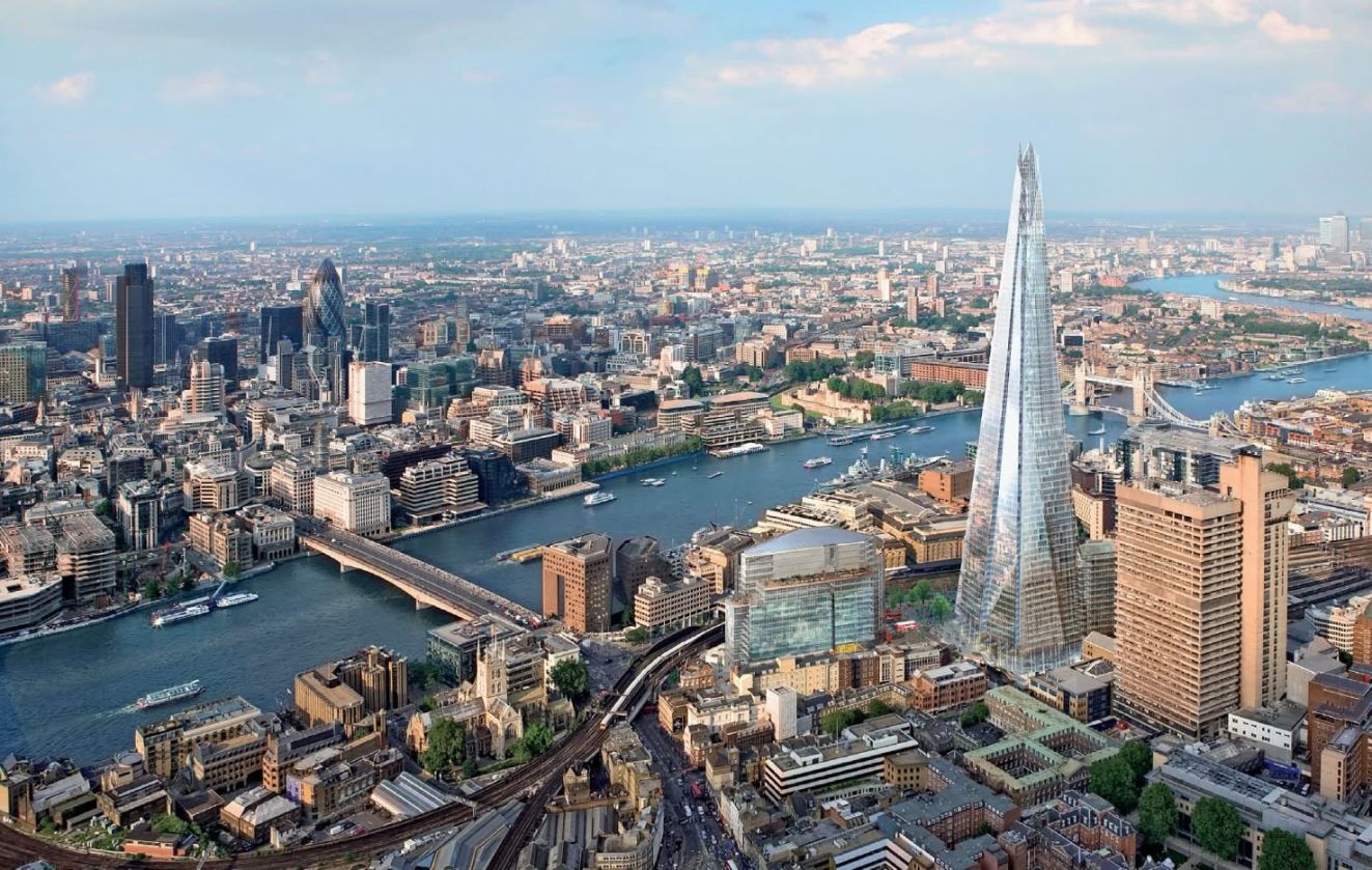
伦敦(英语:London; i/ˈlʌndən/)[4]是英国首都,也是英国最大城市[5]以及其构成国英格兰的首府。位于泰晤士河流域,于公元50年由罗马人建立,取名为伦蒂尼恩,在此后两个世纪内为这一地区最重要的定居点之一[6]。伦敦的历史核心区——伦敦城仍旧维持其中世纪的界限,面积606.95平方英里(1,572.0平方千米),2019年人口为898.2万,为全英格兰最大的城市。自19世纪起,“伦敦”一称亦用于指称围绕这一核心区开发的周围地带[7]。这一城区集合自1965年起构成大伦敦行政区,由32个伦敦自治市加上伦敦城组成[8][9],由伦敦市长及伦敦议会管辖。[10][注 1]
伦敦亦是一个全球城市[11][12],[13]在文艺、商业、教育、娱乐、时尚、金融、健康、媒体、专业服务、研究与开发、旅游和交通方面都具有显著的地位[14][15][16][17],同时还是全球主要金融中心之一[18][19][20],根据计算,为全球国内生产总值第六大的都市区[注 2][21][22]。伦敦亦是全球文化首都之一[23][24][25][26],还是全球国际访客数量最多的城市[27],根据客流量计算则拥有全球最为繁忙的城市机场系统[28]。伦敦是全球领先投资地[29],吸引很多国际零售商来投资[30],个人净资产值高于其它城市[31]。伦敦拥有43所大学,其高等教育机构密集度在全欧洲最高[32]。2012年,伦敦成为史上首座三次举办现代夏季奥林匹克运动会的城市。[33]
伦敦的人口和文化十分多样,在大伦敦地区内使用的语言就超过300种[34]。这一区域2015年的官方统计人口为8,673,713[35],人口占全英国的12.5%[36]。在2020年英国脱离欧盟之前,伦敦的城市区为欧盟第二大,根据2011年普查其人口达到9,787,426,仅次于巴黎[37]。其都市区为欧洲最大,人口达13,614,409[注 3][38],而大伦敦政府则称伦敦都市区的总人口为2,100万[39]。1831年—1925年间,伦敦为世界最大的城市。[40]
有四项世界遗产位于伦敦,分别为:伦敦塔;邱园;威斯敏斯特宫、威斯敏斯特教堂和圣玛格丽特教堂;以及格林尼治历史区(其中的皇家天文台为本初子午线、0°经线和格林尼治标准时间所经之地)[41]。其他著名景点包括白金汉宫、伦敦眼、皮卡迪利圆环、圣保罗座堂、伦敦塔桥、特拉法加广场和碎片大厦。伦敦亦是诸多博物馆、画廊、图书馆、体育运动及其他文化机构的所在地,包括大英博物馆、国家美术馆、泰特现代艺术馆、大英图书馆以及40家西区剧院[42]。伦敦地铁是全球最古老的地下铁路网络。
London (deutsche Aussprache [ˈlɔndɔn] oder gelegentlich [ˈlɔndən], englische Aussprache [ˈlʌndən]) ist zugleich die Hauptstadt des Vereinigten Königreiches und Englands. Die Stadt liegt an der Themse in Südostengland. Das heutige Verwaltungsgebiet mit 33 Stadtbezirken entstand im Jahr 1965 durch die Gründung von Greater London. Dort lebten 2022 rund 8,9 Millionen Menschen, davon rund 3,4 Millionen in den 13 Stadtbezirken Inner Londons.[2][4] In der gesamten Metropolregion London lebten 2019 knapp 14,4 Millionen Einwohner.[5]
Im Jahr 50 n. Chr. von den Römern als Londinium gegründet, wurde die Stadt nach der normannischen Eroberung 1066 Hauptstadt und Königssitz des Königreiches England. Bereits im Mittelalter entwickelte sich die Stadt zu einem bedeutenden internationalen Handelsplatz. Unter der Herrschaft von Elisabeth I. stieg ihre Bedeutung als Hafenstadt der Nordsee. Durch den Beginn der Industrialisierung im 18. Jahrhundert wuchs auch die Bevölkerung Londons, sodass es um 1800 eine der ersten Städte war, die mehr als eine Million Einwohner zählte. Bis 1900 versechsfachte sich die Bevölkerung, und London war bis zum Jahr 1925 die größte Stadt der Welt. Es entwickelte sich zu einem bedeutenden Zentrum der Technik und Industrie und wird bis heute zu den Weltstädten gerechnet.
London ist eines der bedeutendsten Kultur- und Handelszentren der Welt mit zahlreichen Universitäten, Hochschulen, Theatern und Museen. Mit einem BIP von 801,66 Mrd. € im Jahr 2017 ist London die größte städtische Wirtschaft Europas.[6] Die Stadt zählt außerdem neben New York City, Singapur und Hongkong zu den größten Finanzplätzen der Welt.[7] Historische Gebäude wie der Palace of Westminster oder Tower of London zählen zum UNESCO-Weltkulturerbe. Mit jährlich über 19 Millionen Touristen aus dem Ausland war London im Jahr 2016 nach Bangkok weltweit die zweitmeistbesuchte Stadt vor Paris.[8][9]
ロンドン(英語: London [ˈlʌndən] ( 音声ファイル))はグレートブリテンおよび北アイルランド連合王国およびこれを構成するイングランドの首都。イギリスやヨーロッパ域内で最大の都市圏を形成している。ロンドンはテムズ川河畔に位置し、2,000年前のローマ帝国によるロンディニウム創建が都市の起源である[4]。ロンディニウム当時の街の中心部は、現在のシティ・オブ・ロンドン(シティ)に当たる地域にあった。シティの市街壁内の面積は約1平方マイルあり、中世以来その範囲はほぼ変わっていない。少なくとも19世紀以降、「ロンドン」の名称はシティの市街壁を越えて開発が進んだシティ周辺地域をも含めて用いられている[5]。ロンドンは市街地の大部分はコナベーションにより形成されている[6]。ロンドンを管轄するリージョンであるグレーター・ロンドンでは[7]、選挙で選出されたロンドン市長とロンドン議会により統治が行われている[8]。
ロンドンは屈指の世界都市として、芸術、商業、教育、娯楽、ファッション、金融、ヘルスケア、メディア、専門サービス、調査開発、観光、交通といった広範囲にわたる分野において強い影響力がある[9]。また、ニューヨークと並び世界をリードする金融センターでもあり[10][11][12]、2009年時点の域内総生産は世界第5位で、欧州域内では最大である[13]。世界的な文化の中心でもある[14][15][16][17]。ロンドンは世界で最も来訪者の多い都市であり[18]、単一の都市圏としては世界で最も航空旅客数が多い[19]。欧州では最も高等教育機関が集積する都市であり、ロンドンには大学が43校ある[20]。2012年のロンドンオリンピック開催に伴い、1908年、1948年に次ぐ3度目のオリンピック開催となり、同一都市としては史上最多となる[21]。
ロンドンは文化的な多様性があり、300以上の言語が使われている[22]。2011年3月時点のロンドンの公式の人口は817万4,100人であり、欧州の市域人口では最大で[23][24]、イギリス国内の全人口の12.7%を占めている[25]。グレーター・ロンドンの都市的地域は、パリの都市的地域に次いで欧州域内で第2位となる8,278,251人の人口を有し[26]、ロンドンの都市圏の人口は1200万人[27]から1400万人[28]に達し、欧州域内では最大である。ロンドンは1831年から1925年にかけて、世界最大の人口を擁する都市であった[29]。2012年にマスターカードが公表した統計によると、ロンドンは世界で最も外国人旅行者が訪れる都市である[30]。
イギリスの首都とされているが、他国の多くの首都と同様、ロンドンの首都としての地位を明示した文書は存在しない[31]。
London (/ˈlʌndən/ ( listen) LUN-dən) is the capital and most populous city of England and the United Kingdom.[8][9] Standing on the River Thames in the south east of the island of Great Britain, London has been a major settlement for two millennia. It was founded by the Romans, who named it Londinium.[10] London's ancient core, the City of London, largely retains its 1.12-square-mile (2.9 km2) medieval boundaries. Since at least the 19th century, "London" has also referred to the metropolis around this core, historically split between Middlesex, Essex, Surrey, Kent and Hertfordshire,[11][12][13] which today largely makes up Greater London,[14][15][note 1] a region governed by the Mayor of London and the London Assembly.[16][note 2][17]
London is one of the leading global cities[18][19] in the arts, commerce, education, entertainment, fashion, finance, healthcare, media, professional services, research and development, tourism and transportation.[20][21][22] It is the world's largest financial centre[23][24][25][26] and has the fifth or sixth largest metropolitan area GDP in the world.[note 3][27][28] London is often regarded as a world cultural capital.[29][30][31] It is the world's most-visited city as measured by international arrivals[32] and has the world's largest city airport system measured by passenger traffic.[33] It is the world's leading investment destination,[34][35][36][37] hosting more international retailers[38][39] and ultra high-net-worth individuals[40][41] than any other city. London's universities form the largest concentration of higher education institutes in Europe.[42] In 2012, London became the first city to have hosted the modern Summer Olympic Games three times.[43]
London has a diverse range of people and cultures, and more than 300 languages are spoken in the region.[44] Its estimated mid-2016 municipal population (corresponding to Greater London) was 8,787,892,[4] the largest of any city in the European Union[45] and accounting for 13.4% of the UK population.[46] London's urban area is the second most populous in the EU, after Paris, with 9,787,426 inhabitants at the 2011 census.[47] The city's metropolitan area is the most populous in the EU with 14,040,163 inhabitants in 2016,[note 4][3] while the Greater London Authority states the population of the city-region (covering a large part of the south east) as 22.7 million.[48][49] London was the world's most populous city from around 1831 to 1925.[50]
London contains four World Heritage Sites: the Tower of London; Kew Gardens; the site comprising the Palace of Westminster, Westminster Abbey, and St Margaret's Church; and the historic settlement of Greenwich (in which the Royal Observatory, Greenwich defines the Prime Meridian, 0° longitude, and GMT).[51] Other landmarks include Buckingham Palace, the London Eye, Piccadilly Circus, St Paul's Cathedral, Tower Bridge, Trafalgar Square and The Shard. London is home to numerous museums, galleries, libraries, sporting events and other cultural institutions, including the British Museum, National Gallery, Natural History Museum, Tate Modern, British Library and West End theatres.[52] The London Underground is the oldest underground railway network in the world.
Londres (prononcé [lɔ̃dʁ] ; en anglais London [ˈlʌn.dən]), située dans le Sud-Est de la Grande-Bretagne, est la capitale et la plus grande ville de l'Angleterre et du Royaume-Uni. Longtemps capitale de l'Empire britannique, elle est désormais le siège du Commonwealth of Nations.
Fondée il y a presque 2 000 ans par les Romains sous le nom de Londinium, Londres était au XIXe siècle la ville la plus peuplée du monde. Bien que largement dépassée dans ce domaine par de nombreuses mégapoles, elle reste une métropole de tout premier plan1, en raison de son rayonnement et de sa puissance économique, dû notamment à sa place de premier centre financier mondial2. Londres se place dans la triade des grands centres financiers du monde, avec New York et Hong Kong, en étant la principale place bancaire et financière d'Europe. Cette trilogie est appelée par les médias anglophones « Nylonkong »3.
La région de Londres, composée de l'Inner London et de l'Outer London, comptait environ 8 673 000 habitants en 2015 et réalise un cinquième du produit intérieur brut du Royaume-Uni4. En 2015, l'aire urbaine de Londres comptait 9 787 426 habitants et son aire métropolitaine 12 317 800 habitants. En Europe, seules les agglomérations de Moscou, Istanbul et Paris5 ont un poids démographique comparable. Ses habitants s'appellent les Londoniens (en anglais : Londoners).
Londres, la seule ville du monde à ce jour à avoir organisé trois fois les Jeux olympiques (1908, 1948, 2012), est dynamique et très diverse sur le plan culturel. Elle joue un rôle important dans l'art et dans la mode. Elle reçoit 28 millions de touristes par an et compte quatre sites inscrits au patrimoine mondial ainsi que de nombreux monuments emblématiques : le palais de Westminster, le Tower Bridge, la tour de Londres, l'abbaye de Westminster, le palais de Buckingham, Big Ben ainsi que des institutions renommées comme le British Museum ou la National Gallery.
Londra (AFI: [ˈlondra];[2] in inglese britannico: London, [ˈlʌndən][3]) è la capitale e maggiore città dell'Inghilterra e del Regno Unito, con i suoi 8 825 000 abitanti.
La sua estensione territoriale la rende la terza città più estesa d'Europa, preceduta da Mosca e Istanbul e seguita da Roma e Berlino, ed è stata la città più popolata dell'Unione europea sino all'uscita del Regno Unito dall'Unione nota come Brexit. L'area metropolitana conta infatti circa 14 milioni di residenti e si estende per svariate decine di chilometri lungo la valle del Tamigi, fino al suo enorme estuario. Molti degli abitanti, chiamati londinesi (Londoners), provengono dall'estero o sono di origine straniera, risultando così una delle città più cosmopolite e multietniche del mondo. Londra è stata la capitale indiscussa dell'Impero britannico, e quindi meta di flussi migratori durante e soprattutto dopo la fine dell'era coloniale.
Ha il più elevato PIL fra tutte le città europee, ed il quinto al mondo.[4] I suoi sei aeroporti internazionali ne fanno il più grande snodo del traffico aereo globale; è anche sede del più antico sistema di metropolitana del mondo, la London Underground (The Tube). È la seconda città più visitata al mondo dal turismo internazionale, dopo Bangkok in Asia.[5]
A Londra hanno sede numerose istituzioni, organizzazioni e società internazionali. Vi si trovano importanti musei, teatri e sale da concerto; la città contiene quattro patrimoni dell'umanità. Inoltre, vi risiede stabilmente il monarca del Regno Unito presso Buckingham Palace ed il parlamento; il primo ministro occupa l'abitazione al 10 Downing Street. Per tutte le caratteristiche elencate, Londra conquista il titolo di Città globale, classificandosi come l'unica città britannica nella lista delle Città Mondiali Alfa[6].
Dal 2000, con le riforme volute dal governo di Tony Blair, Londra è amministrata secondo una speciale legislazione sui generis[7] che determina e coordina i poteri della superiore Autorità della Grande Londra, composta dal Sindaco e dall'Assemblea di Londra, con quelli di 33 borghi londinesi a livello inferiore.[8]
Londres (London en inglés, ˈlʌndən (?·i)) es la capital y mayor ciudad de Inglaterra y del Reino Unido.23 Situada a orillas del río Támesis, Londres es un importante asentamiento humano desde que fue fundada por los romanos con el nombre de Londinium hace casi dos milenios.4 El núcleo antiguo de la urbe, la City de Londres, conserva básicamente su perímetro medieval de una milla cuadrada. Desde el siglo XIX el nombre «Londres» también hace referencia a toda la metrópolis desarrollada alrededor de este núcleo.5 El grueso de esta conurbación forma la región de Londres y el área administrativa del Gran Londres,6 gobernado por el alcalde y la asamblea de Londres.7
Londres es una ciudad global, uno de los centros neurálgicos en el ámbito de las artes, el comercio, la educación, el entretenimiento, la moda, las finanzas, los medios de comunicación, la investigación, el turismo o el transporte.8 Es el principal centro financiero del mundo91011 y una de las áreas metropolitanas con mayor PIB.1213 Londres es también una capital cultural mundial,14151617 la ciudad más visitada considerando el número de visitas internacionales18 y tiene el mayor sistema aeroportuario del mundo según el tráfico de pasajeros.19 Asimismo, las 43 universidades de la ciudad conforman la mayor concentración de centros de estudios superiores de toda Europa.20 En el año 2012 Londres se convirtió en la única ciudad en albergar la celebración de tres Juegos Olímpicos de Verano.21
En esta ciudad multirracial convive gente de un gran número de culturas que hablan más de trescientos idiomas distintos.22 La Autoridad del Gran Londres estima que en 2015 la ciudad tiene 8,63 millones de habitantes,23 una cifra que la convierte en el municipio más poblado de la Unión Europea y que supone el 12,5 % del total de habitantes del Reino Unido.24 El área urbana del Gran Londres, con 10 470 00025 habitantes, es la segunda más grande de Europa, pero su área metropolitana, con una población estimada de entre 12 y 14 millones,2627 es la mayor del continente. Desde 1831 a 1925 Londres, como capital del Imperio británico, fue la ciudad más poblada del mundo.28
Londres cuenta con cuatro enclaves declarados Patrimonio de la Humanidad: la Torre de Londres, el Real Jardín Botánico de Kew, el sitio formado por el Palacio, la Abadía de Westminster, la Iglesia de Santa Margarita y Greenwich (donde se encuentra el Real Observatorio que marca el meridiano de Greenwich y el tiempo medio).29 Otros lugares famosos de la ciudad son el Palacio de Buckingham, el London Eye, Piccadilly Circus, la Catedral de San Pablo, el Puente de la Torre o Trafalgar Square. Londres cuenta también con numerosos museos, galerías de arte, bibliotecas, eventos deportivos y otras instituciones culturales como el Museo Británico, la National Gallery, la Tate Modern, la Biblioteca Británica y los cuarenta teatros del West End.30 El metro de Londres, que en 2013 cumplió 150 años, es el más antiguo del mundo.3132
Ло́ндон (англ. London [ˈlʌndən] слушать) — столица и крупнейший город Соединённого Королевства Великобритании и Северной Ирландии. Административно образует регион Англии Большой Лондон, разделённый на 33 самоуправляемых территории. Население составляет 8,6 млн человек (2015 год) — это третий[2] по величине город Европы. Образует агломерацию Большой Лондон и более обширный метрополитенский район. Расположен на юго-востоке острова Великобритания, на равнине в устье Темзы, вблизи Северного моря. Главный политический, экономический и культурный центр Соединённого Королевства.
Лондон относится к глобальным городам высшего ранга и ведущим мировым финансовым центрам. Экономика его составляет пятую часть экономики страны.
Основан римлянами вскоре после их вторжения в Британию 43 года н. э. Приблизительно с 100 года н. э. — столица римской Британии, с XI—XII столетий — Англии, с 1707 года — Великобритании, с XVI по XX век — Британской империи. С 1825 по 1925 год Лондон был крупнейшим городом мира.
Исторический центр города, образованный районами Вестминстер и Сити, сложился в викторианскую эпоху. Среди немногих построек, уцелевших здесь после пожара 1666 года, — средневековая цитадель Тауэр.
Australia
Women's Soccer World Cup 2023
ITU World Championship Series
Sport
Triathlon
 Western Australia-WA
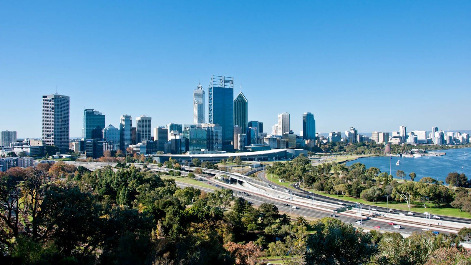
珀斯(英语:Perth)是西澳大利亚州的首府,也是澳大利亚第四大城市。据根据2009年9月的人口统计,2021年8月的人口珀斯都会区的人口共有202万人,是澳大利亚第四大城市,人口增长率高于国家统计的平均水准。
由于地处澳大利亚大陆西岸地中海气候地区,拥有温和的气候与天鹅河岸的别致景色,使珀斯得以成为非常受欢迎的观光旅游目的地。
珀斯拥有广阔的居住空间及高水准的生活质素,于每年的世界最佳居住城市评选中都是名列前茅,反映出珀斯无论居住环境,生活质素及社会福利等都是极佳的城市。珀斯人的友善态度世界公认,曾于2003年获得世界最友善城市称号[4],得到世界性的赞赏及认同。
Perth [pɜːθ] ist die Hauptstadt und mit Abstand größte Stadt des australischen Bundesstaates Western Australia. Trotz seiner isolierten Lage im Südwesten des australischen Kontinents ist Perth ein globales Zentrum der Bergbau- und Erdölindustrie. Die Stadt liegt an der Mündung des Swan River in den südlichen Indischen Ozean und ist bekannt für hohe Lebensqualität.[1][2][3] Das Globalization and World Cities Research Network stuft Perth als Beta-Weltstadt ein (Stand 2020).
Women's Soccer World Cup 2023
Geography
Geography
*World's Most Livable Cities
ITU World Championship Series
New Zealand
Sport
Triathlon
Sport
The Ocean Race
Important port
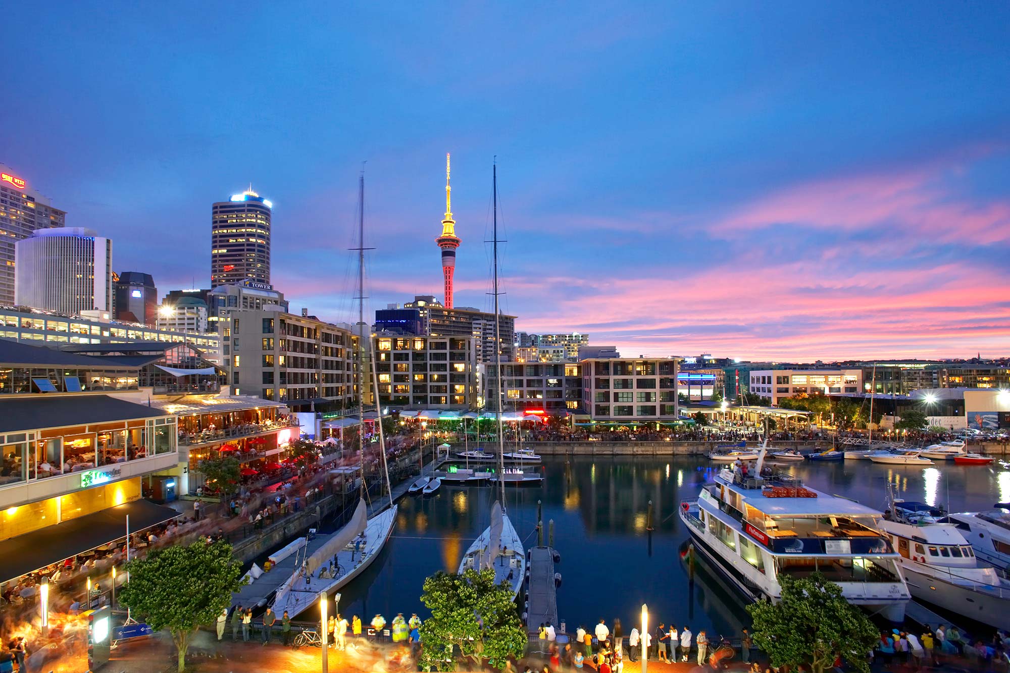
奥克兰(英语:Auckland;毛利语:Tāmaki Makaurau 或 Ākarana),老华侨译作屋仑[1] ,是新西兰的一个都会区,为新西兰人囗最多的城市,也是北岛最大的城市。人口约150万,聚居了全国约32%的人口,[2]也是世界上波利尼西亚人最多的城市。[3]奥克兰被称为“帆之都”,同时也是新西兰工业和商业中心。
新西兰的首都早先设在奥克兰,后来于1865年迁至北岛南端的惠灵顿 。现今的奥克兰仍然为新西兰最发达的地区之一,同时也是南太平洋的枢纽,旅客出入境的主要地点。在2014年的世界最佳居住城市评选中,奥克兰高居全球第三位。[4]在2021年的世界最佳居住城市评选中,奥克兰排名全球榜首。[5]奥克兰因其在商业,艺术和教育方面的重要性而被GaWC归类为Beta+世界城市。
Auckland [ˈɔːklənd], offizielle Bezeichnung Auckland Council, auf Māori: Tāmaki Makaurau oder Ākarana, ist eine Großstadt und zugleich Unitary Authority auf der Nordinsel von Neuseeland. Mit über 1,4 Millionen Einwohnern ist sie die größte Stadt Neuseelands, in der etwa ein Drittel der neuseeländischen Bevölkerung lebt.[4] Die Māori-Bezeichnung Tāmaki Makaurau bedeutet „Eine junge Schönheit mit 100 Liebhabern“, während Ākarana eine an den Lautstand des Māori angepasste Version von „Auckland“ ist.[5]
Das landschaftliche Bild des multikulturellen Auckland wird von 53 inaktiven Vulkanen geprägt, zwischen denen sich die Großstadt erstreckt.[6] Ihnen verdankt die Stadt weitläufige Parkanlagen, die bis ins Zentrum hineinreichen. Die Lage an geschützten Meeresbuchten trägt ebenfalls wesentlich zum Bild Aucklands bei, nicht zuletzt durch die zahlreichen Segelboote, die der Stadt den Beinamen City of Sails einbrachte.
Zum 1. November 2010 wurde aus dem Ballungsraum Auckland (englisch: Greater Auckland bzw. Auckland Metropolitan Area), mit den bis dahin verwaltungstechnisch eigenständigen Städten Auckland City, Manukau City, North Shore City und Waitakere City, den Distrikten Franklin District, Papakura District und Rodney District und dem Auckland Regional Council, der Auckland Council gebildet, der, wie geplant, die Probleme des Großraums Auckland aus einer einheitlichen und zentral organisierten Verwaltungsstruktur heraus lösen soll. Der Auckland Council wurde per Kommunalwahl vom 9. Oktober 2010 politisch legitimiert und fasst seitdem alle vorherigen Verwaltungseinheiten unter der Regierung von einem Bürgermeister und 20 Stadträten zusammen.
In einer Rangliste der Städte mit der höchsten Lebensqualität weltweit belegte Auckland im Jahre 2018 den dritten Platz.
Germany
Elbe
FIFA Fussball-Weltmeisterschaft 2006
 UEFA European Championship 2024
Geography
Geography
*World's Most Livable Cities
UEFA European Championship 2024
Geography
Geography
*World's Most Livable Cities
 Hamburg
 Hanseatic City
ITU World Championship Series
Sport
Triathlon
Umwelthauptstadt Europas
Vacation and Travel
Important port
Hanseatic City
ITU World Championship Series
Sport
Triathlon
Umwelthauptstadt Europas
Vacation and Travel
Important port
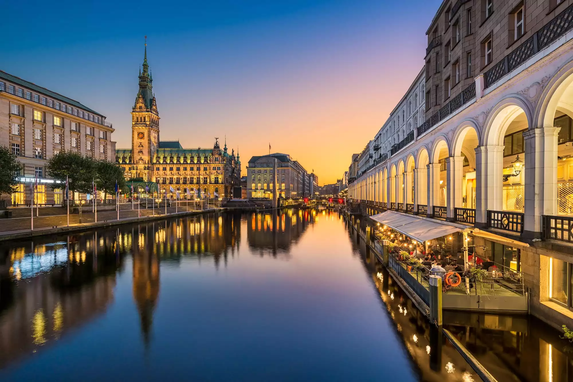
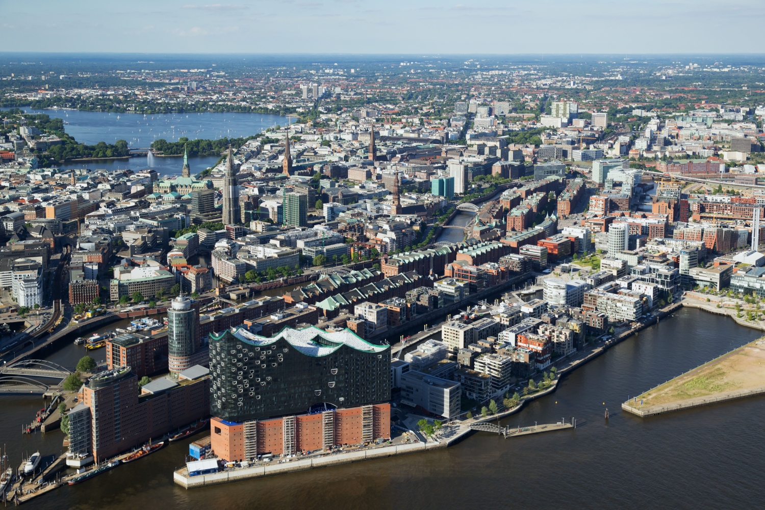
汉堡是德国三大州级市(柏林,汉堡,不来梅)之一,德国第二大城市,也是德国最重要的海港和最大的外贸中心、德国第二金融中心,同时是德国北部的经济和文化大都市。有着“世界桥城”的美称。
汉堡是德国北部重要的交通枢纽,是欧洲最富裕的城市之一,也已成为德国的新闻传媒与工业制造业中心。汉堡是世界大港,被誉为“德国通往世界的大门”。世界各地的远洋轮来德国时,都会在汉堡港停泊。
除美国西雅图外,汉堡是世界上第二大飞机制造区,生产“空中客车”。汉堡大多数工业和外贸有关。
汉堡(/ˈhæmbɜːrɡ/; 德语发音:[ˈhambʊʁk]( 发音), 当地发音:[ˈhambʊɪ̯ç] 聆听; 低地德语/低地撒克逊语:Hamborg -[ˈhambɔːx] 聆听)),全称为汉堡汉萨自由市(德语:Freie und Hansestadt Hamburg)[3],位于德国北部的一个港口城市。汉堡拥有近180万人口,是仅次于柏林的德国第二大城市,欧盟第八大城市。作为一个城市州,其行政级别有其联邦州议会和州立法委员会。汉堡及其周围城镇共有274万人口,而汉堡大城市群则有500万人口。
汉堡港位于易北河出海口,是德国最大的港口,也是世界上第20大港口。同时因为包括汉堡机场和众多轨道交通,汉堡是欧洲物流的最重要的枢纽之一。汉堡经济主要为高科技经济,包括航空航天工程企业(空中客车)、生命科学企业、信息技术企业、制成品企业(拜尔斯道夫和联合利华),同时作为一个媒体中心其拥有发达的文化产业。
Die Freie und Hansestadt Hamburg ( [ˈhambʊʁk]; regional auch [ˈhambʊɪ̯ç], niederdeutsch Friee un Hansestadt Hamborg[1] [ˈhambɔːχ], Ländercode: HH, Abkürzung: FHH oder FuHH) ist ein Stadtstaat und ein Land der Bundesrepublik Deutschland.[15] Der amtliche Name geht auf die Geschichte Hamburgs als Freie Reichsstadt und als führendes Mitglied der Hanse zurück.
Hamburg ist mit ca. 1,8 Millionen Einwohnern aus 183 Ländern die zweitgrößte Stadt Deutschlands nach Berlin und die größte Stadt in der Europäischen Union, die keine Hauptstadt ist. Die Metropolregion Hamburg hat über fünf Millionen Einwohner,[9] der städtische Ballungsraum zählt 2,7 Millionen Einwohner. Das Stadtgebiet ist in sieben Bezirke und 104 Stadtteile gegliedert.[12][16]
Der Hamburger Hafen ist einer der größten Umschlaghäfen weltweit[17] und macht Hamburg zusammen mit seinem internationalen Flughafen zu einem der bedeutendsten Logistikstandorte in Europa. Aktuell wird ein Strukturwandel zu einem Kreativ-, Wissenschafts- und Finanzplatz angestrebt.[18] Wirtschaftlich und wissenschaftlich ist die Metropole vor allem im Bereich der Spitzentechnologien wie der Luft- und Raumfahrttechnik, der Biowissenschaften und der Informationstechnik, sowie für die Konsumgüterbranche bedeutend. Hamburg hat eine in Mitteleuropa führende Medienlandschaft und Videospielbranche, ein wachsendes Startup-Ökosystem sowie eine dynamische Kultur- und Kreativszene. Der Bildungs- und Forschungsstandort Hamburg ist Zentrum mehrerer renommierter Bildungseinrichtungen, Institute und Forschungszentren.
Am 5. Juli 2015 wurden die Speicherstadt aus der Zeit der Industrialisierung und das angrenzende Kontorhausviertel von der UNESCO als Weltkulturerbe in die Welterbeliste aufgenommen.[19][20] Weitere bekannte Kulturdenkmäler sind das Rathaus und die markanten Hauptkirchen. Typisch für das Stadtbild sind Klinkerfassaden und viele Wasserlagen an den Flüssen Elbe und Alster sowie zahlreichen Fleeten und Kanälen. Europaweit bekannt sind auch der „Kiez“ als Vergnügungsviertel und Türöffner für Musiker und andere Künstler, sowie das Konzerthaus der Elbphilharmonie. Der Musicalstandort Hamburg ist der bedeutendste auf dem europäischen Kontinent. Hamburg verzeichnet ein verstärktes Wachstum im Bereich des internationalen Stadttourismus und gilt als eine der Städte mit der höchsten Lebensqualität der Welt.[21]
Hamburg ist seit 1996 Sitz des Internationalen Seegerichtshofs (ISGH). Seit 2004 findet mit dem Hamburg Summit ein bedeutendes chinesisch-europäisches Gipfeltreffen statt.[22] Im Juli 2017 fand in der Hansestadt der G20-Gipfel statt.
ハンブルク(ドイツ語: Hamburg、低ザクセン語・低地ドイツ語: Hamborg (Hamborch) [ˈhaˑmbɔːχ])は、ドイツの北部に位置し、エルベ川河口から約100kmほど入った港湾都市。正式名称は自由ハンザ都市ハンブルク(Freie und Hansestadt Hamburg、フライエ・ウント・ハンゼシュタット・ハンブルク)。行政上では、ベルリン特別市と同様に、一市単独で連邦州(ラント)を構成する特別市(都市州)なので、ハンブルク特別市やハンブルク州と呼ばれる。人口約175万人。国際海洋法裁判所がある。
Hamburg (English: /ˈhæmbɜːrɡ/; German: [ˈhambʊɐ̯k] ( listen); Low German: Hamborg [ˈhambɔːç] ( listen); officially: Free and Hanseatic City of Hamburg; German: Freie und Hansestadt Hamburg; Low German: Friee un Hansestadt Hamborg)[5] is, with a population of roughly 1.8 million people, the second-largest city of Germany after Berlin, the eighth-largest city in the European Union, as well as the union's largest city which is not one of its member states' capital cities. It is one of Germany's 16 federal states, surrounded by the states of Schleswig-Holstein to the north, and Lower Saxony to the south, and is the largest city of Northern Germany. The city's metropolitan region is home to more than five million people. Hamburg lies on the River Elbe and two of its tributaries, the River Alster, which forms two large lakes within the city, and the River Bille. It is the third-largest German-speaking city after Berlin and Vienna, and the largest city in the Low German dialect area.
The official name reflects Hamburg's history as a member of the medieval Hanseatic League, a free imperial city of the Holy Roman Empire, a city-state and one of the 16 states of Germany. Before the 1871 Unification of Germany, it was a fully sovereign state. Prior to the constitutional changes in 1919 it formed a civic republic headed constitutionally by a class of hereditary grand burghers or Hanseaten. The city has repeatedly been beset by disasters such as the Great Fire of Hamburg, exceptional coastal flooding and military conflicts including World War II bombing raids. Historians remark that the city has managed to recover and emerge wealthier after each catastrophe.
Situated on the Elbe river, Hamburg is home to Europe's second-largest port and a broad corporate base. In media, the major regional broadcasting firm NDR, the printing and publishing firm Gruner + Jahr and the newspapers Der Spiegel and Die Zeit are based in the city. Hamburg remains an important financial center, the seat of Germany's oldest stock exchange and the world's oldest merchant bank, Berenberg Bank. Media, commercial, logistical, and industrial firms with significant locations in the city include multinationals Airbus, Blohm + Voss, Aurubis, Beiersdorf, and Unilever.
The city hosts specialists in world economics and international law, including consular and diplomatic missions as the International Tribunal for the Law of the Sea, the EU-LAC Foundation, and the UNESCO Institute for Lifelong Learning. In recent years, the city has played host to multipartite international political conferences and summits such as Europe and China and the G20. Former German Chancellor Helmut Schmidt, who governed Germany for eight years, and Angela Merkel, German chancellor since 2005, come from Hamburg.
The city is a major international and domestic tourist destination. It ranked 18th in the world for livability in 2016.[6] The Speicherstadt and Kontorhausviertel were declared World Heritage Sites by UNESCO in 2015.[7]
Hamburg is a major European science, research, and education hub, with several universities and institutions. Among its most notable cultural venues are the Elbphilharmonie and Laeiszhalle concert halls. It gave birth to movements like Hamburger Schule and paved the way for bands including The Beatles. Hamburg is also known for several theatres and a variety of musical shows. St. Pauli's Reeperbahn is among the best-known European entertainment districts.
Hambourg est une ville et l'un des 16 Länder composant l'Allemagne. Située au nord du pays, près de l'embouchure de l'Elbe et à proximité de la mer du Nord, Hambourg est la deuxième plus grande ville d'Allemagne (après Berlin) et le premier port du pays. Elle est également le deuxième port d'Europe en termes de volume de marchandises échangées, derrière Rotterdam.
La ville s'étend sur 755 km2 et compte 1,78 million d'habitants1 ; l'agglomération environ 3,5 millions. Hambourg était membre fondateur de la ligue hanséatique. Cette ancienne appartenance est encore aujourd'hui revendiquée par la ville, comme élément caractéristique de son identité. C'est ainsi que le code de la ville sur les plaques d'immatriculation est HH, qui signifie Hansestadt Hamburg et que le nom officiel de la ville est Freie und Hansestadt Hamburg (ville libre et hanséatique de Hambourg).
C'est également une ville au tourisme actif, ce qu'elle doit notamment à son architecture, à son réseau de canaux et aux abords luxuriants de l'Alster, rivière formant un lac artificiel au cœur de la ville. Elle présente de très nombreux théâtres et musées, notamment la célèbre Kunsthalle ou le jeune Bucerius Kunst Forum, qui accueille des expositions temporaires. Hambourg dispose d'un quartier entier dédié à la vie nocturne : Sankt Pauli et sa Reeperbahn, lieu de toutes les extravagances et libéralités.
Amburgo (in tedesco Hamburg, pronunciato [ˈhamˌbʊɐ̯k]; in basso-tedesco Hamborg, pronunciato [ˈhaˑmbɔːχ]) è una città della Germania, posta sull'estuario del fiume Elba.
È la seconda città più popolosa della Germania, dopo la capitale Berlino, ed è anche la città non-capitale più popolosa dell'Unione europea. Il suo porto è il maggiore della Germania e il secondo nell'Unione europea (non a caso la città ospita ITLOS, il tribunale della Convenzione delle Nazioni Unite sul diritto del mare).
Amburgo, coerentemente con il suo passato anseatico, costituisce ancora oggi una città-stato e si fregia ufficialmente del titolo di Freie- und Hansestadt Hamburg [ˈfʁaɪ̯ə ʔʊnt ˈhansəˌʃtat ˈhambʊɐ̯k] ("Città libera ed anseatica di Amburgo").
Hamburgo (en alemán, Hamburg; pronunciación: [ˈham.bʊʁk] (?·i); localmente: [ˈham.bʊɪç] (?·i); en bajo alemán Hamborg, [ˈham.bɔːx] (?·i)), oficialmente la Ciudad Libre y Hanseática de Hamburgon. 1 (en alemán, Freie und Hansestadt Hamburg) es una ciudad-estadon. 2 situada en el norte de Alemania. Tiene una extensión de 755 km² y 1 828 123 habitantes (septiembre de 2017). Hamburgo encabeza un área metropolitana de 5,3 millones de personas y ocupa estados vecinos de Baja Sajonia y Schleswig-Holstein. Hamburgo es la segunda ciudad más poblada en Alemania, después de Berlín,2 la tercera de Europa Central y la séptima de la Unión Europea. El puerto de Hamburgo es el segundo más grande de Europa, solo tras el puerto de Róterdam; y el noveno del mundo. Se encuentra a 290 kilómetros de Berlín.
El nombre completo de Hamburgo es «Ciudad libre y hanseática de Hamburgo» (Freie und Hansestadt Hamburg en alemán). Esto se debe a su historia como miembro de la liga medieval hanseática y como Ciudad Imperial Libre del Sacro Imperio Romano Germánico, y también por el hecho de que es una ciudad-estado y uno de los dieciséis estados federados de Alemania.
Га́мбург (нем. Hamburg [ˈhambʊɐ̯k], местн. [ˈhambʊɪç], н.-нем. Hamborg [ˈhambɔːx]; произношение (инф.)) — город на севере Германии. Как Во́льный и ганзе́йский го́род Га́мбург (нем. Freie und Hansestadt Hamburg) является одной из 16 земель Федеративной Республики Германия, городом-государством в её составе. Это второй по величине город в стране (после Берлина), седьмой по величине в Европейском союзе и самый населённый нестоличный город в Европейском союзе. По оценке на 31 декабря 2014 года население города составило 1 803 752 человека.[5]
Гамбург один из самых больших портовых городов в Европе, расположен у места впадения реки Эльбы в Северное море. Девиз города, который можно прочитать в виде надписи над порталом городской ратуши гласит: «Libertatem quam peperere maiores digne studeat servare posteritas». Принятый стихотворный перевод этой фразы на немецкий язык звучит, как «Die Freiheit, die erwarben die Alten, möge die Nachwelt würdig erhalten» («Свободу, что добились для нас наши предки, достойно пусть с честью хранят потомки»). Латинским названием города, используемым, например, в гимне города, является лат. Hammonia. На гербе и флаге Гамбурга изображены ворота городской крепости, и Гамбург часто называют за это «воротами в мир» (нем. Tor zur Welt). Кроме того, у Гамбурга есть свой гимн. Им стала песня, восхваляющая город и сочинённая в 1828 году, когда Гамбург был независимым городом-государством, Георгом Николаусом Берманом (нем. Georg Nikolaus Bärmann). Этот поэт написал много песен на нижненемецком языке, слыл большим знатоком истории Гамбурга. Песня в честь Гамбурга прозвучала впервые в финале его пьесы «Гражданская верность», поставленной по случаю 300-летия Реформации.
Beijing Shi-BJ
China
Chinese Super League 2019
Financial
***Global Financial Center
History
N 2000 - 2100 AD
History
L 1000 - 1500 AD
History
M 1500 - 2000 AD
International cities
***Global Urban Economic Competitiveness
ITU World Championship Series
Beijing-Hangzhou Grand Canal
League of Legends
League of Legends World Championship
Olympic Summer Games
2022 Winter Olympics
Silk road
Shanghai Cooperation Organization
Sport
Triathlon
World Heritage
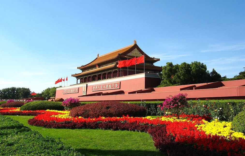
北京,简称“京”,是中华人民共和国的首都、直辖市、国家中心城市、超大城市、国际大都市,全国政治中心、文化中心、国际交往中心、科技创新中心,是中国共产党中央委员会、中华人民共和国中央人民政府、全国人民代表大会、中国人民政治协商会议全国委员会、中华人民共和国中央军事委员会所在地,也是中部战区司令部驻地。
北京位于华北平原北部,背靠燕山,毗邻天津市和河北省。北京的气候为典型的北温带半湿润大陆性季风气候。
北京是首批国家历史文化名城和世界上拥有世界文化遗产数最多的城市,三千多年的历史孕育了故宫、天坛、八达岭长城、颐和园等众多名胜古迹。早在七十万年前,北京周口店地区就出现了原始人群部落“北京人”。公元前1045年,北京成为蓟、燕等诸侯国的都城。公元938年以来,北京先后成为辽陪都、金中都、元大都、明、清国都。1949年10月1日成为中华人民共和国首都。
北京被全球权威机构GaWC评为世界一线城市 。联合国报告指出,北京人类发展指数居中国城市第二位 。2017年,北京人均可支配收入达到57230元,社会消费品零售总额11575.4亿元 。北京住户存款总额和人均住户存款均居全国第一 。2017年,北京高新技术企业达到20183家。 福布斯2017年“中国大陆最佳商业城市排行榜”排第3位。
2015年7月31日,国际奥委会主席巴赫宣布北京携手张家口获得2022年冬季奥林匹克运动会的举办权。北京由此成为全球首个既举办过夏季奥运会又将举办冬季奥运会的城市。
北京是一座有着三千多年历史的古都,在不同的朝代有着不同的称谓,大致算起来有二十多个别称。
燕都,据史书记载,公元前1122年,周武王灭商以后,在燕封召公。燕都因古时为燕国都城而得名。战国七雄中有燕国,据说是因临近燕山而得国名,其国都称为“燕都”。
幽州,远古时代的九州之一。幽州之名,最早见于《尚书·舜典》:“燕曰幽州。”两汉、魏、晋、唐代都曾设置过幽州,所治均在今天的北京一带。
京城,京城泛指国都,北京成为国都后,也多将其称为京城。
南京,辽太宗会同元年(938年),将原来的幽州升为幽都府,建号南京,又称燕京,作为辽的陪都。当时辽的首都在上京。
大都,元代以金的离宫今北海公园为中心重建新城,元世祖至元九年(1272年)改称大都,俗称元大都。
北平,明代洪武元年(1368年),朱元璋灭掉元朝后,为了记载平定北方的功绩,将元大都改称北平。
北京,明永乐元年(1403年),明成祖朱棣永乐皇帝取得皇位后,将他做燕王时的封地北平府改为顺天府,建北京城,并准备迁都城于此,这是正式命名为北京的开始,至今已有600余年的历史。
京师,明成祖于永乐十八年(1420年)迁都北京,改称京师,直至清代。
京兆,民国二年(1913年)废顺天府,翌年置京兆地方,直隶中央,其范围包括今天的北京大部分地区,民国十七年(1928年)废京兆地方,改北京为北平。
Peking (chinesisch 北京, Pinyin Běijīng, W.-G. Pei-ching auch Beijing, [pei˨˩tɕiŋ˥˥], deutsch historisch Pekingen[2]) ist die Hauptstadt der Volksrepublik China. Der Name bedeutet Nördliche Hauptstadt (vgl. Nanjing für Südliche Hauptstadt). Peking hat eine über dreitausendjährige Geschichte und ist heute eine regierungsunmittelbare Stadt, das heißt, sie ist direkt der Zentralregierung unterstellt und damit Provinzen, autonomen Gebieten und Sonderverwaltungszonen gleichgestellt.
Das gesamte 16.807 Quadratkilometer große (etwas größer als Schleswig-Holstein) Verwaltungsgebiet Pekings hat 21,5 Millionen Einwohner (Stand: März 2016).[3] Es stellt kein zusammenhängendes Stadtgebiet dar, mit seiner dominierenden ländlichen Siedlungsstruktur ist es eher mit einer Provinz vergleichbar.[4] Von der Gesamtbevölkerung sind 11,8 Millionen registrierte Bewohner mit ständigem Wohnsitz (戶口 / 户口, hùkǒu) und 7,7 Millionen temporäre Einwohner (流動人口 / 流动人口, liúdòng rénkǒu) mit befristeter Aufenthaltsgenehmigung (暫住證 / 暂住证, zànzhùzhèng).[5] Wird die Kernstadt (hohe Bebauungsdichte und geschlossene Ortsform) als Grundlage genommen, leben in Peking 7,7 Millionen Menschen mit Hauptwohnsitz (2007).[6] Der Ballungsraum (einschließlich Vororte) hat 11,8 Millionen Einwohner (2007).[7] Ab 2017 soll die Metropole Kern einer Megalopolis von 130 Millionen Einwohnern namens Jing-Jin-Ji werden.
Peking stellt als Hauptstadt das politische Zentrum Chinas dar. Aufgrund der langen Geschichte beherbergt Peking ein bedeutendes Kulturerbe. Dies umfasst die traditionellen Wohnviertel mit Hutongs, den Tian’anmen-Platz (chinesisch Platz am Tor des Himmlischen Friedens), die 1987 von der UNESCO zum Weltkulturerbe erklärte Verbotene Stadt, den neuen und alten Sommerpalast und verschiedene Tempel, wie z. B. den Himmelstempel, den Lamatempel und den Konfuziustempel.(2012)
北京市(ペキンし、中国語: 北京市、拼音: Běijīng)は、中華人民共和国の首都である。
行政区画上は直轄市であり、中国の華北の中央に位置する。人口は2152万(2014年)であり、中国では上海に次ぐ第二の都市。世界有数のメガシティであり、極めて高い影響力を有する世界都市でもある。古くは大都・燕京・北平とも呼ばれた。
春秋戦国時代には燕の首都で薊(けい)と称された。周の国都洛陽からは遠く離れ、常に北方の匈奴などの遊牧民族の侵入による被害を受ける辺境であった。秦漢代には北平(ほくへい)と称されるが、満州開発が進み、高句麗など周辺国の勢力が強大となると、戦略上、また交易上の重要な拠点として重視されるようになった。北京市に隣接する河北省涿郡(たくぐん)は三国志の英雄劉備の故郷で知られるとともに隋の煬帝が築いた大運河の北の起点とされている。
唐末五代の騒乱期、内モンゴルから南下してきた遼朝は、後晋に対し軍事支援を行った代償として北京地方を含む燕雲十六州を割譲された。遼はこの都市を副都の一つ南京と定めた。その後金朝が遼を滅ぼし支配権を獲得すると、金は北京に都城を定め中都とした。更にモンゴル帝国(元朝)が金を滅ぼすと大都として元朝の都城となり、カラコルムに代わってモンゴル帝国の中心となった。
朱元璋が元を北方に駆逐し明朝が成立すると、名称は北平に戻され、都城は南京に定められた。しかし、燕王に封じられ北京を拠点とした朱棣(後の永楽帝)は、1402年に建文帝に対し軍事攻撃を行い政権を奪取。皇帝に即位した後北京遷都を実行し地名を北京に改めた。辛亥革命後は中華民国北洋政府は北京を首都と定めたが、南京を首都と定めた蒋介石を中心とする国民政府は、「政府直轄地域」を意味する直隷省を1928年6月15日に河北省へ、北の首都を意味する北京を北平(ほくへい、ベイピンBěipíng)へと、それぞれ改称した。1937年から1945年まで続いた日本軍占領期は北京の名称が用いられ(公式には1940年に改名)、日本の敗戦によって再び北平に改称された。
1949年10月1日の中華人民共和国成立により新中国の首都とされた北京(北平)は再び北京と改称され現在に至っている。しかし、中華人民共和国の存在を承認せず、南京を公式な首都として大陸地区への統治権を主張する中華民国(台湾)では、現在でも公式名称として「北平」の名称が用いられている。
Beijing (/beɪˈdʒɪŋ/;[10] Mandarin: [pèi.tɕíŋ] ( listen)), formerly romanized as Peking,[11] is the capital of the People's Republic of China, the world's third most populous city proper, and most populous capital city. The city, located in northern China, is governed as a municipality under the direct administration of central government with 16 urban, suburban, and rural districts.[12] Beijing Municipality is surrounded by Hebei Province with the exception of neighboring Tianjin Municipality to the southeast; together the three divisions form the Jingjinji metropolitan region and the national capital region of China.[13]
Beijing is an important capital and global power city, and one of the world's leading centers for politics, economy and business, finance, education, culture, innovation and technology, architecture, language, and diplomacy. A megacity, Beijing is the second largest Chinese city by urban population after Shanghai and is the nation's political, cultural, and educational center.[14] It is home to the headquarters of most of China's largest state-owned companies and houses the largest number of Fortune Global 500 companies in the world.[15] It is also a major hub for the national highway, expressway, railway, and high-speed rail networks. The Beijing Capital International Airport has been the second busiest in the world by passenger traffic since 2010,[16] and, as of 2016, the city's subway network is the busiest and second longest in the world.
Combining both modern and traditional architecture, Beijing is one of the oldest cities in the world, with a rich history dating back three millennia. As the last of the Four Great Ancient Capitals of China, Beijing has been the political center of the country for most of the past eight centuries,[17] and was the largest city in the world by population for much of the second millennium A.D.[18] Encyclopædia Britannica notes that "few cities in the world have served for so long as the political headquarters and cultural center of an area as immense as China."[19] With mountains surrounding the inland city on three sides, in addition to the old inner and outer city walls, Beijing was strategically poised and developed to be the residence of the emperor and thus was the perfect location for the imperial capital. The city is renowned for its opulent palaces, temples, parks, gardens, tombs, walls and gates.[20] It has seven UNESCO World Heritage Sites – the Forbidden City, Temple of Heaven, Summer Palace, Ming Tombs, Zhoukoudian, and parts of the Great Wall and the Grand Canal – all popular locations for tourism.[21] Siheyuans, the city's traditional housing style, and hutongs, the narrow alleys between siheyuans, are major tourist attractions and are common in urban Beijing.
Pékin2 (en chinois : 北京 ; pinyin : běijīng ; API : [pe˨˩˦i.tɕi˥ŋ] Écouter la prononciation en mandarin, littéralement « capitale du nord »), également appelée Beijing, est la capitale de la République populaire de Chine. Située dans le nord du pays, la municipalité de Pékin (北京市, abrégé en 北京), d'une superficie de 16 800 km2, borde la province du Hebei ainsi que la municipalité de Tianjin. Pékin est considérée comme le centre politique et culturel de la Chine, tandis que Hong Kong et Shanghai dominent au niveau économique.
D'abord ville périphérique de l'empire chinois sous les Han et les Tang, elle prend de l'importance lorsque les Jurchen, qui fondent la dynastie Jin, la choisissent comme leur capitale principale en 1153. Le prince mongol Kubilai Khan en fait de même sous le nom de Dadu (« grande métropole »), enfin les Ming y transfèrent leur administration en 1421, parachevant le choix de Pékin comme capitale de la Chine. Située à proximité de la Grande Muraille, Pékin abrite des monuments célèbres comme la Cité interdite et le Temple du ciel, qui sont inscrits au patrimoine mondial. De nombreuses réalisations architecturales et structurelles ont modifié la ville à l'occasion des Jeux olympiques d'été dont elle a été l'hôte en 2008. Beijing a été choisie par le CIO pour organiser les Jeux olympiques d'hiver de 2022 et sera la première ville à avoir accueilli les deux éditions de l'évènement sportif international.
Avec 21,15 millions d'habitants en 2013, Pékin est la deuxième ville la plus peuplée de Chine après Shanghai. La zone urbaine compte quant à elle 18 millions d'habitants. Le parler pékinois forme la base du mandarin standard. D'un point de vue économique, Pékin est la troisième ville de Chine par le PIB total derrière Shanghai et Hong Kong. Elle connaît une croissance économique très rapide, nettement plus de 10 % par an dans les années 2000. Un nouveau Central business district (CBD) est en construction.
Pechino (AFI: /peˈkino/[1]; in cinese 北京S, BěijīngP, letteralmente "capitale del nord", pronuncia in mandarino[?·info]) è la capitale della Cina e della municipalità omonima.
L'intera municipalità ha dimensioni pari a poco più della metà del Belgio avendone però quasi il doppio degli abitanti (21.516.000[senza fonte]). Pechino è la seconda città più popolata della Cina dopo Shanghai, la capitale di Stato più popolata al mondo, e la seconda città del mondo per popolazione. Confina esclusivamente con la provincia dell'Hebei e a sud-est con la municipalità di Tientsin.
Pekín, Pequín o Beijing (chino simplificado y tradicional: 北京, pinyin: Běijīng, Wade-Giles: Pei-ching, pronunciado: [pèi.tɕíŋ]( escuchar), literalmente «capital del Norte») es uno de los cuatro municipios que, junto con las veintidós provincias, cinco regiones autónomas y dos regiones administrativas especiales, conforman la República Popular China. Además Pekín es la capital del país y una de las ciudades más pobladas del mundo con 21 150 000 personas en 2013.2
Situada en la periferia de la antigua civilización china, Pekín se convirtió en el baluarte de las potencias extranjeras que ocuparon China del Norte entre los siglos X y XII. La dinastía Liao estableció aquí su capital meridional, la más acreditada de las cinco del reino. La dinastía Jin, la siguiente dinastía "bárbara" emprendió un amplio proyecto urbanístico a imagen de la capital de los Song septentrionales, Kaifeng. En 1215 los mongoles arrasaron la ciudad, pero 50 años después Kublai Kan decidió edificar en ella la nueva capital.
En la zona centro-sur del trazado hipodámico se hallaba la colosal villa imperial que contenía el complejo de palacios imperiales. El emperador Yongle, el tercer Ming, decidió trasladar la capitalidad a Pekín. Las murallas del lado septentrional fueron trasladadas más hacia el Sur para que el complejo palaciego imperial, la llamada Ciudad Prohibida, quedase exactamente en el centro del plano. Así la estructura del nuevo Pekín representa la cima del urbanismo tradicional chino, basado en la organización introducida por los mongoles así como en la estructura de los palacios imperiales de Kaifeng y Nankín además de tomar en consideración las normas de la geomancia china (風水).
Pekín es uno de los cuatro municipios de China que poseen un estatus provincial y están bajo el control directo del gobierno central. Pekín ha sido municipalidad desde la creación de la República Popular China. Es una de las ciudades más pobladas de China, tan sólo superada por Shanghái en cuanto a población. Es considerada el corazón cultural, político y social de China.
Пеки́н (кит. 北京, пиньинь: Běijīng, палл.: Бэйцзин, буквально: «Северная столица») — столица и один из городов центрального подчинения Китайской Народной Республики. Пекин с трёх сторон окружён провинцией Хэбэй и граничит с Тяньцзинем на юго-востоке.
Это крупнейший железно- и автодорожный узел и один из основных авиаузлов страны. Кроме того, Пекин является политическим, образовательным и культурным центром КНР, в то время как главными экономическими центрами считаются Шанхай и Гонконг. Вместе с тем, в последнее время всё больше берёт на себя роль локомотива предпринимательской деятельности и основного поля для создания инновационных предприятий.
Входит в число четырёх древних столиц Китая. В 2008 году в городе прошли Летние Олимпийские игры. В 2022 году в городе пройдут Зимние Олимпийские игры.