
漢德百科全書 | 汉德百科全书
 International cities


 Religion

 Important port
 China
Chinese Super League 2019
Women's Soccer World Cup 2007
Beijing-Hangzhou Grand Canal
Tianjin Shi-TJ
China
Chinese Super League 2019
Women's Soccer World Cup 2007
Beijing-Hangzhou Grand Canal
Tianjin Shi-TJ
 Vacation and Travel
World Economic Forum,WEF
Vacation and Travel
World Economic Forum,WEF
 The summer Davos Forum 2012
World Economic Forum,WEF
The summer Davos Forum 2010
World Economic Forum,WEF
The summer Davos Forum 2008
World Economic Forum,WEF
The summer Davos Forum 2014
World Economic Forum,WEF
The summer Davos Forum 2016
The summer Davos Forum 2012
World Economic Forum,WEF
The summer Davos Forum 2010
World Economic Forum,WEF
The summer Davos Forum 2008
World Economic Forum,WEF
The summer Davos Forum 2014
World Economic Forum,WEF
The summer Davos Forum 2016


Die Stadt Tianjin liegt am westlichen Ufer des Bohai-Meeres, nordöstlich der Ostchinesischen Tiefebene, genauer sagt auf den Koordinaten von 38°33’ bis 40°15’ nördlicher Breite und 116°42’ bis 11803’ östlicher Länge. Im Norden grenzt sie an Beijing, im Osten, Westen und Süden an die Städte Tangshan, Chengde, Langfang und Cangzhou in der Provinz Hebei. Tianjin nimmt eine Fläche von 11.305 Quadratkilometern ein und die Küstenlinie der Stadt beträgt 133 Kilometer. Der Name Tianjin ("der Kaiser macht eine Überfahrt") entstand in der Ming-Dynastie, als der Ort für den Kaiser zu einer verkehrsgünstigen Anbindung zum Süden des Landes wurde. Der Bau der Stadt begann im Jahre 1404, als dort die Tianjiner Garnision angelegt wurde. So ist die Stadt zu einem Militärstützpunkt geworden.(Quelle:german.china.org.cn/german/209484.htm)
Tianjin (chinesisch 天津市, Pinyin Tiānjīn shì, W.-G. T’ien-chin ‚wörtl.: Himmelsfurt-Stadt‘, veraltet: nach Post, Stange Tientsin) ist eine wichtige Hafenstadt in der Volksrepublik China. Das gesamte Verwaltungsgebiet der Stadt hat eine Fläche von 11.943 Quadratkilometern. Tianjin ist eine der vier Regierungsunmittelbaren Städte in China, das heißt direkt der Zentralregierung in Peking unterstellt und hat damit denselben Status wie eine Provinz.
Das gesamte Verwaltungsgebiet Tianjins hat 12,3 Millionen Einwohner (Jahresende 2009).[1] Davon sind 9,5 Millionen registrierte Bewohner mit ständigem Wohnsitz (户口, hùkǒu) und 1,0 Millionen temporäre Einwohner (流动人口, liúdòng rénkǒu) mit befristeter Aufenthaltsgenehmigung (暂住证, zànzhùzhèng). Wird die Kernstadt (hohe Bebauungsdichte und geschlossene Ortsform) als Grundlage genommen, leben in Tianjin 3,8 Millionen Menschen mit Hauptwohnsitz (2007).[2] Der Ballungsraum (einschließlich Vororte) hat 6,4 Millionen Einwohner (2007).[3]
Die Stadt ist Industriezentrum, Verkehrsknoten und kultureller Mittelpunkt der Region mit Universitäten, Hochschulen, Museen und Baudenkmälern. Das Verwaltungsgebiet Tianjins stellt kein zusammenhängendes Stadtgebiet dar, sondern wäre – mit seiner dominierenden ländlichen Siedlungsstruktur – eher mit einer kleinen Provinz vergleichbar. Historisch war Tianjin die Hauptstadt der ehemaligen Provinz Zhili.
2014年12月12日,位于天津市滨海新区的中国(天津)自由贸易试验区正式获得国家批准设立。2015年4月21日,中国(天津)自由贸易试验区正式挂牌。中国(天津)自由贸易试验区为中国北方第一个自贸区。
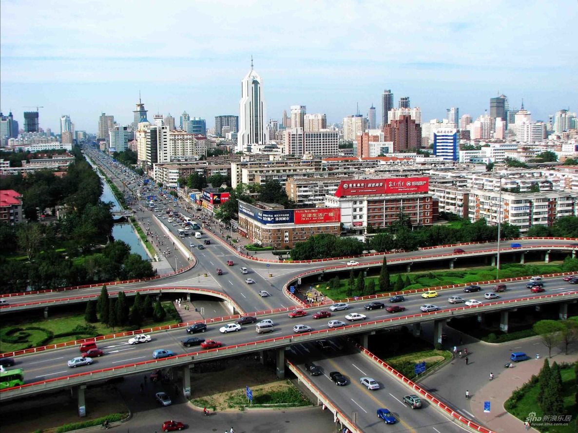
天津市,简称津,是中华人民共和国直辖市、国家中心城市和中国北方最大沿海开放城市。天津位于华北平原的海河各支流交汇处,东临渤海,北依燕山;有海河在城中蜿蜒而过,跨越海河的各式桥梁形成了“一桥一景”的景致。
天津因漕运而兴起,1404年12月23日正式筑城[1]。自1860年天津开放为通商口岸后,西方多国在天津设立租界,洋务派亦在天津兴办实业,使天津成为中国北方开放的前沿和近代中国洋务运动的基地。在领风气之先的同时,天津近代工业、商业、金融业等发展迅速。由天津开始的军事、教育、司法、交通、通讯、工业等方面的近代化建设,均开中国之先河。天津成为当时中国第二大的工商业城市和北方最大的金融商贸中心。
2006年3月,国务院批复的《天津市总体规划》将天津完整定位为“国际港口城市、北方经济中心、生态城市”[2],并将“推进天津滨海新区开发开放”纳入国家发展战略,设立为国家综合配套改革试验区。2007年11月,中国、新加坡两国政府选址天津共同建设中新生态城。2015年4月,中国(天津)自由贸易试验区挂牌成立,成为中国长江以北唯一的自由贸易试验区。经过自1990年代开始的工业东移战略,天津市已经初步形成了“中心城区-滨海新区”和“天津港-天津南港”的双城双港的城市格局。2015年4月,《京津冀协同发展纲要》确定天津市为“全国先进制造研发基地、北方国际航运核心区、金融创新运营示范区和改革先行示范区”[3]。
天津市举办了2013年的第六届东亚运动会和2017年第十三届全运会[4],同时天津也是夏季达沃斯论坛的常驻举办城市。
天津市(てんしんし/テンチンし、簡体字: 天津市、拼音: 、英語: Tianjin)は、中華人民共和国に位置する直轄市。国家中心都市の一つ。略称は津。
天津は華北平原海河の五大支流の合流する所に位置し、東に渤海を、北に燕山を臨む。市内を流れる海河は天津の母親河とも呼ばれる。
環渤海湾地域の経済的中心地であり、中国北方最大の対外開放港である。首都北京市とは高速道路、高速直通列車、京津城際線によって、0.5〜2時間以内で結ばれている。元々は海河の河港であったが、河口の塘沽に大規模な港湾やコンテナターミナル、工業地帯が形成されている。経済成長率の高さはここ数年に渡り、全国トップである。2017年の第13期の全国体育大会の開催が決まっており、夏季ダボスフォーラム常駐開催都市でもある。
市区人口は506万人、都市圏人口は720万人。
Tianjin ([tʰjɛ́n.tɕín] (![]() listen)), formerly romanized as Tientsin, is a coastal metropolis in northern China and one of the nine national central cities of the People's Republic of China (PRC), with a total population of 15,469,500, and is also the world's 11th-most populous city proper.[5] It is governed as one of the four municipalities under the direct administration of central government of the PRC and is thus under direct administration of the central government. Tianjin borders Hebei Province and Beijing Municipality, bounded to the east by the Bohai Gulf portion of the Yellow Sea. Part of the Bohai Economic Rim, it is the largest coastal city in northern China.
listen)), formerly romanized as Tientsin, is a coastal metropolis in northern China and one of the nine national central cities of the People's Republic of China (PRC), with a total population of 15,469,500, and is also the world's 11th-most populous city proper.[5] It is governed as one of the four municipalities under the direct administration of central government of the PRC and is thus under direct administration of the central government. Tianjin borders Hebei Province and Beijing Municipality, bounded to the east by the Bohai Gulf portion of the Yellow Sea. Part of the Bohai Economic Rim, it is the largest coastal city in northern China.
In terms of urban population, Tianjin is the fourth largest in China, after Shanghai, Beijing, and Guangzhou. In terms of administrative area population, Tianjin ranks fifth in Mainland China.[6] The walled city of Tianjin was built in 1404. As a treaty port since 1860, Tianjin has been a major seaport and gateway to Beijing. During the Boxer Rebellion the city was the seat of the Tianjin Provisional Government. Under the Qing dynasty and the Republic of China, Tianjin became one of the largest cities in the region.[7] At that time, numerous European-style buildings and mansions were constructed in concessions, many of which are well-preserved today. After the founding of the People's Republic of China, Tianjin suffered a depression due to the policy of the central government and Tangshan earthquake, but recovered from 1990s.[8] Nowadays Tianjin is a dual-core city, with its main urban area (including the old city) located along the Hai River, which connects to the Yellow and Yangtze Rivers via the Grand Canal; and Binhai, a New Area urban core located east of the old city, on the coast of the Bohai Gulf. As of the end of 2010, around 285 Fortune 500 companies have set up base in Binhai.
Tien-Tsin ou Tientsin (en français)2 ou Tianjin (nom local en anglais)3 (en chinois : 天津市 ; pinyin : ; EFEO : T'ien-Tsin), est une municipalité autonome du nord-est de la République populaire de Chine. Avec une agglomération de plus de quinze millions d'habitants en 2014, il s'agit de la quatrième ville de Chine en nombre d'habitants, après Shanghai, Pékin et Canton. Tianjin est également l'une des quatre municipalités du pays qui sont directement gouvernées par le pouvoir central. Elle est part du Jing-Jin-Ji.
Durant l'Antiquité, Tianjin était un village portuaire alors appelé Zhigu. Avec l'ouverture du Grand Canal sous la dynastie Sui (581-618), la ville se développe et devient un port de commerce important. En 1404, l'empereur Yongle donne à la ville son nom actuel, qui signifie littéralement le « gué de l'Empereur »4 , marquant le fait que le souverain a traversé le fleuve à cet endroit. Quelques années plus tard, un fort connu sous le nom de fort de Tianjin (Tianjin Wei, 天津卫) y est établi. En 1725, la ville obtient le statut de préfecture. Au XIXe siècle, les Chinois et les puissances occidentales s'y affrontent dans le cadre de la Seconde guerre de l'opium : la défaite chinoise et le traité de Tianjin (1858) entraînent la création de concessions étrangères. Devenue une ville de notables, Tianjin est occupée en 1937 par l'armée impériale japonaise à la suite du déclenchement de la guerre sino-japonaise.
Située sur les rives du golfe de Bohai — un bras de la mer Jaune — la municipalité de Tianjin est frontalière de la province Hebei et de la municipalité de Pékin. Elle se divise en deux ensembles urbains : la ville de Tianjin proprement dite, avec le centre historique, située sur les rives du fleuve Hai He - qui rejoint le fleuve Jaune (Huang He) et le Yangzi Jiang via le Grand Canal - ; et Binhai, une ville nouvelle située à l'est du centre historique, sur les rives de la mer de Bohai. Cette dernière, ainsi que le district de Tanggu voisin, est une zone économique spéciale destinée à accueillir de nombreuses entreprises chinoises et internationales. Sa croissance économique est l'une des plus importantes de Chine : le PIB de Binhai a dépassé en 2010 celui de Pudong à Shanghai5.
Symbole de ce récent développement économique - autour de l'aéronautique et de l'électronique notamment -, plusieurs gratte-ciels sont actuellement en construction, comme la China 117 Tower ou le Tianjin International Trade Centre. La ville abrite également un musée d'art chinois, le mémorial dédié à Zhou Enlai (le Premier ministre de Mao Zedong), le Temple de la Grande Compassion, ainsi que l'ancienne cathédrale de la concession française, l’Église Notre-Dame des Victoires. Plus récemment, la ville a accueilli des compétitions sportives dans son centre olympique, construit à l'occasion des Jeux olympiques de 2008 à Pékin.
Tientsin[1][2][3][4][5], conosciuta anche come Tianjin (pr. cinese: [tʰi̯ɛ́ntɕín]: pr. it. [tjɛnˈʤin][6]; in cinese 天津S, TiānjīnP, letteralmente "guado del fiume del paradiso"), è una delle quattro municipalità della Repubblica Popolare Cinese direttamente controllate dal governo centrale.
L'area metropolitana si estende su una superficie di 11 760 km² e nel 2014 aveva una popolazione di 15 200 000 abitanti – che la rendono la quarta municipalità della Cina per popolazione dopo Shanghai, Pechino e Chongqing.
Negli ultimi anni Tientsin, grazie alla presenza di un significativo bacino produttivo tecnologico, ha registrato una tra le maggiori crescite di PIL su base annua tra le città cinesi. Dal 2007 ospita la sessione estiva del Forum economico mondiale di Davos.
Tianjin1 (pronunciado:[Tián-Chín](![]() escuchar), en chino: 天津, pinyin: Tiānjìn, transcripción antigua: Tientsin) es uno de los cuatro municipios que, junto con las veintidós provincias, cinco regiones autónomas y dos regiones administrativas especiales, conforman la República Popular China. Está situado en China del Norte a orillas del río Hai en su desembocadura en el mar de Bohai. Es la cuarta ciudad más poblada de China tras Shanghái, Beijing y Guangzhou, con más de cuatro millones de habitantes en 170 kilómetros cuadrados que hacen un total de 15 469 500 habitantes.2
escuchar), en chino: 天津, pinyin: Tiānjìn, transcripción antigua: Tientsin) es uno de los cuatro municipios que, junto con las veintidós provincias, cinco regiones autónomas y dos regiones administrativas especiales, conforman la República Popular China. Está situado en China del Norte a orillas del río Hai en su desembocadura en el mar de Bohai. Es la cuarta ciudad más poblada de China tras Shanghái, Beijing y Guangzhou, con más de cuatro millones de habitantes en 170 kilómetros cuadrados que hacen un total de 15 469 500 habitantes.2
Tianjin es una de las cinco ciudades centrales nacionales, de gran relevancia histórica. La ciudad amurallada de Tianjin fue construida en 1404. Como puerto de tratado desde 1860, Tianjin ha sido un importante puerto marítimo y puerta de entrada a Beijing. Durante el levantamiento de los bóxers la ciudad fue la sede del Gobierno Provisional de Tianjin. Bajo el Imperio Ta-tsing y la República de China, Tianjin se convirtió en una de las ciudades más grandes de la región.3 En esa época, numerosos edificios y mansiones de estilo europeo fueron construidos en concesiones, muchas de las cuales están bien conservadas hoy en día. Después de la fundación de la República Popular de China, Tianjin sufrió una depresión debido a la política del gobierno central y el terremoto de Tangshan, pero se recuperó a partir de 1990.4
En la actualidad, Tianjin es una ciudad de dos núcleos, con su área urbana principal (incluyendo la ciudad vieja) situada a lo largo del río Hai, que conecta con los ríos Amarillo y Yangtze vía el Gran Canal y Binhai, un nuevo núcleo urbano situado al este de la ciudad vieja, en la costa del mar de Bohai. A finales de 2010, alrededor de 285 empresas Fortune 500 han establecido su base en Binhai, que es un nuevo polo de crecimiento en China y es un centro de la industria avanzada y la actividad financiera.
Тяньцзи́нь (кит. упр. 天津, пиньинь: Tiānjīn) — один из четырёх городов центрального подчинения Китайской Народной Республики. Городская зона Тяньцзиня является третьей по величине в континентальном Китае. Население — 14 425 000 человек (по данным 2009 года), площадь 11 943 км², ВВП — 750 млрд юаней (2009).


通厄伦(荷兰语:Tongeren,荷兰语发音:[ˈtɔŋərə(n)] (ⓘ);法语:Tongres,法语发音:[tɔ̃ɡʁ];德语:Tongern,德语发音:[ˈtɔŋɐn];林堡语:Tóngere,林堡语发音: [ˈtoŋəʀə])是比利时弗拉芒大区林堡省的一座城市,南与瓦隆大区列日省接壤,通行荷兰语,是弗拉芒社群的一部分,面积87.56平方千米,人口31,142人(2020年1月1日)。
Tongern (niederländisch Tongeren, limburgisch Tóngere, französisch Tongres) ist eine Stadt in der belgischen Provinz Limburg und der niederländischsprachigen Region Flandern. Sie ist die älteste Stadt Belgiens (gegründet um 15 v. Chr.), entstanden aus der römischen Siedlung Aduatuca Tungrorum, die an der Römerstraße von Köln nach Bavay lag, die heute Via Belgica genannt wird und weiter bis nach Bononia führte.
Tunis (arabisch تونس, DMG Tūnis, Zentralatlas-Tamazight ⵜⵓⵏⵙ Tunes) ist die Hauptstadt Tunesiens und Provinzhauptstadt des gleichnamigen Gouvernements. Sie ist die größte Stadt Tunesiens und hatte im Jahr 2014 laut Zensus 1.056.247 Einwohner. In der Agglomeration wohnen etwa zwei Millionen Einwohner (Juni 2014).[2] Ihr historischer Kern, die Médina, steht auf der UNESCO-Welterbe-Liste.
Nachdem die Stadt ein bescheidenes Dorf im Schatten von Karthago, Kairouan und danach Mahdia gewesen war, wurde sie am 20. September 1159 (5. Ramadan 554 des muslimischen Kalenders) unter der Regierung der Almohaden als Hauptstadt genannt. Ihr Status wurde danach im Jahr 1228 von den Hafsiden bestätigt und auch nach der Unabhängigkeit des Landes von Frankreich am 20. März 1956.
Tunis ist die ökonomische und kommerzielle Hauptstadt Tunesiens. Ihr dichtes Straßen- und Autobahnnetz und ihre relativ fortgeschrittene Fluganbindung machen sie zu einem Konvergenzpunkt des Nationalverkehrs. Diese Situation ist ein Ergebnis einer langen zentralistischen Politik, die dazu beigetragen hat, dass sich alle wichtigen Institutionen in Tunis befinden.
Im Laufe des 20. Jahrhunderts hat sich die Agglomeration außerhalb der Grenzen der Gemeinde erweitert. Zurzeit erstreckt sich Tunis über vier Gouvernorats, Tunis, l'Ariana, Ben Arous und La Manouba, und wird Le Grand Tunis (das große Tunis) genannt.
突尼斯(阿拉伯语:تونس;法语:Tunis)是北非国家突尼斯的首都,也是突尼斯省的省会。突尼斯是该国最大的城市,位于突尼斯北部的突尼斯湾(Gulf of Tunis,本身是地中海的一部分)内,市区本身被突尼斯湖与西边的潟湖包夹两侧,突尼斯运河贯穿市中心,在外港哈克阿瓦迪附近入海。
チュニス(Tunis、تونس ラテン文字転写 : Tūnis トゥーニス)は、チュニジア共和国の首都であり、同国のチュニス県の県都でもある。また同国の商業・工業の中心地で、アフリカ有数の世界都市である。2014年のシンクタンクの発表によると、世界第81位の都市と評価されている。北アフリカではカイロ、カサブランカに次ぐ第3位である。 人口約83万人(2004年12月現在)。近郊を含む都市的地域の人口は235万人であり、世界第164位である[1]。市街はチュニス湖とその西方の塩湖セブカ・セジューミ(fr)の間の地峡部にあり、チュニス湖は、地峡部を横断する運河で、地中海・チュニス湾に面する外港のラ・グレットと結ばれる。オリーブ油・リン鉱石などを輸出。チュニス大学がある。
Tunis (Arabic: تونس ![]() Tūnis) is the capital and largest city of Tunisia. The greater metropolitan area of Tunis, often referred to as "Grand Tunis", has about 2,700,000 inhabitants, making it the third-largest city in the Maghreb region (after Casablanca and Algiers) and the sixteenth-largest in the Arab world.
Tūnis) is the capital and largest city of Tunisia. The greater metropolitan area of Tunis, often referred to as "Grand Tunis", has about 2,700,000 inhabitants, making it the third-largest city in the Maghreb region (after Casablanca and Algiers) and the sixteenth-largest in the Arab world.
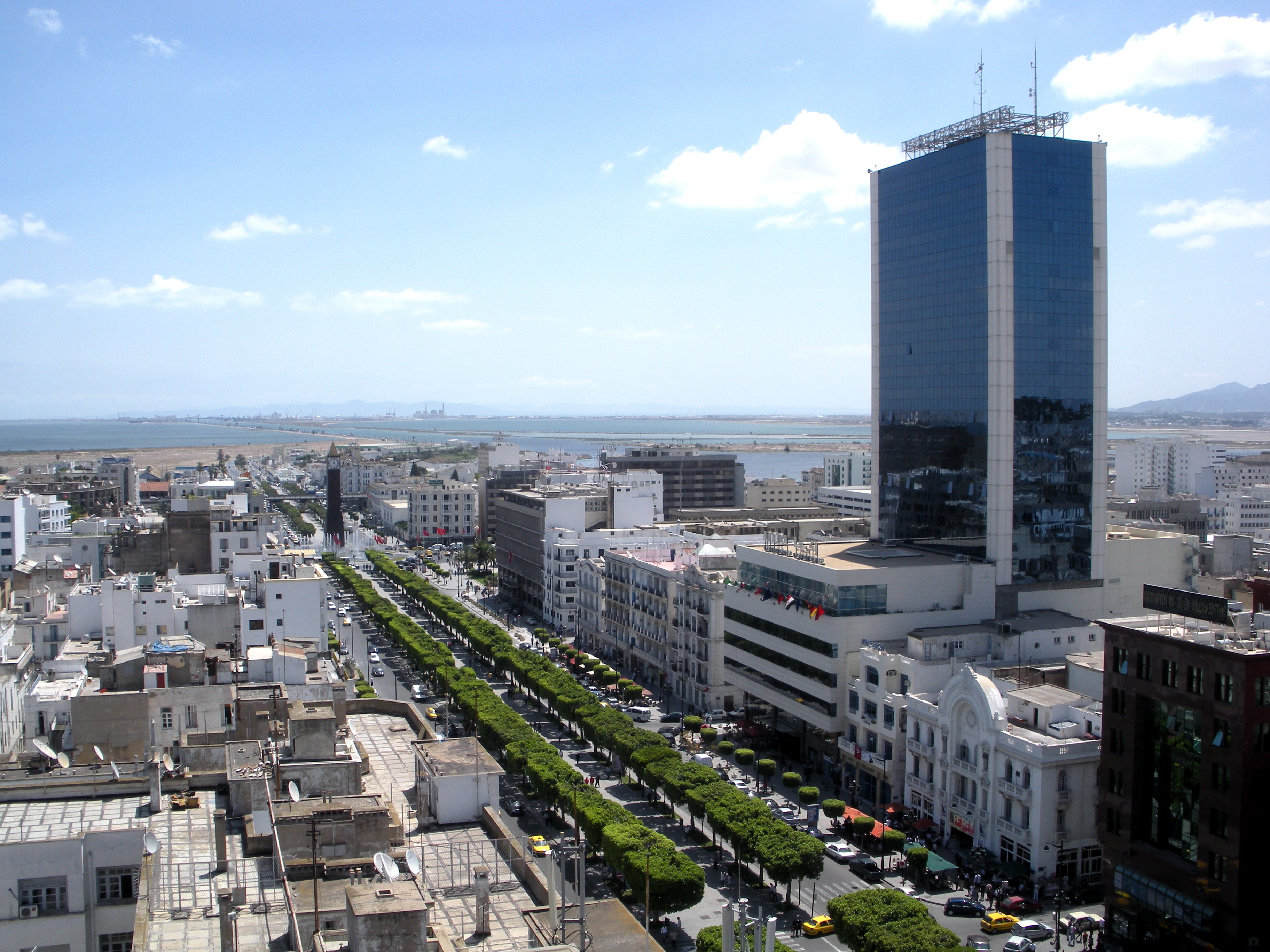
Situated on a large Mediterranean Sea gulf (the Gulf of Tunis), behind the Lake of Tunis and the port of La Goulette (Ḥalq il-Wād), the city extends along the coastal plain and the hills that surround it. At its core lies its ancient medina, a World Heritage Site. East of the medina through the Sea Gate (also known as the Bab el Bhar and the Porte de France) begins the modern city, or Ville Nouvelle, traversed by the grand Avenue Habib Bourguiba (often referred to by popular press and travel guides as "the Tunisian Champs-Élysées"), where the colonial-era buildings provide a clear contrast to smaller, older structures. Further east by the sea lie the suburbs of Carthage, La Marsa, and Sidi Bou Said. As the capital city of the country, Tunis is the focus of Tunisian political and administrative life; it is also the centre of the country's commercial and cultural activities. It has two cultural centres, as well as a municipal theatre that is used by international theatre groups and a summer festival, the International Festival of Carthage, which is held in July.
Tunis ([ty.nis] ; arabe : تونس, tūnis [ˈtuːnɪs]2 Écouter) est la ville la plus peuplée et la capitale de la Tunisie. Elle est aussi le chef-lieu du gouvernorat du même nom depuis sa création en 1956. Située au nord du pays, au fond du golfe de Tunis dont elle est séparée par le lac de Tunis, la cité s'étend sur la plaine côtière et les collines avoisinantes. Son cœur historique est la médina, inscrite au patrimoine mondial de l'Unesco.
Bourgade modeste placée dans l'ombre de Carthage, Kairouan puis Mahdia, elle est finalement désignée comme capitale le 20 septembre 1159 (5 ramadan 554 du calendrier musulman), sous l'impulsion des Almohades, puis confirmée dans son statut sous la dynastie des Hafsides en 1228 et à l'indépendance du pays le 20 mars 1956.
Tunis est la capitale économique et commerciale de la Tunisie. La densité de son réseau routier, autoroutier et sa structure aéroportuaire en font un point de convergence pour les transports nationaux. Cette situation est issue d'une longue évolution, en particulier des conceptions centralisatrices qui donnent un rôle considérable à la capitale et tendent à y concentrer à l'extrême les institutions.
En 2014, la population de la municipalité de Tunis intra-muros est de 638 845 habitants d'après le recensement de l'Institut national de la statistique1. Néanmoins, au cours du XXe siècle, l'agglomération s'est largement développée hors des limites de la municipalité, s'étendant sur quatre gouvernorats, Tunis, l'Ariana, Ben Arous et La Manouba. Le Grand Tunis compte 2 643 695 habitants en 2014, soit environ 14 % de la population du pays.
Tunisi (AFI: [ˈtunizi][2]; in arabo: تونس, Tūnis, in francese Tunis, giornalisticamente chiamata anche Cartagine) è una città di 1.056.247 abitanti dell'Africa settentrionale, capitale e massimo porto della Tunisia (di cui è la città più popolosa) e capitale del governatorato omonimo. Si trova sulle rive di una laguna presso l'antica Cartagine, unita al Mar Mediterraneo da un canale navigabile di circa 10 km che la collega all'avamporto di La Goletta.
Nata come modesto villaggio situato all'ombra di Cartagine, Kairouan e Mahdia, Tunisi è finalmente stata designata come capitale il 20 settembre 1159 (5 ramadan 554, per il calendario musulmano) per volontà della dinastia degli Almohadi, successivamente confermata dentro il proprio statuto sotto la dinastia hafside nel 1228 e anche all'indipendenza del paese, il 20 marzo 1956.
Tunisi è la capitale economica e commerciale della Tunisia. La densità della rete stradale, autostradale e della struttura aeroportuale della città ne fanno un punto di convergenza per i trasporti nazionali. Questa situazione è il risultato di una lunga evoluzione, in particolare della concezione centralistica che ha dato un ruolo considerevole alla capitale e che ha fatto in modo che vi si concentrassero le istituzioni principali.
Túnez (en árabe, تونس, en bereber: Tunest) es la capital de la República Tunecina ininterrumpidamente desde que los almohades le dieran ese título en 1159 y la dinastía de los hafsidas confirmase su estatus en 1228.[aclaración requerida] También es la capital de la gobernación homónima desde su creación, en 1956. Es el centro de las actividades industriales, comerciales, culturales, y políticas. Está situada al norte, al final del golfo de Túnez, a continuación del lago de Túnez o laguna del Behira, entre la llanura costera y las colinas que la rodean. Está unida por un canal al puerto de La Goleta (La Goulette en francés). Según el censo de 2004, en ella viven 728 453 habitantes (alrededor de un 10 % de la población estatal),1 llamados tunecinos,2 lo que la convierte en la ciudad más poblada del país; esta cifra aumenta hasta 2 380 500 personas en su área metropolitana.
Al norte de la ciudad se encuentra la masa verde del Belvedere, y al suroeste, el cerro del cementerio de Jellaz. Al este está la medina de Túnez, el centro de la ciudad, compuesto de callejuelas y pasadizos cubiertos, con multitud de olores y variedad de colores provenientes de los comercios. La ciudad moderna (Nouvelle ville) se alcanza al cruzar la puerta de Francia, antiguamente llamada «puerta del mar». Está atravesada por la gran avenida Bourguiba (considerada por muchos como los Campos Elíseos tunecinos), cuyos edificios de estilo colonial de principios de siglo XX contrastan con la arquitectura de estilo árabe de la ciudad antigua, que vino a llamarse la «ciudad de los indígenas».
 Hauts-de-France
 World Heritage

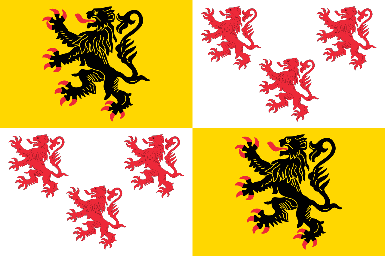
图尔奈(法语:Tournai,法语发音:[tuʁnɛ] (ⓘ);荷兰语:Doornik,荷兰语发音:[ˈdoːrnɪk] (ⓘ);皮卡第语:Tornai;德语旧名:Dornick),比利时瓦隆大区埃诺省城市,位于埃斯科河畔,西与法国接壤,通行法语,是比利时法语社群的一部分,人口69,554人(2018年1月1日)。
图尔奈与阿尔隆、通厄伦同为比利时最古老的三个城市,在比利时文化历史上扮演了重要角色。历史上,图尔奈曾是法兰克帝国的首都,其大教堂和钟楼都被联合国教科文组织列为世界文化遗产。
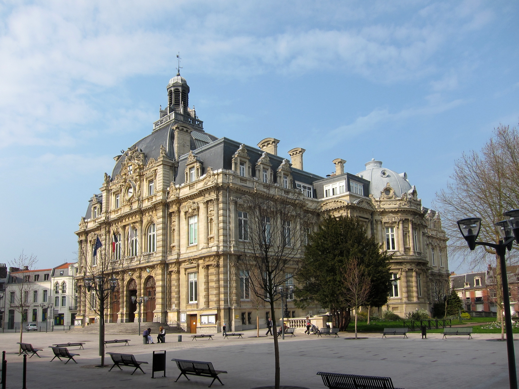
Tournai (französisch, aus lateinisch Turnacum;[1] niederländisch Doornik, deutsch veraltet Dornick) ist eine Stadt am Fluss Escaut (niederländisch: Schelde) in der Provinz Hennegau (niederländisch Henegouwen, französisch Hainaut) im picardischen Teil von Wallonien, dem überwiegend Französisch sprechenden Teil Belgiens. Sie hatte am 1. Januar 2019 gemäß den Angaben des nationalen Registers 69.233 Einwohner.[2] Die Stadt liegt etwa 85 km südwestlich von Brüssel. Mit einer Fläche von über 213 km² ist sie die größte Gemeinde Belgiens.