
Deutsch-Chinesische Enzyklopädie, 德汉百科
 Singapore
 Financial
England
Partner of the Paris 2024 organizing committee
Singapore
Financial
England
Partner of the Paris 2024 organizing committee
Singapore
 Companies
 *Centuries-old companies in the world
United Kingdom
*Centuries-old companies in the world
United Kingdom
 Economy and trade

Deloitte Touche Tohmatsu Limited (DTTL, kurz Deloitte, [diˈlɔ͜ɪt]) ist ein internationales Unternehmen der Wirtschaftsbranche. Es erbringt Dienstleistungen in den Bereichen Wirtschaftsprüfung, Risikoberatung (Risk Advisory), Steuerberatung, Finanzberatung (Financial Advisory) und Consulting für Unternehmen und Institutionen aus allen Wirtschaftszweigen; Rechtsberatung wird in Deutschland von Deloitte Legal erbracht.
Deloitte Touche Tohmatsu Limited(简称 DTTL 或 Deloitte,[diˈlɔ͜ɪt])是一家商业领域的国际公司。它为各行各业的公司和机构提供审计、风险咨询、税务咨询、财务咨询和顾问服务。
 Architecture
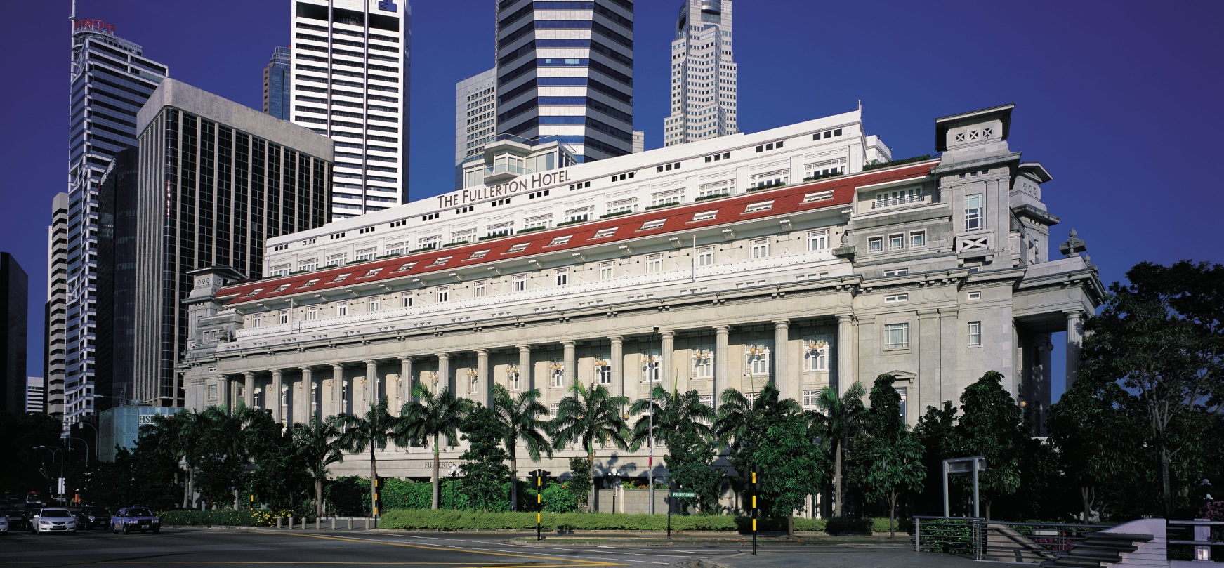
 Life and Style
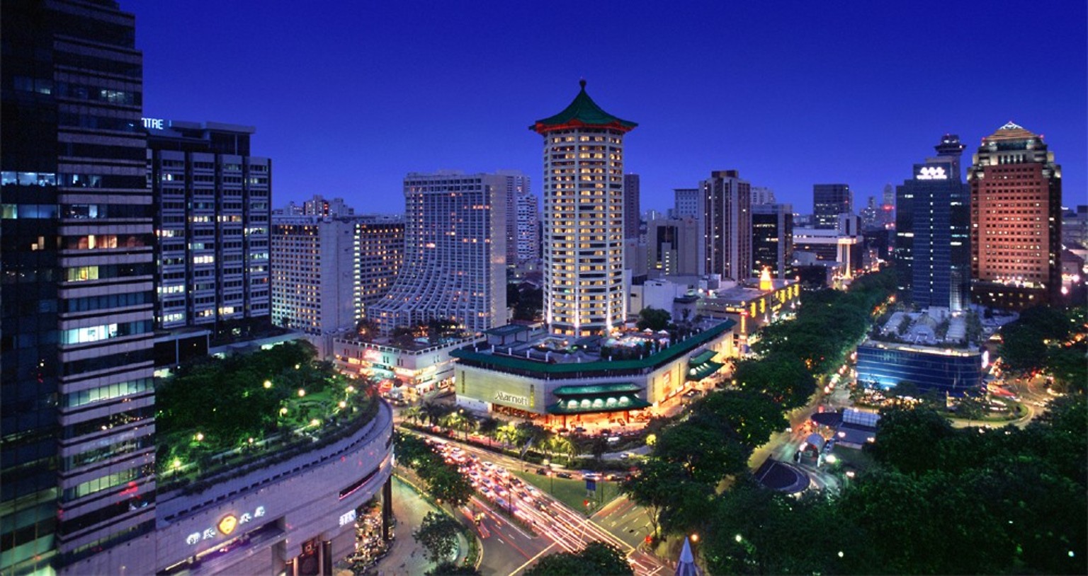
 *UK political system
Antigua and Barbuda
Australia
Bahamas
Bangladesh
Barbados
Belize
Botsuana
Brunei Darussalam
Commonwealth of Nations
Dominica
*UK political system
Antigua and Barbuda
Australia
Bahamas
Bangladesh
Barbados
Belize
Botsuana
Brunei Darussalam
Commonwealth of Nations
Dominica
 History
M 1500 - 2000 AD
History of the United Kingdom
Ghana
Grenada
Guyana
India
Jamaika
Cameroon
Canada
Kenya
Kiribati
Lesotho
Malawi
Malaysia
Malediven
Malta
Mosambik
Namibia
Nauru
New Zealand
Nigeria
Pakistan
Papua-Neuguinea
Salomonen
Sambia
Samoa
Seychellen
Sierra Leone
Singapore
Sri Lanka
Saint Kitts and Nevis
St. Vincent and the Grenadines
South Africa
Swasiland
Tansania
Tonga
Trinidad und Tobago
Tuvalu
Uganda
Vanuatu
United Kingdom
History
History
M 1500 - 2000 AD
History of the United Kingdom
Ghana
Grenada
Guyana
India
Jamaika
Cameroon
Canada
Kenya
Kiribati
Lesotho
Malawi
Malaysia
Malediven
Malta
Mosambik
Namibia
Nauru
New Zealand
Nigeria
Pakistan
Papua-Neuguinea
Salomonen
Sambia
Samoa
Seychellen
Sierra Leone
Singapore
Sri Lanka
Saint Kitts and Nevis
St. Vincent and the Grenadines
South Africa
Swasiland
Tansania
Tonga
Trinidad und Tobago
Tuvalu
Uganda
Vanuatu
United Kingdom
 Important International Organizations
Cyprus
Important International Organizations
Cyprus
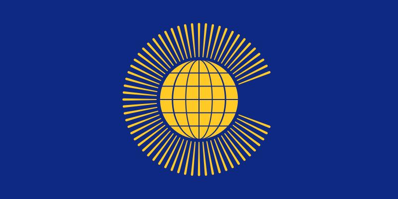
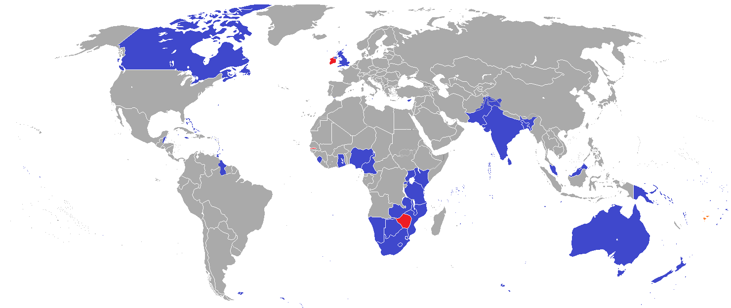
英联邦(英语:Commonwealth of Nations,新马作共和联邦,台湾作大英国协),是一个现代的国际组织,由56个英语系的主权国家联合而成。
英联邦不是一个统一的联邦国家,而是一个国际组织,英联邦也无权约束旗下任何成员国内政。英联邦元首通常由英国君主兼任,其首任元首是乔治六世,现任是查尔斯三世,但元首并无实权,秘书长才是英联邦实际上的掌权者[4][5]。该组织的成员国基本由英国及其旧殖民地组成,也以英式英语为共通语言,但英国的地位并没有凌驾于他国之上,所有成员国一律平等。目前英联邦有56个成员国,其中15个属于英联邦王国,英联邦王国的国家元首、英联邦元首均和英国的一致,即现在的查尔斯三世;另外5个属于独立君主国,它们不以英国君主为自己的元首,而是自立君主,这五国是文莱、斯威士兰、莱索托、马来西亚、汤加;其余的36个均属于共和国,没有君主。
The Commonwealth of Nations, generally known simply as the Commonwealth,[3] is a political association of 53 member states, nearly all of them former territories of the British Empire.[4] The chief institutions of the organisation are the Commonwealth Secretariat, which focuses on intergovernmental aspects, and the Commonwealth Foundation, which focuses on non-governmental relations between member states.[5]
The Commonwealth dates back to the first half of the 20th century with the decolonisation of the British Empire through increased self-governance of its territories. It was originally created as the British Commonwealth of Nations[6] through the Balfour Declaration at the 1926 Imperial Conference, and formalised by the United Kingdom through the Statute of Westminster in 1931. The current Commonwealth of Nations was formally constituted by the London Declaration in 1949, which modernised the community and established the member states as "free and equal".[7]
The human symbol of this free association is the Head of the Commonwealth, currently Queen Elizabeth II, and the 2018 Commonwealth Heads of Government Meeting appointed Charles, Prince of Wales to be her designated successor, although the position is not technically hereditary. The Queen is the head of state of 16 member states, known as the Commonwealth realms, while 32 other members are republics and five others have different monarchs.
Member states have no legal obligations to one another, but are connected through their use of the English language and historical ties. Their stated shared values of democracy, human rights and the rule of law are enshrined in the Commonwealth Charter[8] and promoted by the quadrennial Commonwealth Games.
The countries of the Commonwealth cover more than 29,958,050 km2 (11,566,870 sq mi), equivalent to 20% of the world's land area, and span all six inhabited continents.
Le Commonwealth ou Commonwealth of Nations (littéralement, la « Communauté des Nations ») est une organisation intergouvernementale composée de 53 États membres qui sont presque tous d'anciens territoires de l'Empire britannique.
Le Commonwealth a émergé au milieu du XXe siècle pendant le processus de décolonisation. Il est formellement constitué par la Déclaration de Londres de 1949 qui fait des États membres des partenaires « libres et égaux ». Le symbole de cette libre association est la reine Élisabeth II qui est chef du Commonwealth. La reine est également le chef d'État monarchique des 16 royaumes du Commonwealth. Les autres États membres sont 32 républiques et cinq monarchies dont le monarque est différent.
Les États membres n'ont aucune obligation les uns envers les autres. Ils sont réunis par la langue, l'histoire et la culture et des valeurs décrites dans la Charte du Commonwealth telles que la démocratie, les droits humains et l'état de droit.
Les États du Commonwealth couvrent 29 958 050 km2 de territoire sur les cinq continents habités. Sa population est estimée à 2,328 milliards d'habitants.
Il Commonwealth delle Nazioni o Commonwealth (acronimo CN) è un'organizzazione intergovernativa di 53 Stati membri indipendenti, tutti accomunati, eccetto il Mozambico e il Ruanda, da un passato storico di appartenenza all'Impero britannico, del quale il Commonwealth è una sorta di sviluppo su base volontaria. La popolazione complessiva degli stati che vi aderiscono è di oltre due miliardi di persone. La parola Commonwealth deriva dall'unione di common (comune) e wealth (benessere), cioè benessere comune.
In passato fu noto anche come Commonwealth britannico, benché tale definizione esistette formalmente solo dalla fondazione nel 1926 fino al 1948.
La Mancomunidad de Naciones (en inglés: Commonwealth of Nations)?, antiguamente Mancomunidad Británica de Naciones (British Commonwealth of Nations), es una organización compuesta por 53 países soberanos independientes y semi independientes que, con la excepción de Mozambique y Ruanda,1 comparten lazos históricos con el Reino Unido. Su principal objetivo es la cooperación internacional en el ámbito político y económico, y desde 1950 la pertenencia a ella no implica sumisión alguna a la Corona británica, aunque se respeta la figura de la reina del Reino Unido. Con el ingreso de Mozambique, la organización ha favorecido el término Mancomunidad de Naciones para subrayar su carácter internacionalista. Sin embargo, el adjetivo británico se sigue utilizando con frecuencia para diferenciarla de otras mancomunidades existentes a nivel internacional.
La reina Isabel II del Reino Unido es la cabeza de la organización, según los principios de la Mancomunidad, «símbolo de la libre asociación de sus miembros».
Содру́жество на́ций (англ. Commonwealth of Nations, до 1946 года — Британское Содружество наций — англ. British Commonwealth of Nations), кратко именуемое просто Содружество (англ. The Commonwealth) — добровольное объединение суверенных государств, в которое входят Великобритания и почти все её бывшие доминионы, колонии и протектораты. Членами Содружества также являются Мозамбик, Руанда, Намибия и Камерун[2].
 States of Asia
Commonwealth of Nations
States of Asia
Commonwealth of Nations
 Geography
***IMF Developed countries
IMF Developed countries
IMF Developed countries
TOP4
Singapore
Geography
Geography
***IMF Developed countries
IMF Developed countries
IMF Developed countries
TOP4
Singapore


新加坡共和国(英语:Republic of Singapore;马来语:Singapura;泰米尔语:சிங்கப்பூர் குடியரச),通称新加坡,是东南亚中南半岛南端的一个城邦岛国、城市国家。该国位于马来半岛南端,扼守马六甲海峡最南端出口,其南面有新加坡海峡与印尼相隔,北面有柔佛海峡与西马来西亚相隔,并以新柔长堤与第二通道等这两座桥梁相连于新马两岸之间。新加坡的国土除了新加坡本岛之外,还包括周围所属岛屿,新加坡最大的外岛为德光岛。从新加坡独立以来,大规模的填海已经为新加坡增加了23%的面积,相等于增加了130平方公里。
1819年,任职于英国不列颠东印度公司的斯坦福·莱佛士与柔佛苏丹签订条约,获准在新加坡建立交易站和殖民地,经莱佛士的努力,逐渐发展成繁荣的转口港。由于地理位置特殊,新加坡在第二次世界大战以前一直是大英帝国在东南亚最重要的战略据点。1942年至1945年间,新加坡曾被日本占领三年半之久,其后回归英国管理,并从海峡殖民地独立出来,1959年成立自治邦,1963年加入马来西亚成为一个州,称为新加坡州(简称星州)。1965年8月9日,马来西亚国会以126票赞成、0票反对,同意将新加坡驱逐出联邦。新加坡共和国正式成立,李光耀为总理,尤索夫·伊萨为总统。新加坡被驱逐马来西亚后独立建国。
自1965年独立后,新加坡从穷困潦倒中,依靠着国际贸易和人力资本的操作,迅速转变成为富裕的亚洲四小龙之一,同时凭借着地理优势,新加坡也是亚洲重要的金融、服务和航运中心之一。教育素质良好的国民也是亚洲政治和科学文化的纽带,大多数的新加坡人都通晓至少两种语言,分别是英语以及自己的母语。新加坡是个多元文化种族的社会,也是全球最国际化的国家之一,所以主要由华人组成的新加坡并非为单一民族国家,而是和一部分马来人及印度人所组成的移民国家,其中华人文化以福建移民为大宗[6]。在国内居住的居民有38%为永久居民、持有工作签证的外籍劳工以及持有学生签证的学生,建筑业和服务业的外劳比例分别为80%和50%[7][8][9][10]。整个城市在绿化和环境卫生方面效果显著,故有花园城市之美称。
Singapur (amtlich Republik Singapur, englisch Republic of Singapore [ɹɪˈpʰʌb.lɪkʰ.əv.ˈsɪŋ.(g)ə.pʰɔː], malaiisch Republik Singapura, chinesisch 新加坡共和国, Pinyin Xīnjiāpō Gònghéguó, auch: 新加坡 [ɕin.tɕiɑ.pʰuɔ], Tamil சிங்கப்பூர் குடியரசு Ciṅkappūr Kudiyarasu) ist ein Insel- und Stadtstaat und der flächenmäßig kleinste Staat Südostasiens. Er ist Mitglied im Commonwealth of Nations.
Beim Index der menschlichen Entwicklung belegte Singapur 2018 den neunten Platz.[6] Singapur ist eines der reichsten Länder (und Städte) weltweit und gilt als eine der Städte mit den weltweit höchsten Lebenshaltungskosten.[7] Zudem zählt der Stadtstaat mit mehr als elf Millionen ausländischen Touristen im Jahr zu den zehn meistbesuchten Städten der Welt[8] und gilt neben Hongkong als wichtigster Finanzplatz Asiens. Singapur ist ein multiethnischer Staat, in dem Chinesen, Malaien und Inder die größten Bevölkerungsteile stellen.
シンガポール共和国(シンガポールきょうわこく、英語: Republic of Singapore、マレー語: Republik Singapura、簡体字: 新加坡共和国、繁体字: 新加坡共和國、タミル語: சிங்கப்பூர் குடியரசு)、通称シンガポールは、東南アジアに位置し、シンガポール島及び60以上の小規模な島々からなる共和制国家[4]。
同国は、北はジョホール海峡により半島マレーシアから、南はシンガポール海峡によりインドネシアのリアウ諸島州から各々切り離されている。同国は高度に都市化され、原初の現存植生はほとんどない。シンガポールの領土は、一貫して埋立てにより拡大してきた。
シンガポールは、教育・エンターテインメント・金融・ヘルスケア・人的資本・イノベーション・ロジスティクス・製造・技術・観光・貿易・輸送の世界的な中心である。多くの国際順位で格付けされており、最も「テクノロジー対応」国(WEF)、国際会議のトップ都市(UIA)、世界で最もスマートな都市である「投資の可能性が最も高い」都市(BERI)、世界で最も安全な国、世界で最も競争力のある経済、3番目に腐敗の少ない国、3番目に大きい外国為替市場、3番目に大きい金融センター、3番目に大きい石油精製貿易センター、5番目に革新的な国、2番目に混雑するコンテナ港湾。2013年以来、エコノミストはシンガポールを「最も住みやすい都市」として格付けしている[5][6][7][8]。
シンガポールは、すべての主要な格付け機関からAAAソブリン格付けを持つ、アジアで唯一の国であり、世界11か国のうちの1つである。シンガポール航空は2018年の「世界最高の航空会社」であり、世界的にはシンガポール港とチャンギ国際空港がそれぞれ「マリタイムキャピタル」と「ベスト空港」のタイトルを連続して獲得している[9][10]。
シンガポールは、1人当たりGDPが2番目に高く、国連人間開発指数で9位である、主権国にとってアジアで最高。これは、教育・医療・平均余命・生活の質・個人の安全・住宅などの主要な社会的指標に高く置かれており、人口の90%が家の所有者である。
Singapore (/ˈsɪŋ(ɡ)əpɔːr/ ( listen)), officially the Republic of Singapore, is a sovereign city-state and island country located in maritime Southeast Asia. Singapore lies about one degree of latitude (137 kilometres or 85 miles) north of the equator, and is situated off the southern tip of the Malay peninsula, and, by extension, the southernmost extremity of continental Eurasia. The island country is wedged between western Indonesia and peninsular Malaysia, sharing its southern maritime border with the Batam, Bintan, and Karimun archipelago of the former's Riau Islands province, and its northern, western, and eastern maritime borders with the latter's Johor state; it is additionally in the vicinity of Sumatra to its west and Borneo to its east. The island country is enveloped by the littoral waters of the Johore Strait to its north and the Singapore Strait to its south, and is geographically positioned within the confluence of the Indian and Pacific Oceans, being bounded by the Malacca Strait to its west and the South China Sea to its east. The country's territory, which is archipelagic, is composed of one main island, 63 satellite islands and islets, and one outlying islet, the combined area of which has increased by 25% since the country's independence as a result of extensive land reclamation projects.
Throughout its millennia-long history, Singapore—historically known by the names Pulau Ujong, Temasek, and subsequently Singapura—was a maritime emporium that fell under the suzerainty of several successive Indianised and Islamicate Malay polities: initially a series of ancient to medieval Hindu-Buddhist thalassocratic empires, subsequently a medieval localised Hindu-Buddhist kingdom, and ultimately two medieval to early modern Islamic sultanates.[14][Note 8] The 1819 arrival of Stamford Raffles, a British colonial officer, and the subsequent establishment of a British East India Company trading post on the main island—then part of the Johor Sultanate—marked the genesis of modern Singapore. Five years later, the British and Dutch East India companies partitioned the Sultanate, with the British coercively wresting Singapore from the Sultan in the process, marking the cessation of indigenous rule over the island for the first time in its history. In 1826, Singapore was incorporated into the Straits Settlements, a pan-Malayan presidency of the Company with Penang as capital,[15][Note 9] and in 1830, the Settlements were annexed to British India as a residency, where they would be governed from the capital of Calcutta under two administrations—until 1858 under Company rule, and—following the Company's collapse in the wake of the 1857 Indian Rebellion—until 1867 under the successive British Raj. In 1867, the administration of the Settlements was transferred to London, bringing them under the direct control of the United Kingdom as a Malayan crown colony.[16][17][18]
From 1867 to the 1940s, Singapore, having taken over Penang as capital of the Settlements, grew into a thriving entrepôt and settler-colony under the auspices of the British Empire, attracting large numbers of non-indigenous settlers and sojourners from the region and beyond.[19] During the Second World War, Imperial Japan invaded and annexed Singapore, resulting in an interregnum of British colonial rule corresponding with a brief but bloody Japanese occupation from 1942 to 1945. Following Japan's surrender in 1945, Singapore was returned to British control; in 1946, the Straits Settlements were dissolved, and Singapore became a standalone crown colony. In 1959, following a protracted period of agitation against colonial rule, Singapore was granted limited autonomy; in 1963, it became fully emancipated from the British Empire upon its federation with the territories of the erstwhile British Malaya and British Borneo to form the new country of Malaysia.[Note 10] However, after two tumultuous years as a constituent state of the Malaysian Federation, marred by violent ethnoreligious strife and other intractable differences between indigenous and non-indigenous groups, Singapore was expelled in 1965, becoming the first country in modern history to gain independence against its will—although this narrative remains contentious.[Note 11] After early years of turbulence, the newly sovereign nation—viewed as a nonviable state by international observers due to its diminutiveness, geostrategic vulnerability, absence of natural resources, and lack of a hinterland—defied odds by rapidly developing and industrialising under the leadership of the inaugural People's Action Party to become a high-income economy and developed country within a single generation.
Singapore is a unitary parliamentary constitutional republic with a unicameral legislature that has been characterised by dominant-party rule since independence. It is considered a soft authoritarian technocratic state; the Economist Intelligence Unit rated Singapore a "flawed democracy" in 2019.[21] It is the only truly sovereign city-state in the world; it has its own currency and a well-funded military that is considered the most advanced in Southeast Asia.[22] The country is home to 5.6 million residents, 61% (3.4 million) of whom are Singaporeans; as a legacy of its historical nature as an entrepôt and settler-colony, modern Singapore is a pluralistic country with a racially, culturally, and religiously diverse citizenry,[23][24] with one indigenous ethnic group, the Malays, and two settler-descended ethnic groups, the Chinese and Indians, forming the historical and contemporary core of the citizen populace. As a reflection of this pluralism, multiracialism has been enshrined as a foundational principle of the state, and has shaped the country's politics and national policies. The country, which is Anglophone, has four official languages: English, Malay, Chinese, and Tamil; Malay, as the ancestral language of the country, is accorded protected status in the country's constitution as the national language, while English is the lingua franca, being spoken as a common tongue by the vast majority of Singaporeans.
Singapore is one of the five founding members of ASEAN, is the headquarters of the Asia-Pacific Economic Cooperation (APEC) Secretariat and Pacific Economic Cooperation Council (PECC) Secretariat,[25] is a member of the United Nations, World Trade Organization, East Asia Summit, Non-Aligned Movement, and the Commonwealth of Nations, and is a recurrent guest invitee to the annual G20 summit;[26] its outsized influence on global affairs, relative to its size, has lead to it being classified as a middle power.[27][28] The country is the most developed sovereign nation in Asia, being ranked 9th on the UN Human Development Index, and has the 7th highest GDP per capita in the world.[29][30] It is also considered by Transparency International to be the most incorruptible nation in Asia, and the fifth most incorruptible worldwide. Singapore is placed highly in key social indicators: education, healthcare, quality of life, personal safety and housing, with a home-ownership rate of 91%. Singaporeans enjoy one of the world's longest life expectancies and one of the lowest infant mortality rates in the world.[31] As a city, Singapore is classified as an Alpha+ global city, and is the only country in Asia with an AAA sovereign rating from all major rating agencies. It is a major financial and shipping hub, consistently ranked the most expensive city to live in since 2013, and has been identified as a tax haven.[32][33] Singapore is also a popular tourist destination, with well-known landmarks such as the Merlion, Marina Bay Sands, Gardens by the Bay, the Jewel, the Orchard Road shopping belt, the resort island of Sentosa, and the Singapore Botanic Gardens, the only tropical garden in the world to be honoured as a UNESCO World Heritage Site.[34][35]
Singapour, en forme longue la république de Singapour (en anglais : Singapore et Republic of Singapore, en chinois : 新加坡 (Xīnjiāpō) et 新加坡共和国 (Xīnjiāpō Gònghéguó), en malais : Singapura et Republik Singapura, en tamoul : சிங்கப்பூர் (Ciṅkappūr) et சிங்கப்பூர் குடியரசு) (Ciŋkappūr Kudiyarasu), est une cité-État d’Asie du Sud-Est. Sa superficie est de 719,1 km2. Elle comprend 63 îles, dont la principale est Pulau Ujong (584,8 km2). Cette île est très densément urbanisée, mais la végétation luxuriante – même en plein centre-ville – a valu à Singapour le surnom de « ville jardin ». Cette abondance de verdure découle en partie d'un climat équatorial, uniformément chaud et orageux tout au long de l'année. Sa densité de population est la plus élevée d'Asie et la deuxième sur le plan mondial.
L'État de Singapour est situé à l'extrême sud de la péninsule Malaise, dont il est séparé au nord par le détroit de Johor, et borde au sud le détroit de Singapour. Il est connu et souvent montré en exemple pour son extraordinaire réussite économique. Après l'indépendance de l'Empire britannique en 1958, le rattachement à la Malaisie en 1963, puis l'indépendance en 1965, Singapour a su devenir, avec très peu de ressources naturelles et des problèmes socio-économiques importants – émeutes raciales, chômage massif, difficultés de logement et d'accès à l'eau –, l'un des pays les plus développés et les plus prospères du monde, en termes d'économie, d'éducation, de santé, de sécurité et d'urbanisme. La ville, cité souveraine, est un réduit chinois au cœur même du monde malais : la population est majoritairement composée de Chinois (74,3 %). De cette confrontation ethnique sont nés en partie les troubles qui ont accéléré son retrait de la Malaisie, le 9 août 19656.
Dans les années 1980, le pays fait partie, avec Hong Kong, la Corée du Sud et Taïwan, des quatre dragons asiatiques, des États en transition et au développement économique effréné. En 2011, Singapour est le troisième pays au monde en termes de produit intérieur brut à parité de pouvoir d'achat (PPA) par habitant après le Qatar et le Luxembourg7. Plaque tournante commerciale et financière entre la zone Pacifique et l'Europe, la ville doit son essor à sa situation maritime exceptionnelle à l'extrémité Est du détroit de Malacca, qui lui vaut le surnom de : Cité marchande aux confins de l'Orient. Elle possède le deuxième port au monde (après Shanghai) en termes d'exportations et de trafic maritime. La population singapourienne dispose d'un très haut niveau de vie et la Cité-État est souvent surnommée La Suisse d'Asie8. En 2009, Singapour affichait ainsi la plus forte concentration de millionnaires rapportés à la population totale devançant Hong Kong (Chine), la Suisse, le Qatar et le Koweït9.
Présentant une stabilité politique remarquable, Singapour est considéré aujourd'hui comme une « démocratie autoritaire » ou « dictature bienveillante », avec la même famille au pouvoir depuis l'indépendance. La cité-État est donc considérée comme un pays pratiquant le libéralisme économique sans le libéralisme politique.
Le centre-ville est situé dans le sud de l'île de Pulau Ujong, à l'embouchure de la rivière Singapour (Singapore River). Il comprend un centre d'affaires qui a fait de la ville la quatrième place financière au monde, ainsi que différents quartiers ethniques (chinois, malais, et indien) et une grande zone commerciale autour d'Orchard Road.
Singapore (AFI: /sinɡaˈpore/[5]), ufficialmente Repubblica di Singapore (in malese Republik Singapura; in inglese Republic of Singapore; in cinese 新加坡共和国, Xīnjiāpō Gònghéguó; in tamil சிங்கப்பூர் குடியரசு, Ciŋkappūr Kudiyarasu), è una città-Stato del sud-est asiatico, situata sull'estrema punta meridionale della penisola malese, 152 km a nord dell'equatore. Si sviluppa su un arcipelago formato da 58 isole, la più grande e principale delle quali è l'isola di Singapore che ospita la metropoli. A nord Singapore è separata dalla Malaysia dallo Stretto di Johor, a sud è separata dalle indonesiane isole Riau dallo Stretto di Singapore.
La città-Stato è il quarto principale centro finanziario del mondo[6] ed è una delle principali città cosmopolite del globo, con un importante ruolo nel commercio internazionale e nella finanza. Il suo porto è tra i primi cinque per attività e traffico su scala mondiale.[7]
Singapore è un Paese con una lunga storia di immigrazione. Ha una popolazione variegata e gli oltre 5 milioni di abitanti sono composti prevalentemente da cinesi, malesi, indiani e altre discendenze di asiatici ed europei.[8]
Il 42% della popolazione è straniero, qui presente per lavoro o studio. I lavoratori stranieri costituiscono il 50% del settore dei servizi.[9][10]
Singapore è il secondo Paese più densamente popolato del mondo dopo il Principato di Monaco e nel 2009 ha raggiunto la più alta concentrazione di milionari in rapporto alla popolazione, davanti a Hong Kong, Svizzera, Qatar e Kuwait.[11]
Singapur, oficialmente República de Singapur (en inglés: Republic of Singapore; en chino: 新加坡共和国 [Xīnjīapō Gònghéguó]; en malayo: Republik Singapura; y en tamil: சிங்கப்பூர் குடியரசு [Siṅkappūr Kuṭiyarasu]), es un país soberano insular de Asia, formado por sesenta y tres islas, cuya forma de gobierno es la república parlamentaria.
Su territorio se divide en cinco consejos de desarrollo comunitario. Su capital es la ciudad de Singapur, por lo que Singapur se considera una ciudad-estado. Está situado al sur del Estado de Johor en la península de Malasia y al norte de las islas Riau de Indonesia, separada de estas por el estrecho de Singapur. Con 697 km²,1 es el país más pequeño del Sudeste Asiático. Su territorio ha crecido constantemente con tierras ganadas al mar.
Desde el siglo II d. C., cuando se establecieron allí los primeros humanos, la isla de Singapur ha formado parte de varios imperios regionales. El moderno Singapur fue fundado en 1819 por el británico Thomas Stamford Raffles como puesto comercial de la Compañía Británica de las Indias Orientales con el permiso del Sultanato de Johor. El Reino Unido obtuvo la soberanía sobre la isla en 1824 y esta pasó a ser una de las Colonias del Estrecho británicas en 1826. Ocupada por los japoneses durante la Segunda Guerra Mundial, Singapur declaró su independencia del Reino Unido en 1963 como un estado más de Malasia mediante un referéndum de incorporación, de la que se separó dos años después. Desde entonces la ciudad-estado ha prosperado rápidamente y se ha ganado la distinción de ser uno de los «cuatro tigres asiáticos».
Singapur es una de las principales ciudades globales y uno de los centros neurálgicos del comercio mundial, contando con el tercer mayor centro financiero y el segundo puerto que más mercancías mueve. Su economía globalizada y diversificada depende especialmente del comercio y del sector manufacturero. En términos de paridad de poder adquisitivo, Singapur es el tercer país con mayor renta per cápita del mundo, además de figurar entre los primeros países en las listas internacionales de educación, sanidad, transparencia política y competitividad económica.
Políticamente, Singapur es una república parlamentaria multipartidista con un gobierno parlamentario unicameral inspirado en el sistema Westminster británico. El Partido de Acción Popular ha ganado todas las elecciones desde que el país obtuvo la independencia. Sin embargo, las libertades civiles y de expresión están sumamente restringidas y se dan casos de censura por parte del Gobierno, por lo que está considerado como un país con rasgos tanto democráticos como autoritarios.4 La población, unos cinco millones de habitantes, es muy diversa: alrededor de dos millones son de origen extranjero y entre los nativos, el 75 % son chinos y el resto minorías de malayos, indios o euroasiáticos. Esta diversidad tiene su reflejo en los cuatro idiomas oficiales del país, que son el inglés, el chino, el malayo y el tamil, así como en las políticas gubernamentales que promueven el multiculturalismo.5
Singapur es uno de los miembros fundadores de la Asociación de Naciones del Sudeste Asiático y ha sido sede del secretariado del Foro de Cooperación Económica Asia-Pacífico, además de formar parte de la Cumbre de Asia Oriental, del Movimiento de Países No Alineados y de la Mancomunidad de Naciones. El rápido desarrollo del país lo ha llevado a tener una influencia importante en los asuntos internacionales y a que algunos analistas lo consideren una potencia intermedia.67
Республика Сингапу́р (англ. Republic of Singapore; малайск. Republik Singapura, ريڤوبليق سيڠاڤورا; кит. трад. 新加坡共和國, упр. 新加坡共和国, пиньинь: Xīnjiāpō Gònghéguó, палл.: Синьцзяпо Гунхэго; там. சிங்கப்பூர் குடியரசு Ciŋkappūr Kudiyarasu) — город-государство, расположенный на островах в Юго-Восточной Азии, отделённых от южной оконечности Малаккского полуострова узким Джохорским проливом. Граничит с султанатом Джохор, входящим в состав Малайзии, и с провинцией Острова Риау, входящей в состав Индонезии.
Площадь Сингапура составляет 725,7 км² (2019 год), она постепенно увеличивается благодаря программе намыва территории, действующей с 1960-х годов. В настоящее время государство Сингапур состоит из 63 островов. Самые крупные из них — Сингапур (главный остров), Убин, Теконг-Бесар, Брани, Сентоса, Семакау и Судонг. Высшая точка — холм Букит-Тимах (163,3 м).
 Religion
 Afghanistan
Egypt
Albania
Antigua and Barbuda
Argentina
Armenia
Azerbaijan
Bahrain
Bangladesh
Barbados
Beijing Shi-BJ
Belarus
Belgium
Amber Road
Bolivia
Bosnia Herzegovina
Bulgaria
Chile
China
Chongqing Shi-CQ
Columbia
Costa Rica
Cuba
Demokratische Republik Timor-Leste
Dominica
Dominikanische Republik
Ecuador
Eritrea
Fidschi
Fujian Sheng-FJ
Gansu Sheng-GS
Georgia
Grenada
Greece
Guangdong Sheng-GD
Guangxi Zhuangzu Zizhiqu-GX
Guyana
Hainan Sheng-HI
Afghanistan
Egypt
Albania
Antigua and Barbuda
Argentina
Armenia
Azerbaijan
Bahrain
Bangladesh
Barbados
Beijing Shi-BJ
Belarus
Belgium
Amber Road
Bolivia
Bosnia Herzegovina
Bulgaria
Chile
China
Chongqing Shi-CQ
Columbia
Costa Rica
Cuba
Demokratische Republik Timor-Leste
Dominica
Dominikanische Republik
Ecuador
Eritrea
Fidschi
Fujian Sheng-FJ
Gansu Sheng-GS
Georgia
Grenada
Greece
Guangdong Sheng-GD
Guangxi Zhuangzu Zizhiqu-GX
Guyana
Hainan Sheng-HI
 Hand in Hand
Hebei Sheng-HE
Heilongjiang Sheng-HL
Henan Sheng-HA
Honduras
Hongkong Tebiexingzhengqu-HK
Indonesia
Iraq
Iran
Jamaika
Yemen
Jiangsu Sheng-JS
Jiangxi Sheng-JX
Jilin Sheng-JL
Jordan
Cambodia
Kasachstan
Katar
Kenya
Kenya
Kyrgyzstan
Croatia
Kuwait
Laos
Latvia
Liaoning Sheng-LN
Libanon
Lithuania
Luxembourg
Madagaskar
Malaysia
Malediven
Malta
Moldawien
Hand in Hand
Hebei Sheng-HE
Heilongjiang Sheng-HL
Henan Sheng-HA
Honduras
Hongkong Tebiexingzhengqu-HK
Indonesia
Iraq
Iran
Jamaika
Yemen
Jiangsu Sheng-JS
Jiangxi Sheng-JX
Jilin Sheng-JL
Jordan
Cambodia
Kasachstan
Katar
Kenya
Kenya
Kyrgyzstan
Croatia
Kuwait
Laos
Latvia
Liaoning Sheng-LN
Libanon
Lithuania
Luxembourg
Madagaskar
Malaysia
Malediven
Malta
Moldawien
 Mongolei
Montenegro
Myanmar
Nei Mongol Zizhiqu-NM
Nepal
New Zealand
Nicaragua
Ningxia Huizu Zizhiqu-NX
Nordmazedonien
Oman
Austria
Pakistan
Palestine
Papua-Neuguinea
Peru
Poland
Portugal
Qinghai Sheng-QH
Republik El Salvador
Republic of Korea
Republic of the Sudan
Romania
Russia
Switzerland
Silk road
Serbia
Serbia
Shaanxi Sheng-SN
Shanghai Shi-SH
Sichuan Sheng-SC
Singapore
Slovakia
Slovenia
Somalia
Sri Lanka
South Africa
Suriname
Syria
Tajikistan
Taiwan Sheng-TW
Thailand
Tianjin Shi-TJ
Trinidad und Tobago
Turkey
Turkmenistan
Ukraine
Hungary
Uruguay
Uzbekistan
Venezuela
United Arab Emirates
Vietnam
Mongolei
Montenegro
Myanmar
Nei Mongol Zizhiqu-NM
Nepal
New Zealand
Nicaragua
Ningxia Huizu Zizhiqu-NX
Nordmazedonien
Oman
Austria
Pakistan
Palestine
Papua-Neuguinea
Peru
Poland
Portugal
Qinghai Sheng-QH
Republik El Salvador
Republic of Korea
Republic of the Sudan
Romania
Russia
Switzerland
Silk road
Serbia
Serbia
Shaanxi Sheng-SN
Shanghai Shi-SH
Sichuan Sheng-SC
Singapore
Slovakia
Slovenia
Somalia
Sri Lanka
South Africa
Suriname
Syria
Tajikistan
Taiwan Sheng-TW
Thailand
Tianjin Shi-TJ
Trinidad und Tobago
Turkey
Turkmenistan
Ukraine
Hungary
Uruguay
Uzbekistan
Venezuela
United Arab Emirates
Vietnam
 World Heritage
Economy and trade
Xinjiang Uygur Zizhiqu-XJ
Zhejiang Sheng-ZJ
Zhejiang Sheng-ZJ
Cyprus
World Heritage
Economy and trade
Xinjiang Uygur Zizhiqu-XJ
Zhejiang Sheng-ZJ
Zhejiang Sheng-ZJ
Cyprus

丝绸之路(德语:Seidenstraße;英语:Silk Road),常简称为丝路,此词最早来自于德意志帝国地理学家费迪南·冯·李希霍芬男爵于1877年出版的一套五卷本的地图集。[1]
丝绸之路通常是指欧亚北部的商路,与南方的茶马古道形成对比,西汉时张骞以长安为起点,经关中平原、河西走廊、塔里木盆地,到锡尔河与乌浒河之间的中亚河中地区、大伊朗,并联结地中海各国的陆上通道。这条道路也被称为“陆路丝绸之路”,以区别日后另外两条冠以“丝绸之路”名称的交通路线。因为由这条路西运的货物中以丝绸制品的影响最大,故得此名。其基本走向定于两汉时期,包括南道、中道、北道三条路线。但实际上,丝绸之路并非是一条 “路”,而是一个穿越山川沙漠且没有标识的道路网络,并且丝绸也只是货物中的一种。[1]:5
广义的丝绸之路指从上古开始陆续形成的,遍及欧亚大陆甚至包括北非和东非在内的长途商业贸易和文化交流线路的总称。除了上述的路线之外,还包括约于前5世纪形成的草原丝绸之路、中古初年形成,在宋代发挥巨大作用的海上丝绸之路和与西北丝绸之路同时出现,在宋初取代西北丝绸之路成为路上交流通道的南方丝绸之路。
虽然丝绸之路是沿线各君主制国家共同促进经贸发展的产物,但很多人认为,西汉的张骞在前138—前126年和前119年曾两次出使西域,开辟了中外交流的新纪元,并成功将东西方之间最后的珠帘掀开。司马迁在史记中说:“于是西北国始通于汉矣。然张骞凿空,其后使往者皆称博望侯,以为质与国外,外国由此信之”,称赞其开通西域的作用。从此,这条路线被作为“国道”踩了出来,各国使者、商人、传教士等沿着张骞开通的道路,来往络绎不绝。上至王公贵族,下至乞丐狱犯,都在这条路上留下了自己的足迹。这条东西通路,将中原、西域与大伊朗、累范特、阿拉伯紧密联系在一起。经过几个世纪的不断努力,丝绸之路向西伸展到了地中海。广义上丝路的东段已经到达了朝鲜、日本,西段至法国、荷兰。通过海路还可达意大利、埃及,成为亚洲和欧洲、非洲各国经济文化交流的友谊之路。
丝绸之路经济带和21世纪海上丝绸之路(英语:The Silk Road Economic Belt and the 21st-century Maritime Silk Road[1]),简称一带一路(英语:The Belt and Road Initiative,缩写B&R)[1],是中华人民共和国政府于2013年倡议[2]并主导的跨国经济带[3]。
一带一路范围涵盖历史上丝绸之路和海上丝绸之路行经的中国、中亚、北亚和西亚、印度洋沿岸、地中海沿岸的国家和地区。中国政府指出,“一带一路”倡议坚持共商、共建、共享的原则,努力实现沿线区域基础设施更加完善,更加安全高效,以形成更高水平的陆海空交流网络。同时使投资贸易的便利化水平更有效的提升,建立高品质、高标准的自由贸易区域网。以使沿线各国经济联系更加紧密,政治互信更加的深入,人文交流更加的广泛[4]。
Als Seidenstraße (chinesisch 絲綢之路 / 丝绸之路, Pinyin Sīchóu zhī Lù ‚die Route / Straße der Seide‘; mongolisch ᠲᠣᠷᠭᠠᠨ ᠵᠠᠮ Tôrgan Jam; kurz: 絲路 / 丝路, Sīlù) bezeichnet man ein altes Netz von Karawanenstraßen, dessen Hauptroute den Mittelmeerraum auf dem Landweg über Zentralasien mit Ostasien verband. Die Bezeichnung geht auf den im 19. Jahrhundert lebenden deutschen Geografen Ferdinand von Richthofen zurück, der den Begriff 1877 erstmals verwendet hat.
Auf der antiken Seidenstraße wurde in westliche Richtung hauptsächlich Seide, gen Osten vor allem Wolle, Gold und Silber gehandelt.[1] Nicht nur Kaufleute, Gelehrte und Armeen nutzten ihr Netz, sondern auch Ideen, Religionen und ganze Kulturkreise diffundierten und migrierten auf den Routen von Ost nach West und umgekehrt: hierüber kamen z. B. der Nestorianismus (aus dem spätantiken Römischen Reich) und der Buddhismus (von Indien) nach China.[1]
Die 6.400 Kilometer[1] lange Route begann in Xi’an und folgte dem Verlauf der Chinesischen Mauer in Richtung Nordwesten, passierte die Taklamakan-Wüste, überwand das Pamirgebirge und führte über Afghanistan in die Levante; von hier wurden die Handelsgüter dann über das Mittelmeer verschifft. Nur wenige Kaufleute reisten auf der gesamten Route, die Waren wurden eher gestaffelt über Zwischenhändler transportiert.
Ihre größte Bedeutung erreichte das Handels- und Wegenetz zwischen 115 v. Chr. und dem 13. Jahrhundert n. Chr. Mit dem allmählichen Verlust römischen Territoriums in Asien und dem Aufstieg Arabiens in der Levante wurde die Seidenstraße zunehmend unsicher und kaum noch bereist. Im 13. und 14. Jahrhundert wurde die Strecke unter den Mongolen wiederbelebt, u. a. benutzte sie zu der Zeit der Venezianer Marco Polo um nach Cathay (China) zu reisen. Nach weit verbreiteter Ansicht war die Route einer der Hauptwege, über die Mitte des 14. Jahrhunderts Pestbakterien von Asien nach Europa gelangten und dort den Schwarzen Tod verursachten.[1]
Teile der Seidenstraße sind zwischen Pakistan und dem autonomen Gebiet Xinjiang in China heute noch als asphaltierte Fernstraße vorhanden (-> Karakorum Highway). Die alte Straße inspirierte die Vereinten Nationen zu einem Plan für eine transasiatische Fernstraße. Von der UN-Wirtschafts- und Sozialkommission für Asien und den Pazifik (UNESCAP) wird die Einrichtung einer durchgehenden Eisenbahnverbindung entlang der Route vorangetrieben, der Trans-Asian Railway.[1]
Die "Neue Seidenstraße", das "One Belt, One Road"-Projekt der Volksrepublik China unter ihrem Staatspräsident Xi Jinping umfasst landgestützte (Silk Road Economic Belt) und maritime (Maritime Silk Road) Infrastruktur- und Handelsrouten, Wirtschaftskorridore und Transportlinien von China über Zentralasien und Russland bzw. über Afrika nach Europa, dazu werden verschiedenste Einrichtungen (z. B. Tiefsee- oder Containerterminals) und Verbindungen (wie Bahnlinien oder Gaspipelines) entwickelt bzw. ausgebaut. Bestehende Korridore sind einerseits Landverbindungen über die Türkei oder Russland und andererseits Anknüpfungen zum Hafen von Shanghai, über Hongkong und Singapur nach Indien und Ostafrika, Dubai, den Suez-Kanal, den griechischen Hafen Piräus nach Venedig.[2]
Das Projekt One Belt, One Road (OBOR, chinesisch 一帶一路 / 一带一路, Pinyin Yídài Yílù ‚Ein Band, Eine Straße‘, neuerdings Belt and Road, da „One“ zu negativ besetzt war) bündelt seit 2013 die Interessen und Ziele der Volksrepublik China unter Staatspräsident Xi Jinping zum Auf- und Ausbau interkontinentaler Handels- und Infrastruktur-Netze zwischen der Volksrepublik und zusammen 64 weiteren Ländern Afrikas, Asiens und Europas. Die Initiative bzw. das Gesamtprojekt betrifft u. A. rund 62 % der Weltbevölkerung und ca. 35 % der Weltwirtschaft.[1][2]
Umgangssprachlich wird das Vorhaben auch „Belt and Road Initiative“ (B&R, BRI) bzw. ebenso wie das Projekt Transport Corridor Europe-Caucasus-Asia (TRACECA) auch „Neue Seidenstraße“ (新絲綢之路 / 新丝绸之路, Xīn Sīchóuzhīlù) genannt. Es bezieht sich auf den geografischen Raum des historischen, bereits in der Antike genutzten internationalen Handelskorridors „Seidenstraße“; zusammengefasst handelt es sich um zwei Bereiche, einen nördlich gelegenen zu Land mit sechs Bereichen unter dem Titel Silk Road Economic Belt und einen südlich gelegenen Seeweg namens Maritime Silk Road.
シルクロード(絹の道、英語: Silk Road, ドイツ語: Seidenstraße, 繁体字:絲綢之路, 簡体字:丝绸之路)は、中国と地中海世界の間の歴史的な交易路を指す呼称である。絹が中国側の最も重要な交易品であったことから名付けられた。その一部は2014年に初めて「シルクロード:長安-天山回廊の交易路網」としてユネスコの世界遺産に登録された。
「シルクロード」という名称は、19世紀にドイツの地理学者リヒトホーフェンが、その著書『China(支那)』(1巻、1877年)においてザイデンシュトラーセン(ドイツ語:Seidenstraßen;「絹の道」の複数形)として使用したのが最初であるが、リヒトホーフェンは古来中国で「西域」と呼ばれていた東トルキスタン(現在の中国新疆ウイグル自治区)を東西に横断する交易路、いわゆる「オアシスの道(オアシスロード)」を経由するルートを指してシルクロードと呼んだのである。リヒトホーフェンの弟子で、1900年に楼蘭の遺跡を発見したスウェーデンの地理学者ヘディンが、自らの中央アジア旅行記の書名の一つとして用い、これが1938年に『The Silk Road』の題名で英訳されて広く知られるようになった。
シルクロードの中国側起点は長安(陝西省西安市)、欧州側起点はシリアのアンティオキアとする説があるが、中国側は洛陽、欧州側はローマと見る説などもある。日本がシルクロードの東端だったとするような考え方もあり、特定の国家や組織が経営していたわけではないのであるから、そもそもどこが起点などと明確に定められる性質のものではない。
現在の日本でこの言葉が使われるときは、特にローマ帝国と秦・漢帝国、あるいは大唐帝国の時代の東西交易が念頭に置かれることが多いが、広くは近代(大航海時代)以前のユーラシア世界の全域にわたって行われた国際交易を指し、南北の交易路や海上の交易路をも含める。つまり、北方の「草原の道(ステップロード)」から南方の「海の道(シーロード)」までを含めて「シルクロード」と呼ばれるようになっているわけである。
シルクロード経済ベルトと21世紀海洋シルクロード(シルクロードけいざいベルトと21せいきかいようシルクロード、拼音: Sīchóu zhī lù jīngjìdài hé èrshíyī shìjì hǎishàng sīchóu zhī lù、英語: The Silk Road Economic Belt and the 21st-century Maritime Silk Road)とは、2014年11月10日に中華人民共和国北京市で開催されたアジア太平洋経済協力首脳会議で、習近平総書記が提唱した経済圏構想である。
略称は一帯一路(いったいいちろ、拼音: Yídài yílù、英語: The Belt and Road Initiative, BRI; One Belt, One Road Initiative, OBOR)。
The Silk Road was an ancient network of trade routes that connected the East and West. It was central to cultural interaction between the regions for many centuries.[1][2][3] The Silk Road refers to both the terrestrial and the maritime routes connecting East Asia and Southeast Asia with East Africa, West Asia and Southern Europe.
The Silk Road derives its name from the lucrative trade in silk carried out along its length, beginning in the Han dynasty (207 BCE–220 CE). The Han dynasty expanded the Central Asian section of the trade routes around 114 BCE through the missions and explorations of the Chinese imperial envoy Zhang Qian.[4] The Chinese took great interest in the safety of their trade products and extended the Great Wall of China to ensure the protection of the trade route.[5]
Trade on the Road played a significant role in the development of the civilizations of China, Korea,[6] Japan,[2] India, Iran, Afghanistan, Europe, the Horn of Africa and Arabia, opening long-distance political and economic relations between the civilizations.[7] Though silk was the major trade item exported from China, many other goods were traded, as well as religions, syncretic philosophies, sciences, and technologies. Diseases, most notably plague, also spread along the Silk Road.[8] In addition to economic trade, the Silk Road was a route for cultural trade among the civilizations along its network.[9]
Traders in ancient history included the Bactrians, Sogdians, Syrians, Jews, Arabs, Iranians, Turkmens, Chinese, Malays, Indians, Somalis, Greeks, Romans, Georgians, Armenians, and Azerbaijanis.[10]
In June 2014, UNESCO designated the Chang'an-Tianshan corridor of the Silk Road as a World Heritage Site. The Indian portion is on the tentative site list.
The Belt and Road Initiative (BRI) or the Silk Road Economic Belt and the 21st-century Maritime Silk Road is a development strategy adopted by the Chinese government. The 'belt' refers to the overland interconnecting infrastructure corridors; the Silk Road Economic Belt (SREB) component. The 'road' refers to the sea route corridors; the 21st Century Maritime Silk Road (MSR) component.[2] The initiative focuses on connectivity and cooperation between Eurasian countries, primarily the People's Republic of China (PRC).
Until 2016 the initiative was known in English as the One Belt and One Road Initiative (OBOR) but the Chinese came to consider the emphasis on the word "one" as misleading.[3]
The Chinese government calls the initiative "a bid to enhance regional connectivity and embrace a brighter future".[4] Independent observers, however, see it as a push for Chinese dominance in global affairs with a China-centered trading network.[5][6]
La route de la soie est un réseau ancien de routes commerciales entre l'Asie et l'Europe, reliant la ville de Chang'an (actuelle Xi'an) en Chine à la ville d'Antioche, en Syrie médiévale (aujourd'hui en Turquie). Elle tire son nom de la plus précieuse marchandise qui y transitait : la soie.
La route de la soie était un faisceau de pistes par lesquelles transitaient de nombreuses marchandises, et qui monopolisa les échanges Est-Ouest pendant des siècles. Les plus anciennes traces connues de la route de la soie, comme voie de communication avec les populations de l'Ouest, remontent à « 2000 avant notre ère au moins ». Les Chinois en fixent l'ouverture au voyage de Zhang Qian en 138-1261. Mais la route de la soie s'est développée surtout sous la dynastie Han (221 av. J.-C. - 220 ap. J.-C.), en particulier Han Wudi.
Puis sous la dynastie Tang (618-907). À partir du XVe siècle, la route de la soie est progressivement abandonnée, l'instabilité des guerres turco-byzantines, puis la chute de Constantinople poussent en effet les Occidentaux à chercher une nouvelle route maritime vers les Indes. L'abandon de la route de la soie correspond ainsi au début de la période des « Grandes découvertes » durant laquelle les techniques de transport maritime deviennent de plus en plus performantes. Du côté chinois, les empereurs Ming Yongle, puis Ming Xuanzong chargent, à la même époque, l'amiral Zheng He d'expéditions maritimes similaires.
La nouvelle route de la soie ou la Ceinture et la Route2 (stratégie aussi appelée OBOR en anglais pour One Belt, One Road3) est à la fois un ensemble de liaisons maritimes et de voies ferroviaires entre la Chine et l'Europe passant par le Kazakhstan, la Russie, la Biélorussie, la Pologne, l'Allemagne, la France et le Royaume-Uni.
Le nouveau nom est Initiative route et ceinture (Belt and Road Initiative, B&R selon l’acronyme anglais) afin de marquer le fait que ce projet ne se limite pas à une seule route4.
Outre l'amélioration de la connectivité ferroviaire, il s'agit aussi d'une stratégie de développement pour promouvoir la coopération entre les pays sur une vaste bande s'étendant à travers l'Eurasie et pour renforcer la position de la Chine sur le plan mondial, par exemple en préservant la connexion de la Chine avec le reste du monde en cas de tensions militaires sur ses zones côtières5.
La Nouvelle route de la soie a été dévoilée à l'automne 2013 par le gouvernement chinois en tant que pendant terrestre du collier de perles6 ; elle est l'une des priorités de la diplomatie chinoise, sous la présidence de Xi Jinping7.
Selon CNN, ce projet englobera 68 pays représentant 4,4 milliards d’habitants et 62 % du PIB mondial8.
Per via della seta (in cinese: 絲綢之路T, 丝绸之路S, sī chóu zhī lùP; persiano: راه ابریشم, Râh-e Abrisham) s'intende il reticolo, che si sviluppava per circa 8.000 km, costituito da itinerari terrestri, marittimi e fluviali lungo i quali nell'antichità si erano snodati i commerci tra l'impero cinese e quello romano.
Le vie carovaniere attraversavano l'Asia centrale e il Medio Oriente, collegando Chang'an (oggi Xi'an), in Cina, all'Asia Minore e al Mediterraneo attraverso il Medio Oriente e il Vicino Oriente. Le diramazioni si estendevano poi a est alla Corea e al Giappone e, a Sud, all'India. Il nome apparve per la prima volta nel 1877, quando il geografo tedesco Ferdinand von Richthofen (1833-1905) pubblicò l'opera Tagebucher aus China. Nell'Introduzione von Richthofen nomina la Seidenstraße, la «via della seta».
La destinazione finale della seta che su di essa viaggiava (non certo da sola ma insieme a tante altre merci preziose) era Roma, dove per altro non si sapeva con precisione quale ne fosse l'origine (se animale o vegetale) e da dove provenisse. Altre merci altrettanto preziose viaggiavano in senso inverso, e insieme alle merci viaggiavano grandi idee e religioni (concetti fondamentali di matematica, geometria, astronomia) in entrambi i sensi, manicheismo, e nestorianesimo verso oriente. Sulla via della seta compì un complesso giro quasi in tondo anche il buddhismo, dall'India all'Asia Centrale alla Cina e infine al Tibet (il tutto per trovare itinerari che permettessero di evitare le quasi invalicabili montagne dell'Himalaya).
Questi scambi commerciali e culturali furono determinanti per lo sviluppo e il fiorire delle antiche civiltà dell'Egitto, della Cina, dell'India e di Roma, ma furono di grande importanza anche nel gettare le basi del mondo medievale e moderno.
La Nuova via della seta è un'iniziativa strategica della Cina per il miglioramento dei collegamenti e della cooperazione tra paesi nell'Eurasia. Comprende le direttrici terrestri della "zona economica della via della seta" e la "via della seta marittima del XXI secolo" (in cinese: 丝绸之路经济带和21世纪海上丝绸之路S, Sīchóu zhī lù jīngjìdài hé èrshíyī shìjì hǎishàng sīchóu zhī lùP), ed è conosciuta anche come "iniziativa della zona e della via" (一带一路S, tradotta comunemente in inglese con Belt and Road Initiative, BRI) o "una cintura, una via" e col corrispondente iniziale acronimo inglese OBOR (One belt, one road), poi modificato in BRI per sottolineare l'estensione del progetto non esclusivo solo della Cina[1], nonostante la prospettiva sinocentrica, com'è stato illustrato in un recente studio italiano[2].
Partendo dallo sviluppo delle infrastrutture di trasporto e logistica, la strategia mira a promuovere il ruolo della Cina nelle relazioni globali, favorendo i flussi di investimenti internazionali e gli sbocchi commerciali per le produzioni cinesi. L'iniziativa di un piano organico per i collegamenti terrestri (la cintura) è stata annunciata pubblicamente dal presidente cinese Xi Jinping a settembre del 2013, e la via marittima ad ottobre dello stesso anno, contestualmente alla proposta di costituire la Banca asiatica d'investimento per le infrastrutture (AIIB), dotata di un capitale di 100 miliardi di dollari USA, di cui la Cina stessa sarebbe il principale socio, con un impegno pari a 29,8 miliardi e gli altri paesi asiatici (tra cui l'India e la Russia) e dell'Oceania avrebbero altri 45 miliardi (l'Italia si è impegnata a sottoscrivere una quota di 2,5 miliardi).
La Ruta de la Seda fue una red de rutas comerciales organizadas a partir del negocio de la seda china desde el siglo I a. C., que se extendía por todo el continente asiático, conectando a China con Mongolia, el subcontinente indio, Persia, Arabia, Siria, Turquía, Europa y África. Sus diversas rutas comenzaban en la ciudad de Chang'an (actualmente Xi'an) en China, pasando entre otras por Karakórum (Mongolia), el Paso de Khunjerab (China/Pakistán), Susa (Persia), el Valle de Fergana (Tayikistán), Samarcanda (Uzbekistán), Taxila (Pakistán), Antioquía en Siria, Alejandría (Egipto), Kazán (Rusia) y Constantinopla (actualmente Estambul, Turquía) a las puertas de Europa, llegando hasta los reinos hispánicos en el siglo XV, en los confines de Europa y a Somalia y Etiopía en el África oriental.
El término "Ruta de la Seda" fue creado por el geógrafo alemán Ferdinand Freiherr von Richthofen, quien lo introdujo en su obra Viejas y nuevas aproximaciones a la Ruta de la Seda, en 1877. Debe su nombre a la mercancía más prestigiosa que circulaba por ella, la seda, cuya elaboración era un secreto que solo los chinos conocían. Los romanos (especialmente las mujeres de la aristocracia) se convirtieron en grandes aficionados de este tejido, tras conocerlo antes del comienzo de nuestra era a través de los partos, quienes se dedicaban a su comercio. Muchos productos transitaban estas rutas: piedras y metales preciosos (diamantes de Golconda, rubíes de Birmania, jade de China, perlas del golfo Pérsico), telas de lana o de lino, ámbar, marfil, laca, especias, porcelana, vidrio, materiales manufacturados, coral, etc.
En junio de 2014, la Unesco eligió un tramo de la Ruta de la Seda como Patrimonio de la Humanidad con la denominación Rutas de la Seda: red viaria de la ruta del corredor Chang’an-Tian-shan. Se trata de un tramo de 5000 kilómetros de la gran red viaria de las Rutas de la Seda que va desde la zona central de China hasta la región de Zhetysu, situada en el Asia Central, incluyendo 33 nuevos sitios en China, Kazajistán y Kirguistán.1
La Iniciativa del Cinturón y Ruta de la Seda o Belt and Road Initiative, abreviada BRIZNA (también One Belt, One Road, abreviado OBOR y también la Nueva Ruta de la Seda) y NRS (Nueva Ruta de la Seda) por las siglas en español, es el nombre con que se conoce el proyecto político-económico del Secretario General del Partido Comunista de China, Xi Jinping, que propuso en septiembre de 2013 en sus respectivos viajes a Rusia, Kazajistán y Bielorrusia. Bajo el pretexto de que "hace más de dos milenios, las personas diligentes y valientes de Eurasia exploraron y abrieron nuevas vías de intercambio comercial y cultural que unían las principales civilizaciones de Asia, Europa y África, colectivamente llamadas ruta de la seda por generaciones posteriores", el proyecto quiere conectar Europa, Asia del Sur-Oriental, Asia Central y el Oriente Medio, mediante el modelo económico, e implícitamente político, chino.12
El proyecto parte de la reconstrucción de la antigua ruta de la seda y la creación de una ruta marítima paralela, de aquí el nombre de "Cinturón y Ruta". El proyecto afecta a 60 países, el 75% de las reservas energéticas conocidas al mundo, el 70% de la población mundial y generaría el 55% del PIB mundial. El gobierno comunista chino tiene previsto invertir unos 1,4 billones de dólares. Se trataría de un cinturón económico, pero, que algunos comentaristas occidentales ya denominamos "Plan Marshall del siglo XXI al estilo chino". Esta afirmación se sostiene por el hecho que el propio Secretario General Xi Jinping asegura que el proyecto tiene cinco pilares: comunicación política, circulación monetaria, entente entre pueblos, conectividad vital y fluidez. Todo ello se ha visto reflejado de acá el inicio de su puesta en marcha a través de las inversiones importantes con planes de ayuda para empresas chinas interesadas en el mercado exterior. China por el contrario se defiende y argumenta que no se trata de ningún plan Marshall visto que las condiciones políticas impuestas entonces con el Plan Marshall no existen en este proyecto. Pero, artículos de prensa van más allá de las simples afirmaciones de Plan Marshall a la china y hablan directamente de "nuevo orden mundial chino", atrás quedaría la orden mundial norteamericano.3
Nicola Casarini, director de Investigación para Asia del Instituto Affari Internacionali de Roma, sostiene que se trata de una iniciativa ambiciosa que pretende dar cabida en exceso de capacidad interna y a la voluntad de reestructuración de diferentes sectores estratégicos del país, como la industria pesando. La ruta, sin embargo, ha reactivado, a pesar de pretender ser un medio de pacificación de Oriente Medio, las antiguas tensiones del siglo XIX. A la India y Japón, se añade ahora Rusia y los EE.UU. El presidente proyecta la Belt and Road Initiative por unos treinta años. Así el proyecto tendría que estar terminado para el 2049, año donde el país rememoraría los 100 años de fundación de la República Popular.
Вели́кий шёлковый путь — караванная дорога, связывавшая Восточную Азию со Средиземноморьем в древности и в Средние века. В первую очередь использовался для вывоза шёлка из Китая, с чем и связано его название. Путь был проложен во II веке до н. э., вёл из Сианя через Ланьчжоу в Дуньхуан, где раздваивался: северная дорога проходила через Турфан, далее пересекала Памир и шла в Фергану и казахские степи, южная — мимо озера Лоб-Нор по южной окраине пустыни Такла-Макан через Яркенд и Памир (в южной части) вела в Бактрию, а оттуда — в Парфию, Индию и на Ближний Восток вплоть до Средиземного моря. Термин введён немецким географом Фердинандом фон Рихтгофеном в 1877 году.
«Оди́н по́яс и один путь» (кит. 一带一路) — выдвинутое в 2010-х годах Китайской Народной Республикой (КНР) предложение объединённых проектов «Экономического пояса Шёлкового пути» и «Морского Шёлкового пути XXI века».
Предложение было впервые выдвинуто председателем КНР Си Цзиньпином во время визитов в Казахстан и в Индонезию осенью 2013 года[1]. В таких политических документах, как «План социально-экономического развития на 2015 год» и «Доклад о работе правительства», строительство «Одного пояса и одного пути» было включено в список важных задач, поставленных перед новым правительством Китая. Министр иностранных дел Китая Ван И подчеркнул, что осуществление этой инициативы станет «фокусом» внешнеполитической деятельности КНР в 2015 году. Подтверждено, что этот огромный проект будет включён и в план «13-й пятилетки», который будет принят в 2016 году[2]. Суть данной китайской инициативы заключается в поиске, формировании и продвижении новой модели международного сотрудничества и развития с помощью укрепления действующих региональных двусторонних и многосторонних механизмов и структур взаимодействий с участием Китая. На основе продолжения и развития духа древнего Шёлкового пути «Один пояс и один путь» призывает к выработке новых механизмов регионального экономического партнерства, стимулированию экономического процветания вовлечённых стран, укреплению культурных обменов и связей во всех областях между разными цивилизациями, а также содействию мира и устойчивого развития[3]. По официальным данным Китая, «Один пояс и один путь» охватывает большую часть Евразии, соединяя развивающиеся страны, в том числе «новые экономики», и развитые страны. На территории мегапроекта сосредоточены богатые запасы ресурсов, проживает 63 % населения планеты, а предположительный экономический масштаб — 21 трлн долларов США[4].
Australia
Bangladesh
Brunei Darussalam
China
Hainan Sheng-HI
India
Indonesia
Iran
Israel
Japan
Cambodia
Kasachstan
Kyrgyzstan
Laos
Malaysia
Malediven
Mongolei
Myanmar
Nepal
New Zealand
Pakistan
Philippines
Republic of Korea
Singapore
Sri Lanka
Tajikistan
Thailand
Turkmenistan
Uzbekistan
Vietnam

ボアオ・アジア・フォーラム(博鰲アジアフォーラム、Boao Forum for Asia、略称BFA、中国語:博鳌亚洲论坛、ピンイン:Bóáo Yàzhōu Lùntán)は、中華人民共和国に本拠を置く国際非営利組織。
スイスのダボスで開催されている世界の政治家・財界人・知識人が集まる国際会議(ダボス会議)を主催する世界経済フォーラムにならい、そのアジア版を目指して、中国政府の全面的支援を受けて構想された。2001年2月27日の設立にはアジアの25カ国とオーストラリアの計26カ国が参加している。
ボアオ・アジア・フォーラム主催の最初の国際会議は2002年4月12日・4月13日に開催され、日本からは小泉純一郎内閣総理大臣が出席して演説を行った[1]。国際会議の会場は、2001年の発足会議以来、中国・海南省の海浜リゾート地・ボアオ(博鰲、海南島東海岸の瓊海市)に固定されている。会議は毎年行われ、各国首脳や大企業経営者、学者、NGO代表など政府・民間のハイレベルの人材が集い、アジアや世界の経済動向、金融政策、経済統合、経済投資、国際協力、社会問題、環境問題などに関する討議が行われる。また多くの経済人や政治家、社会運動家らが直接話し合い、国家間協力や企業提携などのトップ会談が持たれる。 過去の議題には中国の世界貿易機関(WTO)への加入問題、90年代後半のアジア金融危機問題などが取り上げられ、2004年には中国の地政学的な「和平崛起」(平和的台頭)戦略の可否が議題となった。
The Boao Forum for Asia (BFA; Chinese: 博鳌亚洲论坛; pinyin: Bó'áo Yàzhōu Lùntán) is a non-profit organisation that hosts high-level forums for leaders from government, business and academia in Asia and other continents to share their vision on the most pressing issues in this dynamic region and the world at large. BFA is modelled on the World Economic Forum held annually in Davos, Switzerland. Its fixed address is in Bo'ao, Hainan province, China, although the Secretariat is based in Beijing. The forum, sometimes known as the “Asian Davos”, takes its name from the town of Boao, located in China’s southern Hainan province, which has been the permanent venue for its annual conference since 2002.[1]
The Forum is committed to promoting regional economic integration and bringing Asian countries even closer to their development goals. Initiated in 1998 by Fidel V. Ramos, former President of the Philippines, Bob Hawke, former Prime Minister of Australia, and Morihiro Hosokawa, former Prime Minister of Japan, the Boao Forum for Asia was formally inaugurated in February 2001. The founding of the BFA was driven by the People's Republic of China and founded by 26 Asian and Australasian states on 27 February 2001. The organisation held its first meeting from 12–13 April 2002.
Discussions at the BFA focus on economics, integration, cooperation, society and the environment. In the past the forum also addressed China's entry into the World Trade Organization, as well as Southeast Asia's economic crisis during the 1990s. The geopolitical strategy 'China's peaceful rise' was a topic of discussion for the forum in 2004. In addition to its annual meeting, the BFA also sponsors other forums and meetings related to Asian issues.
El Foro de Boao para Asia (en chino: 博鳌亚洲论坛, pinyin: Bó'áo Yàzhōu Lùntán), conocida también por sus siglas en inglés BFA, es una organización no lucrativa que organiza foros de alto nivel para líderes del gobierno, los negocios y la academia en Asia y otros continentes para compartir su visión sobre los asuntos más apremiantes en esta región y en el mundo entero. El Foro Boao es el modelo del Foro Económico Mundial que se celebra anualmente en Davos, Suiza. Tiene su sede en Bo'ao, Hainan, China, aunque la Secretaría se encuentra en Pekín.
El Foro tiene como objetivos promover la integración económica regional y acercar a los países asiáticos hacia sus metas de desarrollo.1 Fue creado en 1998 por Fidel V. Ramos, expresidente de Filipinas, Bob Hawke, ex primer ministro de Autralia y Morihiro Hosokawa, ex primer ministro de Japón.2 El Foro de Boao para Asia fue formalmente inaugurado en febrero de 2001. La creación del foro fue liderado por la República Popular de China y fundada por 26 países de Asia y Australasia el 27 de febrero de 2001. La organización tuvo su primera reunión el 12 y 13 de abril de 2002.
Las discusiones del Foro Boao se centran en economía, cooperación, sociedad y medio ambiente. En e pasado el foro también abordaba el ingreso de China en la Organización Mundial del Comercio, así como la crisis financiera asiática de los años noventa. Además de su reunión anual, el foro también patrocina otros foros y reuniones relacionados con temas asiáticos.
Боаоский Азиатский Форум, БАФ (кит: 博鳌亚洲论坛; пиньинь: Bó'áo Yàzhōu Lùntán, англ: Boao Forum for Asia, аббр: BFA), также известен как «Восточный Давос» — неправительственная и некоммерческая международная организация, имеющая своей целью поддержку и развитие экономического обмена, взаимодействия и сотрудничества как в Азии, так и за её пределами путём проведения ежегодных встреч высокого уровня с участием представителей правительственных, деловых, промышленных и научных кругов и обсуждения актуальных экономических, социальных, экологических и др. проблем.
Учреждён в 2001 году. Ежегодные конференции в Боао проводятся с 2002 года.
Главный офис организации находится в г. Боао, пров. Хайнань, КНР.
В 2018 году Боаоский азиатский форум /БАФ/ пройдет 8-11 апреля. Главными темами мероприятия станут реформы, открытость, инновации и "Пояс и путь"[1].

新加坡岛(英语:Singapore Island)是东南亚岛国新加坡共和国的主岛,长宽约50公里乘以26公里,面积约710平方公里。新加坡岛位于马来半岛南端,毗邻马六甲海峡南口,南隔新加坡海峡与印尼廖内群岛相望,北有柔佛海峡与马来半岛相隔。
Die Singapur-Insel (englisch: Singapore Island) ist die Hauptinsel der Republik Singapur, eines Inselstaates in Südostasien, mit einer Länge und Breite von etwa 50 mal 26 Kilometern und einer Fläche von etwa 710 Quadratkilometern. Die an der Südspitze der Malaiischen Halbinsel gelegene Singapur-Insel grenzt an die südliche Mündung der Straße von Malakka und ist im Süden durch die Straße von Singapur von den Riau-Inseln in Indonesien und im Norden durch die Straße von Johor von der Malaiischen Halbinsel getrennt.
 Motorsport
Formel-1-Weltmeisterschaft 2017
Circuit
Formel-1-Weltmeisterschaft 2018
Motorsport
Formel-1-Weltmeisterschaft 2017
Circuit
Formel-1-Weltmeisterschaft 2018
 Formula 1 World Championship 2025
Singapore
Formula 1 World Championship 2025
Singapore
 Sport
Sport
 Australia
Brunei Darussalam
China
India
Indonesia
Japan
Cambodia
Laos
Malaysia
Myanmar
New Zealand
Philippines
Republic of Korea
Russia
Singapore
Thailand
United States
Vietnam
Australia
Brunei Darussalam
China
India
Indonesia
Japan
Cambodia
Laos
Malaysia
Myanmar
New Zealand
Philippines
Republic of Korea
Russia
Singapore
Thailand
United States
Vietnam
东亚峰会(英语:East Asia Summit, EAS),是每年一次由泛东亚地区16个国家领导人参加的国际会议,东南亚国家联盟(东盟)是该会议的领导者。俄罗斯也于2005年申请加入,并以观察员身份参加。第一届峰会于2005年12月14日在马来西亚首都吉隆坡举行,此后的峰会都于每年东盟领导人会议之后举行。并同时在东盟十加三会议后举行。
Der Ostasiengipfel (EAS) ist ein regionales Forum, das jährlich von den Staats- und Regierungschefs von zunächst 16 Ländern der Regionen Ostasien, Südostasien, Südasien und Ozeanien auf der Grundlage des ASEAN-plus-Six-Mechanismus abgehalten wird. Auf der sechsten EAS-Konferenz im Jahr 2011 wurde die Mitgliedschaft auf 18 Länder erweitert, darunter Russland und die Vereinigten Staaten. Seit seiner Gründung hat die ASEAN die zentrale Rolle und Führung in dem Forum inne. Die EAS-Treffen finden im Anschluss an die jährlichen Treffen der ASEAN-Staats- und Regierungschefs statt und spielen eine wichtige Rolle in der regionalen Architektur des asiatisch-pazifischen Raums. Der erste Gipfel fand am 14. Dezember 2005 in Kuala Lumpur, Malaysia, statt.