
漢德百科全書 | 汉德百科全书
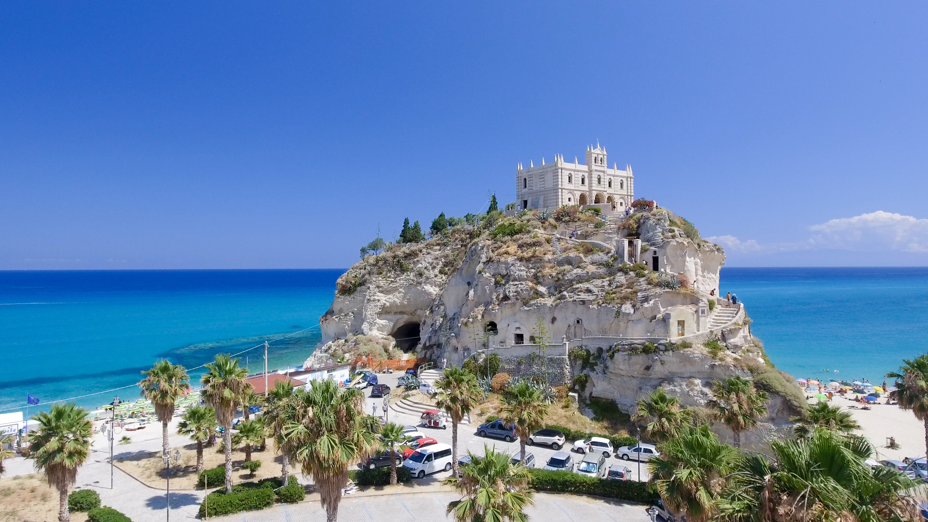
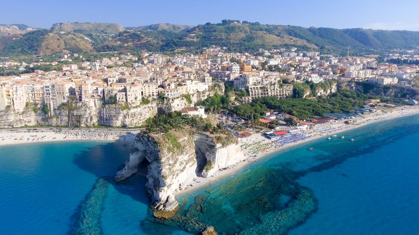
 Calabria
 Sport
Sport


 International cities
 Architecture
 Religion

 History
Calabria
History
Calabria
 Art
Art
 *European bronze art
Art
WB - Western art 15th century BC - 5th century AD
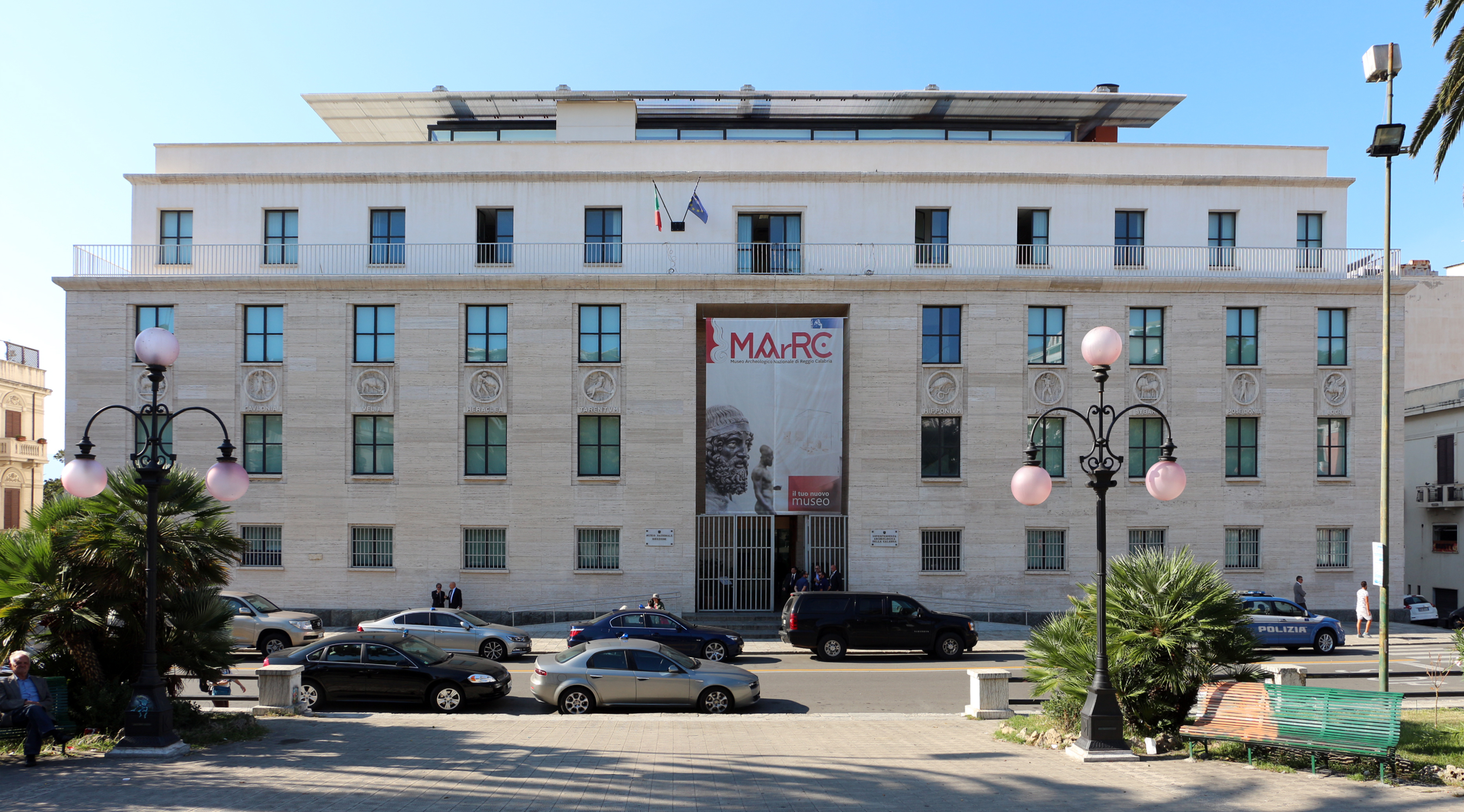
Museo Archeologico Nazionale Di Reggio Calabria
*European bronze art
Art
WB - Western art 15th century BC - 5th century AD
Museo Archeologico Nazionale Di Reggio Calabria

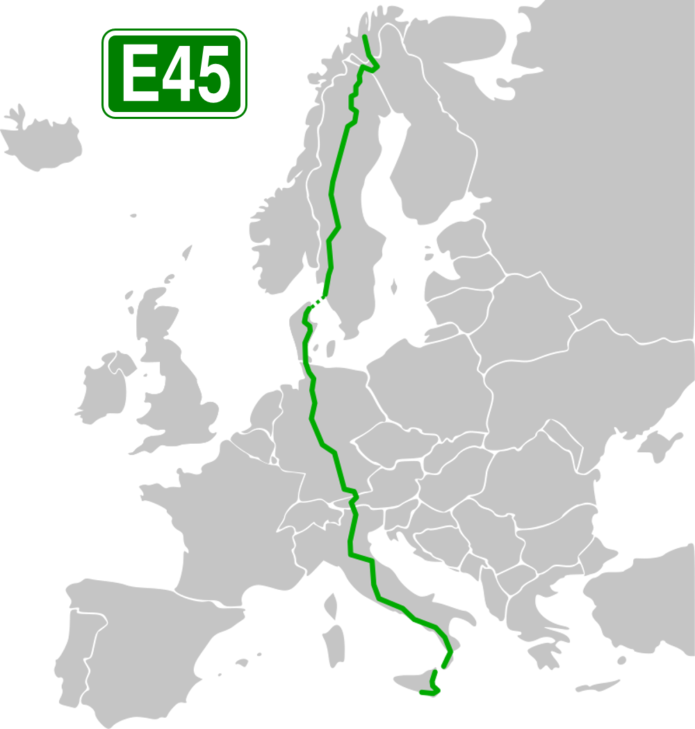
 Transport and traffic
 Bavaria
Calabria
Bavaria
Calabria
 Campania
Denmark
Germany
Campania
Denmark
Germany
 Emilia-Romagna
Finland
Emilia-Romagna
Finland
 Hamburg
 Hessen
Italy
Hessen
Italy
 Lazio
Lazio
 Lower Saxony
Austria
Lower Saxony
Austria
 Schleswig-Holstein
Sweden
Schleswig-Holstein
Sweden
 Sicilia
 Tyrol
Tyrol
 Toscana
 Trentino-Alto Adige
 Veneto

 Geography
 Abruzzo
 Basilicata
Calabria
Campania
Emilia-Romagna
Italy
Lazio
Basilicata
Calabria
Campania
Emilia-Romagna
Italy
Lazio
 Liguria
 Lombardia
 Marche
 Molise
 Piemonte
 Puglia
Sicilia
Toscana
Puglia
Sicilia
Toscana
 Umbria

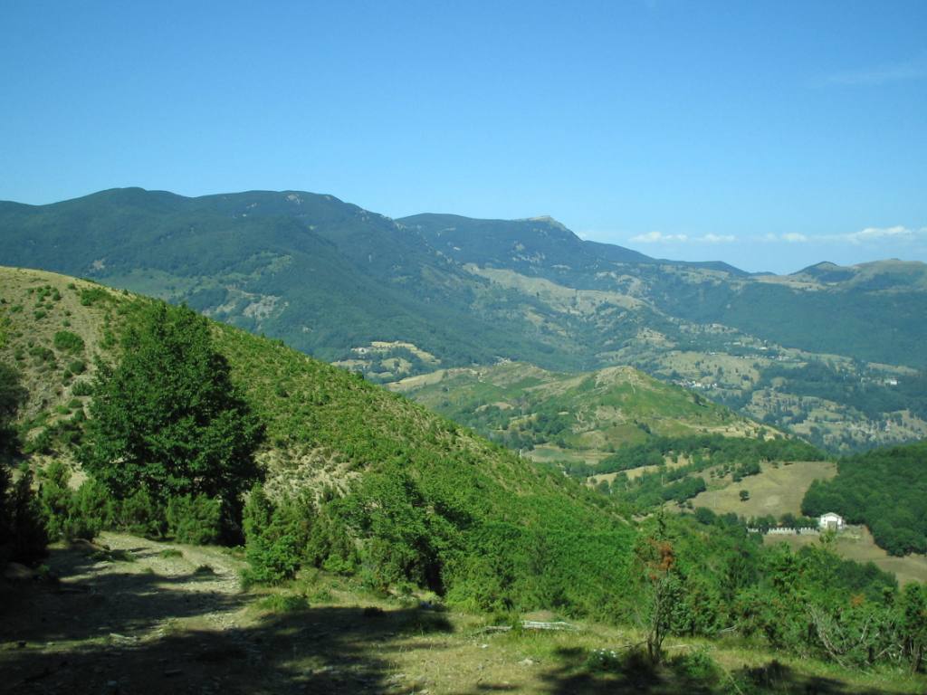
Der Apennin (auch im Plural die Apenninen; italienisch gli Appennini) ist ein rund 1500 km langer Gebirgszug in Italien (sowie zu sehr kleinen Teilen in San Marino), der einen großen Teil des Staatsgebiets durchzieht, überwiegend in Nordwest-Südost-Richtung. Über den Apennin verläuft die Hauptwasserscheide Italiens. Er ist Teil des Alpidischen Gebirgssystems. Der Großteil des Gebirges liegt auf der Apenninhalbinsel.
Der Apennin beginnt im Nordwesten Italiens und bildet im Ligurischen Apennin die Fortsetzung der Ligurischen Alpen. Die Grenze zwischen Alpen und Apennin bildet der Col di Cadibona (436 m). Von dort reicht der Apennin Richtung Osten über die Apuanischen Alpen bis zur Adriaküste, wo er sich nach Süden wendet und im Abruzzischen Apennin mit dem Massiv des Gran Sasso d’Italia (2912 m) seine größte Höhe erreicht.
Weiter südwärts teilt sich der Apennin in einzelne kleinere Gebirgsteile wie die Sila und den Aspromonte auf und findet seine Fortsetzung in den Gebirgen Nordsiziliens.
Im Apennin herrscht typisches Gebirgsklima mit niedrigen Temperaturen, jedoch starken Temperaturschwankungen und hohen Niederschlägen. Im Hügelland und den Vorgebirgen ist das Klima mediterran beeinflusst, mit Niederschlagsmengen von etwa 800 mm und einer deutlichen Sommertrockenheit. In den subalpinen Regionen steigt die Niederschlagsmenge auf über 1300 mm, wobei ein deutlicher West-Ost-Unterschied besteht.
亚平宁山脉(意大利语:Appennini[1]),位于亚平宁半岛东侧,是亚平宁半岛的主干山脉,北起阿尔卑斯山南麓,南至亚平宁半岛南端,全长超过1000公里。全境属意大利管辖。
Abruzzo
Basilicata
Calabria
Campania
Emilia-Romagna
 Friuli-Venezia Giulia
Italy
Lazio
Liguria
Lombardia
Marche
Molise
Piemonte
Puglia
Friuli-Venezia Giulia
Italy
Lazio
Liguria
Lombardia
Marche
Molise
Piemonte
Puglia
 Sardegna
Sicilia
Toscana
Trentino-Alto Adige
Veneto
Sardegna
Sicilia
Toscana
Trentino-Alto Adige
Veneto
