Deutsch-Chinesische Enzyklopädie, 德汉百科
 Cuba
Cuba
 International cities
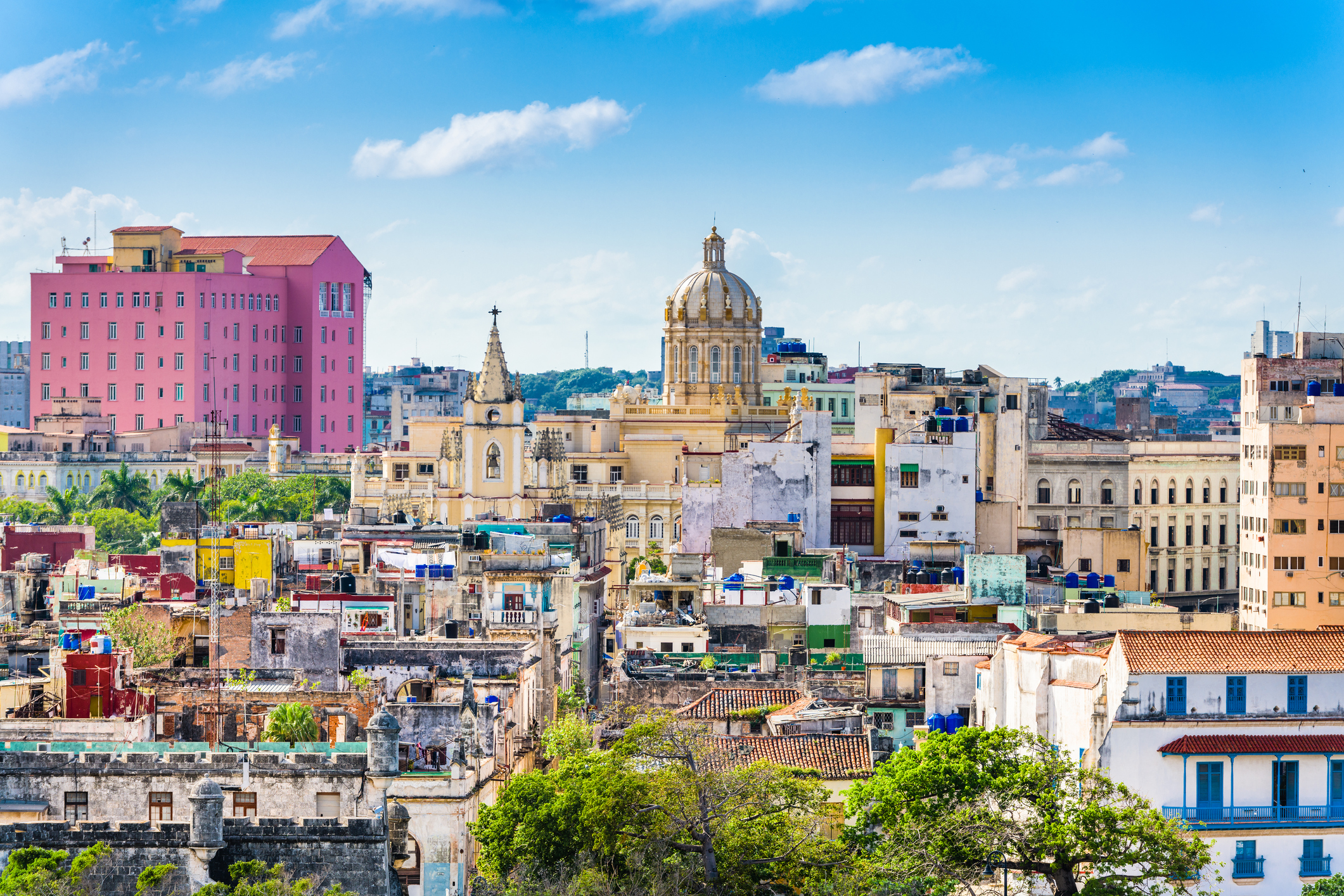
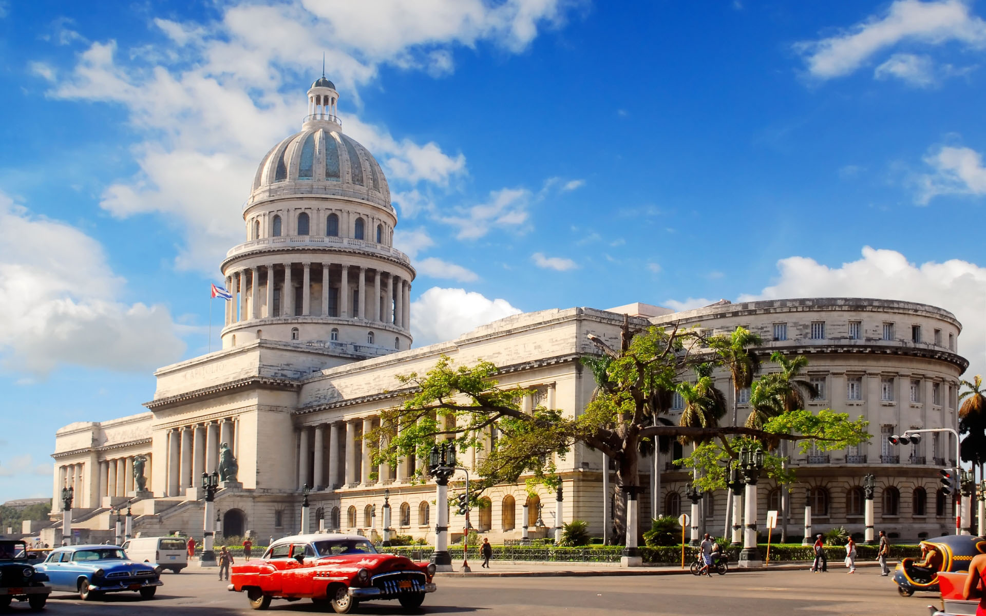
古巴首都、西印度洋最大的城市哈瓦那(Havana),位于古巴岛西北部哈瓦那湾的阿尔门达雷斯河畔,扼佛罗里达海峡西南口,与美国佛罗里达半岛隔海相望,气候温和,四季宜人,风光秀丽,素有“加勒比海明珠”之称。
哈瓦那是一座拥有400多年历史的城市,现有人口200多万,是古巴政治、经济、文化和交通中心。古巴岛于1492年由哥伦布发现,1510年开始殖民化进程。哈瓦那建于1519年,1550年成为古巴主要城市,1898年起成为首都。
哈瓦那市区分为新城旧城两部分。新城濒临加勒比海,街道宽阔整齐,高楼鳞次栉比,拥有豪华的宾馆、饭店、公寓、政府大厦等,花坛草坪点缀其间,充满现代化 气息,是拉丁美洲著名的现代化城市之一。旧城位于哈瓦那湾西侧的一个半岛上,占地面积不大,街道狭窄曲折,迄今保留着许多欧洲式古老建筑。旧城是当年西班 牙殖民统治时期征服新大陆的重要基地,四周工事环绕,具有很高建筑学价值的古老建筑物大多集中在城区的兵器广场、大教堂广场、圣弗朗西斯科广场以及老广场 附近。城区那些传统性民宅具有独特的历史文化氛围。哈瓦那老城区古建筑布局整齐和谐,外观古香古色,迄今保存完好,1982年被联合国教育、科学及文化组 织列入世界文化及自然遗产保护名录。(Quelle: http://trip.byecity.com/article-6052.html)
哈瓦那[3],当地华人旧称湾京 或 夏灣拿 ,(西班牙语:La Habana,旧称:San Cristóbal de La Habana)为古巴的首都,主要城市以及商业中心。城市人口有240万人。是古巴和加勒比海国家里最大的城市。城市分别向西和向南延伸,内有三个港口:Regla、Guanabacoa和Atarés。阿尔门达雷斯河从南到北贯穿整个城市,注入佛罗里达海峡。它位于古巴的西北部海岸,被哈瓦那省包围,距离佛罗里达州的基韦斯特南部仅90多海里(144 km)。地理位置是北纬23度8分、西经82度23分。
需要注意的是,哈瓦那市(Ciudad de La Habana)并不属于前哈瓦那省,而是单独成为古巴15个省份之一,名称就是哈瓦那市(Ciudad de La Habana),哈瓦那市下分为15个(县)区(municipio)。在古巴及大部分拉美国家,municipio是基层地方政府。此外,哈瓦那(La Habana)一词在当地人的口中一般特指该城于西班牙殖民时期所建的部分,即哈瓦那旧城(La Habana Vieja)以及后来建造的中哈瓦那(Centro Habana)。
西班牙腓力二世国王于1592年授予哈瓦那城市的封号,并于1634年由皇家颁布其"通往新世界的钥匙和西印度群岛的堡垒"封号以正式确认该市的重要地位。[4]这个封号铭刻在哈瓦那的盾章上。西班牙人开始修建防御工事,在1553年政府所在地从岛上最东面的圣地亚哥迁到了哈瓦那,从而使哈瓦那成为实际意义上的首都(de facto capital)。修建港口防御工事的重要性最早是由于当时英国、法国以及荷兰的海盗在16世纪袭击该城市。而在1898年,美国缅因号战舰在哈瓦那港口沉船事件是美西战争的导火索。
现在,哈瓦那是古巴国务委员会、古巴全国人大和古巴共产党中央委员会所在地,许多政体机构以及商业总部也都设在那里。
Havanna (spanisch La Habana), vollständige Bezeichnung Villa de San Cristóbal de la Habana, ist die Hauptstadt der Republik Kuba und zugleich eigenständige Provinz. Mit rund 2,10 Millionen Einwohnern und einer Fläche von 728,26 km² ist sie die zweitgrößte Metropole der Karibik nach Santo Domingo. Die Stadt grenzt im Norden an den Atlantischen Ozean bzw. die Straße von Florida und erstreckt sich südlich und westlich der Bucht von Havanna („Bahía de La Habana“). Der Fluss Río Almendares durchquert die Stadt von Süden nach Norden und mündet schließlich westlich der Bucht in die Floridastraße. Die östlich des Zentrums gelegene Bucht beheimatet die drei großen Häfen der Stadt: Marimelena, Guanabacoa und Atarés.
Havanna wurde im Jahr 1519 aufgrund der strategisch günstigen Lage von den Spaniern gegründet. Die Stadt diente als Angelpunkt, von dem aus die weitere Eroberung des Kontinents bis nach Nordamerika durch die Spanier erfolgte. Philipp II. von Spanien erteilte Havanna im Jahr 1592 das Stadtrecht, doch war Havanna bereits seit dem Jahr 1552 die Hauptstadt Kubas.[3] Der Untergang der USS Maine im Hafen von Havanna im Jahr 1898 war der unmittelbare Auslöser des Spanisch-amerikanischen Krieges.
Die Stadt ist das politische Zentrum des Landes und Sitz der Regierung, zahlreicher Ministerien und Unternehmen sowie über 90 Botschaften. Die aktuelle Bürgermeisterin Havannas ist Marta Hernández Romero (PCC). Die Stadt ist des Weiteren ein touristisches Zentrum Kubas, im Jahr 2010 besuchten 1,17 Millionen Touristen die Stadt, 46 % aller Besucher des Landes.[4] Seit dem Jahr 1982 ist die Altstadt, La Habana Vieja, UNESCO-Welterbe.
ハバナ(スペイン語: La Habana[1] [la aˈβana] ( 音声ファイル)、英語: Havana /həˈvænə/[2])は、キューバの首都。キューバ島北西沿岸のフロリダ海峡に接する地点に位置し、カリブ海地域における最大の都市である。人口は約200万人。位置は北緯23度8分、西経82度23分。キューバの公用語であるスペイン語での発音は「ラ・アバーナ」に近いが、日本語では英語音に近い「ハバナ」の名称が広く用いられている。
歴史的な名称はサン・クリストーバル・デ・ラ・アバーナ[注 1](スペイン語: San Cristóbal de La Habana)。「クリストーバル」はクリストフォロスのスペイン語読みであり、ハバナの守護聖人である。
Havana (/həˈvænə/; Spanish: La Habana [la aˈβana] ( listen)) is the capital city, largest city, province, major port, and leading commercial center of Cuba.[4] The city has a population of 2.1 million inhabitants,[5][4] and it spans a total of 781.58 km2 (301.77 sq mi) – making it the largest city by area, the most populous city, and the fourth largest metropolitan area in the Caribbean region.[5][6]
The city of Havana was founded by the Spanish in the 16th century and due to its strategic location it served as a springboard for the Spanish conquest of the Americas, becoming a stopping point for treasure-laden Spanish galleons returning to Spain. The King Philip II of Spain granted Havana the title of City in 1592.[7] Walls as well as forts were built to protect the old city.[8] The sinking of the U.S. battleship Maine in Havana's harbor in 1898 was the immediate cause of the Spanish–American War.[9]
The city is the center of the Cuban government, and home to various ministries, headquarters of businesses and over 90 diplomatic offices.[10] The current governor is Reinaldo García Zapata of the Communist Party of Cuba (PCC).[11][12] In 2009, the city/province had the third highest income in the country.[13]
Contemporary Havana can essentially be described as three cities in one: Old Havana, Vedado and the newer suburban districts. The city extends mostly westward and southward from the bay, which is entered through a narrow inlet and which divides into three main harbors: Mari melena, Guanabacoa and Antares. The sluggish Almendares River traverses the city from south to north, entering the Straits of Florida a few miles west of the bay.[14]
The city attracts over a million tourists annually;[15] the Official Census for Havana reports that in 2010 the city was visited by 1,176,627 international tourists,[15] a 20% increase from 2005. Old Havana was declared a UNESCO World Heritage Site in 1982.[16] The city is also noted for its history, culture, architecture and monuments.[17] As typical of Cuba, Havana experiences a tropical climate.
La Havane (en espagnol : La Habana [la aˈβana], Ciudad de La Habana officiellement) est la capitale et le centre économique de Cuba. Cette ville portuaire est aussi l'une des quinze provinces cubaines. La ville/province compte 2,4 millions d'habitants, tandis que l'agglomération en compte plus de 3,7 millions, ce qui fait de La Havane la plus grande ville des Caraïbes1. La ville s'étend sur plus de 720 kilomètres carrés principalement à l'ouest et au sud d'une baie, à laquelle on accède par un passage étroit, et qui est divisé en trois ports : Marimelena, Guanabacoa et Atarés. La rivière Almendares traverse la ville du sud au nord, et se jette dans le détroit de Floride à quelques kilomètres à l'ouest de la baie.
Le roi Philippe II d'Espagne accorde à La Havane le statut de ville en 1592, et un décret royal de 1634 reconnaît son importance en la désignant officiellement comme « Clé du Nouveau Monde et Rempart des Caraïbes2 ». Le blason de La Havane porte par ailleurs cette inscription. Les Espagnols commencent à édifier des fortifications, et en 1553 ils transfèrent la résidence du gouverneur depuis Santiago de Cuba, à l'extrémité est de l'île, jusqu'à La Havane, lui accordant de facto le rang de capitale. En 1607, La Havane est désignée capitale de l’île par un ordre royal qui divisa également le pays en deux gouvernements : un à La Havane et l’autre à Santiago, le second étant subordonné au premier3.
Aujourd'hui, La Havane est le centre du gouvernement cubain, et divers ministères y sont basés. C'est aussi le centre économique et culturel de l'île.
L'Avana (in spagnolo La Habana, ufficialmente San Cristóbal de La Habana) è la capitale di Cuba, di cui è anche il principale porto, il centro economico-culturale e il principale polo turistico. È la città più popolata del paese, con una popolazione di 2 106 146 abitanti secondo dati del 2012, e la più popolata dei Caraibi.[1] Come capitale di Cuba, la città è la sede ufficiale degli organi superiori dello Stato e del Governo cubano, di tutti gli organismi centrali e di quasi la totalità delle imprese e associazioni in ambito nazionale.
Fondata nel 1514 dal conquistador Diego Velázquez de Cuéllar, con il nome di Villa di San Cristóbal de La Habana, fu una delle prime sette cittadine fondate dagli spagnoli nell'isola.[2] Grazie alla sua posizione privilegiata rispetto alle coste del Mar dei Caraibi, e per le caratteristiche della sua baia, l'allora villa si convertì in un importante centro commerciale, e per questo fu attaccata da pirati e corsari con lo scopo di saccheggiarla, durante i primi anni del XVI secolo. Nel 1561, la Corona spagnola dispose che la villa fosse il luogo di attracco delle navi spagnole provenienti dalle colonie americane prima di attraversare l'oceano (Flotta spagnola del tesoro), e quindi furono costruite, per la sua protezione, difese militari all'entrata della baia dell'Avana e in altri luoghi strategici, convertendo la città in una delle più difese del Nuovo Mondo.[3][4]
Nel 1563 il governatore di Cuba trasferì all'Avana la sua residenza ufficiale, da Santiago di Cuba, sede fino ad allora del governo dell'isola, e ventinove anni dopo, il 20 di dicembre del 1592, Filippo II di Spagna conferì alla villa il titolo di "città". Nel 1665 le venne concesso il diritto di mostrare il suo proprio scudo, nel quale erano rappresentate le tre fortezze (La Real Fuerza, El Morro e La Punta) che difendevano la città.
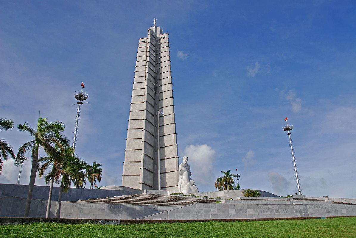
Il suo patrimonio storico, architettonico e culturale, espresso dalla fusione tra europei, africani e aborigeni all'inizio, accanto a altri componenti etnici e culturali più contemporanei, convertono la città in un importante sito turistico. Il suo centro storico, dichiarato Patrimonio dell'umanità dall'Unesco nel 1982, è uno dei meglio conservati dell'America Latina.[5] Tra i suoi monumenti più rappresentativi si trovano la Cattedrale dell'Avana, Plaza de Armas, il Castello del Morro, il Museo della Rivoluzione, il Museo nazionale delle belle arti, il Gran Teatro dell'Avana, il Capitolio, la Piazza della Rivoluzione e il Malecón, forse il simbolo più riconosciuto a livello internazionale della città.
La Habana es la capital de la República de Cuba, su urbe más grande, el principal puerto, su centro económico-cultural y su principal polo turístico. Es la ciudad más poblada del país, con una población de 2 106 146 habitantes según datos de 2012,4 y la tercera más poblada de la región del Caribe. Como capital de Cuba, la ciudad es la sede oficial de los órganos superiores del Estado y el Gobierno cubano, de todos los organismos centrales y de casi la totalidad de empresas y asociaciones de ámbito nacional. Además, reúne la mayor cantidad de sucursales y casas matrices de las entidades extranjeras radicadas en Cuba.
Fundada en 1514 (inicialmente en la costa sur de la isla) por el conquistador Pánfilo de Narváez (bajo las órdenes de Diego Velázquez de Cuéllar), bajo el nombre fundacional de Villa de San Cristóbal de La Habana,5 fue una de las primeras siete villas fundadas por la Corona española en la isla. Debido a su privilegiada ubicación, frente a las costas del Atlántico Norte, y las características de su bahía, la entonces villa se convirtió en un importante centro comercial, razón por la cual fue sometida a ataques y saqueos por parte de piratas y corsarios durante los primeros años del siglo XVI. En 1561, la Corona dispone que la villa sea el lugar de concentración de las naves españolas procedentes de las colonias americanas antes de cruzar juntas el océano (Flota de Indias),6 construyéndose por tanto, para su protección, defensas militares a la entrada de la bahía de La Habana y en sitios estratégicos,7 convirtiendo a la ciudad en una de las mejor defendidas del Nuevo Mundo.
El 20 de diciembre de 1592, Felipe II confiere a la villa el título de "ciudad", veintinueve años después de que el gobernador de Cuba trasladara a ella su residencia oficial desde Santiago de Cuba, sede hasta entonces del gobierno de la isla.
En 1634 por Decreto Real se le declaró "Llave del Nuevo Mundo y Salvaguarda de las Indias Orientales".
En 1665, se le concedió el derecho de ostentar su escudo de armas, en el que estuvieron representadas, mediante tres torreones, las fortalezas (La Real Fuerza, El Morro y La Punta) que defendían la ciudad.
El azúcar y el comercio influyeron notablemente en que durante los siglos XIX y XX la urbe experimentara no solo un profundo proceso de expansión de su territorio sino también de crecimiento demográfico, socio-económico y cultural, factores que convirtieron a La Habana en una de las ciudades más ricas y notorias de la zona de América Central y Caribe. Surgen durante esa etapa nuevos barrios como El Cerro o El Vedado, donde se concentraría la nueva burguesía habanera; mientras, las zonas antiguas de la ciudad se convertirían en áreas de casa de inquilinato y ciudadelas. No es hasta la década de 1950 que comienza a configurarse la actual forma de la capital, producto de la aparición del concepto especulativo de propiedad horizontal así como el establecimiento de centros y subcentros urbanos a lo largo de ese siglo. El triunfo de la Revolución cubana y la aplicación de proyectos de transformación nacional trajeron consigo el aumento de la emigración hacia las urbes, provocando el boom demográfico en La Habana, y con ello su expansión, esta vez hacia las zonas del este y el sur.
Su patrimonio histórico, arquitectónico y sobre todo cultural, expresado en la fusión entre europeos, africanos y aborígenes en un inicio, junto a otros componentes étnicos y culturales más contemporáneos, convierten a la ciudad en una importante receptora de turismo internacional y en el centro de la vida nacional. Su centro histórico, declarado Patrimonio de la Humanidad por la Unesco en 1982,8 es hoy uno de conjuntos arquitectónicos mejor conservados de América Latina. Entre sus monumentos más representativos se encuentran la Catedral de la Habana, la Plaza de Armas, el Castillo del Morro, el Museo de la Revolución, el Palacio Nacional de Bellas Artes, el Gran Teatro de La Habana, el Capitolio, la Plaza de la Revolución y el Malecón, quizás el símbolo más reconocido a nivel internacional de la ciudad.
Гава́на (исп. La Habana [aβana] — Авана, полностью San Cristóbal de La Habana) — столица и крупнейший город Республики Куба, политический, экономический и культурный центр страны, одна из 16 её провинций. Площадь большой Гаваны составляет 728,25 км², город поделён на 15 муниципалитетов[es].
 Afghanistan
Egypt
Albania
Angola
Antigua and Barbuda
Argentina
Armenia
Australia
Bahrain
Bangladesh
Barbados
Belgium
Belize
Benin
Bolivia
Botsuana
Brazil
Brunei Darussalam
Bulgaria
Burkina Faso
Burundi
Chile
China
Columbia
Costa Rica
Côte d´Ivoire
Cuba
Denmark
Demokratische Republik Kongo
Germany
Dominica
Dominikanische Republik
Djibouti
Ecuador
Estonia
Afghanistan
Egypt
Albania
Angola
Antigua and Barbuda
Argentina
Armenia
Australia
Bahrain
Bangladesh
Barbados
Belgium
Belize
Benin
Bolivia
Botsuana
Brazil
Brunei Darussalam
Bulgaria
Burkina Faso
Burundi
Chile
China
Columbia
Costa Rica
Côte d´Ivoire
Cuba
Denmark
Demokratische Republik Kongo
Germany
Dominica
Dominikanische Republik
Djibouti
Ecuador
Estonia
 European Union
Fidschi
European Union
Fidschi
 Financial
Finland
France
Gabun
Gambia
Georgia
Ghana
Grenada
Greece
Guatemala
Guinea
Guinea-Bissau
Guyana
Honduras
Hongkong Tebiexingzhengqu-HK
India
Indonesia
Ireland
Iceland
Israel
Italy
Jamaika
Japan
Yemen
Jordan
Cambodia
Cameroon
Canada
Kap Verde
Kasachstan
Katar
Kenya
Kyrgyzstan
Croatia
Kuwait
Laos
Lesotho
Latvia
Liberia
Liechtenstein
Lithuania
Luxembourg
Macau Tebiexingzhengqu-MO
Madagaskar
Malawi
Malta
Morocco
Mauritania
Mauritius
Mexico
Moldawien
Financial
Finland
France
Gabun
Gambia
Georgia
Ghana
Grenada
Greece
Guatemala
Guinea
Guinea-Bissau
Guyana
Honduras
Hongkong Tebiexingzhengqu-HK
India
Indonesia
Ireland
Iceland
Israel
Italy
Jamaika
Japan
Yemen
Jordan
Cambodia
Cameroon
Canada
Kap Verde
Kasachstan
Katar
Kenya
Kyrgyzstan
Croatia
Kuwait
Laos
Lesotho
Latvia
Liberia
Liechtenstein
Lithuania
Luxembourg
Macau Tebiexingzhengqu-MO
Madagaskar
Malawi
Malta
Morocco
Mauritania
Mauritius
Mexico
Moldawien
 Mongolei
Montenegro
Mosambik
Myanmar
Namibia
Nepal
New Zealand
Nicaragua
Netherlands
Niger
Nigeria
Nordmazedonien
Norwegen
Oman
Austria
Pakistan
Panama
Papua-Neuguinea
Paraguay
Peru
Philippines
Poland
Portugal
Republik El Salvador
Republik Haiti
Republik Kongo
Republic of Korea
Ruanda
Romania
Russia
Salomonen
Sambia
Samoa
Saudi Arabia
Sweden
Sweden
Switzerland
Mongolei
Montenegro
Mosambik
Myanmar
Namibia
Nepal
New Zealand
Nicaragua
Netherlands
Niger
Nigeria
Nordmazedonien
Norwegen
Oman
Austria
Pakistan
Panama
Papua-Neuguinea
Paraguay
Peru
Philippines
Poland
Portugal
Republik El Salvador
Republik Haiti
Republik Kongo
Republic of Korea
Ruanda
Romania
Russia
Salomonen
Sambia
Samoa
Saudi Arabia
Sweden
Sweden
Switzerland
 Genf
Senegal
Seychellen
Sierra Leone
Simbabwe
Singapore
Slovakia
Slovenia
Spain
Sri Lanka
Saint Kitts and Nevis
St. Lucia
St. Vincent and the Grenadines
South Africa
Suriname
Swasiland
Tajikistan
Taiwan Sheng-TW
Tansania
Thailand
Togo
Tonga
Trinidad und Tobago
Tschad
Czech Republic
Tunisia
Turkey
Uganda
Ukraine
Hungary
Uruguay
Vanuatu
Venezuela
United Arab Emirates
United States
United Kingdom
Vietnam
Genf
Senegal
Seychellen
Sierra Leone
Simbabwe
Singapore
Slovakia
Slovenia
Spain
Sri Lanka
Saint Kitts and Nevis
St. Lucia
St. Vincent and the Grenadines
South Africa
Suriname
Swasiland
Tajikistan
Taiwan Sheng-TW
Tansania
Thailand
Togo
Tonga
Trinidad und Tobago
Tschad
Czech Republic
Tunisia
Turkey
Uganda
Ukraine
Hungary
Uruguay
Vanuatu
Venezuela
United Arab Emirates
United States
United Kingdom
Vietnam
 Important International Organizations
World Trade Organization
Roberto Azevêdo
World Trade Organization
Mike Moore
World Trade Organization
Ngozi Okonjo-Iweala
World Trade Organization
Pascal Lamy
World Trade Organization
Peter Sutherland
World Trade Organization
Renato Ruggiero
World Trade Organization
Supachai Panitchpakdi
Central African Republic
Cyprus
Important International Organizations
World Trade Organization
Roberto Azevêdo
World Trade Organization
Mike Moore
World Trade Organization
Ngozi Okonjo-Iweala
World Trade Organization
Pascal Lamy
World Trade Organization
Peter Sutherland
World Trade Organization
Renato Ruggiero
World Trade Organization
Supachai Panitchpakdi
Central African Republic
Cyprus

世界贸易组织(简称世贸组织或世贸;英语:World Trade Organization,缩写为 WTO;法语:Organisation Mondiale du Commerce,缩写为 OMC;西班牙语:Organización Mundial del Comercio,缩写为 OMC)是负责监督成员经济体之间各种贸易协议得到执行的一个国际组织,前身是1948年起实施的关税及贸易总协定的秘书处。
世贸总部位于瑞士日内瓦,现任总干事是罗伯托·阿泽维多。截至2016年7月29日,世界贸易组织共有164个成员。[5]世界贸易组织的职能是调解纷争,加入WTO不算签订一种多边贸易协议,但其设置的入会门槛可以做为愿意降低关税、法政上配合、参与国际贸易的门票,它是贸易体制的组织基础和法律基础,是众多贸易协定的管理者,是各成员贸易立法的监督者,是就贸易提供解决争端和进行谈判的场所。该机构是当代最重要的国际经济组织之一,其成员间的贸易额占世界贸易额的绝大多数,被称为“经济联合国”。
Die Welthandelsorganisation (englisch World Trade Organization, WTO; französisch Organisation mondiale du commerce, OMC; spanisch Organización Mundial de Comercio, OMC) ist eine internationale Organisation mit Sitz in Genf, die sich mit der Regelung von Handels- und Wirtschaftsbeziehungen beschäftigt. Sie wurde am 15. April 1994 aus dem General Agreement on Tariffs and Trade (GATT) in der Uruguay-Runde nach siebenjähriger Verhandlungszeit gegründet. Am 1. Januar 1995 nahm sie ihre Arbeit in Genf auf. Die WTO ist neben dem IWF und der Weltbank eine der zentralen internationalen Organisationen, die Handels- und Wirtschaftspolitik mit globaler Reichweite verhandelt.
世界貿易機関(せかいぼうえききかん、英: World Trade Organization、略称:WTO)は、自由貿易促進を主たる目的として創設された国際機関である。常設事務局がスイスのジュネーブに置かれている。
GATT(ガット)ウルグアイ・ラウンドにおける合意によって、世界貿易機関を設立するマラケシュ協定(WTO設立協定)に基づいて1995年1月1日にGATTを発展解消させて成立した。
本来GATTは、第二次世界大戦後の安定を見据え、国際通貨基金および国際復興開発銀行とともに設立が予定されていた国際貿易機関(ITO)の設立準備の際に、暫定協定として結ばれたものであった。国際貿易機関の設立が廃案となり、GATTがその代替として発展強化されていくうちに、再びこの分野の常設機関が求められ、WTOが設立されることとなった。発展解消であるため、GATTの事務局及び事務局長もWTOへと引き継がれることとなった[4]。
WTOはGATTを継承したものであるが、GATTが協定(Agreement)に留まったのに対し、WTOは機関(Organization)であるのが根本的な違いである。
を基本原則としている。また、物品貿易だけでなく金融、情報通信、知的財産権やサービス貿易も含めた包括的な国際通商ルールを協議する場である。
対抗処置の発動では、紛争処理機関(パネル)の提訴に対し全加盟国による反対がなければ採択されるというネガティブ・コンセンサス方式(逆コンセンサス方式)を採用した強力な紛争処理能力を持つ。これは国際組織としては稀な例であり、コンセンサス方式を採っていたGATTとの大きな違いで、WTOの特徴の一つといえる。
新多角的貿易交渉(新ラウンド)は、2001年11月にカタールのドーハで行われた第4回WTO閣僚会議で開始を決定し、ドーハ・ラウンドと呼ばれていた。2002年2月1日の貿易交渉委員会で新ラウンドがスタートした。しかし9年に及ぶ交渉は先進国と、急速に台頭してきたBRICsなど新興国との対立によって中断と再開を繰り返した末、ジュネーブで行われた第4回WTO閣僚会議(2011年12月17日)で「交渉を継続していくことを確認するものの、近い将来の妥結を断念する」(議長総括)となり事実上停止状態になった。
その後、2013年のバリ島における閣僚会議で、貿易円滑化協定を含む合意が成立し、2014年7月まで貿易円滑化協定をWTO協定に加える(附属書1Aに追加)するための文書を一般理事会で採択すべきとされた[5]。しかしインドが合意を蒸し返す状態で反対したため期限までに採択できなかった[6]。その後食糧備蓄への補助金の問題で先進国側が譲歩することでようやくインドが合意し、2014年11月27日の一般理事会で貿易円滑化協定が採択された[6]。WTO加盟国の3分の2が改正を受諾した日に発効することになっており、2017年2月22日にこの要件を満たし、協定が発効した。
The World Trade Organization (WTO) is an intergovernmental organization that regulates international trade. The WTO officially commenced on 1 January 1995 under the Marrakesh Agreement, signed by 124 nations on 15 April 1994, replacing the General Agreement on Tariffs and Trade (GATT), which commenced in 1948. It is the largest international economic organization in the world.[5][6]
The WTO deals with regulation of trade in goods, services and intellectual property between participating countries by providing a framework for negotiating trade agreements and a dispute resolution process aimed at enforcing participants' adherence to WTO agreements, which are signed by representatives of member governments[7]:fol.9–10 and ratified by their parliaments.[8] The WTO prohibits discrimination between trading partners, but provides exceptions for environmental protection, national security, and other important goals.[9] Trade-related disputes are resolved by independent judges at the WTO through a dispute resolution process.[9]
The WTO's current Director-General is Roberto Azevêdo,[10][11] who leads a staff of over 600 people in Geneva, Switzerland.[12] A trade facilitation agreement, part of the Bali Package of decisions, was agreed by all members on 7 December 2013, the first comprehensive agreement in the organization's history.[13][14] On 23 January 2017, the amendment to the WTO Trade Related Aspects of Intellectual Property Rights (TRIPS) Agreement marks the first time since the organization opened in 1995 that WTO accords have been amended, and this change should secure for developing countries a legal pathway to access affordable remedies under WTO rules.[15]
Studies show that the WTO boosted trade,[16][17][9] and that barriers to trade would be higher in the absence of the WTO.[18] The WTO has highly influenced the text of trade agreements, as "nearly all recent [preferential trade agreements (PTAs)] reference the WTO explicitly, often dozens of times across multiple chapters... in many of these same PTAs we find that substantial portions of treaty language—sometime the majority of a chapter—is copied verbatim from a WTO agreement."[19]
L'Organisation mondiale du commerce (OMC ; en anglais : World Trade Organization, WTO, en espagnol : Organización Mundial del Comercio, OMC) est une organisation internationale qui s'occupe des règles régissant le commerce international entre les pays. Au cœur de l'organisation se trouvent les accords de l'OMC, négociés et signés en avril 1994 à Marrakech1 par la majeure partie des puissances commerciales du monde2 et ratifiés par leurs assemblées parlementaires. L'OMC a pour but principal de favoriser l'ouverture commerciale. Pour cela, elle tâche de réduire les obstacles au libre-échange, d'aider les gouvernements à régler leurs différends commerciaux et d'assister les exportateurs, les importateurs et les producteurs de marchandises et de services dans leurs activités.
Depuis 2001, le cycle de négociation mené par l'OMC est le Cycle de Doha3. Bien que l'OMC ne soit pas une agence spécialisée de l'ONU, elle entretient des liens avec cette dernière4. Le siège de l'OMC est au Centre William-Rappard, à Genève. Depuis le 1er septembre 2013, l'organisation est présidée par le Brésilien Roberto Azevêdo qui a été élu directeur général.
L'Organizzazione mondiale del commercio, abbreviato in OMC (in inglese: World Trade Organization, WTO), è un'organizzazione internazionale creata allo scopo di supervisionare numerosi accordi commerciali tra gli stati membri. Vi aderiscono[3] 164 Paesi, a cui se ne aggiungono altri 22 con ruolo di osservatori,[4] comprendendo così oltre il 95% del commercio mondiale di beni e servizi.[5]
La sede dell'OMC si trova, dal 1995, presso il Centro William Rappard a Ginevra, Svizzera.[6]
La Organización Mundial del Comercio (OMC) fue establecida en 1995. Tiene su sede en Ginebra, Suiza, y sus idiomas oficiales son el inglés, el francés y el español. La OMC no forma parte del sistema de las Naciones Unidas, y tampoco de los organismos de Bretton Woods como el Banco Mundial o el FMI.Nota 1
Всеми́рная торго́вая организа́ция (ВТО; англ. World Trade Organization (WTO), фр. Organisation mondiale du commerce (OMC), исп. Organización Mundial del Comercio) — международная организация, созданная 1 января 1995 года с целью либерализации международной торговли и регулирования торгово-политических отношений государств-членов. ВТО образована на основе Генерального соглашения по тарифам и торговле (ГАТТ), заключенного в 1947 году и на протяжении почти 50 лет фактически выполнявшего функции международной организации, но не являвшегося тем не менее международной организацией в юридическом смысле.
ВТО отвечает за разработку и внедрение новых торговых соглашений, а также следит за соблюдением членами организации всех соглашений, подписанных большинством стран мира и ратифицированных их парламентами. ВТО строит свою деятельность, исходя из решений, принятых в 1986—1994 годах в рамках Уругвайского раунда и более ранних договоренностей ГАТТ. Обсуждения проблем и принятие решений по глобальным проблемам либерализации и перспективам дальнейшего развития мировой торговли проходят в рамках многосторонних торговых переговоров (раунды). К настоящему времени проведено 8 раундов таких переговоров, включая Уругвайский, а в 2001 году стартовал девятый в Дохе, Катар. Организация пытается завершить переговоры по Дохийскому раунду переговоров, который был начат с явным акцентом на удовлетворение потребностей развивающихся стран. По состоянию на декабрь 2012 года будущее раунда переговоров в Дохе остаётся неопределённым: программа работы состоит из 21 части, а первоначально установленный окончательный срок 1 января 2005 года был давно пропущен[3]. В ходе переговоров возник конфликт между стремлением к свободной торговле и стремлением множества стран к протекционизму, особенно в плане сельскохозяйственных субсидий. До сих пор эти препятствия остаются главными и мешают любому прогрессу для запуска новых переговоров в рамках Дохийского раунда. По состоянию на июль 2012 года, существуют различные группы переговоров в системе ВТО для решения текущих вопросов в плане сельского хозяйства, что приводит к застою в самих переговорах[4].
Штаб-квартира ВТО расположена в Женеве, Швейцария. Глава ВТО (генеральный директор) — Роберту Карвалью ди Азеведу, в штате самой организации около 600 человек[5].
На 26 апреля 2015 года в ВТО состояли 162 страны[6].
Правила ВТО предусматривают ряд льгот для развивающихся стран. В настоящее время развивающиеся страны — члены ВТО имеют (в среднем) более высокий относительный уровень таможенно-тарифной защиты своих рынков по сравнению с развитыми. Тем не менее, в абсолютном выражении общий размер таможенно-тарифных санкций в развитых странах гораздо выше, вследствие чего доступ на рынки высокопередельной продукции из развивающихся стран серьёзно ограничен[7].
Правила ВТО регулируют только торгово-экономические вопросы. Попытки США и ряда европейских стран начать дискуссию об условиях труда (что позволило бы считать недостаточную законодательную защиту работников конкурентным преимуществом) были отвергнуты из-за протестов развивающихся стран, которые утверждали, что такие меры только ухудшат благосостояние работников в связи с сокращением числа рабочих мест, снижением доходов и уровня конкурентоспособности[7].
Mitglieder der WTO
| Staat | Beitrittsdatum |
|---|---|
 Ägypten Ägypten |
30. Juni 1995 |
 Afghanistan Afghanistan |
29. Juli 2016 |
 Albanien Albanien |
8. September 2000 |
 Angola Angola |
23. November 1996 |
 Antigua und Barbuda Antigua und Barbuda |
1. Januar 1995 |
 Argentinien Argentinien |
1. Januar 1995 |
 Armenien Armenien |
5. Februar 2003 |
 Australien Australien |
1. Januar 1995 |
 Bahrain Bahrain |
1. Januar 1995 |
 Bangladesch Bangladesch |
1. Januar 1995 |
 Barbados Barbados |
1. Januar 1995 |
 Belgien Belgien |
1. Januar 1995 |
 Belize Belize |
1. Januar 1995 |
 Benin Benin |
22. Februar 1996 |
 Bolivien Bolivien |
12. September 1995 |
 Botswana Botswana |
31. Mai 1995 |
 Brasilien Brasilien |
1. Januar 1995 |
 Brunei Brunei |
1. Januar 1995 |
 Bulgarien Bulgarien |
1. Dezember 1996 |
 Burkina Faso Burkina Faso |
3. Juni 1995 |
 Burundi Burundi |
23. Juli 1995 |
 Chile Chile |
1. Januar 1995 |
 Volksrepublik China Volksrepublik China |
11. Dezember 2001 |
 Costa Rica Costa Rica |
1. Januar 1995 |
 Dänemark Dänemark |
1. Januar 1995 |
 Deutschland Deutschland |
1. Januar 1995 |
 Dominica Dominica |
1. Januar 1995 |
 Dominikanische Republik Dominikanische Republik |
9. März 1995 |
 Dschibuti Dschibuti |
31. Mai 1995 |
 Ecuador Ecuador |
21. Januar 1996 |
 El Salvador El Salvador |
7. Mai 1995 |
 Elfenbeinküste Elfenbeinküste |
1. Januar 1995 |
 Estland Estland |
13. November 1999 |
 Eswatini Eswatini |
1. Januar 1995 |
 Europäische Union Europäische Union |
1. Januar 1995 |
 Fidschi Fidschi |
14. Januar 1996 |
 Finnland Finnland |
1. Januar 1995 |
 Frankreich Frankreich |
1. Januar 1995 |
 Gabun Gabun |
1. Januar 1995 |
 Gambia Gambia |
23. Oktober 1996 |
 Georgien Georgien |
14. Juni 2000 |
 Ghana Ghana |
1. Januar 1995 |
 Grenada Grenada |
22. Februar 1996 |
 Griechenland Griechenland |
1. Januar 1995 |
 Guatemala Guatemala |
21. Juli 1995 |
 Guinea Guinea |
25. Oktober 1995 |
 Guinea-Bissau Guinea-Bissau |
31. Mai 1995 |
 Guyana Guyana |
1. Januar 1995 |
 Haiti Haiti |
30. Januar 1996 |
 Honduras Honduras |
1. Januar 1995 |
 Hongkong Hongkong |
1. Januar 1995 |
 Indien Indien |
1. Januar 1995 |
 Indonesien Indonesien |
1. Januar 1995 |
 Irland Irland |
1. Januar 1995 |
 Island Island |
1. Januar 1995 |
 Israel Israel |
21. April 1995 |
 Italien Italien |
1. Januar 1995 |
 Jamaika Jamaika |
9. März 1995 |
 Jemen Jemen |
26. Juni 2014 |
 Japan Japan |
1. Januar 1995 |
 Jordanien Jordanien |
11. April 2000 |
 Kambodscha Kambodscha |
13. Oktober 2004 |
 Kamerun Kamerun |
13. Dezember 1995 |
 Kanada Kanada |
1. Januar 1995 |
 Kap Verde Kap Verde |
23. Juli 2008 |
 Kasachstan Kasachstan |
30. November 2015 |
 Katar Katar |
13. Januar 1996 |
 Kenia Kenia |
1. Januar 1995 |
 Kirgisistan Kirgisistan |
20. Dezember 1998 |
 Kolumbien Kolumbien |
30. April 1995 |
 Demokratische Republik Kongo Demokratische Republik Kongo |
1. Januar 1997 |
 Republik Kongo Republik Kongo |
27. März 1997 |
 Kroatien Kroatien |
30. November 2000 |
 Kuba Kuba |
20. April 1995 |
 Kuwait Kuwait |
1. Januar 1995 |
 Laos Laos |
2. Februar 2013 |
 Lesotho Lesotho |
31. Mai 1995 |
 Lettland Lettland |
10. Februar 1999 |
 Liberia Liberia |
14. Juli 2016 |
 Liechtenstein Liechtenstein |
1. September 1995 |
 Litauen Litauen |
31. Mai 2001 |
 Luxemburg Luxemburg |
1. Januar 1995 |
 Macau Macau |
1. Januar 1995 |
 Madagaskar Madagaskar |
17. November 1995 |
 Montenegro Montenegro |
29. April 2012 |
 Malawi Malawi |
31. Mai 1995 |
 Malaysia Malaysia |
1. Januar 1995 |
 Malediven Malediven |
31. Mai 1995 |
 Mali Mali |
31. Mai 1995 |
 Malta Malta |
1. Januar 1995 |
 Marokko Marokko |
1. Januar 1995 |
 Mauretanien Mauretanien |
31. Mai 1995 |
 Mauritius Mauritius |
1. Januar 1995 |
 Nordmazedonien Nordmazedonien |
4. April 2003 |
 Mexiko Mexiko |
1. Januar 1995 |
 Moldau Moldau |
26. Juli 2001 |
 Mongolei Mongolei |
29. Januar 1997 |
 Mosambik Mosambik |
26. August 1995 |
 Myanmar Myanmar |
1. Januar 1995 |
 Namibia Namibia |
1. Januar 1995 |
 Nepal Nepal |
23. April 2004 |
 Neuseeland Neuseeland |
1. Januar 1995 |
 Nicaragua Nicaragua |
3. September 1995 |
 Niederlande Niederlande |
1. Januar 1995 |
 Niger Niger |
13. Dezember 1996 |
 Nigeria Nigeria |
1. Januar 1995 |
 Norwegen Norwegen |
1. Januar 1995 |
 Oman Oman |
9. November 2000 |
 Österreich Österreich |
1. Januar 1995 |
 Pakistan Pakistan |
1. Januar 1995 |
 Panama Panama |
6. September 1997 |
 Papua-Neuguinea Papua-Neuguinea |
9. Juni 1996 |
 Paraguay Paraguay |
1. Januar 1995 |
 Peru Peru |
1. Januar 1995 |
 Philippinen Philippinen |
1. Januar 1995 |
 Polen Polen |
1. Juli 1995 |
 Portugal Portugal |
1. Januar 1995 |
 Ruanda Ruanda |
22. Mai 1996 |
 Rumänien Rumänien |
1. Januar 1995 |
 Russland Russland |
22. August 2012 |
 Salomonen Salomonen |
26. Juli 1996 |
 Sambia Sambia |
1. Januar 1995 |
 Saudi-Arabien Saudi-Arabien |
11. Dezember 2005 |
 Samoa Samoa |
10. Mai 2012 |
 Schweden Schweden |
1. Januar 1995 |
 Schweiz Schweiz |
1. Januar 1995 |
 Senegal Senegal |
1. Januar 1995 |
 Seychellen Seychellen |
26. April 2015 |
 Sierra Leone Sierra Leone |
23. Juli 1995 |
 Simbabwe Simbabwe |
5. März 1995 |
 Singapur Singapur |
1. Januar 1995 |
 Slowakei Slowakei |
1. Januar 1995 |
 Slowenien Slowenien |
30. Juli 1995 |
 Spanien Spanien |
1. Januar 1995 |
 Sri Lanka Sri Lanka |
1. Januar 1995 |
 St. Kitts und Nevis St. Kitts und Nevis |
21. Februar 1996 |
 St. Lucia St. Lucia |
1. Januar 1995 |
 St. Vincent und die Grenadinen St. Vincent und die Grenadinen |
1. Januar 1995 |
 Südafrika Südafrika |
1. Januar 1995 |
 Südkorea Südkorea |
1. Januar 1995 |
 Suriname Suriname |
1. Januar 1995 |
 Tadschikistan Tadschikistan |
2. März 2013 |
 Taiwan[1] Taiwan[1] |
1. Januar 2002 |
 Tansania Tansania |
1. Januar 1995 |
 Thailand Thailand |
1. Januar 1995 |
 Togo Togo |
31. Mai 1995 |
 Tonga Tonga |
27. Juli 2007 |
 Trinidad und Tobago Trinidad und Tobago |
1. März 1995 |
 Tschad Tschad |
19. Oktober 1996 |
 Tschechien Tschechien |
1. Januar 1995 |
 Tunesien Tunesien |
29. März 1995 |
 Türkei Türkei |
26. März 1995[2] |
 Uganda Uganda |
1. Januar 1995 |
 Ukraine Ukraine |
16. Mai 2008 |
 Ungarn Ungarn |
1. Januar 1995 |
 Uruguay Uruguay |
1. Januar 1995 |
 Venezuela Venezuela |
1. Januar 1995 |
 Vereinigte Arabische Emirate Vereinigte Arabische Emirate |
10. April 1996 |
 Vereinigtes Königreich Vereinigtes Königreich |
1. Januar 1995 |
 Vereinigte Staaten Vereinigte Staaten |
1. Januar 1995 |
 Vanuatu Vanuatu |
24. August 2012 |
 Vietnam Vietnam |
11. Januar 2007 |
 Zentralafrikanische Republik Zentralafrikanische Republik |
31. Mai 1995 |
 Zypern Zypern |
30. Juli 1995 |
 Geography

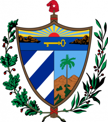
古巴共和国(西班牙语:República de Cuba),通称古巴(Cuba),是美洲加勒比海北部的一个群岛国家,位于北纬19°与24°,西经74°与85°之间。处在墨西哥湾入口处,西与墨西哥尤卡坦半岛隔尤卡坦海峡,南有牙买加和开曼群岛,东与海地共和国和多米尼加共和国隔向风海峡,东北方有巴哈马群岛,与美国隔佛罗里达海峡相对,与佛罗里达州最南端的基韦斯特的陆地最短距离约为145公里。作为加勒比地区面积最大和人口第二多的岛屿,古巴扼守巴拿马运河与美国东岸之间的海路要道。被形容为墨西哥湾的钥匙。领土包括古巴主岛及其附属群岛和青年岛。哈瓦那是古巴的首都和最大城市,圣地亚哥是第二大城市[10][11]。
一般认为,“古巴”一名源自泰诺语“coabana”,意为“肥沃之地”或“好地方”[12]。古巴是加勒比海地区少数以白人为主、混血为辅的国家,同时有少量的华裔,族群组成与美国类似,许多民众有亲戚居住在美国。然而古巴是美洲唯一的社会主义国家,面临着美国长期的经济封锁,但凭借78.3岁的预期寿命、99.9%的识字率和接近1.8公顷的人均生态足迹,其人类发展指数多年来一直维持在高水平;在2014年,古巴更是首次迈入极高人类发展指数行列。古巴于2006年成为全球唯一符合世界自然基金会可持续发展定义的国家。[13]目前古巴以市场为导向的经济改革已经展开,例如加入世界贸易组织等。[14]联合国粮农组织驻古巴的代表特奥多尔·弗里德里奇指出,古巴是目前拉美唯一完全消除了饥饿的国家[15]。不过,古巴的审查制度、言论自由、人权等方面与其他一党制国家一样,存在由国家主导控制和镇压言论自由的倾向,而且有部分异见人士因为政治因素流亡国外。[16]
2011年,劳尔·卡斯特罗接替兄长菲德尔·卡斯特罗出任古巴共产党中央委员会第一书记,开始进行一系列改革,至2014年与美国关系正常化,出现古巴解冻。2018年,米格尔·迪亚斯-卡内尔成为新一任古巴国务委员会主席,全国人民政权代表大会通过修宪,包括为领导人设立任期制及承认私有财产制,新宪法在2019年公投中通过。根据新宪法,古巴将设立国家主席和总理职务,取代之前的国务委员会主席和部长会议主席职务。2019年10月10日,古巴全国人民政权代表大会宣布,现任古巴国务委员会主席兼部长会议主席卡内尔当选古巴共和国主席。
Kuba (spanisch Cuba [ˈkuβa], amtliche Bezeichnung República de Cuba) ist ein realsozialistischer Inselstaat in der Karibik. Er grenzt im Nordwesten an den Golf von Mexiko, im Nordosten an den Atlantischen Ozean und im Süden an das Karibische Meer. Hauptstadt des Landes ist Havanna, die zweitgrößte Metropole der Karibik.
キューバ共和国(キューバきょうわこく、西: República de Cuba)、通称キューバは、カリブ海の大アンティル諸島(西インド諸島の一部)に位置し、キューバ本島とその周辺の島嶼からなる社会主義共和制国家。首都はハバナ。
ラテンアメリカにある島国。ウィンドワード海峡を隔てて東にはイスパニョーラ島のハイチとドミニカ共和国が、南には英領ケイマン諸島とジャマイカが存在する。西はユカタン海峡を挟んでメキシコのユカタン半島と、北はフロリダ海峡を隔てて北に145キロ先のアメリカ合衆国フロリダ州(フロリダ半島)と向かい合う。北東にはバハマや英領タークス・カイコス諸島が存在する。
フィリピンのルソン島ほどの面積を持つ島国で、地理的には北アメリカに含まれ、広義の中央アメリカにも含まれる。南北アメリカ大陸間、およびラテンアメリカとヨーロッパを結ぶ要路に位置している。アメリカ合衆国とは「アメリカ合衆国の裏庭」とも呼ばれるほど関わりが深かったが、キューバ革命により、南北アメリカ大陸で初めて反米・親ソ連の社会主義政権が1959年に成立。その後は「カリブに浮かぶ赤い島」と形容されることもある。
Cuba (/ˈkjuːbə/ (listen); Spanish pronunciation: [ˈkuβa]), officially the Republic of Cuba (Spanish: República de Cuba (help·info)), is a country comprising the island of Cuba as well as Isla de la Juventud and several minor archipelagos. Cuba is located in the northern Caribbean where the Caribbean Sea, Gulf of Mexico and Atlantic Ocean meet. It is east of the Yucatán Peninsula (Mexico), south of both the U.S. state of Florida and the Bahamas, west of Haiti and north of both Jamaica and the Cayman Islands. Havana is the largest city and capital; other major cities include Santiago de Cuba and Camagüey. The area of the Republic of Cuba is 110,860 square kilometers (42,800 sq mi) (109,884 square kilometers (42,426 sq mi) without the territorial waters). The island of Cuba is the largest island in Cuba and in the Caribbean, with an area of 105,006 square kilometers (40,543 sq mi), and the second-most populous after Hispaniola, with over 11 million inhabitants.[13]
The territory that is now Cuba was inhabited by the Ciboney Taíno people from the 4th millennium BC until Spanish colonization in the 15th century.[14] From the 15th century, it was a colony of Spain until the Spanish–American War of 1898, when Cuba was occupied by the United States and gained nominal independence as a de facto United States protectorate in 1902. As a fragile republic, in 1940 Cuba attempted to strengthen its democratic system, but mounting political radicalization and social strife culminated in a coup and subsequent dictatorship under Fulgencio Batista in 1952.[15] Open corruption and oppression under Batista's rule led to his ousting in January 1959 by the 26th of July Movement, which afterwards established communist rule under the leadership of Fidel Castro.[16][17][18] Since 1965, the state has been governed by the Communist Party of Cuba. The country was a point of contention during the Cold War between the Soviet Union and the United States, and a nuclear war nearly broke out during the Cuban Missile Crisis of 1962. Cuba is one of a few extant Marxist–Leninist socialist states, where the role of the vanguard Communist Party is enshrined in the Constitution. Independent observers have accused the Cuban government of numerous human rights abuses, including short-term arbitrary imprisonment.[19]
Massive Soviet military assistance enabled Cuba to project power abroad. It was involved in a broad range of military and humanitarian activities in Guinea-Bissau, Syria, Angola, Algeria, South Yemen, North Vietnam, Laos, Zaire, Iraq, Libya, Zanzibar, Ghana, Equatorial Guinea, Eritrea, Somalia, Ethiopia, Congo-Brazzaville, Sierra Leone, Cape Verde, Nigeria, Benin, Cameroon, Zimbabwe and Mozambique.[20] Cuba sent more than 300,000 of its citizens to fight in Angola (1975–91) and defeated South Africa's armed forces in conventional warfare involving tanks, planes, and artillery.[21] Cuban intervention in Angola contributed to the downfall of the apartheid regime in South Africa.[22] The presence of a substantial number of blacks and mulattos in the Cuban forces (40–50 percent in Angola)[23] helped give teeth to Castro's campaign against racism and related prejudice like xenophobia.
Culturally, Cuba is considered part of Latin America.[24] It is a multiethnic country whose people, culture and customs derive from diverse origins, including the aboriginal Taíno and Ciboney peoples, the long period of Spanish colonialism, the introduction of African slaves and a close relationship with the Soviet Union in the Cold War. The population of Cuba is 51% mulatto (of mixed European and African lineage), 37% white, 11% black and 1% Chinese.[25] From 1962 until 1992, Cuba was officially an atheist Republic, openly and categorically hostile to religion.[26]
Cuba is a sovereign state and a founding member of the United Nations, the G77, the Non-Aligned Movement, the African, Caribbean and Pacific Group of States, ALBA and Organization of American States. It has currently one of the world's only planned economies, and its economy is dominated by the tourism industry and the exports of skilled labor, sugar, tobacco, and coffee. According to the Human Development Index, Cuba has high human development and is ranked the eighth highest in North America, though 72nd in the world in 2019.[27] It also ranks highly in some metrics of national performance, including health care and education.[28][29] It is the only country in the world to meet the conditions of sustainable development put forth by the WWF.[30]
Cuba, en forme longue la république de Cuba (en espagnol : República de Cuba), est un État insulaire des Caraïbes formé de l'île de Cuba (la plus grande île des Antilles), de l'île de la Jeunesse (appelée île aux Pins jusqu'en 1978) et de 4 095 cayes et Îlots3,4,5. Il est situé à l'ouest des grandes Antilles, à la confluence de la mer des Caraïbes, du golfe du Mexique et de l'océan Atlantique ; au nord-est des Îles Caïmans ; au nord-nord-ouest de la Jamaïque ; à l'est du Mexique (Yucatán) ; au sud-sud-est de la péninsule de Floride ; au sud-ouest des Bahamas ; à l'ouest d'Haïti et des îles Turques-et-Caïques.
Devançant Hispaniola en superficie, Cuba est toutefois derrière en nombre d'habitants : c'est ainsi la deuxième île la plus peuplée des Caraïbes avec près de 11 253 000 habitants. Sa capitale est La Havane, sa langue officielle l'espagnol et deux monnaies y sont utilisées : le peso cubain et le peso cubain convertible.
L'île a été une colonie espagnole de 1492 à 1898 puis un territoire des États-Unis jusqu'au 20 mai 1902. Depuis la révolution de 1959, Cuba se définit comme une république socialiste6, bien que Fidel Castro n'officialise le caractère socialiste du régime que le 17 août 1961 à la suite de l'épisode de la Baie des Cochons, dont le Parti communiste de Cuba, créé en 1965, constitue la « force dirigeante supérieure »7, mais le pays est considéré par ses opposants comme une dictature8,9.
Cuba est membre de l'Alliance bolivarienne pour les Amériques (ALBA) depuis la Déclaration conjointe signée par Hugo Chávez et Fidel Castro le 14 décembre 2004 à La Havane.
Cuba è uno Stato insulare nell'America Centrale, posto tra il mar dei Caraibi, il golfo del Messico e l'oceano Atlantico. Verso nord si trovano gli Stati Uniti e Bahamas, a ovest il Messico, a sud le isole Cayman e la Giamaica,[5] e a sud-est Haiti.
Cuba, oficialmente República de Cuba,1 es un país soberano insular asentado en las Antillas del mar Caribe. El territorio está organizado en quince provincias y un municipio especial con La Habana como capital y ciudad más poblada.
Es uno de los trece estados independientes que forman la América Insular, Antillas o islas del mar Caribe, y uno de los treinta y cinco del continente americano. La isla de Cuba tiene origen orogénico. Completan el archipiélago la isla de la Juventud y más de un millar de cayos o pequeñas islas que las rodean: Cayo Coco, Cayo Guillermo, Cayo Largo del Sur y Cayo Jutías, entre otros. Colinda, al norte, con el estado estadounidense de Florida, con las Bahamas, al oeste con México y al sur con las Islas Caimán y Jamaica. Al sudeste de Cuba, se encuentra la isla de La Española. Está ubicado en el extremo noroeste de las Antillas, limitando al norte con el océano Atlántico a 700 km del Triángulo de las Bermudas, que lo separa de Estados Unidos y Bahamas, al este con el Paso de los Vientos, que lo separa de Haití, al sur con el mar Caribe y al noroeste con el golfo de México. Con 11 616 000 habitantes en 2017 es el país más poblado de las Antillas, con 110 860 km², el más extenso, y con 102,7 hab/km², el tercero menos densamente poblado, por detrás de Dominica y Bahamas. Junto a La Española, Jamaica y Puerto Rico, es una de las cuatro Antillas Mayores y la mayor isla de la región.
Previo al período de la colonización española de América iniciado en el siglo XVI, el actual territorio cubano se encontraba habitado por diversos pueblos amerindios. Cuba se mantuvo como colonia española hasta 1869, y como provincia española hasta la Guerra hispano-estadounidense de 1898, desatada a partir de la intervención de Estados Unidos en la guerra de Independencia cubana. El triunfo estadounidense condujo a la independencia nominal de facto como protectorado de Estados Unidos en 1902. Durante la primera mitad del siglo XX, Cuba trató de reforzar su sistema democrático, pero tras fuertes conflictos sociales y tensiones políticas, se produjo un Golpe de Estado en 1952, que dio lugar a la dictadura de Fulgencio Batista.
Batista huyó de Cuba el 1 de enero de 1959 después de más de tres años de lucha armada encabezada por el Movimiento 26 de Julio encabezado por Fidel Castro y por el Directorio revolucionario. Pasados los primeros meses, Fidel Castro se autodesignó como primer ministro, jefe de Gobierno. En 1965, se fundó el Partido Comunista de Cuba, que gobierna el país hasta la actualidad. Este fue un punto de alta conflictividad entre la Unión Soviética y los Estados Unidos, en el marco de la Guerra Fría, al punto de llevar a ambas naciones al borde de una guerra nuclear durante el desarrollo de la Crisis de los misiles de 1962.
Cuba se define como un Estado socialista de derecho y justicia social; con un sistema político de partido único gobernado por el Partido Comunista de Cuba (PCC), cuyo papel se encuentra amparado por la constitución. Es una nación en vías de desarrollo que adopta para sí una economía planificada, con reconocimineto y control del mercado; cuyas principales actividades son las exportaciones de azúcar, tabaco, café, productos farmacéuticos y profesionales especializados, principalmente en la medicina, la informática, las ciencias agrícolas y la biotecnología. Ocupa el puesto 68.º en el Índice de desarrollo humano elaborado por la Organización de las Naciones Unidas, y el 6.º entre los latinoamericanos.9 De acuerdo con la ONU, era el único país del mundo a inicios del siglo XXI que cumplía los dos criterios que, para la organización WWF, significan la existencia del desarrollo sostenible: desarrollo humano alto (IDH 0,8) y huella ecológica sostenible (huella < 1,8 ha/p).10
Ку́ба (исп. Cuba), официальное название — Респу́блика Ку́ба (исп. República de Cuba [reˈpuβlika ðe ˈkuβa]), неофициальное с 1959 года Остров Свободы — островное государство в северной части Карибского моря. Страна занимает территорию одноимённого острова в составе Больших Антильских островов, острова Хувентуд и множества мелких островов. От Северной Америки Куба отделена Флоридским проливом на севере и Юкатанским проливом на западе. Страна является членом ООН с 1945 года. Столица и крупнейший город — Гавана.
 Eat and Drink

 Dances
 Performing Arts
 Music
Music

 Animal world

 Sport
Sport

 History
Afghanistan
Egypt
Albania
Antigua and Barbuda
Argentina
Armenia
Azerbaijan
Bahrain
Bangladesh
Barbados
Beijing Shi-BJ
Belarus
Belgium
Amber Road
Bolivia
Bosnia Herzegovina
Bulgaria
Chile
China
Chongqing Shi-CQ
Columbia
Costa Rica
Cuba
Demokratische Republik Timor-Leste
Dominica
Dominikanische Republik
Ecuador
Eritrea
Fidschi
Fujian Sheng-FJ
Gansu Sheng-GS
Georgia
Grenada
Greece
Guangdong Sheng-GD
Guangxi Zhuangzu Zizhiqu-GX
Guyana
Hainan Sheng-HI
History
Afghanistan
Egypt
Albania
Antigua and Barbuda
Argentina
Armenia
Azerbaijan
Bahrain
Bangladesh
Barbados
Beijing Shi-BJ
Belarus
Belgium
Amber Road
Bolivia
Bosnia Herzegovina
Bulgaria
Chile
China
Chongqing Shi-CQ
Columbia
Costa Rica
Cuba
Demokratische Republik Timor-Leste
Dominica
Dominikanische Republik
Ecuador
Eritrea
Fidschi
Fujian Sheng-FJ
Gansu Sheng-GS
Georgia
Grenada
Greece
Guangdong Sheng-GD
Guangxi Zhuangzu Zizhiqu-GX
Guyana
Hainan Sheng-HI
 Hand in Hand
Hebei Sheng-HE
Heilongjiang Sheng-HL
Henan Sheng-HA
Honduras
Hongkong Tebiexingzhengqu-HK
Indonesia
Iraq
Iran
Jamaika
Yemen
Jiangsu Sheng-JS
Jiangxi Sheng-JX
Jilin Sheng-JL
Jordan
Cambodia
Kasachstan
Katar
Kenya
Kenya
Kyrgyzstan
Croatia
Kuwait
Laos
Latvia
Liaoning Sheng-LN
Libanon
Lithuania
Luxembourg
Madagaskar
Malaysia
Malediven
Malta
Moldawien
Mongolei
Montenegro
Myanmar
Nei Mongol Zizhiqu-NM
Nepal
New Zealand
Nicaragua
Ningxia Huizu Zizhiqu-NX
Nordmazedonien
Oman
Austria
Pakistan
Palestine
Papua-Neuguinea
Peru
Poland
Portugal
Qinghai Sheng-QH
Republik El Salvador
Republic of Korea
Republic of the Sudan
Romania
Russia
Switzerland
Silk road
Serbia
Serbia
Shaanxi Sheng-SN
Shanghai Shi-SH
Sichuan Sheng-SC
Singapore
Slovakia
Slovenia
Somalia
Sri Lanka
South Africa
Suriname
Syria
Tajikistan
Taiwan Sheng-TW
Thailand
Tianjin Shi-TJ
Trinidad und Tobago
Turkey
Turkmenistan
Ukraine
Hungary
Uruguay
Uzbekistan
Venezuela
United Arab Emirates
Vietnam
Hand in Hand
Hebei Sheng-HE
Heilongjiang Sheng-HL
Henan Sheng-HA
Honduras
Hongkong Tebiexingzhengqu-HK
Indonesia
Iraq
Iran
Jamaika
Yemen
Jiangsu Sheng-JS
Jiangxi Sheng-JX
Jilin Sheng-JL
Jordan
Cambodia
Kasachstan
Katar
Kenya
Kenya
Kyrgyzstan
Croatia
Kuwait
Laos
Latvia
Liaoning Sheng-LN
Libanon
Lithuania
Luxembourg
Madagaskar
Malaysia
Malediven
Malta
Moldawien
Mongolei
Montenegro
Myanmar
Nei Mongol Zizhiqu-NM
Nepal
New Zealand
Nicaragua
Ningxia Huizu Zizhiqu-NX
Nordmazedonien
Oman
Austria
Pakistan
Palestine
Papua-Neuguinea
Peru
Poland
Portugal
Qinghai Sheng-QH
Republik El Salvador
Republic of Korea
Republic of the Sudan
Romania
Russia
Switzerland
Silk road
Serbia
Serbia
Shaanxi Sheng-SN
Shanghai Shi-SH
Sichuan Sheng-SC
Singapore
Slovakia
Slovenia
Somalia
Sri Lanka
South Africa
Suriname
Syria
Tajikistan
Taiwan Sheng-TW
Thailand
Tianjin Shi-TJ
Trinidad und Tobago
Turkey
Turkmenistan
Ukraine
Hungary
Uruguay
Uzbekistan
Venezuela
United Arab Emirates
Vietnam
 World Heritage
 Economy and trade
Xinjiang Uygur Zizhiqu-XJ
Zhejiang Sheng-ZJ
Zhejiang Sheng-ZJ
Cyprus
Economy and trade
Xinjiang Uygur Zizhiqu-XJ
Zhejiang Sheng-ZJ
Zhejiang Sheng-ZJ
Cyprus

丝绸之路(德语:Seidenstraße;英语:Silk Road),常简称为丝路,此词最早来自于德意志帝国地理学家费迪南·冯·李希霍芬男爵于1877年出版的一套五卷本的地图集。[1]
丝绸之路通常是指欧亚北部的商路,与南方的茶马古道形成对比,西汉时张骞以长安为起点,经关中平原、河西走廊、塔里木盆地,到锡尔河与乌浒河之间的中亚河中地区、大伊朗,并联结地中海各国的陆上通道。这条道路也被称为“陆路丝绸之路”,以区别日后另外两条冠以“丝绸之路”名称的交通路线。因为由这条路西运的货物中以丝绸制品的影响最大,故得此名。其基本走向定于两汉时期,包括南道、中道、北道三条路线。但实际上,丝绸之路并非是一条 “路”,而是一个穿越山川沙漠且没有标识的道路网络,并且丝绸也只是货物中的一种。[1]:5
广义的丝绸之路指从上古开始陆续形成的,遍及欧亚大陆甚至包括北非和东非在内的长途商业贸易和文化交流线路的总称。除了上述的路线之外,还包括约于前5世纪形成的草原丝绸之路、中古初年形成,在宋代发挥巨大作用的海上丝绸之路和与西北丝绸之路同时出现,在宋初取代西北丝绸之路成为路上交流通道的南方丝绸之路。
虽然丝绸之路是沿线各君主制国家共同促进经贸发展的产物,但很多人认为,西汉的张骞在前138—前126年和前119年曾两次出使西域,开辟了中外交流的新纪元,并成功将东西方之间最后的珠帘掀开。司马迁在史记中说:“于是西北国始通于汉矣。然张骞凿空,其后使往者皆称博望侯,以为质与国外,外国由此信之”,称赞其开通西域的作用。从此,这条路线被作为“国道”踩了出来,各国使者、商人、传教士等沿着张骞开通的道路,来往络绎不绝。上至王公贵族,下至乞丐狱犯,都在这条路上留下了自己的足迹。这条东西通路,将中原、西域与大伊朗、累范特、阿拉伯紧密联系在一起。经过几个世纪的不断努力,丝绸之路向西伸展到了地中海。广义上丝路的东段已经到达了朝鲜、日本,西段至法国、荷兰。通过海路还可达意大利、埃及,成为亚洲和欧洲、非洲各国经济文化交流的友谊之路。
丝绸之路经济带和21世纪海上丝绸之路(英语:The Silk Road Economic Belt and the 21st-century Maritime Silk Road[1]),简称一带一路(英语:The Belt and Road Initiative,缩写B&R)[1],是中华人民共和国政府于2013年倡议[2]并主导的跨国经济带[3]。
一带一路范围涵盖历史上丝绸之路和海上丝绸之路行经的中国、中亚、北亚和西亚、印度洋沿岸、地中海沿岸的国家和地区。中国政府指出,“一带一路”倡议坚持共商、共建、共享的原则,努力实现沿线区域基础设施更加完善,更加安全高效,以形成更高水平的陆海空交流网络。同时使投资贸易的便利化水平更有效的提升,建立高品质、高标准的自由贸易区域网。以使沿线各国经济联系更加紧密,政治互信更加的深入,人文交流更加的广泛[4]。
Als Seidenstraße (chinesisch 絲綢之路 / 丝绸之路, Pinyin Sīchóu zhī Lù ‚die Route / Straße der Seide‘; mongolisch ᠲᠣᠷᠭᠠᠨ ᠵᠠᠮ Tôrgan Jam; kurz: 絲路 / 丝路, Sīlù) bezeichnet man ein altes Netz von Karawanenstraßen, dessen Hauptroute den Mittelmeerraum auf dem Landweg über Zentralasien mit Ostasien verband. Die Bezeichnung geht auf den im 19. Jahrhundert lebenden deutschen Geografen Ferdinand von Richthofen zurück, der den Begriff 1877 erstmals verwendet hat.
Auf der antiken Seidenstraße wurde in westliche Richtung hauptsächlich Seide, gen Osten vor allem Wolle, Gold und Silber gehandelt.[1] Nicht nur Kaufleute, Gelehrte und Armeen nutzten ihr Netz, sondern auch Ideen, Religionen und ganze Kulturkreise diffundierten und migrierten auf den Routen von Ost nach West und umgekehrt: hierüber kamen z. B. der Nestorianismus (aus dem spätantiken Römischen Reich) und der Buddhismus (von Indien) nach China.[1]
Die 6.400 Kilometer[1] lange Route begann in Xi’an und folgte dem Verlauf der Chinesischen Mauer in Richtung Nordwesten, passierte die Taklamakan-Wüste, überwand das Pamirgebirge und führte über Afghanistan in die Levante; von hier wurden die Handelsgüter dann über das Mittelmeer verschifft. Nur wenige Kaufleute reisten auf der gesamten Route, die Waren wurden eher gestaffelt über Zwischenhändler transportiert.
Ihre größte Bedeutung erreichte das Handels- und Wegenetz zwischen 115 v. Chr. und dem 13. Jahrhundert n. Chr. Mit dem allmählichen Verlust römischen Territoriums in Asien und dem Aufstieg Arabiens in der Levante wurde die Seidenstraße zunehmend unsicher und kaum noch bereist. Im 13. und 14. Jahrhundert wurde die Strecke unter den Mongolen wiederbelebt, u. a. benutzte sie zu der Zeit der Venezianer Marco Polo um nach Cathay (China) zu reisen. Nach weit verbreiteter Ansicht war die Route einer der Hauptwege, über die Mitte des 14. Jahrhunderts Pestbakterien von Asien nach Europa gelangten und dort den Schwarzen Tod verursachten.[1]
Teile der Seidenstraße sind zwischen Pakistan und dem autonomen Gebiet Xinjiang in China heute noch als asphaltierte Fernstraße vorhanden (-> Karakorum Highway). Die alte Straße inspirierte die Vereinten Nationen zu einem Plan für eine transasiatische Fernstraße. Von der UN-Wirtschafts- und Sozialkommission für Asien und den Pazifik (UNESCAP) wird die Einrichtung einer durchgehenden Eisenbahnverbindung entlang der Route vorangetrieben, der Trans-Asian Railway.[1]
Die "Neue Seidenstraße", das "One Belt, One Road"-Projekt der Volksrepublik China unter ihrem Staatspräsident Xi Jinping umfasst landgestützte (Silk Road Economic Belt) und maritime (Maritime Silk Road) Infrastruktur- und Handelsrouten, Wirtschaftskorridore und Transportlinien von China über Zentralasien und Russland bzw. über Afrika nach Europa, dazu werden verschiedenste Einrichtungen (z. B. Tiefsee- oder Containerterminals) und Verbindungen (wie Bahnlinien oder Gaspipelines) entwickelt bzw. ausgebaut. Bestehende Korridore sind einerseits Landverbindungen über die Türkei oder Russland und andererseits Anknüpfungen zum Hafen von Shanghai, über Hongkong und Singapur nach Indien und Ostafrika, Dubai, den Suez-Kanal, den griechischen Hafen Piräus nach Venedig.[2]
Das Projekt One Belt, One Road (OBOR, chinesisch 一帶一路 / 一带一路, Pinyin Yídài Yílù ‚Ein Band, Eine Straße‘, neuerdings Belt and Road, da „One“ zu negativ besetzt war) bündelt seit 2013 die Interessen und Ziele der Volksrepublik China unter Staatspräsident Xi Jinping zum Auf- und Ausbau interkontinentaler Handels- und Infrastruktur-Netze zwischen der Volksrepublik und zusammen 64 weiteren Ländern Afrikas, Asiens und Europas. Die Initiative bzw. das Gesamtprojekt betrifft u. A. rund 62 % der Weltbevölkerung und ca. 35 % der Weltwirtschaft.[1][2]
Umgangssprachlich wird das Vorhaben auch „Belt and Road Initiative“ (B&R, BRI) bzw. ebenso wie das Projekt Transport Corridor Europe-Caucasus-Asia (TRACECA) auch „Neue Seidenstraße“ (新絲綢之路 / 新丝绸之路, Xīn Sīchóuzhīlù) genannt. Es bezieht sich auf den geografischen Raum des historischen, bereits in der Antike genutzten internationalen Handelskorridors „Seidenstraße“; zusammengefasst handelt es sich um zwei Bereiche, einen nördlich gelegenen zu Land mit sechs Bereichen unter dem Titel Silk Road Economic Belt und einen südlich gelegenen Seeweg namens Maritime Silk Road.
シルクロード(絹の道、英語: Silk Road, ドイツ語: Seidenstraße, 繁体字:絲綢之路, 簡体字:丝绸之路)は、中国と地中海世界の間の歴史的な交易路を指す呼称である。絹が中国側の最も重要な交易品であったことから名付けられた。その一部は2014年に初めて「シルクロード:長安-天山回廊の交易路網」としてユネスコの世界遺産に登録された。
「シルクロード」という名称は、19世紀にドイツの地理学者リヒトホーフェンが、その著書『China(支那)』(1巻、1877年)においてザイデンシュトラーセン(ドイツ語:Seidenstraßen;「絹の道」の複数形)として使用したのが最初であるが、リヒトホーフェンは古来中国で「西域」と呼ばれていた東トルキスタン(現在の中国新疆ウイグル自治区)を東西に横断する交易路、いわゆる「オアシスの道(オアシスロード)」を経由するルートを指してシルクロードと呼んだのである。リヒトホーフェンの弟子で、1900年に楼蘭の遺跡を発見したスウェーデンの地理学者ヘディンが、自らの中央アジア旅行記の書名の一つとして用い、これが1938年に『The Silk Road』の題名で英訳されて広く知られるようになった。
シルクロードの中国側起点は長安(陝西省西安市)、欧州側起点はシリアのアンティオキアとする説があるが、中国側は洛陽、欧州側はローマと見る説などもある。日本がシルクロードの東端だったとするような考え方もあり、特定の国家や組織が経営していたわけではないのであるから、そもそもどこが起点などと明確に定められる性質のものではない。
現在の日本でこの言葉が使われるときは、特にローマ帝国と秦・漢帝国、あるいは大唐帝国の時代の東西交易が念頭に置かれることが多いが、広くは近代(大航海時代)以前のユーラシア世界の全域にわたって行われた国際交易を指し、南北の交易路や海上の交易路をも含める。つまり、北方の「草原の道(ステップロード)」から南方の「海の道(シーロード)」までを含めて「シルクロード」と呼ばれるようになっているわけである。
シルクロード経済ベルトと21世紀海洋シルクロード(シルクロードけいざいベルトと21せいきかいようシルクロード、拼音: Sīchóu zhī lù jīngjìdài hé èrshíyī shìjì hǎishàng sīchóu zhī lù、英語: The Silk Road Economic Belt and the 21st-century Maritime Silk Road)とは、2014年11月10日に中華人民共和国北京市で開催されたアジア太平洋経済協力首脳会議で、習近平総書記が提唱した経済圏構想である。
略称は一帯一路(いったいいちろ、拼音: Yídài yílù、英語: The Belt and Road Initiative, BRI; One Belt, One Road Initiative, OBOR)。
The Silk Road was an ancient network of trade routes that connected the East and West. It was central to cultural interaction between the regions for many centuries.[1][2][3] The Silk Road refers to both the terrestrial and the maritime routes connecting East Asia and Southeast Asia with East Africa, West Asia and Southern Europe.
The Silk Road derives its name from the lucrative trade in silk carried out along its length, beginning in the Han dynasty (207 BCE–220 CE). The Han dynasty expanded the Central Asian section of the trade routes around 114 BCE through the missions and explorations of the Chinese imperial envoy Zhang Qian.[4] The Chinese took great interest in the safety of their trade products and extended the Great Wall of China to ensure the protection of the trade route.[5]
Trade on the Road played a significant role in the development of the civilizations of China, Korea,[6] Japan,[2] India, Iran, Afghanistan, Europe, the Horn of Africa and Arabia, opening long-distance political and economic relations between the civilizations.[7] Though silk was the major trade item exported from China, many other goods were traded, as well as religions, syncretic philosophies, sciences, and technologies. Diseases, most notably plague, also spread along the Silk Road.[8] In addition to economic trade, the Silk Road was a route for cultural trade among the civilizations along its network.[9]
Traders in ancient history included the Bactrians, Sogdians, Syrians, Jews, Arabs, Iranians, Turkmens, Chinese, Malays, Indians, Somalis, Greeks, Romans, Georgians, Armenians, and Azerbaijanis.[10]
In June 2014, UNESCO designated the Chang'an-Tianshan corridor of the Silk Road as a World Heritage Site. The Indian portion is on the tentative site list.
The Belt and Road Initiative (BRI) or the Silk Road Economic Belt and the 21st-century Maritime Silk Road is a development strategy adopted by the Chinese government. The 'belt' refers to the overland interconnecting infrastructure corridors; the Silk Road Economic Belt (SREB) component. The 'road' refers to the sea route corridors; the 21st Century Maritime Silk Road (MSR) component.[2] The initiative focuses on connectivity and cooperation between Eurasian countries, primarily the People's Republic of China (PRC).
Until 2016 the initiative was known in English as the One Belt and One Road Initiative (OBOR) but the Chinese came to consider the emphasis on the word "one" as misleading.[3]
The Chinese government calls the initiative "a bid to enhance regional connectivity and embrace a brighter future".[4] Independent observers, however, see it as a push for Chinese dominance in global affairs with a China-centered trading network.[5][6]
La route de la soie est un réseau ancien de routes commerciales entre l'Asie et l'Europe, reliant la ville de Chang'an (actuelle Xi'an) en Chine à la ville d'Antioche, en Syrie médiévale (aujourd'hui en Turquie). Elle tire son nom de la plus précieuse marchandise qui y transitait : la soie.
La route de la soie était un faisceau de pistes par lesquelles transitaient de nombreuses marchandises, et qui monopolisa les échanges Est-Ouest pendant des siècles. Les plus anciennes traces connues de la route de la soie, comme voie de communication avec les populations de l'Ouest, remontent à « 2000 avant notre ère au moins ». Les Chinois en fixent l'ouverture au voyage de Zhang Qian en 138-1261. Mais la route de la soie s'est développée surtout sous la dynastie Han (221 av. J.-C. - 220 ap. J.-C.), en particulier Han Wudi.
Puis sous la dynastie Tang (618-907). À partir du XVe siècle, la route de la soie est progressivement abandonnée, l'instabilité des guerres turco-byzantines, puis la chute de Constantinople poussent en effet les Occidentaux à chercher une nouvelle route maritime vers les Indes. L'abandon de la route de la soie correspond ainsi au début de la période des « Grandes découvertes » durant laquelle les techniques de transport maritime deviennent de plus en plus performantes. Du côté chinois, les empereurs Ming Yongle, puis Ming Xuanzong chargent, à la même époque, l'amiral Zheng He d'expéditions maritimes similaires.
La nouvelle route de la soie ou la Ceinture et la Route2 (stratégie aussi appelée OBOR en anglais pour One Belt, One Road3) est à la fois un ensemble de liaisons maritimes et de voies ferroviaires entre la Chine et l'Europe passant par le Kazakhstan, la Russie, la Biélorussie, la Pologne, l'Allemagne, la France et le Royaume-Uni.
Le nouveau nom est Initiative route et ceinture (Belt and Road Initiative, B&R selon l’acronyme anglais) afin de marquer le fait que ce projet ne se limite pas à une seule route4.
Outre l'amélioration de la connectivité ferroviaire, il s'agit aussi d'une stratégie de développement pour promouvoir la coopération entre les pays sur une vaste bande s'étendant à travers l'Eurasie et pour renforcer la position de la Chine sur le plan mondial, par exemple en préservant la connexion de la Chine avec le reste du monde en cas de tensions militaires sur ses zones côtières5.
La Nouvelle route de la soie a été dévoilée à l'automne 2013 par le gouvernement chinois en tant que pendant terrestre du collier de perles6 ; elle est l'une des priorités de la diplomatie chinoise, sous la présidence de Xi Jinping7.
Selon CNN, ce projet englobera 68 pays représentant 4,4 milliards d’habitants et 62 % du PIB mondial8.
Per via della seta (in cinese: 絲綢之路T, 丝绸之路S, sī chóu zhī lùP; persiano: راه ابریشم, Râh-e Abrisham) s'intende il reticolo, che si sviluppava per circa 8.000 km, costituito da itinerari terrestri, marittimi e fluviali lungo i quali nell'antichità si erano snodati i commerci tra l'impero cinese e quello romano.
Le vie carovaniere attraversavano l'Asia centrale e il Medio Oriente, collegando Chang'an (oggi Xi'an), in Cina, all'Asia Minore e al Mediterraneo attraverso il Medio Oriente e il Vicino Oriente. Le diramazioni si estendevano poi a est alla Corea e al Giappone e, a Sud, all'India. Il nome apparve per la prima volta nel 1877, quando il geografo tedesco Ferdinand von Richthofen (1833-1905) pubblicò l'opera Tagebucher aus China. Nell'Introduzione von Richthofen nomina la Seidenstraße, la «via della seta».
La destinazione finale della seta che su di essa viaggiava (non certo da sola ma insieme a tante altre merci preziose) era Roma, dove per altro non si sapeva con precisione quale ne fosse l'origine (se animale o vegetale) e da dove provenisse. Altre merci altrettanto preziose viaggiavano in senso inverso, e insieme alle merci viaggiavano grandi idee e religioni (concetti fondamentali di matematica, geometria, astronomia) in entrambi i sensi, manicheismo, e nestorianesimo verso oriente. Sulla via della seta compì un complesso giro quasi in tondo anche il buddhismo, dall'India all'Asia Centrale alla Cina e infine al Tibet (il tutto per trovare itinerari che permettessero di evitare le quasi invalicabili montagne dell'Himalaya).
Questi scambi commerciali e culturali furono determinanti per lo sviluppo e il fiorire delle antiche civiltà dell'Egitto, della Cina, dell'India e di Roma, ma furono di grande importanza anche nel gettare le basi del mondo medievale e moderno.
La Nuova via della seta è un'iniziativa strategica della Cina per il miglioramento dei collegamenti e della cooperazione tra paesi nell'Eurasia. Comprende le direttrici terrestri della "zona economica della via della seta" e la "via della seta marittima del XXI secolo" (in cinese: 丝绸之路经济带和21世纪海上丝绸之路S, Sīchóu zhī lù jīngjìdài hé èrshíyī shìjì hǎishàng sīchóu zhī lùP), ed è conosciuta anche come "iniziativa della zona e della via" (一带一路S, tradotta comunemente in inglese con Belt and Road Initiative, BRI) o "una cintura, una via" e col corrispondente iniziale acronimo inglese OBOR (One belt, one road), poi modificato in BRI per sottolineare l'estensione del progetto non esclusivo solo della Cina[1], nonostante la prospettiva sinocentrica, com'è stato illustrato in un recente studio italiano[2].
Partendo dallo sviluppo delle infrastrutture di trasporto e logistica, la strategia mira a promuovere il ruolo della Cina nelle relazioni globali, favorendo i flussi di investimenti internazionali e gli sbocchi commerciali per le produzioni cinesi. L'iniziativa di un piano organico per i collegamenti terrestri (la cintura) è stata annunciata pubblicamente dal presidente cinese Xi Jinping a settembre del 2013, e la via marittima ad ottobre dello stesso anno, contestualmente alla proposta di costituire la Banca asiatica d'investimento per le infrastrutture (AIIB), dotata di un capitale di 100 miliardi di dollari USA, di cui la Cina stessa sarebbe il principale socio, con un impegno pari a 29,8 miliardi e gli altri paesi asiatici (tra cui l'India e la Russia) e dell'Oceania avrebbero altri 45 miliardi (l'Italia si è impegnata a sottoscrivere una quota di 2,5 miliardi).
La Ruta de la Seda fue una red de rutas comerciales organizadas a partir del negocio de la seda china desde el siglo I a. C., que se extendía por todo el continente asiático, conectando a China con Mongolia, el subcontinente indio, Persia, Arabia, Siria, Turquía, Europa y África. Sus diversas rutas comenzaban en la ciudad de Chang'an (actualmente Xi'an) en China, pasando entre otras por Karakórum (Mongolia), el Paso de Khunjerab (China/Pakistán), Susa (Persia), el Valle de Fergana (Tayikistán), Samarcanda (Uzbekistán), Taxila (Pakistán), Antioquía en Siria, Alejandría (Egipto), Kazán (Rusia) y Constantinopla (actualmente Estambul, Turquía) a las puertas de Europa, llegando hasta los reinos hispánicos en el siglo XV, en los confines de Europa y a Somalia y Etiopía en el África oriental.
El término "Ruta de la Seda" fue creado por el geógrafo alemán Ferdinand Freiherr von Richthofen, quien lo introdujo en su obra Viejas y nuevas aproximaciones a la Ruta de la Seda, en 1877. Debe su nombre a la mercancía más prestigiosa que circulaba por ella, la seda, cuya elaboración era un secreto que solo los chinos conocían. Los romanos (especialmente las mujeres de la aristocracia) se convirtieron en grandes aficionados de este tejido, tras conocerlo antes del comienzo de nuestra era a través de los partos, quienes se dedicaban a su comercio. Muchos productos transitaban estas rutas: piedras y metales preciosos (diamantes de Golconda, rubíes de Birmania, jade de China, perlas del golfo Pérsico), telas de lana o de lino, ámbar, marfil, laca, especias, porcelana, vidrio, materiales manufacturados, coral, etc.
En junio de 2014, la Unesco eligió un tramo de la Ruta de la Seda como Patrimonio de la Humanidad con la denominación Rutas de la Seda: red viaria de la ruta del corredor Chang’an-Tian-shan. Se trata de un tramo de 5000 kilómetros de la gran red viaria de las Rutas de la Seda que va desde la zona central de China hasta la región de Zhetysu, situada en el Asia Central, incluyendo 33 nuevos sitios en China, Kazajistán y Kirguistán.1
La Iniciativa del Cinturón y Ruta de la Seda o Belt and Road Initiative, abreviada BRIZNA (también One Belt, One Road, abreviado OBOR y también la Nueva Ruta de la Seda) y NRS (Nueva Ruta de la Seda) por las siglas en español, es el nombre con que se conoce el proyecto político-económico del Secretario General del Partido Comunista de China, Xi Jinping, que propuso en septiembre de 2013 en sus respectivos viajes a Rusia, Kazajistán y Bielorrusia. Bajo el pretexto de que "hace más de dos milenios, las personas diligentes y valientes de Eurasia exploraron y abrieron nuevas vías de intercambio comercial y cultural que unían las principales civilizaciones de Asia, Europa y África, colectivamente llamadas ruta de la seda por generaciones posteriores", el proyecto quiere conectar Europa, Asia del Sur-Oriental, Asia Central y el Oriente Medio, mediante el modelo económico, e implícitamente político, chino.12
El proyecto parte de la reconstrucción de la antigua ruta de la seda y la creación de una ruta marítima paralela, de aquí el nombre de "Cinturón y Ruta". El proyecto afecta a 60 países, el 75% de las reservas energéticas conocidas al mundo, el 70% de la población mundial y generaría el 55% del PIB mundial. El gobierno comunista chino tiene previsto invertir unos 1,4 billones de dólares. Se trataría de un cinturón económico, pero, que algunos comentaristas occidentales ya denominamos "Plan Marshall del siglo XXI al estilo chino". Esta afirmación se sostiene por el hecho que el propio Secretario General Xi Jinping asegura que el proyecto tiene cinco pilares: comunicación política, circulación monetaria, entente entre pueblos, conectividad vital y fluidez. Todo ello se ha visto reflejado de acá el inicio de su puesta en marcha a través de las inversiones importantes con planes de ayuda para empresas chinas interesadas en el mercado exterior. China por el contrario se defiende y argumenta que no se trata de ningún plan Marshall visto que las condiciones políticas impuestas entonces con el Plan Marshall no existen en este proyecto. Pero, artículos de prensa van más allá de las simples afirmaciones de Plan Marshall a la china y hablan directamente de "nuevo orden mundial chino", atrás quedaría la orden mundial norteamericano.3
Nicola Casarini, director de Investigación para Asia del Instituto Affari Internacionali de Roma, sostiene que se trata de una iniciativa ambiciosa que pretende dar cabida en exceso de capacidad interna y a la voluntad de reestructuración de diferentes sectores estratégicos del país, como la industria pesando. La ruta, sin embargo, ha reactivado, a pesar de pretender ser un medio de pacificación de Oriente Medio, las antiguas tensiones del siglo XIX. A la India y Japón, se añade ahora Rusia y los EE.UU. El presidente proyecta la Belt and Road Initiative por unos treinta años. Así el proyecto tendría que estar terminado para el 2049, año donde el país rememoraría los 100 años de fundación de la República Popular.
Вели́кий шёлковый путь — караванная дорога, связывавшая Восточную Азию со Средиземноморьем в древности и в Средние века. В первую очередь использовался для вывоза шёлка из Китая, с чем и связано его название. Путь был проложен во II веке до н. э., вёл из Сианя через Ланьчжоу в Дуньхуан, где раздваивался: северная дорога проходила через Турфан, далее пересекала Памир и шла в Фергану и казахские степи, южная — мимо озера Лоб-Нор по южной окраине пустыни Такла-Макан через Яркенд и Памир (в южной части) вела в Бактрию, а оттуда — в Парфию, Индию и на Ближний Восток вплоть до Средиземного моря. Термин введён немецким географом Фердинандом фон Рихтгофеном в 1877 году.
«Оди́н по́яс и один путь» (кит. 一带一路) — выдвинутое в 2010-х годах Китайской Народной Республикой (КНР) предложение объединённых проектов «Экономического пояса Шёлкового пути» и «Морского Шёлкового пути XXI века».
Предложение было впервые выдвинуто председателем КНР Си Цзиньпином во время визитов в Казахстан и в Индонезию осенью 2013 года[1]. В таких политических документах, как «План социально-экономического развития на 2015 год» и «Доклад о работе правительства», строительство «Одного пояса и одного пути» было включено в список важных задач, поставленных перед новым правительством Китая. Министр иностранных дел Китая Ван И подчеркнул, что осуществление этой инициативы станет «фокусом» внешнеполитической деятельности КНР в 2015 году. Подтверждено, что этот огромный проект будет включён и в план «13-й пятилетки», который будет принят в 2016 году[2]. Суть данной китайской инициативы заключается в поиске, формировании и продвижении новой модели международного сотрудничества и развития с помощью укрепления действующих региональных двусторонних и многосторонних механизмов и структур взаимодействий с участием Китая. На основе продолжения и развития духа древнего Шёлкового пути «Один пояс и один путь» призывает к выработке новых механизмов регионального экономического партнерства, стимулированию экономического процветания вовлечённых стран, укреплению культурных обменов и связей во всех областях между разными цивилизациями, а также содействию мира и устойчивого развития[3]. По официальным данным Китая, «Один пояс и один путь» охватывает большую часть Евразии, соединяя развивающиеся страны, в том числе «новые экономики», и развитые страны. На территории мегапроекта сосредоточены богатые запасы ресурсов, проживает 63 % населения планеты, а предположительный экономический масштаб — 21 трлн долларов США[4].

 Architecture