
Deutsch-Chinesische Enzyklopädie, 德汉百科

 Architecture

 Tasmania-TAS

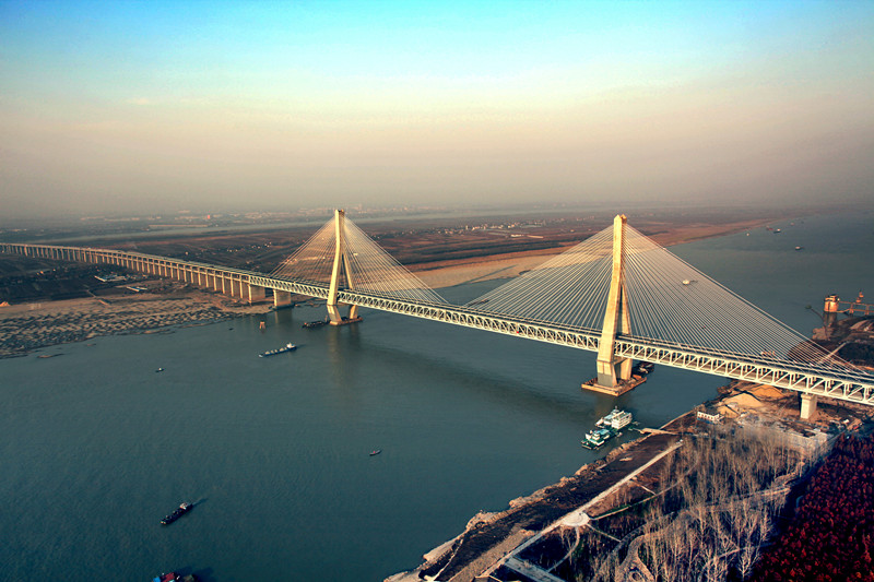
塔斯曼大桥(英语:Tasman Bridge)是澳大利亚塔斯马尼亚州首府霍巴特的一座跨过德文特河的桥梁,1964年建成,替代了原先的拱型浮桥霍巴特大桥,承载塔斯曼公路[1]。
Die Tasman Bridge ist eine Brücke in Hobart, Tasmanien, Australien. Sie überspannt den Derwent River und verbindet das Zentrum Hobarts mit den östlichen Vororten und dem Flughafen der Hauptstadt. Die Tasman Bridge wird täglich von etwa 67.000 Fahrzeugen befahren und ist Teil des Tasman Highways.
Die Tasman Bridge ist eine Spannbetonbrücke mit einer Gesamtlänge von 1395 Metern und eine Breite von 17,5 Metern, auf der fünf Fahrstreifen für Kraftfahrzeuge und beidseitige Fuß- und Radwege Platz finden. An ihrem höchsten Punkt hat die Tasman Bridge eine Höhe von 60,5 Metern und eine Durchfahrtshöhe von 46 Metern.


 Saxony-Anhalt
 Vacation and Travel

 California-CA
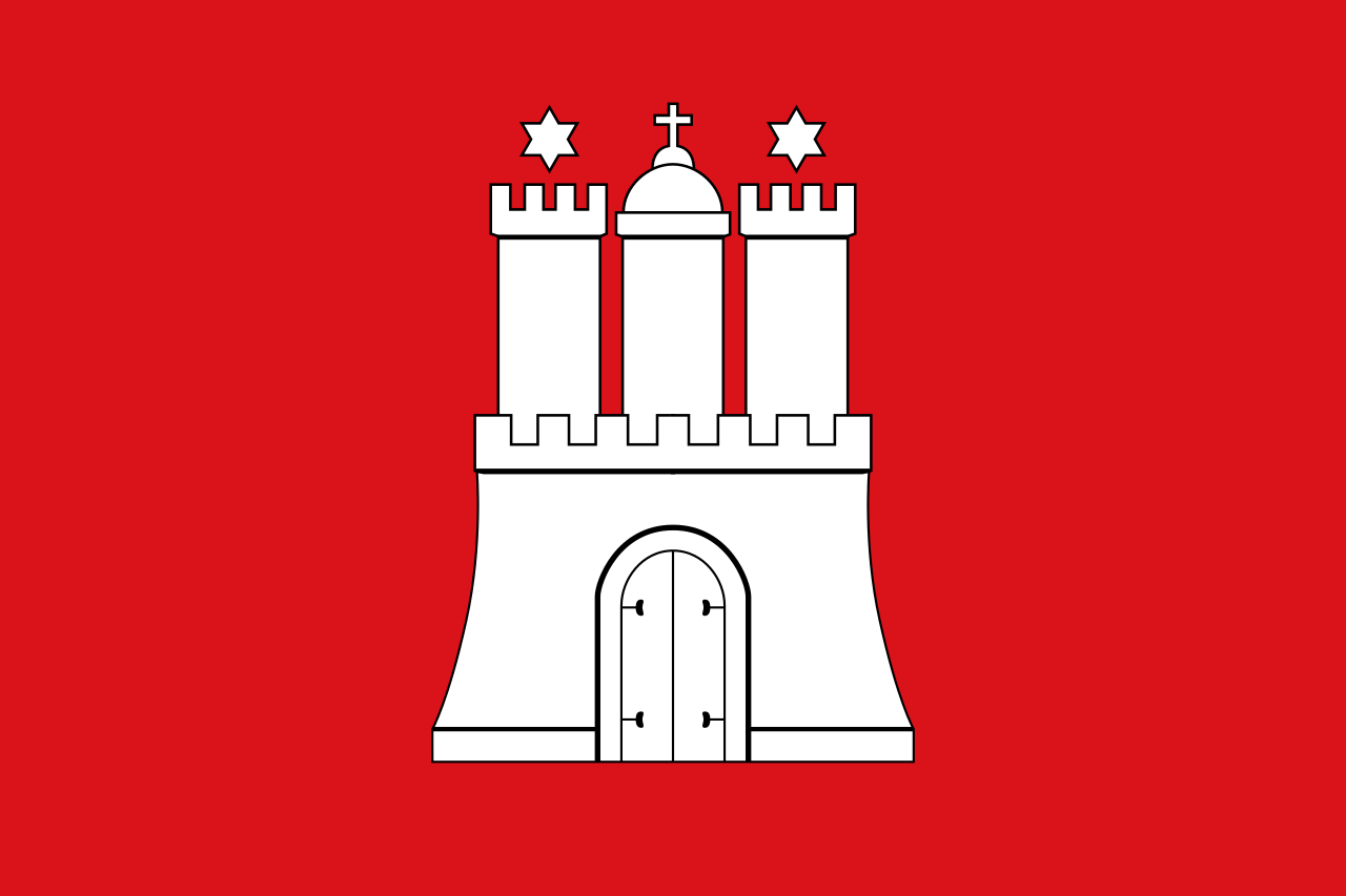 Hamburg
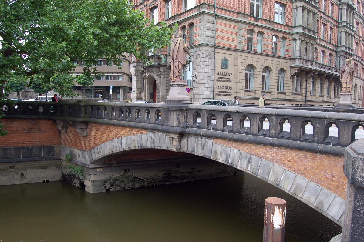
Die Trostbrücke überspannt das Nikolaifleet in Hamburg. Sie verband ursprünglich die bischöfliche Altstadt rund um den Bereich Dom und Petrikirche mit der gräflichen Neustadt. Hier befand sich vom Mittelalter bis zum Hamburger Brand 1842 das weltliche Zentrum der Stadt und der innerste Teil des Hafens. Beide Gebiete gehören heute zum Stadtteil Hamburg-Altstadt.
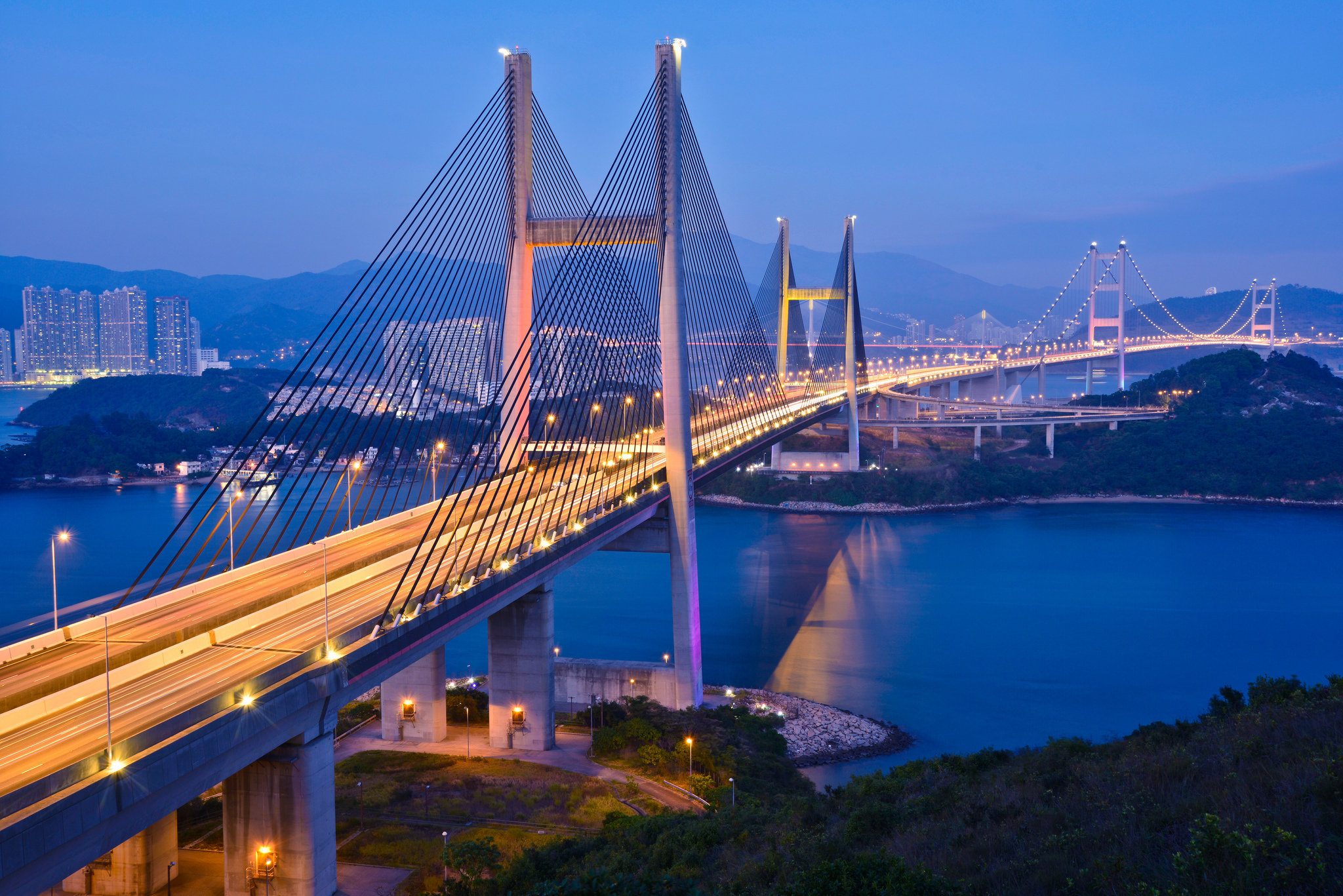
Die Tsing-Ma-Brücke (chinesisch 青馬大橋 / 青马大桥, Pinyin Qīngmǎ Dàqiáo, Jyutping Cing1maa5 Daai6kiu4) in Hongkong war nach ihrer Fertigstellung 1997 für ein Jahr die Brücke mit der zweitlängsten Spannweite in der Welt. Sie verbindet die durch den Ma Wan Kanal getrennten Inseln Ma Wan und Tsing Yi und dient der Autobahn 8 sowie den Schnellbahnen Tung Chung Line und Airport Express, die Hongkong mit Lantau und weiter mit Chek Lap Kok verbinden, wo sich der Hong Kong International Airport befindet.
Die 41 Meter breite Brücke hat zwei Decks, ein Straßen- und ein Eisenbahndeck. Auf dem oberen Deck befinden sich sechs Fahrspuren für PKWs, auf dem unteren sind zwei Gleise für Züge sowie zwei Fahrspuren für PKWs, die bei starken Winden genutzt werden. Die Hauptspannweite beträgt 1377 Meter, die Pylone sind 206 Meter hoch. Bis zur Eröffnung der Yavuz-Sultan-Selim-Brücke über den Bosporus im August 2016 hatte sie weltweit die größte Spannweite aller Brücken mit Eisenbahngleisen.
青馬大橋(せいばおおはし、英: Tsing Ma Bridge)は、香港にある吊橋。青衣島と馬湾島を結んで、馬湾海峡を横断している。橋のスパンは最大で1377mであり、吊橋として世界で6番目の規模である。また、道路鉄道併用橋としては世界一の長さを誇る。(共に2007年4月現在)
この橋の名前は、橋の両端の島である青衣島と馬湾島から名付けられた。橋は2層構造となっており、上層部には片側3車線の道路、下層部には2レーンの鉄道路と2車線の保守用道路が設けられている。鉄道路はMTR東涌線と機場快線の路線の一部となっている。
Tsing Ma Bridge is a bridge in Hong Kong. It is the world's 14th-longest span suspension bridge, and was the second longest at time of completion.[3] The bridge was named after the two islands it connects, namely Tsing Yi and Ma Wan. It has two decks and carries both road and rail traffic, which also makes it the largest suspension bridge of this type. The bridge has a main span of 1,377 metres (4,518 ft) and a height of 206 metres (676 ft). The span is the longest of all bridges in the world carrying rail traffic.
The 41-metre-wide (135 ft) bridge deck carries six lanes of automobile traffic, with three lanes in each direction. The lower level contains two rail tracks and two sheltered carriageways used for maintenance access and traffic lanes when particularly severe typhoons strike Hong Kong and the bridge deck is closed to traffic.[4]
Le pont Tsing Ma (chinois simplifié : 青马大桥 ; chinois traditionnel : 青馬大橋 ; pinyin : ) est un pont de Hong Kong en Chine. Il relie les îles de Tsing Yi et Ma Wan, d’où il tire son nom. Avec une portée principale de 1 377 mètres, il est le septième pont suspendu le plus grand au monde et il a été le deuxième lors de l'achèvement des travaux.
Il dispose d’un tablier à deux niveaux, l’un réservé au trafic routier, l’autre au trafic ferroviaire. Il est aussi le plus grand pont suspendu de ce type.
Tsing Ma Bridge è un ponte sospeso realizzato nella Repubblica popolare cinese a Hong Kong per conto del Highways Department, Hong Kong Government su progetto e ingegneria dello Studio di Ingegneria inglese Mott MacDonald Hong Kong Limited dal Consorzio Anglo Japanese Construction JV. Il ponte, aperto al traffico nel 1997, prende il nome delle due sponde che collegano l'isola e la penisola di Hong Kong (Tsing e Ma). L'impalcato del ponte prevede sia il traffico stradale (tre corsie per ogni senso di marcia) che il traffico ferroviario (doppio binario). I due binari ferroviari sono alloggiati all'interno dell'impalcato (come se fossero in galleria) conferendo così una maggior sicurezza nei confronti del vento. Infatti anche con fortissimi venti (tifoni) il traffico ferroviario è sempre garantito. Il ponte ha una campata centrale di 1.377 m e un'altezza dei piloni di 206 m. Esso è il settimo ponte sospeso più grande del mondo per luce libera ma è il maggiore al mondo a sopportare contemporaneamente sia il traffico stradale (sei corsie) che quello ferroviario (due binari).
El puente de Tsing Ma (en chino tradicional, 青馬大橋; en chino simplificado, 青马大桥; pinyin, Qīngmǎ Dàqiáo) es un puente colgante situado en Hong Kong, China. Es el séptimo puente colgante más largo del mundo.
El nombre proviene de Tsing Yi y Ma Wan, dos de las islas de Hong Kong. El puente tiene dos plataformas, una para el tráfico rodado y otra para el ferrocarril, lo que le convierte en el más largo del mundo de este tipo. En la plataforma superior hay 6 carriles para automóviles y en la inferior dos vías ferroviarias, así como dos carriles más para vehículos que se utilizan cuando el viento es fuerte. La longitud del vano principal es de 1.377 m, y los pilares tienen una altura de 206 m. Es el puente con el mayor vano del mundo destinado para trenes. La anchura del puente es de 41 metros.
Su planeación se puede remontar al año de 1978. Sin embargo, el comienzo de la construcción fue mucho después, en el año de 1992 y fue formalmente1 inaugurado el 27 de abril de 1997.
El puente de Tsing Ma une las islas del Tsing Yi al norte y Ma Wan al oeste atravesando el Canal de Ma Wan. El puente es parte del Enlace de Lantau, que une Hong Kong con Chek Lap Kok, donde está situado el Aeropuerto internacional de Hong Kong. El gálibo para el tráfico marítimo es de 62 metros.
Цинма, Цинг-Ма? (англ. Tsing Ма, кит. упр. 青馬大橋, палл. Цинма дацяо) — висячий мост в Гонконге, шестой в мире по длине. Соединяет остров Цинг-И на востоке и остров Мавань (Ма-Ван) на западе, является частью магистрали Лантау, которая с тремя другими мостами соединяет Новые Территории, и остров Чек Лап Кок, где располагается Международный аэропорт Гонконга. Железная дорога — часть системы метро MTR, ветки Тунг Чунг и международного аэропорта.
Мост имеет два уровня, по которым организовано автомобильное и железнодорожное движение. На верхнем уровне расположена шестиполосная автомагистраль, по три полосы в каждом направлении. На нижнем — два железнодорожных пути и запасная двухполосная автодорога для служебных целей и для движения во время сильных ветров (Гонконг иногда подвергается действию тайфунов). Основной пролет моста имеет длину 1377 метров (больше, чем у знаменитых Золотых Ворот в Сан-Франциско), высота пилонов — 206 метров. Пролет — самый большой в мире среди мостов, по которым организовано железнодорожное движение.
Создание моста началось в 1992 году, закончилось в 1997. Магистраль Лантау открылась 27 апреля 1997 года. Строительство моста обошлось в 7,2 миллиарда гонконгских долларов. На церемонии открытия присутствовала бывший премьер-министр Великобритании Маргарет Тэтчер.
Для контроля над движением на мосту были установлены камеры наблюдения. Изображения доступны на правительственном сайте (1) (обновляются каждые 2 минуты).

 History

 New York-NY

韦拉札诺海峡大桥(英语:Verrazzano-Narrows Bridge)是一条位于美国纽约州纽约市的桥梁,以双层结构的悬索桥横跨纳罗斯水道来连接纽约市的史泰登岛与布鲁克林。此桥是以意大利探险家乔凡尼·达·韦拉札诺来命名的,韦拉札诺是有纪录以来第一个进入纽约港以及哈德逊河的欧洲探险家。其最长跨距为1,290米(4,232英尺),在1964年完工之初为全世界最长的悬索桥。直到1981年,现今其跨距排名全世界第十,但是仍然还是美国境内最大的悬索桥。其高耸的塔架可以在纽约大都会区大多数地方看到。这条桥的完工为纽约市地区的区域高速公路系统提供了最后的一个连接的环节,并对于新泽西州直通长岛与肯尼迪机场、减缓曼哈顿公路的拥挤车流,有相当大的贡献。
此外,每年举办的纽约市马拉松竞赛即以此处为起点,另外大部分要进入纽约港的货船或是游艇都必须经过此桥下方的航道。
Die Verrazzano-Narrows Bridge ist eine zweistöckige Hängebrücke, die die New Yorker Stadtbezirke Staten Island und Brooklyn über die Meerenge The Narrows hinweg verbindet. Die Meerenge, die von der Brücke überspannt wird, trennt die geschützte und bis nach Manhattan reichende Upper New York Bay von der seewärts hin gelegenen Lower New York Bay.
Ihre Spannweite von 1298 m zwischen den Pylonen ist 18 Meter größer als die der Golden Gate Bridge. Die Verrazzano-Narrows Bridge war deshalb ab ihrer Fertigstellung 1964 die längste Hängebrücke der Welt, bis sie 1981 von der Humber-Brücke abgelöst wurde. Seit 2023 ist sie noch die vierzehntlängste Hängebrücke der Welt und nach wie vor die längste auf dem amerikanischen Kontinent.