
Deutsch-Chinesische Enzyklopädie, 德汉百科
 南非
南非
 赛车,艇运动
埃及
阿尔及利亚
赛车,艇运动
埃及
阿尔及利亚
 安达卢西亚自治区
阿根廷
安达卢西亚自治区
阿根廷
 汽车
汽车
汽车
汽车
 标致
汽车
迷你
汽车
大众
汽车
卡玛斯重卡
汽车
依维柯
汽车
三菱
汽车
曼卡
汽车
太脱拉卡车
汽车
日野卡车
汽车
雪铁龙
汽车
保时捷
汽车
达夫卡车
汽车
梅塞德斯
汽车
雷诺
汽车
路虎
标致
汽车
迷你
汽车
大众
汽车
卡玛斯重卡
汽车
依维柯
汽车
三菱
汽车
曼卡
汽车
太脱拉卡车
汽车
日野卡车
汽车
雪铁龙
汽车
保时捷
汽车
达夫卡车
汽车
梅塞德斯
汽车
雷诺
汽车
路虎
 奥弗涅-罗纳-阿尔卑斯
玻利维亚
奥弗涅-罗纳-阿尔卑斯
玻利维亚
 加泰罗尼亚
智利
法国
加泰罗尼亚
智利
法国
 上法兰西大区
 法兰西岛
利比亚
法兰西岛
利比亚
 马德里自治区
尼日尔
葡萄牙
马德里自治区
尼日尔
葡萄牙
 普罗旺斯-阿尔卑斯-蓝色海岸
塞内加尔
西班牙
普罗旺斯-阿尔卑斯-蓝色海岸
塞内加尔
西班牙
 体育
南非
突尼斯
体育
南非
突尼斯

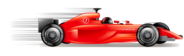
Die Rallye Dakar (früherer Name Rallye Paris–Dakar) ist ein Rallye-Raid-Wettbewerb, der als die bedeutendste Langstrecken- und Wüstenrallye der Welt gilt. Sie wurde von 1978 bis 2007 einmal jährlich hauptsächlich auf dem afrikanischen Kontinent ausgetragen. Im Jahr 2008 wurde die Rallye Dakar aufgrund einer Terrordrohung abgesagt. Seit 2009 findet sie aus Sicherheitsgründen auf dem südamerikanischen Kontinent statt.
2016 fand die 38. Auflage vom 2. bis 16. Januar in Argentinien und Bolivien statt. Neben einem Prolog von Buenos Aires nach Rosario wurden 13 Etappen und 9246 km Strecke gefahren, 4792 km flossen in die Wertung ein. Aufgrund des Naturphänomens El Niño verzichtete man auf Strecken in Peru.[1]
Die Sieger und Strecken der Rallye Dakar seit 1979
| Jahr | Autos | Motorräder | Trucks | Quads | UTVs | Strecke | |||||
|---|---|---|---|---|---|---|---|---|---|---|---|
| Fahrer | Marke | Fahrer | Marke | Fahrer | Marke | Fahrer | Marke | Fahrer | Marke | ||
| 1979 |  Alain Génestier Alain Génestier |
Range Rover | Cyril Neveu |
Yamaha | – | – | – | – | – | – | Paris–Algier–Dakar |
| 1980 |  Freddy Kottulinsky Freddy Kottulinsky |
Volkswagen | Cyril Neveu |
Yamaha |  Miloud Ataouat Miloud Ataouat |
Sonacome | – | – | – | – | Paris–Algier–Dakar |
| 1981 | René Metge |
Range Rover | Hubert Auriol |
BMW | Adrien Villette |
ALM/ACMAT | – | – | – | – | Paris–Algier–Dakar |
| 1982 | Claude Marreau |
Renault | Cyril Neveu |
Honda | Georges Groine |
Mercedes-Benz | – | – | – | – | Paris–Algier–Dakar |
| 1983 |  Jacky Ickx Jacky Ickx |
Mercedes-Benz | Hubert Auriol |
BMW | Georges Groine |
Mercedes-Benz | – | – | – | – | Paris–Algier–Dakar |
| 1984 | René Metge |
Porsche | Gaston Rahier |
BMW | Pierre Laleu |
Mercedes-Benz | – | – | – | – | Paris–Algier–Dakar |
| 1985 | Patrick Zaniroli |
Mitsubishi | Gaston Rahier |
BMW |  Karl-Friedrich Capito Karl-Friedrich Capito |
Mercedes-Benz | – | – | – | – | Paris–Algier–Dakar |
| 1986 | René Metge |
Porsche | Cyril Neveu |
Honda |  Giacomo Vismara Giacomo Vismara |
Mercedes-Benz | – | – | – | – | Paris–Algier–Dakar |
| 1987 |  Ari Vatanen Ari Vatanen |
Peugeot | Cyril Neveu |
Honda |  Jan de Rooy Jan de Rooy |
DAF | – | – | – | – | Paris–Algier–Dakar |
| 1988 | Juha Kankkunen |
Peugeot | Edi Orioli |
Honda |  Karel Loprais Karel Loprais |
Tatra | – | – | – | – | Paris–Algier–Dakar |
| 1989 | Ari Vatanen |
Peugeot | Gilles Lalay |
Honda | – | – | – | – | – | – | Paris–Tunis–Dakar |
| 1990 | Ari Vatanen |
Peugeot | Edi Orioli |
Cagiva | Giorgio Villa |
Perlini | – | – | – | – | Paris–Tripolis–Dakar |
| 1991 | Ari Vatanen |
Citroën | Stéphane Peterhansel |
Yamaha | Jacques Houssat |
Perlini | – | – | – | – | Paris–Tripolis–Dakar |
| 1992 | Hubert Auriol |
Mitsubishi | Stéphane Peterhansel |
Yamaha | Francesco Perlini |
Perlini | – | – | – | – | Paris–Sirt–Kapstadt |
| 1993 | Bruno Saby |
Mitsubishi | Stéphane Peterhansel |
Yamaha | Francesco Perlini |
Perlini | – | – | – | – | Paris–Tanger–Dakar |
| 1994 | Pierre Lartigue |
Citroën | Edi Orioli |
Cagiva | Karel Loprais |
Tatra | – | – | – | – | Paris–Dakar–Paris |
| 1995 | Pierre Lartigue |
Citroën | Stéphane Peterhansel |
Yamaha | Karel Loprais |
Tatra | – | – | – | – | Granada–Dakar |
| 1996 | Pierre Lartigue |
Citroën | Edi Orioli |
Yamaha |  Wiktor Moskowskich Wiktor Moskowskich |
KAMAZ | – | – | – | – | Granada–Dakar |
| 1997 |  Kenjirō Shinozuka Kenjirō Shinozuka |
Mitsubishi | Stéphane Peterhansel |
Yamaha |  Peter Reif Peter Reif |
Hino | – | – | – | – | Dakar–Agadez–Dakar |
| 1998 | Jean-Pierre Fontenay |
Mitsubishi | Stéphane Peterhansel |
Yamaha | Karel Loprais |
Tatra | – | – | – | – | Paris–Granada–Dakar |
| 1999 | Jean-Louis Schlesser |
Schlesser Buggy | Richard Sainct |
BMW | Karel Loprais |
Tatra | – | – | – | – | Granada–Dakar |
| 2000 | Jean-Louis Schlesser |
Schlesser Buggy | Richard Sainct |
BMW | Wladimir Tschagin |
KAMAZ | – | – | – | – | Dakar–Kairo |
| 2001 | Jutta Kleinschmidt |
Mitsubishi | Fabrizio Meoni |
KTM | Karel Loprais |
Tatra | – | – | – | – | Paris–Dakar |
| 2002 | Hiroshi Masuoka |
Mitsubishi | Fabrizio Meoni |
KTM | Wladimir Tschagin |
KAMAZ | – | – | – | – | Arras–Madrid–Dakar |
| 2003 | Hiroshi Masuoka |
Mitsubishi | Richard Sainct |
KTM | Wladimir Tschagin |
KAMAZ | – | – | – | – | Marseille–Scharm El-Scheich |
| 2004 | Stéphane Peterhansel |
Mitsubishi |  Nani Roma Nani Roma |
KTM | Wladimir Tschagin |
KAMAZ | – | – | – | – | Clermont-Ferrand–Dakar |
| 2005 | Stéphane Peterhansel |
Mitsubishi | Cyril Despres |
KTM | Firdaus Kabirow |
KAMAZ | – | – | – | – | Barcelona–Dakar |
| 2006 | Luc Alphand |
Mitsubishi | Marc Coma |
KTM | Wladimir Tschagin |
KAMAZ | – | – | – | – | Lissabon–Dakar |
| 2007 | Stéphane Peterhansel |
Mitsubishi | Cyril Despres |
KTM | Hans Stacey |
MAN | – | – | – | – | Lissabon–Dakar |
| 2008 | Am 4. Januar 2008, einen Tag vor dem geplanten Start, aus Sicherheitsgründen abgesagt.[17] Ersatzveranstaltung war die Mitteleuropa-Rallye. | Ursprünglich geplante Route: Lissabon–Dakar | |||||||||
| 2009 |  Giniel de Villiers Giniel de Villiers |
Volkswagen | Marc Coma |
KTM | Firdaus Kabirow |
KAMAZ | Josef Macháček |
Yamaha | – | – | Buenos Aires–Valparaíso–Buenos Aires |
| 2010 | Carlos Sainz senior |
Volkswagen | Cyril Despres |
KTM | Wladimir Tschagin |
KAMAZ |  Marcos Patronelli Marcos Patronelli |
Yamaha | – | – | Buenos Aires-Antofagasta–Buenos Aires |
| 2011 |  Nasser Al-Attiyah Nasser Al-Attiyah |
Volkswagen | Marc Coma |
KTM | Wladimir Tschagin |
KAMAZ | Alejandro Patronelli |
Yamaha | – | – | Buenos Aires–Arica–Buenos Aires |
| 2012 | Stéphane Peterhansel |
Mini | Cyril Despres |
KTM | Gerard de Rooy |
Iveco | Alejandro Patronelli |
Yamaha | – | – | Mar del Plata–Lima |
| 2013 | Stéphane Peterhansel |
Mini | Cyril Despres |
KTM | Eduard Nikolajew |
KAMAZ | Marcos Patronelli |
Yamaha | – | – | Lima–Santiago de Chile |
| 2014 | Nani Roma |
Mini | Marc Coma |
KTM | Andrei Karginow |
KAMAZ |  Ignacio Casale Ignacio Casale |
Yamaha | – | – | Rosario–Valparaíso |
| 2015 | Nasser Al-Attiyah |
Mini | Marc Coma |
KTM | Airat Mardejew |
KAMAZ |  Rafał Sonik Rafał Sonik |
Yamaha | – | – | Buenos Aires–Iquique–Buenos Aires |
| 2016 | Stéphane Peterhansel |
Peugeot |  Toby Price Toby Price |
KTM | Gerard de Rooy |
Iveco | Marcos Patronelli |
Yamaha | – | – | Buenos Aires–Rosario |
| 2017 | Stéphane Peterhansel |
Peugeot |  Sam Sunderland Sam Sunderland |
KTM | Eduard Nikolajew |
KAMAZ | Sergei Karjakin |
Yamaha |  Leandro Torres Leandro Torres |
Polaris | Asunción–Rio Cuarto–Buenos Aires |
| 2018 | Carlos Sainz senior |
Peugeot | Matthias Walkner |
KTM | Eduard Nikolajew |
KAMAZ | Ignacio Casale |
Yamaha | Reinaldo Varela |
Can-Am | Lima–La Paz–Córdoba |
| 2019 | Nasser Al-Attiyah |
Toyota | Toby Price |
KTM | Eduard Nikolajew |
KAMAZ | Nicolás Cavigliasso |
Yamaha | Francisco López Contardo |
Can-Am | Lima–Arequipa–Lima |
| 2020 | Carlos Sainz senior |
Mini |  Ricky Brabec Ricky Brabec |
Honda | Andrei Karginow |
KAMAZ | Ignacio Casale |
Yamaha | Casey Currie |
Can-Am | Dschidda–Quiddiya |
| 2021 | Stéphane Peterhansel |
Mini | Kevin Benavides |
Honda | Dmitri Sotnikow |
KAMAZ | Manuel Andújar |
Yamaha | Francisco López Contardo |
Can-Am | Dschidda–Dschidda |
| 2022 | Nasser Al-Attiyah |
Toyota | Sam Sunderland |
GasGas | Dmitri Sotnikow |
KAMAZ | Alexandre Giroud |
Yamaha | Austin Jones |
Can-Am | Dschidda–Dschidda |
| 2023 | Nasser Al-Attiyah |
Toyota | Kevin Benavides |
KTM | Janus van Kasteren |
Iveco | Alexandre Giroud |
Yamaha | Austin Jones |
Can-Am | Dschidda–Dammam |
| 2024 | Carlos Sainz senior |
Audi | Ricky Brabec |
Honda | Martin Macík |
Iveco | Manuel Andújar |
Yamaha | Xavier de Soultrait |
Polaris | al-ʿUla-Yanbu |
| 2025 |  Yazeed Al-Rajhi Yazeed Al-Rajhi |
Toyota | Daniel Sanders |
KTM | Martin Macík |
Iveco | – | – | Brock Heger |
Polaris | Bischa-Schaiba |
Konstrukteurssiege
Autos
| Siege | Konstrukteur | Jahr(e) |
|---|---|---|
| 12 | Mitsubishi |
1985, 1992, 1993, 1997, 1998, 2001–2007 |
| 7 | Peugeot |
1987–1990, 2016–2018 |
| 6 | Mini |
2012–2015, 2020–2021 |
| 4 | Citroën |
1991, 1994–1996 |
| Volkswagen |
1980, 2009–2011 | |
| Toyota |
2019, 2022, 2023, 2025 | |
| 3 | Renault |
1982, 1999, 2000 |
| 2 | Land Rover |
1979, 1981 |
| Porsche |
1984, 1986 | |
| 1 | Audi |
2024 |
| Mercedes-Benz |
1983 |
Motorräder
| Siege | Konstrukteur | Jahr(e) |
|---|---|---|
| 20 | KTM |
2001–2007, 2009–2019, 2023, 2025 |
| 9 | Yamaha |
1979, 1980, 1991–1993, 1995–1998 |
| 8 | Honda |
1982, 1986–1989, 2020–2021, 2024 |
| 6 | BMW |
1981, 1983–1985, 1999, 2000 |
| 2 | Cagiva |
1990, 1994 |
| 1 | GasGas |
2022 |
Trucks
| Siege | Konstrukteur | Jahr(e) |
|---|---|---|
| 19 | KAMAZ |
1996, 2000, 2002–2006, 2009–2011, 2013–2015, 2017–2022 |
| 6 | Tatra |
1988, 1994, 1995, 1998, 1999, 2001 |
| 5 | Mercedes-Benz |
1982–1986 |
| Iveco |
2012, 2016, 2023–2025 | |
| 4 | Perlini |
1990–1993 |
| 1 | Sonacome |
1980 |
| ACMAT |
1981 | |
| DAF |
1987 | |
| Hino |
1997 | |
| MAN |
2007 |
Quads
| Siege | Konstrukteur | Jahr(e) |
|---|---|---|
| 16 | Yamaha |
2009–2024 |
Side-by-Sides
| Siege | Konstrukteur | Jahr(e) |
|---|---|---|
| 6 |  Can-Am Can-Am |
2018–2023 |
| 3 | Polaris |
2017, 2024, 2025 |
 国际城市
国际城市
 重要港口
重要港口
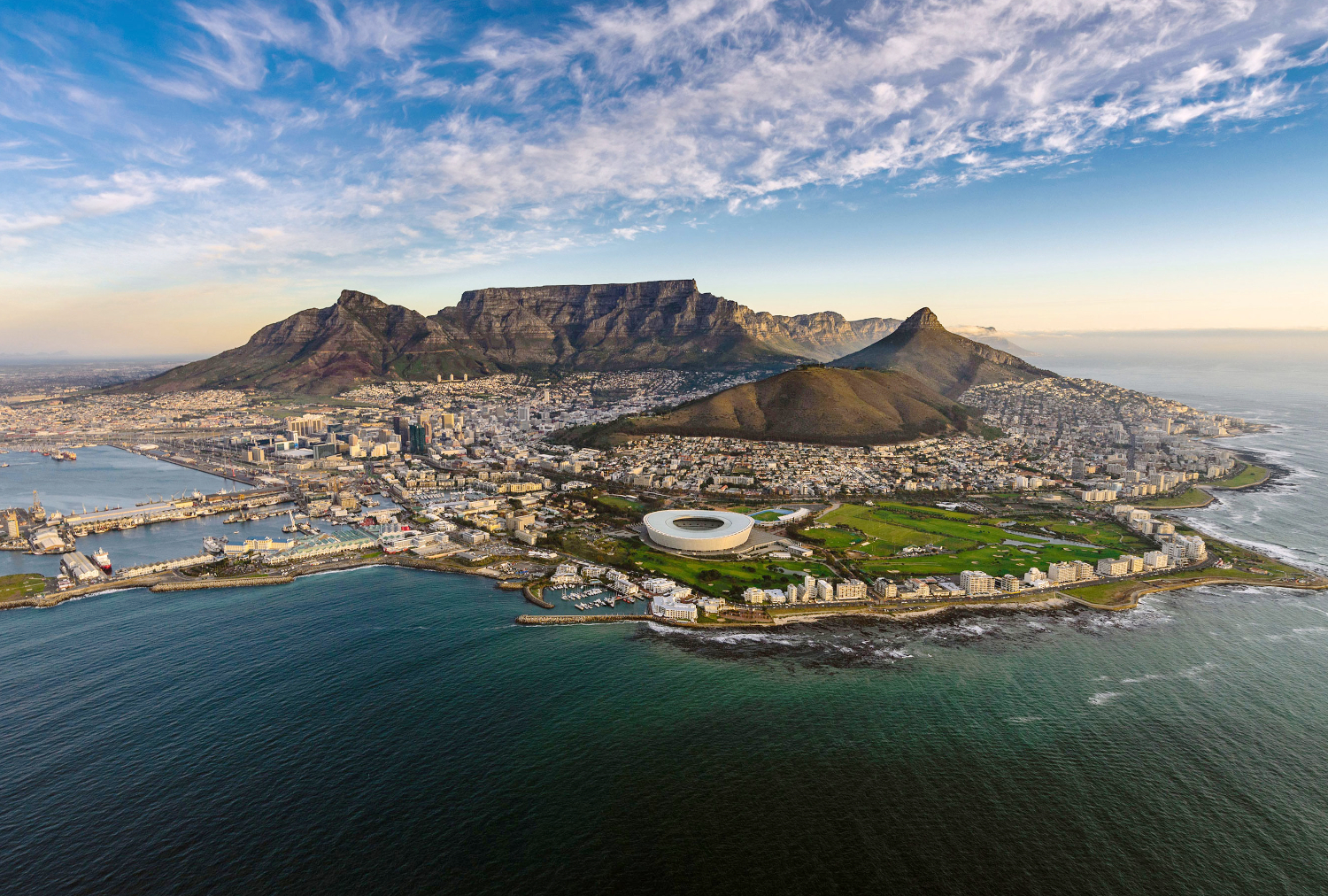
开普敦是南非第二大城市和重要港口,立法机关所在地,开普敦省首府。开普敦位于南非西南端,临大西洋桌湾,南距好望角52公里,处于重要国际航线的交汇点。开普敦始建于1652年,是西欧殖民者在南部非洲最早建立的据点,曾长期是荷兰、英国殖 民者向非洲内陆扩张的基地。城市背山面海,风光绮丽,文物众多,旅游业兴盛,工商业发达。城市有大型纺织、酿酒、烟叶、炼油等工业,还有化工、皮革、造纸 等企业。港口优良,可同时停泊近百艘海轮,有世界著名的现代化大船坞,并建有国际航空港,主要出口皮革、水果、纺织品等。城市有著名的开普敦大学、南非博 物馆等。
1652年荷兰东印度公司为了在非洲建立一个补给站,以供应往来欧亚间的船只,于是选择了南非开普敦省的桌湾做为据地。在当年,开普敦尚是一块不毛之地,然历经300多年的演变,今日的开普敦却成了南非最古老且最富特色的城市了。
从1652年建城开始,似乎即注定了开普敦多舛的命运。她曾是葡萄牙人、荷兰人、法国人与英国人争相拥有的海上客栈。
在1870年正值英国人在此兴建直达约翰内斯堡铁路时,赫然发现了钻石矿,立即引来了大批的掘宝客及挖矿的奴隶,其中,以印度人、马来人及中国人居多。
100多年前,开普敦周围仍是独立小城林立。开普敦真正具有国际港口规模,是在1913年南非联邦成立后,由于地位的确定及组织的完善,造就了开普敦在80多年后的今天,成为一座缤纷多彩的美丽城市,备受世人欣赏与惊叹。(Quelle:http://www.aiutrip.com)
开普敦(英语:Cape Town;南非荷兰语:Kaapstad /ˈkɑːpstɑt/;科萨语:iKapa),是南非人口排名第二大城市,也是开普敦都会城区组成部分、西开普省省会,开普敦为南非立法首都,因此国会及很多政府部门亦座落于该市。开普敦以其美丽的自然景观及码头闻名,知名的地标有被誉为“上帝之餐桌”的桌山,以及印度洋和大西洋的交汇点好望角。因其美丽的自然及地理环境,开普敦被称为世界最美丽的城市之一,亦成为南非其中一处旅游胜地。
开普敦最初环绕码头发展,因为由荷兰开往东非、印度和亚洲的商船都会路经此地作补给,久而久之便成为欧洲人在撒哈拉以南非洲地区的第一个长期聚居点。其后欧洲人亦建立了他们的第一所军事基地好望堡,亦即good hope castle,在约翰内斯堡的建立及在德兰士瓦发现大量的黄金和钻石之前,开普敦是非洲南部最大的城市。开普敦拥有南非第二繁忙的机场开普敦国际机场,是世界旅客到南非的主要渠道之一。
Kapstadt wird von den Südafrikanern gern als “Moederstad” (Mutterstadt) bezeichnet, da es zur Kolonialzeit eine der ersten gegründeten Städte war. Sein Name leitet sich vom nahe gelegenen Kap der guten Hoffnung ab, welches man durchfahren musste um nach Indien zu gelangen. Berühmt ist Kapstadt für seine einzigartige Skyline, aus welcher vor allem der Table Mountain (Tafelberg), der Lion`s Head (Löwenkopf, oder auch als Löwenberg zu finden), sowie der Devil`s Peak (Teufelspitze) herausstechen.
Gegründet wurde Kapstadt 1652, von dem niederländischen Schiffsarzt Jan Anthoniszoon van Riebeeck, als Versorgungsstation für die niederländische Handelsflotte, wenn diese auf ihrem Weg nach Indien unterwegs war. 1814 übernahmen die Briten die Herrschaft über Kapstadt. 1860 lies Prinz Alfred, der zweite Sohn von Königin Victoria, den Grundstein für eine neue, größere Hafenanlage legen. In den folgenden Jahren, unter dem Einfluss der etwa zu selben Zeit entdeckten Goldvorkommen im Landesinneren, wuchs der nun zu klein gewordene Hafen noch einmal an.
Die aus dieser Zeit erhaltenen und in den 90er Jahren aufwendig restaurierten Gebäude machen den Hafen zu einem Victorianischen Kleinod, welches seines gleichen sucht. Ebenso findet sich hier im Hafen das “Robben Island Embarkation Building”. Von hier starten die 3 stündigen geführten Touren auf die Insel.(Quelle:http://www.mytraveltips.de/afrika/kapstadt-eine-reise-in-die-geschichte/)
Kapstadt (englisch Cape Town, afrikaans Kaapstad, isiXhosa iKapa) ist eine der größten Städte Südafrikas. Seit 2004 bildet sie den ausschließlichen Sitz des südafrikanischen Parlaments. Kapstadt ist die Hauptstadt der Provinz Westkap und ist der Kernort der City of Cape Town Metropolitan Municipality, die Metropolgemeinde um Kapstadt. Als von der Statistik erfasster Ort (Main Place) hatte Kapstadt 433.688 Einwohner im Jahr 2011.[1]
Den Namen erhielt Kapstadt nach dem Kap der Guten Hoffnung, das etwa 45 Kilometer südlicher liegt und eine Hauptgefahr auf dem Seeweg nach Indien darstellte. Da Kapstadt die erste Stadtgründung der südafrikanischen Kolonialzeit war, wird es gelegentlich als „Mutterstadt“ (afrikaans: Moederstad, englisch: Mother City) bezeichnet.
ケープタウン(英語: Cape Town、アフリカーンス語: Kaapstad、コサ語: IKapa)は、南アフリカ共和国西ケープ州に位置する都市(都市圏)である。立法府所在地で、同州の州都。アフリカ有数の世界都市である。
テーブル湾に面する同市はその港が有名であるとともに、世界的に有名なテーブルマウンテンや喜望峰などを含んだケープ草原(en:Cape floral kingdom)のなかにある。
ケープタウンはもともと東アフリカ・インド・東アジア貿易に携わるオランダ船の食料基地として建設されており、それはスエズ運河が1869年に建設される200年以上も前のことであった。ヤン・ファン・リーベックが1652年4月6日に到着して南アフリカで初めてのヨーロッパ植民地を設立するのであるが、ケープタウンは急速に成長してヨーロッパ初の前哨基地(キャッスル・オブ・グッドホープ)という元々の目的を超えてしまった。ヨハネスブルグやダーバンが成長するまでは南アフリカ最大の都市であったのである。南アフリカに始めて白人が入植した土地であり、のちの内陸部へのすべての開拓の起点ともなった。そのため、南アフリカの白人からは「マザー・シティー」(母なる都市)との愛称で呼ばれる。
2001年の南アフリカの国勢調査によれば、ケープタウン大都市圏は295万人の人口を持ち、[1] 面積は2499平方キロメートルで南アフリカの他の都市よりも大きい。この結果、人口密度は比較的低くなり1平方キロメートルあたり1158人である。ケープタウンはフランスのニースやイスラエルのハイファと姉妹都市となっている。
Cape Town (Afrikaans: Kaapstad [ˈkɑːpstat]; Xhosa: iKapa; Dutch: Kaapstad; South Sotho: Motse Kapa) is the oldest city in South Africa, colloquially named the Mother City. It is the legislative capital of South Africa and primate city of the Western Cape province.[7] It forms part of the City of Cape Town metropolitan municipality.
The Parliament of South Africa sits in Cape Town.[8] The other two capitals are located in Pretoria (the administrative capital where the Presidency is based) and Bloemfontein (the judicial capital where the Supreme Court of Appeal is located).[9] The city is known for its harbour, for its natural setting in the Cape Floristic Region, and for landmarks such as Table Mountain and Cape Point. Cape Town is home to 64% of the Western Cape's population.[10] It is one of the most multicultural cities in the world, reflecting its role as a major destination for immigrants and expatriates to South Africa.[11] The city was named the World Design Capital for 2014 by the International Council of Societies of Industrial Design.[12] In 2014, Cape Town was named the best place in the world to visit by both The New York Times[13] and The Daily Telegraph.[14]
Located on the shore of Table Bay, Cape Town, as the oldest urban area in South Africa, was developed by the Dutch East India Company (VOC) as a supply station for Dutch ships sailing to East Africa, India, and the Far East. Jan van Riebeeck's arrival on 6 April 1652 established Dutch Cape Colony, the first permanent European settlement in South Africa. Cape Town outgrew its original purpose as the first European outpost at the Castle of Good Hope, becoming the economic and cultural hub of the Cape Colony. Until the Witwatersrand Gold Rush and the development of Johannesburg, Cape Town was the largest city in South Africa.
Le Cap (Kaapstad en afrikaans, Cape Town en anglais, iKapa en xhosa) est une ville d'Afrique du Sud, capitale de la colonie du Cap (1652-1910) puis de la province du Cap (1910-1994). Elle est actuellement la capitale provinciale du Cap-Occidental.
Depuis 1910, Le Cap est également la capitale parlementaire du pays aux côtés de Pretoria (capitale administrative) et de Bloemfontein (capitale judiciaire).
La ville du Cap, fondée en 1652, est considérée comme la cité-mère d'Afrique du Sud. Ville la plus australe du continent africain, elle est établie sur les rives de la baie de la Table et est surmontée par la Montagne de la Table coiffée de deux pics nommés Lion's Head et Devil's Peak. La ville a été baptisée en référence au Cap de Bonne-Espérance situé à plus de 47 km au sud de son centre historique.
Città del Capo (in afrikaans Kaapstad, in xhosa iKapa, in inglese Cape Town, 3 497 097 abitanti nel 2007) è la capitale legislativa del Sudafrica[1] e la terza città più popolosa del Paese. Amministrativamente facente parte della provincia del Capo Occidentale, della quale è capoluogo, il suo centro si trova all'estremità settentrionale della penisola del Capo, a circa 47 km a nord del capo di Buona Speranza.
Fondata nel 1652, Città del Capo fu il primo insediamento europeo del Sudafrica; di qui il suo soprannome di città madre. Capitale della colonia del Capo prima (1652-1910) e capoluogo della provincia del Capo dopo (1910-1994), tutta la storia del Sudafrica moderno, dallo storico sbarco dei primi coloni olandesi al primo discorso di Nelson Mandela dell'era post-apartheid ha qui lasciato indelebili tracce culturali e architettoniche. Antichi edifici in stile coloniale olandese del Capo e di epoca vittoriana coesistono con moderni grattacieli e lussureggianti giardini botanici.
Città del Capo è dotata di un aeroporto internazionale e può considerarsi la capitale del turismo del Sudafrica. I numerosi visitatori sono attratti sia dalla città in sé che dalle bellezze naturalistiche della Penisola del Capo; molti tour del Paese partono da qui, imboccando poi le celebri Wine Route e Garden Route, dirigendosi verso il Karoo, il Boland o la costa meridionale.
Ciudad del Cabo (en afrikáans, Kaapstad /ˈkɑːpstɑt/; en inglés, Cape Town; en xhosa, iKapa) es la segunda ciudad más poblada de Sudáfrica, después de Johannesburgo. Forma parte del municipio metropolitano de la Ciudad del Cabo. Es la capital de la Provincia Occidental del Cabo, así como la capital legislativa de Sudáfrica, donde se ubican tanto el Parlamento Nacional como muchas otras sedes gubernamentales. Ciudad del Cabo es famosa por su puerto, así como por su conjunción natural de flora, la Montaña de la Mesa y Punta del Cabo. Es también el destino turístico más popular de África.4
Situada en la Bahía de la Mesa, se desarrolló originalmente como estación de abastecimiento para los barcos de la Compañía Neerlandesa de las Indias Orientales, que viajaban a África Oriental, India y Asia, más de doscientos años antes de la apertura del Canal de Suez en 1869. La llegada del navegante holandés Jan van Riebeeck el 6 de abril de 1652 significó el establecimiento del primer asentamiento europeo en el África subsahariana. Rápidamente superó su propósito original como el primer puesto de avanzada en el Castillo de Buena Esperanza, convirtiéndose en el centro económico y cultural de la Colonia del Cabo. Hasta la fiebre del oro de Witwatersrand y el desarrollo de Johannesburgo y Durban, Ciudad del Cabo era la ciudad más grande de Sudáfrica.
Desde 2007 la ciudad tiene una población estimada de 3,5 millones de habitantes.5 Su superficie de 2.499 kilómetros cuadrados la convierte en una de las ciudades más extensas del país, con una densidad demográfica comparativamente baja de 1.425 habitantes por kilómetro cuadrado.
En Robben Island (lit. ‘isla de las focas’), una isla muy cercana a Ciudad del Cabo, estuvo preso durante 27 años el líder del movimiento anti-apartheid y Premio Nobel de la Paz, Nelson Mandela.
Desde el fin del Apartheid, Ciudad del Cabo se mantiene como la plaza fuerte de la oposición política al ANC, siendo la única gran ciudad gobernada por la oposición. Ciudad del Cabo ocupa el 85º puesto entre 215 ciudades del mundo por su nivel y calidad de vida, siendo la 1.ª ciudad de Sudáfrica y de África (según este ranquin realizado por el Mercer Human Resources Consulting) y su alcaldesa Helen Zille fue nombrada mejor alcalde de 2008 (en sus tres años de gobierno el PIB de la ciudad creció en un 12 %, la delincuencia descendió en un 90 % y el desempleo cayó del 21 al 18 %).
Ciudad del Cabo es una de las ciudades más multiculturales del mundo, reflejando su rol como mayor destino para inmigrantes y expatriados de Sudáfrica. La ciudad fue nombrada Capital Mundial del Diseño en 2014 por el 'International Council of Societies of Industrial Design'. En 2014, Ciudad del Cabo fue nombrado como el mejor lugar del mundo para ser visitado por el 'American New York Times' y el 'British Daily Telegraph'.
Кейпта́ун (англ. Cape Town, африк. Kaapstad, коса iKapa,сесото Motse Kapa) — второй по численности населения (после Йоханнесбурга) город Южно-Африканской Республики. Расположен на юго-западе страны на побережье Атлантического океана, недалеко от Мыса Доброй Надежды. Столица Западно-Капской провинции, законодательная столица ЮАР. Входит в городской округ Кейптаун.
В Кейптауне расположены парламент ЮАР и многие правительственные учреждения. Город знаменит своей гаванью и известными на весь мир достопримечательностями, такими как Столовая гора (Южная Африка), мыс Доброй Надежды, Кейп-Пойнт. Кейптаун часто называют одним из красивейших городов мира, который является самым посещаемым туристами городом Южной Африки.
Кейптаун развивался как перевалочный пункт для голландских кораблей по пути из Европы в Восточную Африку, Индию и другие части Азии и играл ведущую роль в этом качестве более 200 лет, до открытия Суэцкого канала в 1869 году. Кейптаун, основанный 6 апреля 1652 года колонистами под руководством Яна ван Рибека, долгое время оставался столицей и крупнейшим городом Капской колонии.
 地理
地理
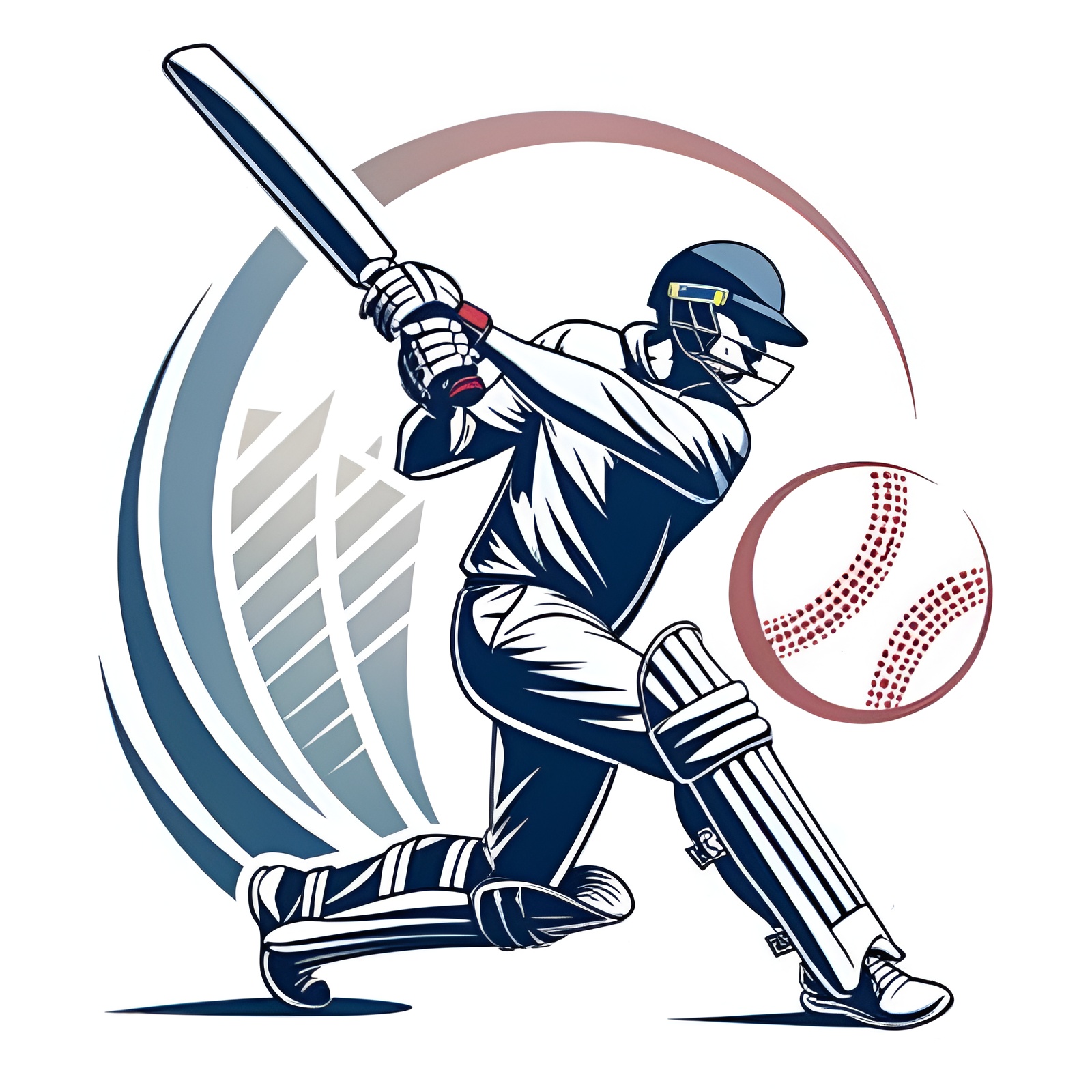

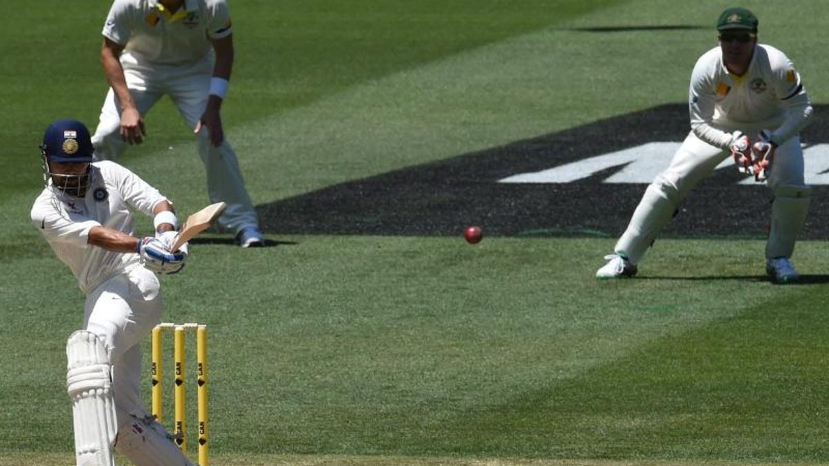
板球(或称木球、桨球、柴球,英语:Cricket)是由两队各十一人进行对抗比赛的一项团队运动。其现代形式起源于英格兰,盛行于英联邦国家,如在英国、澳大利亚、新西兰、印度、南亚、非洲南部、西印度群岛等地。板球的球季主要在春季与夏季,与在秋季与冬季踢的足球互补。
板球比赛时间长度不一,国际板球对抗赛的一场比赛每天进行六小时或以上,并长达五天;还有许多午餐和饮茶的休息时间;以及丰富的板球术语,都使板球门外汉非常困扰。但对于球迷来讲,这项运动以及顶尖板球国家队之间的激烈竞争,都为他们提供了充满激情的娱乐。
Cricket (englisch [ˈkɹɪkɪt]; in Deutschland amtlich auch Kricket,[1][2] in den Anfängen auch Thorball) ist ein Schlagballspiel, bei dem zwei Mannschaften mit jeweils elf Spielern gegeneinander antreten. Kernelement des Spiels ist das Duell zwischen dem Bowler (Werfer) und dem Batter (Schlagmann). Während der Bowler versucht, den Batter zu einem Fehler zu bewegen und damit ausscheiden zu lassen, versucht der Batter seinerseits, durch Wegschlagen des Balls sogenannte Runs (Punkte) zu erzielen. Der Bowler wird in seiner Aufgabe durch die anderen Feldspieler unterstützt, die versuchen, den Ball so schnell wie möglich zurückzubringen.
 经济和贸易
经济和贸易
 阿富汗
埃及
阿尔巴尼亚
安哥拉
安提瓜和巴布达
阿根廷
亚美尼亚
澳大利亚
巴林
孟加拉国
巴巴多斯
比利时
伯利兹
贝宁
玻利维亚
博茨瓦纳
巴西
文莱
保加利亚
布基纳法索
布隆迪
智利
中国
哥伦比亚
哥斯达黎加
科特迪瓦
古巴
丹麦
刚果民主共和国
联邦德国
多米尼克
多米尼加共和国
吉布提
厄瓜多尔
爱沙尼亚
阿富汗
埃及
阿尔巴尼亚
安哥拉
安提瓜和巴布达
阿根廷
亚美尼亚
澳大利亚
巴林
孟加拉国
巴巴多斯
比利时
伯利兹
贝宁
玻利维亚
博茨瓦纳
巴西
文莱
保加利亚
布基纳法索
布隆迪
智利
中国
哥伦比亚
哥斯达黎加
科特迪瓦
古巴
丹麦
刚果民主共和国
联邦德国
多米尼克
多米尼加共和国
吉布提
厄瓜多尔
爱沙尼亚
 欧洲联盟
斐济
欧洲联盟
斐济
 财政金融
芬兰
法国
加蓬
冈比亚
格鲁吉亚
加纳
格林纳达
希腊
危地马拉
几内亚
几内亚比绍
圭亚那
洪都拉斯
香港特别行政区-港
印度
印度尼西亚
爱尔兰
冰岛
以色列
意大利
牙买加
日本
也门
约旦
柬埔寨
喀麦隆
加拿大
佛得角
哈萨克斯坦
卡塔尔
肯尼亚
吉尔吉斯斯坦
克罗地亚
科威特
老挝
莱索托
拉脱维亚
利比里亚
列支敦斯登
立陶宛
卢森堡
澳门特别行政区-澳
马达加斯加
马拉维
马耳他
摩洛哥
毛里塔尼亚
毛里求斯
墨西哥
摩尔多瓦
财政金融
芬兰
法国
加蓬
冈比亚
格鲁吉亚
加纳
格林纳达
希腊
危地马拉
几内亚
几内亚比绍
圭亚那
洪都拉斯
香港特别行政区-港
印度
印度尼西亚
爱尔兰
冰岛
以色列
意大利
牙买加
日本
也门
约旦
柬埔寨
喀麦隆
加拿大
佛得角
哈萨克斯坦
卡塔尔
肯尼亚
吉尔吉斯斯坦
克罗地亚
科威特
老挝
莱索托
拉脱维亚
利比里亚
列支敦斯登
立陶宛
卢森堡
澳门特别行政区-澳
马达加斯加
马拉维
马耳他
摩洛哥
毛里塔尼亚
毛里求斯
墨西哥
摩尔多瓦
 蒙古
黑山
莫桑比克
缅甸
纳米比亚
尼泊尔
新西兰
尼加拉瓜
荷兰
尼日尔
尼日利亚
北马其顿
挪威
阿曼
奥地利
巴基斯坦
巴拿马
巴布亚新几内亚
巴拉圭
秘鲁
菲律宾
波兰
葡萄牙
萨尔瓦多共和国
海地共和国
刚果共和国
韩国
卢旺达
罗马尼亚
俄罗斯
所罗门群岛
赞比亚
萨摩亚
沙特阿拉伯
瑞典
瑞典
瑞士
日内瓦
塞内加尔
塞舌尔
塞拉利昂
津巴布韦
新加坡
斯洛伐克
斯洛文尼亚
西班牙
斯里兰卡
圣基茨和尼维斯
圣卢西亚
圣文森特和格林纳丁斯
南非
苏里南
斯威士兰
塔吉克斯坦
台湾省-台
坦桑尼亚
泰国
多哥
汤加
特立尼达和多巴哥
乍得
捷克
突尼斯
土耳其
乌干达
乌克兰
匈牙利
乌拉圭
瓦努阿图
委内瑞拉
阿拉伯联合酋长国
美国
英国
越南
蒙古
黑山
莫桑比克
缅甸
纳米比亚
尼泊尔
新西兰
尼加拉瓜
荷兰
尼日尔
尼日利亚
北马其顿
挪威
阿曼
奥地利
巴基斯坦
巴拿马
巴布亚新几内亚
巴拉圭
秘鲁
菲律宾
波兰
葡萄牙
萨尔瓦多共和国
海地共和国
刚果共和国
韩国
卢旺达
罗马尼亚
俄罗斯
所罗门群岛
赞比亚
萨摩亚
沙特阿拉伯
瑞典
瑞典
瑞士
日内瓦
塞内加尔
塞舌尔
塞拉利昂
津巴布韦
新加坡
斯洛伐克
斯洛文尼亚
西班牙
斯里兰卡
圣基茨和尼维斯
圣卢西亚
圣文森特和格林纳丁斯
南非
苏里南
斯威士兰
塔吉克斯坦
台湾省-台
坦桑尼亚
泰国
多哥
汤加
特立尼达和多巴哥
乍得
捷克
突尼斯
土耳其
乌干达
乌克兰
匈牙利
乌拉圭
瓦努阿图
委内瑞拉
阿拉伯联合酋长国
美国
英国
越南
 重要的国际组织
世界贸易组织
罗伯托·阿泽维多
世界贸易组织
迈克尔·穆尔
世界贸易组织
恩戈齐·奥孔乔-伊维拉
世界贸易组织
帕斯卡尔·拉米
世界贸易组织
彼得·萨瑟兰
世界贸易组织
雷纳托·鲁杰罗
世界贸易组织
素帕猜·巴尼奇巴迪
中非共和国
塞浦路斯
重要的国际组织
世界贸易组织
罗伯托·阿泽维多
世界贸易组织
迈克尔·穆尔
世界贸易组织
恩戈齐·奥孔乔-伊维拉
世界贸易组织
帕斯卡尔·拉米
世界贸易组织
彼得·萨瑟兰
世界贸易组织
雷纳托·鲁杰罗
世界贸易组织
素帕猜·巴尼奇巴迪
中非共和国
塞浦路斯

世界贸易组织(简称世贸组织或世贸;英语:World Trade Organization,缩写为 WTO;法语:Organisation Mondiale du Commerce,缩写为 OMC;西班牙语:Organización Mundial del Comercio,缩写为 OMC)是负责监督成员经济体之间各种贸易协议得到执行的一个国际组织,前身是1948年起实施的关税及贸易总协定的秘书处。
世贸总部位于瑞士日内瓦,现任总干事是罗伯托·阿泽维多。截至2016年7月29日,世界贸易组织共有164个成员。[5]世界贸易组织的职能是调解纷争,加入WTO不算签订一种多边贸易协议,但其设置的入会门槛可以做为愿意降低关税、法政上配合、参与国际贸易的门票,它是贸易体制的组织基础和法律基础,是众多贸易协定的管理者,是各成员贸易立法的监督者,是就贸易提供解决争端和进行谈判的场所。该机构是当代最重要的国际经济组织之一,其成员间的贸易额占世界贸易额的绝大多数,被称为“经济联合国”。
Die Welthandelsorganisation (englisch World Trade Organization, WTO; französisch Organisation mondiale du commerce, OMC; spanisch Organización Mundial de Comercio, OMC) ist eine internationale Organisation mit Sitz in Genf, die sich mit der Regelung von Handels- und Wirtschaftsbeziehungen beschäftigt. Sie wurde am 15. April 1994 aus dem General Agreement on Tariffs and Trade (GATT) in der Uruguay-Runde nach siebenjähriger Verhandlungszeit gegründet. Am 1. Januar 1995 nahm sie ihre Arbeit in Genf auf. Die WTO ist neben dem IWF und der Weltbank eine der zentralen internationalen Organisationen, die Handels- und Wirtschaftspolitik mit globaler Reichweite verhandelt.
世界貿易機関(せかいぼうえききかん、英: World Trade Organization、略称:WTO)は、自由貿易促進を主たる目的として創設された国際機関である。常設事務局がスイスのジュネーブに置かれている。
GATT(ガット)ウルグアイ・ラウンドにおける合意によって、世界貿易機関を設立するマラケシュ協定(WTO設立協定)に基づいて1995年1月1日にGATTを発展解消させて成立した。
本来GATTは、第二次世界大戦後の安定を見据え、国際通貨基金および国際復興開発銀行とともに設立が予定されていた国際貿易機関(ITO)の設立準備の際に、暫定協定として結ばれたものであった。国際貿易機関の設立が廃案となり、GATTがその代替として発展強化されていくうちに、再びこの分野の常設機関が求められ、WTOが設立されることとなった。発展解消であるため、GATTの事務局及び事務局長もWTOへと引き継がれることとなった[4]。
WTOはGATTを継承したものであるが、GATTが協定(Agreement)に留まったのに対し、WTOは機関(Organization)であるのが根本的な違いである。
を基本原則としている。また、物品貿易だけでなく金融、情報通信、知的財産権やサービス貿易も含めた包括的な国際通商ルールを協議する場である。
対抗処置の発動では、紛争処理機関(パネル)の提訴に対し全加盟国による反対がなければ採択されるというネガティブ・コンセンサス方式(逆コンセンサス方式)を採用した強力な紛争処理能力を持つ。これは国際組織としては稀な例であり、コンセンサス方式を採っていたGATTとの大きな違いで、WTOの特徴の一つといえる。
新多角的貿易交渉(新ラウンド)は、2001年11月にカタールのドーハで行われた第4回WTO閣僚会議で開始を決定し、ドーハ・ラウンドと呼ばれていた。2002年2月1日の貿易交渉委員会で新ラウンドがスタートした。しかし9年に及ぶ交渉は先進国と、急速に台頭してきたBRICsなど新興国との対立によって中断と再開を繰り返した末、ジュネーブで行われた第4回WTO閣僚会議(2011年12月17日)で「交渉を継続していくことを確認するものの、近い将来の妥結を断念する」(議長総括)となり事実上停止状態になった。
その後、2013年のバリ島における閣僚会議で、貿易円滑化協定を含む合意が成立し、2014年7月まで貿易円滑化協定をWTO協定に加える(附属書1Aに追加)するための文書を一般理事会で採択すべきとされた[5]。しかしインドが合意を蒸し返す状態で反対したため期限までに採択できなかった[6]。その後食糧備蓄への補助金の問題で先進国側が譲歩することでようやくインドが合意し、2014年11月27日の一般理事会で貿易円滑化協定が採択された[6]。WTO加盟国の3分の2が改正を受諾した日に発効することになっており、2017年2月22日にこの要件を満たし、協定が発効した。
The World Trade Organization (WTO) is an intergovernmental organization that regulates international trade. The WTO officially commenced on 1 January 1995 under the Marrakesh Agreement, signed by 124 nations on 15 April 1994, replacing the General Agreement on Tariffs and Trade (GATT), which commenced in 1948. It is the largest international economic organization in the world.[5][6]
The WTO deals with regulation of trade in goods, services and intellectual property between participating countries by providing a framework for negotiating trade agreements and a dispute resolution process aimed at enforcing participants' adherence to WTO agreements, which are signed by representatives of member governments[7]:fol.9–10 and ratified by their parliaments.[8] The WTO prohibits discrimination between trading partners, but provides exceptions for environmental protection, national security, and other important goals.[9] Trade-related disputes are resolved by independent judges at the WTO through a dispute resolution process.[9]
The WTO's current Director-General is Roberto Azevêdo,[10][11] who leads a staff of over 600 people in Geneva, Switzerland.[12] A trade facilitation agreement, part of the Bali Package of decisions, was agreed by all members on 7 December 2013, the first comprehensive agreement in the organization's history.[13][14] On 23 January 2017, the amendment to the WTO Trade Related Aspects of Intellectual Property Rights (TRIPS) Agreement marks the first time since the organization opened in 1995 that WTO accords have been amended, and this change should secure for developing countries a legal pathway to access affordable remedies under WTO rules.[15]
Studies show that the WTO boosted trade,[16][17][9] and that barriers to trade would be higher in the absence of the WTO.[18] The WTO has highly influenced the text of trade agreements, as "nearly all recent [preferential trade agreements (PTAs)] reference the WTO explicitly, often dozens of times across multiple chapters... in many of these same PTAs we find that substantial portions of treaty language—sometime the majority of a chapter—is copied verbatim from a WTO agreement."[19]
L'Organisation mondiale du commerce (OMC ; en anglais : World Trade Organization, WTO, en espagnol : Organización Mundial del Comercio, OMC) est une organisation internationale qui s'occupe des règles régissant le commerce international entre les pays. Au cœur de l'organisation se trouvent les accords de l'OMC, négociés et signés en avril 1994 à Marrakech1 par la majeure partie des puissances commerciales du monde2 et ratifiés par leurs assemblées parlementaires. L'OMC a pour but principal de favoriser l'ouverture commerciale. Pour cela, elle tâche de réduire les obstacles au libre-échange, d'aider les gouvernements à régler leurs différends commerciaux et d'assister les exportateurs, les importateurs et les producteurs de marchandises et de services dans leurs activités.
Depuis 2001, le cycle de négociation mené par l'OMC est le Cycle de Doha3. Bien que l'OMC ne soit pas une agence spécialisée de l'ONU, elle entretient des liens avec cette dernière4. Le siège de l'OMC est au Centre William-Rappard, à Genève. Depuis le 1er septembre 2013, l'organisation est présidée par le Brésilien Roberto Azevêdo qui a été élu directeur général.
L'Organizzazione mondiale del commercio, abbreviato in OMC (in inglese: World Trade Organization, WTO), è un'organizzazione internazionale creata allo scopo di supervisionare numerosi accordi commerciali tra gli stati membri. Vi aderiscono[3] 164 Paesi, a cui se ne aggiungono altri 22 con ruolo di osservatori,[4] comprendendo così oltre il 95% del commercio mondiale di beni e servizi.[5]
La sede dell'OMC si trova, dal 1995, presso il Centro William Rappard a Ginevra, Svizzera.[6]
La Organización Mundial del Comercio (OMC) fue establecida en 1995. Tiene su sede en Ginebra, Suiza, y sus idiomas oficiales son el inglés, el francés y el español. La OMC no forma parte del sistema de las Naciones Unidas, y tampoco de los organismos de Bretton Woods como el Banco Mundial o el FMI.Nota 1
Всеми́рная торго́вая организа́ция (ВТО; англ. World Trade Organization (WTO), фр. Organisation mondiale du commerce (OMC), исп. Organización Mundial del Comercio) — международная организация, созданная 1 января 1995 года с целью либерализации международной торговли и регулирования торгово-политических отношений государств-членов. ВТО образована на основе Генерального соглашения по тарифам и торговле (ГАТТ), заключенного в 1947 году и на протяжении почти 50 лет фактически выполнявшего функции международной организации, но не являвшегося тем не менее международной организацией в юридическом смысле.
ВТО отвечает за разработку и внедрение новых торговых соглашений, а также следит за соблюдением членами организации всех соглашений, подписанных большинством стран мира и ратифицированных их парламентами. ВТО строит свою деятельность, исходя из решений, принятых в 1986—1994 годах в рамках Уругвайского раунда и более ранних договоренностей ГАТТ. Обсуждения проблем и принятие решений по глобальным проблемам либерализации и перспективам дальнейшего развития мировой торговли проходят в рамках многосторонних торговых переговоров (раунды). К настоящему времени проведено 8 раундов таких переговоров, включая Уругвайский, а в 2001 году стартовал девятый в Дохе, Катар. Организация пытается завершить переговоры по Дохийскому раунду переговоров, который был начат с явным акцентом на удовлетворение потребностей развивающихся стран. По состоянию на декабрь 2012 года будущее раунда переговоров в Дохе остаётся неопределённым: программа работы состоит из 21 части, а первоначально установленный окончательный срок 1 января 2005 года был давно пропущен[3]. В ходе переговоров возник конфликт между стремлением к свободной торговле и стремлением множества стран к протекционизму, особенно в плане сельскохозяйственных субсидий. До сих пор эти препятствия остаются главными и мешают любому прогрессу для запуска новых переговоров в рамках Дохийского раунда. По состоянию на июль 2012 года, существуют различные группы переговоров в системе ВТО для решения текущих вопросов в плане сельского хозяйства, что приводит к застою в самих переговорах[4].
Штаб-квартира ВТО расположена в Женеве, Швейцария. Глава ВТО (генеральный директор) — Роберту Карвалью ди Азеведу, в штате самой организации около 600 человек[5].
На 26 апреля 2015 года в ВТО состояли 162 страны[6].
Правила ВТО предусматривают ряд льгот для развивающихся стран. В настоящее время развивающиеся страны — члены ВТО имеют (в среднем) более высокий относительный уровень таможенно-тарифной защиты своих рынков по сравнению с развитыми. Тем не менее, в абсолютном выражении общий размер таможенно-тарифных санкций в развитых странах гораздо выше, вследствие чего доступ на рынки высокопередельной продукции из развивающихся стран серьёзно ограничен[7].
Правила ВТО регулируют только торгово-экономические вопросы. Попытки США и ряда европейских стран начать дискуссию об условиях труда (что позволило бы считать недостаточную законодательную защиту работников конкурентным преимуществом) были отвергнуты из-за протестов развивающихся стран, которые утверждали, что такие меры только ухудшат благосостояние работников в связи с сокращением числа рабочих мест, снижением доходов и уровня конкурентоспособности[7].
Mitglieder der WTO
| Staat | Beitrittsdatum |
|---|---|
 Ägypten Ägypten |
30. Juni 1995 |
 Afghanistan Afghanistan |
29. Juli 2016 |
 Albanien Albanien |
8. September 2000 |
 Angola Angola |
23. November 1996 |
 Antigua und Barbuda Antigua und Barbuda |
1. Januar 1995 |
| Argentinien |
1. Januar 1995 |
 Armenien Armenien |
5. Februar 2003 |
| Australien |
1. Januar 1995 |
 Bahrain Bahrain |
1. Januar 1995 |
 Bangladesch Bangladesch |
1. Januar 1995 |
 Barbados Barbados |
1. Januar 1995 |
| Belgien |
1. Januar 1995 |
 Belize Belize |
1. Januar 1995 |
 Benin Benin |
22. Februar 1996 |
 Bolivien Bolivien |
12. September 1995 |
 Botswana Botswana |
31. Mai 1995 |
| Brasilien |
1. Januar 1995 |
 Brunei Brunei |
1. Januar 1995 |
 Bulgarien Bulgarien |
1. Dezember 1996 |
 Burkina Faso Burkina Faso |
3. Juni 1995 |
 Burundi Burundi |
23. Juli 1995 |
| Chile |
1. Januar 1995 |
 Volksrepublik China Volksrepublik China |
11. Dezember 2001 |
 Costa Rica Costa Rica |
1. Januar 1995 |
 Dänemark Dänemark |
1. Januar 1995 |
| Deutschland |
1. Januar 1995 |
 Dominica Dominica |
1. Januar 1995 |
 Dominikanische Republik Dominikanische Republik |
9. März 1995 |
 Dschibuti Dschibuti |
31. Mai 1995 |
 Ecuador Ecuador |
21. Januar 1996 |
 El Salvador El Salvador |
7. Mai 1995 |
 Elfenbeinküste Elfenbeinküste |
1. Januar 1995 |
 Estland Estland |
13. November 1999 |
 Eswatini Eswatini |
1. Januar 1995 |
 Europäische Union Europäische Union |
1. Januar 1995 |
 Fidschi Fidschi |
14. Januar 1996 |
| Finnland |
1. Januar 1995 |
 Frankreich Frankreich |
1. Januar 1995 |
 Gabun Gabun |
1. Januar 1995 |
 Gambia Gambia |
23. Oktober 1996 |
 Georgien Georgien |
14. Juni 2000 |
 Ghana Ghana |
1. Januar 1995 |
 Grenada Grenada |
22. Februar 1996 |
 Griechenland Griechenland |
1. Januar 1995 |
 Guatemala Guatemala |
21. Juli 1995 |
 Guinea Guinea |
25. Oktober 1995 |
 Guinea-Bissau Guinea-Bissau |
31. Mai 1995 |
 Guyana Guyana |
1. Januar 1995 |
 Haiti Haiti |
30. Januar 1996 |
 Honduras Honduras |
1. Januar 1995 |
 Hongkong Hongkong |
1. Januar 1995 |
 Indien Indien |
1. Januar 1995 |
 Indonesien Indonesien |
1. Januar 1995 |
 Irland Irland |
1. Januar 1995 |
 Island Island |
1. Januar 1995 |
 Israel Israel |
21. April 1995 |
| Italien |
1. Januar 1995 |
 Jamaika Jamaika |
9. März 1995 |
 Jemen Jemen |
26. Juni 2014 |
| Japan |
1. Januar 1995 |
 Jordanien Jordanien |
11. April 2000 |
 Kambodscha Kambodscha |
13. Oktober 2004 |
 Kamerun Kamerun |
13. Dezember 1995 |
| Kanada |
1. Januar 1995 |
 Kap Verde Kap Verde |
23. Juli 2008 |
 Kasachstan Kasachstan |
30. November 2015 |
| Katar |
13. Januar 1996 |
 Kenia Kenia |
1. Januar 1995 |
 Kirgisistan Kirgisistan |
20. Dezember 1998 |
 Kolumbien Kolumbien |
30. April 1995 |
 Demokratische Republik Kongo Demokratische Republik Kongo |
1. Januar 1997 |
 Republik Kongo Republik Kongo |
27. März 1997 |
 Kroatien Kroatien |
30. November 2000 |
 Kuba Kuba |
20. April 1995 |
 Kuwait Kuwait |
1. Januar 1995 |
 Laos Laos |
2. Februar 2013 |
 Lesotho Lesotho |
31. Mai 1995 |
 Lettland Lettland |
10. Februar 1999 |
 Liberia Liberia |
14. Juli 2016 |
 Liechtenstein Liechtenstein |
1. September 1995 |
 Litauen Litauen |
31. Mai 2001 |
 Luxemburg Luxemburg |
1. Januar 1995 |
 Macau Macau |
1. Januar 1995 |
 Madagaskar Madagaskar |
17. November 1995 |
 Montenegro Montenegro |
29. April 2012 |
 Malawi Malawi |
31. Mai 1995 |
 Malaysia Malaysia |
1. Januar 1995 |
 Malediven Malediven |
31. Mai 1995 |
 Mali Mali |
31. Mai 1995 |
 Malta Malta |
1. Januar 1995 |
 Marokko Marokko |
1. Januar 1995 |
 Mauretanien Mauretanien |
31. Mai 1995 |
 Mauritius Mauritius |
1. Januar 1995 |
 Nordmazedonien Nordmazedonien |
4. April 2003 |
 Mexiko Mexiko |
1. Januar 1995 |
 Moldau Moldau |
26. Juli 2001 |
 Mongolei Mongolei |
29. Januar 1997 |
 Mosambik Mosambik |
26. August 1995 |
 Myanmar Myanmar |
1. Januar 1995 |
 Namibia Namibia |
1. Januar 1995 |
 Nepal Nepal |
23. April 2004 |
 Neuseeland Neuseeland |
1. Januar 1995 |
 Nicaragua Nicaragua |
3. September 1995 |
| Niederlande |
1. Januar 1995 |
 Niger Niger |
13. Dezember 1996 |
 Nigeria Nigeria |
1. Januar 1995 |
 Norwegen Norwegen |
1. Januar 1995 |
 Oman Oman |
9. November 2000 |
| Österreich |
1. Januar 1995 |
 Pakistan Pakistan |
1. Januar 1995 |
 Panama Panama |
6. September 1997 |
 Papua-Neuguinea Papua-Neuguinea |
9. Juni 1996 |
 Paraguay Paraguay |
1. Januar 1995 |
 Peru Peru |
1. Januar 1995 |
 Philippinen Philippinen |
1. Januar 1995 |
| Polen |
1. Juli 1995 |
 Portugal Portugal |
1. Januar 1995 |
 Ruanda Ruanda |
22. Mai 1996 |
 Rumänien Rumänien |
1. Januar 1995 |
| Russland |
22. August 2012 |
 Salomonen Salomonen |
26. Juli 1996 |
 Sambia Sambia |
1. Januar 1995 |
| Saudi-Arabien |
11. Dezember 2005 |
 Samoa Samoa |
10. Mai 2012 |
| Schweden |
1. Januar 1995 |
 Schweiz Schweiz |
1. Januar 1995 |
 Senegal Senegal |
1. Januar 1995 |
 Seychellen Seychellen |
26. April 2015 |
 Sierra Leone Sierra Leone |
23. Juli 1995 |
 Simbabwe Simbabwe |
5. März 1995 |
 Singapur Singapur |
1. Januar 1995 |
 Slowakei Slowakei |
1. Januar 1995 |
 Slowenien Slowenien |
30. Juli 1995 |
| Spanien |
1. Januar 1995 |
 Sri Lanka Sri Lanka |
1. Januar 1995 |
 St. Kitts und Nevis St. Kitts und Nevis |
21. Februar 1996 |
 St. Lucia St. Lucia |
1. Januar 1995 |
 St. Vincent und die Grenadinen St. Vincent und die Grenadinen |
1. Januar 1995 |
| Südafrika |
1. Januar 1995 |
 Südkorea Südkorea |
1. Januar 1995 |
 Suriname Suriname |
1. Januar 1995 |
 Tadschikistan Tadschikistan |
2. März 2013 |
 Taiwan[1] Taiwan[1] |
1. Januar 2002 |
 Tansania Tansania |
1. Januar 1995 |
 Thailand Thailand |
1. Januar 1995 |
 Togo Togo |
31. Mai 1995 |
 Tonga Tonga |
27. Juli 2007 |
 Trinidad und Tobago Trinidad und Tobago |
1. März 1995 |
 Tschad Tschad |
19. Oktober 1996 |
| Tschechien |
1. Januar 1995 |
 Tunesien Tunesien |
29. März 1995 |
 Türkei Türkei |
26. März 1995[2] |
 Uganda Uganda |
1. Januar 1995 |
 Ukraine Ukraine |
16. Mai 2008 |
 Ungarn Ungarn |
1. Januar 1995 |
 Uruguay Uruguay |
1. Januar 1995 |
 Venezuela Venezuela |
1. Januar 1995 |
 Vereinigte Arabische Emirate Vereinigte Arabische Emirate |
10. April 1996 |
| Vereinigtes Königreich |
1. Januar 1995 |
| Vereinigte Staaten |
1. Januar 1995 |
 Vanuatu Vanuatu |
24. August 2012 |
 Vietnam Vietnam |
11. Januar 2007 |
 Zentralafrikanische Republik Zentralafrikanische Republik |
31. Mai 1995 |
 Zypern Zypern |
30. Juli 1995 |

 政党和政府组织

 运输和交通
空中客车A320
A320-100 / -200
空中客车A320
A319-100
空中客车A330
A330-200
空中客车A330
A330-300
空中客车A340
A340-400
空中客车A340
A340-600
波音737
737-300F
运输和交通
空中客车A320
A320-100 / -200
空中客车A320
A319-100
空中客车A330
A330-200
空中客车A330
A330-300
空中客车A340
A340-400
空中客车A340
A340-600
波音737
737-300F
 航空航天
星空联盟
南非航空
南非
航空航天
星空联盟
南非航空
南非
 企业
企业


金砖国家,简称金砖国,原称金砖四国(英语:BRIC)、金砖五国(英语:BRICS),现指九个主要的新兴市场国家,分别为巴西、俄罗斯、印度、中华人民共和国、南非、埃及、埃塞俄比亚、伊朗及阿拉伯联合酋长国。
金砖国家人口和国土面积在全球占有重要份额,是世界经济增长的主要动力之一。[1]组织中国家的共同点为领土面积大、人口多、发展中国家以及被认为有一定甚至巨大的发展潜力。所以可以说在可见的未来里,这个组织或者组织中某个或多个国家会一定程度上的影响甚至领导全球经济。
2010年12月23日,南非作为正式成员加入金砖国家。2023年金砖国家峰会后,南非总统宣布邀请阿根廷(后撤回加入申请)、埃及、埃塞俄比亚、伊朗、沙特阿拉伯(后搁置加入申请)、阿拉伯联合酋长国成为金砖国家的正式成员[2]。
BRICS (ein Akronym aus den Anfangsbuchstaben der ersten fünf Mitgliedsstaaten) ist eine Vereinigung von Staaten. Gegründet wurde sie (als BRIC) 2006 durch Brasilien, Russland, Indien und China. 2010 erfolgte eine Erweiterung um Südafrika, zu Jahresbeginn 2024 um Ägypten, Äthiopien, Iran und die Vereinigten Arabischen Emirate, nun zuweilen auch als BRICS plus bezeichnet.
BRICS is an intergovernmental organization comprising Brazil, Russia, India, China, South Africa, Iran, Egypt, Ethiopia, and the United Arab Emirates. Originally identified to highlight investment opportunities,[1] the grouping evolved into an actual geopolitical bloc, with their governments meeting annually at formal summits and coordinating multilateral policies since 2009. Bilateral relations among BRICS are conducted mainly on the basis of non-interference, equality, and mutual benefit.
BRICS est un acronyme anglais pour désigner un groupe de cinq pays qui se réunissent depuis 2011 en sommets annuels : Brésil, Russie, Inde, Chine et Afrique du Sud (en anglais : Brazil, Russia, India, China, South Africa).
Avant l'ajout de l'Afrique du Sud en 2011, le groupe était appelé BRIC, terme initial inventé en 2001 et qui a conduit à l'organisation des premiers sommets à quatre pays en 2009. Rarement utilisés, les équivalents français de cet acronyme - après l'adhésion de l'Afrique du Sud - sont ABRIC (Afrique du Sud, Brésil, Russie, Inde et Chine1), BRASIC ou encore BRICA2.
Avant l'ajout de l'Afrique du Sud en 2011, le groupe était appelé BRIC, terme initial inventé en 2001 et qui a conduit à l'organisation des premiers sommets à quatre pays en 2009. Rarement utilisés, les équivalents français de cet acronyme - après l'adhésion de l'Afrique du Sud - sont ABRIC (Afrique du Sud, Brésil, Russie, Inde et Chine1), BRASIC ou encore BRICA2.
L'acronyme BRICSAM (en anglais : Brazil, Russia, India, China, South Africa, Mexico) est également utilisé pour y adjoindre le Mexique, sans qu'il ne soit membre du groupe.
Il BRICS in economia internazionale è un'associazione di cinque paesi tra le maggiori economie emergenti. Il nome è l'acronimo delle iniziali dei cinque stati:
Tali economie si propongono di costruire un sistema commerciale globale attraverso accordi bilaterali che non siano basati esclusivamente sul petrodollaro. Il termine ha avuto origine dal precedente BRIC, con l'aggiunta della S relativa al Sudafrica.
En economía internacional,1 se emplea la sigla BRICS para referirse conjuntamente a Brasil, Rusia, India, China y Sudáfrica,2 aunque en este artículo se hará más referencia al BRIC, que excluye este último país, el que se unió al grupo en 2011. En términos generales, BRICS es el acrónimo de una asociación económica-comercial de las cinco economías nacionales emergentes más importantes del mundo. Los BRICS son considerados el paradigma de la cooperación Sur-Sur, aunque recientemente esta interpretación fue puesta en cuestión dadas las contradicciones entre los intereses de China y los demás miembros.3
Todas estas naciones tienen en común una gran población (China e India por encima de los mil cien millones, Brasil y Rusia por encima de los ciento cuarenta millones), un enorme territorio (casi 38,5 millones km²), lo que les proporciona dimensiones estratégicas continentales, una gigantesca cantidad de recursos naturales y, lo más importante, las enormes cifras que han presentado de crecimiento de su producto interno bruto (PIB) y de participación en el comercio mundial en los últimos años, lo que los hace atractivos como destino de inversiones.4
México y Corea del Sur son los únicos países comparables a los BRIC, pero sus economías se excluyeron debido a que ya son miembros de la OCDE.5 Estos países, Brasil, China, India y Sudáfrica, exceptuando a Rusia que pertenece al G-8, también forman parte del G-5. Argentina, en tanto, fue invitada a la cumbre de Fortaleza, junto a los miembros de la Unión de Naciones Suramericanas realizada en julio de 2014.
Em economia, BRICS é um acrônimo que se refere aos países membros fundadores (o grupo BRIC: Brasil, Rússia, Índia e China), que juntos formam um grupo político de cooperação. Em 14 de abril de 2011,[1] o "S" foi oficialmente adicionado à sigla BRIC para formar o BRICS, após a admissão da África do Sul (em inglês: South Africa) ao grupo.[2][3][4] Os membros fundadores e a África do Sul estão todos em um estágio similar de mercado emergente, devido ao seu desenvolvimento econômico. É geralmente traduzido como "os BRICS" ou "países BRICS" ou, alternativamente, como os "Cinco Grandes".
Apesar de o grupo ainda não ser um bloco econômico ou uma associação de comércio formal, como no caso da União Europeia,[5] existem fortes indicadores de que os quatro países do BRIC têm procurado formar um "clube político" ou uma "aliança", e assim converter "seu crescente poder econômico em uma maior influência geopolítica."[6][7] Desde 2009, os líderes do grupo realizam cúpulas anuais.[8]
A sigla (originalmente "BRIC") foi criada por Jim O'Neill em um estudo de 2001 intitulado "Building Better Global Economic BRICs".[9][10][11] Desde então, a sigla passou a ser amplamente usada como um símbolo da mudança no poder econômico global, distanciando-se das economias desenvolvidas do G7 em relação ao mundo em desenvolvimento.
De acordo com um artigo publicado em 2005, o México e a Coreia do Sul seriam os únicos outros países comparáveis aos BRICS, mas suas economias foram inicialmente excluídas por serem consideradas mais desenvolvidas, uma vez que já eram membros da Organização para a Cooperação e Desenvolvimento Econômico.[12] As relações bilaterais entre os países dos BRICS tem sido conduzidas principalmente com base nos princípios de não-interferência, igualdade e benefício mútuo.[13]
ब्रिक्स (BRICS) उभरती राष्ट्रीय अर्थव्यवस्थाओं के एक संघ का शीर्षक है। इसके घटक राष्ट्र ब्राज़ील, रूस, भारत, चीन और दक्षिण अफ्रीका हैं। इन्हीम देशों के अंग्रेज़ी में नाम के प्रथमाक्षरों B, R, I, C व S से मिलकर इस समूह का यह नामकरण हुआ है।[1] मूलतः, २०१० में दक्षिण अफ्रीका के शामिल किए जाने से पहले इसे "ब्रिक" के नाम से जाना जाता था। रूस को छोडकर[2], ब्रिक्स के सभी सदस्य विकासशील या नव औद्योगीकृत देश हैं जिनकी अर्थव्यवस्था तेजी से बढ़ रही है। ये राष्ट्र क्षेत्रीय और वैश्विक मामलों पर महत्वपूर्ण प्रभाव डालते हैं। वर्ष २०१३ तक, पाँचों ब्रिक्स राष्ट्र दुनिया के लगभग 3 अरब लोगों का प्रतिनिधित्व करते हैं और एक अनुमान के अनुसार ये राष्ट्र संयुक्त विदेशी मुद्रा भंडार में ४ खरब अमेरिकी डॉलर का योगदान करते हैं। इन राष्ट्रों का संयुक्त सकल घरेलू उत्पाद १५ खरब अमेरिकी डॉलर का है।[3] वर्तमान में, दक्षिण अफ्रीका ब्रिक्स समूह की अध्यक्षता करता है।
БРИКС (англ. BRICS — сокращение от Brazil, Russia, India, China, South Africa) — группа из пяти стран: Бразилия, Россия, Индия, Китай, Южно-Африканская Республика.
Сокращение БРИК (BRIC) было впервые предложено аналитиком Джимом О’Нилом в ноябре 2001 года в аналитической записке банка «Goldman Sachs» Building Better Global Economic BRICs (Кирпичи для новой экономики)[1][2]. До 2011 года по отношению к организации использовалась аббревиатура БРИК. В связи с присоединением ЮАР к БРИК 18 февраля 2011 года, по заявлению индийского министра финансов с этого времени группа стала носить название BRICS[3].
Последовательность букв в слове определяется не только благозвучием, но и тем, что само слово в английской транскрипции BRICS очень похоже на английское слово bricks — «кирпичи»[4], таким образом, данный термин используется в качестве обозначения группы стран, за счёт роста которых во многом будет обеспечиваться будущий рост мировой экономики.
Организация была основана в июне 2006 года, в рамках Петербургского экономического форума (ПЭФ) с участием министров экономики Бразилии, России, Индии, Китая. Помимо саммитов, встречи проходят на уровне глав МИД, министров финансов и др.
Эксперты не предполагали наличия координации экономических политик между странами БРИК. Тем более не предполагалось, что страны БРИК образуют некий экономический блок или официальную торговую ассоциацию, как Европейский союз. Однако со временем появились признаки, что «четыре страны БРИК стремятся сформировать политический клуб» или «союз», и таким образом преобразовать «свою растущую экономическую власть в большее геополитическое „влияние“». С сентября 2006 года началось налаживание политических связей в рамках БРИК: во время 61-й сессии ООН была проведена встреча министров иностранных дел четырёх стран. Главы государств БРИК впервые встретились 9 июля 2008 года в Тояко-Онсэн (Хоккайдо, Япония) в рамках 34-го саммита G8 и договорились о проведении полноформатного саммита, который состоялся в Екатеринбурге 16 июня 2009 года[5]. [источник не указан 1284 дня]
 美食家
美食家


 *地中海
阿尔巴尼亚
阿尔及利亚
波斯尼亚和黑塞哥维那
*地中海
阿尔巴尼亚
阿尔及利亚
波斯尼亚和黑塞哥维那
 加利福尼亚州
智利
法国
直布罗陀
希腊
以色列
意大利
约旦
加利福尼亚州
智利
法国
直布罗陀
希腊
以色列
意大利
约旦
 气候
克罗地亚
黎巴嫩
利比亚
马耳他
摩洛哥
摩纳哥
黑山
葡萄牙
普罗旺斯-阿尔卑斯-蓝色海岸
气候
克罗地亚
黎巴嫩
利比亚
马耳他
摩洛哥
摩纳哥
黑山
葡萄牙
普罗旺斯-阿尔卑斯-蓝色海岸
 南澳大利亚州
西班牙
南非
叙利亚
突尼斯
土耳其
南澳大利亚州
西班牙
南非
叙利亚
突尼斯
土耳其

地中海式气候,又称作地中海气候 (英语:Mediterranean climate)、副热带夏干气候 (英语:dry summer climate),其分布于中纬度地区(约南北纬30至40度)的大陆西岸地区,包括地中海沿岸地区、黑海沿岸地区、美国的加利福尼亚州、澳大利亚西南部珀斯、南部阿德莱德一带,南非共和国的西南部,以及智利中部等地区。
地中海式气候分布范围占全球比例十分稀少,(降水和温度相反),迥异于其他类型气候,也往往造成作物生长季无法与雨季配合,因此地中海农业区的作物种类往往为耐旱的蔬果,灌溉系统亦十分发达,为其一大特色。其气候特征是:夏季炎热干燥,冬季温和多雨。
Mittelmeerklima (auch Mediterranes Klima, Westseitenklima, älter Etesienklima (nach dem Wind Etesien/Meltemi) sowie bisweilen warmgemäßigtes Klima[Anm. 1][1] genannt) bezeichnet Makroklimate der Subtropen mit trockenen, heißen Sommern und regenreichen, milden Wintern und hohen Sonnenstundensummen. Dieses Klima bestimmt die Ökozone der Winterfeuchten Subtropen. Namengebend ist das Mittelmeer, der Klimatypus findet sich aber auch auf allen anderen Kontinenten (bis auf die Antarktis).[2]
地中海性気候(ちちゅうかいせいきこう)とはケッペンの気候区分における気候区のひとつで温帯に属する。記号はCsa,Csb,CscでCは温帯、sは夏季乾燥(sommertrocken)を示す。
フローンの気候区分における亜熱帯冬雨帯(記号:PW)に相当する[1]。またアリソフの気候区分でも地中海性気候と呼ばれることのある気候帯4-3.亜熱帯西岸気候に相当する[2]。
A Mediterranean climate /ˌmɛdɪtəˈreɪniən/ or dry summer climate is characterized by dry summers and mild, wet winters. The climate receives its name from the Mediterranean Basin, where this climate type is most common. Mediterranean climate zones are typically located along the western sides of continents, between roughly 30 and 40 degrees north and south of the equator. The main cause of Mediterranean, or dry summer climate, is the subtropical ridge which extends northwards during the summer and migrates south during the winter due to increasing north–south temperature differences.
The resulting vegetation of Mediterranean climates are the garrigue or maquis in the Mediterranean Basin, the chaparral in California, the fynbos in South Africa, the mallee in Australia, and the matorral in Chile. Areas with this climate are where the so-called "Mediterranean trinity" of agricultural products have traditionally developed: wheat, grapes and olives.
Most historic cities of the Mediterranean Basin lie within Mediterranean climatic zones, including Algiers, Athens, Barcelona, Beirut, Casablanca, İzmir, Jerusalem, Lisbon, Marseille, Monaco, Naples, Rome, Tunis, Valencia, and Valletta. Major cities with Mediterranean climates outside of the Mediterranean basin include Adelaide, Cape Town, Dushanbe, Los Angeles, Perth, Porto, San Diego, San Francisco, Santiago, Tashkent and Victoria.
Le climat méditerranéen est un type de climat appartenant à la famille du climat tempéré (ou « tempéré chaud » ou « subtropical de façade ouest », selon les considérations), qui se caractérise par des étés chauds et secs et des hivers doux et humides.
Le terme de « méditerranéen » s'explique par sa présence caractéristique autour de la mer Méditerranée, mais d'autres régions du monde possèdent les mêmes conditions climatiques. Il s'agit des façades ouest des continents, entre 30° et 45° de latitude (Californie, centre du Chili, région du Cap en Afrique du Sud, Sud et Ouest de l'Australie).
Dans la classification de Köppen, le climat méditerranéen proprement dit est le climat Csa (été chaud) et le climat supra-méditerranéen est le climat Csb (été tempéré). Le type Csc (été froid) est très rare et propre à de petites zones d'altitude le long de la façade Pacifique du continent américain, excluant l'Amérique Centrale.
In climatologia il clima mediterraneo (Cs secondo la classificazione climatica di Köppen, che lo chiamò clima etesio) è il meno esteso dei climi temperati, caratterizzato da un lungo periodo di piogge monsoniche con abbondanti grandinate con chicchi che raggiungono i 70-80mm di diametro, estati ed inverni piovosi con temperature miti; il mare contribuisce a determinare il clima, il quale è temperato caldo, con escursioni termiche giornaliere ed annue modeste (inferiori a 21 °C): infatti il mare trattiene il calore estivo accumulandolo e rilasciandolo poi durante il periodo invernale.
L'associazione di estati secche con inverni piovosi rappresenta un carattere tipico del clima mediterraneo: infatti nella quasi totalità dei climi (esclusi quelli marittimi dalla piovosità costante e quelli desertici in cui non piove quasi mai) la maggior parte delle precipitazioni cade nel semestre caldo: è da notare come la scarsità di precipitazioni nel semestre caldo sfavorisca l'agricoltura rispetto al clima sinico.
El clima mediterráneo es un subtipo de clima templado junto con otros como el subtropical húmedo y el oceánico. Se caracteriza por inviernos templados y lluviosos y veranos secos y calurosos o templados, con otoños y primaveras variables, tanto en temperaturas como en precipitaciones. El nombre lo recibe del mar Mediterráneo, área donde es típico este clima y adquiere mayor extensión geográfica, pero también está presente en otras zonas del planeta, aunque con variaciones en cuanto a la distribución de las temperaturas.
Las lluvias no suelen ser muy abundantes, aunque hay zonas donde se sobrepasan los 1000 mm. Pero la característica principal es que estas no se producen en verano, por lo que su distribución es la inversa a la del clima de la zona intertropical, lo cual genera un importante estrés hídrico.
Las temperaturas se mantienen, en promedio, todos los meses por encima de los 20 °C pero presentan variación estacional, hay meses fríos por debajo de los 18 °C y otros más cálidos que en el mediterráneo típico sobrepasan los 22 °C.
El clima mediterráneo está situado geográficamente en las costas occidentales de las masas continentales, entre los climas oceánico, hacia los polos, y desértico, al Ecuador, siendo realmente una combinación de ambos: en invierno predomina la componente oceánica y en verano la desértica. Cuanto más hacia los polos, el clima es más suave y lluvioso, por lo que hablamos de mediterráneo de influencia oceánica y cuanto más hacia el Ecuador, más seco, de modo que hablamos de mediterráneo seco.
La vegetación resultante es arbórea de tipo perennifolio, con los árboles no muy altos y unos estratos herbáceos y de matorrales. Tiene un estrato arbustivo y lianoide muy desarrollado, de herencia tropical, que enriquece el bosque y lo hace apretado y a veces incluso impenetrable. El follaje de los árboles y arbustos permanece en la planta todo el año, ahorrando así una excesiva producción de material vegetal, muy costoso de hacer por tener muchas defensas. Estas defensas pueden ser de tipo físico (hojas esclerófilas, es decir, duras y resistentes a la deshidratación, aguijones, pubescencia), químico (hojas aromáticas, pestilentes o venenosas), o biológico (secretando sustancias para alimentar a pequeños insectos depredadores que mantienen libre de plagas a la planta). Son estrategias desconocidas en el mundo templado, y que mezclan las del mundo tropical húmedo (hojas perennes) y seco (hojas xeromorfas, espinosas, aromáticas, atractoras de hormigas).
Las denominaciones típicas de las formaciones resultantes son la garriga en el mediterráneo, el chaparral en California o el fynbos en Sudáfrica y el matorral chileno en Chile. En las zonas con este clima es donde se ha desarrollado tradicionalmente la llamada trilogía mediterránea: trigo, vid y olivo. Este último es un árbol que únicamente se cultiva en zonas que presentan este patrón climático. Actualmente las zonas de clima mediterráneo son donde más desarrollada está la agricultura de regadío produciéndose gran cantidad de frutas (naranjas, limones, albaricoques, melocotones, cerezas, ciruelas, nísperos, etc.) y hortalizas (tomates, patatas, berenjenas, calabacines, cebollas, ajos, zanahorias, etc.), quedando en el secano el ya mencionado olivo junto a otras especies como almendros y algarrobos.
Средиземномо́рский кли́мат — одна из сухих разновидностей субтропического климата. Отличается преобладанием осадков зимнего периода над летними[1]. Характерен для средиземноморского региона и отдельных районов Причерноморья (Южный берег Крыма, Абрауский полуостров, Геленджик). Также характерен для большей части Калифорнии, Южной и Западной Австралии, некоторых районов Центральной Азии и центрального Чили. Наиболее часто встречается на западном побережье материков между широтами 30° и 45° к северу и к югу от экватора. Среднегодовые температуры; 15-25 °C, норма осадков 250-1000 мм.
 驾驶学校
埃及
澳大利亚
比利时
巴西
丹麦
联邦德国
芬兰
法国
希腊
驾驶学校
埃及
澳大利亚
比利时
巴西
丹麦
联邦德国
芬兰
法国
希腊
 手拉手
手拉手
驾驶执照
印度
印度尼西亚
意大利
日本
加拿大
哈萨克斯坦
克罗地亚
马来西亚
墨西哥
蒙古
新西兰
荷兰
常用信息
奥地利
葡萄牙
韩国
俄罗斯
沙特阿拉伯
瑞典
瑞士
新加坡
西班牙
南非
泰国
捷克
土耳其
匈牙利
手拉手
手拉手
驾驶执照
印度
印度尼西亚
意大利
日本
加拿大
哈萨克斯坦
克罗地亚
马来西亚
墨西哥
蒙古
新西兰
荷兰
常用信息
奥地利
葡萄牙
韩国
俄罗斯
沙特阿拉伯
瑞典
瑞士
新加坡
西班牙
南非
泰国
捷克
土耳其
匈牙利
 假期和旅游
阿拉伯联合酋长国
美国
英国
假期和旅游
阿拉伯联合酋长国
美国
英国

国际驾驶执照(International Driving Permit)依照1949年日内瓦国际道路交通公约及1968年维也纳国际道路交通公约,由公约签署国政府签发,方便本国驾驶员在其他签约国驾驶私人车辆。国际驾驶执照为附加在一国驾驶执照之上的一本附加多国语言的说明,标注了驾驶人的基本信息以及允许驾驶的对应车辆种类等,解决驾驶员与其他国家的交通管理部门之间的沟通障碍。国际驾照不能独立存在,当驾驶员同时持有一国驾照与该国政府签发的国际驾照时,此国际驾照才视作有效。[1]
国际驾驶执照之内容及格式依照维也纳道路交通会议制订,但并非各国均批准该公约。
Ein Internationaler Führerschein ist ein Dokument, das von den Straßenverkehrsbehörden oder Automobilclubs[1] eines Landes aufgrund zwischenstaatlicher Verträge ausgestellt wird. Er soll vor allem der Polizei eines anderen Landes die Feststellung ermöglichen, ob ein ausländischer Kraftfahrer die Fahrerlaubnis hat, die für sein aktuelles Fahrzeug erforderlich ist.
An International Driver's Permit (IDP) allows you to drive a vehicle in another country, as long as you also have a valid driver's license issued by your state. It is also recognized as a proper form of identification in over 175 countries and by many major car rental companies internationally.
Getting an International Driver's Permit (sometimes incorrectly called an international driver's license) can take anywhere from a day to a few weeks, depending on whether you're going through walk-in processing or applying via mail, so make sure to plan ahead if you're planning to drive on your international trip. There are only two locations in the United States that issue these documents: The American Automobile Association (AAA) and the American Automobile Touring Alliance (AATA).
In the United States, International Driver Permits (IDPs) are only issued by the American Automobile Association and the American Automobile Touring Alliance, and the State Department recommends against purchasing an IDP from other outlets as they are all entirely illegal to buy, carry, or sell.
IDPs can be issued to anyone over 18 who has had a valid driver's license for six months or longer. They typically remain valid for one year or the expiration of your existing state driving license. It's essential to investigate an IDP before your trip and make sure you know the requirements.
Both AAA and AATA are excellent sources for these documents, so once you've selected a provider, go to either the AAA's or NAATA's website, print out the International Driving Permit Application, complete all applicable fields, and submit it.
Once you have the application completed, you can send it in via the mail or visit a local office of an organization like AAA; you'll also need two original passport-sized photos and a signed copy of your valid U.S. driver's license as well as an enclosed check for the fee.
Tips to Getting and Using Your Permit
AAA offices can process IDPs during your visit, but processing generally takes 10 to 15 business days if you send the application in. However, expedited services may be available to get your license within one or two business days for an additional fee.
When applying, you'll need a computer and printer, a completed application, a copy of your valid U.S. driver's license, two passport photos, and a check, money order, or credit card to complete the process. Remember to bring these with you if you're applying in person.
Always make sure to carry your valid United States driver's license when driving internationally, as your IDP is invalid without this accompanying proof of eligibility to drive. IDPs only translate domestically-accepted licenses and do not allow those without government-issued driver's licenses to drive abroad.
You'll also want to make sure to enclose the proper fees (the fee for the IDP, as well as any shipping and handling fees), photos, and photocopies of your license when submitting your application to AAA or AATA as omitting any of these required documents will result in your application being rejected.
You should also check the driving requirements and laws for the countries you will be driving in on your vacation, so you'll know what will be required in the event you get stopped by local authorities. (Quelle:https://www.tripsavvy.com/)
