漢德百科全書 | 汉德百科全书
 Italien
 Architektur
 Astronomie

 Automobil
 *Selbstfahrendes Kraftfahrzeug
Belgien
Dänemark
Deutschland
*Selbstfahrendes Kraftfahrzeug
Belgien
Dänemark
Deutschland
 Europäische Union
Finnland
Frankreich
Griechenland
Irland
Europäische Union
Finnland
Frankreich
Griechenland
Irland

 IT-Times
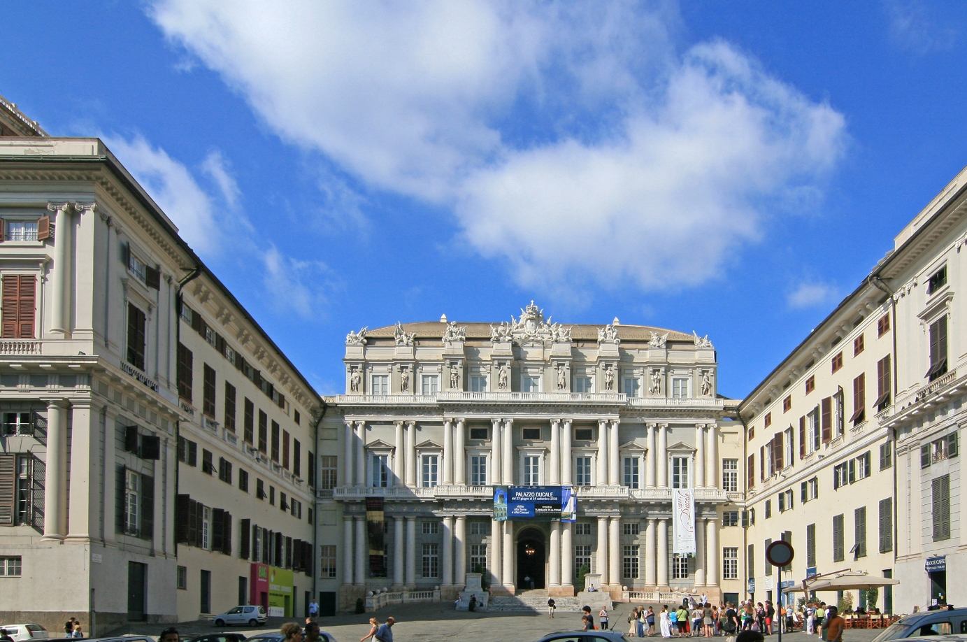
Italien
IT-Times
Italien
 Landwirtschaft, Forstwirtschaft, Viehzucht, Fischerei

 Luft- und Raumfahrt
*ASI
Luft- und Raumfahrt
*CNES
Luft- und Raumfahrt
*DLR
Luft- und Raumfahrt
*ESA
Luxemburg
Luft- und Raumfahrt
*ASI
Luft- und Raumfahrt
*CNES
Luft- und Raumfahrt
*DLR
Luft- und Raumfahrt
*ESA
Luxemburg

 Militär,Verteidigung und Ausrüstung
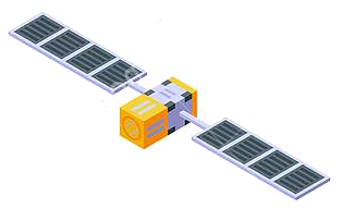
Navigation Satellite System
Niederlande
Norwegen
Österreich
Portugal
Rumänien
Militär,Verteidigung und Ausrüstung
Navigation Satellite System
Niederlande
Norwegen
Österreich
Portugal
Rumänien
 Schiffe und Nautik
Schweden
Spanien
Schiffe und Nautik
Schweden
Spanien
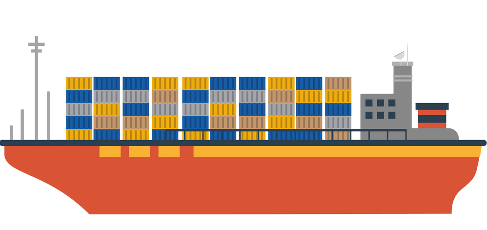
 Transport und Verkehr
Tschechien
Vereinigtes Königreich
Transport und Verkehr
Tschechien
Vereinigtes Königreich
 Wissenschaft und Technik
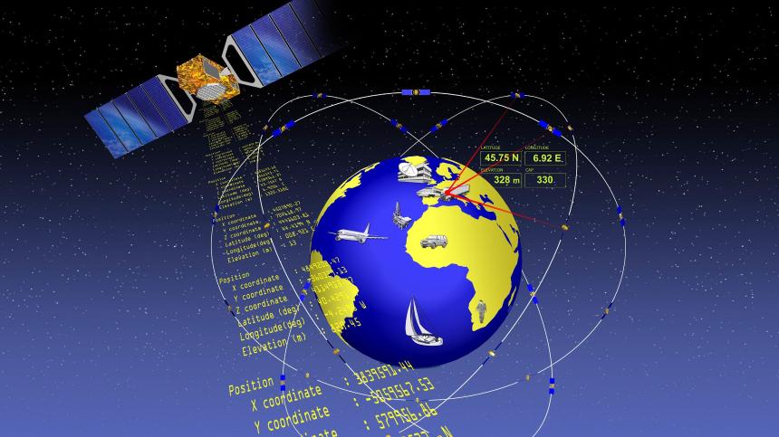
Die genaue Bestimmung des Standorts und der Zeit - Informationen, die in Zukunft immer häufiger mit hoher Zuverlässigkeit zu zur Verfügung stehen müssen. In wenigen Jahren wird dies mit dem Satellitennavigationssystem GALILEO, einer gemeinsamen Initiative der Europäischen Union und der Europäischen Weltraumorganisation (ESA), möglich sein. Dieses weltweite System wird zugleich komplementär zum derzeitigen GPS-System sein.
Die Satellitennavigation ist eine Spitzentechnologie. Dabei werden von mehreren Satelliten im Weltraum höchst genaue Zeitsignale ausgestrahlt, anhand derer jedermann mit einem kleinen und preisgünstigen Empfangsgerät seinen Standort oder den eines bewegten oder unbewegten Objekts (Fahrzeug, Schiff, Viehherde usw.) auf den Meter genau bestimmen kann.
GALILEO basiert auf einer Konstellation von 30 Satelliten und Bodenstationen, die Nutzer aus den verschiedensten Bereichen mit Ortungsinformationen versorgen können. Zu diesen Sektoren gehören das Verkehrswesen (Ortung und Ermittlung der Geschwindigkeit von Fahrzeugen, Wegplanung, Navigationssysteme usw.), soziale Einrichtungen (z.B. Hilfe für Behinderte oder Senioren), die Justiz und der Zoll (Feststellung des Aufenthaltsortes von Verdächtigen, Grenzkontrollen), das Bauwesen (geografische Informationssysteme), Not- und Rettungsdienste oder der Freizeitsektor (Orientierung auf dem Meer und in den Bergen usw.).(Quelle: http://ec.europa.eu/dgs/energy_transport/galileo/index_de.htm)
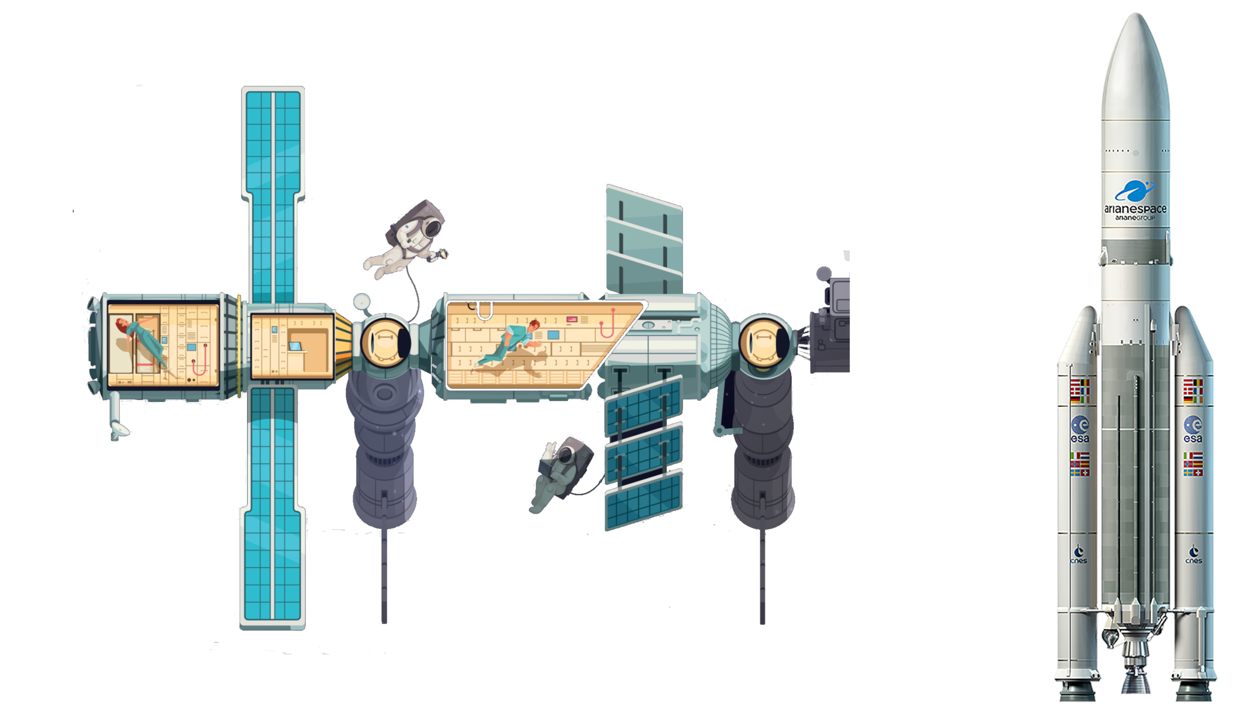
Galileo ist ein im Aufbau befindliches, teilweise bereits operationelles, europäisches globales Satellitennavigations- und Zeitgebungssystem unter ziviler Kontrolle (europäisches GNSS).[1]
Es liefert weltweit Daten zur genauen Positionsbestimmung und ähnelt dem US-amerikanischen NAVSTAR-GPS, dem russischen GLONASS-System und dem chinesischen Beidou-System. Die Systeme unterscheiden sich hauptsächlich durch die Frequenznutzungs-/Modulationskonzepte, die Art und Anzahl der angebotenen Dienste und die Art der Kontrolle (GLONASS, Beidou und GPS sind militärisch kontrolliert).
Auftraggeber von Galileo ist die Europäische Union. Der Sitz der Agentur für das Europäische GNSS (Galileo-Agentur, GSA) befindet sich seit 2014 in der tschechischen Hauptstadt Prag.[2]
Mit Stand Ende 2017 sind 22 der vorgesehenen 30 Satelliten in ihrem Orbit.[3] Bis Ende 2019 sollen alle Satelliten in ihre Umlaufbahn gebracht werden. Das Satellitennavigationssystem ist für die Allgemeinheit seit dem 15. Dezember 2016 zugänglich.[4][5]
伽利略定位系统(意大利语:Galileo),是一个正在建造中的卫星定位系统,该系统由欧盟通过欧洲空间局和欧洲导航卫星系统管理局建造[3],总部设在捷克共和国的布拉格。该系统有两个地面操控站,分别位于德国慕尼黑附近的奥伯法芬霍芬和意大利的富齐诺。这个造价五十亿欧元[4]的项目是以意大利天文学家伽利略的名字命名的。伽利略系统的目的之一是为欧盟国家提供一个自主的高精度定位系统,该系统独立于俄罗斯的格洛纳斯系统和美国的全球定位系统(GPS),在这些系统被关闭时,欧盟就可以使用伽利略系统。该系统的基本服务(低精度)是提供给所有用户免费使用的,高精度定位服务仅提供给付费用户使用。伽利略系统的目标是在水平和垂直方向提供精度1米以内的定位服务,并且在高纬度地区提供比其他系统更好的定位服务。[5]
伽利略系统是中地球轨道搜救卫星系统的一部分,可提供一种新的全球搜救方式。伽利略系统的卫星安装有转发器,可以把求救信号从事故地点发送到救援协调中心,救援协调中心就会开始组织救援。同时,该系统还会发射一个返回信号到事故地点处,通知求救人员他们的信号已被收到,相应的救援也正在展开。现有的全球卫星搜救系统是不具备反馈信号功能的,所以伽利略系统这个发消息功能被认为是对全球卫星搜救系统的一个重要升级。[6]2014年,研究人员对伽利略系统的搜救功能进行了测试,该系统是作为当时的全球卫星搜救系统的一部分工作的,测试结果显示,该系统对77%的模拟求救位置定位精度在2千米以内,95%的求救位置定位精度在5千米以内。[7]
伽利略系统的第一颗试验卫星GIOVE-A于2005年12月28日发射,第一颗正式卫星于2011年8月21日发射。该系统计划发射30颗卫星,截止2016年5月,已有14颗卫星发射入轨。伽利略系统于2016年12月15日在布鲁塞尔举行激活仪式,提供早期服务。于2017年到2018年提供初步工作服务,最终于2019年具备完全工作能力。[8] 该系统的30颗卫星预计将于2020年前发射完成,其中包含24颗工作卫星和6颗备用卫星。[9]
ガリレオ(Galileo)は、EUが構築した全地球航法衛星システム。
ガリレオはEUによる全地球航法衛星システムである。高度約24000kmの上空に30機の航法衛星を運用することを予定している。民間主体としては初の衛星航法システムであり、EUはアメリカ国防総省が運営するGPSのように、軍事上の理由によるサービスの劣化及び中断を避けられる利点があるとコメントしている。さらに、測位にかかる時間が短縮され、GPSの数メートルに比べて1メートルまで精度を向上できる。
試験衛星は2005年12月28日に1機目のGIOVE-A衛星が打ち上げられ、2006年1月12日から試験電波が発射されており、2007年5月2日に英Surrey Satellite Technologyによって作成された航法メッセージがギルドフォード地球局からGIOVE-A衛星にアップロードされ放送された。2006年中に打ち上げ予定だった2機目の試験衛星GOOV-Bは、打上げが2008年4月まで遅れた。本格利用開始は2010年頃とされていたが、2013年へと先送りされ、2010年末段階計画では2014年末に18機による初期運用とし2016年末に規定の機数による本格運用に入る計画で進められている。年間の運用コストはEGNOSと合わせて8億ユーロになると見積もられている。
無料で利用できるGPSに対して、莫大な費用を投資し有料での活用を予定しているガリレオの採算性を疑問視する意見も多い。当初の事業費は36億ユーロないし38億ユーロと見込まれており、うち民間企業が24億ユーロを負担する予定だったが、2007年に共同事業体が解散し計画の中止が検討された。2007年5月にEUは公的資金で全額を肩代わりすることを決定し、11月に承認された。2010年には、Wikileaksによって漏出したアメリカ外交当局の資料に、ガリレオに用いる14機の衛星製造を請け負っているドイツの契約企業の担当役員が、ガリレオ計画を「フランスの国益に基づく馬鹿げたアイデア」だとコメントしたことが明らかとなり、問題の役員が解任される騒ぎがあった[1]。
Galileo is the global navigation satellite system (GNSS) that went live in 2016,[4] created by the European Union (EU) through the European GNSS Agency (GSA),[5] headquartered in Prague in the Czech Republic,[6] with two ground operations centres, Oberpfaffenhofen near Munich in Germany and Fucino in Italy. The €10 billion project[3][7] is named after the Italian astronomer Galileo Galilei. One of the aims of Galileo is to provide an independent high-precision positioning system so European nations do not have to rely on the U.S. GPS, or the Russian GLONASS systems, which could be disabled or degraded by their operators at any time.[8] The use of basic (lower-precision) Galileo services will be free and open to everyone. The higher-precision capabilities will be available for paying commercial users. Galileo is intended to provide horizontal and vertical position measurements within 1-metre precision, and better positioning services at higher latitudes than other positioning systems. Galileo is also to provide a new global search and rescue (SAR) function as part of the MEOSAR system.
The first Galileo test satellite, the GIOVE-A, was launched 28 December 2005, while the first satellite to be part of the operational system was launched on 21 October 2011. As of July 2018, 26 of the planned 30 active satellites are in orbit.[9][10] Galileo started offering Early Operational Capability (EOC) on 15 December 2016,[1] providing initial services with a weak signal, and is expected to reach Full Operational Capability (FOC) in 2019.[11] The complete 30-satellite Galileo system (24 operational and 6 active spares) is expected by 2020.[12]
Le programme Galileo est un système de positionnement par satellites (radionavigation) développé par l'Union européenne et incluant un segment spatial dont le déploiement doit s'achever vers 2020. Comme les systèmes américain GPS, russe GLONASS et chinois Beidou, il permet à un utilisateur muni d'un terminal de réception d'obtenir sa position. La précision attendue pour le service de base, gratuit, est de 4 mètres horizontalement et de 8 mètres en altitude[réf. nécessaire]. Un niveau de qualité supérieur sera fourni dans le cadre de services payants proposés aux professionnels.
Le segment spatial de Galileo sera constitué à terme de 30 satellites dont 6 de rechange. Chaque satellite, d'une masse d'environ 700 kg, circule sur une orbite moyenne (23 222 kilomètres) dans trois plans orbitaux distincts ayant une inclinaison de 56°. Ces satellites émettent un signal qui leur est propre et retransmettent un signal de navigation fourni par le segment de contrôle de Galileo. Ce dernier est constitué par deux stations chargées également de surveiller l'orbite et l'état des satellites.
Le projet Galileo, après une phase de définition technique qui débute en 1999, est lancé le 26 mai 2003 avec la signature d'un accord entre l'Union européenne et l'Agence spatiale européenne chargée du segment spatial. Une des motivations principales du projet est de mettre fin à la dépendance de l'Europe vis-à-vis du système américain, le GPS. Contrairement à ce dernier, Galileo est uniquement civil. Le projet parvient à surmonter l'opposition de certains membres de l'UE et d'une partie des décideurs américains ainsi que les difficultés de financement (le coût final est évalué à 5 milliards d'euros). Les tests de Galileo débutent fin 2005 grâce aux lancements des satellites précurseurs Giove-A et Giove-B en décembre 2005 et avril 2008. Les premiers satellites en configuration opérationnelle (FOC) sont lancés en août 2014. Au 15 août 2018, vingt-six satellites ont été lancés, dont 18 sont opérationnels et 4 en cours de mise en service1. Les premiers services de Galileo sont opérationnels depuis le 15 décembre 20162,3. La précision maximale ne sera pas atteinte avant 2020, lorsque 24 des 30 satellites seront opérationnels3,4. En janvier 2018, Galileo compte déjà près de 100 millions d'utilisateurs5, et 200 millions en septembre6.
Il sistema di posizionamento Galileo è un sistema di posizionamento e navigazione satellitare civile (in inglese GNSS - Global Navigation Satellite System), sviluppato in Europa come alternativa al Global Positioning System (NAVSTAR GPS), controllato invece dal Dipartimento della Difesa degli Stati Uniti d'America.
La sua entrata in servizio prevista per la fine del 2019[1] è stata anticipata al 15 dicembre 2016[2]. Il sistema una volta completato potrà contare su 26 satelliti artificiali orbitanti (24 operativi più 2 di scorta)[3] su 3 piani inclinati rispetto al piano equatoriale terrestre di circa 56° e ad una quota di circa 23.925 km[3]. Le orbite che saranno seguite dai satelliti sono quelle MEO (Medium earth orbit). A luglio 2018 si trovano in orbita 26 satelliti ma non tutti sono completamente operativi.
Galileo es el programa europeo de radionavegación y posicionamiento por satélite desarrollado por la Unión Europea (UE) conjuntamente con la Agencia Espacial Europea. Este programa dota a la Unión Europea de una tecnología independiente del GPS estadounidense y el GLONASS ruso.1 Al contrario de estos dos, será de uso civil.2 El sistema se pudo poner en marcha el 15 de diciembre del 20163 con alrededor de media constelación y será completado para 2020.4
«Галиле́о» (Galileo) — совместный проект спутниковой системы навигации Европейского союза и Европейского космического агентства, является частью транспортного проекта Трансевропейские сети (англ. Trans-European Networks). Система предназначена для решения геодезических и навигационных задач. В последнее время всё больше производителей ГССН-оборудования интегрируют в свои спутниковые приёмники и антенны возможность принимать и обрабатывать сигналы со спутников «Галилео», этому способствует достигнутая договорённость о совместимости и взаимодополнении с системой NAVSTAR GPS третьего поколения. Финансирование проекта будет осуществляться в том числе за счёт продажи лицензий производителям приёмников.
Помимо стран Европейского Союза, в проекте участвуют: Китай, Израиль, Южная Корея, Украина. Кроме того, ведутся переговоры с представителями Аргентины, Австралии, Бразилии, Чили, Индии, Малайзии. Ожидалось, что «Галилео» войдёт в строй в 2014—2016 годах, когда на орбиту будут выведены все 30 запланированных спутников (24 операционных и 6 резервных[1]). Но на 2018 год спутниковая группировка «Галилео» так и не достигла необходимого количества аппаратов. Компания Arianespace заключила договор на 10 ракет-носителей «Союз» для запуска спутников, начиная с 2010 года[2]. Космический сегмент будет обслуживаться наземной инфраструктурой, включающей в себя три центра управления и глобальную сеть передающих и принимающих станций.
В отличие от американской GPS и российской ГЛОНАСС, система «Галилео» не контролируется национальными военными ведомствами, однако в 2008 году парламент ЕС принял резолюцию «Значение космоса для безопасности Европы», согласно которой допускается использование спутниковых сигналов для военных операций, проводимых в рамках европейской политики безопасности. Разработку системы осуществляет Европейское космическое агентство. Общие затраты оцениваются в 4,9 млрд евро.
Спутники «Галилео» выводятся на круговые геоцентрические орбиты высотой 23 222 км (или 29 600 км от центра Земли), проходят один виток за 14 ч 4 мин 42 с и обращаются в трёх плоскостях, наклонённых под углом 56° к экватору. Долгота восходящего узла каждой из трёх орбит отстоит на 120° от двух других. На каждой из орбит при полном развёртывании системы будет находиться 8 действующих и 2 резервных спутника. Эта конфигурация спутниковой группировки обеспечит одновременную видимость из любой точки земного шара по крайней мере четырёх аппаратов. Временна́я погрешность атомных часов, установленных на спутниках, составляет одну миллиардную долю секунды, что обеспечит точность определения места приёмника около 30 см на низких широтах. За счёт более высокой, чем у спутников GPS, орбиты, на широте Полярного круга будет обеспечена точность до одного метра.
Каждый аппарат «Галилео» весит около 675 кг, его габариты со сложенными солнечными батареями составляют 3,02×1,58×1,59 м, а с развёрнутыми — 2,74×14,5×1,59 м, энергообеспечение равно 1420 Вт на солнце и 1355 Вт в тени. Расчётный срок эксплуатации спутника превышает 12 лет.
 Geographie
Ägypten
Algerien
Geographie
Ägypten
Algerien
 Essen und Trinken
*Oliven/Olivenöl
Griechenland
Italien
Landwirtschaft, Forstwirtschaft, Viehzucht, Fischerei
Marokko
Portugal
Spanien
Syrien
Tunesien
Türkei
Essen und Trinken
*Oliven/Olivenöl
Griechenland
Italien
Landwirtschaft, Forstwirtschaft, Viehzucht, Fischerei
Marokko
Portugal
Spanien
Syrien
Tunesien
Türkei

| Rank | Country | Production (Tonnes) | Production per Capita (Kg) | Harvasted Area (Ha) | Yield (Kg/Ha) |
|---|---|---|---|---|---|
| 1 | Spain | 6,559,884 | 141 | 2,573,473 | 2,549 |
| 2 | Greece | 2,343,383 | 218 | 887,177 | 2,641 |
| 3 | Italy | 2,092,175 | 34.6 | 1,165,562 | 1,795 |
| 4 | Turkey | 1,730,000 | 21.4 | 845,542 | 2,046 |
| 5 | Morocco | 1,416,107 | 40.7 | 1,008,365 | 1,404 |
| 6 | Syria | 899,435 | 49.2 | 765,603 | 1,175 |
| 7 | Tunisia | 700,000 | 61.2 | 1,646,060 | 425 |
| 8 | Algeria | 696,962 | 16.4 | 424,028 | 1,644 |
| 9 | Egypt | 694,309 | 7.1 | 67,293 | 10,318 |
| 10 | Portugal | 617,610 | 60.0 | 355,075 | 1,739 |
| 11 | Libya | 188,975 | 29.2 | 357,797 | 528 |
| 12 | Argentina | 175,094 | 3.9 | 61,942 | 2,827 |
| 13 | United States of America | 159,600 | 0.49 | 14,164 | 11,268 |
| 14 | Lebanon | 118,146 | 19.4 | 62,297 | 1,897 |
| 15 | Jordan | 115,813 | 11.3 | 63,963 | 1,811 |
| 16 | Chile | 111,481 | 6.3 | 20,343 | 5,480 |
| 17 | Albania | 99,075 | 34.5 | 38,889 | 2,548 |
| 18 | Palestinian Territories | 95,044 | | 66,645 | 1,426 |
| 19 | Israel | 91,000 | 10.2 | 33,700 | 2,700 |
| 20 | Iran | 85,049 | 1.0 | 66,915 | 1,271 |
| 21 | Australia | 75,083 | 3.0 | 32,747 | 2,293 |
| 22 | Peru | 56,157 | 1.8 | 17,119 | 3,281 |
| 23 | Croatia | 31,183 | 7.4 | 18,184 | 1,715 |
| 24 | France | 27,102 | 0.40 | 17,354 | 1,562 |
| 25 | Mexico | 21,650 | 0.17 | 5,094 | 4,250 |
| 26 | Cyprus | 13,499 | 15.8 | 10,612 | 1,272 |
| 27 | Macedonia | 12,369 | 6.0 | 5,852 | 2,114 |
| 28 | El Salvador | 10,840 | 1.6 | 5,227 | 2,074 |
| 29 | Iraq | 9,332 | 0.24 | 2,294 | 4,068 |
| 30 | Afghanistan | 7,647 | 0.24 | 2,200 | 3,476 |
| 31 | Uruguay | 6,159 | 1.8 | 2,985 | 2,063 |
| 32 | Taiwan | 2,621 | 0.11 | 318 | 8,256 |
| 33 | China | 2,621 | 0.00188 | 318 | 8,256 |
| 34 | Slovenia | 1,662 | 0.80 | 1,173 | 1,417 |
| 35 | Azerbaijan | 1,586 | 0.16 | 2,979 | 533 |
| 36 | Brazil | 647 | 0.00309 | 574 | 1,127 |
| 37 | Bosnia and Herzegovina | 359 | 0.095 | 254 | 1,416 |
| 38 | Montenegro | 250 | 0.40 | 90.0 | 2,778 |
| 39 | Uzbekistan | 116 | 0.00355 | 117 | 987 |
| 40 | Kuwait | 60.0 | 0.014 | 35.0 | 1,702 |
| 41 | Malta | 30.0 | 0.063 | 28.0 | 1,064 |
Belarus
 Berlin
 Brandenburg
 Bremen
Dänemark
Deutschland
Estland
Finnland
Frankreich
Bremen
Dänemark
Deutschland
Estland
Finnland
Frankreich
 Hamburg
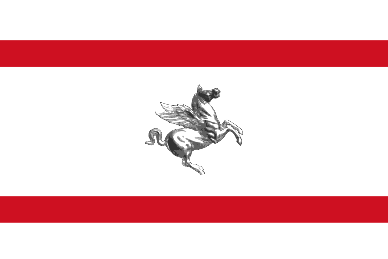
Italien
Lettland
Litauen
Hamburg
Italien
Lettland
Litauen
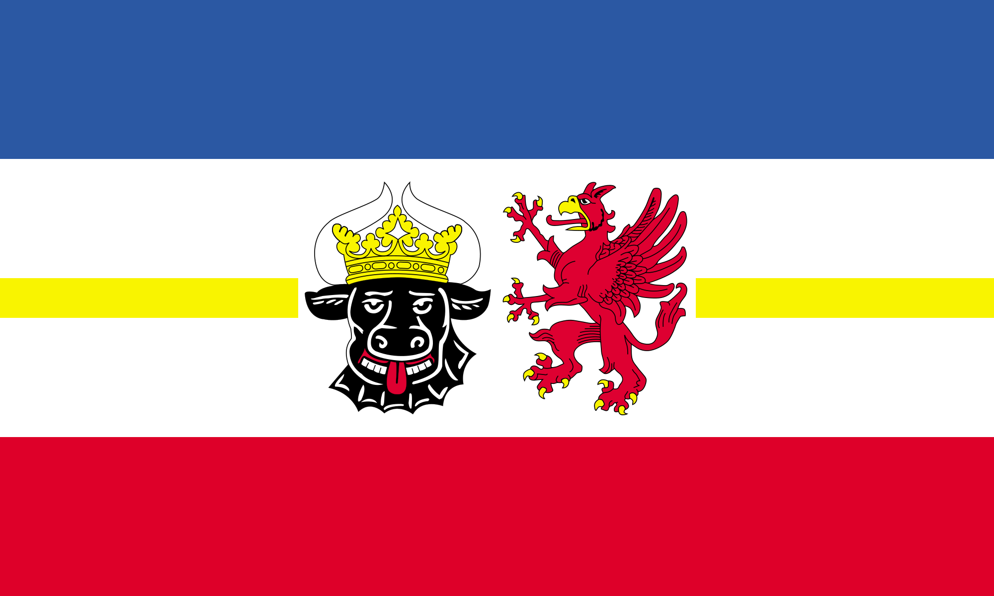 Mecklenburg-Vorpommern
Niederlande
Mecklenburg-Vorpommern
Niederlande
 Niedersachsen
 Nordrhein-Westfalen
Polen
Russland
Nordrhein-Westfalen
Polen
Russland
 Sachsen
 Sachsen-Anhalt
 Schleswig-Holstein
Schweden
Schweiz
Vereinigtes Königreich
Schleswig-Holstein
Schweden
Schweiz
Vereinigtes Königreich
 Weltkulturerbe

Die Backsteingotik (englisch Brick Gothic, polnisch Gotyk ceglany) umfasst gotische Bauwerke, die aus oder mit sichtbarem Backstein errichtet wurden. Sie ist vor allem in Norddeutschland, dem Ostseeraum und den Niederlanden[1] verbreitet. Ihr Verbreitungsgebiet erstreckt sich im Westen bis an die Straße von Dover und im Südosten bis nach Galizien. Der auch oft verwendete Begriff Norddeutsche Backsteingotik erfasst daher nur einen Teil der gesamten Backsteingotik. Gotische Backsteinarchitektur in Italien und Südfrankreich wird in der Regel allein den dortigen Regionalstilen zugerechnet.
Die mittelalterliche Verwendung von Backstein als Baustoff setzte nördlich der Alpen im 12. Jahrhundert ein. Die ältesten Bauten gehören deshalb noch der so genannten Backsteinromanik an. Im 16. Jahrhundert ging die Backsteingotik in die Backsteinrenaissance über. Die geografische Verbreitung des Bauens aus Backstein und mit sichtbarem Backstein unterlag vom Beginn des Hochmittelalters bis in die frühe Neuzeit aber durchaus Veränderungen. So gab es in Teilen des Münsterlandes zwischen Pionierbauten der Romanik und dem starken Backsteineinsatz in Renaissance und Barock eine zeitliche Lücke.
Viele von der Backsteingotik geprägte Altstädte und Einzelbauten wurden in die Liste des UNESCO-Welterbes aufgenommen.
一种特别在德国北海和波罗的海海岸常见的哥特式建筑是用烤砖建造起来的建筑结构.这个十二世纪开始使用那红色的烤砖作为建 筑材料的独特建筑风格之所以在北部德国低地如此普及是因为这块地区缺少天然石而且运输也非常困难,由于那片地区和汉萨盟的一 致性,因此它就成为了汉萨同盟的象征.有些历史悠久的建筑也就成了联合国教科文组织世界文化遗产项目之一。
Brick Gothic (German: Backsteingotik, Polish: Gotyk ceglany, Dutch: Baksteengotiek) is a specific style of Gothic architecture common in Northwest and Central Europe especially in the regions in and around the Baltic Sea, which do not have resources of standing rock, but in many places a lot of glacial boulders. The buildings are essentially built using bricks. Buildings classified as Brick Gothic (using a strict definition of the architectural style based on the geographic location) are found in Belgium (and the very north of France), Netherlands, Germany, Poland, Lithuania, Latvia, Estonia, Kaliningrad (former East Prussia), Sweden and Finland.
As the use of baked red brick arrived in Northwestern and Central Europe in the 12th century, the oldest such buildings are classified as the Brick Romanesque. In the 16th century, Brick Gothic was superseded by Brick Renaissance architecture.
Brick Gothic is characterised by the lack of figural architectural sculpture, widespread in other styles of Gothic architecture. Typical for the Baltic Sea region is the creative subdivision and structuring of walls, using built ornaments and the colour contrast between red bricks, glazed bricks and white lime plaster. Nevertheless, these characteristics are neither omnipresent nor exclusive. Many of the old town centres dominated by Brick Gothic, as well as some individual structures, have been listed as UNESCO World Heritage sites.
The real extent and the real variety of this brick architecture has to be distinguished from the view of late 19th and early 20th century, especially the years around the end of World War I, when it was instrumentalized, politically.
Indeed, about a quarter of medieval Gothic brick architecture is standing in the Netherlands, in Flanders and in French Flanders. Some dominant buildings combinations of brick and stone. But the criterion "no stone at all" looks like a trick to exclude them.[according to whom?] The towers of St Mary church in Lübeck, the very top Brick Gothic church of the Baltic Sea region, have corners of granite ashley. And many village churches in northern Germany and Poland have Brick Gothic design, but most of their walls are formed by boulders.
L'architettura gotica dei paesi baltici è una varietà regionale dell'architettura gotica, in particolare del gotico tedesco. Le aree coinvolte in questa forma di architettura medievale si affacciano sul mar Baltico e sul Mare del Nord e, da un punto di vista politico, comprendevano gli stati settentrionali del Sacro Romano Impero, le città della Lega Anseatica, i possedimenti dell'Ordine Teutonico. Il periodo interessato va dal XIII secolo al XV secolo.
Le caratteristiche distintive sono che si tratta di un'architettura prevalentemente in laterizio e di una rielaborazione originale e per certi aspetti molto distante dall'iniziale gotico francese. I paesi europei attuali che hanno testimonianze di questa architettura sono Germania, Polonia, Lituania, Lettonia, Estonia, e nell'area della storica Prussia Orientale, (Oblast di Kaliningrad Russia); alcune testimonianze sono anche presenti in Scandinavia.
Le gothique de brique (allemand : Backsteingotik) est un style d´architecture gothique du Nord de l´Europe, et plus particulièrement du Nord de l'Allemagne et des régions autour de la mer Baltique. Il s'est surtout répandu dans les villes culturellement allemandes de l'ancienne Ligue Hanséatique à partir du XIIIe siècle, puis bien au-delà par influence (Scandinavie, Flandres, toute la Pologne, Allemagne du Sud). Les bâtiments sont essentiellement constitués de briques et le style de la décoration s'est adapté aux possibilités et aux limites de ce matériaux, conférant à cette architecture une identité bien particulière.
Il existe d'autres styles d'architecture gothique en brique en Europe, plus ou moins indépendants, comme en Italie et dans la région Toulousaine en France. Le style gothique baltique ne comprend pas tout le gothique en brique d'Europe.
El gótico báltico (en alemán, Norddeutsche Backsteingotik), forma la parte mayor del gótico de ladrillos (en alemán: Backsteingotik). Es una variante de la arquitectura gótica y neogótica que apareció en la Europa septentrional. Sin la especificación "Baltico" es estendido del estrecho de Calais a la Galicia de los Cárpatos. Con la especificación "Baltico" esta concentrada en el norte de Alemania y las zonas aledañas al mar Báltico. En todas estas regiones mancan recursos naturales para construir edificios de piedra. Se extendió principalmente en las ciudades culturalmente alemanas de la antigua Liga Hanseática desde el siglo XIII, y luego por influencia (Escandinavia, toda Polonia, el sur de Alemania). Los edificios son esencialmente de ladrillo y el estilo de decoración se ha adaptado a las posibilidades y límites de este material, dando a esta arquitectura una identidad muy particular.
Кирпичная, ганзейская или северогерманская готика — разновидность готического стиля архитектуры, распространённая в Северной Германии, Польше, Белоруссии и Прибалтике в XIII—XVI веках. Красный керамический кирпич как строительный материал стал использоваться в Северной Европе в XII веке, поэтому самые древние кирпичные образцы относятся ещё к так называемой «кирпичной романике». В XVI в. кирпичную готику сменил «кирпичный ренессанс».
Для кирпичной готики характерны, с одной стороны, отсутствие скульптурных украшений, которые невозможно выполнить из кирпича, и, с другой стороны, богатство орнаментальных деталей кладки и структуризация плоскостей за счёт чередования красного либо глазурованного кирпича и известковой побелки стен.
Многие города, внешний облик которых украшают готические сооружения из красного кирпича, являются объектами Всемирного культурного наследия ЮНЕСКО.
 Leben und Style
 Unternehmen
 Modewelt
 Abruzzo
 Basilicata
 Calabria
 Campania
 Emilia-Romagna
 Geschichte
I 500 - 0 vor Christus
Geschichte
J 0 - 500 nach Christus
Italien
Geschichte
I 500 - 0 vor Christus
Geschichte
J 0 - 500 nach Christus
Italien
 Lazio
Lazio
 Liguria
 Lombardia
 Marche
 Molise
 Piemonte
 Puglia
 Toscana
 Umbria
 Veneto
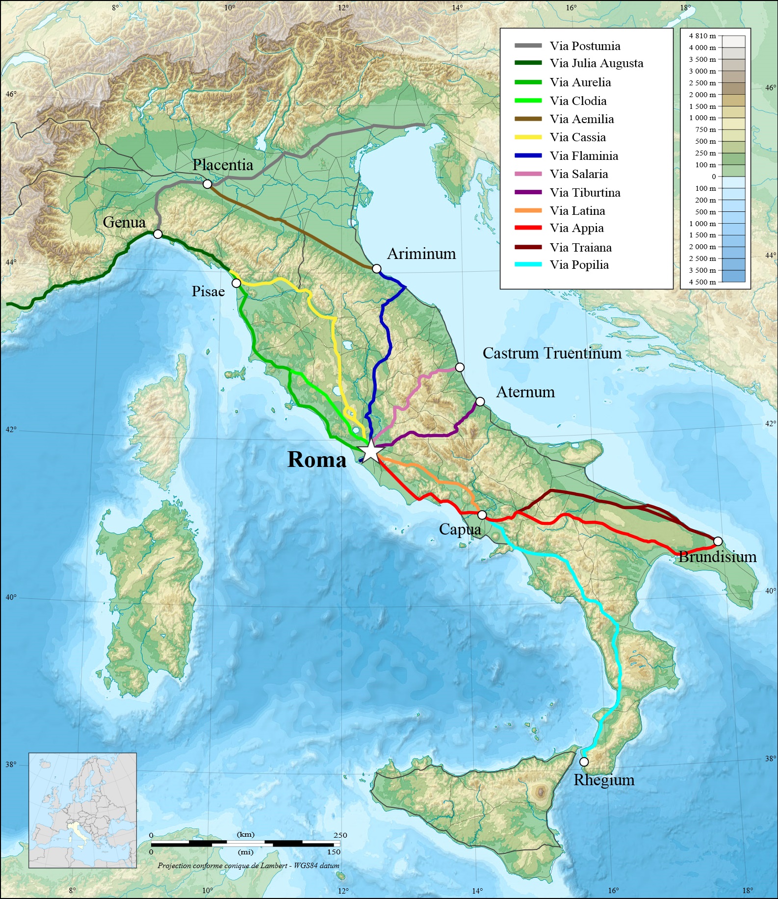
| Bauzeit und Erbauer | Verlauf | |
|---|---|---|
| Via Aemilia | 187 v. Chr. unter Marcus Aemilius Lepidus | Von Rimini (Ariminum), am Ende der Via Flaminia, über Cesena, Bologna nach Piacenza (Placentia) und Mailand (Mediolanum), jetzt die Staatsstraße 9 |
| Via Aemilia Scaura | 109 v. Chr. unter Marcus Aemilius Scaurus | Verlängerte Via Aurelia, von Pisa entlang der östlichen ligurischen Küste über Genua nach Vado Ligure (Vada Sabatia), weiter als Via Iulia Augusta, bzw. nach Piacenza (Placentia) |
| Via Amerina | Von Rom nach Ameria (heute Amelia) und Perugia | |
| Via Annia | 153 v. Chr. unter Konsul Tito Annio Lusco | Vom Hafen Adria über Padua nach Aquileia |
| Via Appia | 312 v. Chr. unter Appius Claudius Caecus | Älteste Römerstraße. Von Rom über Albano, Terracina, Fondi, Capua, Benevento (Beneventum), Venosa und Tarent (Tarantum) nach Brindisi (Brundisium, 264 v. Chr.) in Apulien, jetzt etwa die Staatsstraße 7 |
| Via Ardeatina | Von Rom über Falcognana nach Ardea (bei Aprilia) | |
| Via Aurelia | 241 v. Chr. unter Gaius Aurelius Cotta | Von Rom über Orbetello (Cosa), Pisa nach Lucca, später über Genua, Savona nach Ventimiglia und weiter nach Gallien (Frankreich), jetzt die Staatsstraße 1 |
| Via Caecilia | 142 v. Chr. unter Lucius Caecilius Metellus Calvus bzw. 117 v. Chr. unter Lucius Caecilius Metellus Diadematus | Von der Via Salaria abzweigend über Amiternum (bei L´Aquila), überwindet den zentralen Apennin am Passo delle Capanelle und führt nach Hatria (heute Atri) bzw. über Teramo nach Castrum Novum (Giulianova) zur Adria |
| Via Campana | Den Tiber entlang, parallel zur Via Portuense bzw. zur Saline Veienti | |
| Via Casilina | Von Rom über Anagni, Frosinone nach Casilinum bei Cassino (entspricht ab Anagni der Via Latina) | |
| Via Cassia | 171 v. Chr. | Von Rom (abzweigend von der Via Flaminia) über Sutri, Viterbo durch Etrurien und über Arezzo (Aretium) nach Florenz (Florentia) und weiter über Pistoia nach Lucca und Pisa (zur Via Aurelia) |
| Via Clodia | 225 v. Chr. | Von Rom (abzweigend von der Via Cassia) über Bracciano und Vejano wieder zur Via Cassia |
| Via Collatina Antica | Von Rom südlich des Flusses Aniene nach Collatia bei Palestrina (Penestrina) | |
| Via Domitiana | 95 v. Chr. unter Domitian | Von Terracina über Pozzuoli (Puteoli) nach Portus Julius am Golf von Neapel und weiter über Neapel (Neapolis) nach Reggio (Rhegium) |
| Via Empolitana | Von Tivoli nach Subiaco | |
| Via Farnesiana | Abzweigend von der Via Aurelia zum Ort Farnese (Castrum Farneti) westl. des Bolsena-See | |
| Via Flaminia | 220 v. Chr. unter Gaius Flaminius | Von Rom über Narni (Narnia) nach Fano (Fanum Fortunae) bzw. bis nach Rimini (Ariminum), jetzt Staatsstraße 3 |
| Via Flaminia Nuova | Neuere Variante der Via Flaminia über Spoleto (Spoletum) | |
| Via Flaminia Minor | 187 v. Chr. | Von Arezzo (Arretium) nach Rimini (Ariminum) |
| Via Gallica | Von Verona (abzweigend von der Via Postumia) über Brescia, Bergamo nach Mailand | |
| Via Iulia Augusta | 13 v. Chr. unter Augustus | Fortführung der Via Aurelia und Via Postumia von Genua über Vado Ligure (Vada Sabatia) entlang der ligurischen Küste über Albenga (Albigaunum) und Ventimiglia (Albintimilium) und durch die Seealpen nach Westen bis Arles (Arelate) bzw. Tarascon in Gallien (Anschluss an die Via Domitia) (heute Provence) |
| Via Iulia Augusta | Eine andere „Via Iulia Augusta“ führt von Aquileia nordwärts über Zúglio (Karnische Alpen, Iulium Carnicum) und den Plöckenpass bis ins Drautal, teilt sich bei Irschen (castrum Ursen) und führt über Aguntum (bei Lienz/Osttirol) und Innichen (Littamum) nach Veldidena (Wilten/Innsbruck) bzw. über Teurnia (bei Spittal an der Drau) und Virunum (am Magdalensberg bei Klagenfurt) nach Iuvavum (Salzburg) | |
| Via Labicana | Von Rom, von der Via Latina über Labicum zur Via Praenestina | |
| Via Latina | Von Rom nördlich der Albaner Berge über Anagni, Ferentinum, Frosinone (Frusino) und Liri nach Capua (Anschluss an die Via Appia) | |
| Via Laurentina | Von Rom nach Laurentum (San Lorenzo am Thyrrhenischen Meer) | |
| Via Nomentana | Von Rom nach Nomentum (heute Mentana) (früher Via Ficulensis nach Ficulea) | |
| Via Ostiense | Von Rom nach Ostia (römische Hafenstadt) südlich des Tiber | |
| Via Palombarese | Mittelalterliche Bezeichnung der Straße von der Via Nomentana nach Polombara Sabina | |
| Via Pompea | 210 v. Chr. | Umrundung von Sizilien |
| Via Popilia | 132 v. Chr. unter Konsul Publio Popillio Lenate | Von Capua, über Nocera (Nuceria), Morano(Moranum), Cosenza (Cosentia), Vibo (Valentia) nach Reggio Calabria (Rhegium) |
| Via Popilia-Annia | 132 v. Chr. | Von Rimini nach Aquileia |
| Via Portuense | unter Claudius | Von Rom zum Hafen Portus Augusti nördlich des Tiber (in der Nähe des heutigen Flughafens Fiumicino) |
| Via Postumia | 148 v. Chr. | Von Aquileia, über Oderzo, Vicenza, Verona, Cremona, Piacenza (Placentia), Voghera (Iria), Tortona (Dertona), Serravalle (Libarna) nach Genua (erbaut unter Postumio Albino) |
| Via Praenestina | Von Rom nach Palestrina (Praeneste) (früher als Via Gabina bezeichnet) | |
| Via Sabina | Von der Via Salaria abzweigend nach L´Aquila | |
| Via Salaria | Von Rom über Settebagni, Fara in Sabina, Rieti, Antrodoco, Arquata und Ascoli Piceno nach Porto d´Ascoli zur Adria in den Marken, jetzt die Staatsstraße 4 | |
| Via Salaria Gallica | Von Fossombrone (Forum Sempronii) über Suasa, Ostra, Jesi, Macerata, Urbisaglia, Falesone nach Ascoli Piceno (Asculum) in den Marken (Verbindung der Via Flaminia und Via Salaria, im Landesinnern) | |
| Via Salaria Picena | Verbindet die Via Flaminia und die Via Salaria, von Fano (Fanum Fortunae) nach Castrum Truentinum bei Porto d´Ascoli an der Adria (Küstenstraße) | |
| Via Salaria Vecchia | Von Ascoli über S.Omero und Giulianova nach Atri (Verbindung von der Via Salaria zur Via Caecilia) | |
| Via Satricana | Von Rom nach Satricum (Le Ferriere, Stadtteil von Latina), siehe Via Ardeatina | |
| Via Severiana | Von Ostia nach Terracina (am Thyrrhenischen Meer) | |
| Via Sublacense | Von der Via Valeria abzweigend, im Aniene-Tal über Villa di Nerone nach Subiaco | |
| Via Tiberina | Von Rom im Tibertal über Capena, Fiano Nazzano, Ponzano und Magliano zur Via Flaminia | |
| Via Tiburtina | 286 v. Chr. unter Markus Valerius Maximus | Von Rom nach Tibur (Tivoli) und weiter als Via (Tiburtina) Valeria |
| Via Tiburtina Valeria | Fortsetzung der Via Tiburtina durch das Aniene-Tal, am ehem. Fucino-See entlang nach Pescara (Adria), jetzt in etwa die Staatsstraße 5 | |
| Via Traiana | 109 n. Chr. unter Marco Ulpio Traiano | Erbaut als Alternative zur alten Via Appia. Führt von Benevento über Ascoli Satriano, Canosa di Puglia, Ruvo und Bitonto nach Bari (Adria) und als Via Traiana Costiera (Küstenstraße) bzw. als Via Traiana Interna (im Landesinnern) über Rutigliano und Conversano weiter nach Brindisi |
| Via Traiana Calabra | Verlängert die Via Traiana von Brindisi nach Otranto | |
| Via Tuscolana | Von Rom nach Tusculum |

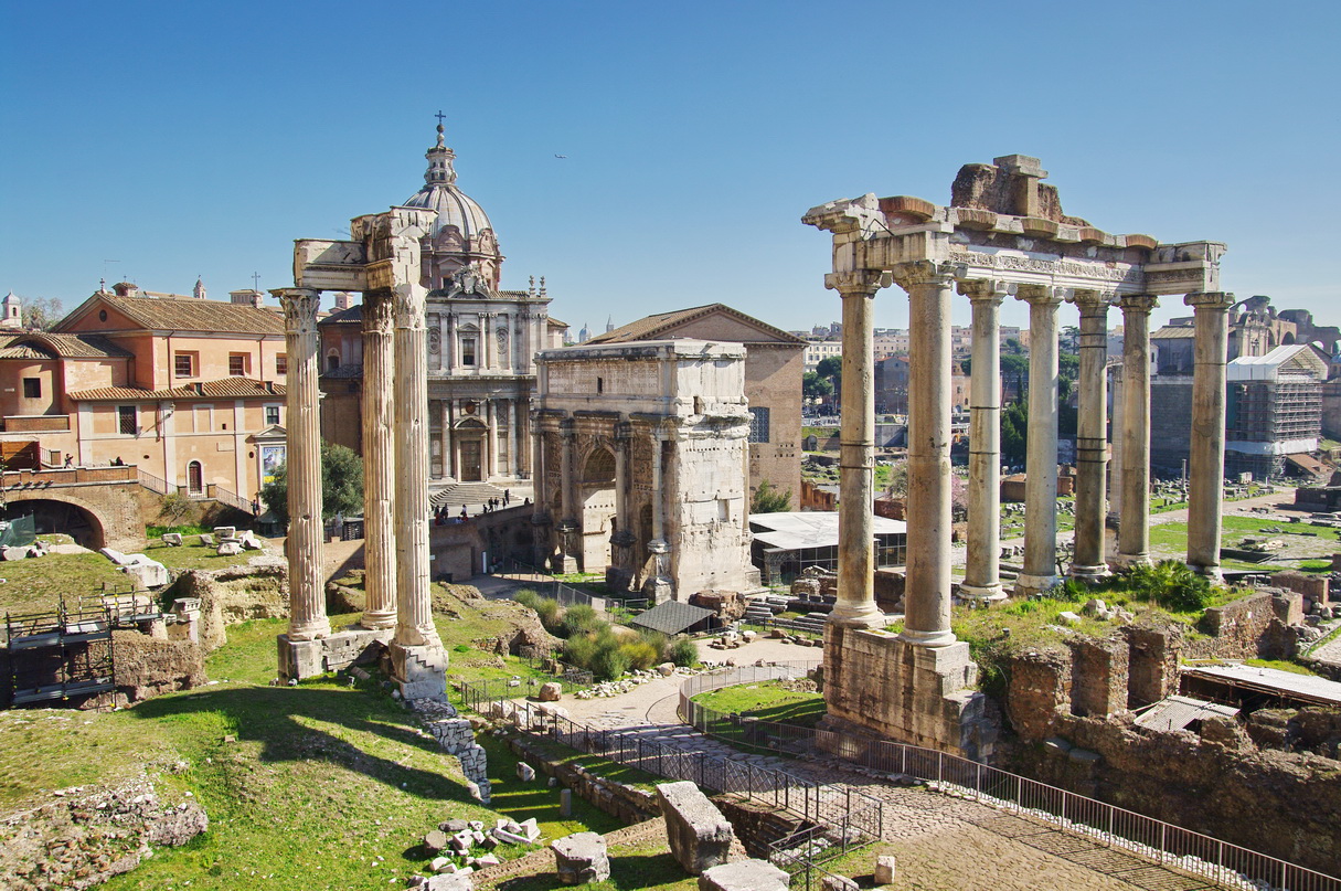
Das Forum Romanum in Rom ist das älteste römische Forum und war Mittelpunkt des politischen, wirtschaftlichen, kulturellen und religiösen Lebens. Es liegt in einer Senke zwischen den drei Stadthügeln Kapitol, Palatin und Esquilin und war der Ort vieler öffentlicher Gebäude und Denkmäler.
Ursprünglich ein von einem Bach durchzogenes, sumpfiges Tal, wurde es erst unter dem legendären etruskischen König Lucius Tarquinius Priscus zu Beginn des 7. Jahrhunderts v. Chr. in die Stadt einbezogen. Den Höhepunkt seines prachtvollen Ausbaus erlebte es in der Römischen Kaiserzeit.[1] Es ist heute eine der wichtigsten Ausgrabungsstätten des antiken Roms.
古罗马广场(Roman Forum)是古罗马时代的城市中心,其中还残留了些许的古罗马时期的重要建筑的废墟。屹立在此地的建筑物有提图斯凯旋门、奥古斯都凯旋门、塞维鲁凯旋门、凯撒神庙、灶神庙,维纳斯和罗马神庙。古罗马政治、宗教、商业、娱乐等建筑的聚集地又可以被称为“古罗马废墟”。
罗马市政府刻意保留了这块残垣断壁,为全人类留下了珍贵的文化遗产,这片古罗马废墟犹如大露天博物馆不 仅吸引着全世界慕名而来的游客一探究竟,还吸引着众多考古工作者和历史学家前来探寻古罗马当时的生活百态,很具有考古价值。这片废墟其实最早是被破砖乱瓦 覆盖,到十九世纪才被重见天日,古代劳动人民为我们留下了一片难得的建筑遗迹,让人联想到昔日的繁荣富裕的生活。公元前6世纪时开始建设,至西罗马帝国灭亡为止。广场上集中了大量宗教性和纪念性建筑物。广场的主要部分约长134米,宽63米。南北两侧各有一座巴西利卡(长方形会堂),供审判和集会用。广场东端是凯撒庙和奥古斯都凯旋门,西端是检阅台和另一座凯旋门。广场西北角的元老院和门前的集议场形成政治中心;凯撒庙和奥古斯都凯旋门以东的灶神庙和祭司长府是宗教中心。公元 4世纪建造君士坦丁巴西利卡之后,广场向东扩展,建造了第度凯旋门。西端在检阅台外还有两座公元初期的神庙。中世纪时,有几座古罗马时代建筑物被改成教堂。以后又不断拆取古建筑物的大理石,用于建筑或烧石灰,以致除少数建筑物外,广场建筑群仅存废墟。18世纪末开始发掘,并加以保护。罗马城旧广场的北面,从公元前1世纪到公元 2世纪初陆续建造了凯撒广场、奥古斯都广场、韦帕香广场、乃尔维广场和图拉真广场。它们各自按设计一次建成,平面为长方形,四周柱廊的一端建造神庙。凯撒广场有钱庄和演讲台,奥古斯都广场有演讲堂。这些广场都是为纪念个人功绩而建造的。
古罗马广场(拉丁语:Forum Romanum)位于意大利罗马帕拉蒂尼山与卡比托利欧山(Collis Capitolinus)之间,它是古罗马时代的城市中心,包括一些罗马最古老与最重要的建筑。
The Roman Forum, also known by its Latin name Forum Romanum (Italian: Foro Romano), is a rectangular forum (plaza) surrounded by the ruins of several important ancient government buildings at the center of the city of Rome. Citizens of the ancient city referred to this space, originally a marketplace, as the Forum Magnum, or simply the Forum.
For centuries the Forum was the center of day-to-day life in Rome: the site of triumphal processions and elections; the venue for public speeches, criminal trials, and gladiatorial matches; and the nucleus of commercial affairs. Here statues and monuments commemorated the city's great men. The teeming heart of ancient Rome, it has been called the most celebrated meeting place in the world, and in all history.[1] Located in the small valley between the Palatine and Capitoline Hills, the Forum today is a sprawling ruin of architectural fragments and intermittent archaeological excavations attracting 4.5 million or more sightseers yearly.[2]
Many of the oldest and most important structures of the ancient city were located on or near the Forum. The Roman Kingdom's earliest shrines and temples were located on the southeastern edge. These included the ancient former royal residence, the Regia (8th century BC), and the Temple of Vesta (7th century BC), as well as the surrounding complex of the Vestal Virgins, all of which were rebuilt after the rise of imperial Rome.
Other archaic shrines to the northwest, such as the Umbilicus Urbis and the Vulcanal (Shrine of Vulcan), developed into the Republic's formal Comitium (assembly area). This is where the Senate—as well as Republican government itself—began. The Senate House, government offices, tribunals, temples, memorials and statues gradually cluttered the area.
Over time the archaic Comitium was replaced by the larger adjacent Forum and the focus of judicial activity moved to the new Basilica Aemilia (179 BC). Some 130 years later, Julius Caesar built the Basilica Julia, along with the new Curia Julia, refocusing both the judicial offices and the Senate itself. This new Forum, in what proved to be its final form, then served as a revitalized city square where the people of Rome could gather for commercial, political, judicial and religious pursuits in ever greater numbers.
Eventually much economic and judicial business would transfer away from the Forum Romanum to the larger and more extravagant structures (Trajan's Forum and the Basilica Ulpia) to the north. The reign of Constantine the Great saw the construction of the last major expansion of the Forum complex—the Basilica of Maxentius (312 AD). This returned the political center to the Forum until the fall of the Western Roman Empire almost two centuries later.
Le Forum Romain ou Forum de Rome (Foro Romano en italien, Forum Romanum en latin), appelé aussi Forum Magnum (« Grand Forum ») ou Forum Vetus (« Vieux Forum »), est situé dans le site archéologique le plus important de Rome, entre les collines du Capitole et du Mont Palatin.
Le forum est la place principale de la Rome antique. Son importance historique, religieuse et politique en fait l'endroit autour duquel toute la vie de la ville s'articule : célébration de mariages, organisation de jeux, de combats de gladiateurs, de cérémonies et de fêtes religieuses, de défilés militaires (sur la Via Sacra), de proclamations politiques (par exemple lors de l'incinération de Jules César, en ce même lieu)..., il est le centre vivant de la ville, à l'image de l'agora, lieu de rassemblement politique et mercantile des cités grecques.
Il Foro Romano (in latino Forum Romanum, sebbene i Romani si riferissero ad esso più spesso come Forum Magnum o semplicemente Forum) è un'area archeologica di Roma racchiusa tra il Palatino, il Campidoglio, Via dei Fori Imperiali e il Colosseo, costituita dalla stratificazione dei resti di quegli edifici e monumenti di epoche eterogenee che per gran parte della storia antica di Roma rappresentarono il centro politico, giuridico, religioso ed economico della città di Roma, oltre che il centro nevralgico dell'intera civiltà romana.
Dall'età regia fino all'avvento dell'età medievale, la valle del Foro è stata teatro di eventi e sede di istituzioni di importanza tale da aver determinato a più riprese il corso storico della civiltà occidentale[1][2][3][4][5][6][7][8], e da aver influenzato in modo preponderante le basi politiche, giuridiche, culturali e filosofiche del pensiero occidentale.
Dopo una fase di declino iniziata nell'età tardoantica il Foro Romano è stato soggetto a frequenti spoliazioni e cambi di destinazione d'uso, fino a ritrovarsi, nel XVI secolo, quasi completamente interrato e stabilmente utilizzato come pascolo per i bovini, da cui il nomignolo di Campo Vaccino[9][10].
Grazie alle imponenti ristrutturazioni urbanistiche dell'Italia post-unitaria e del periodo fascista, l'area del Foro è stata gradualmente riportata alla luce, studiata, e musealizzata, diventando con il Colosseo e il Palatino uno dei siti archeologici più illustri e visitati al mondo[11].
El Foro Romano (en latín, Forum Romanum, aunque los romanos se referían a él comúnmente como Forum Magnum o simplemente Forum) era el foro de la ciudad de Roma, es decir, la zona central, semejante a las plazas centrales en las ciudades actuales, donde se encuentran las instituciones de gobierno, mercado y religión. Al igual que hoy en día era donde tenían lugar el comercio, los negocios, la prostitución, la religión y la administración de justicia. En él se situaba el hogar comunal. Series de restos de pavimento muestran que sedimentos erosionados desde las colinas circundantes ya estaban elevando el nivel del foro en la primera época de la República. Originalmente había sido un terreno pantanoso, que fue drenado por los Tarquinios mediante la Cloaca Máxima. Su pavimento de travertino definitivo, que aún puede verse, data del reinado de César Augusto.
Actualmente es famoso por sus restos, que muestran elocuentemente el uso de los espacios urbanos durante el Imperio Romano. El Foro Romano incluye los siguientes monumentos, edificios y demás ruinas antiguas importantes:
- Templo de Cástor y Pólux
- Templo de Rómulo
- Templo de Saturno
- Templo de Vesta
- Templo de Venus y Roma
- Basílica Emilia
- Basílica Julia
- Arco de Septimio Severo
- Arco de Tito
- Rostra (plural de rostrum), la tribuna desde donde los políticos daban sus discursos a los ciudadanos romanos.
- Curia Julia, sede del Senado.
- Basílica de Majencio y Constantino
- Tabulario
- Templo de Antonino y Faustina
- Regia
- Templo de Vespasiano y Tito
- Templo de la Concordia
- Templo de Jano
Un camino procesional, la Vía Sacra, cruza el Foro Romano conectándolo con el Coliseo. Al final del Imperio perdió su uso cotidiano quedando como lugar sagrado.
El último monumento construido en el Foro fue la Columna de Focas. Durante la Edad Media, aunque la memoria del Foro Romano persistió, los edificios fueron en su mayor parte enterrados bajo escombros y su localización, la zona entre el monte Capitolino y el Coliseo, fue designada Campo Vaccinio o ‘campo bovino’. El regreso del papa Urbano V desde Aviñón en 1367 despertó un creciente interés por los monumentos antiguos, en parte por su lección moral y en parte como cantera para construir nuevos edificios. Se extrajo gran cantidad de mármol para construcciones papales (en el Vaticano principalmente) y para cocer en hornos creados en el mismo foro para hacer cal. Miguel Ángel expresó en muchas ocasiones su oposición a la destrucción de los restos. Artistas de finales del siglo XV dibujaron las ruinas del Foro, los anticuarios copiaron inscripciones desde el siglo XVI y una excavación profesional fue comenzada a finales del siglo XVIII. Un cardenal tomó medidas para drenarlo de nuevo y construyó el barrio Alessadrine sobre él. No obstante, la excavación de Carlo Fea, quien empezó a retirar los escombros del Arco de Septimio Severo en 1803, y los arqueólogos del régimen napoleónico marcaron el comienzo de la limpieza del Foro, que no fue totalmente excavado hasta principios del siglo XX.
En su estado actual, se muestran juntos restos de varios siglos, debido a la práctica romana de construir sobre ruinas más antiguas.
Existieron foros en otras zonas de la ciudad, conservándose restos en ocasiones considerables de la mayoría de ellos. Los foros en la antigua ciudad de Roma eran los siguientes:
- Los más importantes son los grandes foros imperiales (o Fori Imperiali), que formaban un complejo con el Foro Romano. Estos eran el Foro de César (o Forum Iulium), el Foro de Augusto (o Forum Augustum), el Foro de Nerva (o Forum Transitorium) y el Foro de Trajano. Los planificadores del régimen de Mussolini retiraron la mayor parte de los estratos medievales y barrocos y construyeron una carretera entre los foros imperiales y el Foro.
- El Foro Boario (o Forum Boarium), entre el monte Palatino y el río Tíber, que estaba dedicado al comercio de ganado.
- El Foro Holitorio (o Forum Holitorium), entre el monte Capitolino y las murallas servianas, que estaba dedicado al comercio de hierbas y verduras.
- El Forum Piscarium, entre el monte Capitolino y el Tíber, en la zona del actual gueto de Roma, que estaba dedicado al comercio de pescado.
- El Forum Suarium, cerca de los barracones de las cohortes urbanae, en la parte norte del campo de Marte, que estaba dedicado al comercio del cerdo.
- El Forum Vinarium, en la zona del actual rione Testaccio, entre el monte Aventino y el Tíber, que estaba dedicado al comercio del vino.
- Existían otros mercados, pero no son correctamente identificables debido a la falta de información precisa o la pluralidad de ubicaciones. Entre éstos está el Forum cuppedinis, dedicado al comercio genérico de varias clases de bienes.
Ubicación geográfica:  41°53′33.12″N 12°29′8.5″E
*Mittelmeer
Ägypten
Algerien
Belgien
Bulgarien
Deutschland
Frankreich
Geschichte
Geschichte
H 1000 - 500 vor Christus
Geschichte
I 500 - 0 vor Christus
Geschichte
J 0 - 500 nach Christus
Israel
Italien
Jordanien
Kroatien
Libanon
Libyen
Marokko
Niederlande
Portugal
Rumänien
Schweiz
Serbien
Syrien
Tunesien
Türkei
Ungarn
Vereinigtes Königreich
 Zivilisation
Zypern
Zivilisation
Zypern
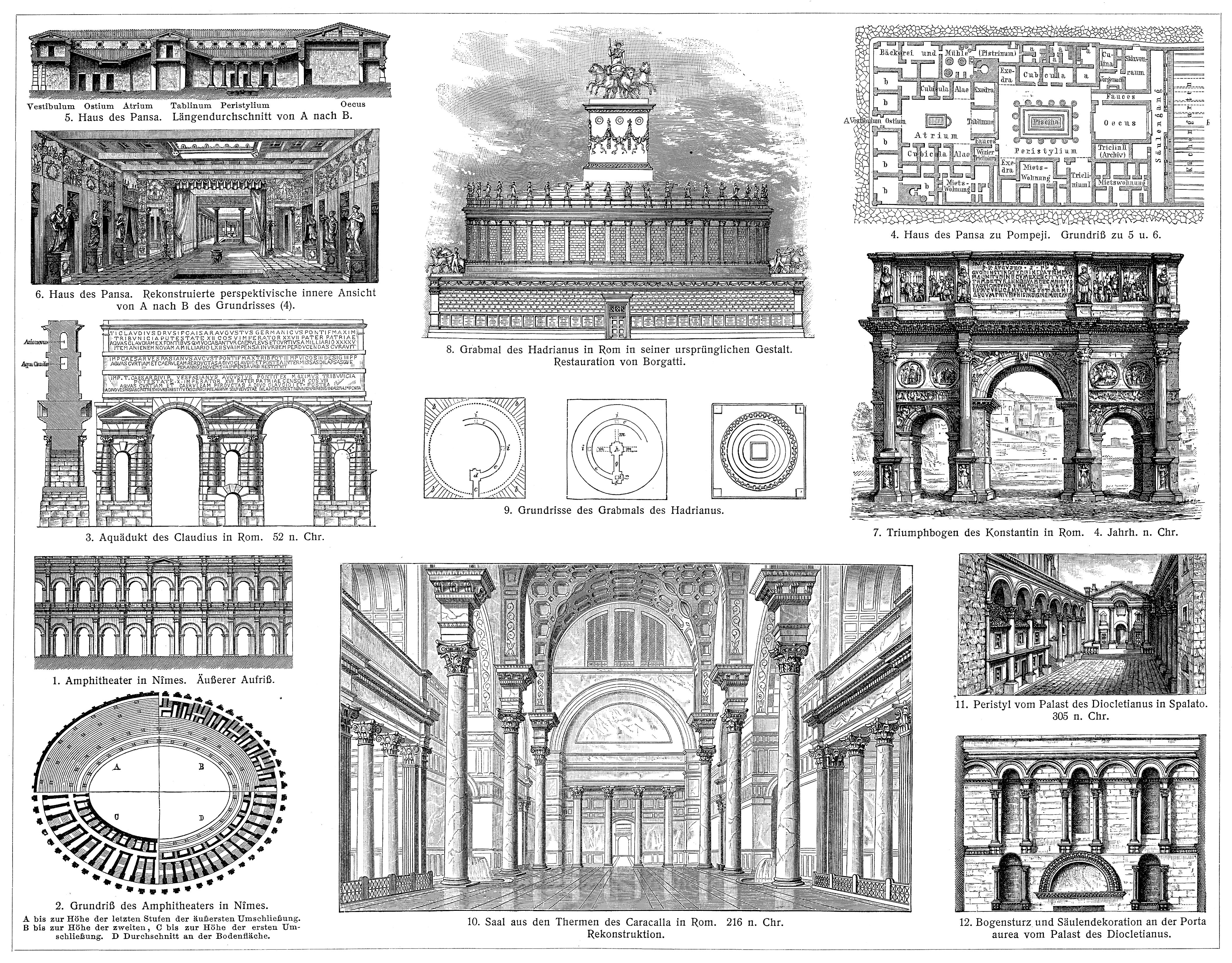
Als römische Architektur bezeichnet man die Baukunst der Römer zur Zeit der römischen Republik und der Kaiserzeit. Die römische Architekturgeschichte umfasst damit einen Zeitraum von etwa neun Jahrhunderten (500 v. Chr.–400 n. Chr.). Die Epochen der römischen Architektur werden nach einzelnen Herrschern, Dynastien oder retrospektiv formulierten historischen Zeitabschnitten benannt. Die seitens der Klassischen Archäologie geprägten Epochen- oder Stilbegriffe finden keine Entsprechungen in der schriftlichen antiken Überlieferung, entsprechen also nicht antiker Wahrnehmung und Einteilung.
古罗马建筑(英语:Ancient Roman architecture),是指由古罗马人创造并且扩展到地中海沿岸其所控制疆域的一种新风格的建筑艺术,经常简称为罗马建筑(英语:Roman architecture)。它直接继承了古希腊晚期的建筑成就,而且将其向前大大推进,使之在1到3世纪达到奴隶制时代全世界建筑的顶峰[1][2]。在西方学术界传统上特指古罗马共和国与帝国时期的建筑[3],中文学术界定义较为宽泛,有时可以包括前期的伊特鲁里亚建筑[4],也可以包括分裂之后的西罗马帝国建筑[2],但是一般不包含东罗马帝国建筑。
 Fahrschule
Ägypten
Australien
Belgien
Brasilien
China
Dänemark
Deutschland
Finnland
Frankreich
Griechenland
Fahrschule
Ägypten
Australien
Belgien
Brasilien
China
Dänemark
Deutschland
Finnland
Frankreich
Griechenland
 Hand in Hand
Führerschein
Indien
Indonesien
Italien
Japan
Kanada
Kasachstan
Kroatien
Malaysia
Hand in Hand
Hand in Hand
Führerschein
Indien
Indonesien
Italien
Japan
Kanada
Kasachstan
Kroatien
Malaysia
 Mongolei
Neuseeland
Niederlande
NuetzlicheInfo
Österreich
Portugal
Republik Korea
Russland
Saudi-Arabien
Schweden
Schweiz
Singapur
Spanien
Südafrika
Thailand
Tschechien
Türkei
Ungarn
Mongolei
Neuseeland
Niederlande
NuetzlicheInfo
Österreich
Portugal
Republik Korea
Russland
Saudi-Arabien
Schweden
Schweiz
Singapur
Spanien
Südafrika
Thailand
Tschechien
Türkei
Ungarn
 Urlaub und Reisen
Vereinigte Arabische Emirate
Vereinigte Staaten
Vereinigtes Königreich
Urlaub und Reisen
Vereinigte Arabische Emirate
Vereinigte Staaten
Vereinigtes Königreich

国际驾驶执照(International Driving Permit)依照1949年日内瓦国际道路交通公约及1968年维也纳国际道路交通公约,由公约签署国政府签发,方便本国驾驶员在其他签约国驾驶私人车辆。国际驾驶执照为附加在一国驾驶执照之上的一本附加多国语言的说明,标注了驾驶人的基本信息以及允许驾驶的对应车辆种类等,解决驾驶员与其他国家的交通管理部门之间的沟通障碍。国际驾照不能独立存在,当驾驶员同时持有一国驾照与该国政府签发的国际驾照时,此国际驾照才视作有效。[1]
国际驾驶执照之内容及格式依照维也纳道路交通会议制订,但并非各国均批准该公约。
Ein Internationaler Führerschein ist ein Dokument, das von den Straßenverkehrsbehörden oder Automobilclubs[1] eines Landes aufgrund zwischenstaatlicher Verträge ausgestellt wird. Er soll vor allem der Polizei eines anderen Landes die Feststellung ermöglichen, ob ein ausländischer Kraftfahrer die Fahrerlaubnis hat, die für sein aktuelles Fahrzeug erforderlich ist.
An International Driver's Permit (IDP) allows you to drive a vehicle in another country, as long as you also have a valid driver's license issued by your state. It is also recognized as a proper form of identification in over 175 countries and by many major car rental companies internationally.
Getting an International Driver's Permit (sometimes incorrectly called an international driver's license) can take anywhere from a day to a few weeks, depending on whether you're going through walk-in processing or applying via mail, so make sure to plan ahead if you're planning to drive on your international trip. There are only two locations in the United States that issue these documents: The American Automobile Association (AAA) and the American Automobile Touring Alliance (AATA).
In the United States, International Driver Permits (IDPs) are only issued by the American Automobile Association and the American Automobile Touring Alliance, and the State Department recommends against purchasing an IDP from other outlets as they are all entirely illegal to buy, carry, or sell.
IDPs can be issued to anyone over 18 who has had a valid driver's license for six months or longer. They typically remain valid for one year or the expiration of your existing state driving license. It's essential to investigate an IDP before your trip and make sure you know the requirements.
Both AAA and AATA are excellent sources for these documents, so once you've selected a provider, go to either the AAA's or NAATA's website, print out the International Driving Permit Application, complete all applicable fields, and submit it.
Once you have the application completed, you can send it in via the mail or visit a local office of an organization like AAA; you'll also need two original passport-sized photos and a signed copy of your valid U.S. driver's license as well as an enclosed check for the fee.
Tips to Getting and Using Your Permit
AAA offices can process IDPs during your visit, but processing generally takes 10 to 15 business days if you send the application in. However, expedited services may be available to get your license within one or two business days for an additional fee.
When applying, you'll need a computer and printer, a completed application, a copy of your valid U.S. driver's license, two passport photos, and a check, money order, or credit card to complete the process. Remember to bring these with you if you're applying in person.
Always make sure to carry your valid United States driver's license when driving internationally, as your IDP is invalid without this accompanying proof of eligibility to drive. IDPs only translate domestically-accepted licenses and do not allow those without government-issued driver's licenses to drive abroad.
You'll also want to make sure to enclose the proper fees (the fee for the IDP, as well as any shipping and handling fees), photos, and photocopies of your license when submitting your application to AAA or AATA as omitting any of these required documents will result in your application being rejected.
You should also check the driving requirements and laws for the countries you will be driving in on your vacation, so you'll know what will be required in the event you get stopped by local authorities. (Quelle:https://www.tripsavvy.com/)
 Friuli-Venezia Giulia