漢德百科全書 | 汉德百科全书
 History

 Geography
Atomic bomb
BRICS summit
Commonwealth of Nations
History
Geography
Atomic bomb
BRICS summit
Commonwealth of Nations
History
 M 1500 - 2000 AD
History
History
History
N 2000 - 2100 AD
History of India
India
M 1500 - 2000 AD
History
History
History
N 2000 - 2100 AD
History of India
India

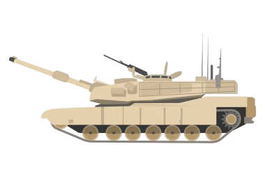

 Military, defense and equipment
Nuclear Weapon
Military, defense and equipment
Nuclear Weapon
 Party and government
Group of the twenty most important industrial and emerging countries
Party and government
BRICS
Silk road
Shanghai Cooperation Organization
Party and government
Group of the twenty most important industrial and emerging countries
Party and government
BRICS
Silk road
Shanghai Cooperation Organization
 States of Asia

Indien ist ein Staat in Südasien, der den größten Teil des indischen Subkontinents umfasst. Indien ist eine Bundesrepublik, die von 29 Bundesstaaten gebildet wird und außerdem sieben bundesunmittelbare Gebiete umfasst. Der Eigenname der Republik lautet in den beiden landesweit gültigen Amtssprachen Bharat Ganarajya (Hindi) und Republic of India (Englisch). Die moderne demokratische und säkulare indische Republik besteht seit 1949 und seit 1950 gilt die Verfassung Indiens.
Der Himalaya bildet die natürliche Nordgrenze Indiens, im Süden umschließt der Indische Ozean das Staatsgebiet. Indien grenzt an Pakistan, das chinesische Autonome Gebiet Tibet, Nepal, Bhutan, Myanmar (Birma) und Bangladesch. Weitere Nachbarstaaten im Indischen Ozean sind Sri Lanka und die Malediven. Hinsichtlich der Landesfläche ist Indien das flächenmäßig siebtgrößte Land der Erde.
Das Gebiet Indiens ist mindestens seit der bronzezeitlichen Indus-Hochkultur zivilisiert. Der indische Staat ist mit über 1,3 Milliarden Einwohnern (2016)[6] nach der Volksrepublik China (fast 1,4 Mrd.)[7] das zweitbevölkerungsreichste Land der Erde und somit die bevölkerungsreichste Demokratie der Welt.[8] Bei gleichbleibend hohem Bevölkerungswachstum könnte Indien schon im Jahr 2020 China überholen. Durch fortschreitende Modernisierung, Bildung, Wohlstand und Urbanisierung sinkt die Geburtenrate jedoch bereits. Hauptstadt Indiens ist Neu-Delhi, Teil der Metropole Delhi; weitere Ballungsräume sind auch Mumbai, Kalkutta, Chennai, Bangalore, Hyderabad, Ahmedabad und Pune.
Die indische Gesellschaft wird trotz verfassungsmäßiger Religionsfreiheit vom religiösen hierarchischen Kastensystem bestimmt. Die mit Abstand größte Religionsgruppe sind die Hindus, gefolgt von Muslimen, Christen und den historisch aus Indien stammenden Sikhs, Buddhisten und Jaina. Laut Index der menschlichen Entwicklung (HDI) erreicht Indien den Status „mittlere menschliche Entwicklung“ und Platz 131 von 187 weltweit (2016, im Vergleich erreicht die VR China Platz 90).[9] Wirtschaftlich gilt Indien als Schwellenland und gehört zu den O5- und BRICS-Staaten und der Gruppe der zwanzig wichtigsten Industrie- und Schwellenländer (G20). Indien ist trotz seines noch niedrigen Pro-Kopf-Einkommens bereits die drittgrößte bzw. sechstgrößte Wirtschaftsmacht der Welt (kaufkraftbereinigt bzw. nominell) und war 2015 erstmals die am schnellsten wachsende Volkswirtschaft der G20-Gruppe.
印度共和国(印地语:भारत गणराज्य,Bhārat Ganarājya;英语:Republic of India),通称印度(印地语:भारत;英语:India),是位于南亚印度次大陆上的国家,印度面积位列世界第七,印度人口众多,位列世界第二,截至2018年1月印度拥有人口13.4亿,仅次于中国人口的13.8亿,人口成长速度比中国还快,预计近年将交叉。是亚洲第二大也是南亚最大的国家,面积328万平方公里(实际管辖),同时也是世界第三大(购买力平价/PPP)经济体。
印度并非单一民族及文化的国家。印度的民族和种族非常之多,有“民族大熔炉”之称,其中印度斯坦族占印度总人口的大约一半,是印度最大的民族。印度各个民族都拥有各自的语言,仅宪法承认的官方语言就有22种之多,其中印地语和英语被定为印度共和国的联邦官方语言[5],并且法院裁定印度没有国语。[9][10]英语作为共同语言使用在印度非常流行,尤其在南印地位甚至高于印地语,但受限于教育水准,普通民众普遍不精通英语。另外,印度也是一个多宗教多信仰的国家,世界4大宗教其中的佛教和印度教都源自印度。大部分印度人信仰印度教。伊斯兰教在印度也有大量信徒,是印度的第二大宗教,信教者约占印度的14.6%(截至2011年,共有约1亿7千7百万人)。伊斯兰教是在公元8世纪随着阿拉伯帝国的扩张而传播到印度的。公元10世纪后,北印的大多数王朝统治者都是信奉伊斯兰教的,特别是莫卧儿王朝。印度也是众多正式和非正式的多边国际组织的成员,包括世界贸易组织、英联邦、金砖五国、南亚区域合作联盟和不结盟运动等。
以耕种农业、城市手工业、服务业以及其支撑产业为主的部分行业已经相对取得了进展。除了民族文化与北方地形的丰富使印度旅游业颇受欢迎之外,由于时差,大批能说英语的人才也投入外包行业(即是外国企业把客户咨询,电话答录等等服务转移到印度)。另一方面,宝莱坞电影的文化输出在英语圈乃至全球的影响力不亚于世界主流。同时印度还是很多专利过期药物的生产地,以低价格提供可靠的医疗。近年来,印度政府还大力投资本国高等教育,以利于在科学上与国际接轨,例如自主太空研究、南亚半岛生态研究等等。印度最重要的贸易伙伴是美国、欧盟、日本、中国和阿拉伯联合酋长国。
インドは、南アジアに位置し、インド洋の大半とインド亜大陸を領有する連邦共和制国家である。ヒンディー語の正式名称भारत गणराज्य(ラテン文字転写: Bhārat Gaṇarājya、バーラト・ガナラージヤ、英語: Republic of India)を日本語訳したインド共和国とも呼ばれる。
西から時計回りにパキスタン、中華人民共和国、ネパール、ブータン、バングラデシュ、ミャンマー、スリランカ、モルディブ、インドネシアに接しており、アラビア海とベンガル湾の二つの海湾に挟まれて、国内にガンジス川が流れている。首都はニューデリー、最大都市はムンバイ。
1947年にイギリスから独立。インダス文明に遡る古い歴史、世界第二位の人口を持つ。国花は蓮、国樹は印度菩提樹、国獣はベンガルトラ、国鳥はインドクジャク、国の遺産動物はインドゾウである。
インドは南アジア随一の面積と世界第2位の人口を持つ大国である。12億人を超える国民は、多様な民族、言語、宗教によって構成されている。連邦公用語はヒンディー語、他にインド憲法で公認されている言語が21あり主な言語だけで15を超えるため、インドの紙幣には17の言語が印刷されている。議会制民主主義国家であり、有権者数8億人と世界最大である[5]。州政府が一定の独立性を持っているため、各州に中央政府とは別に政府があり大臣がいる。
労働力人口の3分の2が農業に従事する一方、製造業とサービス業が急速に成長している。国民の識字率は74.04%である。ヒンドゥー教徒が最も多く、イスラム教、シーク教がこれに次ぐ。カースト制度による差別は憲法で禁止されているが、今でも農村部では影響は残っている。
アジア開発銀行はインドの中間層が向こう15年間で人口の7割に達するとしている[6]。
India (IAST: Bhārat), also known as the Republic of India (IAST: Bhārat Gaṇarājya),[18][e] is a country in South Asia. It is the seventh largest country by area and with more than 1.3 billion people, it is the second most populous country and the most populous democracy in the world. Bounded by the Indian Ocean on the south, the Arabian Sea on the southwest, and the Bay of Bengal on the southeast, it shares land borders with Pakistan to the west;[f] China, Nepal, and Bhutan to the northeast; and Bangladesh and Myanmar to the east. In the Indian Ocean, India is in the vicinity of Sri Lanka and the Maldives, while its Andaman and Nicobar Islands share a maritime border with Thailand and Indonesia.
The Indian subcontinent was home to the urban Indus Valley Civilisation of the 3rd millennium BCE. In the following millennium, the oldest scriptures associated with Hinduism began to be composed. Social stratification, based on caste, emerged in the first millennium BCE, and Buddhism and Jainism arose. Early political consolidations took place under the Maurya and Gupta empires; later peninsular Middle Kingdoms influenced cultures as far as Southeast Asia. In the medieval era, Judaism, Zoroastrianism, Christianity, and Islam arrived, and Sikhism emerged, all adding to the region's diverse culture. Much of the north fell to the Delhi Sultanate; the south was united under the Vijayanagara Empire. The economy expanded in the 17th century in the Mughal Empire. In the mid-18th century, the subcontinent came under British East India Company rule, and in the mid-19th under British crown rule. A nationalist movement emerged in the late 19th century, which later, under Mahatma Gandhi, was noted for nonviolent resistance and led to India's independence in 1947.
In 2017, the Indian economy was the world's sixth largest by nominal GDP[19] and third largest by purchasing power parity.[15] Following market-based economic reforms in 1991, India became one of the fastest-growing major economies and is considered a newly industrialised country. However, it continues to face the challenges of poverty, corruption, malnutrition, and inadequate public healthcare. A nuclear weapons state and regional power, it has the second largest standing army in the world and ranks fifth in military expenditure among nations. India is a federal republic governed under a parliamentary system and consists of 29 states and 7 union territories. A pluralistic, multilingual and multi-ethnic society, it is also home to a diversity of wildlife in a variety of protected habitats.
L'Inde, officiellement la république de l'Inde4, en hindi : भारत (Bhārat) et भारत गणराज्य (Bhārat Gaṇarājya), est un pays d'Asie du Sud qui occupe la majeure partie du sous-continent indien. Sa capitale est New Delhi. L'Inde est le deuxième pays le plus peuplé et le septième pays le plus grand du monde. Le littoral indien s'étend sur plus de sept mille kilomètres. Le pays a des frontières communes avec le Pakistan à l'ouest, la Chine, le Népal, et le Bhoutan au nord et au nord-est, le Bangladesh et la Birmanie à l'est. Sur l'océan Indien, l'Inde est à proximité des Maldives au sud-ouest, du Sri Lanka et de l'Indonésie au sud-est. L'Inde revendique également une frontière avec l'Afghanistan au nord-ouest. L'Inde dispose de l'arme nucléaire depuis 1974 après avoir fait des essais officiels.
L'Inde est un foyer de civilisations parmi les plus anciennes du monde, la civilisation de la vallée de l'Indus s'y est développée dès 3000 av. J.-C. Le sous-continent indien a abrité de vastes empires et est présent sur les routes commerciales dès l'Antiquité. L'Inde est la terre de naissance de quatre religions majeures — l'hindouisme, le jaïnisme, le bouddhisme et le sikhisme — alors que le zoroastrisme, le christianisme et l'islam s'y sont implantés durant le Ier millénaire. L'Inde est aujourd'hui un pays très divers sur le plan religieux, linguistique et culturel.
Le pays a été progressivement annexé par la Compagnie anglaise des Indes avant de passer sous le contrôle du Royaume-Uni au XIXe siècle. L'Inde devient indépendante en 1947 après une lutte marquée par la résistance non-violente du Mohandas Karamchand Gandhi. Le pays est depuis 1950 une république parlementaire fédérale considérée comme la démocratie la plus peuplée au monde.
En 2017, l'économie indienne est la sixième du monde en PIB nominal et la troisième en PIB à parité de pouvoir d'achat. L'Inde, pays à forte croissance économique, est considéré comme un nouveau pays industrialisé. Cependant certains problèmes comme la pauvreté, l'analphabétisme ou la corruption restent très importants.
L'India (hindi: भारत Bhārat), ufficialmente Repubblica dell'India (hindi: भारत गणराज्य Bhārat Gaṇarājya), è uno Stato federale dell'Asia meridionale, con capitale Nuova Delhi.
È il settimo Stato per estensione geografica al mondo (3 287 263 km²) e il secondo più popolato, con 1 335 250 000 abitanti (censimento 2017).[8] È bagnato dall'oceano Indiano a sud, dal mar Arabico a ovest e dal golfo del Bengala a est. Possiede una linea costiera che si snoda per 7.517 km.[9] Confina con il Pakistan a ovest,[10] Cina, Nepal e Bhutan a nord-est, Bangladesh e Birmania a est. Suoi vicini prossimi, separati dell'oceano Indiano, sono lo Sri Lanka a sud-est e le Maldive a sud-ovest.
Sede della civiltà della valle dell'Indo e regione di rotte commerciali storiche e di vasti imperi, il subcontinente indiano è stato identificato con il suo commercio e la ricchezza culturale per gran parte della sua lunga storia.[11] Quattro grandi religioni del mondo (l'induismo, il buddismo, il giainismo e il sikhismo) sono nate qui, mentre lo zoroastrismo, l'ebraismo, il cristianesimo e l'islam arrivarono entro il I millennio d.C. dando forma nella regione a una grandissima diversità culturale. Gradualmente annessa alla Compagnia britannica delle Indie orientali dai primi decenni del XVIII secolo e colonizzata dal Regno Unito dalla metà del XIX secolo, l'India è diventata un moderno Stato nazionale nel 1947, dopo una lotta per l'indipendenza che è stata caratterizzata da una diffusa resistenza non violenta guidata da Gandhi.
L'India è la dodicesima più grande economia del mondo in termini nominali e la quarta in termini di potere d'acquisto. Riforme economiche hanno trasformato lo Stato nella seconda economia a più rapida crescita[12] (è uno dei cinque Paesi a cui ci si riferisce con l'acronimo BRICS),[13] ma nonostante ciò il Paese soffre ancora di alti livelli di povertà, analfabetismo e malnutrizione, oltre ad avere un sistema sociale basato sulle caste. Società pluralistica, multilingue e multietnica, l'India è inoltre ricca sul piano naturale, con un'ampia diversità di fauna selvatica e di habitat protetti.
La India8 ―oficialmente República de la India (en hindi, भारत गणराज्य, Bhārat Gaṇarājya; en inglés, Republic of India)― es un país soberano ubicado en el sur de Asia. Con sus más de 1240 millones de habitantes, es el segundo país del mundo por población ―después de la República Popular China (con 1395 millones). Su superficie es de 3 287 263 km²,3 lo cual lo ubica en el séptimo lugar entre los países más extensos del planeta. Limita con el océano Índico al sur, con el mar Arábigo al oeste y con el golfo de Bengala al este, a lo largo de una línea costera de más de 7517 kilómetros.9
La India también limita con Pakistán al oeste;10 al norte con China, Nepal y Bután y al este con Bangladés y Birmania. Además, la India se encuentra cerca de las islas de Sri Lanka, Maldivas e Indonesia. Su capital es Nueva Delhi y su ciudad más poblada es Bombay.
Hogar de la cultura del valle del Indo y una región histórica por sus rutas comerciales y grandes imperios, el subcontinente indio fue identificado por su riqueza cultural y comercial en la mayor parte de su larga historia.11 Cuatro de las religiones más importantes del mundo, el hinduismo, el budismo, el jainismo y el sijismo se originaron allí, mientras que otras religiones como el zoroastrismo, el judaísmo, el cristianismo y el islam llegaron durante el I milenio, dando forma a diversas culturas de la región.
Gradualmente anexada por la Compañía Británica de las Indias Orientales desde principios del siglo XVIII y colonizada por el Reino Unido desde mediados del siglo XIX, la India se convirtió en una nación independiente en 1947, tras una lucha por la independencia que estuvo marcada por un movimiento de no violencia.12
La India es una república federal13 compuesta por 29 estados y 7 territorios de la Unión, con un sistema de democracia parlamentaria. En 2017, la economía india es la tercera más grande del mundo y la sexta en términos de PIB nominal. Las reformas económicas de 1991 la han transformado en una de las economías de más rápido crecimiento;14 sin embargo, todavía sufre de problemas como los altos niveles de pobreza, analfabetismo,15 pandemias, malnutrición y constantes violaciones de los derechos de las mujeres. Además de una sociedad plural en lo religioso, multilingüe y multiétnica, la India también alberga una flora y fauna diversas en diferentes hábitats protegidos.
Además, la República de la India es uno de los diez países que posee un arsenal nuclear y no es signataria del Tratado de No Proliferación Nuclear, dado que, en sus actuales términos, no le permitiría mantener su armamento atómico.
И́ндия (хинди भारत Bhārat, англ. India), официальное название — Респу́блика И́ндия (хинди भारत गणराज्य Bhārat Gaṇarājya, англ. Republic of India) — государство в Южной Азии. Население — 1 340 468 000 человек (22 декабря 2017)[6], территория — 3 287 263 км², по обоим этим показателям является крупнейшей страной Южной Азии. Занимает второе место в мире по численности населения и седьмое по территории. Столица — Нью-Дели. Государственные языки — хинди и английский.
Федеративное государство, парламентская республика. Премьер-министр — Нарендра Моди, президент — Рам Натх Ковинд.

Die bronzezeitliche Indus-Kultur oder Indus-Zivilisation war eine der frühesten städtischen Zivilisationen. Sie entwickelte sich etwa in den Jahren 2800–1800 v. Chr. entlang des Indus im Nordwesten des indischen Subkontinents. Die Indus-Kultur erstreckte sich über fast das gesamte heutige Pakistan sowie Teile Indiens und Afghanistans, insgesamt umfasste sie 1.250.000 km² und damit eine größere Landfläche als das antike Ägypten und Mesopotamien zusammen. Sie war neben diesen eine der drei frühesten Zivilisationen der Welt.
Sie wird teilweise auch Harappa oder Harappa-Kultur genannt, nach Harappa, einem der Hauptausgrabungsplätze am Ravi. Eine weitere alternative Benennung dieser Kultur lautet Sindhu-Sarasvati-Zivilisation; hinter dieser Bezeichnung steht die Theorie, dass sie eine in der vedischen Literatur erwähnte Zivilisation sei. Möglicherweise ist sie auch mit dem sumerischen Meluha zu identifizieren.
Bis heute sind über 1050 Fundorte identifiziert, hauptsächlich entlang des Indus. Zusätzlich gibt es Hinweise auf einen anderen großen Fluss östlich des Indus, der heute ausgetrocknet ist und der antike Ghaggra-Hakra oder Sarasvati gewesen sein könnte. Über 140 antike Städte und Siedlungen wurden an seinem Lauf gefunden. Die beiden größten urbanen Zentren der Harappa-Kultur waren wohl Harappa und Mohenjo-Daro, daneben gab es noch große Städte bei Dholavira, Ganweriwala, Lothal und Rakhigarhi. Zu ihrer Blütezeit zählte die Indus-Kultur vermutlich über fünf Millionen Menschen.
Diese frühe indische Kultur kannte bereits Architektur und eine regelmäßige Städteplanung einschließlich gepflasterter Straßen mit Straßenablauf (Gullys). Sie entwickelte zum ersten Mal in der Geschichte der Menschheit den gebrannten Ziegel mit den perfekten, noch heute gebräuchlichen Proportionen 1:2:4, der als Einhandziegel in allen Richtungen beliebig addierbar ist.
Möglicherweise besaß sie auch eine Schrift; ob aber die sogenannte Indus-Schrift tatsächlich eine Schrift ist, wird in Fachkreisen bisher kontrovers diskutiert.
古印度文明時期,也称哈拉帕文明(harappa)时期,是指世界四大文明之一的古印度,約公元前2300年至前1300年之時期。
印度河流域文明发生晚于两河流域文明、尼罗河流域文明,但早于商朝。考古专家在印度河流域发现摩亨约达罗和哈拉帕两个古代城市遗址,发现了大量石器、青铜器、印章和农作物遗迹,估计城市人口都在4万以上。
两个城市的中心都有一个人工堆成的土墩,作用未知,考古学家猜测这可能是城市的中心。城市建筑以卫城为中心呈网格状分布,有市政建筑、市场、作坊、储存区、民居和神庙。每座民居都围着一个院子建成,有几个房间、一间厕所和一口水井。建筑用基本材料是从烧木头的窑里制出的土砖。在摩亨佐-达罗的卫城上建造了一个大浴池,有私人浴池、会所等。
印度河流域的农民种植大麦、小麦、棉花、瓜和椰枣。他们还驯养大象和水牛在田里干活。这一地区有许多手艺精湛的制陶人,他们用陶轮制作陶器,这在当时是一项崭新的技术。哈拉帕人使用石器,并用青铜制作刀、武器、碗和雕像。他们建立了发达的废物处理系统,包括有盖板的排水系统和倒垃圾的斜槽。
遗址中有许多天秤和砝码,说明他们有一套度量衡制度好配合其繁荣的商业贸易。而印度河流域文明更证明与古美索不达米亚,阿富汗,缅甸甚至和古中国都有商业往来。
印度河文明持续了800年,尚未有人知道它是如何结束的,但是有几种说法:河水泛滥、瘟疫、贸易或经济或国内秩序崩溃等等。
インダス文明(インダスぶんめい、Indus Valley civilization)は、インド・パキスタン・アフガニスタンのインダス川および並行して流れていたとされるガッガル・ハークラー川周辺に栄えた文明である。これら各国の先史文明でもある(インドの歴史、アフガニスタンの歴史も参照)。崩壊の原因となったという説のあった川の名前にちなんでインダス文明、最初に発見された遺跡にちなんでハラッパー文明とも呼ばれる[1]。
狭義のインダス文明は、紀元前2600年から紀元前1800年の間を指す。インダス文明の遺跡は、東西1500km、南北1800kmに分布し、遺跡の数は約2600におよぶ。そのうち発掘調査が行われた遺跡は、2010年時点でインド96、パキスタン47、アフガニスタン4の合計147となっている[2]。
The Indus Valley Civilisation (IVC) was a Bronze Age civilisation in the northwestern regions of South Asia, lasting from 3300 BCE to 1300 BCE, and in mature form from 2600 BCE to 1900 BCE.[1] Along with ancient Egypt and Mesopotamia it was one of three early civilisations of the Old World, and of the three, the most widespread, extending from what today is northeast Afghanistan to Pakistan and northwest India.[2][note 1] It flourished in the basins of the Indus River, which flows through the length of Pakistan, and along a system of perennial, mostly monsoon-fed, rivers that once coursed in the vicinity of the seasonal Ghaggar-Hakra river in northwest India and eastern Pakistan.[1][3] Aridification of this region during the 3rd millennium BCE may have been the initial spur for the urbanisation associated with the civilisation, but eventually also reduced the water supply enough to cause the civilisation's demise, and to scatter its population eastward.[4][5][3][6]
The civilisation's cities were noted for their urban planning, baked brick houses, elaborate drainage systems, water supply systems, clusters of large non-residential buildings, and new techniques in handicraft (carnelian products, seal carving) and metallurgy (copper, bronze, lead, and tin). [7] Its large urban centres of Mohenjo-daro and Harappa very likely grew to containing between 30,000 and 60,000 individuals,[8][note 2] and the civilisation itself during its florescence may have contained between one and five million individuals.[9][note 3]
The Indus civilisation is also known as the Harappan Civilisation, after its type site, Harappa, the first of its sites to be excavated in the 1920s in what was then the Punjab province of British India and now is Pakistan.[10][note 4] The discovery of Harappa and soon afterwards Mohenjo-Daro was the culmination of work beginning in 1861 with the founding of the Archaeological Survey of India during the British Raj.[11] There were however also earlier and later cultures often called Early Harappan and Late Harappan in the same area; for this reason, the Harappan civilisation is sometimes called the Mature Harappan' culture to distinguish it from these cultures. By 2002, over 1,000 Mature Harappan cities and settlements had been reported, of which just under a hundred had been excavated,[12][note 5][13][14][note 6] mainly in the general region of the Indus and Ghaggar-Hakra Rivers and their tributaries; however, there are only five major urban sites at the peak of the settlement hierarchy:[15][note 7] Harappa, Mohenjo-daro (UNESCO World Heritage Site), Dholavira, Ganeriwala in Cholistan and Rakhigarhi.[16][note 8] The early Harappan cultures were preceded by local Neolithic agricultural villages, from which the river plains were populated.[17][18]
The Harappan language is not directly attested, and its affiliation is uncertain since the Indus script is still undeciphered.[19] A relationship with the Dravidian or Elamo-Dravidian language family is favoured by a section of scholars.[20][21]
La civilisation de la vallée de l'Indus (vers 2600 av. J.-C. – vers 1900 av. J.-C.), ou civilisation harappéenne, du nom de la ville antique de Harappa, est une civilisation de l'Âge du bronze, dont le territoire s'étendait autour de la vallée du fleuve Indus, dans l'ouest du sous-continent indien (le Pakistan moderne et ses alentours). Les raisons de son émergence, de sa prospérité rayonnante durant sept siècles, puis de son déclin brutal, sont mal connues et restent débattues, ainsi que son influence, probable, sur la culture hindoue antique.
Oubliée jusqu’à sa découverte dans les années 1920, la civilisation de l’Indus se classe, avec celles de la Mésopotamie et de l’Égypte antique, comme l’une des toutes premières civilisations de l'histoire, celles-ci étant définies par l'apparition de villes, puis de l’écriture.
Si la civilisation de l’Indus n’est pas considérée comme la première civilisation antique, la Mésopotamie et l’Égypte ayant développé des villes un peu plus tôt, elle est par contre celle qui connait à son époque la plus grande extension géographique. À ce jour, sur les 1 052 sites qui ont été découverts, plus de 140 se trouvent sur les rives du cours d'eau saisonnier Ghaggar-Hakra. D’après certaines hypothèses, ce système hydrographique, autrefois permanent, arrosait la principale zone de production agricole de la civilisation de l’Indus.
La plupart des autres sites se situent le long de la vallée de l’Indus et de ses affluents, mais on en trouve aussi à l’ouest, jusqu’à la frontière de l’Iran, à l’est jusqu’à Delhi, au sud jusque dans le Maharashtra, et au nord jusqu’à l’Himalaya. Parmi ces sites, on compte de nombreuses villes comme Dholavira, Ganweriwala, Mehrgarh, Harappa, Lothal, Mohenjo-daro et Rakhigarhi. À son apogée, sa population pourrait avoir dépassé cinq millions de personnes.
Malgré toutes ses réalisations, cette civilisation est très mal connue. Son existence même a été oubliée jusqu’au XXe siècle. Son écriture reste indéchiffrée et on ne sait pas si elle a un lien quelconque avec l’écriture brahmi, ce qui semble peu probable au regard des connaissances actuelles. Parmi les mystères que cette civilisation recèle, trois questions au moins sont fondamentales :
- formait-elle un État ou un ensemble de cités-états ?
- quels étaient ses moyens de subsistance ?
- quelles sont les causes de sa disparition soudaine et dramatique, à partir du XIXe siècle av. J.-C. ?
La langue utilisée par ses membres et le nom qu’ils se donnaient restent à ce jour inconnus.
La civiltà della valle dell'Indo (c. 3300–1500 a.C., fiorita 2600–1900 a.C.) fu una civiltà antica, estesa geograficamente soprattutto lungo il fiume Indo nel subcontinente indiano, ma anche lungo il Sarasvati, un fiume dell'India ormai prosciugato.
Nel mondo anglosassone viene citata come "civiltà dell'Indo-Sarasvati", in riferimento alla civiltà descritta nei Veda e che si sarebbe sviluppata lungo i due fiumi. È anche conosciuta come "civiltà di Harappa", dal primo sito conosciuto, scoperto nel 1857, ma scavato soltanto dagli anni venti del Novecento.
La cultura del valle del Indo fue una civilización de la Edad del Bronce, que se desarrolló desde c. 3300 a. C. hasta 1300 a. C. a lo largo del valle del río Indo, en Afganistán, Pakistán y el noroeste de la India. Abarcaba cerca de un centenar de asentamientos y dos ciudades importantes: Harappa y Mohenjo-Daro, ambos sitios en Pakistán. En conjunto comprendía el área más extensa de todas las civilizaciones antiguas, más de un millón de kilómetros cuadrados, y atravesó varios periodos, siendo su máximo esplendor entre el 2600 y el 1900 a. C.
Al igual que las civilizaciones de Mesopotamia y Egipto, dependía de su río. Como el Nilo, el Indo se desbordaba todos los años, inundando extensas zonas y depositando sedimentos fértiles. Este inmenso potencial agrícola fue la base sobre la cual se desarrolló el urbanismo en torno al río Indo.
Con las culturas prehistóricas del valle del Indo se prepara el primer capítulo de la historia de la India. Se trata de un largo periodo prehistórico, probado por testimonios líticos. Por otra parte, se pueden encontrar vestigios prehistóricos hasta el I milenio a. C., es decir, hasta un tiempo en que la península ya había entrado en la historia. En sentido estricto, las culturas del Indo pertenecen a la prehistoria ya que solamente han dejado restos arqueológicos sin documentos literarios, pero para apreciar la historia india hace falta tomar en consideración estas culturas urbanas prearias.
И́ндская или Хара́ппская цивилизация — третья[* 1] по времени появления древневосточная цивилизация бронзы[1], после египетской и месопотамской. Из всех трёх она занимала наибольшую площадь, превосходя в 2 раза суммарную площадь двух остальных[2][3]. Индская цивилизация относительно быстро пришла в упадок, пережив расцвет между 2600—1900 годами до нашей эры, см. Засуха 2200 года до н. э..
Хараппская цивилизация развивалась в долине реки Инд в 3300—1300 годах до нашей эры[4]. Наиболее значительные центры — Ракхигархи (350 га), Мохенджо-Даро (300 га)[5], Хараппа (150 га), Лотхал (60 га) и Дхолавира — 47 гектаров.[6]. Население в годы расцвета составляло около 5 миллионов человек и состояло из эламито-дравидов, без примеси индоевропейцев[7]. Зрелый период развития Индской цивилизации шёл с 2600 до 1900 лет до нашей эры. Простиралась на территориях нынешних Афганистана, Пакистана и Северо-Западной Индии.
В шумерских текстах хараппская цивилизация предположительно носила название «Мелухха»[8].
В течение III-го тысячелетия до нашей эры началась аридизация — постепенное истощение водных ресурсов региона, где находилось государство. Возможной причиной аридизации археологи называют возросшую урбанизацию в регионе и постепенное осушение почв и рек. В итоге это могло привести к упадку государства. При этом, после упадка, население ушло на Восток.
Первые данные о существовании доарийской цивилизации в западной Индии опубликовал в XIX веке Александр Каннингем. Окончательно существование индской цивилизации было установлено в 1921—1922 годах экспедицией во главе с Джоном Маршаллом.
На пике развития индская цивилизация имела население свыше 5 миллионов человек. Жители долины реки Инд разработали ряд новых ремёсел — обработку сердолика, обработку кости, металлургию бронзы, меди, свинца и олова. Города хараппской цивилизации отличаются чётким планированием построек. Строительный материал — обожжённый кирпич из глины. Освоены и использовались сложные дренажные системы, системы водоснабжения и целые кластеры крупных нежилых зданий.
При раскопках городов были найдены как детские игрушки, так и небольшое количество оружия, что указывает на не сильную милитаризацию государства и относительно мирные периоды существования. Ставка в развитии была сделана на торговлю с далёкими землями, дальше чем Вавилон, Шумер и южная Месопотамия. На развитую торговлю указывают многочисленные печати, украшенные животными и мифическими существами.
Названия «цивилизация Инд» и «цивилизация Хараппы» — равнозначны в археологической литературе[источник не указан 150 дней], хотя термин «Хараппа» может ввести в заблуждение, так как это обозначение дано по названию современного городка Хараппа, где располагается хронологически первая археологическая площадка, раскопанная еще в 1920-е годы. Вскоре был обнаружен и исследован Мохенджо-Даро, что привело к сенсационным открытиям. Данные памятники относятся к зрелому этапу хараппской цивилизации и отличаются от предшествующих и последующих культур, называемых ранней хараппской и поздней хараппской культурами. Ранней хараппской культуре предшествовали местные неолитические поселения сельскохозяйственного типа.
К 2008 году было найдено 1 022 города и поселения, главным образом в районе рек Инд и Гхаггар-Хакра и их притоков. Из них 406 объектов найдены на территории нынешнего Пакистана и 616 в Индии. Раскопаны и изучены — 96 объектов. Среди этих 96 объектов значатся крупные городские центры, в том числе Хараппа, Мохенджо-Даро (объект Всемирного наследия Юнеско), Дхолавира, Ганеривала[en], Ракхигархи.
Язык государства не имеет точной идентификации, его генеалогическая принадлежность пока не ясна. Связи хараппского языка и дравидийских и эламо-дравидийских языков изучены недостаточно.[9]
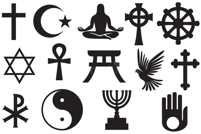 Religion
 Architecture
 Art
Art
 World Heritage
 History
M 1500 - 2000 AD
History
History
N 2000 - 2100 AD
India
Karnataka
History
M 1500 - 2000 AD
History
History
N 2000 - 2100 AD
India
Karnataka

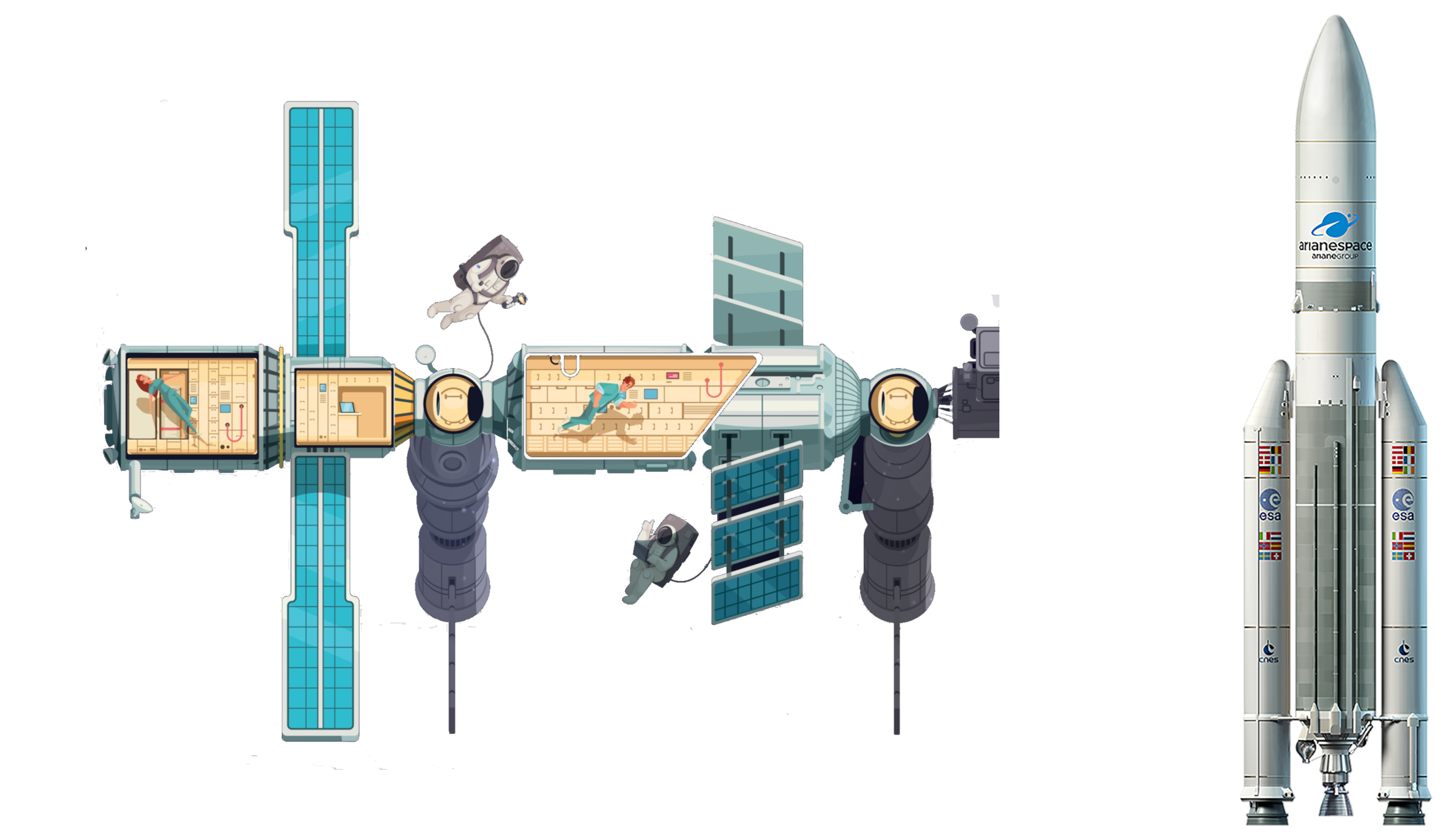 Aerospace
Missions to Mars
Aerospace
Missions to Mars
 Civilization

印加帝国(克丘亚语:Tawantinsuyu)是11世纪至16世纪时位于南美洲的古老帝国,亦是前哥伦布时期美洲最大的帝国,[1]印加帝国的政治、军事和文化中心位于今日秘鲁的库斯科。印加帝国的重心区域分布在南美洲的安第斯山脉上,其主体民族印加人也是美洲三大文明印加文明的缔造者。
印加人的祖先生活在秘鲁的高原地区,后来他们迁徙到库斯科,建立了库斯科王国,这个国家在1438年发展为印加帝国。印加帝国在1438年到1533年间,运用了从武力征服,到和平同化等各种方法,使得印加帝国的版图几乎涵盖了整个南美洲西部(地跨秘鲁、厄瓜多尔、哥伦比亚、玻利维亚、智利、阿根廷),是一个幅员辽阔的南美洲印第安人帝国。
除了印加帝国的官方语言克丘亚语,印加人还使用数百种美洲原住民语言和各种的克丘亚语方言。印加人称印加帝国为Tawantinsuyu,意为“四方之地”,或是“四地之盟”。印加帝国内部存在着多种原始信仰,但是印加的统治阶级推崇印加宗教,信仰太阳神因蒂、创世神维拉科查、地球女神帕查玛玛等神明。[2]印加帝国的君主称萨帕·印卡,意为“独一无二的君主”,同时萨帕·印卡亦被印加人当作“太阳的儿子”。
印加帝国的国力在君主瓦伊纳·卡帕克统治期间达到顶峰。1526年,西班牙征服者弗朗西斯科·皮萨罗带领一支有168人的军队从巴拿马南下,发现了印加帝国。1529年,在瓦伊纳·卡帕克感染天花而意外去世后,两位继承人选瓦斯卡尔与阿塔瓦尔帕为了争夺王位,而爆发血腥内战,大大地削弱了印加帝国的实力。1533年,西班牙人施计杀掉了赢得内战的阿塔瓦尔帕,皮萨罗的军队与数十万名原住民盟军成功将印加征服,印加帝国灭亡,沦为西班牙帝国的殖民地。印加人的最后抵抗势力比尔卡班巴王国亦在1572年灭亡。
Als Inka (Plural Inka oder Inkas) wird heute eine indigene urbane Kultur in Südamerika bezeichnet. Oft werden als Inka auch nur die jeweiligen herrschenden Personen dieser Kultur bezeichnet. Sie herrschten zwischen dem 13. und 16. Jahrhundert über ein weit umspannendes Reich von über 200 ethnischen Gruppen,[1] das einen hohen Organisationsgrad aufwies. Zur Zeit der größten Ausdehnung um 1530 umfasste es ein Gebiet von rund 950.000 Quadratkilometern, sein Einfluss erstreckte sich vom heutigen Ecuador bis nach Chile und Argentinien; ein Gebiet, dessen Nord-Süd-Ausdehnung größer war als die Strecke vom Nordkap bis nach Sizilien. Entwicklungsgeschichtlich sind die Inka mit den bronzezeitlichen Kulturen Eurasiens vergleichbar. Das rituelle, administrative und kulturelle Zentrum war die Hauptstadt Qusqu (Cusco) im Hochgebirge des heutigen Peru.
Ursprünglich war mit dem Begriff „Inka“ die Bezeichnung eines Stammes gemeint, der nach eigener Auffassung dem Sonnengott Inti entstammte und die Umgebung Cuscos besiedelte. Seine herrschende Sippe fungierte später als Adel des gleichnamigen theokratischen Reiches. Aus ihr rekrutierten sich auch der Klerus[2] und die Offiziere der Inka-Armee. Sapa Inka („einziger Inka“) war der Titel des Inka-Herrschers des Tawantinsuyu („Land der vier Teile, Reich der vier Weltgegenden“ – so die Selbstbezeichnung des Reiches).
インカ帝国(インカていこく、スペイン語:Imperio Inca、ケチュア語:タワンティン・スウユ(Tawantinsuyo, Tahuantinsuyo))は、南アメリカのペルー、ボリビア(チチカカ湖周辺)、エクアドルを中心にケチュア族が築いた国。文字を持たない社会そして文明であった。
首都はクスコ。世界遺産である15世紀のインカ帝国の遺跡「マチュ・ピチュ」から、さらに千メートル程高い3,400mの標高にクスコがある。1983年12月9日、クスコの市街地は世界遺産となった。
前身となるクスコ王国は13世紀に成立し、1438年のパチャクテク即位による国家としての再編を経て、1533年にスペイン人のコンキスタドールに滅ぼされるまで約200年間続いた。最盛期には、80の民族と1,600万人の人口をかかえ、現在のチリ北部から中部、アルゼンチン北西部、コロンビア南部にまで広がっていたことが遺跡および遺留品から判明している。
インカ帝国は、アンデス文明の系統における最後の先住民国家である。メキシコ・グアテマラのアステカ文明、マヤ文明と対比する南米の原アメリカの文明として、インカ文明と呼ばれることもある。その場合は、巨大な石の建築と精密な石の加工などの技術、土器や織物などの遺物、生業、インカ道路網を含めたすぐれた統治システムなどの面を評価しての呼称である。なお、インカ帝国の版図に含まれる地域にはインカ帝国の成立以前にも文明は存在し、プレ・インカと呼ばれている。
インカ帝国は、被征服民族についてはインカ帝国を築いたケチュア族の方針により比較的自由に自治を認めていたため、一種の連邦国家のような体をなしていた。
The Inca Empire (Quechua: Tawantinsuyu, lit. "The Four Regions"[4]), also known as the Incan Empire and the Inka Empire, was the largest empire in pre-Columbian America.[5] Its political and administrative structure is considered by most scholars to have been the most developed in the Americas before Columbus' arrival.[6] The administrative, political and military center of the empire was located in Cusco, Peru. The Inca civilization arose from the Peruvian highlands sometime in the early 13th century. Its last stronghold was conquered by the Spanish in 1572.
From 1438 to 1533, the Incas incorporated a large portion of western South America, centered on the Andean Mountains, using conquest and peaceful assimilation, among other methods. At its largest, the empire joined Peru, southwest Ecuador, western and south central Bolivia, northwest Argentina, northern Chile and a small part of southwest Colombia into a state comparable to the historical empires of Eurasia. Its official language was Quechua.[7] Many local forms of worship persisted in the empire, most of them concerning local sacred Huacas, but the Inca leadership encouraged the sun worship of Inti – their sun god – and imposed its sovereignty above other cults such as that of Pachamama.[8] The Incas considered their king, the Sapa Inca, to be the "son of the sun."[9]
The Inca Empire was unique in that it lacked many features associated with civilization in the Old World. In the words of one scholar,[10]
The Incas lacked the use of wheeled vehicles. They lacked animals to ride and draft animals that could pull wagons and plows... [They] lacked the knowledge of iron and steel... Above all, they lacked a system of writing... Despite these supposed handicaps, the Incas were still able to construct one of the greatest imperial states in human history.
— Gordon McEwan, The Incas: New Perspectives
Notable features of the Inca Empire include its monumental architecture, especially stonework, extensive road network reaching all corners of the empire, finely-woven textiles, use of knotted strings (quipu) for record keeping and communication, agricultural innovations in a difficult environment, and the organization and management fostered or imposed on its people and their labor.
The Incan economy has been described in contradictory ways by scholars:[11]
... feudal, slave, socialist (here one may choose between socialist paradise or socialist tyranny)
— Darrell E. La Lone, The Inca as a Nonmarket Economy: Supply on Command versus Supply and Demand
The Inca empire functioned largely without money and without markets. Instead, exchange of goods and services was based on reciprocity between individuals and among individuals, groups, and Inca rulers. "Taxes" consisted of a labour obligation of a person to the Empire. The Inca rulers (who theoretically owned all the means of production) reciprocated by granting access to land and goods and providing food and drink in celebratory feasts for their subjects.[12]
L’Empire inca (Tahuantinsuyu, Tahuantinsuyo ou Tawantin Suyu en quechua, signifiant « quatre en un » ou « le tout des quatre parts »1) fut, du XVe au XVIe siècle, le plus vaste empire de l'Amérique précolombienne. Son territoire s'est en effet étendu, à son extension maximale, sur près de 4 500 km de long, depuis le Sud-Ouest de l'actuelle Colombie (au Río Patía), au nord, jusqu'au milieu de l'actuel Chili (au Río Maule), au sud, et comprenant la quasi totalité des territoires actuels du Pérou et de l'Équateur, ainsi qu'une partie importante de la Bolivie et significative de l'Argentine du Nord-Ouest2.
L'Impero inca (Tawantinsuyu in lingua aymara e quechua moderne, o Tahuantinsuyo in antica lingua quechua) è stato il più vasto impero precolombiano del continente americano. La sua esistenza va dal XIII secolo fino al XVI secolo e la sua capitale fu Cuzco, nell'attuale Perù.
Il Perù è stato la culla della civiltà inca, uno dei maggiori popoli nativi americani. La civiltà Inca unificò, conquistando o annettendo pacificamente, la maggior parte dei territori occidentali dell'America del Sud. A ogni popolo conquistato venivano imposti l'idioma e la religione dell'impero. A loro volta, gli inca si arricchivano della cultura dei popoli annessi.
El Imperio incaico o inca (en quechua: Tawantinsuyu, lit. "Las cuatro regiones o divisiones") fue el mayor imperio en la América precolombina.2
Al territorio del mismo se denominó Tawantinsuyu y al período de su dominio se le conoce, además, como incanato y/o incario. Floreció en la región andina del subcontinente entre los siglos xv y xvi, como consecuencia del apogeo de la civilización incaica.[cita requerida] Abarcó cerca de dos millones de kilómetros cuadrados entre el océano Pacífico y la selva amazónica, desde las cercanías de Pasto (Colombia) en el norte hasta el río Maule (Chile) por el sur.
Los orígenes del imperio se remontan a la victoria de las etnias cuzqueñas (Región Sur del actual Perú), lideradas por Pachacútec, frente a la confederación de estados chancas en 1438. Luego de la victoria, el curacazgo incaico fue reorganizado por Pachacútec, con quien el Imperio incaico inició una etapa de continua expansión, que prosiguió con su hermano Cápac Yupanqui, luego por parte del décimo inca Túpac Yupanqui, y finalmente del undécimo inca Huayna Cápac, quien consolidó los territorios. En esta etapa la civilización incaica logró la máxima expansión de su cultura, tecnología y ciencia, desarrollando los conocimientos propios y los de la región andina, así como asimilando los de otros estados conquistados.
La Civilización incaica surgió de las tierras altas del Perú en algún momento a principios del siglo xiii. Su último bastión fue conquistado por los españoles en 1572.
Luego de este periodo de apogeo el imperio entró en declive por diversos problemas, siendo el principal la confrontación por el trono entre los hijos de Huayna Cápac: los hermanos Huáscar y Atahualpa, que derivó incluso en una guerra civil. Entre los incas la viruela acabó con el monarca Huayna Capac, provocó la guerra civil previa a la aparición hispana y causó un desastre demográfico en el Tahuantinsuyu. Finalmente Atahualpa vencería en 1532. Sin embargo su ascenso al poder coincidió con el arribo de las tropas españolas al mando de Francisco Pizarro, que capturaron al inca y luego lo ejecutaron. Con la muerte de Atahualpa en 1533 culminó el Imperio incaico. Sin embargo, varios incas rebeldes, conocidos como los «Incas de Vilcabamba», se rebelaron contra los españoles hasta 1572, cuando fue capturado y decapitado el último de ellos: Túpac Amaru I.
Los incas consideraban a su rey, el Sapa Inca, como el "hijo del sol". Muchas formas locales de adoración persistieron en el imperio, la mayoría de ellas relacionadas con las sagradas Huacas locales, pero los líderes incas alentaron el culto al sol de Inti - su dios del sol - e impusieron su soberanía por encima de otros cultos como el de Pachamama.
La economía inca ha sido descrita de manera contradictoria por los eruditos: como "feudal, esclavo, socialista (aquí uno puede elegir entre el paraíso socialista o la tiranía socialista)". El imperio Inca funcionó en gran parte sin dinero y sin mercados. En cambio, el intercambio de bienes y servicios se basó en la reciprocidad entre individuos y entre individuos, grupos y gobernantes incas. 'Impuestos' consistía en una obligación laboral de una persona para el Imperio. Los gobernantes incas (que teóricamente poseían todos los medios de producción) correspondieron al otorgar acceso a la tierra y los bienes y proporcionar alimentos y bebidas en las celebraciones de sus súbditos.
El Imperio incaico abarcó los actuales territorios correspondientes al extremo suroccidental de Colombia en la frontera, pasando por Ecuador, principalmente por Perú, el oeste de Bolivia, la mitad norte de Chile y el norte, noroeste y oeste de Argentina.
El imperio estuvo subdividido en cuatro suyos: el Chinchaysuyu (Chinchay Suyu) al norte, el Collasuyu (Qulla Suyu) al sur, el Antisuyu (Anti Suyu) al este y Contisuyu (Kunti Suyu) al oeste.
La capital del imperio fue la ciudad de Cuzco, en el actual Perú.
Импе́рия и́нков (кечуа Tawantin Suyu, Tawantinsuyu, Тауантинсу́йу) — крупнейшее по площади и численности населения индейское раннеклассовое государство в Южной Америке в XI—XVI веках. Занимало территорию от нынешнего Пасто в Колумбии до реки Мауле в Чили. Империя включала в себя полностью территории нынешних Перу, Боливии и Эквадора (за исключением части равнинных восточных районов, поросших непроходимой сельвой), частично Чили, Аргентины и Колумбии. Первым европейцем, проникшим в империю инков, был португалец Алежу Гарсия в 1525 году. В 1533 году испанские конкистадоры установили контроль над большей частью империи, а в 1572 году государство инков прекратило своё существование. Есть гипотеза, что последним независимым пристанищем инков является ненайденный город (страна) Пайтити (до середины или конца XVIII века)[1].
Археологические исследования показывают, что большое количество достижений было унаследовано инками от предшествующих цивилизаций, а также от подчинённых ими соседних народов. К моменту появления на исторической арене инков в Южной Америке существовал ряд цивилизаций: Моче (культура мочика, известная цветной керамикой и ирригационными системами), Уари (это государство явилось прообразом империи инков, хотя население говорило, по-видимому, на ином языке — аймара), Чиму (центр — город Чан-Чан, характерная керамика и архитектура), Наска (известные тем, что создали так называемые линии Наска, а также своими системами подземных водопроводов, керамикой), Пукина (цивилизация города Тиауанако с населением около 40 тысяч человек, находившаяся к востоку от озера Титикака), Чачапояс («Воины Туч», известные своей грозной крепостью Куэлап, которую ещё называют «Мачу-Пикчу севера»).

 Science and technology

Die Druckerpresse wurde um 1440 von dem Deutschen Johannes Gutenberg im Römischen Reich erfunden. Gutenbergs Presse war eine handgekurbelte Presse, die Tinte über die erhabenen Flächen beweglicher Metalltypen rollte und gegen ein Blatt Papier drückte. Vor der Einführung des Buchdrucks mussten alle Texte von Hand geschrieben oder durch typografischen Handdruck erstellt werden, wobei etwa 40 bis 50 Seiten pro Tag produziert werden konnten. Die früheste Druckerpresse konnte 3.600 Seiten pro Tag produzieren, wodurch sich die Menge an gedrucktem Text, die der Welt zur Verfügung stand, dramatisch erhöhte. Bis zum Jahr 1500 hatten die Druckerpressen mehr als 20 Millionen Bände an Text produziert. Der Buchdruck öffnete die Tür für die Massenproduktion von Büchern und führte zu einem weit verbreiteten Austausch von Wissen auf der ganzen Welt. Zum ersten Mal hatte der Durchschnittsbürger Zugang zu Büchern und dem Wissen, das sie mit sich brachten. Die Druckerpresse gilt als eine der wichtigsten Erfindungen in der Geschichte der Menschheit. Das erste große Buch, das mit der Presse gedruckt wurde, war die Gutenberg-Bibel, die 1454 fertiggestellt wurde.
 Music
Music

 Education and Research
Universities and Colleges in Chinese History
History
L 1000 - 1500 AD
Henan Sheng-HA
Education and Research
Education and Research
Universities and Colleges in Chinese History
History
L 1000 - 1500 AD
Henan Sheng-HA
 Review
 Vacation and Travel
 Financial
 Historical coins, banknotes


Wilhelm der Eroberer (englisch William the Conqueror, französisch Guillaume le Conquérant; vor der Eroberung Englands Wilhelm der Bastard genannt; * 1027/28 in Falaise, Normandie, Frankreich; † 9. September 1087 im Kloster Saint-Gervais bei Rouen, Frankreich) war ab 1035 als Wilhelm II. Herzog der Normandie und regierte ab 1066 als Wilhelm I. das Königreich England.
Der romanisierte Normanne war der letzte Herrscher, der Großbritannien von außen erobern konnte. Das von ihm erlassene Grundbuch Domesday Book dient teilweise selbst heute noch als Rechtsquelle, vor allem ist es eine überragende Quelle für die Wirtschafts- und Sozialgeschichte.