Deutsch-Chinesische Enzyklopädie, 德汉百科
 Shandong Sheng-SD
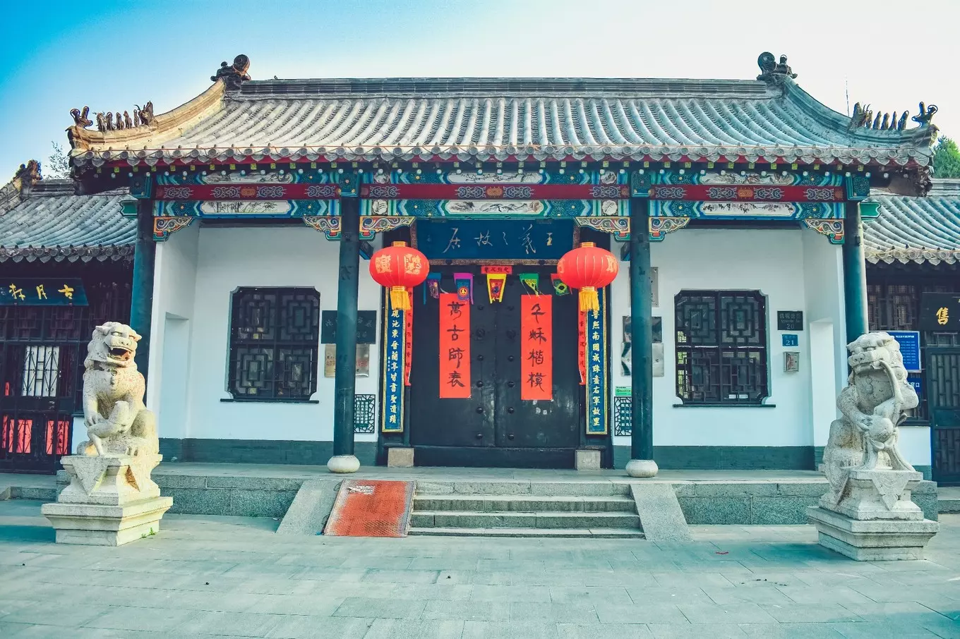
 Architecture

 History
 Theme park
Anhui Sheng-AH
Gansu Sheng-GS
Guangdong Sheng-GD
Guangxi Zhuangzu Zizhiqu-GX
Henan Sheng-HA
Hubei Sheng-HB
Hunan Sheng-HN
Jiangxi Sheng-JX
Liaoning Sheng-LN
Shandong Sheng-SD
Shanxi Sheng-SX
Sichuan Sheng-SC
Tianjin Shi-TJ
Theme park
Anhui Sheng-AH
Gansu Sheng-GS
Guangdong Sheng-GD
Guangxi Zhuangzu Zizhiqu-GX
Henan Sheng-HA
Hubei Sheng-HB
Hunan Sheng-HN
Jiangxi Sheng-JX
Liaoning Sheng-LN
Shandong Sheng-SD
Shanxi Sheng-SX
Sichuan Sheng-SC
Tianjin Shi-TJ

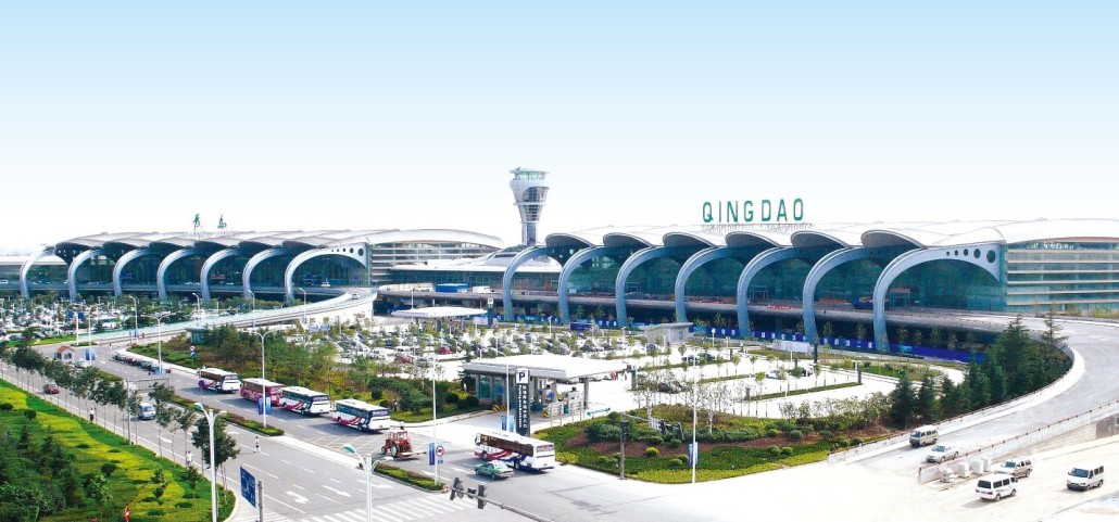
 Transport and traffic

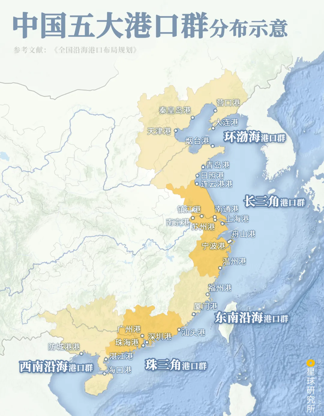
 Geography
Fujian Sheng-FJ
Guangdong Sheng-GD
Guangxi Zhuangzu Zizhiqu-GX
Hainan Sheng-HI
Hebei Sheng-HE
Jiangsu Sheng-JS
Liaoning Sheng-LN
Shandong Sheng-SD
Shanghai Shi-SH
Tianjin Shi-TJ
Zhejiang Sheng-ZJ
Geography
Fujian Sheng-FJ
Guangdong Sheng-GD
Guangxi Zhuangzu Zizhiqu-GX
Hainan Sheng-HI
Hebei Sheng-HE
Jiangsu Sheng-JS
Liaoning Sheng-LN
Shandong Sheng-SD
Shanghai Shi-SH
Tianjin Shi-TJ
Zhejiang Sheng-ZJ
 Sport
Sport
 *Yellow river
China
Gansu Sheng-GS
Henan Sheng-HA
Beijing-Hangzhou Grand Canal
Nei Mongol Zizhiqu-NM
Ningxia Huizu Zizhiqu-NX
Qinghai Sheng-QH
Shaanxi Sheng-SN
Shandong Sheng-SD
Shanxi Sheng-SX
Sichuan Sheng-SC
*Yellow river
China
Gansu Sheng-GS
Henan Sheng-HA
Beijing-Hangzhou Grand Canal
Nei Mongol Zizhiqu-NM
Ningxia Huizu Zizhiqu-NX
Qinghai Sheng-QH
Shaanxi Sheng-SN
Shandong Sheng-SD
Shanxi Sheng-SX
Sichuan Sheng-SC
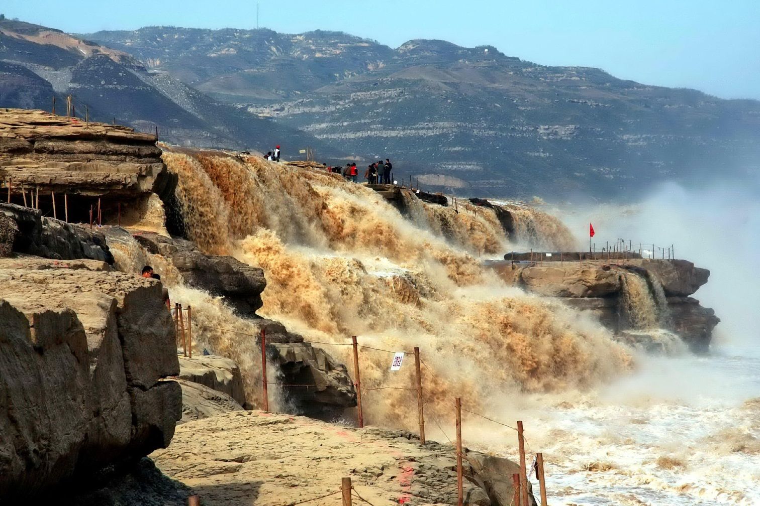
黄河,中国北部大河,全长约5464公里,流域面积约752443平方公里。世界第五大长河,中国第二长河。
黄河发源于青海省青藏高原的巴颜喀拉山脉北麓约古宗列盆地的玛曲,呈“几”字形。自西向东分别流经青海、四川、甘肃、宁夏、内蒙古、陕西、山西、河南及山东9个省、市、自治区,最后流入渤海。
黄河中上游以山地为主,中下游以平原、丘陵为主。由于河流中段流经中国黄土高原地区,因此夹带了大量的泥沙,所以它也被称为世界上含沙量最多的河流。但是在中国历史上,黄河下游的改道给人类文明带来了巨大的影响。是中华文明最主要的发源地,中国人称其为“母亲河”。每年都会生产差不多十六亿吨泥沙,其中有十二亿吨流入大海,剩下四亿吨长年留在黄河下游,形成冲积平原,有利于种植。
黄河,在中国古代称作河水、大河,简称河,是中国的第二长河,仅次于长江,也是世界第六长河流。中国的两条母亲河之一,发源于中国青海省巴颜喀拉山脉噶达素齐老峰,流经青海、四川、甘肃、宁夏、内蒙古、陕西、山西、河南、山东9个省区,最后于山东省东营市垦利区注入渤海,干流全长5464千米,流域总面积79.5万平方公里(含内流区面积4.2万平方公里)[1][2]。
黄河源头位于青海巴颜喀拉山的雅拉达泽峰,巴颜喀拉山北麓的玛曲、约古宗列曲是黄河的正源。黄河依次穿越青藏高原、黄土高原、内蒙古高原、华北平原,蜿蜒东流,在山东省东营市垦利县注入渤海(莱州湾)。
黄河从源头到内蒙古自治区托克托县河口镇为上游,河长3472公里,流域面积42.8万平方公里;河口镇至河南郑州桃花峪间为中游,河长1206公里,流域面积34.4万平方公里;桃花峪以下为下游,河长786公里,流域面积只有2.3万平方公里[注 1]。黄河横贯中国东西,流域东西长1900公里,南北宽1100公里,总面积达795000平方千米(含内流区面积4.2万平方公里)。
黄河中游因河段流经黄土高原,支流带入大量泥沙,使黄河成为世界上含沙量最高的河流。最大年输沙量达39.1亿吨(1933年),1977年录得最高含沙量达920千克/立方米,三门峡站多年平均输沙量约16亿吨,平均含沙量35千克/立方米。由于兴建水库以及流域林草覆盖率提高等原因,近年来黄河泥沙含量锐减,悄然出现变清态势[3]。
在整个中国历史上,黄河及黄河流域对人类文明产生了巨大的影响,为中华民族最主要的发源地。[4]
Der Gelbe Fluss (chinesisch 黃河 / 黄河 Huáng Hé,  anhören, Huanghe, Wade-Giles: Hwangho, Huang Ho, Huangho; mong. Hatan Gol) ist ein als Strom klassifiziertes Fließgewässer im Norden der Volksrepublik China (Ostasien). Nach dem Jangtsekiang ist er der zweitlängste Fluss Chinas und der viertlängste einzelne Fluss der Erde. Zu seiner Länge gibt es abhängig vom Messverfahren unterschiedliche Zahlen: 4.845 Kilometer ist die geläufigste Angabe und diejenige, die in verschiedenen Lexika zu finden ist; die größte in diversen Medien genannte Länge beträgt 5.464 Kilometer. Sein Einzugsgebiet umfasst 752.000 km².
Seinen Namen trägt der Fluss aufgrund der gelblichen Färbung, die durch abgetragenen Löss entsteht, der über Bäche und Nebenarme in den Flusslauf gespült wird.
Die Quelle des Gelben Flusses befindet sich in den ausgedehnten Weiten des Hochlandes von Tibet, von relativ flach wirkenden Bergen umrahmt, etwa 200 Kilometer nördlich der halben Luftlinie zwischen Lhasa, der Hauptstadt des Autonomen Gebiets Tibet, und Xining in der tibetisch geprägten Region Amdo. Dort liegt sie im Gebirgszug Bayankara Shan (südlich des Kunlun Shan) etwa 450 Kilometer östlich des Quellgebiets des Jangtsekiang, westlich zweier Seen (Ngoring Tsho und Kyaring Tsho) und nordwestlich des Sternenmeers (Xingsuhai) – ein felsig-steppenartiges Gebiet.
Von seiner Quelle aus durchquert der Gelbe Fluss erst die beiden Seen Kyaring Tsho (Tsaring-nor) und Ngoring Tsho (Ngoring-nor) (♁34° 55′ 19″ N, 97° 30′ 43″ O). Danach fließt er hauptsächlich in östlicher Richtung unter dem tibetischen Namen Ma-chu (རྨ་ཆུ་ „Fluss des Pfaus“, chinesisch 玛曲 maqu) im Zick-Zack-Kurs durch ein stark gewundenes Hochgebirgstal, unweit des heiligen Bergs A'nyê Maqên.
Sein weiterer Lauf führt dann nordwärts, wo er bis an die Grenzen der Inneren Mongolei vorstößt. Dort beschreibt er einen riesigen Bogen um das Ordos-Plateau, bis er, nun wieder südlich fließend, in den Stausee (♁35° 37′ 16″ N, 110° 35′ 40″ O) der Sanmenxia-Talsperre (♁34° 49′ 44″ N, 111° 20′ 37″ O) mündet. In diesem See fließt ihm aus der Region der alten Kaiserstadt Xi’an der Wei He zu.
Nördlich des Funiushan-Gebirges biegt er um 90° nach Osten ab. Von dort aus fließt der Gelbe Fluss durchwegs in Richtung Osten über die Xiaolangdi-Talsperre (♁34° 55′ 22″ N, 112° 21′ 45″ O), durchquert in den Provinzen Shanxi und Shaanxi ein Lössplateau und verlässt nach und nach das schluchtenreiche Bergland.
Etwa 45 Kilometer nach der Stadt Kaifeng wendet sich der Strom nach Nordosten und durchfließt die aus seinen Ablagerungen gebildete Tiefebene. Etwas über 500 Kilometer nach Kaifeng erreicht der Huáng Hé zwischen Tianjin und der Halbinsel Shandong den Golf von Bohai, einen Randbereich des Gelben Meeres.
黄河(こうが、拼音: Huánghé、ファンフー)とは、中国の北部を流れ、渤海へと注ぐ川。全長約5,464kmで、中国では長江(揚子江)に次いで2番目に長く、アジアでは長江とエニセイ川に次いで3位、世界では6番目の長さである。なお、河という漢字は本来固有名詞であり、中国で「河」と書いたときは黄河を指す。これに対し、「江」と書いたときは長江を指す。現在の中国文明の直接の母体である黄河文明を育んだ川であり、中国史上において長江と並び巨大な存在感を持つ河川である。
The Yellow River or Huang He ( listen (help·info)) is the second longest river in Asia, after the Yangtze River, and the sixth longest river system in the world at the estimated length of 5,464 km (3,395 mi).[1] Originating in the Bayan Har Mountains in Qinghai province of Western China, it flows through nine provinces, and it empties into the Bohai Sea near the city of Dongying in Shandong province. The Yellow River basin has an east–west extent of about 1,900 kilometers (1,180 mi) and a north–south extent of about 1,100 km (680 mi). Its total drainage area is about 752,546 square kilometers (290,560 sq mi).
Its basin was the birthplace of ancient Chinese civilization, and it was the most prosperous region in early Chinese history. There are frequent devastating floods and course changes produced by the continual elevation of the river bed, sometimes above the level of its surrounding farm fields.
Le fleuve Jaune (chinois : 黃河 ; pinyin : Huāng hé) est le deuxième plus long fleuve de Chine après le Yangzi Jiang. Long de 5 464 kilomètres, il se jette dans la mer de Bohai, dans la mer Jaune.
Son nom lui vient de sa couleur boueuse liée à sa forte turbidité car il charrie de grandes quantités d'alluvions (lœss, limons) qui fertilisent la grande plaine du Nord de la Chine.
En 1938, le Kuomintang détruit des digues retenant le fleuve dans le but de ralentir l'avancée de l'armée japonaise, ce qui provoque de graves inondations et cause au moins 500 000 morts parmi la population locale.
Il Fiume Giallo (黃河T, 黄河S, Huáng HéP, Huang HoW), noto anche come Huang He o Hwang Ho, è il principale fiume della Cina settentrionale, spesso chiamato la culla della civiltà cinese.
Con i suoi 5464 km di lunghezza è uno dei fiumi più lunghi del mondo, nonché il secondo fiume più lungo della Cina.[1] Il bacino idrografico invece si estende su un'area di circa 750.000 km², questo fa del Fiume Giallo il terzo fiume più grande del Paese.[2]
Il fiume nasce nella provincia del Qinghai sull'altopiano del Tibet e attraversa altre sei province e due regioni autonome nella sua corsa verso il Bo Hai (golfo di Chihli), un'insenatura del mar Giallo. Nel suo corso inferiore appare come un mutevole, turbolento corso d'acqua carico di limo che spesso rompe gli argini inondando parte della pianura della Cina del Nord. Per questo motivo, è stato soprannominato anche il «dolore della Cina» e l'«Ingovernabile»[3].
Il termine huang («giallo») si riferisce ai fini sedimenti di loess che il fiume trasporta fino al mare. Il bacino del Fiume Giallo ospita una popolazione numerosissima - superata solo da quella di un piccolo numero di Paesi - e il fiume e i suoi affluenti attraversano alcune delle città più antiche della Cina, quali Lanzhou, Baotou, Xi'an (Sian), Taiyuan, Luoyang, Zhengzhou, Kaifeng e Jinan.
El río Amarillo o Huang He, antiguamente, Hwang-ho, (chino tradicional: 黃 河, chino simplificado: 黄 河, pinyin: Huáng Hé, Wade-Giles: Huang-ho) es un largo río del centro de China que fluye en direcciones NE, E, S y nuevamente, NE, a través de las provincias de Qinghai, Gansu, Henan, Shandong, Shanxi y Shaanxi, y las regiones autónomas de Mongolia Interior y Ningxia, hasta desaguar en el mar de Bohai. Tiene una longitud de 5464 km, lo que lo sitúan como el sexto río más largo del mundo, por detrás del Amazonas, Nilo, Yangtsé, el Misisipi-Misuri y el Yeniséi-Angará.1
Originario de las montañas de Bayan Har, en el oeste de China, fluye a través de siete provincias —Qinghai, Gansu, Shaanxi, Shanxi, Henan y Shandong— y dos regiones autónomas —Ningxia y Mongolia Interior— y desemboca en el mar de Bohai. La cuenca del río Amarillo tiene una extensión, de este a oeste de 1900 km y, de norte a sur de 1100 km, drenando 742 443 km² (la 33.ª del mundo).
Históricamente, es el río más importante de China y en su cuenca se han descubierto numerosos yacimientos arqueológicos que demuestran la presencia humana ininterrumpida desde la prehistoria. En torno a él, en la llanura del Norte de China, surgió la civilización de los han, el principal grupo étnico del país, cuyo territorio se iría expandiendo después hacia el sur. El río Amarillo es considerado por ello «la cuna de la civilización china», ya que su cuenca —en concreto, el valle del río Wei que corta a través del largo bucle de Ordos— fue la cuna de las antiguas civilizaciones chinas y la región más próspera de la temprana historia de China. Sin embargo, las frecuentes y devastadoras inundaciones y los cambios de rumbo producidos por la elevación continua del lecho del río, a veces por encima del nivel de los campos circundantes, también le han servido para ser llamado la «Tristeza de China» y «Azote de los hijos de Han».2
Su nombre se debe a la gran cantidad de materiales en suspensión que arrastran sus turbulentas aguas, lodos y loess —partículas de arena muy finas, con predominio de cuarzo—, que le dan su característico color, además de las partículas en suspensión que provienen de la multitud de cultivos de maíz alrededor del cauce a lo largo de cientos de kilómetros en su curso medio.
Хуанхэ́[1] (кит. трад. 黃河, упр. 黄河, пиньинь: Huáng hé) — река в Китае, одна из крупнейших рек Азии[2]. В переводе с китайского языка её название — «Жёлтая река», что связано с обилием наносов, придающих желтоватый оттенок её водам[3]. Именно благодаря им море, в которое впадает река, называется Жёлтым. Бассейн Хуанхэ считается местом формирования и становления китайского этноса.
Хуанхэ берёт начало в восточной части Тибетского нагорья на высоте свыше 4000 м, протекает через озёра Орин-Нур и Джарин-Нур, отроги горных массивов Куньлунь и Наньшань. При пересечении Ордоса и Лёссового плато в своём среднем течении образует большую излучину, далее через ущелья Шаньсийских гор выходит на Великую Китайскую равнину, по которой течёт около 700 км до впадения в Бохайский залив Жёлтого моря, формируя в районе впадения дельту. По разным данным длина реки от 4670 км до 5464 км, а площадь её бассейна от 745 тыс. км² до 771 тыс. км².
Средний расход воды в реке составляет приблизительно 2000 м³ в секунду. Река обладает муссонным режимом при летнем половодье с подъёмом уровня воды до 5 м на равнинах и до 20 м в горах.
Размывая Лёссовое плато и Шаньсийские горы Хуанхэ ежегодно выносит 1,3 млрд тонн взвешенных наносов, занимая по этому показателю первое место среди рек мира. Интенсивное отложение наносов в нижнем течении повышает русло, которое расположено на высотах от 3 до 10 м выше прилегающих равнин. В целях защиты от наводнений Хуанхэ и её притоки ограждены масштабной системой дамб, суммарная длина которых составляет около 5 тыс. км. Прорывы дамб приводили к огромным наводнениям и перемещениям русла. Это приводило к гибели большого числа людей и дало реке прозвище «Горе Китая». Максимальное зафиксированное перемещение русла Хуанхэ составило около 800 км.
В 11 г. н. э. Хуанхэ совершила прорыв в новое русло, который стал причиной гуманитарной катастрофы — одним из факторов, приведших к падению династии Синь. С 602 н. э. до наших дней зафиксировано 26 изменений русла Хуанхэ и 1573 прорыва дамб[4]. В числе крупнейших катастроф — наводнение 1931 года (природное) и 1938 года, организованное гоминьдановскими властями с целью остановить наступление японской армии.
China
Democratic People's Republic of Korea
Jiangxi Sheng-JX
Liaoning Sheng-LN
Republic of Korea
Shandong Sheng-SD
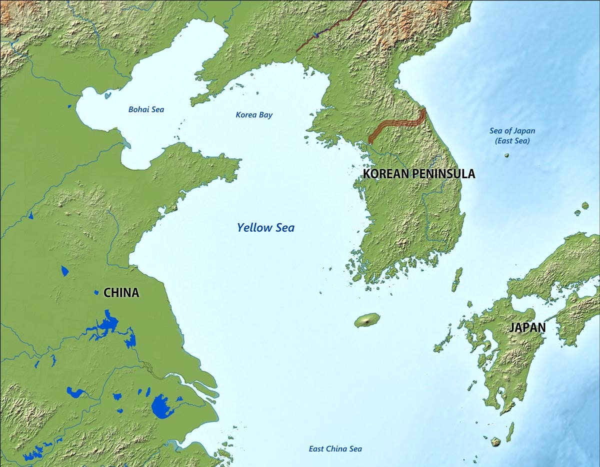
Das Gelbe Meer ist ein Teil des Chinesischen Meeres und ein von der Volksrepublik China und der Koreanischen Halbinsel umgebenes Randmeer des Pazifischen Ozeans. Der Golf von Bohai und die Koreabucht im Norden sind Teile des Gelben Meeres. Im Süden schließt sich das Ostchinesische Meer an.
Das Gelbe Meer misst 960 Kilometer von Nord nach Süd und ist 700 Kilometer breit. Die Flächenausdehnung beträgt 380.000 km². Es ist durchschnittlich 44 Meter und maximal 152 Meter tief. Damit ergibt sich ein Wasservolumen von 16.720 km³. Das Gelbe Meer ist ein flaches Meer, vergleichbar mit der Nordsee am anderen Ende des eurasischen Kontinents. Seine Wattflächen sind ein bedeutendes Rastgebiet für Watvögel.
Seine charakteristische Farbe, die zur Namensgebung führte, erhält es von dem nährstoffhaltigen gelben Schwemmsand, dem Löss, den der Gelbe Fluss und andere Flüsse an ihrer Mündung in das Gelbe Meer hineintragen und dort ablagern.
黄海(こうかい、英語:Yellow Sea)は、中国大陸と朝鮮半島の間にある海[1][2]。 黄河から運ばれる黄土により黄濁している部分があることから黄海と呼ばれている。フランスの地図製作者ダンヴィルが1737年に作成した『中国新地図帳』に黄海 (Hoang Hai ou Mer Jaune) と表記したことで国際的にも認知されるようになった。
The Yellow Sea is a marginal sea of the Western Pacific Ocean located between mainland China and the Korean Peninsula, and can be considered the northwestern part of the East China Sea. It is one of four seas named after common colour terms (the others being the Black Sea, the Red Sea and the White Sea), and its name is descriptive of the phenomenon whereby fine sand grains from the Gobi Desert sand storms, that descend annually from the northwest, turn the surface of its waters a golden yellow.
The innermost bay of northwestern Yellow Sea is called the Bohai Sea (previously Pechihli Bay or Chihli Bay), into which flow some of the most important rivers of northern China, such as the Yellow River (through Shandong province and its capital Jinan), the Hai River (through Beijing and Tianjin) and the Liao River (through Liaoning province). Sand and silt carried down by these rivers contribute further to the sea's colour. The northern extension of the Yellow Sea is called the Korea Bay, into which flow the Yalu River, the Chongchon River and the Taedong River.
La mer Jaune est un bras de mer de l'océan Pacifique qui sépare la Chine de la péninsule coréenne. Elle s'ouvre au sud sur la mer de Chine orientale qui la borde. Son nom provient du sable et des sédiments apportés par le vent soufflant depuis le désert de Gobi et par les fleuves, en particulier le fleuve Jaune et le Hai He qui lui donnent une couleur jaune1. En Corée, elle est aussi appelée la mer de l'Ouest. Sa partie septentrionale est appelée golfe de Corée et communique avec le golfe de Bohai qui se trouve de l'autre côté des péninsules du Liaodong et du Shandong. Cette dernière partie est aussi incluse dans la mer Jaune. Celle-ci mesure 960 km du nord au sud et 700 km de l'est à l'ouest pour une superficie de 380 000 km2, le golfe de Bohai non compris2. Reposant sur le plateau continental, c'est une mer peu profonde : la profondeur moyenne est de 44 m pour un maximum de 152 m. Cette mer est récente puisqu'elle a été formée à la fin du dernier âge glaciaire, il y a près de 10 000 ans lorsque le niveau des eaux monta de 120 mètres. Le fond de la mer descend lentement du côté de la Chine et remonte plus rapidement du côté de la Corée. La côte de Corée du Sud est très découpée, comprenant de nombreuses îles telles que celles de Ganghwa, Jeju et Yeonpyeong. Les plus grands fleuves proviennent de Chine et débouchent dans le Bohai (le fleuve Jaune, le Hai He et le Liao). Au niveau de la péninsule coréenne, le Yalou et le Taedong se jettent dans le golfe de Corée tandis que le fleuve Han arrive dans la mer Jaune proprement dite.
Il mar Giallo (in cinese 黄海S, Huáng HǎiP e in coreano: 황해, Hwanghae) è una porzione dell'Oceano Pacifico posta a settentrione del mar Cinese Orientale, tra la costa cinese e la penisola coreana. Copre una superficie di circa 417000 km² e sulle sue acque si affacciano la Cina, la Corea del Nord e la Corea del Sud.
Il mar Giallo è chiamato mare Occidentale nelle due Coree. Il suo nome deriva dai sedimenti di colore giallo che colorano le sue acque, apportati da vari fiumi, in particolare dal fiume Giallo (Huáng Hé).
La parte più interna del mar Giallo è costituita dal golfo di Bohai che è compreso tra le penisole di Liaodong a nord e dello Shandong a sud.
È un mare poco profondo con una profondità massima di 105 metri, ma nonostante ciò è molto trafficato con importanti porti sia sulla costa cinese sia su quella coreana. La parte settentrionale del mare gela in inverno.
El mar Amarillo (en chino simplificado, 黄海; pinyin, huáng hǎi, en coreano, 황해 [Hwang Hae]) es la parte norte del mar de la China Oriental que se convierte en parte del océano Pacífico. Es un amplio mar, ocupando un área de cerca de 417 000 km², aunque es poco profundo, con una profundidad máxima de 105 metros.
Está situado entre la China continental y la península de Corea. Su nombre proviene de las partículas de arena que le dan ese color al agua, originalmente del río Amarillo, Huang he. Se conoce también localmente, en Corea del Sur, con el nombre de mar del Oeste.
La inmensa bahía que forma el fondo del mar Amarillo recibe el nombre de mar de Bohai (conocido anteriormente como bahía de Zhili). En ella desemboca el río Amarillo, después de cruzar la provincia de Shandong y su capital, Jinan, así como el río Hai que cruza Pekín y Tianjin.
La bahía de Corea, entre la provincia china de Liaoning y el noroeste de Corea del Norte, forma parte también del mar Amarillo. El mar de Bohai y la península de Corea están separadas por la península de Liaodong, con la ciudad de Dalian situada en su extremo sur.
Жёлтое мо́ре (кит. упр. 黄海, пиньинь Huánghǎi, кор. 황해 хванхэ, в КНДР известно как 조선서해, 朝鮮西海 чосон-сохэ — «Западно-Корейское море») — мелководное шельфовое полузамкнутое окраинное море Тихого океана у восточного побережья Азии к западу от Корейского полуострова. Название дано по цвету воды, вызванному наносами китайских рек и в меньшей степени пыльными бурями. Весной жёлтые пыльные бури бывают настолько сильны, что судам приходится прекращать движение.


 Eat and Drink